
Content made there

Photos
Hikes / Capitol Reef and Bryce Canyon / Kraig Adams's version
North America · United States
Mar 2022 · 2 days · Solo · Hotels and guesthouses

In late March 2022 I flew from New York to Las Vegas, rented a car and drove to southern Utah for three national parks in a row: Capitol Reef, Bryce Canyon, then Zion. This guide is the first two. On a Monday in Capitol Reef I hiked the Chimney Rock Loop in the morning, then Cohab Canyon, the Frying Pan Trail, Cassidy Arch and Grand Wash in the afternoon, one way to Utah 24. The next day in Bryce Canyon I walked the Rim Trail and the whole Fairyland Loop, then went down Queen's Garden and up the Navajo Loop in the afternoon. Four day hikes, about 26.7 miles (42.9 km) and 4,630 ft of climbing in two days by my GPS. It's the trip from my films Hiking Alone in Capitol Reef National Park Utah and Hiking the Fairyland Loop in Bryce Canyon National Park.
I hiked alone. It was the very start of the season: cold nights, no leaves on the trees in Fruita yet, and pockets of snow on the trails at Bryce.
| Quick facts | |
|---|---|
| Distance | 26.7 miles (42.9 km) over 2 days and 4 hikes, by my GPS |
| Climbing | About 4,630 ft (1,410 m) up and down, by my GPS |
| Days | 2: Capitol Reef on day 1, Bryce Canyon on day 2, two hikes each day |
| Base towns | Torrey, about 6,800 ft, just west of Capitol Reef; Bryce Canyon City or Tropic for Bryce |
| Heights | Capitol Reef hikes 5,200 to 6,700 ft (1,590 to 2,040 m); the Bryce rim about 8,000 ft (2,440 m) |
| Difficulty | Day hikes on good trails. The NPS rates Chimney Rock, Frying Pan, Cassidy Arch and the Fairyland Loop strenuous: steep climbs, slickrock and drop-offs |
| Water | No drinking water on the trails. Carry it |
| Rules (2026) | No permit for these day hikes on the park pages. Entrance fee at Bryce; at Capitol Reef only on the Scenic Drive. No drones in either park. No dogs on these trails |
| Getting between | About 3 hours from Torrey to Bryce on Scenic Byway 12 (NPS) |
| Day | Hike | Miles (km) | Up / down (ft) | Time I took |
|---|---|---|---|---|
| 1 | Chimney Rock Loop, Capitol Reef | 4.2 (6.7) | 787 / 780 | 1 h 33 min |
| 1 | Cohab Canyon, Frying Pan, Cassidy Arch and Grand Wash | 9.2 (14.9) | 1,777 / 1,864 | 3 h 28 min |
| 2 | Rim Trail and Fairyland Loop, Bryce Canyon | 9.5 (15.3) | 1,473 / 1,417 | 3 h 28 min |
| 2 | Queen's Garden and Navajo Loop | 3.8 (6.1) | 593 / 566 | 1 h 24 min |
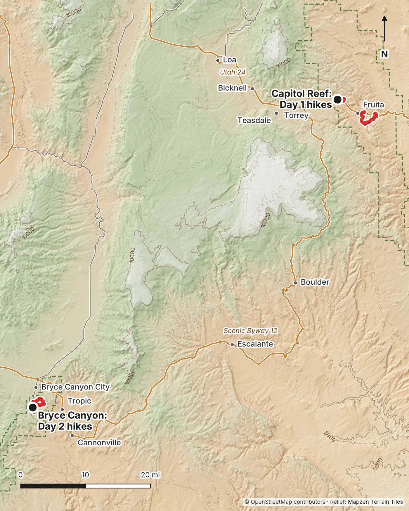
Flying in. The nearest big airports are Las Vegas (LAS) and Salt Lake City (SLC), each about 270 miles from Bryce Canyon (NPS). Cedar City (about 80 miles from Bryce) and St. George (about 125) are smaller. I flew from New York to Las Vegas and rented a car at the airport. I found no public transport to either park on the park pages: plan on a car.
Las Vegas to Torrey. Roughly 330 to 350 miles. It took me about six hours "with coffee breaks and water breaks." Capitol Reef asks you not to rely on a GPS unit to find the park: use a map too.
Torrey to Capitol Reef. Utah 24 runs east from Torrey into the park. The Chimney Rock trailhead is on Utah 24 before the visitor center; the Hickman Bridge and Grand Wash trailheads are further east on the same road.
Capitol Reef to Bryce Canyon. Utah 12, Scenic Byway 12, runs 123 miles from Torrey over Boulder Mountain and through Boulder, Escalante and Tropic toward Bryce. The Park Service says the drive between the parks takes about three hours that way, and that winter weather can make it hazardous. Bryce's entrance road, Utah 63, turns south off Utah 12 and passes Bryce Canyon City before the park entrance.
Inside Bryce. I drove in and parked near Sunrise Point for both Bryce hikes. From April 3 to October 18, 2026, a free shuttle ran about every 15 minutes from Bryce Canyon City to Sunrise, Sunset, Inspiration and Bryce Points. It doesn't stop at Fairyland Point.
My 2022 costs: a round-trip flight from New York to Las Vegas, about $500, and a rental car from the Las Vegas airport, about $400 for five or six days. I didn't keep a list of the rest.
For your budget (October 2026), four days from Las Vegas for two people, camping:
| Item | For two | Each |
|---|---|---|
| Rental car, my 2022 price (check current rates) | about $400 | about $200 |
| Gas, about 730 miles at 30 mpg and $4.94 a gallon (Utah average, October 3, 2026) | about $120 | about $60 |
| Entrance fee: Bryce Canyon $35 a car (Capitol Reef's $20 only on the Scenic Drive) | $35 | about $18 |
| Campgrounds: Fruita one night, Bryce two nights | $85 | about $43 |
| Food, 4 days | about $200 | about $100 |
| Total | about $840 | about $420 |
If you're not a US resident, add $100 each at Bryce Canyon (aged 16 and over). If you'll visit more parks, the America the Beautiful pass ($80 for residents, $250 for nonresidents) may cost less than the separate fees. A motel instead of camping costs more; prices change a lot with the season.
| Night | Where |
|---|---|
| Before Day 1 | A hotel in Torrey. "I think I stayed at the Red Sands." I'd booked Fruita Campground, but at about 20 F it "would not have been fun" in a tent |
| After Day 1 | Near Bryce Canyon (not in my record) |
Fruita Campground (Capitol Reef): 71 sites in the orchards, $25 a night, reservations only on Recreation.gov all year, with no first-come sites. Loops A and B are open all year, Loop C from March 1 to the end of November.
Bryce Canyon campgrounds: North Campground, open all year, and Sunset Campground, about mid-April to mid-October (April 15 to October 11 in 2026). Both $30 a night, booked on Recreation.gov: North up to six months ahead, Sunset up to 14 days ahead.
Food. I ate at Chak Balam, a Mexican place in Torrey, and had a steak dinner at a restaurant at the end of Day 2. On the trail, snacks; in the car between hikes, coffee and a snack. Carry everything you'll eat on the trail.
Water. There's none on any of these trails, and the washes at Bryce were dry. Fill up in town or at the visitor centers. Carry more than you think in Capitol Reef: the Park Service says a gallon per person per day.
From my films (I have no full gear list for this trip):
What these hikes need:
Monday, March 21, 2022. I'd booked Fruita Campground for the night before, but with a low around 20 F I stayed in a hotel in Torrey instead. I picked my Capitol Reef hikes by searching AllTrails for the most popular ones.
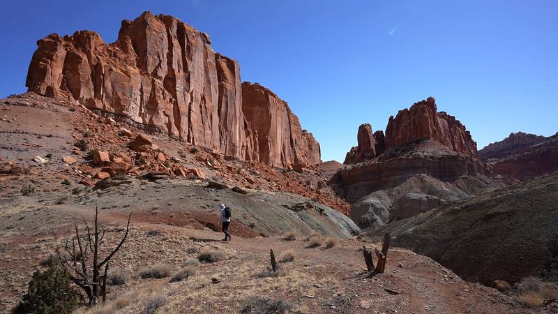
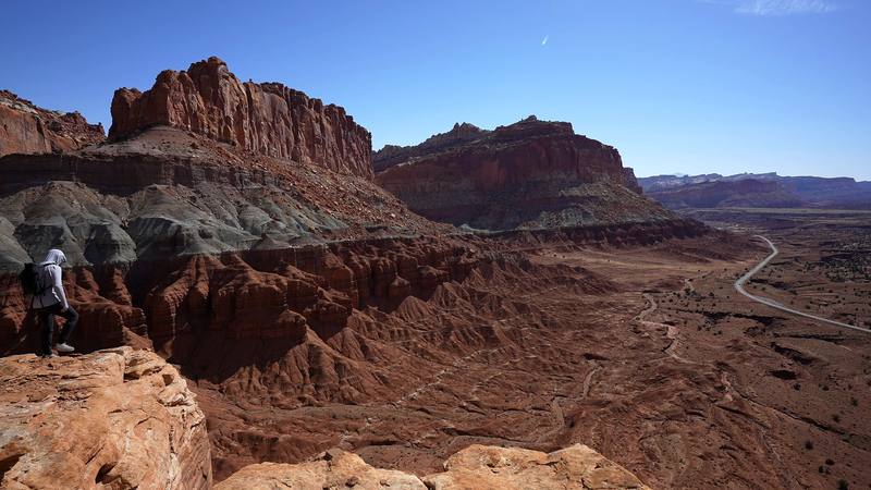
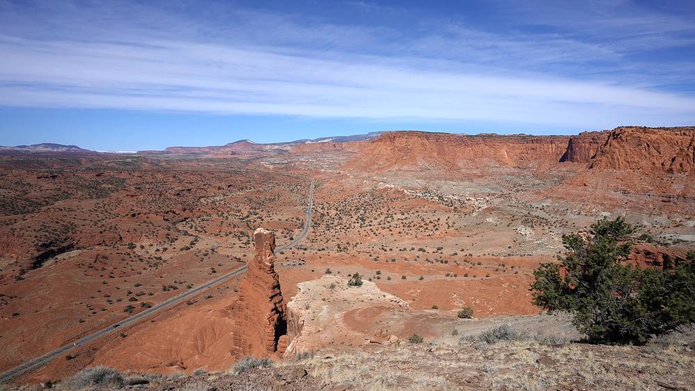
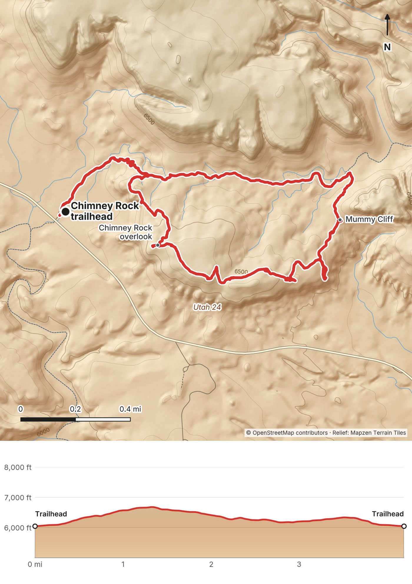
I parked at the Chimney Rock trailhead and started at 10:42 a.m. The trail climbs a grey slope to the rim. At the Chimney Rock overlook, a mile in, you look down on the red tower of Chimney Rock and Utah 24 winding through the valley below. "This whole thing is kind of worth it just for this." "I'm pretty sure I'm gonna use this for the thumbnail."
From the overlook the loop runs along the top past Mummy Cliff, with the Waterpocket Fold's red cliffs ahead and snowy mountains in the distance, then drops back to the trail you came up. I was back at the car at 12:15 p.m. "This was a baby little baby hike." For an hour and a half at that pace I didn't even need water. You should still carry some.
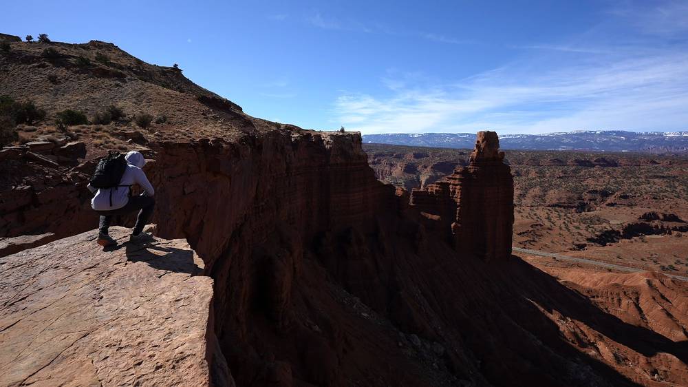
To the rim. From the trailhead the trail climbs steeply up a grey slope and splits into the loop. The overlook spur is a short walk off the loop at about mile 1.0 by my GPS.
The loop. The trail follows the high ground east past Mummy Cliff, with views over the Waterpocket Fold, then curves back down to the start. The NPS calls it 3.6 miles and 590 ft; my GPS recorded 4.2 miles and 787 ft.
The overlook, a mile in, is the best view of the hike. If it's hot, windy or you're short on time, enjoy it and go back the way you came.
The Chimney Rock Loop (from 0:33)
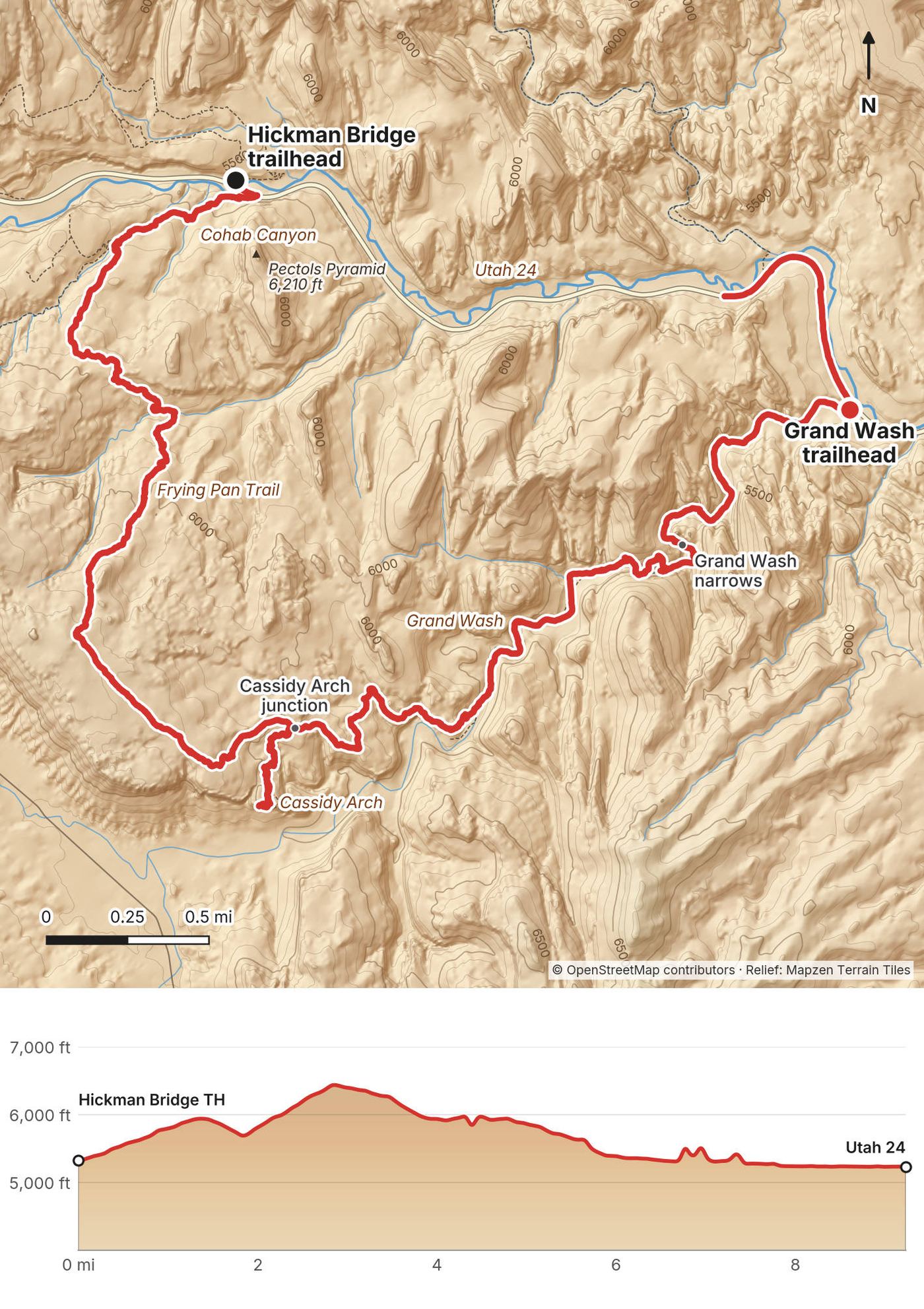
I drove a few miles east on Utah 24 and parked at the Hickman Bridge trailhead. At 12:33 p.m. I walked along the highway bridge beside the Fremont River to the Cohab Canyon trail and its "CARRY WATER" sign. Then it was "up up up," on rocky trail and slickrock. "Nothing too interesting, not many people."
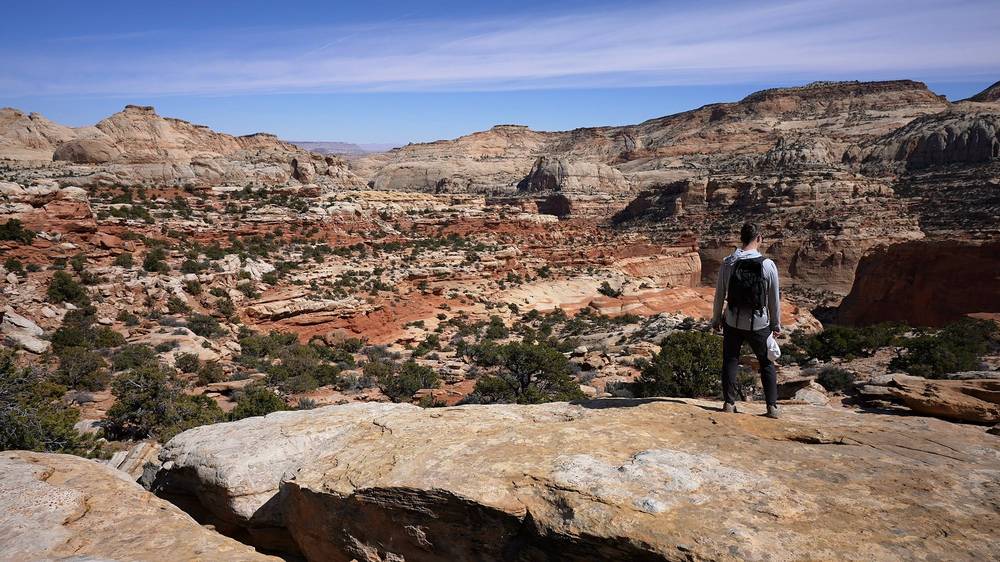
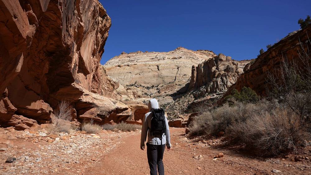
The Frying Pan Trail runs along the top for about 3 miles. I kept expecting it to follow the rim, and it doesn't, but "once you get over this hump you start to get some more views": big slickrock domes, junipers and the canyons below. My GPS high point was here, at about mile 2.8.
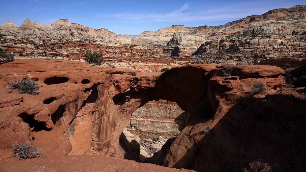
At the Cassidy Arch junction, at 2:08 p.m., there were "so many more people," because most people drive to the trailhead at the end of the Grand Wash road, off the Scenic Drive, and hike up to the arch and back. I walked out to the arch, sat down for a snack, and walked back to the junction. To me it's "a very small baby arch" next to the ones in Arches National Park, but it's the thing everyone comes to see.
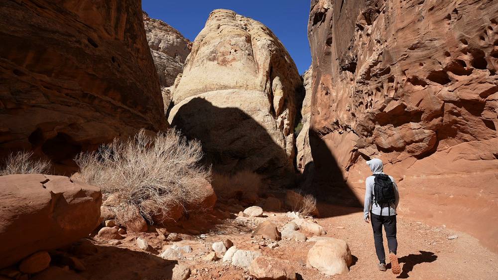
From the junction I went down the Cassidy Arch trail into Grand Wash and turned east, down the wash between high walls and through the narrows, to Utah 24 at 3:47 p.m. My car was back at Hickman Bridge. "I would have had to walk this whole way," but after 0.85 mile along the highway some subscribers stopped and gave me a ride back to my car. "Almost a full day of day hikes."
My GPS had trouble in the canyons: in narrow places like Grand Wash the satellites struggle, and the track wanders a little.
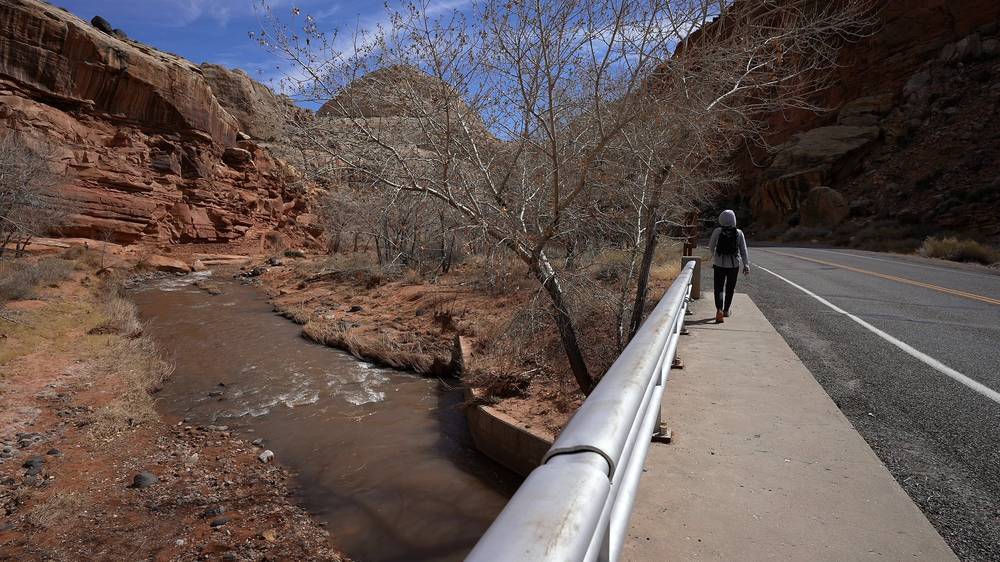
Hickman Bridge trailhead to Cohab Canyon. From the parking, cross the Fremont River on the Utah 24 bridge to the north end of the Cohab Canyon trail, then climb to the Frying Pan junction, about 0.8 mile from the car by my GPS. Cohab Canyon's other end comes down to Fruita, by the campground.
The Frying Pan Trail. It climbs onto the ridges and slickrock between Cohab Canyon and Cassidy Arch: 2.9 miles one way and 810 ft of climbing (NPS), rated strenuous. I reached the Cassidy Arch junction at mile 3.9.
Cassidy Arch. A short spur from the junction to the viewpoint over the arch, about half a mile each way by my GPS. Stay back from the edges.
Down to Grand Wash. The Cassidy Arch trail drops about 1.1 miles by my GPS to the floor of Grand Wash, near the trailhead at the end of the Grand Wash road.
Grand Wash. Turn east, down the wash, and follow it 2.5 miles by my GPS, through the narrows, to its trailhead on Utah 24. It's easy walking on sand and gravel, and the narrows are a flash-flood trap: see Heat, flash floods, snow and safety.
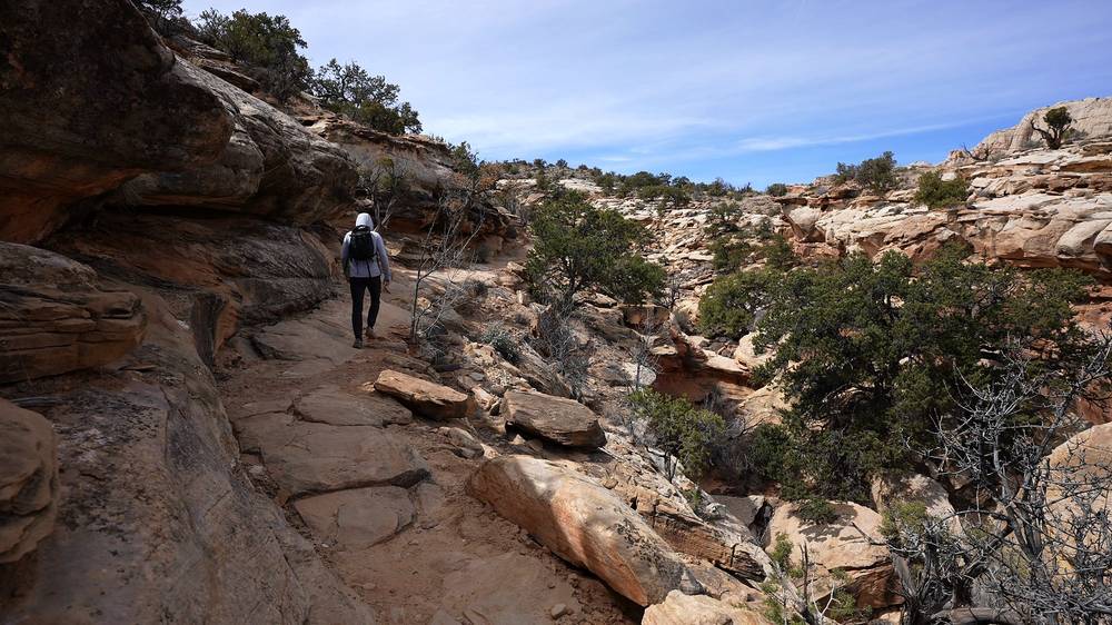
The top of Cohab Canyon, where the Frying Pan Trail starts, is the first place to decide: from there you can go down into Fruita instead. Once you're on the Frying Pan Trail there's no easy way off until the Cassidy Arch junction. If thunderstorms are building, don't go into Grand Wash: climb back to the Frying Pan Trail or wait it out on high ground.
Cohab Canyon, Frying Pan, Cassidy Arch and Grand Wash (from 2:44)
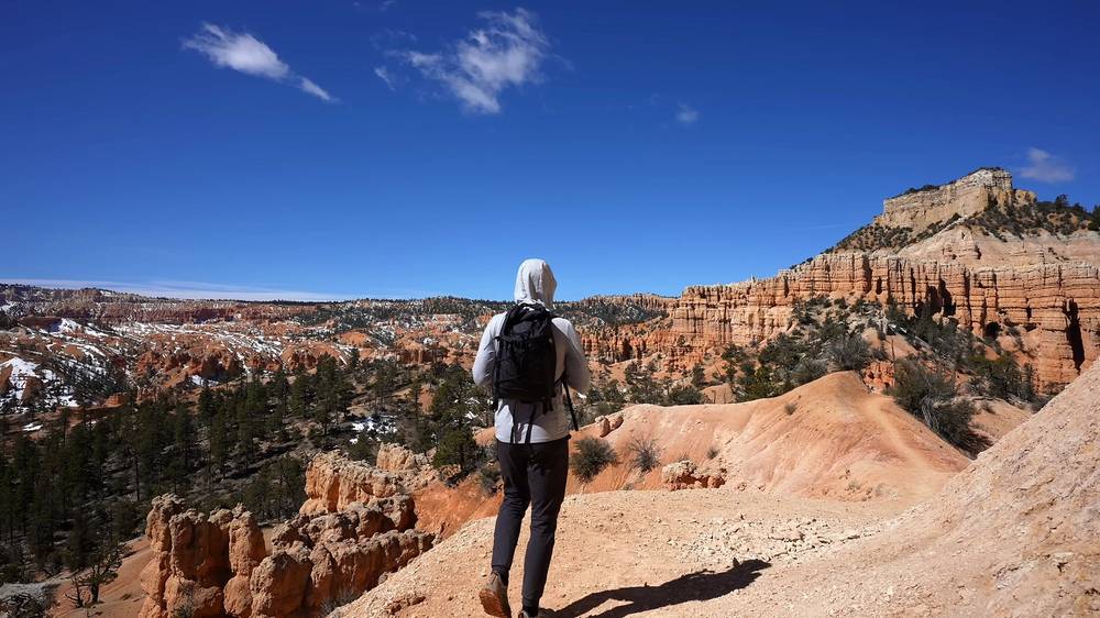
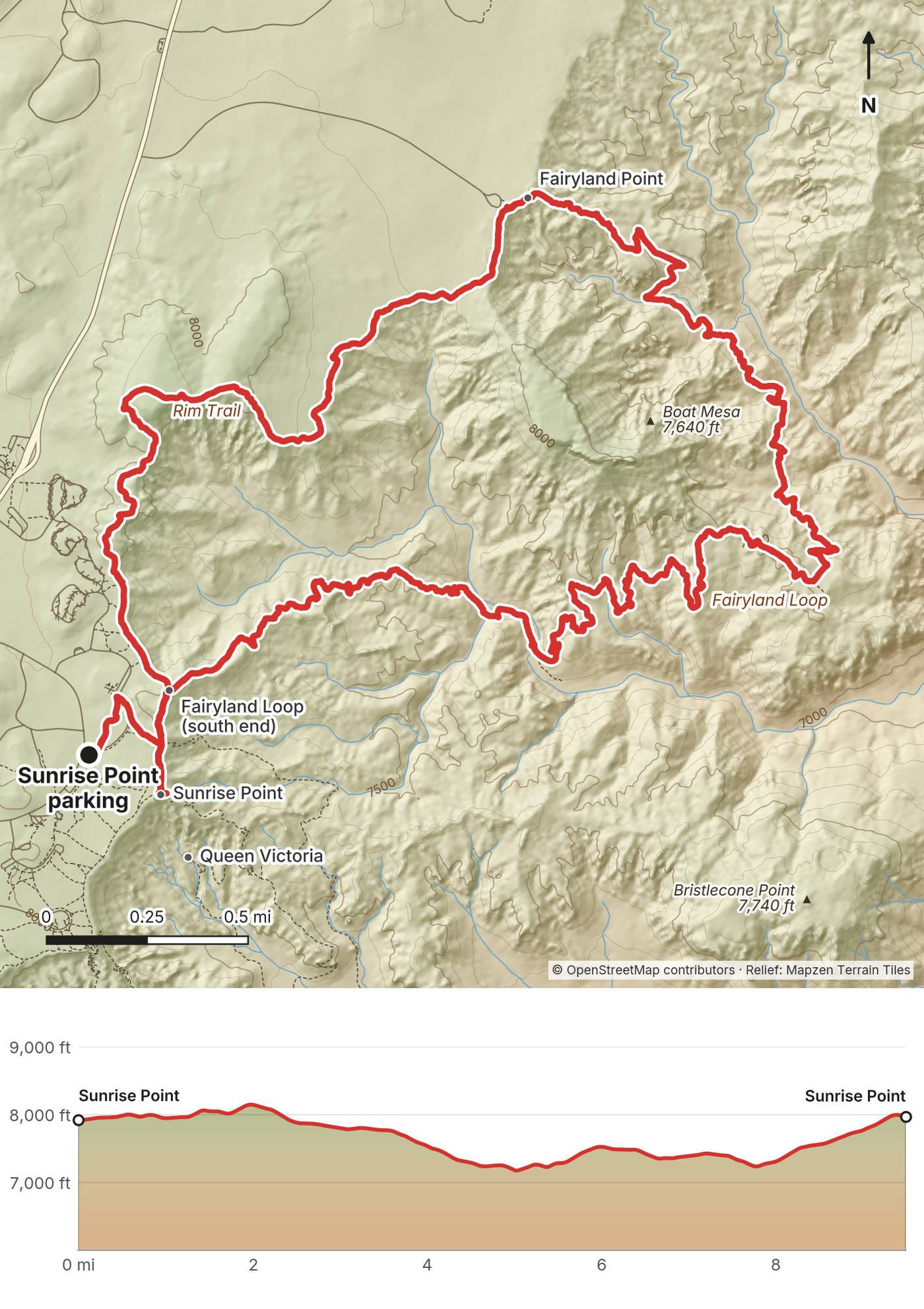
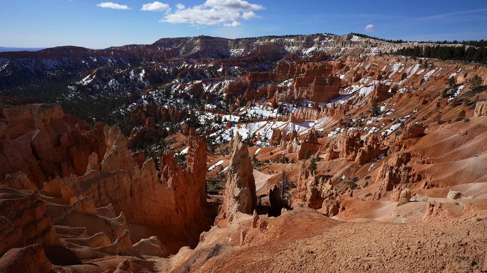
Tuesday, March 22, 2022. I parked by Sunrise Point, where snow still covered the edges of the lot, and set off at 9:59 a.m. "It's cold and windy." The Fairyland Loop is a loop, but "the first part is just along that rim," and it took me a while to get to the real start at Fairyland Point. The Rim Trail runs north through the pines, with snow patches and views down into the hoodoos, and reaches Fairyland Point after 3.6 miles by my GPS.
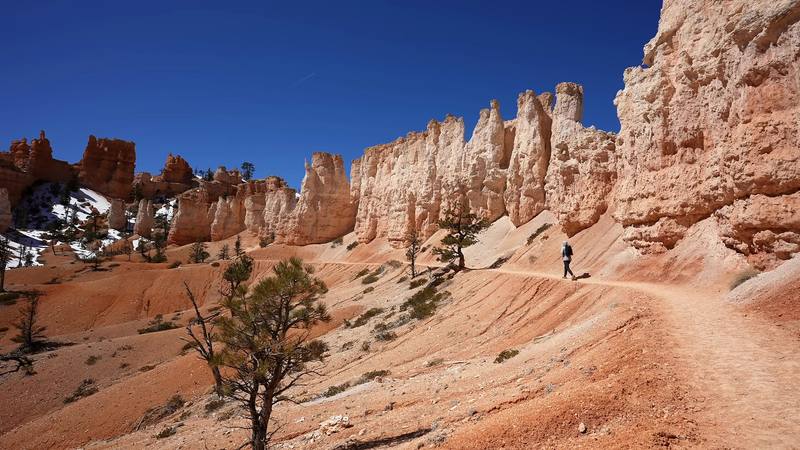
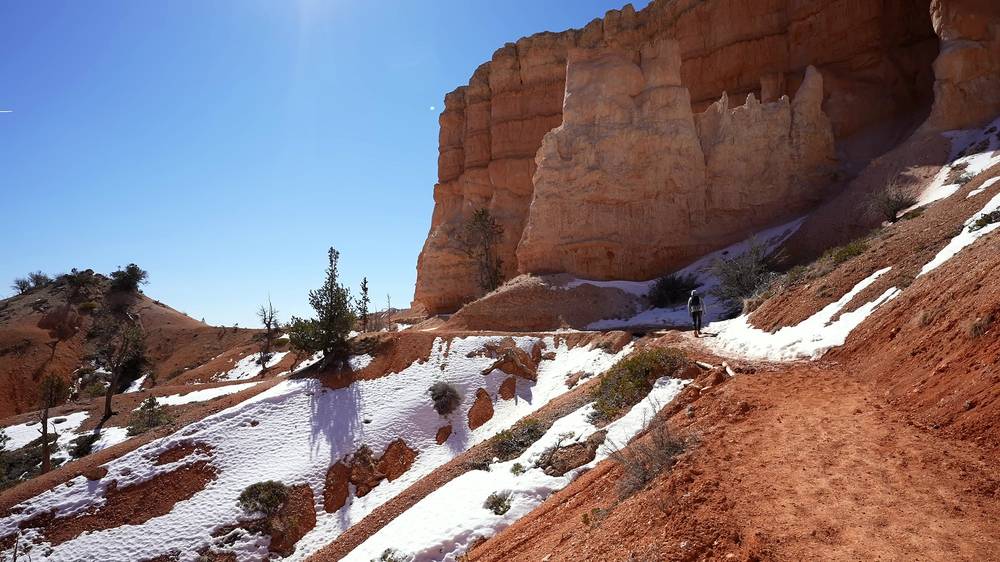
From Fairyland Point the trail drops into Fairyland Canyon: orange hoodoos, snow at the foot of the cliffs, a dry wash in the trees, and a long wall of white and orange spires. The lowest point was at about mile 5. Then the trail climbs back up past the turn for Tower Bridge to the rim north of Sunrise Point, and I was back at the car at 1:27 p.m.
"Almost 10 miles with the rim walk back." It's "pretty easy, not much elevation gain" for its length. In late March there were "little tiny pockets of snow, but I didn't need microspikes at all," and I barely touched the 0.6 liter of water I carried.
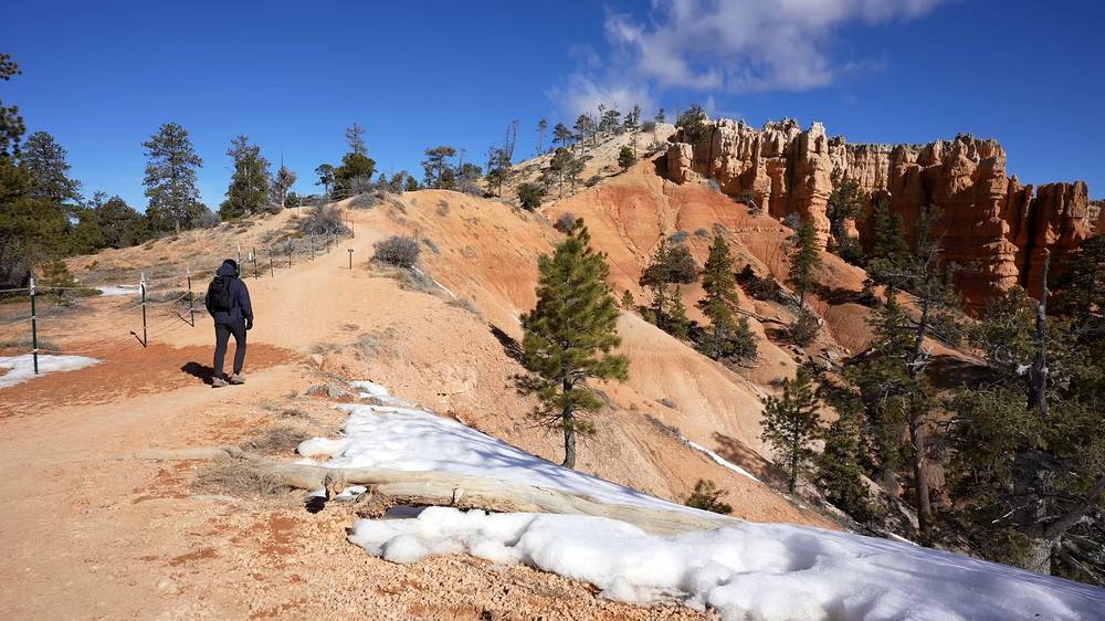
Sunrise Point to Fairyland Point. From the Sunrise Point parking, walk to the rim at Sunrise Point and follow the Rim Trail north. It climbs gently through the trees to its high point and then drops to Fairyland Point, 3.6 miles by my GPS.
Fairyland Canyon. From Fairyland Point the Fairyland Loop Trail descends into the canyon below the rim, winds through hoodoos and washes and around Boat Mesa, then climbs back toward the rim. The NPS points out the Chinese Wall and Tower Bridge on this section.
Back to Sunrise Point. The loop rejoins the Rim Trail just north of Sunrise Point, a short walk from the parking.
Starting at Fairyland Point. The official start, at the end of a 1-mile road off the main park road north of the visitor area. The loop is then 8.0 miles (NPS). The Park Service closes the Fairyland Point road to cars all winter once it needs plowing; then start from Sunrise Point, as I did in late March.
Fairyland Point, at mile 3.6, is the place to decide. If the trail below is icy, or storms are coming, walk back along the rim or take the Rim Trail the rest of the way. Once you're down in the canyon, the way out is the climb back to the rim. In winter and spring, carry traction devices if there's ice; I didn't need them on March 22.
The Rim Trail and Fairyland Loop (from the start)
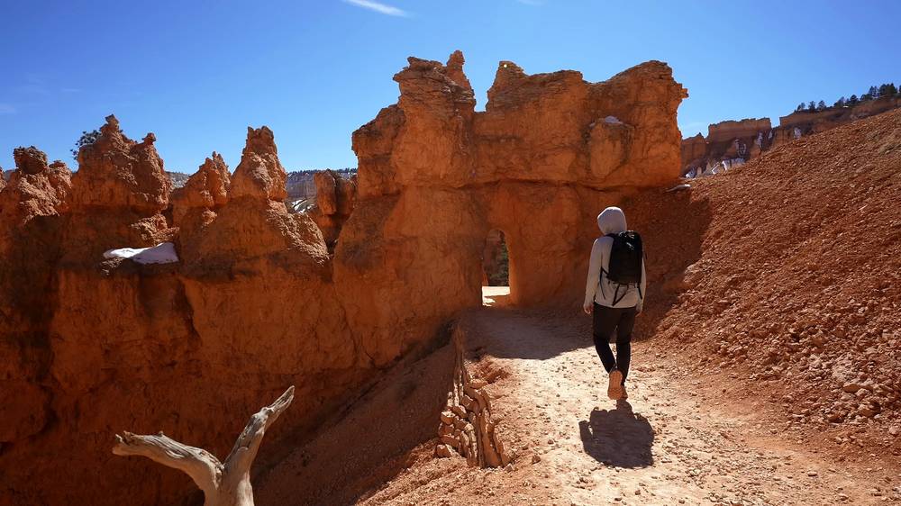
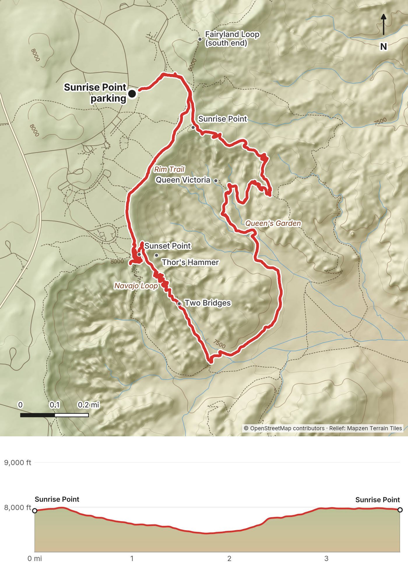
After coffee, a snack and sunscreen at the car I went back out at 3:03 p.m. for "a more popular, easier one." From Sunrise Point the Queen's Garden trail drops through the hoodoos, past the one called Queen Victoria. On this hike the trail also goes through a tunnel in a rock fin.
At the bottom, at 3:48 p.m., I joined the Navajo Loop and went up its Two Bridges side, below Thor's Hammer, then up the switchbacks to Sunset Point. There were lots of people on the switchbacks, and on the rim. I walked the paved Rim Trail back to Sunrise Point and the car, at 4:27 p.m.
"Just over an hour, an hour and a half total, barely any elevation gain, not even four miles." There was no water flowing in the washes. "It would have been prettier if the streams were flowing a little bit," but it was very early in the season.
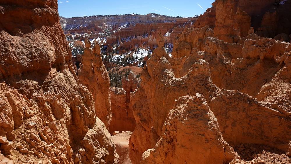
Queen's Garden. From Sunrise Point the Queen's Garden trail descends into the amphitheater, "the least difficult trail that descends into the canyon" (NPS), to the junction with the Navajo Loop at about mile 2.1 by my GPS.
The Navajo Loop. The loop climbs to Sunset Point by two routes. In winter only the Two Bridges side is open, the one I took, past Two Bridges and Thor's Hammer. When the Wall Street side is open, the Park Service recommends hiking the combination clockwise.
The rim back. From Sunset Point the paved Rim Trail runs half a mile along the edge to Sunrise Point.
Shorter. "If you just want to see the steps you could legit just go down from Sunrise Point to the steps and then go back up." Wall Street, Thor's Hammer and Two Bridges are "all very accessible" from Sunset Point, when they're open.
Anywhere: every step down is a step back up, and the rim is never far. In a thunderstorm, get off the rim and out of the narrow sections.
Queen's Garden and the Navajo Loop (from 5:06)
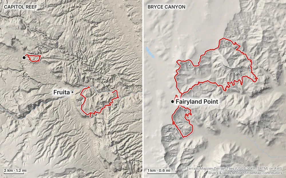
Elevation5,230–8,156 ft26.7 mi
Terrain: Mapzen Terrain Tiles (USGS 3DEP, SRTM) on AWS · Rivers & lakes © OpenStreetMap contributors
Capitol Reef to Bryce CanyonChimney Rock Loop map and…Cohab Canyon, Frying Pan,…Rim Trail and Fairyland Loop…Queen's Garden and Navajo Loop…Tap a map to open it full size.
Checked on the National Park Service pages for both parks on October 3, 2026.
Capitol Reef: fully open. That's the park's own banner. On October 3 the Scenic Drive and the Grand Wash road were open to ordinary cars. Capitol Gorge road was closed (no reason given); it isn't on this route. No closures were listed for the Chimney Rock, Cohab Canyon, Frying Pan, Cassidy Arch or Grand Wash trails.
Bryce Canyon: open. The park is open 24 hours a day all year, with short road closures during and after winter storms. In 2026 the Navajo Loop closed more than once: the whole loop in February, after mudslides on the Two Bridges side, and the Wall Street side after storm damage in summer 2026; Wall Street was still reported closed in early October (news reports; the park's page doesn't list trail closures). Check at the visitor center. If the Navajo Loop is closed, walk down Queen's Garden and back up the same way.
The Navajo Loop in winter. The Park Service says the Navajo Loop is "not a loop in winter": its Wall Street side closes, and you use the Two Bridges side instead. That's the side I went up in March.
Fees. Bryce Canyon is one of eleven parks where visitors who aren't US residents, aged 16 and over, pay a $100 nonresident fee on top of the entrance fee (2026). Capitol Reef isn't on the list. Since 2026 the fee-free days are for US citizens and residents only. Details in What it costs.
Checked on the National Park Service pages on October 3, 2026.
Entrance fees. Capitol Reef $20 a car, charged only on the Scenic Drive past Fruita Campground (the Grand Wash road is off it; Utah 24 and its trailheads, where all my Capitol Reef hikes start and end, are free), Bryce Canyon $35 a car (or $10 and $20 per person on foot or bike). The America the Beautiful pass, $80 a year for US residents and $250 for nonresidents, covers both. At Bryce, nonresidents 16 and over also pay $100 each. You can buy a digital pass on Recreation.gov.
Drones. Prohibited in both parks.
Dogs. Not on these trails. In Capitol Reef pets are allowed, on a 6-foot leash, within 50 ft of roads, in parking areas, the orchards and picnic areas, and on two short paths near the campground. At Bryce, only on paved surfaces and the paved Rim Trail between Sunset and Sunrise Points.
Stay on the trail. Don't walk on the plants or take rocks or anything else. At Bryce the footing near the cliff edges is unstable (NPS): keep back from them.
Camping. This guide uses the campgrounds; it doesn't cover backcountry camping. Fruita Campground in Capitol Reef takes reservations only, all year (no first-come sites). See Where I slept, food and water.
Fires. At Bryce, only in established fire pits. No fireworks.
Late March, when I went. Cold nights and quiet trails. In Capitol Reef it was about 20 F at night, the fruit trees in Fruita had no leaves yet, and Torrey was half closed: "half of the things were open, half were not." At Bryce there were "little tiny pockets of snow, but I didn't need microspikes at all," and the streams weren't flowing. "Late March is just the beginning of like when you should be going here, it's when the snow melts."
Average temperatures (NPS, highs and lows in F):
| Month | Capitol Reef (Fruita) | Bryce Canyon |
|---|---|---|
| March | 58 / 34 | 45 / 23 |
| April | 65 / 39 | 54 / 29 |
| May | 74 / 48 | 64 / 37 |
| June | 87 / 58 | 75 / 45 |
| July | 91 / 65 | 80 / 53 |
| August | 88 / 63 | 77 / 50 |
| September | 80 / 55 | 70 / 42 |
| October | 66 / 43 | 58 / 32 |
Spring. Bryce sits about 2,500 ft higher than Capitol Reef and stays colder. The Park Service warns that March and April storms can still bring heavy snow, and it recommends traction devices on the trails in winter.
Summer. Capitol Reef is hot: highs in the 90s, often more. July to September is the monsoon, when thunderstorms can send flash floods down narrow canyons like Grand Wash. At Bryce, July and August bring frequent afternoon thunderstorms with lightning on the rim. Start early.
Fall. October has mild days in both parks, after the summer storm season.
Emergencies. Call 911. The park phones are 435-834-5322 (Bryce Canyon) and 435-425-3791 (Capitol Reef). The park pages warn of limited or no phone signal, and that a rescue or a tow truck can take hours.
Flash floods. Grand Wash is a narrow canyon. Thunderstorms, even far away, can send floods down it, mostly July to September. "If thunder roars, get out of the gorge!" (NPS). Check the forecast, and skip Grand Wash when storms are predicted.
Heat. Capitol Reef's summer highs are in the 90s and can reach 100 F or more. Hike early, carry a gallon of water a day, and rest in shade if you feel sick, dizzy or get a headache.
Lightning. At Bryce, afternoon thunderstorms with lightning are frequent in July and August. "If you can hear thunder, lightning is within 10 miles" (NPS): get off the rim and into a building or your car.
Snow and ice. Bryce gets snow from fall to spring, and March and April storms can be heavy. Trails below the rim can be icy; the Park Service strongly recommends traction devices in winter.
Altitude. Bryce is about 8,000 to 9,100 ft. At the top you have about 70% of the oxygen you'd have at sea level (NPS). Drink more and take it slowly the first day.
Edges. The rims at Bryce and the cliffs on the Chimney Rock and Frying Pan trails have big drops. Stay on the trail and back from the edge.
Do I need a permit? Not for these day hikes: the park pages list none. You pay the entrance fee at Bryce, and at Capitol Reef only if you drive the Scenic Drive.
How hard is it? None of it is technical. The NPS rates Chimney Rock, the Frying Pan Trail, Cassidy Arch and the Fairyland Loop strenuous, for their steep climbs; Grand Wash is easy. My longest hike was 9.5 miles. At Bryce you start around 8,000 ft. "I didn't feel any elevation," but you may.
How far is it? 26.7 miles (42.9 km) by my GPS: 4.2 for Chimney Rock, 9.2 for the Frying Pan hike (the last 0.85 of it walking along the highway), 9.5 for the Rim Trail and Fairyland Loop, 3.8 for Queen's Garden and the Navajo Loop.
Do I need a 4WD? No. Every trailhead I used is on a paved road.
Is there water? Not on the trails. Carry it. The Park Service says a gallon per person per day in Capitol Reef, and a quart every hour or two at Bryce. At Bryce in March "I packed a 0.6 liter of water and barely used any of it."
How do I do the Frying Pan hike one way? It ends on Utah 24 at the Grand Wash trailhead, about 2 miles by road from where I parked at the Hickman Bridge trailhead. I hitchhiked back. Two cars, or a friend with a car, is easier. Or hike it as an out-and-back. See Other ways to do it.
Can I bring my dog? Not on these trails. Both parks allow leashed pets only near roads, in parking areas and campgrounds, and on a few short paths (at Bryce, the paved Rim Trail between Sunset and Sunrise Points).
Can I fly a drone? No. Drones are prohibited in both parks.
Which park did I like more? Bryce. On the trail there I said "This is ten times better than Capitol Reef," and it's "one of my favorites." I'm "not the biggest fan of desert hikes in general." Capitol Reef was "okay, it's a desert, some canyon stuff, wasn't that interesting to me, but I'm happy I went out there." On Chimney Rock I said "this whole thing is kind of worth it just for this" view.
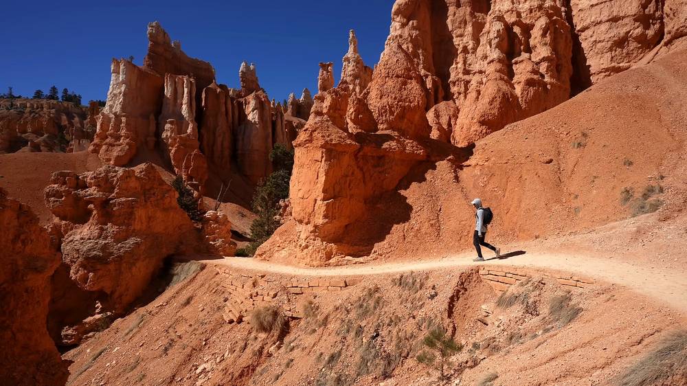
Cassidy Arch from Grand Wash. The way most people go: from the trailhead at the end of the Grand Wash road off the Scenic Drive, 1.7 miles one way and 670 ft of climbing to the arch (NPS), so about 3.4 miles round trip.
Grand Wash only. 2.2 miles one way and 200 ft (NPS), easy, between the end of the Grand Wash road and Utah 24. Walk it out and back from either end, or leave a car at each.
The whole Frying Pan hike without a second car. Hike from Fruita up Cohab Canyon and along the Frying Pan Trail to Cassidy Arch and back, or start at the Grand Wash road and go the other way. Both are long out-and-backs: add up the NPS one-way distances above.
Hickman Bridge. 0.9 mile one way and 400 ft (NPS) from the same trailhead where I parked, to a 133-foot natural bridge.
Cathedral Valley. In the park's north, the Temple of the Sun, the Temple of the Moon and Glass Mountain. "If I had a better rental car I would have taken the drive out here." On October 2, 2026 the park listed the Cathedral Valley roads as high-clearance 2WD, with a 10-inch ford of the Fremont River.
The Fairyland Loop from Fairyland Point. The official start: 8.0 miles and 1,900 ft (NPS). Fairyland Point isn't a shuttle stop.
Tower Bridge only. 3.0 miles round trip and 760 ft (NPS), from the Fairyland Loop's start north of Sunrise Point.
Peekaboo Loop. 5.5 miles and 1,560 ft from Bryce Point (NPS), strenuous; hike it clockwise, as required.
Mossy Cave and the Bristlecone Loop. Two short, easy walks: Mossy Cave, 0.8 mile on Utah 12 east of the main entrance; the Bristlecone Loop, 1.0 mile at Rainbow Point, the park's high point at 9,115 ft (NPS).
On to Zion. From Bryce I drove on to Zion National Park for the third film of the trip.
Torrey (about 6,800 ft) is the town just west of Capitol Reef. In late March it was "a sleepy little town, half of the things were open, half were not." The county lists hotels, B&Bs, cabins and RV parks, and restaurants including Chak Balam (Mexican), Dark Sky Coffee, Rock Reef Cafe, Broken Spur Steakhouse and Hunt & Gather. Gifford Homestead in Fruita, inside the park, sells pies.
Bryce Canyon City, just outside the park entrance on Utah 63, is where Ruby's Inn and the shuttle station are. Tropic is a small town east of the park on Utah 12. Inside the park, The Lodge at Bryce Canyon and the General Store at Sunrise Point are open seasonally.
Hospitals. Garfield Memorial Hospital in Panguitch (435-676-8811), northwest of Bryce, and Sevier Valley Hospital in Richfield (435-893-4100), northwest of Torrey. Both have 24-hour emergency departments.
These change every year. Everything else in this guide stays the same.
Is it open?
Getting there
Fees and bookings
Your stuff
Planning questions about Capitol Reef and Bryce Canyon, answered only from this page's facts, the creators' versions and hikers' public tracks, with where each answer comes from. When the data doesn't say, the answer says "not given".
From hikers
Sign in to comment. Free; your hikes stay private unless you share them.
Something wrong or missing on this page? Send feedback.