
Content made there
The film is at the top of this page.
Photos
Hikes / Tour of the Jungfrau Region / Kraig Adams's version
Europe · Switzerland
Jul 23–26, 2022 · 4 days · Solo · Tent

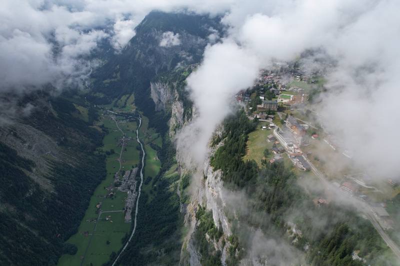
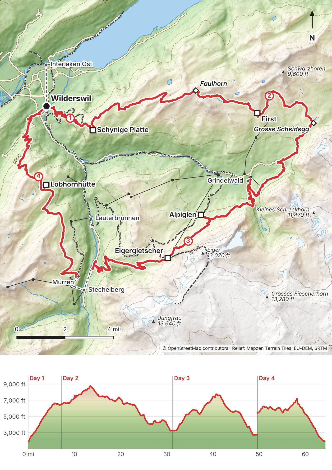
In late July 2022 I spent four days hiking alone through the Swiss Alps around Grindelwald: a loop of about 64 miles from Wilderswil, just outside Interlaken, on sections of the Jungfrau Region's long-distance trails. I went up to Schynige Platte, over the Faulhorn to First and Grindelwald, along the Eiger Trail under the north face, down into the Lauterbrunnen valley, and back to Wilderswil from Mürren. I carried a tent, slept in it three nights, and ate at the mountain inns along the way.
This isn't one official trail with fixed stages. It's a line I walked on well-signed paths, with trains, gondolas and buses all around it, which makes it easy to shorten, split or skip a climb. Years later a subscriber asked me where I camped, where I left my bag and how I got around, and I wrote back that I really should've had a guide section explaining all of this in the video. This is that guide: my four days, what I paid, and everything you need to plan your own version, with a bed every night if you want one.
| Quick facts | |
|---|---|
| Distance | 64.4 miles (103.6 km) by my GPS over 4 days. The film title says 60 |
| Climbing | about 18,180 ft (5,541 m) up and 20,870 ft (6,361 m) down |
| Days | 4 walking days, a loop |
| Start and finish | Wilderswil station, 5 minutes by train from Interlaken Ost |
| Nights on the way | 3, all in my tent: one wild camp, two campsites |
| High point | The Faulhorn, 8,800 ft (2,681 m), on Day 2 |
| When | Summer; the high trail is usually open from mid-June |
| Airports | Zürich or Geneva, then the train to Interlaken Ost |
| Trip date | July 23 to 26, 2022, solo |
| Day | Route | Miles (km) | Up / down (ft) | Sleep |
|---|---|---|---|---|
| 1 | Wilderswil to Schynige Platte | 7.2 (11.6) | 4,910 / 330 | My tent on the ridge |
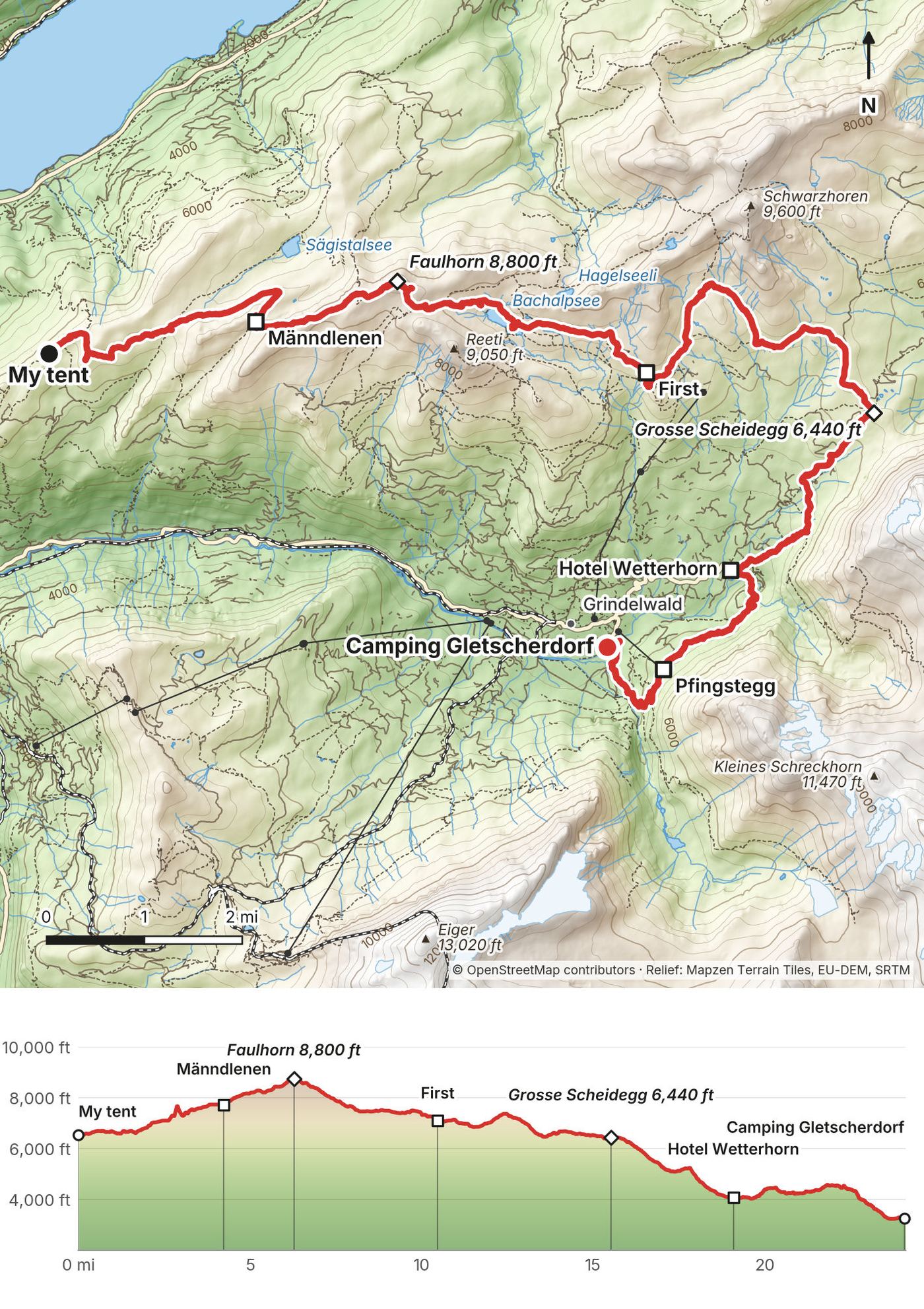
| 2 | Schynige Platte to Grindelwald | 24.1 (38.8) | 4,510 / 7,770 | Camping Gletscherdorf |
| 3 | Grindelwald to the Lauterbrunnen Valley | 18.4 (29.5) | 5,480 / 6,010 | Camping Breithorn |
| 4 | Mürren to Wilderswil | 14.7 (23.7) | 3,280 / 6,760 |
The numbers come from my own GPS recordings, smoothed the same way for every day. My recording app's totals are a little higher.
I came from Zürich, where I'd stayed the night before. On the morning of July 23 I bought a Sunrise prepaid SIM, then took the train: CHF 51 from Zürich HB and CHF 28 from Bern to Interlaken Ost, 2nd class full fare (2022). At Interlaken Ost I left my big bag in a large locker for the four days and bought food at a supermarket. My recording starts at Wilderswil station at 5:15 p.m.
After Day 4 I went back to Interlaken Ost, paid the extra locker charge (CHF 21) and took the train to Geneva (CHF 72, 2nd class full fare, 2022).
By train. Zürich HB to Interlaken Ost takes about 1 hour 55 minutes, with a direct train every hour; other trains change in Bern. Geneva to Interlaken Ost takes about 3 hours, changing in Bern. From Interlaken Ost, the BOB train to Wilderswil takes 5 minutes (2026 timetable). Buy tickets in the SBB app or at the machines.
Lockers. Interlaken Ost has 140 large lockers (44.7 x 88 x 61.5 cm): CHF 10 per 24 hours, open around the clock, for up to 144 hours, paid by coin, card or Apple Pay. The luggage counter is open 7:30 to 16:30 daily, +41 33 828 73 20 (2026). SBB also sends bags station to station for CHF 12 an item (collect the day after tomorrow).
My records for this trip are the receipts I photographed on the way. Prices are 2022, in Swiss francs.
| Item | What I paid |
|---|---|
| Sunrise prepaid SIM, Zürich | CHF 19.90 |
| Trains, Zürich HB to Bern and Bern to Interlaken Ost | CHF 51.00 and CHF 28.00, 2nd class full fare |
| Locker at Interlaken Ost, four days | CHF 21.00 extra at pickup (I remember maybe $20 in all) |
| Night 1, my tent on the ridge | Nothing (and not allowed; see The camping rules) |
| Lunch at First, dinner at Hotel Wetterhorn | CHF 49.80 and CHF 32.50 (cash) |
| Camping Gletscherdorf and Camping Breithorn | Cheap; not in my records |
| Cable car, Stechelberg to Mürren | CHF 22.40 |
| Hotel Eiger, Mürren | CHF 8.80 on the one receipt I kept |
| Train, Interlaken Ost to Geneva | CHF 72.00, 2nd class full fare |
Camping the way I did (minus the wild camp) costs one hiker about CHF 37 a night at Camping Gletscherdorf in July and CHF 22 at Camping Breithorn. Mountain inns run CHF 80 to 85 with dinner and breakfast in a dorm, or CHF 40 with breakfast at Männdlenen; valley hostels start around CHF 30. The lift fares are in Trains, lifts and passes. My rough estimate for the 7-day bed version is CHF 500 to 650 for beds and half board, before lunches, drinks and transport.
I wild camped on Day 1, on the ridge past the Oberberghorn. Wild camped above treeline, and had the entire place to myself all morning. Don't copy it. That spot is in the municipality of Bönigen, which says wild camping on its land is prohibited, with fines up to CHF 5,000 (2026). Grindelwald (the Bachalpsee, First, Grosse Scheidegg) and Lauterbrunnen (the valley, Mürren, Isenfluh) don't allow camping outside campsites either, and camping is banned outright in federal hunting reserves like the Schwarzhorn reserve around First. The Swiss Alpine Club says a single night above the tree line is usually fine only where the canton and municipality don't restrict it, and here they do. Use the campsites and the inns.
Camping Gletscherdorf, Grindelwald (end of Day 2, my night 2). I remember the place having plugs to charge, bathrooms and being cheap. 2026 prices: adult CHF 10 to 12 a night by season, a small tent (up to 4 m²) CHF 11 to 15, tourist tax CHF 5.20, and CHF 5 extra for a single night in July and August: about CHF 37 for one hiker in July. +41 33 853 14 29, gletscherdorf.ch. The tent meadow can be booked online.
Camping Breithorn, Sandbach (end of Day 3, my night 3). In the Lauterbrunnen valley, half a mile from the Trümmelbach Falls. I got there just before they closed the snack shop and got my little dinner there. Plenty of space in the valley but not much else. Prices on its site: adult CHF 10 including taxes, tent up to 4 m CHF 12, so about CHF 22 for one hiker. Tent pitches May 1 to September 30. Cash (CHF, EUR) and cards. +41 33 855 12 25, campingbreithorn.ch.
These are the beds on or next to my line. Prices are per person, as published in September 2026 (some pages give no year).
Grindelwald, Lauterbrunnen, Mürren, Wilderswil and Interlaken all have hotels. Cheaper options I checked: the Youth Hostel Grindelwald (+41 33 853 10 09), the Valley Hostel in Lauterbrunnen (dorm from CHF 30, +41 33 855 20 08) and the Mountain Hostel in Gimmelwald, below Mürren (dorm CHF 45 to 48 with breakfast, +41 33 855 17 04).
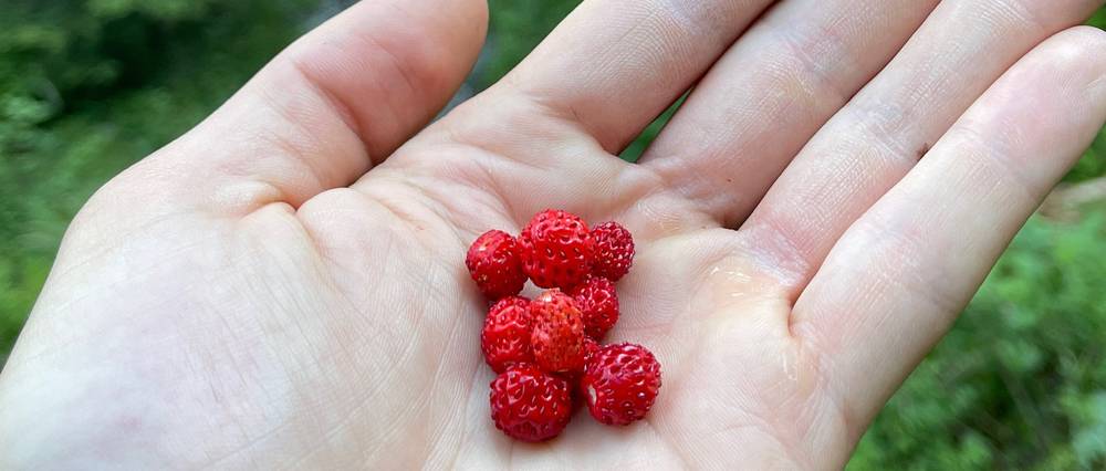
Where I ate. Day 1: food from a supermarket before I started, and dinner at the Schynige Platte hotel restaurant. Day 2: a stop inside Berghaus Männdlenen in the morning; lunch at Berggasthaus First (a chicken and avocado bowl, an espresso, and apple strudel with vanilla sauce and ice cream); a Coke and Bergkäse ravioli at Hotel Wetterhorn on the way down. Day 3: coffee and food on the terrace at Berghaus Alpiglen, a long stop at Eigergletscher, and my little dinner from the snack shop at Camping Breithorn. Day 4: a full breakfast at Hotel Eiger in Mürren. Treat yo self. And wild strawberries on the climb out of Grindelwald: my pace slows considerably when I spot them.
Where to stock up. Interlaken, Grindelwald and Lauterbrunnen are the towns on or near the loop; up high there are only the inns and restaurants.
Water. Fill up at the inns, restaurants and campsites, including the restaurant at First. The Berghotel Faulhorn says there's no drinking water on its mountain, so leave Männdlenen with enough for the Faulhorn.
Paid links: I earn a commission if you buy through these links, at no extra cost to you. As an Amazon Associate I earn from qualifying purchases.
I camped all three nights on this loop, carrying everything myself. Here's what I carried in 2022, what I'd take now, and what I filmed with.
I didn't list my kit for this trip. This is what the film and my photos show.
My current kit for this loop, with a bed or a tent. My favorite gear that year, from my Favorite Hiking Gear 2022 video (not a list of what I carried here): a Hyperlite Southwest 2400 pack, Nemo Hornet 1P tent, Hyperlite quilt, NeoAir XLite pad, Salomon Speedcross 5 and Brooks Cascadia 16 trail runners, Arc'teryx Beta AR, a Katadyn filter bottle, a Jetboil, a headlamp, an Anker power bank and a Sirui carbon tripod.
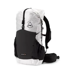 Pack: Hyperlite Mountain Gear Waypoint 35 (Hyperlite). For the bed version: you don't carry a tent or food.
 Tent: NEMO Hornet Elite OSMO 1P (Amazon). If you camp as I did, use the campsites: wild camping is banned in Bönigen, Grindelwald and Lauterbrunnen.
 Sleeping-bag liner: Naturehike ZY20 Sleeping Bag Liner (Amazon). For the huts and inns: the Faulhorn asks for one.
 Rain shell: Arc’teryx Beta AR Jacket (Arc’teryx)
 Warm layer: Arc’teryx Cerium Hoody (Arc’teryx). The Faulhorn is at 8,800 ft.
 Hat: PATH Projects Hoyt Merino Beanie (PATH Projects)
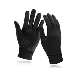 Gloves: Unigear Touchscreen Liner Gloves (Amazon)
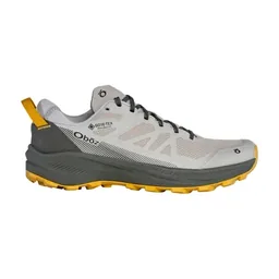 Shoes: Oboz Katabatic LT Low GTX (Amazon). Good grip for rock and wet grass.
 Poles: Black Diamond Alpine Carbon Z Poles (Amazon). For the long descents: more than 5,000 ft down to Wilderswil on Day 4.
 Water: Katadyn BeFree AC · 1L (Amazon). Carry about 2 liters. There's no drinking water on the Faulhorn.
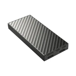 Power bank: Nitecore NB20000 (Amazon)
What I filmed this trip with in 2022. My setup is smaller now (below). Check the drone rules in Weather and safety before you fly: drones are prohibited in the hunting reserve around First.
Since September 2026 I film with a smaller setup: the Pocket 4 and the Mic 3 on the trail, and the Mini 5 Pro in the air.
 Camera: DJI Osmo Pocket 4 (Amazon)
 Mic: DJI Mic 3 · 1 TX + 1 RX (Amazon). It pairs with the Pocket 4.
 Drone: DJI Mini 5 Pro (Amazon)
I came from Zürich by train that afternoon, changing in Bern, and left my big bag in a locker at Interlaken Ost. I bought food at a supermarket and started my recording at Wilderswil station at 5:15 p.m.
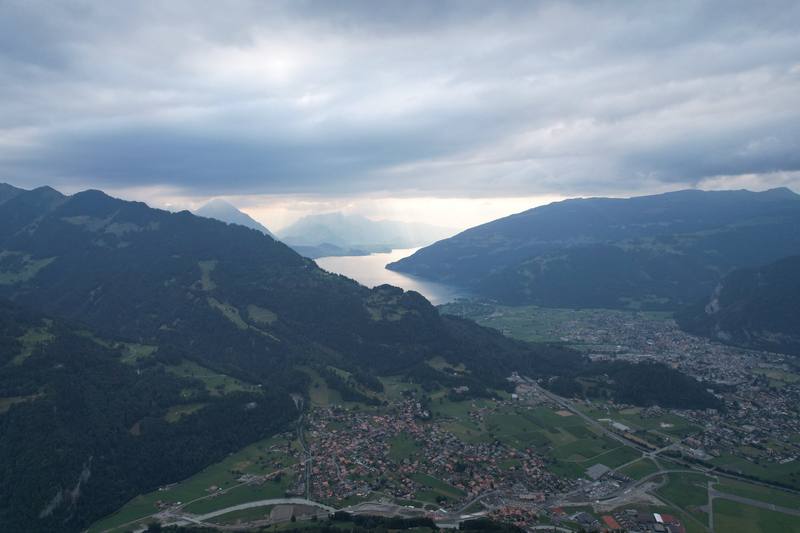
The Schynige Platte railway climbs from Wilderswil to the top of the ridge. I hiked up before sunset instead of taking the cog train, an extra 4,000 feet. The path goes up through forest, crosses the railway, and comes out on open alp meadows with the lakes behind you.
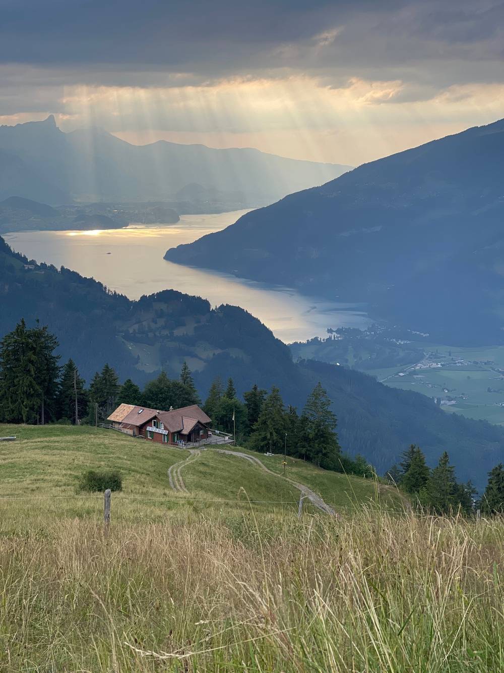
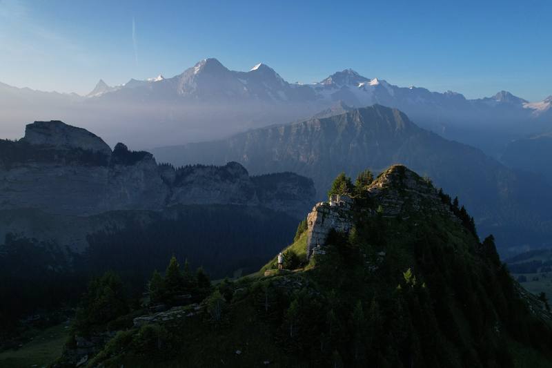
I reached the Schynige Platte hotel just after 8 p.m. and had dinner at its restaurant. Then I kept going along the ridge in the last light, past the Gumihorn and the Oberberghorn, and put up my tent at about 9:30. Wild camped above treeline, and had the entire place to myself all morning.
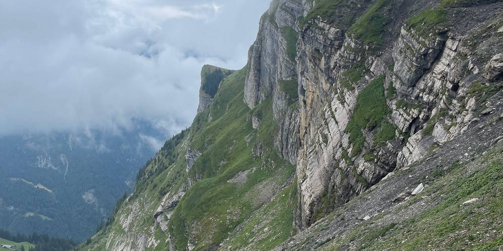
From Wilderswil station, 1,940 ft (591 m), the path climbs steadily through forest, on and off beside the rack railway, past the alp of Schwendi at 3.2 miles, 4,790 ft (1,459 m). Above the trees it's open pasture to the Schynige Platte hotel at 5.5 miles, 6,520 ft (1,986 m), and the station just beyond. That's about 4,700 ft (1,430 m) of climbing in 5.5 miles, with almost no flat ground. The Panoramaweg then runs northeast along the edge of the ridge past the Daube, the Gumihorn and the Oberberghorn, with steep drops on the lake side and views down to Lake Brienz, to where I stopped at 7.2 miles, 6,530 ft (1,990 m).
Anywhere on the climb, go back down to Wilderswil. From Schynige Platte the railway runs down to Wilderswil until the evening; check the last train (see Trains, lifts and passes).
Film, Day 1 · Dinner at Schynige Platte
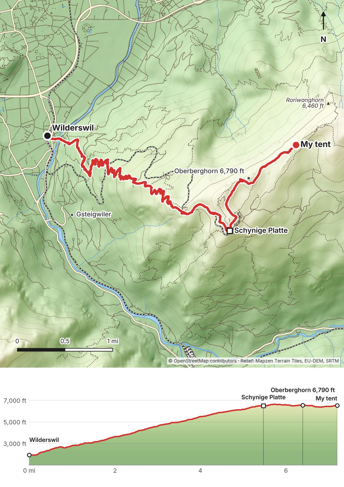
I was walking by 6:20 a.m. on the Panoramaweg, with the Eiger, Mönch and Jungfrau across the valley in the first light. At Berghaus Männdlenen, a small mountain inn on the ridge, I stopped to eat inside and dried my tent on the railing. From there the path climbs over scree to the Faulhorn, the highest point of my loop, where there's a hotel right on the summit.
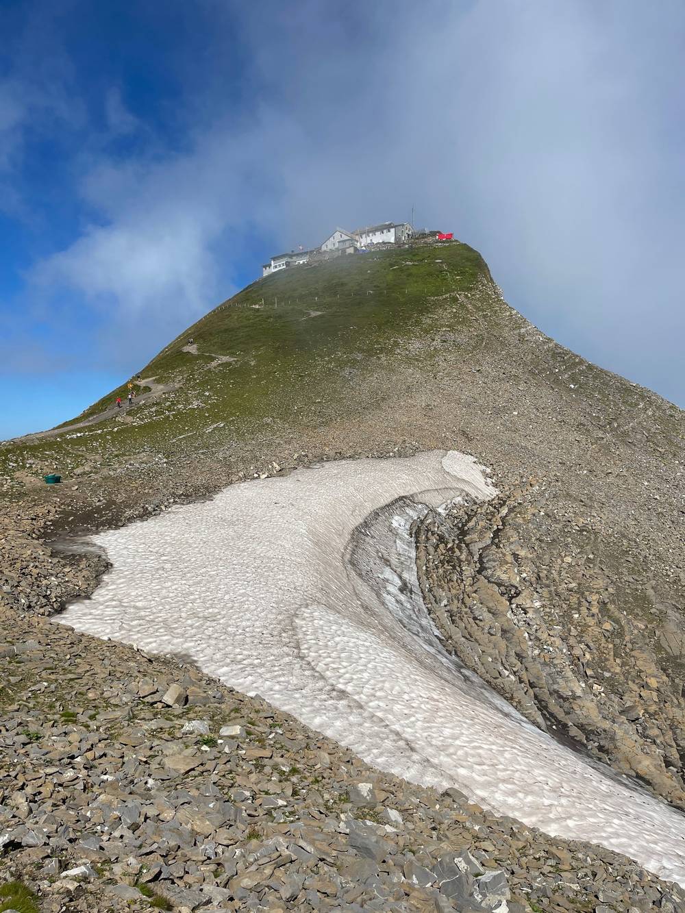
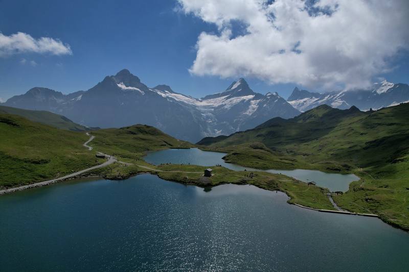
Below the Faulhorn is the Bachalpsee. Of course I jumped in. So refreshing. From the lake to First it's a wide, busy path full of day hikers. At First I walked the Cliff Walk and had lunch at the Berggasthaus: a bowl with chicken and avocado, an espresso, and apple strudel with vanilla sauce and ice cream.
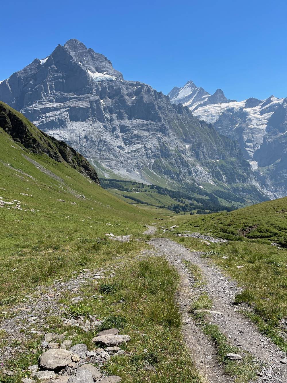
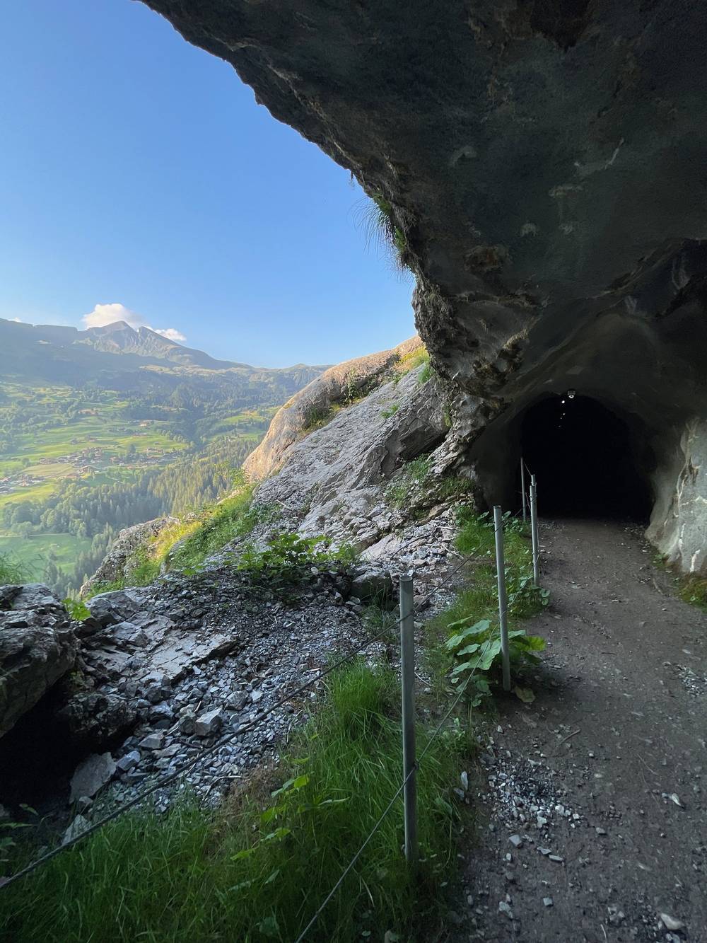
The afternoon was the long way round to Grindelwald: over the high pastures to Grosse Scheidegg, then down under the Wetterhorn. I stopped at Hotel Wetterhorn for a Coke and a plate of Bergkäse ravioli, then took the path across to Pfingstegg, through a short rock tunnel, and down into Grindelwald. I reached Camping Gletscherdorf at 8:50 p.m. The campsite had plugs to charge, bathrooms, and it was cheap. My Instagram story that day: hiked 23 miles today, but I had apple strudel with vanilla sauce and ice cream, so...
From the ridge, 6,540 ft (1,993 m), the Panoramaweg goes east along the ridge over the Güwtürli saddle to Berghaus Männdlenen (Weber Hütte) at 4.2 miles, 7,690 ft (2,344 m). The climb continues on rock and scree to the Faulhorn at 6.3 miles, 8,800 ft (2,681 m). The path is rocky, with steep drops in places. A snow patch was still lying below the summit in late July. From the summit it's a steady descent past two small shelters to the Bachalpsee at 8.4 miles, 7,430 ft (2,265 m), and an easy, wide path to First at 10.6 miles, 7,110 ft (2,168 m).
After First my line went up again over the Chrinnenboden and across the Grindel alps to Grosse Scheidegg at 15.4 miles, 6,440 ft (1,962 m), the pass between Grindelwald and Meiringen. The way down passes right under the Wetterhorn to Hotel Wetterhorn at about 19 miles, 4,030 ft (1,228 m). From there a path climbs and traverses southwest below the Upper Grindelwald Glacier, with a short tunnel and a section cut into the cliff with a hand rail, to Pfingstegg at 21.9 miles, 4,530 ft (1,382 m), then drops through forest to Camping Gletscherdorf at 24.1 miles, 3,270 ft (996 m).
Splitting it. This is a very long day. The natural split is First: take the gondola down to Grindelwald at 10.6 miles, or stay up high (see Where to sleep).
Before the Faulhorn, go back to Schynige Platte and the railway. From the Faulhorn on, head for First and the gondola down to Grindelwald (25 minutes). From Grosse Scheidegg, bus 128 runs down to Grindelwald station in about half an hour, hourly in summer (May 14 to October 18 in 2026), and it stops at Oberer Gletscher by Hotel Wetterhorn on the way. Pfingstegg has a cable car down to Grindelwald (April 25 to October 25 in 2026).
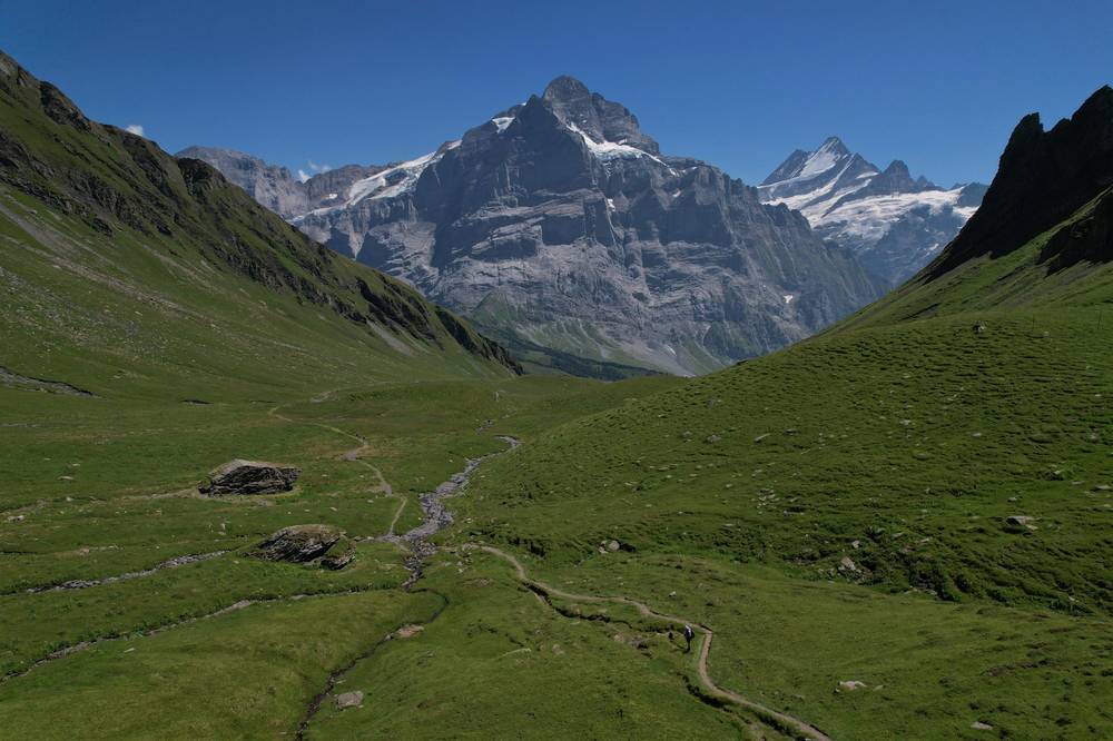
Out of the campsite at 7:40 a.m. The climb from the Glacier Gorge up toward Alpiglen is steep, through forest and meadow, and my pace slows considerably when I spot wild strawberries. I stopped for an hour at Berghaus Alpiglen for coffee and food on the terrace.
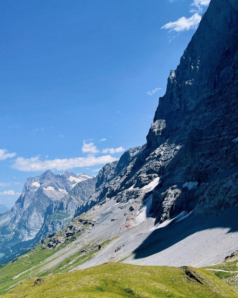
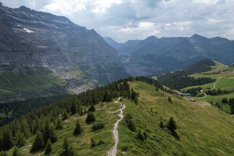
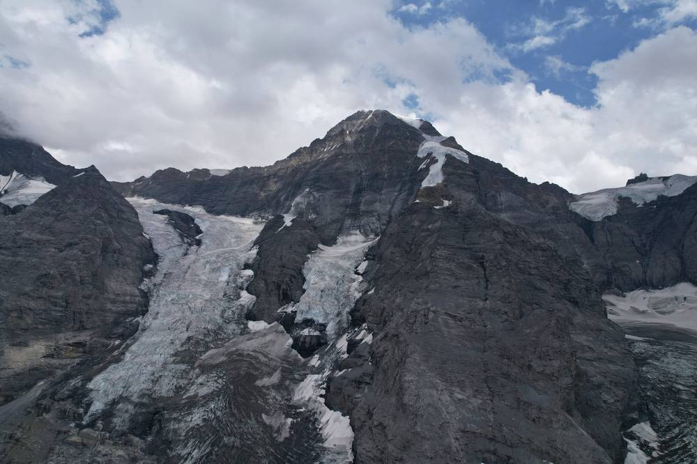
The Eiger Trail runs right under the north face. I posted a photo of it looking back: in the rear view mirror. The Eiger Express gondolas go by overhead near the top. At Eigergletscher, where the Jungfrau Railway stops, I took another long break with a view of the glaciers.
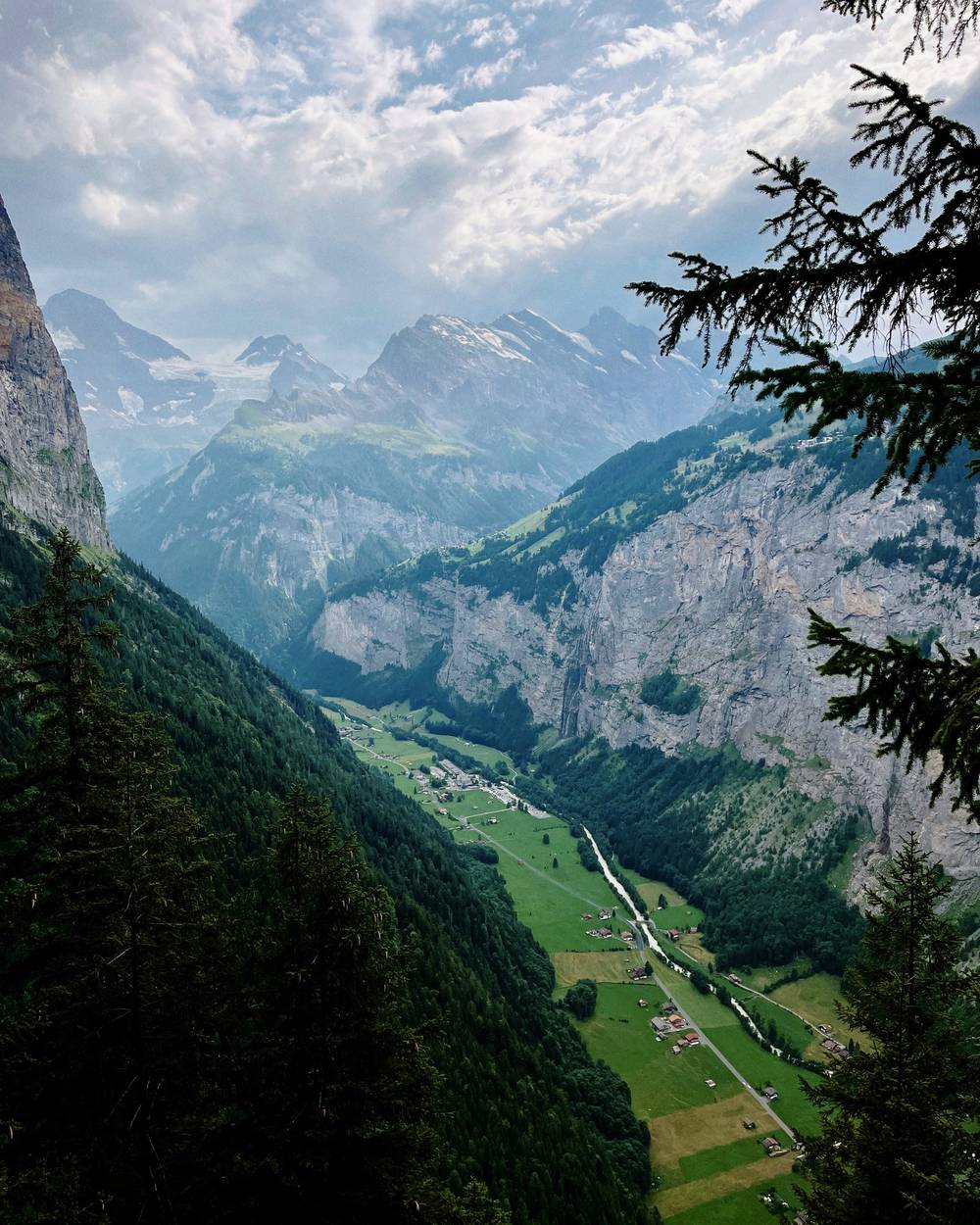
The afternoon was all downhill to the Lauterbrunnen valley: open ridges and alps with cows, Wengernalp, Mettlenalp, then a long, steep path through the forest to the valley floor at the Trümmelbach Falls. I reached Camping Breithorn just before they closed the snack shop and got my little dinner there. Plenty of space in the valley but not much else.
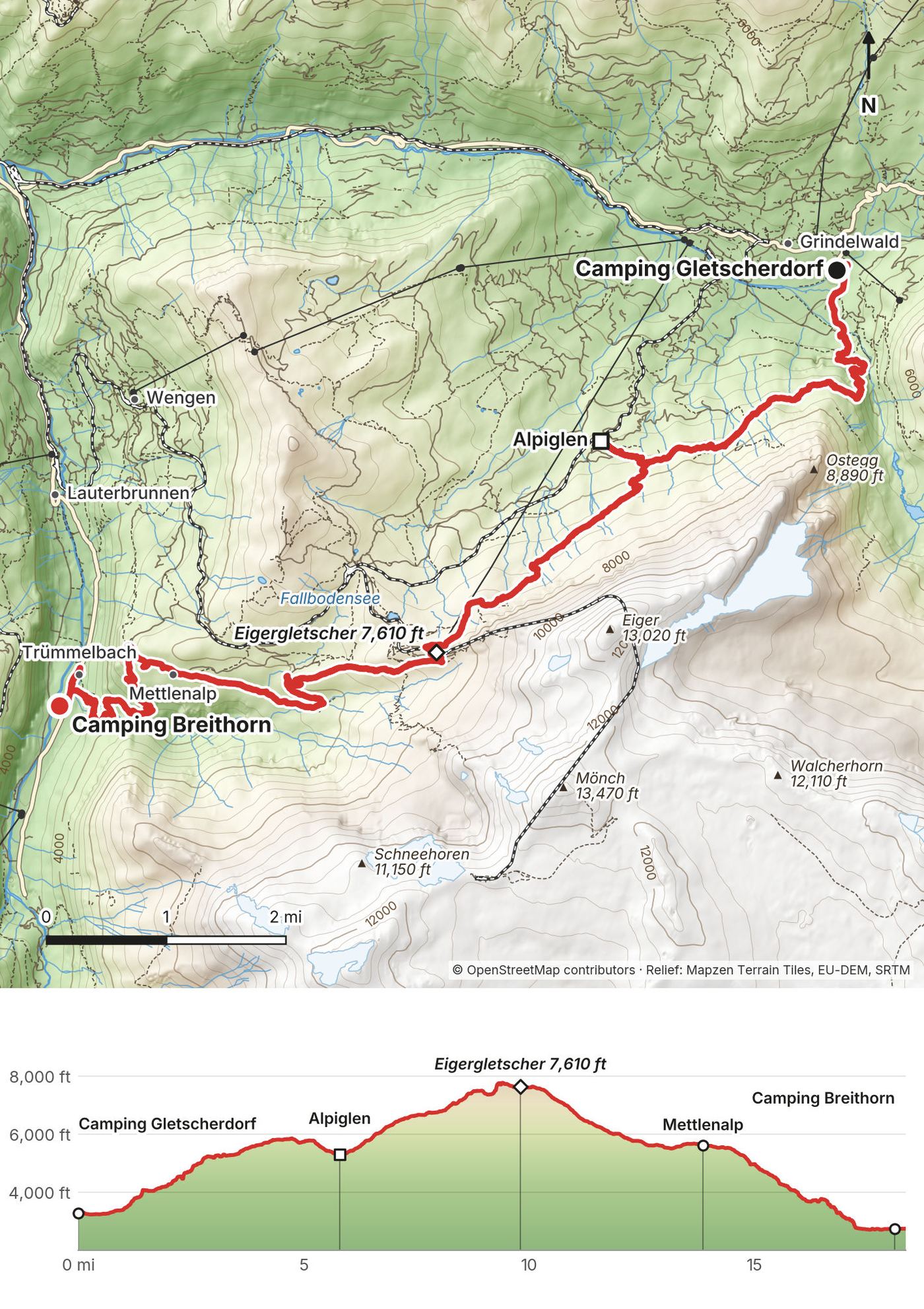
From Camping Gletscherdorf, 3,260 ft (995 m), the path goes south past Hotel Gletscherschlucht at 1 mile and climbs hard through forest and meadow, past the Bonera shelter at 2.6 miles, 4,950 ft (1,508 m), and across the slopes under the Eiger's east ridge to about 5,820 ft (1,775 m), then down to Alpiglen at 5.8 miles, 5,300 ft (1,616 m). The Eiger Trail starts here: about 3.9 miles and 2,500 ft (760 m) of climbing, on a rocky path at the foot of the north face, to Eigergletscher at 9.7 miles, 7,610 ft (2,320 m). Most people walk it the other way, downhill from Eigergletscher: Jungfrau Railways gives about 2 hours down and 2.5 hours up, and Switzerland Tourism gives its season as July to October, with the difficult sections secured with ropes.
From Eigergletscher my line went down west past the Haaregg and the Fallboden to Wengernalp (the station is about 500 m off the line), across to Mettlenalp at 13.9 miles, 5,620 ft (1,712 m), and then down a long, steep forest path: about 2,900 ft (880 m) of descent in 3.7 miles to the valley road at the Trümmelbach Falls, 17.6 miles, 2,740 ft (834 m). Camping Breithorn is half a mile up the valley at Sandbach.
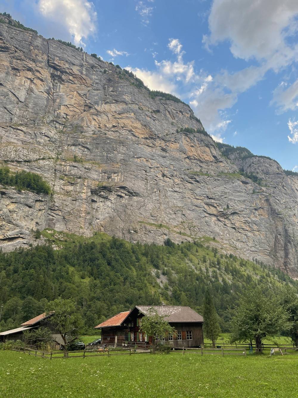
Before Alpiglen, go back to Grindelwald. Alpiglen and Eigergletscher are both stations on the Wengernalp and Jungfrau railways, and the Eiger Express gondola runs from Eigergletscher down to Grindelwald Terminal. Wengernalp has a station too, with trains down to Wengen and Lauterbrunnen or over to Kleine Scheidegg. Once you're below Mettlenalp, keep going down to the valley.
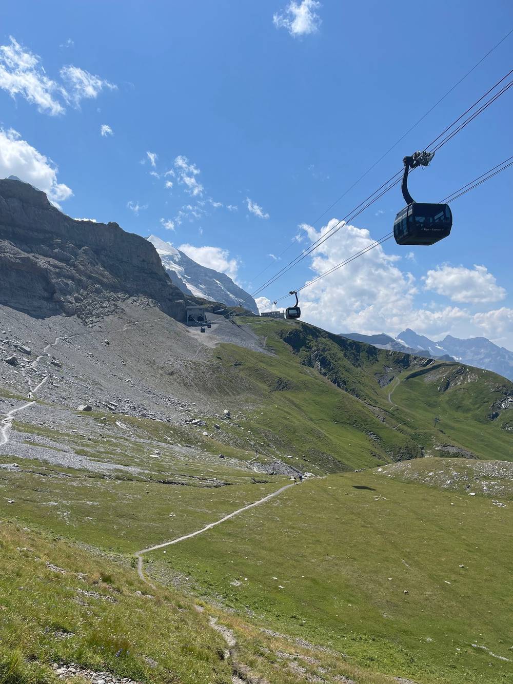
In the morning I went up the valley to Stechelberg and took the cable car up to Mürren. The gondola was optional, because I could have hiked up; it wasn't too expensive and it was easy to buy a ticket right when I rolled up to it. I couldn't find a restaurant to eat until I got up to Mürren, so breakfast was a full one at Hotel Eiger. Treat yo self.
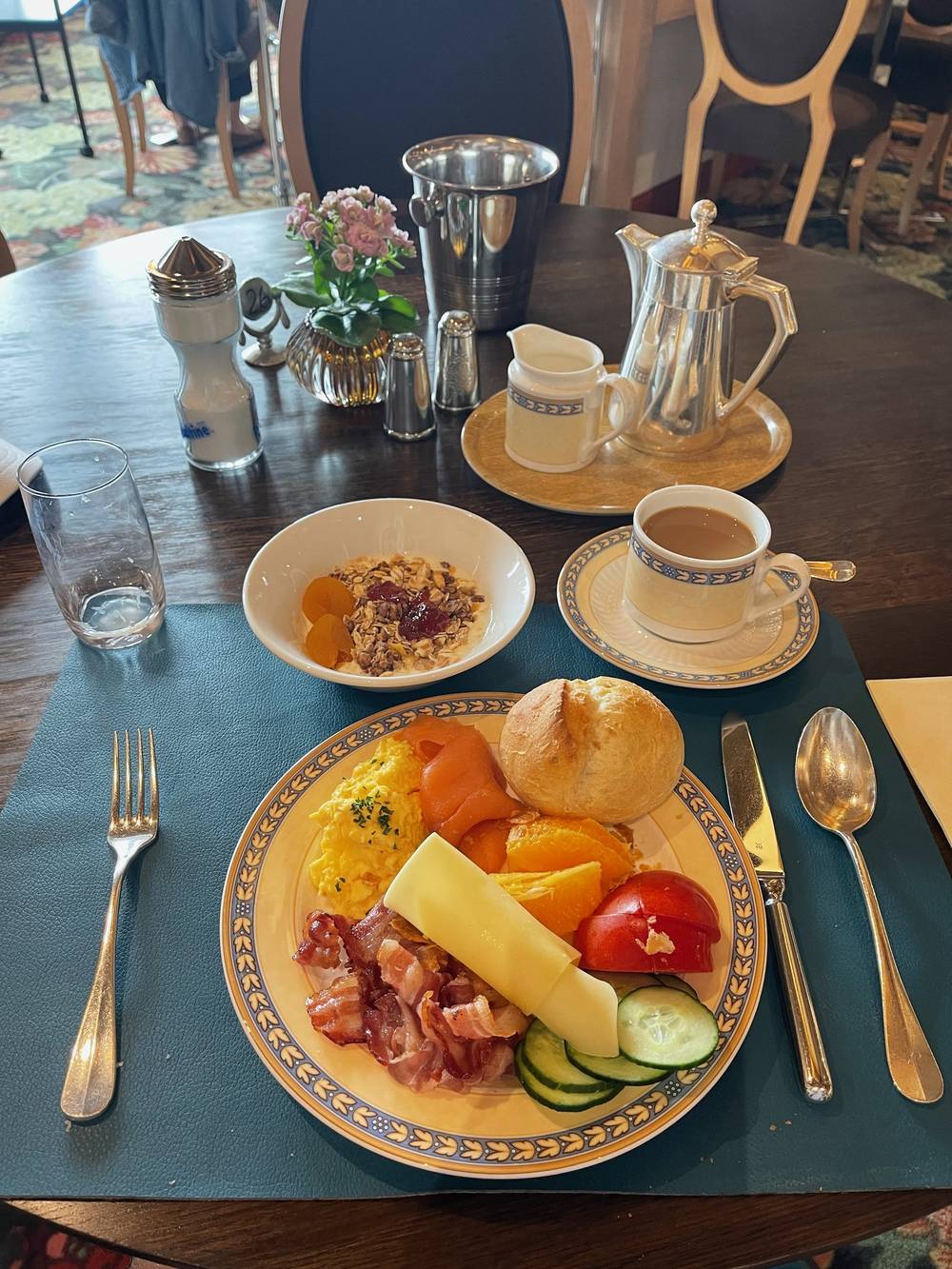
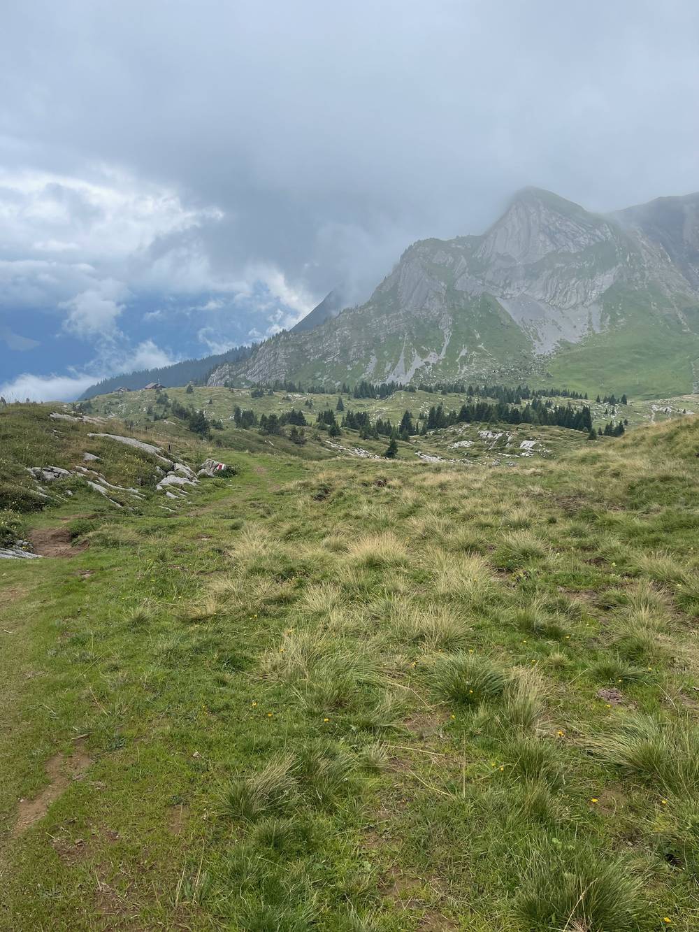
This was the cloudy day. I started walking from Mürren at 10:50 in fog, along the balcony path above the Lauterbrunnen valley, past the Sulsseeli and the alps below the Lobhörner, and over the ridge below the Sulegg. Then it was all downhill through the forest to Wilderswil, where I'd started four days before. I was there just after 5 p.m. I picked up my bag from the locker at Interlaken Ost and took the train to Geneva that evening.
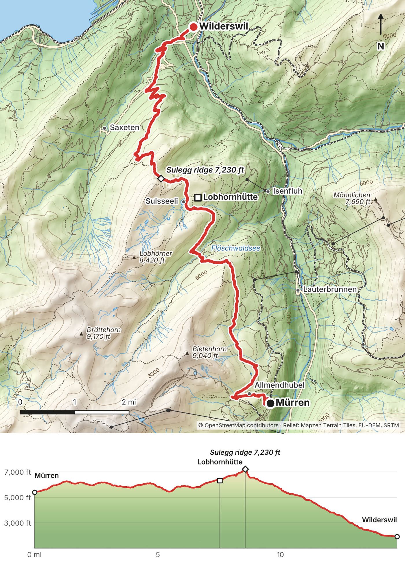
From Mürren station, 5,400 ft (1,646 m), the path climbs below the Allmendhubel to about 6,000 ft and runs north along the slope high above the Lauterbrunnen valley, past Winteregg and above Grütschalp (the station is about 550 m below the line at 4.2 miles), to Alpiglenläger at 5 miles. It keeps traversing, up and down, to the Sulsseeli at 7.4 miles, 6,300 ft (1,920 m); the Suls-Lobhornhütte is about 300 m to the east. From the lake the path climbs to the day's high point, 7,230 ft (2,203 m), on the ridge below the Sulegg at 8.6 miles, then comes down past the Bällen alps. After that it's a long descent: about 5,300 ft (1,620 m) down in 6 miles, through the Saxetwald forest and the fields of Ried, to Wilderswil station at 14.7 miles, 1,920 ft (586 m).
From Mürren, the mountain railway runs to Grütschalp, and the cable car from Grütschalp goes down to Lauterbrunnen. From the Lobhornhütte a path goes down to Sulwald, where a small cable car drops to Isenfluh (every 15 minutes, 2026), with bus 142 on to Lauterbrunnen. After the Sulegg ridge, keep going down to Wilderswil; the other way down is Saxeten, which has only a few buses a day (line 111).
Wilderswil station is on the BOB line: 5 minutes to Interlaken Ost, where the main-line trains leave for Bern, Zürich and Geneva (about 2 hours to Zürich, about 3 hours to Geneva, 2026 timetable). That evening I paid the extra locker charge at Interlaken Ost, bought a ticket to Geneva (CHF 72, 2nd class full fare, 2022), and was in Geneva that night.
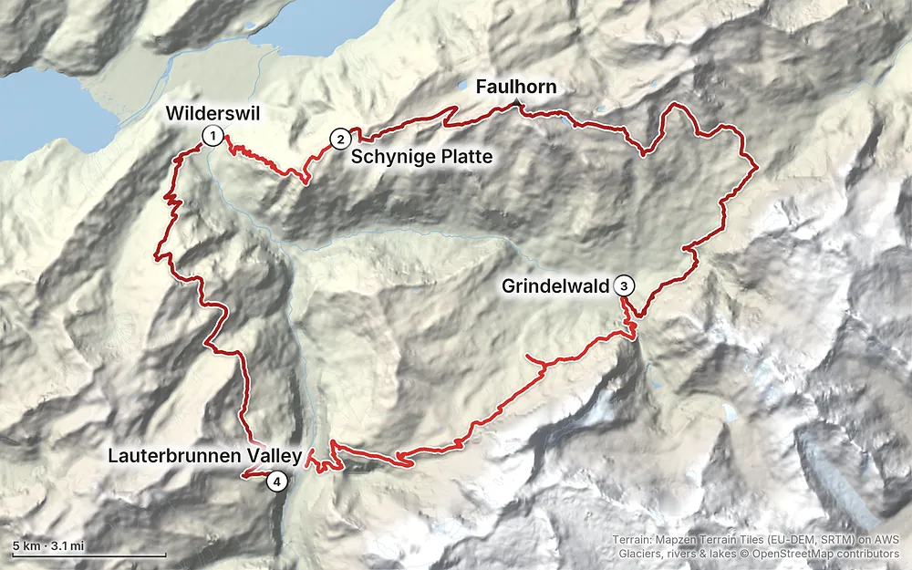
Elevation1,923–8,750 ft64.4 mi
Terrain: Mapzen Terrain Tiles (EU-DEM, SRTM) on AWS · Glaciers, rivers & lakes © OpenStreetMap contributors
Tap a map to open it full size.
Nothing to book for the hike itself. The mountain inns are small, so book them ahead in July and August. Camping outside campsites is banned in Bönigen, Grindelwald and Lauterbrunnen, and in the Schwarzhorn hunting reserve around First (2026)
From the hike's facts; check the official page before you go.
The season. The high trail from Schynige Platte over the Faulhorn to First is "usually only accessible from mid-June" (Berner Wanderwege), and Switzerland Tourism gives the Eiger Trail's season as July to October. The lifts and inns set the rest. For 2026: the Schynige Platte railway ran from June 13, with offers valid to October 25; the Berghotel Faulhorn is open through October 4; Berghotel Grosse Scheidegg is open May 16 to October 18, about the same season as the Grosse Scheidegg bus (May 14 to October 18); Camping Breithorn takes tents May 1 to September 30. July to the end of September is the easiest window.
What I got. I went in late July. There was dark cloud over the ridge on the first evening; Days 2 and 3 were mostly sunny, with cloud building on the afternoon of Day 3. Day 4 was the cloudy day, with fog from Mürren to the Sulegg. There was still a patch of snow below the Faulhorn summit.
Summer crowds. The lift stations are busy. The path from the Bachalpsee to First was full of day hikers, and so was First itself. Start early: I had my camp spot on the ridge past Schynige Platte to myself all morning.
Forecasts. Use the free MeteoSwiss app (local and mountain forecasts, with warnings). Check it every evening, and ask at the inns about the trail ahead.
Emergencies. Call 1414 for Rega, the air rescue (+41 333 333 333 from a foreign phone), or 144 for an ambulance, 117 for the police and 112 for the European emergency number. Rega's patronage (CHF 40 a year) is a donation, not insurance: Rega may waive or reduce costs for patrons at its discretion. Get travel insurance that covers mountain rescue.
Hunting reserves. The area around First is in the Schwarzhorn federal hunting reserve. There, camping is banned, dogs must be on a lead, and drones are prohibited. Elsewhere, drone flights follow the federal rules (up to 120 m above ground, in sight, never over crowds, registration required) and its map of restricted zones.
None of my route needs a rope, but these spots need care:
How hard is it? The paths are good and well signed, but my days were long. Day 2 was 24 miles, over 14 hours with stops, and Days 3 and 4 each finish with more than 5,000 ft (1,500 m) of descent. The high parts (the Schynige Platte ridge, the Faulhorn, the Eiger Trail) are rocky in places, with steep drops beside the path. Nothing needs climbing gear; the Eiger Trail has fixed ropes on its difficult sections. Try this at home: 15 miles with 4,000 ft of climbing and a pack, two days in a row. If that's too much, take the 7-day version in Other ways to do it, or use the lifts.
How many days? I did it in four. With a bed every night it's a comfortable seven. The trains and lifts let you cut almost any day short.
Where do you sleep? I camped: one wild camp on Day 1, then two campsites. You can't copy the wild camp: camping outside campsites is banned in Bönigen, where I pitched my tent, and in Grindelwald and Lauterbrunnen. There are mountain inns all along the high part of the loop, and hotels, hostels and campsites in the valleys. See Where to sleep.
Do I need to book? I didn't book anything for the hike itself. For the cable car up to Mürren I bought a ticket right when I rolled up to it. The mountain inns are small, so book those ahead in summer. Camping Gletscherdorf takes bookings for its tent meadow online.
Is it marked? Yes. Swiss trails are signed at every junction with times to the next places. Yellow signs are hiking trails; a white-red-white stripe marks a mountain trail. Carry the GPX files anyway: my line links several named routes, and fog comes in.
Can I skip the climbs? Yes. That's the beauty of this area. The Schynige Platte railway goes up from Wilderswil, the First gondola comes down to Grindelwald, a summer bus runs from Grosse Scheidegg, the Eiger Express goes up to Eigergletscher, and railways and cable cars link the Lauterbrunnen valley with Mürren, Grütschalp and Isenfluh. See Trains, lifts and passes.
Should I buy a pass? It depends on how many lifts you'll use. On this trip I bought ordinary tickets. These days I have connections with Switzerland Tourism, so I get free Swiss Passes when I visit; you'll be paying for yours. The passes and what they cover are in Trains, lifts and passes.
Where do I leave my luggage? I used a large locker at Interlaken Ost for the four days. If you leave something in there for a long time, they may move it to storage and you ask for it back at the desk. No biggie. In 2026 a large locker costs CHF 10 per 24 hours, up to 6 days.
Is there water? At the inns, restaurants and campsites, including the restaurant at First. The Berghotel Faulhorn says there's no drinking water on its mountain, so fill up before the long high section of Day 2.
Phone and data? I bought a Sunrise prepaid SIM in Zürich on the first day (CHF 19.90, 2022).
Cash or cards? Cards are taken almost everywhere in Switzerland, including Camping Breithorn and the Faulhorn hotel. The Lobhornhütte prefers cash (cards and TWINT from CHF 20). Carry some Swiss francs for small places.
Can I fly a drone? Drones are banned in federal hunting reserves, and the Schwarzhorn reserve covers the area around First. Elsewhere, the federal drone rules and its restricted-zone map apply. See Weather and safety.
I walked the four days above, camping three nights. These versions are for people who want a bed every night or shorter days. I didn't walk them this way; the distances come from my own GPS on the same paths.
| Day | From, to | Miles on my GPS | Sleep |
|---|---|---|---|
| 1 | Wilderswil to Schynige Platte | 5.5 | Berghotel Schynige Platte |
| 2 | Schynige Platte, Männdlenen, to the Faulhorn | 8.0 | Berghotel Faulhorn |
| 3 | Faulhorn, Bachalpsee, First, to Grosse Scheidegg | 9.1 | Berghotel Grosse Scheidegg |
| 4 | Grosse Scheidegg, Hotel Wetterhorn, Pfingstegg, to Grindelwald | 8.7 | Grindelwald (campsite, hostel or hotel) |
| 5 | Grindelwald, Alpiglen, the Eiger Trail, down to the Lauterbrunnen valley | 18.4 | Lauterbrunnen valley |
| 6 | Cable car to Mürren, then Grütschalp and the Sulsseeli to the Lobhornhütte | about 7.6 | Suls-Lobhornhütte |
| 7 | Lobhornhütte, the Sulegg ridge, down to Wilderswil | about 7.3 |
Day 5 is still long. Two ways to shorten it: ride the Eiger Express from Grindelwald Terminal up to Eigergletscher and walk the Eiger Trail downhill to Alpiglen and back to Grindelwald, which is the way most people do it; or walk my line over Eigergletscher as far as Wengernalp (13.4 miles) and take the train down to Lauterbrunnen. Book the mountain inns ahead in July and August.
Everything on the loop, with 2026 details. Timetables are at sbb.ch and in the SBB app. Jungfrau Railways publishes "from" prices, so check the full fare when you buy.
If you walk the loop the way I did, you only ride the BOB and one cable car, and ordinary tickets are cheaper. The passes pay off if you ride the lifts to shorten the days.
| Line | Where | 2026 |
|---|---|---|
| BOB train | Interlaken Ost to Wilderswil | 5 minutes |
| Schynige Platte railway | Wilderswil to Schynige Platte | 52 minutes; from June 13, offers to October 25; from CHF 34 |
| First gondola | First to Grindelwald | 25 minutes; from CHF 38 |
| Bus 128 (GrindelwaldBus) | Grosse Scheidegg and Hotel Wetterhorn to Grindelwald | Hourly, May 14 to October 18; CHF 27 |
| Eiger Express | Eigergletscher to Grindelwald Terminal | 15 minutes; from CHF 40.60 |
| Wengernalp railway | Alpiglen, Wengernalp, Wengen, Lauterbrunnen | Wengernalp to Lauterbrunnen 33 minutes |
| Bus 141 | Lauterbrunnen to Sandbach and Stechelberg | Every 30 minutes |
| Schilthornbahn | Stechelberg to Mürren | New in December 2024. 4 minutes; CHF 11.80; closed October 19 to 30 |
| Mürren railway and Grütschalp cable car | Mürren, Grütschalp, Lauterbrunnen | Closed for works April 13 to July 10 and October 26 to November 6 |
| Isenfluh-Sulwald cable car | Sulwald to Isenfluh | Every 15 minutes, 7:00 to 18:15; CHF 10; to November 1 |
| Bus 142 | Isenfluh to Lauterbrunnen | 12 minutes, about 8 to 11 a day |
| Bus 111 | Saxeten to Wilderswil | 24 minutes, only a few a day |
These change every year. Everything else in this guide stays the same.
Where you sleep
Getting there and around
Trail, weather and your stuff
The film is at the top of this page.
Planning questions about Tour of the Jungfrau Region, answered only from this page's facts, the creators' versions and hikers' public tracks, with where each answer comes from. When the data doesn't say, the answer says "not given".
From hikers
Sign in to comment. Free; your hikes stay private unless you share them.
Some lodging links earn me a small commission at no cost to you.
Something wrong or missing on this page? Send feedback.