
Content made there
The film is at the top of this page.
Photos
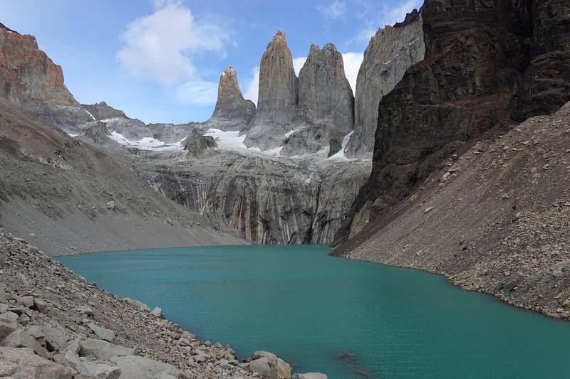
Hikes / Torres del Paine O Circuit / Kraig Adams's version
South America · Chile
Mar 2020 · 5 days · about 85 miles · Solo · Huts and tent

In March 2020 I flew to southern Chile and hiked Torres del Paine alone: the O circuit around the back of the Paine massif, then the W along its front, finishing at the foot of the three granite towers. I'd always wanted to hike in Patagonia, and Torres del Paine is one of the hikes you find the moment you research long treks. Most of the hiking world was still cold that March. Chile wasn't. I walked it in five days, about 85 miles by my GPS, with my own tent and food, and on the fourth day I let loose and walked 31 miles from Grey to Central.
Compared to other trails I've hiked, I'd call it a more remote, more isolated version of the Tour du Mont Blanc, with not as much elevation gain. What makes it work is planning: every night must be booked, the O goes one way only, and there are no fires and no wild camping.
| Quick facts | |
|---|---|
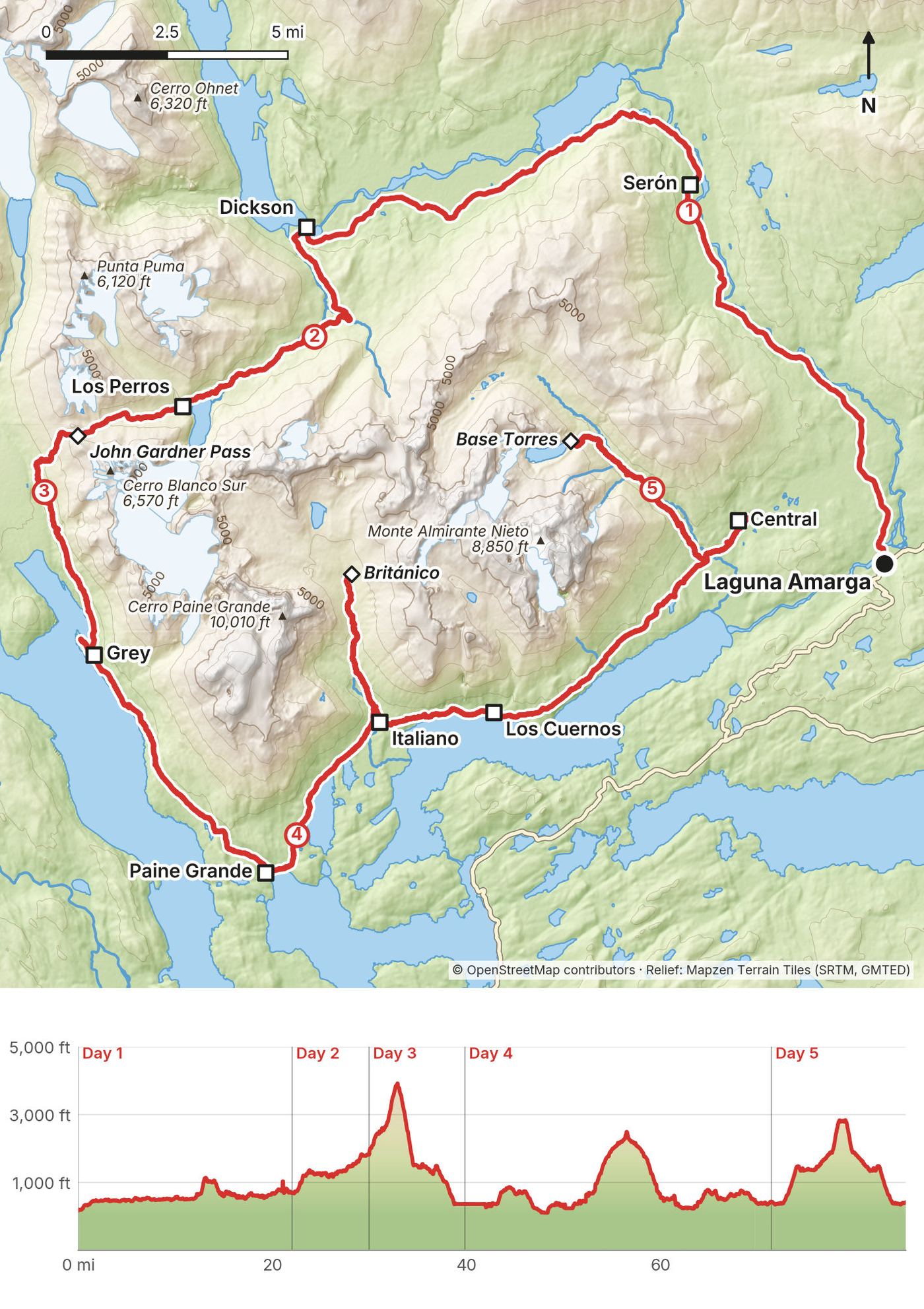
| Distance | 85.3 miles (137.2 km) over 5 days on foot, with the Valle del Francés and the Base Torres |
| Climbing | about 14,590 ft (4,450 m) up and 14,430 ft (4,400 m) down |
| Start | Laguna Amarga, the park entrance on the bus road from Puerto Natales |
| Finish | Central, near Hotel Las Torres, after the Base Torres out and back |
| High point | The John Gardner Pass on Day 3: 3,963 ft (1,208 m) on my GPS; 1,200 m published |
| Direction | Counterclockwise. The back of the O is one-way |
| Nights | 3 at campsites in my own tent, 1 in a refugio room at Grey |
| How | Alone, carrying my own tent and food, every night booked ahead |
| When | Southern summer. The O opens about November to March, on dates CONAF sets each season. I walked March 10 to 14, 2020 |
| Difficulty | A well-made trail with no scrambling. One real pass. Wind and weather are the hard part |
| Base | Puerto Natales, about 3 hours by bus from Punta Arenas airport and 2 hours from the park |
| Day | Route | Miles (km) | Up / down (ft) | Night, ft (m) |
|---|---|---|---|---|
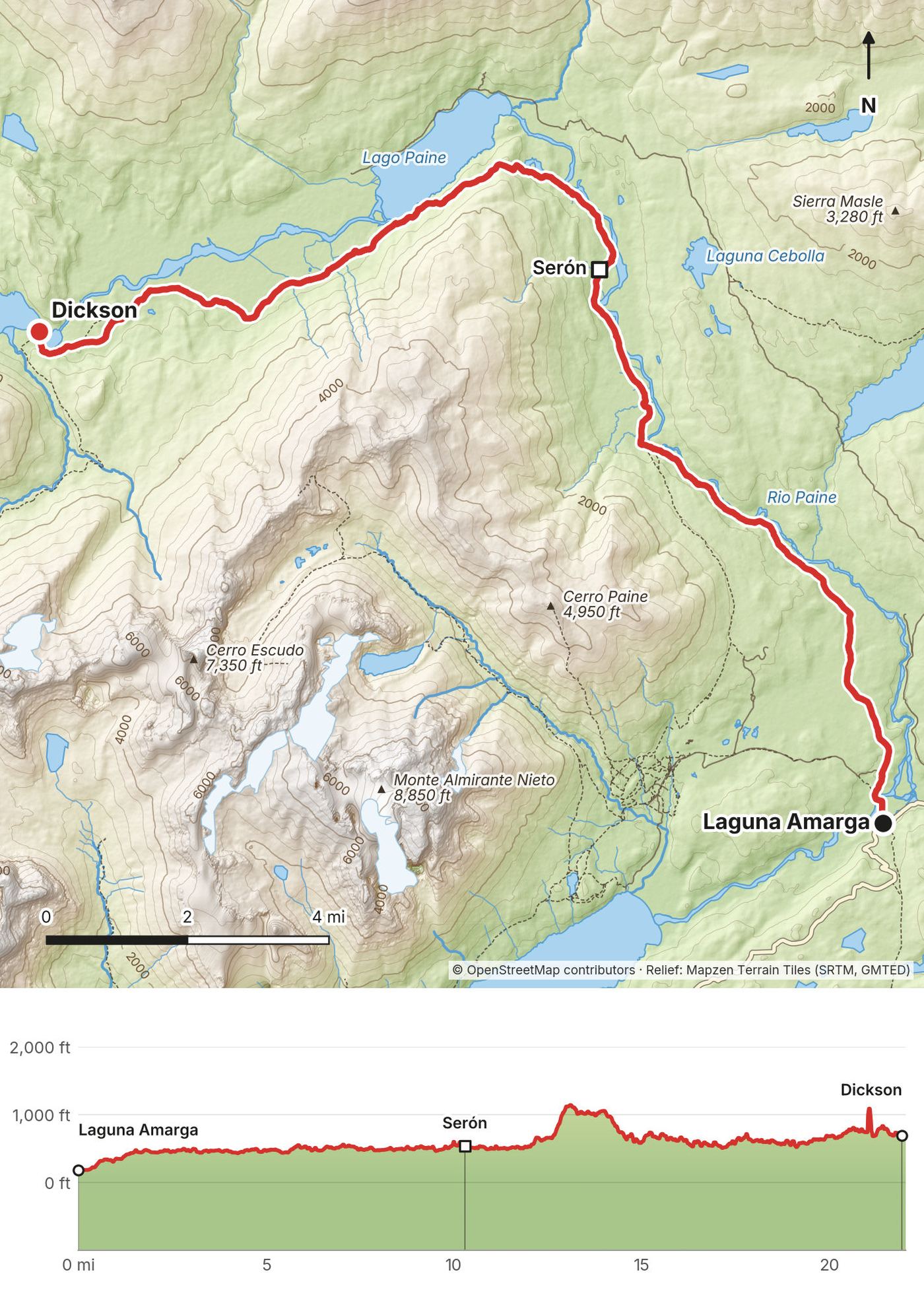
| 1 | Laguna Amarga to Dickson | 22.1 (35.5) | 2,617 / 2,119 | Dickson, 690 (211) |
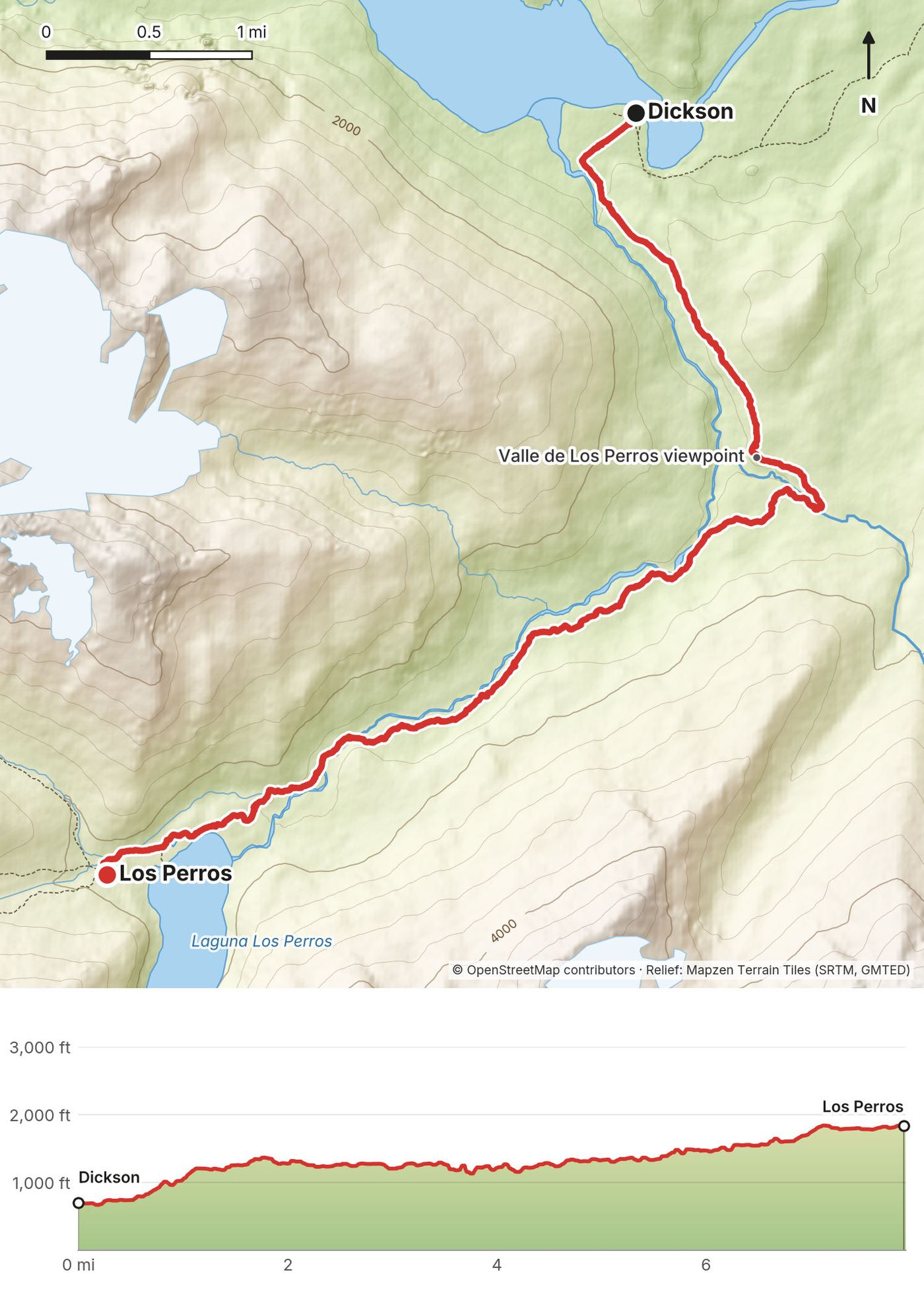
| 2 | Dickson to Los Perros | 7.9 (12.7) | 1,594 / 458 | Los Perros, 1,840 (560) |
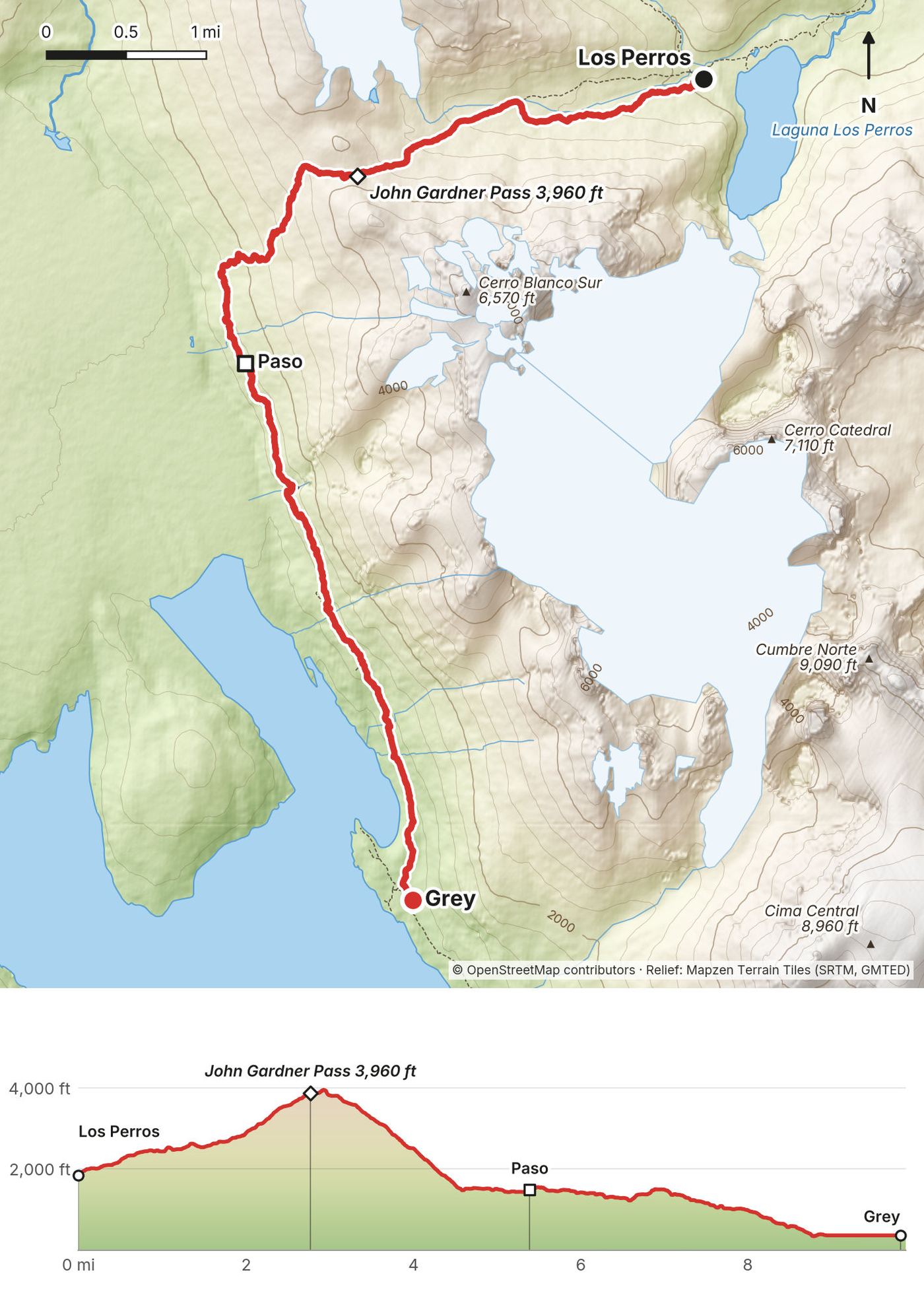
| 3 | Los Perros to Grey | 9.9 (15.9) | 2,388 / 3,908 | Grey, 360 (110) |
| 4 | Grey to Central | 31.5 (50.7) | 4,976 / 4,903 | Central, 440 (133) |
| 5 | Central to Base Torres and back | 13.9 (22.3) | 3,009 / 3,040 |
The numbers come from my own GPS recordings, smoothed the same way for every day. Day 4 includes the side trip up the Valle del Francés to the Británico viewpoint. My film's title says 80 miles.
Fly to Punta Arenas. It's a long flight: the long flight is the one real downside of this trail. My round trip from the US cost about $1,000.
Punta Arenas to Puerto Natales. There's a good bus system. When you fly into Punta Arenas you can take a bus straight to Puerto Natales; I paid about $10. You can skip Punta Arenas itself: I liked the smaller town closer to the park better. Bus-Sur, for one, meets flights at Punta Arenas airport on every departure: 3 hours 15 minutes, from CLP 11,000 (2026). Buses Fernández also runs the route.
Puerto Natales. I recommend staying a night in town to get used to things and to buy supplies. I stayed at a hostel, Niko's II Adventure, three nights for about $40. It had free breakfast and good Wi-Fi, the people were nice, and they let me keep the things I didn't take into the park, my laptop and my drone, in their locker room. It still runs in 2026 (nikostwoadventure.com, Phillipi 528).
Groceries. Buy your trail food at a local store in Puerto Natales before you go. You can buy supplies and freeze-dried meals in the park, at the visitor center and the camps, but they're more expensive.
To the trailhead. Buses go from the Puerto Natales bus terminal (Av. España 1455) to the park; I paid about $10. Bus-Sur's 2026-27 season: 7:00 a.m. and 12:00 p.m. daily, plus 2:30 p.m. from November, reaching Laguna Amarga about 2 hours later; CLP 18,000 a leg. The 7:00 a.m. bus fits the O: my Day 1 started at Laguna Amarga at 9:20 a.m. Other companies run the same road. A shuttle links Laguna Amarga with the Welcome Center near Hotel Las Torres (CLP 4,500, cash).
From El Calafate, Argentina. Bus-Sur runs El Calafate to Puerto Natales in about 6 hours, from CLP 40,000 (2026).
My costs, from the list in my film, in US dollars, for March 2020:
| Item | What I spent |
|---|---|
| Round-trip flight from the US | about $1,000 |
| Hostel in Puerto Natales, three nights | about $40 |
| Meals in town | about $50 |
| Buses (airport to Puerto Natales, to the park and back) | about $20 to $30 |
| Park entrance | about $30 |
| Campsites and my room at Grey | about $50 |
| Groceries | about $25 |
| Meals on the trail | about $60 |
| Drinks and snacks | about $40 |
| Wi-Fi at the camps | about $10 |
I took out about $300 in Chilean pesos from an ATM in Puerto Natales, and I went through most of it on the trek. Chile felt more expensive than Peru and less expensive than Switzerland. If you bring your own food, stove and tent, it can be cheap: the camps can come to $40 to $60 for the whole trip, not counting the park fee, the buses, and the occasional beer.
That's a big change from 2020: my camps and room cost about $50 in total. The same four nights at 2026-27 rates, for one person in their own tent, with a simple bed at Grey, come to about US$160: US$11 at Dickson, US$11 at Los Perros, US$46 at Grey and US$90 at Central (Las Torres' solo rate). Vertice's US dollar rates are for foreign visitors showing their passport and entry card.
What I ate. How you eat is entirely up to you. I love the combo of sausage, cheese and crackers: if you buy the right kind they won't spoil much, and they're delicious on the trail. I always pack nuts, because they're very nutrient dense for the weight and they don't spoil, and I get some dried fruit, or bananas and apples if I have space in my pack. I also brought a couple of Meal2Go bars from the States (only two; I wished I'd had more) and about five pouches of Performance Nut Butter, all eaten on the trail.
Meals at the camps. Most camps sell meals and snacks; I spent about $60 to $70 on meals, breakfasts and dinners, and about $40 on drinks and snacks, a lot of it beer and the occasional Coke. I had dinner in the refugio at Grey. On this trip, get at least one hamburger: they make them very big in Chile, and I had one with a pink bun, for some reason. Refugio meals must be booked; at Paine Grande, for example, dinner is booked before 3:00 p.m. (2026-27 prices are in What I paid).
Cooking. Stoves only in the camps' cooking areas: never in or next to your tent, and not at all at Chileno. Where the cooking area is outdoors, the park's rules say not to use a stove when the wind is 30 km/h (19 mph) or more or the temperature is 15 C (59 F) or more. No fires of any kind.
Water. There was plenty of water in streams along the way. People told me you could just drink straight from the glacier water, which you might be able to do, but I never trust it: I filter my water with a little filter that screws onto my water bottle.
I packed very light compared to other people. A lot of beginners are on this trail and most beginners overpack; the people I talked to said they thought they'd overpacked as well. At most camps you can rent a tent and a sleeping pad and buy your meals, so you could get away with barely anything in your pack.
Paid links: I earn a commission if you buy through these links, at no extra cost to you. As an Amazon Associate I earn from qualifying purchases.
I carried my own tent and food for four nights. Here's what I carried in 2020, what I'd take now for Patagonian wind and rain, and what I filmed with.
The full gear list I made for the film is no longer in its description. This is what my record shows.
My current kit for what this route needs. Wind and weather are the hard part here, above all on the John Gardner Pass.
 Tent: NEMO Hornet Elite OSMO 1P (Amazon). Bring a tent that can take wind, or book a rented one with your camp.
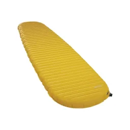 Sleeping pad: Therm-a-Rest NeoAir XLite NXT (Amazon). Most camps rent pads too.
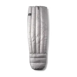 Sleeping bag: Hyperlite Mountain Gear 20° Quilt (Hyperlite). The nights were cool and chilly in early March.
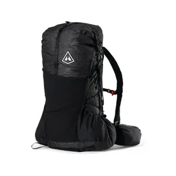 Pack: Hyperlite Mountain Gear Unbound 55 (Hyperlite). Room for a tent and four days of food.
 Rain shell: Arc’teryx Beta AR Jacket (Arc’teryx). Patagonian weather changes fast: I packed up a wet tent in the rain on Day 2.
 Puffy: Arc’teryx Cerium Hoody (Arc’teryx). Warm layers for the camps and the pass.
 Poles: Black Diamond Alpine Carbon Z Poles (Amazon). Required on the W and the Base Torres while snow and ice last in winter (2026).
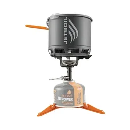 Stove: Jetboil Stash (Amazon). Only in the camps' cooking areas, and not at all at Chileno.
 Water filter: Katadyn BeFree AC · 1L (Amazon). There's plenty of water in streams along the way. This is the filter I carry now.
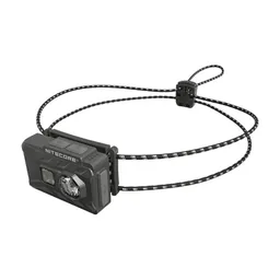 Headlamp: Nitecore NU20 Classic (Amazon). For the camps. Walking after dark isn't allowed.
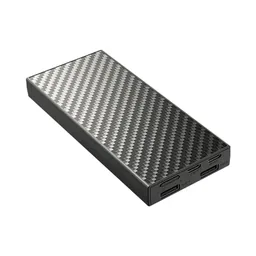 Power bank: Nitecore NB20000 (Amazon). There's nowhere to charge on the trail, and some days are long.
This trip was a test of a much smaller camera than the Sony a7 III I'd been using. I didn't take my laptop or my drone into the park; my hostel kept them in its locker room. Recreational drones are banned in the park (see Straight answers).
Since September 2026 I film with a smaller setup: the Pocket 4 and the Mic 3 on the trail, and the Mini 5 Pro in the air.
 Camera: DJI Osmo Pocket 4 (Amazon)
 Mic: DJI Mic 3 · 1 TX + 1 RX (Amazon). It pairs with the Pocket 4.
 Drone: DJI Mini 5 Pro (Amazon)
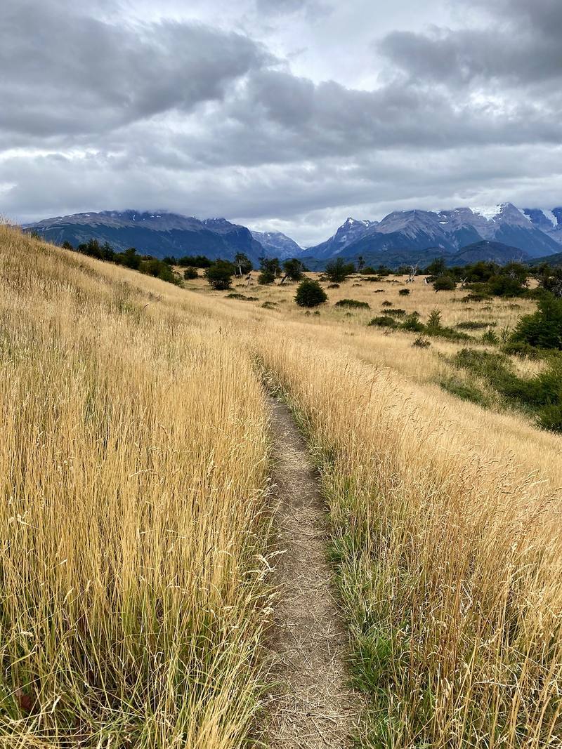
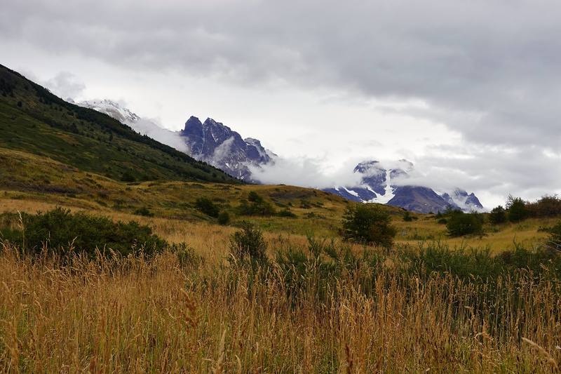
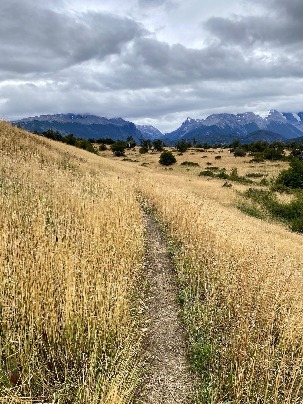
The bus from Puerto Natales dropped me at the Laguna Amarga entrance, and I started walking at 9:20 a.m. The first part is open golden grassland with the Paine massif in cloud to the west, and the Paine river running fast beside the path. I passed the Serón camp at 12:20 p.m., 10 miles in, and kept going.
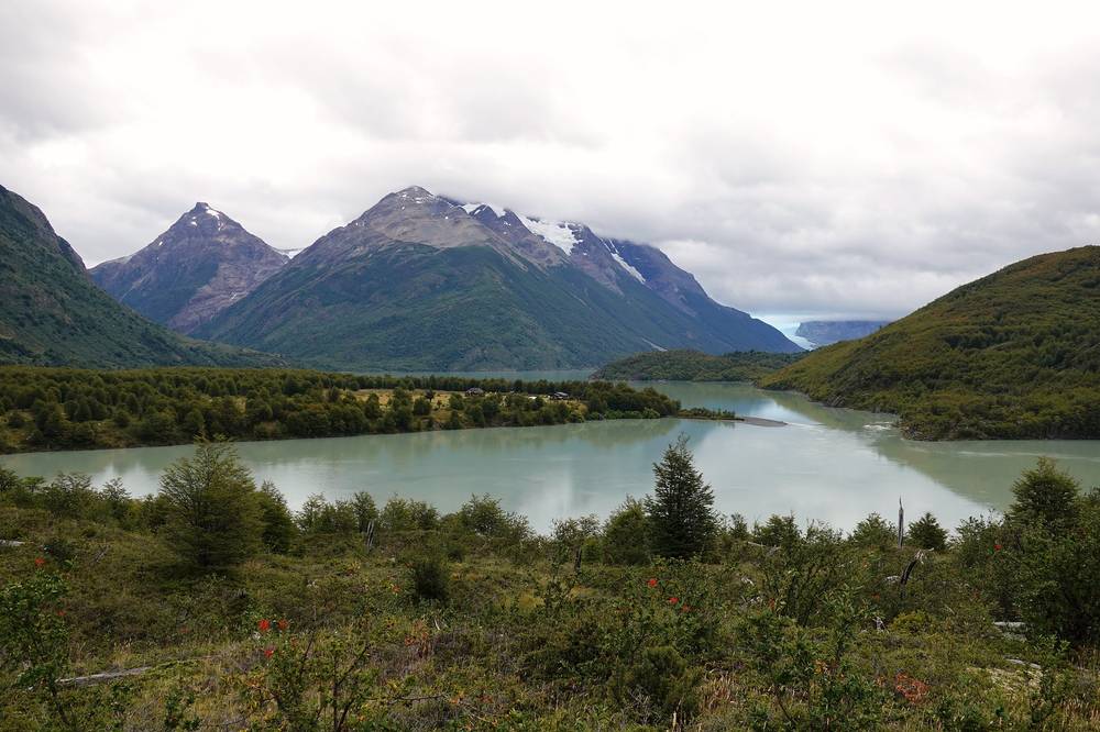
After Serón the path climbs over a low shoulder above Lago Paine, the high point of the day, and then follows the lake and the river west through meadow and forest to Lago Dickson. I reached the Dickson camp at 4:43 p.m. and pitched my tent near rows of yellow tents in the meadow, under the peaks, and ate from my own food bag in the tent door.
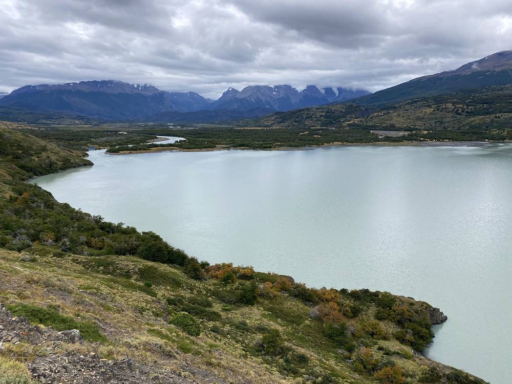
The O starts on the east side of the park and heads north up the valley of the Paine river. From Laguna Amarga the path runs north across open steppe, easy and nearly flat, to Serón at 10 miles. Most people stop there on their first night; the film's itinerary shows it that way too (11 miles and 11 miles). I went on. From Serón the trail climbs a little over the shoulder of the hills above Lago Paine, drops back to the valley, passes the Coirón ranger station, and follows the river and the lake west to Dickson, on the shore of Lago Dickson.
It's a long first day at 22 miles. Split at Serón, it's two easy ones.
Back the way you came to Laguna Amarga and the bus road. Past Coirón, you're committed to the circuit in one direction: the back of the O is one-way.
Film, Day 1 · Getting to the trail
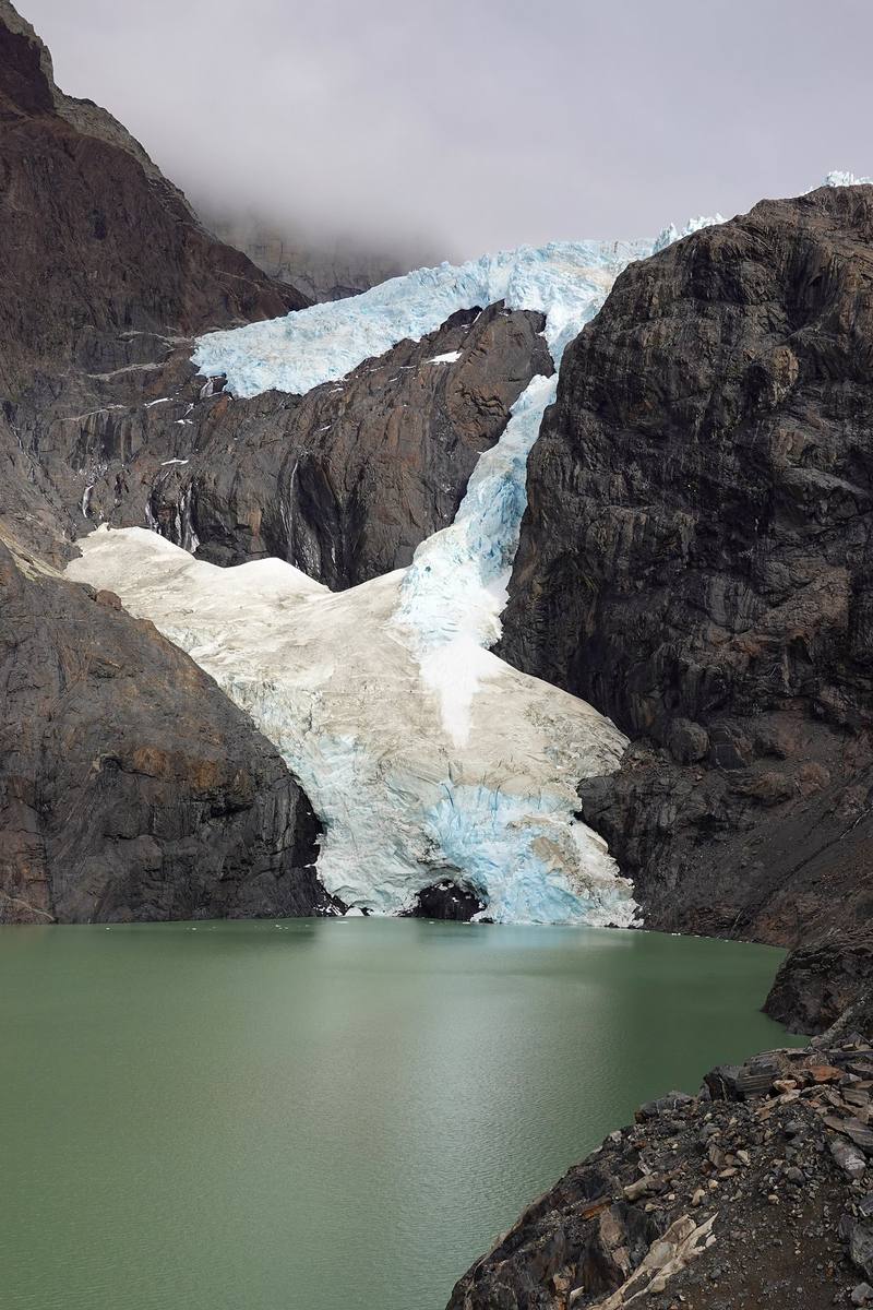
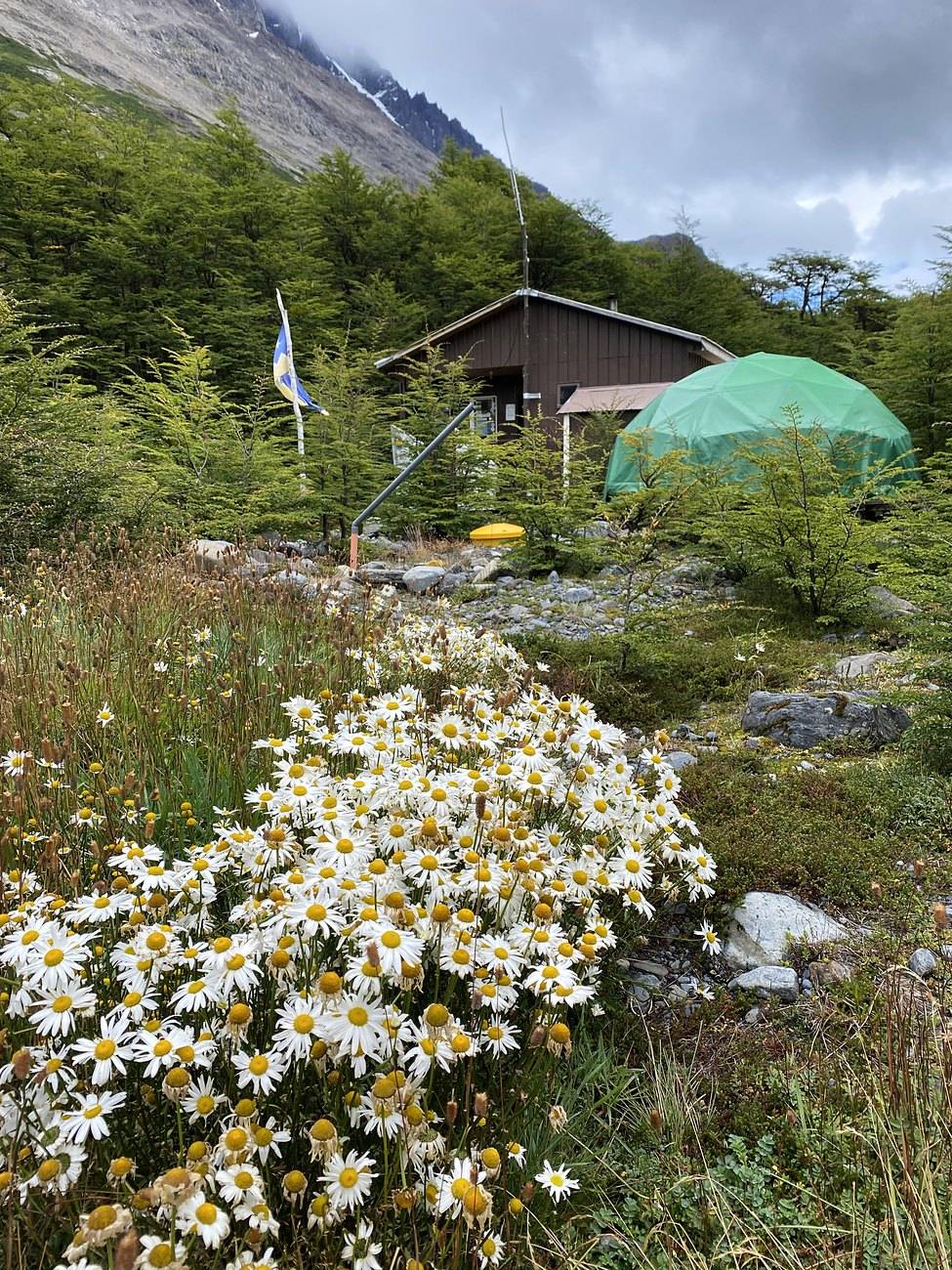
Morning at Dickson was thick fog over the forest. I packed up and started at 9:10 a.m., up the Los Perros valley through mossy lenga forest, with peaks showing above the cloud now and then. At 12:13 p.m. I was at the Los Perros glacier and its gray lake, and I reached the camp in the trees at 12:22 p.m.
This is what I meant about the rules. You have to stay at the camp you booked, so on days like this I'd start at 9 and be done with my 6, 7 or 8 miles by noon or one o'clock. That's a lot of wasted time. I'm very used to doing 20 to 30 miles a day, especially then, when I was getting ready for the Pacific Crest Trail. I'm not calling myself experienced, but I'm definitely not a beginner, and I wanted to hike more than they allowed. That's one of the only downsides of hiking the O. Near camp I sat by the glacier's gray lake for a while.
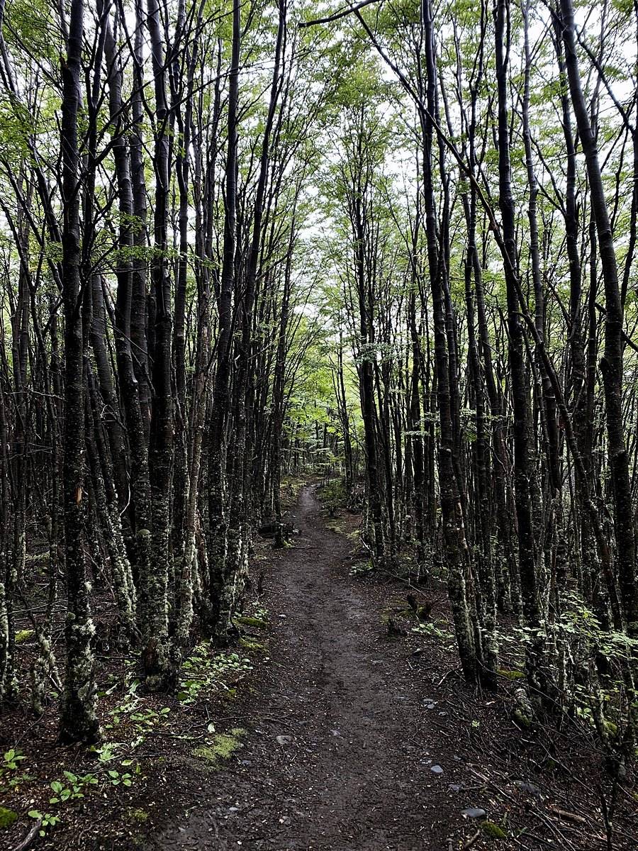
From Dickson the path turns south and climbs gently up the forested Los Perros valley, with the river below and several streams to cross on logs and small bridges. It's a steady, easy climb of about 1,600 ft. Near the head of the valley the trail comes out of the trees at the moraine of the Los Perros glacier: a short walk leads to the viewpoint over its lake. The camp is a few minutes further on, in the forest. It's the last camp before the pass.
Back down the valley to Dickson and out the way you came in. The O is one-way from Serón to Paso: turning back is for emergencies, so talk to the rangers.
Film, Day 2 · Campsite reservations and booking
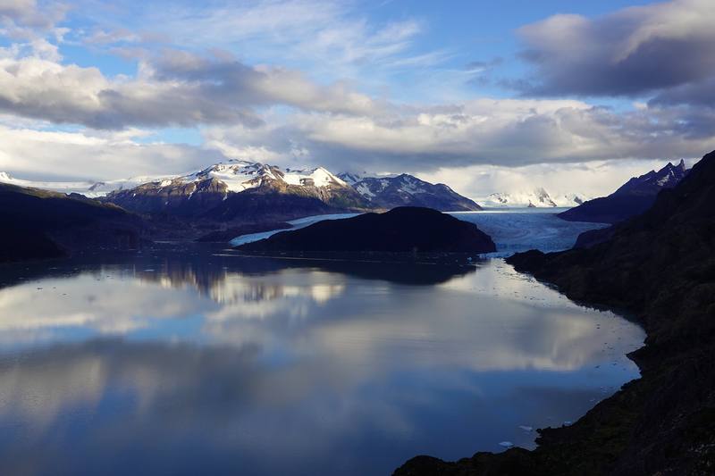
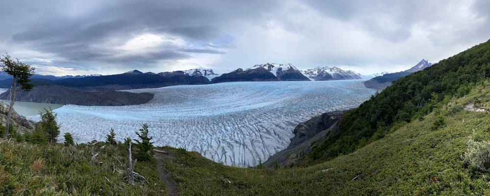
The sun came up red on the peaks above Los Perros. I left camp at 8:10 a.m. and climbed through forest, then rock and scree, to the John Gardner Pass, reaching the top at 9:35 a.m. From there you look down on the Grey glacier and out across the Southern Patagonian Ice Field. This is the view I meant: I'd never seen anything like it, and I sat there and stared for a while.
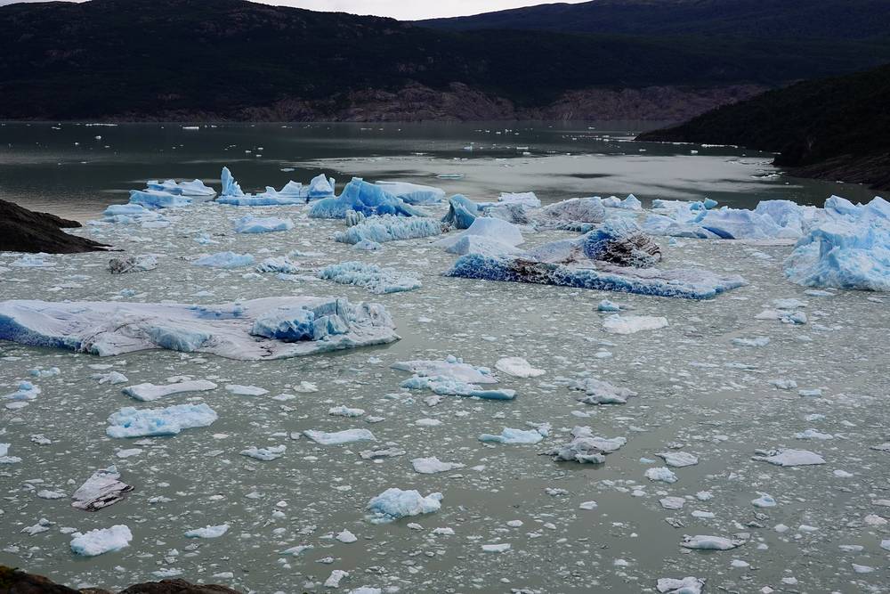
Then it's down, steeply, through the forest, past the Paso camp at 11:02 a.m., over the high suspension bridges with the glacier beside you, to Refugio Grey at 1:10 p.m. This was my refugio night: a bunk room, a drink on the deck, a walk down to the icebergs at the glacier front, and dinner in the refugio with the other hikers.
The one real climb of the circuit, and the part to take seriously. From Los Perros the path crosses boggy ground in the forest, then climbs above the trees on rock and scree to the pass, 2.8 miles and about 2,100 ft up from camp. The top is broad and exposed, and it is where the wind is strongest.
On the far side the trail drops fast, nearly 2,500 ft in about 2.5 miles, through steep forest to Paso. From Paso it follows the east side of the Grey glacier south, up and down across side ravines, including two suspension bridges more than 60 ft (20 m) high, to Grey, on the shore of Lago Grey near the glacier front.
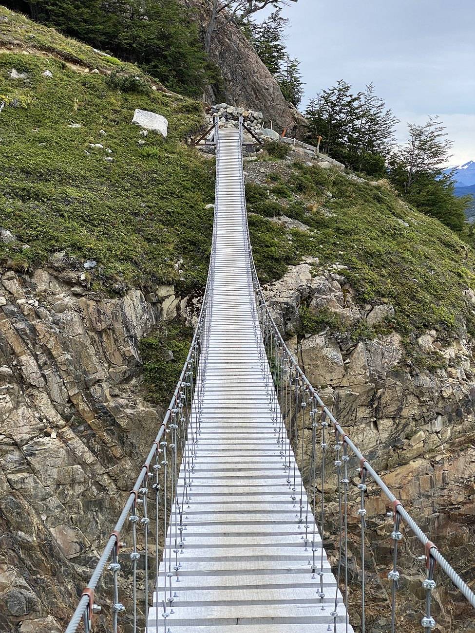
Before the pass, back to Los Perros. After it, go on to Grey, then Paine Grande, where the catamaran crosses Lago Pehoé to Pudeto and the bus road. Don't cross the pass in a storm: wait at Los Perros and ask the ranger.
This is the 32-mile day in my film. I just let loose and went wild on that day.
I was up early, with Lago Grey mirror-still at dawn, and walked out to the Grey viewpoint before setting off at about 7:45 a.m. I passed Paine Grande at 10:11 a.m. and turned up the Valle del Francés at Italiano, where hikers leave their packs: the valley viewpoint at 12:23 p.m., then on to the Mirador Británico at the top, where I stopped for half an hour, from 1:36 to 2:04 p.m., with the peaks all around the head of the valley. It was a clear, sunny day.
Back at Italiano at 3:17 p.m., I walked the shore of Lago Nordenskjöld past Francés to Refugio Los Cuernos, where I stopped from 4:43 to 5:24 p.m.; the film shows a drink and a plate in the dining room. Then the long walk east above the lake to Central, reaching camp at 8:07 p.m. I pitched my tent in the trees at dusk.
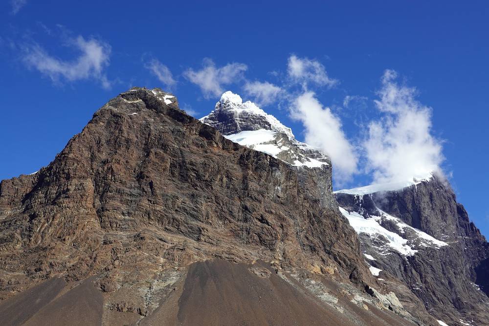
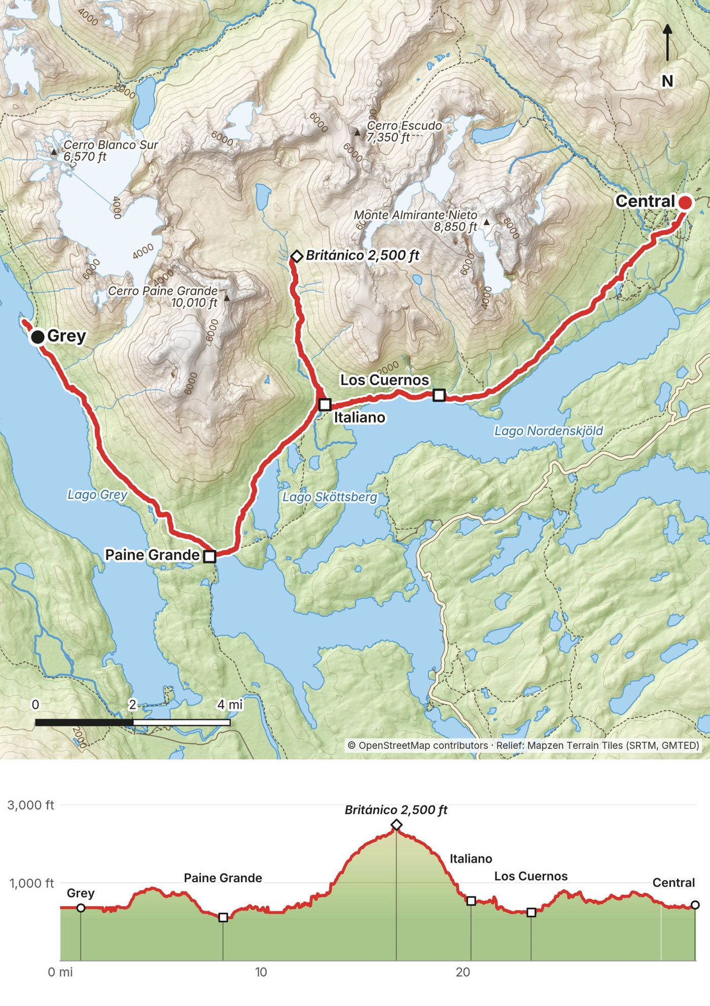
This is the whole W in one day, except the Base Torres. From Grey the path runs south above Lago Grey, with a few short climbs, to Paine Grande on Lago Pehoé. It then turns east past Lago Skottsberg to Italiano, at the mouth of the Valle del Francés.
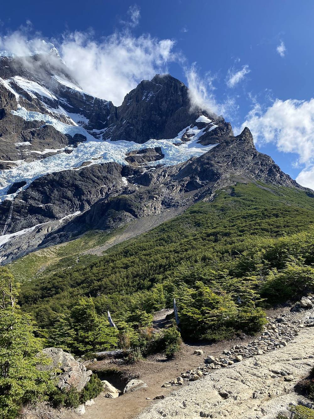
The valley is the middle point of the W: 5.4 km (3.4 mi) up from Italiano to Británico by the park's figures, first past the hanging glaciers of Paine Grande to the Francés viewpoint, then on through forest and boulders to the Británico viewpoint, ringed by the Cuernos and the peaks at the head of the valley. You come back down the same way.
From Italiano the trail follows the north shore of Lago Nordenskjöld past Francés and Los Cuernos, then runs east above the lake to Hotel Las Torres and the Central camp. The stretch from Central to Chileno and Los Cuernos is private land; check arrival times with Las Torres.
Most itineraries split this into three or four days, sleeping at Paine Grande, Francés or Italiano, and Los Cuernos or Central, depending on your bookings. In one day it's long by any measure: I was walking for almost 13 hours.
Paine Grande is the exit on the west: the catamaran crosses Lago Pehoé to Pudeto, where the buses stop. On the east, go on to Central and the Welcome Center, with the shuttle to Laguna Amarga.
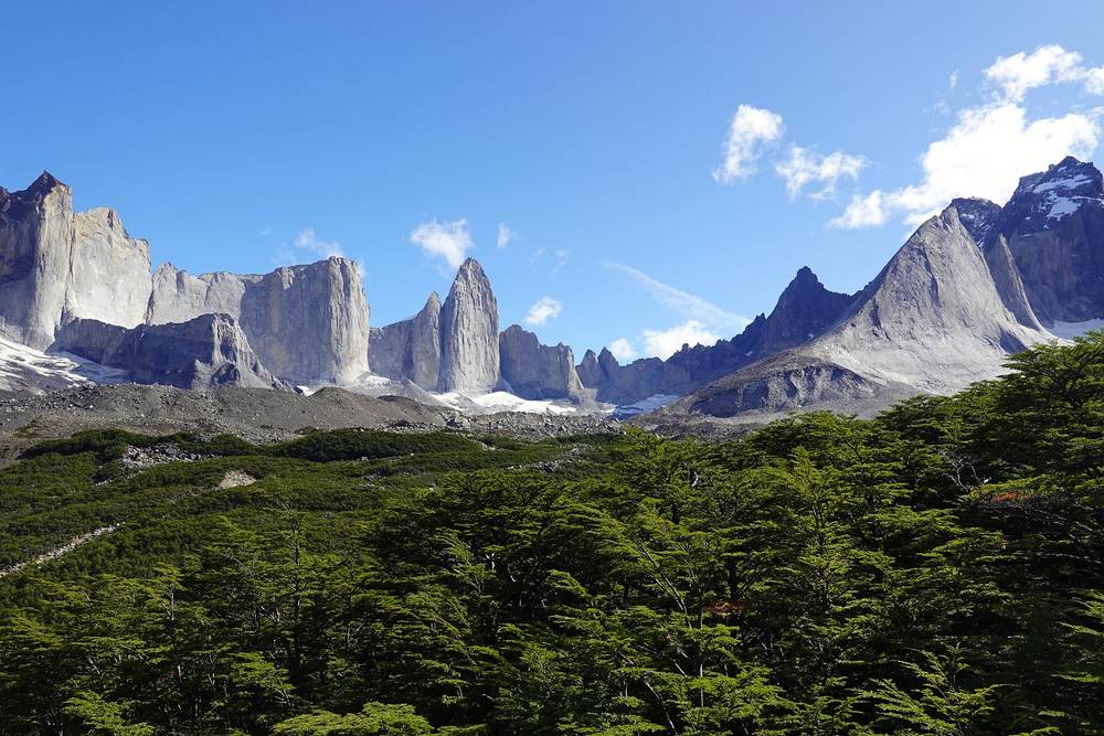
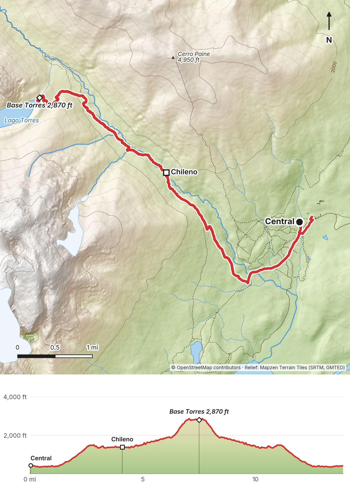
My last day was a half day. I left Central at 8:37 a.m. and climbed into the Ascencio valley, over the Paso del Viento and down to Chileno, where I stopped from 9:49 to 10:41 a.m. From there it's up through the forest and the boulder moraine to the lake under the three towers. I was at the Mirador Base Torres from 12:03 to 12:28 p.m.
Then back the same way, a short stop at Chileno, and down to Central at 2:36 p.m.
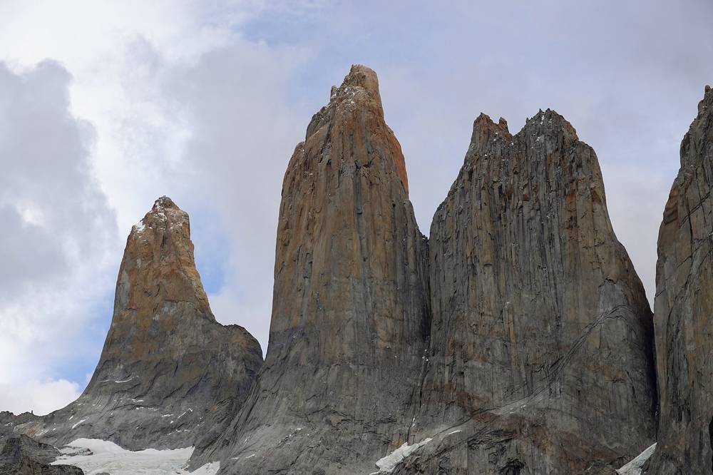
The eastern point of the W and the most famous view in the park. From Central the path climbs steeply northwest onto a shoulder, the Paso del Viento, then follows the side of the Ascencio valley down to Chileno. Past Chileno it runs through forest along the river, and the last section, about an hour by the park's times, climbs steeply over big boulders on the moraine to the lake at the foot of the towers. It's also a day hike, so expect company.
You're never far from Central and the Welcome Center. Turn around at Chileno if the weather closes in.
From Central, walk to the Welcome Center and take the shuttle to Laguna Amarga, where the buses to Puerto Natales stop. Bus-Sur asks you to be at the Welcome Center 30 minutes before your bus. Its 2026-27 return times from Laguna Amarga are 11:00 a.m. from November, 3:00 p.m. and 8:15 p.m.; the ride to Natales takes about 1 hour 15 minutes to 2 hours 5 minutes (the 3:00 p.m. bus arrives about 5:05 p.m., the 8:15 p.m. about 9:30 p.m.). My record doesn't show which bus I took.
I flew home right after the trek. By the time I finished the trail the coronavirus had ramped things up, so I wrapped up and got back to the US, to Colorado, as quickly as possible. I recorded the guide part of my film there a few days later.
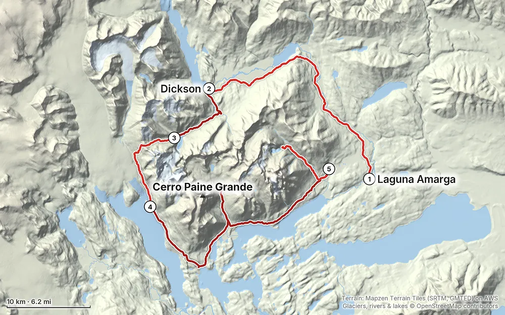
Elevation102–3,927 ft85.3 mi
Terrain: Mapzen Terrain Tiles (SRTM, GMTED) on AWS · Glaciers, rivers & lakes © OpenStreetMap contributors
Tap a map to open it full size.
Park ticket bought online at pasesparques.cl at least 24 hours ahead (CLP 48,500 foreign adult, 2026), plus a booked camp for every night
From the hike's facts; check the official page before you go.
Weather. Patagonia is known for wind, and it can change fast. On my trip in early March it was a little overcast, with cool nights and mild days, fog on the morning of Day 2, and a clear, sunny Day 4. That's one trip: don't plan on it.
Wind and the John Gardner Pass. The pass is the most exposed place on the circuit, and the park's 2026-27 map marks strong winds there. On November 17, 2025, Chilean press reported that a storm with very strong gusts caught hikers between Los Perros and the pass, and five hikers died. The park closed the O and reopened it on December 9, 2025 with registration at Coirón and a limit of 100 people a day; since January 2026 it has used a protocol that closes trails at set wind, rain and temperature thresholds. What that means for you: check the forecast in Puerto Natales, listen to the rangers at Los Perros, and don't cross the pass in a storm.
Fire. Fire is taken very seriously here. The park says all of its past forest fires were caused by people, including one started near Lago Grey in December 2011 that burned about 17,000 hectares (42,000 acres). Lighting any fire or heat source outside the authorized places can bring a fine of up to CLP 2,000,000 or up to three years in prison, and foreigners can be expelled. No smoking anywhere in the park.
Rules that keep you safe. No walking after dark; the trails have closing times so night doesn't catch you before the next camp. Register at every ranger station. Don't cross a river if the water is above your knees. Pumas live in the park: don't walk in the dark, and follow the park's advice if you meet one.
Getting help. There's no phone signal on the trails and no rescue close by. Emergency numbers in Chile (checked September 2026): 131 ambulance, 132 fire, 133 police (Carabineros), 136 mountain rescue (Cuerpo de Socorro Andino), 138 air rescue. The park's emergency radio is VHF 143.800 MHz. The nearest year-round emergency care is at Cerro Castillo, 54 km from the main gate; the hospital is in Puerto Natales. Carry a satellite messenger, and have insurance that covers evacuation.
Should I do the O or the W? If you come all the way to southern Chile, do both. The O is the W plus the back of the massif: the Paine river valley, Dickson, Los Perros and the John Gardner Pass. The pass gives you the view of the ice field and the Grey glacier. It was the first time I'd seen anything like it, and you just sit there and stare for a while.
What were the highlights? The granite towers at the top of each point of the W are just spectacular, a once-in-a-lifetime thing. And the massive ice field glacier on the west side: it was the first time I'd ever seen anything like it, and you just sit there and stare for a while.
How hard is it? Probably one of the easiest multi-day hikes I've done. The trail is well maintained, there are no technical scrambles, and the passes are very doable. I saw a lot of beginners and first-time trekkers, and it's probably perfect for them. The real difficulty is Patagonian weather, above all wind on the John Gardner Pass. Read Weather and safety.
How many days do I need? I walked it in five, with two very long days. Most people take more: the park and the operators suggest 8 to 10 days for the O, and the camps you can book decide your days. See Other ways to do it.
Can I just show up? Not on the trail. On the O and the W every night must be booked before you go in, and rangers check your bookings. In 2020 I didn't book ahead: I planned the trip a week before, walked into an operator's office in Puerto Natales and asked what was free for the next four days. That was the off season. In peak season the camps fill months ahead. See How this trek works.
Which direction? Counterclockwise on the O, as I walked it. The stretch from Serón over the pass to Paso is one-way.
Do I need a guide? Not in summer. On the W and the Base Torres, guides stopped being required on September 16, 2026, after a winter rule, but microspikes and trekking poles were still required while snow and ice lasted. The O is closed in winter. Check the rules for your dates.
What does it cost? I took out about $300 in pesos for the trek and went through most of it: buses, the park ticket, camps and my room, food and drinks. My flight was extra. Camp prices have gone up a lot since 2020. See What I paid.
Is there phone signal or Wi-Fi? No phone signal on the trails. Some of the big camps sell Wi-Fi; I paid about $10 for it over the trip. Download everything before you leave Puerto Natales.
Can I fly a drone? No. Recreational drones are banned in the park. I left mine in a locker at my hostel in Puerto Natales.
The O in more days. My five days are the fast version. The film's itinerary shows six, splitting my first day at Serón: 11, 11, 8, 10, 32 and 14 miles. The park suggests 8 to 10 days for the O and the operators about 8 to 9, sleeping at Serón, Dickson, Los Perros, Paso or Grey, Paine Grande, Italiano or Francés, Los Cuernos or Central. Your bookings set the days: book each night before you go.
Just the W. The W is Grey to Central (or the reverse), with the Valle del Francés and the Base Torres: my Day 4 and Day 5, usually walked in several days. It's open all year, and the one-way rule applies only to the back of the O. You can start at Paine Grande by catamaran from Pudeto, or at Central from Laguna Amarga.
The Base Torres as a day hike. No camp booking needed, just a park ticket. The park sets a latest start from the Laguna Amarga gate and a time to leave the viewpoint, and they change by month. Its 2025-26 bulletin gave 9:30 a.m. and 3:00 p.m. in October, November, March and April, and 10:00 a.m. and 4:00 p.m. from December to February; its September 2026 page gives 9:00 a.m. and 3:00 p.m. Check the times for your dates.
I walked the version in this guide. I haven't walked these other versions.
This is the part that confuses people, and it confused me. The park is well run and well protected, so every campsite has a limit on people, and on the O and the W you must have a booking for every night before you start. You can't just show up.
How I did it in 2020. I didn't book in advance. I planned the trip a week before I went. I showed up at the office in Puerto Natales (the film shows Vertice Patagonia's), told them I wanted to hike the next day, and asked what was available for the next four days along the O. They gave me three campsites and one room at Grey. That was fine with me: I'd brought my own tent and gear, and a real bed for one night sounded good. It was early March, technically the off season, so there was availability.
What I'd tell you. Book in advance, and if it's all too confusing, buy a complete package: one price that covers every campsite along the O, because you can't really skip. Bookings fill up for the peak season, so you might have to buy months ahead.
The rules today (the park, October 2026):
Two companies run the camps and refugios, and you book each with its own company:
| Camp | Run by | What's there |
|---|---|---|
| Serón | Las Torres | Camping |
| Dickson | Vertice | Refugio and camping |
| Los Perros | Vertice | Camping |
| Paso | CONAF (the park) | Free camp; listed as closed in 2025-26 |
| Grey | Vertice | Refugio and camping |
| Paine Grande | Vertice | Refugio and camping |
| Italiano | CONAF (the park) | Free camp; listed as closed in 2025-26 |
| Francés | Las Torres | Refugio and camping |
| Los Cuernos | Las Torres | Refugio and camping |
| Central | Las Torres | Refugio and camping |
| Chileno | Las Torres | Camping |
Sources: vertice.travel and lastorres.com (2026-27 rates pages), the park's 2025-26 bulletin; checked October 1, 2026. The park hadn't published its 2026-27 bulletin yet, so check whether Paso and Italiano open this season.
The camps have plenty of services. You can rent a tent and a sleeping pad at most of them and buy meals, so you could get away with barely anything in your pack. I carried my own tent and food.
Tickets are sold online only, at pasesparques.cl, at least 24 hours ahead. For a foreign adult in 2026: CLP 48,500 for more than one day (valid up to 10 days in a row) or CLP 32,400 for one day. Tickets are non-refundable. Carry the QR code on your phone or printed; there's no internet at the entrance. In 2020 I paid about $30 at the park.
The O is open in the southern summer, on dates the park (CONAF) sets each season. In 2025-26 it was shut from November 17 into December for a search for lost hikers, and closed early, on March 26, for snow and ice. It is closed until October 31, 2026, pending the park's weather and safety review. The W and the Base Torres are open all year, with winter rules from about May to August (in 2026 they ran from late April to mid-September).
I went in early March 2020, technically the off season. The weather was a little overcast. There were some openings at the campsites and fewer people in town; the virus was starting to pick up speed, so I think travel was down in general. The temperature was fantastic in March: cool, chilly nights for sleeping, and during the day it never got so hot that I was sweating standing in the sun.
The peak season, December to February, is more crowded, especially at the main points of the W. Book early for those months.
These change from year to year; everything else in this guide stays the same. Checked October 1, 2026. Check them again when you book and the week you fly.
In the park
Getting there
Health and safety
Money and gear
The film is at the top of this page.
Planning questions about Torres del Paine O Circuit, answered only from this page's facts, the creators' versions and hikers' public tracks, with where each answer comes from. When the data doesn't say, the answer says "not given".
From hikers
Sign in to comment. Free; your hikes stay private unless you share them.
Some lodging links earn me a small commission at no cost to you.
Something wrong or missing on this page? Send feedback.