
Content made there
The film is at the top of this page.
Photos
Hikes / Skye Trail / Kraig Adams's version
Europe · United Kingdom
Apr 28 – May 1, 2026 · 4 days · about 80 miles · Solo · Tent

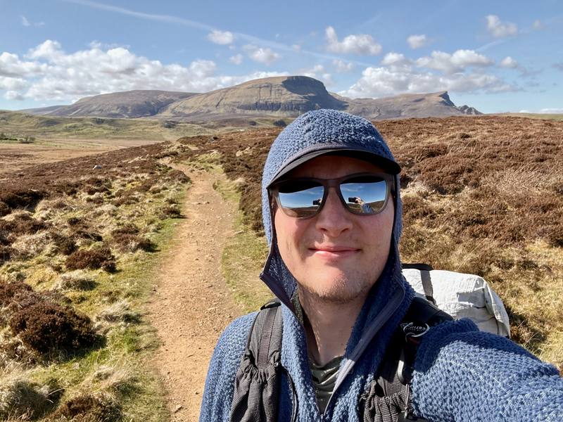
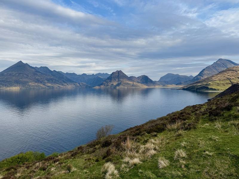
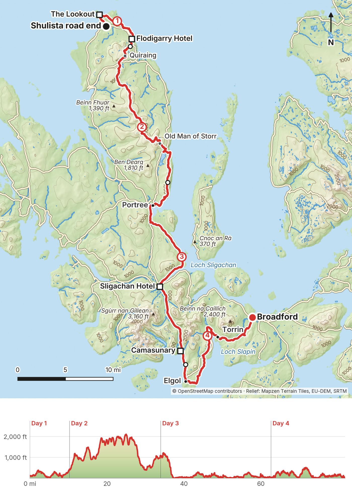
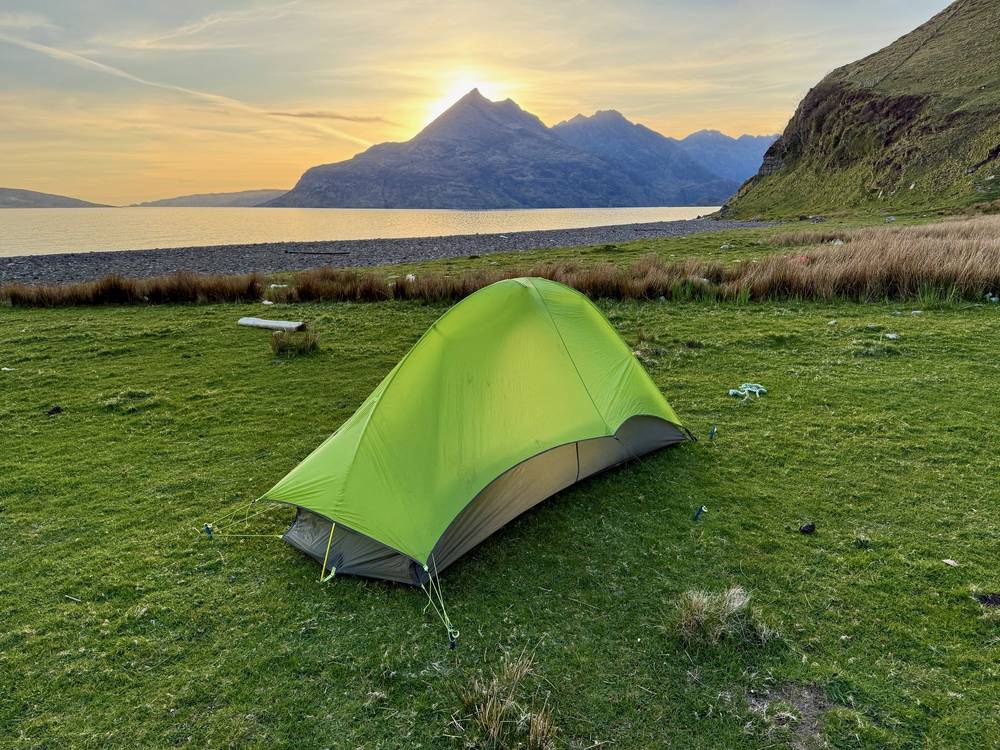
I hiked about 80 miles alone on the Skye Trail in Scotland, from April 28 to May 1, 2026. I started near Rubha Hunish at the northern tip of the Isle of Skye, walked the whole Trotternish ridge past the Old Man of Storr, came down to Portree, went through Glen Sligachan below the Cuillin, and finished in Broadford. I wild camped three nights: above Flodigarry, on a ridge north of Portree, and on a beach near Elgol.
I had a wonderful time, mainly because the weather was perfect. It was not supposed to be like this. I prepared for wind and rain, brought extra gear, and didn't need any of it. I didn't get a single drop of rain.
| Quick facts | |
|---|---|
| Distance | 81.9 miles (131.8 km) |
| Climbing | about 10,600 ft (3,240 m) up and the same down |
| Days | 4 hiking days (the first was a half day), 3 nights wild camping |
| Start | Shulista road end parking near Duntulm, a short walk from Rubha Hunish |
| Finish | Broadford |
| Best months | Late April to May, before the midges (late May to early September). June to September also work, with midges |
| Difficulty | Cicerone calls it a challenging backpacking route. It has no waymarks, a long high ridge with little water, remote glens, road walking and fast-changing weather |
| Nearest airport | Inverness (INV) |
| Trip date | April 28 to May 1, 2026, solo |
| Day | Route | Miles (km) | Up / down (ft) | Sleep |
|---|---|---|---|---|
| 1 | Shulista road end to Flodigarry | 10.4 (16.7) | 1,099 / 805 | Wild camp above Flodigarry |
| 2 | Trotternish ridge and the Storr | 23.6 (38.1) | 5,558 / 4,917 | Wild camp on a ridge north of Portree |
| 3 | Portree, Sligachan and Glen Sligachan | 28.7 (46.2) | 1,970 / 2,968 | Wild camp on a beach near Elgol |
| 4 | Elgol and Torrin to Broadford | 19.1 (30.8) | 2,006 / 2,007 | Sligachan campsite, by car |
Numbers come from my own GPS files. How they're measured, and why apps show more climbing, is in Using the GPX files.
I flew into Inverness and rented a car for the whole trip. It cost $160 total. Being in the UK, I had to drive on the left-hand side and remind myself every single time I touched the steering wheel. It wasn't my first time driving on the opposite side, so it wasn't an issue. You just have to slow down and be more defensive.
The drive from the airport to Portree was about 3 hours. A lot of it toward the end is single-track road. Every so often there's a passing place, but a lot of times you're coming at the other car and you have to figure out who's going to yield. I thought the bus would take about 5 hours with a transfer or two, and renting a car was much easier, especially since it wasn't that expensive. The Citylink 917 is actually direct and takes about 3 hours 15 minutes (see below).
In Portree I parked in the square, which had 30 minutes of free parking. I got food at the Co-op, a gas canister at an outdoor shop called Inside Out, which has a lot of other hiking gear too, so it's a good spot to resupply, and a quick coffee and Wi-Fi at Birch. Then I drove north to the trailhead, parked at about 4 pm, and started walking.
By bus from Inverness. Citylink bus 917 runs from Inverness bus station to Portree in about 3 hours 15 minutes, direct. In September 2026 it left Inverness at 6:10, 8:30, 13:15 and 17:45. citylink.co.uk
By bus from Glasgow. Citylink bus 915 runs from Glasgow via Fort William to Portree and Uig.
Portree to the start. Stagecoach buses 57A and 57C loop around the Trotternish peninsula from Somerled Square in Portree, in opposite directions, and both stop at the Shulista road end, where I started. In the September 2026 timetable, Monday to Saturday, the 57A (via the Old Man of Storr, Staffin and Flodigarry) left Portree at 6:55, 9:10, 12:10 and 15:50 and took about 50 minutes; the 57C (via Uig) left at 10:10, 13:20, 15:50 and 17:50 and took about an hour. There were no Sunday buses. Plan a night in Portree and take a morning bus. Timetables: bustimes.org or Traveline Scotland.
By car. The start is at the north end of the Trotternish peninsula, on the A855 loop from Portree. The parking area is at the end of the Shulista road, next to the bus stop. If you leave a car there for the whole hike, you'll need to get back to it from Broadford at the end (see Getting home).
Take the Citylink 917 from Inverness to Portree. Sleep in Portree, buy food and a gas canister, and take the next morning's 57A (9:10 in September 2026) or 57C (10:10) to the Shulista road end.
Right as I ended my hike in Broadford, I ran into some subscribers who were just about to start. We became friends, took the bus back to Portree together, and grabbed drinks at the pub. Then I headed north and got back to my car, with zero issues. I drove south to the campsite at Sligachan and camped there for the night.
The next day, May 2, it started to rain for the first time as I was leaving the Isle of Skye. I drove back to Inverness past Loch Ness, and tent camped at a Caravan and Motorhome Club campsite, because it was close to the airport and super cheap. I'd wrapped up everything I needed to do, so I changed my flight to leave two days earlier, and flew home the next morning.
Broadford to Portree and Inverness. Citylink bus 917 stops at Broadford Post Office in both directions. In September 2026, buses toward Portree (about 45 minutes) left Broadford at 8:42, 11:02, 15:47 and 20:17, and buses toward Inverness (about 2 hours 40 minutes) left from opposite the Post Office at 9:45, 11:20, 13:45 and 18:25.
Back to a car at the start. Take the 917 from Broadford to Portree, then a 57A or 57C from Portree to the Shulista road end. There were no 57A or 57C buses on Sundays in September 2026, so don't finish on a Saturday afternoon and expect to reach your car the next day.
Ending in Elgol. Stagecoach bus 55 runs from Elgol to Broadford, Monday to Friday only.
These are the costs I mentioned in the film. I didn't track the rest.
| Item | What I paid |
|---|---|
| Rental car, whole trip, from Inverness airport | $160 |
| Portree Independent Hostel, 1 night booked, not used | $50 (the booking price) |
| Wild camping, 3 nights | Free |
| Food, gas canister, cafes and bus back to Portree | Not recorded |
| Flights | Not recorded |
What to budget for your trip (2026 prices where known)
Scotland's access rights include wild camping, under the Scottish Outdoor Access Code. In short:
I had a reservation at the Portree Independent Hostel for my arrival night. The weather window was good on arrival and was going to get worse in a couple of days, so I skipped the hostel and started hiking that afternoon instead.
I had dry weather all three nights. On the ridge and the beach you're exposed to wind and rain, so pick your spot for the forecast you have.
| Place | Where on my route | What it is |
|---|---|---|
| Portree | Day 3, mile 4.5 | Town with hostels, hotels, cafes and shops. Portree Independent Hostel: skyehostel@yahoo.co.uk, WhatsApp +44 7864 721156 |
| Sligachan | Day 3, mile 18.2 | Sligachan Campsite (tents from £12.50 per person in 2026, no booking needed, April 1 to September 30), plus the Sligachan Hotel and a bunkhouse |
| Broadford | End of Day 4 | Village with hotels, a hostel and shops |
| The Lookout | Day 1, mile 2.1 | A free bothy in an old coastguard lookout on the cliffs above Rubha Hunish; it sleeps three and has no water |
| Camasunary | Day 3, about mile 27 | A free bothy by the bay below the Cuillin |
The Portree Independent Hostel's 2026 terms: a 50% deposit, the balance in cash on arrival, check-in 4 pm to 9 pm (tell them if you'll be later), with kitchen, showers, linen and a drying room. hostelskye.co.uk
The Sligachan campsite has hot showers, toilets, drinking water, a charging area, free Wi-Fi and coffee. Check in 3 pm to 8 pm. glensligachan.com
Bothies are simple stone shelters kept up by volunteers from the Mountain Bothies Association. They're free and can't be booked, so they can be full. Always carry your tent.
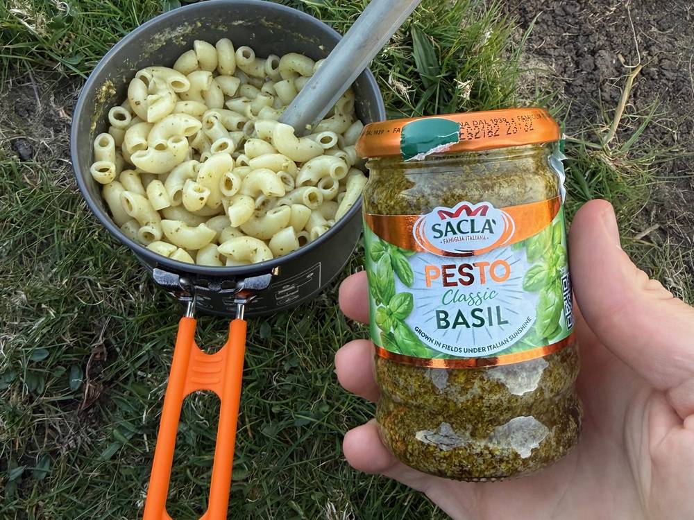
I carried food for the whole of Day 2 and cooked backpacking meals on my stove. After a day and a half of backpacking meals and snacks, I was really ready for a proper breakfast in Portree. The meals are what I enjoy the most on these trips.
| Where | Mile on my route | What I did there |
|---|---|---|
| Portree | Before the start | Food at the Co-op, gas at Inside Out, coffee at Birch |
| Flodigarry Hotel | Day 1, mile 8.8 | Hoped for dinner, but it was late. I just had a beer |
| Portree | Day 3, mile 4.5 | Breakfast at Cafe Arriba. Nakd bars and pesto at the Co-op |
| Sligachan Hotel | Day 3, mile 18.2 | Lunch at Seumas' Bar |
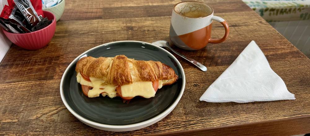
| Elgol | Day 4, mile 2.3 | Breakfast at the Elgol cafe |
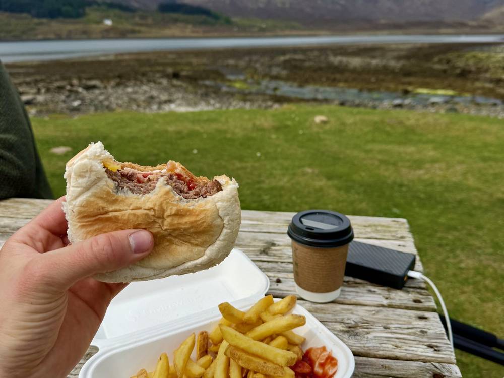
| Near Torrin | Day 4, mile 12.2 | A hamburger at Mrs Mack's takeaway |
| Broadford | End of Day 4 | Village shops, cafes and a hotel bar |
Opening days and hours for small cafes and takeaways change every season, so treat them as a bonus, not a plan. Carry enough to finish each section without them.
There's plenty of water on Skye, but not always where you are. I carried a 1-liter BeFree bottle with a built-in filter and filled it at running streams. Up on the ridge on Day 2 I had really long sections without any water, and one stretch where I was so thirsty. On the ridge, carry at least 2 liters and fill up at every good stream before you climb. Treat or filter everything. The Sligachan campsite has drinking water.
Inside Out in Portree sells gas canisters and other hiking gear. You can't fly with gas, so buy it on Skye.
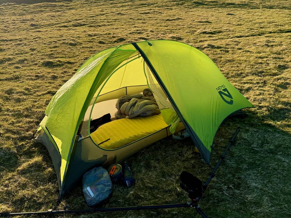
This is what I used on this trip. I've been using Hyperlite Mountain Gear packs for almost 7 years.
I only had a 1-liter bottle, and on the ridge I got really thirsty. Carry more water capacity than I did.
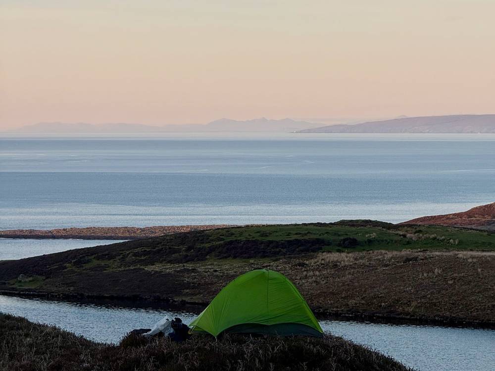
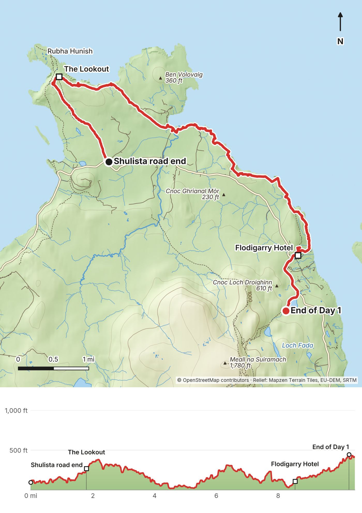
This first day was more like a half day. I hiked about 10 miles, but I started super late, at 4 pm. I walked out to the Lookout, the old coastguard hut on the cliffs above Rubha Hunish, then followed the coast east. I made it past the Flodigarry Hotel, where I'd hoped to get dinner, but it was a little late and they were a little snooty, so I just grabbed a beer and shoved off. I found my spot to camp just outside and up the hill from the hotel, once it got a little quieter.
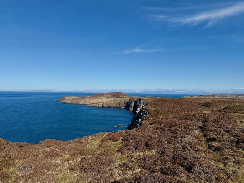
From the parking at the Shulista road end, a path heads north over rough moorland to the Lookout bothy at about 2.1 miles (3.4 km), on the cliff edge above the Rubha Hunish headland. The headland itself is below you; I didn't go down to it. From the Lookout the route follows the cliff tops east and then south along the coast to Flodigarry, with the sea on your left. About a mile of the day is on roads, where the route touches the A855.
The Flodigarry Hotel is at about 8.8 miles (14.2 km). My camp was about 1.6 miles (2.6 km) beyond it, up the hill toward the ridge.
The whole day stays close to the A855 road, which the 57A and 57C buses use. You can walk inland to the road almost anywhere and catch a bus back to Portree, or stay at Flodigarry.
Film, Day 1 · My notes on Day 1
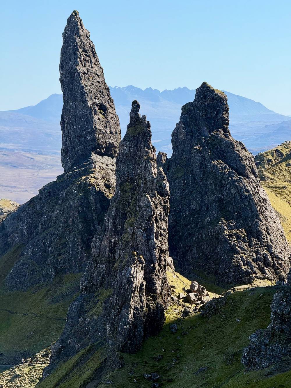
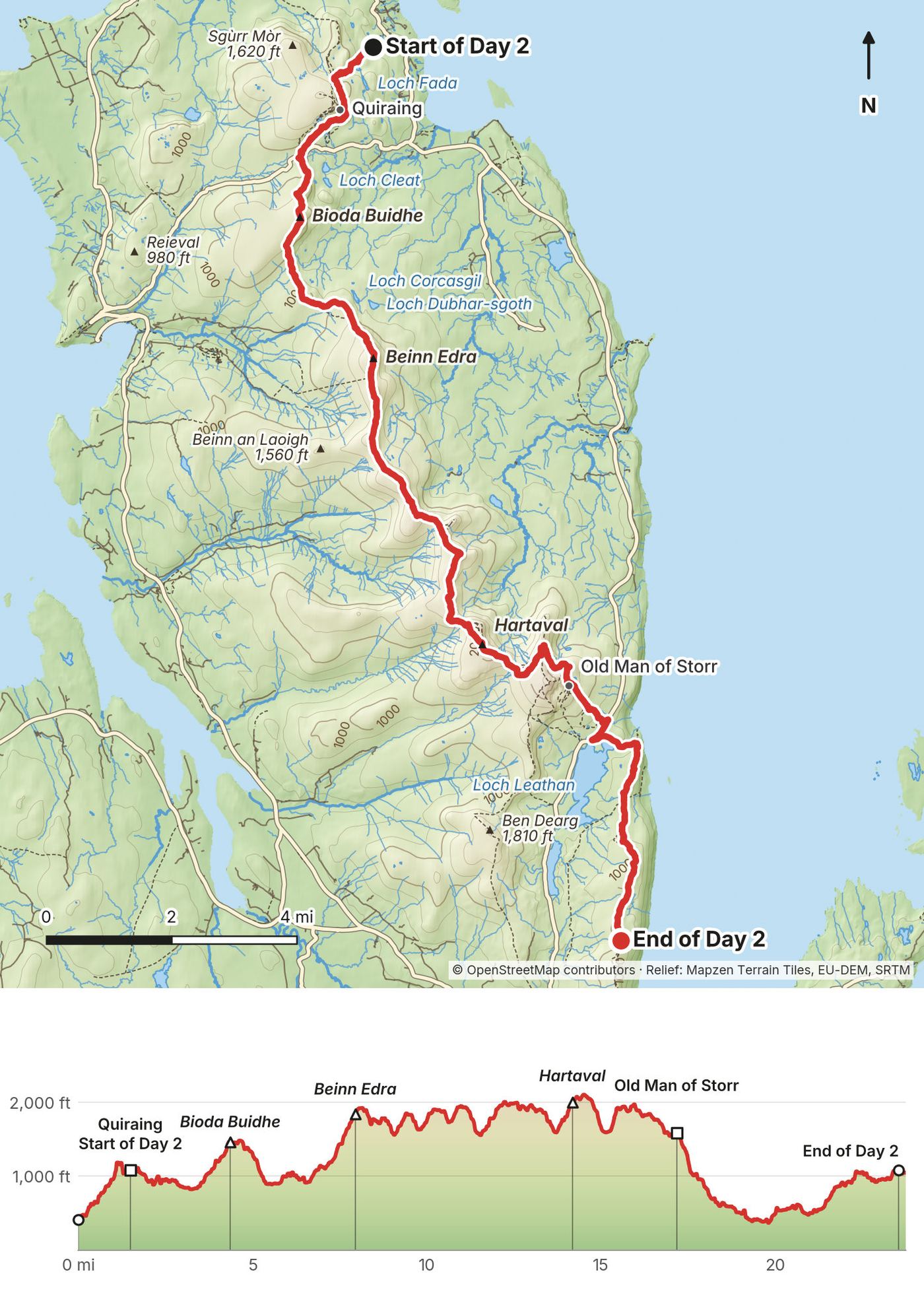
Day 2 was huge. I did 24 miles, which is very fun, and it was a big day because I had elevation gain with the mileage across the entire ridge and the Old Man of Storr. I didn't eat at any restaurants the entire day. It was all food I brought in my backpack and cooked with my stove. Up on the ridge I had really long sections without any water, and there was one stretch where I was so thirsty. The super touristy day hike up to the Old Man of Storr was very busy and not as fun, so I kind of breezed through there, but I'm glad to have seen it. Past that, back up on the smaller ridge on the other side, I found absolute isolation and a wonderful spot to pitch my tent, with sunset, sunrise and really good visibility.
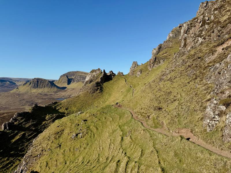
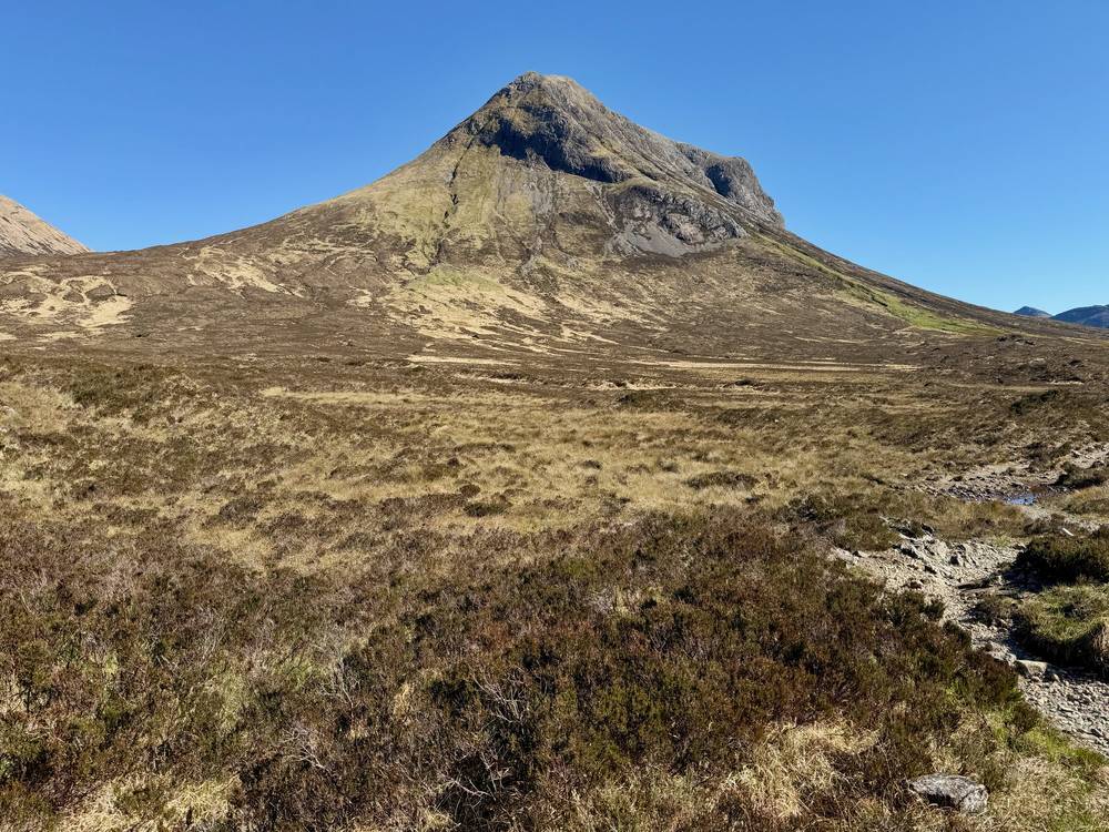
From above Flodigarry the route climbs to the Quiraing, whose rock pinnacles you pass at about 1.7 miles (2.7 km), and crosses the Quiraing road by the car park. Then comes the long Trotternish ridge: a line of grassy summits with cliffs on the east side, over Bioda Buidhe, Beinn Edra and Hartaval. There are no waymarks. It's high, open and exposed, with lots of up and down: more than half of the whole trip's climbing is on this day.
The Old Man of Storr is at about 17.3 miles (27.8 km). Here you join a busy, built path full of day hikers. South of the Storr the route drops toward the road, then climbs onto a lower ridge heading for Portree. I camped on it at 23.6 miles (38.1 km), about 4.5 miles (7.2 km) north of Portree.
There's no food or shelter on the ridge and very little water. Carry at least 2 liters and all your food. Only go up in decent weather: in wind, rain or cloud, the ridge is hard work and hard to navigate.
The A855 runs parallel to the ridge, below it on the east side. The road crossing near the Quiraing is the clear exit early on. Further south, dropping east means steep ground and cliffs in places, so study your map before you commit, and only come down where it's clearly safe. The Old Man of Storr car park is on the road and the 57A and 57C buses stop there.
Film, Day 2 · My notes on Day 2
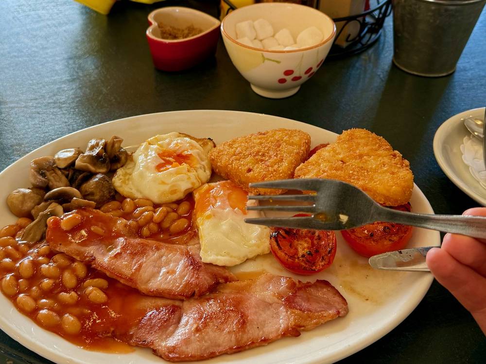
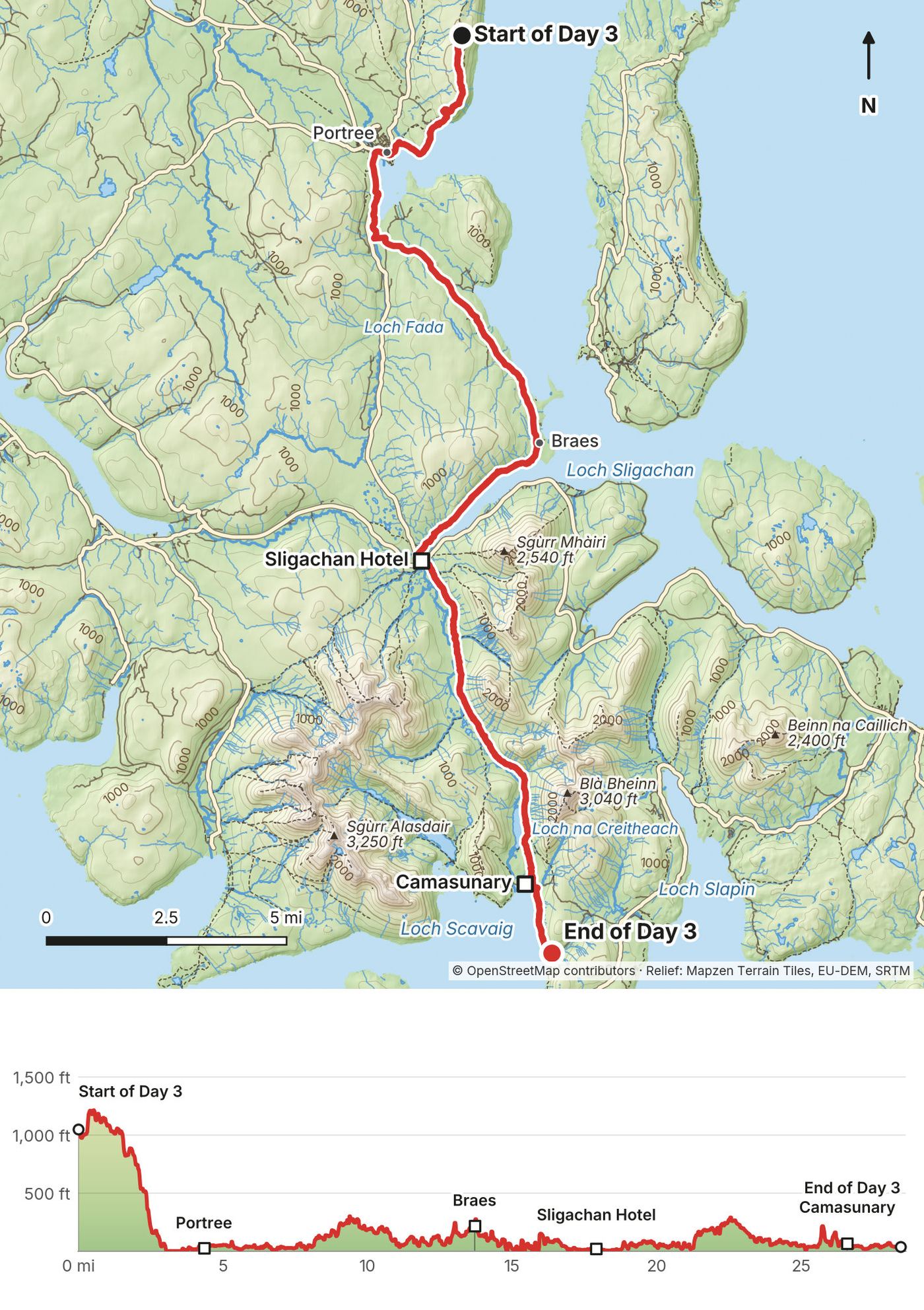
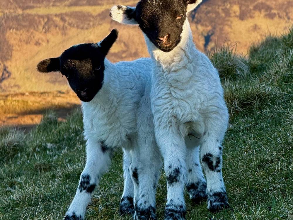
Day 3 was an even bigger day: 29 miles. It isn't the biggest day I've ever done, but it's probably top 10. Right after I started hiking I passed a ton of lambs, and two of them came right up to me. After a day and a half of backpacking meals, I was really gung-ho for a Scottish breakfast in Portree. It was a place called Cafe Arriba, and it was perfect: very simple, cheap, tasty, no notes. I charged my batteries, had some Wi-Fi, and bought some Nakd bars and pesto at the Co-op before leaving.
People on Instagram were messaging me that the YouTuber Eva zu Beck was hiking the same trail. It turns out we just missed each other by about 100 feet. I crushed some road walking, which isn't ideal, but whatever. It got me between two beautiful sections of the trail. I had lunch at Seumas' Bar at Sligachan, super touristy and not that great, but a place where I could charge my batteries again. Then I breezed through the mountains and found a super isolated spot to pitch my tent on a beach, where I fell asleep to the sound of whales.
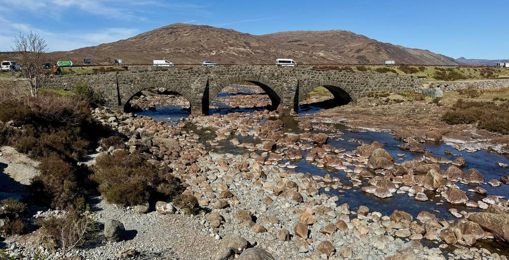
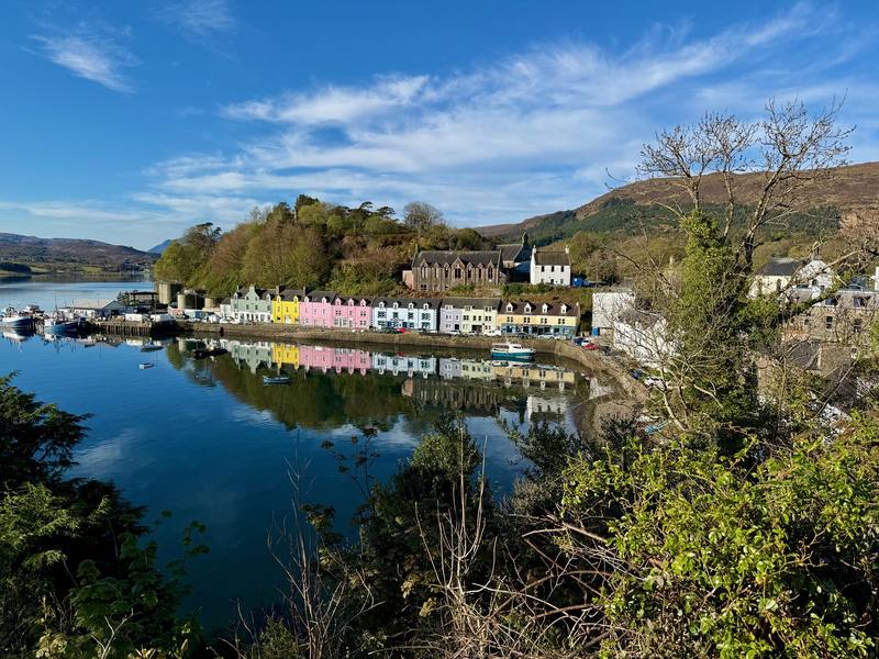
The day starts with a descent into Portree, at about 4.5 miles (7.2 km): the only town in the middle of the route, and the place to resupply. From Portree the route heads south through the Braes on roads, mostly the B883: about 9 miles (14 km) of the day is on tarmac. Then it follows the shore of Loch Sligachan to the Sligachan Hotel and its old stone bridge at about 18.2 miles (29.3 km).
From Sligachan a path runs south through Glen Sligachan, a long, empty glen between the Black Cuillin and the Red Hills, with no road and no services. Streams cross the path and can run high after rain. At the south end it passes Loch na Creitheach and drops to Camasunary bay and its bothy, at about 27 miles (43 km). From there a coastal path heads toward Elgol, with steep slopes above the sea. I camped on a beach along it, at 28.7 miles (46.2 km).
Sligachan is the last food until Elgol. Fill your water there.
Portree has buses in every direction. Sligachan is on the main road, where Citylink 917 stops outside the hotel. Once you're in Glen Sligachan, you're committed: it's a long walk forward or back. From Camasunary a track leads east over the hill to the Elgol road at Kilmarie.
Film, Day 3 · My notes on Day 3
My final day was about 19 miles, a lot of flat sections and road walking, but it was fun. The highlight of the day was reaching Elgol and a new cafe, where a husband and wife team made me breakfast and chatted with me over coffee. I got to chat with some other hikers who were figuring out their way, including a Swiss couple near a takeout place where I had a hamburger. Then I decided to take an alternate escape to shorten the last day a little. I felt like I had enough footage, I'd had a fun time, and I just wanted to get out to Broadford and end the hike. Right as I finished, I ran into some subscribers who were just about to start their hike.
From the beach the path continues along the coast to Elgol, at about 2.3 miles (3.7 km), with views across Loch Scavaig to the Cuillin. From Elgol my line goes east to Glasnakille, then north along the shore of Loch Slapin, on a mix of quiet road, tracks and paths, to Torrin at about 12.8 miles (20.6 km).
Here I left the usual route. The standard finish goes around the coast past the abandoned villages of Suisnish and Boreraig. I walked the B8083 road from Torrin past Loch Cill Chriosd straight to Broadford instead, about 6.3 miles (10.1 km). It's quicker, but it's all road. In all, about 10.5 miles (17 km) of my Day 4 was on roads. My GPX file follows the road, not the coast.
Stagecoach bus 55 runs between Elgol, Torrin and Broadford, Monday to Friday only. In September 2026 it left Elgol for Broadford at 8:07, 13:12 and 16:31. From Torrin you can also just walk the road to Broadford like I did.
Film, Day 4 · My notes on Day 4
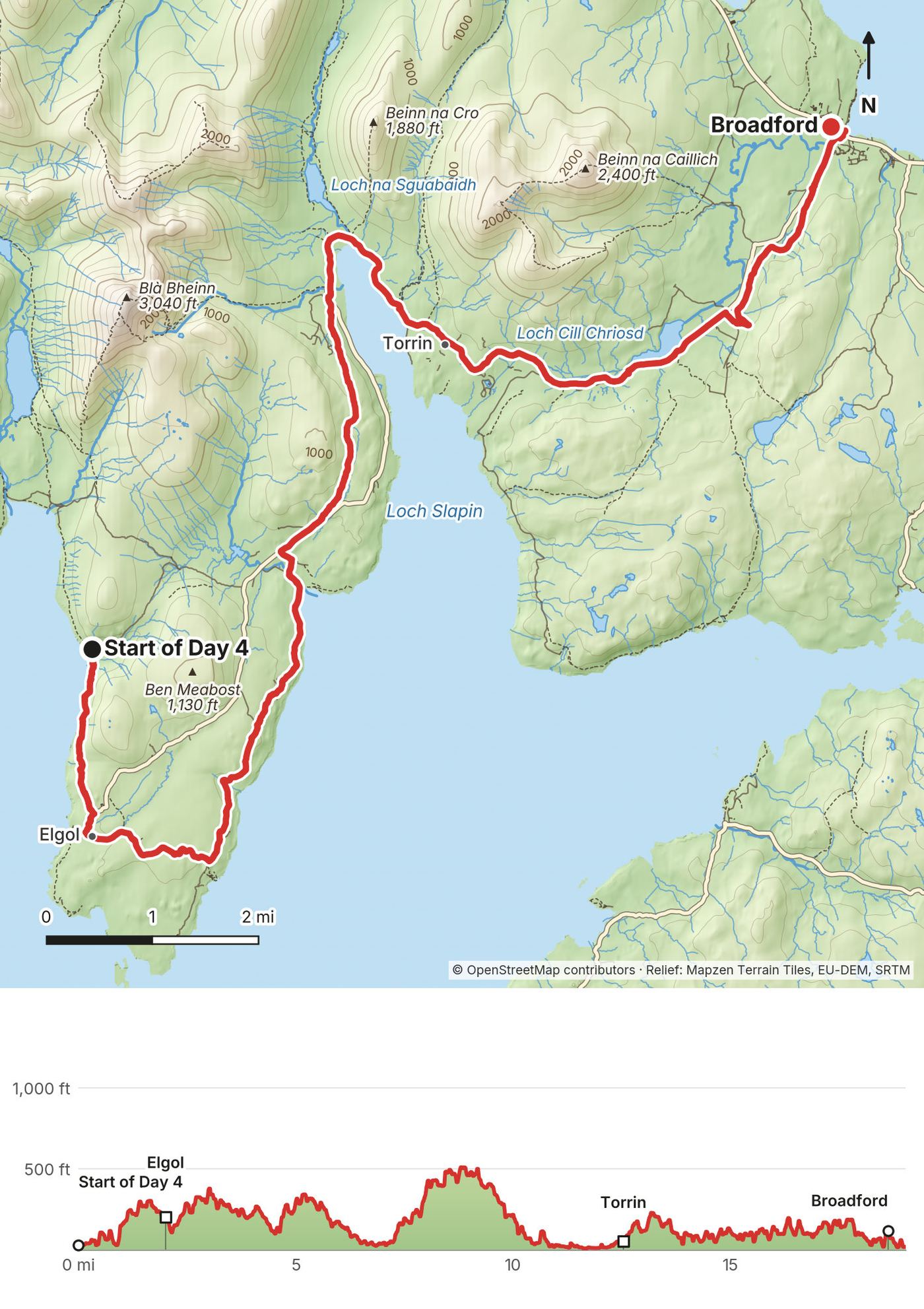
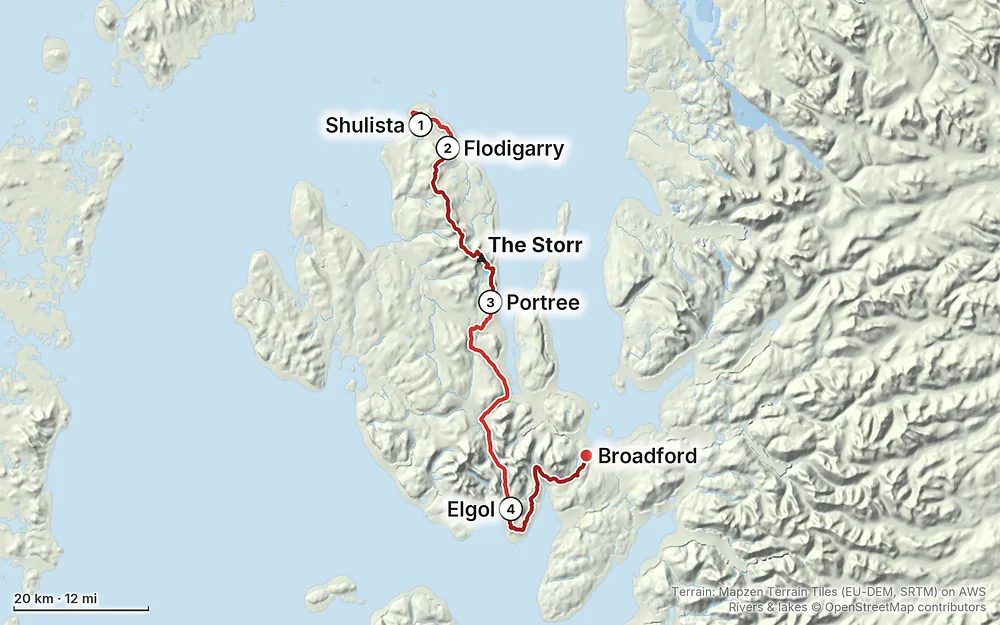
Elevation0–2,106 ft81.9 mi
Terrain: Mapzen Terrain Tiles (EU-DEM, SRTM) on AWS · Rivers & lakes © OpenStreetMap contributors
Tap a map to open it full size.
Scotland's access rights let you walk and wild camp on most land if you act responsibly: a lightweight tent, small numbers, no more than two or three nights in one place. Byelaws restrict camping in some areas (as of Nov 2026)
From the hike's facts; check the official page before you go.
My trip. I hiked April 28 to May 1, 2026, at the end of April going into May. It was the perfect timing for dryness, beauty, things being open, and no bugs. By no bugs, I mean no midges. Midges are terrible. The weather was perfect the whole time, and it only started to rain on May 2, as I was driving off the island. It was also lambing season, and there were lambs everywhere. On Day 3 two of them came right up to me.
It's usually wet. I don't want you to plan around my weather. This is typically a wet hike with rain and fog and moisture in general. I packed an umbrella, waterproof gloves and Crocs for mud and water crossings, and brought extra layers for wind and rain. I just didn't need them.
Midges. Scotland's biting midges come out from about late May to early September, and they're worst in July and August on still, damp days, especially at dawn and dusk. They don't fly in a breeze. Late April and early May come before they appear. If you go in summer, bring a head net and repellent.
Long days. In late April the sun rises on Skye at about 5:45 a.m. and sets at about 9 p.m. By June it's light from before 5 a.m. to after 10 p.m. Long daylight is what makes a 4 pm start or a 25-mile day workable.
Seasonal things. Some places on the route only open in the warmer months. In 2026, the Sligachan campsite was open April 1 to September 30, Seumas' Bar at the Sligachan Hotel was open daily, and the summer bus timetable around the north of Skye ran April 3 to October 24.
Lambing. In April and May, give ewes and lambs a wide berth, close gates behind you, and keep any dog under close control.
Weather. Skye weather changes fast, and wind and cloud matter as much as rain, especially on the Trotternish ridge. My dry, sunny trip was not normal. Check the mountain forecast every evening:
If strong wind, rain or low cloud are forecast for the ridge, don't go up. Wait a day, or take the bus around to Portree and walk the southern half.
Emergencies. Call 999 or 112 and ask for Police, then Mountain Rescue. Have ready your location (a grid reference or a named place), how many people are hurt and how, and your phone number.
Emergency texts. If your signal is too weak to call, you can text 999, but only if you've registered first. To register, text the word register to 999 and follow the instructions in the reply. It takes two minutes. Do it before you go.
Signal. Mobile reception in the Highlands is often patchy or non-existent. Leave your plan with someone at home, check in when you can, and carry offline maps and a charged power bank.
Ticks. Ticks live in the grass, bracken and heather, and some carry Lyme disease. Wear long clothing in long vegetation, check yourself every evening, and remove any tick with a tick remover.
Going solo. I hiked the whole thing alone. Tell someone your plan and your expected finish, and let them know when you're out.
How many days do I need? I did it in four, and the first was really a half day. That's about 80 miles in three and a half days, with a lot of flat sections and road walking. About 21 miles (34 km) of my line is on public roads, mostly on Days 3 and 4. Most people take about a week: the Cicerone guidebook splits the Skye Trail into seven stages. Other ways to do it has a 7-day plan on my exact line, and a 2-day ridge-only option.
When should I go? I went at the end of April into May, and it was the perfect timing for dryness, beauty, things being open, and no bugs. It was not supposed to be like this: it's usually a wet hike with rain and fog. Midges come out from late May to early September.
Where do I sleep? Mostly in a tent. Scotland allows responsible wild camping, and I camped three nights. There are beds in Portree, a campsite and hotel at Sligachan, and more in Broadford, and two free bothies (basic shelters) on the route. See Wild camping and where to sleep.
Is wild camping legal? Yes, if you follow the Scottish Outdoor Access Code: a small tent, small numbers, no more than two or three nights in one place, well away from buildings and roads, and leave no trace.
Am I fit enough? My days were 10, 24, 29 and 19 miles. Day 2 was the big one, with more than half of the trip's climbing, and Day 3 was 29 miles, probably one of my ten biggest days ever. Try this at home: hike 12 to 15 miles with the pack you'll carry, two days in a row, including some rough ground. If you feel fine on the second morning, the 7-day plan will work. My 4-day pace is for people who already do 20+ mile days.
Is there water? Not much on the ridge. I carried a 1-liter bottle and filled it at running streams, and on Day 2 there were long sections with no water. At one point I was so thirsty. Carry more than I did on the ridge, and treat what you drink.
Where do I buy food? Portree is the only real town in the middle of the route. I carried all my food for Day 2 and cooked with my stove. On Day 3 I had breakfast in Portree and bought more food at the Co-op. There's food at Sligachan, a cafe in Elgol, a takeaway near Torrin, and shops in Broadford.
Can I do it without a car? Yes. Citylink bus 917 runs from Inverness to Portree, and Stagecoach buses 57A and 57C loop around the north of Skye from Portree, past the start at the Shulista road end. From Broadford, the 917 goes back to Portree and Inverness.
Where do I leave a car? I parked at the lot at the start at about 4 pm, left my car there for the entire hike, and had zero issues: no tickets.
Is there phone signal? Sometimes. People were messaging me on Instagram during the hike, but mobile reception in the Highlands is often patchy or non-existent. Download everything before you go, and register your phone for emergency texts (see Weather and safety).
Is it OK to go solo? I hiked it alone. I met people along the way: at the Lookout on Day 1, a viewer named Brian on Day 4, a Swiss couple near Torrin, and more subscribers in Broadford who were just starting. On the smaller ridge past the Storr I found absolute isolation.
Is it waymarked? No. The Skye Trail is an unofficial route with no signs or waymarks of its own. You follow paths where they exist, open ridge and glen where they don't, and roads in between. Carry the GPX files, offline maps and a paper map and compass, and know how to use them in cloud.
Is this the same as the guidebook route? Mostly. I started from the parking at the Shulista road end and walked out to the Lookout above Rubha Hunish, without going down onto the headland itself, and on the last day I took an alternate escape: I walked the road from Torrin to Broadford instead of the usual finish around the coast past the abandoned village of Boreraig. The GPX files are what I actually walked.
I walked the route in four days. Most people take about a week, and unless you're used to 20+ mile days, plan on that. I didn't walk these versions. They use my GPS line and the places I passed, with distances from my files.
| Day | From and to | Miles (km) | Night |
|---|---|---|---|
| 1 | Shulista road end to Flodigarry | 8.8 (14.2) | Wild camp near Flodigarry, or a room there |
| 2 | Flodigarry to Hartaval on the ridge | 15.8 (25.4) | Wild camp on the ridge (carry water) |
| 3 | Hartaval, the Storr and down to Portree | 13.9 (22.4) | Portree hostel or hotel |
| 4 | Portree to Sligachan by the Braes | 13.7 (22.0) | Sligachan campsite, hotel or bunkhouse |
| 5 | Sligachan through Glen Sligachan to Camasunary | 8.7 (14.0) | Camasunary bothy or wild camp |
| 6 | Camasunary to Elgol and Torrin | 14.6 (23.5) | Wild camp or a room near Torrin |
| 7 | Torrin to Broadford by road, like me | 6.3 (10.1) | Broadford |
The ridge night on Day 2 is the hard one: there's little or no reliable water up there, so fill up before you climb and carry enough for dinner and breakfast. If the forecast is bad for the ridge, wait a day in Portree or at Flodigarry rather than going up anyway.
The Trotternish ridge is the wildest part of the hike and works on its own. From Flodigarry, follow Day 2 along the ridge and down to Portree: about 29.7 miles (47.8 km) on my line, with one wild camp on the ridge. Take the 57A or 57C bus from Portree to Flodigarry in the morning to start, and you finish in town.
If you want to do it my way, the biggest thing is daylight and weather. My long days worked because it was dry and the days were long. Start early, not at 4 pm like me, unless you only want a half day.
These change every year. Everything else in this guide stays the same.
Weather
Buses
Places to stay and eat
Rules
Your stuff
The film is at the top of this page.
Planning questions about Skye Trail, answered only from this page's facts, the creators' versions and hikers' public tracks, with where each answer comes from. When the data doesn't say, the answer says "not given".
From hikers
Sign in to comment. Free; your hikes stay private unless you share them.
Some lodging links earn me a small commission at no cost to you.
Something wrong or missing on this page? Send feedback.