
Content made there
The film is at the top of this page.
Photos
Hikes / Alpstein and the Saxer Lücke / Kraig Adams's version
Europe · Switzerland
Sep 2024 · 2 days · Solo · Huts

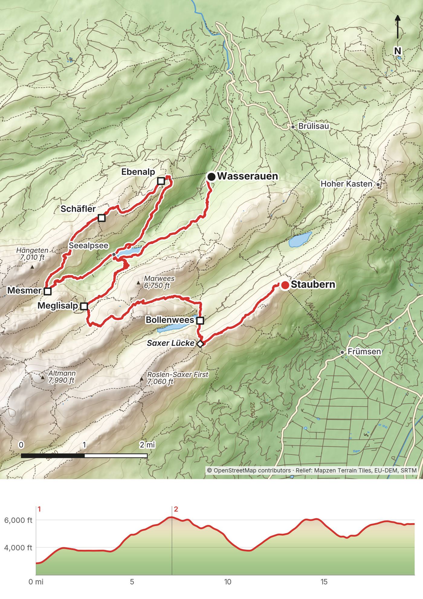
In September 2024 I spent two days hiking in the Alpstein, the mountains of Appenzell in northeast Switzerland. I went up from Wasserauen past the Seealpsee and the Aescher, the inn built into the cliff, to a night at the Berggasthaus Schäfler on its ridge. The next day I walked past Mesmer, the Seealpsee again and Meglisalp, over the Widderalpsattel to Bollenwees on the Fälensee, up to the Saxer Lücke, and along the Stauberen ridge to the cable car at Staubern. Two days, about 20 miles by my GPS. It's the trip from my film Hiking to Saxer Lücke in Switzerland.
I picked this area mainly because I had seen the Saxer Lücke before. It's a pretty popular image on Instagram, and I thought it would be cool to do an overnight loop or some kind of bigger hike to get to that spot. A lot of my videos are just the behind the scenes of how I get the thumbnail, and doing the work to get to the spot makes the image more interesting.
| Quick facts | |
|---|---|
| Distance | 19.7 miles (31.7 km) from Wasserauen to the Staubern cable car. My film says 7 and 13 miles |
| Climbing | About 7,740 ft (2,360 m) up and 4,890 ft (1,490 m) down |
| Days | 2: 7.1 miles on Day 1, 12.6 on Day 2 |
| Start | Wasserauen station, 2,848 ft (868 m), the end of the Appenzeller Bahnen line from Appenzell |
| Finish | The Staubern cable car, about 5,720 ft (1,744 m), down to Frümsen in the Rhine valley |
| When | I went September 18 and 19, 2024 |
| Difficulty | White-red-white mountain trails the whole way, with steep, exposed stretches secured with cables. Snow lingers into summer and can come back in September |
| Permits | None. You book the mountain inns directly |
| Day | Route | Miles (km) | Up / down (ft) | Sleep |
|---|---|---|---|---|
| 1 | Wasserauen to the Schäfler | 7.1 (11.4) | 3,651 / 319 | Berggasthaus Schäfler |
| 2 | The Schäfler over the Saxer Lücke to Staubern | 12.6 (20.3) | 4,084 / 4,571 | (the cable car down to Frümsen) |
Distances and climbing are from my own GPS, with the points where I stood still taken out (see Using the GPX files). Heights of named places are map heights. Day 2 isn't the most direct way: snow sent me back down to the Seealpsee in the middle of it.
My way in, 2024. I came to Switzerland for Creator Camp, a trip for a big group of creators, then spent a few days on my own in the St. Gallen area, recharging and getting ready to shoot. On the morning of Day 1 I was sick and took half the day to rest in town. By late morning I was in Appenzell; I took the train to Wasserauen, about 12 minutes, and started walking at 1:17 p.m.
Trains to Wasserauen (2026). The Appenzeller Bahnen line ends at Wasserauen. From St. Gallen it's 52 minutes, changing at Appenzell, every 30 minutes; from Zürich main station about 2 hours 5 minutes, changing at Gossau, every 30 minutes; from Zürich airport about 1 hour 50 minutes. In 2026 a single from St. Gallen was CHF 12.60 (half with the Half Fare Card) and from Zürich CHF 41, with cheaper Supersaver tickets on sbb.ch. The Swiss Travel Pass and the GA cover these trains and buses. The last train from Wasserauen was at 6:48 p.m.; after that the B23 bus ran to Appenzell at 7:47, 8:47 and 9:47 p.m. The timetable changes on December 13, 2026: check sbb.ch.
The Ebenalp cable car (2026). From its valley station, a short walk from Wasserauen station, up to Ebenalp in 6 minutes, every 15 minutes or on demand. CHF 24 one way, CHF 36 return; half price with the Half Fare Card, the Swiss Travel Pass or the GA. In late September and October it ran up from 7:30 a.m. to 5:15 p.m., with the last ride down at 5:30 p.m.; in July and August the last ride down was at 7 p.m. Closed for maintenance in April and from November to Christmas.
Parking at Wasserauen. Since May 19, 2026 the public car parks in Appenzell Innerrhoden have one tariff: free for 90 minutes, then up to CHF 15.75 for the first 24 hours and CHF 10 for each extra day, for at most 7 days. The ebenalp.ch page says coins or parking apps only. A parking guidance system is planned for 2027. From Friday to Sunday, April to October 2026, Appenzell tourism offered free P+Rail parking at Gossau station with a code. The train is easier.
Getting back from Staubern (2026). The Staubern cable car goes down to Frümsen in 8 minutes. It runs every 20 minutes (the departure on the hour only with at least 3 people), daily from May to October until 10 p.m., from 7 a.m. in June to September and 8 a.m. in May and October; it's closed from January to March, and in April, November and December it runs only on demand or for groups. CHF 20 one way, CHF 40 return, with no rail pass discounts listed. Buy the ticket from the machine at the valley station or at the inn. From the valley station it's a 7 to 10 minute walk down to the bus stop Frümsen, Rathaus/Staubern, where bus 411 runs every hour. To St. Gallen took 1 hour 27 to 31 minutes in October 2026, changing at Gams and Buchs or at Salez-Sennwald; to Zürich about 1 hour 48 minutes. From December 13, 2026 bus 411 no longer goes via Salez, so for the Salez-Sennwald station you change to bus 300: check sbb.ch. Parking in Frümsen is very limited.
The Hoher Kasten cable car. From Brülisau to the Hoher Kasten (5,886 ft, 1,794 m) in 8 minutes, every 20 minutes. CHF 28 one way, CHF 40 return, and no rail pass discounts. Its 2027 timetable is published: from June 12 to August 15, up from 7:20 a.m. to 5:20 p.m. and the last ride down at 5:40 p.m.; from August 16 to October 17, the last ride down at 5:20 p.m. Bus 192 runs between Weissbad station and Brülisau, Kastenbahn every 30 minutes; in 2026 the last bus from Brülisau was at 6:14 p.m.
| Item | What I paid |
|---|---|
| The Berggasthaus Schäfler, one night, paid by card that evening (2024) | CHF 147.50. My film calls it "Half Board - $175" |
| The train from Appenzell to Wasserauen | Not in my records |
| Coffees at the Aescher and Mesmer, the salad at Bollenwees | Not in my records |
| The Staubern cable car down to Frümsen | Not in my records |
For your budget (prices posted in 2026). Train from St. Gallen to Wasserauen CHF 12.60; from Zürich CHF 41 (Supersaver from CHF 30.80). The Ebenalp cable car CHF 24 one way. The Staubern cable car CHF 20 one way. Meglisalp's dorm with half board CHF 90; Bollenwees's dorm CHF 50 to 60, with breakfast. Tourist tax CHF 2.50 a night. Parking at Wasserauen up to CHF 15.75 for 24 hours.
These are the rules and the mountain inns (Berggasthaus, plural Berggasthäuser) on the route, from the inns', cantons' and Appenzell tourism's own pages, checked on October 1, 2026. Most inns charge a tourist tax of CHF 2.50 per adult per night on top. No inn had published its 2027 season yet.
Booking. You book each inn directly, online or by phone (Bollenwees counts a booking only once it's confirmed in writing). On busy summer weekends book well ahead.
Payment. Most prefer cash in Swiss francs; most take cards. The Schäfler takes Maestro, Mastercard and Visa. Carry enough cash anyway.
The inns, in walking order
| Inn | Height | Season (2026) | Beds | Notes |
|---|---|---|---|---|
| Berggasthaus Seealpsee | 3,743 ft (1,141 m) | Mid-April to Nov 1, closed Mondays | Rooms | No overnight guests on Sunday or Monday nights; dinner from the menu required with a room; no dogs overnight |
| Gasthaus Forelle, Seealpsee | 3,743 ft (1,141 m) | May to Nov 1, closed Wednesdays | 15 rooms | Rooms only with dinner |
| Aescher-Wildkirchli | 4,770 ft (1,454 m) | May to Nov 1 | 8 beds, 15 dorm places | No shower or heating; closed from 6 p.m. on Sundays in May, June and September |
| Berggasthaus Ebenalp | about 5,220 ft (1,590 m) | May 1 to end of November | Rooms and dorm | No overnight guests on Sunday or Monday nights |
| Berggasthaus Schäfler | 6,312 ft (1,924 m) | May to October; closed Tue and Wed in May and June, Wed in July to October | 15 beds, 70 bunk places | Bring a hut sleeping bag or rent one (CHF 5) |
| Berggasthaus Mesmer | 5,292 ft (1,613 m) | Daily June to end of October (opened May 23) | Rooms and dorm | Booking commits you to dinner |
| Meglisalp | 4,977 ft (1,517 m) | To about Nov 1 | Rooms and a 35-place dorm | Half board on offer; shower included |
| Bollenwees | about 4,830 ft (1,470 m) | May to end of October | Dorm, bunk rooms and doubles | Closed Tuesday evenings outside mid-July to mid-August and early to mid-October; showers CHF 1 a minute |
| Berggasthaus Staubern | 5,741 ft (1,750 m) | Daily to end of October | Doubles, a 10-bed room | No half board; dinner from the menu |
Prices (posted in October 2026, per person, breakfast included unless noted; only Meglisalp's page names the year). Meglisalp: dorm CHF 50, or CHF 90 with half board; doubles CHF 100 to 110, or CHF 140 to 150 with half board. Mesmer: dorm CHF 50; three-bed room CHF 85; a double with shower CHF 225 for the room. Bollenwees: dorm CHF 50 to 60; bunk rooms CHF 75 to 95; doubles CHF 100 to 125. Seealpsee: CHF 75 to 110. Ebenalp: dorm CHF 58, rooms CHF 80. Staubern: doubles from CHF 170 for the room; the 10-bed room from CHF 65, mainly for groups. The Schäfler shows its prices only in its online booking, and the Aescher's posted prices carry no year.
No wild camping. Appenzell tourism says plainly that the Alpstein isn't a campsite and wild camping isn't allowed. The canton's own 2025 report names Seealp, the Saxer Lücke, the Sämtisersee, Bollenwees and the Kamor as the places people camp anyway, and the canton is drafting a law that would allow a bivouac only with the landowner's permission (news reports say 2028 at the earliest). The Saxer Lücke sits on the line between Appenzell Innerrhoden and St. Gallen, and on the St. Gallen side the town of Sennwald says wild camping up high isn't wanted and issues no permits. Since 2026 volunteer rangers patrol the Alpstein on weekends and holidays. Sleep in the inns.
Protected area. Between the Steckenberg and Mesmer the route crosses the federal Säntis hunting-ban area: dogs on a lead, no camping and no drones.
Drones. Appenzell Innerrhoden has banned drones in the Alpstein since November 1, 2020, and the federal drone map shows the restriction from Wasserauen to the Saxer Lücke and at Staubern.
Dogs and cows. Dogs on a lead during the alp season, and not in the troughs. Keep your distance from mother cows with calves, walk around cows standing on the trail, and close every gate.
Fires. Use the fire pits that are there; no disposable grills, no fires in the forest or on pasture.
| Night | Where | Height |
|---|---|---|
| Before the hike | In the St. Gallen area | |
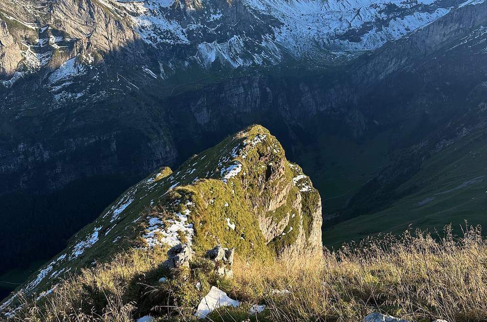
| 1 | Berggasthaus Schäfler, in a bunk room | 6,312 ft (1,924 m) |
| After Day 2 | Not in my records: I got a lift from Frümsen back toward St. Gallen |
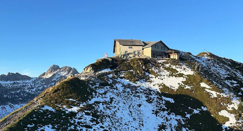
The Berggasthaus Schäfler. On the ridge just below the Schäfler's summit, with a view over the lowlands. It has 15 beds in rooms (some unchanged since 1914, with jugs and basins for washing) and 70 places in bunk rooms of 3 to 12, for which you need a hut sleeping bag (rent one for CHF 5). Hot and cold water are in the washrooms in the annex. Book online or by phone (+41 71 799 11 44). It prefers cash and takes Maestro, Mastercard and Visa. Dogs sleep in the side building. Its tap water is collected rainwater, filtered.
The other inns are in Huts and rules.
On Day 1 I ate an apple by the Seealpsee and had a coffee at the Aescher. At the Schäfler I had soup, then macaroni with cheese, onions and a sausage, and muesli in the morning. On Day 2 I had a coffee at Mesmer and a salad at Bollenwees. On the flight home I had an Appenzeller beer with my lunch, and it's from the exact spot I was standing.
Prices at the Schäfler (2026 menu). Coffee CHF 5, barley soup CHF 9.50, Chäshörnli (Swiss macaroni and cheese) CHF 18, rösti CHF 19.
There's an inn every hour or two, and every one sells drinks. Running water is scarce up high. If you drink from a stream, treat it: cows graze the alps. At the Schäfler the tap water is rainwater, filtered with particle and UV filters (a 3 dl glass was CHF 2 in 2026); the Aescher's water also comes from rain, collected in the cave. Carry enough to get from one inn to the next on a hot day.
Paid links: I earn a commission if you buy through these links, at no extra cost to you. As an Amazon Associate I earn from qualifying purchases.
Here's what I carried in September 2024, what I'd take now, and what I filmed with.
My film shows my pack, my camera and my tripod. I did bring my tent and all my equipment for a night out at the Saxer Lücke, and didn't use them.
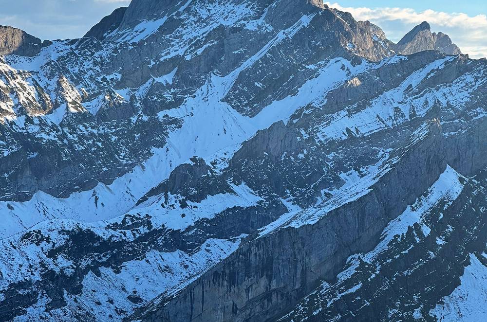
 Puffy: Arc’teryx Cerium Hoody (Arc’teryx). In mid-September 2024 an early storm left snow on the high trails.
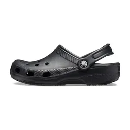 Hut shoes: Crocs Classic Clog (Amazon). At the Schäfler I changed into Crocs in the boot room.
My current kit for a night in a mountain inn and steep, sometimes snowy trails.
 Hut sleeping bag: Naturehike ZY20 Sleeping Bag Liner (Amazon). You need one for the Schäfler's bunk rooms, or rent one there for CHF 5.
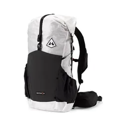 Pack: Hyperlite Mountain Gear Waypoint 35 (Hyperlite)
 Poles: Black Diamond Alpine Carbon Z Poles (Amazon). For the steep descents. I used my tripod as a walking stick on Day 1 because I was struggling.
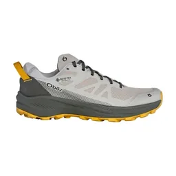 Shoes: Oboz Katabatic LT Low GTX (Amazon)
 Rain shell: Arc’teryx Beta AR Jacket (Arc’teryx)
 Hat: PATH Projects Hoyt Merino Beanie (PATH Projects). The Säntis has frost even in summer.
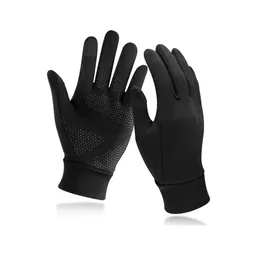 Gloves: Unigear Touchscreen Liner Gloves (Amazon)
 Microspikes: Yatta Life Ice Spikes (Amazon). For early summer or after an early snowfall. Turn around if it's too snowy.
 Water filter: Katadyn BeFree AC · 1L (Amazon). To treat stream water.
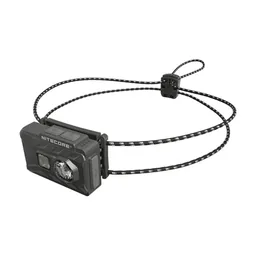 Headlamp: Nitecore NU20 Classic (Amazon)
What I filmed this trip with in 2024, from my photos' camera data. My setup is smaller now (below). Check the drone rules in Huts and rules before you fly.
Since September 2026 I film with a smaller setup: the Pocket 4 and the Mic 3 on the trail, and the Mini 5 Pro in the air.
 Camera: DJI Osmo Pocket 4 (Amazon)
 Mic: DJI Mic 3 · 1 TX + 1 RX (Amazon). It pairs with the Pocket 4.
 Drone: DJI Mini 5 Pro (Amazon)
I was actually feeling terrible. I woke up that morning with what I think was food poisoning: short of breath, my stomach hurt, I had no appetite, and I was so weak I just wanted to sleep. I took half the day to rest in town and postponed the hike as much as I could. My plan was to sleep up high at a hut I'd booked, because sleeping up high gives you the best views of sunset and sunrise, way more interesting than sleeping down in the valleys. So I started that afternoon, and backwards from my plan, to keep my hut booking.
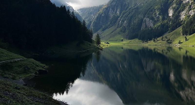
I took the train to Wasserauen and started walking at 1:17. I went up to the Seealpsee, skipped a stone and ate an apple by the water, and walked along the lake.
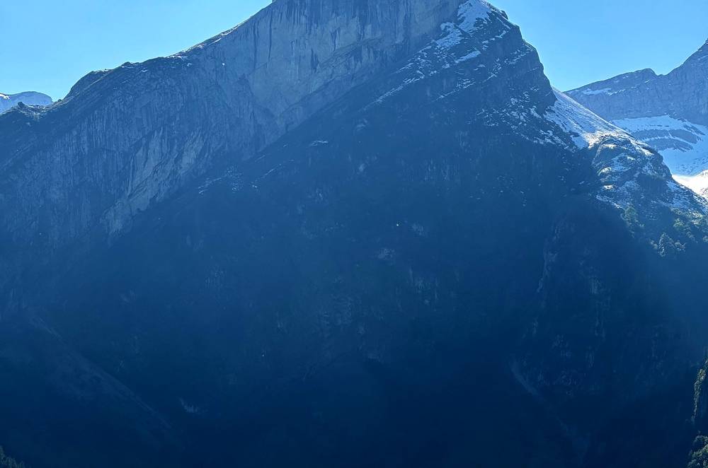
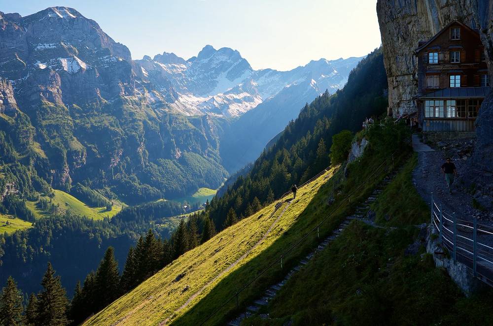
From the lake I climbed past the little mountain hut on the side of the mountain, the Aescher. This mountain hut built right into the side of the cliff is really, really unique. I know there are cable cars up here to make it easy for people to visit, but it's definitely very cool to see. I've never seen any mountain huts like this. I had a coffee on its terrace, then went through the Wildkirchli caves and up past all of the paragliders who were taking the cable car up to Ebenalp. I really want to do that sometime too.
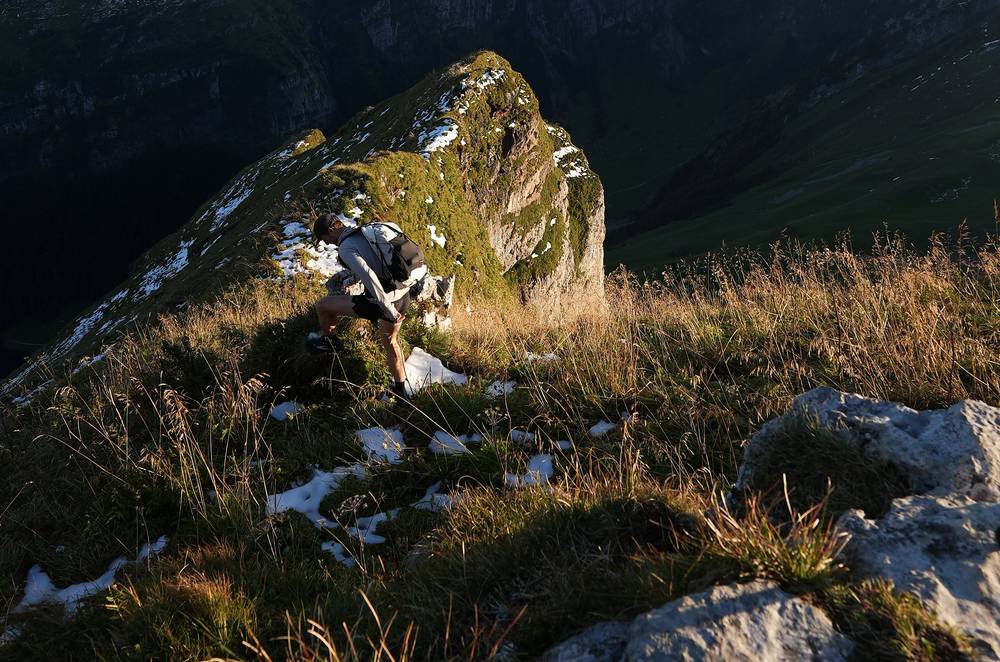
From Ebenalp I followed the ridge to the Schäfler, with slush on the path near the top. I did not feel good. I was using my tripod as a walking stick because I was struggling. I reached the hut at 6:21 and ended up with a really nice view: a sunset over a sea of clouds. Dinner was soup, then macaroni with cheese, onions and a sausage, and I slept in a bunk room.
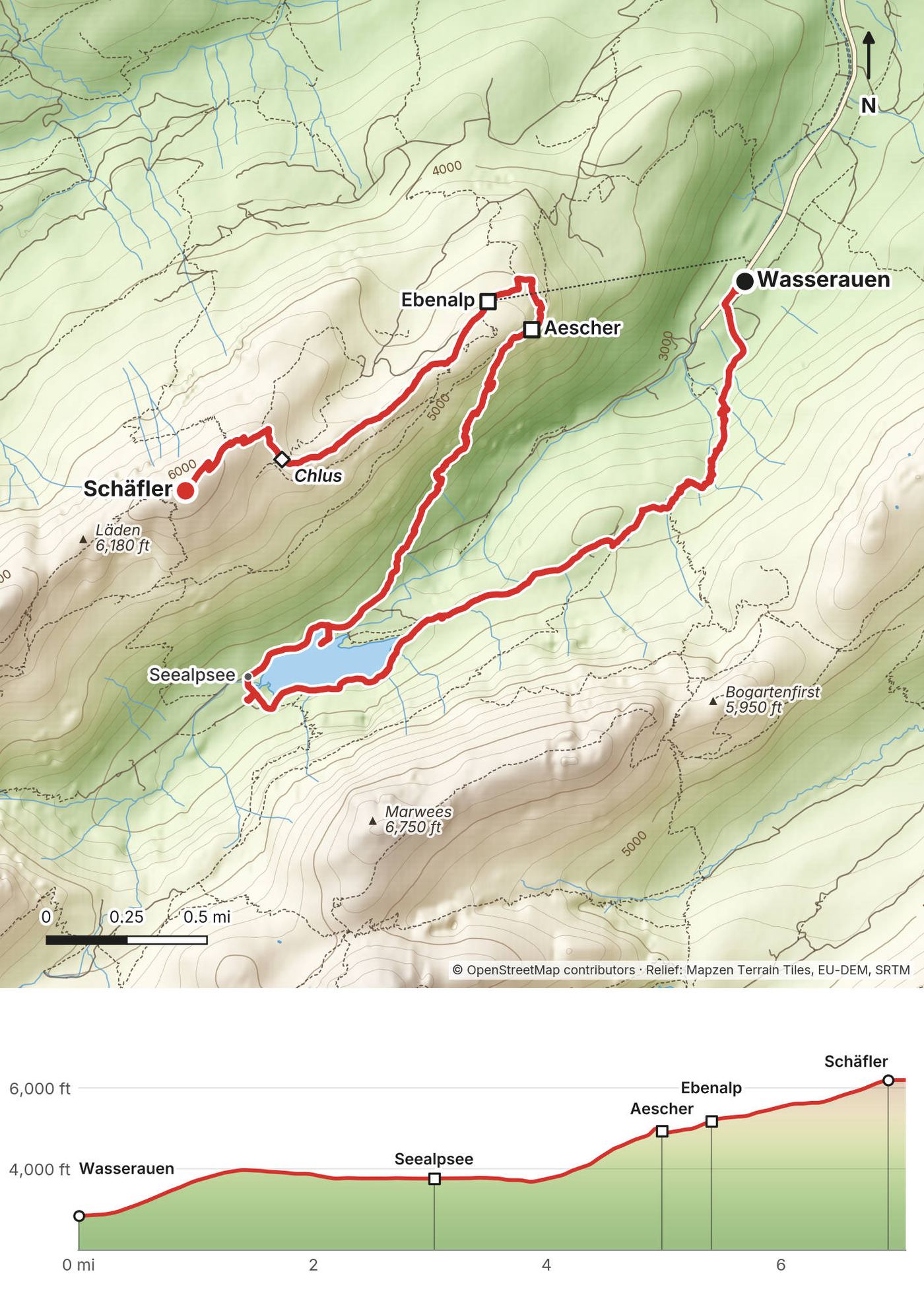
Wasserauen to the Seealpsee. In the official trail data, everything but the first few hundred meters from the station is a white-red-white mountain trail. From the station (2,848 ft, 868 m) I took the path that climbs through the forest, with cables on a steep stretch, to the alp pastures at Klein-Hütten and Gross Hütten (about 3,960 ft, 1,210 m), then down a little to the Seealpsee (3,743 ft, 1,141 m) at mile 2.2. A track also runs up the valley from Wasserauen to the lake. Local news reported in 2026 that the path from Wasserauen toward the Hüttentobel was being renovated and closed during the work: if it's closed when you get there, take the track. Two inns stand by the water: the Berggasthaus Seealpsee and the Gasthaus Forelle. I walked to the lake's west end and back along the north shore.
Up to the Aescher. From Chobel (mile 3.9), just below the lake's east end, a mountain trail climbs about 1,150 ft (350 m) in a mile to the Aescher (4,770 ft, 1,454 m). It's steep and exposed in places. On June 9, 2025 a hiker fell about 70 m from it, where the trail is about 5 feet (1.5 m) wide, between the Aescher and the Seealpsee, and died. Take it slowly, and not when it's wet.
Through the caves to Ebenalp. From the Aescher the trail goes through the Wildkirchli caves, past a cave chapel and through a dark tunnel, up to Ebenalp (about 5,220 ft, 1,590 m), with the top station of the cable car and the Berggasthaus Ebenalp. The Aescher gives it as 15 minutes on foot. The grassy slope by the top station is a paragliding launch.
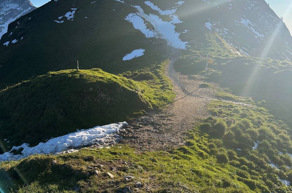
Ebenalp to the Schäfler. The ridge trail runs southwest past Chlus (5,663 ft, 1,726 m, mile 6.3) to the Berggasthaus Schäfler (6,312 ft, 1,924 m), just below the Schäfler's summit. The Schäfler calls it about an hour from Ebenalp on a beautiful, easy trail. I had slush and old snow near the top.
At any point before Ebenalp, go back down to the Seealpsee and on to Wasserauen. From Ebenalp the cable car goes down to Wasserauen in 6 minutes; in late September and October 2026 the last ride down was at 5:30 p.m. The Seealpsee, the Aescher and Ebenalp all have beds (see Huts and rules). In an emergency call 1414 (Rega, the air rescue) or 144.
Getting to the trailhead · Film, Day 1 · My walk-through of the route on a map
I slept overnight above the clouds and started out a big day with my stomach still killing me. I was able to recover my strength a bit at the start of Day 2.
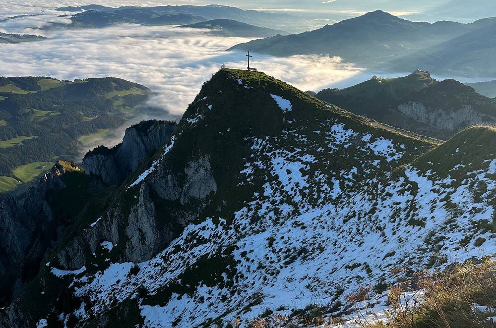
Out of the hut I went down out of the snow to the next hut, Mesmer, and had a coffee in its doorway.
I would have liked to go up and over from Mesmer. There was a trail going over the ridge line there, but it was way too snowy in the shade. With snow, you definitely have to think about where the shade is, because there's going to be a lot more snow there. So unfortunately I had to go all the way back down to where I already was, the Seealpsee, which I don't think I've ever done in a hiking video before. It feels a bit redundant to return to the same spot. I really wanted to go up and over.
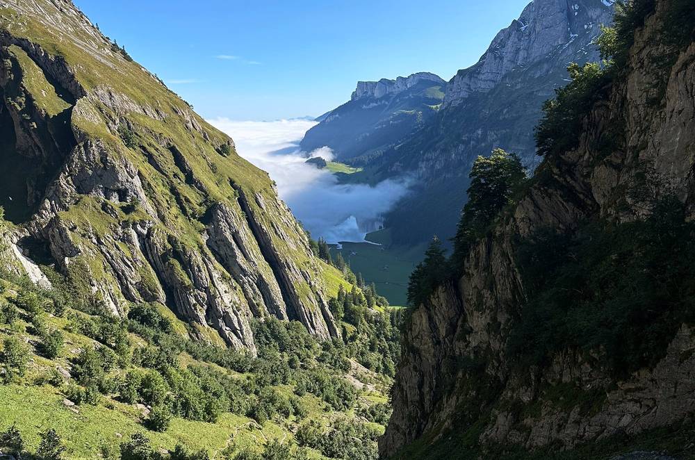
Then I went back up to the next hut, Meglisalp, and stopped there for about half an hour. Above it I faced some snow going up over the pass, the Widderalpsattel, but I took my time and it wasn't anything too crazy. Once you do Mount Whitney before permit season, you can do a lot; I've got some experience when it comes to going over snowy passes.
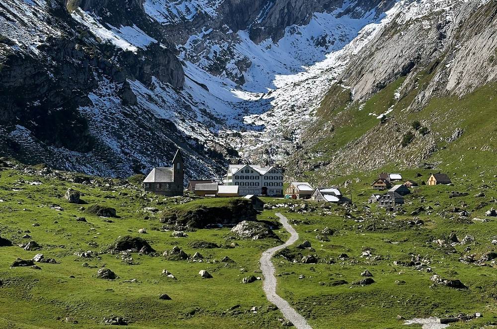
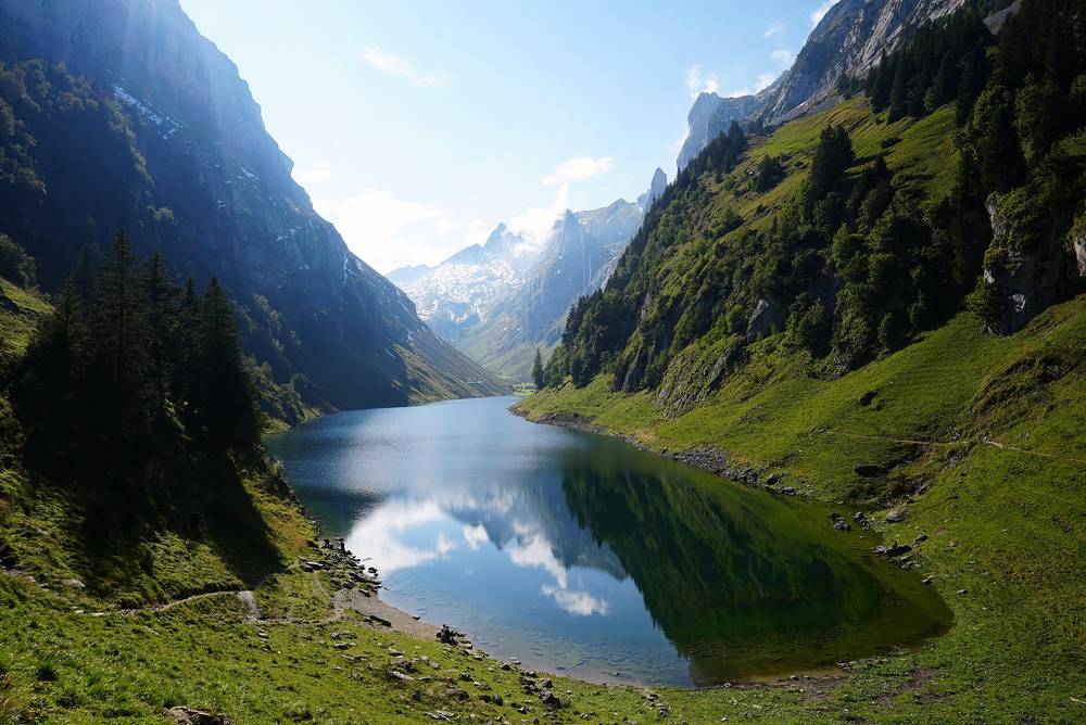
The lake on the other side, the Fälensee, was pretty great. It was nice to stop for a salad at Bollenwees, and by that point I had almost fully recovered my strength. Then I finished the day going up to the view at the Saxer Lücke to get my thumbnail. The Saxer view at the end was worth going over a bit of snow on the middle pass.
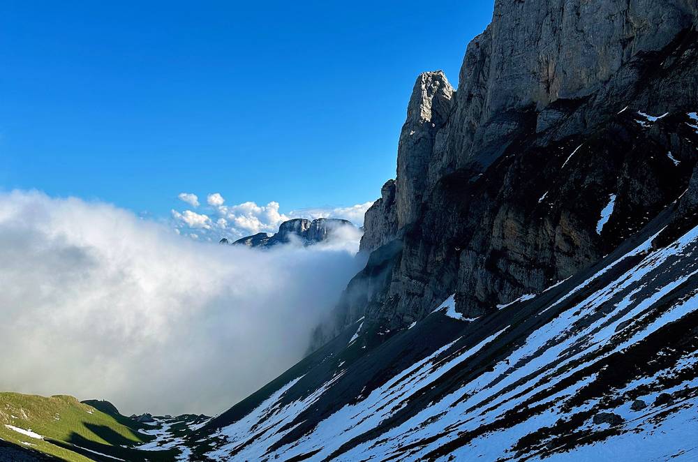
My original plan was actually to sleep up there. I passed a guy with a bivy sack, and in my research I learned that there are two or three little clearings with a view of the Saxer Lücke where people wild camp. I wasn't sure if it's allowed, but people were doing it. Because I was sick, because it was cold and because there was snow, I didn't. I did bring my tent and all my equipment, but I kept this hike pretty easy because of the sickness. It isn't allowed: see Huts and rules.
For sunset I made my way along the ridge toward Staubern, which was great because I had views of Liechtenstein and Austria, all three countries, like a little intersection here. I hoped to keep going along the ridge and take another cable car down, but I knew that if I continued it would be almost dark by the time I got there and that cable car wouldn't be running. I would have had to hike down in the dark to a town and walk over to Weissbad for a train. So I'd had enough, and there was a cute dog at Staubern, so I hung out there and then took the Staubern cable car down. One of the guys in the cable car was super nice and was driving back to the St. Gallen area, so I hitchhiked with him.
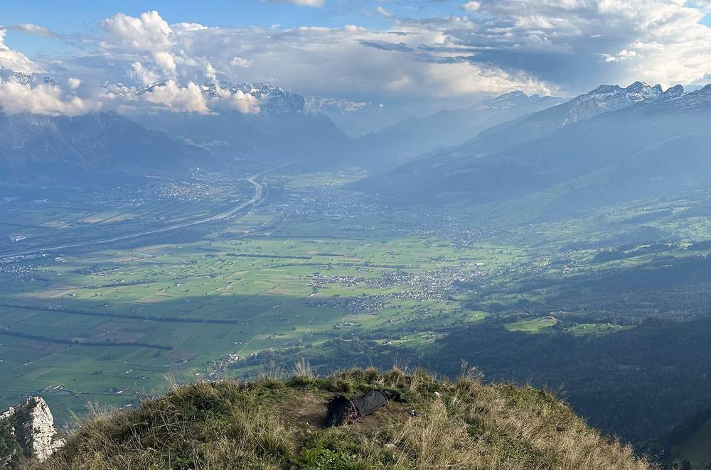
This view is amazing. It really was, with the snow and the clouds and the light the way it was. It was really pretty, and I'm glad I did this hike.
The Schäfler to Mesmer. Rated T3 by Appenzell tourism, and in its words only for hikers who are sure-footed and free from vertigo. From the inn the trail goes around the Schäfler's summit to a short descent secured with cables, then along under the walls of the Läden and the Altenalp towers, over the Altenalpsattel (5,938 ft, 1,810 m, mile 0.8) and the Steckenberg (5,755 ft, 1,754 m), crossing steep slopes down to the Berggasthaus Mesmer (5,292 ft, 1,613 m, mile 2.2). In mid-September 2024 there was fresh snow on this stretch, deep in places on a steep slope. From the Steckenberg to just past Mesmer you're in the federal Säntis hunting-ban area: dogs on a lead, no camping, no drones.
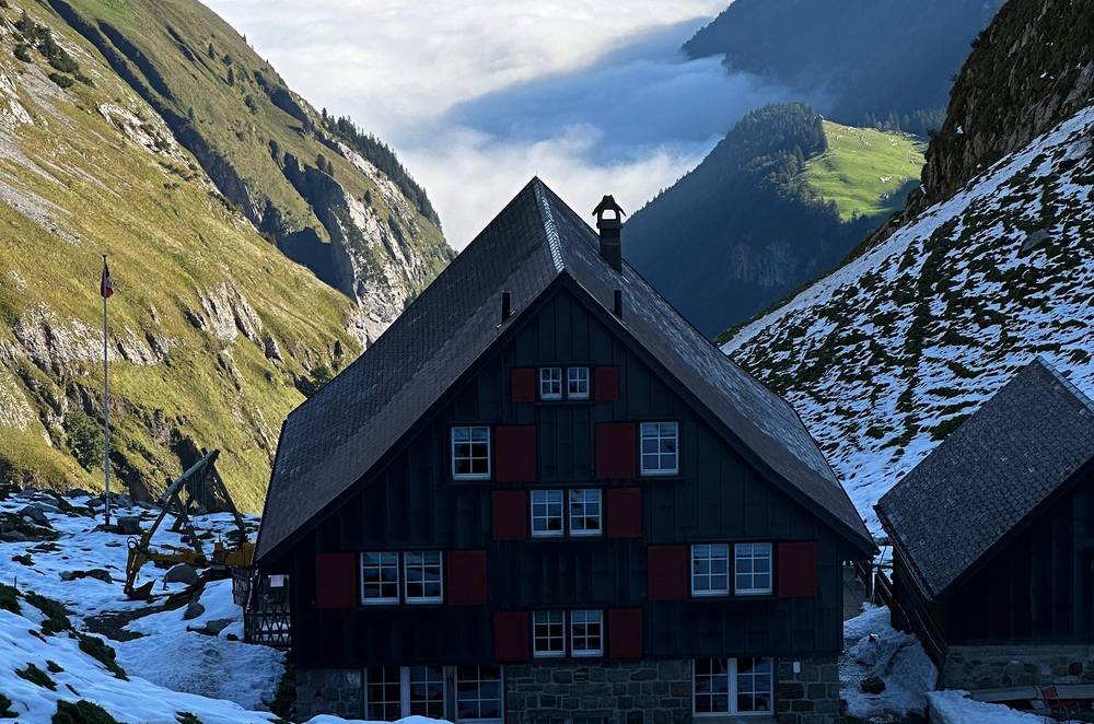
Mesmer down to the Seealpsee. Down past Unterer Mesmer and the alp at Oberstofel to the west end of the Seealpsee (3,743 ft, 1,141 m, mile 4.0): about 1,550 ft (470 m) down.
Up to Meglisalp. From the lake the Unterstrich trail climbs south through the cliffs of the Teufelskanzel to Meglisalp (4,977 ft, 1,517 m, mile 5.9), a cluster of alp huts around the Berggasthaus Meglisalp. Appenzell tourism calls the Unterstrich the last spectacular section of its high trail.
Over the Widderalpsattel. From Meglisalp the trail climbs past Spitzigstein (5,305 ft, 1,617 m) to the Widderalpsattel (6,086 ft, 1,855 m, mile 7.5), the pass I called the middle pass, then drops past Widderalp to Bollenwees at the east end of the Fälensee (about 4,830 ft, 1,470 m, mile 9.6). Appenzell tourism rates its tour over this pass T3. A white-blue-white alpine route branches off at the pass: stay on the white-red-white trail. I crossed some snow near the pass in September.
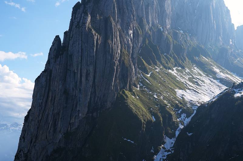
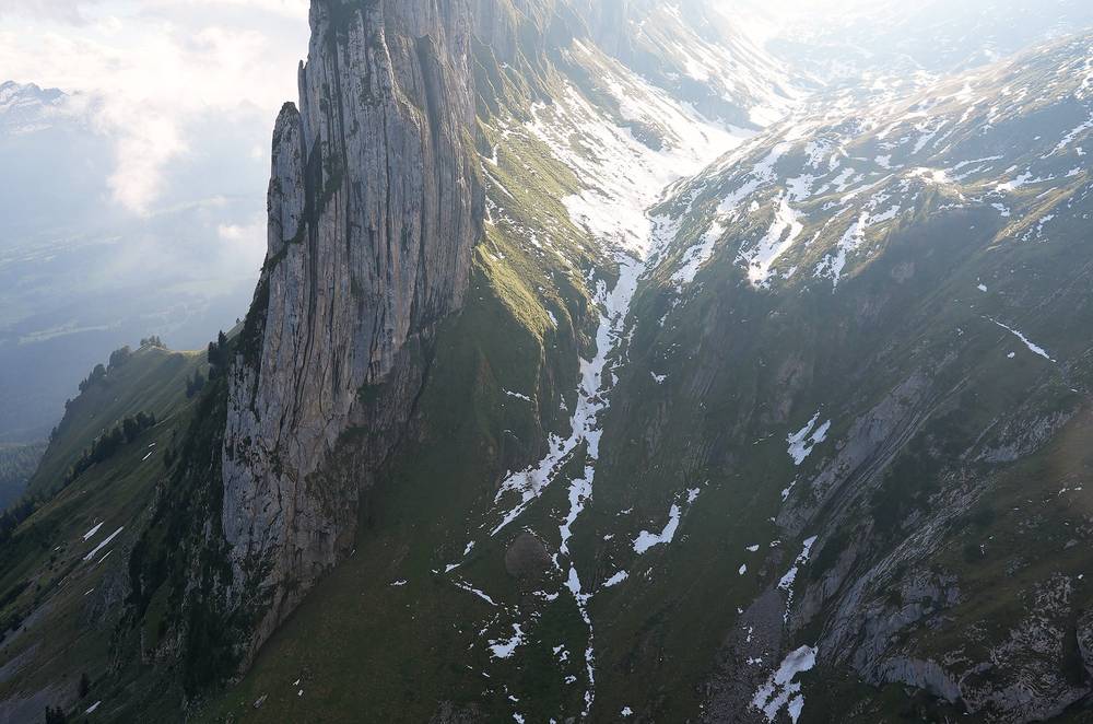
Bollenwees to the Saxer Lücke. The signpost at Bollenwees said 35 minutes to the Saxerlücke (that's how the signs spell it). I took 26 minutes, climbing about 590 ft (180 m) to the gap (5,410 ft, 1,649 m, mile 10.1). This climb and the ridge beyond are the Geologischer Wanderweg, the trail from the Hoher Kasten along the ridge to Bollenwees, rated T2 by Appenzell tourism. This is where I came for my thumbnail: the rock towers of the Kreuzberge, with the Rhine valley below. The Saxer Lücke sits on the border between the cantons of Appenzell Innerrhoden and St. Gallen.
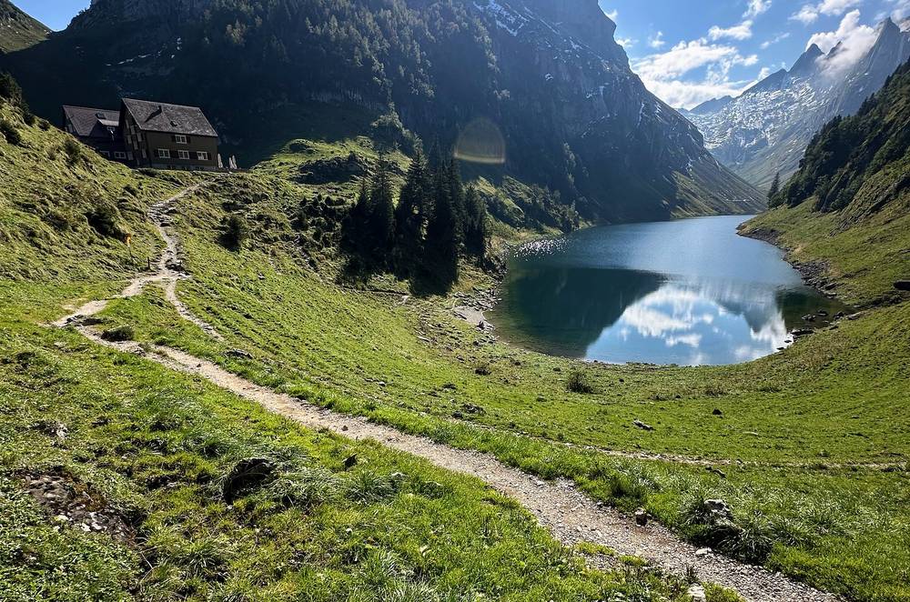
The Stauberen ridge to Staubern. The trail follows the ridge northeast past Sattel (5,958 ft, 1,816 m, mile 11.3), with the Rhine valley, Liechtenstein and Austria on your right, to the Berggasthaus Staubern (5,741 ft, 1,750 m, mile 12.4) and the top station of the cable car (mile 12.6). The ridge trail goes on to the Hoher Kasten. Appenzell tourism gives the whole Geologischer Wanderweg, from the Hoher Kasten along the ridge to Bollenwees and on down to Brülisau, as 10 miles (16.2 km), about 5.5 hours.
Mesmer, the Seealpsee, Meglisalp, Bollenwees and Staubern all have beds. From Mesmer or Meglisalp, the way out is down to the Seealpsee and Wasserauen. From Bollenwees, a trail goes down past the Sämtisersee to Brülisau, where bus 192 runs to Weissbad station (the last bus in 2026 at 6:14 p.m.). From the Saxer Lücke you can go back down to Bollenwees, or on along the ridge to the Staubern cable car, which ran until 10 p.m. from May to October in 2026. In an emergency call 1414 or 144.
Film, Day 2 · My walk-through of the route on a map
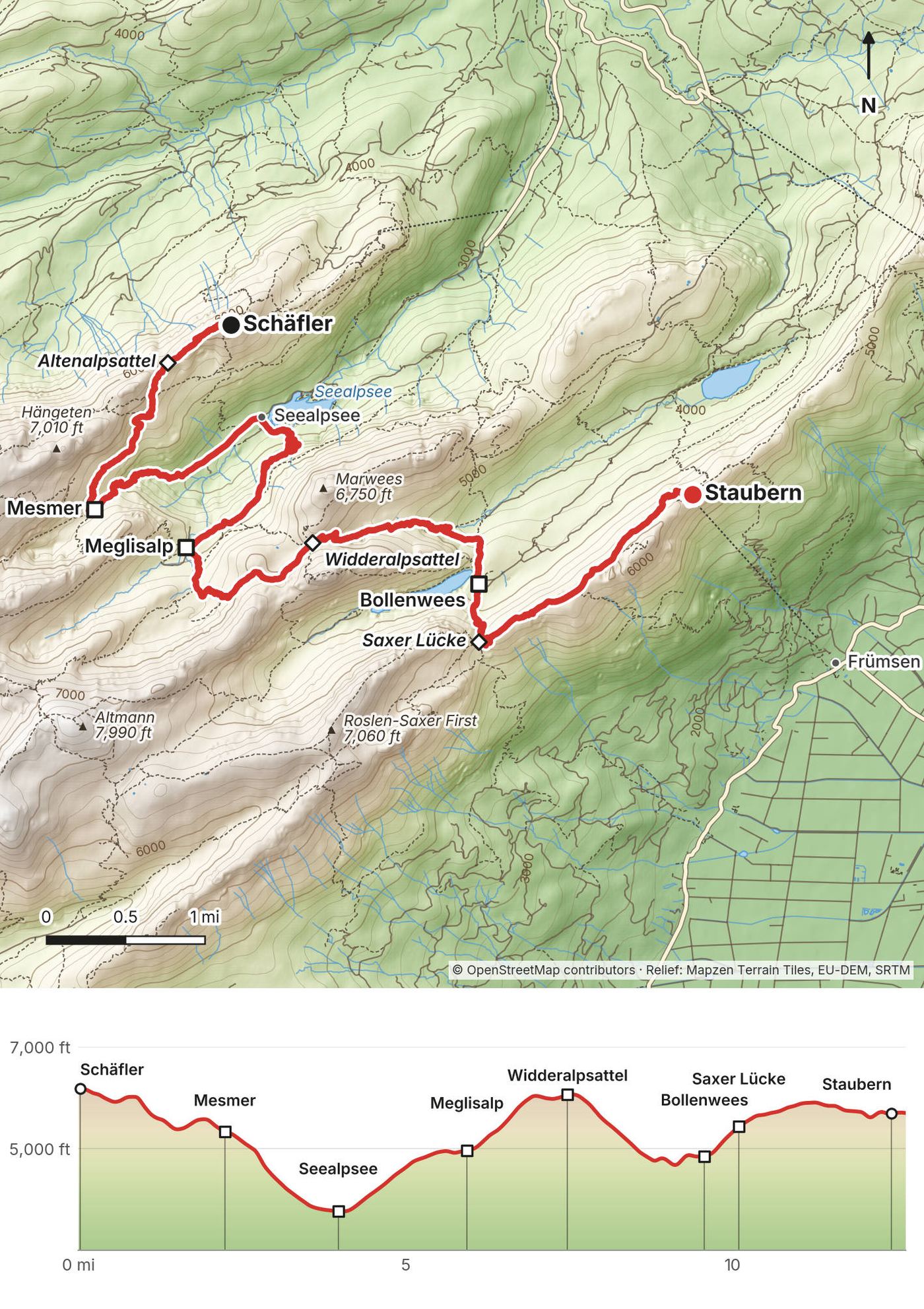
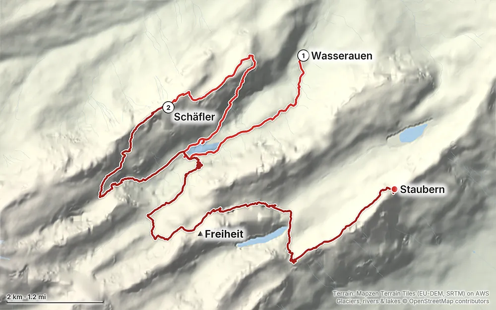
Elevation2,848–6,188 ft19.7 mi
Terrain: Mapzen Terrain Tiles (EU-DEM, SRTM) on AWS · Glaciers, rivers & lakes © OpenStreetMap contributors
Tap a map to open it full size.
Checked on the official pages of Appenzell tourism, the Swiss trail closures map, the cantons and the inns and cable cars on October 1, 2026.
Open. The official Swiss map of trail closures and diversions (Schweizer Wanderwege) shows nothing on this route. Appenzell tourism's trail report of October 1, 2026 says the mountain and hiking trails are in very good condition ("bestens präpariert"). The two notices in the area are off the route: a diversion on the far side of the Säntis while the Säntis cable car is closed for its renewal (May to late autumn 2026), and a logging closure below the Hoher Kasten.
Rockfall above the Seealpsee. In September 2026 rocks fell from an unstable face above the lake. A local news report of September 22 said warning signs are up, geologists are watching it, and no closure is planned for now. The reports didn't say which path is under it. Check the signs when you get to the lake.
The inns' new rest days. From 2026 the Berggasthaus Schäfler is closed on Tuesdays and Wednesdays in May and June and on Wednesdays from July to October. It calls 2026 a test season and will review it. Other inns on the way take no overnight guests on certain nights (see Huts and rules). Plan your days around them.
The cable cars in 2027. The Ebenalp cable car is getting a new line, ideally in 2030, built beside the old one so that it keeps running. Its 2027 timetable isn't published yet; in 2026 it was closed for maintenance from April 7 to 24 and from November 2 to December 24. The Hoher Kasten cable car is closed from March 1 to 24, 2027 for maintenance, then runs until November 2028, when it closes until its replacement opens, planned for summer 2029. The Staubern cable car is closed from January to March.
What to do. Before you plan dates, check each inn's own page for its season and rest days, and book. Look at the trail report on appenzell.ch and the closures layer on the SchweizMobil map the week before you go.
Mid-September, as I did. I went on September 18 and 19, 2024. A few days before, I went for a trail run to scout the area: a big snowstorm had dumped a ton of snow up high early for the season, so I was checking how safe it was and making sure the huts were still open. They were. There was still a lot of snow blocking the high trails, but it was only high up. Lower down it was beautiful, the green grass and the lake with snow-capped mountains above. MeteoSwiss called it a massive drop in temperature that brought locally exceptional amounts of snow to higher ground in the first half of September 2024.
The season. The trail along the ridge from the Hoher Kasten to the Saxer Lücke has its season from the end of June to October, according to the Hoher Kasten cable car; Switzerland's hiking federation gives June to October for its mountain tour from Wasserauen to the Säntis. Old snow can lie in the shade into early summer, and new snow can come in September, as it did for me.
Average temperatures (MeteoSwiss, 1991 to 2020, °F high / low). St. Gallen is in the lowlands north of the Alpstein, at 2,546 ft (776 m). The Säntis is the range's highest summit, at 8,209 ft (2,502 m). This route runs between 2,848 ft and 6,312 ft, so expect something in between.
| Month | St. Gallen | Säntis | Rain days on the Säntis |
|---|---|---|---|
| June | 68 / 53 | 44 / 36 | 16 |
| July | 71 / 56 | 49 / 39 | 17 |
| August | 70 / 56 | 49 / 40 | 16 |
| September | 62 / 50 | 43 / 34 | 13 |
| October | 54 / 43 | 39 / 30 | 12 |
Summer is the wettest season. In MeteoSwiss's figures, June to August bring the most rain and thunderstorms; September and October are drier, with fewer rain days, and in October the Säntis gets about 60% more sunshine than St. Gallen.
Daylight (2027, Appenzell). Mid-June: sunrise 5:25 a.m., sunset 9:20 p.m. Mid-September: 6:59 a.m. and 7:35 p.m. Mid-October: 7:40 a.m. and 6:35 p.m.
Emergencies. Call 1414 for Rega, the air rescue (it works from a foreign phone too), or 144 for an ambulance, 117 for the police; 112 works too. The Rega app sends your position with the alarm, but needs at least some phone signal. The federal coverage map predicts a signal along the whole route, but not in every gully; if you have none, move and try again, or try 112.
Falls. Every trail on the route is a white-red-white mountain trail: steep, narrow and partly exposed. Appenzell tourism warns that wet grass slopes and snowfields raise the risk of slipping and falling, and to expect rockfall anywhere in the mountains. A hiker died after a 70 m fall from the trail between the Aescher and the Seealpsee in June 2025. Wear proper boots, keep to the trail, and turn back in good time.
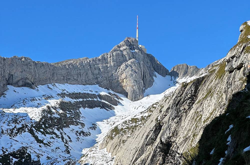
Snow. In MeteoSwiss's averages the Säntis has frost on 4 to 5 days in July and August and 12 days in September, and old snow can lie in the shade into early summer. In mid-September 2024 an early storm left snow on the high trails, and the route from Mesmer over the ridge was too snowy for me. Ask at the inns about the next stretch.
Thunderstorms. They're most common in summer and often build very suddenly. MeteoSwiss says to keep away from ridges when one is coming, and the Stauberen ridge and the Saxer Lücke are exactly that. When storms are forecast, plan to be off the ridges before they build.
Föhn. The warm, strong south wind blows down the Rhine valley, most often in spring. The Hoher Kasten warns that strong wind can change its departures.
Cows and dogs. Keep your distance from mother cows, and keep dogs on a lead.
Leave a plan with someone at home: your route, your inn and when you'll be out.
How many days do I need? I did it in two, with one night at the Schäfler. If you don't want to go back down to the Seealpsee as I did, you can do it in two shorter days, or spread it over three with a night at Bollenwees or Meglisalp. See Other ways to do it.
How hard is it? Day 2 is a big day: 12.6 miles and about 4,080 ft of climbing by my GPS, ten hours with my stops. Every trail on the route is a white-red-white mountain trail, which in Switzerland means steep, narrow and in places exposed, with cables on the hardest bits. You need to be sure-footed and not bothered by drops. Appenzell tourism rates its tours over the stretch from the Schäfler to Mesmer and over the Widderalpsattel T3, and the Saxer Lücke ridge T2.
Do I need a permit? No. You pay for the cable cars and book the inns.
Is there water on the trail? Running water is scarce up high (the Schäfler and the Aescher collect rain for theirs), but there's an inn every hour or two: at the Seealpsee, the Aescher, Ebenalp, the Schäfler, Mesmer, Meglisalp, Bollenwees and Staubern. Buy drinks and fill up there. See Where I slept, food and water.
When should I go? The high trails have their season from about the end of June to October; the inns are open from about May to the start of November. I went in mid-September, a few days after a big early snowstorm. See When to go.
Can I wild camp at the Saxer Lücke? I wanted to, and people were doing it, but no. Appenzell Innerrhoden's tourism office says wild camping isn't allowed in the Alpstein, the canton is drafting a law, and on the St. Gallen side the local town says it isn't wanted. Sleep in the inns. See Huts and rules.
Can I fly a drone? No. Drones have been banned in the Alpstein since November 1, 2020.
How do I get back from Staubern? The Staubern cable car goes down to Frümsen in the Rhine valley, and an hourly bus connects it to the trains. In 2026 the cable car ran until 10 p.m. from May to October, much later than the others. I got a lift from someone in my cabin back toward St. Gallen. See Getting there.
Can I bring my dog? Yes, on a lead during the alp season, and some inns don't take dogs overnight. Check before you book.
My original plan was to take a cable car up onto the ridge, hike along the spine, see the Saxer Lücke early on, and then make it up and over to the hut. It would have been a big day, but I'd planned on just making it a really big first day. The snow up high made it almost impossible, so I would have had to change my route regardless. In the official trail data, the ridge from the Hoher Kasten to Staubern and the Saxer Lücke is the Geologischer Wanderweg (T2, white-red-white). Its season is the end of June to October.
If the high trail is clear, you don't need to drop back to the Seealpsee. Appenzell tourism's high trail (rated difficult, T3) goes on from Mesmer over the Ageteplatte to Meglisalp, with safety ropes most of the way between Mesmer and the Ageteplatte. Ask at the Schäfler or Mesmer whether it's free of snow before you set out.
Day 1 to the Schäfler, Day 2 to Meglisalp or Bollenwees, Day 3 over the Saxer Lücke and along the ridge to Staubern or the Hoher Kasten. Bollenwees and Meglisalp both have dorms and rooms; check their rest days.
Appenzell tourism's tour of the Alpstein's mountain lakes goes from Wasserauen past the Seealpsee, Meglisalp, the Widderalpsattel, the Fälensee and the Sämtisersee to Brülisau: 11 miles (17.6 km), about 6 hours 45 minutes, rated T3.
Stay low: the Seealpsee from Wasserauen, or the Aescher and Ebenalp by cable car. On snow, think about where the shade is, as I learned on Day 2: there's going to be a lot more snow there.
These change every year. Everything else in this guide stays the same.
Is it open?
Getting there and back
Conditions
Your stuff
The film is at the top of this page.
Planning questions about Alpstein and the Saxer Lücke, answered only from this page's facts, the creators' versions and hikers' public tracks, with where each answer comes from. When the data doesn't say, the answer says "not given".
From hikers
Sign in to comment. Free; your hikes stay private unless you share them.
Something wrong or missing on this page? Send feedback.