
Content made there
The film is at the top of this page.
Photos
Hikes / San Juan Mountains / Kraig Adams's version
North America · United States
Jun 2020 · 2 days · about 35 miles · With friends · Tent

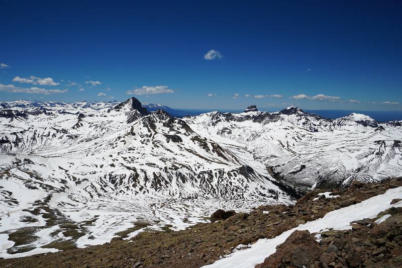
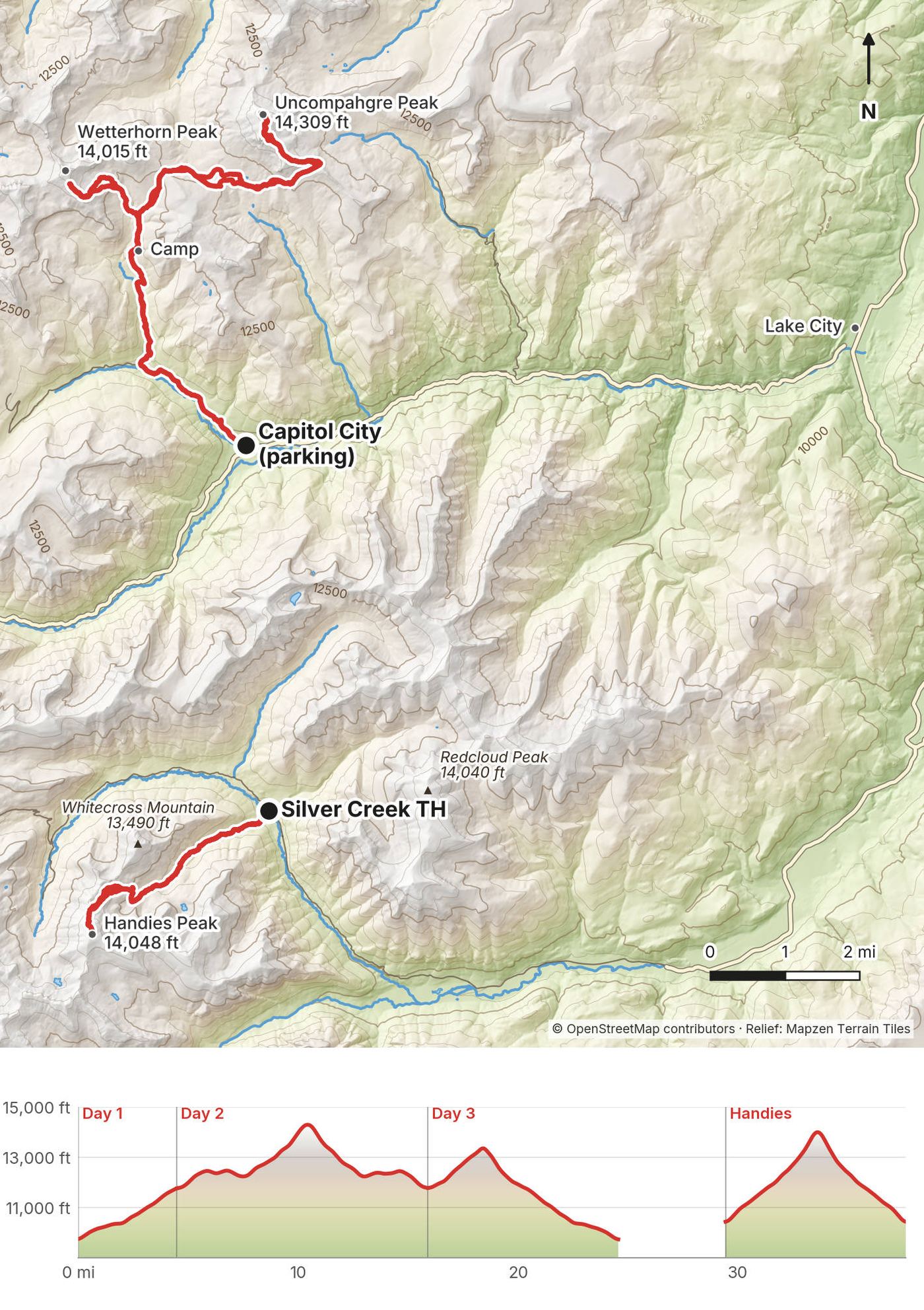
In June 2020 my younger brother Kurtis and I climbed Uncompahgre and Handies, and climbed toward Wetterhorn, in the San Juan Mountains above Lake City, Colorado. We parked at Capitol City on Henson Creek Road, walked up the North Fork in the evening to a snowy camp below Matterhorn Peak, climbed Uncompahgre Peak the next day, climbed toward Wetterhorn Peak the morning after, hiked out to the car, and that same evening drove around to the Cinnamon Pass road and climbed Handies Peak, coming down by headlamp. About 32.7 miles (52.7 km) and 10,650 ft of climbing in three days by my GPS. It's the trip from my film Hiking 35 miles in Colorado's San Juan Mountains.
It was early June in a snowy year. There was snow from our first camp up, I carried an ice axe, and we filtered our water from snowmelt streams.
| Quick facts | |
|---|---|
| Distance | 32.7 miles (52.7 km) over 3 days by my GPS, Handies included |
| Climbing | About 10,650 ft (3,250 m) up and 10,570 ft (3,220 m) down, by my GPS |
| Days | 3: a short evening walk in, a long summit day, then a morning on Wetterhorn, the hike out and Handies in the evening |
| Start and finish | Capitol City on Henson Creek Road, about 9,720 ft (2,960 m), 9 miles from Lake City; Handies from the Silver Creek / Grizzly Gulch trailhead, about 10,400 ft (3,175 m) |
| Direction | Out and back each time: Uncompahgre and Wetterhorn from Capitol City, Handies from its own trailhead |
| Summits | Uncompahgre Peak 14,309 ft, Wetterhorn Peak 14,015 ft, Handies Peak 14,048 ft (the USGS heights on the Forest Service and BLM pages) |
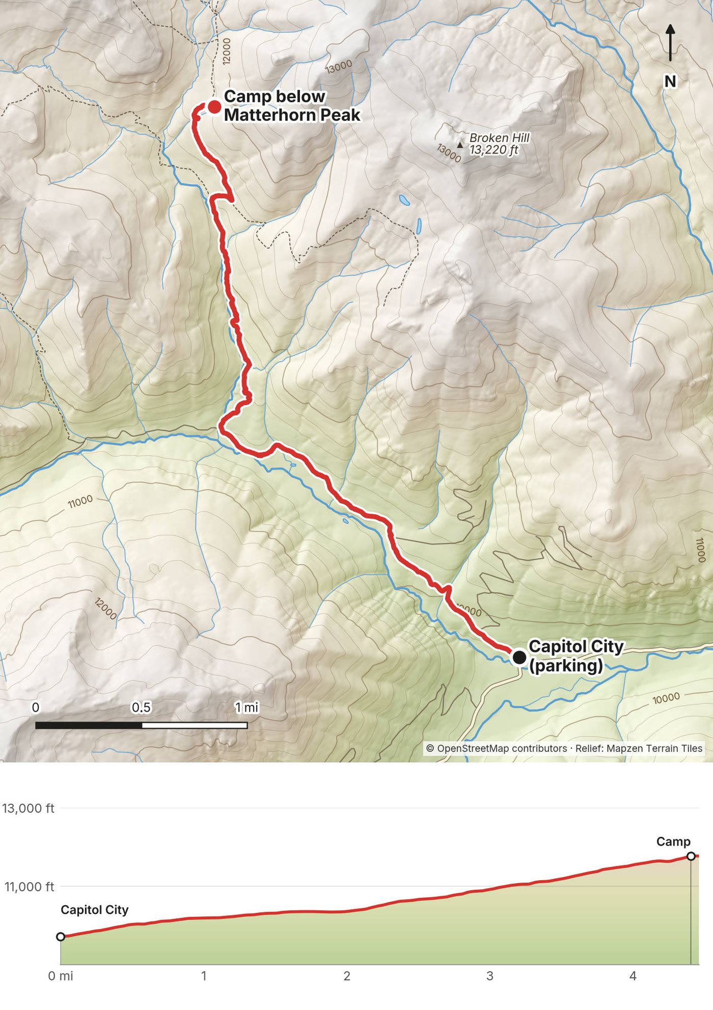
| Camp | In the trees below Matterhorn Peak, about 11,770 ft (3,590 m), 4.5 miles from Capitol City |
| Difficulty | Uncompahgre and Handies: class 2 hiking at high altitude. Wetterhorn: a class 3 scramble with exposure and loose rock. In June, snow on all three |
| Water | Snowmelt streams on the walk in, at camp and on the way up Uncompahgre. Treat it |
| Rules (2026) | No permit. Uncompahgre Wilderness rules: groups of 15 at most, camp 100 ft from trails and water, no fires above tree line, no drones |
| Day | Route | Miles (km) | Up / down (ft) | Sleep |
|---|---|---|---|---|
| 1 | Capitol City to camp below Matterhorn Peak | 4.5 (7.2) | 2,056 / 10 | Camp, about 11,770 ft |
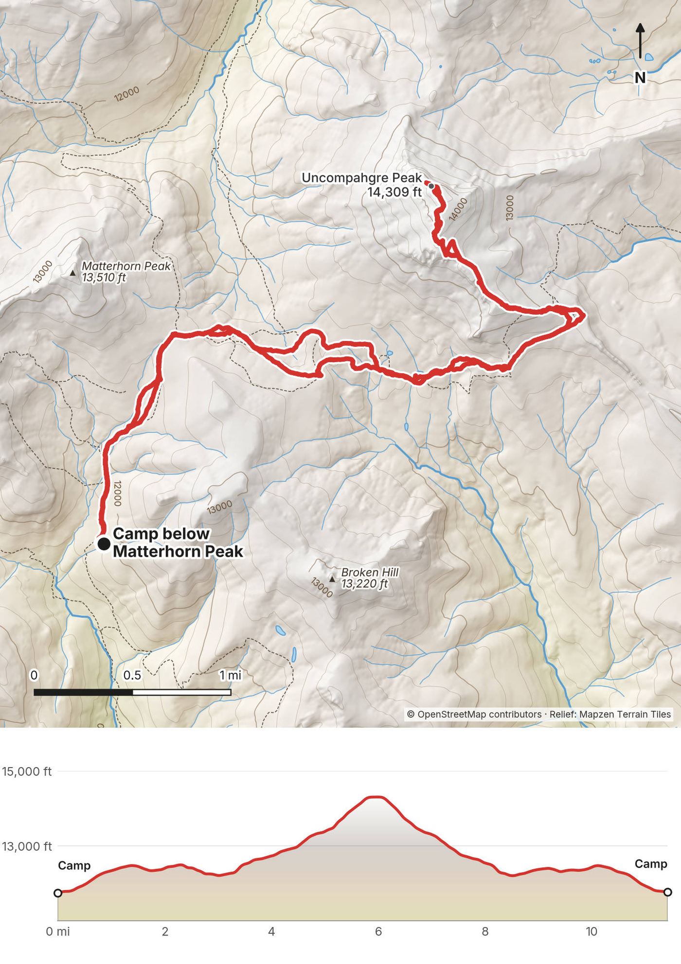
| 2 | Uncompahgre Peak from camp | 11.4 (18.4) | 3,300 / 3,265 | Camp, about 11,770 ft |
| 3 | Wetterhorn Peak from camp, then out to Capitol City | 8.7 (13.9) | 1,666 / 3,670 | |
| 3, evening | Handies Peak from Silver Creek / Grizzly Gulch | 8.2 (13.2) | 3,629 / 3,621 |
Lake City (about 8,670 ft) is the base for all three peaks. It's a small mountain town with a grocery store, gas, a gear shop and a medical center.
Flying in. The nearest airport is Gunnison (GUC), about 55 miles and an hour from Lake City; Montrose (MTJ) is about two hours. Both have rental cars. From Denver it's about 255 miles, about 5 hours, by US 285, US 50 over Monarch Pass, Gunnison and CO 149. From Durango, roughly 3.5 to 4 hours over Wolf Creek and Slumgullion passes. Don't let a map app send you over Cinnamon or Engineer Pass: those are 4WD roads.
To Capitol City (the walk in). From Lake City take Henson Creek Road (County Road 20, the Alpine Loop) west about 9 miles to the old Capitol City site, where North Henson Road (Forest Road 870) turns off. We parked there. Any car can get this far in summer.
Closer, with clearance. North Henson Road climbs about 2 miles to the Matterhorn Creek turn; AWD with good tires and clearance gets to the lower lot. The last 0.7 mile to the upper Matterhorn Creek trailhead, at about 10,720 ft, is steep and rocky: high-clearance 4WD only.
To Handies (Silver Creek / Grizzly Gulch trailhead). Drive about 2 miles south of Lake City on CO 149 and turn right on County Road 30, toward Lake San Cristobal and Cinnamon Pass. The trailhead is about 16 miles in, at about 10,400 ft. The road gets rough after about 12.5 miles, with a shelf section from about 13 to 14.5 miles; careful 2WD drivers usually make it in summer (as reported). It has toilets (as reported).
Renting a Jeep. Lake City outfitters rent Jeeps for about $245 to $295 a day (2026, as reported). Ask whether their contract allows the Matterhorn Creek spur.
I didn't keep a list of what this trip cost us.
For your budget (October 2026). A 4-day trip from Denver for two people, in your own car, comes to about $350, or about $175 each:
| Item | For two | Each |
|---|---|---|
| Gas, about 580 miles at 25 mpg and $4.30 a gallon | about $100 | about $50 |
| Two campground nights at about $20 | $40 | $20 |
| Food, 4 days | about $200 | about $100 |
| CORSAR cards (search and rescue fund), 1 year | $10 | $5 |
| Total | about $350 | about $175 |
Extras: a Jeep for a day, about $245 to $295; a motel night instead of camping, about $140 to $170; a bear canister if you don't have one. With a rental car and those extras it comes to about $430 each.
| Night | Where | Height |
|---|---|---|
| 1 | Our tents in the trees below Matterhorn Peak (Day 1 mile 4.5) | about 11,770 ft (3,590 m) |
| 2 | The same camp | about 11,770 ft (3,590 m) |
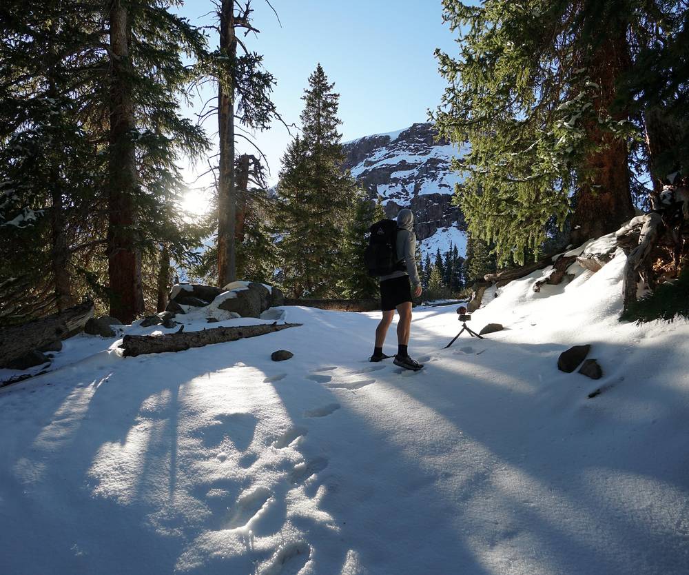
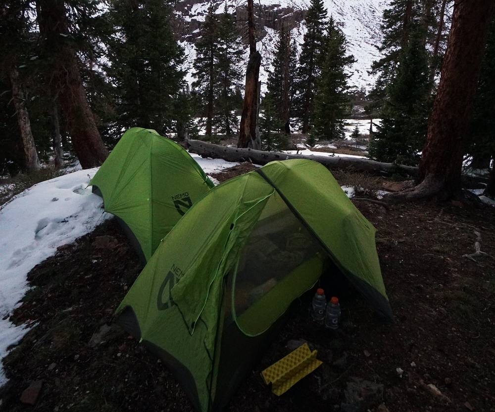
The camp. There are no named or designated campsites in the Matterhorn Creek basin. Camp in the trees, at least 100 ft from the trail and the creek, and never light a fire above tree line. In June we pitched our tents on snow.
Campgrounds near Lake City. Mill Creek (BLM) on County Road 30, about 14 miles from town, on the way to Handies: about $7 to $20 a night, June to September, some sites on Recreation.gov. Williams Creek (Forest Service) on the same road, about $20. Wupperman, on Lake San Cristobal, $15 (as reported). There's no developed campground on Henson Creek Road.
Food. We carried all our food: snacks on the trail and a hot dinner at camp. Buy everything in Lake City or before; there's nothing on the trail.
Water. In early June there was snowmelt everywhere: we filtered from a stream on the walk in and on the plateau below Uncompahgre. Treat all of it. Later in summer, fill up low and carry enough for the summit.
Paid links: I earn a commission if you buy through these links, at no extra cost to you. As an Amazon Associate I earn from qualifying purchases.
From my film and photos (I have no full gear list for this trip).
My current kit for what these peaks need.
 Traction: Yatta Life Ice Spikes (Amazon). In June, or any time snow is reported, with an ice axe and the skill to use them.
 Poles: Black Diamond Alpine Carbon Z Poles (Amazon). For the snow and the long descents.
 Rain shell: Arc’teryx Beta AR Jacket (Arc’teryx). It's windy on top.
 Warm layer: Arc’teryx Cerium Hoody (Arc’teryx). It's freezing at night.
 Hat: PATH Projects Hoyt Merino Beanie (PATH Projects)
 Gloves: Unigear Touchscreen Liner Gloves (Amazon)
 Sunglasses: Goodr OG Sunglasses (Amazon). The sun at 14,000 ft is strong, and it bounces off snow.
 Water: Katadyn BeFree AC · 1L (Amazon)
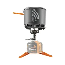 Stove: Jetboil Stash (Amazon). No fires above tree line.
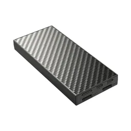 Power bank: Nitecore NB20000 (Amazon). A backup battery for the phone with your offline map.
What I filmed with in 2020. Drones are prohibited in Wilderness: see The rules.
 Camera: DJI Osmo Pocket 4 (Amazon)
 Mic: DJI Mic 3 · 1 TX + 1 RX (Amazon). It pairs with the Pocket 4.
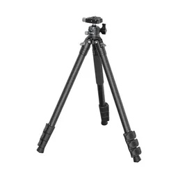 Tripod: SmallRig Carbon Fiber Tripod (Amazon)
We left the car at Capitol City at 5:31 p.m. and walked up the dirt road through the aspens with full packs. Kurtis and I carry almost the same gear. I carried two beers.
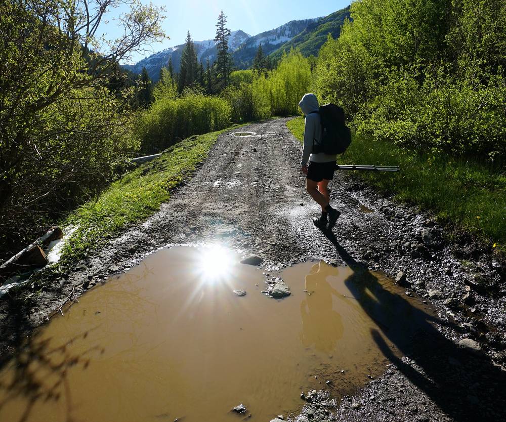
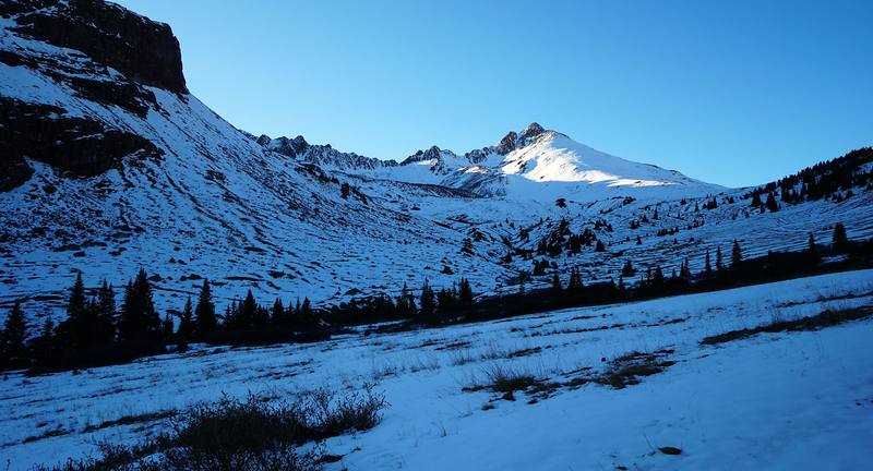
We passed the Matterhorn Creek trailhead sign at dusk and filtered water from a stream running through the snow. Above it the snow got deep. We found a spot in the trees and pitched our tents in the snow, hammering a stake in with a rock. We reached camp at 7:53 p.m., ate on a log, and I sorted my gear in the tent by headlamp.
Capitol City. The old town site at the North Henson Road turn, about 9,720 ft. Park off the road.
North Henson Road. The road climbs north up the North Fork of Henson Creek, about 2 miles to the turn for Matterhorn Creek, then 0.7 mile of steep, rocky road to the upper trailhead at about 10,720 ft.
Matterhorn Creek. From the trailhead the trail climbs north up Matterhorn Creek into the basin below Matterhorn Peak and Wetterhorn. The Forest Service calls this trail the Ridge Stock Driveway (Trail 233) for its first 2.4 miles, to where it meets the Matterhorn trail (Trail 135). We camped in the trees, about 4.5 miles from Capitol City by my GPS. Camp at least 100 ft from the trail and the creek.
It's a short road walk. If you start late or the snow is deep in the trees, camp lower, near the trailhead, and start earlier the next day.
Day 1, the walk in (from 0:00)
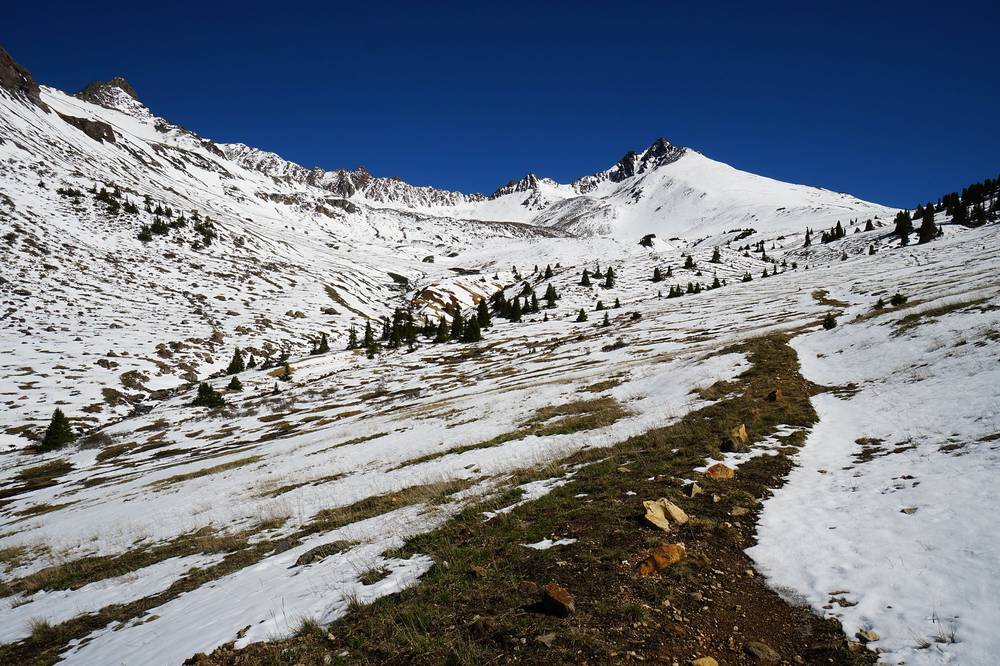
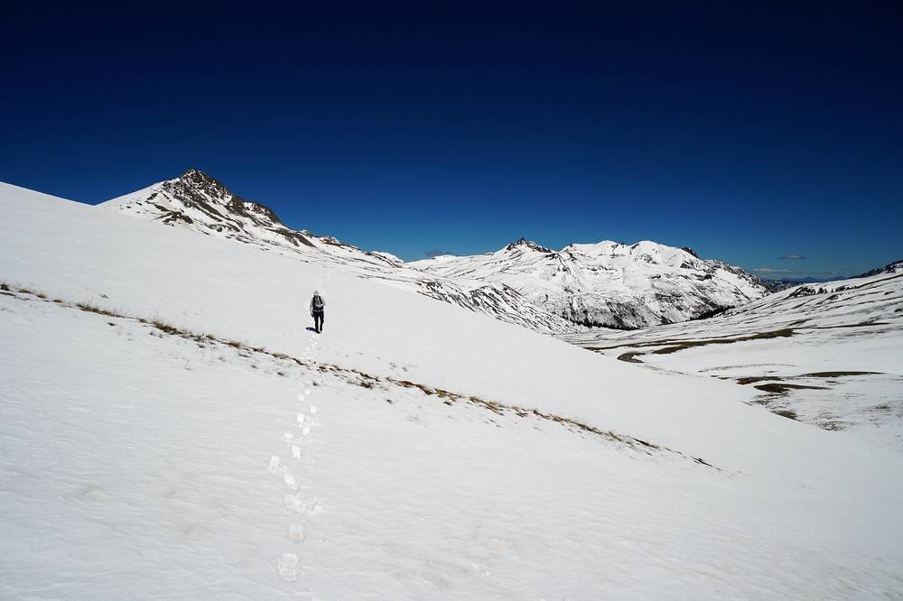
We had breakfast at the snowy camp and left at 9:28 a.m. The way east to Uncompahgre crossed snowfields and a wide, high plateau. I carried my ice axe. We put on sunscreen at a wooden trail sign and filtered water from a stream on the plateau.
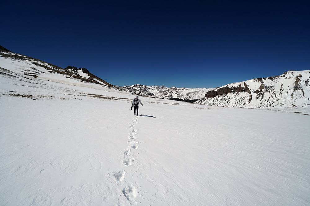
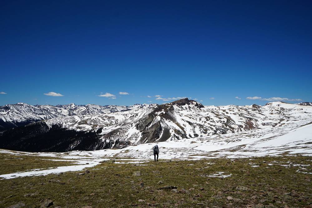
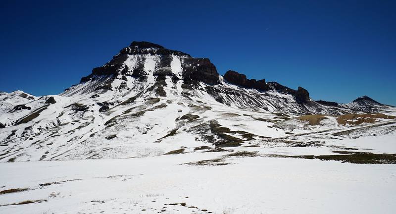
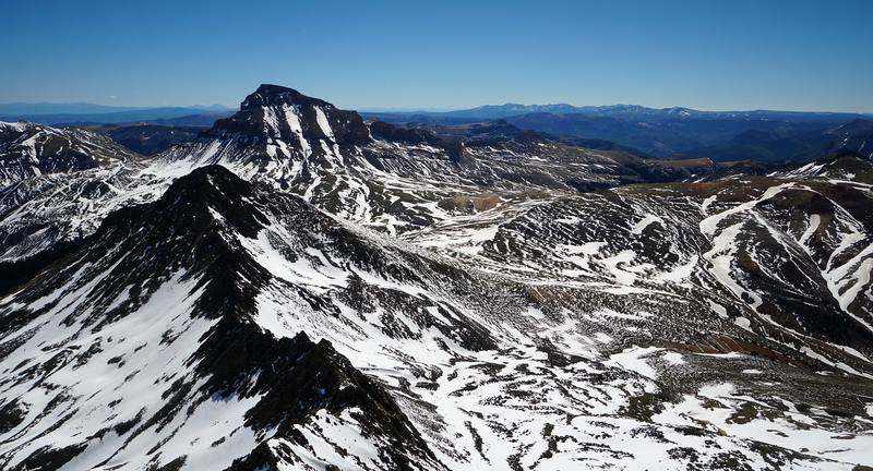
Higher up we walked a grassy ridge with patches of snow, then scrambled up the loose rock below the summit. We reached the top together at about 2:10 p.m., 5.9 miles from camp. The summit ridge is narrow, with big drops off its edge.
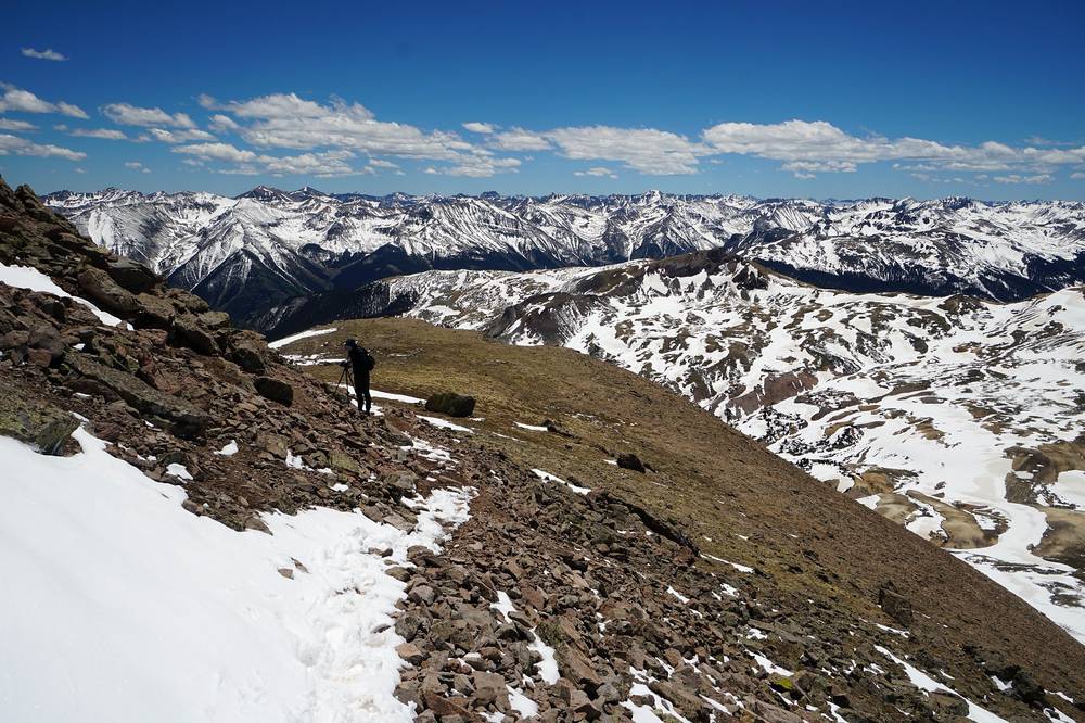
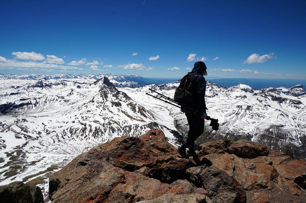
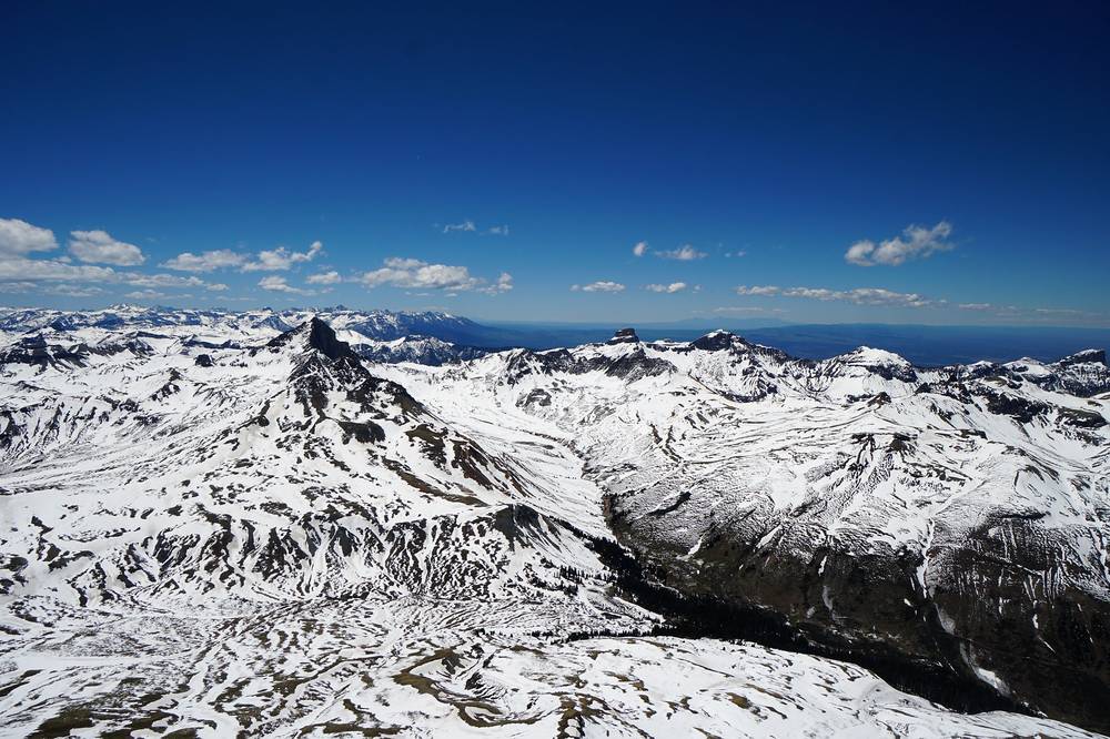
We were back at camp at 5:36 p.m. Dinner was cowboy beans and brown rice again.
Toward Uncompahgre. From camp the trail keeps climbing north out of the trees, past the turn for Wetterhorn. About 1.5 miles above camp, at about 12,450 ft, my track turns east across the high ground below Matterhorn Peak toward Uncompahgre.
The plateau. The track crosses open tundra, which held big snowfields when we were there, and joins the standard Uncompahgre trail (Trail 239) from Nellie Creek below the peak's south ridge.
The south ridge. The trail climbs the ridge to about 13,800 ft, where it crosses to the west side for about 150 ft of steep, loose rock, the hardest part (class 2, as reported), then reaches the broad summit at 14,309 ft. Watch for rocks knocked down by people above you.
The plateau is the place to decide. If clouds are building, turn around before the south ridge: there's no shelter for miles. In June, if the snow is hard and steep and you don't have an ice axe or traction, turn around.
I left camp at 8:53 a.m. for Wetterhorn. The trail was mud and snowmelt low down, then deep snow. A marmot watched me eat a snack from a few feet away, and I told it to get out of here. Higher up there's a steep snow slope and then a rock gully, "sketchy snow," as I put it in the film.
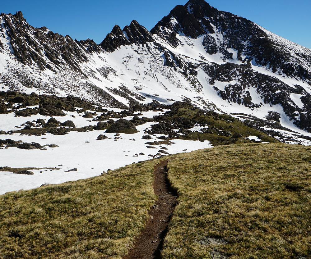
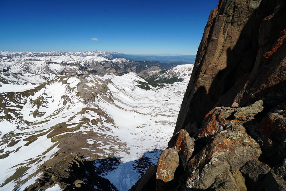
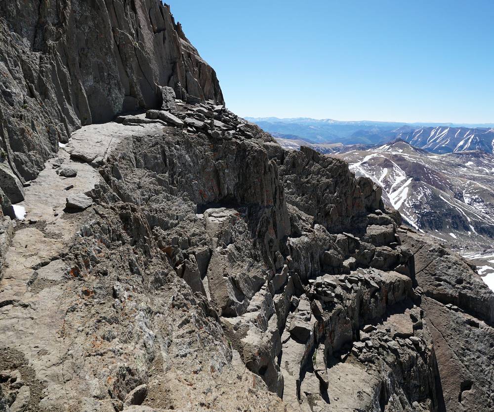
My GPS recording tops out at 13,460 ft, 2.5 miles from camp, about 550 ft below the summit. It stops there for about 15 minutes and then turns back toward camp. So the GPX file doesn't show the last part of the climb. The route description below is from current route descriptions, not my track. On the way down I slid down a snow slope on my backside, and I was back at camp at 11:48 a.m.
We packed up the tents and walked out from 12:06 p.m., down through the meadow and the aspens, and reached the car at Capitol City at 1:26 p.m.
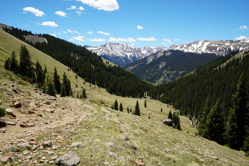
To the saddle (as reported). From the upper Matterhorn Creek trailhead the trail heads north about 0.75 mile to a junction near 11,200 ft. Turn right and keep climbing north out of the trees. Near 12,000 ft, about 0.6 mile above our camp by my GPS, turn left onto the Wetterhorn trail, then go north into rocky ground east of the peak and southwest to a saddle on the southeast ridge at about 13,100 ft.
The ridge and the Prow (as reported). Above the saddle: yellow dirt, a rock rib and a fin-shaped tower called the Prow. The final pitch is class 3, with a ledge to the summit block. The route has high exposure, loose rock and route-finding; a helmet is a good idea. In June, snow in the gully below the summit can turn the scramble into steep snow above a drop.
The hike out. Back down the Matterhorn Creek trail to the trailhead and down North Henson Road to Capitol City, 4.2 miles and about 2,000 ft down by my GPS.
The 13,100 ft saddle is the place to decide. If the gully above holds steep snow and you don't have an ice axe and the skill to use it, or there are storms building, or other people are above you knocking rocks down, go back down. The class 3 pitch is no place to be in a storm.
Wetterhorn Peak (from 6:27) · The hike out (from 8:19)
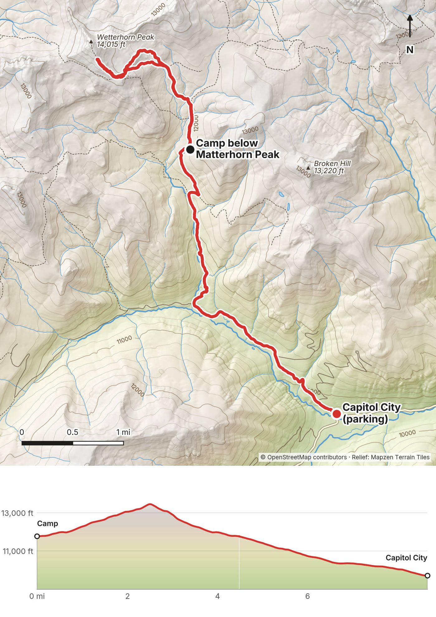
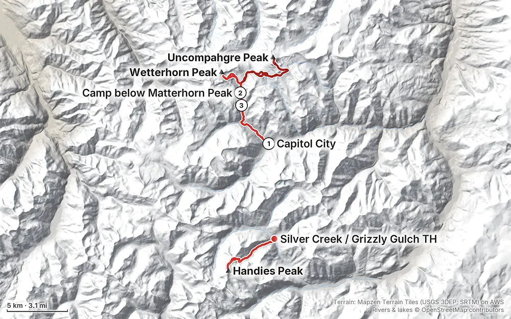
Elevation9,711–14,311 ft32.7 mi
Terrain: Mapzen Terrain Tiles (USGS 3DEP, SRTM) on AWS · Rivers & lakes © OpenStreetMap contributors
Tap a map to open it full size.
Checked on the Grand Mesa, Uncompahgre and Gunnison National Forests (GMUG) and BLM pages, West Slope Fire Info (the fire agencies' joint site) and local news, on October 3, 2026.
Open, after a fire summer. The Gold Mountain Fire (from June 27, 2026, near Ouray) and the Elk Fire (from July 9, 2026, northwest of Lake City) closed much of the Uncompahgre Wilderness. The Forest Service reopened Nellie Creek Road and the Uncompahgre Peak trail on July 29, and the Wetterhorn trailhead, trail and summit on August 24, while parts of the Ridge Stock Driveway, the trail that links the two peaks, stayed closed. Local news reported that the Forest Service lifted all the Elk Fire closures on September 15, 2026, and on October 4, 2026 the GMUG alerts page listed no Elk Fire closure. The Gold Mountain Fire closure (order v4.0, from September 15) still closes the Middle Fork, Cow Creek, Dexter Creek and Cutler Creek roads and trails on the west side of the wilderness, including the Middle Fork trail where the Matterhorn trail ends. That's off our route. Check the GMUG alerts page before you go. Burned slopes north of the route can drop trees and send debris down in storms.
Fire restrictions. The national forests lifted their Stage 1 fire restrictions on September 3, 2026. The BLM and Hinsdale County set their own, so check West Slope Fire Info for the Handies side too. Restrictions come back most summers; check West Slope Fire Info before you go. Above tree line you can't have a fire anyway.
The roads. Henson Creek Road to Capitol City is graded gravel. Reports from September 2026 say the North Fork road above Capitol City is rougher than in past years, with the last 0.7 mile to the Matterhorn Creek trailhead for high-clearance 4WD only. The Cinnamon Pass road to the Silver Creek trailhead for Handies was passable by careful 2WD cars in summer 2026 (as reported). The Alpine Loop passes usually close in October.
The Wilderness rules. A new Uncompahgre Wilderness order, GMUG-2026-06, runs from May 14, 2026 to May 2029. See The rules.
Checked on the Forest Service (GMUG) and BLM pages on October 3, 2026.
Where you are. Uncompahgre and Wetterhorn are in the Uncompahgre Wilderness (Uncompahgre National Forest). Handies is in the Handies Peak Wilderness Study Area, managed by the BLM; at 14,048 ft it's the highest point on BLM land outside Alaska.
The Uncompahgre Wilderness order (GMUG-2026-06, May 14, 2026 to May 2029). Groups of 15 people at most. No camping within 100 ft of a trail or of any lake or stream. No campfires within 100 ft of a trail or water, or anywhere above tree line. Dogs on a leash or under direct voice control. No bikes or carts. No caching gear. Don't cut switchbacks.
Drones. Recreational drones are prohibited in Wilderness (Forest Service).
Food. The forest's food-storage order (March 1 to November 30) applies in developed campgrounds and numbered campsites. In the backcountry, use a bear canister or hang your food: there are black bears here, and above tree line there's nothing to hang from.
Near the old mines (BLM, from January 2025). No camping or campfires within 150 ft of a historic structure, such as an old cabin or mine building, on the BLM land around the Alpine Loop.
Waste. Pack out all trash. The BLM has piloted a waste-bag station at American Basin because of human waste near Handies; bring a trowel, and above tree line pack it out.
Early June. We hiked June 9 to 11, 2020. There was deep snow in the trees at our camp, snowfields all the way up Uncompahgre, a steep snow gully on Wetterhorn and snow patches on Handies. The days were clear and calm, with wind on top of Handies. How much snow there is in June changes a lot from year to year: in 2026, reports had Wetterhorn almost free of snow by mid-June (as reported).
The usual season. July to September, when the trails are mostly dry and the roads are open.
Storms. The summer monsoon usually starts around the second week of July and ends by late August (National Weather Service, Grand Junction). Storms are most likely from about noon to 3 p.m. Uncompahgre's summit plateau and Wetterhorn's ridge are long, exposed stretches with slow ways down.
Fall. The aspens near Lake City usually turn about September 18 to 28, and the tundra goes red from early September. The first snow on the high peaks can come in late September.
Temperatures. Expect freezing or near-freezing nights at a camp around 11,000 to 12,000 ft in June and September, and cold wind on the summits even on a warm day.
Emergencies. Call 911. Hinsdale County Sheriff: (970) 944-2291. There's no signal on most of the route, so a satellite messenger is your link out. The sheriff warns that help takes at least as long to reach you as it took you to walk in, probably longer, and that self-rescue may be your only option. Leave your route and dates with someone at home.
CORSAR card. Colorado's search and rescue card costs $5 a year or $20 for five years (Colorado Parks and Wildlife). It pays the rescue teams back; it isn't insurance.
Lightning. The biggest risk in July and August. Start before dawn and be off the summits by noon. If you hear thunder, get off the ridge and away from high points. Two hikers were killed by lightning on other Colorado fourteeners in July 2026 (as reported).
Snow. In June, snow can cover the trails above the trees and fill Wetterhorn's gully. Hard morning snow on a steep slope is dangerous without an ice axe and traction. Soft afternoon snow is slow and wet. Glissade only on slopes with a safe runout, and never with crampons on.
Rockfall. Both Uncompahgre's upper scramble and Wetterhorn's ridge have loose rock. Wear a helmet on Wetterhorn, don't climb below other people, and watch your feet.
Altitude. You sleep at about 11,800 ft and climb to over 14,000 ft. Spend a night or two in Lake City or higher first. Headache, nausea, dizziness or breathlessness at rest are warning signs: go down.
Burn scars. After the 2026 fires, burned slopes can drop trees and send mud and debris down in heavy rain. Check the Forest Service's notes on the burned areas before you go.
Do I need a permit? No. I found no permit, quota or trailhead fee for Uncompahgre, Wetterhorn or Handies in 2026.
How hard is it? Uncompahgre and Handies are long, steady climbs to over 14,000 ft, class 2 near the top. Wetterhorn is harder: a class 3 scramble on a ridge with exposure and loose rock, where a helmet makes sense. In June, snow can turn any of them into a snow climb. We did it in early June in a snowy year, with an ice axe.
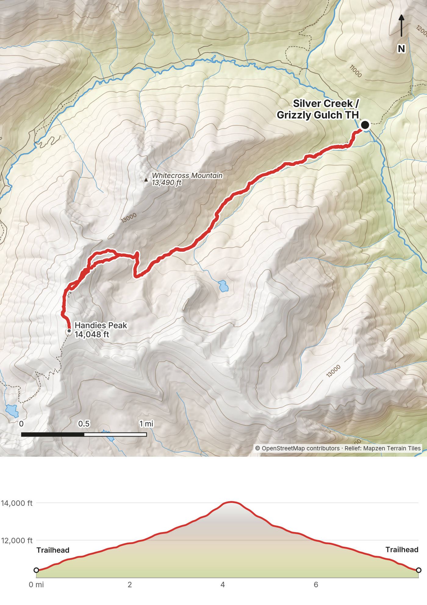
How far is it? 32.7 miles (52.7 km) by my GPS, Handies included: 4.5 miles in, 11.4 for Uncompahgre, 4.5 for Wetterhorn from camp, 4.2 out and 8.2 for Handies. The film's title and description say 35.
Do I need a 4WD? No. We parked at Capitol City, where any car can get in summer, and walked the rest. A high-clearance 4WD can drive the 2.7 miles of rough road to the upper Matterhorn Creek trailhead and save you most of the walk in. For Handies from Silver Creek, a careful 2WD car can usually make it (as reported).
Is there water? Yes, in early summer: snowmelt streams on the walk in, near camp and on the high plateau below Uncompahgre. Treat all of it. Later in the season the higher streams may dry up; carry enough for the summit.
Can I do them as day hikes? Yes. Most people climb Uncompahgre from Nellie Creek and Wetterhorn from the upper Matterhorn Creek trailhead in a day each. See Other ways to do it.
Can I fly a drone? Not on Uncompahgre or Wetterhorn. The Forest Service says recreational drones are prohibited in Wilderness. Handies is in a BLM Wilderness Study Area, managed to keep it wild, and we found no rule that allows them there: don't plan on flying.
Can I bring my dog? Yes, on a leash or under direct voice control (the 2026 Wilderness order). Wetterhorn's scramble is no place for most dogs.
Is there a phone signal? In Lake City. Mostly not on Henson Creek Road, the North Fork or the Cinnamon Pass road. Carry a satellite messenger.
What about lightning? In July and August storms build over the peaks almost every day, often by late morning. We summited Uncompahgre at about 2:10 p.m. and Handies at 7:30 p.m. in early June, before the storm season; in July and August, start before dawn and be off the summits by noon.
The standard route, and the shortest: from the Nellie Creek trailhead at about 11,400 ft, 7.5 miles round trip and about 3,000 ft of climbing (as reported). Nellie Creek Road leaves Henson Creek Road about 5 miles from Lake City and climbs 4 rough miles with stream crossings: 4WD. Without 4WD, park on Henson Creek Road and walk the road too: about 15.5 miles and 5,500 ft.
From the upper Matterhorn Creek trailhead: about 7 miles round trip and 3,300 ft, class 3 (as reported). Start at first light to be off the ridge by noon.
From the Matterhorn Creek trailhead by the Ridge Stock Driveway: about 17 miles and 6,400 ft (as reported). A very long day; camping in the basin, as we did, splits it.
The easier side: class 1, about 5.75 miles round trip and 2,500 ft from the upper American Basin trailhead at about 11,600 ft, or 7.75 miles and 2,800 ft from the lower parking (as reported). American Basin is about 21 miles up County Road 30; the last part needs 4WD or AWD. The lot fills on summer weekends (as reported).
Two more fourteeners from the same Silver Creek trailhead as Handies, up the Silver Creek trail on the other side of the road. Redcloud alone is about 9 miles round trip and 3,700 ft, class 2 (as reported).
After the hike out we stopped at a restaurant for a beer. "Cheers, brother." Then we drove around to the Cinnamon Pass road and started up Handies at 4:57 p.m.
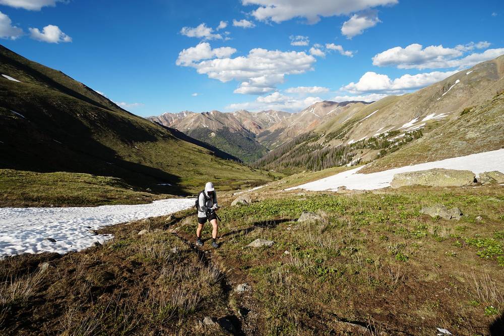
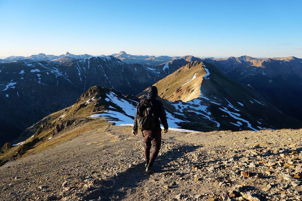
The trail climbed a grassy valley beside a stream, past snow patches, to a short rocky section and a narrow ridge. We were on the summit at about 7:30 p.m., in warm evening light, and put our jackets on in the wind. We came down at sunset and walked the last stretch in the dark by headlamp, back at the car at 9:34 p.m.
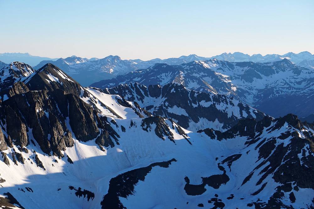
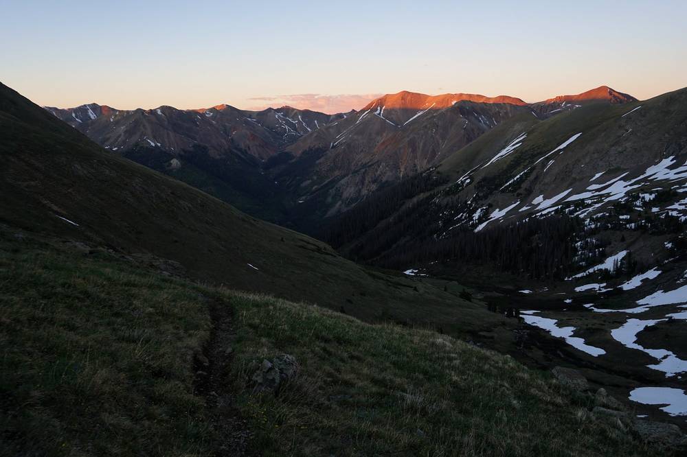
Grizzly Gulch. From the trailhead on County Road 30, cross the Lake Fork on the footbridge and follow the Grizzly Gulch trail southwest up the gulch through the trees into open meadows, crossing the stream once or twice (as reported).
To the north ridge. Above about 12,300 ft the trail swings north, then climbs southwest to Handies' north ridge at about 13,600 ft and follows it south to the summit, 4.2 miles from the trailhead by my GPS. Class 2, with a short rocky section near the top.
The top of Grizzly Gulch, where you leave the meadows for the ridge. If storms are building, go down. We started at 5 p.m. in early June; in July and August, start early in the morning instead.
Lake City (about 8,670 ft) is the town at the start of Henson Creek Road and the Cinnamon Pass road, and the place to sleep the night before, buy food and gas, and check the roads.
Lake San Cristobal, just south of town on the road to Handies, has a county campground, Wupperman.
These change every year. Everything else in this guide stays the same.
Is it open?
Getting there
Your stuff
The film is at the top of this page.
Planning questions about San Juan Mountains, answered only from this page's facts, the creators' versions and hikers' public tracks, with where each answer comes from. When the data doesn't say, the answer says "not given".
From hikers
Sign in to comment. Free; your hikes stay private unless you share them.
Something wrong or missing on this page? Send feedback.