
Content made there

Photos
Hikes / Picos de Europa / Kraig Adams's version
Europe · Spain
Oct 2–8, 2019 · 7 days · about 90 miles · Solo · Huts and tent

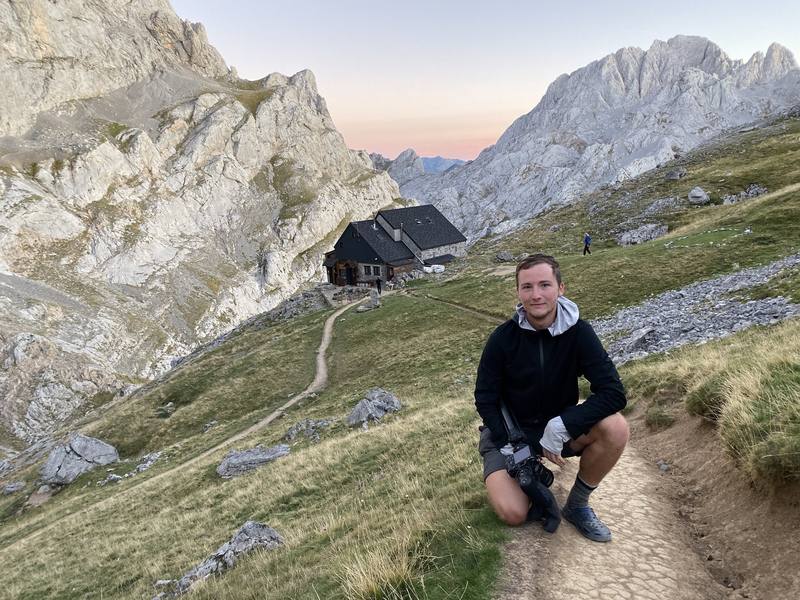
In early October 2019 I hiked alone for seven days through the Picos de Europa National Park in northern Spain: about 90 miles through limestone peaks, deep river gorges, quiet mountain villages and high pastures. I didn't know much about the area before I showed up. A friend planned the trip and convinced me to come, then got hurt on the first morning, so I did it by myself. It was a very difficult trail, but I loved it. In 2020 I called it my favorite hike to that day, and the film is the one I go back and watch by myself.
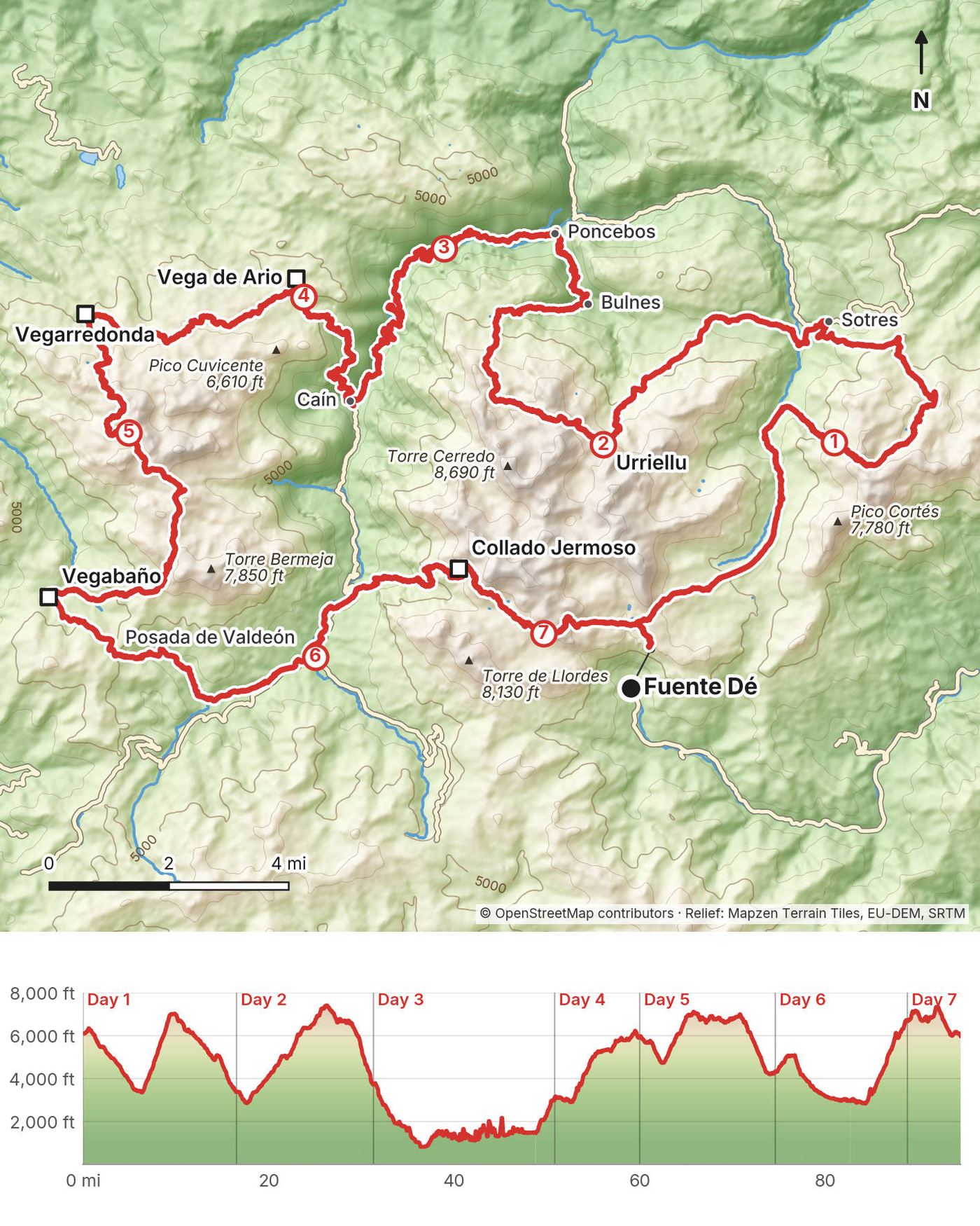
My loop starts and ends at the top of the Fuente Dé cable car and goes counter-clockwise: Sotres, the Naranjo de Bulnes, Bulnes, the Cares gorge, Caín, Vega de Ario, Vegarredonda, Vegabaño, Posada de Valdeón and Collado Jermoso. You pass three towns and plenty of refuges. I slept in a hostel, two refuges and my tent, and I had no reservations anywhere. This guide shows exactly what I did, including the parts I wouldn't repeat, and what the park allows now.
| Quick facts | |
|---|---|
| Distance | 94.6 miles (152.2 km) by my GPS over 7 days, about 90 miles on the ground (my GPS zigzagged in the Cares gorge on Day 3) |
| Climbing | about 31,600 ft (9,640 m) up and 31,900 ft (9,720 m) down by my GPS, a few thousand feet less in reality (Day 3 again) |
| Days | 7 walking days, a loop |
| Start and finish | The top station of the Fuente Dé cable car, Cantabria |
| Nights on the way | 6: a hostel in Sotres, three camps, the Refugio de Vegabaño and the Refugio Collado Jermoso |
| High point | Horcada Arenera, 7,460 ft (2,273 m), near the Naranjo de Bulnes on Day 2 |
| Low point | Poncebos, 850 ft (259 m), at the start of the Cares gorge on Day 3 |
| When | Summer and early autumn. I went in early October, at the end of the season |
| Difficulty | In my words: a very difficult trail, even though you pass three towns and plenty of refuges |
| Airports | Asturias or Santander are closest. I flew into Madrid |
| Trip date | October 2 to 8, 2019, solo |
| Day | Route | Miles (km) | Up / down (ft) | Sleep |
|---|---|---|---|---|
| 1 | Fuente Dé to Sotres | 16.5 (26.6) | 4,250 / 6,960 | Hostel, Sotres |
| 2 | Sotres to Cantu Collugos | 14.7 (23.7) | 4,950 / 4,600 | Camp |
| 3 | Cantu Collugos to Caín | 19.5 (31.4)* | 8,200 / 8,950* | Camp above Caín |
| 4 | Caín to Pico Conjurtao | 9.2 (14.8) | 3,900 / 1,040 | Camp |
| 5 | Pico Conjurtao to Vegabaño | 14.6 (23.5) | 3,550 / 5,230 | Refugio de Vegabaño |
| 6 | Vegabaño to Collado Jermoso | 14.2 (22.9) | 5,280 / 2,930 | Refugio Collado Jermoso |
| 7 | Collado Jermoso to Fuente Dé | 5.8 (9.3) | 1,500 / 2,180 |
*Day 3 as my GPS logged it. On the ground it's closer to 15 miles (24 km) and 3,000 ft (900 m) of climbing: see Day 3.
The numbers come from my own GPS recordings, smoothed the same way for every day. The chapter titles in my film add up to 97 miles; the recordings say 94.6.
I flew into Madrid. My friend rented a car, picked me up at the airport and drove us all the way up. It's a pretty quick drive. I remember at one point being able to see the peaks, and it was really exciting because they were much higher than I expected. We arrived pretty late and ate in Potes or on the way. Spain's timing for lunch and dinner takes some getting used to, so do your own research. We camped at Camping El Redondo, right by the cable car at Fuente Dé. It was cheap and a fantastic choice, because the trail starts right there.
Fly. Asturias Airport (OVD) and Santander Airport (SDR) are the closest. The Cabrales council gives about 1 hour 20 minutes by road from Santander and 1 hour 45 minutes from Asturias to Cabrales, on the north side of the park. Madrid is about 5 hours' drive, roughly 430 to 450 km (check a route planner).
To Fuente Dé by bus. Autobuses Palomera runs Santander to Potes (about 2 hours 15 minutes), and in summer on to Fuente Dé; in winter it stops at Potes. I couldn't confirm the 2026 timetable or the dates of the Fuente Dé extension. The Potes tourist office can help.
Camping El Redondo. The campsite is about 5 minutes' walk from the valley station of the cable car. Listings give a season of June 1 to about October 1 and the phone +34 942 736 699 (2026, not confirmed by the campsite).
The cable car. The Teleférico de Fuente Dé, run by Cantur, climbs about 2,450 ft (750 m) from the valley to the top station, 5,980 ft (1,823 m), where my loop starts. 2026 adult prices: EUR 13 one way and EUR 20 return in low season (which includes October), EUR 17 and EUR 30 in high season (July to September, Easter week, and national holidays and long weekends such as October 12). It's closed December 24, 25 and 31 and January 1 and 6. From September 14 to October 18, 2026, it ran 10:00 to 18:00 on weekdays and 9:00 to 18:00 at weekends, then until 17:00. It stops for wind and maintenance. As of November 2026, the operator says it closes on November 16 for improvement work, for a few weeks, with no reopening date announced yet; check the website before you plan a start or finish there. Online tickets must be bought at least a day ahead (telefericodefuentede.com). Summer queues can be long. A full refurbishment is planned from 2028.
Starting on the north side instead. It's a loop, so you can start in Sotres, Poncebos or Caín. From Asturias, ALSA buses run from Oviedo to Cangas de Onís and Arenas de Cabrales, and in summer a shuttle runs from Arenas to Poncebos and on to Sotres (June 1 to October 12, 2026: EUR 3 return to Poncebos, EUR 5 to Sotres).
My records for this trip are thin: two receipts and what I said in the film.
| Item | What I paid |
|---|---|
| Flight to Madrid | Not in my records |
| Car from Madrid | My friend drove |
| Camping El Redondo, the night before | Cheap; the price isn't in my records |
| Fuente Dé cable car, Oct 2 2019 | EUR 34 by card (the receipt doesn't say how many tickets) |
| Hostel in Sotres | Very cheap; I don't remember how much |
| Refugio de Vegabaño, Refugio Collado Jermoso | Not in my records |
| Food and drinks on the way | Not in my records |
| Hotel in Santander after the hike, single room | EUR 47 |
A refuge night with dinner and breakfast is about EUR 38 to 42 for a member and about EUR 47 for a non-member (Vega de Ario, Urriellu and Collado Jermoso, 2026). The refuge version above has five refuge nights, so budget about EUR 250 for those, plus three village nights (prices vary; check), picnic lunches at EUR 10 to 14, drinks, the cable car (EUR 13 one way in low season, EUR 17 in high season) and the funicular if you take it (EUR 17.61). A mountain federation card with insurance can pay for itself in member rates.
I wild camped on Days 2, 3 and 4. Am I allowed to wild camp like this? Probably not. I set up in the dark and packed up at first light, but don't copy me: the rules are clearer and stricter now.
The park's new management plans (in force in Asturias from April 20, 2026, and adopted by Castilla y León and Cantabria too) allow a bivouac only without a tent, only above 1,800 m (5,900 ft), and for at most three nights. In bad weather, still above 1,800 m, you may pitch a tent from an hour before sunset to an hour after sunrise. Free camping is not allowed anywhere in the park, and you can't camp around the refuges. The park's own visitor page still shows the older 1,600 m rule, so check it before you go.
My camps below Cantu Collugos (3,750 ft, 1,142 m) and above Caín (3,025 ft, 922 m) were well below 1,800 m, in a tent. My Day 4 camp near Pico Conjurtao was just above 1,800 m, but I used a tent. None of them fits the rules now.
A staffed refuge (refugio) has bunk rooms, dinner, breakfast, drinks and a picnic lunch to buy. They lend you flip-flops or Crocs for inside, and a sleeping-bag liner is compulsory in every refuge in the park (Vega de Ario hires them for EUR 5, 2026). Prices have a member rate (for mountain federation cardholders) and a non-member rate. Most refuges on this loop book through reservarefugios.com; Terenosa and Casetón de Ándara book by phone. There's a trade-off between tent camping and refuges. At Vega de Ario, in hindsight, a night in the refuge would have been pleasant.
The refuges and villages, with 2026 details, are in The refuges and villages.
Sotres, Bulnes, Caín and Posada de Valdeón all have places to sleep and eat. My hostel in Sotres was open and completely empty in October 2019, and very cheap.
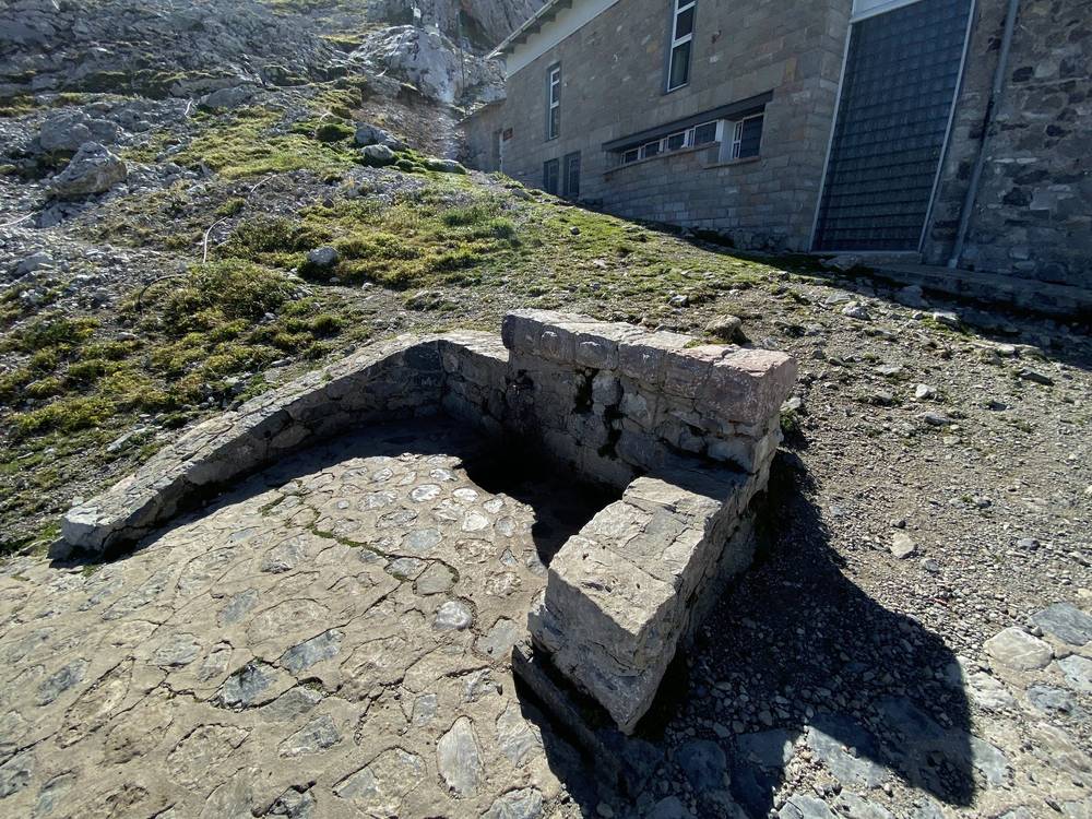
2026 details from each refuge's own site or its mountain federation, per person. "Member" is the rate for mountain federation cardholders; from 2026 all FEDME licence holders get it. My notes are what I said on the trip; where there's no note, I didn't say anything about it. No refuge page says whether it takes cards, so carry cash.
Refugio Casetón de Ándara (Day 1). 5,660 ft (1,725 m), Cantabrian federation. 18 places. Staffed June 1 to October 15, weekends outside that (federation page); another listing says Easter to October 19. Caretaker +34 635 425 228; phone coverage is poor, so WhatsApp is suggested. Bed EUR 12 member, EUR 15 non-member (year not stated). Book by phone. When I passed in October 2019 there was nobody there.
Refugio de la Terenosa (Day 2). 4,270 ft (1,300 m). 20 places. Staffed April 1 to October 31; a bunk room stays open when it isn't. +34 630 552 016, bookings by phone only. Prices not published.
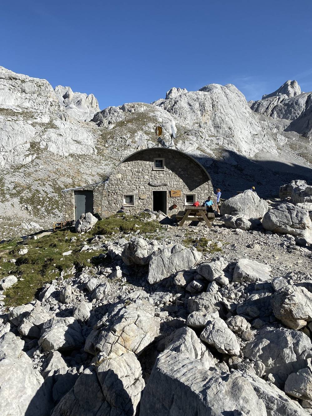
Refugio de Urriellu (Day 2). About 6,430 ft (1,960 m), under the Naranjo de Bulnes. 64 places. Staffed March 15 to December 15, with a winter room the rest of the year. +34 650 780 381 or +34 984 090 981, refugiodeurriellu.com. Bed EUR 15 member, EUR 20 non-member; breakfast EUR 8; dinner EUR 19 (current in September 2026, year not stated). Book at reservarefugios.com. There were people there, everything was in Spanish, and I think it was cash only.
Refugio Jou de los Cabrones (Day 2). 6,670 ft (2,034 m). 16 to 18 places. Staffed May to October. +34 673 570 548. Prices not published where I could read them. Book at reservarefugios.com.
Refugio Vega de Ario (Day 4). About 5,350 ft (1,630 m). 35 beds in two dorms, and a small winter room. Staffed May to October. +34 984 092 000 or +34 656 843 095, refugiovegadeario.es. 2026: bed EUR 15 member, EUR 20 non-member; breakfast EUR 8; dinner EUR 19; picnic EUR 10; half board EUR 42 member, EUR 47 non-member. Liner compulsory (hire EUR 5). Check-in from 18:00. No mobile coverage. Book at reservarefugios.com only. This place rules. I totally could have slept there.
Refugio de Vegarredonda (Day 5). About 4,800 to 5,090 ft (1,460 to 1,550 m). 45 to 63 places (sources differ). Open May to October (its own site). +34 985 922 952 or +34 626 343 366, refugiovegarredonda.com. A search summary gives 2026 prices of EUR 20 for a bed, EUR 8 breakfast and EUR 19 dinner; I couldn't confirm them on the refuge's site. Book at reservarefugios.com. I went out of my way to get a coffee there.
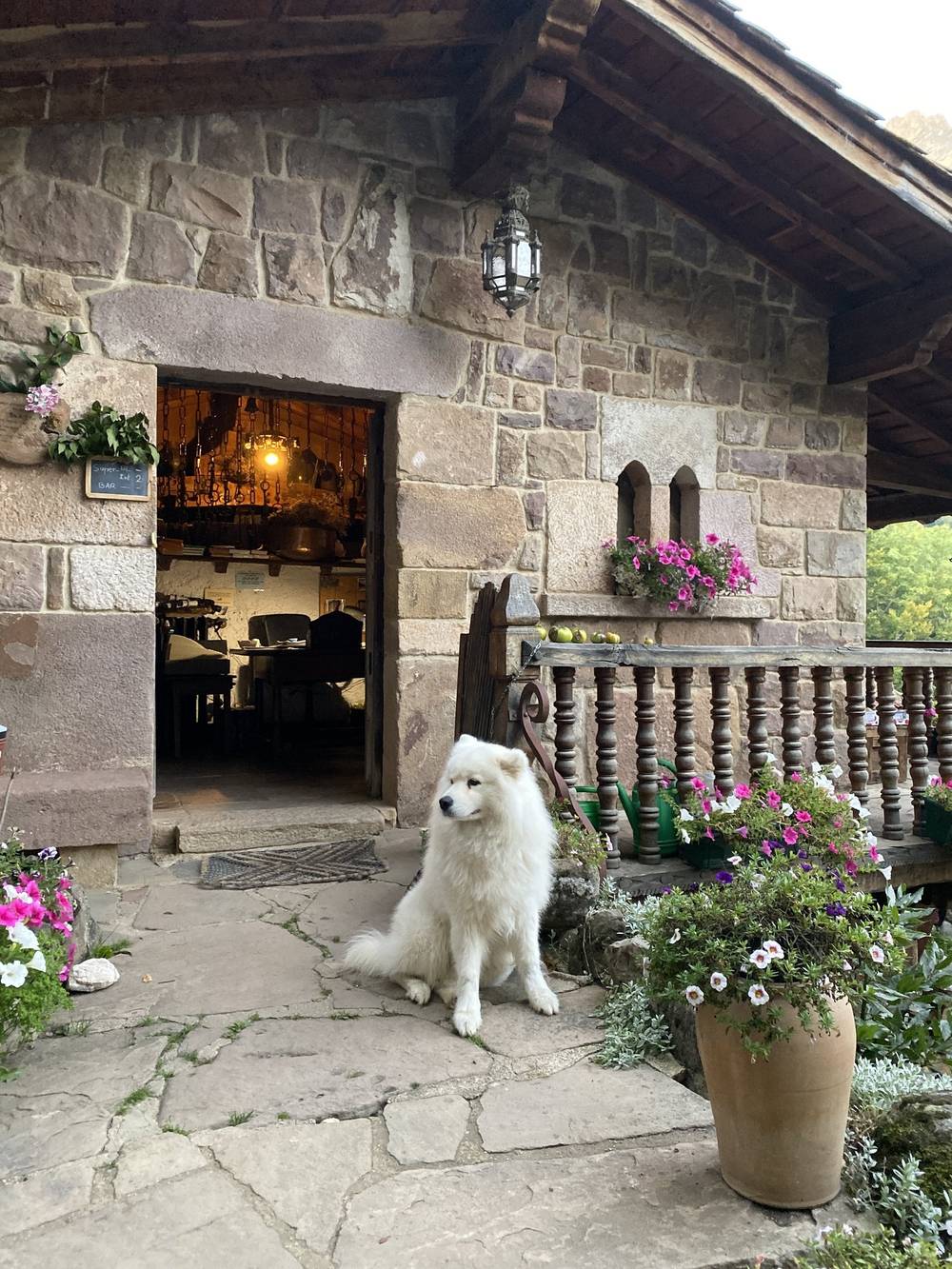
Refugio de Vegabaño (Day 5, my night 5). 4,700 ft (1,432 m), Castilla y León. 35 bunks, showers, heating. Open all year. +34 699 633 244, refugiopicos@gmail.com. A search summary gives 2026 half board at EUR 45.50; not confirmed on the refuge's own site. About 50 minutes' walk from Soto de Sajambre. Such a chill spot, with a big farm dog. I don't think anybody else was sleeping there.
Refugio Collado Jermoso (Day 6, my night 6). 6,770 ft (2,064 m), Castilla y León. 32 places. 2026 season: a few days at Easter, then from May 1; closing day not published. +34 636 998 727 (no text messages), colladojermoso.com. 2026: bed EUR 12.50 member, EUR 19 non-member; breakfast EUR 7 to 7.50; dinner EUR 18 to 20; picnic EUR 14; hot shower EUR 3.50. Book at reservarefugios.com. Fantastic, one of the best. It took Visa, and had good food, good drinks and great views. It was the one night the beds were mostly full.
Hotel Áliva (Day 1). Closed in 2026 for a full rebuild, with reopening planned for summer 2027 (not confirmed by Cantur). No food, water or beds there until then.
Vega Huerta and El Frade (Day 5). Small unstaffed shelters: Vega Huerta has about 4 places, El Frade about 8. Their condition is unknown; don't plan on them.
Sotres (end of Day 1). The highest village in the Picos. Places to stay include Hotel Sotres and the Peña Castil hotel and hostel; OpenStreetMap lists several more guesthouses. Summer bus to Arenas de Cabrales.
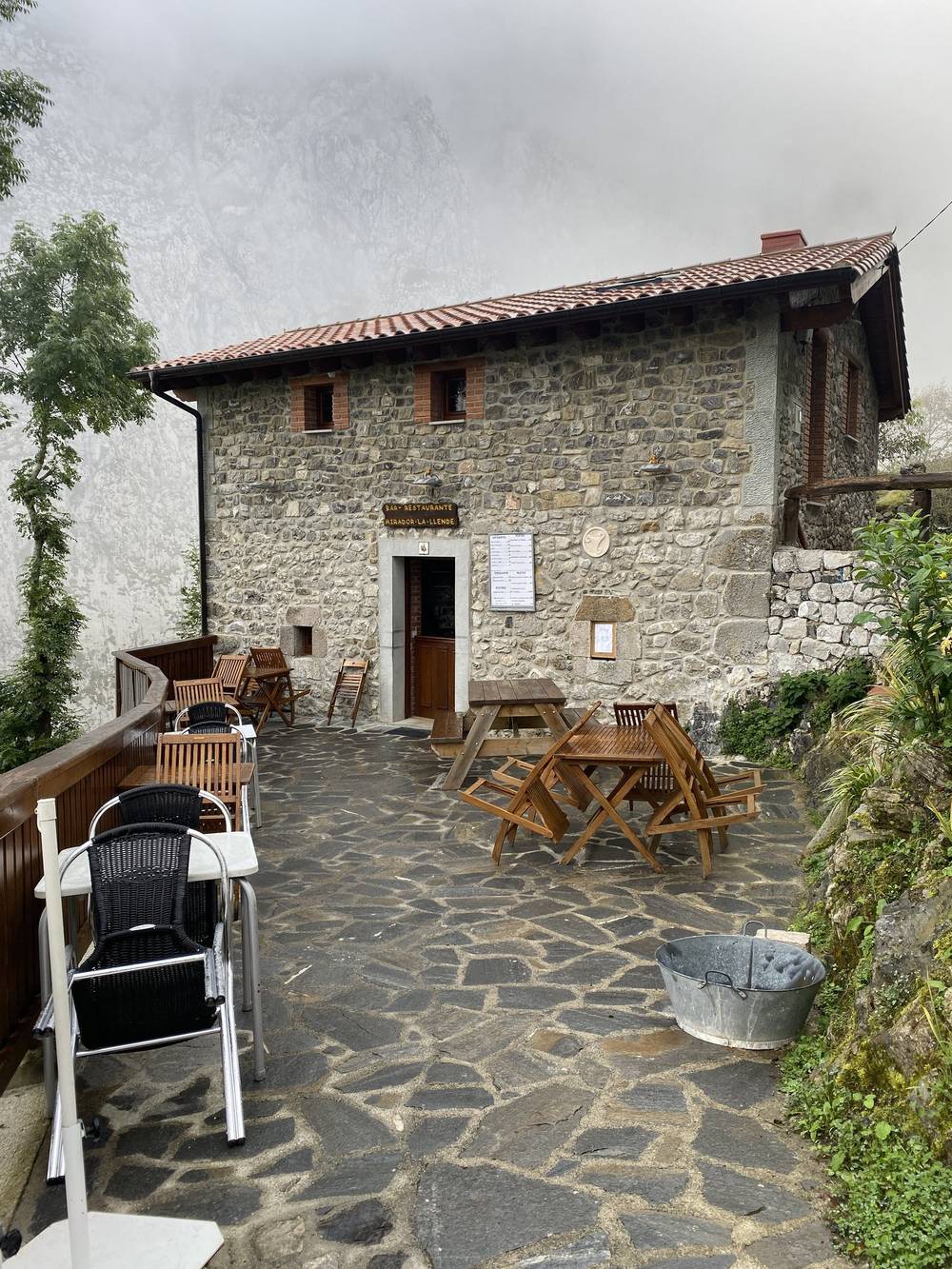
Bulnes (Day 3). A village with no road, reached on foot or by the Funicular de Bulnes from Poncebos (ALSA, 2026: EUR 17.61 one way, EUR 22.16 return; every 30 minutes from 10:00). OpenStreetMap lists hostels and guesthouses. My breakfast stop was the Bar Mirador Lallende, as I marked it on my map.
Caín (end of Day 3). Where the road up the Valdeón valley ends. OpenStreetMap lists a hotel, two hostels and restaurants; I found restaurants and beer.
Posada de Valdeón (Day 6). The main village of the valley, with hotels, hostels, restaurants and shops. My lunch was at the Restaurante Begoña. Taxis and 4x4 taxis work the valley; the ALSA bus ran on summer weekends and holidays only in 2026 (until August 24).
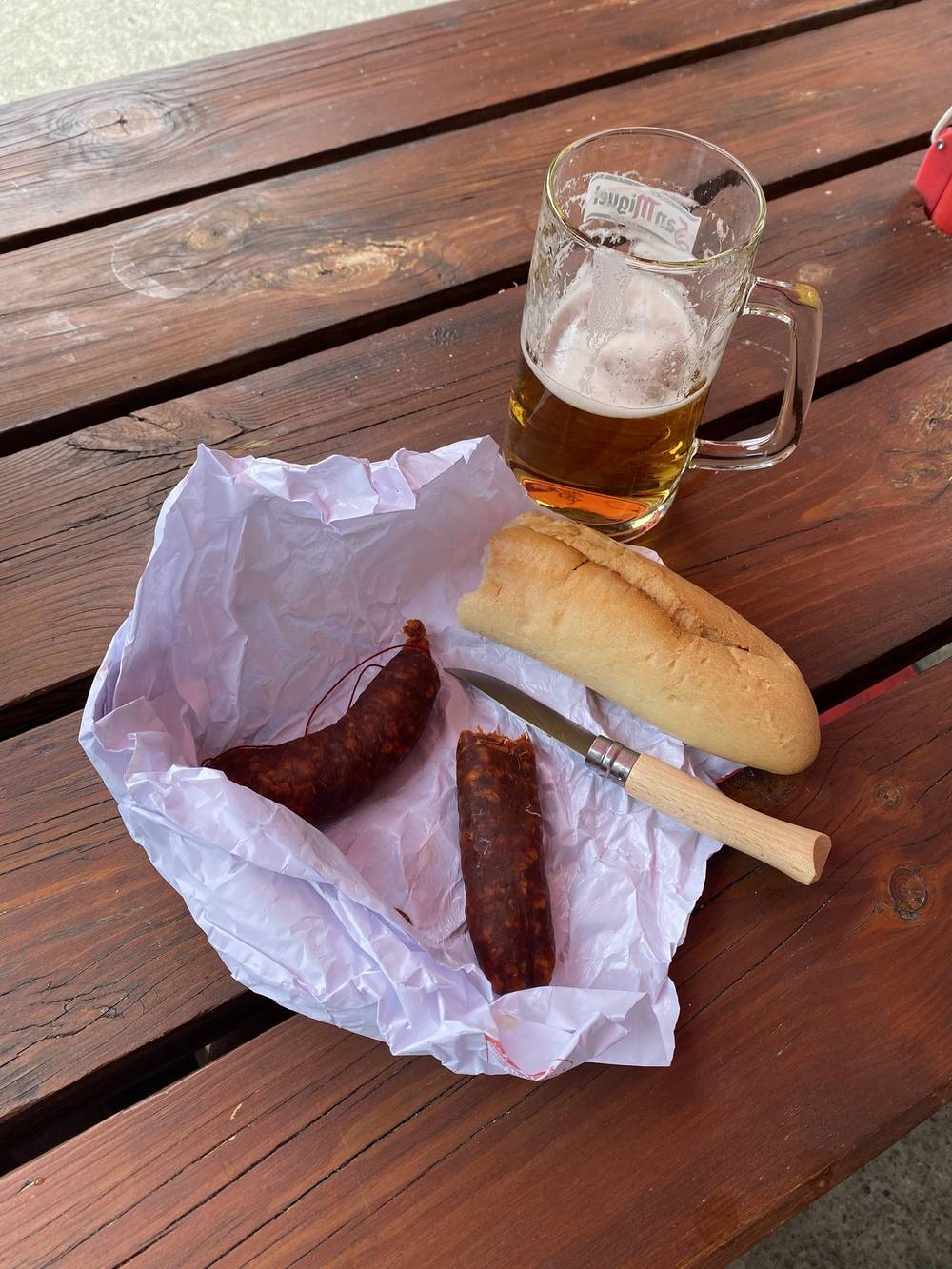
What I ate. I relied on the food at the refuges and the occasional town, and carried the rest: bread (a baguette goes really quickly), fresh fruit (it's heavy, all water weight, but it's great to have), Twix for sugar and fat, Spanish sausage, Babybel, nuts (very dense energy that doesn't spoil) and energy or granola bars. Some kind of sausage and some kind of cheese that doesn't spoil are the staples. And just drink as much water as you can.
Where I ate. A hotel restaurant in Sotres (Day 1), a stop at Urriellu (Day 2), breakfast in Bulnes and a beer and sausage in Caín (Day 3), a coffee at Vega de Ario (Day 4), coffee at Vegarredonda (Day 5), white bean soup, a beer and a baguette in Posada de Valdeón and dinner at Collado Jermoso (Day 6), coffee at the top of the cable car (Day 7). The food in Spain was amazing. White bean soup sounds really simple, but with the right bread and good beer after hiking all day, it's hard to beat.
Water. Water is usually down in the valleys; there's rarely any on the peaks and ridges, because water flows down. I marked the taps and fountains I found; they're waypoints in the GPX file. You should always have some way of filtering, and never assume water is safe unless you're at a place with people you can ask. The park also says not to drink from low springs or where livestock graze. The driest stretches were the high ground on Day 5 and the climb to Collado Jermoso on Day 6.
Meal times. Spain eats late: lunch in the afternoon and dinner late in the evening. Refuges serve dinner at a set time.
Paid links: I earn a commission if you buy through these links, at no extra cost to you. As an Amazon Associate I earn from qualifying purchases.
This was early in my hiking career. I didn't have all the fancy things companies have sent me since. Here's my kit that fall, what I'd take now, and what I filmed with.
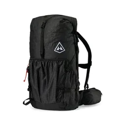 Pack: Hyperlite Mountain Gear Southwest 2400 (Hyperlite). The 2400 size, about 40 L.
 Tent: REI Passage 1. A cheap tent that isn't the lightest or the smallest. Similar: NEMO Hornet Elite OSMO 1P (Amazon).
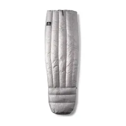 Quilt: Nemo quilt. Similar: Hyperlite Mountain Gear 20° Quilt (Hyperlite).
 Water filter: Sawyer filter. On a Smartwater bottle, plus a 2 L Platypus for dry stretches. Similar: Katadyn BeFree AC · 1L (Amazon).
My current kit for what this route needs.
 Sleeping-bag liner: Naturehike ZY20 Sleeping Bag Liner (Amazon). Compulsory in all the park's refuges.
 Rain shell: Arc’teryx Beta AR Jacket (Arc’teryx). Fog and cold come in fast.
 Warm layer: Arc’teryx Cerium Hoody (Arc’teryx)
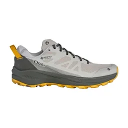 Shoes: Oboz Katabatic LT Low GTX (Amazon). You want good grip on wet limestone.
 Poles: Black Diamond Alpine Carbon Z Poles (Amazon)Water filter: Katadyn BeFree AC · 1L (Amazon). Carry about 2 liters of water capacity.
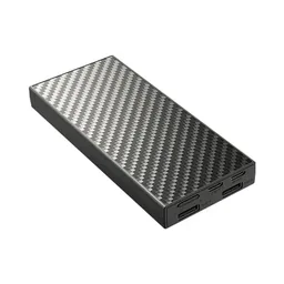 Power bank: Nitecore NB20000 (Amazon)
What I filmed this trip with in 2019. My setup is smaller now (below). Leave the drone at home here: drones are banned in the national park (see Straight answers).
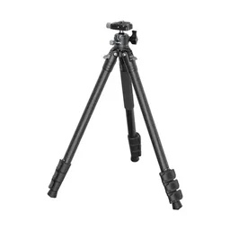 Tripod: Peak Design Travel Tripod. Similar: SmallRig Carbon Fiber Tripod (Amazon).
Since September 2026 I film with a smaller setup: the Pocket 4 and the Mic 3 on the trail, and the Mini 5 Pro in the air.
 Camera: DJI Osmo Pocket 4 (Amazon)
 Mic: DJI Mic 3 · 1 TX + 1 RX (Amazon). It pairs with the Pocket 4.
 Drone: DJI Mini 5 Pro (Amazon)
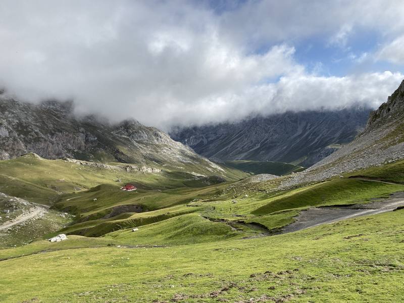
We camped the night before at a campground near Fuente Dé, right by the trailhead. It was cheap, and the owners had three dogs that made it into the film. In the morning there were cows around the tents. You can climb from Fuente Dé on a huge set of switchbacks or ride the cable car. We took the cable car. At the top there were a lot of tourists and day hikers, and a café and souvenir shop. The rocks up there are almost white. We had fog and sheep.
My friend had done most of the planning and convinced me to come. Not far from the top he realized he had an injury, and we split up. I went on alone, counter-clockwise. This was the beginning of my hiking career. I didn't know how many miles I was going, and I had zero expectations and no prep. Luckily I had proper gear and enough warm clothes, and I relied on the refuges and the occasional town for food.
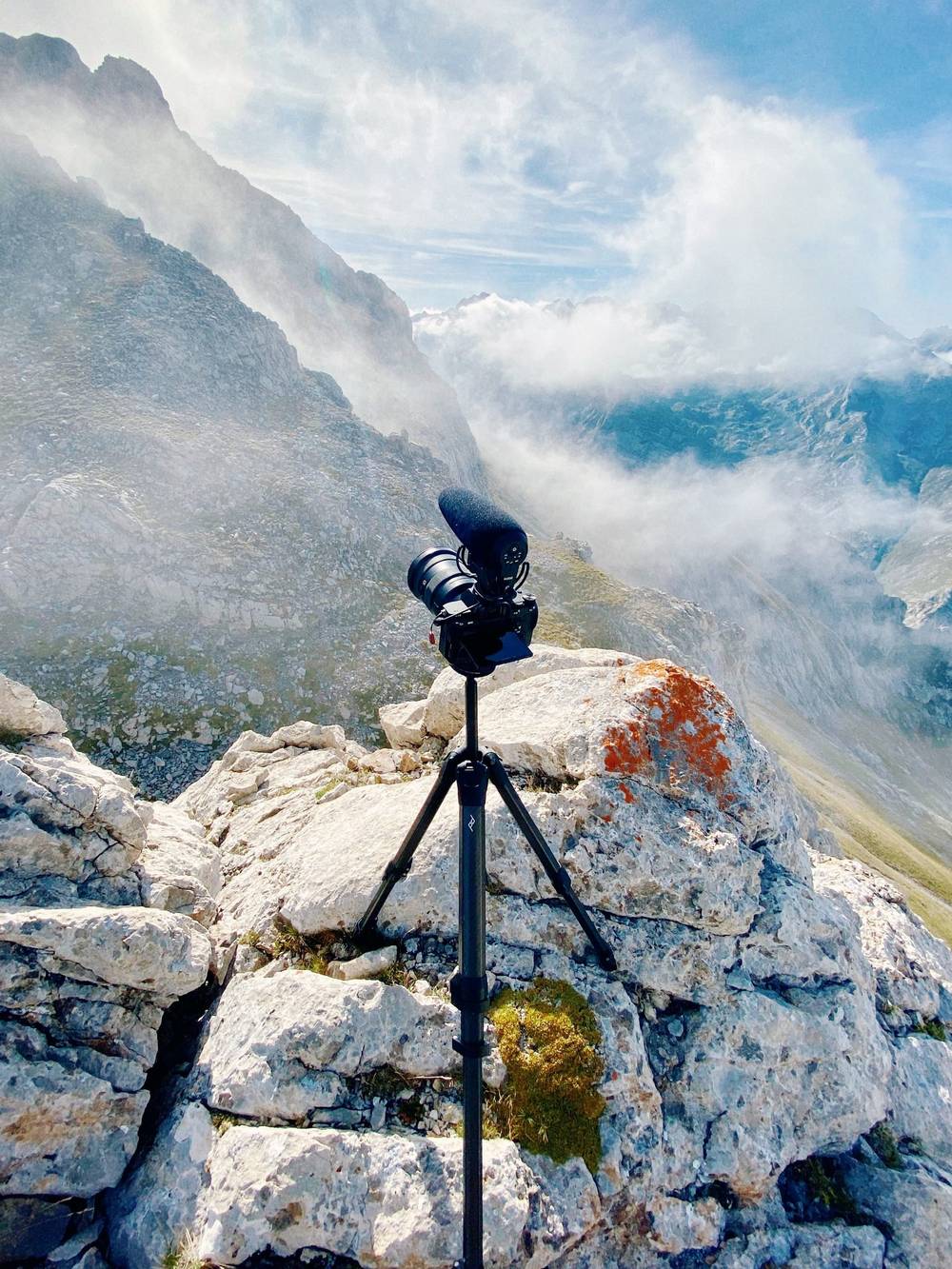
In the Duje valley the normal trail goes straight down to Sotres. My map suggested I go up a pass instead, and I don't really regret it, but it was a huge climb. Near the top it turns into a scramble, mostly rock with no dirt, so you can't really tell where the trail is. Little green markers show the way, and I had AllTrails downloaded, so even on airplane mode I could follow my location. I was alone for this whole section, just me and herds of goats or ibex (I don't know the technical word). I didn't get too close. At the top the chains start coming out, and you have to trust your full weight to them.
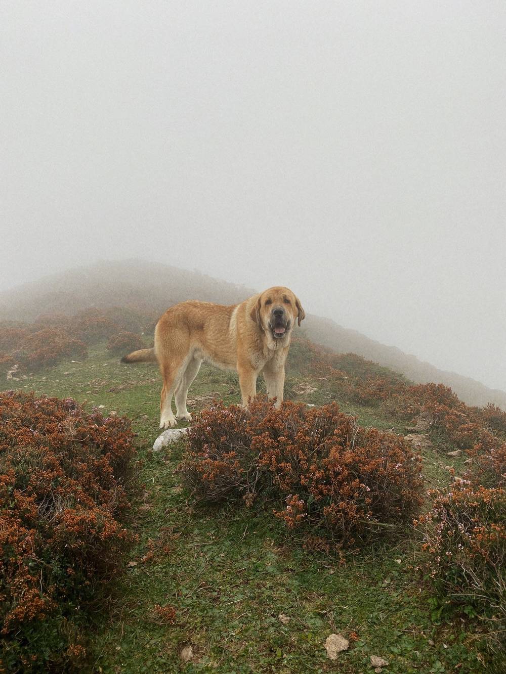
On the way down I passed a hut with nobody there. It got darker and foggier, and farm horses wandered past. Then two livestock guard dogs came out of the fog. The second one was the biggest dog I've ever seen, with a huge spiked collar. I'm 6'2" and it was massive. I went way out of my way to be friendly. I didn't make it before sunset. The hostel in Sotres was open and completely empty, and it was very cheap. I ate at a hotel restaurant and went straight to bed.
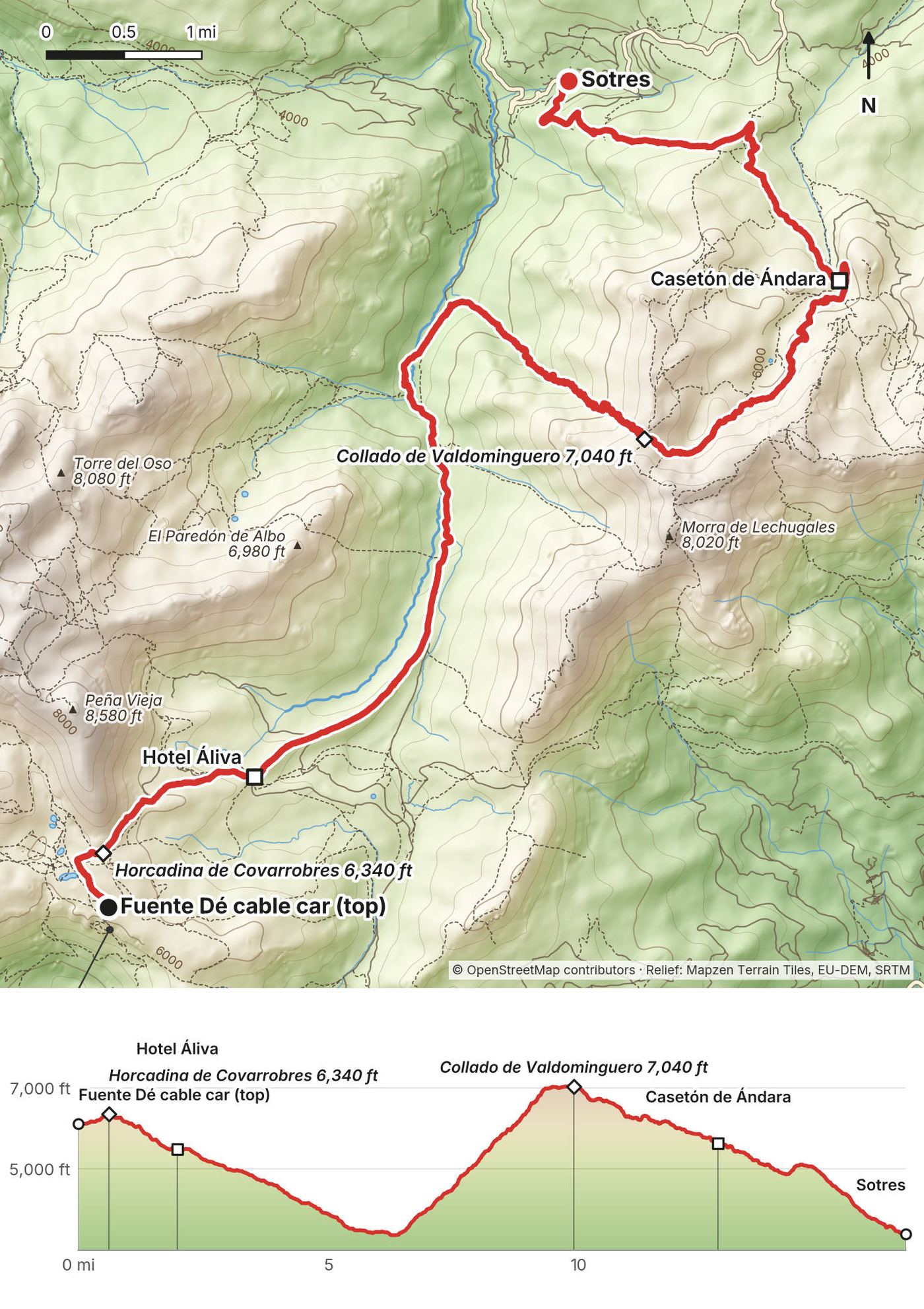
From the top station of the cable car, 5,980 ft (1,823 m), a jeep track climbs gently to the Horcadina de Covarrobres at 0.6 miles and drops past the Hotel Áliva at 2 miles. It keeps going down the open Duje valley to about 3,480 ft (1,061 m) at 5.7 miles. This is the easy way: the track carries on north to Sotres, about 3 more miles. My line turned east and climbed about 3,500 ft (1,080 m) in 4 miles to the Collado de Valdominguero at 9.9 miles, 7,040 ft (2,145 m): a path at first, overgrown in places, then rock and scrambling with a short chained section at the top. From the col it drops to the Casetón de Ándara hut at 12.8 miles, then on down over the Collado la Cima to Sotres at 16.5 miles, 3,395 ft (1,035 m).
Before the Duje valley, go back up to the cable car. In the valley, follow the track north to Sotres: it's the easy way and saves the whole climb. After the Collado de Valdominguero, keep going down to Sotres.
Main film, Day 1 · Guide film, Day 1
There is no better feeling than waking up early, putting everything you own into a backpack and just dipping. You feel like you're getting away with something, like a heist. You're up before everyone, you have everything you need, and you slip off to get to your destination before people even realize you're gone. I love that feeling every morning I wake up for a hike.
I walked a little on the road down to the valley, then straight up a green valley. It was a really big climb for the beginning of the day, but what waited up there was really special: turning corners and seeing these giants. The temperature and weather were really good for the whole hike. I was tired, but I was booking it. Twix for some good sugar and fat.
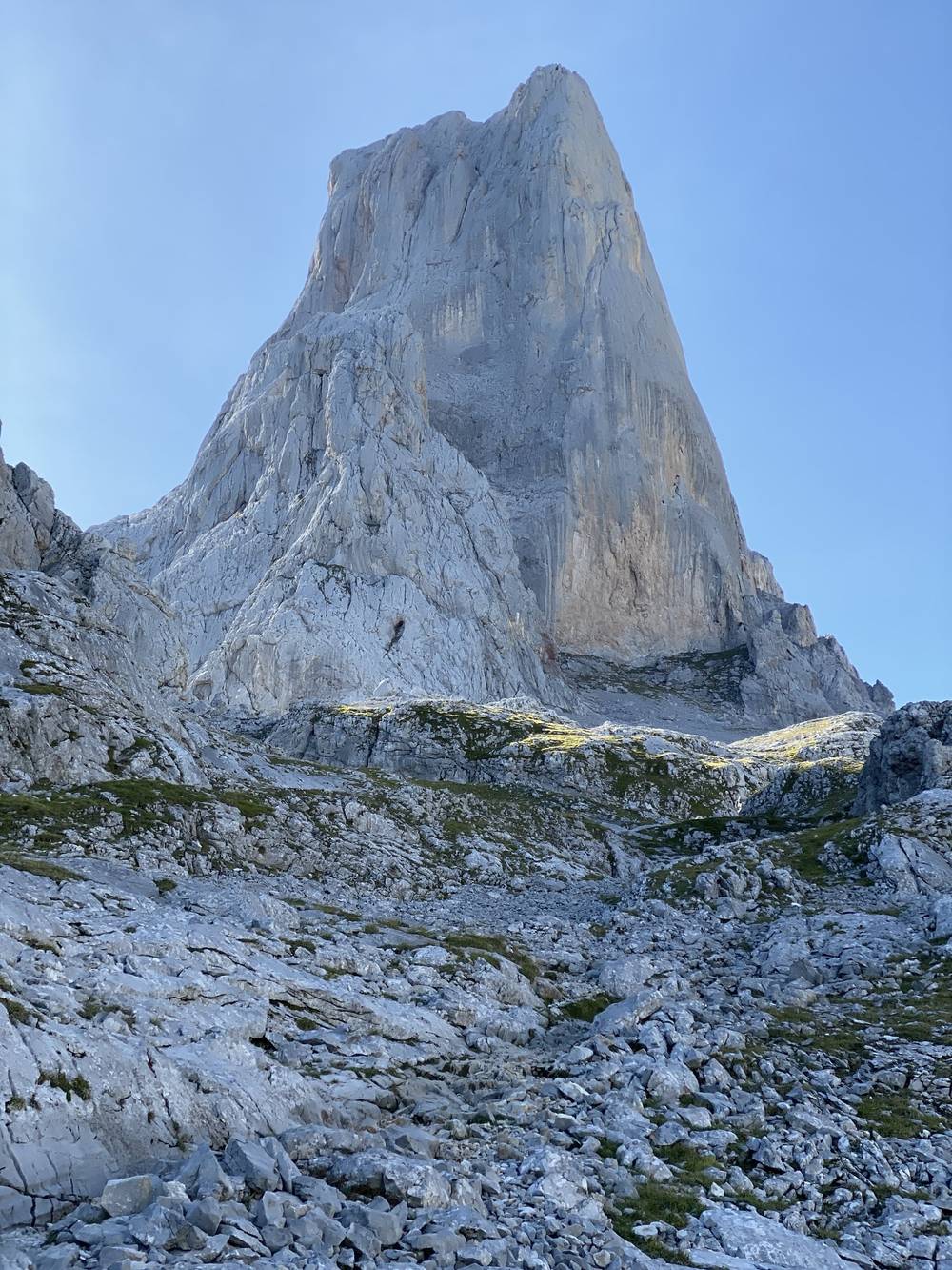
The iconic peak of the area is the Naranjo de Bulnes, and the Refugio de Urriellu sits right under it. There were people there, and everything was in Spanish. I think it was cash only. I probably could have slept there if I'd timed the distances right, but I was in no-reservation mode. I wanted to go at my own pace and sleep wherever I ended up each day, which I kind of like. There are pros and cons to that.
After the refuge there are a few scrambles and a few cables. That area is pretty steep, but nothing too bad, and there were definitely fewer people. Lunch was Spanish sausage and Babybel, cut with a knife my friend bought me. Every day there's an up and every day there's a down.
For this entire hike I was hiking all day, and I love doing that: starting early, doing as many miles as I can, and still hiking when the colors are nice at sunset. I camped along this route. Am I allowed to wild camp like this? Probably not. Should I have found a spot that was more leave no trace, not on the grass? Probably. I set up my tent in the dark and I'm out at first light before anyone would notice. There was a small village and a funicular below me, and I probably could have found a place there, but I was interested in wild camping and staying away from people.
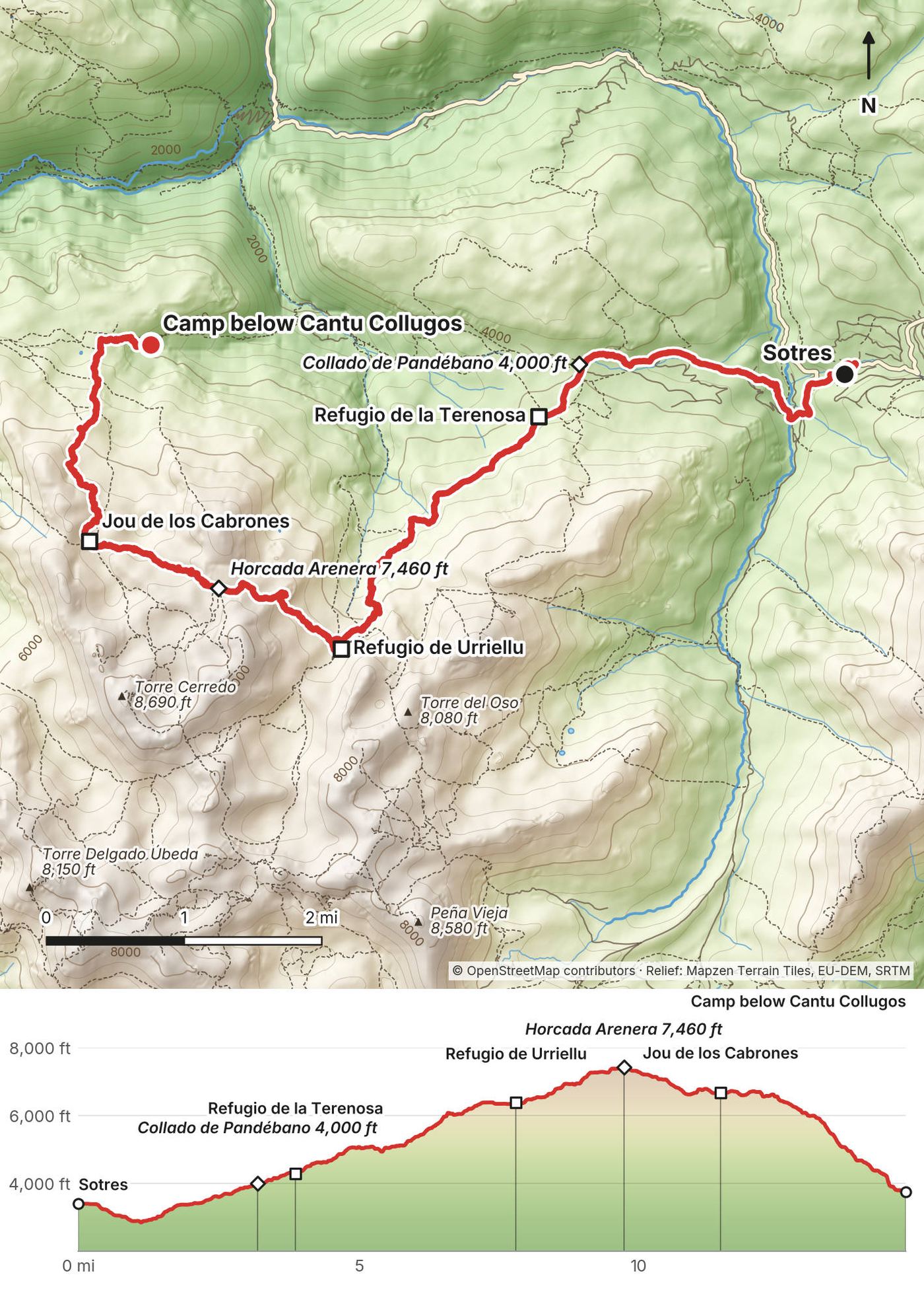
From Sotres, 3,395 ft (1,035 m), a short road walk leads down to the river and the path climbs over the Collado Cuaceya to the Collado de Pandébano at 3.2 miles, 3,990 ft (1,219 m), and past the Refugio de la Terenosa at 3.9 miles. Then it's the big climb of the day: about 2,100 ft (640 m) on a popular path to the Refugio de Urriellu at 7.8 miles, 6,390 ft (1,949 m), under the west face of the Naranjo de Bulnes. Beyond the refuge the ground is bare limestone: steep and rocky up to the Horcada Arenera at 9.7 miles, 7,460 ft (2,273 m), with a few cables, then down and across to the Refugio Jou de los Cabrones at 11.4 miles, 6,680 ft (2,035 m). From there a long, steep descent of about 2,900 ft (890 m) drops north to where I camped below Cantu Collugos at 14.7 miles, 3,745 ft (1,142 m), above Bulnes.
Before Urriellu, go back down to Pandébano and Sotres. From Urriellu, the busy path down to Pandébano is the way out. After the Horcada Arenera, keep going: the way down to Bulnes is the nearest village.
Main film, Day 2 · Guide film, Day 2
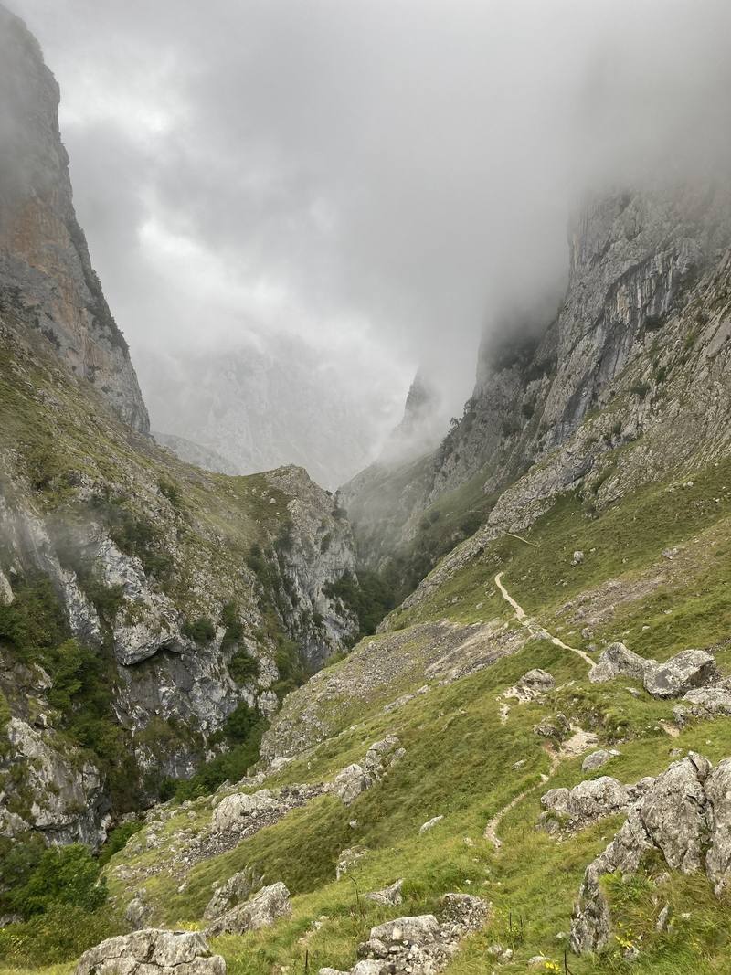
I woke up with a ton of fog, and there were spider webs everywhere, covered in morning dew. I came down to a place in Bulnes that was more restaurant than refuge and had breakfast there: sausage, eggs, fruit, bread and coffee, alone, with absolutely no one out. All the way down at the bottom there was fog, but the higher I went, the more I was above it.
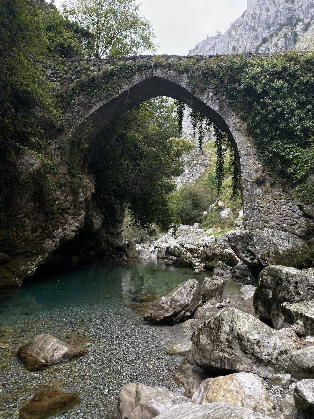
From there I went down to the river and across a really cool old bridge. There were a bunch of cars parked there, and a ton of day tourists. Then the Cares gorge. This was probably the most boring day, for a couple of reasons. It was very repetitive. It's an actual traveling path more than a hike, more paved, brick and stone than trail. And I was starting to get blisters. My feet were wet, so I carried two pairs of socks: you wear one and hang the other on the outside of your pack to dry, then swap.
I reached Caín, which had restaurants and beer. It was the off-season, so it was empty, just dogs. I could have paid to stay there, but I had my tent and was in camping mode. I turned off my GPS because I thought I was done for the day, then at the last minute decided to go up. I would not recommend going up the way I did. It was overgrown and not fun, I was sweating, and I cut across through the brush. I gave up when it got dark. It wasn't a good spot for a tent: I was on a slope, on the edge, and using a rock to stop me from falling.
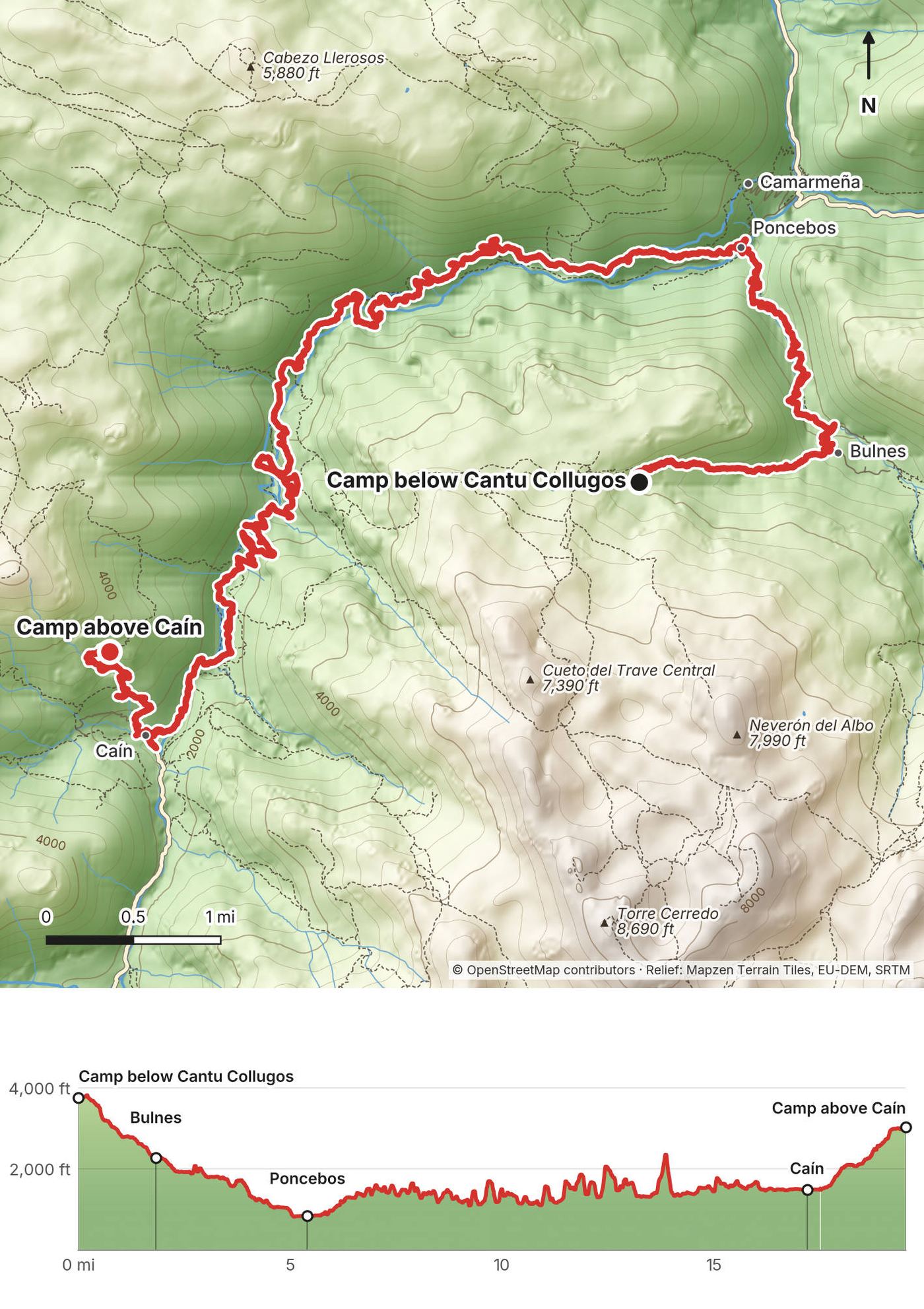
From my camp, 3,745 ft (1,142 m), the path drops to Bulnes at 1.8 miles, 2,280 ft (696 m), a village with no road, then down its gorge to Poncebos at 5.4 miles, 850 ft (259 m), the lowest point of the trip. The Funicular de Bulnes, a train in a tunnel, also links Bulnes and Poncebos. At Poncebos the Ruta del Cares starts, the most famous walk in the Picos, about 11 to 12 km (7 to 7.5 mi) to Caín. It climbs a few hundred feet at the start, then runs along a path cut into the cliffs high above the river, through tunnels and over the Puente Bolín and the Puente de los Rebecos near the end, to Caín at 17.5 miles on my GPS, 1,490 ft (454 m). Caín is where the road from the Valdeón valley ends. My evening climb went up steep, overgrown ground west of Caín for 2 miles and about 1,550 ft (470 m) to my camp at 3,025 ft (922 m).
About the numbers. My GPS lost the sky in the gorge and zigzagged across it, so it logged about 19.5 miles and 8,200 ft of climbing. The real walk is shorter: the Poncebos to Caín path is about 11 to 12 km (7 to 7.5 mi), not the 11.8 miles my GPS logged for it. On the ground the whole day was closer to 15 miles (24 km), with roughly 3,000 ft (900 m) of real climbing, more than half of it in my evening climb out of Caín. Those two figures are my estimates from the map, not measurements. I kept the recording as it is in the GPX file; follow the path, not my zigzags.
Bulnes has the funicular down to Poncebos. Poncebos has a road down to Arenas de Cabrales, with a shuttle bus in summer (June 1 to October 12 in 2026). In the gorge, go on to Caín or back to Poncebos. Caín has beds, and a road up the Valdeón valley to Posada de Valdeón.
Main film, Day 3 · Guide film, Day 3
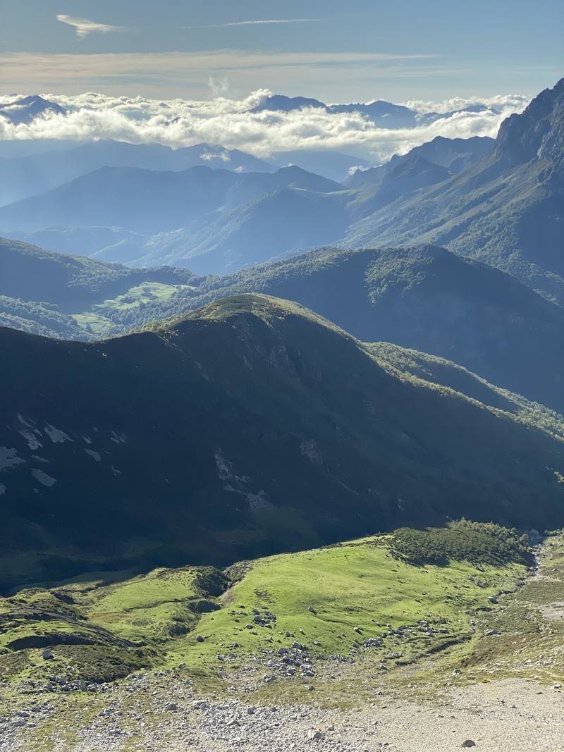
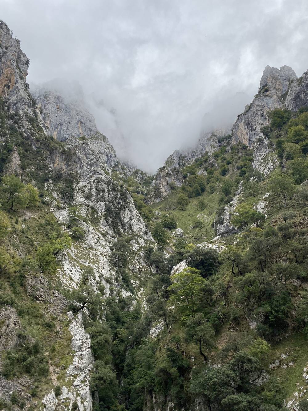
The morning was tough because this trail was not good. I'd say this whole section was sketchy, and the path was a bit precarious. But it was nice being above the mist, and the warmer it got, the higher the mist went. I was battling the mist the whole time, with a beautiful view behind me. The thumbnail for the film came right over this spot, with all the mountains in the background.
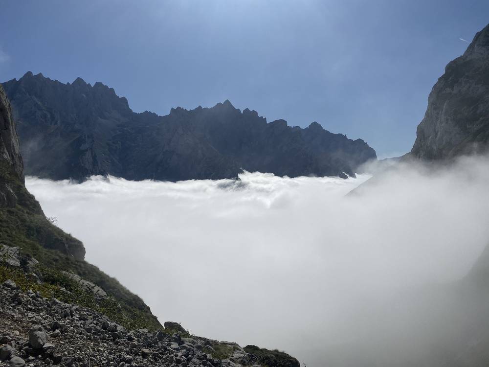
The rocks were super sharp, and yellow dots mark the trail. Because it's so rocky, it's pretty difficult to stay on it. My track shows how crazy the switchbacks were. That section is bare rock and spiky, like a maze. It reminded me of Sam and Frodo in The Two Towers.
Then you come out into the pasture and see the refuge, and there were people there. It was so nice. There were farm animals, and a herding dog doing its work with the sheep while I sipped a coffee. The refuge lends you flip-flops or Crocs if you don't have your own. The Refugio Vega de Ario rules. I totally could have slept there, and in hindsight it would have been pleasant, with the sun hitting the tops of the mountains at sunrise. This whole trip was battling the moisture and the sweat, trying to dry out all my stuff.
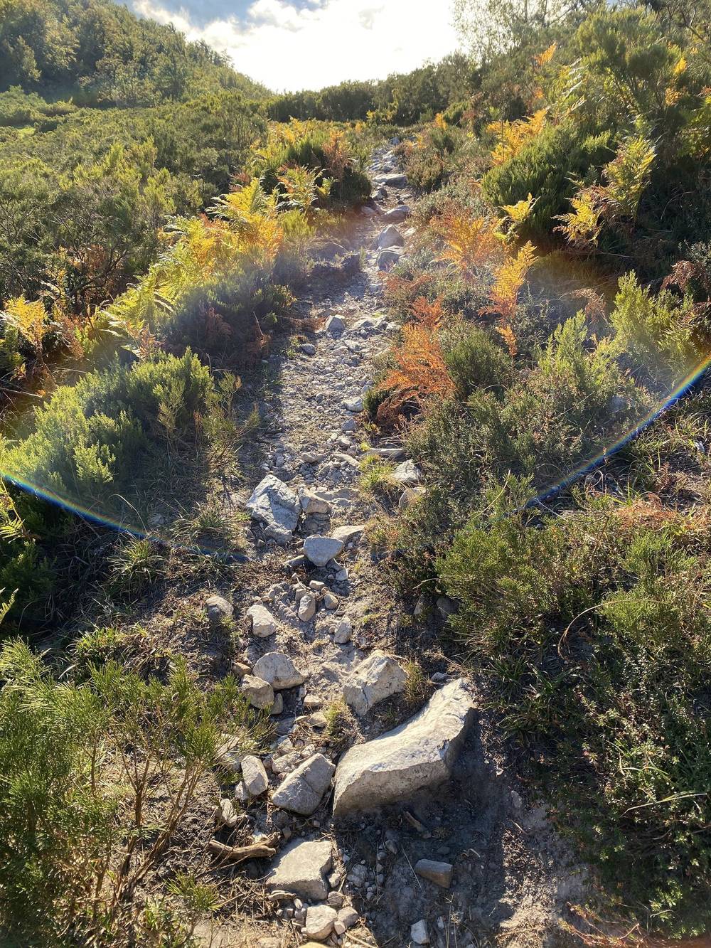
After that it was up, up, up, like always. Cairns were super helpful. It was a lot of climbing for the day, and I hiked until it was getting dark, found a little divot and camped there. Super above the clouds, really trippy, and absolutely alone: nobody for hours. If the clouds hadn't been there, I think I would have been able to see the ocean.
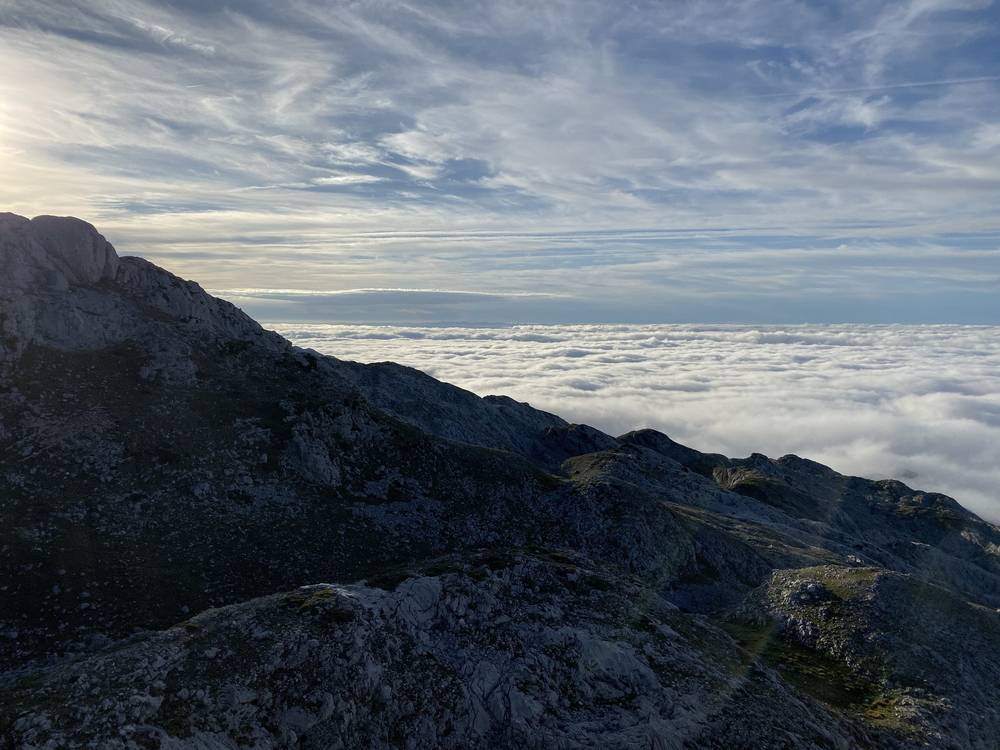
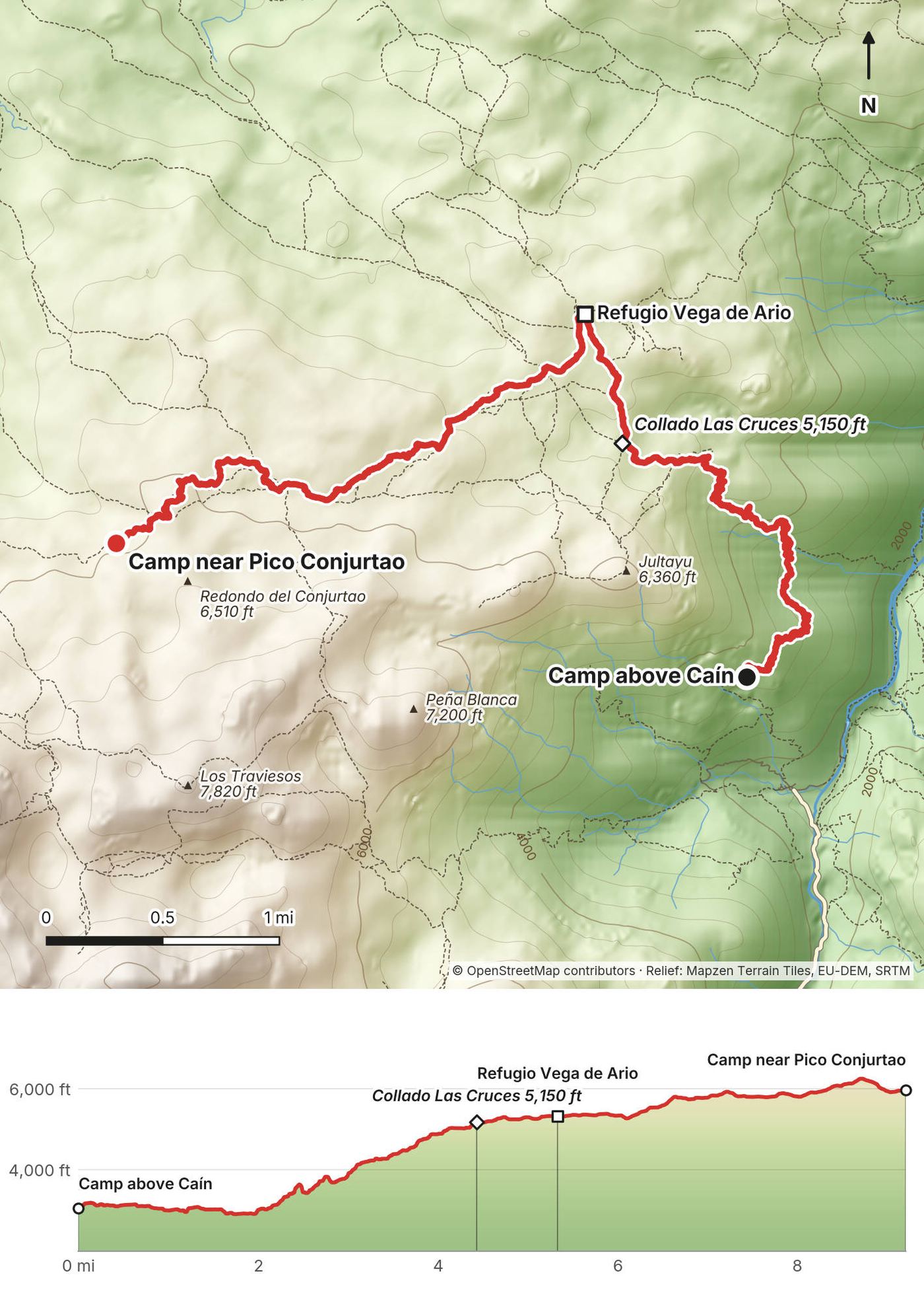
From my camp above Caín, 3,025 ft (922 m), the path climbs steeply and roughly through rock and scrub, with switchbacks and some exposed, precarious stretches, to the Collado Las Cruces at 4.4 miles, 5,150 ft (1,571 m). The last part before the col is bare, sharp limestone marked with yellow dots. Just beyond is the pasture of Vega de Ario and its refuge at 5.3 miles, 5,320 ft (1,622 m). From the refuge my line climbed southwest across rocky high ground toward Pico Conjurtao, following cairns, to my camp at 9.2 miles, 5,960 ft (1,817 m). Most people walk to Vega de Ario from the Lagos de Covadonga, on the far side; my way up from Caín is much rougher.
Before the Collado Las Cruces, go back down to Caín. From Vega de Ario, a well-used path runs west to the Lagos de Covadonga. The lakes road is closed to private cars on busy dates (in 2026: Easter, May weekends, every day from June 1 to October 18, and a few late-autumn holidays). On those dates a bus runs between the lakes and Cangas de Onís (2026: EUR 9 return, buslagoscovadonga.es).
Main film, Day 4 · Guide film, Day 4
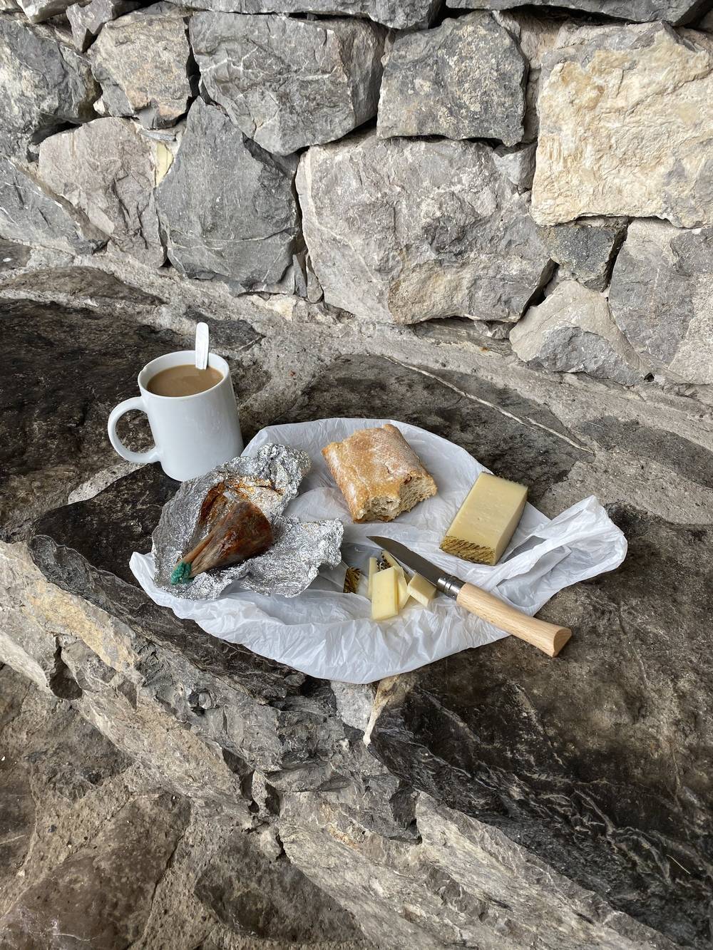
Another foggy morning. I went out of my way, down to the Refugio de Vegarredonda, just so I could have a cup of coffee. I had bought cheese somewhere, a bit of cured meat, and of course a baguette. There is nothing better than coffee, cheese, meat and bread while hiking in Europe.
Then back up. This was a big day, a lot up and a lot down. On all of these hikes I'm hiking all day and exhausted, and I'm always amazed at how refreshed I feel in the morning. If you drink enough water, I think your body just fixes itself, and going to bed at sunset and waking at sunrise you get something like 10 hours of sleep. In one or two sections there's scrambling going down, nothing too bad. So much fog and cloud.
By now I had a walking stick I'd picked up, and I was amazed at how much it helped. It kind of saved my life. I was super tired. Coming out of the rocky area there's a water source, then cows, green grass and a refuge, then down into the forest as it got dark. I thought I could go one way, but there was a big fence, so I had to go a little out of my way.
I had no reservations for any of these places. I just showed up, and I was lucky: it was the edge of the season, places were open, there was nobody there, and there was always space. The Refugio de Vegabaño was such a chill spot. I don't think anybody else was sleeping there. There was a big farm dog, a giant floof, and I sat petting it. When I'm hiking by myself, the animals are who I talk to and hang out with.
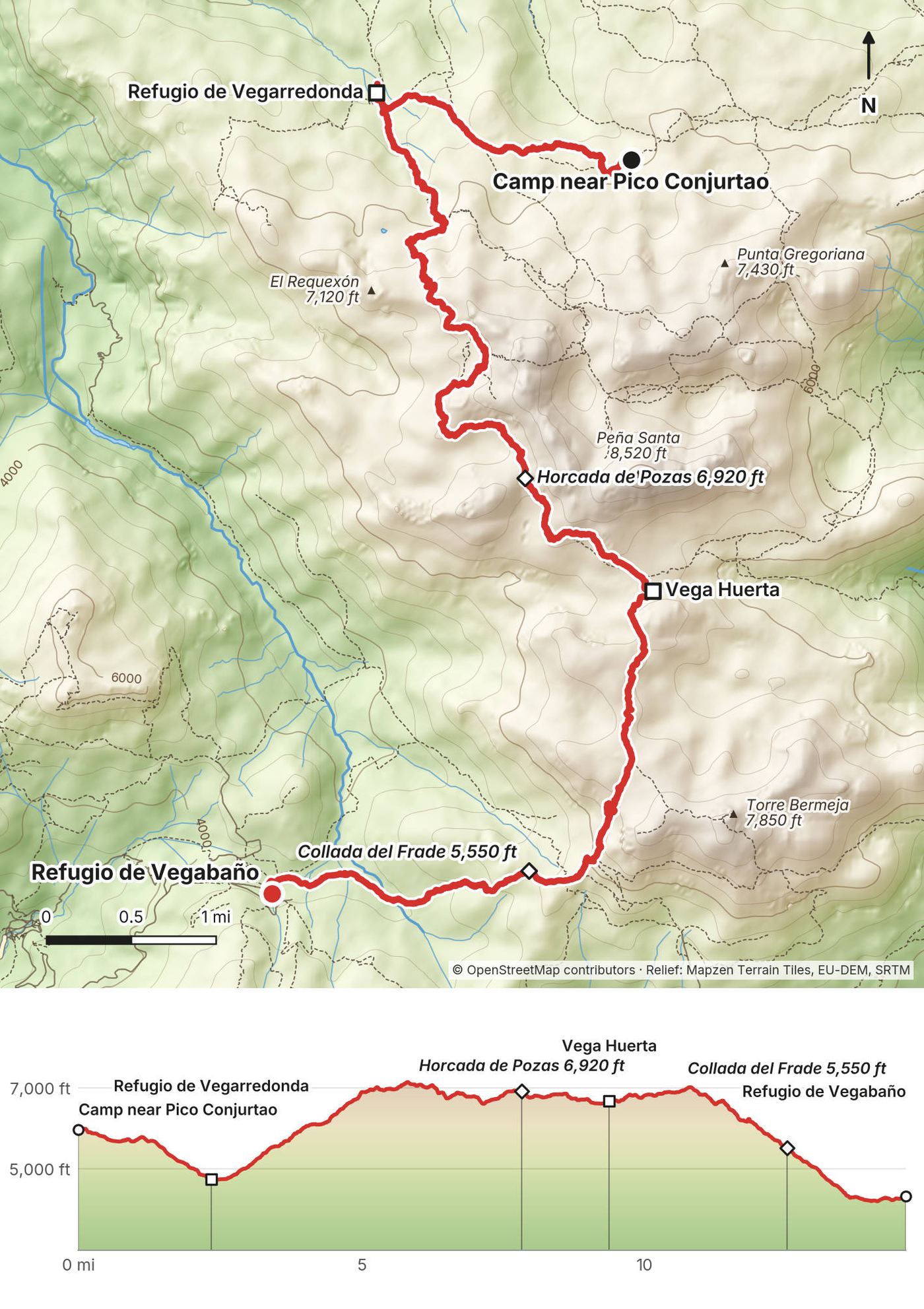
From my camp near Pico Conjurtao, 5,960 ft (1,817 m), the path drops to the Refugio de Vegarredonda at 2.3 miles, 4,750 ft (1,448 m), then climbs back up through the rocky western massif over the Collada de les Merines at 5.1 miles and the Horcada de Pozas at 7.8 miles, both about 6,900 ft (2,108 to 2,109 m), to the small Vega Huerta hut at 9.4 miles, 6,680 ft (2,036 m). Past the Collado del Burro, the high point of the day at about 7,000 ft, it's a long descent: grass, the Collada del Frade at 12.5 miles, 5,550 ft (1,693 m), and beech forest down to the Refugio de Vegabaño at 14.6 miles, 4,330 ft (1,320 m). The high part of the day is bare, rocky limestone with little water; below the Collada del Frade it turns to grass and then forest.
From Vegarredonda, a well-used path goes down to the Lagos de Covadonga. After the Collada del Frade, keep going to Vegabaño: from there it's about 50 minutes' easy walk down to the village of Soto de Sajambre.
Main film, Day 5 · Guide film, Day 5
A lot of this morning was through the woods, and I didn't film much of it. I started filming again once I reached the buildings, and there were more puppies. Then brunch: a white bean soup with a beer and a baguette. I did all of that hiking and then had an early lunch by myself in Posada de Valdeón, at the Restaurante Begoña. This place was awesome. I highly recommend it.
I was tired. I actually considered calling it a day and somehow getting back to where I started. It was day six and I was kind of done. Then I changed my mind and kept going. I went up, up, up, so exhausted. There wasn't much water up there, and I was at the end of my wits. When I found flowing water I was so happy. One person passed me here. I was going so slow.
I finally reached the Refugio Collado Jermoso, and it was fantastic, one of the best. I was absolutely exhausted and it was getting late, so: mission accomplished. It took Visa, and had good food, good drinks and great views. But this was the one night that most of the beds were filled, and there were snorers, so it wasn't the best sleep. I think the guys were French. I chatted with them, and they offered me wine, which was very French of them.
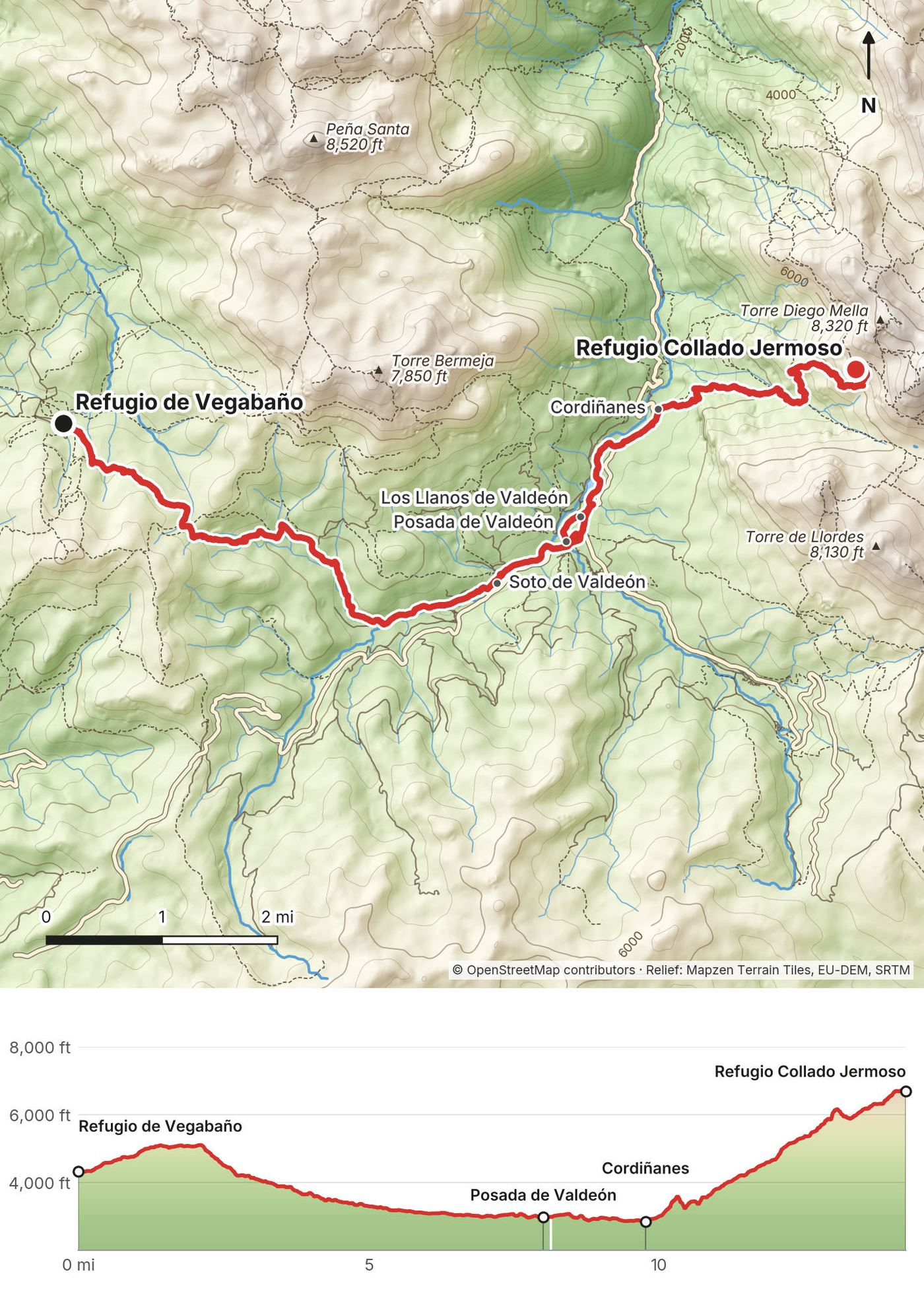
From Vegabaño, 4,320 ft (1,316 m), the path runs east through beech forest and pasture and drops into the Valdeón valley at Soto de Valdeón (6 miles), then to Posada de Valdeón at 8 miles, 2,980 ft (907 m). A quiet road leads down the valley to Cordiñanes at 9.7 miles, 2,830 ft (861 m). From there it's the biggest climb of the trip in one go: about 3,900 ft (1,180 m) in 4.5 miles, steep, up the side of the valley and a rocky gully to the Refugio Collado Jermoso at 14.2 miles, 6,700 ft (2,042 m), on a grassy ledge under the peaks.
Posada de Valdeón has beds, food, taxis and a road out. In 2026 the ALSA bus from León and Riaño to Caín and Posada de Valdeón ran on weekends and holidays only, until August 24; outside that, use a taxi. On the climb, go back down to Cordiñanes.
Main film, Day 6 · Guide film, Day 6
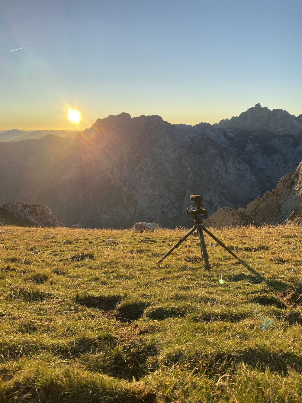
I started early. I was on a mission to finish this last stretch. It wasn't a full day, and I was really excited to get through it. I'd had a wonderful time, but I was done with this hike. You can see the destination for a long time, but it's very far in the distance, and it took hours. It was kind of deceiving, and a bit repetitive, so I didn't film much.
Back at the top of the cable car I had a coffee. I could have walked down, but I was done, so I took the cable car. Then back at the campsite, the three puppies. That campsite is worth it just for those dogs.
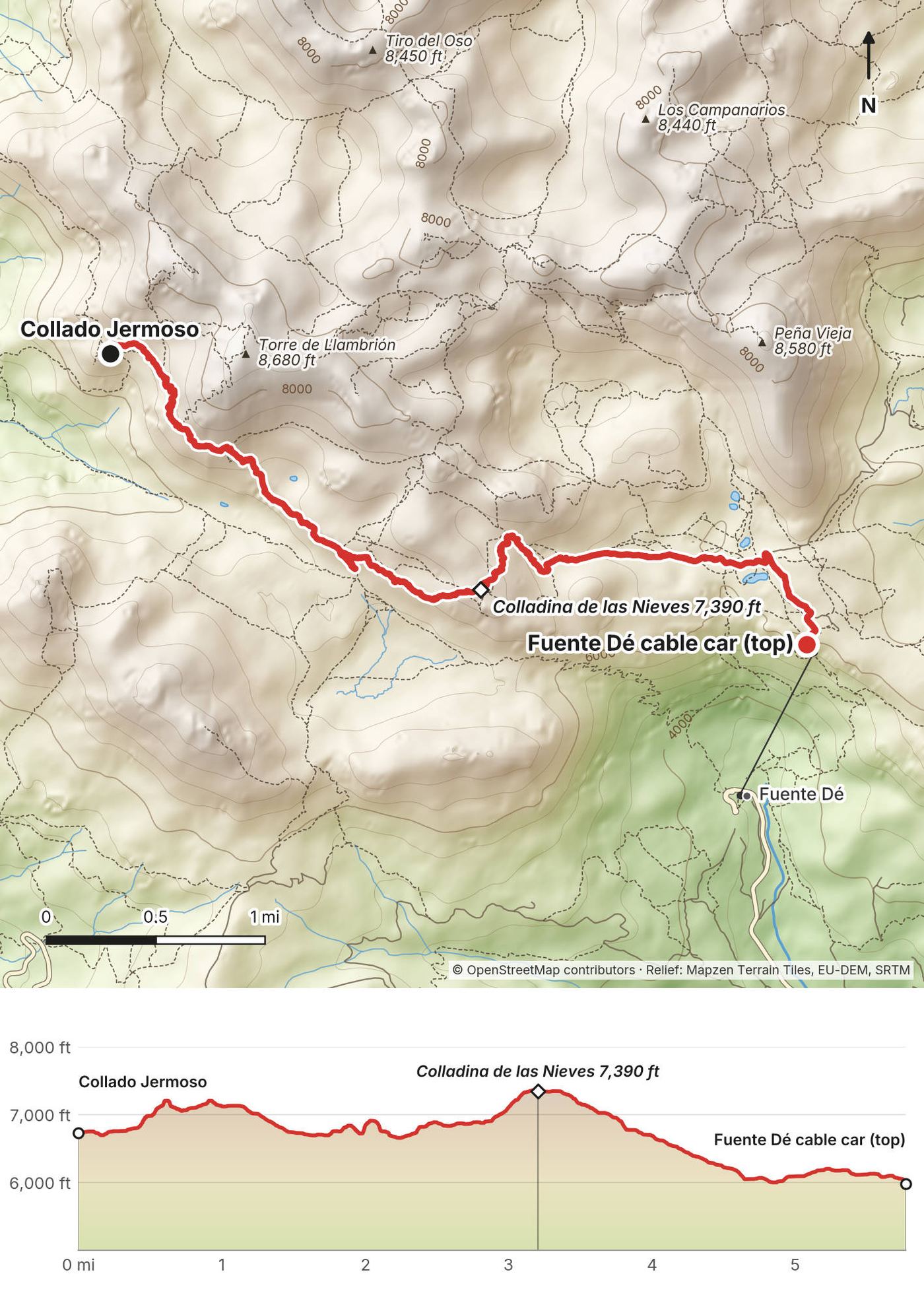
From the refuge, 6,735 ft (2,053 m), the path climbs east across rocky ground to the Colladina de las Nieves at 3.2 miles, 7,390 ft (2,251 m), the highest point of the day. From there it's a long traverse, with the top station of the cable car in view much of the way, to the station at 5.8 miles, 5,980 ft (1,823 m).
There's no easy way off in the middle. Turn back to the refuge if the weather turns bad early on.
Back at the top station, take the cable car down to Fuente Dé (EUR 13 one way in low season, EUR 17 in high season, 2026). From there it's the same way you came: the summer bus or a car to Potes and Santander. That night I was in a hotel in Santander.
Main film, Day 7 · Guide film, Day 7
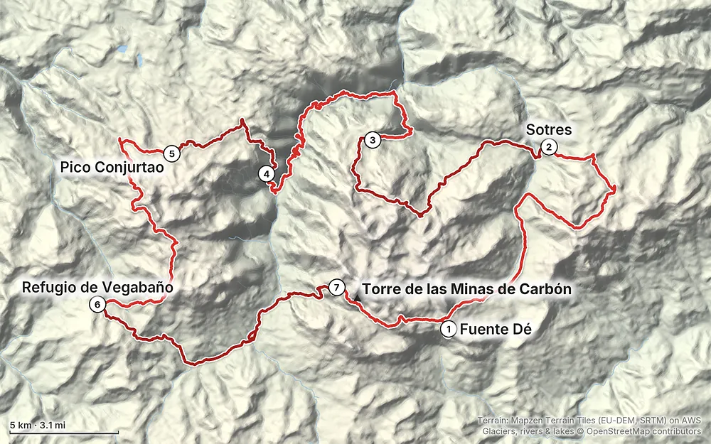
Elevation814–7,421 ft94.6 mi
Terrain: Mapzen Terrain Tiles (EU-DEM, SRTM) on AWS · Glaciers, rivers & lakes © OpenStreetMap contributors
Tap a map to open it full size.
No permit; I didn't book anything in October, but book the refuges ahead in summer (most use reservarefugios.com). Free camping isn't allowed in the park: a bivouac only above 1,800 m, without a tent except in bad weather, dusk to dawn (2026 rules)
From the hike's facts; check the official page before you go.
The season. The staffed refuges on this loop open in spring and close in autumn. For 2026: Urriellu is staffed from March 15 to December 15, Terenosa from April 1 to October 31, Jou de los Cabrones, Vega de Ario and Vegarredonda from May to October (no exact closing day published), Collado Jermoso from May 1 (closing day not published), Casetón de Ándara to mid-October (the federation says October 15), and Vegabaño all year. The Fuente Dé cable car runs all year, with shorter hours in autumn. June to September is the easiest time; late June to September is also the busiest, especially on the Cares.
What I got. I walked October 2 to 8. The temperature and weather were really good for the whole hike. Most mornings started in fog, sometimes with me climbing out above a sea of cloud, and the valleys were in mist. It was the off-season: villages were empty, refuges had space, and I met very few people.
Early October, now. It's the very end of the season. Some refuges close in October, the summer buses stop (the Cares shuttle ran until October 12 in 2026), and Hotel Áliva is closed for rebuilding in 2026. Days are shorter too: I hiked until sunset, which was just before 8 p.m. If you go in October, check each refuge's closing day before you set out.
Fog. Thick fog on the high ground is common, even in summer. On Day 1 I came down to Sotres in fog so thick I couldn't tell where I was except on the map.
Forecasts. Check the AEMET mountain forecast for the Picos de Europa every evening (aemet.es, Picos de Europa): temperatures, wind and the freezing level. Ask the refuge staff about the way ahead.
Emergencies. Call 112. It works in all three regions of the park (Asturias, Cantabria and Castilla y León), and the park says 112 calls get through more reliably than normal calls where coverage is poor. Mountain rescue is the Guardia Civil's GREIM teams with the Guardia Civil helicopter, called out through 112. Get travel insurance that covers mountain rescue.
Fog. The park warns that thick fog is common at altitude even in summer. If you're caught in it on rocky ground, stop, find shelter and wait, or follow the GPX track carefully. Tell someone, or the refuge, where you're going.
Livestock guard dogs. On Day 1 two huge guard dogs came out of the fog at me. These are working dogs defending a herd and a farm, so they could see you as a threat. I went way out of my way to be friendly. I don't recommend interacting with them if you don't have to, but if you do this hike you'll probably run into one or two. Just be careful. General advice (not from the park, whose dog page I couldn't read): keep your distance from the flock, walk calmly around it, don't run, and don't wave a stick.
Cows and horses. I always get weirded out around cows. If I'm going to be trampled by anything in the woods, it's probably a farm cow. Give them room.
The Cares gorge. A rockfall at La Raya injured two hikers on July 31, 2026, and the park closed the path for a few days. The risk is higher in and after rain and wind.
Park rules. No camping (see the camping rules), no fires, dogs on a lead everywhere (a fixed lead of at most 1.2 m on the Cares), no bathing in lakes and streams, and no drones: flying is banned in the national park.
None of my route needs a rope or climbing gear, but these spots need care:
How hard is it? It's a difficult hike. Most days are 14 to 17 miles with 4,000 to 5,000 ft of climbing, on rough limestone, and the Picos are steep: every day there's an up and every day there's a down. A few places are scrambles with chains or cables (Days 1 and 2) or rough and exposed (the climb above Caín on Day 4). It really pushed me physically and mentally. Try this at home: 12 miles with 4,000 ft of climbing and a full pack, two days in a row. If you're fine on the second morning, you can do this with the refuge version in this guide.
How many days? I did it in seven long days, hiking from morning until dark. The refuge version in Other ways to do it takes nine days with shorter stages.
Where do you sleep? Refuges (staffed mountain huts with bunks, dinner and breakfast), village hostels and guesthouses. You can't camp freely in the park. I wild camped three nights, and that isn't allowed now (it probably wasn't then either). See Where to sleep.
Do I need to book? I didn't. I just showed up, and I was lucky: it was the edge of the season, places were open, there was nobody there, and there was always space. Collado Jermoso, on a Monday night in October, was the one place that was nearly full. In summer, book the refuges ahead (most use one website, reservarefugios.com).
Is the route marked? Much of it is signed, and on the rocky high ground there are paint marks (green on Day 1, yellow dots on Day 4) and cairns. In places the path is overgrown or the rock hides it. Carry the GPX files on your phone.
Is there water? Water is usually down in the valleys; there's rarely any up on the peaks and ridges. I marked the taps on my map, and they're waypoints in the GPX file. Always filter.
What about the dogs? You'll probably meet a big livestock guard dog or two. They're working dogs guarding the sheep. Read Weather and safety.
Is there phone signal? Often not. The park says coverage is limited and that 112 calls get through more reliably than normal calls. Vega de Ario has no mobile coverage (2026).
Cash or cards? Bring cash. I think Urriellu was cash only when I was there; Collado Jermoso took Visa. In 2026 no refuge page I checked says whether it takes cards.
What does it cost? I spent very little on the trail: a cheap hostel, two refuge nights and food. The cable car is EUR 13 one way in October (2026). See What I paid.
Can I fly a drone? No. Drones are banned in the national park (the park repeated this in September 2026).
Do I need to speak Spanish? At Urriellu everything was in Spanish. A few phrases and a translation app help.
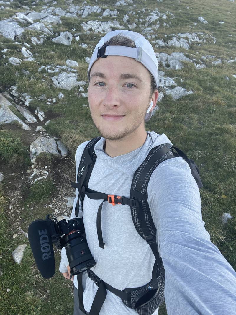
What did you film on? A Sony A7 III with the 16 to 35 mm f/2.8 G Master lens, a Rode VideoMic Pro+, a Peak Design travel tripod and a DJI Mavic 2 Pro drone.
I walked the seven days above, camping three nights. These versions are for people who want to sleep indoors every night, or do less. I didn't walk them this way; the distances come from my own GPS on the same paths.
| Day | From, to | Miles on my GPS | Sleep |
|---|---|---|---|
| 1 | Fuente Dé to Sotres | 16.5 (or about 9 by the easy line, below) | Sotres (village) |
| 2 | Sotres to Urriellu | 7.8 | Refugio de Urriellu |
| 3 | Urriellu over the Horcada Arenera to Bulnes | 8.7 | Bulnes (village) |
| 4 | Bulnes, Poncebos and the Cares gorge to Caín | about 11 on the ground (15.7 on my GPS) | Caín (village) |
| 5 | Caín to Vega de Ario, by the Canal de Trea | about 4.5 (not my line) | Refugio Vega de Ario |
| 6 | Vega de Ario to Vegarredonda | 6.2 | Refugio de Vegarredonda |
| 7 | Vegarredonda to Vegabaño | 12.3 | Refugio de Vegabaño |
| 8 | Vegabaño, Posada de Valdeón and up to Collado Jermoso | 14.2 | Refugio Collado Jermoso |
| 9 | Collado Jermoso to Fuente Dé | 5.8 |
This keeps every night legal and lets you carry no tent. Day 5, from Caín up to Vega de Ario, is still the roughest climb on the loop; skipping it by public transport is hard: in 2026 the ALSA bus to Caín ran only on weekends and holidays, until August 24, and there's no direct bus from Caín to the Lagos de Covadonga. A 4x4 taxi from the Valdeón valley is the practical way round. Don't follow my track out of Caín: the usual way up is the Canal de Trea, signed off the Cares path about 2 miles (3 km) back toward Poncebos, steep all the way (about 3,900 ft, 1,200 m, up) to the Collado Las Cruces, where my Day 4 line joins it. Book the refuges ahead in summer, and check closing days in autumn.
In the Duje valley below Áliva the track goes straight on to Sotres, about 3 more miles. That skips my whole detour over the Collado de Valdominguero: about 3,500 ft of climbing and the scramble at the top. My map suggested the detour, and I don't regret it, but it's a huge climb.
These change every year. Everything else in this guide stays the same.
Where you sleep
Getting there and around
Trail, weather and your stuff
Planning questions about Picos de Europa, answered only from this page's facts, the creators' versions and hikers' public tracks, with where each answer comes from. When the data doesn't say, the answer says "not given".
From hikers
Sign in to comment. Free; your hikes stay private unless you share them.
Some lodging links earn me a small commission at no cost to you.
Something wrong or missing on this page? Send feedback.