
Content made there
The film is at the top of this page.
Photos
Hikes / Travessia Petrópolis-Teresópolis / Kraig Adams's version
South America · Brazil
Apr 2024 · 2 days · about 19 miles · Solo · Tent

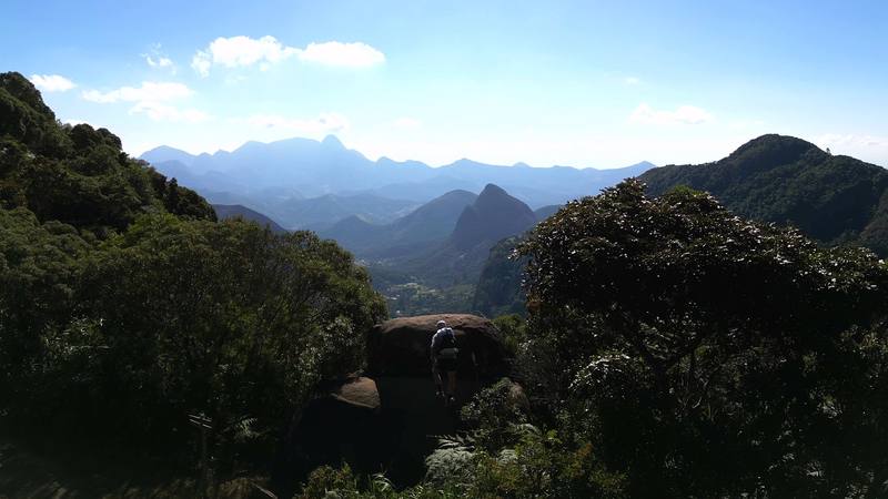
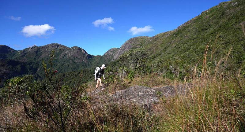
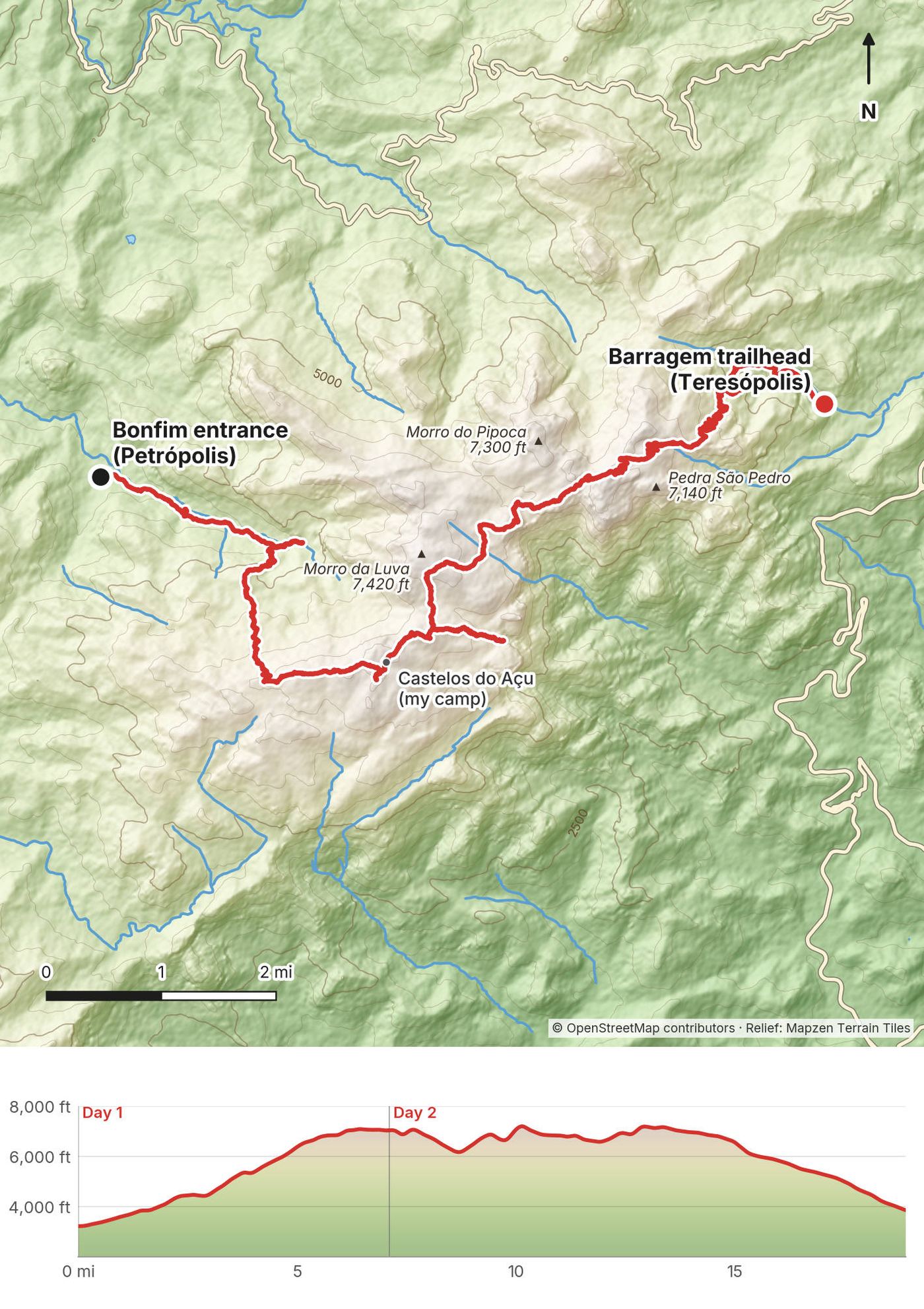
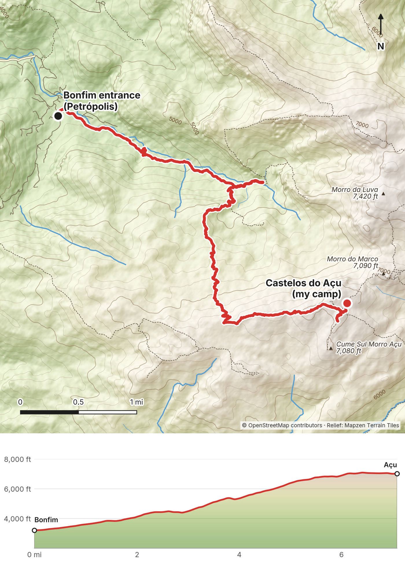
At the end of April 2024 I hiked the Travessia Petrópolis-Teresópolis alone in Serra dos Órgãos National Park, Brazil. I started at the Bonfim entrance above Petrópolis late in the morning, climbed onto the granite ridge and pitched my tent at the Castelos do Açu camp. The next day I left in the dark at 4:17 a.m., watched the sunrise at the Portais de Hércules, crossed the high peaks past Pedra do Sino and walked down to the Teresópolis side. By my GPS it was 18.9 miles (30.4 km) and about 6,330 ft (1,930 m) of climbing in two days. It's the trip from my film Hiking Alone in Brazil.
Before the hike I spent a few days in Rio de Janeiro, where it was "way hotter than it was supposed to be," as I said in my live stream after the trip. On the traverse I saw few people: "The Brazil hike was extremely quiet."
| Quick facts | |
|---|---|
| Distance | 18.9 miles (30.4 km) over 2 days by my GPS. ICMBio, the park service: about 30 km |
| Climbing | About 6,330 ft (1,930 m) up and 5,690 ft (1,735 m) down, by my GPS |
| Days | 2 for me. ICMBio plans 3 and recommends 3 |
| Start | The Bonfim entrance (Sede Petrópolis), about 1,100 m by ICMBio |
| Finish | The Barragem trailhead on the Teresópolis side, 3,832 ft (1,168 m) by my GPS, about 2 miles of road above the park's main gate |
| High point | 7,241 ft (2,207 m) by my GPS, near Morro da Luva. The trail passes below Pedra do Sino, 2,275 m (ICMBio) |
| Terrain | Forest low down, then granite ridges, grass, boulders, iron rungs and scrambles |
| Camp | Your own tent, only at the camps beside the Açu shelter and Abrigo 4 |
| Water | Springs and streams at a few named points. Treat it |
| Rules (2026) | Online booking, a signed risk form (TCRN), free for now, closed Mondays |
| Day | Route | Miles (km) | Up / down (ft) | Sleep |
|---|---|---|---|---|
| 1 | Bonfim (Petrópolis) to Castelos do Açu | 7.1 (11.4) | 3,986 / 180 | Tent at the Castelos do Açu camp, 7,030 ft |
| 2 | Castelos do Açu to Teresópolis | 11.8 (19.0) | 2,341 / 5,513 | Off the mountain |
From Rio to Petrópolis. Única Fácil buses run from Rio's Rodoviária Novo Rio, about 1 hour 10 to 1 hour 20 minutes, at least hourly, about R$47 (as reported). Most arrive at the Leonel Brizola bus station, a bit out of the center (as reported). I found no direct bus from either Rio airport.
From Petrópolis to Bonfim. A city bus to the Terminal de Corrêas, then line 611 (Bonfim) or 616 (Pinheiral), which stop about 0.6 mile (1 km) from the entrance; R$5.90 a ride in 2026 (as reported). A taxi or Uber is simpler.
How I did it. I took Ubers. From my hotel in Rio I went to the center, where I bought stove fuel and snacks at a hiking store, then to a hotel near the airport where I'd booked my last night and left a duffel bag. Then another Uber drove me all the way up to Bonfim. "I think this was an hour and a half maybe," I said in my live stream. At the end of the dirt road I ate scrambled eggs at a small restaurant near the entrance. It wasn't open yet, but they cooked for me anyway.
Back from Teresópolis. Hikers report about 2 miles (3.2 km) of road from the trailhead at the dam (the Barragem) down to the park's main gate: walk, or take a taxi or Uber. City buses MS200, MS201 and 04A run from near the entrance to the bus station. Viação Teresópolis goes to Rio's Novo Rio station roughly hourly, about 2 hours, about R$46; buses to Petrópolis take about 1 hour 10 to 1 hour 30 minutes, R$21 to R$30. An Uber to Ipanema is about US$50. (All as reported.)
How I got back. Near the end I met a park ranger who drove me into town. That was luck. Plan your own ride.
Driving. The traverse is one-way and I found no shuttle between the entrances. Leave the car in Petrópolis or Rio and come back by bus.
I didn't keep a list of what I spent in 2024, and I don't have a record of any fee at the gate.
For your budget (October 2026). Two days from Rio by bus for one person comes to about R$520 to R$920 (about US$100 to US$180), most of it a night in Petrópolis; park entry and camping were free. Rough US dollars at about R$5 to US$1 (Banco Central do Brasil, R$4.99 on October 9, 2026).
| Item | R$ | About US$ |
|---|---|---|
| Bus, Rio to Petrópolis (as reported) | 47 | 9 |
| Two city buses, Petrópolis to Bonfim (R$5.90 each, as reported) | 12 | 2 |
| Park entry and camping (ICMBio, October 2026) | 0 | 0 |
| City bus, Teresópolis (as reported) | 6 | 1 |
| Bus, Teresópolis to Rio (as reported) | 46 | 9 |
| Stove fuel, one canister (a rough allowance) | 40 | 8 |
| Food for 2 days (a rough allowance) | 120 | 24 |
| A night in Petrópolis before (as reported, undated) | 250 to 650 | 50 to 130 |
| Total | about R$520 to R$920 | about US$100 to US$180 |
Extras. A guide, about R$200 to R$400 a person in older reports (as reported); a taxi or Uber instead of the city buses; a cable car ticket at Sugarloaf, from about R$205 (as reported). From January 2027 the new operator may charge access and camping fees: the planning study suggested R$30 and R$25 (October 2026, not prices yet).
| Night | Where | Height |
|---|---|---|
| Before | Rio de Janeiro (I took an Uber up to Bonfim in the morning) | |
| 1 | My tent at the Castelos do Açu camp, beside the Açu shelter | 7,030 ft (2,143 m) |
| 2 | Off the mountain; my last night was at a hotel near Rio's airport |
The Açu camp. A small, sloping clearing beside the shelter, crowded for how few people were on the trail. In my live stream I said, "I should have just found a different area to sleep." The rules allow camping only in the designated camp, so get there early for a flat spot, and bring earplugs.
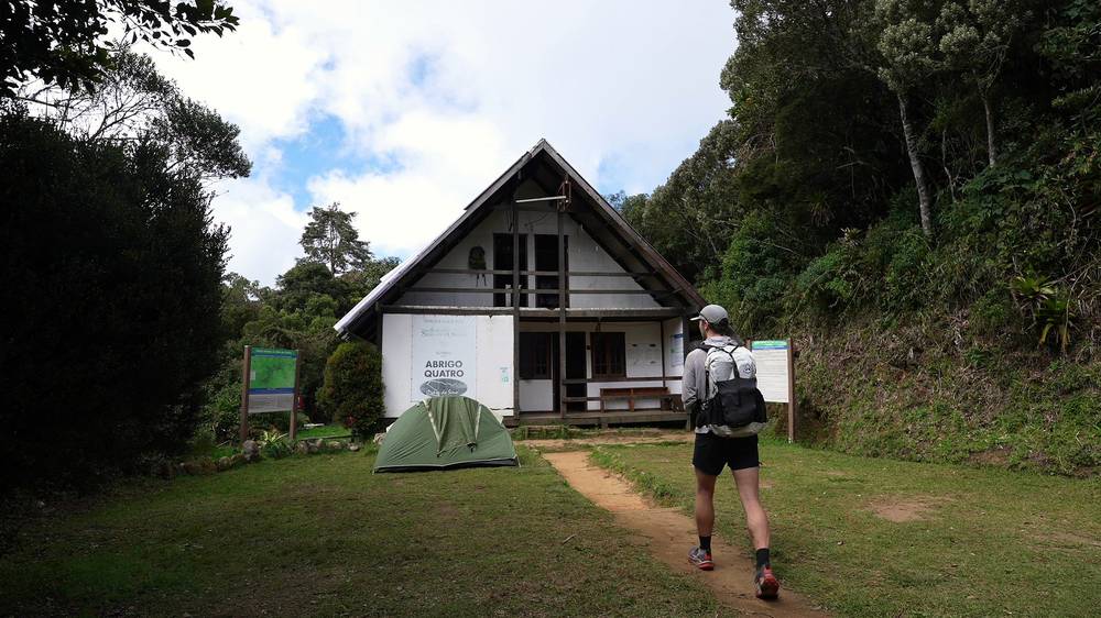
The Abrigo 4 camp. Beside Abrigo 4, below Pedra do Sino. I ate lunch on the hut's porch.
The shelters. Closed for sleeping in October 2026. The 2027 partner may open beds and bivouac places (planned: 12 and 18 a shelter). Don't count on it until the booking page says so.
The night before. Hikers suggest Petrópolis (as reported). Guesthouses near Bonfim, in Corrêas and in Teresópolis list about R$250 to R$650 a night (as reported, undated).
Food. Bring everything: nothing is sold on the trail in 2026. On the trip I had scrambled eggs at the restaurant near the entrance, coffee in the tent and at the Portais, and a pouch meal at Abrigo 4.
Stove fuel. You can't fly with gas canisters. I bought mine at a hiking store in central Rio. I couldn't confirm a shop selling them in Petrópolis or Teresópolis: buy fuel in Rio.
Water. The park lists Ajax (a spring), the Vale da Luva stream, the Cachoeirinha and the Vale das Antas (all year). Hikers also report a sink at each camp, and say some sources can run dry (as reported). On Day 1 I filtered water from a stream; on Day 2 I filled my bottle from a stream in the Vale da Luva. ICMBio says to treat all water: filter it, use tablets, or boil it 1 to 3 minutes, longer above 2,000 m.
From my film, my live stream and the film's description. I have no full gear list for this trip.
What this traverse needs:
I walked through the entrance at Bonfim on Tuesday, April 30, 2024 and started at 11:37 a.m. by my GPS. The first hour was forest: dense, uphill and hot. In my live stream I said I was "sweating profusely" and "not seeing anyone else on trail."
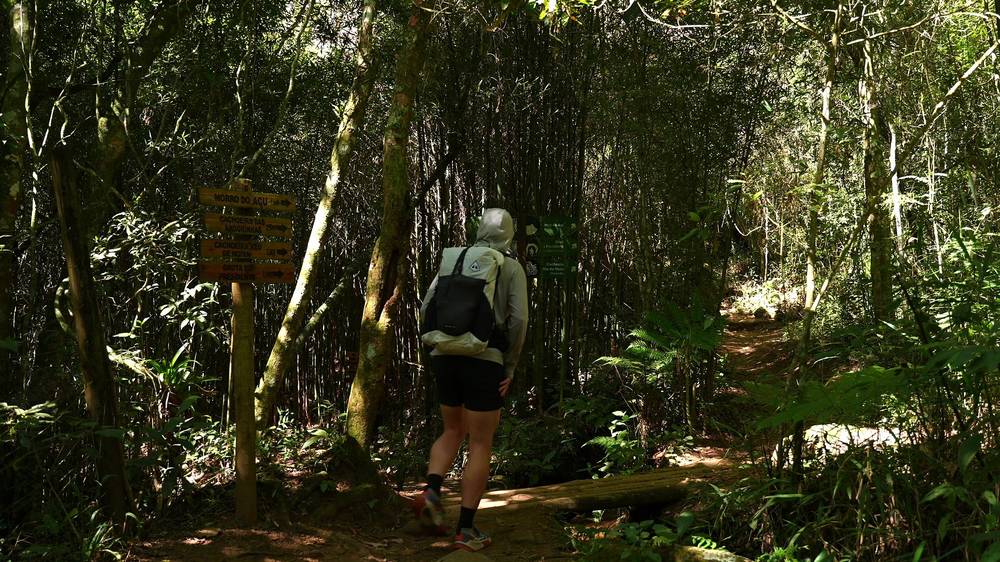
Then I reached the water. My longest stop of the day was there, 23 minutes at mile 2.4 (1:05 to 1:28 p.m.), near the Gruta do Presidente and the Véu da Noiva waterfall. "This water was so nice," I said.
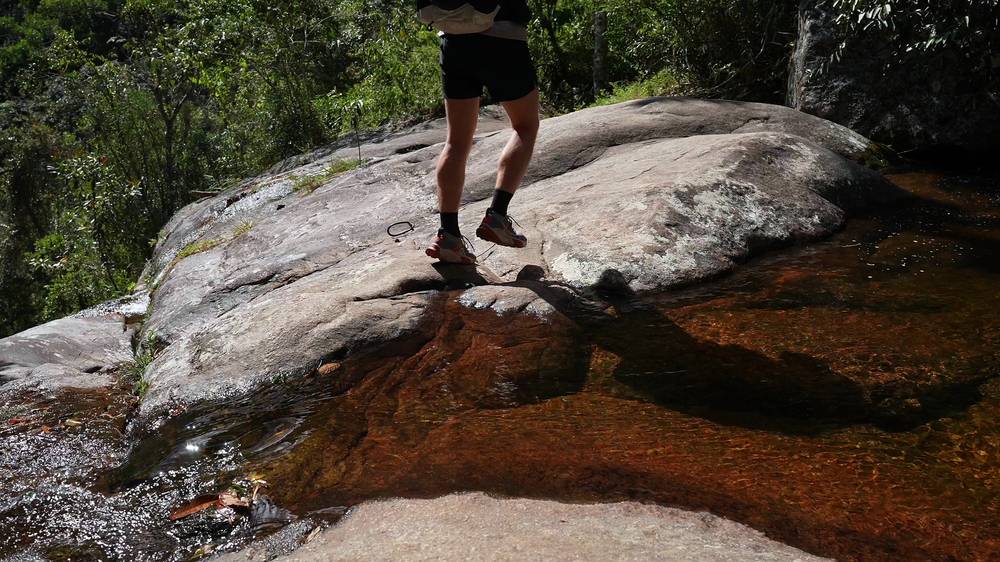
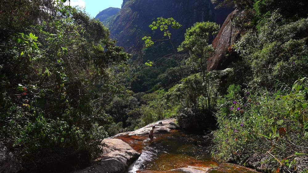
I had the whole afternoon for a short day, so I took my time. Somewhere on the way up I filtered water from a stream into my bottle. Above the forest the trail climbs steep rock and grass with views back over the hills. I passed the Ajax spring at about mile 4.6. On the open ridge the wind picked up: "by the time I hit this ridge, it got pretty windy."
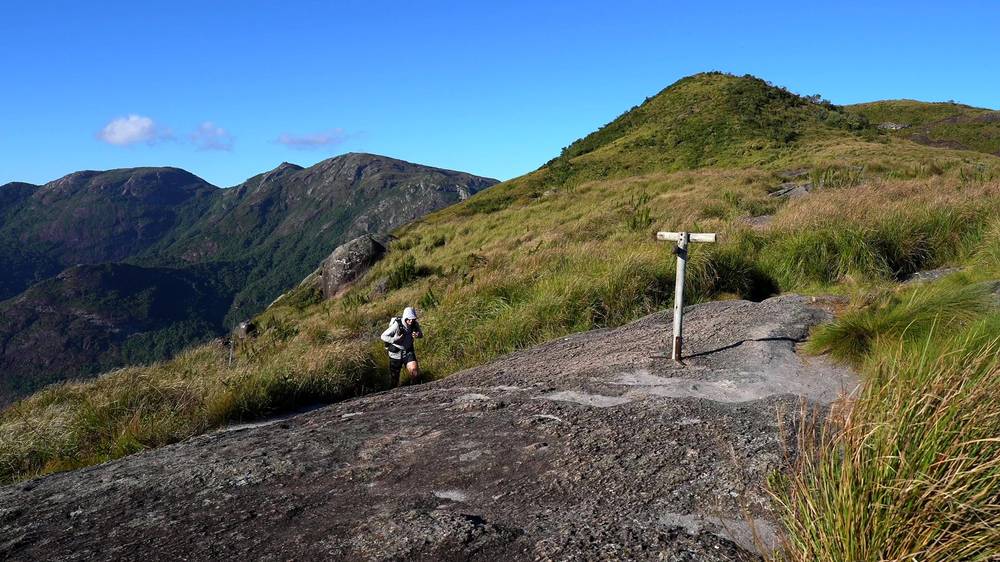
Near the top the trail winds between huge granite boulders. I shouted to hear the echo. "These rocks were so cool," I said. The light was golden when I reached the Açu shelter, at about mile 6.5 and 4:43 p.m. I looked around the camp for a while and stopped for the day at 5:26 p.m., 7.1 miles from Bonfim, as the sun went down.
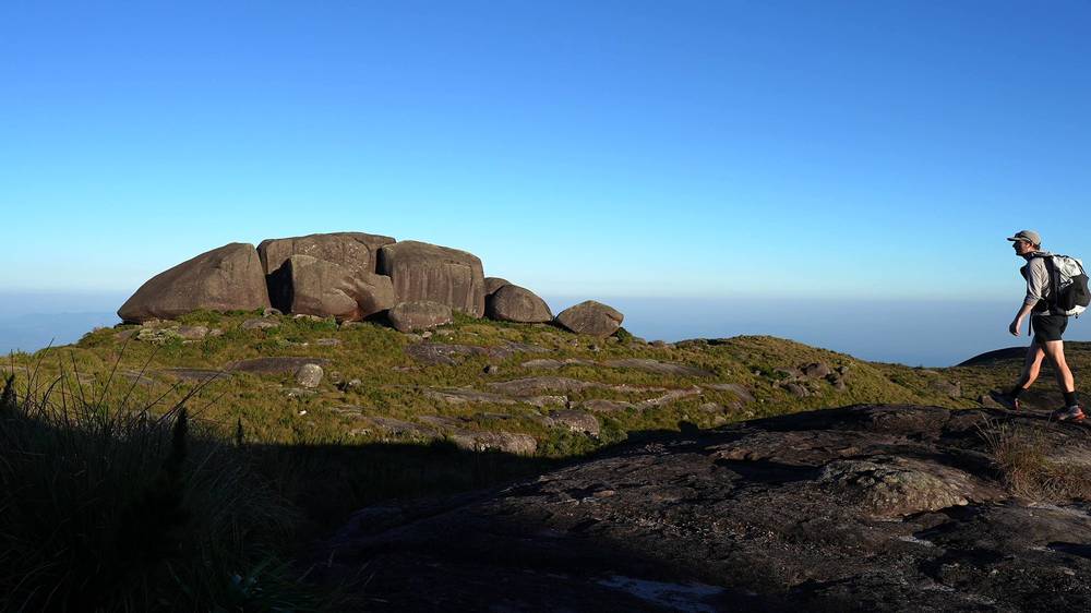
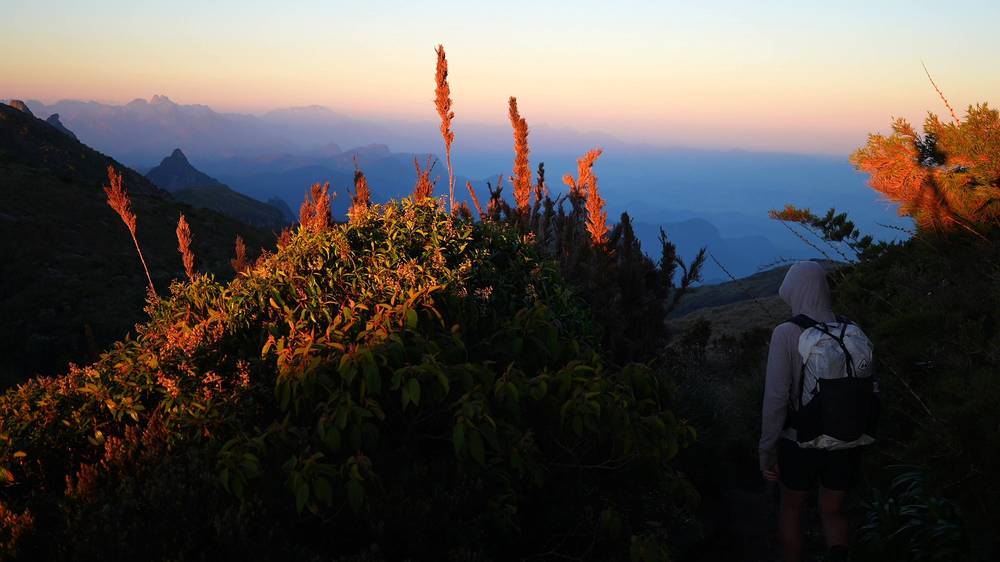
The camp is a small clearing beside the shelter. There were maybe three or four groups, and we were close together. I said hello to a few pairs and pitched my tent on the flattest spot left: "I was definitely on a slope." I looked into the shelter's kitchen, where a Brazilian flag hangs, and went to bed around eight. "I could hear snoring and talking the whole night."
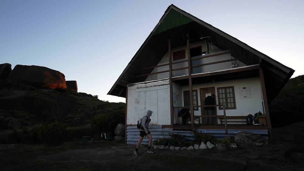
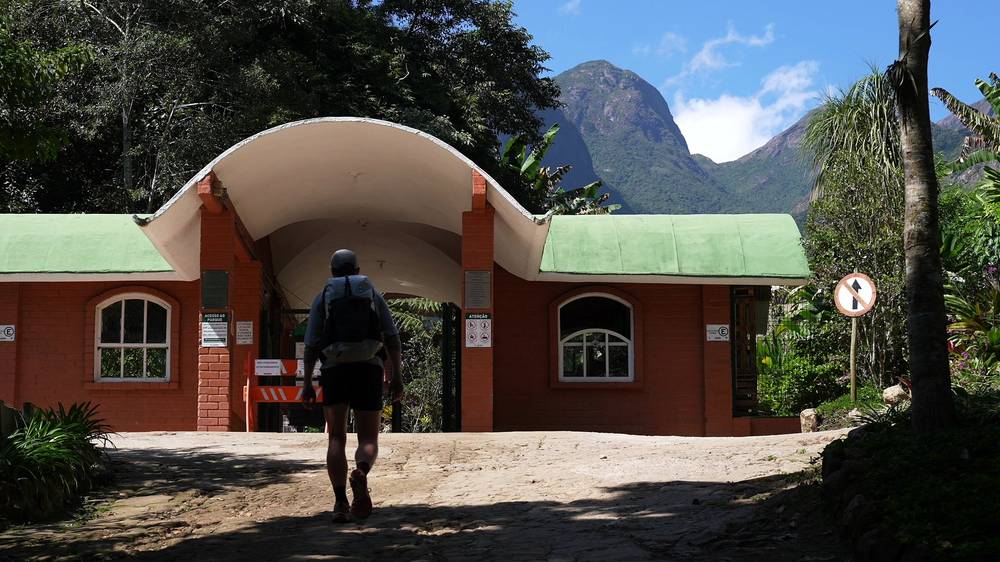
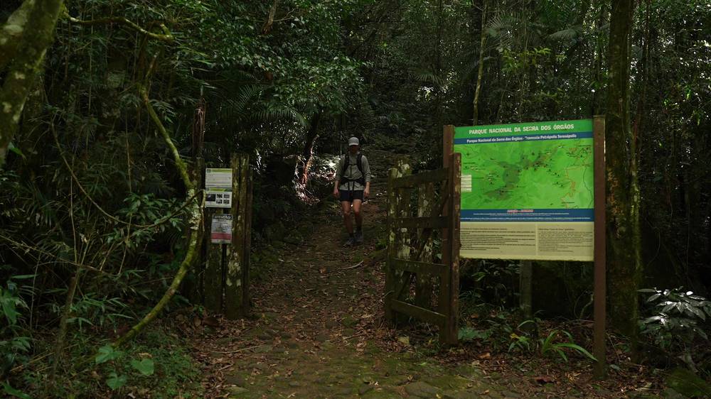
The Bonfim entrance (Sede Petrópolis). About 1,100 m by ICMBio. Check in here. My track starts at 3,213 ft (979 m).
Through the forest. ICMBio's times: about 40 minutes to the Gruta do Presidente and the Véu da Noiva waterfall, about 50 more to Pedra do Queijo, a viewpoint, and about 40 more to the Ajax spring (no camping). By my GPS the Véu da Noiva is at about mile 2.6 and Ajax at about mile 4.6. Fill up at Ajax: it's the last water the park lists before the Açu camp.
The Isabeloca and the Chapadão. ICMBio calls the Isabeloca a steep, eroded stretch. Then comes the Chapadão, and the ridge over rock and grass to Castelos do Açu.
Castelos do Açu. The granite towers and boulders around the Açu shelter. ICMBio gives Pedra do Açu as 7,365 ft (2,245 m), the highest point of Petrópolis; OSM marks Morro Açu here at 2,216 m. My tent was about 150 m from the shelter, at 7,030 ft (2,143 m) by my GPS. ICMBio gives just over 7 km and about 6 hours for this day; my GPS measured 11.4 km.
Ajax. If you're slow, short of water or the weather is turning, decide here: you can't camp at Ajax, and above it the trail gets steeper and more exposed. The way off is back down to Bonfim.
Day 1, Bonfim to Castelos do Açu (from 1:12)
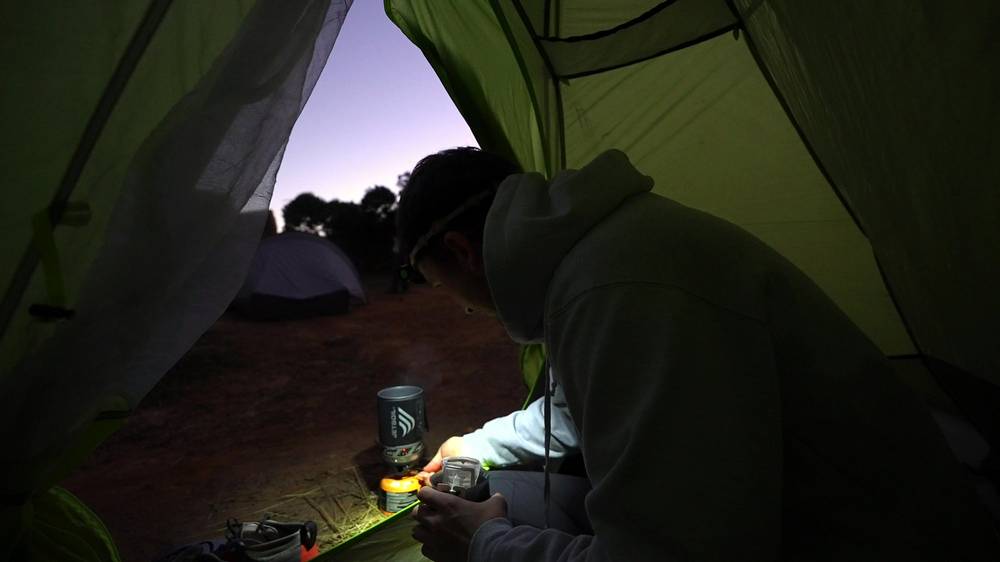
I was up at four on Wednesday, May 1, 2024. I made coffee in the tent by headlamp, with local Brazilian coffee in small single-cup bags, then took the tent down. I left at 4:17 a.m. Other headlamps were moving in the fog.
Walking in the dark was hard: steep, rocky drops, plants wet with dew, slippery rock. "I definitely got lost," I said in my live stream. I zigzagged off the trail and had to double back. When the sky got light I could see city lights far below and find the way again.
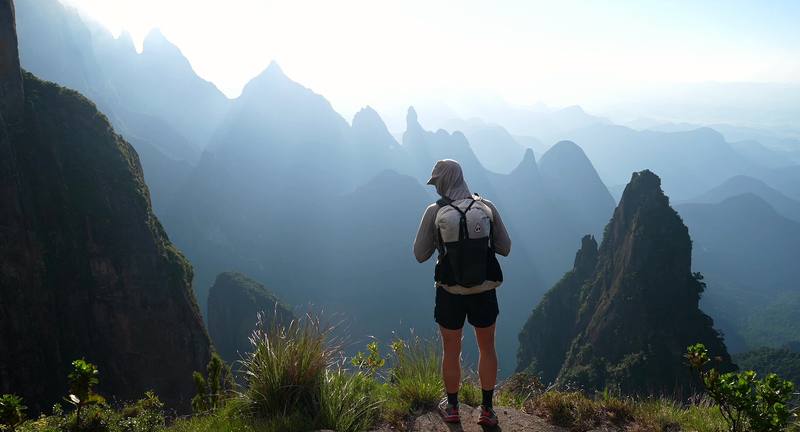
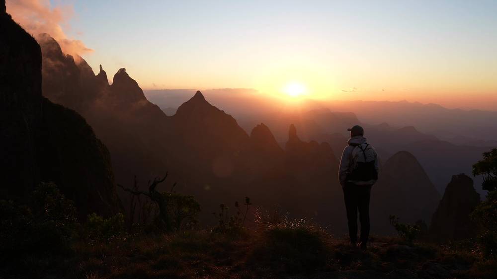
The Portais de Hércules are a short side trip off the main trail, about 1.5 miles from camp. I passed a group of four who had left earlier, got to the viewpoint first, and they arrived while I was making coffee. I stayed a long time: by my GPS from 5:53 to 7:06 a.m. The sun came up behind the peaks. "I don't usually get up early for sunrise stuff, but this was definitely worth it."
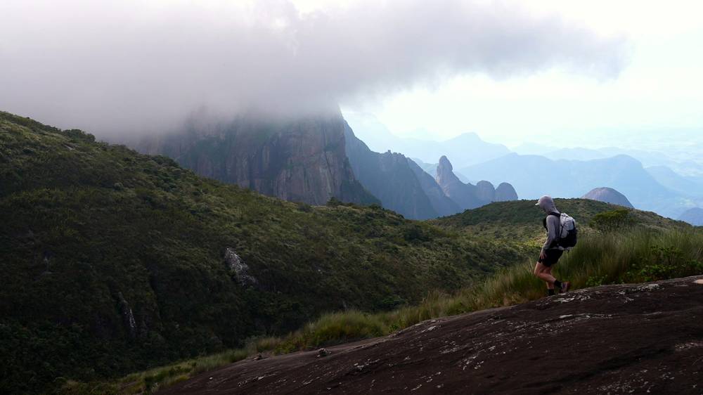
Back on the main trail I went down into the Vale da Luva and filled my bottle from a small stream, funnelling the water with a leaf. I reached my high point of the day, 7,241 ft, near Morro da Luva at 8:35 a.m. Then the clouds rolled in, "a lot more clouds than I expected," and came and went for the rest of the day. I was sick by then, in my nose and throat.
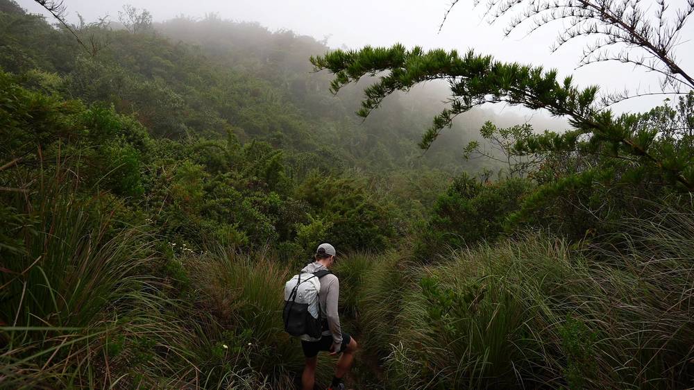
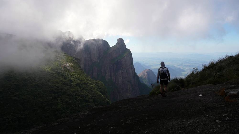
Then came the iron rungs up a rock face. "No photo ever does it justice," I said, "but legit some rock climbing moments on this trail." I was exhausted at the top of it. The trail keeps climbing and scrambling over granite, and "you're getting hit with these wet, sharp leaves all the time."
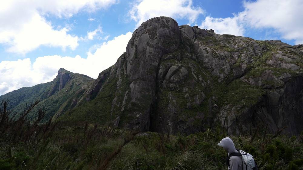
My track passes about 100 m from the top of Pedra do Sino at 11:11 a.m. I didn't go to the summit. I stopped at Abrigo 4, mile 6.6, from 11:43 a.m. to 12:09 p.m. and ate a pouch meal on the porch. A tent was pitched beside the hut.
From Abrigo 4 it's downhill all the way. I'd thought about a side section for the views, but took the main trail down. Lower down there were "a ton of day hikers coming up from the city." I put on some music and walked fast. I reached the Barragem trailhead, the gate at the top of the Sino trail on the Teresópolis side, at 2:41 p.m. by my GPS. A park ranger I met near the end gave me a ride into town. In my live stream I called it a tough day: "lack of sleep, being sick."
Morro do Marco. About 0.5 mile from the Açu camp, at 7,087 ft (2,160 m) by OSM. ICMBio gives about 30 minutes. Between the camp and the Portais is where I lost the trail in the dark: go slowly and check the GPX.
The Portais de Hércules. A variant off the main route (ICMBio) to a viewpoint at the spires, 6,299 ft (1,920 m) by OSM, about 1.5 miles from camp by my GPS.
The Vale da Luva and Morro da Luva. About 30 minutes down into the Vale da Luva, cloud forest with a stream, then about 30 minutes up Morro da Luva, 7,425 ft (2,263 m) by OSM, and 30 more to the Cachoeirinha, with water (ICMBio's times). My track crosses a spring at about mile 2.7 and reaches its high point at mile 3.05.
The Elevador. Iron rungs set in a rock face. ICMBio says to keep your balance with a heavy pack. Keep three points of contact, and go one person at a time.
The Dinossauro and the Vale das Antas. About 40 minutes to Morro do Dinossauro, then about 40 minutes down into the Vale das Antas, with water all year and no camping (ICMBio). Hikers also name the Mergulho, a squeeze between boulders where some use a rope (as reported).
The Dorso da Baleia and the Cavalinho. ICMBio calls the Cavalinho "the most dangerous point" of the traverse. ICMBio says a rope is mandatory here, and its hiker leaflet says ropes may be needed at the Mergulho and the Cavalinho. Hikers describe a boulder where packs are passed up by hand. Carry a rope, or go with a guide who has one, and take it slowly.
Pedra do Sino and Abrigo 4. Pedra do Sino is 7,464 ft (2,275 m) by ICMBio, the highest point of the Serra dos Órgãos; some sources give 2,263 m. A summit trail leads up to it; my track passes about 100 m from the top, at 7,121 ft (2,170 m). Abrigo 4 and its camp are just below. From the Açu camp to Abrigo 4 my GPS measured 6.6 miles (10.7 km); ICMBio gives about 7 hours.
Down to Teresópolis. From Abrigo 4 the trail is a long descent, much of it on switchbacks: past the ruins of Abrigo 3 (a lookout), the remains of Abrigo 2 and the Véu da Noiva de Teresópolis, a waterfall of about 16 m (ICMBio), which my track passes at about mile 10.5. My GPS measured 5.2 miles (8.4 km) from Abrigo 4 to the end of my track at 3,832 ft (1,168 m). ICMBio gives 11 km and about 4 hours from Pedra do Sino to the Teresópolis side.
Before you drop into the Vale da Luva. If the fog is down, the wind is strong or anyone is struggling, go back to the Açu camp and down to Bonfim: past the Vale da Luva the way off is forward, over the Elevador and the Cavalinho. If you're slow, stop at the Abrigo 4 camp (with a booking) rather than walking down in the dark.
Day 2, Castelos do Açu to Teresópolis (from 5:47) · Sunrise at the Portais de Hércules (from 7:43) · The iron rungs (from 9:42)
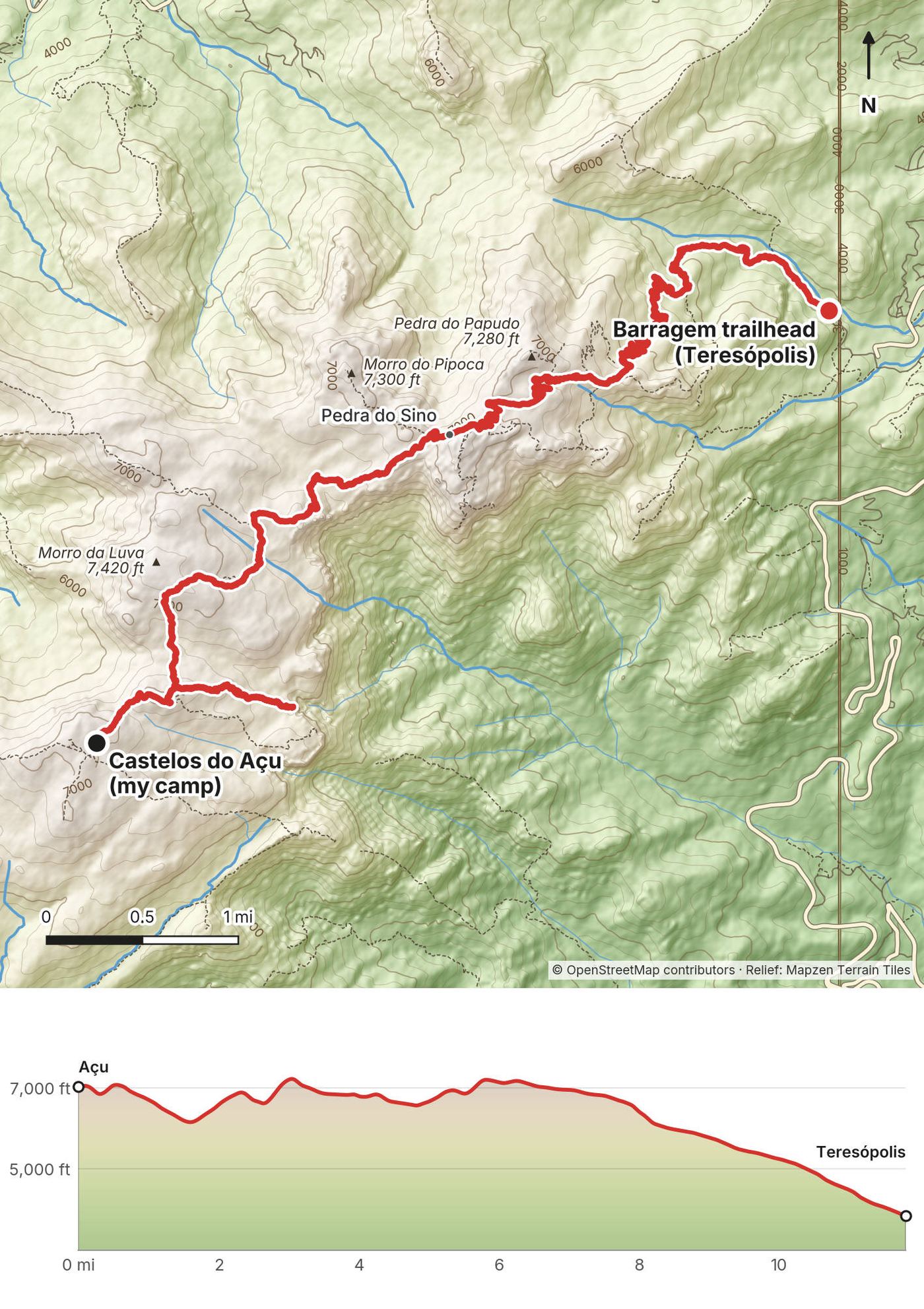
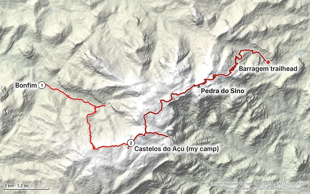
Elevation3,209–7,241 ft18.9 mi
Terrain: Mapzen Terrain Tiles (SRTM, GMTED) on AWS · Rivers & lakes © OpenStreetMap contributors
Tap a map to open it full size.
Checked on the ICMBio pages for Parque Nacional da Serra dos Órgãos and its visitor rules (PROV 01/2025) on October 10, 2026.
Open, with booking. The park's booking page (updated October 1, 2026) says the Sede Petrópolis and the Travessia reopened after a fire started by a fallen balloon was put out. It doesn't give the date of the fire. I found no other closure notice.
The shelters. The Açu shelter (Abrigo Açu, at Castelos do Açu) is closed "for an indefinite time" after a windstorm left it structurally unsafe, and has no staff. Abrigo 4, at Pedra do Sino, is also closed to overnight guests. Abrigo 4 opens only as day support, 6 to 9 a.m. and 5 to 9 p.m., for its kitchen and dining room; ICMBio says there are no park staff and no support at all at Açu, so plan your first night with nothing there. You sleep in your own tent in the camp beside each shelter.
A new operator, planned from January 2027. ICMBio is choosing a non-profit partner to run visitor support and overnight stays on the traverse, including both shelters: proposals October 7 to November 9, 2026, final result November 30, operation from January 2027 for five years. The planning study suggests future charges (access R$30, camping R$25, a shelter bed R$80), but in October 2026 these were projections, not prices. Expect changes in 2027.
Mondays. The park is closed on Mondays, except when a national or Rio state holiday, or the eve of one, falls on that Monday.
The season. I found no seasonal closure. Hikers report June to August as the driest, clearest months (as reported). See When to go.
Checked on the ICMBio pages and the park's visitor protocol, PROV 01/2025, on October 10, 2026. My trip was in 2024, and the rules then may have been different.
Where you are. Parque Nacional da Serra dos Órgãos, run by ICMBio, Brazil's federal park service: sac.parnaso@icmbio.gov.br, (21) 97896-2463 (WhatsApp).
Booking. Required for any overnight trip on the traverse.
The risk form (TCRN). The Termo de Conhecimento de Riscos e Normas, from the park's site or the gates, is filled in, signed and handed in at check-in. One adult signs for up to 5 people; a minor without a legal guardian needs a separate authorization. Signing out is required: the form must be checked out at the exit gate (the park's main gate and visitor center, not the Barragem trailhead), and the form says failing to do so brings a fine of at least R$500. In 2024 I had my paperwork printed, and at the gate they had me fill in the form again anyway.
ID. Bring your passport, or a CPF with a photo ID.
Fees. None in October 2026: the protocol says access to all entrances, parking, campsites and trails is free for now. The new operator may charge from January 2027.
Hours. Tuesday to Sunday and holidays. Entrances 7 a.m. to 4 p.m. (check-in in those hours), out by 5 p.m. Traverse access 7 to 10 a.m. for a day hike, 7 a.m. to 10 p.m. for an overnight, but check-in (handing in the TCRN) closes at 4 p.m., so arrive by then. Day hikers should start down by 2 p.m.
Camping. Only beside Abrigo Açu (Castelos do Açu) and Abrigo 4 (Pedra do Sino). Not at Ajax, the Vale das Antas or the top of Pedra do Sino.
What the shelters do now. Both are closed for sleeping. The Açu shelter is closed completely, with no staff or support. At Abrigo 4, from 6 to 9 a.m. and 5 to 9 p.m. you can use the kitchen and dining room, but not the shelter's stove: bring your own. An outside bathroom is for changing and your waste kit.
Waste. A waste kit ("shit tube" or similar) is required overnight. No trash collection: carry everything out.
Fires and glass. No fires on the traverse (only at the park's lower campsites). No glass.
Drones. Restricted by the park's protocol (banned in the Travessia sector on weekends and holidays from May to September, with limits elsewhere). This guide doesn't cover flying one.
Rescue. The park says it isn't responsible for rescue. Call the fire brigade (Corpo de Bombeiros) on 193.
My trip. I hiked on Tuesday, April 30 and Wednesday, May 1, 2024, during a hot spell in Rio. It was warm enough that I left my sleeping bag at home. In my live stream I said, "I actually secretly didn't bring a sleeping bag because it was so hot," and then, "You should always have a sleeping bag because it could be colder than you think." Day 1 was sunny. Day 2 started clear for the sunrise, then the clouds rolled in and stayed for most of the day.
The dry season. Hikers report June to August, the Brazilian winter, as the driest and clearest months; others say May to August (as reported). I found no official season statement. ICMBio's hiker leaflet says temperatures in the high part of the park often approach 0 °C (32 °F).
The wet season. Summer, roughly November to March, is humid and stormy (as reported). Wet granite is slick, and fog is more likely. October is often cloudy (as reported).
Busy days. The camps take a fixed number of people a night (see The rules), and bookings open two months ahead. I went midweek, and the middle of the traverse was quiet. The Teresópolis end was busy with day hikers.
Daylight. In late April I reached the Açu camp at 5:26 p.m., around sunset, and started Day 2 in full darkness at 4:17 a.m.
Emergencies. Call 193 for the Corpo de Bombeiros (fire brigade). The park says it isn't responsible for rescue. Park contact: sac.parnaso@icmbio.gov.br, (21) 97896-2463 (WhatsApp).
Fog. The ridge is often in cloud, and ICMBio says hikers often get lost here, mostly on foggy days: on Day 1 the trail is faint in places on the Chapadão, and on Day 2 the rocky descent from Morro da Luva toward the Cachoeirinha is poorly marked. On Day 2 the clouds came and went all day. Follow the trail markers, check the GPX track often, and if you can't see the next marker, stop and look before you go on.
The dark. I got lost after leaving the Açu camp at 4:17 a.m. If you start early for the Portais sunrise, study the first mile on your GPX, go slowly, and when you lose the trail, go back to where you last had it.
The scrambles. ICMBio names the Elevador (iron rungs) and the Cavalinho ("the most dangerous point", where it says a rope is mandatory); its leaflet adds the Mergulho. Keep three points of contact, pass packs up by hand where you need to, and go one at a time. Wet granite is slick, even with morning dew: wait out rain if you can.
Storms. The ridge is exposed, and the wet summer is stormy (as reported). If a storm builds, get off the high ground.
Cold. ICMBio says temperatures up high often approach freezing. Bring a sleeping bag even if Rio is hot.
Long days. On a two-day plan, Day 2 is long, with the hardest scrambling in the middle. Carry a headlamp.
Do I need a permit? For an overnight trip, yes: an online booking, plus a signed risk form (the TCRN) handed in at the entrance. A day hike needs no booking, only the form. Entry and camping were free in October 2026. See The rules.
How hard is it? Hard. It's steep and rocky, with scrambling: the park names the Elevador (iron rungs up a rock face) and the Cavalinho, "the most dangerous point." Fog makes the route easy to lose. If you haven't scrambled on rock with a pack, go with a guide or someone who knows the route.
How far is it? By my GPS, 18.9 miles (30.4 km): 7.1 on Day 1 and 11.8 on Day 2. ICMBio says about 30 km. My film's description says "about 20 miles."
How many days? Two for me. ICMBio plans three: Bonfim to Castelos do Açu, then to Pedra do Sino, then down to Teresópolis. See Other ways to do it.
Which direction? Petrópolis to Teresópolis, as I did and as the park describes it. I found no rule against the reverse.
Do I need a guide? ICMBio recommends one but doesn't require it; without one, someone in the group must know the route and the rules. One ICMBio page calls an experienced guide essential between Castelos do Açu and Pedra do Sino. I went alone, and I found no rule against that.
Where do I sleep? In your own tent, only at the two designated camps, beside the Açu shelter and beside Abrigo 4.
Is there water? At a few named points. Treat it. See Where I slept, food and water.
Can I bring my dog? No. The park's public-use rules don't allow domestic animals, except guide dogs.
Is there a phone signal? Don't count on one. Hikers report no reception at either trailhead (as reported).
ICMBio's plan, with its own times:
| Day | From, to | Park's estimate | By my GPS |
|---|---|---|---|
| 1 | Bonfim to Castelos do Açu | just over 7 km, about 6 hours | 7.1 mi (11.4 km) |
| 2 | Castelos do Açu to Pedra do Sino (Abrigo 4 camp) | about 7 hours | 6.6 mi (10.7 km) |
| 3 | Pedra do Sino to Teresópolis | 11 km, about 4 hours, mostly downhill | 5.2 mi (8.4 km) |
It needs a booking at both camps, and it leaves time to walk up Pedra do Sino. Unless you're fast and know the route, do it this way.
A night at Castelos do Açu means a long second day: I took 10 hours 24 minutes, starting in the dark. Some hikers instead walk to the Abrigo 4 camp on Day 1 and down on Day 2 (as reported). Either way, one day is long.
I found no rule against it. Reversed, my track would climb about 5,690 ft instead of 6,330, starting with the long climb to Pedra do Sino. Check with the park.
No booking, only the risk form; start by 10 a.m. and start down by 2 p.m. Pedra do Sino from Teresópolis is the trail I came down, up and back. Castelos do Açu from Bonfim is my Day 1 up and back: about 13 miles (21 km) to the shelter and back, and about 4,200 ft (1,270 m) of climbing.
ICMBio lists the credentialed condutores (local guides) for the traverse. Guides registered with CADASTUR or the mountain guides' association (ABGM) don't need their own booking; their clients do. Older reports put a guide at R$200 to R$400 a person (as reported). Ask for a quote.
I spent a few days in Rio first, staying in Urca, below Sugarloaf. "I chose it because it was quiet and safe," I said in my live stream. I walked, biked and took Ubers. "Rio is way cooler than I anticipated, especially because of these rocks." Both hikes below are in the city, and both are short.
The huge granite headland in Tijuca National Park, above the sea. I hiked it on Sunday, April 28, 2024.
It was a heat wave, on a jungle trail, and I saw monkeys eating jackfruit. I took an Uber to a café near the start and went back after for the "air conditioning, coffee, an amazing breakfast." In my live stream I said, "Anyone in Rio, I think should do this."
The Carrasqueira. Near the top is the Carrasqueira, a smooth, steep rock face of about 40 m that needs hands and feet. Hikers report that most accidents on the mountain happen there, and that people use ropes and harnesses and climb it one at a time (as reported). In 2024 I saw guides offering people belays down it. If you've never climbed rock, hire a guide with a rope or stop below it, and don't try it wet.
The facts (as reported). The trail starts on Estrada do Sorimã. Hikers report no authorization needed, hours of about 8 a.m. to 5 or 6 p.m. with no start after 2 p.m., and an unclear fee. I couldn't confirm these on the Tijuca National Park pages: check before you go, and start early.
I walked this on Monday, April 29, 2024, from Urca.
My track's 659 ft of climbing fits Morro da Urca, the lower hill below Sugarloaf. Fog rolled in right when I got up there. I had ice cream and saw a marmoset. "Much nicer hiking up than taking the cable car in my opinion."
The facts (as reported). The Morro da Urca trail leaves from the Pista Cláudio Coutinho, a shore path below Sugarloaf: about 1.5 km and 25 to 40 minutes up, free, gate open about 8:30 or 9 a.m. to 5 p.m. At the top a hiker's cable car ticket takes you up to Sugarloaf and back, or down. The cable car runs 8:30 a.m. to 9 p.m. (Parque Bondinho); a full ticket for a foreign adult was from about R$205 in 2026. Avoid the trail after rain.
From the UK government's travel advice for Brazil: robberies are common, especially on buses and of phones, mostly from 4 to 9 p.m.; avoid all favelas, even if your GPS routes you through one; use official taxi and ride apps; and flash floods and landslides are common near Rio's mountains. Read your own government's advice too.
Petrópolis. A mountain town about 1 hour 10 minutes by bus from Rio (as reported). The traverse starts above it, in Bonfim. Most buses from Rio stop at the Leonel Brizola bus station, out of the center (as reported). I didn't stop in town: my Uber drove straight to the trailhead.
Teresópolis. The town at the end. The park's visitor center and main gate are on this side, about 2 miles of road below the Barragem trailhead: sign out your risk form there. Buses go back to Rio and to Petrópolis from the bus station (see Getting there). The ranger drove me into town, where I got some food and left.
Guesthouses. Near Bonfim and Corrêas, and near the park in Teresópolis; about R$250 to R$650 a night (as reported, undated).
These change every year. Everything else in this guide stays the same.
Is it open?
Booking and rules
Getting there
Your stuff
The film is at the top of this page.
When bookings open, from the sources named under each. Dates move: confirm on the official site.
Dates open two months ahead at midnight (the park's example: August 1 opens on June 1). Book the day dates open; there's no waiting list.
Opens a set time before your start date: make a plan with your dates to see yours.
Source: Kraig Adams's Petrópolis to Teresópolis guide: The rules (checked Oct 10, 2026). Checked October 2026.
Planning questions about Travessia Petrópolis-Teresópolis, answered only from this page's facts, the creators' versions and hikers' public tracks, with where each answer comes from. When the data doesn't say, the answer says "not given".
From hikers
Sign in to comment. Free; your hikes stay private unless you share them.
Something wrong or missing on this page? Send feedback.