
Content made there

Photos
Hikes / Peaks of the Balkans / Kraig Adams's version
Europe · Kosovo, Montenegro, Albania
May 20–25, 2026 · 6 days · over 100 miles · Solo · Huts and tent

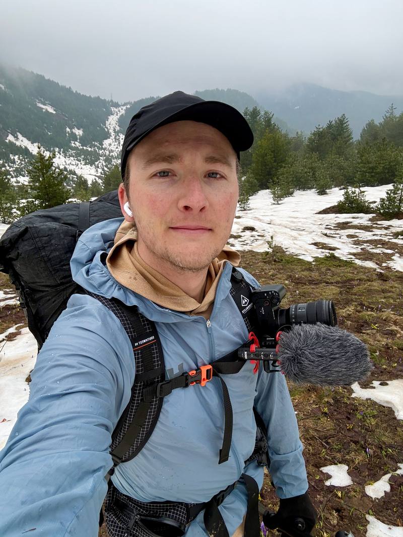
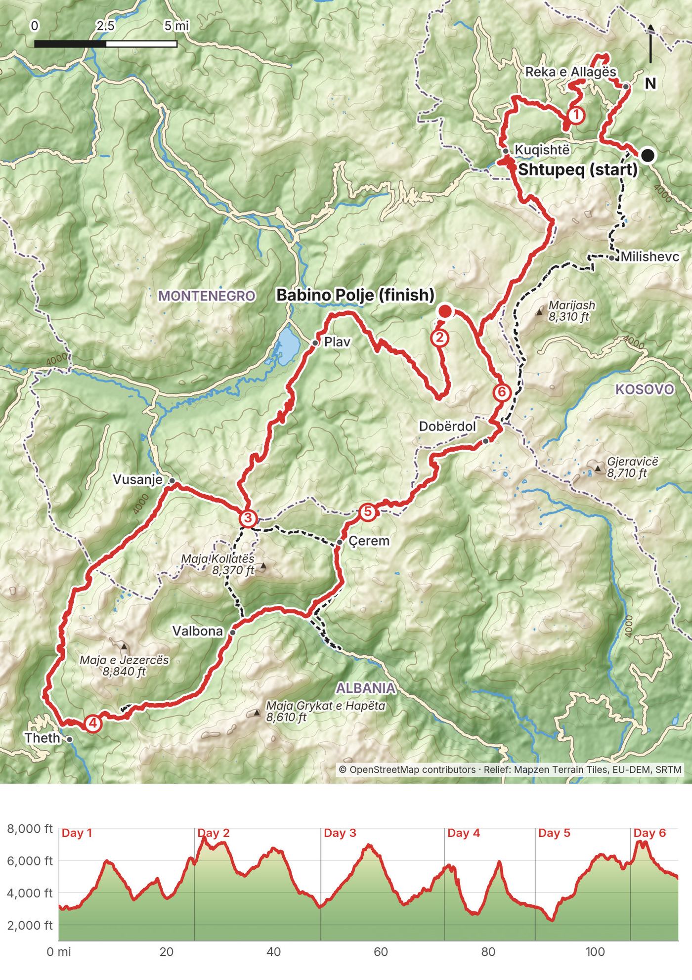
In late May 2026 I spent six days hiking the Peaks of the Balkans trail, a loop through the mountains where Kosovo, Montenegro and Albania meet. I started in the Rugova valley in Kosovo, crossed into Montenegro, then into Albania over to Theth and Valbona, and ended at Babino Polje in Montenegro, where snow turned me off the loop. My GPS says 115.4 miles in six days.
It was so early in the season that the trails were empty, but also buried in snow and ice. That made this my snowiest hike ever. Between huge days, long road walks and the worst night I've ever spent in a tent, this trip definitely tested me. But I also loved finally getting to visit this part of the world. Along the way I got to see incredible mountains, valleys, dogs, food, beer and some really friendly people.
| Quick facts | |
|---|---|
| Distance | 115.4 miles (185.7 km) of walking over 6 days |
| Climbing | about 29,900 ft (9,110 m) up and 28,200 ft (8,600 m) down |
| Days | 6 walking days |
| Start | Shtupeq i Madh, Rugova valley, Kosovo |
| Finish | Babino Polje, Montenegro (I left the loop here because of snow) |
| Countries | Kosovo, Montenegro and Albania, with permit crossings on Days 2 and 3 |
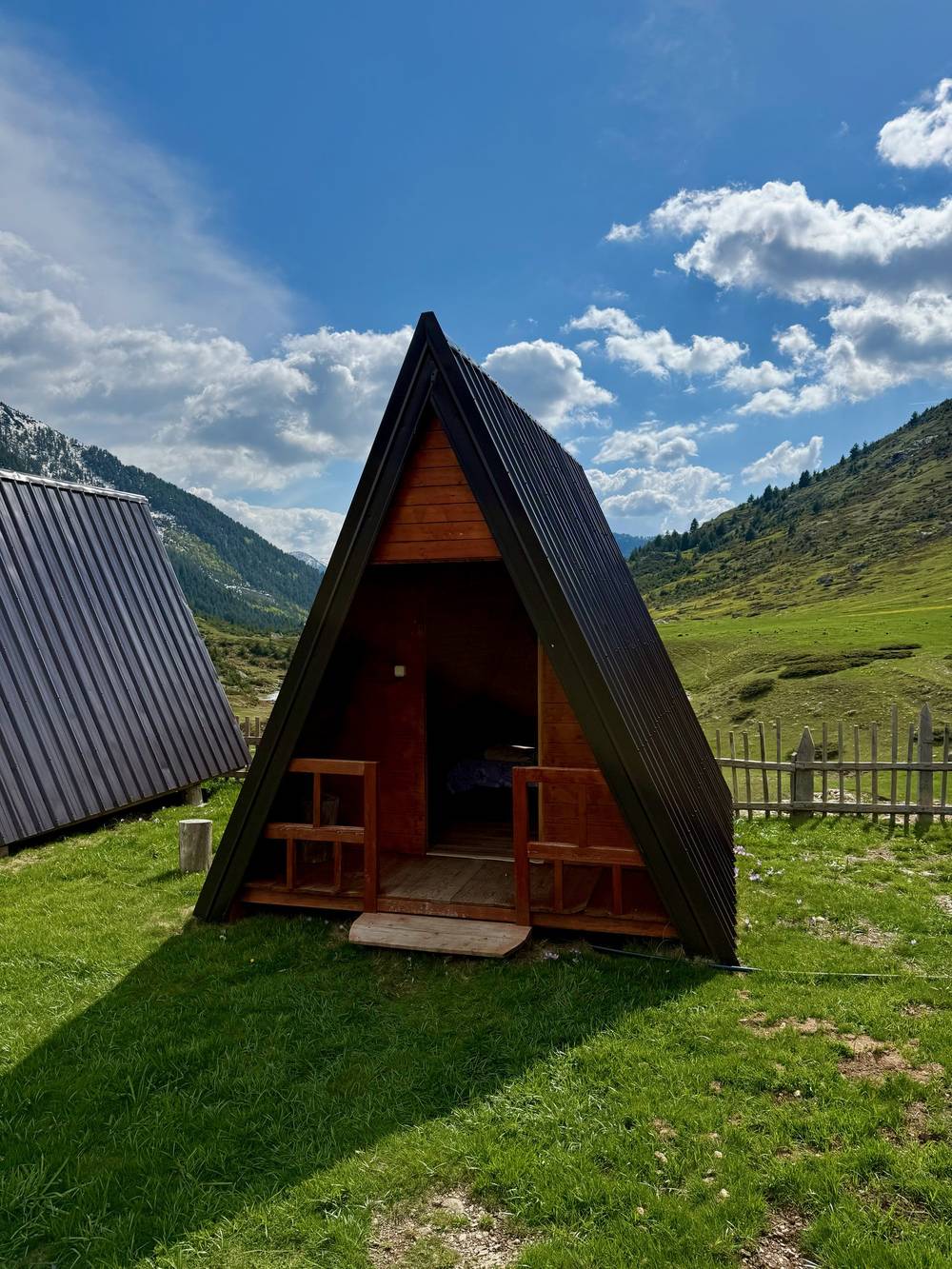
| Nights | 2 in my tent, 1 in a hotel in Plav, 1 in a guesthouse in Valbona, 1 in an A-frame cabin in Dobërdol |
| When | Guesthouse season is summer. I went in late May, with a lot of snow |
| Difficulty | Hard in May: long days, steep snow without a trail to follow, and storms |
| Nearest airports | Pristina (Kosovo), Podgorica (Montenegro), Tirana (Albania) |
| Trip date | May 20 to 25, 2026 |
| Day | Route | Miles (km) | Up / down (ft) | Sleep |
|---|---|---|---|---|
| 1 | Shtupeq to Lake Drelaj | 25.2 (40.5) | 7,293 / 4,649 | My tent by two cabins |
| 2 | Lake Drelaj to Plav | 23.6 (37.9) | 4,407 / 7,053 | Hotel Cattleya, Plav |
| 3 | Plav to a camp below Qafa e Pejës | 23.1 (37.1) | 6,877 / 4,541 | My tent by a waterfall |
| 4 | Qafa e Pejës to Valbona | 16.9 (27.3) | 4,389 / 6,829 | Guesthouse Demushi |
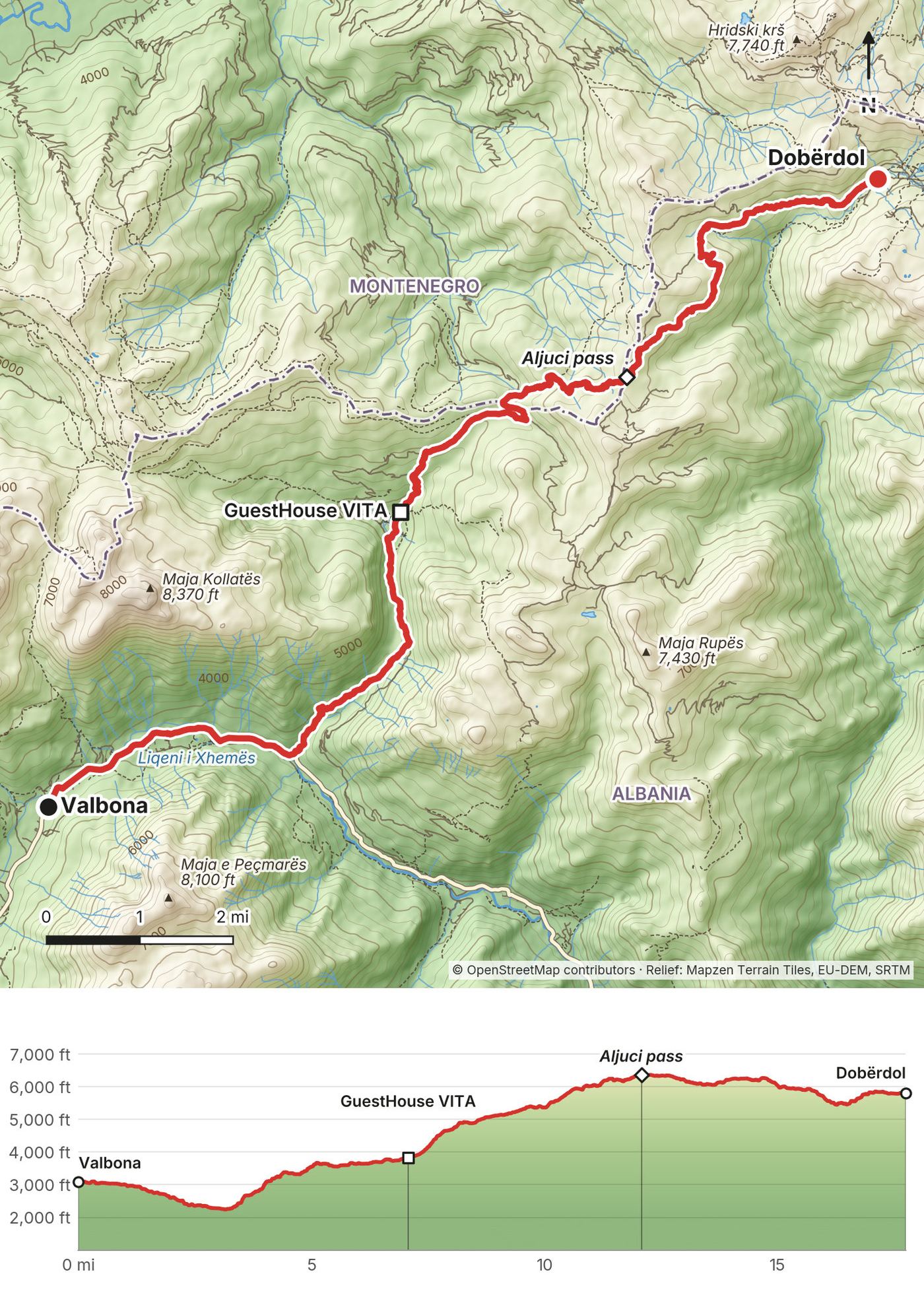
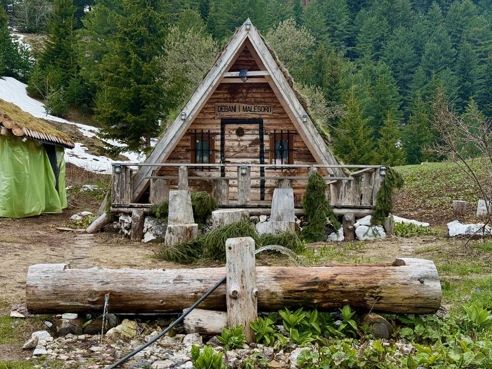
| 5 | Valbona to Dobërdol | 17.8 (28.6) | 5,063 / 2,343 | A-frame cabin, Dobërdol |
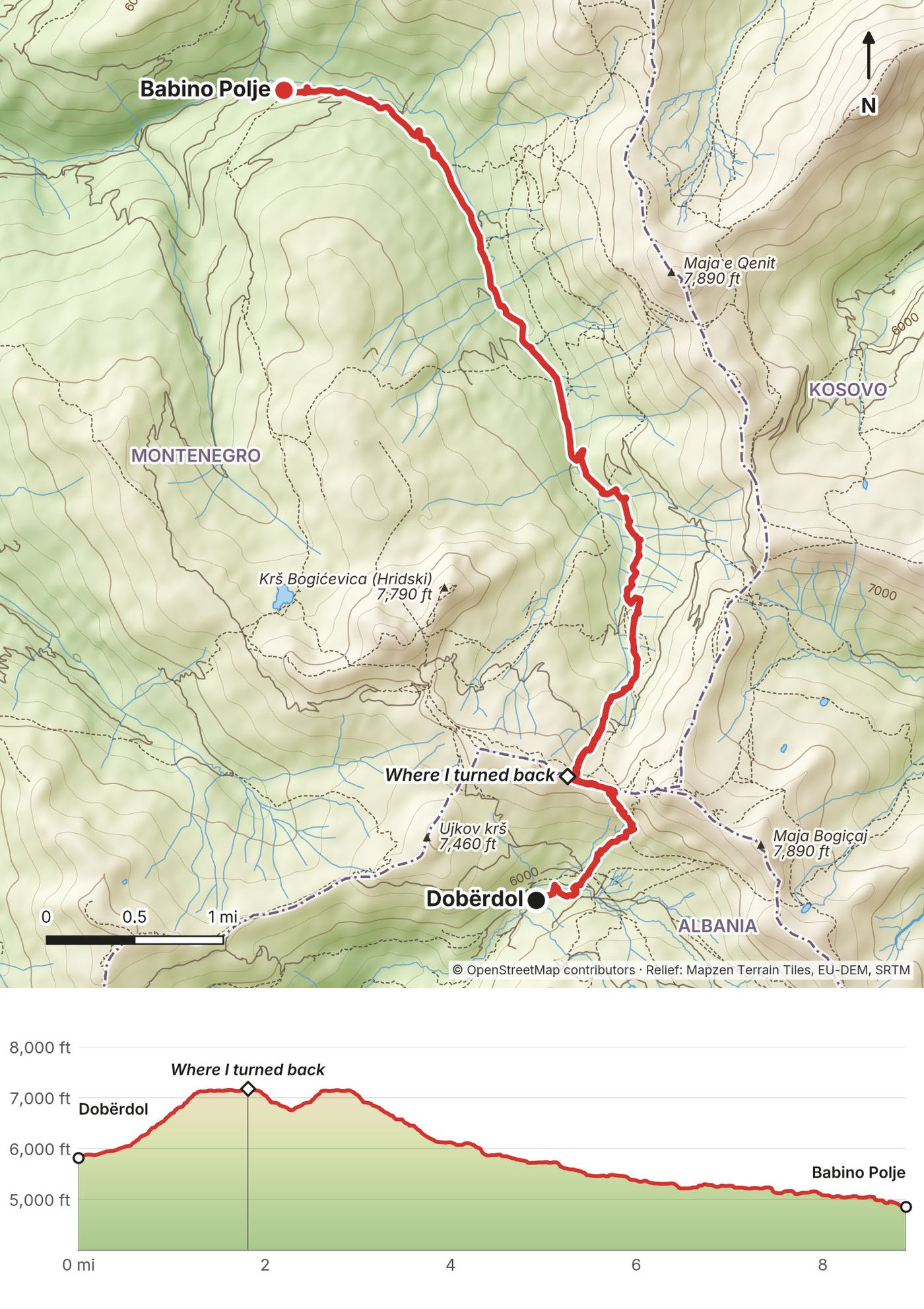
| 6 | Dobërdol to Babino Polje | 8.9 (14.3) | 1,864 / 2,811 | Ride to Plav, taxi to Pristina |
The numbers come from my own GPS recordings, smoothed the same way for every day. Apps count climbing differently, so the figures I said in my film are higher ("almost 8,000 feet" on Day 1). My film titles say 100 miles; my GPS says 115.4.
What I did. I met my friends in Istanbul, and we flew from there to Pristina airport in Kosovo. We got our first views of the mountains at sunset on the drive to Hotel Melishta in the Rugova valley, about two hours by road. I packed my hiking gear there and left my roller duffel at the hotel to pick up at the end.
There are three ways in, one for each country. Pick the one nearest where you want to start. Times and prices are from late September 2026 timetables; summer times can differ.
Kosovo: Pristina to Peja and the Rugova valley (where I started). Buses from Pristina to Peja run about every half hour from 7:30 a.m. to 9 p.m., about 1 hour 25 minutes and about €5; from Pristina airport there are about five a day, with a change. From Peja, about three buses a day go up the Rugova valley to Kuqishtë (about 35 minutes), and taxis go anywhere in the valley. Journey planner: travel.gjirafa.com.
Montenegro: Podgorica to Plav or Gusinje. Buses from Podgorica to Plav take 3 hours 40 minutes to 4 hours 10 minutes and cost €16; the late September 2026 timetable had five a day (8:25, 10:25, 13:28, 15:30 and 17:14). Most continue to Gusinje, 7 km on. Podgorica has the nearest airport.
Albania: Shkodër to Theth or Valbona. Minibuses leave Shkodër for Theth at 7:30 a.m. and 2 p.m. from Hotel Rozafa and take about 2 hours; they come back from Theth at 11 a.m. and 5 p.m. from the Jezerca mini market (Berisha, komanilakeferry.com). Local operators list the fare at €12 to €15. Berisha lists the line as running all year; some operators say April to early November, so check outside summer. For Valbona, take the Komani lake ferry: a 6:45 a.m. minibus from Shkodër (€8) meets the 9 a.m. boat from Koman to Fierzë (daily April 15 to November 5, €9 online or €10 cash), and local operators sell the onward minibus from Fierzë to Valbona (Berisha, komanilakeferry.com/timetables-and-prices). Coming back, a 10:30 a.m. minibus from Valbona meets the 1 p.m. boat. Tirana has direct buses to Theth (about 5 hours) and the country's main airport.
Road borders. The direct road from Plav to Peja over the Čakor pass has been closed to traffic since 1999, so by car you go round through Rožaje and the Kula crossing. My taxi from Plav to the Rugova valley took three hours. The road crossing between Gusinje and Vermosh links Montenegro and Albania. Road crossings don't need the trail permits.
My records for this trip are thin: my emails have no bookings or receipts. These are the prices I said in my film or wrote down at the time.
| Item | What I paid |
|---|---|
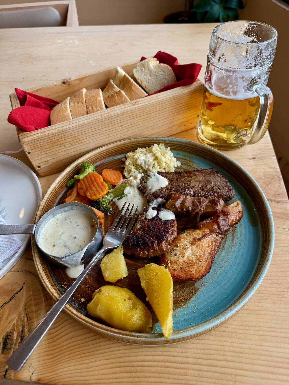
| Beer and meat plate, Guri i Kuq (Day 1) | $18 |
| Omelet, bread, cheese and tea, Babino Polje (Day 2) | $5 |
| Two A-frame cabins with dinner and breakfast, Dobërdol, for three of us (Day 5) | $150 |
| Farmer's ride, Babino Polje to Plav, 45 minutes (Day 6) | $50 |
| Taxi, Plav to Hotel Melishta and Pristina airport, about 5 hours (Day 6) | $300 |
| Hotels, flights, border permits | Not in my records (a friend arranged the permits) |
For your budget: local operators listed guesthouses at €40 to €55 a person a night with dinner, breakfast and a packed lunch in 2026. My Dobërdol night came to about $50 each with dinner and breakfast. Add permits (free in Albania and Kosovo; €6 plus €3 a person in Montenegro, or €5 a person per crossing through an operator), the Prokletije park ticket in Montenegro (€3 a day), buses and taxis, and a day or two of spare cash for weather.
| Night | Where | How |
|---|---|---|
| May 19 | Hotel Melishta, Shtupeq i Madh (Rugova, Kosovo) | Hotel; I left my duffel bag here |
| May 20 | My tent by two small cabins near Lake Drelaj | The cabin owner said it was fine |
| May 21 | Hotel Cattleya & Restaurant, Plav (Montenegro) | Hotel |
| May 22 | My tent by a waterfall below Qafa e Pejës (Albania) | Wild camp in a storm |
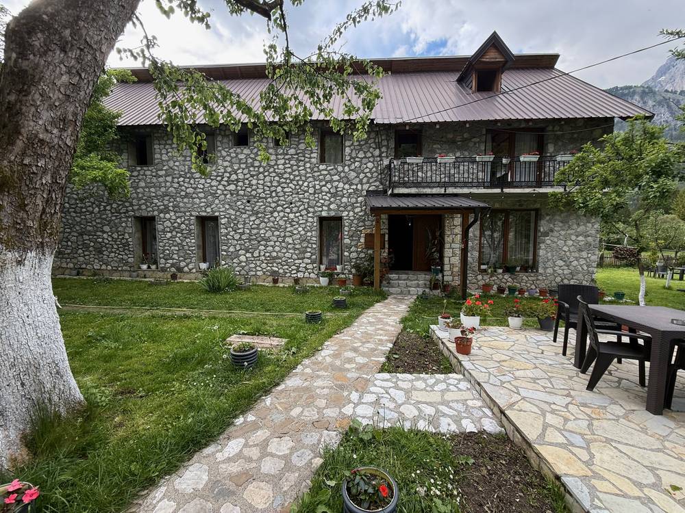
| May 23 | Guesthouse Demushi, Valbona (Albania) | Bunk room; my friends booked it |
| May 24 | An A-frame cabin at Dobërdol (Albania) | Booked when I got there, with dinner and breakfast |
| May 25 | Off the trail | A ride to Plav, then a taxi to Kosovo and Pristina airport |
How I booked. I didn't book much. My friends booked Guesthouse Demushi in Valbona. In Dobërdol I arrived first and booked two A-frame cabins for the three of us on the spot; it was $150 for the three of us to sleep and eat. My emails don't show bookings for the hotels. In late May the valley hotels were close to empty: nobody else was staying at Hotel Melishta.
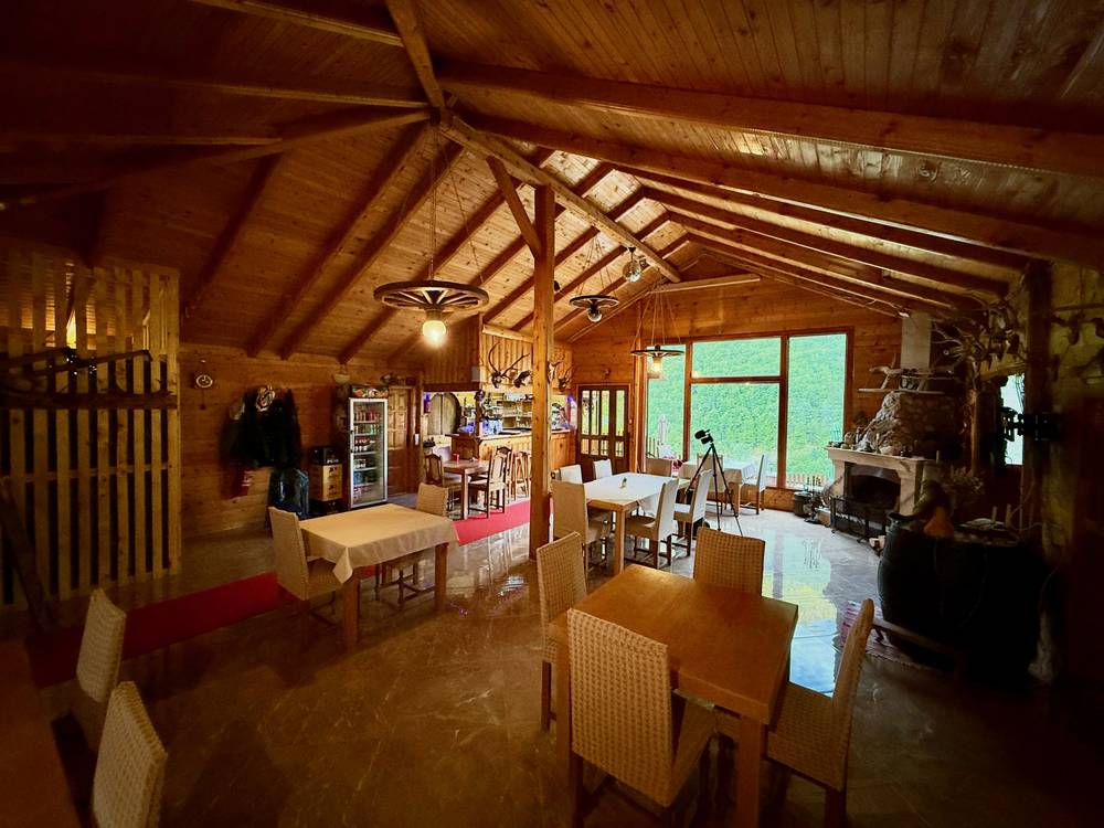
Hotel Melishta is in Shtupeq i Madh, in the Rugova valley west of Peja. They lit a fire and served breakfast, which was excellent. Hotel Cattleya in Plav: the food was good, the rooms were cheap, and the staff went above and beyond to help us when we came back on Day 6.
In summer, book the guesthouses in the small high villages ahead, especially Dobërdol, Çerem, Milishevc and Reka e Allagës, where there are only a few. Most guesthouses take bookings by phone or WhatsApp, some on booking sites, and most want cash. Dinner and breakfast are usually included or offered, and many will pack you lunch. The trail's information offices in Theth, Valbona, Plav, Gusinje and Peja can help. Several local operators sell self-guided packages with the guesthouses, luggage transfers and permits included, if you'd rather not book it yourself.
I camped on Days 1 and 3, both times because anywhere else that high was still buried in snow or there was no guesthouse within reach. On Day 1 I pitched next to two small cabins; a camera over the doorway started talking to us, I gave a thumbs-up, and the owner said "All good." On Day 3 I camped by a big waterfall just below Qafa e Pejës, and a storm wrecked the night.
Much of the loop runs through national parks: Prokletije in Montenegro, Bjeshkët e Nemuna in Kosovo, and the Albanian Alps National Park, which since 2022 includes the old Theth and Valbona parks. Prokletije charges €3 a person a day to enter and €3 a day for a tent space (the park's price list, checked September 2026: nparkovi.me). In Albania, local operators advise camping in guesthouse yards, which usually charge a small fee. Ask the owner before you camp near a house or a shepherd's hut.
| Where | What I had | Day |
|---|---|---|
| Hotel Melishta, Shtupeq i Madh | Breakfast by the fire | 1 |
| Hotel/Restaurant Guri i Kuq | A beer and a meat plate, $18 | 1 |
| A guesthouse at Babino Polje | Omelet with cheese, bread, vegetables and tea, $5 | 2 |
| Hotel Cattleya, Plav | Pasta; a packed sandwich for Day 3 | 2 |
| Guest House Dedushi, Vusanje | A meal with a spicy red pepper spread | 3 |
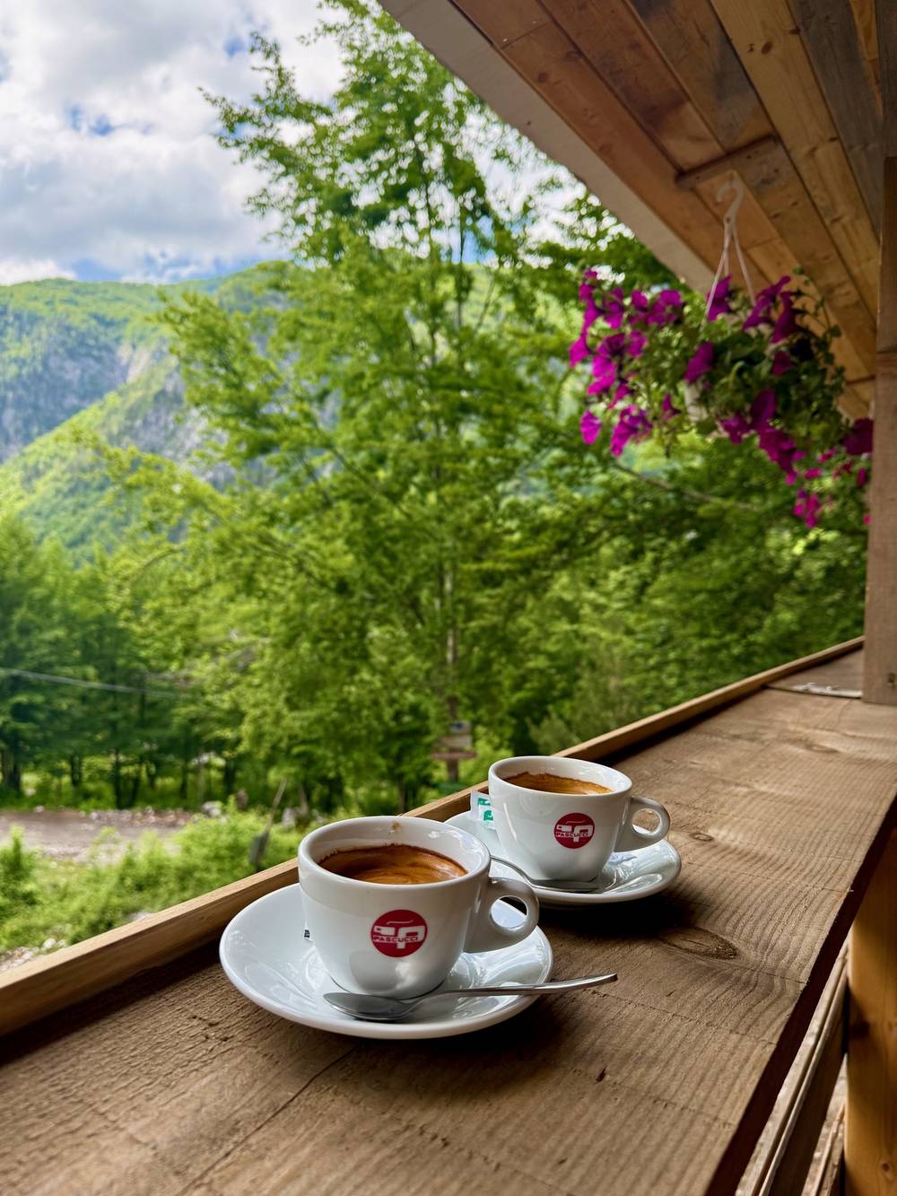
| A café above Theth | A sandwich and two double espressos | 4 |
| A hut café on the Valbona pass trail | A Coke | 4 |
| Hotel Fusha e Gjesë | Chicken, vegetables, bread and a beer | 4 |
| Guesthouse Demushi, Valbona | Dinner, breakfast and a packed lunch | 4, 5 |
| GuestHouse VITA, Çerem | Lunch | 5 |
| Dobërdol | White bean soup, rice, vegetables and a grilled pepper; breakfast | 5, 6 |
| Hotel Cattleya, Plav | Pizza | 6 |
Plan on guesthouse food. In late May a lot of places weren't open yet, and I went until late afternoon on Day 1 without a hot meal. In summer you can eat dinner and breakfast at your guesthouse every night and ask for a packed lunch.
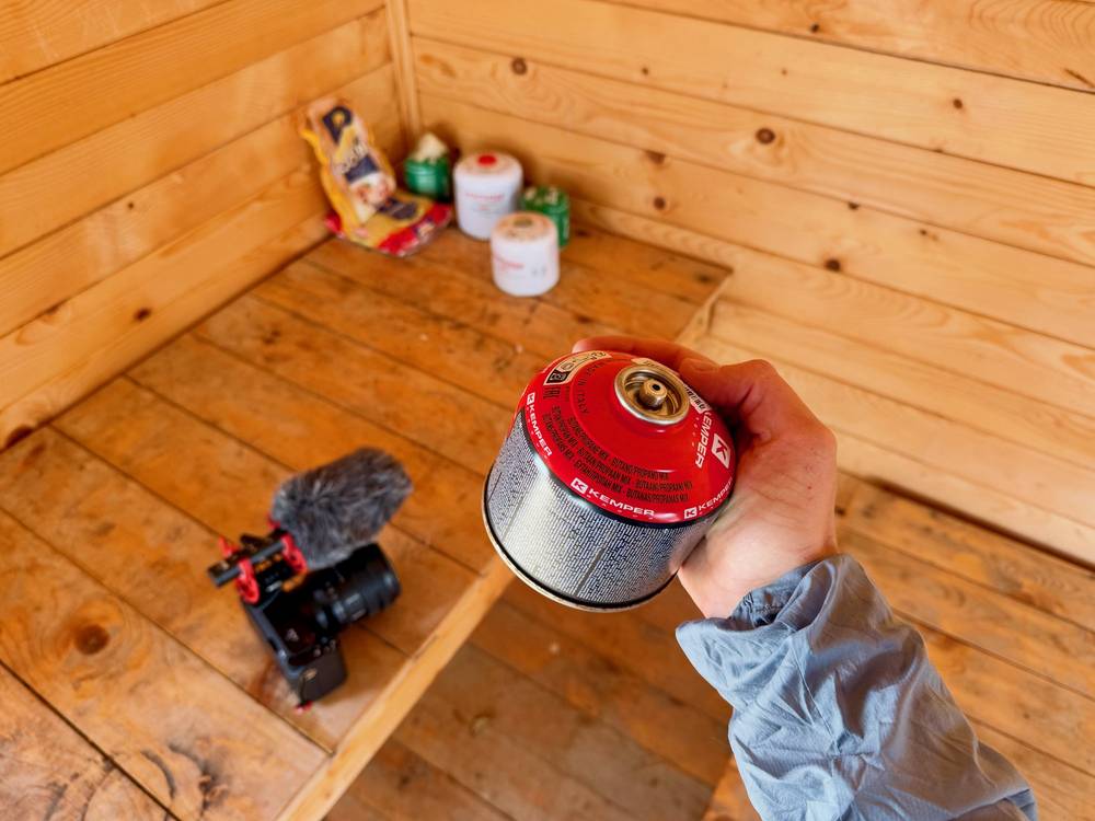
Stove fuel. I couldn't find gas canisters anywhere between Pristina airport and the trail, so I couldn't boil water until I found a canister someone had left in the cyclists' shelter on Day 2. Don't count on buying fuel on the way.
I filled from taps at the first high point and near my Day 1 camp, from snowmelt streams on Day 2, and from a big waterfall at my Day 3 camp. I carried a filter bottle. There are springs and streams on most of the route, but the high ridges are dry once the snow goes: fill up in the villages.
Kosovo and Montenegro use the euro. Albania uses the lek (about 100 lek to the euro in 2026 ferry prices), but guesthouses on the trail are usually happy with euros. I got cash at the airport before the hike, and most places I ate required it.
There are no ATMs in the mountain villages. The last ones are in the towns: Plav and Gusinje (a bank machine is a few steps from Hotel Cattleya in Plav), Peja, Bajram Curri and Shkodër. One local operator says there's no ATM in Valbona; reports on Theth disagree, so don't count on one. Bring enough cash for every bed, meal and ride, plus the Montenegro permit fee if you apply yourself.
My kit from this trip, as named in my film. Camera gear aside, it's what I'd bring again, plus microspikes.
Pack and sleeping: a Hyperlite Mountain Gear 35L pack, a NEMO Hornet tent, a quilt, a Therm-a-Rest pad with a pump sack, and an inflatable pillow. I left a roller duffel at the first hotel with everything I didn't need.
Clothes: Arc'teryx Cerium down jacket, Arc'teryx rain shell, Senchi fleece hoodie, Territory Run Co. shorts, Oboz Katabatic LT Low GTX shoes, and Crocs for camp and river crossings. I also wore some Helly Hansen hiking clothes.
Kitchen and water: a small gas stove, a lighter, a long titanium spoon, a Katadyn BeFree filter bottle, and wet wipes.
Other: a trekking umbrella, a Nitecore NU20 headlamp, and a carbon fiber tripod that I use as trekking poles. A regional eSIM for data.
Filming: Sony ZV-E1, Sony 16-35mm f/4 lens, a microphone, a DJI Mini drone and a spare battery. I also brought a DJI Osmo Pocket 3 to see if it could replace my Sony camera. I ended up deciding against that.
What this trip needs in early season:
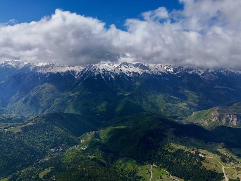
We could already see snow on the mountains as I packed up and left my roller duffel at the hotel. Nobody else was staying there, so I had the dining room to myself. They lit a fire and served breakfast, which was excellent.
Unfortunately, I was starting on the boring part of the loop that most people skip. But the weather was great, and it was still nice seeing snow on the peaks. The day took me through a few green valleys and a lot of road walking. A dog walked with me for about a mile before disappearing. At the top of my first high point there was a bit of a view, a locked cabin and a water tap. I put the drone up to get a sense of how much snow we'd be dealing with in the next section. The answer was: a lot.
Then it was a dirt road, a paved road, back to a dirt road, and past a random castle with an American flag. There weren't any places to buy stove fuel between the airport and the start, so I couldn't boil water and had been snacking all day. Because it was so early in the season, nothing was open. I finally found a place that was half open, the Guri i Kuq hotel, and ordered a beer and a meat plate, which was delicious. The whole meal cost $18.
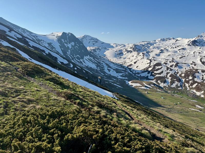
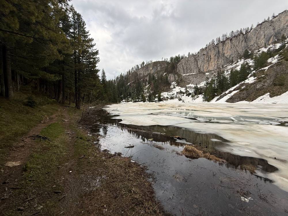
I finished with a snowy climb past the first signs of spring, wildflowers poking through the melted patches, and rested by Leqinat lake, still mostly frozen. Most of the day felt like an unnecessary side quest on roads. I camped next to two small cabins because anywhere else that high was still buried in snow. My friends arrived shortly after, and we flew our drones for sunset.
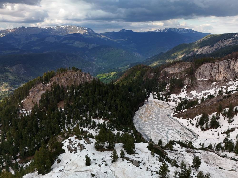
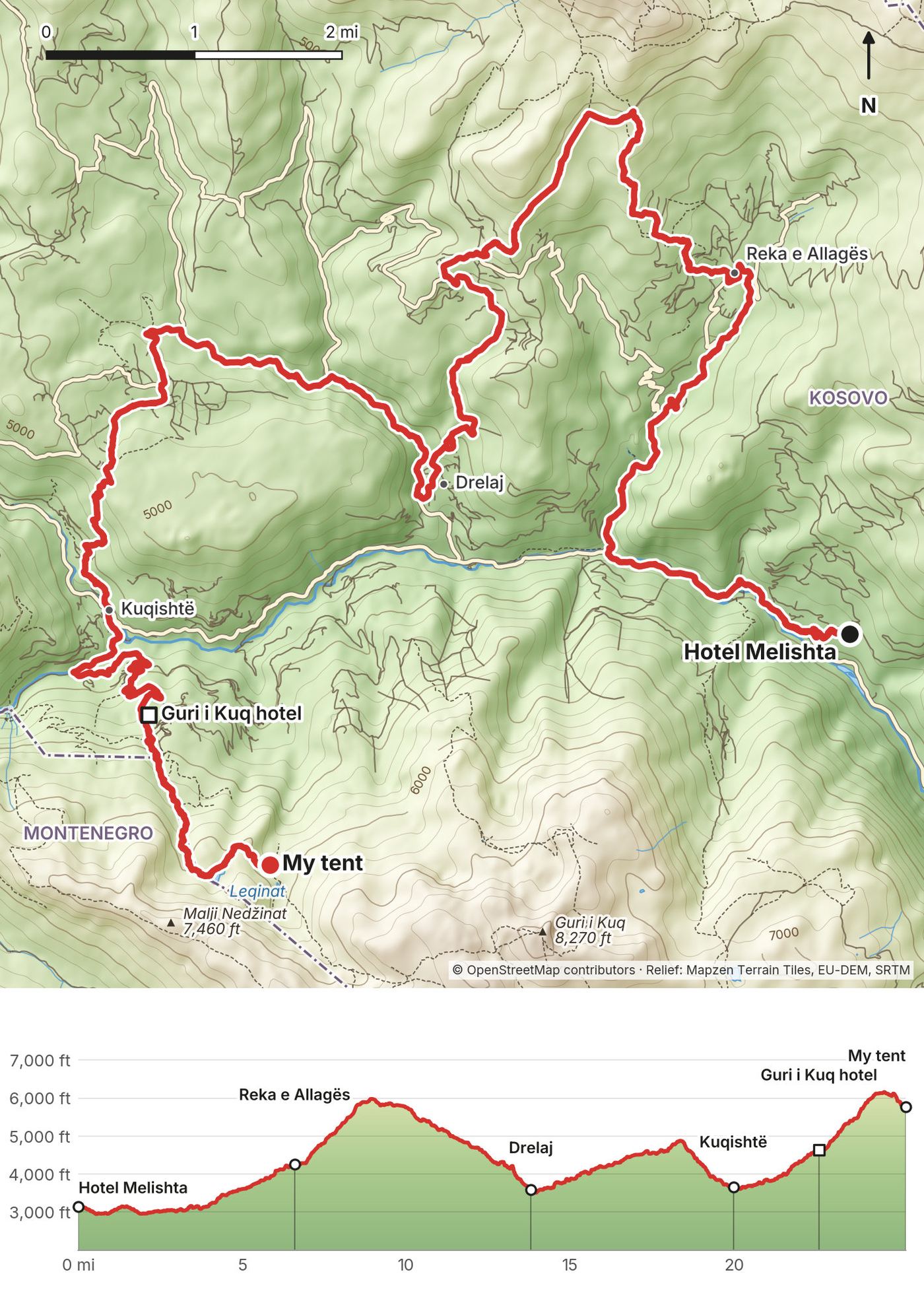
From Shtupeq i Madh (about 3,100 ft) the line climbs north through Reka e Allagës (mile 6.6) to the first high point, about 6,000 ft at mile 9, near Llutovë. It drops to Drelaj (mile 13.8, 3,600 ft), rolls over a smaller hill, and comes down to the Rugova valley road at Kuqishtë (mile 19.9). Most of these first 20 miles are roads and tracks. From Kuqishtë it climbs past the Guri i Kuq hotel (mile 22.5, 4,640 ft) into the snow, reaches Leqinat lake at mile 24.4 (6,140 ft), and drops a little to the cabins near Lake Drelaj (mile 25.1, 5,780 ft).
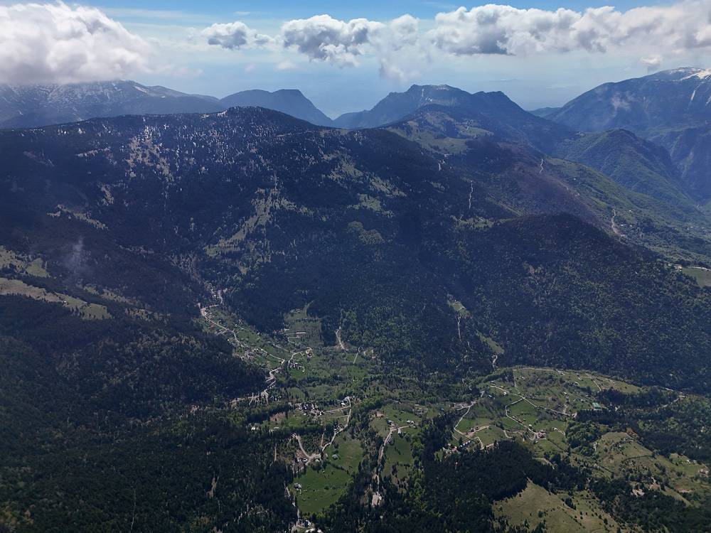
This is not the usual start. Most people walk the loop from Theth, and the marked route through Rugova runs closer to the valley. You could start at Kuqishtë or Guri i Kuq instead and cut 20 road miles.
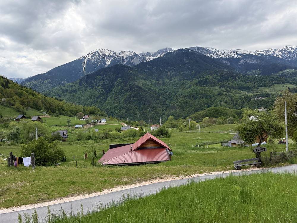
You're never far from a road today. Drelaj, Kuqishtë and Guri i Kuq are all on roads up from the Rugova valley and Peja.
Narrated film, Day 1 · Ambient film, Day 1 · Getting to the trailhead
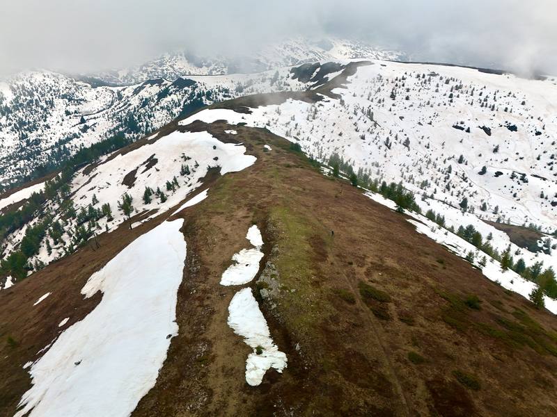
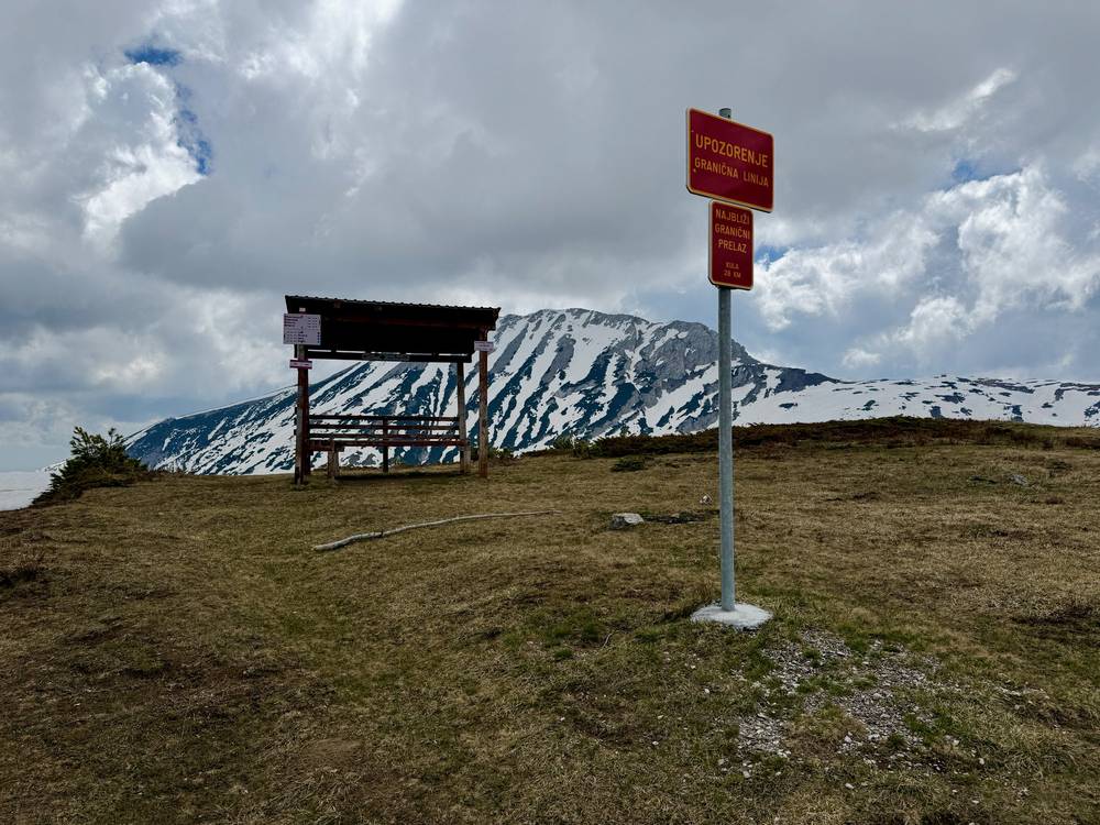
I slept great. It was a bit overcast, but there was no reason to delay the pass, so I was first out. I passed Lake Drelaj and headed straight into snowy slush. I forgot my microspikes on this trip, which was unfortunate. Once I got higher I was completely alone. There wasn't a visible trail or any previous footsteps, so I had to kick steps for every single move. I use my tripod as trekking poles, and I don't think I could have done this hike without them. I stopped to drink water and reconsider my life choices before crossing the pass, completely socked in by early morning fog. I was officially in Montenegro.
Any break in the snowpack felt like a luxury. Red and white markers guided me the whole way, and I tried not to step on the purple flowers poking through the snow. This ridge gave me one of my favorite shots of the whole hike. I crossed the Babino Polje river in my Crocs, and at a guesthouse I got a big omelet with cheese, bread, vegetables and tea. It was absolutely worth the $5.
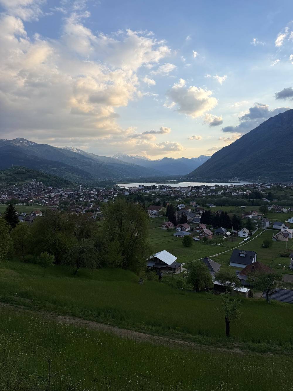
The next climb started with a lot of road before turning into a dirty snow slog up to Hrid lake, speckled with ice. In a cyclists' shelter past the lake I even scored a gas canister from the free stuff corner. A quiet stretch through the forest opened into farmland, and a dirt road brought me into Plav. My friends had skipped the lake climb and road-walked to Plav after the river crossing. We checked into Hotel Cattleya, and I had delicious pasta all alone in their beautiful dining room.
My note that night: crazy snow up the pass without microspikes, but not bad if done slowly and smoothly. Long road walk to town. Great weather.
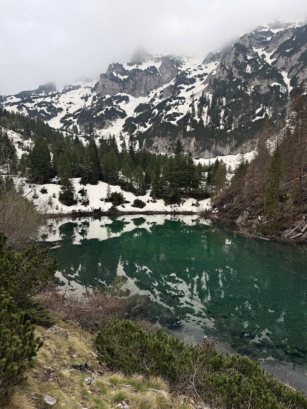
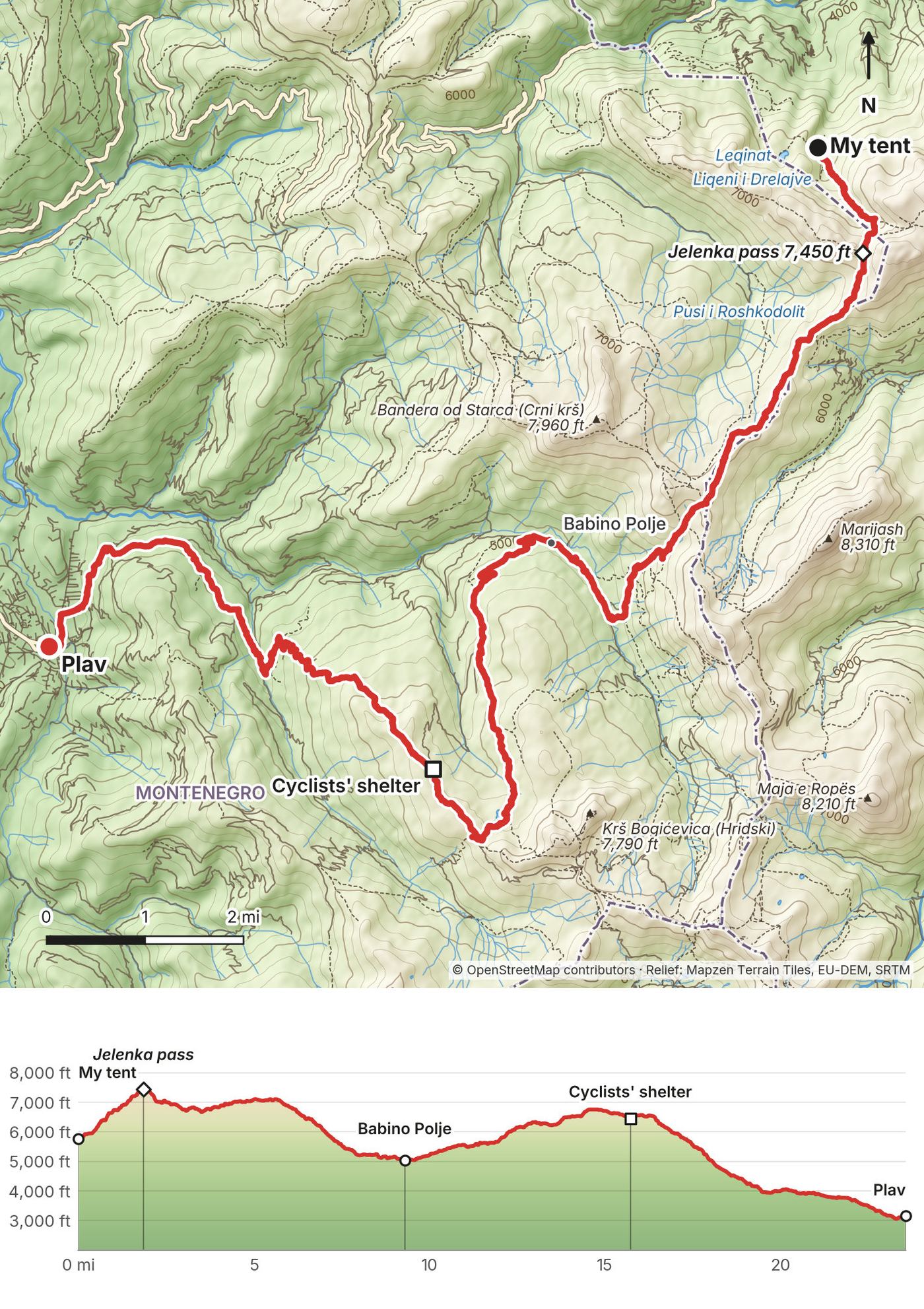
The pass comes first: about 1,700 ft up in the first 1.8 miles, from the lake to the Jelenka pass (7,447 ft) on the Kosovo to Montenegro border. In late May this was deep, untracked snow. The line then follows the high border ridge for about 4 miles, mostly above 6,500 ft, past a shelter and signpost at mile 5.7, then drops about 2,000 ft over snowmelt streams to the river crossing at mile 7.9 and the guesthouses at Babino Polje (mile 9.3, 5,040 ft). From Babino Polje a road and then a trail climb to Hrid lake (mile 14.0, 6,510 ft) and the cyclists' shelter (mile 15.7). The last 8 miles are a long descent of about 3,300 ft through forest, farmland and the village of Komarača into Plav (3,150 ft).
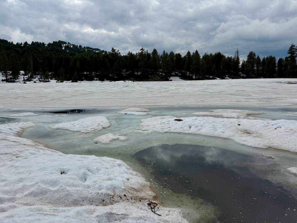
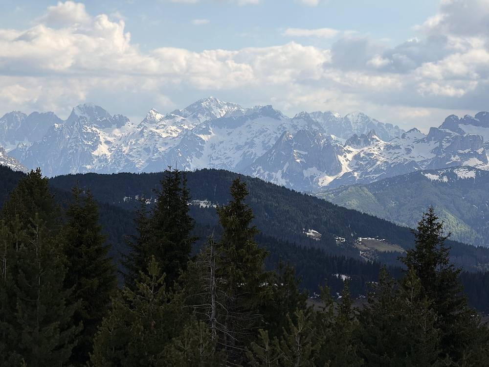
Before the pass, go back down to Lake Drelaj and the Rugova valley. After it, keep going to Babino Polje, where a road runs down to Plav. That road is the shortcut my friends took: from the river crossing they road-walked all the way to Plav and skipped the Hrid lake climb.
Narrated film, Day 2 · Ambient film, Day 2
Day 3 started gloomy, with heavy rain and water running through the streets of Plav. I stuck to my plan of leaving early before breakfast and put up my umbrella for the next four miles. The highlight of the rainy road walk was the giant sandwich the hotel packed for me.
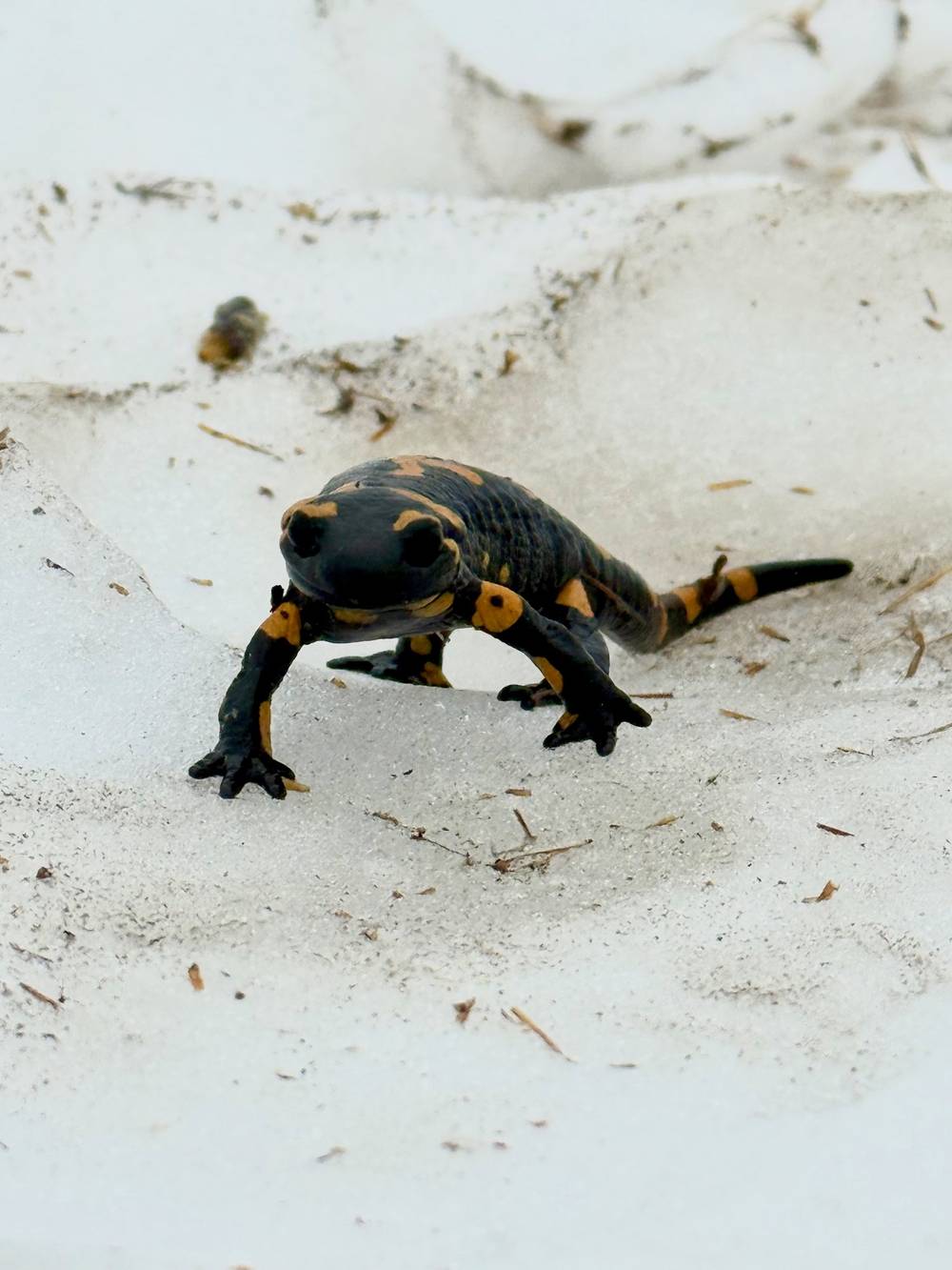
After miles of dirt road, getting onto mossy, leaf-covered trail felt great. It was colder too, which made everything feel more serious. I slowly built steps and climbed my first really exposed section. The wind made everything colder and more stressful, so I pushed through quickly with almost no visibility. There were tons of salamanders up there.
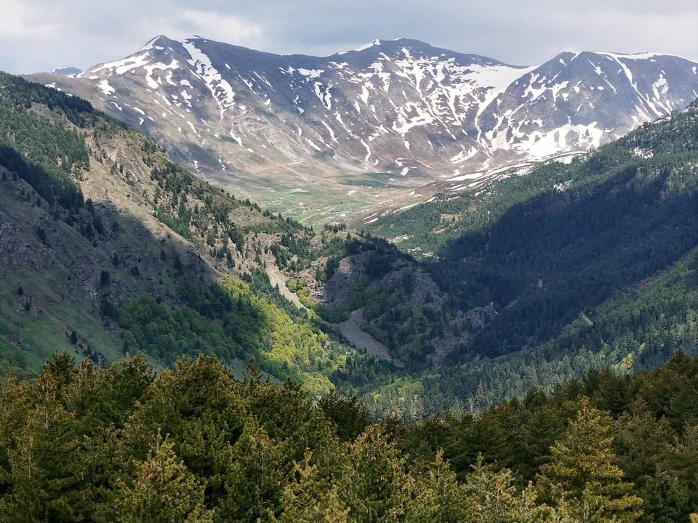
The clouds opened up once I was on the ridge, and the descent was one of my favorite few miles ever. So lovely up there, with marbled rock rising above a green pine forest. I followed guesthouse signs down into Vusanje and had a good meal all to myself at Guest House Dedushi. Most of these places required cash, which I'd already gotten at the airport.
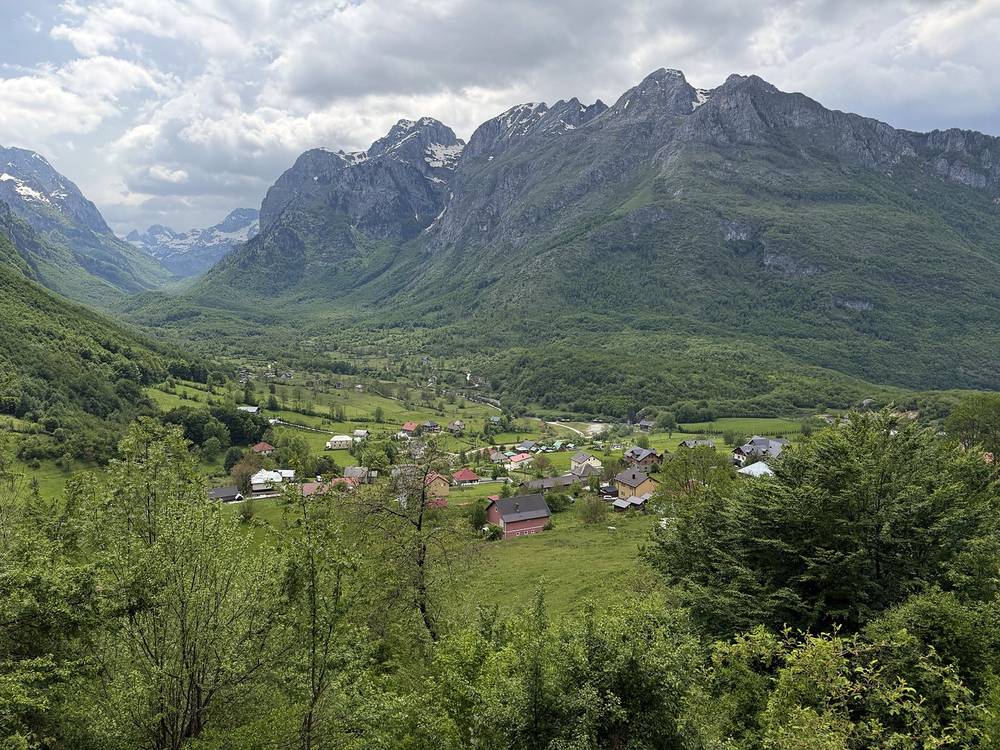
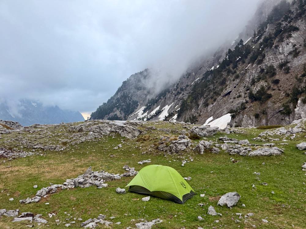
My last section was up the stunning Ropojana valley. I followed the big river on a road for a while, then found a super quiet trail heading all the way into Albania. It felt strange being completely alone in such a beautiful place. I caught a glimpse of the pass ahead and decided to stop before going over it, since it was getting late. The rain picked up hard as I filled water at the mouth of a big waterfall, so I got my tent up as fast as possible and cracked open a tall can of Nikšićko as the storm built. My friends caught up in the rain, and we all hunkered down for one of the worst nights of camping I've ever had.
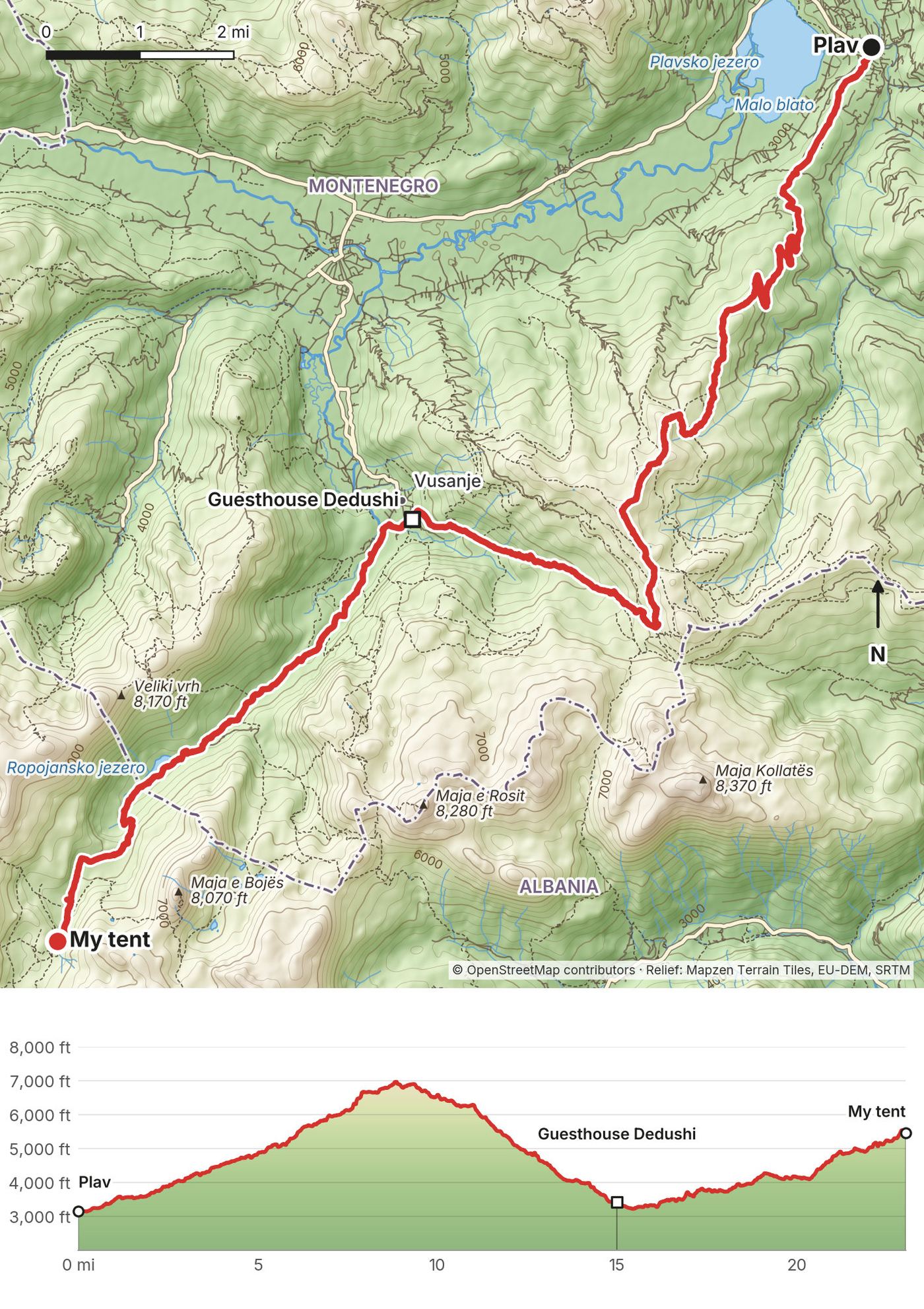
About 4 miles of road and dirt road lead south out of Plav, then a trail climbs through forest to the open ridge above Vusanje. My high point was 6,986 ft at mile 8.9, on an exposed, snowy ridge in May. The descent drops about 3,500 ft to Vusanje (mile 15, 3,420 ft), the last village in Montenegro. From Vusanje a road runs up the Ropojana valley past the Ropojana lake (mile 18.9), and a quiet trail continues across the border into Albania at about mile 20.5 and climbs to my camp at 5,470 ft (mile 23.0), about a mile and a half below Qafa e Pejës.
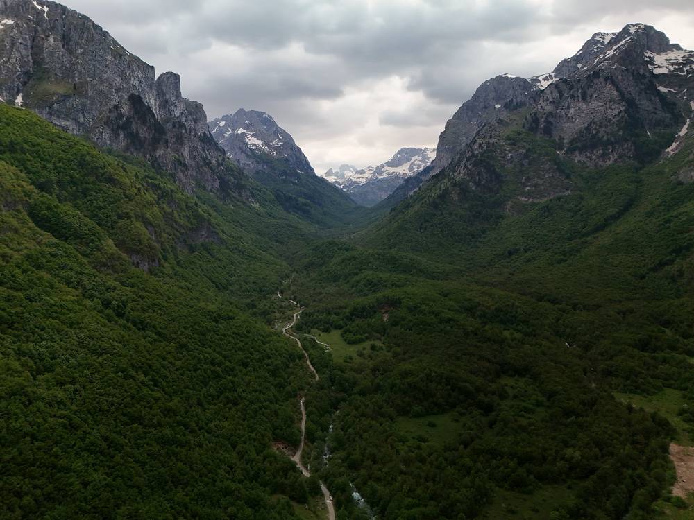
Splitting the day. Plav to Vusanje (15 miles) is a full day on its own, and Vusanje has several guesthouses. The usual plan is to sleep in Vusanje and cross to Theth the next day.
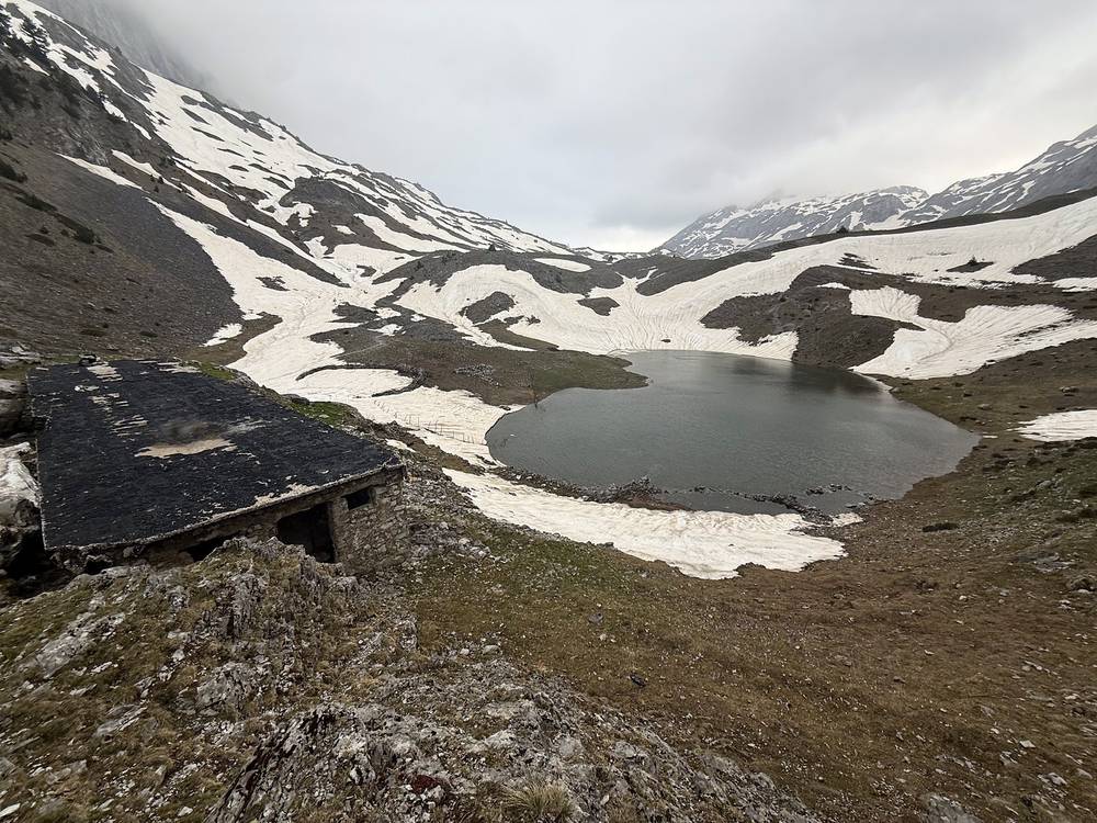
Before the ridge, turn back to Plav. After it, Vusanje is on a road to Gusinje and Plav. Once you're up the Ropojana valley, the nearest beds are back in Vusanje or over the pass in Theth.
Narrated film, Day 3 · Ambient film, Day 3
It rained all night, and the wind got absolutely insane. I had done what I could with stakes and tight guy lines, but my tent couldn't hold up. I barely slept. I had to get out in the rain multiple times to build rock walls and fix the tent before it folded over completely, and I ripped my rain cover a bit. It was the worst night of tent camping I've ever had. Once the sun came up, the only option was to bundle up, pack up and keep moving.
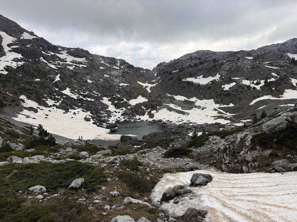
The final pass was a narrow gap that opened into a huge green valley. It was night and day between the two sides. I stopped at a café just outside Theth for a sandwich and two double espressos. Past this point a lot of couples were coming up to do the popular day hike to Valbona, so I put on music and speed-ran this section, passing people, stopping at a hut for a Coke, and pushing on to the pass. There was an Albanian flag, more day hikers, and the dog who apparently follows hikers up and down this route full-time.
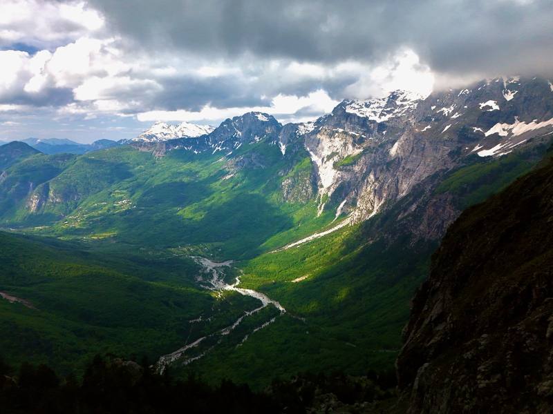
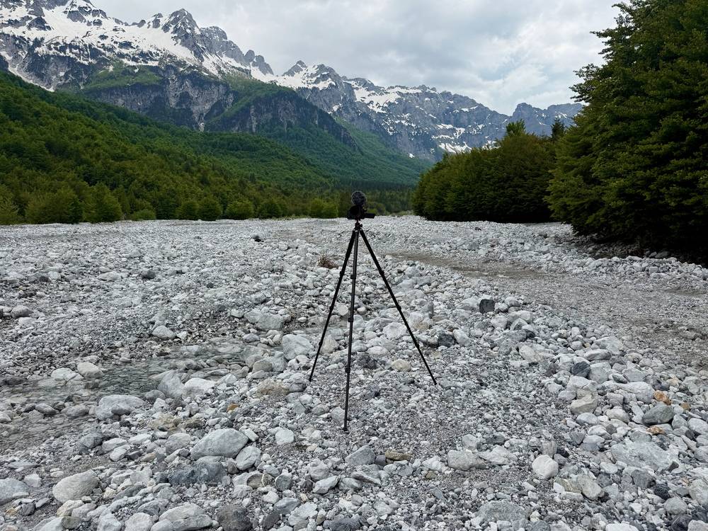
The other side of the pass was a completely different experience. Snow made the normal trail too dangerous to follow, so park rangers had set up ropes and guided people down a safer route. The valleys here are stunning: the Valbona river braids through pale gravel bars below limestone walls. At the bottom a fleet of jeeps and vans was offering rides to tired hikers. I found my hot meal at Hotel Fusha e Gjesë: chicken, vegetables, bread and a beer. The last two miles were on a busier road to Guesthouse Demushi, where I laid out my wet tent, clothes and shoes to dry and ate dinner as the valley turned blue.
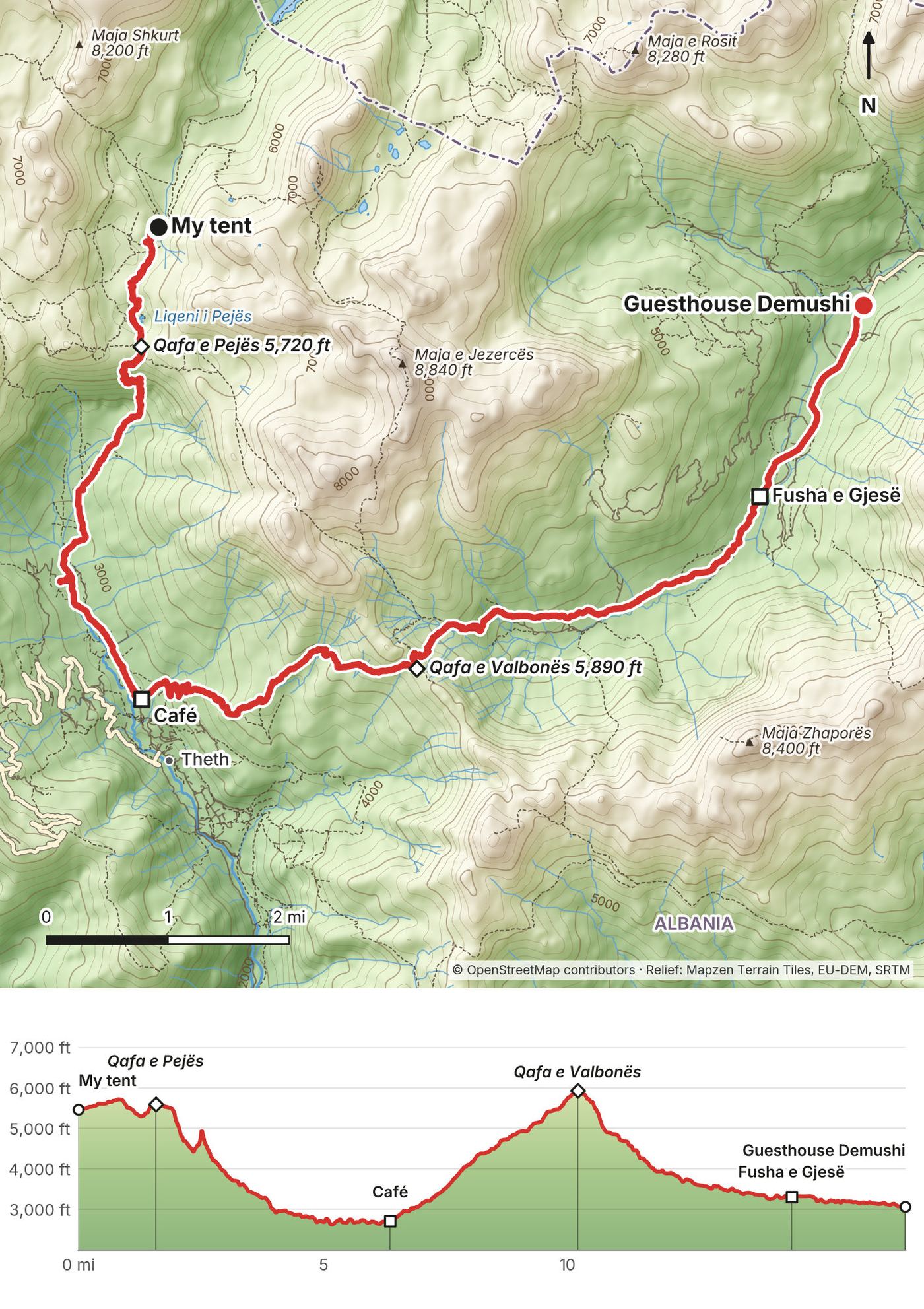
A short climb from my camp reaches Qafa e Pejës (about 5,700 ft, 1,740 m) at mile 1.6. The descent into the Theth valley is long and steep: about 2,900 ft down to the valley floor at 2,700 ft (mile 6.4). I didn't go into Theth village; the café is at the north end, where the trail to Valbona starts. From there the most popular trail on the route climbs about 3,200 ft to Qafa e Valbonës (mile 10.2), past a hut café at mile 9.2. The Valbona side is steeper and holds snow longer; in late May it was roped off and rangers sent people down another line. Below Rragam (mile 12.4) the trail follows the gravel valley to Hotel Fusha e Gjesë (mile 14.6), then a road to Valbona (mile 16.9, 3,080 ft).
Theth is on a paved road to Shkodër. At the Valbona end, jeeps and vans wait below the pass, and Valbona has a road to Bajram Curri and the Komani lake ferry.
Narrated film, Day 4 · Ambient film, Day 4
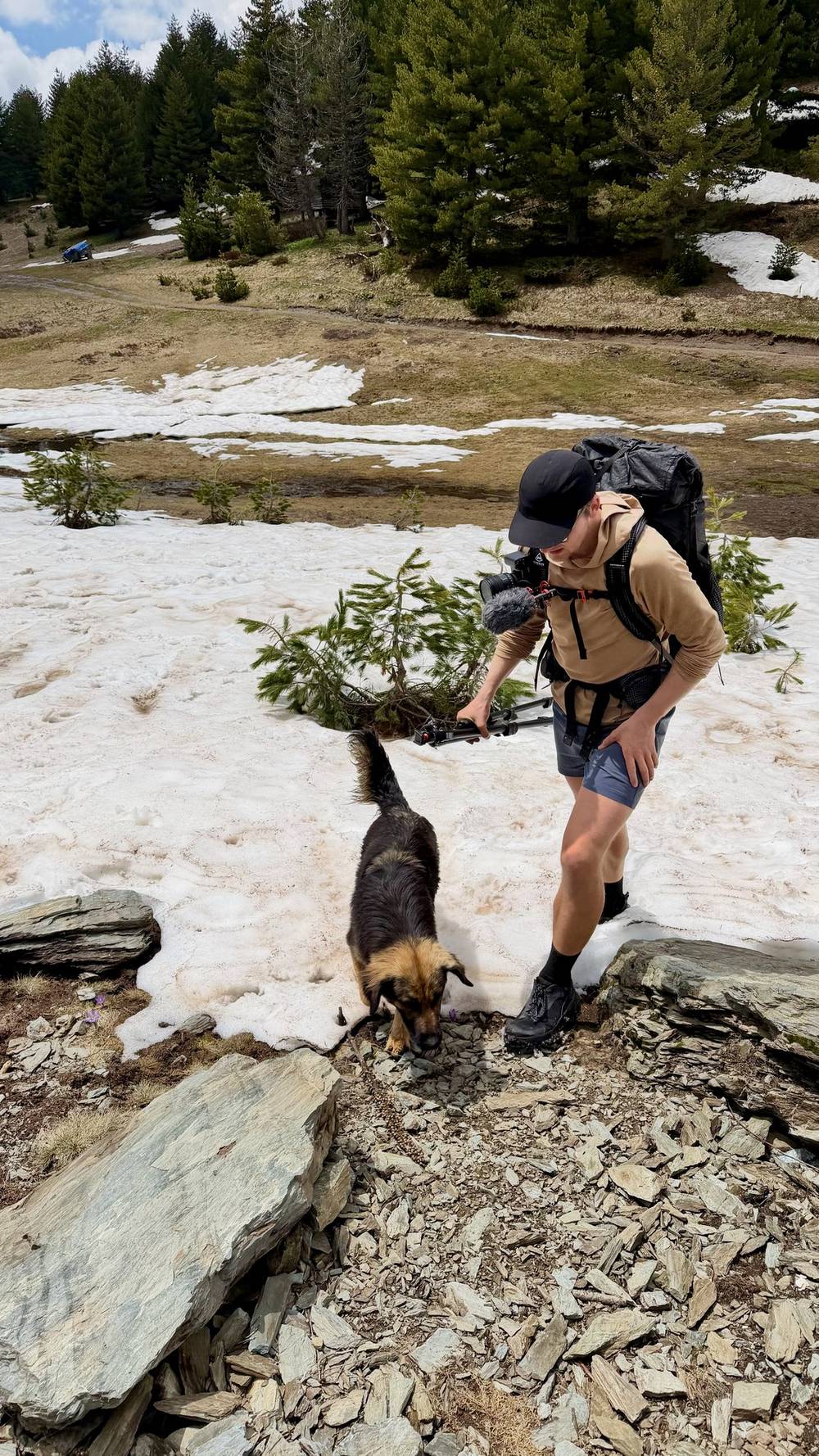
This was basically one long, slow climb back into the higher mountains. I felt fresh and left right after breakfast; my friends slept in and took a taxi to skip the road section. Waiting for me was the same dog from the day before, and I shared the egg from my packed lunch with her. Later a white dog joined us too. If I stopped to fill water or take a break, the dogs stopped too. I ate a few wild strawberries along the way.
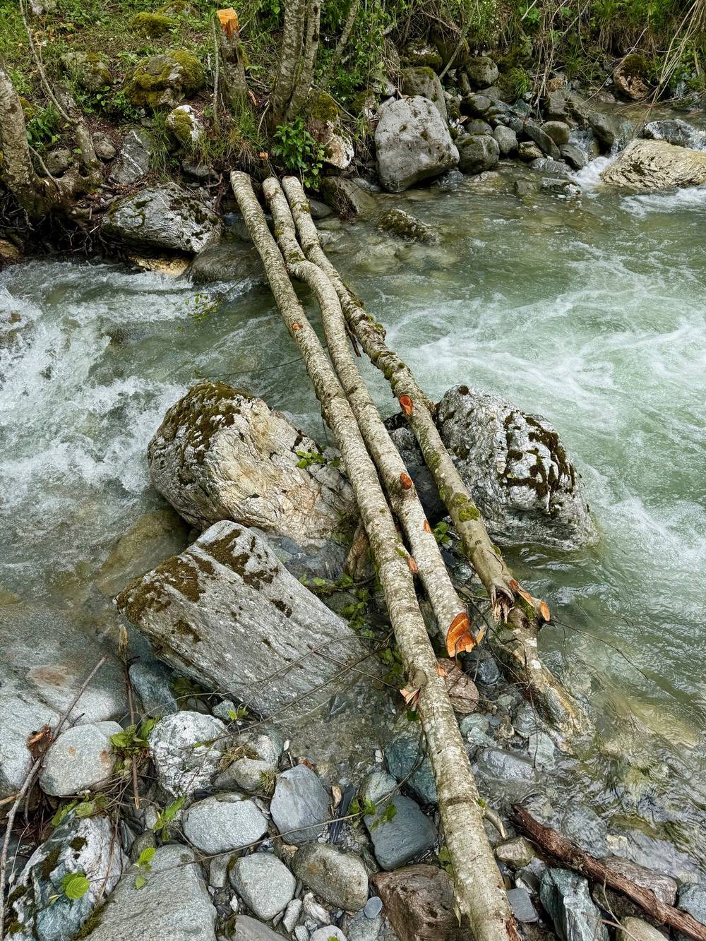
About seven miles in, I stopped for lunch at GuestHouse VITA, and shortly after we crossed a makeshift bridge with no issues at all. Near the Montenegro border, two guards wanted to take photos with me. They asked if I had a border crossing permit, which I did, but they didn't need to see it. The higher section took me through plenty of snow, and I didn't see anyone else the entire time. I passed a few wooden huts that seemed to be shut for the winter.
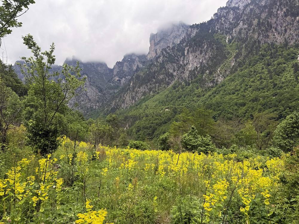
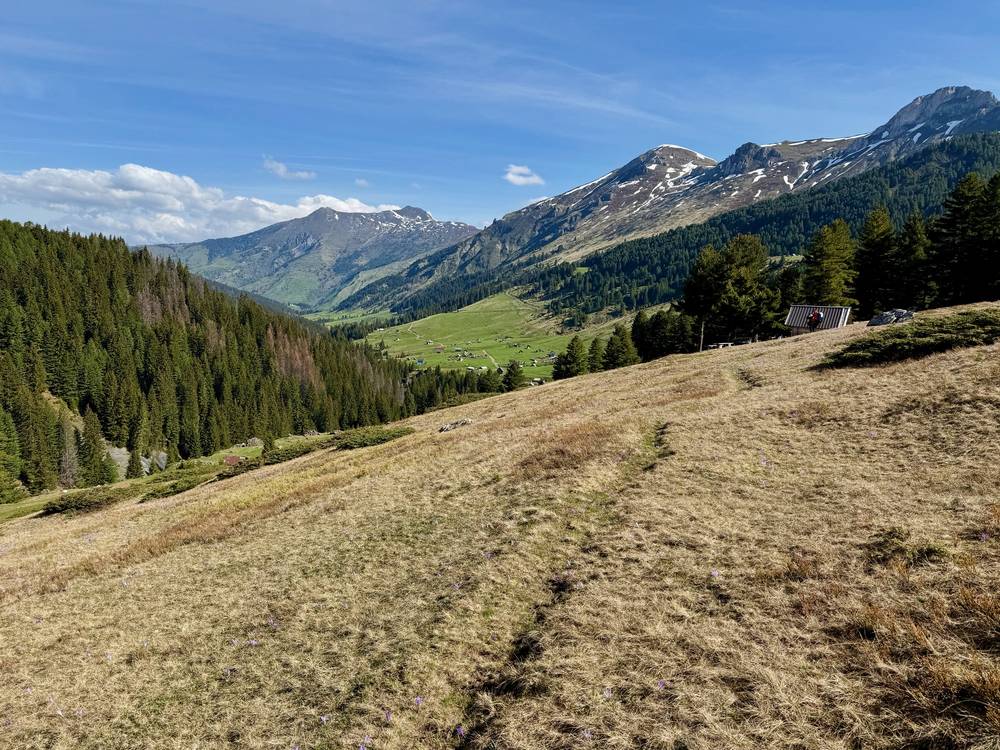
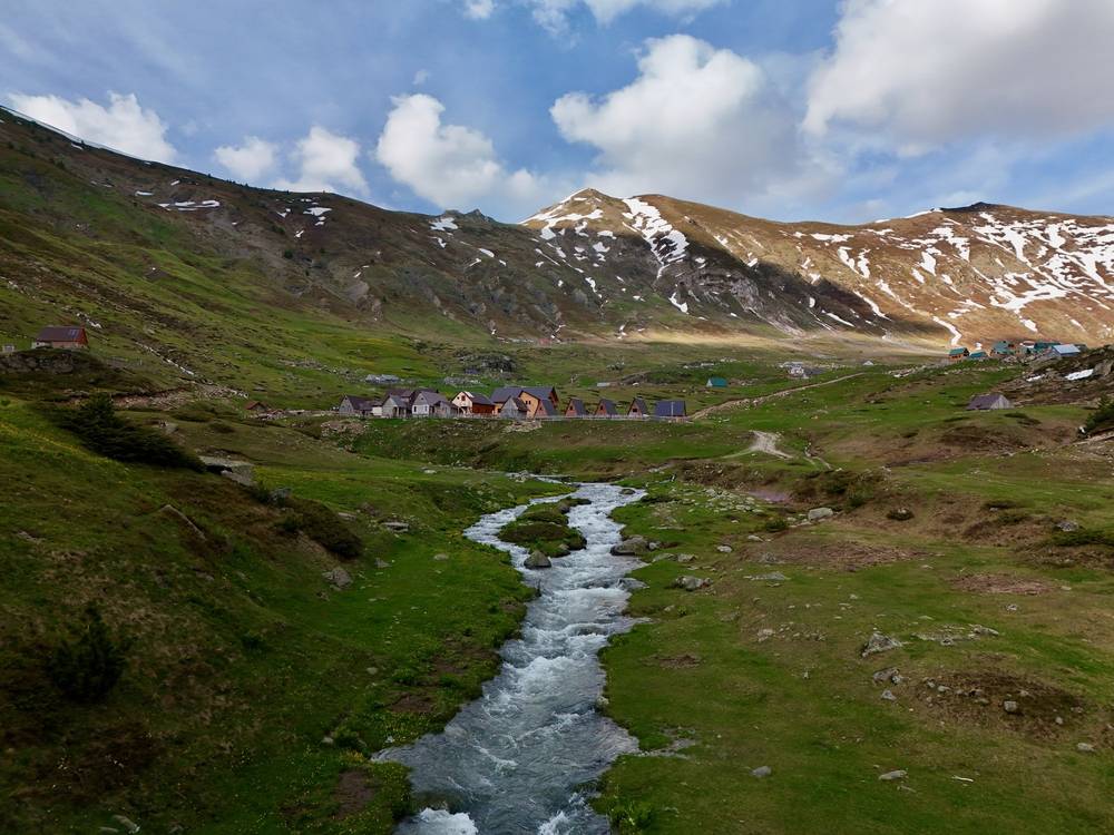
From one viewpoint I got my first look at Dobërdol, a small collection of farms and guesthouses at the base of a U-shaped basin. This was my favorite area of the hike. I got there first, so I booked us two A-frame cabins: simple, quiet and pleasant. I flew the drone up to scout the snow on the shaded side of the next day's pass. Dinner with a handful of other hikers was excellent: white bean soup, rice, vegetables and a nice grilled pepper.
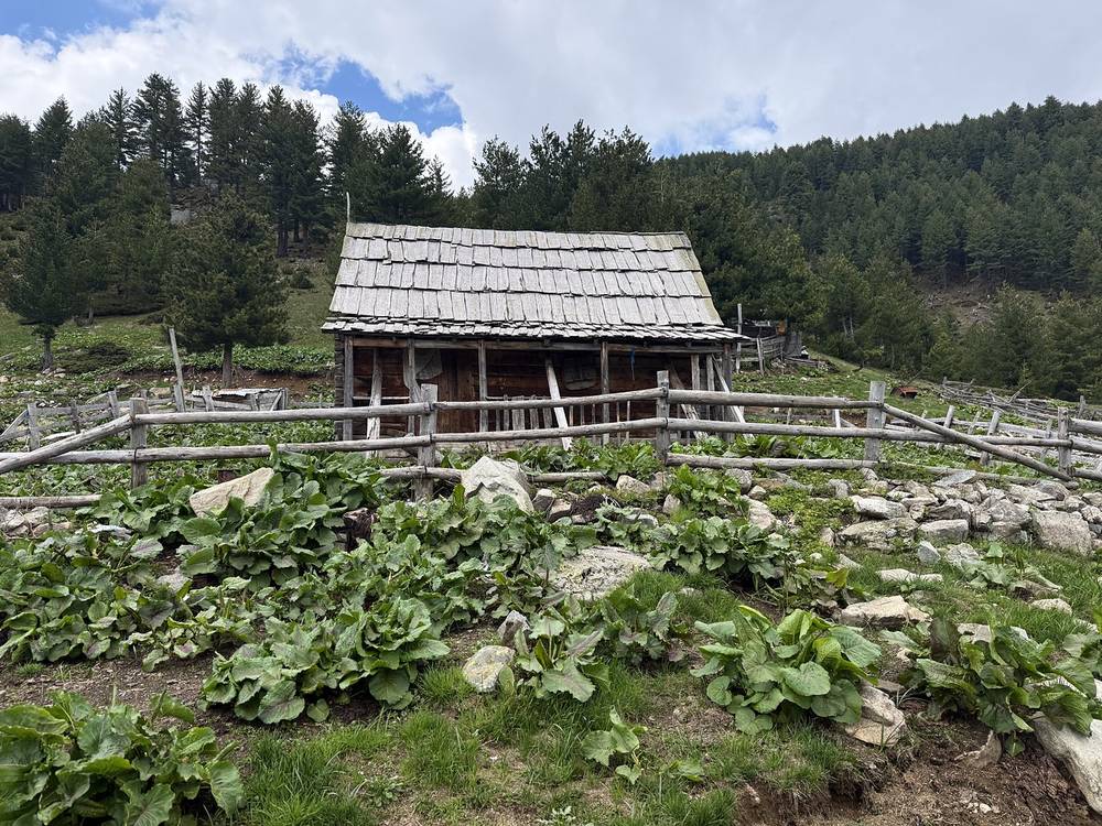
From Valbona the first 3.4 miles follow the valley road down to the lowest point of the trip (2,240 ft). A track then climbs north to Çerem (mile 7.1, 3,820 ft), where GuestHouse VITA is. Just after it is a log bridge over a stream. The climb continues over the Vranica pass (mile 9.3, 5,215 ft) to the border ridge and the Aljuci pass (mile 12.1, 6,373 ft), then rolls through high pastures and shepherds' huts around 6,000 ft before dropping into the Dobërdol basin (mile 17.7, 5,800 ft). In late May there was easy snow on the high part.
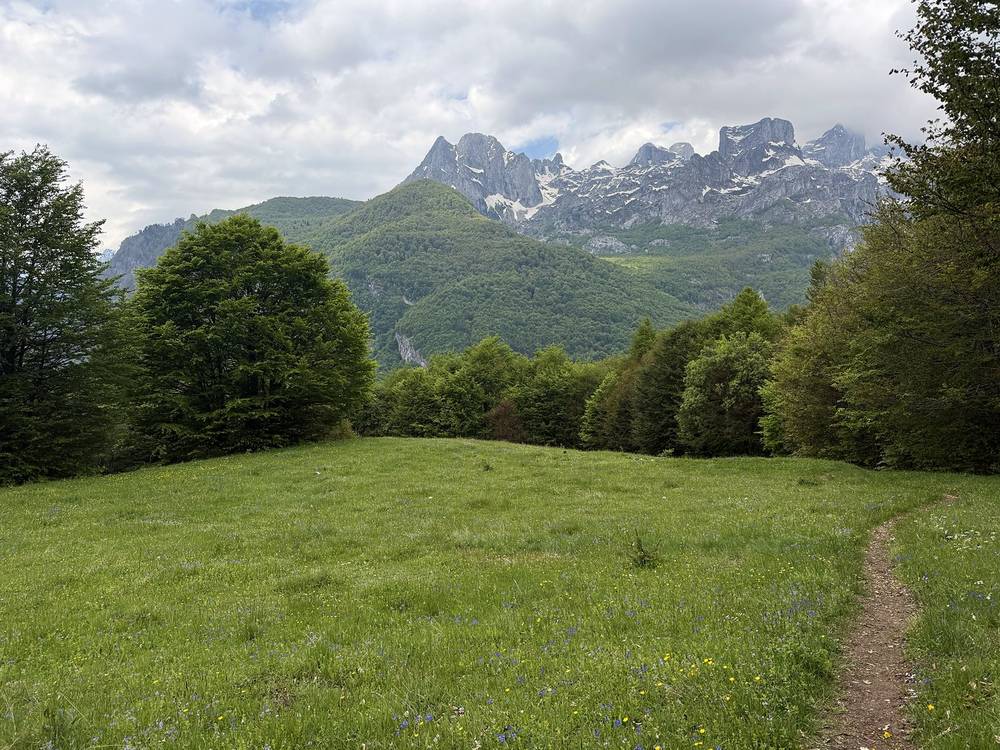
The marked route from Valbona to Çerem goes over the mountains to the north instead of down the valley road (it's the dashed line on the overview map). I took the road and track.
Before the border ridge, go back to Çerem and down to Valbona. After it, carry on to Dobërdol: there's nothing in between.
Narrated film, Day 5 · Ambient film, Day 5
The morning started normally, with quick packing, a solid breakfast and a short climb out of the basin in the cool shade of the range ahead. Scouting with the drone had made me think the snow would be too much, and getting up there on the ground confirmed it. The trail ahead was steep, long and very icy, with a little cornice at the top of the ridge.
We weighed our options and decided not to follow the trail, and escaped down the greener valley instead. I didn't have microspikes, a helmet or an ice axe, so sliding seemed like the better option. At the bottom I realized I'd left my Sony camera on the ground at the very top, so I left my pack and hiked back up for it. It was one of the silliest mistakes I've made while hiking.
The snow slowly turned to grass and then to road. It felt disappointing not to complete the full loop, but the risk wasn't worth it. In the end, that was the right call. We found a farmer willing to drive us 45 minutes back to Plav for $50. He wore a bucket hat, spoke zero English and was hilarious. Back at Hotel Cattleya we ate delicious pizza, and the staff helped us arrange a ride back to our duffel bags: an expensive, long three-hour drive into Kosovo to Hotel Melishta, then another two hours to the airport. It cost $300. A wild exit and end to our hike.
From Dobërdol (5,820 ft) the marked route climbs about 1,400 ft in 1.8 miles to the ridge near the point where Albania, Kosovo and Montenegro meet, then crosses over toward Milishevc in Kosovo. That crossing faces north, and in late May it was steep, icy snow with a cornice. I left the marked trail at 7,192 ft. My line then goes north, down a grassy valley in Montenegro past shepherds' summer camps, onto a dirt road to Babino Polje (mile 8.9, 4,860 ft). It's an escape route, not a marked stage.
This day was my way off. From Babino Polje there's a road to Plav (45 minutes by car).
What I did. A farmer drove us from Babino Polje to Plav (45 minutes, $50). The staff at Hotel Cattleya arranged a taxi that took us around through the Kula crossing into Kosovo to Hotel Melishta for our duffel bags (three hours), then to Pristina airport (two more hours). It cost $300. We flew back to Turkey.
Your options from Plav. Buses to Podgorica take about 4 hours (€16, five a day in the late September 2026 timetable). For Kosovo there's no direct road over the Čakor pass; it's a taxi or a long bus trip round through Rožaje. From Theth or Valbona, see Getting there for the minibuses and the Komani ferry to Shkodër.
Narrated film, Day 6 · Ambient film, Day 6
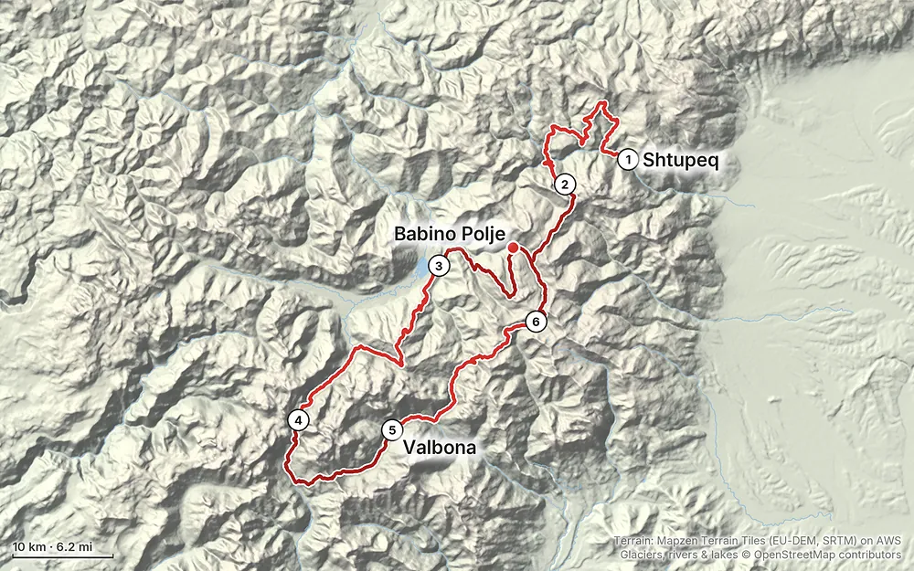
Elevation2,238–7,428 ft115 mi
Terrain: Mapzen Terrain Tiles (EU-DEM, SRTM) on AWS · Glaciers, rivers & lakes © OpenStreetMap contributors
Tap a map to open it full size.
The trail crosses the borders between Kosovo, Montenegro and Albania on mountain passes, where there's no border post. To cross legally you need a permit for each crossing, issued by the border police of the countries involved, for a fixed date and place. It isn't a visa: if you need a visa for a country, you need that too.
What I did. One of my friends arranged the permits for all three of us before the trip. On Day 5 two border guards stopped me near the Montenegro border, asked if I had a border crossing permit, and didn't even need to see it. We took selfies, then they left. It was a very chill interaction.
My crossings. Day 2, Kosovo into Montenegro at the Jelenka pass. Day 3, Montenegro into Albania in the Ropojana valley below Qafa e Pejës. On Day 5 the trail runs along and across the Albania to Montenegro border between Çerem and Dobërdol without staying in Montenegro. On Day 6 I left the loop into Montenegro, which wasn't the plan.
The 2026 process (from Zbulo, a licensed operator in Shkodër, checked September 2026):
Zbulo says walkers a day or two early or late because of weather have not had problems, and that Kosovo checks more than its neighbors, with patrols in the Rugova valley. Montenegrin border guards and park rangers patrol around Babino Polje and Vusanje. Carry your permits and passport every day.
The season. The guesthouses in the high villages (Dobërdol, Milishevc, Reka e Allagës, Çerem) open for the summer, roughly June to September, and the high passes usually hold snow into June. Theth, Valbona, Plav and the Rugova valley have places open longer. July and August are the busy months, especially between Theth and Valbona.
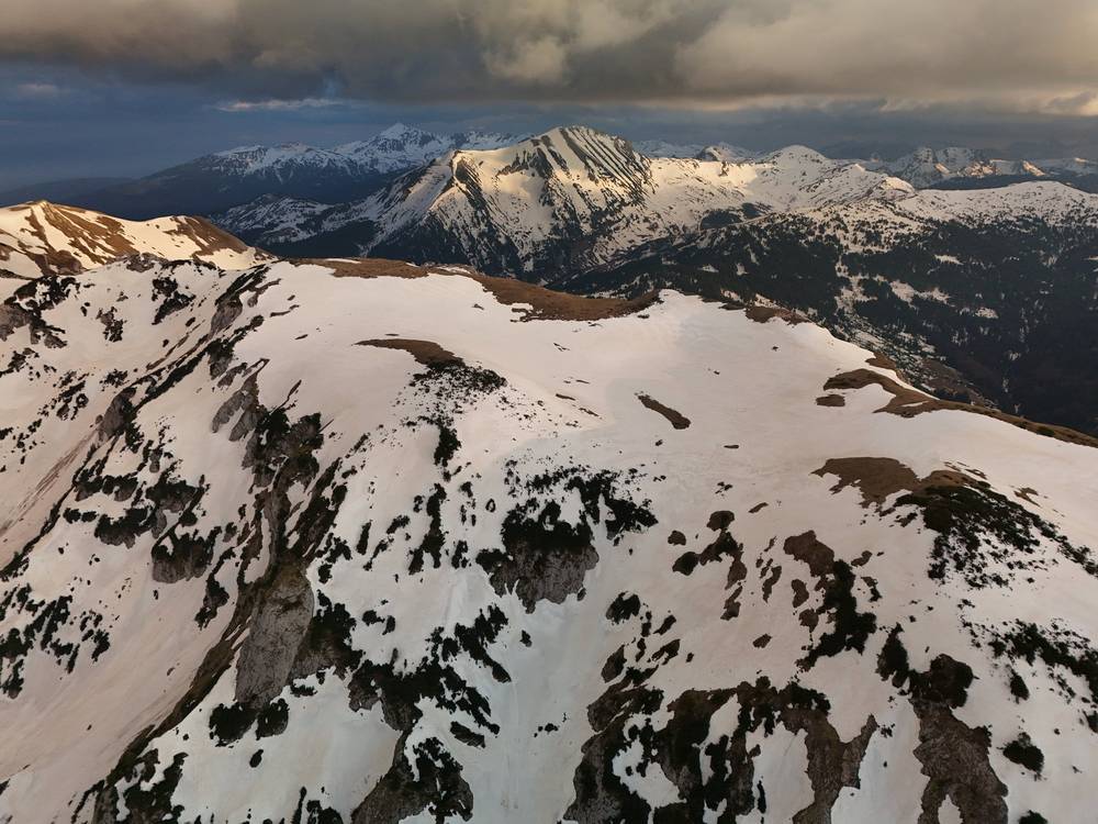
What I got in late May. Snow on every high section. Day 1 was sunny and warm in the valleys, with snow above about 5,500 ft. Day 2 was overcast, with fog on the pass and great weather later. Day 3 started with heavy rain and ended with a storm. That night the rain and wind wrecked my camp. Day 4 was sunny on the Theth side. Days 5 and 6 were clear, and on Day 6 the shaded side of the pass was too icy to cross without spikes, a helmet or an ice axe.
The 2026 snow report. Balkan Natural Adventure, a local operator, posted a trail update on May 27, 2026, two days after I finished: the summer trail over Qafa e Valbonës was still closed and dangerous, with only the winter route recommended; Dobërdol to Milishevc still had heavy snow on the Kosovo side; Qafa e Pejës and Hrid lake had snow patches. Local operators post updates like this every spring, so look for the latest before you go.
Early season in short. Empty trails and wildflowers poking through the snow, but a lot of places aren't open yet. Early in the season I couldn't find hot food on Day 1 until late afternoon, and I couldn't buy stove fuel anywhere between the airport and the trail. If you go before mid-June, bring microspikes (I forgot mine) and be ready to change your route.
Snow. In May and early June the passes hold snow, and the north-facing sides hold it longest. I kicked steps without a trail on the Day 2 pass, rangers had roped off the normal trail below Qafa e Valbonës on Day 4, and on Day 6 the north side of the pass above Dobërdol was steep, icy and corniced, so I left the trail and went down another valley. Without the gear and skills for steep snow, turn around.
Storms. Day 3 brought heavy rain and a storm that wrecked my camp. Pitch low and sheltered from the wind, and check the forecast every evening.
Emergency numbers. 112 works in all three countries. The direct numbers: Albania police 129, ambulance 127; Kosovo police 192, ambulance 194; Montenegro police 122, ambulance 124. Kosovo's Mountain Search and Rescue Service lists 0800 80008 (24 hours). In Montenegro, call 112 for mountain rescue; the Mountain Rescue Service's office number is +382 40 256 084. There's no signal on much of the high ground, so tell someone your plan and carry offline maps.
Forecast. Check it every evening in the villages, where there's signal or guesthouse Wi-Fi. yr.no and meteoblue give point forecasts for Theth, Valbona and Plav. Look at wind as well as rain before you camp high.
Trail conditions. In spring, local operators post snow reports. Balkan Natural Adventure's update of May 27, 2026, two days after I finished, said the summer trail over Qafa e Valbonës was still closed and dangerous, that the Dobërdol to Milishevc section still had heavy snow on the Kosovo side, and that Qafa e Pejës and Hrid lake had snow patches. That matches what I found.
Where to be careful:
Going solo. Most days I walked alone and met my friends in the evening. Tell someone your plan for each day. There's no signal on some high sections.
Dogs. Dogs walked with me on Days 1, 4 and 5, and all of them were friendly. There are shepherds' dogs at the summer camps; give them room.
Border permits. Carry them every day, with your passport. See Border permits.
Drones. Montenegro's national parks, Prokletije included, published rules on July 1, 2026: filming needs approval from the Environmental Protection Agency and the parks, plus the Civil Aviation Agency for drones over 249 g (nparkovi.me). Albania and Kosovo have their own national rules. Check them for the country you're in.
What is the Peaks of the Balkans? A marked hiking loop through the Accursed Mountains (Prokletije in Montenegro, Bjeshkët e Nemuna in Kosovo, Alpet Shqiptare in Albania). It links mountain villages with guesthouses, and it crosses the borders on mountain passes, away from any border post. Red and white markers guided me the whole way.
How long is it? The marked loop is almost 200 km (about 120 miles), usually walked in 10 stages. I walked 115.4 miles in six days, but not the whole loop: I started east of the usual line in Rugova, and snow turned me off on Day 6, so I skipped the stretch from Dobërdol to Milishevc and back to Rugova, about 15 miles on the mapped trail.
How many days do I need? Most people take 10 to 12 days, a stage a day, with a guesthouse every night. My days were 17 to 25 miles, which is a lot. There's a 10-stage plan built from my GPS in Other ways to do it.
Do I need a permit? Yes, to cross the borders on the trail. It's free in Albania and Kosovo and costs a few euros in Montenegro. Apply at least two weeks ahead, or pay a local operator to do it. See Border permits.
When should I go? Summer, when the guesthouses are open and the snow is gone: roughly mid-June to mid-September. I went in late May. The trails were empty, but the high passes were buried in snow, a lot of places weren't open yet, and I didn't finish the loop. See When to go.
Huts or guesthouses? Guesthouses. Families in the villages rent beds and cook dinner and breakfast, and many pack lunch. There's no hut chain like in the Alps. See Guesthouses and camping.
Can I camp? I camped twice, both times because there was nowhere else to sleep that high up. See Guesthouses and camping for the national park rules.
Is it safe to do alone? I walked most days alone and met my friends in the evening. In late May I saw nobody for hours on the high sections, and on Day 2 there was no visible trail or any previous footsteps in the snow. In summer the Theth to Valbona section is busy with day hikers; the rest is quiet.
Am I fit enough? Try this at home: walk 15 miles with about 5,000 ft of climbing and your full pack, two days in a row. If you're fine on the second morning, you can do a stage a day. My days were longer than that, and harder in snow.
Cash or cards? Cash. Most of the places I ate required it, and I got cash at the airport before I started. Kosovo and Montenegro use the euro; Albania uses the lek, and euros are widely taken on the trail. See Food, water and cash.
Is there phone signal? In the villages, mostly. I used a regional eSIM. On the high sections, don't count on it: carry offline maps.
I walked the six days in this guide. These are other ways to use it; I didn't do them.
Snow turned me off the loop on Day 6, so I didn't walk from Dobërdol over the ridge to Milishevc in Kosovo and on to the Rugova valley, about 15 miles (24 km) on the OpenStreetMap line of the trail. It's two stages on the usual plan: Dobërdol to Milishevc, and Milishevc to Reka e Allagës. It's the highest part of the loop, near the three-country point, and the last to lose its snow. It's not in my GPS files.
This is the usual way round, starting in Theth, with a guesthouse village every night. Distances are on my GPS line where I walked that stage. Add at least two spare days for weather.
| Stage | From, to | My miles (km) | Notes |
|---|---|---|---|
| 1 | Theth to Valbona | 10.6 (17.0) | My Day 4 from the café above Theth |
| 2 | Valbona to Çerem | 7.1 (11.4) | My valley road; the marked route goes over the mountains |
| 3 | Çerem to Dobërdol | 10.7 (17.2) | My Day 5 |
| 4 | Dobërdol to Milishevc | Not walked | Kosovo; permit crossing |
| 5 | Milishevc to Reka e Allagës | Not walked | Kosovo |
| 6 | Reka e Allagës to Kuqishtë | 13.4 (21.5) | My Day 1, by roads north of the marked line |
| 7 | Kuqishtë to Babino Polje | 14.5 (23.4) | My Day 1 end and Day 2; permit crossing |
| 8 | Babino Polje to Plav | 14.3 (23.0) | My Day 2, over Hrid lake |
| 9 | Plav to Vusanje | 15.0 (24.1) | My Day 3 |
| 10 | Vusanje to Theth | 14.4 (23.2) | My Day 3 end and Day 4; permit crossing |
Short on days? Theth to Valbona is the popular day hike, and Theth, Valbona, Çerem and Dobërdol, back by road, stays in Albania with no permits. In July or August, with the snow gone, the passes I kicked steps up or left the trail on are normal trail.
These change every year. Everything else in this guide stays the same.
Permits and borders
Beds, food and transport
Conditions and your stuff
Planning questions about Peaks of the Balkans, answered only from this page's facts, the creators' versions and hikers' public tracks, with where each answer comes from. When the data doesn't say, the answer says "not given".
From hikers
Sign in to comment. Free; your hikes stay private unless you share them.
Some lodging links earn me a small commission at no cost to you.
Something wrong or missing on this page? Send feedback.