
Content made there
The film is at the top of this page.
Photos
Hikes / Manaslu Circuit / Kraig Adams's version
Asia · Nepal
Nov 2022 · 10 days on foot · Group trip · Teahouses

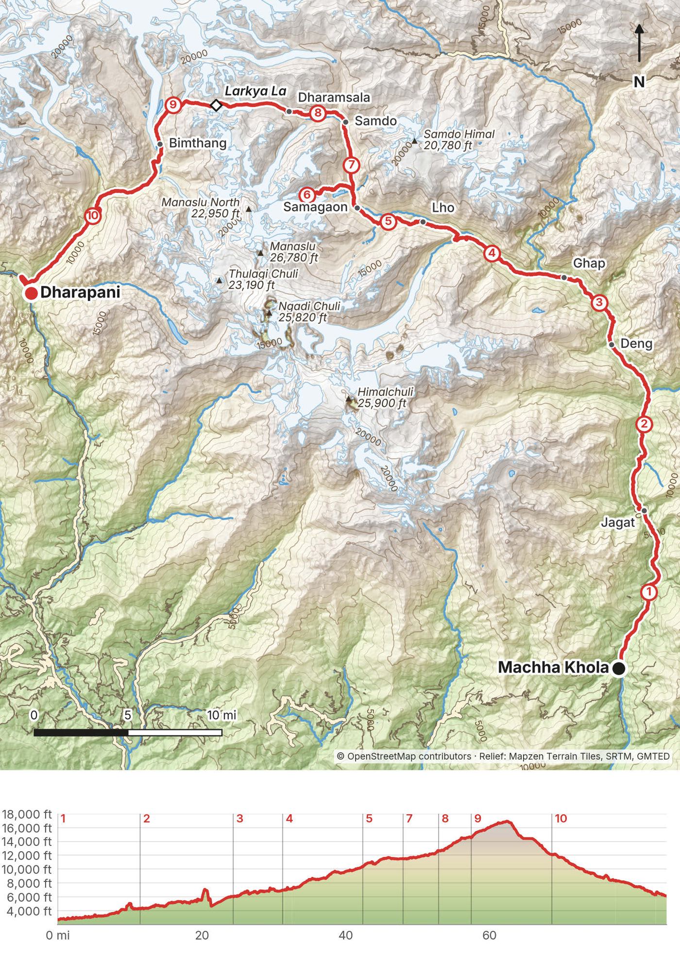
In early November 2022 I hiked the Manaslu Circuit in Nepal: about 100 miles in ten days around the eighth highest mountain in the world, up the Budhi Gandaki valley, over Larkya La and down to Dharapani. It was my third trip to Nepal in three years, after Mardi Himal and Everest Base Camp, and a different area above Kathmandu each time. I love Nepal, and I'll definitely go again.
This wasn't a solo hike. It was a group trip I hosted with subscribers, run by the trekking company Vagabond Trails, with a guide, a Sherpa mountain leader and porters to carry the duffels. Everything was taken care of, and I just had to go and enjoy myself. So this guide gives you my GPS files, maps, photos and notes for every day, and plain, checked facts for the things the company handled for me: the permits, the rules about guides, and the roads in and out.
| Quick facts | |
|---|---|
| Distance | 93.4 miles (150.3 km) on foot over 10 days, Machha Khola to Dharapani, with a day walk to Manaslu Base Camp |
| Climbing | about 31,000 ft (9,450 m) up and 27,800 ft (8,470 m) down |
| Start | Machha Khola, a 9-hour drive from Kathmandu |
| Finish | Dharapani, a 5-hour drive from Besisahar and the roads to Kathmandu and Pokhara |
| High point | Larkya La, published as 5,106 m or 5,160 m. My GPS read 16,795 ft (5,119 m) at the pass sign and 16,940 ft (5,163 m) a little beyond it |
| Highest night | Dharamsala (Larkya Phedi), 14,554 ft (4,436 m) on my GPS |
| Nights | 11 in teahouses from Machha Khola to Dharapani, November 3 to 13, 2022 |
| How | A group trip with a guide, a Sherpa mountain leader and porters. I carried a day pack |
| When | March to May or September to November. I walked in early November |
| Permits | Manaslu restricted area permit (US$100 a week in autumn), Manaslu and Annapurna conservation areas (NPR 3,000 each) |
| Guide | Required: the permit is issued only through a registered agency, with a licensed guide |
| Difficulty | Not technical, but long and high, with one big pass day |
| Base | Kathmandu |
| Day | Route | Miles (km) | Up / down (ft) | Night (ft) |
|---|---|---|---|---|
| 1 | Machha Khola to Jagat | 11.4 (18.4) | 3,942 / 2,375 | 4,319 |
| 2 | Jagat to Deng | 13.0 (20.9) | about 5,880 / 4,190 | 6,024 |
| 3 | Deng to Ghap | 7.1 (11.4) | 2,513 / 1,598 | 6,973 |
| 4 | Ghap to Lho | 10.9 (17.5) | 4,446 / 1,064 | 10,352 |
| 5 | Lho to Samagaon | 5.6 (9.1) | 1,767 / 613 | 11,500 |
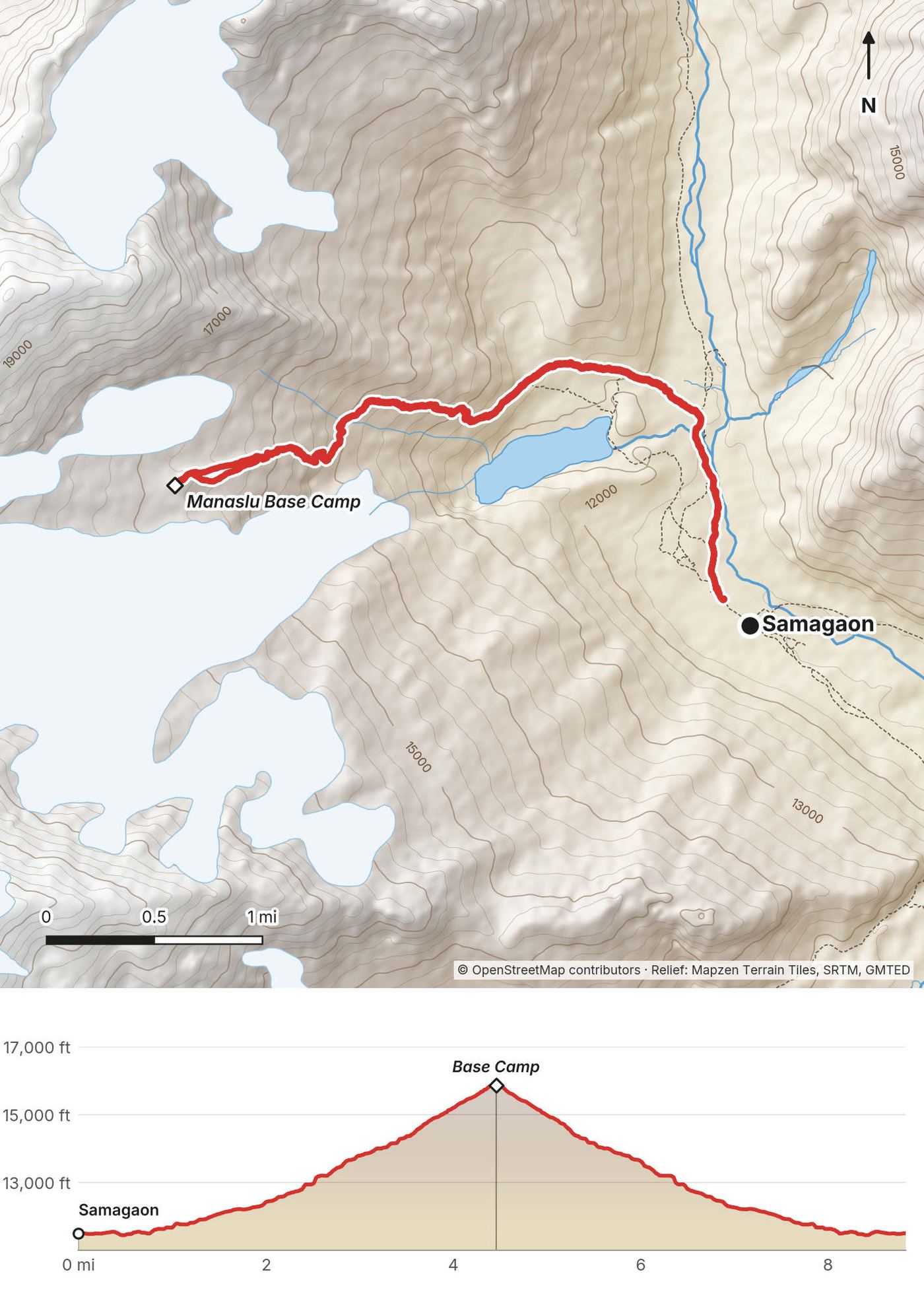
| 6 | Samagaon to Manaslu Base Camp and back | 8.8 (14.2) | 4,483 / 4,496 | 11,500 |
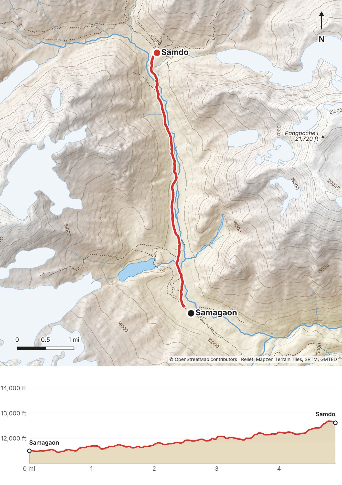
| 7 | Samagaon to Samdo | 4.9 (7.9) | 1,677 / 525 | 12,615 |
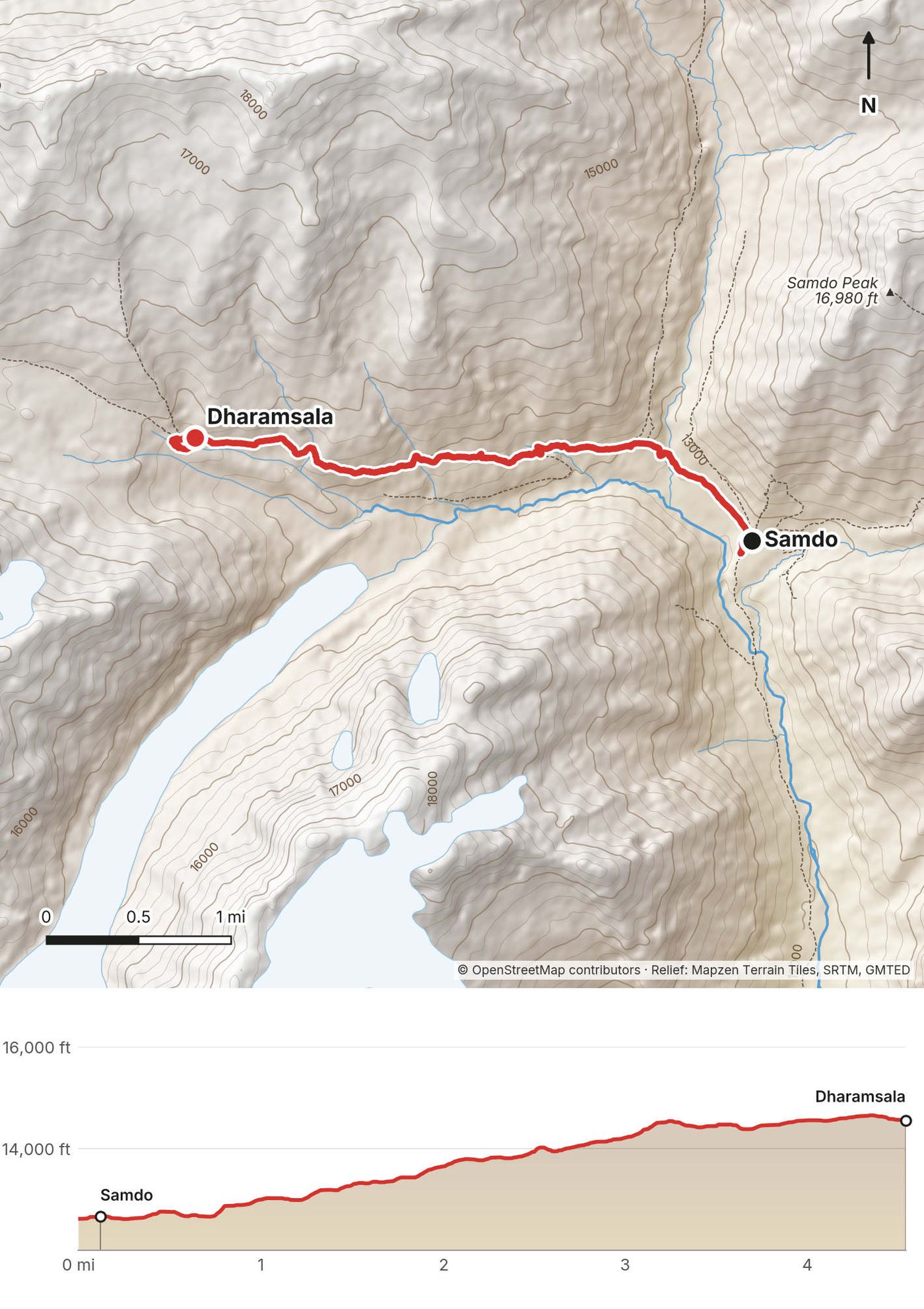
| 8 | Samdo to Dharamsala | 4.5 (7.3) | 2,277 / 324 | 14,554 |
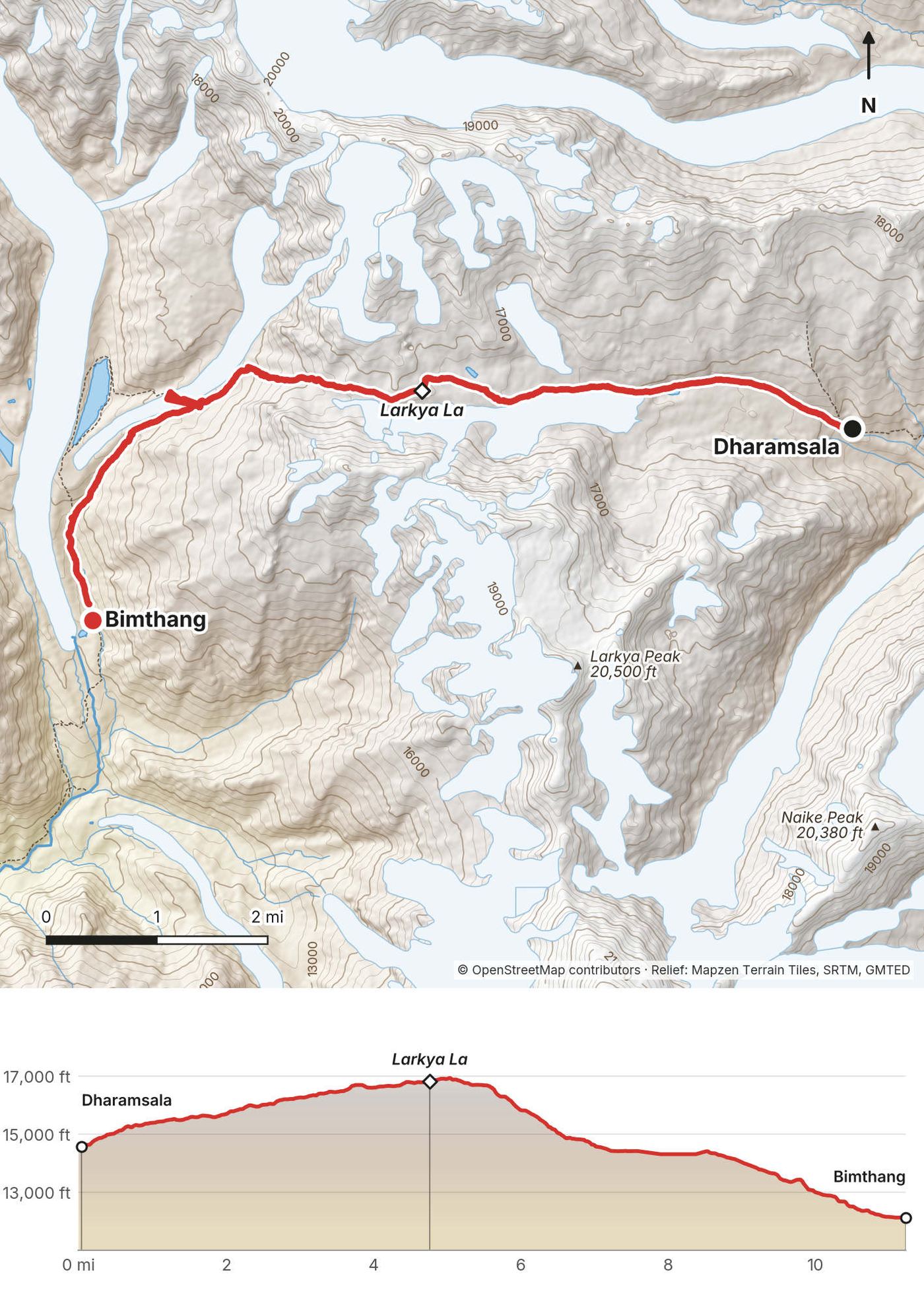
| 9 | Dharamsala over Larkya La to Bimthang | 11.2 (18.0) | 2,713 / 5,141 | 12,116 |
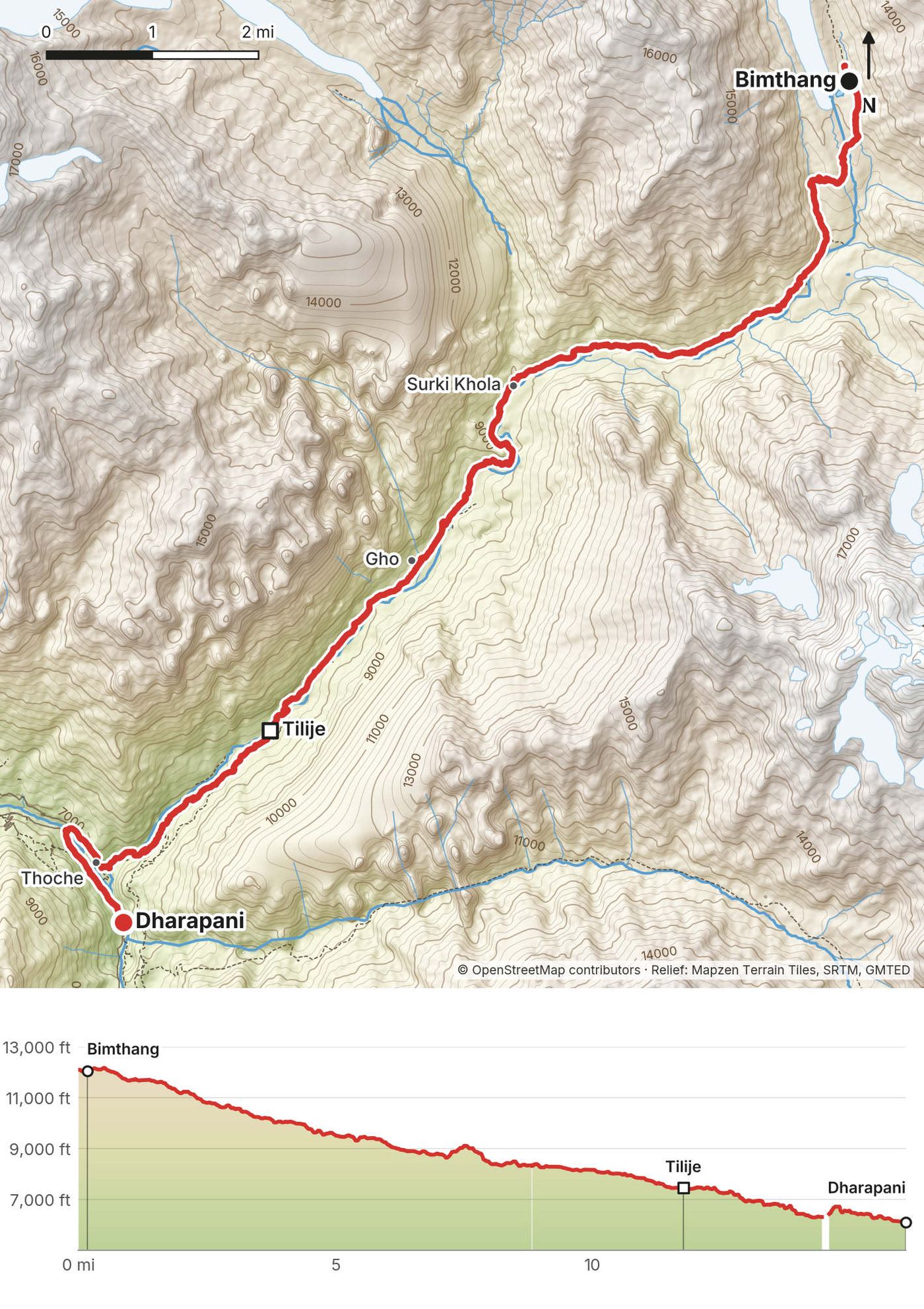
| 10 | Bimthang to Dharapani | 15.9 (25.7) | 1,312 / 7,469 | 6,105 |
The numbers come from my own GPS recordings, smoothed the same way for every day. My film calls it 100 miles, and I logged it on Strava as 100 miles and 28,000 ft of climbing over 10 days; the GPS files add up to 93.4 miles. On Day 2 my phone lost its height in the gorge below Deng, so that day's climbing is approximate (see Day 2).
The group. This was a group trip I hosted: Vagabond Trails (vagabond-trails.com) organized the whole thing, and I invited my subscribers to come along. My brother and a friend came too, and I met the rest of the group for the first time in Kathmandu. We had a guide I'd hiked with before on the Tour du Mont Blanc, a Sherpa mountain leader, and porters to help carry the duffels. Everything was taken care of on this trek, and I just had to go and enjoy myself.
Bags. Porters carried a duffel for each of us, and we each carried a day pack. At the briefing in Kathmandu we were told to pack our day packs as if we were going hiking tomorrow and to get our duffels down to 10 kg.
The pace. We walked about 5 to 16 miles a day and usually reached the next village in the afternoon. The last day was different: I trail ran almost 14 miles downhill from Bimthang, through the fall colors, and it was nice to be alone for a little bit and get some exercise. The start of the trek is like a ski lift up, so I can trail run down.
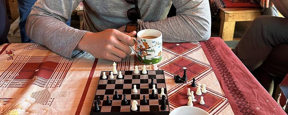
Traditions. We kept up the tradition of sneaking little rocks into people's packs while they were hiking; people found small rocks in their stuff a lot on this trek. I brought a mini magnetic chess board, and we used it every single day. One of the group carried a giant stick up and down the entire trek, and the locals loved it.
What it cost. The trip was booked through the company, so there are no teahouse or permit receipts in my records, and this guide doesn't give the company's prices. The permit fees for 2026 are below.
Kathmandu. I met the group in Kathmandu on November 1. The next day was a sightseeing tour and trek preparation day: we saw Kathmandu Durbar Square, Pashupatinath and Boudhanath, and had a briefing with the map. Get your visa on arrival and your rupees here.
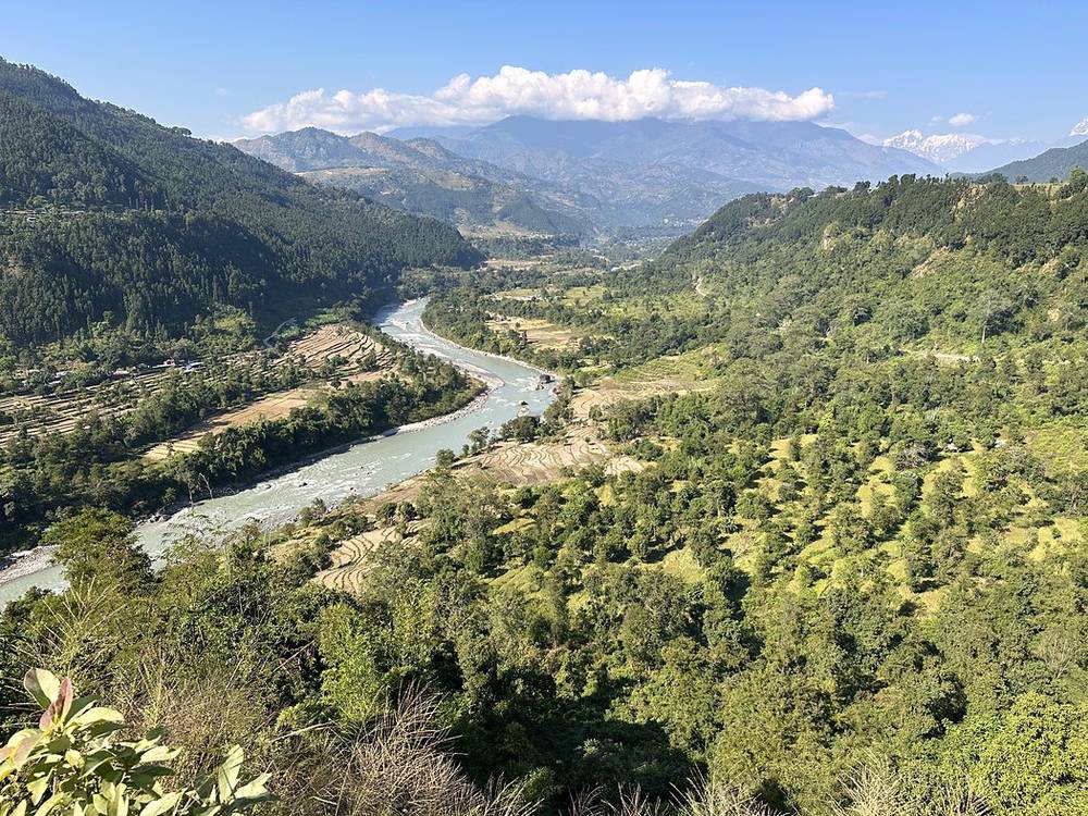
The drive to Machha Khola. On November 3 we drove about nine hours from Kathmandu to Machha Khola, where the trek starts. The road runs west out of Kathmandu, then north through Dhading and Arughat and along the Budhi Gandaki. The last part, above Arughat and Soti Khola, is a rough dirt track above the river.
Roads here are being pushed farther up the valley, and trekking companies in 2026 say jeeps can reach Machha Khola and sometimes beyond, toward Jagat. I couldn't confirm the current road end on an official page: ask your agency where the road ends on your dates, and how long the drive takes after the monsoon.
What I did. On November 14 we drove about five hours from Dharapani down the Marsyangdi valley to Besisahar, past the Syange waterfall, and then back to Kathmandu. After the trek I flew directly home to Denver.
What you'll do. From Dharapani, jeeps go down the Besisahar-Chame road to Besisahar in about 3 to 6 hours, and buses and jeeps run from Besisahar to Kathmandu or Pokhara. Your agency usually arranges this.
Check the road. News reports said a landslide at Kharkhare Bhir, near Besisahar, fully blocked the Besisahar-Chame road on September 27, 2026, with about 200 m of road washed away, and the road at Dharapani was closed for paving on some days in September 2026. Late-September 2026 storms also blocked the Prithvi Highway between Malekhu and Mugling for a time. Check road closures on the Department of Roads map at navigate.dor.gov.np and ask your agency how the road is on your dates.
Tsum Valley. A side valley that branches off near Philim and Ekle Bhatti, with its own restricted area permit (US$40 a week in autumn). Agencies combine it with the circuit for a trip of about three weeks. I haven't done it.
A night in Namrung. Day 4 from Ghap to Lho is the biggest jump in sleeping height of the trek. Stopping in Namrung, with lodges and a permit check, splits it.
Shorter drive days. If the road goes farther up the valley on your dates, some groups drive past Machha Khola and start walking higher up. That skips part of Day 1 and makes the altitude gain a little faster.
I walked the version in this guide. I haven't walked these other versions.
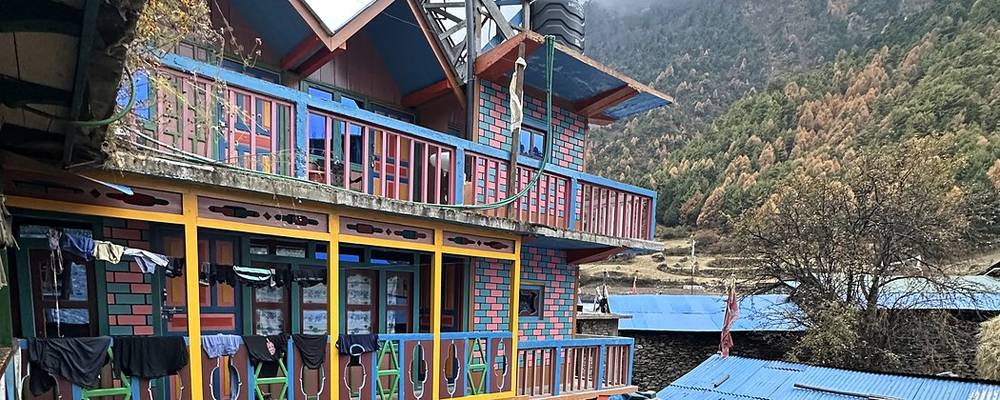
Teahouses. Food was available to buy at every stop, every day and night, and there were multiple teahouses along the way. Rooms are simple, often two beds and not much else. Wi-Fi and charging were available at every stop except a day or two either side of the pass, and showers at every stop except near the pass (some hot, some not). Toilets are squat toilets. On my trip the company booked everything, so I can't give you prices; teahouses take cash, and prices go up with the altitude.
Food. Dal bhat, rice with lentil soup and vegetables, is on every menu and comes with refills. Teahouses also serve noodles, soups, potatoes and tea. In my film, someone at the Kathmandu briefing says the safest thing to do is to eat vegetarian.
Water. The Manaslu and Annapurna conservation areas ask trekkers not to buy bottled water: refill at safe drinking water stations or treat it yourself. Carry a filter or tablets.
Dharamsala has only a few lodges, with cold rooms and basic food. Bring snacks for the pass day.
Paid links: I earn a commission if you buy through these links, at no extra cost to you. As an Amazon Associate I earn from qualifying purchases.
On this trek I walked with a day pack and a porter carried my duffel. Here's what I carried in 2022, what I'd take now for the cold days up high and the pass, and what I filmed with.
From my film. My full gear list for this trip isn't in my records.
 Puffy: The North Face Summit Series Breithorn Hoodie. The North Face sponsored the film. It kept me warm. Similar: Arc’teryx Cerium Hoody (Arc’teryx).
 Camp shoes: The North Face ThermoBall Traction Booties. They kept my feet super warm at camp, and they're so soft they packed small. Similar: Crocs Classic Clog (Amazon).
My current kit for what this trek needs.
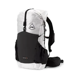 Day pack: Hyperlite Mountain Gear Waypoint 35 (Hyperlite). A porter carries your duffel, so a day pack is all you wear.Down jacket: Arc’teryx Cerium Hoody (Arc’teryx). For the high days and the pass morning, which starts in the dark on snow.
 Base layer: PATH Projects Lynx PD Base Liner (PATH Projects)
 Hat: PATH Projects Hoyt Merino Beanie (PATH Projects)
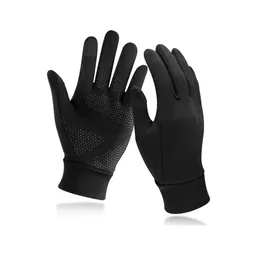 Gloves: Unigear Touchscreen Liner Gloves (Amazon)
 Rain shell: Arc’teryx Beta AR Jacket (Arc’teryx)
 Sleeping bag: Hyperlite Mountain Gear 20° Mummy Bag (Hyperlite). Teahouse rooms are cold up high, and Dharamsala's are the coldest.
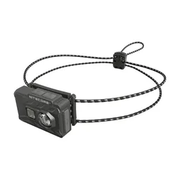 Headlamp: Nitecore NU20 Classic (Amazon). For the pass morning.
 Microspikes: Yatta Life Ice Spikes (Amazon). If snow is forecast for Larkya La.
 Water filter: Katadyn BeFree AC · 1L (Amazon). The conservation areas ask trekkers not to buy bottled water.
 Wet wipes: Sea to Summit Wilderness Wipes (Amazon)
 Sunglasses: Goodr OG Sunglasses (Amazon). For the snow and the sun up high.
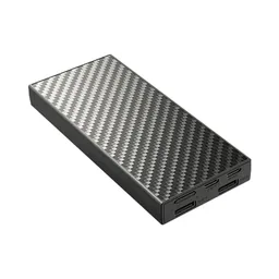 Power bank: Nitecore NB20000 (Amazon). No charging for a day or two either side of the pass.
I shot the whole film handheld on my phone. Check the drone rules in Weather and safety before you fly: Nepal's Civil Aviation Authority, the Ministry of Home Affairs and the conservation areas each need to approve it.
Since September 2026 I film with a smaller setup: the Pocket 4 and the Mic 3 on the trail, and the Mini 5 Pro in the air.
 Camera: DJI Osmo Pocket 4 (Amazon)
 Mic: DJI Mic 3 · 1 TX + 1 RX (Amazon). It pairs with the Pocket 4.
 Drone: DJI Mini 5 Pro (Amazon)
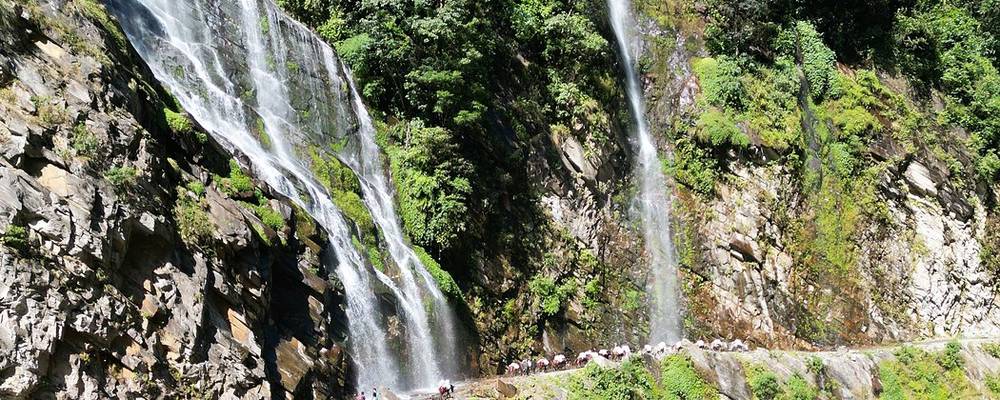
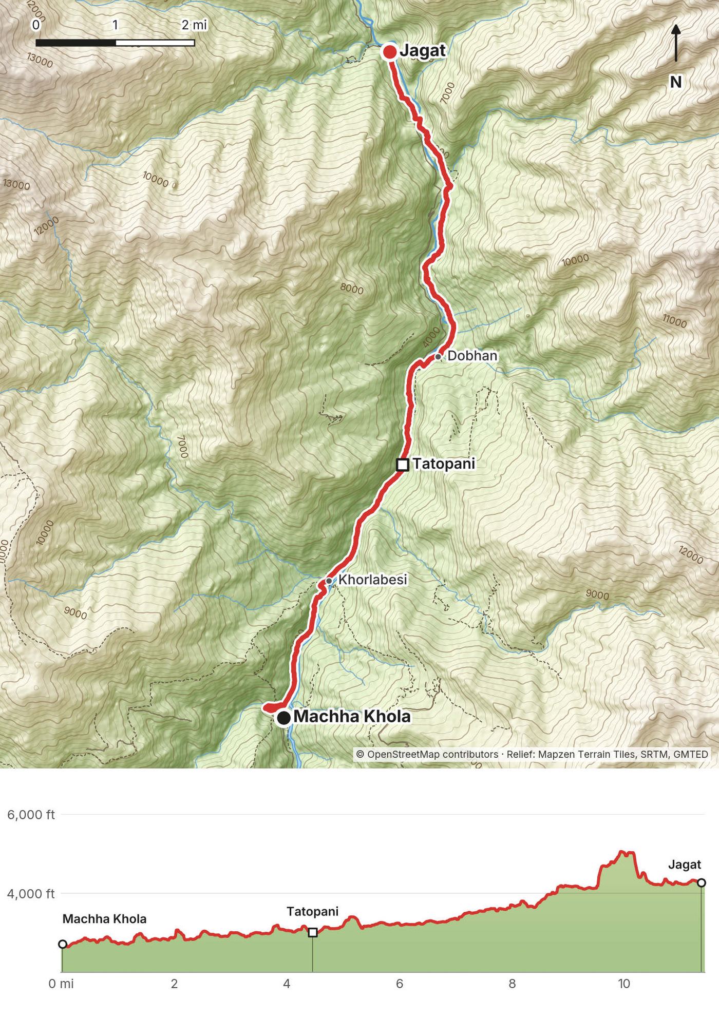
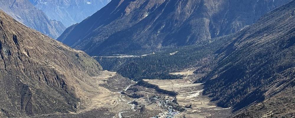
We started walking from Machha Khola at 7:57 a.m. after a night there at the end of the drive. It's the lowest part of the trek, warm, with steep green valley walls and waterfalls coming down onto the trail. We crossed the river on suspension bridges, passed Khorlabesi and Tatopani, and rolled into Jagat in the middle of the afternoon.
From Machha Khola the path follows the Budhi Gandaki upstream through Khorlabesi to Tatopani, a village with hot springs, 4.5 miles in. Past Dobhan it stays close to the river, with some rough, rocky stretches where the valley narrows. Jagat is where the restricted area starts, and permits are usually checked here.
Walk back down the valley to Machha Khola and the road.
Film, Day 1 · The drive to Machha Khola
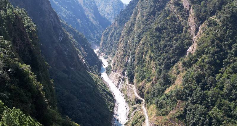
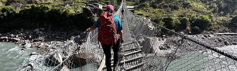
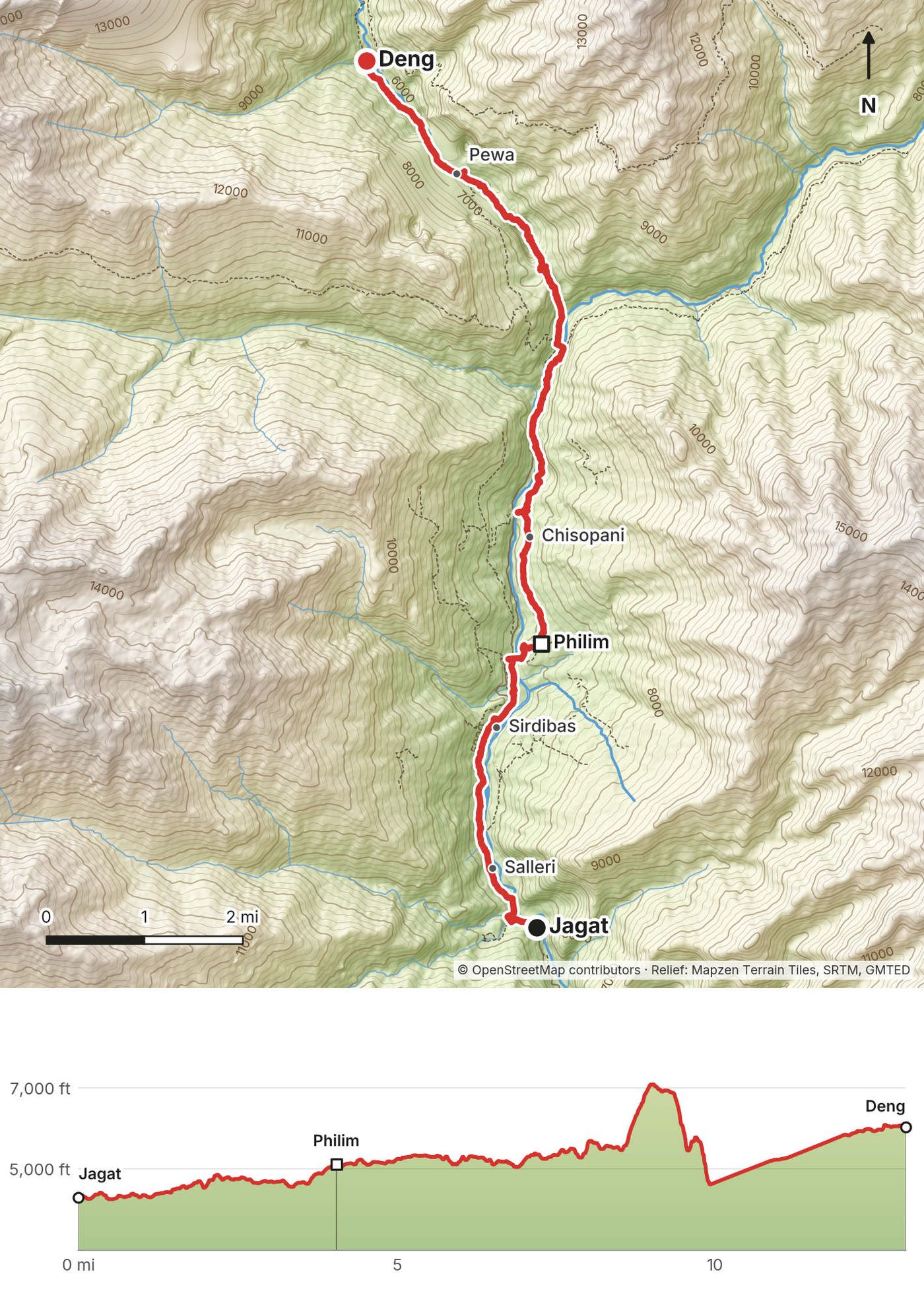
The longest day in the lower valley. We crossed the river on a long wooden suspension bridge near Philim, passed through villages and terraced fields, then went into the gorge, where the path climbs high above the river and drops back down more than once. We reached Deng at about 4:45 p.m. That night I posted 14 miles and 3,500 ft of climbing for the day on Instagram.
From Jagat the trail passes Salleri and Sirdibas, crosses the Budhi Gandaki and climbs to Philim, a big village with lodges. My route then took the high path on the east side of the gorge, past Nyak Phedi, up to about 7,100 ft, and down into a steep side gorge before Pewa and Deng.
About the numbers. For about 2 miles in the gorge my phone's height went wrong (it read about 2,500 ft). The GPX file gives that stretch a straight line of height, so the real climbing is a little higher than it shows.
Back down to Philim and Jagat, then Machha Khola.
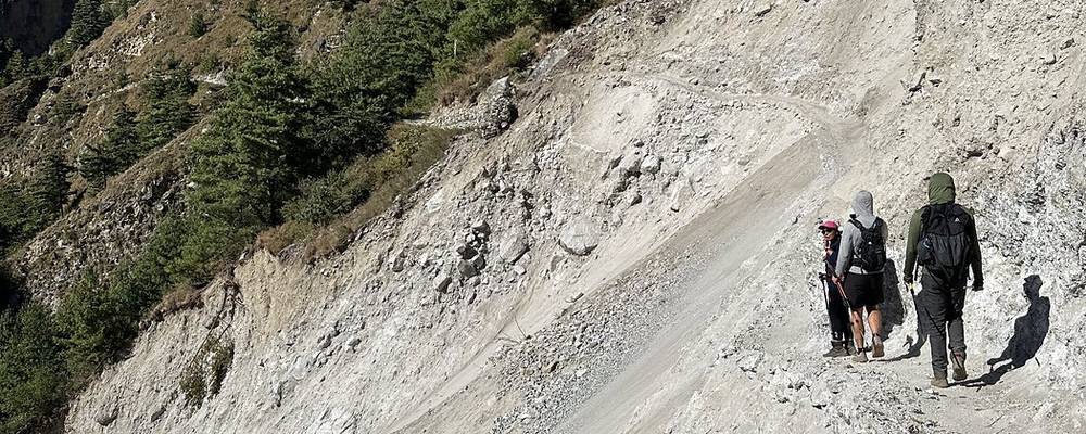
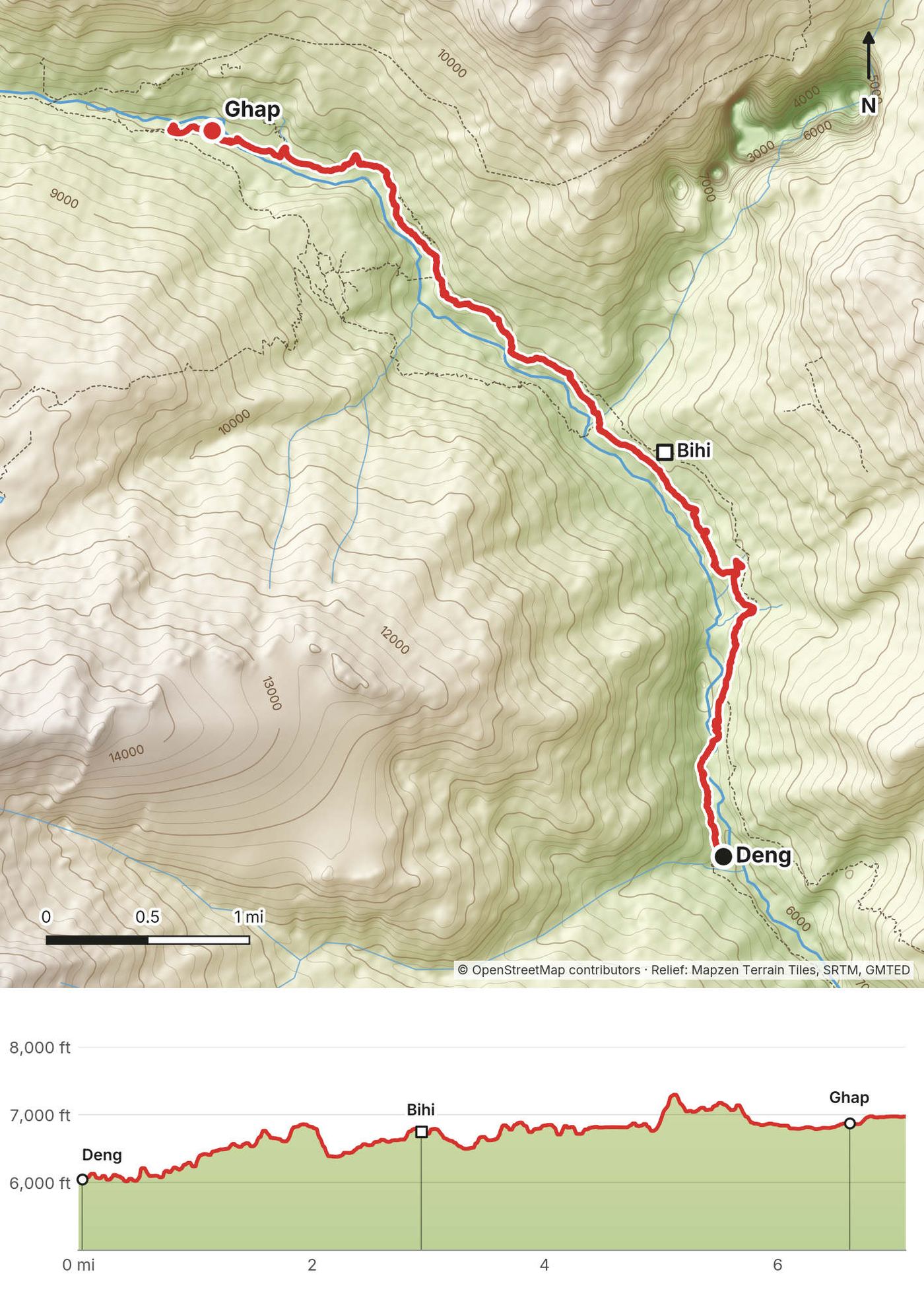
A shorter day. We stopped at a teahouse near Bihi in the morning for tea and a game on my little magnetic chess board, and passed chilies drying in the sun in the villages. In the afternoon we crossed a landslide where the trail had been swept away. On Instagram I wrote that the Manaslu Circuit is more remote than others in Nepal, and that numerous sections of the trail were missing from rock slides.
From Deng the trail climbs through forest to Bihi, then follows the valley west past small villages to Ghap. Before Ghap it crosses landslide slopes: loose ground where the monsoon has taken the old path. Watch for falling stones and move across one at a time.
Back down to Deng, Philim and Jagat.
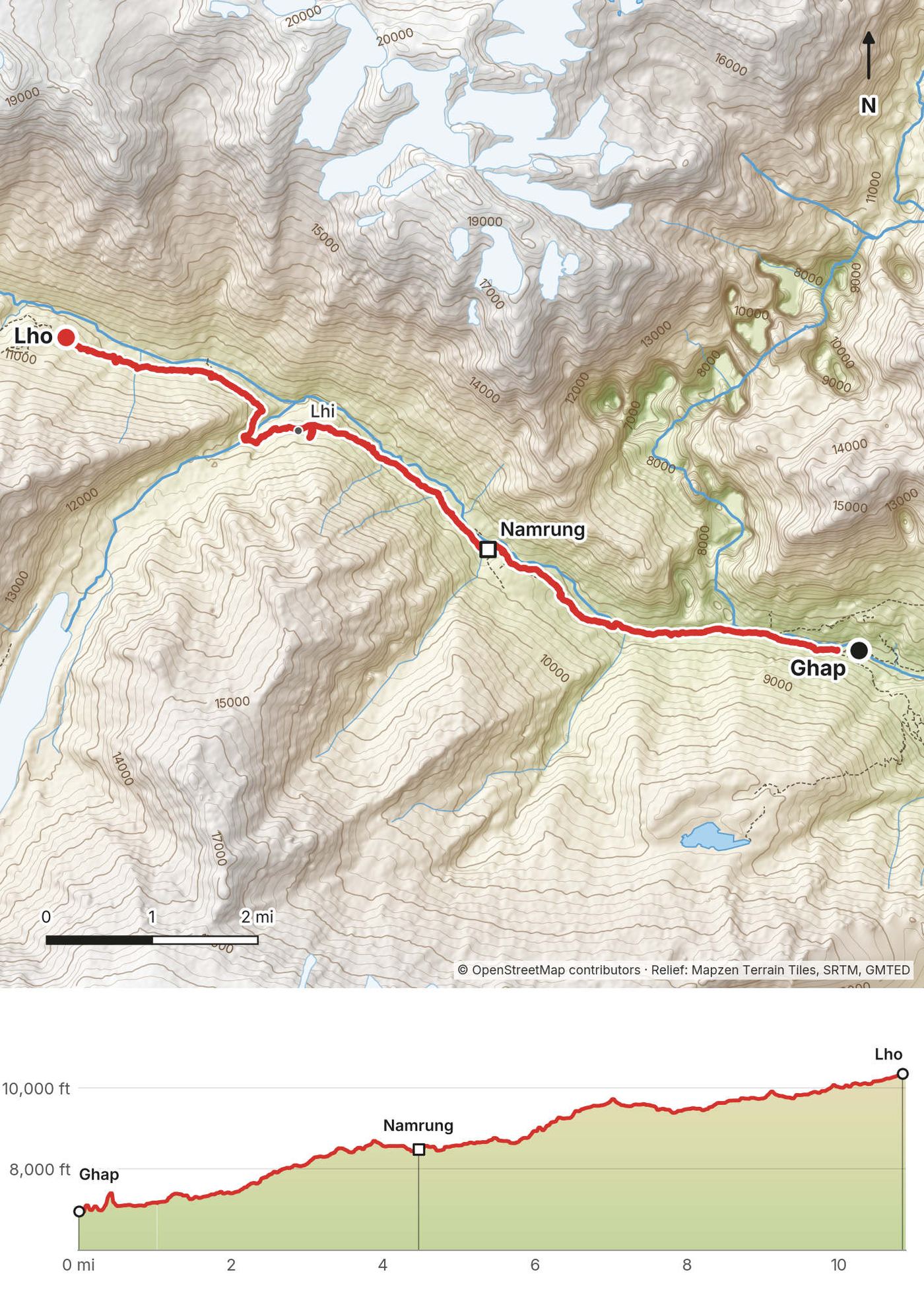
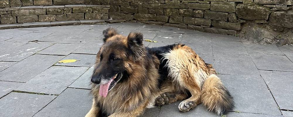
The day we climbed out of the forest. We reached Namrung, with its stone buildings, gate and a big fluffy dog lying in the square, around lunchtime, and walked on in the afternoon past barley fields near Lhi. We got to Lho just before 5 p.m. and stayed in a colorful teahouse there.
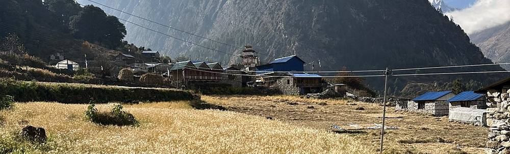
From Ghap the trail crosses the Budhi Gandaki and climbs steadily through forest to Namrung, where permits are usually checked again. Namrung is where the valley opens up: above it are the villages of Lhi and Lho, with barley fields, stone houses, monasteries and the first big peaks. From Lhi the trail climbs gently to Lho.
Note for 2026: a flood at Namrung on September 6, 2026 swept away two bridges; the route reopened on September 11 on a temporary bridge and an alternate path. Ask your agency how the crossing is on your dates.
Down to Namrung, Ghap and the lower valley.
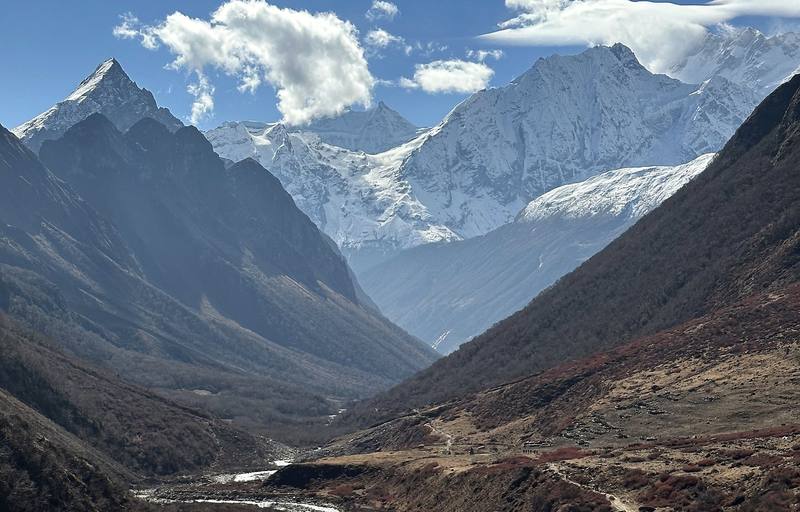
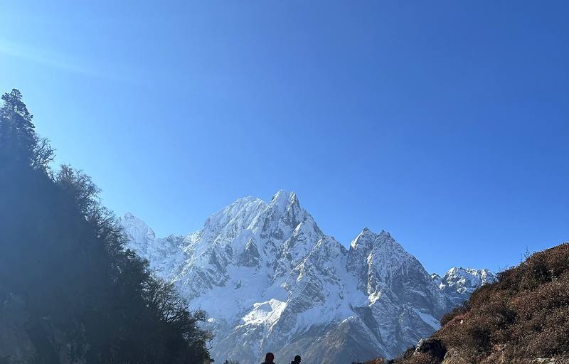
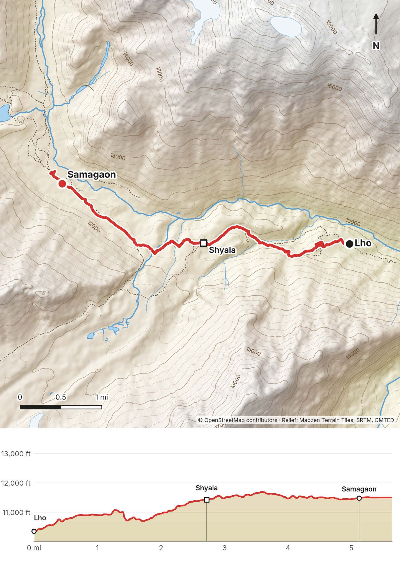
This was the day of the first view of Manaslu, and it's just amazing: it's the eighth highest mountain in the world, so it's a big boy. We saw it just above Lho in the morning, then walked on through Shyala, with Manaslu right above the village and its monastery, and reached Samagaon by lunchtime.
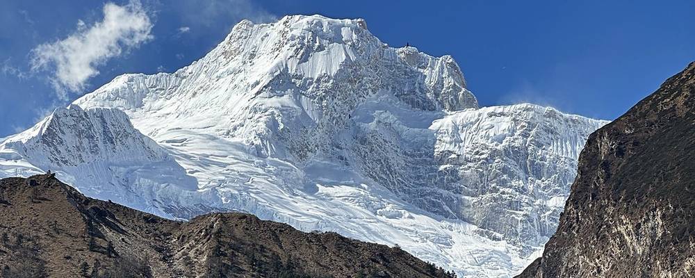
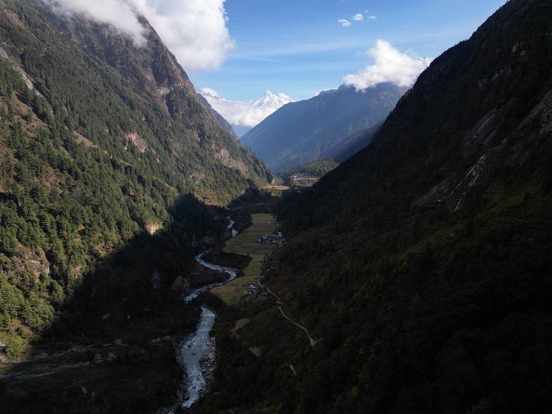
From Lho the trail drops to a stream and climbs through forest, then opens out at Shyala, with Manaslu, Manaslu North and the glaciers straight ahead. From there it's an easy walk across the flats to Samagaon, a big village and the main stop of the upper valley, at about 11,500 ft. Most groups spend two nights here to acclimatize.
Back down to Lho and Namrung.
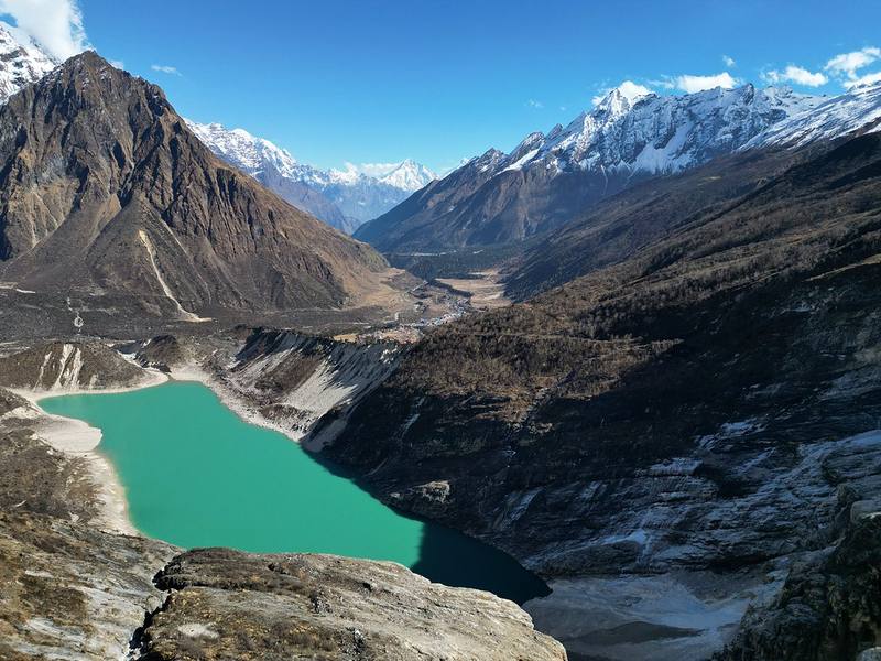
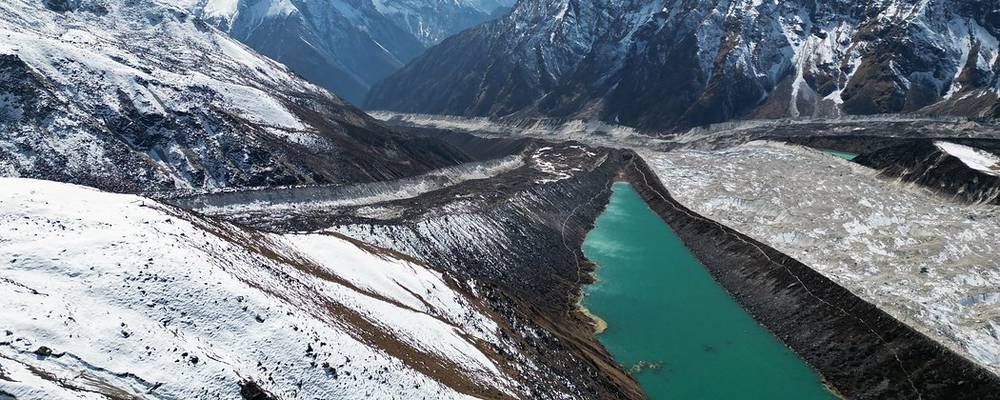
Wednesday the 9th, our acclimatization day. We walked up from Samagaon past Birendra Lake and up the ridge beside the Manaslu glacier to Manaslu Base Camp, where there's a stone cairn with prayer flags, and came back down to Samagaon for a second night. The optional day up to Manaslu Base Camp is totally worth it: great views, and you get up to about 16,000 ft, which helps you prepare for the pass.
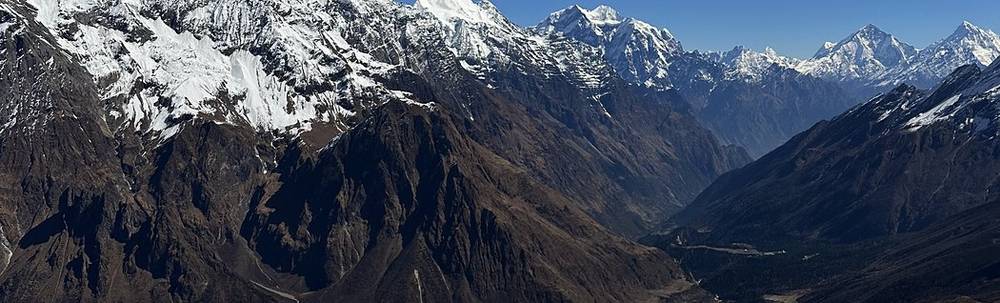
From Samagaon a path heads west to Birendra Lake, a milky turquoise lake at the foot of the Manaslu glacier, then climbs steeply up the grassy and rocky ridge on its north side. Higher up it's steep, loose and, in November, snowy. The base camp is on the ridge at about 15,900 ft (my GPS 4,836 m). Come back the same way.
Turn around: you sleep in Samagaon either way.
The shortest day of the trek: just over two hours up the open valley, with the river below and big peaks all around, to Samdo, a small village near the Tibetan border. We were there by mid-morning.
From Samagaon the trail runs north up the wide valley floor, along the Budhi Gandaki. At the end it crosses the river and climbs to Samdo, the last village before the pass.
Back to Samagaon, an easy two hours down.
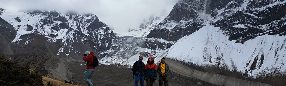
We woke up in Samdo to fresh snow on the roofs and the valley white all the way down. We walked up in the snow, in the sun, with the Larkya glacier and big peaks opening up on the left, and reached Dharamsala, the last stop below the pass, around noon. The rest of the day was for resting, eating and getting ready for an early start.
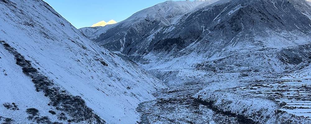
From Samdo the trail drops to cross a stream and climbs west up a side valley, high above the Larkya glacier. It's a steady, short climb to Dharamsala, also called Larkya Phedi, a few basic lodges at about 14,500 ft. It's cold at night.
Back down to Samdo and Samagaon. Don't go over the pass if you have symptoms of altitude sickness here.
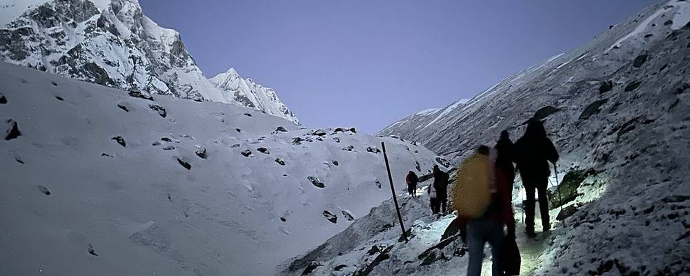
The big pass. We left Dharamsala at 4:39 a.m. with headlamps, in the dark and the cold, and walked up over the snowy moraine as the sky got light. We reached the top of Larkya La at 8:05 a.m., with its huge pile of prayer flags. Then came the long way down, past glaciers and big snow peaks, to Bimthang in the afternoon, ten hours after we started.
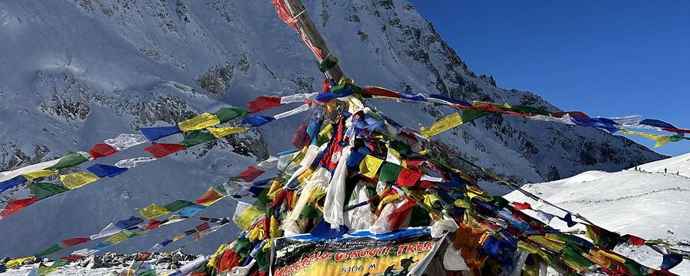
From Dharamsala the path climbs west over the moraine beside the Larkya glacier, with small ups and downs and frozen lakes, then up a long, gentle slope of snow to the pass. The top is wide, with the prayer flags and the sign. On the far side the trail drops steeply at first, on snow and loose ground, then down a long moraine valley past the glaciers below Larkya Peak to the pastures and lodges of Bimthang.
Start early: afternoon wind and cloud are common on the pass, and it's a long day either way. In November I needed a warm jacket, gloves and a headlamp before dawn. With fresh snow, microspikes help.
Before the top, go back down to Dharamsala and Samdo. Past the top, keep going down to Bimthang: it's the nearest shelter.
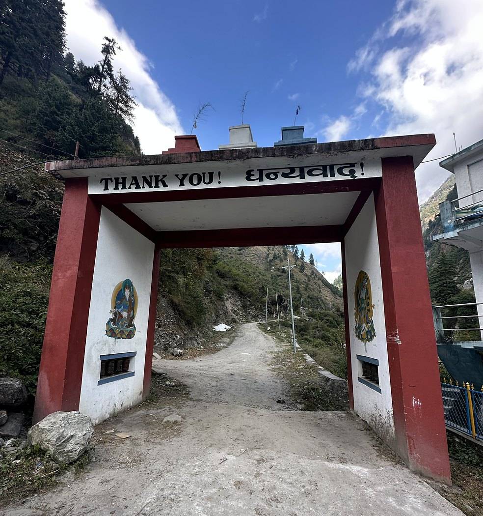
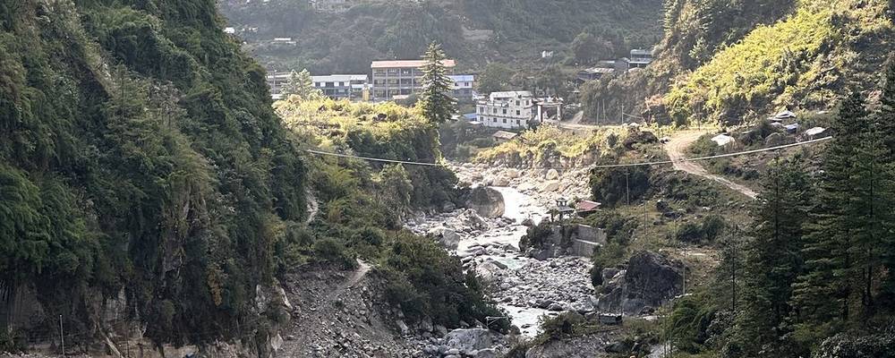
The last day of hiking. I absolutely loved getting to trail run down, almost 14 miles of running downhill, going through the fall colors. It was nice to be alone for a little bit and get some exercise. At the end I stood under the "Thank you" gate near Dharapani. That day was more than 6,500 ft of descent, and that night we celebrated in Dharapani with a cake.
From Bimthang the trail crosses the Dudh Khola and drops through forest, with views back to Manaslu, past Surki Khola to Gho and Tilije, the first big villages on the Annapurna side. Below Tilije it follows the Dudh Khola to Thoche and meets the Marsyangdi valley and the Annapurna Circuit road at Dharapani. It's a long day with a lot of descent: go easy on your knees.
Keep going down: Tilije and Dharapani are on the road.
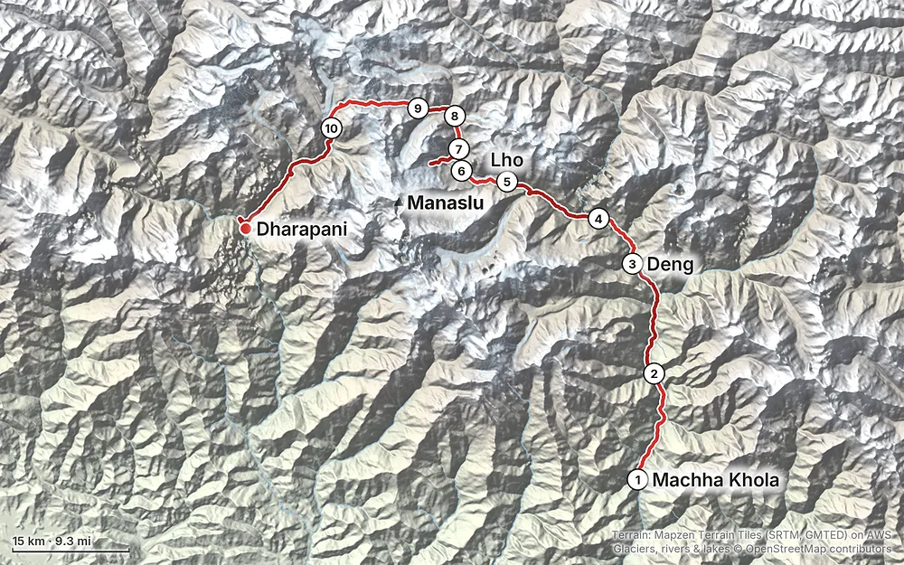
Elevation2,641–16,900 ft93.4 mi
Terrain: Mapzen Terrain Tiles (SRTM, GMTED) on AWS · Glaciers, rivers & lakes © OpenStreetMap contributors
Tap a map to open it full size.
Carry your permits and passport in your day pack: they're checked on the trail, and the permit has to be shown to police or immigration on request. (Checked September 29, 2026; sources in the guide's research notes.)
The Nepal Tourism Board gives the best seasons for the Manaslu area as March to May and September to November. June to September is the monsoon, with heavy rain, landslides and trail damage low down; in winter, snow can make Larkya La hard or impossible to cross. Early snow can close it in autumn too: news reports on September 30, 2026 said heavy snow had blocked the pass since late September, with trekkers waiting in Samagaon and Samdo.
I walked from November 4 to 13, 2022. It was pretty dry, with perfect weather, blue skies most days, and fall colors low down on the last day. Clouds came in over Samdo on the afternoon of Day 7, snow fell that night, and Day 8 and the pass on Day 9 were on fresh snow. It was cold and dark when we started the pass day, and clear and sunny by the time we reached the top.
The Manaslu Circuit starts low, at about 2,700 ft (826 m on my GPS) in Machha Khola, and climbs slowly for five days before the high part. The last four nights before Bimthang are at 11,500 ft and above, and the pass is at about 16,900 ft.
How we did it. Two nights in Samagaon, with a day walk up to Manaslu Base Camp in between, then short days to Samdo and Dharamsala before the pass. We gained height slowly for the first three days; Day 4 was a big jump (see below).
My nights (heights from my GPS):
| Night after | Where | My GPS |
|---|---|---|
| The drive | Machha Khola | about 2,710 ft (826 m) |
| Day 1 | Jagat | 4,319 ft (1,317 m) |
| Day 2 | Deng | 6,024 ft (1,836 m) |
| Day 3 | Ghap | 6,973 ft (2,125 m) |
| Day 4 | Lho | 10,352 ft (3,155 m) |
| Days 5 and 6 | Samagaon | 11,500 ft (3,505 m) |
| Day 7 | Samdo | 12,615 ft (3,845 m) |
| Day 8 | Dharamsala (Larkya Phedi) | 14,554 ft (4,436 m) |
| Day 9 | Bimthang | 12,116 ft (3,693 m) |
| Day 10 | Dharapani | 6,105 ft (1,861 m) |
The rules of thumb. The US CDC's current guidance (Yellow Book 2026): once above 3,000 m (9,850 ft), don't raise your sleeping height by more than 500 m (1,650 ft) a night, and add an extra night for every 1,000 m (3,300 ft) you gain. On this route the big jump is Day 4, Ghap to Lho, about 3,400 ft (1,030 m) of sleeping height; a night in Namrung splits it. The Samagaon rest day and the short day to Samdo keep within it; Samdo to Dharamsala, about 590 m (1,940 ft), is a little over.
The signs. Headache is the main symptom of acute mountain sickness, usually with loss of appetite, dizziness, tiredness or nausea. Confusion, stumbling or drowsiness, like being drunk, can mean HACE (swelling of the brain). Breathlessness at rest, a cough and chest congestion can mean HAPE (fluid in the lungs). Both are emergencies. Going down 300 m (1,000 ft) or more usually helps quickly. Ask your doctor about acetazolamide before you go.
Help on the trail. There's no Himalayan Rescue Association aid post on the Manaslu Circuit (its nearest post, Manang, is off this route). Help above Samagaon means going down or a helicopter, so your guide, your insurance and turning back early matter more here than on the busier treks.
Weather. In early November: mostly clear, dry and sunny, warm low down and cold up high, with afternoon cloud up high and snow overnight before the pass on my trip.
The trail. It runs along the river, and the monsoon changes it every year: landslides take out stretches of trail and bridges. Watch for falling rocks and loose ground, cross landslide slopes quickly and one at a time, and follow your guide's choice of path.
Altitude is the main risk up high. Read Altitude. Tell your guide early if you feel unwell, and don't cross the pass with worsening symptoms.
Getting help. Above Samagaon, help is far away: there's no aid post on the circuit, and rescue is by helicopter. Have insurance that covers helicopter evacuation at this height, and carry the policy details. The agency is responsible for rescue under the permit rules.
Emergency numbers in Nepal (checked September 2026): 100 police, 1144 tourist police (toll free). There's a tourist police post in Dharapani. On the Manaslu side, Gorkha's emergency operations center is 1234 (Nepal Tourism Board, 2026).
Travel advice. The US State Department had Nepal at Level 2, exercise increased caution, in September 2026, with a separate Do Not Travel area on the Langtang side, not on this route.
2026 closures. The Namrung bridges (September 6 to 11), a Manaslu Conservation Area permit stop in heavy rain (September 24 to 27), the Besisahar-Chame road (from September 27) and Larkya La (snow, late September): see Before you go, check these.
Drones. I flew a drone on this trip. Flying one in Nepal needs permission from the Civil Aviation Authority of Nepal and a security clearance from the Ministry of Home Affairs, and the conservation areas don't allow drones without their approval. This is a border area. Arrange it before you go, or leave it at home.
Is it really 100 miles? Close. My GPS recordings add up to 93.4 miles (150.3 km) from Machha Khola to Dharapani, including the day walk up to Manaslu Base Camp. The film and my Strava say 100 miles.
How many days do I need? I walked ten days, with one of them a round trip to Manaslu Base Camp from Samagaon to help with the altitude. Add a day in Kathmandu to get ready, a long day's drive to the start and a long day's drive out, and plan on about two weeks in Nepal. My whole trip ran from November 1 to November 15.
Do I need a guide? Yes. The Manaslu area is a restricted area, and its permit is issued only through a registered trekking agency, with a licensed guide going with you. I didn't do any research on this because everything was taken care of by the company, but I believed you needed a guide, and the rules say so. See Permits and fees.
Can I do it alone? Not without a guide. Since March 2026, Nepal's Department of Immigration lets a single trekker get the permit, but still only through an agency and with a licensed guide assigned to go with you.
How hard is it? The trail is pretty rugged compared to others I've done in Nepal. It runs along the river on a dynamic trail: in the monsoon the water rises and destroys parts of it, so rocks can fall and dirt can be loose. The hard days are the long ones low down, where it climbs and drops a lot, and Day 9, the pass: I started at 4:39 a.m. and walked for ten hours, up to about 16,900 ft and down more than 5,000 ft.
Is Manaslu Base Camp worth it? Totally worth it. It's an optional day from Samagaon, with great views, and you get up to about 16,000 ft (my GPS: 15,868 ft), which helps you prepare for the pass a few days later.
Is it busy? The trail was pretty quiet, in my opinion.
What about food and beds? Food was available to buy at every stop, every day and night, with multiple teahouses along the way. See Teahouses, food and water.
Phone, Wi-Fi and charging? Wi-Fi was available the whole trek at every stop except for a day or two either side of the pass, and I could charge at every place except, again, a day or two either side of the pass.
Showers and toilets? There were places to take showers at every stop except near the pass. Some were hot, some were not. I chose to be a dirt ball and not shower until the very end. The toilets are basic squat toilets, and you just have to get used to it. Bring wet wipes and a roll of toilet paper, also for blowing your nose: it gets messed up at high altitude.
Dogs? There were so many dogs on this trek, and especially tiny puppies. Adorable. My brother stopped to pet every single dog he met.
These change from year to year; everything else in this guide stays the same. Checked September 29, 2026. Check them again when you book and the week you fly.
Permits and rules
The route and roads
Travel
Money and gear
The film is at the top of this page.
Planning questions about Manaslu Circuit, answered only from this page's facts, the creators' versions and hikers' public tracks, with where each answer comes from. When the data doesn't say, the answer says "not given".
From hikers
Sign in to comment. Free; your hikes stay private unless you share them.
Something wrong or missing on this page? Send feedback.