
Content made there

Photos
Europe · Portugal
Apr 11–18, 2023 · 8 days · Solo · Hotels and guesthouses

In April 2023 I spent eight days alone on Madeira, the Portuguese island in the Atlantic off the coast of Africa. I didn't do a thru-hike. I rented a car, slept in hotels and did day hikes from the road: Pico Grande from the Valley of the Nuns, Pico do Areeiro to Pico Ruivo above the clouds, the old laurel trees at Fanal, part of the Levada do Caldeirão Verde, and Ponta de São Lourenço at the east end. In between I drove the coast from Ponta do Sol to Porto Moniz, Seixal and Machico. About 29.6 miles (47.7 km) of hiking and 10,462 ft (3,189 m) of climbing by my GPS. It's the trip from my films 8 Days of Traveling and Hiking in Madeira and Madeira in 8 Days.
Good to know first (October 2026). Since January 1, 2026, every classified trail on Madeira (the PR routes) needs a 30-minute time slot booked and paid online on the SIMplifica portal before you walk: €4.50 a trail, €10.50 for the full PR1 from Pico do Areeiro to Pico Ruivo. And the PR1 is now one-way past the Pedra Rija viewpoint, so you can't walk it out and back the way I did. See The rules: bookings and fees.
| Quick facts | |
|---|---|
| Where | Madeira, an island region of Portugal in the Atlantic, about 35 miles (57 km) end to end |
| Trip | 8 days, April 11 to 18, 2023, by rental car, sleeping in hotels around the island |
| Hiking | 5 day hikes, 29.6 miles (47.7 km) and 10,462 ft (3,189 m) of climbing in all, by my GPS |
| Highest point | Pico Ruivo, 6,109 ft (1,862 m), the top of the island |
| Rules (2026) | Every classified trail (PR) needs a time slot booked and paid online first: €4.50 a trail, €10.50 for the full PR1. The PR1 is one-way past Pedra Rija |
| Difficulty | Pico Grande and the PR1: steep climbs, stairs, drops, short scrambles or tunnels. Fanal, the levada and Ponta de São Lourenço: easy to moderate |
| Day | Hike | Miles (km) | Up / down (ft) |
|---|---|---|---|
| 2 | Pico Grande from Curral das Freiras | 5.6 (9.0) | 3,174 / 3,134 |
| 4 | Pico do Areeiro to Pico Ruivo and Achada do Teixeira, and back | 12.5 (20.1) | 5,118 / 5,125 |
| 5 | Fanal loop | 2.5 (3.9) | 358 / 345 |
| 6 | Levada do Caldeirão Verde from Queimadas (part) | 3.7 (6.0) | 761 / 725 |
| 6 | Ponta de São Lourenço | 5.4 (8.6) | 1,051 / 1,039 |
Flying in. Madeira's airport is Cristiano Ronaldo International (FNC), at Santa Cruz on the east side of the island, about 25 to 30 minutes from Funchal. I flew from Denver with a connection in New York. United flew Newark to Funchal nonstop about three times a week in summer 2026 (mid-May to late September, as reported); outside that season, connect in Lisbon (about 1 hour 45 minutes, many flights a day), Porto or a UK airport.
Wind at the airport. The runway is short and next to cliffs, and strong wind sometimes stops landings: flights divert to Porto Santo, the Canary Islands or Lisbon. It happens most from October to April, but summer isn't immune (as reported). Keep a spare day at the end of your trip, and your essentials in your hand luggage.
Entering Portugal (October 2026). Madeira is in the Schengen area. The EU's Entry/Exit System registers non-EU visitors with a photo and fingerprints at the first border, instead of a passport stamp. The ETIAS travel authorization wasn't running yet, and no start date had been announced; check the EU's travel site (travel-europe.europa.eu) before you go.
The car. I rented an automatic, because I can't really drive a manual. It cost me about $800 for the week, a little extra for the automatic. In 2026 a compact car is about €24 to €45 a day in April and October, and an automatic about €15 to €30 a day more (as reported). Most companies want you to be 21 and charge more under 25, and want a credit card. There are no tolls on the island.
Driving. The main road around the island was easy to drive: tunnels everywhere, with roundabouts between them. The expressway along the south coast (the VR1) is fast. The mountain roads up to Pico do Areeiro, Fanal and the passes are steep, narrow and full of hairpins, and fog can drop the visibility to almost nothing above about 4,000 ft (as reported). Use your headlights in the tunnels.
Parking at the trailheads. Pico do Areeiro is paid (see The rules). Queimadas, Fanal and Baía d'Abra are free but small, and fill early on busy days (as reported).
Buses. The Funchal city bus company (Horários do Funchal) runs a direct bus to Pico do Areeiro every day: up at 6:00 a.m. and 1:30 p.m., down at 12:15 p.m. and 7:00 p.m. (6:00 p.m. in winter), €3. It doesn't go to Achada do Teixeira, where the one-way PR1 ends. There's no direct bus to Queimadas or Achada do Teixeira: take a bus to Santana and a taxi. The SAM bus from Funchal runs to Baía d'Abra for Ponta de São Lourenço (line 113, as reported; check the number and times on the SAM site). A bus goes up to Curral das Freiras about once an hour (line 181, as reported).
Taxis. There's no Uber on Madeira. Bolt works in Funchal but not reliably outside it (as reported). For the one-way PR1, one taxi firm charged €90 a car (up to four people) from Achada do Teixeira back to Pico do Areeiro in 2026 (as reported); book it before you start.
Cable cars. The Funchal cable car to Monte costs €16 one way or €22 return. The Achadas da Cruz cable car down to the shore, which wasn't running when I was there, was reported running in 2026 for €3 one way or €5 return.
The one cost I have from my trip: the automatic rental car, about $800 for the week.
For your budget (October 2026 prices). 8 days for one person, as I did it, comes to about €1,215 to €2,000 before flights and fuel:
| Item | Cost |
|---|---|
| Automatic rental car, 7 days at about €40 to €75 a day | €280 to €525 |
| Hotels, 7 nights at about €80 to €140 | €560 to €980 |
| Trail bookings: PR1 €10.50, PR9 €4.50, PR8 €4.50, Fanal €4.50 | €24 |
| Taxi from Achada do Teixeira back to Pico do Areeiro (one-way PR1) | about €90 |
| Parking at Pico do Areeiro, a morning | about €20 |
| Food, 8 days at about €30 to €45 | €240 to €360 |
| Total, before flights and fuel | about €1,215 to €2,000 |
Two people sharing the car, the rooms and the taxi pay a lot less each. Other prices from 2026 (as reported): an espresso €0.90 to €2.20; espetada for dinner €16 to €28; the Cabo Girão skywalk €5; the Funchal cable car €16 one way; the Porto Moniz pools about €3; a bucket of balls at the Santo da Serra driving range €7.50 (the club's own price list).
Money. Euros. Cards work almost everywhere; carry some cash for small cafés. Tipping is optional: round up, or 5 to 10% for good service (as reported). Plugs are the European two-pin type (C and F, 230 V).
Phone. An eSIM for Portugal gave me Google Maps and 5G the whole time. The signal drops in deep valleys, the laurel forest, on the high ridges and in long tunnels.
Checked on the IFCN booking FAQ (updated June 2, 2026) and trail list (updated October 2, 2026) on October 3, 2026.
Book a time slot for every classified trail. Since January 1, 2026, every classified walking route (PR) run by the IFCN needs a booking for a 30-minute entry slot, paid in advance on the SIMplifica portal (simplifica.madeira.gov.pt). You can't pay at the trailhead or at an IFCN office. Slots can sell out; you can book the same day or the day before if there's space. Arrive within about 15 minutes of your slot. Save the booking on your phone: there's often no signal at the start.
Fees for visitors (2026).
| Booking | Price |
|---|---|
| One trail (any PR except the PR1) | €4.50 |
| PR1, Pico do Areeiro to the Pedra Rija viewpoint and back | €4.50 |
| PR1, the full route to Pico Ruivo (with the PR1.1 and PR1.2) | €10.50 |
| Two or more trails in 1 day (not the PR1) | €9.00 |
| Two or more trails in 3 days (not the PR1) | €22.50 |
| Two or more trails in 7 days (not the PR1) | €52.50 |
Each trail still needs its own slot; the portal charges the cheapest combination. Children 12 and under, Madeira residents, and people with a disability of 60% or more (and one companion) don't pay, but still need to book. If the IFCN closes a trail on your date you can ask for a refund or a new date; if you cancel for weather or anything else, you lose the fee.
For my five hikes: the PR1 (Day 4) €10.50, the PR9 (Day 6) €4.50, the PR8 (Day 6) €4.50. Fanal: the Visit Madeira page asks visitors to pay through SIMplifica "to visit this area", the same €4.50; I couldn't confirm whether a short loop like mine, without the PR13, needs a booking. Pico Grande from Curral das Freiras isn't a classified route.
Fines. Walking a closed trail, damaging signs or leaving litter carries a fine of €250 to €2,500 under Madeira's trail law (DLR 24/2022/M). Visit Madeira says walking a PR without a booking may also be fined.
On the trail. Stay on the path, take your litter home, don't pick plants or feed animals, no fires, and don't walk in heavy rain, strong wind, hail or snow (IFCN). Camping is only allowed in the IFCN's forest campsites with a permit (€5 a tent a night, booked on SIMplifica).
Parking at Pico do Areeiro. Paid since 2025, with barriers that stop cars when the lots are full: about €4 an hour in the upper lot and €2 an hour in the lower one (as reported; rates vary between sources). Card only, and the lots fill before sunrise (as reported).
From my films (I have no packing list for this trip):
What these hikes need:
I flew from Denver, connected in New York, and landed at Cristiano Ronaldo International Airport, named after Madeira's most famous footballer. As they lengthened the runway they ran out of space, so part of it stands on pillars over the shore, and you can drive underneath it.
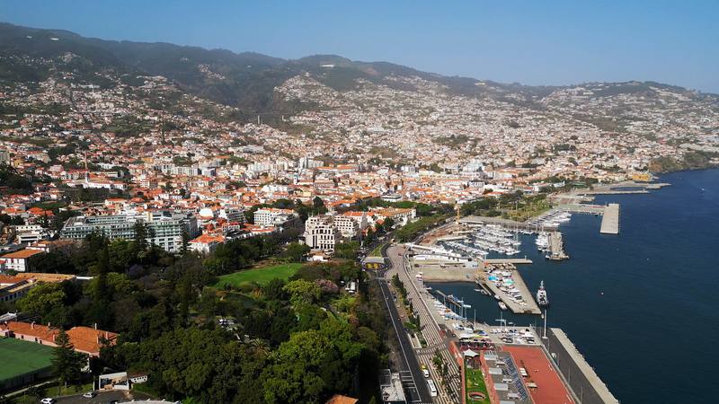
I picked up my rental car, an automatic, and drove straight to Funchal. I checked into the NEXT Hotel and spent the rest of the day walking around the city. I liked the two gardens, Santa Catarina Park and the Municipal Garden. For food, Prima Caju was pretty good (I always want to eat healthy after a long flight), and Fala Fala, on a quiet side street, had good food. My favorite coffee shop was Maia Coffee Shop. All the places I went are in my Google Maps list: Madeira.
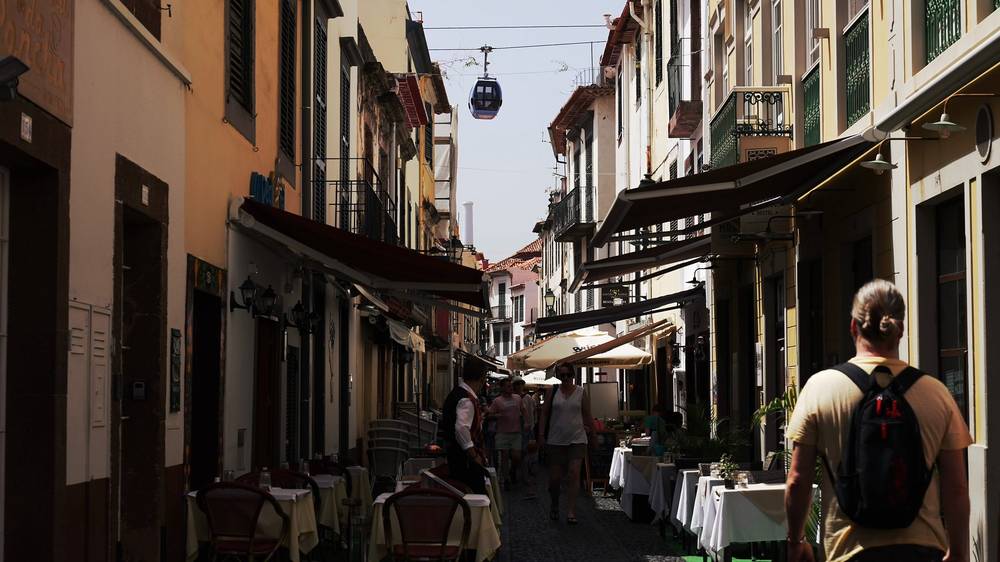
In 2026 (as reported): Prima Caju serves bowls, granola and crepes on Rua da Carreira, daytime only (9:30 a.m. to 4 p.m. on weekdays). Fala Fala is vegetarian and vegan, by the Arcadas de São Francisco.
Funchal (from 6:06) · Funchal, in my travel guide film (from 3:12)
The next morning I drove into the Valley of the Nuns, Curral das Freiras, with one hike in mind: Pico Grande. I started from the top of the village at 10:43 a.m. and snaked my way up. A wooden sign at the edge of the forest points the way to Pico Grande. Higher up the trail climbs a steep slope with cable handrails, then follows a ridge with the village far below, past purple Pride of Madeira flowers. It wasn't too crowded.
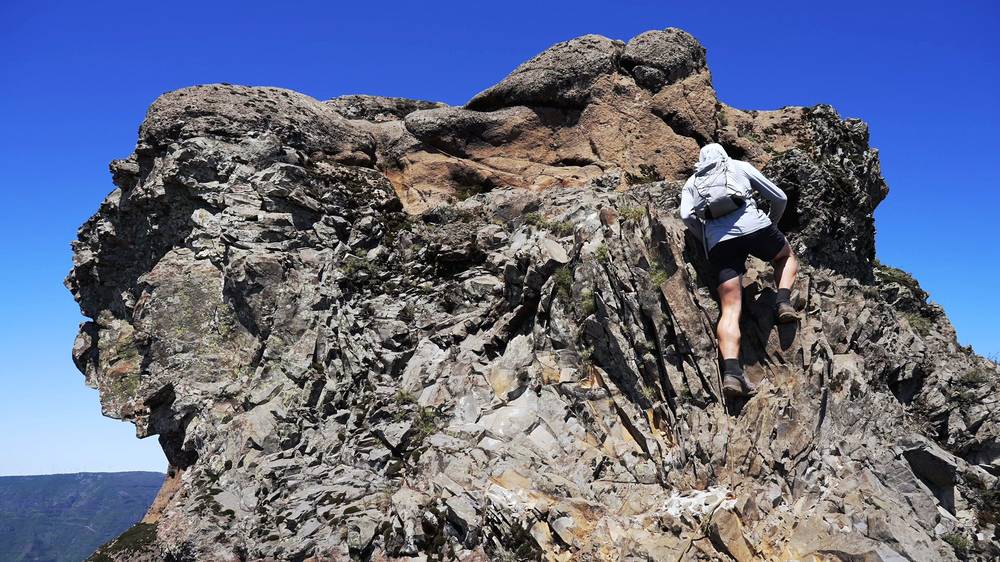
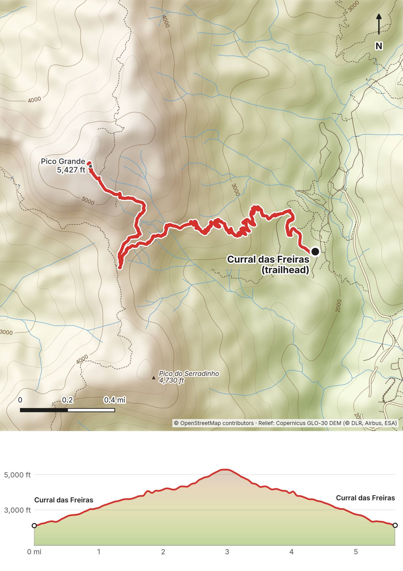
The last part is a short scramble up the summit rocks. From the top I could see the other peaks I'd be doing later in the week, and the valley below. I sat near the top for about a quarter of an hour, then went down the same way. I was back at 2:49 p.m.: 5.6 miles by my GPS, about 3,200 ft up, and about 3 hours 20 minutes moving. On Instagram I called it a warm-up hike.
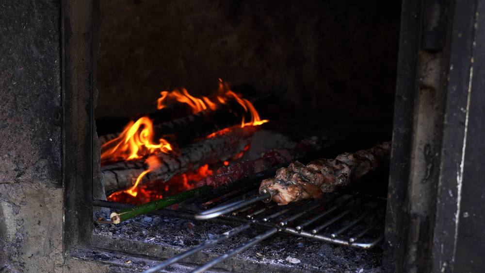
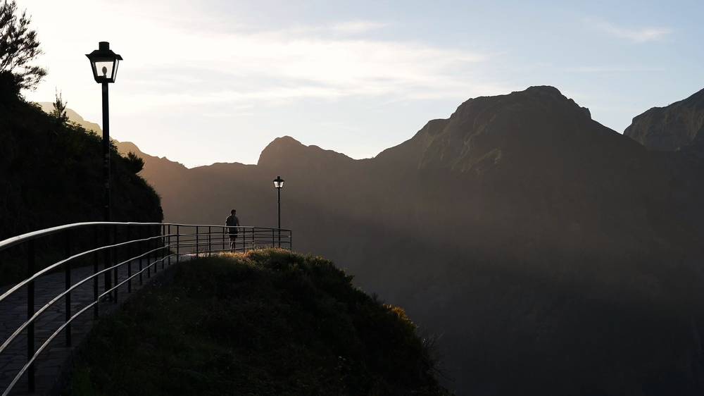
A nice part of this hike was getting back to the trailhead, where Restaurante O Lagar cooks espetada, meat on a skewer, over a wood fire. I had it with a salad and a coffee and fed a bit to a small dog. Then I wandered down into the village, and drove up to my hotel for the night, the Eira do Serrado Hotel & Spa, which has a viewpoint over the whole valley. It was especially nice at sunset. I ate dinner alone in a big, nearly empty dining room.
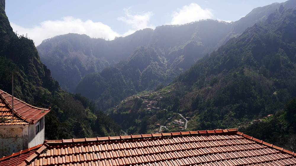
Curral das Freiras. The village sits deep in a valley ringed by cliffs, above Funchal, reached by a tunnel. My recording starts and ends at the top of the village, beside Restaurante O Lagar, at about 2,115 ft (645 m).
Up to the ridge. The path climbs west through old terraces and then forest, signed for Pico Grande. Above the trees it switchbacks up an open slope with cable handrails on the steep parts, and reaches the ridge below the peak about 2 miles in, at around 4,100 ft.
The summit. The path follows the ridge to the summit block. The last few yards are a scramble up rock, using your hands. The top, 5,427 ft (1,654 m), is a small rocky platform with drops on most sides. I reached it about 2.9 miles from the village.
Down. The same way. It's steep: take your time on the loose sections.
The ridge, before the summit rocks, is the place to decide. If the cloud has come down, the rock is wet or the wind is strong, the view from the ridge is already worth it: skip the scramble.
Pico Grande (from 7:18) · Pico Grande, in my travel guide film (from 4:25)
My plan was to wake up and do the PR1, Pico do Areeiro to Pico Ruivo. It turned out to be super overcast, and when I got up there the visibility was really bad. I waited a while in the café and at the car, but the weather never changed, so I decided to push the hike back a day. I'm really glad I did.
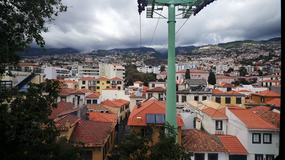
That day I also had a pastel de nata and a coffee at Pastelaria Caribe and rode the cable car up over Funchal's old town. Around then I stopped at Cabo Girão too, the glass skywalk on top of the sea cliff west of Funchal. It was crowded; I'd much rather park farther away.
If this happens to you. The cloud on the peaks can sit all day while the coast is sunny. That's why I wanted a car and a loose plan: with a spare day you can go back up the next morning. In 2026, a booked slot you can't use because of weather isn't refunded, so book the PR1 for the day you're surest of, and check the forecast and the webcams first.
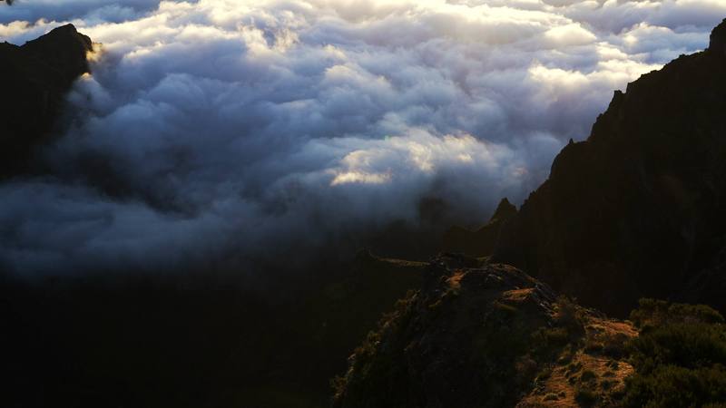
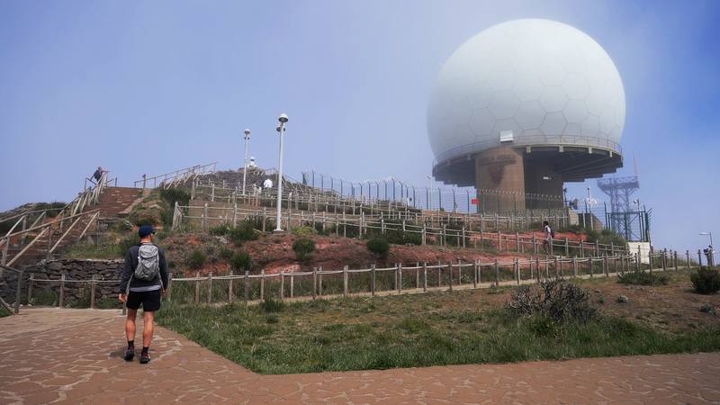
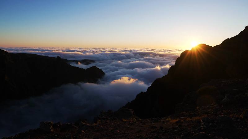
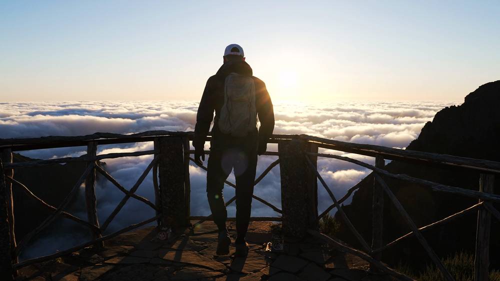
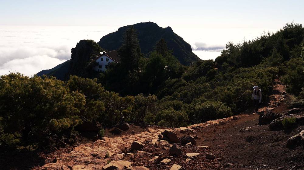
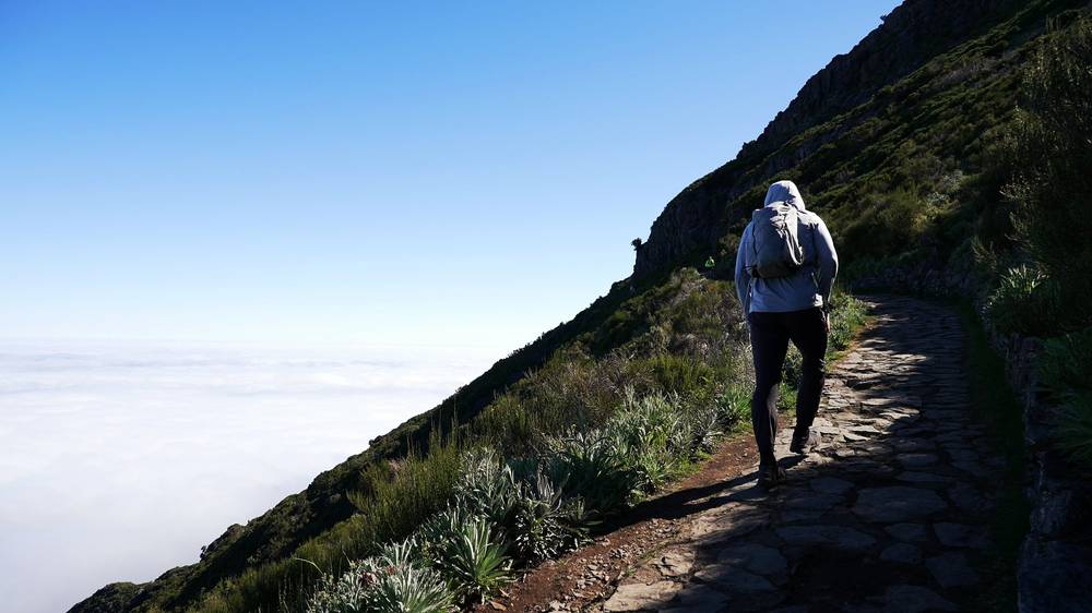
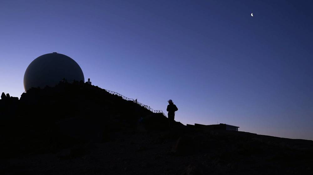
The next morning I got there before sunrise, and the conditions were much better. I parked in the long-term lot and walked up the road to the radar dome on top of Pico do Areeiro. Most people park in the short-term lot by the radar and walk over to get shots of the sunrise; I started my hike instead, at 7:07 a.m., as the sun came up over the clouds. There was a sea of clouds below the ridges, and I stopped for ten minutes just past the top to watch.
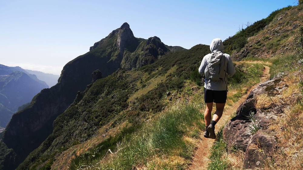
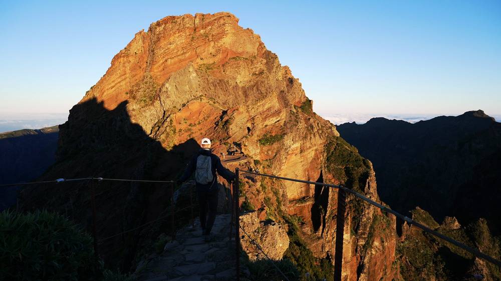
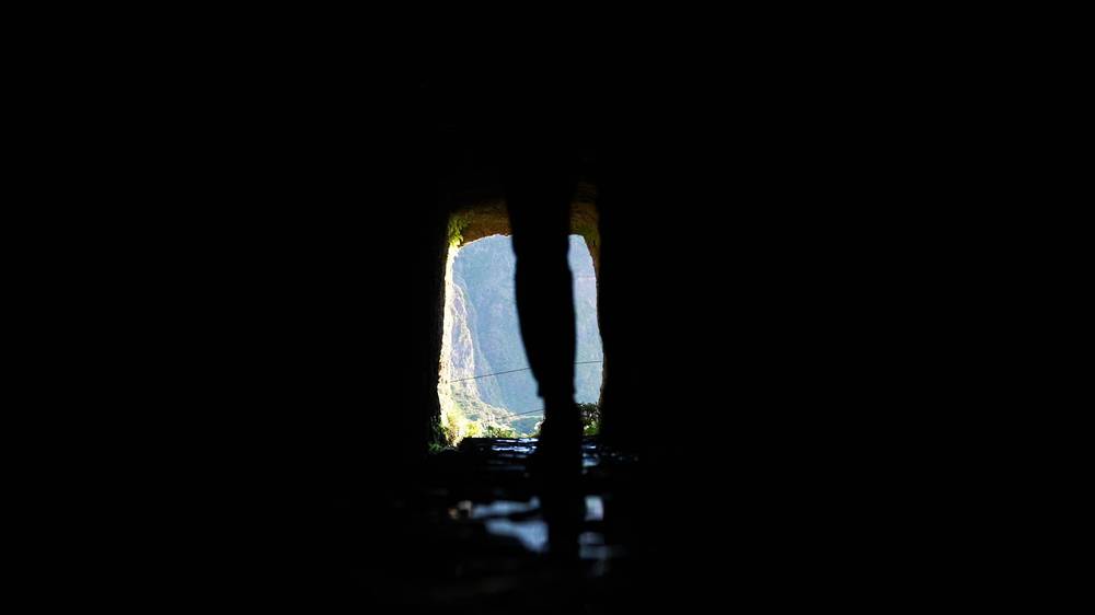
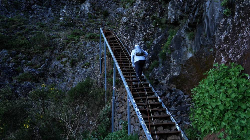
I made quick work of the trail: the steep stone steps, the narrow paths cut into the cliffs, the tunnels, and the little passes around the peaks. In the tunnels I was fine with my iPhone light. I reached the top of Pico Ruivo, the highest point of the island, at about 9:55 a.m. and had a coffee and a drink at the shelter just below it.
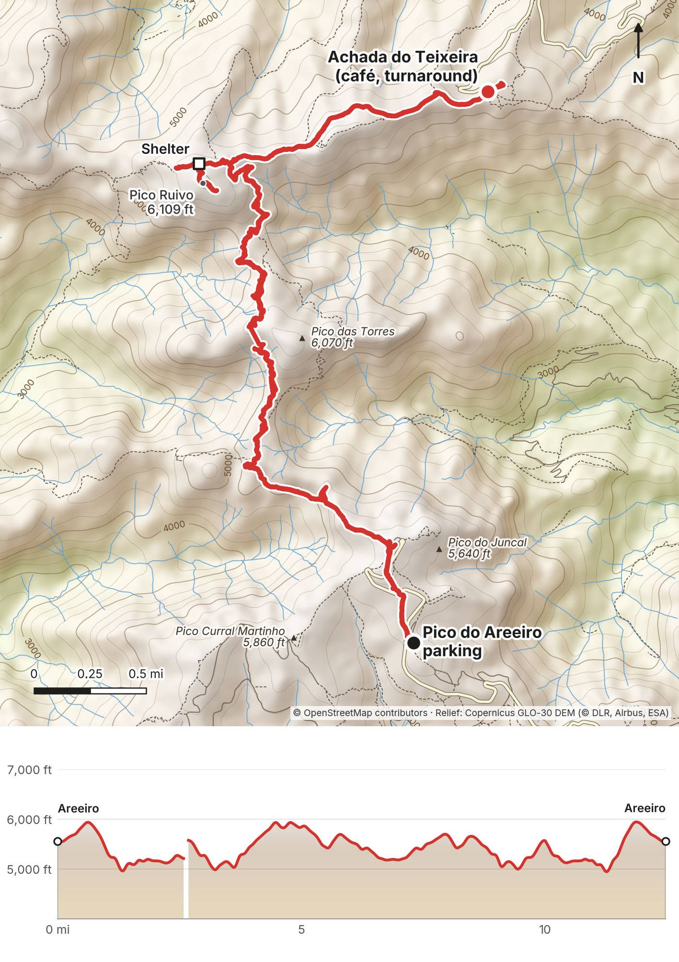
Most people turn back from there. I kept going down the other side to Achada do Teixeira, the parking lot and café on the north side, and had lunch there at about 11:40. Then I walked all the way back over Pico Ruivo to my car, which I reached at 2:38 p.m. By my GPS it was 12.5 miles and about 5,100 ft of climbing (the AllTrails app said 5,758 ft).
This is one of the best day hikes I've ever done, and it's honestly reason enough to visit Madeira: it's so unique and so steep, and it follows the highest points of the island, so you're above the clouds in the morning and then the clouds swirl around the peaks. It can be crowded and claustrophobic at times: the trail is narrow, and when a group of 20 or 30 people goes past at once, you wait to the side.
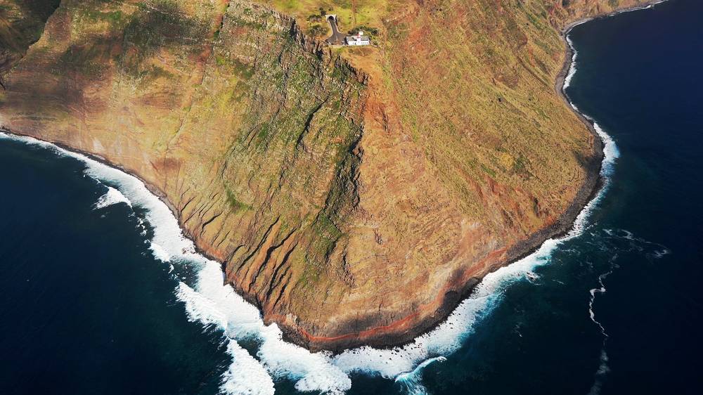
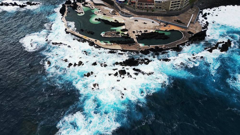
The afternoon: the west coast. I finished around 2:30, so I had time to drive down to the coast and start a road trip around the island. The main road around Madeira was easy to drive, with tunnels everywhere and roundabouts between them. I stopped at Ponta do Sol, which felt like the Italian coast to me: a beach, fish, big umbrellas and places to jump off the rocks. Then I drove all the way to the westernmost point, the lighthouse at Ponta do Pargo, with very dramatic cliffs. It was a great place to stop and rest, and much quieter than anywhere near Funchal or the PR1. I'd planned to take the cable car at Achadas da Cruz down to the shore, but it wasn't running. I ended the day at Porto Moniz, known for its natural rock pools. In April it was a bit too cold to swim, and the sea was too rough; I don't think anyone was swimming.
Pico do Areeiro. The road from Funchal (or from Poiso) ends below the summit, 5,965 ft (1,818 m), the third-highest peak on the island, with the radar dome, a café and the parking. The PR1 starts by the summit.
To Pedra Rija. A paved path with railings drops along a knife-edge ridge with drops on both sides, past the Ninho da Manta viewpoint, to the Pedra Rija viewpoint (1.2 km). In 2026 this part is two-way, and it's a short hike on its own (€4.50).
Past Pedra Rija: one-way. The trail goes on below the spires, with long stone and metal staircases and paths cut into the cliffs, and splits around Pico das Torres. The west branch goes through tunnels in the rock; the east branch over the top of Pico das Torres was closed in 2026. I went through the tunnels. The branches meet again below Pico Ruivo.
Pico Ruivo. Below Pico Ruivo the trail meets the short path up to the summit, 6,109 ft (1,862 m), and the Pico Ruivo shelter (the Casa de Abrigo, which sells drinks and snacks) just below it. I went to the top first, at about mile 4.5 of my recording, then had a coffee at the shelter.
Down to Achada do Teixeira (PR1.2). A paved path drops 2.8 km to the parking and café at Achada do Teixeira, about 5,220 ft (1,592 m), where a road comes up from Santana.
Back. I walked back to Pico do Areeiro the same way. In 2026 you can't: past Pedra Rija the trail is one-way. From Pico Ruivo you leave by Achada do Teixeira (PR1.2) or Ilha (PR1.1), and the IFCN doesn't run any transport back to Pico do Areeiro.
Ways to do it now:
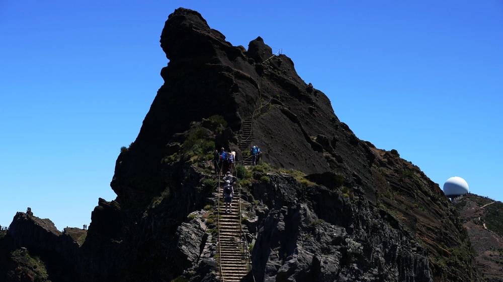
Pedra Rija is the last place you can turn around on the PR1 before it becomes one-way. If the cloud is down, it's windy or wet, or the stairs are icy, turn around there. After that you're committed to Pico Ruivo.
Pico do Areeiro to Pico Ruivo (from 12:51) · the PR1 in my travel guide film (from 5:14) · Ponta do Sol to Porto Moniz (from 18:35)
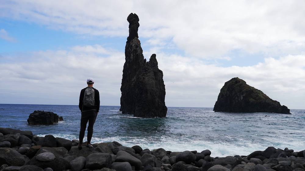
In the morning I went to the viewpoint over the sea stacks at Ribeira da Janela, a really unique thin rock off the coast, and walked down to the shore through a gap in the rock.
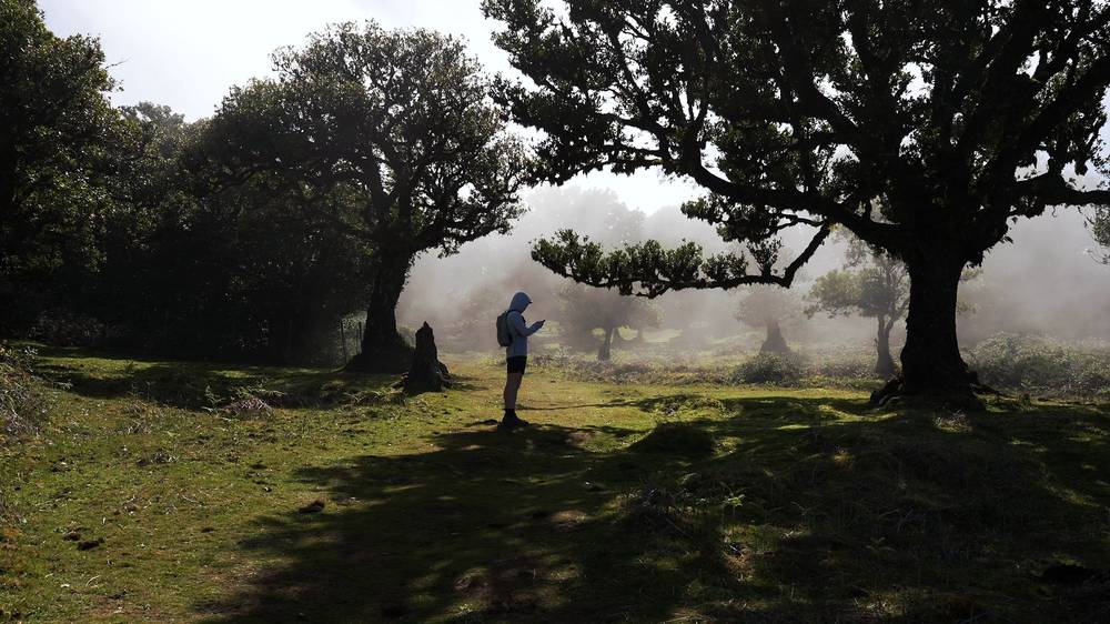
Then I drove up inland to the Fanal forest, where the northern weather fades out. You get really dramatic fog and clouds rolling up over the forest: old laurel trees bent one way, with grass between them, and then it all disappears in the fog. When I got there late in the morning there was still space in the parking lot, and the clouds were really cinematic. I saw the cows and listened to the frogs, and walked a 2.5-mile loop around the area.
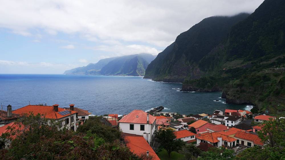
Then I drove back down to the coast. I was excited to see Seixal, a really unique-looking town against the coast, almost like a fortress with the cliffs behind it. It was a little overcast. For lunch I bought meat from a butcher and cooked espetada myself over an open flame, with bread and a beer, and had a coffee with a cat. My last stop was the Ponta do Clérigo area, looking along very dramatic cliffs on the north coast as the sun started to break through. (Ponta do Clérigo itself, the headland, is reported to be reached only by an unmarked, hard path, not from the road.)
My hotel that night was in Machico, near the beach. I saw people surfing, so I rented a wetsuit and a board and went out, but the sea was angry and I kind of got my butt kicked.
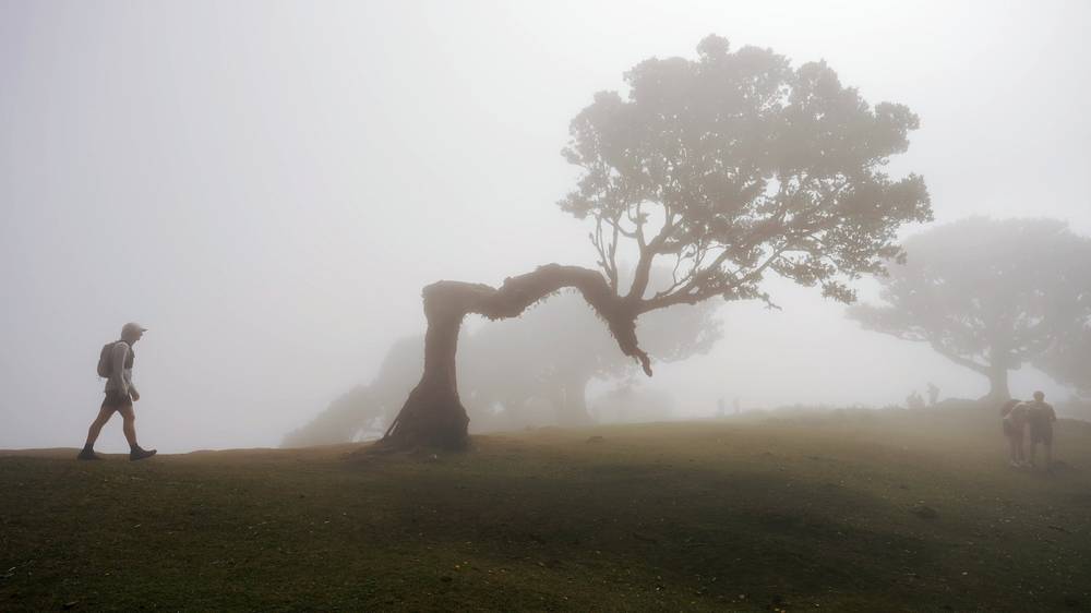
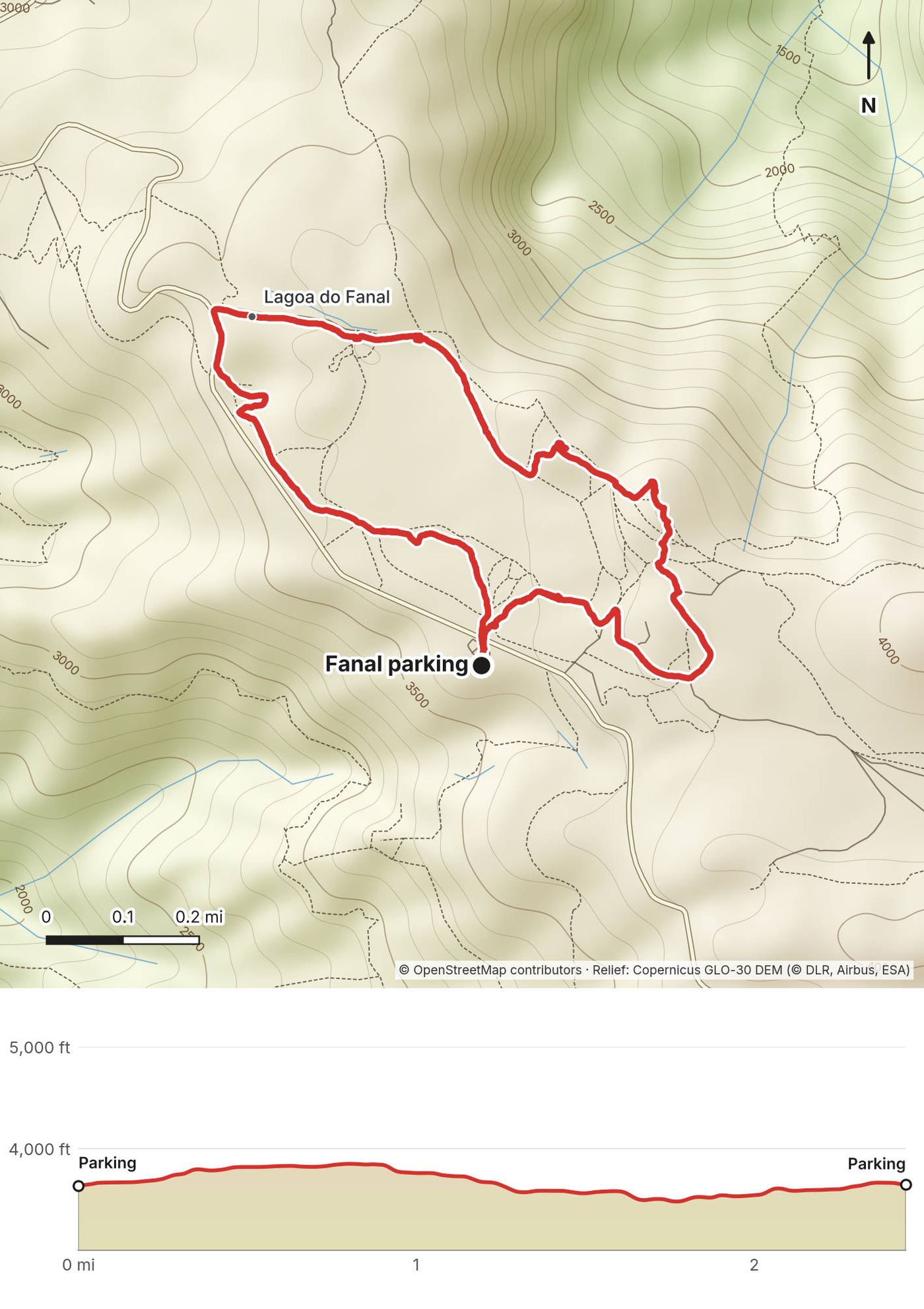
Fanal. A high, grassy clearing at about 3,600 to 3,900 ft (1,100 to 1,190 m) on the edge of the Paul da Serra plateau, with old laurel trees (til trees) and a pond (Lagoa do Fanal) that holds water after rain. It's part of the Laurisilva, Madeira's native laurel forest, a UNESCO World Heritage site. The road from Porto Moniz or Ribeira da Janela comes up to the parking.
My loop. From the parking, I walked up past the old trees to the top of the meadow, on round to the pond and back to the car: 2.5 miles by my GPS, with very little climbing. There are paths everywhere; in fog, keep the GPX or an offline map open, because the trees and the grass all look the same.
Longer. The PR13 Vereda do Fanal comes across the plateau from Paul da Serra to Fanal (10.8 km one way). The PR14 Levada dos Cedros goes from Fanal down to Curral Falso.
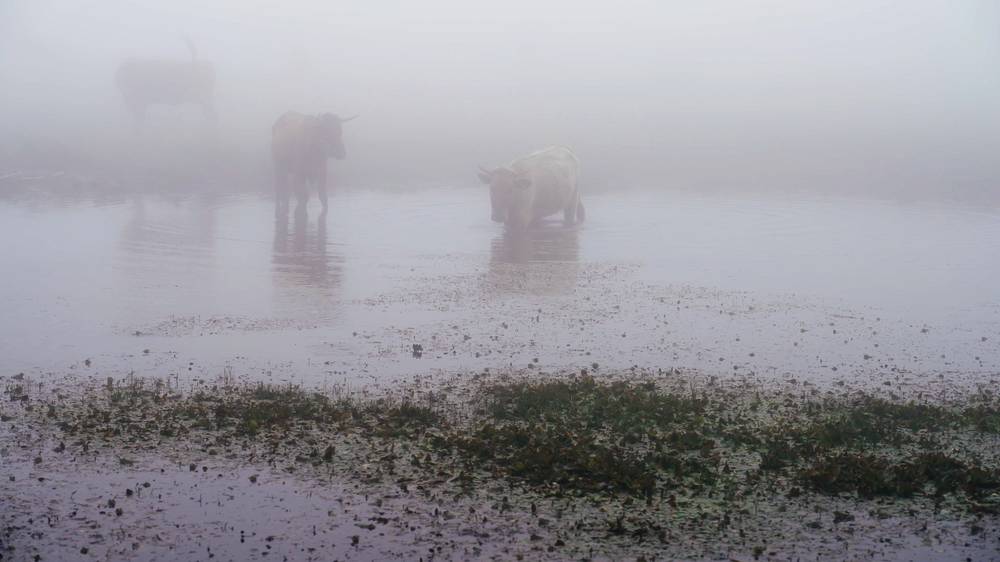
When the fog is thick, stay close to the parking. It's easy to lose your bearings in the meadow.
Ribeira da Janela, Fanal and Seixal (from 20:08) · Fanal and the north coast in my travel guide film (from 10:42)
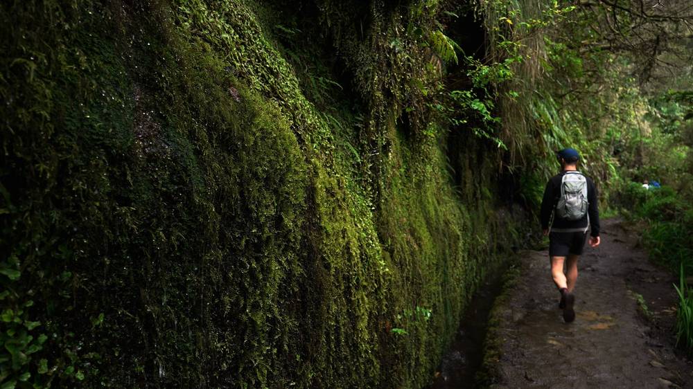
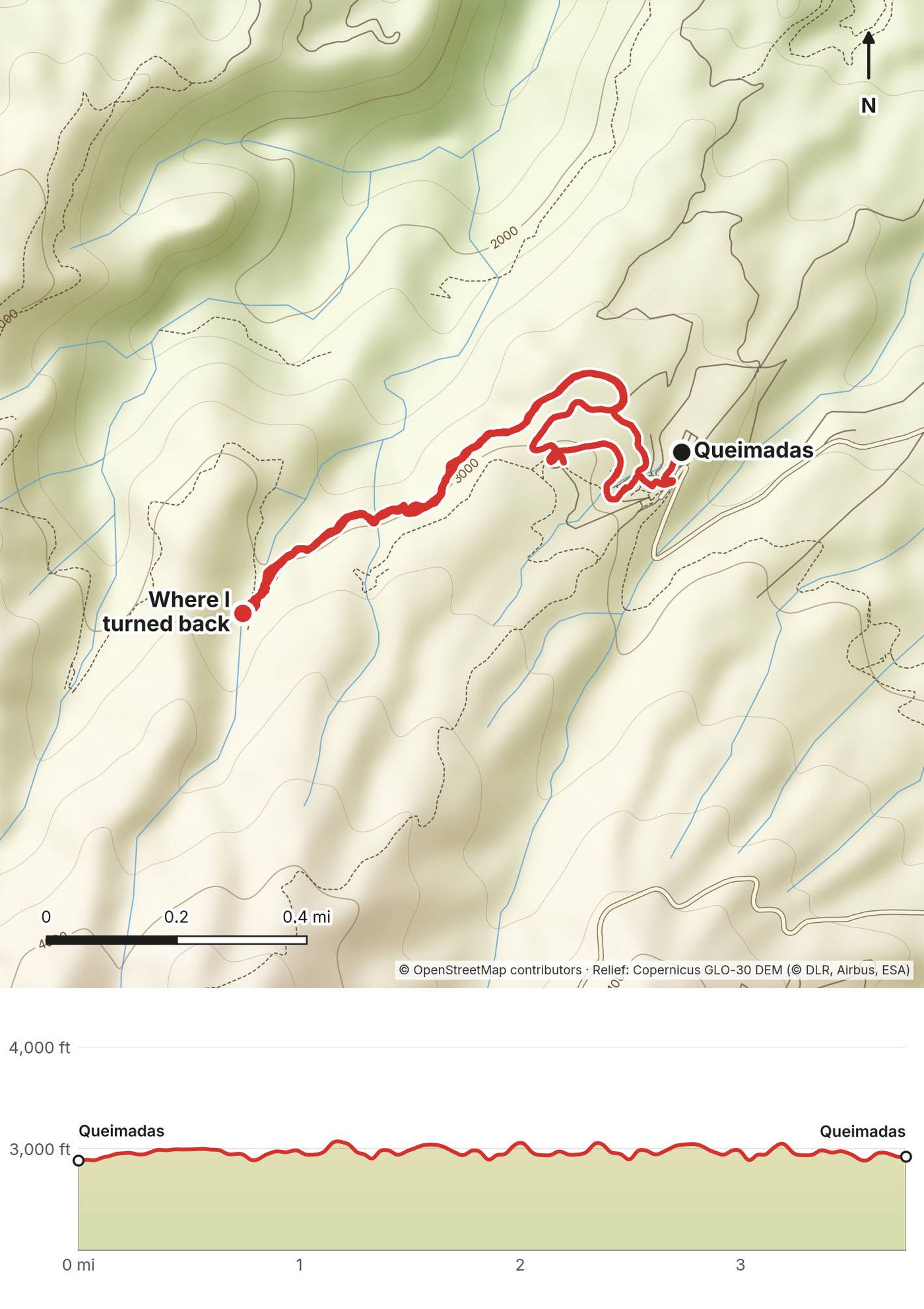
The plan was to wake up before sunrise and drive out for my last hike, but the light wasn't cooperating: it was just too overcast. So I drove up to Queimadas for a levada hike instead. At the trailhead there were really nice little houses with thatched roofs (I thought one was a hotel), some geese, beautiful flowers, cats, and coffee. I didn't do the whole levada, because it was overcast with low visibility, but I got the feel of walking alongside a levada: the water channel, the mossy walls, a stone bridge in the fog. I turned back about 1.6 miles in, and after a bit over three and a half miles I was back at the car.
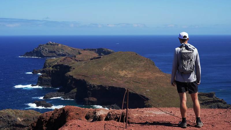
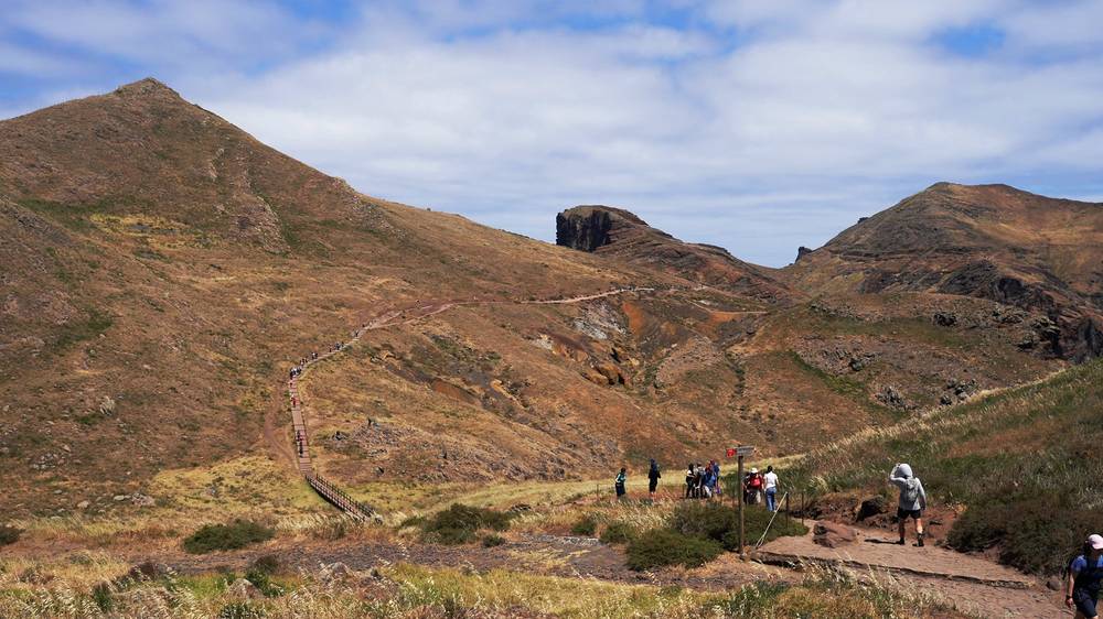
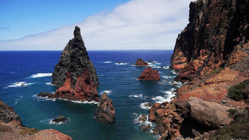
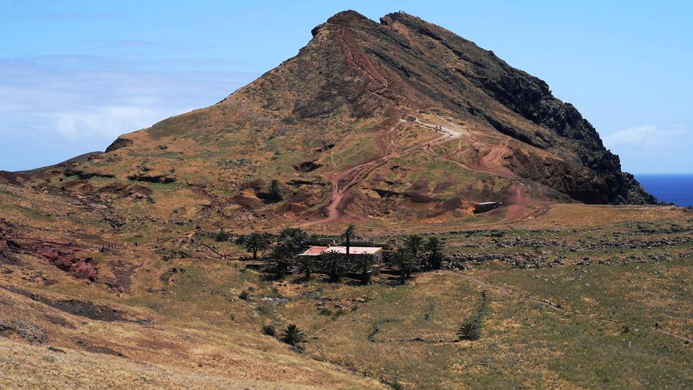
Then I drove to the east end of the island for Ponta de São Lourenço, the last hike I'd planned. At midday it was hot, sunny and crowded. You park at the end of the road and walk to the trailhead, where there were taxis and a lot of people. It's a very unique hike out along the point: bare red and brown ridges, cliffs and sea stacks. There's a café near the end selling food and drinks; I had a bag of chips at a table under a palm tree. You can climb all the way up a cliff at the end for the view out to the ocean, with a lighthouse on the island beyond. It was a bit brown and dry when I was there in April; I'm sure it's greener in other seasons. I was back at the car at 5:04 p.m.
That night I was back in Machico.
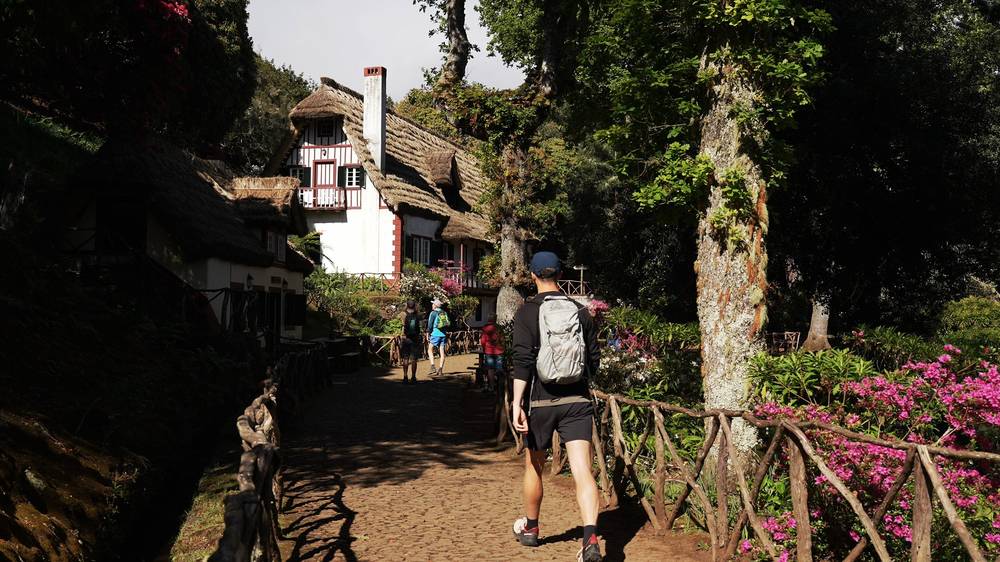
Queimadas. The forest park above Santana, at about 2,880 ft (878 m) where my recording starts, with a small free parking area that fills early (as reported). The thatched house is the forest park's shelter (Casa de Abrigo das Queimadas).
The levada. The PR9 follows the Levada do Caldeirão Verde, an irrigation channel, along steep, forested valley sides to the Caldeirão Verde, a waterfall in a deep, green bowl: 8.7 km one way (17.4 km out and back), with four tunnels where you need a light. The path is mostly level, but narrow, with drops beside it in places and wet, uneven ground in the tunnels. A further section climbs to Caldeirão do Inferno.
Mine. I walked about 1.6 miles along the levada and turned back in the cloud. The GPS shows about 760 ft of climbing, but the path barely climbs: most of that is the terrain model's error on the steep slope.
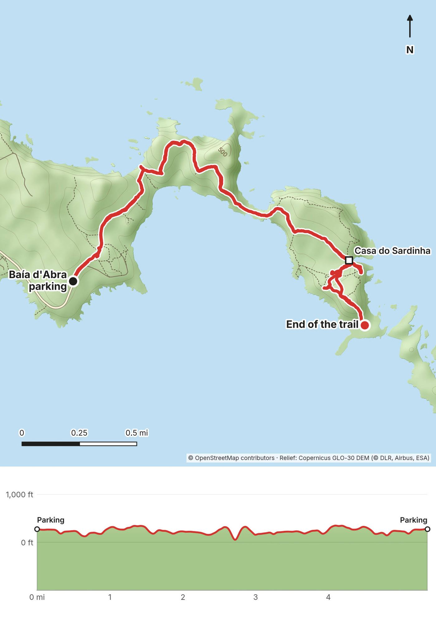
Baía d'Abra. The road east from Caniçal ends at the parking at Baía d'Abra, where the trail starts.
The point. The PR8 runs east along the narrow peninsula, 4 km one way (8 km out and back), up and down over bare ridges with cliffs and sea views on both sides, to the Casa do Sardinha, the nature reserve's reception centre, with the café next to it among the palm trees. From there a steep path climbs the last hill, Pico do Furado, for the view over the end of the point and the islet with the lighthouse. My recording reached the end of the trail at about mile 2.7. There's no shade and it's often windy: stay back from the cliff edges.
On the levada: any time the cloud comes in or the path gets slippery; it's the same way back. At Ponta de São Lourenço: the Casa do Sardinha is the natural end; the climb up Pico do Furado is steep and exposed in wind.
The Levada do Caldeirão Verde (from 23:51) · Ponta de São Lourenço (from 25:03) · both in my travel guide film (from 12:42)
I had one more day, so I went up to the golf course at Santo da Serra and hit balls at the driving range, with the mountains in the background. Golfing on trips is my new thing. I stayed at the Hotel PortoBay Serra Golf near the course, which was very bougie, and a nice place to relax at the end of the trip and import and edit my footage.
The next day I drove to the airport, returned the car and flew home.
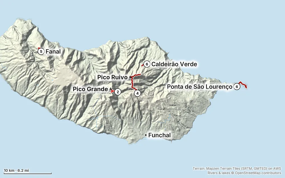
Elevation26–5,961 ft29.5 mi
Terrain: Mapzen Terrain Tiles (SRTM, GMTED) on AWS · Rivers & lakes © OpenStreetMap contributors
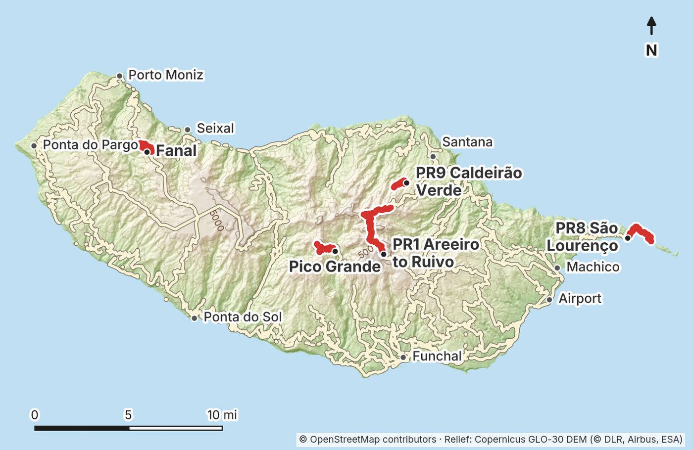
Madeira and my five hikesPico Grande map and elevation…PR1 map and elevation profileFanal map and elevation profilePR9 map and elevation profilePR8 map and elevation profileTap a map to open it full size.
Checked on the IFCN (Madeira's forest and nature service) trail list, updated October 2, 2026, and its booking FAQ, on October 3, 2026.
The PR1 (Pico do Areeiro to Pico Ruivo): open, one-way. After the August 2024 wildfires and rockfall, the PR1 reopened in stages: first only from Pico do Areeiro to the Pedra Rija viewpoint (1.2 km), then the full route from May 1, 2026, and every day from June 26, 2026. Between Pico do Areeiro and Pedra Rija you can walk both ways. From Pedra Rija to Pico Ruivo it's one-way, toward Pico Ruivo, and you leave Pico Ruivo by the PR1.2 to Achada do Teixeira or the PR1.1 to Ilha. Of the two branches around Pico das Torres, the west one through the tunnels (the way I went) is open and the east one over Pico das Torres is closed. The Pedra Rija to Pico Ruivo section closed for a few days in September 2026 for boardwalk work (as reported). Check the IFCN list the day before.
The PR8 (Ponta de São Lourenço): open, with diversions. Trail works started on September 30, 2026, for at least 270 days. The trail stays open with signed diversions (Visit Madeira marks it "restricted").
The PR9 (Levada do Caldeirão Verde): open to Caldeirão Verde and Caldeirão do Inferno on the IFCN list. The extension to Caldeirão do Inferno is often hit by landslides and was reported closed in April 2026.
The PR13 (Vereda do Fanal): open.
Pico Grande from Curral das Freiras. This isn't one of the classified PR routes, so it isn't on the IFCN list or in the booking system (my reading of the list; I found nothing that says otherwise). The classified route toward Pico Grande, the PR12 from Boca da Corrida, was only passable for its first 3.5 km in October 2026.
April. I used weatherspark.com to pick my dates, and April looked like a good time: clearer skies, less rain, cool, comfortable temperatures, and fewer crowds than July and August, when people come for the beaches and pools. I had one morning of thick cloud on the peaks, overcast spells on the north side, and a hot, sunny midday at Ponta de São Lourenço. In April the sea at Porto Moniz was too cold and rough for me to swim, and the east end was brown and dry.
On the coast. Funchal is mild all year: in April the average high is about 70°F (21°C) and the low about 59°F (15°C), with about 2.4 inches (62 mm) of rain in the month. June to August are the driest months; October to February the wettest (IPMA normals, 1991 to 2020).
In the mountains. It's much colder and wetter up high. At Pico do Areeiro the average daily high runs from about 46°F (8°C) in January to about 66°F (19°C) in August, and the lowest temperature on record there, 21°F (-6°C), was in April (1961 to 1990 normals). Ice and snow close the road to Pico do Areeiro on some winter days, as on December 13, 2025, and ice was reported on the peaks in early April 2025. Dress for winter at sunrise in any month.
The best months. April to May and September to October are the usual picks for hiking: less rain than winter, less heat and fewer people than summer (as reported). July and August are hot and busy, and the summer brings wildfire warnings: in early August 2026 the IFCN warned of very high fire risk and closed the mountain road between Pico do Areeiro and Eira do Serrado for a few days.
The sea of clouds. You only get it when the cloud layer sits below the peaks, and not every morning. I missed it on Day 3 and got it on Day 4. Check the summit webcams and the forecast the evening before.
Sunrise. About 7:30 a.m. at Pico do Areeiro in mid-April (my calculation; check timeanddate.com for your date). I started from the car at 7:07 a.m. and watched the sun come up from the trail. Madeira keeps the same time as Lisbon and London: in April, five hours ahead of New York.
Emergencies. Call 112 (Portugal and the EU). Tell someone your route and when you'll be back.
Weather. The IFCN asks hikers not to walk in heavy rain, strong wind, hail or snow, and to check the fire risk and the trail's status before they start. IPMA, Portugal's weather service (ipma.pt), issues the weather warnings and the fire risk for Madeira. Fog can come up in minutes, especially on the north side and at Fanal: carry the GPX and an offline map. Up high it can be near freezing at dawn, even in spring.
Drops and cliffs. The PR1 runs along knife-edge ridges and cliff paths, with railings in places. Pico Grande has cable handrails and a short scramble at the top. Levada paths are narrow with drops beside them. Ponta de São Lourenço has cliffs on both sides and strong wind. Stay on the path, and don't go near the edges for photos.
Tunnels. The PR1 and the PR9 have tunnels in the rock: low, dark and wet in places. Bring a real light.
Rockfall. Rockfall is why the PR1 is one-way past Pedra Rija. Don't stop under loose slopes, and respect closed sections: walking a closed trail is a fineable offence.
Heat and sun. Ponta de São Lourenço has no shade at all. Start early or late, and carry plenty of water.
Fire. Summer wildfires burned large parts of the mountains in August 2024. No fires anywhere, and check the fire risk before you go.
Do I need a permit? You need a booking. Since January 1, 2026, every classified trail needs a 30-minute time slot booked and paid on the SIMplifica portal before you start. There's no payment at the trailhead. See The rules.
Can I still walk the PR1 out and back, like you did? No. Past the Pedra Rija viewpoint it's one-way toward Pico Ruivo. You can go from Pico do Areeiro to Pico Ruivo and down to Achada do Teixeira, and get a taxi back to your car, or walk Pico do Areeiro to Pedra Rija and back, or walk up to Pico Ruivo from Achada do Teixeira and back (the PR1.2). See Day 4.
Do I need a car? I wanted one, because the weather changes so fast that I wanted to be able to come back to a place. You can do it with taxis and buses, but the trailheads are high and scattered. See Getting there and around.
Do I need a guide? No. The IFCN says no guide is required on any PR.
How hard are the hikes? Pico Grande climbs about 3,170 ft from the village, with cables on the steep parts and a short scramble up the summit rocks. The PR1 is a long day of stone stairs, narrow ledges with drops, and tunnels. Fanal, the levada and Ponta de São Lourenço are easy to moderate, but the levada has drops beside the path and Ponta de São Lourenço is hot and windy with no shade.
Do I need a headlamp? For the tunnels on the PR1 and the PR9. People said you needed a head torch for the PR1 tunnels; I was fine with my iPhone light. A real light is safer.
Is it crowded? The PR1 is. I found it crowded and claustrophobic at times: the trail is narrow, and with a group of 20 or 30 people going at once you have to wait to the side. Ponta de São Lourenço was crowded at midday too. Pico Grande wasn't too crowded. The 2026 time slots now cap how many people start each half hour.
What about the weather? The north and the south of the island have different weather. The clouds come and go all day. If you're up high early, you can be above a sea of clouds as the sun comes up. One morning the top was in thick cloud and I put the hike off by a day. Build a spare day into your plan.
Can I fly a drone? I couldn't confirm the drone rules for Madeira's natural park and nature reserves in October 2026. Ask the IFCN before you fly anywhere near the trails.
I didn't base myself in one place. I spent the first night in Funchal, then moved most nights as I drove around the island. With a car, that meant the next hike was always close.
| Night | Where I slept |
|---|---|
| 1 | Funchal (the NEXT Hotel, on the seafront) |
| 2 | Eira do Serrado Hotel & Spa, above Curral das Freiras |
| 3 | Not in my record |
| 4 | Porto Moniz |
| 5 and 6 | Machico, near the beach |
| 7 | Hotel PortoBay Serra Golf, Santo da Serra |
Funchal. The easiest base: the most hotels, restaurants and buses, and 30 to 60 minutes' drive to most trailheads. A mid-range hotel is about $75 to $140 a night in spring and autumn (2026, as reported).
Curral das Freiras and Eira do Serrado. For Pico Grande. The Eira do Serrado Hotel & Spa (26 rooms, a restaurant and a viewpoint over the valley) was open in 2026, from about $155 to $170 a night for two in October 2026 (as reported).
The north coast (Santana, São Vicente, Porto Moniz, Seixal). Closest to Queimadas, Achada do Teixeira and Fanal, and quieter, but cloudier and wetter than the south. Simple hotels are about $70 to $120 a night (2026, as reported).
The east (Machico, Caniçal). Machico is about 5 minutes from the airport and the nearest town to Caniçal and Baía d'Abra, with a small sandy beach and surfing.
Santo da Serra. The Hotel PortoBay Serra Golf is a small hotel in an old manor house next to the golf course, from about €128 a night in 2026 (its own site).
My eight days work as a plan, with three changes for 2026: book the trails, walk the PR1 one-way, and keep a spare day for the weather.
| Day | Plan | Sleep |
|---|---|---|
| 1 | Land, pick up the car, Funchal | Funchal |
| 2 | Pico Grande from Curral das Freiras (no booking) | Curral das Freiras or Eira do Serrado |
| 3 | The PR1 one-way, Pico do Areeiro to Pico Ruivo and Achada do Teixeira, taxi back to the car (book the €10.50 slot and the taxi) | Funchal or the north coast |
| 4 | Spare day for the PR1 if the top is in cloud; otherwise Funchal, Cabo Girão, the south coast | Funchal |
| 5 | The south and west coast: Ponta do Sol, Ponta do Pargo, Porto Moniz | Porto Moniz |
| 6 | Ribeira da Janela, Fanal, Seixal, the north coast | Machico or Santana |
| 7 | The PR9 from Queimadas in the morning, the PR8 at Ponta de São Lourenço after lunch (two bookings) | Machico |
| 8 | Fly home |
Booking tips. Book the PR1 first: it's the one people come for. Book early morning slots where you can: the clouds and the crowds both build during the day. The 3-day combined pass (€22.50) covers two or more other trails in three days, but not the PR1.
Without a car. It's possible, but slower. Take the 6:00 a.m. bus from Funchal to Pico do Areeiro for the PR1 and a taxi back from Achada do Teixeira; the SAM bus to Baía d'Abra for Ponta de São Lourenço; a bus to Curral das Freiras for Pico Grande; and a bus to Santana and a taxi for Queimadas. Fanal has no bus. See Getting there and around.
These change every year. Everything else in this guide stays the same.
Is it open?
Bookings
Getting there
Your stuff
Planning questions about Madeira, answered only from this page's facts, the creators' versions and hikers' public tracks, with where each answer comes from. When the data doesn't say, the answer says "not given".
From hikers
Sign in to comment. Free; your hikes stay private unless you share them.
Some lodging links earn me a small commission at no cost to you.
Something wrong or missing on this page? Send feedback.