
Content made there
The film is at the top of this page.
Photos
Hikes / Longs Peak / Kraig Adams's version
North America · United States
Jun 2022 · 2 days · Solo · Tent

In June 2022 I climbed Longs Peak, 14,259 ft (4,346 m), the highest mountain in Rocky Mountain National Park, by the Keyhole Route. It was my first month living in Denver. I just moved there with my wife and puppy, and one of the reasons you move to Colorado is to hike mountains, specifically 14ers. I went alone and did it in two days: up from the Longs Peak Trailhead on the first afternoon, with a detour to Chasm Lake, to a night in a stone windbreak at the Boulder Field, then the Keyhole, the Ledges, the Trough, the Narrows and the Homestretch to the summit early the next morning, and all the way back down to my car. It's the trip from my film Solo Silent Hike Up Longs Peak.
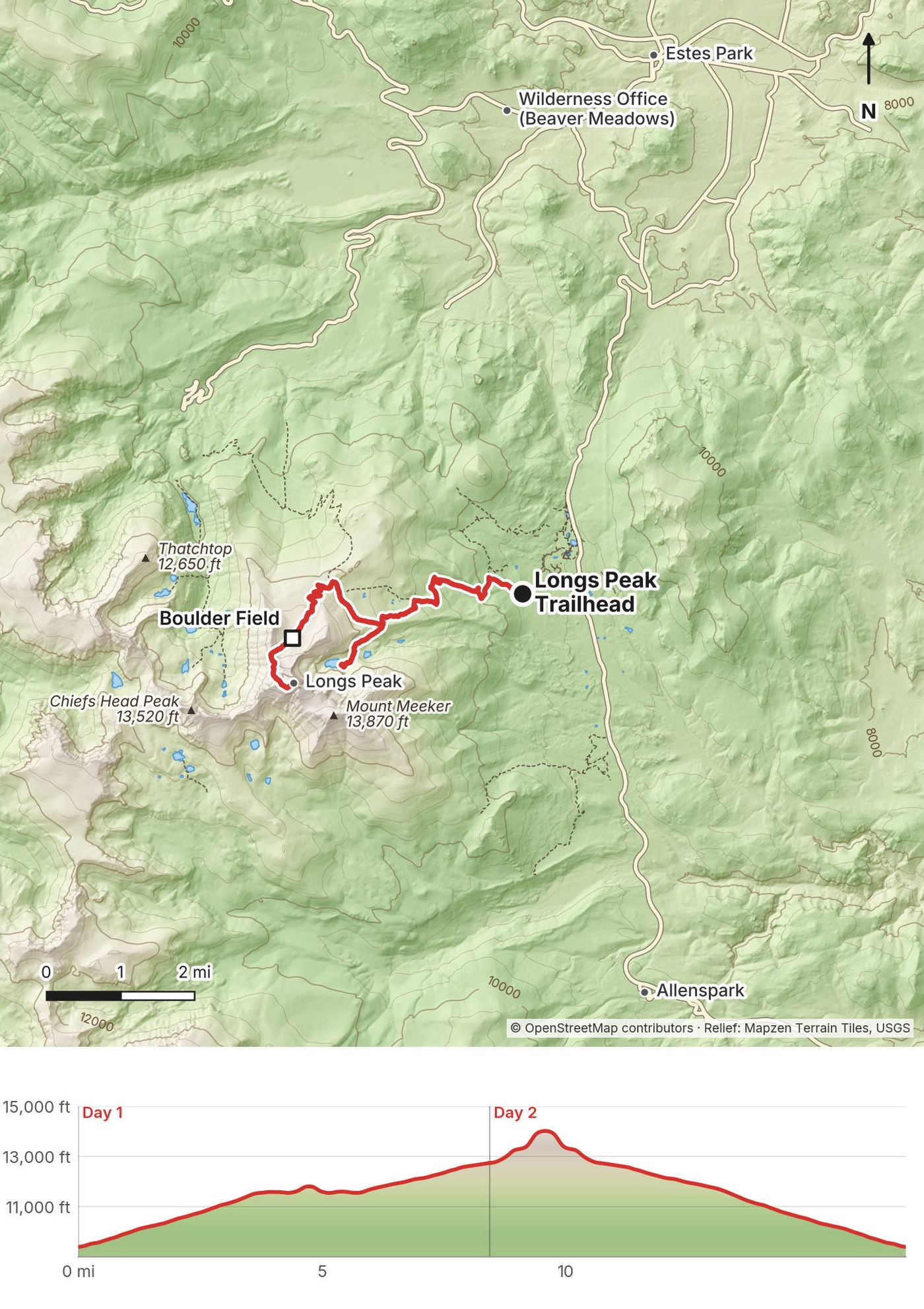
By my GPS the first day was 8.4 miles, with the Chasm Lake detour. I didn't record the second day, so this guide gives its numbers as "about," from the mapped route and my first day's line.
| Quick facts | |
|---|---|
| Distance | About 17 miles (27 km) for my two days, 2.2 of them the Chasm Lake detour. The Park Service gives 7.5 miles to the summit, 15 round trip |
| Climbing | About 5,600 ft (1,700 m) up and down |
| Days | 2: 8.4 miles on Day 1 (my GPS), about 8.5 on Day 2 (not recorded) |
| Start and finish | The Longs Peak Trailhead, about 9,400 ft (2,865 m), off Colorado Highway 7 south of Estes Park |
| Direction | Out and back on the same trail, with an out-and-back spur to Chasm Lake on Day 1 |
| High point | Longs Peak, 14,259 ft (4,346 m), the highest point in Rocky Mountain National Park |
| Sleep | The Boulder Field, 12,760 ft (3,889 m), about 6 miles up |
| Difficulty | A long, steady trail to the Boulder Field, then a scramble with big drops from the Keyhole to the summit, at over 13,000 ft. The Park Service says it's not a hike |
| Permits (2026) | A wilderness permit to camp ($36 a trip). A timed-entry reservation from late May to mid-October, 9 a.m. to 2 p.m. |
| Day | Route | Miles (km) | Up / down (ft) | Sleep |
|---|---|---|---|---|
| 1 | Longs Peak Trailhead to the Boulder Field, with Chasm Lake | 8.4 (13.6) | 3,674 / 350 | The Boulder Field, 12,760 ft |
| 2 | The Boulder Field to the summit and back down to the trailhead | about 8.5 (13.7) | about 1,910 / 5,260 |
Day 1 is from my GPS. Day 2 is from the mapped route (OpenStreetMap) and my Day 1 line, since I didn't record it. Without the Chasm Lake detour the round trip is about 14.8 miles. The trailhead, Boulder Field and summit heights are the Park Service's; the others are "about."
My way in, 2022. I got into my Subaru and did the roughly two-hour drive from Denver, past Boulder, up into this area right on the edge of the national park. I picked up my permit at the wilderness office in the morning, got a quick bite to eat at a restaurant on the way to the trailhead, and started hiking at 1:10 p.m.
Driving (2026). The Longs Peak Trailhead is at the end of Longs Peak Road, about 1 mile west of Colorado Highway 7. From Estes Park, drive about 9 miles south on Highway 7 from its junction with US-36, about 25 minutes. From Denver, the way I went is US-36 through Boulder and Lyons, then Highway 7 up the canyon: about 70 miles and 2 hours. From Denver International Airport it's about 81 miles, also about 2 hours without traffic (rough routing estimates).
Without a car. No shuttle or bus reaches the Longs Peak Trailhead. The park's shuttles and the Estes Park Hiker Shuttle serve the Bear Lake Road area, and the airport shuttle to Estes Park ($85 one way, as reported) stops in town. You need a car or a ride; don't count on booking a ride back from the trailhead, where the phone signal is unreliable.
Parking. There's a parking lot at the trailhead; a timed-entry reservation doesn't guarantee a space in it. Park only on the gravel or pavement, and put a copy of your timed-entry reservation on the dash if you have one. Car-camping in the lot isn't allowed, as reported.
Sleeping near the trailhead. Longs Peak Campground, right at the trailhead, is tent-only and first come, first served: about 26 sites, $30 a night in 2026, no water, open from about early July to early September. You pay with the Recreation.gov app at the kiosk, and it doesn't include the park entrance fee. The Forest Service's Olive Ridge Campground on Highway 7, about 15 miles south of Estes Park, is $29 a night for a single site, and Meeker Park Overflow, also on Highway 7, is $16. Estes Park has motels and lodges. Nothing on Highway 7 is open for a 2 a.m. breakfast, so eat the night before.
The only cost I mention in my film is the walk-up permit: it cost maybe like thirty dollars.
For your budget (2026, US dollars):
| Item | Cost |
|---|---|
| Wilderness permit, to camp | $36 a trip (May to October) |
| Park entrance, one vehicle | $30 for 1 day, $35 for 7 days, $70 for a Rocky Mountain annual pass, $80 for the America the Beautiful pass (US residents); timed entry $2 |
| Non-US visitors, 16 and over | An extra $100 each in 2026, unless you hold an annual pass; the non-resident America the Beautiful pass is $250 |
| Longs Peak Campground | $30 a night |
| A motel in Estes Park, mid-July | About $205 to $290 a night, as reported |
| Bear canister rental (Kirk's Mountain Adventures, Estes Park) | $3 a night, as reported |
| Helmet, microspikes (Estes Park Mountain Shop) | About $8 and $15 a day, as reported |
| A rental car from Denver airport, 2 to 3 days | About $150 to $400 plus fees and taxes (estimate) |
| Gas, Denver airport to the trailhead and back | About $25 to $30 (estimate) |
For a day climb from Denver it can be as little as the entrance fee and gas. With a night at the Boulder Field, a rental car and a motel, budget roughly $450 to $800 for one person from Denver airport, before food and flights.
| Night | Where | Height |
|---|---|---|
| 1 | My tent in a stone windbreak at the Boulder Field (Day 1 mile 8.4) | 12,760 ft (3,889 m) |
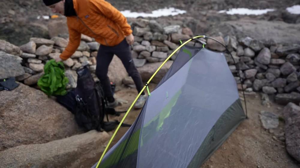
The Boulder Field. I set up my one-person tent inside one of the stone windbreaks, put on my down jacket as it got cooler, and blew up my sleeping pad with a pump sack. It's above tree line and exposed to wind. I forgot my gloves and wasn't looking forward to cold hands during the summit.
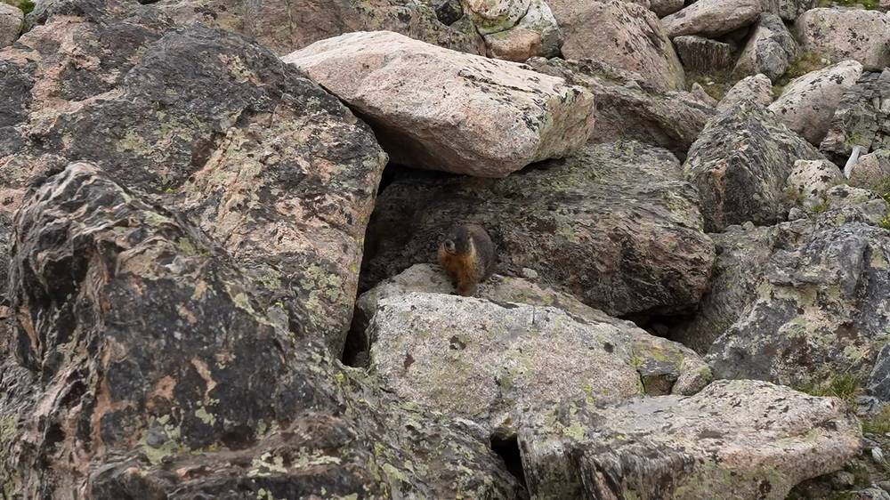
The marmots. Those little buddies were hungry. Someone's been feeding them, because every time I opened a bag of food they showed up and poked their heads up over the rocks. Keep everything in your canister, and don't feed them.
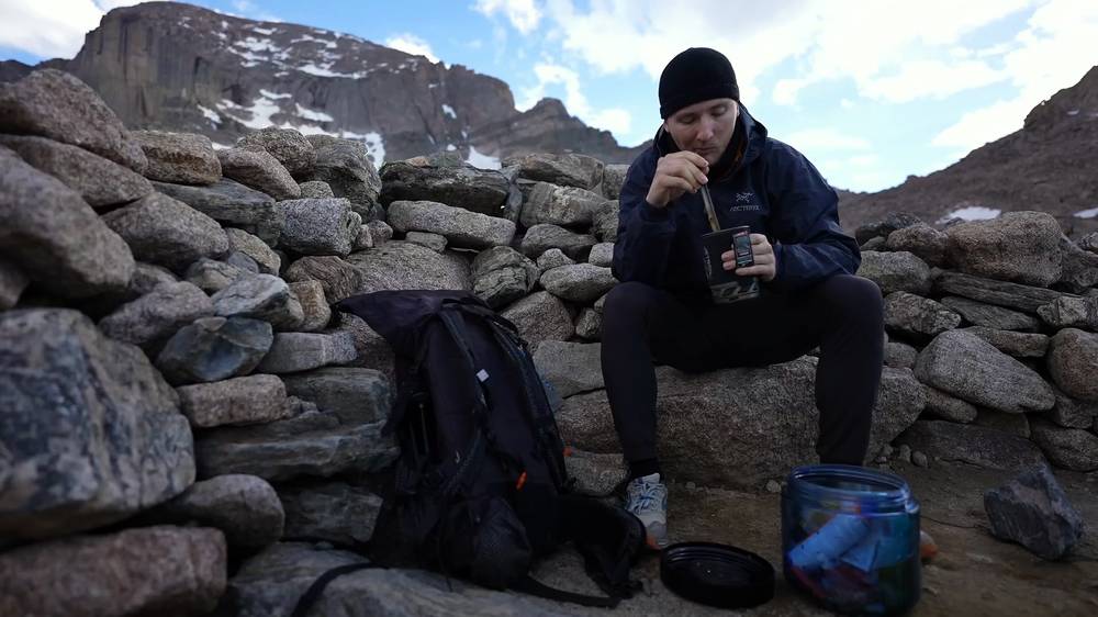
What I ate. A dehydrated meal in my pot at camp, eaten with a long spoon, and a quick breakfast on a rock in the morning. My food went in the bear canister.
Water. There was plenty of water in the brooks along the trail, and there was also water at the Boulder Field, which I had to ask the ranger about. It made sense: there was still snow up there and I could see it from the trailhead, so there would be some water flowing down Boulder Brook. I filled my bottle from a trickle between the boulders. Treat it all. In late summer and autumn the flow at the Boulder Field can be small, so ask at the Wilderness Office. Above the Boulder Field there's no water: carry 3 to 4 quarts for the climb.
From my film (I have no full gear list for this trip):
What this hike needs:
I started out late, at 1:10 p.m. by my GPS, and I was so happy to be out there and hiking again. There was little to no snow on the trail. It climbs through the forest beside the brooks, and there was plenty of water.
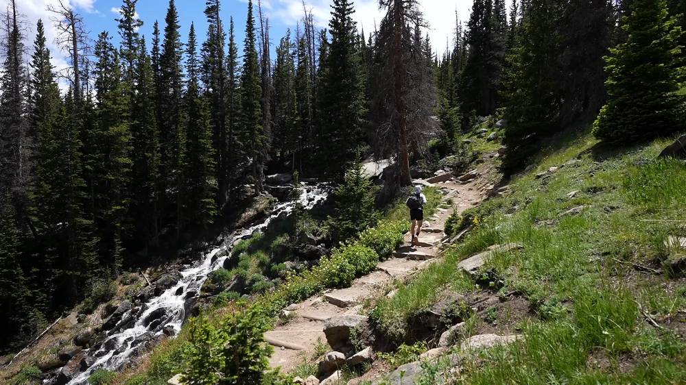
Above the trees the trail crosses open, rocky tundra under big clouds. I love how Longs Peak looks: the gradual climb through the forest, the alpine zone between ten and eleven thousand feet, and then the sheer rock drop to the lake below.
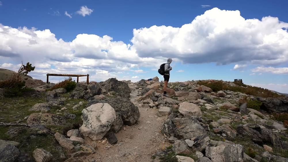
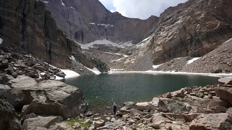
At Chasm Junction, at 2:51 p.m., I turned off for Chasm Lake. I added it on just because I had a lot of time, and I'm glad I did. There was a little bit of snow on the way, which was kind of nice; it's always fun. I had the lake all to myself, right under the east face of Longs, and splashed some of its water on my face.
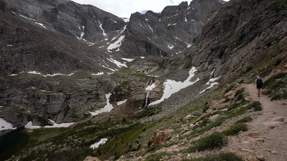
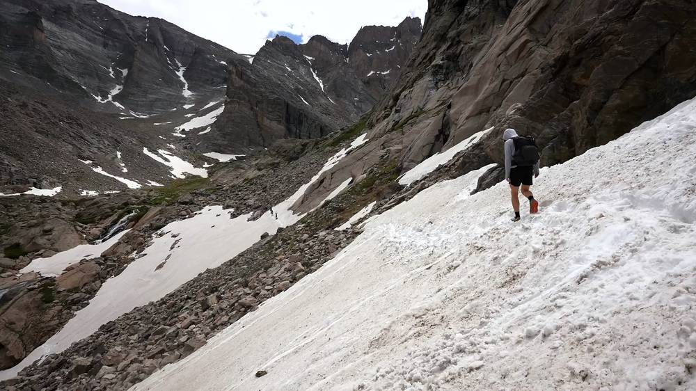
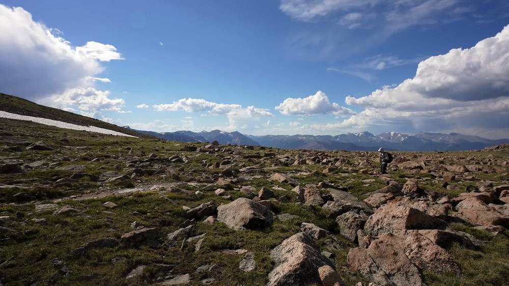
I was back on the main trail at 4:23, over Granite Pass at 4:59, and across the tundra into the Boulder Field. I reached my camp at 6:01 p.m. and had plenty of time before sunset just to eat and relax. There were more marmots than hikers, I would say.
The trailhead. The Longs Peak Trailhead, about 9,400 ft, has a ranger station, a parking lot and the tent-only Longs Peak Campground next to it. The East Longs Peak Trail starts by the ranger station.
Through the forest. About 0.6 mile up by my GPS, keep left at the first junction (the Eugenia Mine Trail goes right). The trail climbs steadily through the trees, past the Goblins Forest camp area at mile 1.3 by my GPS (1.2 by the park's count), and leaves the trees at about 11,000 ft.
Chasm Junction. At mile 3.6 by my GPS, about 11,540 ft, the Chasm Lake Trail turns left. For the Boulder Field keep right toward Granite Pass.
The Chasm Lake detour. The Chasm Lake Trail traverses above Peacock Pool and climbs past a waterfall to the lake, below the east face of Longs Peak (the Diamond) and Mount Meeker. It's not on the way to the summit: my detour, out and back with time at the lake, was 2.2 miles from 2:51 to 4:23 p.m. In early summer a steep snow slope can cover the trail before the lake; the park's conditions report calls it the Chasm crossing.
Granite Pass. At mile 6.9 by my GPS (about 4.7 without the detour), about 12,080 ft, the North Longs Peak Trail joins. Keep left. The trail switchbacks up the slope and then runs into the Boulder Field.
The Boulder Field. A wide field of boulders below the north face of Longs Peak, at 12,760 ft. The camp is a cluster of rock rings with a privy. Here the trail ends; above is the Keyhole, the notch in the ridge.
The only way off is back down the trail. Turn back if a storm is building (in summer they come most afternoons), if the altitude is hitting you hard (a headache that gets worse, vomiting, confusion), or if you're running late. The Boulder Field is exposed and there's nowhere to shelter from lightning above tree line.
Day 1 · The permit and the drive (from 12:27) · My route on the map, Chasm Lake and water (from 13:42)
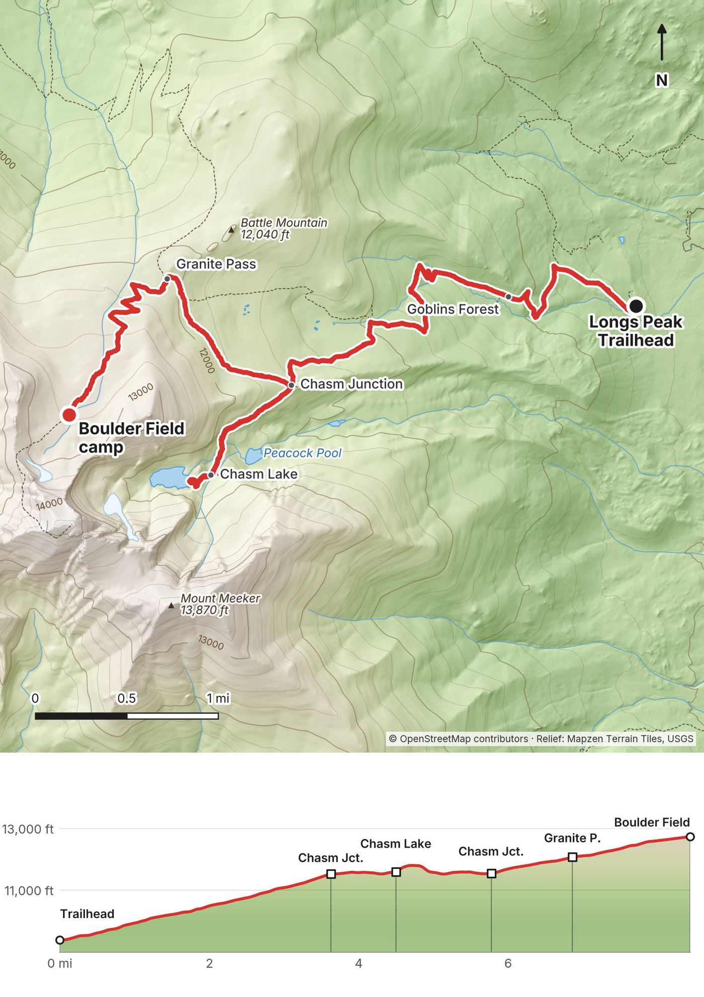
My tent was glowing in the dark before dawn. I packed up in the first light, had a quick breakfast on a rock, and walked up the Boulder Field toward the Keyhole.
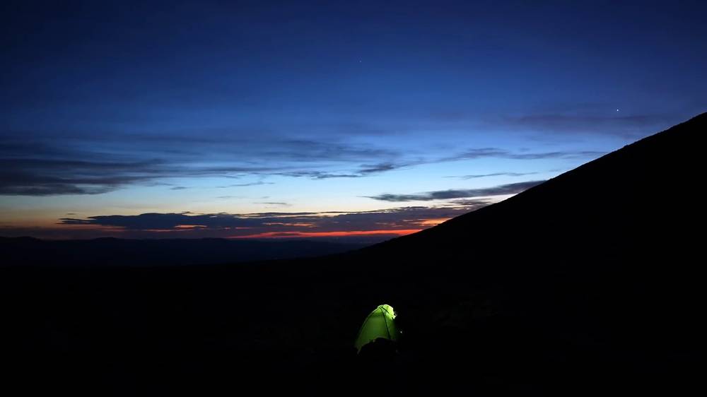
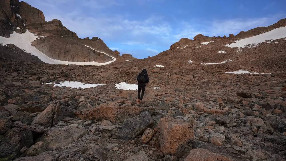
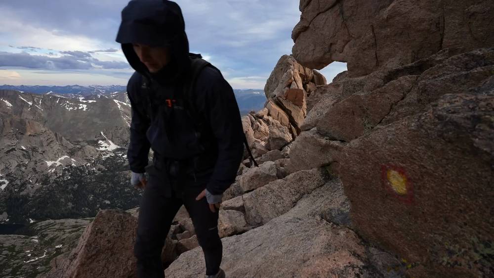
The last part to the Keyhole is a scramble over big boulders. Beside the Keyhole is the Agnes Vaille shelter, a small stone hut. Through the Keyhole the route turns onto the west side of the mountain, and from there you follow the painted bullseyes.
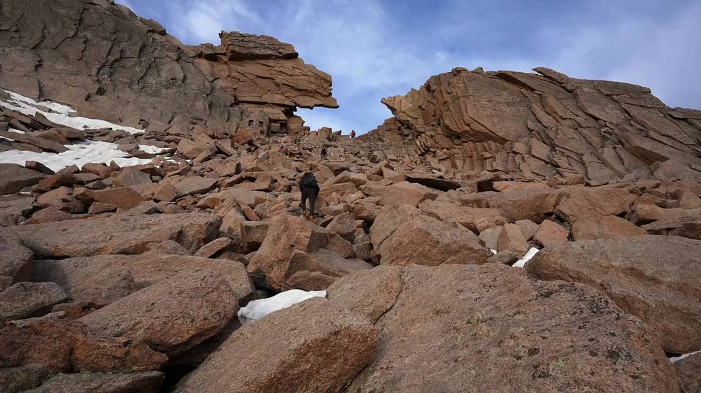
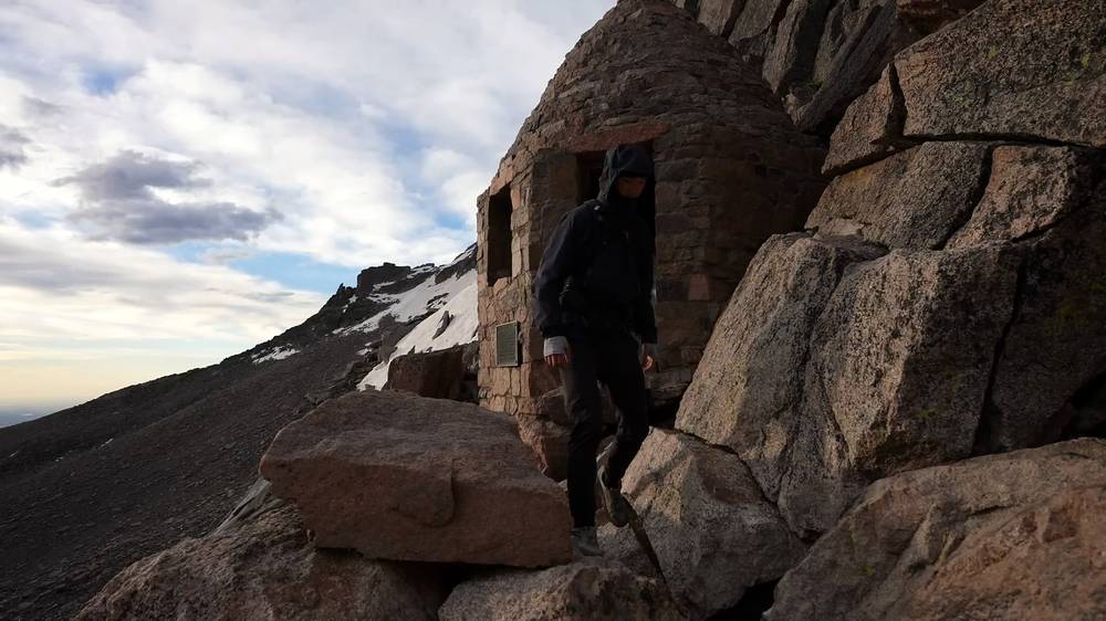
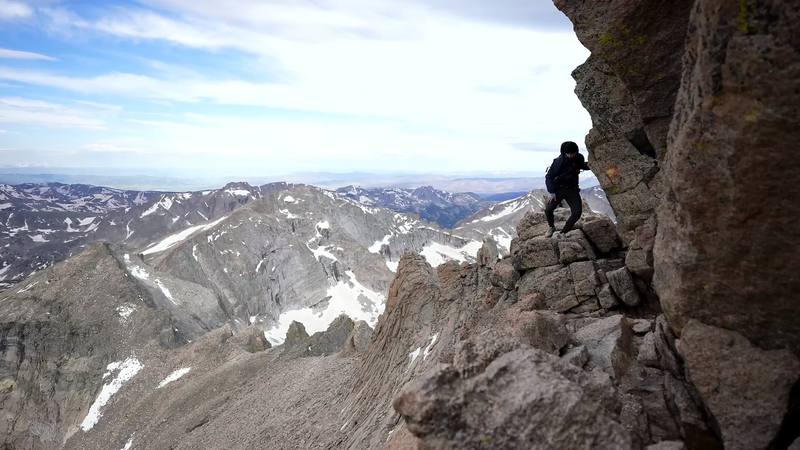
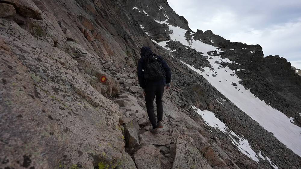
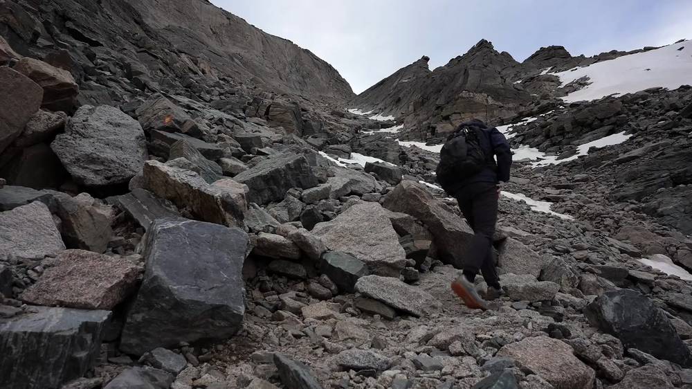
I was expecting something even worse, because I guess these are class 3 scrambles at the top, or like climbing. But I've done harder things, so I was totally fine on it. There was still some ice and snow up top, but everything was pretty manageable, and I didn't use my microspikes once. My phone's photos put me at the bottom of the Trough at 6:56 a.m., at the top of it at 7:24 and on the Homestretch at 7:36.
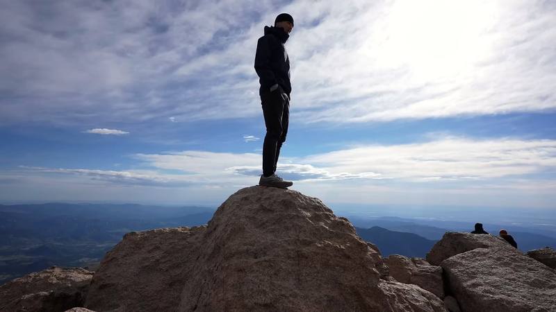
The summit is a big, flat field of rock, with snow patches when I was there and views in every direction. I had a snack and walked to the edge.
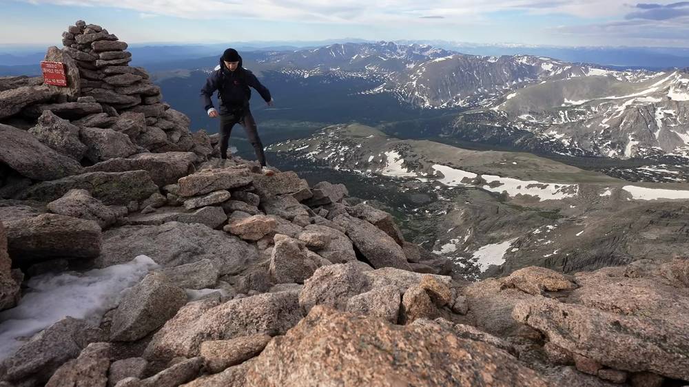
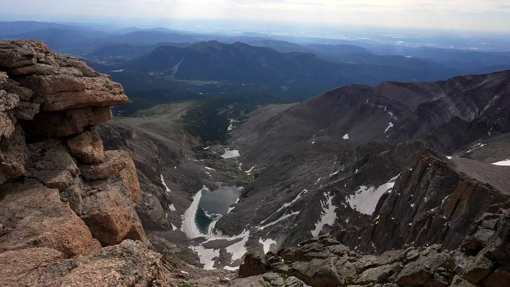
I was back at the top of the Trough at 8:39, then went down through the Boulder Field and the same trail as Day 1, and was back at the trailhead and my car before noon, I believe. It was a pretty quick, not too bad hike.
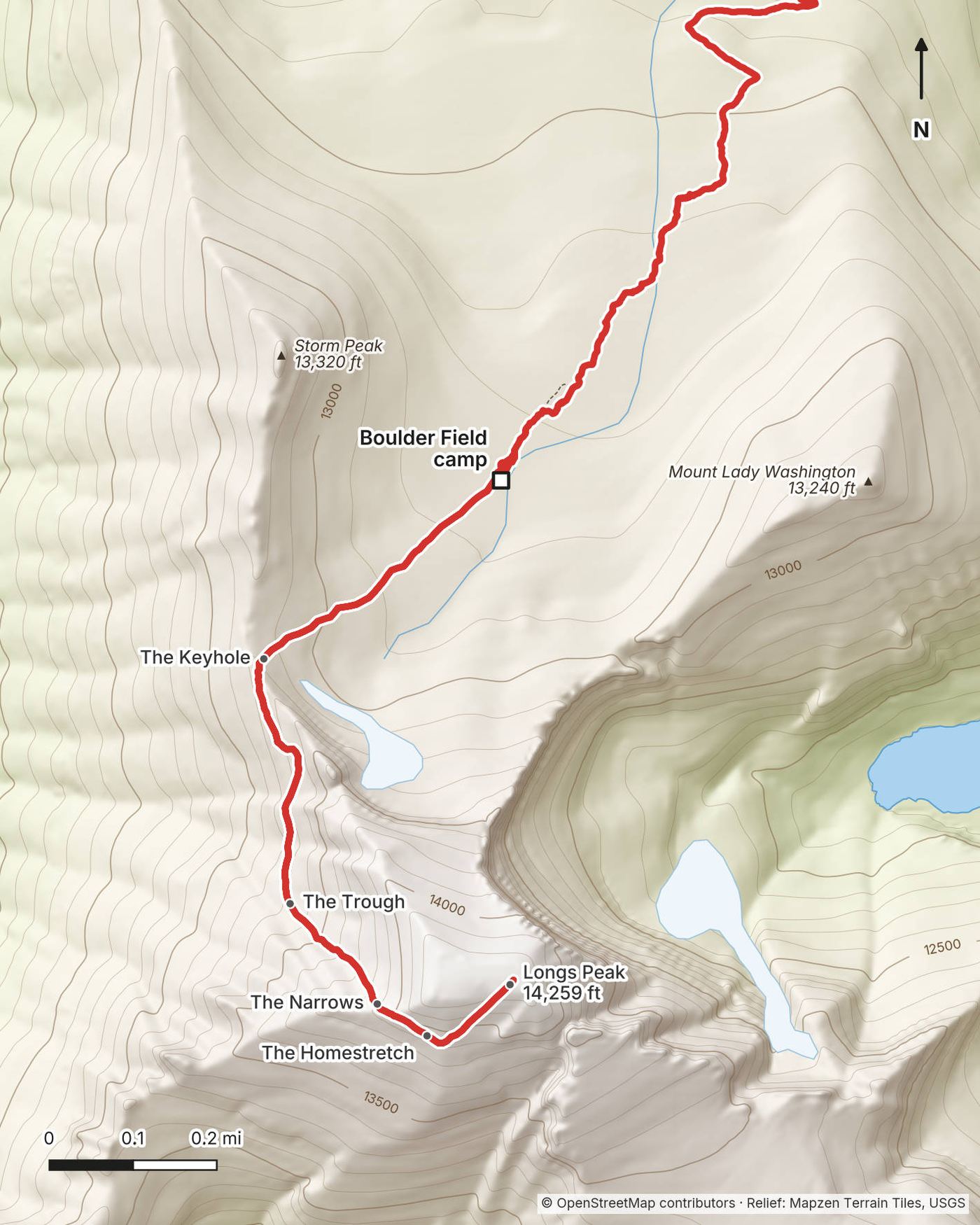
The Keyhole. About 0.4 mile above the camp, about 13,150 ft, the Keyhole is a notch in the ridge between Longs Peak and Storm Peak, with the stone Agnes Vaille shelter beside it. The shelter is not a lightning shelter. Here the trail ends and the climbing route begins. The Park Service calls the Keyhole to the summit the hardest 1.5 miles; the mapped line in this guide measures about 0.7 mile, but it can't follow every move. The route is marked with red and yellow bullseyes painted on the rock. Follow them; many falls happen to people who lose the route or take shortcuts.
The Ledges. From the Keyhole the route traverses narrow ledges along the west face, above a big drop to Glacier Gorge, including a slot with two iron bars drilled into the rock, then makes a descending traverse to the bottom of the Trough. Note where the Ledges meet the Trough: on the way down it's easy to miss.
The Trough. A long, steep gully of loose rock, about 600 ft up to a notch at its top, often with snow or ice in it until midsummer. Watch for rocks knocked down by people above you, and don't knock any down.
The Narrows. A narrow ledge along the south face, with a sheer drop below. It's short, and it's where the exposure feels biggest.
The Homestretch. Steep, smooth granite slabs to the summit, 14,259 ft; dangerous when wet or icy.
Down. The same way back, following the bullseyes. The Park Service says many accidents on the Keyhole Route happen on the way down. Then the Day 1 trail from the Boulder Field to the trailhead, about 6.3 miles by my Day 1 line.
The only way off is back the way you came. The Park Service recommends being back below tree line by noon because of lightning, and advises starting from the trailhead no later than 3 a.m. on a day climb; from the Boulder Field you have a few hours' head start. Turn around at the first sign of a storm, if you lose the bullseyes, if there's ice you're not equipped for, or if the altitude is getting worse.
Day 2 · How hard it was (from 14:25)
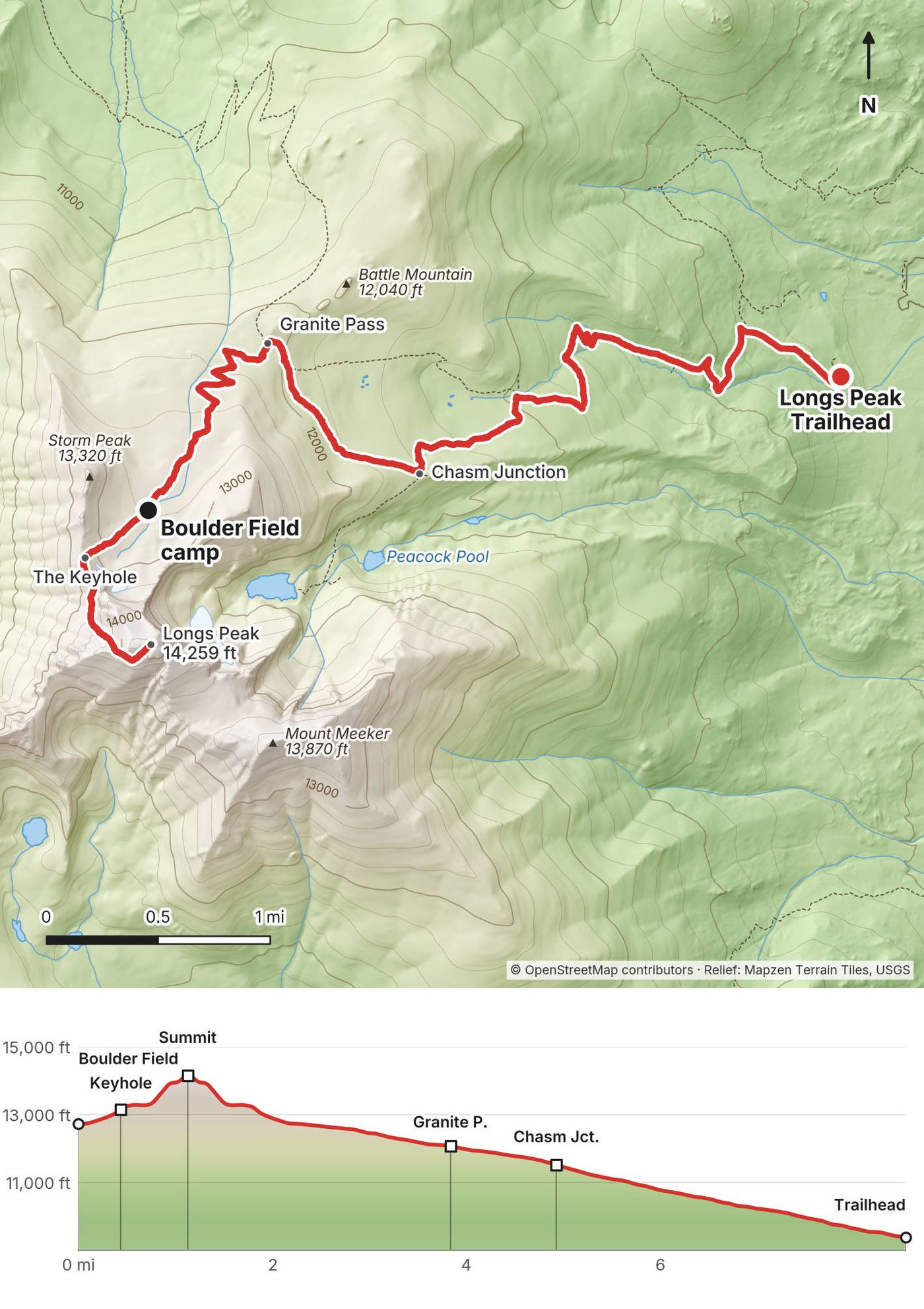
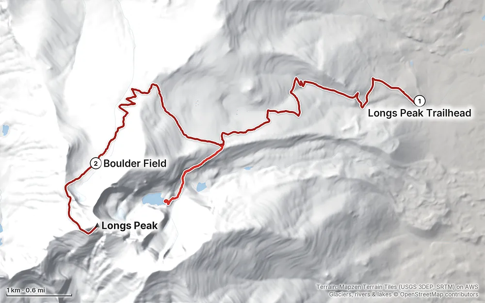
Elevation9,386–14,255 ft17.0 mi
Terrain: Mapzen Terrain Tiles (USGS 3DEP, SRTM) on AWS · Glaciers, rivers & lakes © OpenStreetMap contributors
Tap a map to open it full size.
Checked on Rocky Mountain National Park's and recreation.gov's own pages on October 3, 2026.
Open, with the first snow. I found no closure of the Longs Peak Trail, the Chasm Lake Trail or the trailhead. The park's Longs Peak conditions report of September 23, 2026 says fall has arrived: the first snow of the season is on the Keyhole Route and ice has formed on parts of it. Its newest photos, from September 20, are of the Ledges, the Trough and the Narrows. On the Chasm Lake Trail the steep crossing was snow-free, but the report says the rock slabs below the lake are wet with runoff and ice is becoming a serious hazard this time of year. It says microspikes, or crampons and an ice axe, may be prudent. From about mid-September to mid-July the route is usually in winter or spring conditions.
Longs Peak Campground at the trailhead is closed for the winter. It usually opens in early July and closes in early September; the 2027 dates weren't posted yet.
Timed entry. In 2026 timed entry runs from May 22 to October 12: until then you need a reservation to drive into the park between 9 a.m. and 2 p.m., and that includes the Longs Peak area. Before 9 a.m. or after 2 p.m. you don't need one, and once you've picked up a wilderness permit it serves as your timed-entry reservation. You still need a park entrance pass: buy it on recreation.gov or at the Beaver Meadows entrance before you drive to the trailhead. The 2027 dates weren't announced yet.
What to do. Read the Longs Peak conditions report and the park's alerts the week before you go, and call the Wilderness Office, (970) 586-1242, about snow on the route.
These were checked on Rocky Mountain National Park's and recreation.gov's own pages on October 3, 2026.
A wilderness permit to camp. You need one for any night in the park's wilderness, including the Boulder Field. Summer dates (May 1 to October 31) open on recreation.gov at 8 a.m. Mountain time on March 1 each year, and bookings close 3 days before your first night. A few walk-up permits are given out in person; in 2026 in-person permits started on March 15.
How I did it, 2022. I went to the wilderness office that morning to snag a walk-up permit to spend the night up at the Boulder Field. It was very easy and cost maybe like thirty dollars. The whole process, talking to the ranger, took about five minutes. They just wanted to make sure I had a bear can and that I knew the conditions.
Picking it up. Every permit is picked up in person, up to 30 days ahead: at the Wilderness Office beside the Beaver Meadows Visitor Center, 1000 US Highway 36, just west of Estes Park, open 7 a.m. to 3:30 p.m. daily, (970) 586-1242; or, from May 15 to September 30, at the Kawuneeche Visitor Center on the west side. The Beaver Meadows office is closed on New Year's Day, Martin Luther King Jr. Day, Presidents' Day, Indigenous Peoples' Day, Veterans Day, Thanksgiving and Christmas; no summer holiday is on that list. You get an overnight dashtag with the permit: leave it on your dashboard at the trailhead.
Fees (2026). $36 a trip from May to October ($6 to reserve plus a $30 administrative fee), not per person or per night; $10 from November to April. The park entrance fee is separate.
The Boulder Field camp. Nine sites inside rock rings, the stone windbreaks, at 12,760 ft, 6 miles from the trailhead. There's a privy, and water from Boulder Brook. Camp inside the rings. No more than 3 nights in a row in one camp area.
Bear canisters. From April 1 to October 31 you must store food and trash in a hard-sided, commercially made bear-resistant canister below tree line and at the Boulder Field, and you have to show it at the office to get your permit. Keep it about 70 steps (200 ft) from your tent.
Human waste. There's a privy at the Boulder Field. Elsewhere above tree line, pack out solid waste in a waste bag; it's required.
Other rules. No campfires anywhere in the wilderness. No pets on trails or in the wilderness. No drones in the park. Groups at an individual site are 1 to 7 people.
Timed entry and the entrance pass. See Is it open? and What it costs.
Late June. I went on June 28 and 29, 2022. The weather looked good, and that's one of the reasons I jumped on it so quick and did the walk-up permit: I had a nice day-and-a-half window of sunny skies. There was little to no snow on the trail, a few snow patches on the way to Chasm Lake, and still some ice and snow up top. The skies were partly cloudy.
Mid-July to mid-September. The Park Service says this is when the route is most often free of snow and ice, and it's when most people climb. It's also thunderstorm season: in June, July and August expect afternoon storms and lightning. Start very early and be back below tree line by noon.
The rest of the year. For most of the year Longs Peak is in winter conditions: snow, ice and strong wind on the Keyhole Route. That's a mountaineering trip, with crampons, an ice axe and the skills to use them.
Near the summit (estimated normals for about 13,350 ft, 1991 to 2020, from PRISM as published on Wikipedia; add wind chill):
| Month | High / low °F (°C) | Precipitation, in |
|---|---|---|
| May | 38 / 15 (3 / -10) | 4.0 |
| June | 50 / 24 (10 / -4) | 2.2 |
| July | 56 / 31 (13 / -1) | 2.7 |
| August | 54 / 30 (12 / -1) | 2.6 |
| September | 48 / 23 (9 / -5) | 2.6 |
| October | 36 / 14 (2 / -10) | 2.7 |
From November to April the highs stay around 20 to 30 °F (-7 to -2 °C). The park says to expect temperature drops of 10 to 20 °F on the tundra when the weather turns. Sunrise in Estes Park is about 5:34 a.m. in late June and 6:29 a.m. on September 1.
Emergencies. Call or text 911 (a text can get through when a call won't). There's an emergency telephone at the trailhead ranger station. Rescues on Longs Peak are dangerous and can take many hours, even days. The phone signal is very unreliable, so carry a satellite messenger and leave your plan with someone. A CORSAR card from Colorado Parks and Wildlife ($5 for a year, $20 for five) helps pay Colorado's county rescue teams, not the Park Service; it isn't insurance.
The route itself. Above the Keyhole a fall can be fatal, and people have died on Longs Peak. The Park Service says many accidents happen on the way down, and to people who lose the route or take shortcuts, and some to people climbing alone. I climbed alone; if you do, be extra careful and turn back early.
Lightning. In June, July and August afternoon thunderstorms are common. The Boulder Field, the Keyhole and everything above are exposed. Start early, be back below tree line by noon, and turn around at the first thunder. The Agnes Vaille shelter is not a lightning shelter.
Snow and ice. Even in summer, ice can form on the upper route after a cold night, and it can be hard to see in the shadows. Outside about mid-July to mid-September, expect it.
Altitude. I'd been living in Denver, at 5,280 ft, for a month. Coming from sea level, the altitude above 12,000 ft will hit harder. The CDC says about a quarter of visitors who sleep above 8,000 ft in Colorado get altitude sickness, and that two or three nights at 8,000 to 9,000 ft before going higher protect you well. Flying in and sleeping at the Boulder Field the next night is a much bigger jump than that. Watch for headache, dizziness and nausea, and go down if it gets worse.
Wind and cold. The Boulder Field is exposed and often windy. Bring warm layers and gloves even in summer.
How many days do I need? I did it in two: up to the Boulder Field in the afternoon, the summit and all the way down the next morning. Many people do it in one very long day; the Park Service says the 15-mile round trip takes 10 to 15 hours. See Other ways to do it.
How hard is it? Up to the Boulder Field it's a trail, long and steady. Above the Keyhole it's a scramble on rock with big drops. The videos I watched getting ready made it look pretty gnarly, and the names for the sections, like the Narrows, kind of hype it up and make it a bit scarier than it actually was. I've done harder things, so I was totally fine on it and felt prepared. The Park Service is blunter: the Keyhole Route is not a hike, and an unroped fall there would likely be fatal. If you've never scrambled on exposed rock, practice somewhere easier first.
Do I need a permit? Not to climb it in a day. To camp at the Boulder Field or anywhere else in the park's wilderness, you need a wilderness permit, $36 a trip in summer. See Permits and the rules.
Do I need microspikes or an ice axe? It depends on the month. In late June 2022 there was still some ice and snow up top, but everything was pretty manageable. I had microspikes and didn't use them once. That was before the usual snow-free window, which runs about mid-July to mid-September. Outside it, expect snow and ice on the Ledges, the Trough and the Narrows, and read the conditions report: the park says microspikes, or crampons and an ice axe, may be needed.
Is there water? Brooks along the trail and Boulder Brook at the Boulder Field (treat it all). None above the Boulder Field: the Park Service says to carry 3 to 4 quarts for the climb.
Can I fly a drone? No. Drones are banned everywhere in the park.
Can I bring my dog? No. Pets aren't allowed on any trail or in the wilderness in Rocky Mountain National Park.
Is there a phone signal? Don't count on it. The Park Service calls coverage extremely unreliable. Carry a satellite messenger or a phone with satellite SOS.
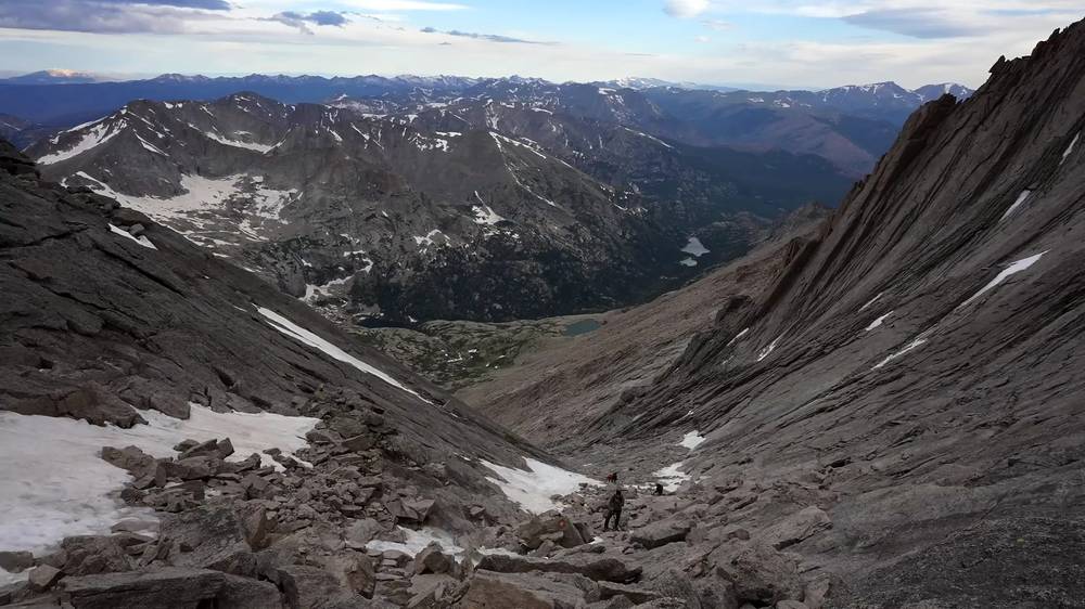
This is how many people climb Longs Peak: the Park Service says 15 miles round trip, 10 to 15 hours, and to start no later than 3 a.m. so you're off the summit early. No wilderness permit is needed. Looking back, I thought 14er summits are pretty basic, and I could have done this in a single day: I would have packed lighter, without the bear can, the sleeping bag and the tent, and been even quicker. I said that if I'd started in the morning I'd have summited around lunchtime and been back before sunset. The Park Service's advice is to start much earlier than that and be back below tree line by noon, because of the afternoon storms. Follow theirs.
A night at the Boulder Field (or at Goblins Forest, 1.2 miles up) splits the climb, lets you start the scramble at first light from 12,760 ft, and gets you used to the altitude. It needs the wilderness permit and a bear canister.
The Chasm Lake detour is a fine day hike on its own: about 9 miles round trip from the trailhead by my Day 1 line (the lake is at mile 4.5), with the east face of Longs Peak right above you. Expect snow on the last part of the trail in early summer.
The Loft, Clark's Arrow, the North Face (the Cables) and Keplinger's Couloir are other routes to the summit. They're harder or need more route-finding, ropes or snow skills. I didn't do them.
These change every year. Everything else in this guide stays the same.
Permits and entry
Is it open?
Getting there
Your stuff
The film is at the top of this page.
When bookings open, from the sources named under each. Dates move: confirm on the official site.
Summer dates open on recreation.gov at 8 a.m. Mountain time on March 1 each year; bookings close 3 days before your first night. A few walk-up permits are given in person.
Next: Mar 1, 2027
Book on recreation.gov.
Source: Kraig Adams's Longs Peak guide: Permits and the rules (checked Oct 3, 2026). Checked October 2026.
Planning questions about Longs Peak, answered only from this page's facts, the creators' versions and hikers' public tracks, with where each answer comes from. When the data doesn't say, the answer says "not given".
From hikers
Sign in to comment. Free; your hikes stay private unless you share them.
Something wrong or missing on this page? Send feedback.