 Solo Silent Hike Up Longs Peak - Colorado’s Most Iconic Summit

Kraig AdamsJun 2022 · Solo
- Days
- 2 days
- Direction
- Out and back on the same trail, with an out-and-back spur to Chasm…
- Cost
- See his costs
- Lodging
- Tent
North America · United States
Rocky Mountain National Park, Colorado
Hikes / North America / Longs Peak
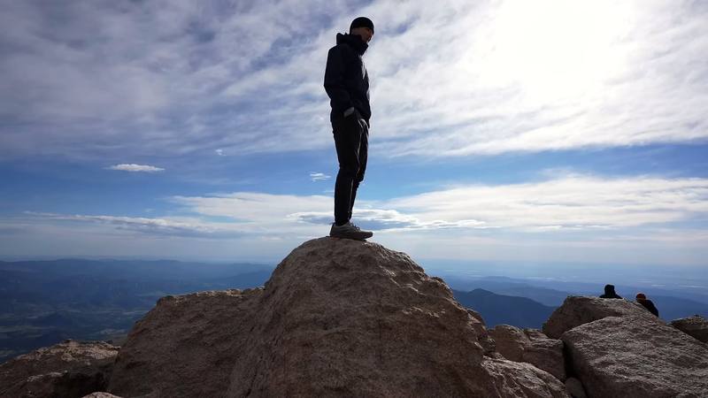
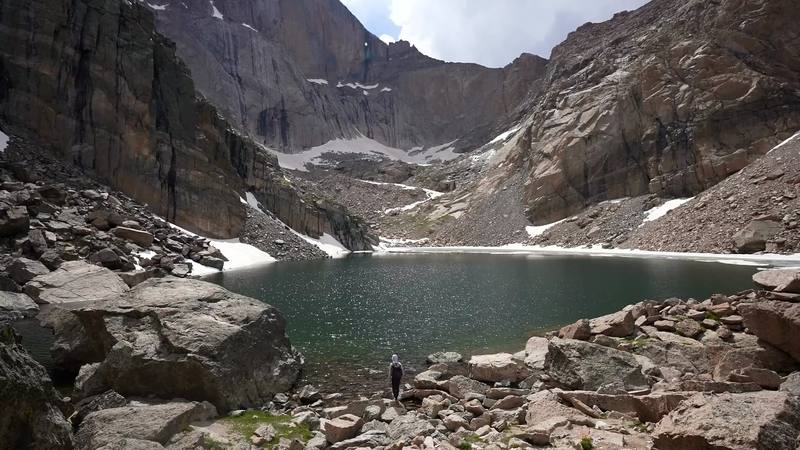
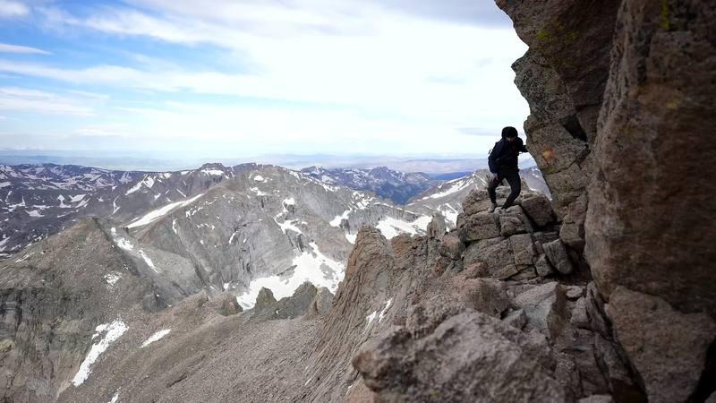
In June 2022 I climbed Longs Peak, 14,259 ft (4,346 m), the highest mountain in Rocky Mountain National Park, by the Keyhole Route. It was my first month living in Denver. I just moved there with my wife and puppy, and one of the reasons you move to Colorado is to hike mountains, specifically 14ers. I went alone and did it in two days: up from the Longs Peak Trailhead on the first afternoon, with a detour to Chasm Lake, to a night in a stone windbreak at the Boulder Field, then the Keyhole, the Ledges, the Trough, the Narrows and the Homestretch to the summit early the next morning, and all the way back down to my car. It's the trip from my film Solo Silent Hike Up Longs Peak.
Kraig Adams
Effort at this pace: Hard · about 8 mi (14 km) and 2,792 ft (851 m) of climbing a day over 2 days, up to 14,259 ft (4,346 m). Our grade for the days given, worked out from distance, climbing and altitude a day; it isn't the trail's usual difficulty rating (under Basics) and doesn't rate exposure, terrain or weather.
From Kraig Adams's GPS recording and guide.
From Kraig Adams's GPS

Elevation9,386–14,255 ft17.0 mi
From Kraig Adams's GPS. Terrain: Mapzen Terrain Tiles (USGS 3DEP, SRTM) on AWS · Glaciers, rivers & lakes © OpenStreetMap contributors
Tap a day for his map of it
The film
 Solo Silent Hike Up Longs Peak - Colorado’s Most Iconic Summit
Before you go
From Kraig Adams's guide
When bookings open, from the sources named under each. Dates move: confirm on the official site.
Summer dates open on recreation.gov at 8 a.m. Mountain time on March 1 each year; bookings close 3 days before your first night. A few walk-up permits are given in person.
Next: Mar 1, 2027
Book on recreation.gov.
Source: Kraig Adams's Longs Peak guide: Permits and the rules (checked Oct 3, 2026). Checked October 2026.
From Kraig Adams's guide
From Kraig Adams's guide. For planning, not navigation: check before you go.
Their films and versions
1 creator so far: Kraig, 2 days, tent.
Solo Silent Hike Up Longs Peak - Colorado’s Most Iconic Summit
Walked Longs Peak? Be the first to share your track: log it with your GPX.
Sign in and log a few hikes to see how long this one would take you.
Typical: 2 days (the hike's facts).
Planning questions about Longs Peak, answered only from this page's facts, the creators' versions and hikers' public tracks, with where each answer comes from. When the data doesn't say, the answer says "not given".
From hikers
Sign in to comment. Free; your hikes stay private unless you share them.
Answered from the data
I did it in two: up to the Boulder Field in the afternoon, the summit and all the way down the next morning. Many people do it in one very long day; the Park Service says the 15-mile round trip takes 10 to 15 hours. See Other ways to do it.
From Kraig Adams's trip and guide.
The only cost I mention in my film is the walk-up permit: it cost maybe like thirty dollars.
From Kraig Adams's trip and guide.
The route is most often free of snow and ice from about mid-July to mid-September. That's also thunderstorm season, so start very early and be back below tree line by noon. I went in late June, with some ice and snow still up top.
From Kraig Adams's trip and guide.
Not for a day climb. To camp at the Boulder Field you need a Rocky Mountain National Park wilderness permit ($36 a trip in summer 2026), picked up in person with a bear canister. In 2026 you also needed a timed-entry reservation to drive into the park between 9 a.m. and 2 p.m. from May 22 to October 12, unless you arrive earlier.
From Kraig Adams's trip and guide.
The Park Service says 7.5 miles to the summit and 15 miles round trip, 10 to 15 hours. My first day, from the trailhead with a detour to Chasm Lake, was 8.4 miles by my GPS; the second, from the Boulder Field to the summit and down, about 8.5.
From Kraig Adams's trip and guide.
Up to the Boulder Field it's a long, steady trail. Above the Keyhole it's a scramble on rock with big drops, at over 13,000 ft, and the Park Service says it's not a hike: a fall there can be fatal. I found it less scary than the videos I'd watched, but I'd done harder scrambles before.
From Kraig Adams's trip and guide.
Yes, with a wilderness permit: nine sites inside stone windbreaks at 12,760 ft, about 6 miles from the trailhead, with a privy and water from Boulder Brook. A hard-sided bear canister is required.
From Kraig Adams's trip and guide.
There are brooks along the trail and Boulder Brook at the Boulder Field (treat it). Above the Boulder Field there's none: the Park Service says to carry 3 to 4 quarts.
From Kraig Adams's trip and guide.