
Content made there
The film is at the top of this page.
Photos
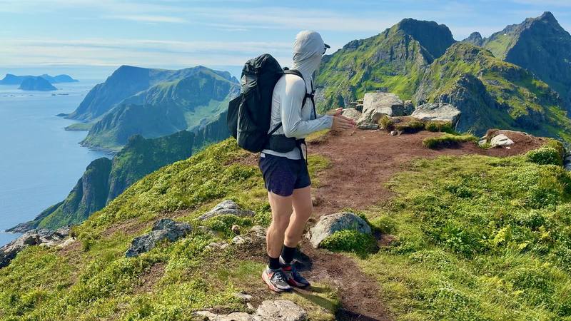
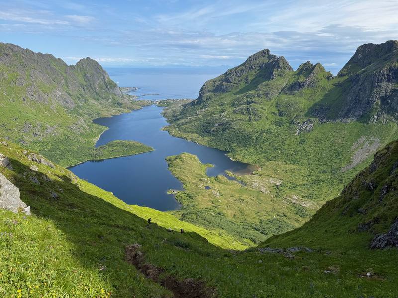
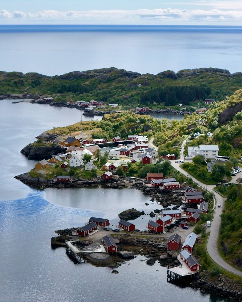
Hikes / Lofoten Islands / Kraig Adams's version
Europe · Norway
Jul 5–12, 2026 · 6 walking days · about 85 miles · Solo · Tent

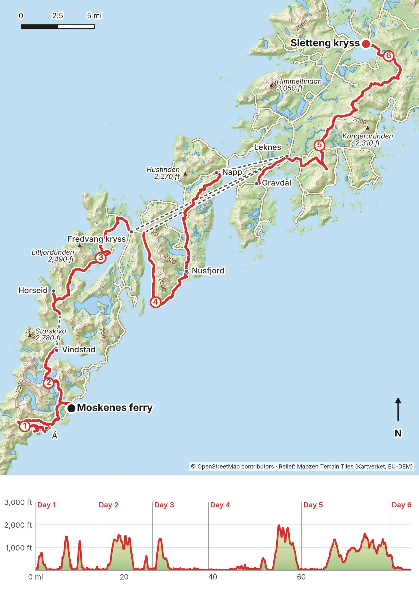
In July 2026 I spent six days hiking alone across the Lofoten Islands in Norway. I got off the overnight ferry at Moskenes, walked about 85 miles with a tent, and finished at a bus stop on the E10 near Borg, on Vestvågøy. Along the way I took a boat across the Reinefjord, rode a lot of buses, slept in a hotel and two rented rooms, and sat out two days of storms.
This is not one marked trail. It's a chain of mountain paths, beaches, village roads, boats and buses. You can't walk the tunnels or the bridges, there are fewer places to resupply than you'd think, and everything costs a lot. It was a tough one for sure. It's also a special place, and a different kind of hike. Many of you asked about the logistics, so this guide is everything I used and learned, in one place, so you can plan a smoother version.
| Quick facts | |
|---|---|
| Distance | 84.7 miles (136.4 km) of walking over 6 days |
| Climbing | about 17,900 ft (5,450 m) up and the same down |
| Days | 6 walking days, plus 2 rest days for weather |
| Start | Moskenes ferry terminal (ferry from Bodø) |
| Finish | Sletteng kryss bus stop on the E10, near Borg, Vestvågøy |
| Not walked | One boat (Vindstad to Kjerkfjorden) and buses between Days 3, 4 and 5 |
| Nights | 3 in my tent, 1 at a campsite, 4 in rooms in Leknes and Gravdal |
| When | Summer. I went in July; the midnight sun lasts until about July 17 |
| Difficulty | Tough: long days, mud, some road walking, and weather that decides everything |
| Nearest airports | Bodø (then the ferry); home from Harstad/Narvik (Evenes) |
| Trip date | July 5 to 12, 2026, solo |
| Day | Route | Miles (km) | Up / down (ft) | Sleep |
|---|---|---|---|---|
| 1 | Moskenes to Å | 14.0 (22.5) | 4,148 / 4,106 | My tent near Å |
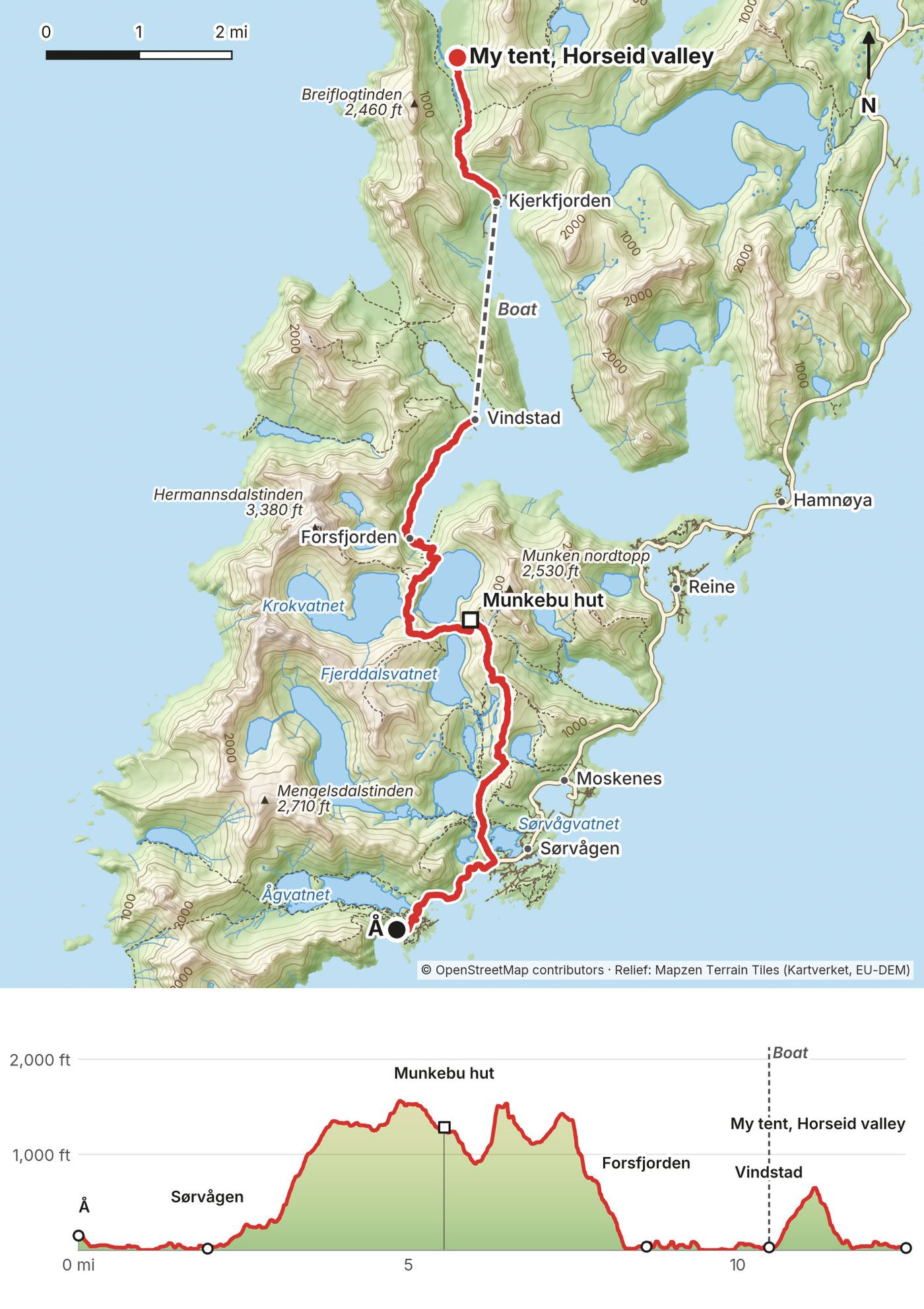
| 2 | Å to Vindstad, boat, to Horseid | 12.6 (20.3) | 3,320 / 3,440 | My tent, Horseid valley |
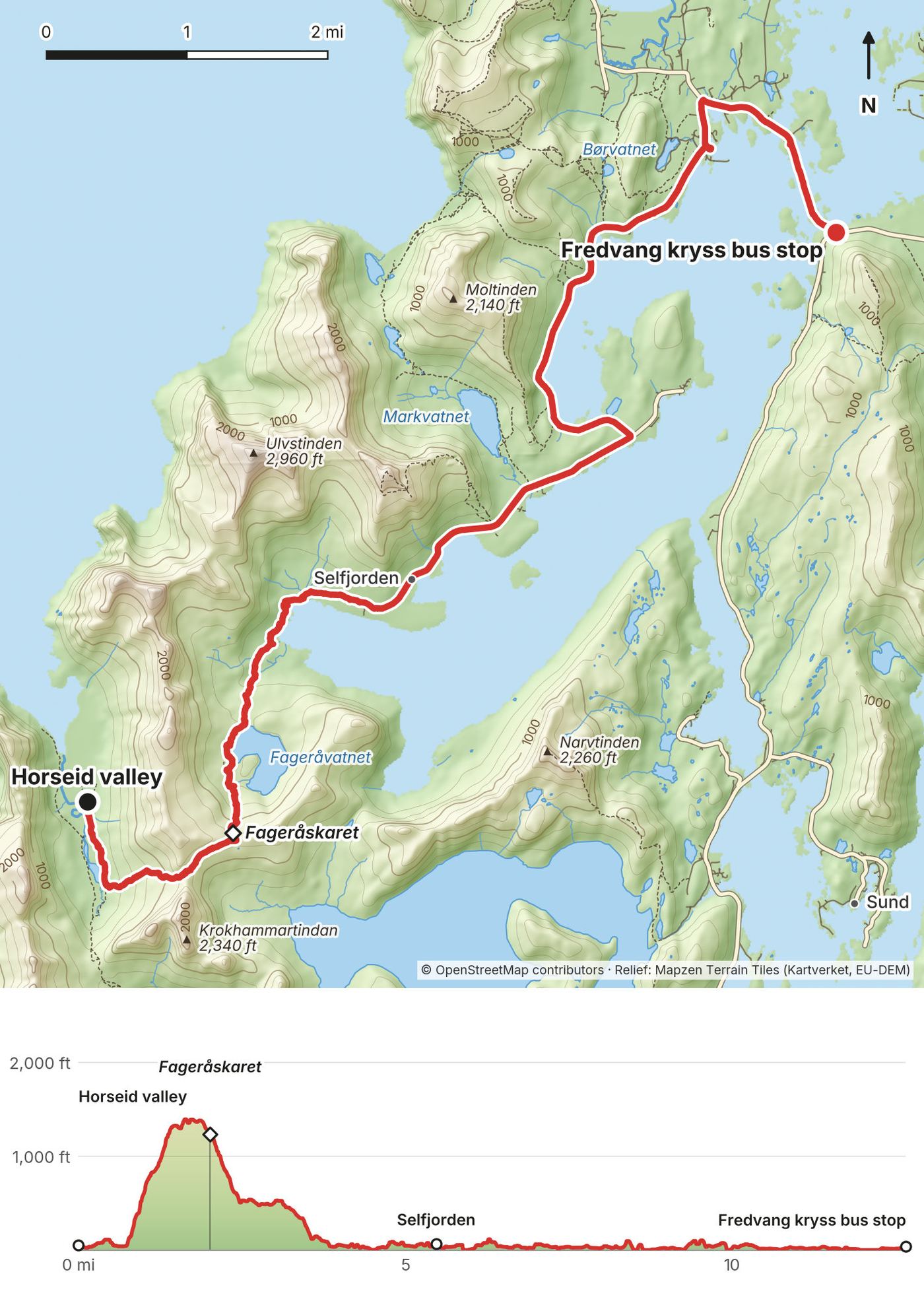
| 3 | Horseid to Fredvang kryss | 12.7 (20.4) | 1,913 / 1,918 | Hotel in Leknes (bus) |
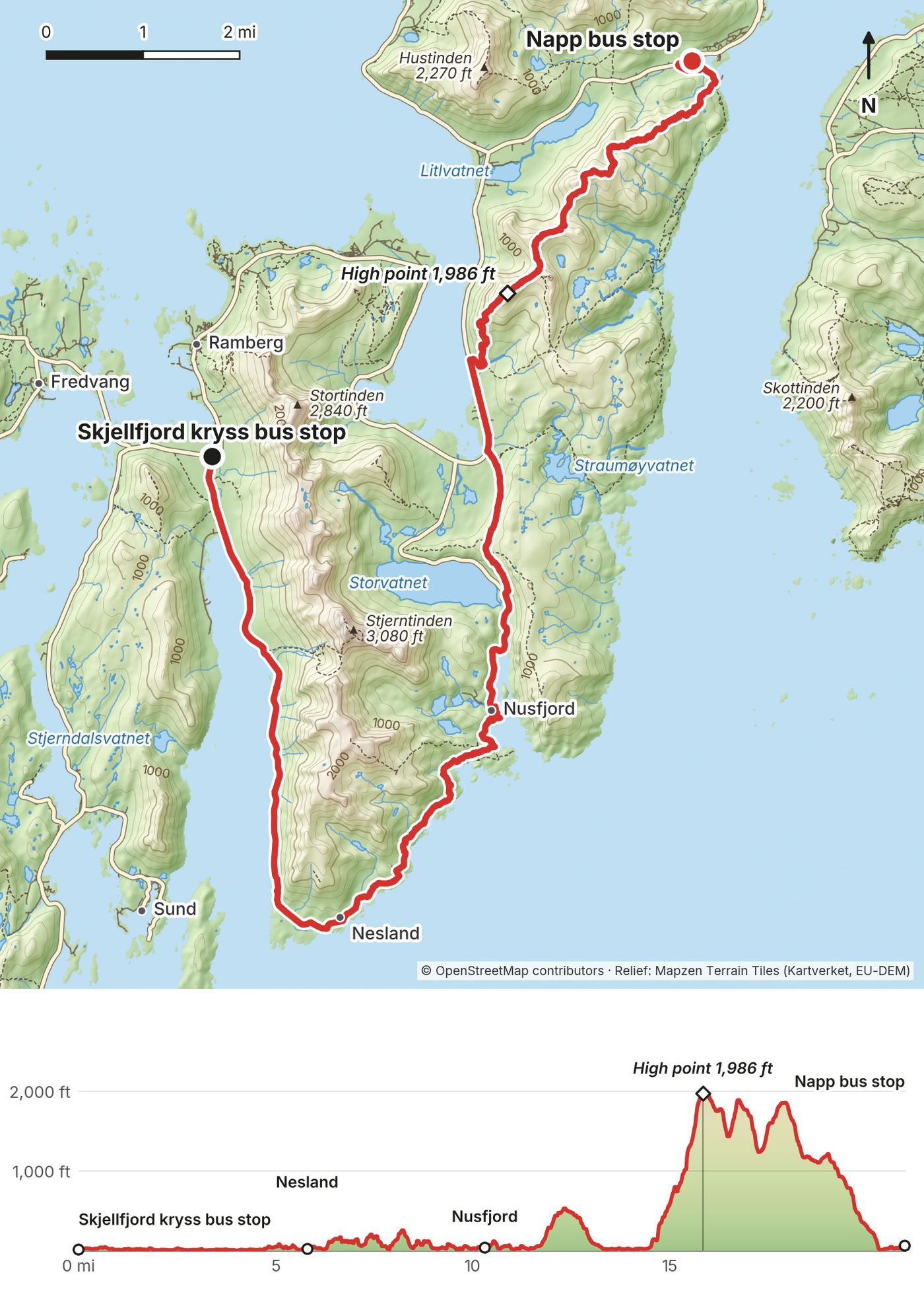
| 4 | Skjellfjord kryss to Napp | 21.0 (33.8) | 4,384 / 4,337 | Room in Leknes (bus) |
| Two rest days | Room in Gravdal | |||
| 5 | Gravdal to Lauvdalen | 19.9 (32.0) | 4,002 / 3,400 | My tent by a shelter |
| 6 | Lauvdalen to Sletteng kryss | 4.7 (7.5) | 91 / 739 | Svolvær (bus) |
The numbers come from my own GPS recordings, smoothed the same way for every day. Apps count climbing differently, so AllTrails shows more (about 20,500 ft for the trip). The title of my film says 85 miles; my GPS says 84.7.
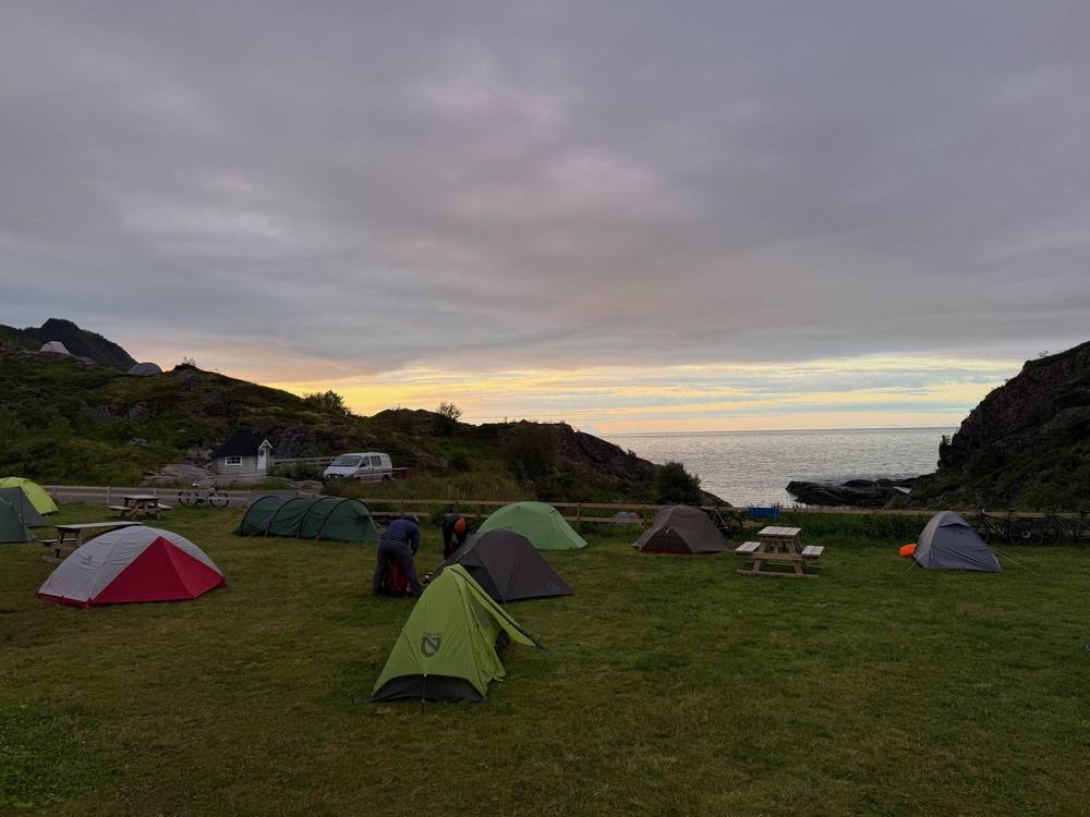
What I did. I flew from New York to Bodø via Helsinki on Finnair ($898.60, booked in April). In Bodø I bought groceries at Coop Prix on Storgata, and hiking food and a stove fuel canister at the Circle K on Olav V gate. I took the 10 p.m. ferry and got to Moskenes at 1:30 a.m., then walked to Moskenes Camping and pitched my tent under the midnight sun.
Buy fuel in Bodø. You can't fly with gas canisters, so buy one in town before the ferry, like I did.
The Bodø to Moskenes ferry (route 18-782). Run by Torghatten Nord for the Norwegian roads authority. In 2026 the crossing is free for foot passengers; you only pay for a vehicle. You can pay for a space guarantee: NOK 65 per adult (2026), up to 20 guaranteed spots per departure for passengers without a vehicle, 2 per booking, bookable until 8 p.m. the day before. With a guarantee you must be in the "Reserved" line 45 minutes before departure. Otherwise, just show up at the terminal. Some sailings stop at Værøy and Røst. Timetables and booking: torghatten.no/our-routes/18-782.
Other ways in. There are flights from Bodø to Leknes, and a fast passenger boat (route 23-755) runs Bodø to Svolvær. Neither drops you at Moskenes, so you'd need a bus back to the start. Search reisnordland.no.
My real costs from my card and receipts, July 2026. Some things aren't in my records, so this isn't the full total.
| Item | What I paid |
|---|---|
| Flight New York to Bodø via Helsinki (Finnair) | $898.60 |
| Groceries, hiking food and stove fuel in Bodø | $20.40 at Circle K, plus groceries |
| Bodø to Moskenes ferry | Free for foot passengers (2026 rule) |
| Moskenes Camping, one night | Not in my records (2026 price: NOK 250 for a small tent) |
| Cinnamon roll, Å | $6.64 |
| Dinner at Å Rorbuer | NOK 597 (fish NOK 449, beer NOK 120, tip) |
| Vindstad café, two purchases | $14.30 |
| Reinefjord boat | $5.62 |
| Bus, Fredvang kryss to Leknes | $8.82 |
| Scandic Leknes, one night | $223 |
| Item | What I paid |
|---|---|
| Lunch at Restaurant Karoline, Nusfjord | $43.55 |
| Bakery, Nusfjord | $7.07 |
| Aiden hotel, Harstad/Narvik Airport | NOK 1,311 |
| Flight out, Evenes to Geneva via Oslo | NOK 3,149 (about $332) |
| All in, approximately | about $2,700: the two flights ($1,230) plus about $1,460 on my card from July 3 to 14 |
For your budget: buses are priced by zone, and fares add up. The nicer restaurants are about $60 a person with a drink, and you can easily spend $100. Moskenes Camping charges NOK 250 to 300 for one person with a tent (2026).
| Night | Where | Type |
|---|---|---|
| July 4 | Moskenes Camping | Campsite, tent (off the ferry at 1:30 a.m.) |
| July 5 | Coast just outside Å | My tent |
| July 6 | Horseid valley, Lofotodden National Park | My tent |
| July 7 | Scandic Leknes | Hotel ($223, booked the same day) |
| July 8 | Rented room in Leknes | Booked the same day |
| July 9 and 10 | Rented room in Gravdal | Booked the same day; Day 5 starts here |
| July 11 | Beside an open shelter above Lauvdalen | My tent |
| July 12 | A camper van in Svolvær | Paid for the night |
| July 13 | Aiden hotel at Harstad/Narvik Airport | Hotel (NOK 1,311) |
Moskenes Camping is a few minutes' walk from the ferry. Tent pitches are drop-in only, first come, first served. 2026 prices: NOK 250 for a one-person tent, NOK 300 for a 2 to 3 person tent, each including one person (NOK 50 per extra person), showers included. moskenescamping.no, +47 994 89 405.
Norway's right to roam lets you pitch a tent in open, uncultivated land. Lofoten's outdoor regulation (friluftsforskrift, 2021, updated 2024) sets the local rules:
The official maps of each zone are attached to the regulation at lovdata.no. Visit Lofoten's camping page has a tourist map of where you can pitch.
My Å camp. On Day 1 I pitched on the grassy, rocky coast just west of Å village. That headland is at the edge of the Langhaugen no-tent zone. Don't copy my spot: stay at a campsite, or walk farther out and check the zone map first.
Horseid. My Day 2 camp was in the Horseid valley inside Lofotodden National Park. The park rules don't ban camping, but they do ban motorized traffic below 300 m (1,000 ft) and all drone flying. Walk softly on the vegetation.
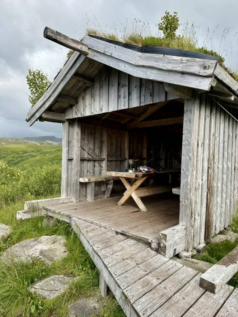
Day 5 camp. I camped next to an open-front wooden shelter with a table and benches in the hills above Lauvdalen. I cooked at the table.
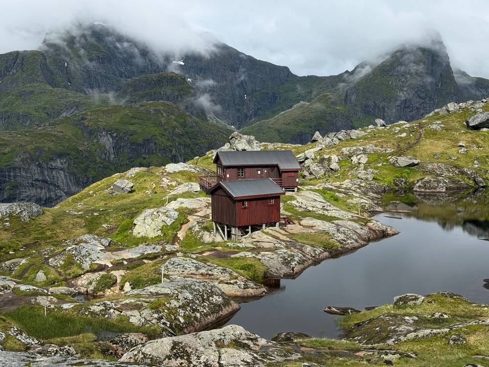
Munkebu (DNT, Lofoten Turlag). The small red hut on Day 2, above Sørvågen. It's unstaffed, sleeps 6, and has no running water or electricity. You book online through DNT, no more than 14 days ahead; at least one person in your group must be a DNT member, and there's no drop-in. Collect and return the key at the Matkroken shop in Sørvågen. Bring a sleeping bag or liner. ut.no/hytte/10947/munkebu. On October 11, 2026 the page still listed it as closed, so check that it's open for your dates. I walked past it; I didn't stay.
Gammen (Vestvågøy). A turf hut in the hills on Day 5, owned by the local hunting and fishing club. Anyone can use it. When I passed, a wood stove was burning and people were inside. The club's rules: leave it clean and ready for the next guests by 10 a.m., give up your place after one night if it's busy, no dogs inside, and the toilet is 100 m southeast by a big rock. The club takes donations for upkeep. njff.no/nordland/vestvagoy/gammen. I stopped in; I didn't sleep there.
I booked my rooms the same day: the Scandic in Leknes after Day 3, a rented room in Leknes after Day 4, and a room in Gravdal for the storm days. Leknes is the one real town in the middle of the route, with supermarkets, cafés and the bus hub. In July, book ahead if you can.
| Where | What I bought | Day |
|---|---|---|
| Bodø: Coop Prix Storgata, Circle K Olav V gate | Groceries, hiking food, stove fuel | Before the ferry |
| Å: the old bakery | Cinnamon roll | 1 |
| Å: Å Rorbuer restaurant | Catch of the day, Hansa beer | 1 |
| Vindstad: café in the old school | Coffee and waffles | 2 |
| Leknes: Circle K, Digg Lofoten, the Scandic | Snacks and dinner | 3 |
| Nusfjord: Restaurant Karoline, the bakery | Lunch and a pastry | 4 |
| Leknes: Extra, Leknes Grillkjøkken, Jordbærpikene, Kringla | Groceries, meals and coffee | 4, rest days |
| Leknes: Huset | Coffee | 5 |
| Svolvær: Deja Brew, Hike And Chill | Coffee, a REAL Turmat freeze-dried meal | 6 |
On the trail I ate packaged meals cooked on a gas stove. Carry at least a day and a half of food at all times: the Vindstad café is seasonal, Days 3 and 5 have nothing after you leave town, and the biggest supermarkets are in Leknes and Svolvær.
Shops on the way: Matkroken in Sørvågen (Moskenesveien 903), Extra Leknes (Storgata 8), Circle K Leknes (Storgata 35).
There are streams and lakes on every mountain section. On Day 2 I filled a soft bottle from a small stream on the climb from Sørvågen. I didn't record every refill, so I can't list reliable sources. Lower down, streams run past farms and villages: treat or filter everything, and fill up before the long road sections and before you camp.
Paid links: I earn a commission if you buy through these links, at no extra cost to you. As an Amazon Associate I earn from qualifying purchases.
Lofoten in July was wet and windy for much of my trip, and I camped four nights. Here's what I carried in 2026, what I'd take now, and what I filmed with.
 Pack: Hyperlite Mountain Gear Southwest 2400 (Hyperlite). It carried my tent and kitchen for four nights of camping.
 Rain jacket: Arc’teryx Beta AR Jacket (Arc’teryx). Much of my trip was wet and windy.
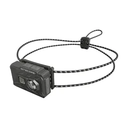 Headlamp: Nitecore NU20 Classic (Amazon)
 Power bank: Nitecore NB20000 (Amazon)
My current kit for the things this route needs.
 Tent: NEMO Hornet Elite OSMO 1P (Amazon). This route needs a tent that handles wind, and stakes that hold in soft ground.
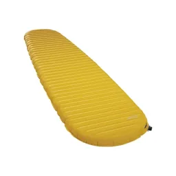 Sleeping pad: Therm-a-Rest NeoAir XLite NXT (Amazon)
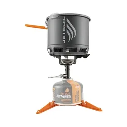 Stove: Jetboil Stash (Amazon). Buy the fuel canister in Bodø; you can't fly with one.
 Spoon: TiTo Long Handle Spork (Amazon). The long handle reaches the bottom of a freeze-dried bag.
 Water filter: Katadyn BeFree AC · 1L (Amazon). There's water almost everywhere, but treat or filter it.
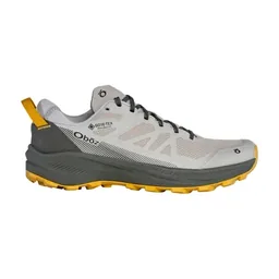 Shoes: Oboz Katabatic LT Low GTX (Amazon). You need grip for wet rock, mud and the fixed ladders on Days 2 and 4.
 Fleece: Senchi Designs A90 Half Zip Hoodie. Warm layers matter, even in July. Similar: PATH Projects Lomond Hoodie (PATH Projects).
 Puffy: Arc’teryx Cerium Hoody (Arc’teryx)
I filmed the whole trip on an iPhone 16. It's fun to just shoot iPhone sometimes. Check the drone rules in Weather and safety before you fly: Lofotodden National Park bans drones.
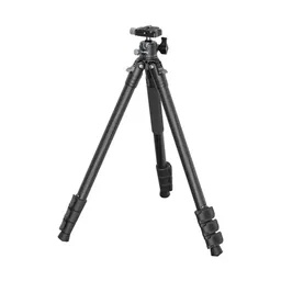 Tripod: SmallRig Carbon Fiber Tripod (Amazon). Mine broke on this trip, and I threw it away at the end of the film. I bought the same one again.
Since September 2026 I film with a smaller setup: the Pocket 4 and the Mic 3 on the trail, and the Mini 5 Pro in the air.
 Camera: DJI Osmo Pocket 4 (Amazon)
 Mic: DJI Mic 3 · 1 TX + 1 RX (Amazon). It pairs with the Pocket 4.
 Drone: DJI Mini 5 Pro (Amazon)
I started from Moskenes Camping a little after 8 a.m. in sunshine. I climbed into the hills above Moskenes, came down to Sørvågen, and walked the road to Å, the village at the very end of the E10.
In Å I got a cinnamon roll at the old bakery, and I spent most of the day in the mountains west of the village, above the lakes and the sea. The rain came in the afternoon. I had dinner at the Å Rorbuer restaurant: the catch of the day and a Hansa beer. I pitched my tent on a grassy, rocky stretch of coast outside the village.
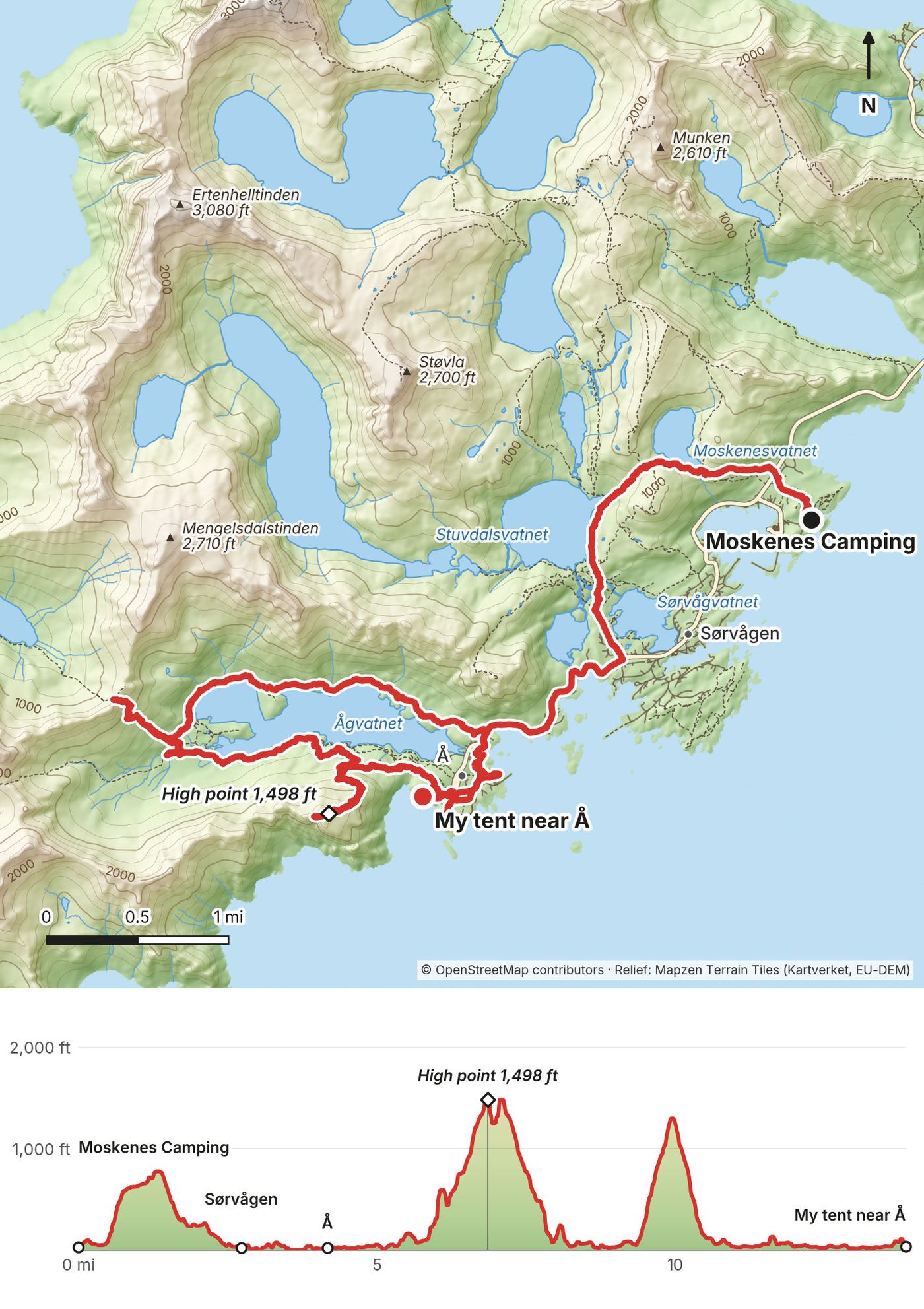
Three climbs. The first goes up into the hills above Moskenes, about 750 ft, and drops to Sørvågen at about 2.7 miles. Then it's a short road walk through Tind to Å, at about 4 miles. West of Å, paths climb into the mountains: my high point was about 1,500 ft at 7 miles on my GPS, and a second climb at about 10 miles tops out around 1,300 ft before you come back down to Å. It's a big first day after a night ferry. You can shorten it by skipping the western mountains and walking straight from Moskenes to Å (about 4 miles).
Food. The old bakery at Å, run by Museum Nord, bakes cinnamon rolls and bread in a stone oven. Å Restaurant is run by Å Rorbuer. Matkroken in Sørvågen (Moskenesveien 903) is the grocery store; it's also where you get the key for the Munkebu hut.
You're never far from the E10 today. Buses (lines 300 and 742) stop at Å, Sørvågen and the Moskenes ferry terminal.
Film, Day 1 · Arrival and midnight camp
I left my camp near Å just after 7:30 a.m. and walked back through Sørvågen. On the climb I filled my water from a small stream. The path took me past the red Munkebu hut and its lakes, then down rocky ground with a ladder to Forsfjorden and along the shore to Vindstad.
In Vindstad I had coffee and waffles at the café in the old school, then waited for the boat. The rain came after a very hard stretch, and that's when I realized parts of this trip were going to be miserable. The boat dropped me at Kjerkfjorden, and at about 6:15 p.m. I started the 2 miles over to the Horseid valley. I pitched my tent in the grass and ate a packaged meal.
A marked path climbs from Sørvågen past Stuvdalsvatnet to the day's high point, about 1,570 ft at 5 miles, then drops a little to the Munkebu hut, at about 5.6 miles and 1,300 ft on my GPS. Beyond the hut the path is rough: rock, steep descents, and a fixed ladder on the way down toward Forsfjorden. After Forsfjorden it follows the shore to Vindstad, at about 10.5 miles. There's no road here; the boat is the only way on.
After the boat, the path from Kjerkfjorden climbs about 650 ft and drops into the Horseid valley. Horseid beach is just beyond.
Water. I filled up from a small stream about 3 miles in, on the climb from Sørvågen (it's a waypoint in the full-route file). Treat it.
No-tent zones. Vindstad and the area around Sørvågvatnet are summer no-tent zones. Horseid is not.
Before Munkebu, walk back down to Sørvågen. After Munkebu, keep going to Vindstad and take the boat to Reine, which is on the E10 (lines 300 and 742). From Horseid the way out is back to Kjerkfjorden for the boat, or on over the pass on Day 3.
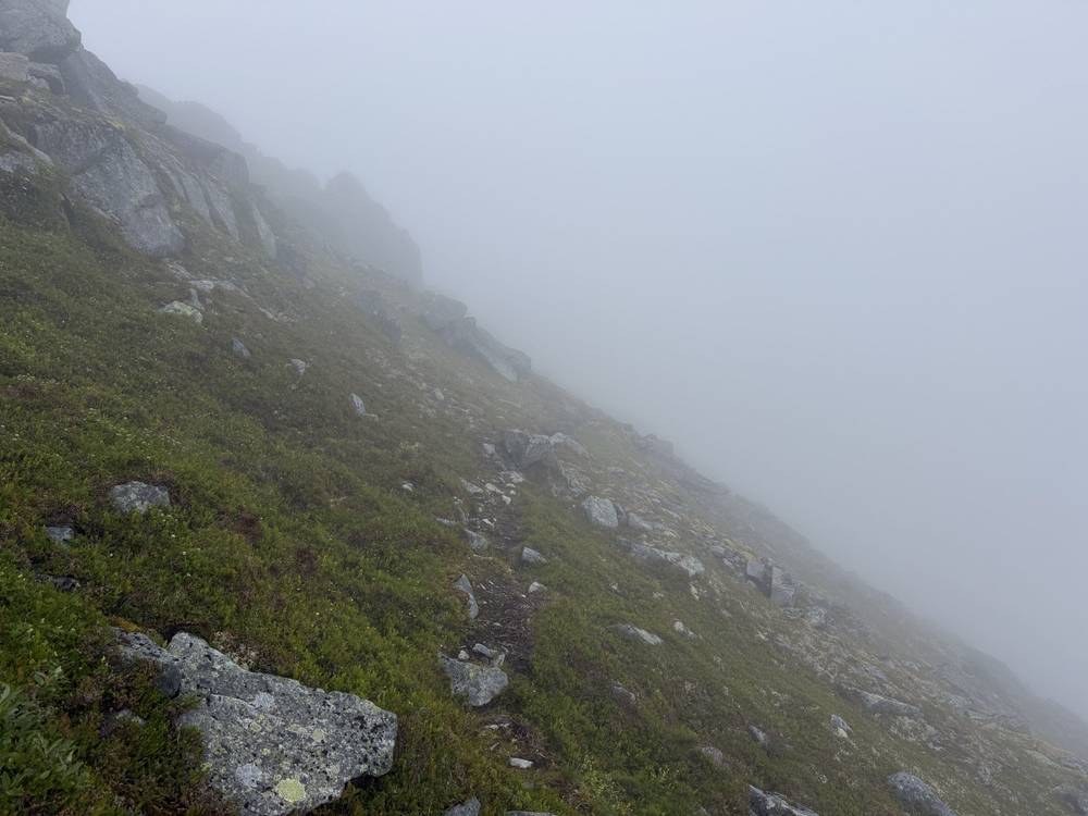
I started at 6:30 a.m. in fog. The climb out of the Horseid valley went over the pass at Fageråskaret, and the descent on the other side was wet and muddy, with thick vegetation and awkward footing. At Selfjorden I reached the road and walked the rest of the way to the Fredvang kryss bus stop on the E10.
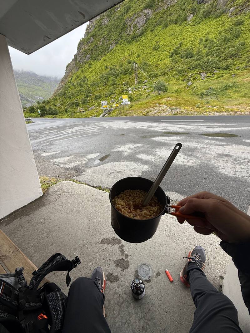
I got there at 12:40, sat in the bus shelter and cooked noodles on my stove while I waited. The bus took me to Leknes, where I booked a room at the Scandic, dried my shoes on paper and ate dinner in town.
The day's only climb comes first, and it's steep. About 0.8 miles from my camp the path climbs about 1,300 ft in less than a mile to the high point, then crosses Fageråskaret, a pass inside the national park, at about 2 miles. The descent toward Selfjorden is the hard part in wet weather: mud, roots and overgrown ground. From Selfjorden, at about 5.5 miles, it's all road: Selfjordveien and Hovdanveien, about 7 miles, to the E10 by the Kubbholmlei bridge.
Before the pass, go back to Kjerkfjorden for the boat. After the pass, head for the road at Selfjorden. The whole second half follows roads to Fredvang kryss, where lines 300 and 742 stop.
After breakfast at the Scandic I took line 742 toward Å and got off at Skjellfjord kryss. The first 6 miles were roads past Skjelfjord to Nesland, then a coast path with a ladder into Nusfjord.
In Nusfjord I had lunch at Restaurant Karoline and a pastry from the bakery. After lunch I went north over the mountains toward Napp. Fog came in on the high section. I reached the Napp bus stop at 8:20 p.m., more than ten hours after I started, and took the bus back to Leknes. This was my longest day.
From Skjellfjord kryss, Skjelfjordveien and Neslandveien run south along the fjord to Nesland, about 6 miles. The coast path from Nesland is low but rough, with a fixed ladder, and reaches Nusfjord at about 10 miles. From Nusfjord you head north to the E10 near Nusfjord kryss, then climb into the mountains toward Napp; my high point was about 2,000 ft at 16 miles. The descent ends at the E10 in Napp, the end of the line on foot: the Nappstraum tunnel is closed to walkers, so take the bus.
Food. Restaurant Karoline takes table bookings on nusfjord.no. In September 2026 it listed lunch 11:00 to 15:00; Landhandleriet Kafé listed 10:00 to 19:00.
This is the day to shorten. From Nusfjord, walk north to the Nusfjord kryss bus stop on the E10 (lines 300, 742 and 771). That makes it about 13.5 miles.
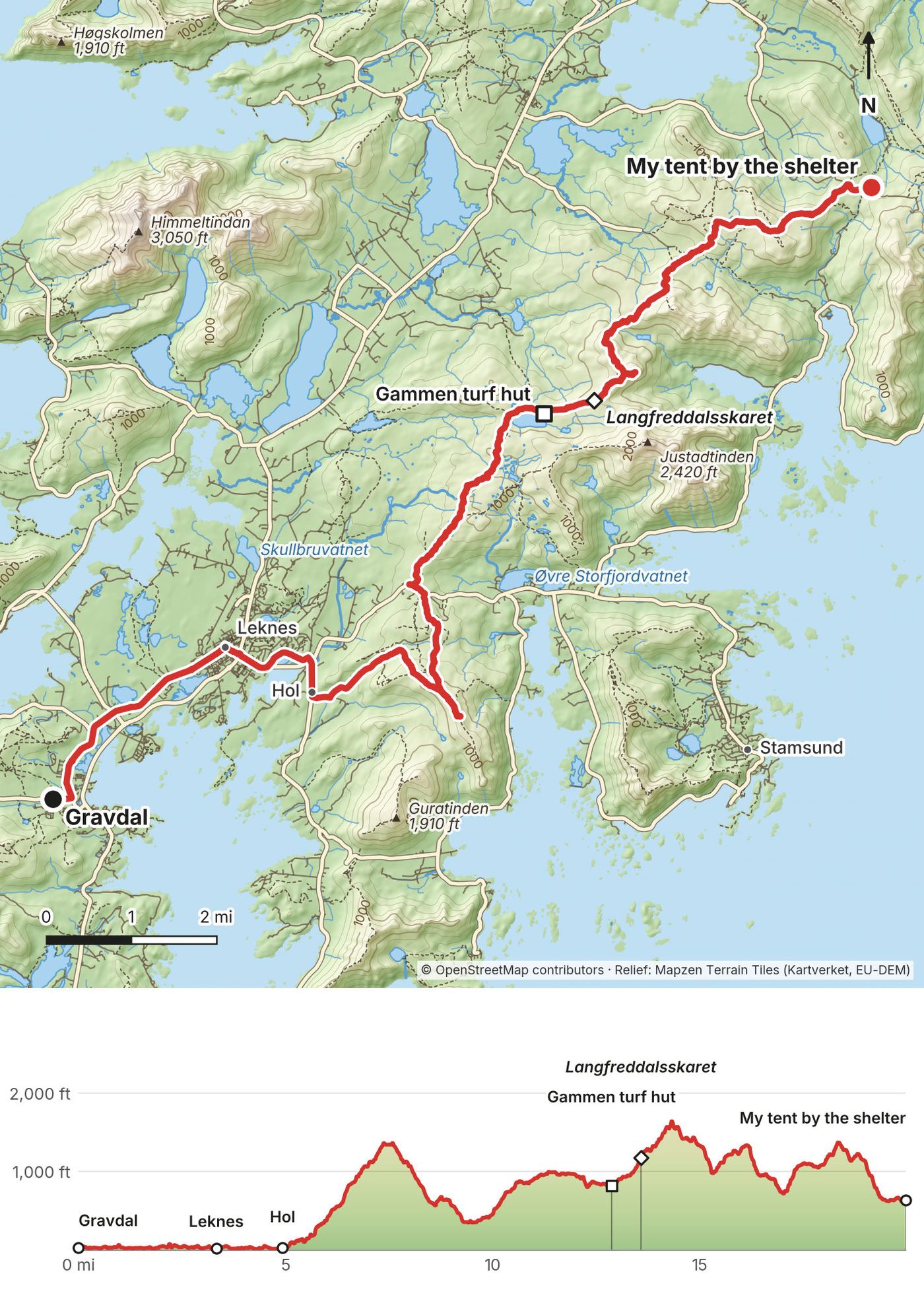
I set off again on July 11 once I had some clear skies. I walked from Gravdal into Leknes for a coffee, then along the roads past Storeidmyra and Hol before climbing into the hills. For part of the climb I walked with another hiker.
At Gammen, the turf hut, a wood stove was burning and people were inside. I kept going over Langfreddalsskaret and across the high, grassy hill country toward Lauvdalen. I camped next to an open-front wooden shelter with a table and benches, and cooked dinner at the table.
The first 5 miles are roads: Gravdal to Leknes (3.3 miles), then east past Storeidmyra to Hol. From Hol the route climbs to about 1,300 ft at 7.5 miles, drops to about 400 to 500 ft around Hagskaret at 9.5 miles, then climbs north into open, grassy hill country. Gammen is at about 12.8 miles. The route crosses Langfreddalsskaret at 13.5 miles, reaches the day's high point at 14.3 miles, and rolls between about 750 and 1,650 ft before dropping to my camp at about 630 ft.
Until Hol you're on roads near Leknes. In the hills, the surest way out is back the way you came, to Hol and Leknes.
It seemed my Lofoten thru-hike was coming to an end, not with a bang but with a whimper: terrible storms and low morale. I packed up, walked down through the vegetation to the valley road, and got off the trail at the E10, the main road through Lofoten, where the buses are easy.
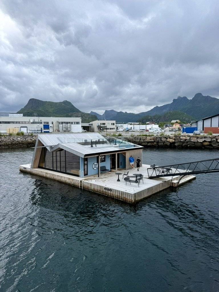
After about an hour of road walking I had about a two-hour wait for the bus to Svolvær. In Svolvær I had coffee at Deja Brew and a pizza, bought a REAL Turmat freeze-dried meal at the Hike And Chill shop, and slept in a camper van.
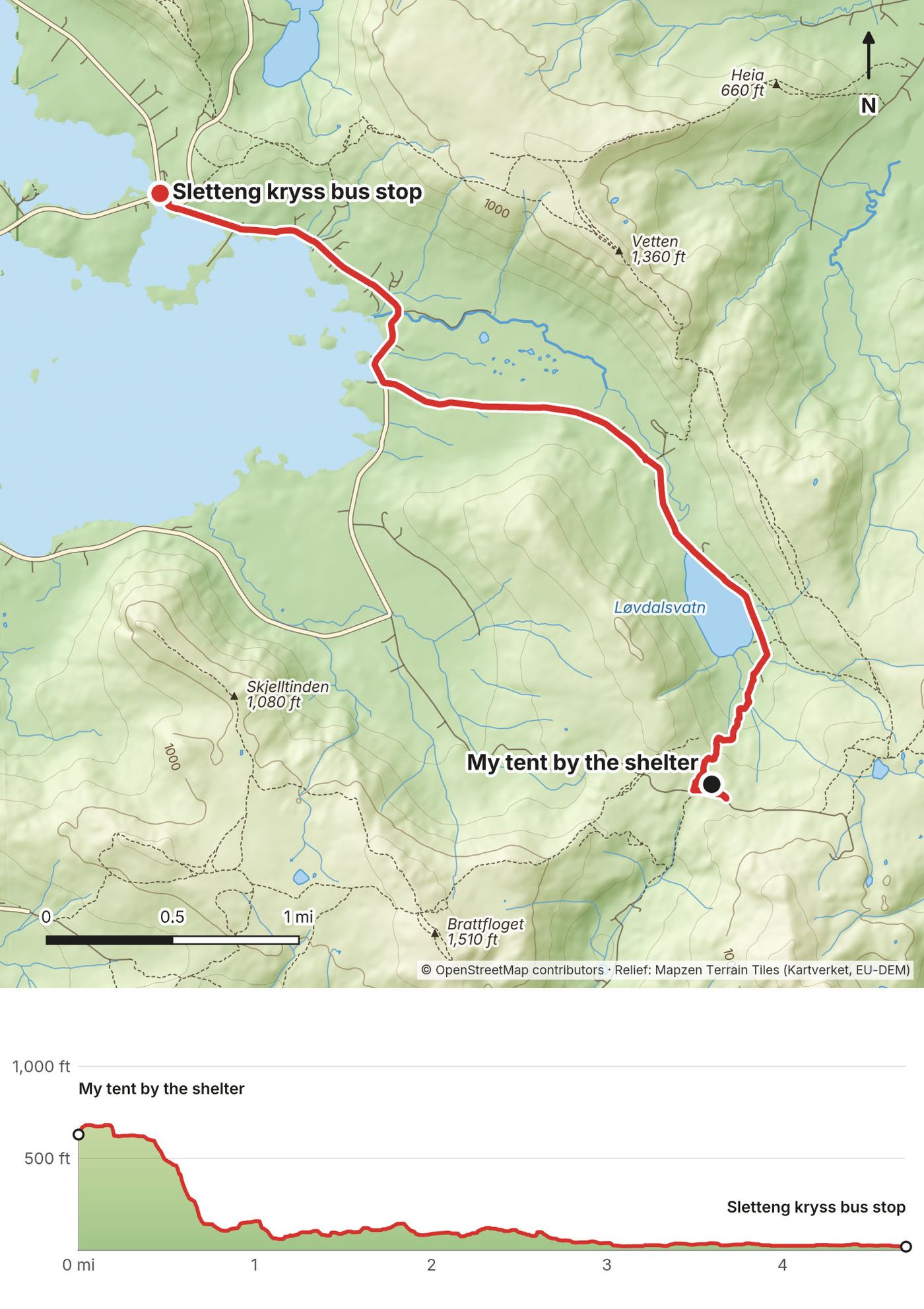
About a mile down from the camp to the valley road, then about 3.5 miles of road walking to Sletteng kryss, where Borgvågveien meets the E10.
You're on a road almost the whole way. Sletteng kryss is the bus stop.
Film, Day 6 · Svolvær · Harstad/Narvik Airport
From Sletteng kryss, lines 300 and 741 go east to Svolvær, and the same lines go west to Leknes. Line 300, the Lofotekspressen, continues past Svolvær to Harstad/Narvik Airport (Evenes) and Narvik: in the autumn 2026 timetable, the 8:30 a.m. bus from Sletteng kryss reached the airport at 12:40 p.m. The Flybuss Lofoten (FB85) also runs between Svolvær and the airport. Leknes and Svolvær have small airports with flights to Bodø. Airport transport: avinor.no.
What I did. After the camper van night in Svolvær I made a rainy trip to Harstad/Narvik Airport, stayed at the Aiden airport hotel (NOK 1,311), and flew out via Oslo on July 14.
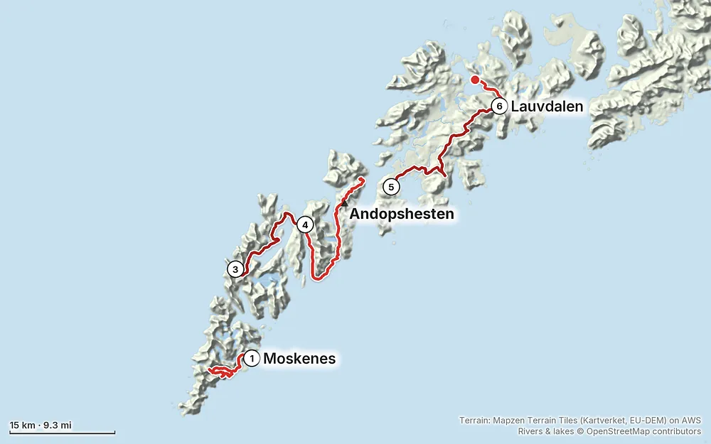
Elevation0–1,978 ft84.7 mi
Terrain: Mapzen Terrain Tiles (Kartverket, EU-DEM) on AWS · Rivers & lakes © OpenStreetMap contributors
Tap a map to open it full size.
No permit. Norway's right to roam lets you camp in open country at least 150 m from houses, up to two nights in one spot. Summer no-tent zones around Reine, Vindstad, Å and other busy spots; no tents at Haukland all year
From the hike's facts; check the official page before you go.
Summer is the season. The midnight sun lasts from about May 27 to July 17 at Moskenes and a couple of days longer farther north (the sun stays above the horizon; mountains can still block it). I walked July 5 to 12.
What I got. Day 1 started in sunshine and turned to rain in the afternoon. Day 2 brought rain after a very hard stretch around the boat; that's when I realized parts of this trip would be miserable. Day 3 was fog and mud. On Day 4 fog came in over the mountains. Then came storms and wind, and I took two rest days in Leknes and Gravdal. I started again on July 11 once the skies cleared, and walked off the trail the next morning.
The honest part. You can do the thru-hike, but unless you have nice weather the whole time, I feel like it's always going to be miserable. Build in spare days and use them. If the forecast is bad, take a bus, sit it out, or do a shorter walk.
Birds. Birds nest in early summer. A couple of days before the end, birds were attacking my head because I was too close to their nest. Give nests a wide berth.
Forecast. Use yr.no, from the Norwegian Meteorological Institute, and check it every evening. It shows official weather warnings too. Look at wind as well as rain for exposed ridges and camp spots.
Emergency numbers. 113 for medical emergencies, 112 for police, 110 for fire. For urgent medical help that isn't an emergency, call 116 117 (the out-of-hours doctor, free). Know your location, or read it off your GPS app.
Where to be careful:
Going solo. I hiked alone, though I walked part of the Day 5 climb with another hiker. Tell someone your plan for each day and when you'll be back in signal. Turn around when fog comes in on a ridge; the views are gone anyway.
The Norwegian Mountain Code. DNT's mountain code is a good one-page list: plan for the weather, be prepared to turn back, and save energy.
Drones. Lofotodden National Park (Days 2 and 3) bans all drone flying without a permit from the park, and motorized traffic below 300 m (1,000 ft). Norway's national drone rules are set by the Civil Aviation Authority: luftfartstilsynet.no.
Is there a Lofoten thru-hike? Not an official one. People link paths, beaches and roads across the islands, and so did I. You can't walk the tunnels or the bridges, so some sections need a bus. My plan was to go south to north from Å toward Svolvær, with buses where needed. I finished near Borg instead, after two storm days and low morale.
How many days do I need? I walked 6 days and took 2 rest days, 8 days from the ferry to the last bus. Days 4 and 5 were about 20 miles each. At a normal pace, plan 8 walking days for the same line, plus a spare day or two for weather. There's a day-by-day plan in A slower version.
Why south to north? People asked. My plan was south to north from the start, from Å toward Svolvær. The ferry from Bodø lands at Moskenes, at the south end, so you start walking where you get off the boat.
When should I go? July was my month. The sun doesn't set from about late May to mid-July, so you can walk whenever the weather allows. The weather is the real issue. I had sun on Day 1, rain that afternoon, fog and mud on Days 3 and 4, then two days of storms. See When to go.
Can I wild camp? Yes, in most places. Norway's right to roam lets you pitch in open country at least 150 m (about 500 ft) from any house or cabin, for up to two nights in one spot. Lofoten adds summer no-tent zones around Reine, Vindstad, Sørvågen, Å and other busy spots, and bans tents at Haukland beach all year. See The camping rules.
Are there huts? A few, but not a hut chain. I walked past the Munkebu hut (book through the Norwegian Trekking Association, DNT) and stopped in at Gammen, a turf hut that anyone can use. Otherwise it's your tent, campsites, or rooms in towns.
Am I fit enough? Try this at home: walk 12 to 14 miles with about 4,000 ft of climbing and your full pack, two days in a row. If you're fine on the second morning, you can do my days in good weather. My longest day was Day 4: 21 miles in 10 hours 15 minutes. In rain and mud, everything takes longer. I fell more on this trip than on any hike before it.
What will it cost? More than you expect. The buses out here are expensive; I've never seen more expensive buses, other than maybe Iceland. Food and hotels are too. I called it "brutally expensive, might have even beat Switzerland on prices." One hotel night in Leknes was $223 and a fish dinner in Å was NOK 597. My flights plus my card spending on the ground came to about $2,700. See What I paid.
Is the water safe? There's water almost everywhere: streams, lakes, rain. I filled up from a small stream on Day 2. Treat or filter it. See Water.
How do the buses work? Buy tickets in the Reis app, or pay by bank card on board for a bit more. Since March 2026 the buses and boats don't take cash. The E10 is the main road through Lofoten, and it's easy to hop on and off: the Lofotekspressen (line 300) and lines 741 and 742 stop at the junctions where I finished my days. Every stop I used is in Ferries and buses.
Is there phone signal? I used a data eSIM. My records don't show where it worked on the trail, so carry offline maps and don't count on signal in the hills.
Cash or cards? Cards. I paid by card, and the buses and boats stopped taking cash in March 2026. Bring a card that works abroad without fees, and a backup.
What did you film on? An iPhone 16. It's fun to just shoot iPhone sometimes.
I walked the six days in this guide. These are other ways to use it, and I didn't do them.
My plan was to go south to north from Å toward Svolvær, walking with ferries and buses between sections, wild camping, and restocking in Ramberg and Leknes, with no rental car. I stopped near Borg. If you have good weather and more days, the same idea continues east across Vestvågøy and Austvågøy toward Svolvær. That part isn't in my GPS files.
Split my long days at the places where a bus or bed exists. Nights 1 and 2 are at Moskenes Camping (or a room in Å), so you don't have to camp in the Å no-tent zone, and nights 4 to 7 are in Leknes.
On the last morning I talked about how I like to hike: if there's a restaurant on the trail, I stop at it, and if there's a guesthouse or hotel at night, I stay there. I'm not going to skip what's available just to suffer.
Looking back, I said a list of about ten peaks and sights, each one done only when the weather window was perfect, would have been more fun, and cheaper too. If your dates are flexible, that's worth considering: base yourself in Leknes, Reine or Svolvær, use the buses in this guide, and pick your days by the forecast. The day maps and GPX files work for that too.
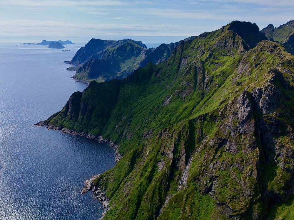
This hike depends on one boat and a handful of buses. Plan them before you plan the walking.
There is no road to Vindstad or Kjerkfjorden. The small passenger boat on the Reinefjord (operated by Charter i Nord for Nordland county) links Reine, Rostad, Kirkefjord (Kjerkfjorden) and Vindstad. In July 2026 I took it from Vindstad to Kjerkfjorden (the stop is called Kirkefjord); my ticket was $5.62.
The direction changes with the timetable. The winter 2026 to 2027 timetable runs Reine, Rostad, Kirkefjord, Vindstad, then Vindstad straight back to Reine. On that pattern you ride from Vindstad to Reine and stay on, or change, for Kirkefjord: in late September 2026 the 10:45 from Vindstad reached Reine at 11:10, and the 14:15 from Reine reached Kirkefjord at 14:40. The summer 2027 timetable isn't out yet (as of October 11, 2026). Look up your date in the Reis app, and plan your walking day around the sailing, not the other way around.
Buy tickets in the Reis app (enter from and to, and it prices the zones), or pay by bank card on board with a surcharge. No cash on board since March 2026. Timetables: reisnordland.no. Journey planner: reise.reisnordland.no.
| Stop | Lines (2026 to 2027) | What I did |
|---|---|---|
| Moskenes ferjekai | 300, 742, 772 | Ferry arrival |
| Fredvang kryss | 300, 742, 770, 771 | Bus to Leknes after Day 3 ($8.82) |
| Skjellfjord kryss | 300, 742, 770 | Bus from Leknes to start Day 4 (line 742 toward Å) |
| Nusfjord kryss | 300, 742, 771 | Bail-out on Day 4 |
| Napp | 300, 742, 771 | Bus back to Leknes after Day 4 |
| Leknes sentrum | 300, 741, 742 and local lines | Town stop for my rooms |
| Sletteng kryss | 300, 741, 761, 764 | Bus to Svolvær after Day 6 |
Line 300 is the Lofotekspressen (Å, Leknes, Svolvær, Narvik). Line 742 runs Leknes to Å, and line 741 runs Leknes to Svolvær. Lines 761, 764, 770 and 771 are school routes that run on school days, so don't plan on them in summer.
The E10 tunnel between Flakstadøya and Vestvågøy (Nappstraumtunnelen) is being rebuilt. The roads authority says it's closed to everyone on foot or bike for the whole construction period, which is planned to finish in December 2027. Walkers must take the bus or another ride. Traffic goes through behind a pilot car, once or twice an hour by day and only at 2 a.m. between 11 p.m. and 6 a.m., so buses run to that schedule. Current notice: vegvesen.no. That's why Day 4 ends at the Napp bus stop.
On July 9 and 10 storms and wind rolled through, so I took two zeros. After Day 4 I slept in a rented room in Leknes, then booked a room in Gravdal on July 9, the same day, and started Day 5 from there. I bought groceries at Extra Leknes and went to the cafés in town (Jordbærpikene and Kringla). My tripod broke around this time, which left me with only a short one.
Leknes is the place to reset: Extra (Storgata 8) and Circle K (Storgata 35) for food, cafés, and the bus hub. Gravdal is the village just southwest of Leknes, about 3 miles by road. Restock here for Day 5; there's nothing to buy after you leave the roads.
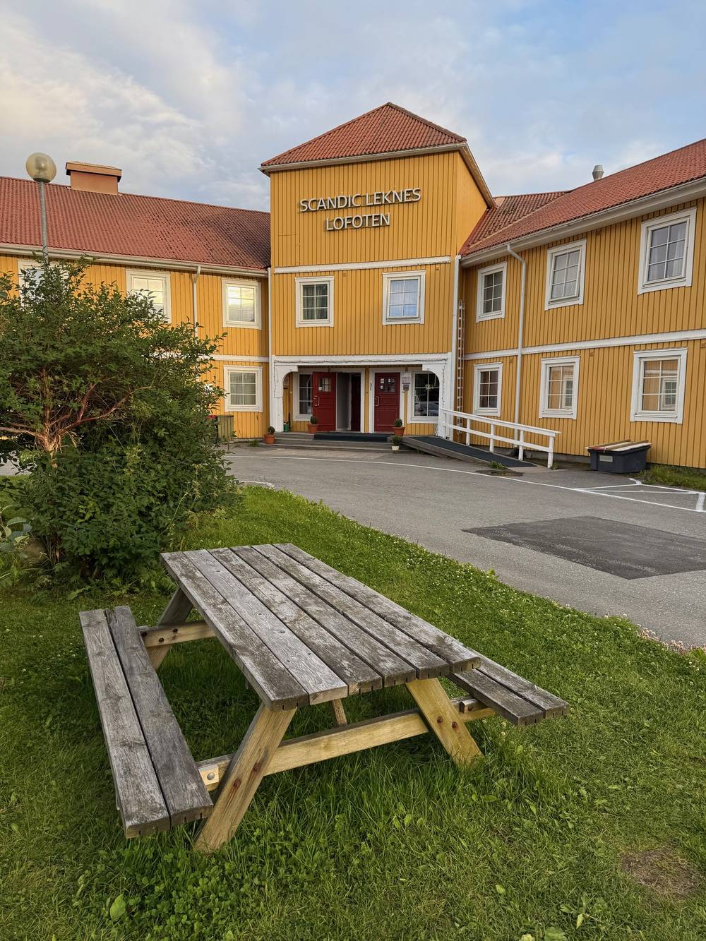
These change every year. Everything else in this guide stays the same.
Boats and buses
Camping and huts
Prices, conditions and your stuff
The film is at the top of this page.
Planning questions about Lofoten Islands, answered only from this page's facts, the creators' versions and hikers' public tracks, with where each answer comes from. When the data doesn't say, the answer says "not given".
From hikers
Sign in to comment. Free; your hikes stay private unless you share them.
Some lodging links earn me a small commission at no cost to you.
Something wrong or missing on this page? Send feedback.