Follow the Hiker
Find my next hikeGearSavedKraig Adams
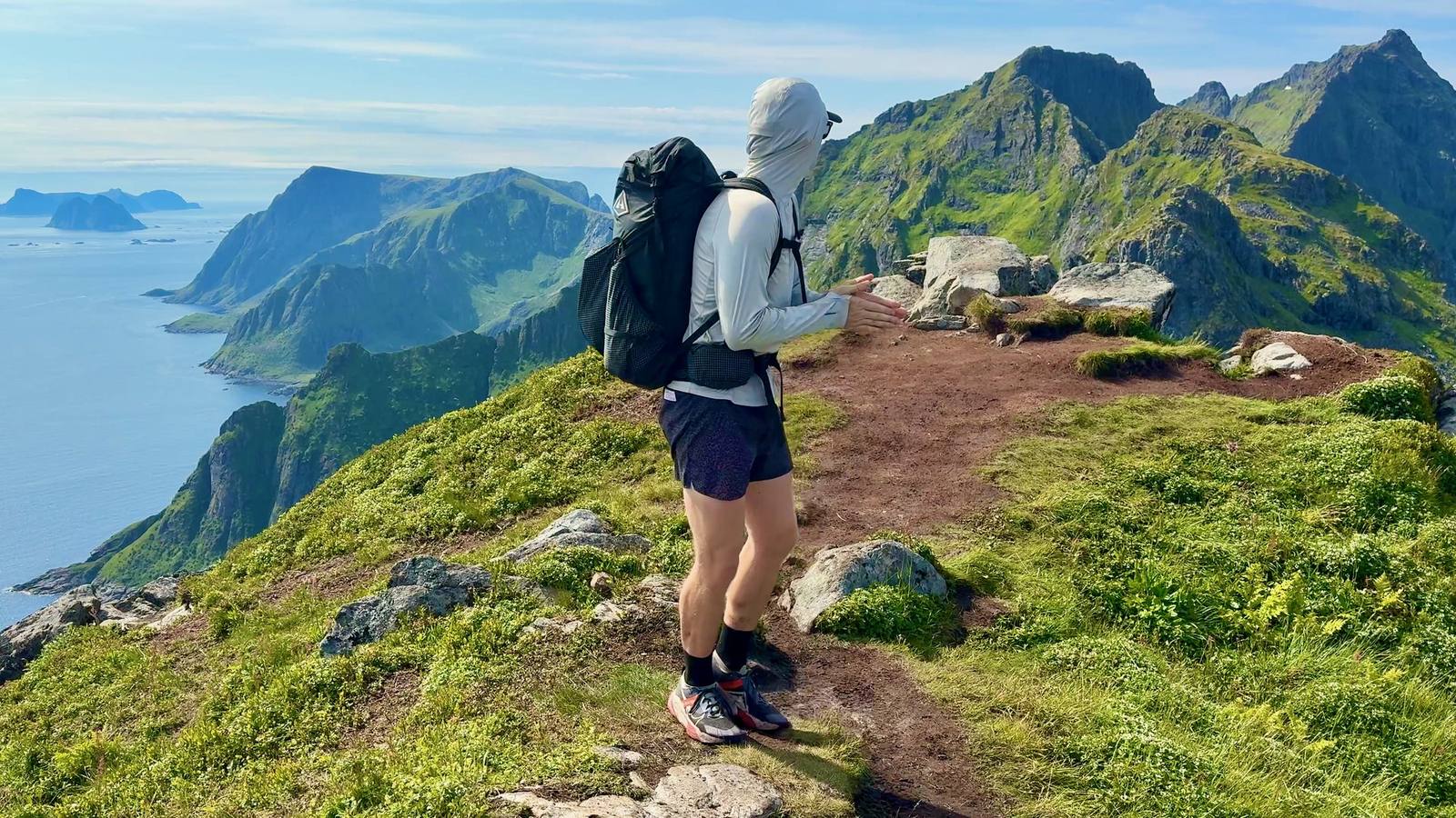
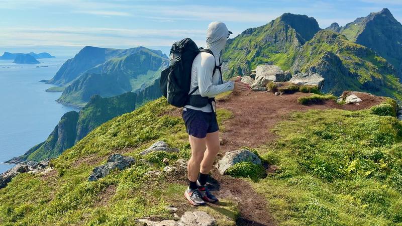
Me above Å on Day 1.

Europe · Norway

Lofoten Islands

Lofoten Islands, Norway

Distance
84.8 mi136.4 km
Days
6 days6 walking days
Elevation gain
17,858 ft5,443 m
High point
1,985 ft605 m
Season
Summer
Lodging
Tent
Plan this hike

Hikes / Europe / Lofoten Islands

In July 2026 I spent six days hiking alone across the Lofoten Islands in Norway. I got off the overnight ferry at Moskenes, walked about 85 miles with a tent, and finished at a bus stop on the E10 near Borg, on Vestvågøy. Along the way I took a boat across the Reinefjord, rode a lot of buses, slept in a hotel and two rented rooms, and sat out two days of storms.

Kraig Adams

Effort at this pace: Very hard · about 14 mi (23 km) and 2,976 ft (907 m) of climbing a day over 6 days, up to 1,985 ft (605 m). Our grade for the days given, worked out from distance, climbing and altitude a day; it isn't the trail's usual difficulty rating (under Basics) and doesn't rate exposure, terrain or weather.

Where these numbers come from

From Kraig Adams's GPS recording and guide.

Plan this hikeSave this hike

Plan: dates, gear, deadlines and stays in a private link. Save: keeps it on your account.

From Kraig Adams's GPS

The route, day by day

Relief map of the Lofoten route: 5 days drawn in red with numbered day starts, labelled Moskenes, Andopshesten and Lauvdalen.

Elevation0–1,978 ft84.7 mi

From Kraig Adams's GPS. Terrain: Mapzen Terrain Tiles (Kartverket, EU-DEM) on AWS · Rivers & lakes © OpenStreetMap contributors

Tap a day for his map of it

The film

Watch it first

Hiking 85 Miles Alone in the Lofoten Islands

Kraig Adams · Jul 5–12, 2026 · Solo

Me above Å on Day 1.
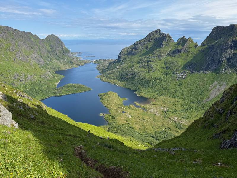
Lakes in the hills west of Å on Day 1.
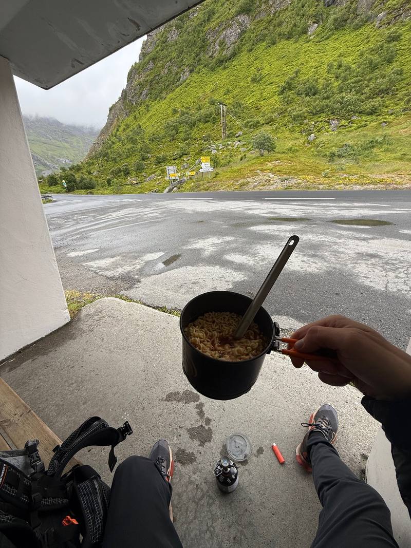
The view from the Fredvang kryss bus shelter, where Day 3 ends.
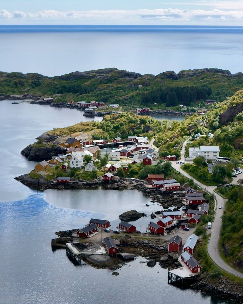
Nusfjord from above on Day 4.
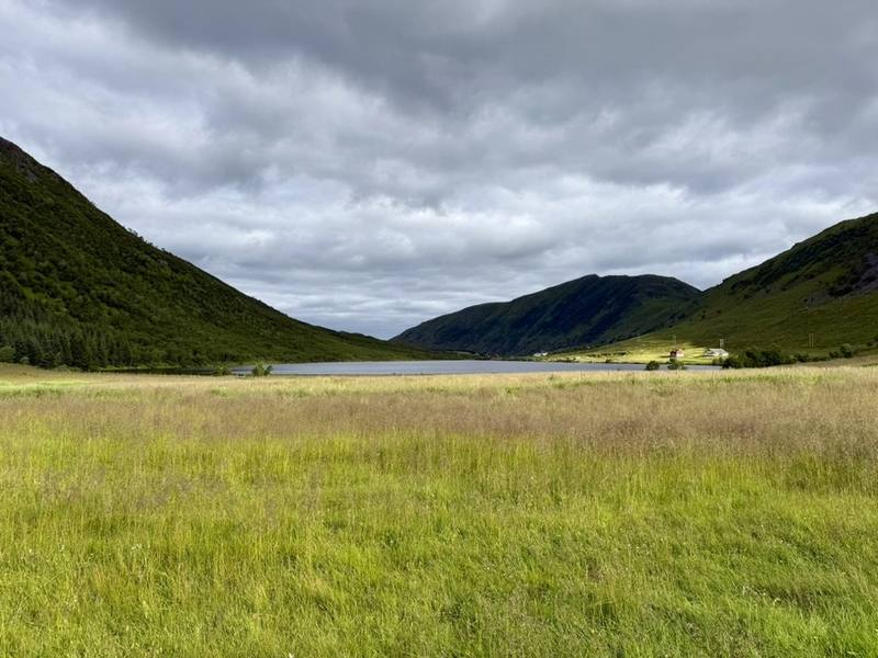
Lauvdalen on the last morning.

Before you go

The basics

Start
Moskenes ferry terminal (ferry from Bodø)
Finish
Sletteng kryss bus stop on the E10, near Borg, Vestvågøy
Usual difficulty
Tough: long days, mud, some road walking, and weather that decides everything
Best time
Summer. I went in July; the midnight sun lasts until about July 17
Permits
No permit. Norway's right to roam lets you camp in open country at least 150 m from houses, up to two nights in one spot. Summer no-tent zones around Reine, Vindstad, Å and other busy spots; no tents at Haukland all year
Getting there
What I did. I flew from New York to Bodø via Helsinki on Finnair ($898.60, booked in April). In Bodø I bought groceries at Coop Prix on Storgata, and hiking food and a stove fuel canister at the Circle K on Olav V gate. I took the 10 p.m. ferry and got to Moskenes at 1:30 a.m., then walked to Moskenes Camping and pitched my tent under the midnight sun.
Nearest airport: Bodø (then the ferry); home from Harstad/Narvik (Evenes)
Lodging
Tent

From Kraig Adams's guide

Costs and gear

What it cost

buses are priced by zone, and fares add up

His costs, line by line

What Kraig carried

Hyperlite Mountain Gear Southwest 2400 · Arc’teryx Beta AR Jacket · Nitecore NB20000 · Nitecore NU20 Classic · my tent, sleeping bag and pad · a gas stove with a canister bought in Bodø, a pot with a long spoon, a soft water bottle · NEMO Hornet Elite OSMO 1P · Therm-a-Rest NeoAir XLite NXT and 14 more.

The full gear list

From Kraig Adams's guide

Safety

Rescue numbers

  • Emergency numbers. 113 for medical emergencies, 112 for police, 110 for fire. For urgent medical help that isn't an emergency, call 116 117 (the out-of-hours doctor, free). Know your location, or read it off your GPS app.

Phone signal

  • I used a data eSIM.
  • My records don't show where it worked on the trail, so carry offline maps and don't count on signal in the hills.

Insurance

  • A GHIC or EHIC is not an alternative to travel insurance.
  • Get travel insurance that suits your trip, including the hiking you plan.

Bail-out points

  • Day 1, Moskenes to Å. You're never far from the E10 today. Buses (lines 300 and 742) stop at Å, Sørvågen and the Moskenes ferry terminal.
  • Day 2, Å to Horseid. Before Munkebu, walk back down to Sørvågen. After Munkebu, keep going to Vindstad and take the boat to Reine, which is on the E10 (lines 300 and 742). From Horseid the way out is back to Kjerkfjorden for the boat, or on over the pass on Day 3.
  • Day 3, Horseid to Fredvang kryss. Before the pass, go back to Kjerkfjorden for the boat. After the pass, head for the road at Selfjorden. The whole second half follows roads to Fredvang kryss, where lines 300 and 742 stop.
  • Day 4, Skjellfjord kryss to Napp. This is the day to shorten. From Nusfjord, walk north to the Nusfjord kryss bus stop on the E10 (lines 300, 742 and 771). That makes it about 13.5 miles.
  • Day 5, Gravdal to Lauvdalen. Until Hol you're on roads near Leknes. In the hills, the surest way out is back the way you came, to Hol and Leknes.
  • Day 6, Lauvdalen to Sletteng kryss. You're on a road almost the whole way. Sletteng kryss is the bus stop.

From Kraig Adams's guide. For planning, not navigation: check before you go.

Their films and versions

Creators who've done it

1 creator so far: Kraig, 6 days, about $2,700, tent.

Walked Lofoten Islands? Be the first to share your track: log it with your GPX.

Your time

Sign in and log a few hikes to see how long this one would take you.

Typical: 6 walking days (the hike's facts).

Ask this hike

Planning questions about Lofoten Islands, answered only from this page's facts, the creators' versions and hikers' public tracks, with where each answer comes from. When the data doesn't say, the answer says "not given".

    From hikers

    Comments

    Sign in to comment. Free; your hikes stay private unless you share them.

    Answered from the data

    Questions people ask

    How many days do you need for Lofoten Islands?

    I walked 6 days and took 2 rest days for storms, 8 days from the ferry to the last bus. At a normal pace, plan 8 walking days for the same line, plus a spare day or two for weather.

    From Kraig Adams's trip and guide.

    How much does Lofoten Islands cost?

    More than you expect. The buses out here are expensive; I've never seen more expensive buses, other than maybe Iceland. Food and hotels are too. I called it "brutally expensive, might have even beat Switzerland on prices." One hotel night in Leknes was $223 and a fish dinner in Å was NOK 597. My flights plus my card spending on the ground came to about $2,700. See what I paid.

    From Kraig Adams's trip and guide.

    When is the best time to hike Lofoten Islands?

    Summer. I went July 5 to 12, 2026. The midnight sun lasts from about May 27 to July 17 at Moskenes, but the weather decides everything, so build in spare days.

    From Kraig Adams's trip and guide.

    Where do you sleep hiking across Lofoten?

    Mostly in a tent. Norway's right to roam lets you camp at least 150 m from any house or cabin, but Lofoten has summer no-tent zones around Reine, Vindstad, Å and other busy spots. I also used Moskenes Camping and rooms in Leknes and Gravdal.

    From Kraig Adams's trip and guide.

    How do you get to the start of the Lofoten hike?

    I flew to Bodø and took the ferry to Moskenes, which was free for foot passengers in 2026. Buy stove fuel in Bodø, since you can't fly with gas canisters.

    From Kraig Adams's trip and guide.

    How do the buses work in Lofoten?

    Buy tickets in the Reis app or pay by bank card on board for a bit more; the buses and boats haven't taken cash since March 2026. Line 300, the Lofotekspressen, runs along the E10 and on to Harstad/Narvik Airport.

    From Kraig Adams's trip and guide.

    Plan this hikeThe route