
Content made there

Photos
Hikes / Southern Iceland: the Laugavegur and a group trip / Kraig Adams's version
Europe · Iceland
Jul 2022 · 12 days, 3 on the Laugavegur · about 59 miles on foot · Solo · Huts and tent

In July 2022 I hiked alone across the highlands of southern Iceland in three days. I started at Landmannalaugar, walked the Laugavegur through the coloured rhyolite hills, the snowfields and the black-sand deserts to Þórsmörk, and then crossed the Fimmvörðuháls pass between two glaciers and followed the Skógá down past waterfall after waterfall to Skógafoss. Technically it's two hikes put together. It came to about 59 miles by my GPS. I camped at the huts and took the highland bus from Reykjavík.
Most people walk the Laugavegur in four days, sleeping in the huts, and add Fimmvörðuháls as a fifth. I did it fast, about 20 miles a day, with my own tent and stove. This guide has my three days, what I paid, and everything you need to plan your own trip at your own pace, with a hut or a campsite every night.
| Quick facts | |
|---|---|
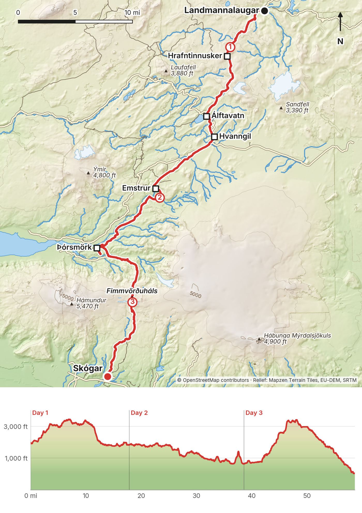
| Distance | 58.7 miles (94.5 km) by my GPS over 3 days, including a side trip up Valahnúkur |
| Climbing | about 8,880 ft (2,707 m) up and 10,780 ft (3,285 m) down |
| Days | 3 walking days, one way |
| Start | Landmannalaugar, about 4.5 hours by highland bus from Reykjavík |
| Finish | Skógafoss, in the village of Skógar on the Ring Road |
| Nights on the way | 2, in my tent at the huts: Hvanngil and the Volcano Huts in Þórsmörk |
| High point | 3,440 ft (1,049 m) near Hrafntinnusker on Day 1; 3,420 ft (1,041 m) on the Fimmvörðuháls pass on Day 3 |
| When | Late June to early September; the huts are staffed then |
| Official lengths | FÍ: the Laugavegur 54 to 55 km (about 34 miles); Fimmvörðuháls about 25 km |
| Trip date | July 12 to 14, 2022, solo |
| Day | Route | Miles (km) | Up / down (ft) | Sleep |
|---|---|---|---|---|
| 1 | Landmannalaugar to Hvanngil | 17.7 (28.5) | 2,940 / 3,040 | Hvanngil campsite |
| 2 | Hvanngil to Þórsmörk | 20.8 (33.4) | 2,580 / 3,770 | Volcano Huts campsite, Húsadalur |
| 3 | Þórsmörk to Skógafoss | 20.2 (32.5) | 3,360 / 3,970 | A hotel in Skógar |
My Iceland trip began with an overnight flight from Denver to Reykjavík. I hung out in Reykjavík after the red-eye, got a hotel, and gathered supplies and snacks. I bought a hiking pass from Reykjavik Excursions, which is like a round-trip bus ticket from the trailheads, for $107. They've got a whole schedule, so you can pick and choose where you go from. I think it's the cheapest and easiest option. Before I got on the bus I bought my cooking fuel at the gas station right next to the BSÍ bus terminal. The bus left at 7 a.m. and took about three hours up into the highlands. My recording starts at the Landmannalaugar hut at 10:48 a.m.
Reykjavik Excursions Highland Bus (sold on icelandia.com, 2026 timetable). To Landmannalaugar: BSÍ 7:00, arriving 11:30, June 13 to September 20. Back from Skógar: 10:15, with a long wait at Hvolsvöllur (11:15 to 17:40), reaching BSÍ at 19:30. Other lines run to Þórsmörk (Húsadalur, Langidalur and Básar) from June 1. "From" prices in 2026: 12,999 ISK to Landmannalaugar, 10,499 ISK to Þórsmörk, 8,999 ISK to Skógar, one way. The round-trip hiking pass I used wasn't listed in September 2026.
Trex (trex.is) also runs to Landmannalaugar and Þórsmörk from Reykjavík City Hall (not BSÍ), with a hikers' bus pass. In September 2026 its site already showed 2027 dates (Landmannalaugar June 18 to September 3, 2027) and two different pass prices, so check it.
Strætó, the public bus (route 52 since January 2026). Summer 2026: Mjódd in Reykjavík 14:21 to Skógar 16:30; back from Skógar 17:45, reaching Mjódd 19:59. The winter timetable from August 24, 2026 is a few minutes different (Mjódd 14:18; Skógar 17:55 to Mjódd 20:08), so check the 2027 summer times. It runs only on Tuesdays, Thursdays, Fridays and Sundays: no bus on Mondays, Wednesdays or Saturdays. If you finish at Skógar on a Saturday, there's no public bus that evening and the Reykjavik Excursions bus has left at 10:15, so plan a night in Skógar. 7,200 ISK Mjódd to Skógar, 4,800 ISK to Hvolsvöllur; pay on board by card or cash.
By road. Reykjavík to Landmannalaugar is 182 km, the last 52 on gravel mountain roads open only part of the summer; Reykjavík to Skógar is 154 km, all paved. Parking at Landmannalaugar costs 1,500 ISK and must be booked ahead for arrivals between 9:00 and 16:00 from June 20 to September 13 (2026).
My records for this trip are what I said in the film, two receipts I photographed, and one menu board. Prices are 2022.
| Item | What I paid |
|---|---|
| Reykjavik Excursions hiking pass, round-trip bus from the trailheads | $107 (its page in my film shows 14,599 ISK) |
| Cooking fuel, gas station by BSÍ | Not in my records |
| Late lunch at Álftavatn: soup, coffee, bread | $22 |
| Night 1, tent at Hvanngil | Six or seven dollars, I think |
| Lunch at Emstrur | My own ramen |
| Night 2, tent at the Volcano Huts, with the dinner and breakfast buffets | Not in my records |
| Water at Baldvinsskáli | Three or four dollars a liter, I think |
| Dinner at Hótel Skógafoss | 6,500 ISK |
| Night 3, a hotel in Skógar | Not in my records |
| Public bus, Hvolsvöllur to Reykjavík | 3,920 ISK |
Camping at the FÍ huts costs 3,600 ISK a person a night in 2027, plus 1,100 ISK for a shower. A hut bed is 18,000 ISK, so four hut nights in the 5-day version (Hrafntinnusker to Þórsmörk) come to 72,000 ISK, about $600. The meal and bus prices that follow are 2026's. A dinner buffet at the Volcano Huts is 5,500 ISK and breakfast 3,200 ISK. The one-way highland bus is from 12,999 ISK to Landmannalaugar and from 8,999 ISK back from Skógar. At the Central Bank's rate in September 2026, 1 US dollar was about 120 ISK.
Camp only at the huts. The Laugavegur from Landmannalaugar crosses the Fjallabak nature reserve, where overnight stays are only allowed in huts and at designated campsites, and FÍ asks everyone to camp only in the campgrounds. SafeTravel says the same for the whole Laugavegur: wild camping isn't allowed there. On Fimmvörðuháls there's no campsite; FÍ says camping by Baldvinsskáli is possible but challenging and not an option in bad weather.
Campers pay per person and use the campsite's toilets, water and outdoor tables. FÍ campers don't get the hut kitchens; there are cooking shelters or tents for campers at Landmannalaugar, Hrafntinnusker, Emstrur and Þórsmörk. Carry your trash out from Hrafntinnusker, Emstrur and Baldvinsskáli.
FÍ (Ferðafélag Íslands, the Iceland Touring Association) runs the huts from Landmannalaugar to Þórsmörk and Baldvinsskáli on the pass. 2027 prices, valid May 1, 2027 to April 30, 2028: a bed 18,000 ISK a night (9,000 for FÍ members), camping 3,600 ISK a person (1,800), a shower 1,100 ISK (800). The 2026 prices (17,000 ISK a bed, 3,400 ISK camping) apply until April 30, 2027. Book and pay online at fi.is. FÍ only books the huts north to south, Emstrur only as part of a package, and it refunds 75% up to 56 days ahead and nothing within 20 days. All the huts are heated; there's no electricity for charging and no Wi-Fi. The huts take cash and cards, but the card machines can fail when the connection drops, so carry some cash.
| Hut | Beds | Height (FÍ) | Warden (summer) | Notes |
|---|---|---|---|---|
| Landmannalaugar | 78 | 550 m | 860 3335 | Hot spring, showers, big campsite |
| Hrafntinnusker (Höskuldsskáli) | 52 | 1,100 m | 784 6608 | No showers, latrines only; camping on sand, gravel or snow |
| Álftavatn | 72 | 550 m | 823 4008 | Showers; phone connection; a small restaurant (see below) |
| Hvanngil | 60 | 550 m | 499 0675 | Showers; two camping areas |
| Emstrur (Botnar) | 60 | 465 m | 823 5008 | Showers; phone signal on the hill above |
| Þórsmörk, Langidalur (Skagfjörðsskáli) | 73 (old hut) | 200 m | 893 1191 | Being rebuilt; new hut due June 17, 2027 |
The heights are FÍ's official figures; my GPS puts Hrafntinnusker at about 1,025 m (see Day 1). FÍ's average open season is about June 25 to mid September for the high huts; Þórsmörk opens in May. Before June 20 or after September 15 there may be no running water and only dry toilets. FÍ's office: +354 568 2533, fi@fi.is.
Langidalur in 2027. FÍ planned to start rebuilding the Skagfjörðsskáli hut in Langidalur on September 12, 2026, with the new hut to open on June 17, 2027. The 73 beds and the small shop FÍ lists are the old hut. Before you book, ask FÍ whether beds and the campsite are open on your dates, especially before mid June 2027.
Volcano Huts, Húsadalur (end of my Day 2). Where I camped on night 2. It's a private place with a restaurant, a campsite, mountain huts, cabins and glamping tents, a sauna and a small geothermal pool. Very nice, lots of food: I had the dinner and breakfast buffets and they were fantastic. It's busy. Open April 1 to October 31. You don't book the campsite unless you're a group of ten or more; you pay at reception, and the price includes showers, the sauna and the pool. Its website doesn't publish the camping price. Published restaurant prices: dinner buffet 5,500 ISK (18:00 to 21:00), breakfast 3,200 ISK (08:00 to 10:00), soup lunch buffet 3,250 ISK. +354 419 4000, volcanotrails.com.
Básar (Útivist, across the Krossá from Langidalur, at the foot of the Fimmvörðuháls trail). 2026: hut bed 16,800 ISK, camping 2,500 ISK plus 400 ISK lodging tax, a shower 1,000 ISK. Camping June to September, no booking needed. Warden +354 563 0114, utivist.is.
Skógar has hotels, guesthouses and a campsite by the falls. I had dinner at Hótel Skógafoss (+354 487 8780, hotelskogafoss.is), right at the foot of the waterfall, then walked over to another hotel in the village for the night. The campsite's operator and 2026 prices weren't on any official site I could find in September 2026.
What I ate. I bought snacks and supplies in Reykjavík and cooking fuel at the gas station next to the BSÍ bus terminal, and carried a small gas stove. Day 1: a late lunch at Álftavatn (soup, coffee and bread), then my own dinner at Hvanngil. Day 2: ramen I cooked at Emstrur, then the dinner buffet at the Volcano Huts. Day 3: the breakfast buffet at the Volcano Huts, a ramen snack at Baldvinsskáli, and dinner at Hótel Skógafoss.
Buying food. All the FÍ huts sell some snacks, at least chocolate. At Álftavatn a small restaurant serves soup at lunch and a dinner (its 2027 dates weren't announced in September 2026). The Volcano Huts in Þórsmörk have a restaurant. The old Langidalur hut had a small shop; ask FÍ whether the new one does. Landmannalaugar's shop in old buses wasn't online in September 2026, so don't count on it. On Fimmvörðuháls there's nothing to buy.
Water. FÍ says the tap water at all its Laugavegur huts is safe to drink. There's no water on the whole Fimmvörðuháls pass: Fimmvörðuskáli has only rainwater and snowmelt, and Baldvinsskáli none. On the south side the Skógá bridge, about 8 km up from Skógafoss, is a good place to fill up. Leave Þórsmörk with enough for the climb.
Paid links: I earn a commission if you buy through these links, at no extra cost to you. As an Amazon Associate I earn from qualifying purchases.
I camped at the huts and cooked some of my own meals in July 2022. I didn't list my kit for this trip, and the gear list I linked in the film isn't in the description any more, so here's what the film and my photos show, what I'd take now, and what I filmed with.
Brands only where the film names them, so most of these have no link.
For the camping version or the huts, from my current kit.
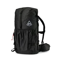 Pack: Hyperlite Mountain Gear Southwest 2400 (Hyperlite). Room for a tent and food between the huts.
 Tent: NEMO Hornet Elite OSMO 1P (Amazon). Camp only at the huts and designated campsites.
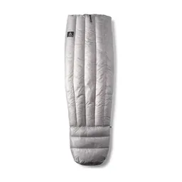 Sleeping bag: Hyperlite Mountain Gear 20° Quilt (Hyperlite). You need one for the huts or your tent.
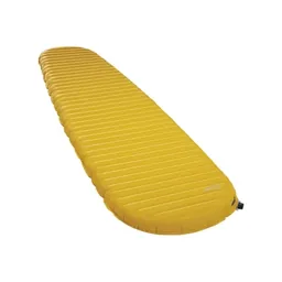 Sleeping pad: Therm-a-Rest NeoAir XLite NXT (Amazon)
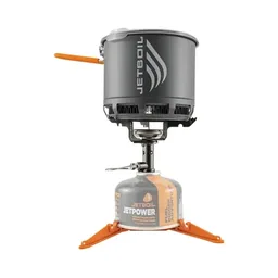 Stove: Jetboil Stash (Amazon). I bought fuel at the gas station next to the BSÍ bus terminal.
 Rain shell: Arc’teryx Beta AR Jacket (Arc’teryx). Wind, rain and hail are normal, even in July.
 Puffy: Arc’teryx Cerium Hoody (Arc’teryx). The wind can be relentless, mixed with rain and sometimes snow.
 Beanie: PATH Projects Hoyt Merino Beanie (PATH Projects)
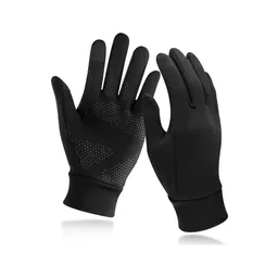 Gloves: Unigear Touchscreen Liner Gloves (Amazon)
 Poles: Black Diamond Alpine Carbon Z Poles (Amazon). For the river crossings and the snow.
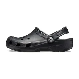 Camp shoes: Crocs Classic Clog (Amazon). For the huts and camp.
 Water: Katadyn BeFree AC · 1L (Amazon). Tap water at the FÍ huts is safe, but there's none on the Fimmvörðuháls pass: carry about 2 liters.
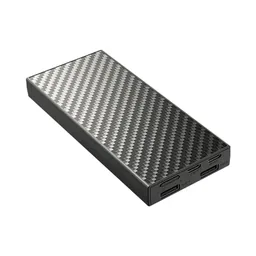 Power bank: Nitecore NB20000 (Amazon). There's no charging at the FÍ huts.
What I filmed this trip with in 2022. My setup is much smaller now (below). Read the drone rules in Weather and safety before you bring one: they're banned in summer around Landmannalaugar and all year at Skógafoss.
Since September 2026 I film with a smaller setup: the Pocket 4 and the Mic 3 on the trail, and the Mini 5 Pro in the air.
 Camera: DJI Osmo Pocket 4 (Amazon)
 Mic: DJI Mic 3 · 1 TX + 1 RX (Amazon). It pairs with the Pocket 4.
 Drone: DJI Mini 5 Pro (Amazon)
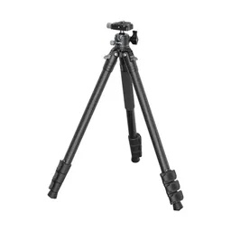 Tripod: SmallRig Carbon Fiber Tripod (Amazon)
The bus got me into the highlands at the trailhead. Landmannalaugar has a hut, a hot spring, a big campsite, a lot of people and families, and a little mall of supplies in some old buses. I wouldn't completely depend on it, but they have a lot of stuff.
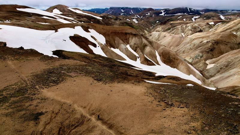
I made my way up into the hills and hiked about 20 miles that first day (my GPS shows 17.7 mi), with a bit of elevation gain and some patches of snow. The trail climbs through a geothermal area, just really pretty little mountains, with steaming vents beside the path. Higher up there was lots of snow, but still no spikes necessary. I blew right past the first hut, Hrafntinnusker, because I didn't have any reason to stop.
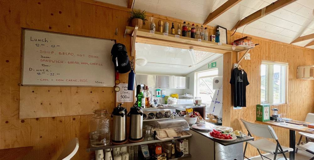
After the high snowfields the land changes as you drop toward Álftavatn: you get more of a black sand beach kind of vibe. The sun started to say hello. I had a nice late lunch at Álftavatn, soup, coffee and bread, for the nice price of $22. What did I tell you, Iceland is expensive. The board that day said soup, bread and a hot drink, 3,000 ISK.
A lot of people were tent camping at Álftavatn, but I knew there was another hut a little further on, so I kept pushing to Hvanngil. It was a nice spot, with little circles of rocks for the tents. I didn't eat at the hut; I cooked my own food and tried to sleep in the daylight. I think it was six or seven dollars to spend the night there with my tent.
From the Landmannalaugar hut, 1,950 ft (595 m), the Laugavegur climbs south through the rhyolite hills and the Brennisteinsalda geothermal area to the plateau at about 3,000 ft (900 m) by 3.5 miles. It stays high for the next seven miles, over snowfields and bare ridges, past the Hrafntinnusker hut at 7.2 miles, 3,360 ft (1,023 m), to the day's high point, 3,440 ft (1,049 m). FÍ gives Landmannalaugar to Hrafntinnusker as 12 km and 4 to 5 hours.
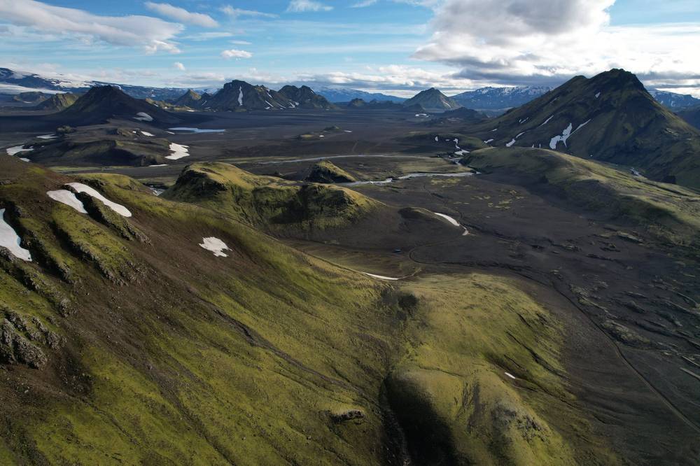
From about 10 miles the trail drops off the plateau, about 1,200 ft (370 m) down in 2.4 miles, to the first unbridged river, the Grashagakvísl, at 12.4 miles, then crosses open sand and moss to the Álftavatn huts by the lake at 14.6 miles, 1,750 ft (535 m). FÍ gives Hrafntinnusker to Álftavatn as 12 km and 4 to 5 hours. From Álftavatn it's about 3 miles over a low ridge and across the Bratthálskvísl to Hvanngil, 1,840 ft (560 m), at 17.7 miles.
Before Hrafntinnusker, go back to Landmannalaugar. In bad weather, stay at a hut: FÍ says the wardens may tell you not to leave. Álftavatn and Hvanngil sit by a 4x4 mountain road with river fords (it's on the map), but none of the 2026 highland bus lines in this guide stop there. The next bus stops are in Þórsmörk.
Film, Day 1 · Hrafntinnusker · Lunch at Álftavatn · Camp at Hvanngil
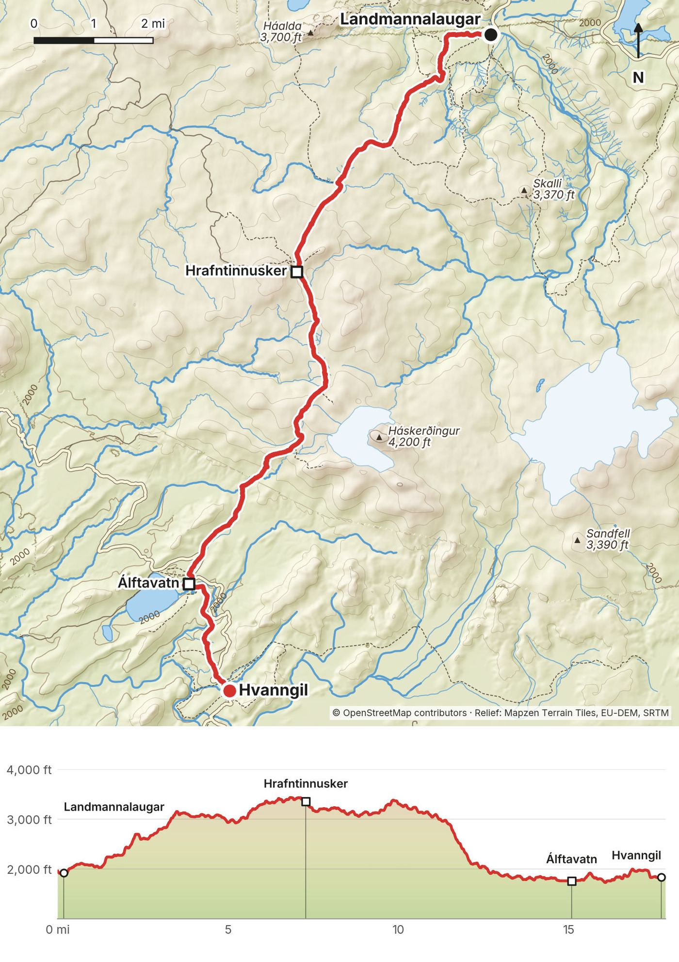
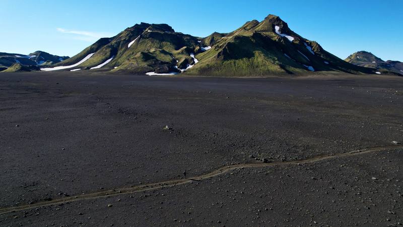
A very nice thing to wake up to was a stream crossing right away in the morning, in the cold. Just really cool vibes. This was the day of the volcanic black sand. It feels like the moon for this section, but it's pretty flat, a little boring.
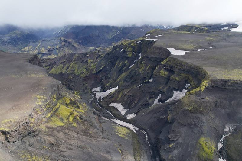
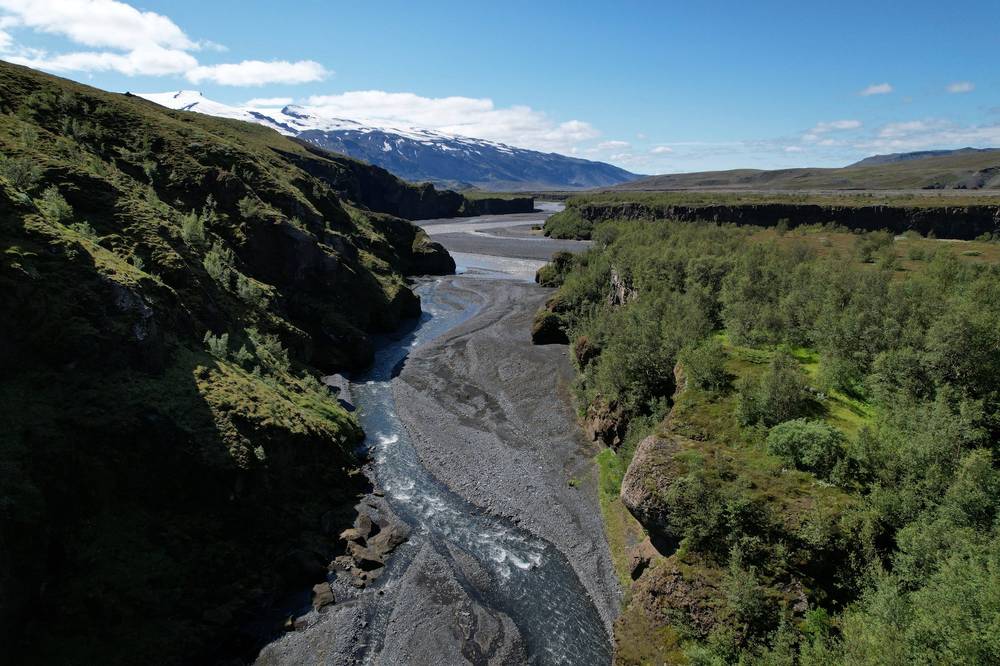
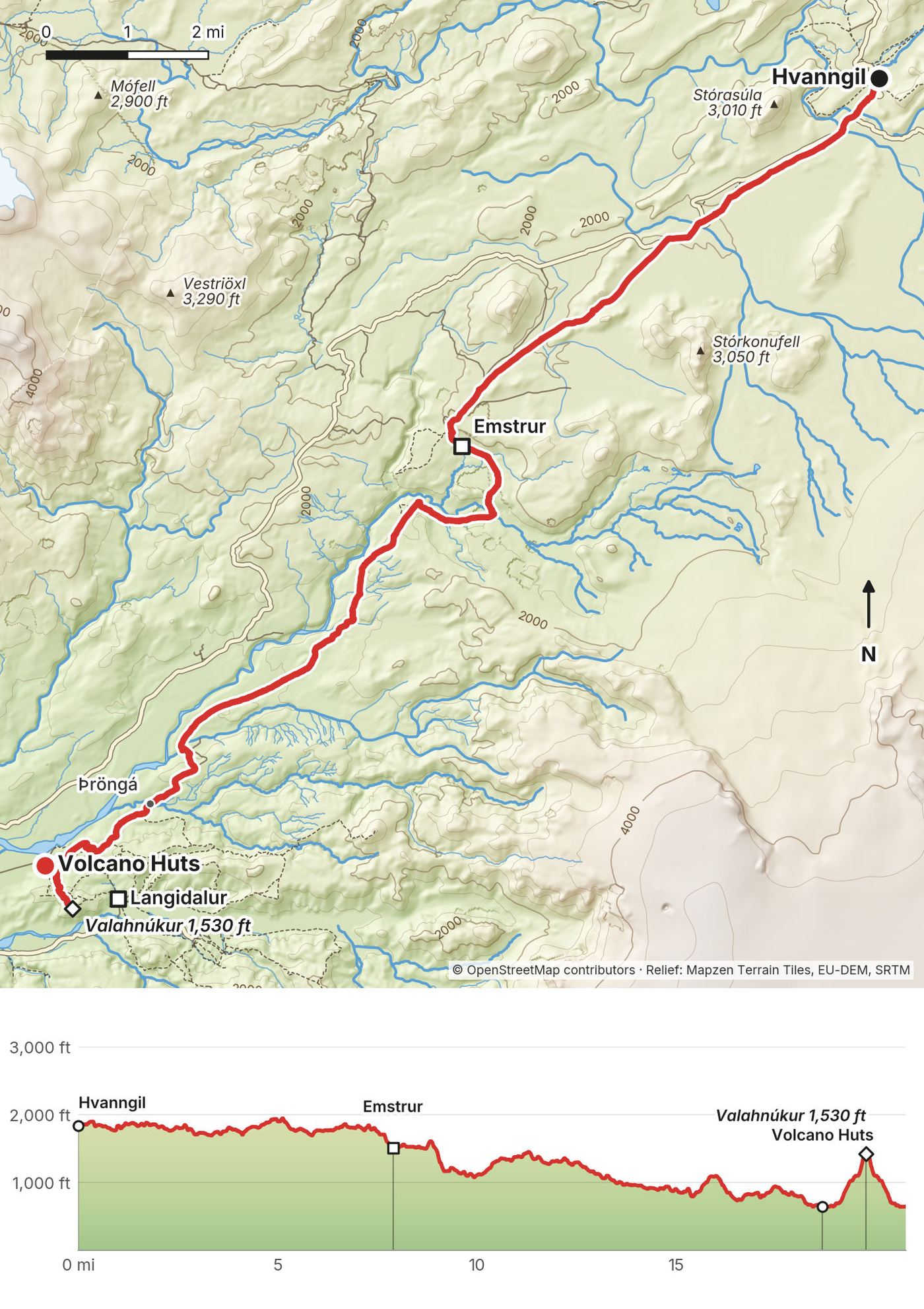
I passed Emstrur, where I had some ramen. There's a hut there, and I'm sure you could buy some food, but I just cooked my own. After Emstrur the trail crosses a deep gorge on a footbridge, and the country turns green, with birch and flowers, as it drops toward Þórsmörk. I waded the Þröngá, the last river, and pulled into the area of the Volcano Huts in Húsadalur at 3:25 p.m. Another 20-ish-mile day.
The Volcano Huts were very nice, with lots of food. I had the dinner and breakfast buffets; they were fantastic. There were a lot of people. I pitched my tent in the birch wood and went up the little peak above the huts, Valahnúkur. That day hike is pretty awesome. Everyone should do it. Then I came back and spent the night in my tent.
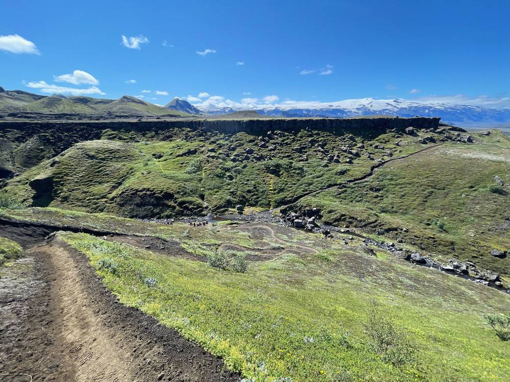
From Hvanngil, 1,840 ft (560 m), the trail crosses the Kaldaklofskvísl on a footbridge at 0.6 miles and wades the Bláfjallakvísl at 0.9 miles. Then it runs southwest for seven miles across the black sand, nearly level, past the Innri-Emstruá at 3.2 miles and the day's high point at 5.1 miles, 1,950 ft (594 m), to the Emstrur huts at 7.9 miles, 1,510 ft (460 m). FÍ gives Hvanngil to Emstrur as 13 km.
From Emstrur the trail goes down to the footbridge over the Fremri-Emstruá gorge at 9.3 miles, then follows the edge of the Markarfljót canyon southwest over grass and sand, gently down, to the Ljósá bridge at 15.3 miles and the Þröngá at 16.6 miles, 740 ft (226 m). The last two miles go through birch wood into Þórsmörk, to the Volcano Huts in Húsadalur at 18.6 miles, 640 ft (196 m). FÍ gives Emstrur to Þórsmörk as 15 km and 6 to 7 hours.
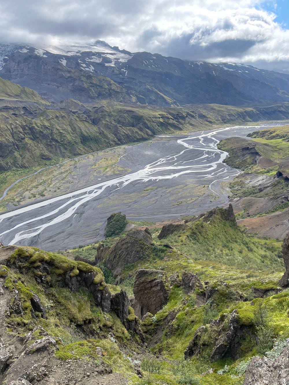
Valahnúkur. From the Volcano Huts a path climbs through the birch wood to the viewpoint on Valahnúkur, about 1,430 ft (435 m) on my GPS (465 m on maps), with a view dial on top and Þórsmörk below: the Krossá riverbed and Eyjafjallajökull. My loop was 2.2 miles, about an hour and a half with a stop on top.
Hvanngil and Emstrur are on 4x4 tracks, but none of the 2026 highland bus lines in this guide stop there. Keep going to Þórsmörk: the highland buses stop at Húsadalur, Langidalur and Básar (2026: afternoon buses back to Reykjavík, arriving at 19:30).
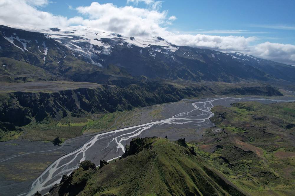
Film, Day 2 · The river in the morning · Emstrur · Valahnúkur
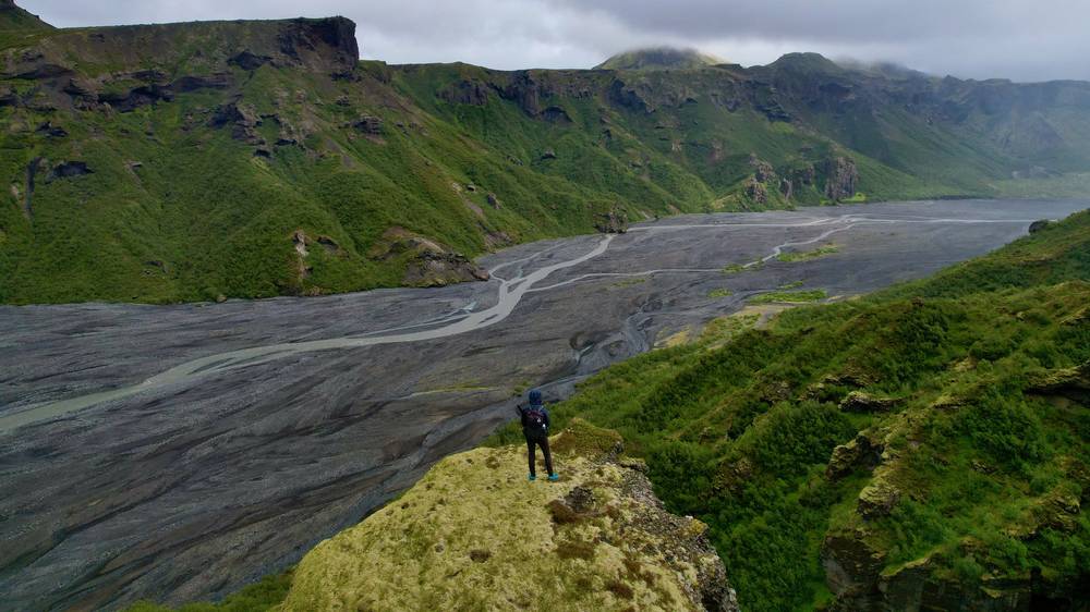
The next day was another 20-mile hike. I had the all-you-can-eat breakfast buffet first and started walking at 9:25. I crossed the Krossá on a couple of footbridges, which were nice, because the streams were pretty big, and blew right past the campsite at Básar. There are still a lot of trees in this area.
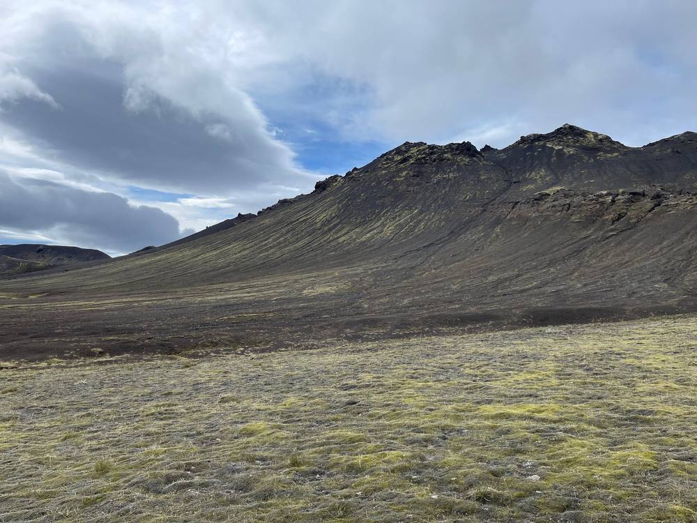
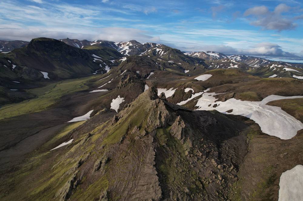
Once you get above the trees it starts to get really, really pretty, and just so diverse. A lot of clouds and fog were rolling in. Up top you pass the peaks of the volcano. You don't really summit them, but all of it is volcanic black soil. There's a lot of snow to cross. Obviously it'll be different for everyone, but I had to walk in snow a lot.
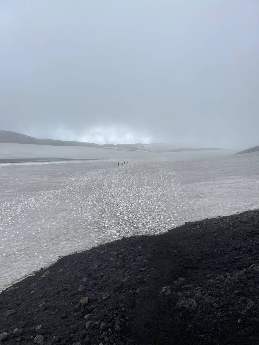
I passed the first hut and went straight on to the next, a little triangle. There was a little dog and a woman there. There's no water for this whole glacial pass area, but she was selling water for three or four dollars a liter, I think, so it's possible to get some up there. I had my ramen snack and started down, with views of the glaciers on either side of me and the ocean popping through the clouds.
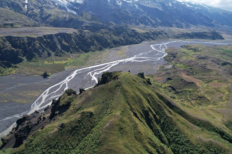
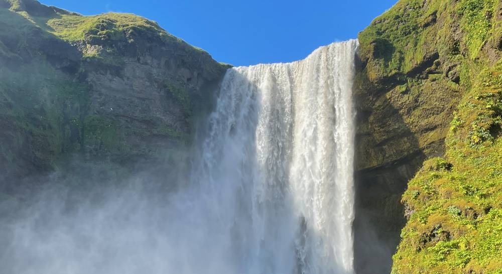
Then it's down, down, down, relentless. You see waterfall after waterfall, and they keep getting bigger and cooler until you reach Skógafoss. You know you're getting close because it gets really crowded; people park right there and walk up to the waterfall. I came down to Hótel Skógafoss and had a nice dinner, then walked over to another hotel in the village and spent the night.
From the Volcano Huts, 640 ft (196 m), the trail goes east past Langidalur, crosses the Krossá channels on footbridges at 1.2 to 1.8 miles, and reaches Básar at 2.8 miles, 770 ft (235 m). The Fimmvörðuháls trail climbs from here, up the Strákagil ravine and a series of steep ridges: Kattarhryggir ("the cat's spine"), Morinsheiði, and Heljarkambur at 7.3 miles, 2,630 ft (801 m), a narrow ridge with a chain handhold on its most exposed part. Above it is the 2010 lava field, Goðahraun, with the craters Magni and Móði, then the snowfields of the pass between Eyjafjallajökull and Mýrdalsjökull, with my high point of 3,420 ft (1,041 m) at 9.5 miles. That's about 2,650 ft (810 m) of climbing in 6.7 miles from Básar. The pass is marked with stakes and often in fog.
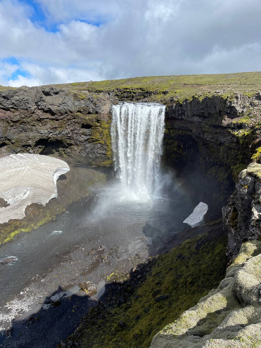
My line passed about 500 m east of Fimmvörðuskáli and reached Baldvinsskáli at 10.6 miles, 2,960 ft (902 m). From there it follows the trail down the Skógá: a bridge over the river at 14.4 miles, then the path along the gorge, past waterfall after waterfall, to the foot of Skógafoss at 20.2 miles, about 50 ft (16 m). That's about 2,900 ft (880 m) of descent in 9.6 miles. FÍ gives Skógar to Baldvinsskáli as 12 km and Baldvinsskáli to Þórsmörk as 13 km; Útivist gives 25 km in all.
The pass in 2027. Part of my 2022 line, between Baldvinsskáli and Fimmvörðuskáli, is where FÍ reported ravines and crevasses in 2026. FÍ's detour follows the better-marked "blue" route: the track between Baldvinsskáli and the Skógá bridge, and the ridge past Fimmvörðuskáli. Follow the current stakes and FÍ's advice, not my track, on this section.
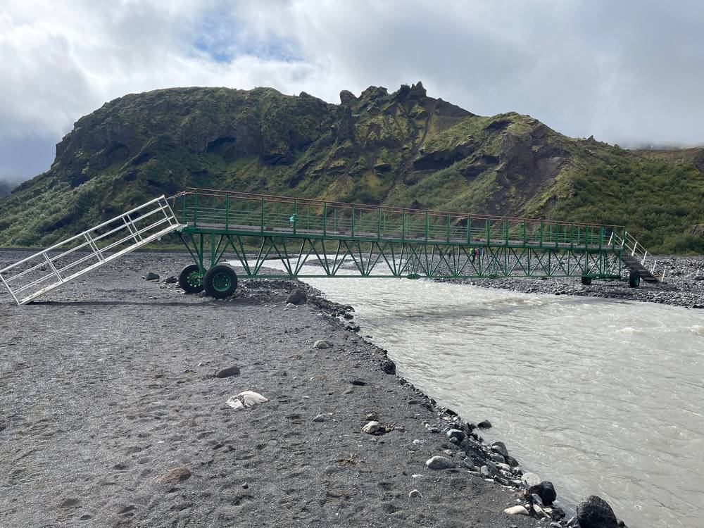
Before the climb, stay in Þórsmörk: the highland buses stop at Básar, Langidalur and Húsadalur. On the pass, the two huts are your shelter. From Baldvinsskáli a track runs down to the Skógá bridge. In fog or storm, turn back or wait at a hut.
Film, Day 3 · Heljarkambur · Baldvinsskáli · Skógafoss
I spent the night in Skógar and the next morning caught my bus back to Reykjavík. My receipt is for the public bus, 3,920 ISK from Hvolsvöllur to Mjódd in Reykjavík (2022). In 2026: the Reykjavik Excursions bus leaves Skógar at 10:15 but waits at Hvolsvöllur until 17:40 and reaches Reykjavík at 19:30; the public bus, route 52, leaves Skógar at 17:45 and reaches Mjódd at 19:59 (summer times; Tue, Thu, Fri and Sun only, none on Saturdays).
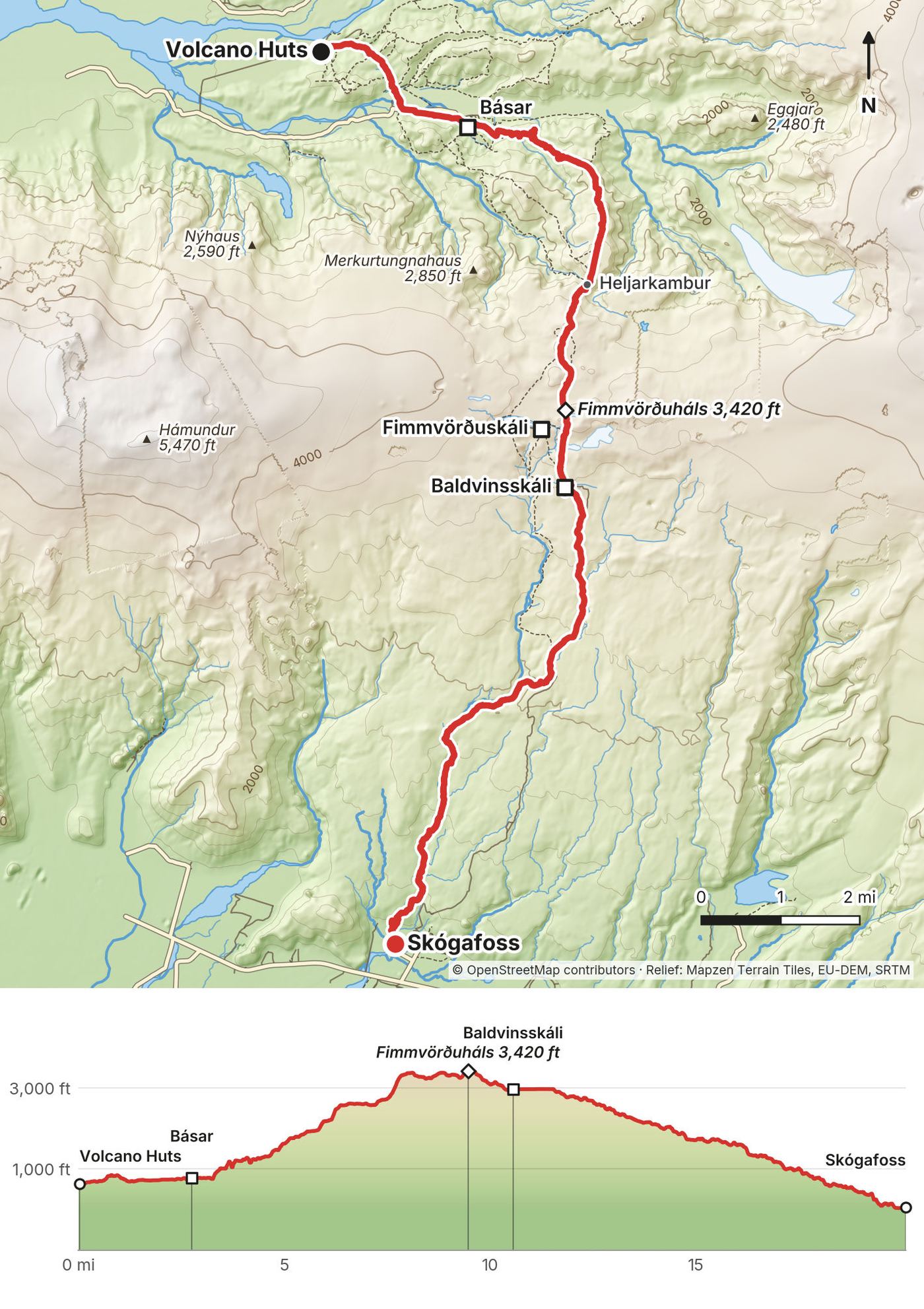
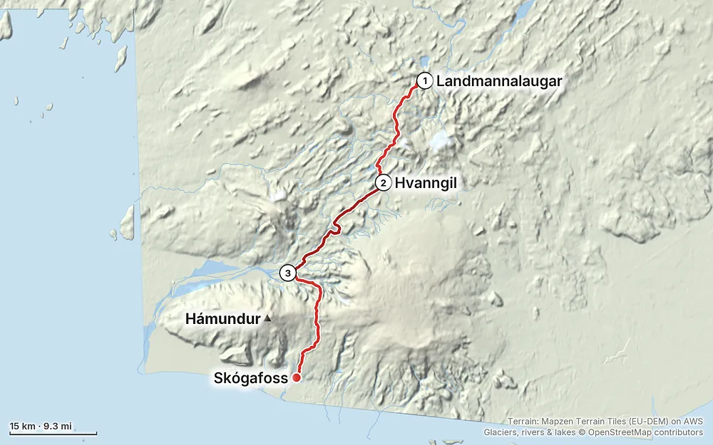
Elevation33–3,438 ft58.7 mi
Terrain: Mapzen Terrain Tiles (EU-DEM) on AWS · Glaciers, rivers & lakes © OpenStreetMap contributors
Tap a map to open it full size.
Book huts or campsites ahead: FÍ expects confirmed bookings before you start
From the hike's facts; check the official page before you go.
The season. FÍ says the Laugavegur is open on average from June 25 to September 15, and that July and August are the most reliable. The road into Landmannalaugar opens on average around June 20. In 2026 FÍ declared the trail open on July 2, with considerable snow between Landmannalaugar and Álftavatn. The highland buses ran from June 13 to September 20 in 2026. FÍ gives early July to early September as the best time for Fimmvörðuháls.
What I got. I went in mid July. Day 1 was cloudy, with snow on the high section and the sun coming out in the late afternoon after Álftavatn. Day 2 was clear and sunny. On Day 3 cloud and fog rolled in over the pass and cleared on the way down to Skógar. I had great weather overall. Iceland at this time of year is light all the time, so you have to go to sleep with the sun out.
Snow. I had to walk in snow a lot: on the high section around Hrafntinnusker on Day 1 and on the pass on Day 3. FÍ says the first two stages can be snow-covered in early summer, with snow-filled ravines and thin snow bridges between Hrafntinnusker and Álftavatn, and the pass is often snow-covered well into summer.
Forecast. Don't go out there if the forecast says it's going to rain the whole time. It's not going to be fun. Wait for a window.
The Laugavegur has several unbridged rivers. FÍ says at least three have to be waded; they're cold, and they rise quickly with rain. On Day 3 the Krossá and the Skógá have footbridges. On my line (from my GPS and OpenStreetMap, with FÍ's list of which ones have bridges):
| River | Where | Bridge? |
|---|---|---|
| Grashagakvísl | Day 1, 12.4 mi, below the descent to Álftavatn | No |
| Bratthálskvísl | Day 1, 16.1 mi, between Álftavatn and Hvanngil | No |
| Kaldaklofskvísl | Day 2, 0.6 mi from Hvanngil | Footbridge |
| Bláfjallakvísl | Day 2, 0.9 mi from Hvanngil | No |
| Innri-Emstruá | Day 2, 3.2 mi | Not on FÍ's list of wades; ask the wardens |
| Fremri-Emstruá | Day 2, 9.3 mi, just past Emstrur, in a gorge | Footbridge |
| Ljósá | Day 2, 15.3 mi | Footbridge |
| Þröngá | Day 2, 16.6 mi, the last before Þórsmörk | No |
| Krossá | Day 3, 1.2 to 1.8 mi, between Langidalur and Básar | Footbridges for walkers |
There were so many water crossings, and I kept my shoes on. The first thing on Day 2 was a cold crossing right after breaking camp.
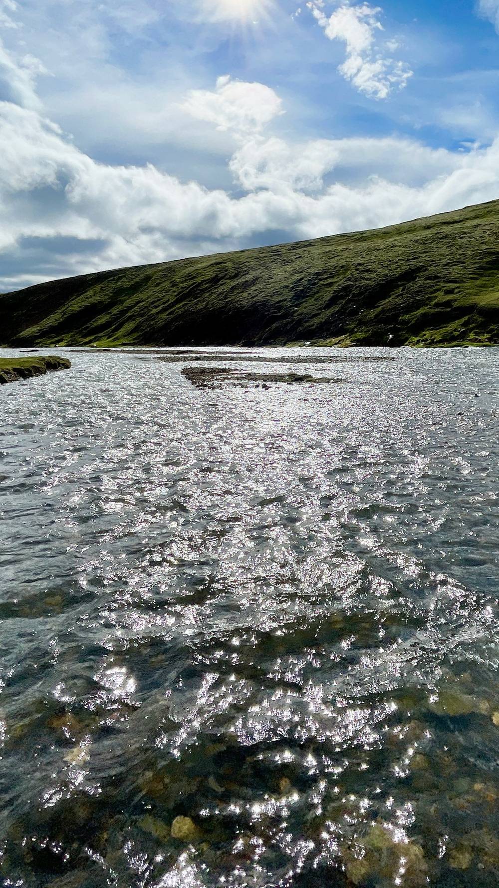
How to cross (SafeTravel and FÍ): only cross if you're sure; ask the hut wardens about the rivers ahead; rivers are often lower in the morning; wear shoes or sandals, not bare feet; loosen all your pack straps; look for the wide, braided parts, where the current is weaker; cross in twos or threes with arms linked; and after heavy rain, wait.
Fimmvörðuháls in 2026. On August 25, 2026, FÍ, Útivist and the Dagrenning rescue team from Hvolsvöllur warned that glacier retreat had opened ravines and crevasses, collapsed snow bridges and exposed steep scree between Baldvinsskáli and Fimmvörðuskáli, that the trail was impassable in places, and advised people not to hike the pass. On September 2, 2026, FÍ published a detour: follow the better-marked "blue" route between Baldvinsskáli and the Skógá bridge, and bypass the damaged section by the ridge past Fimmvörðuskáli. Its stakes carry small numbered plates with known GPS positions, so rescuers can find you. I found no all-clear. Check fi.is and utivist.is before you go.
Forecasts. Use vedur.is, the Icelandic Met Office, and check it every day, even twice a day. FÍ gives summer temperatures on the trail of 5 to 14 °C by day and 0 to 10 °C at night, and says wind over 10 to 12 m/s makes hiking hard. Hut wardens may tell you to stay in the hut in bad weather. Listen to them.
Emergencies. Call 112. Iceland is phasing out 2G and 3G, so SafeTravel also gives a backup number, +354 599 0112. From a satellite phone, 112 Iceland says to call +354 809 0112. The 112 Iceland app sends your location to the emergency centre, and in the highlands a text often gets through when a call won't. Leave a travel plan at safetravel.is. Search and rescue in Iceland is run by volunteers (ICE-SAR); get travel insurance that covers rescue.
Hypothermia. SafeTravel says it's quite common in Iceland in summer. Wet and wind are the danger. Keep dry layers in a bag, eat, and turn back or stop at a hut early.
Drones. Drones are banned in the Fjallabak nature reserve (Landmannalaugar) from June 15 to September 15 without a permit, and since May 2026 permits there are only issued for commercial work. At Skógafoss drones are banned all year; permits are only for commercial work. Elsewhere the EU rules apply: registration, under 120 m, in sight, never over crowds.
None of it needs a rope, but these spots need care:
How hard is it? I think it's not that bad. It's pretty low altitude, so you don't have to worry about altitude sickness, and it's not technical: you just have to do the miles. The river crossings are probably the most difficult part, and they might overwhelm some shorter people. I had water up to my waist at one point, and it's cold. The weather is the other thing. The wind can be relentless, mixed with rain and sometimes snow and hail, and I was hearing stories that a bunch of people got hypothermia a couple of days before I hiked. Pick a good forecast window.
How many days? I did it in three: two days on the Laugavegur and one over Fimmvörðuháls, about 20 miles each. The usual pace is four days on the Laugavegur and one or two more for Fimmvörðuháls. See Other ways to do it.
Where do you sleep? At the huts. I stayed in my tent the whole time on the trail, which saves money, but you still have to pay to camp. You can camp at pretty much any of the hut areas. You can't camp anywhere else: the Laugavegur runs through protected land where overnight stays are only allowed in huts and at designated campsites. See Where to sleep.
Do I need to book? In 2022 I didn't book the campsites ahead; there are no bookings in my records. For 2027, book. FÍ says hikers are expected to have confirmed hut or campsite bookings before they start, and it only books the huts north to south.
Which direction? North to south, from Landmannalaugar to Þórsmörk, like me. It's downhill overall, and it's the direction FÍ books the huts.
Is it marked? Yes, it's a well-trodden trail with marker stakes, which you can see in my photos and the film. In fog and on the snowfields the stakes are what you go by, so carry the GPX files too.
Do I need spikes for the snow? I didn't. Lots of snow at higher elevations, but still no spikes necessary, in mid July 2022. Early in the season there's more (see When to go).
Is there water? At every hut on the Laugavegur, and FÍ says the tap water is safe to drink. On Fimmvörðuháls there's no water for the whole glacial pass area. Fill up before the climb.
Is it expensive? Iceland is expensive in general, and this hike doesn't escape that. Any time you buy food it's more expensive than even in New York City. In 2027 an FÍ hut bed is 18,000 ISK a night (about $150) and a campsite 3,600 ISK. See What I paid.
Phone signal? Patchy. FÍ says coverage can be unstable on the trail and you may have to find a hilltop. Álftavatn has a connection; at Emstrur it's on the hill above the huts.
Can I fly a drone? Not in summer in the Fjallabak nature reserve around Landmannalaugar (June 15 to September 15), and not at Skógafoss at any time of year, unless you have a permit, and since 2026 permits are only for commercial work. See Weather and safety.
I walked it in three long days with a tent. These versions are for people who want a hut every night or shorter days. I didn't walk them this way; the distances come from my own GPS on the same trail, with FÍ's figures beside them.
| Day | From, to | Miles on my GPS | FÍ | Sleep |
|---|---|---|---|---|
| 1 | Landmannalaugar to Hrafntinnusker | 7.2 | 12 km | Hrafntinnusker |
| 2 | Hrafntinnusker to Álftavatn | 7.4 | 12 km | Álftavatn |
| 3 | Álftavatn to Emstrur | 10.6 | 16 km | Emstrur |
| 4 | Emstrur to Þórsmörk | 10.6 | 15 km | Þórsmörk (Langidalur, Básar or the Volcano Huts) |
| 5 | Þórsmörk over Fimmvörðuháls to Skógar | 20.2 | about 25 km | Skógar |
Day 5 is long. Split it at Baldvinsskáli (10.6 miles from the Volcano Huts) or Fimmvörðuskáli for a sixth day, or leave out Fimmvörðuháls and take the bus from Þórsmörk. FÍ says most hikers spend five nights on the trail. Remember FÍ books its huts north to south, Emstrur only in a package.
These change every year. Everything else in this guide stays the same.
The trail
Where you sleep
Getting there and around
Weather and your stuff
Planning questions about Southern Iceland: the Laugavegur and a group trip, answered only from this page's facts, the creators' versions and hikers' public tracks, with where each answer comes from. When the data doesn't say, the answer says "not given".
From hikers
Sign in to comment. Free; your hikes stay private unless you share them.
Some lodging links earn me a small commission at no cost to you.
Something wrong or missing on this page? Send feedback.