
Content made there
The film is at the top of this page.
Photos
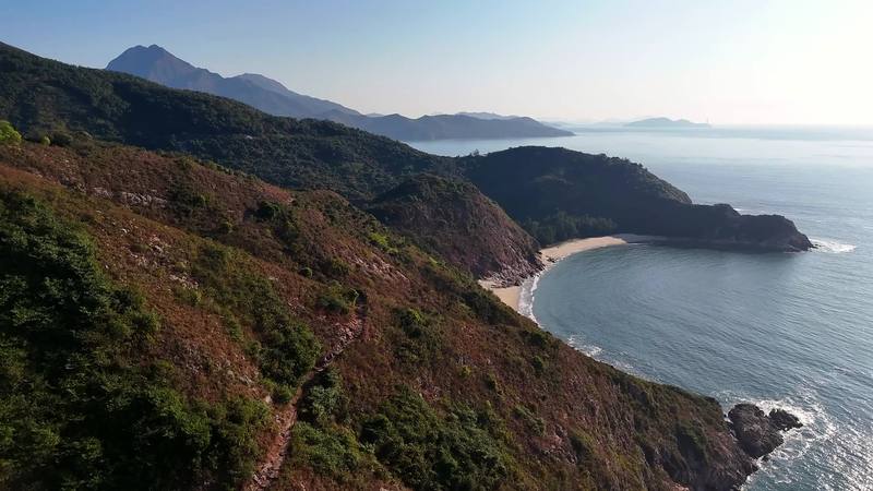
Hikes / Lantau Trail / Kraig Adams's version
Asia · Hong Kong
Jan 2025 · 4 days · 30 miles · With friends · Tent

I love visiting Hong Kong. Five years before this trip, my friend Ryan and I hiked the MacLehose Trail across the New Territories, and on the way out we noticed there was one other long-distance trail in Hong Kong, near the airport. We vowed to come back and hike it. In January 2025 we did, with my friend Renee: the Lantau Trail on Lantau Island, the big mountainous island the airport sits next to.
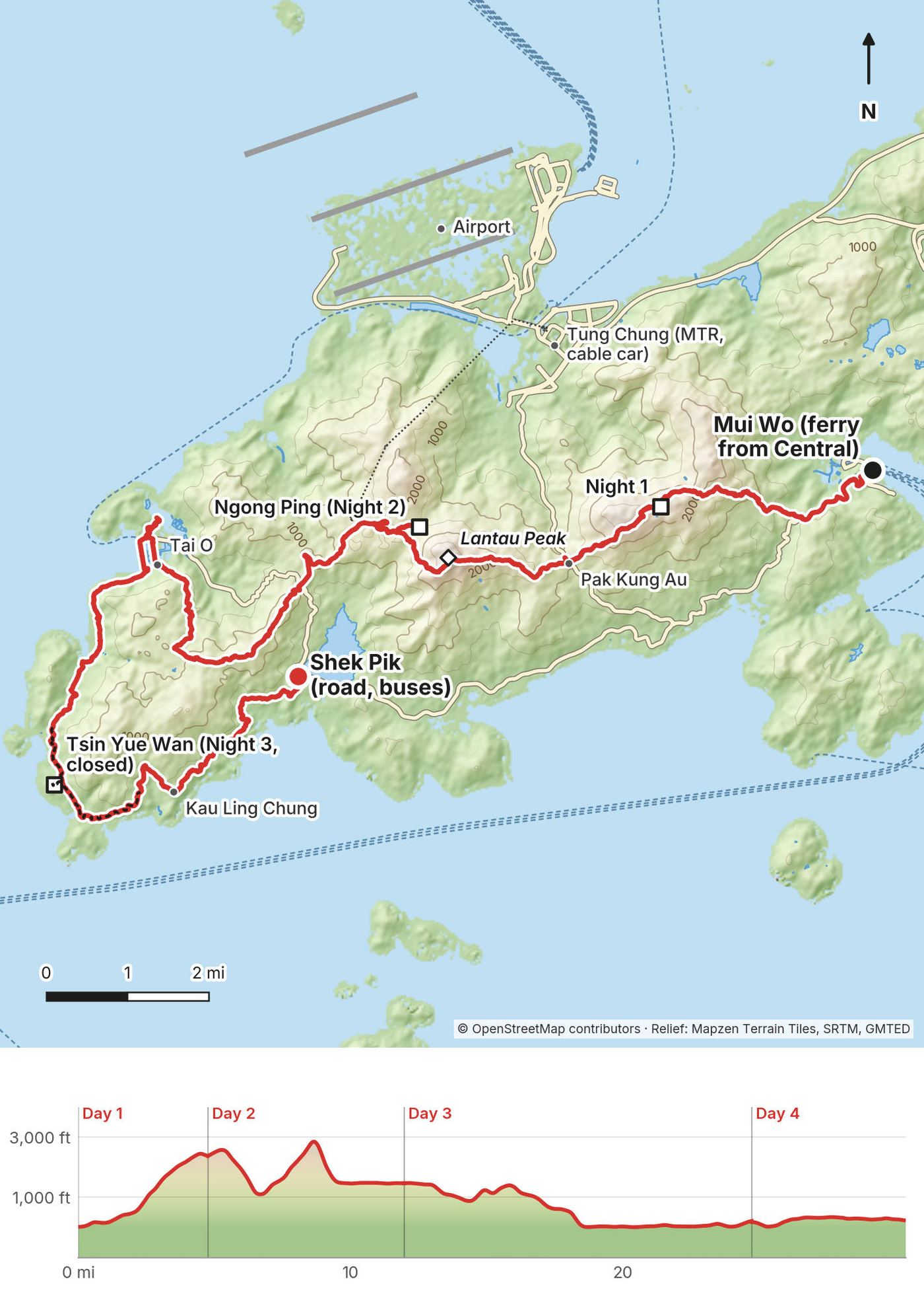
We took the ferry from Central to Mui Wo, climbed toward Sunset Peak and camped above the airport. The next day we went down to Pak Kung Au in the rain, waited it out in Tung Chung, and went back up over Lantau Peak in the fog to the Big Buddha at Ngong Ping. On the third day we walked west to the fishing village of Tai O and down the quiet west coast to a campsite by the sea, and on the fourth we walked out along the south coast to the road at Shek Pik. About 30.4 miles by my GPS over four days and three nights, on Sections 1 to 8 of the trail's 12. It's the trip from my film Hiking in Hong Kong.
| Quick facts | |
|---|---|
| Distance | 30.4 miles (48.9 km) by my GPS, with about 4.5 miles of wandering in Ngong Ping and Tai O. Sections 1 to 8 are 43.5 km (27 miles) by the government's figures; the whole loop is 70 km |
| Climbing | About 6,530 ft (1,990 m) up and 6,300 ft (1,920 m) down, going west like I did |
| Days | 4, with 3 nights: 4.8 miles on Day 1 (an afternoon), 7.2 on Day 2, 12.8 on Day 3, 5.7 on Day 4 |
| Start | Mui Wo ferry pier, at sea level, about 35 to 40 minutes by ferry from Central |
| Finish | South Lantau Road at Shek Pik, about 230 ft (70 m), with buses and taxis |
| High point | Lantau Peak, 3,064 ft (934 m), on Day 2 |
| Sleep | Free campsites, first come, first served. Night 1: not a campsite (see the rules). Night 2: Ngong Ping Campsite. Night 3: Tsin Yue Wan Campsite, closed since October 2023 |
| Difficulty | Sections 2 and 3 (Sunset Peak and Lantau Peak) are rated 4 of 5, Difficult, by the government: long stone staircases. The rest is 1 to 3 of 5 |
| Permits (2026) | None to hike or to camp at the campsites |
| Day | Route | Miles (km) | Up / down (ft) | Sleep |
|---|---|---|---|---|
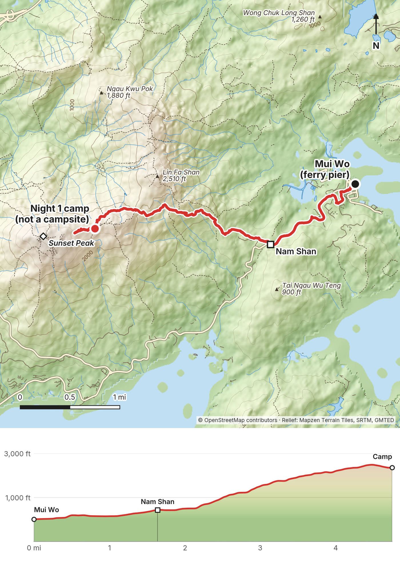
| 1 | Mui Wo to Sunset Peak | 4.8 (7.6) | 2,513 / 173 | Below Sunset Peak, about 2,360 ft (not a campsite) |
| 2 | Sunset Peak to Ngong Ping over Lantau Peak | 7.2 (11.6) | 2,242 / 3,138 | Ngong Ping Campsite, about 1,460 ft |
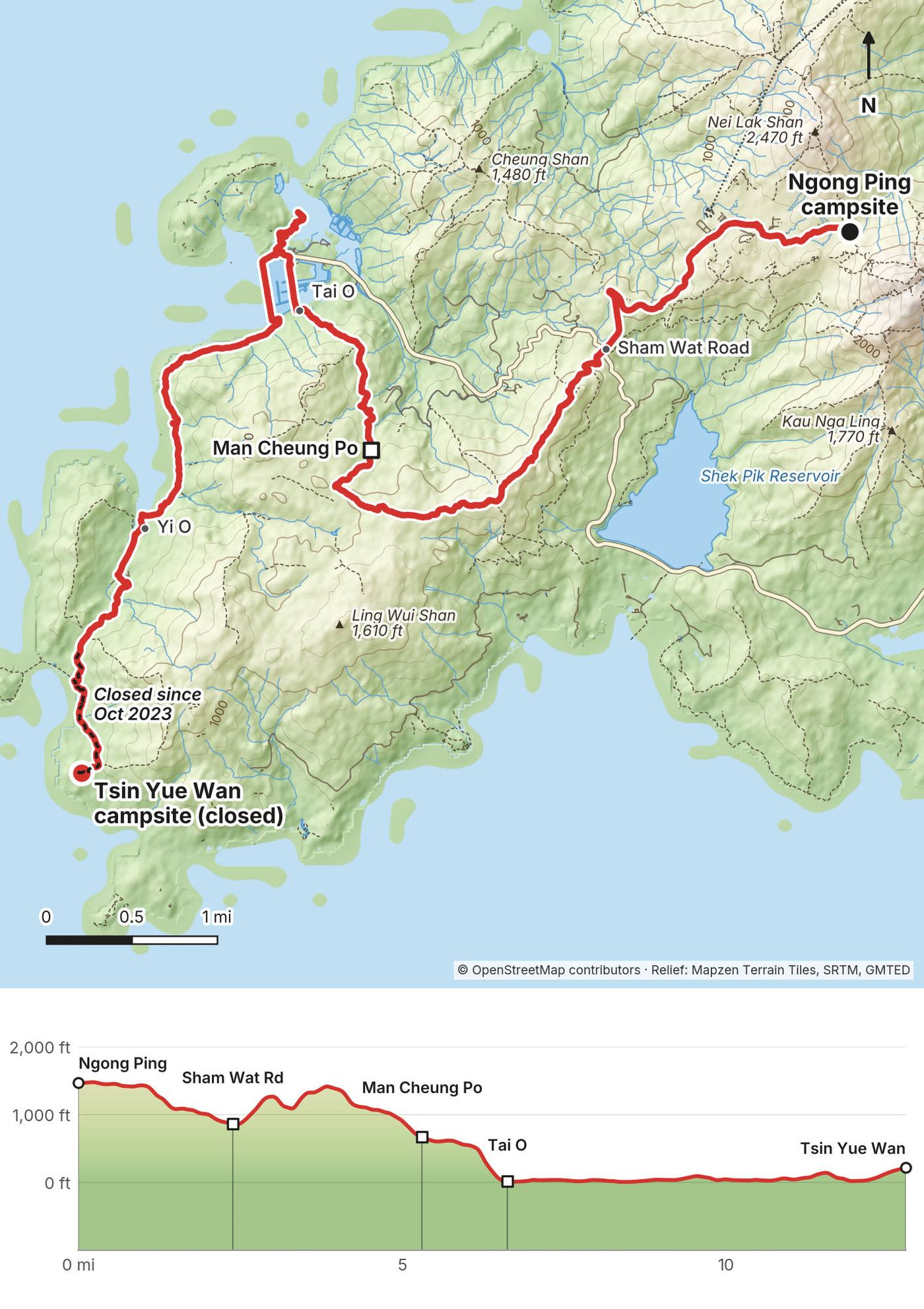
| 3 | Ngong Ping to Tsin Yue Wan by Tai O | 12.8 (20.6) | 1,203 / 2,451 | Tsin Yue Wan Campsite, about 220 ft (closed now) |
| 4 | Tsin Yue Wan to Shek Pik | 5.7 (9.1) | 572 / 533 |
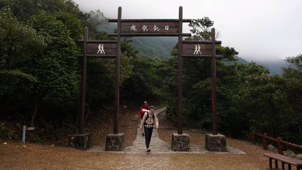
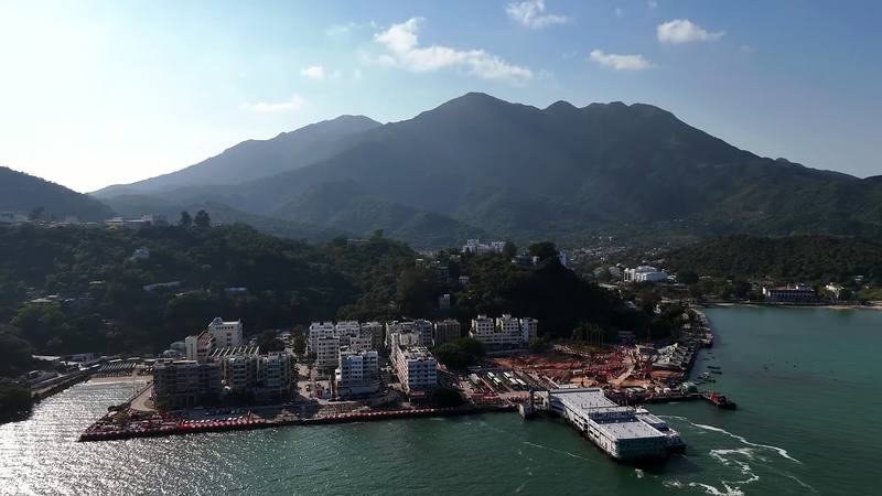
Our way in, 2025. We flew into Hong Kong and stayed in a hotel in Central, which kept our extra luggage while we hiked. Before the hike we went to the best outdoor store we could find on Google to get stove fuel (you can't fly with it), and, as Ryan and I did on our first trip, ate soup dumplings at Din Tai Fung. On the hike's first afternoon we took the ferry from Central to Mui Wo, watched the skyline disappear behind the boat, bought last snacks and big bottles of water at the 7-Eleven by the pier, and started walking at 3:24 p.m.
The start: Mui Wo. Ferries leave Central Pier 6 for Mui Wo about every 30 to 50 minutes from early morning until after 11 p.m. All sailings are fast ferries, about 35 to 40 minutes. An adult fare is HK$33.50 Monday to Saturday and HK$48.50 on Sundays and holidays (Sun Ferry and the Transport Department, October 2026). From Tung Chung, New Lantao Bus 3M goes to Mui Wo (HK$12.50 on weekdays).
The finish: Shek Pik. Section 8 ends on South Lantau Road at Shek Pik. New Lantao Buses stop there: route 11 to Tung Chung (HK$10.10 on weekdays, HK$17.60 on Sundays and holidays), route 23 to Tung Chung, and routes 1 and 2 to Mui Wo. We flagged down an empty taxi within a few minutes, rode up to Ngong Ping and took the cable car down to Tung Chung.
Back to the city. From Tung Chung, the MTR to Central or Hong Kong station is HK$24.30 with an Octopus card. The airport is next to Tung Chung, and the Airport Express to Hong Kong station is HK$120 with an Octopus.
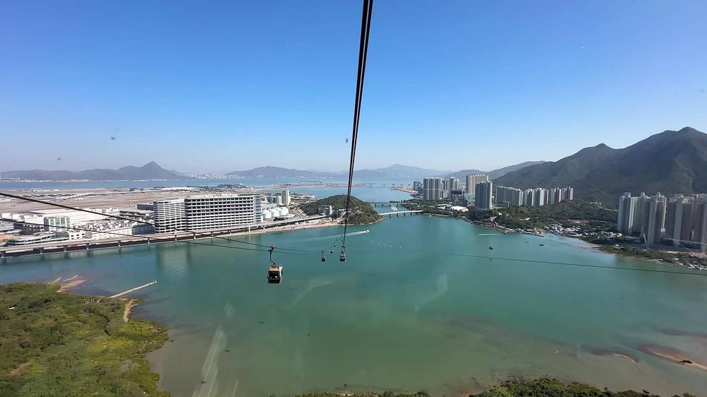
The Ngong Ping 360 cable car. It runs between Tung Chung and Ngong Ping in 25 minutes, over Tung Chung Bay and past the airport, 10:00 a.m. to 6:00 p.m. on weekdays and 9:00 a.m. to 6:30 p.m. on weekends and holidays. A round trip in a standard cabin is HK$295; the glass-bottomed crystal cabin costs more, and one-way tickets are sold too. It can be suspended in bad weather; check the day's notice on its website. Renee used it to meet us at Ngong Ping on Day 2, and it was a perfect way to end our hike.
Taxis. Lantau has its own blue taxis. The meter starts at HK$24 for the first 2 km, then HK$1.90 for each 200 m, plus HK$6 for each bag in the trunk. We found them easily at Pak Kung Au and Shek Pik.
Money and phones. An Octopus card pays for the ferry, buses and the MTR; a tourist version is sold with no deposit.
I didn't keep a list of what this trip cost me.
For your budget (Hong Kong dollars, as checked in October 2026; US$1 is about HK$7.8):
| Item | Cost |
|---|---|
| Campsites | Free |
| Ferry, Central to Mui Wo | HK$33.50 Monday to Saturday, HK$48.50 Sundays and holidays |
| Bus, Shek Pik to Tung Chung (route 11) | HK$10.10, or HK$17.60 Sundays and holidays |
| MTR, Tung Chung to Central | HK$24.30 with an Octopus |
| Cable car, round trip, standard cabin | HK$295 |
| A Lantau taxi | HK$24 for the first 2 km, then HK$1.90 per 200 m |
| Airport Express to Hong Kong station | HK$120 with an Octopus |
The hike itself costs very little: the ferry, the bus from Shek Pik and the MTR back to Central come to under HK$100 (about US$13), plus your food. The city before and after is where the money goes.
Checked on AFCD's pages on October 3, 2026.
No permit, no fee. You don't need a permit to hike the Lantau Trail or to camp at its campsites, and the campsites on Lantau don't take bookings (in all of Hong Kong only Twisk, in the New Territories, does). Arrive with time to find a spot.
Camp only at designated campsites. Hong Kong law (the Country Parks and Special Areas Regulations) says no one may camp or put up a tent in a country park except at a designated campsite. Our first night, below Sunset Peak, broke that rule; the guide gives the legal choices. Don't leave gear to hold a spot, and don't stay more than seven nights.
The campsites on and near my route (AFCD):
| Campsite | Where | Toilet | Water |
|---|---|---|---|
| Nam Shan | End of Section 1, on the road | Flush toilets | Taps |
| Ngong Ping | By Ngong Ping village | Flush toilets, about 100 m | From the toilets |
| Man Cheung Po | End of Section 5 | Pit toilet | Seasonal stream |
| Tsin Yue Wan | Section 7 (closed since Oct 2023) | Pit toilet | Seasonal stream |
| Kau Ling Chung | Start of Section 8, on a beach | Pit toilet | Seasonal stream |
| Shek Pik | End of Section 8 | Flush toilets, about 100 m | From the toilets |
Nam Shan, Man Cheung Po, Kau Ling Chung and Shek Pik have barbecue pits; Ngong Ping doesn't. AFCD also warns that a dry year can leave campsites short of water, so carry some.
Fires. Only in designated pits at campsites, never left unattended, and put out before you leave. Watch for the Observatory's fire danger warnings in the dry season.
Wildlife. Feeding wild animals anywhere in Hong Kong is banned, with a HK$5,000 fixed penalty. Cattle and water buffalo roam parts of Lantau, as reported: give them room.
Other rules. Take your trash out (or use the campsite bins), keep the noise down, keep water clean, and respect the villages and their property.
| Night | Where | Height |
|---|---|---|
| Before | A hotel in Central | |
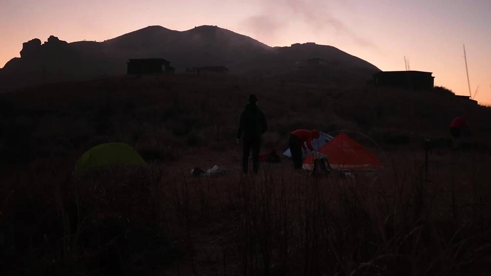
| 1 | Near the stone huts below Sunset Peak (Day 1 mile 4.8). Not a campsite | about 2,360 ft (720 m) |
| 2 | Ngong Ping Campsite (Day 2 mile 7.2) | about 1,460 ft (445 m) |
| 3 | Tsin Yue Wan Campsite (Day 3 mile 12.7), closed since October 2023 | about 220 ft (66 m) |
| After | Back in the city |
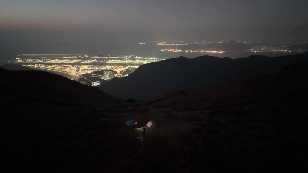
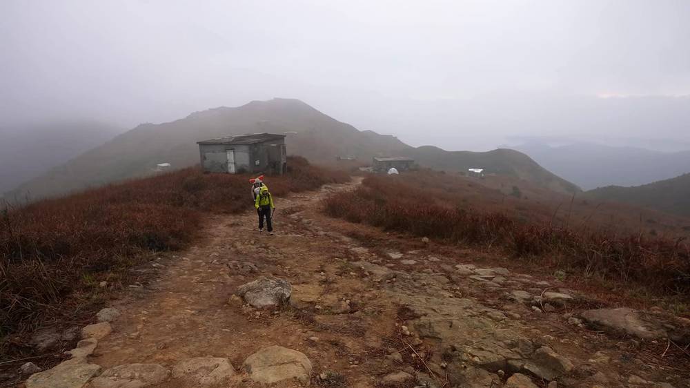
Night 1. A flat, grassy spot near the old stone huts below Sunset Peak, with the airport's lights and planes below. Cloudy, windy and cold. It isn't a designated campsite: sleep at Nam Shan instead.
Night 2. Ngong Ping Campsite, just outside the village: tables, camping platforms, and toilets nearby. Very full on a Sunday night, and super cold.
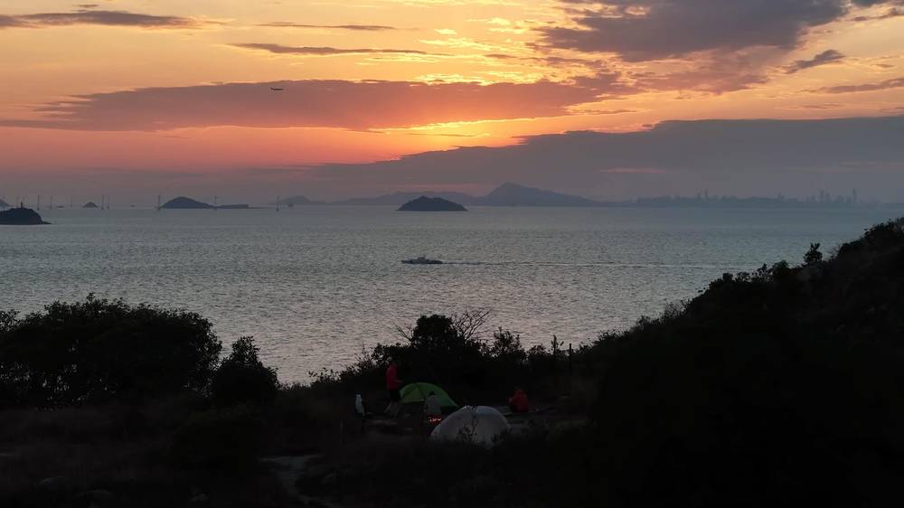
Night 3. Tsin Yue Wan Campsite, up on a hill above the sea at Hong Kong's southwest tip, with a barbecue pit we used for a fire and the sunset over the water. We had it to ourselves. It's closed for now; Kau Ling Chung, on a beach a little over a mile east as the crow flies, is the open campsite in that corner.
What we ate. We cooked on a canister stove, with fuel we found in the city. On the way we bought snacks in Mui Wo, ate brunch in Tung Chung, and had lunch, pastries and coffee in Tai O. On Night 3 I had spicy ramen by the fire, and breakfast on Day 4 was at a table in Fan Lau.
Stove fuel. You can't fly with gas canisters. Buy them in the city before you go; we found an outdoor store on Google, and I upload photos to Google whenever I find camping fuel, to help the next hikers.
Water. Carry everything you need from Mui Wo or Nam Shan (taps and an AFCD water filling station) to Ngong Ping: there's none on Sunset Peak or Lantau Peak, and we found none at Pak Kung Au. Big bottles from the 7-Eleven in Mui Wo are the easy way. Then Ngong Ping village and campsite, Tai O, and the toilets at Shek Pik. Campsite streams like Kau Ling Chung's are seasonal; treat stream water, as AFCD advises.
From my film and the gear list in its description (I have no full list for this trip):
What this hike needs:
We came off the ferry with mostly blue skies and bits of cloud hanging over Sunset Peak, and less than three hours to get to the night's camp before sunset. The Lantau Trail starts right in Mui Wo, through a big wooden gate.
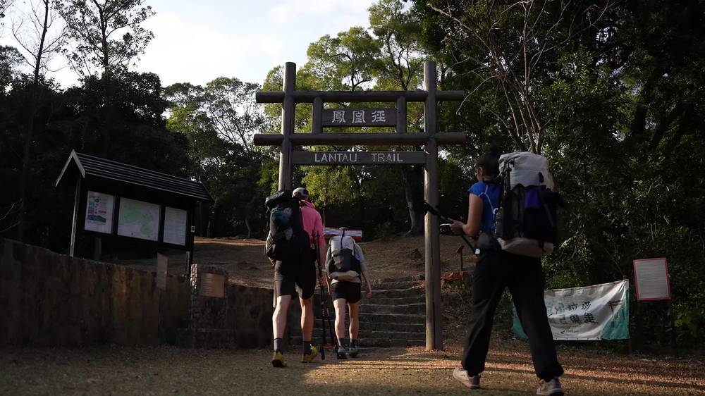
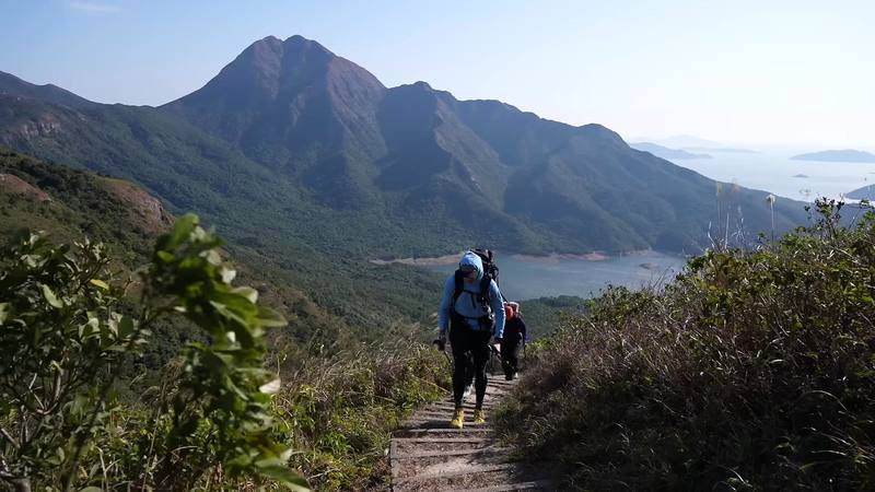
The first section follows the road up past the villages to Nam Shan, which we reached at 4:07 p.m. Then the stairs begin, and these first sets of stone steps foreshadow the defining thing about this trail. Ryan and I happened to be shooting the exact same type of video, so we had to talk about who was getting which shot.
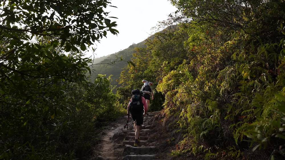
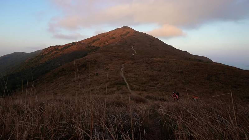
We climbed the ridge toward Sunset Peak in the evening light and reached the area near the peak around 6 p.m., where we found a nice flat spot near the old stone huts as the clouds rolled in and the temperature dropped. It's pretty unique to camp above such a big international airport. We fell asleep to the distant sound of planes taking off.
Mui Wo to Nam Shan (Section 1). From the ferry pier, AFCD's easiest section follows the road up past the five villages of Mui Wo, in the shade, to the barbecue area at Nam Shan Au: 2.5 km, about an hour by AFCD's count, 1.6 miles by my GPS. Nam Shan Campsite, with taps and flush toilets, is right below, by the Nam Shan Campsite bus stop on South Lantau Road. Fill your water here.
Up to Sunset Peak (Section 2). From Nam Shan the stone steps climb steeply and steadily up the ridge, over Yi Tung Shan (749 m) toward Sunset Peak (869 m), through silvergrass with views over the south coast. The trail's high point by my GPS is about 2,620 ft (800 m), on the shoulder of Sunset Peak, which we crossed the next morning; the summit is a short way off the trail. Near the top are the stone chalets of the Lantau Mountain Camp, built for British missionaries in the 20th century and now holiday rentals, AFCD says. There's no shade and no water on the ridge.
Where we camped. Near the stone huts, at mile 4.8 and about 2,360 ft (720 m). It's not a designated campsite, so camping there isn't legal. If you start in the afternoon like we did, sleep at Nam Shan Campsite and climb Sunset Peak in the morning.
Nam Shan, at mile 1.6, is on South Lantau Road, with buses to Mui Wo and Tung Chung. Past it there's no road until Pak Kung Au on Day 2. In fog, strong wind or rain, the exposed ridge to Sunset Peak is unpleasant; go back down to Nam Shan.
Getting to the trail · Mui Wo · Sunset Peak
It was wet in the morning and pretty socked in. I slept well; on this hike I'd switched to an accordion foam sleeping pad, and it was perfectly fine, maybe a good option for warmer hikes compared with blowing up an air pad. Because it was so overcast we skipped the actual top of Sunset Peak; it just didn't seem worth it. Some subscribers from Korea were hiking the same trail and said hello.
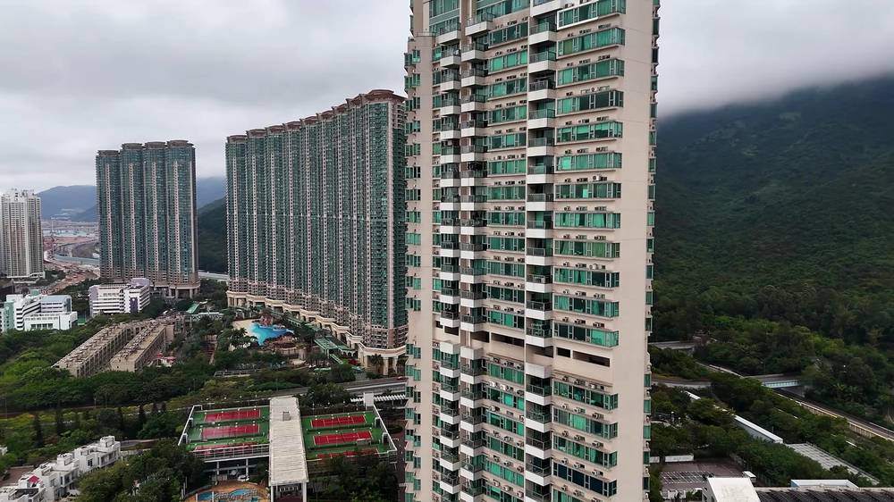
We took our time on the two miles down to the saddle between the two peaks, Pak Kung Au, and got there at 8:54 a.m. We'd expected to refill our water there, because the map showed toilets, but it was dry; there wasn't any. Then it started to rain, so we flagged down a passing taxi and rode ten minutes down to Tung Chung, the airport town.
We could easily have hiked the next peak without water, but we were trying to shoot a good video, we had lots of time, and we weren't in a rush, so we took half a day off and waited for better weather. In Tung Chung we had brunch, walked around the mall, rode the escalators and went into grocery stores with our packs on. Renee even dried her tent's rain fly next to the Starbucks. Lantau Peak stayed completely covered in cloud.
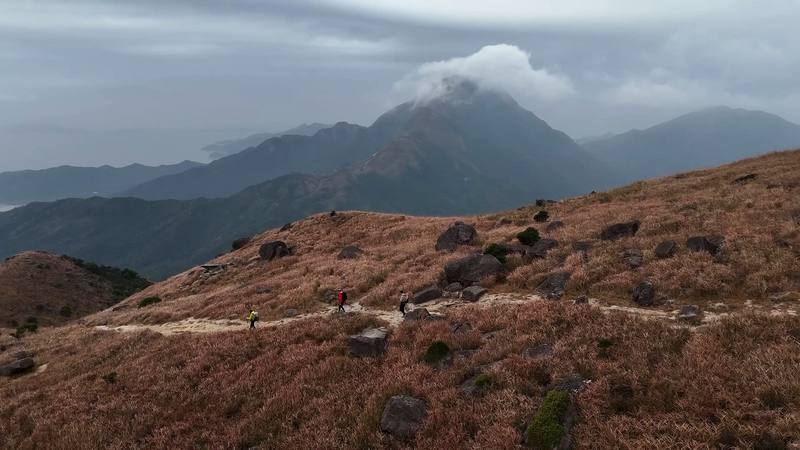
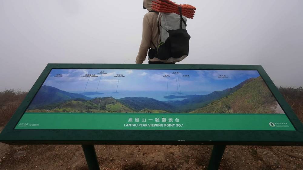
We waited as long as we could. Then Ryan and I took a taxi back up to Pak Kung Au and started up Lantau Peak in the clouds at 1:20 p.m., while Renee took the cable car up to Ngong Ping. It was windy, with almost no view. The trail up the peak wasn't technical, but it was getting nasty, so we put on our shells to battle the wind and rain, and made it to the top at about 2:30 p.m. It was a nice "why are we doing this" bonding moment with Ryan.
We made quick work of the three miles down to Ngong Ping, with the Big Buddha sticking out of the forest in the distance. We passed through another wooden gate and burning incense by the monastery and met Renee outside a vegetarian restaurant. The Po Lin Monastery was beautiful; the area was definitely touristy, with people everywhere, but I'm glad we had time to look around. It was getting surprisingly cold, so we walked over to the campsite just outside the village.
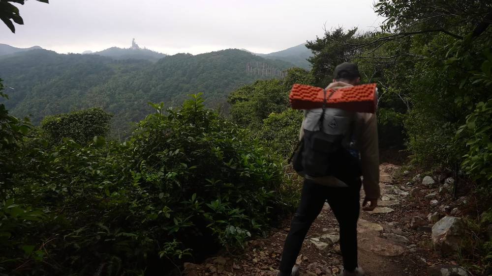
Hiking is really popular in Hong Kong: the campsite was very full, with barely any spots left. We squeezed in, cooked dinner and went to bed with the village's lights shining on the low clouds. It was a super cold night.
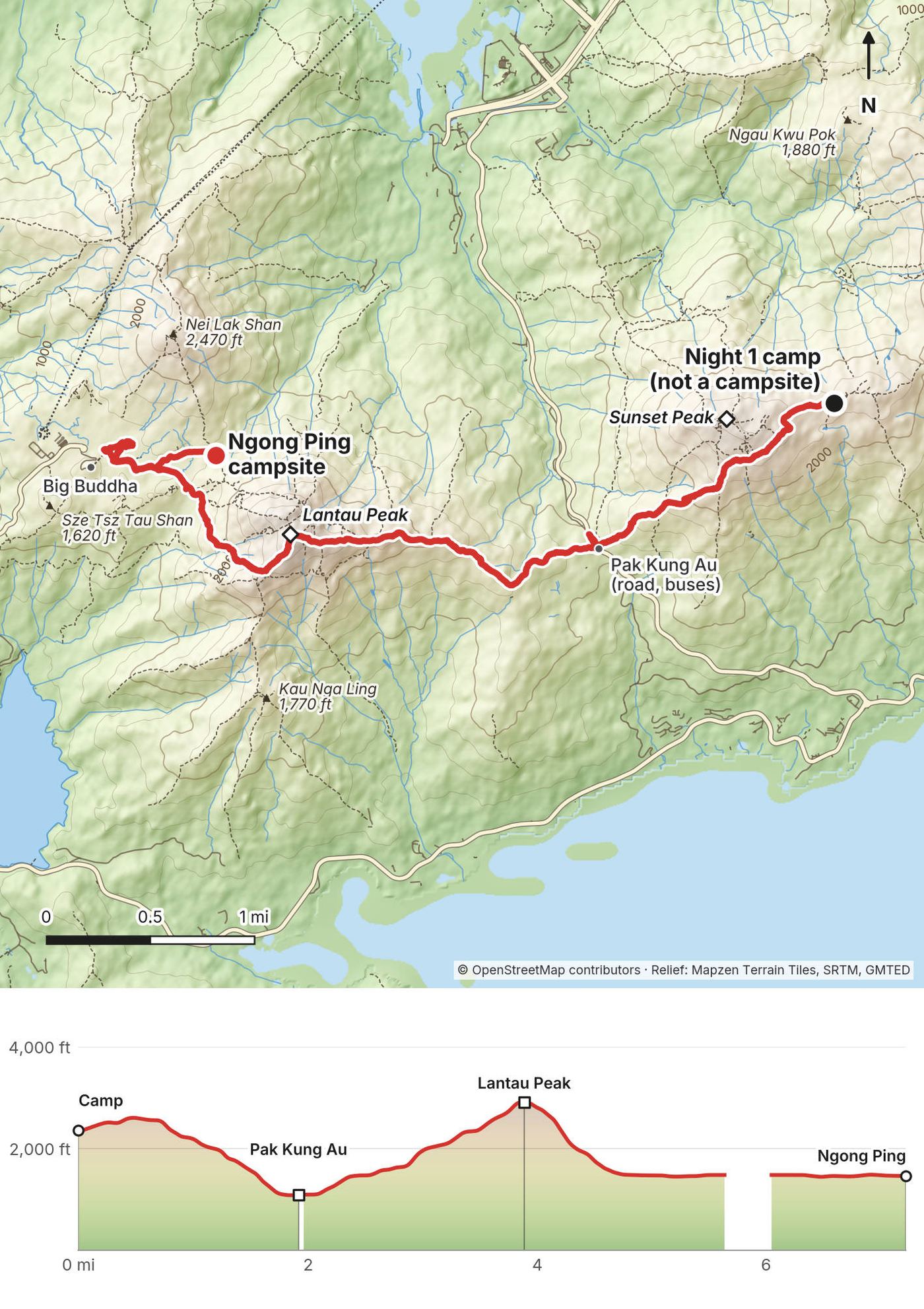
Sunset Peak to Pak Kung Au (end of Section 2). From the huts the trail crosses the shoulder of Sunset Peak, about 2,620 ft (800 m) on my GPS, then goes down long flights of stone steps to Pak Kung Au, the pass where Tung Chung Road crosses the island: 1.9 miles from our camp and about 1,500 ft down. AFCD gives Section 2, from Nam Shan, 6.5 km and 3.25 hours, rated 4 of 5. Pak Kung Au has bus stops for 3M, 11 and 23 and toilets on the map, but we found no water.
Lantau Peak (Section 3). From Pak Kung Au, at about 1,080 ft (330 m), the trail climbs almost all on stone steps to Lantau Peak, 3,064 ft (934 m): about 1,850 ft up in 2 miles by my GPS, which read 2,927 ft at the top. There's a small stone shelter near the top. AFCD says the peak is often cloaked in mist; it was for us. On the far side a steep rock staircase AFCD calls the "Staircase to the Sky" drops toward Ngong Ping. Section 3 is 4.5 km and 3 hours by AFCD, rated 4 of 5.
Ngong Ping. Section 3 ends at the arch and tea garden by Ngong Ping village, at mile 4.8 by my GPS: the Po Lin Monastery, the Big Buddha, the cable car, restaurants and shops, toilets, and buses 2 and 23. Ngong Ping Campsite is a short walk east of the village on the path toward the tea garden. It has camping platforms, tables and cooking places but no barbecue pits, and its water comes from the toilets about 100 m away.
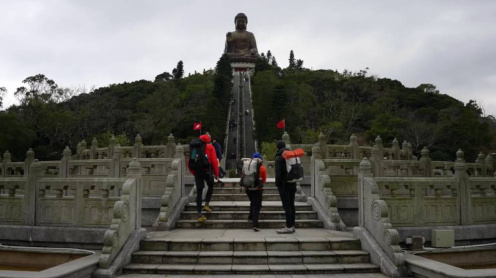
Pak Kung Au (mile 1.9) is the one road between Sunset Peak and Lantau Peak: buses and taxis down to Tung Chung, ten minutes, as we did. On Lantau Peak, the only ways off are back to Pak Kung Au or on to Ngong Ping. Don't start up it in a rainstorm warning, strong wind or heavy fog; we waited half a day and still got wind and rain.
Morning below Sunset Peak · Tung Chung · Lantau Peak · Ngong Ping
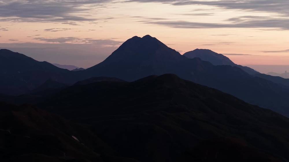
The next morning brought clear skies and lots of wind. We cooked breakfast, packed up and left at 8:06 a.m., before anyone else in the campground, with Lantau Peak at our backs.
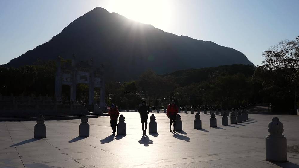
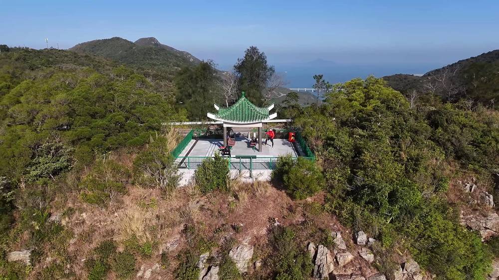
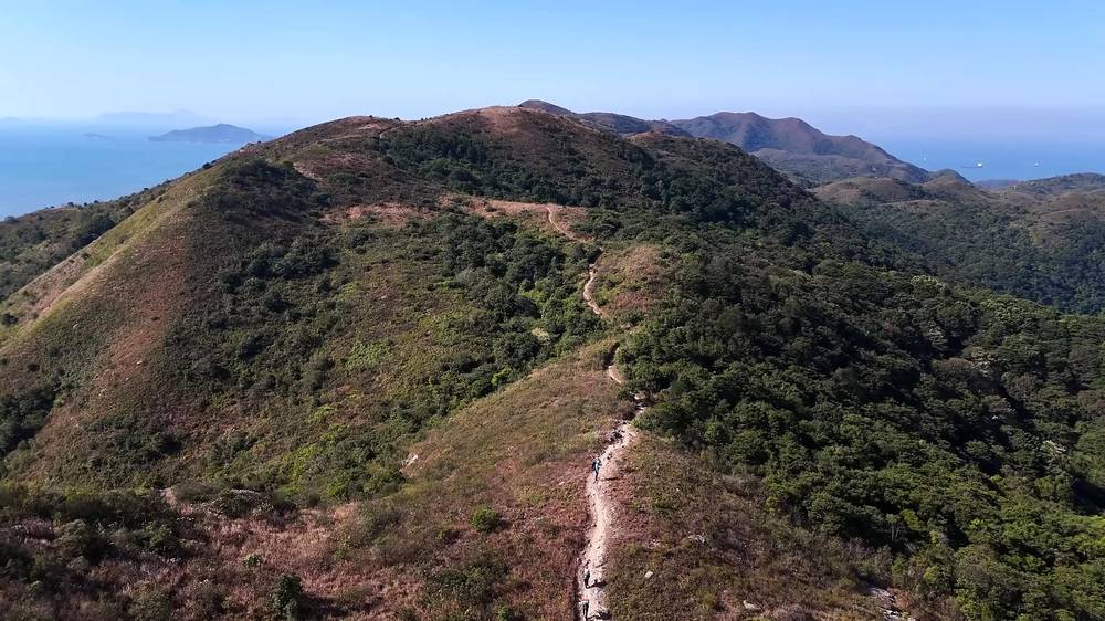
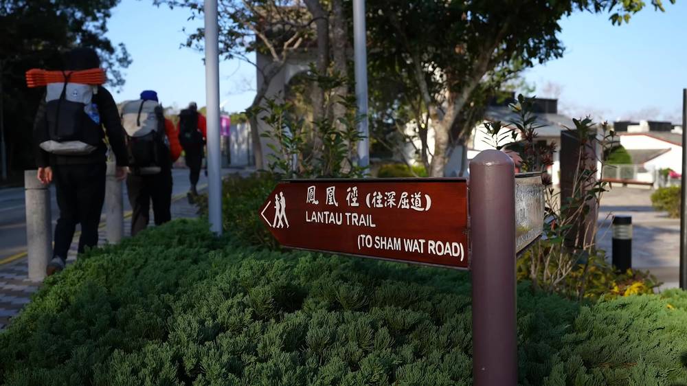
We walked out of the village on roads for a bit, following the sign to Sham Wat Road, before we found a nice viewpoint. It was really nice to finally have a full day of hiking and better weather, but we also had blow-your-hat-off wind; you could see it rippling the reservoir below. Lantau Peak looked far less formidable without the rain and clouds. We had over 12 miles to go, and this first part was up and down some large hills, but nothing too crazy.
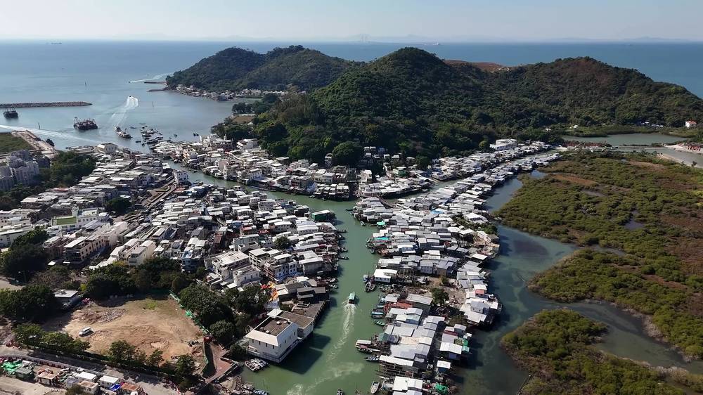
We were just trying to get down to the sea, and to soup. Ryan highly recommended the fishing village of Tai O, and I'm glad we went. It's like a little Venice: the village is split by a big Y-shaped waterway cutting through packed houses, mostly built on stilts. We got there at 11:42 a.m. and crossed bridges past lots of little shops. I stopped to buy my wife a little cat figurine, but Renee talked me into a pufferfish in a hat instead.
We ate at a memorable little place called Crossing Boat Restaurant. The garlic-soaked vegetables were particularly good, and there were cats inside and out. The donut and the mango mochi at Tai O Bakery were exceptional. We finished with coffee at a cafe called Solo, watching boats go by. It was a nice, relaxing moment.

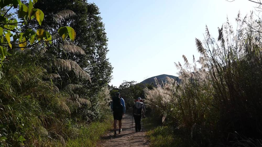
We left Tai O at 3:08 p.m. The rest of the day was an easy stroll along the sea, with beaches now and then. This is the quiet side of the island, and it was nice to be alone with some peace and quiet.
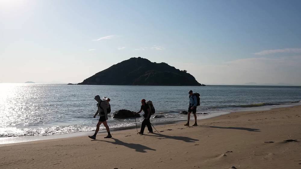
We had plenty of time to reach our campsite at 5 p.m., Tsin Yue Wan, one of my favorite campsites of all time, partly because we could have a fire and partly because we had it all to ourselves, with ships and planes slipping past the setting sun. I ended the day with spicy ramen by the fire and bedtime tea under a red light.
Ngong Ping to Sham Wat Road (Section 4). From the village the trail passes the Wisdom Path, joins the Nei Lak Shan Country Trail and Ngong Ping Road, and runs north of Shek Pik Reservoir, partly in woods and partly beside roads: 4 km and 1.25 hours by AFCD, rated 2 of 5. Sham Wat Road, at mile 2.4 by my GPS, has a bus stop.
Sham Wat Road to Man Cheung Po (Section 5). From the pavilion at the junction of Sham Wat Road and Keung Shan Road, the trail climbs over Kwun Yam Shan, with its temple, and along Keung Shan (459 m), with big views over Shek Pik Reservoir, then down to Man Cheung Po: 7.5 km and 3 hours by AFCD, rated 3 of 5. The windiest part of our day. Man Cheung Po Campsite, a designated campsite with a seasonal stream and a pit toilet, is a few minutes off the trail.
Man Cheung Po to Tai O (Section 6). An old stone path down past a pavilion to Nam Chung village and Tai O: 2.5 km and 45 minutes by AFCD. Tai O has restaurants, shops, toilets and the bus terminus (routes 1, 11 and 21).
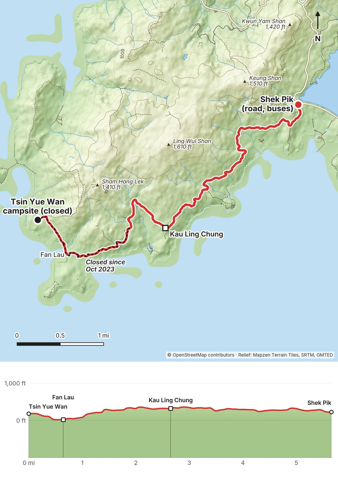
Tai O to Tsin Yue Wan (Section 7, partly closed). Section 7 leaves Tai O by Yim Tin Pok and follows the west coast, mostly flat, over a shingle beach and past mangroves, with the Pearl River estuary out to sea. The trail through the Yi O villages is closed by the landowners; go around them. South of Kan Tau Au, from about mile 11.7 of my day, the trail down the coast to Tsin Yue Wan and Fan Lau has been closed since October 2023, and so has Tsin Yue Wan Campsite, up on the hill above Fan Lau Sai Wan. See the 2027 plan.
Sham Wat Road (mile 2.4) and Tai O (mile 6.6) have buses. Past Tai O there's no road until Shek Pik, the next day; with the closure, end this day in Tai O unless AFCD has reopened Section 7.
Leaving Ngong Ping · Tai O · The coast and our campsite
Our last day of hiking was an easy one. We had a slow wake-up at camp and left at 7:27 a.m. Down in Fan Lau we found an awesome bathroom, bananas growing, and an arrow pointing to drinks, and stopped for a simple breakfast at an outdoor table from 7:57 to 8:19.
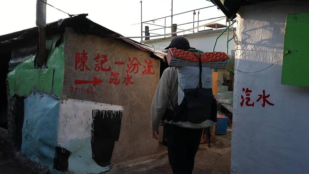
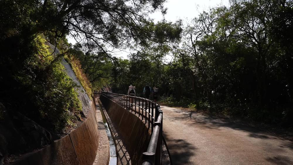
This final stretch was more of an escape, or exit, from the Lantau Trail, on roads and long walkways along water channels, which isn't much fun to hike. We reached the main road at Shek Pik at 10:26 a.m. and ended our hike there. It only took a few minutes to flag down an empty taxi, which drove us up to Ngong Ping, and the cable car down to Tung Chung, with its height, its views and its glass floor, was a perfect way to end our time on the island.
Tsin Yue Wan to Kau Ling Chung (Section 7, partly closed). From the campsite the trail drops to Fan Lau village, on the island's southwest tip, and follows the shore east above Fan Lau Tung Wan, then climbs to meet Section 8 above Kau Ling Chung. The part from the campsite to where the Fan Lau Country Trail comes down, about the first 1.7 miles of my day, is closed since October 2023, as are the Fan Lau Country Trail and the short side road to the South Lantau Obelisk. The rest, to Kau Ling Chung, is open.
Kau Ling Chung to Shek Pik (Section 8). Kau Ling Chung Campsite sits on a beach about 400 m from the trail, down a side path, with a stream and a few bridges, barbecue pits and a pit toilet; AFCD calls it one of the best spots in Lantau's country parks. We didn't go down. From above it, the trail follows the Kau Ling Chung catchwater, a concrete water channel with a path beside it, and the coast above Tai Long Wan, past Tai Long Wan Campsite, to South Lantau Road at Shek Pik: 3 miles and an hour by my GPS. AFCD gives Section 8 as 5.5 km and 2 hours, rated 2 of 5, and calls it ideal for picnickers. Shek Pik Campsite, with flush toilets about 100 m away, is by the end.
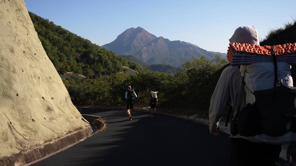
Shek Pik. The trail ends on South Lantau Road by the Shek Pik dam. Buses: 11 and 23 to Tung Chung, 1 and 2 to Mui Wo. Taxis pass. Section 9 continues east along the south coast toward Mui Wo if you want more.
There's no road between Tai O and Shek Pik. Once you're past Kau Ling Chung, Shek Pik is the way out, about an hour on.
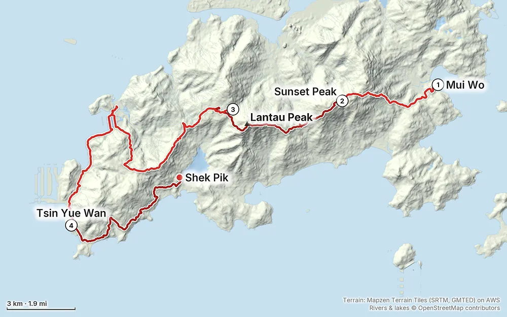
Elevation3–2,923 ft29.9 mi
Terrain: Mapzen Terrain Tiles (SRTM, GMTED) on AWS · Rivers & lakes © OpenStreetMap contributors
Tap a map to open it full size.
Checked on the Agriculture, Fisheries and Conservation Department's (AFCD) own pages on October 3, 2026: its hiking site (hiking.gov.hk), its notice board of trail closures, and its campsite pages. AFCD runs Hong Kong's country parks.
Sections 1 to 6 and 8: open. No closure notice touches them, or the Nam Shan, Ngong Ping, Man Cheung Po, Kau Ling Chung or Shek Pik campsites.
Section 7: partly closed. AFCD's notice, first posted on October 15, 2023 and reissued on October 10, 2025, says that "due to landslides caused by typhoon and heavy rain", these are "temporarily closed from now on until further notice": part of Lantau Trail Section 7, the Fan Lau Country Trail, the path from Kau Ling Chung to Fan Shui Au, the Obelisk South access road, and Tsin Yue Wan Campsite. On AFCD's map, the closed part of Section 7 runs down the west coast from just south of Kan Tau Au, past Tsin Yue Wan, to Fan Lau, and east along the shore above Fan Lau Tung Wan to where the Fan Lau Country Trail comes down. That's the last 1.1 miles of my Day 3 and the first 1.7 of my Day 4. It's marked on the maps. AFCD's notice map also marks an alternative route around the closure, from the Ngong Ping side past Man Cheung Po and south over Fan Shui Au toward Kau Ling Chung.
Yi O. Since 2013, the landowners in Yi O San Tsuen and Yi O Kau Tsuen haven't allowed access while they bring back the farmland, and AFCD lists the bit of Section 7 through the villages as closed: use another path around them.
Kau Ling Chung is open. The campsite at the start of Section 8 isn't on the closed list, and AFCD gives a way in that avoids the closure: the Kau Ling Chung catchwater path from Shek Pik, about an hour. That's the second half of my Day 4, and it's how the 2027 plan gets there.
What to do. Check AFCD's notice board at hiking.gov.hk/news before you go. If the Section 7 closure has been lifted, you can follow my route all the way.
Late January. We hiked January 25 to 28, 2025, just before Lunar New Year. The first evening was cloudy and windy, with the temperature dropping at camp. Day 2 was fog, wind and rain on the peaks. The night at Ngong Ping was super cold. Day 3 brought clear skies but blow-your-hat-off wind, and Day 4 was clear. After the hike, the city and Macau were packed for the holiday.
October to March: the cool, dry season. This is when to hike in Hong Kong. The Observatory says November and December are many people's favorite months, with breezes, plenty of sun and comfortable temperatures. January and February are cooler and cloudier, with frost at times on high ground; AFCD warns of sudden temperature drops and hypothermia. March and April bring fog. The dry winter is also hill fire season.
May to September: hot, wet and typhoon season. Most of the year's rain falls then, with thunderstorms, flash floods and landslides, and heat stroke is a real risk on exposed stairs. Typhoons can hit from May to November, most often July to September.
Holidays. Lunar New Year 2027 is February 6 to 9. Weekends and holidays are busiest at Ngong Ping, on Lantau Peak and at the campsites near roads.
Weather. Normals for the Hong Kong Observatory in Kowloon, at sea level (1991 to 2020). Sunset Peak and Lantau Peak, at 869 and 934 m, are colder and much windier:
| Month | High / low °F (°C) | Rain, in (mm) | Days with rain |
|---|---|---|---|
| November | 76 / 69 (24.5 / 20.3) | 1.5 (39) | 6 |
| December | 69 / 61 (20.4 / 16.2) | 1.1 (29) | 5 |
| January | 66 / 58 (18.7 / 14.6) | 1.3 (33) | 6 |
| February | 67 / 60 (19.4 / 15.3) | 1.5 (39) | 8 |
| March | 71 / 64 (21.9 / 17.6) | 3.0 (75) | 11 |
Emergencies. Call 999 (or 112 from a mobile). Tell them the number on the nearest distance post: the Lantau Trail has numbered posts, L001 to L139, about every 500 m, and AFCD and the police use them to find you. The police's HKSOS app can send your location to the 999 centre.
Fog, wind and rain. The peaks are often in cloud, and we had wind and rain on Lantau Peak. Don't start up Sunset Peak or Lantau Peak under an Amber, Red or Black rainstorm warning or a typhoon signal; under a Black warning AFCD tells people to leave country parks or take shelter.
Cold. From November to February, AFCD warns that a sudden drop in temperature can cause hypothermia. Our night at Ngong Ping was super cold; bring a warm sleeping bag or quilt and a puffy.
Heat. From May to October the stairs are hot and exposed. Start early, carry more water than you think, and watch for the Observatory's Very Hot Weather Warning.
Stairs and knees. The steps down from Sunset Peak to Pak Kung Au and from Lantau Peak to Ngong Ping are long and steep. Poles help, and wet stone is slippery.
Hill fires. The dry winter is fire season. Fires only in campsite pits, and never when the fire danger warning is red.
Wildlife. If you meet cattle or buffalo, give them room. Hong Kong has venomous snakes, more active from spring to autumn; watch where you step.
Landslides. Heavy rain and typhoons close trails, as happened on Section 7 in 2025. Check AFCD's notices after any big storm.
How many days do I need? We took four days and three nights for Sections 1 to 8, with a short first afternoon, a half day lost to rain, and long stops in Ngong Ping and Tai O. In the film I say three days; my GPS and my notes say four. AFCD's walking times for Mui Wo to Tai O add up to about 12 hours, so it can be done in two long days.
How hard is it? The first two days are the hard ones. The stairs at the start foreshadow the defining thing about this trail: stone steps, up and down, over Sunset Peak and Lantau Peak, which AFCD rates 4 of 5. The trail up Lantau Peak wasn't technical, but in wind and rain it got nasty. After Ngong Ping it's up and down some large hills, nothing too crazy, then easy walking along the coast.
Is it a loop? The whole Lantau Trail is a 70 km loop from Mui Wo and back, in 12 sections. We walked Sections 1 to 8, Mui Wo to Shek Pik, and took a taxi from there. Sections 9 to 12 go back to Mui Wo along the south coast.
Can I camp anywhere? No. In Hong Kong's country parks you can only camp at designated campsites; it's the law. They're free and you don't book them. Our first night, near the stone huts below Sunset Peak, was not at a campsite. Don't copy us: for an afternoon start, sleep at Nam Shan Campsite, at the end of Section 1.
Is there water? Not on the mountains. There's none between Nam Shan and Ngong Ping: we expected to refill at Pak Kung Au, where the map showed toilets, and found no water. Fill up in Mui Wo or at Nam Shan (AFCD has a water filling station there), then in Ngong Ping, Tai O and at the toilets by Shek Pik. Campsite streams can run dry.
Can I have a campfire? Only in the barbecue pits at the campsites that have them, like Kau Ling Chung. We had a fire in the pit at Tsin Yue Wan. Fires anywhere else are illegal, and hill fires are a real risk in the dry winter.
Is it crowded? Ngong Ping is a big tourist site: the Big Buddha, the monastery and the cable car. The campsite there was very full on a Sunday night in January. Once we left Tai O we had the coast and our campsite to ourselves.
Is there a phone signal? In an emergency, the government's telecoms office says a 112 call from a mobile connects through any network with coverage, whichever one you're on.
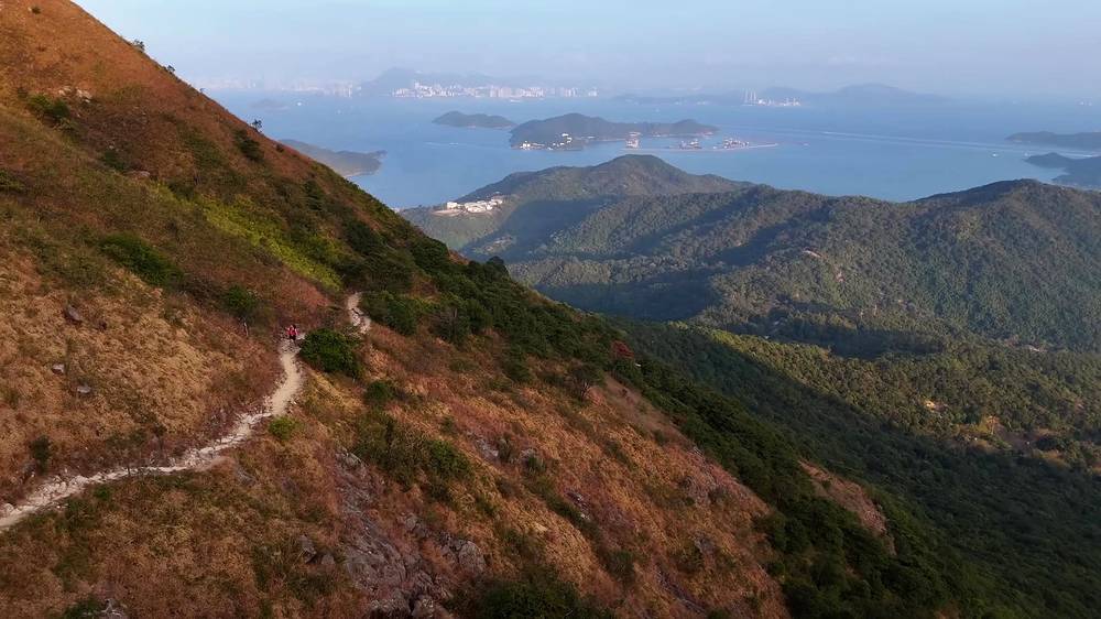
While the Section 7 closure lasts, this is how I'd do it: the same trail I walked, minus the closed part, with every night at a legal campsite.
| Day | Route | About | Sleep |
|---|---|---|---|
| 1 | Ferry to Mui Wo, Section 1 to Nam Shan | 1.6 mi by my GPS (2.5 km, 1 hour by AFCD) | Nam Shan Campsite (taps, flush toilets) |
| 2 | Sections 2 and 3: Sunset Peak, Pak Kung Au, Lantau Peak, Ngong Ping | About 7 mi (11 km, 6.25 hours by AFCD) | Ngong Ping Campsite |
| 3 | Sections 4 to 6 to Tai O; bus to Shek Pik (routes 1 or 11); Section 8 backward to Kau Ling Chung | 6.6 mi to Tai O by my GPS, then 3 mi, about an hour | Kau Ling Chung Campsite (beach, barbecue pits) |
| 4 | Section 8 back to Shek Pik | 3 mi, about an hour |
Days 1 to 3 to Tai O are exactly my route. The hour from Shek Pik to Kau Ling Chung is the second half of my Day 4, walked the other way, and it's the way in AFCD itself gives while Section 7 is closed. AFCD's directions: get off at the Sha Tsui stop and walk along the catchwater for an hour to Kau Ling Chung. Kau Ling Chung is first come, first served and small: if it's full, Shek Pik Campsite is by the road at the end.
If you start in the morning, do Mui Wo to Ngong Ping in one day (Sections 1 to 3, 13.5 km or 8.4 miles by AFCD, over both peaks, with 7.25 hours of walking by its count), and the whole plan takes three days.
Distances. AFCD gives Sections 4 to 6 as 14 km (8.7 miles); my GPS reads 6.6 miles from Ngong Ping Campsite to Tai O, because I took the road out of Ngong Ping and a shorter line near Man Cheung Po in places where AFCD's line goes another way. Follow the signs and expect AFCD's distance.
Three days, ending with a bus from Tai O. You get both peaks, Ngong Ping and Tai O, and skip the coast. Or end at Tai O and visit Kau Ling Chung as a there-and-back from Shek Pik.
The Lantau Trail is a 70 km loop. Sections 9 to 12 go from Shek Pik back to Mui Wo along the south coast, past Shui Hau, Cheung Sha (Hong Kong's longest beach), Pui O and Pak Fu Tin, with the Lo Kei Wan, Shek Lam Chau, Shap Long and Pak Fu Tin campsites. I didn't walk them.
Sections 2 and 3 make a big day hike over Sunset Peak and Lantau Peak, Nam Shan to Ngong Ping, with buses at both ends. Lantau Peak alone is a climb from Pak Kung Au. Section 6, Man Cheung Po down to Tai O, is short and easy.
These change every year. Everything else in this guide stays the same.
Is it open?
Getting there
Your stuff
The film is at the top of this page.
Planning questions about Lantau Trail, answered only from this page's facts, the creators' versions and hikers' public tracks, with where each answer comes from. When the data doesn't say, the answer says "not given".
From hikers
Sign in to comment. Free; your hikes stay private unless you share them.
Something wrong or missing on this page? Send feedback.