
Content made there
The film is at the top of this page.
Photos
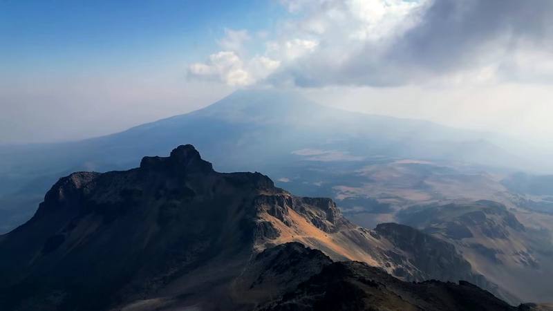
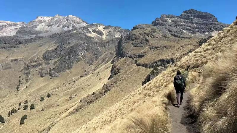
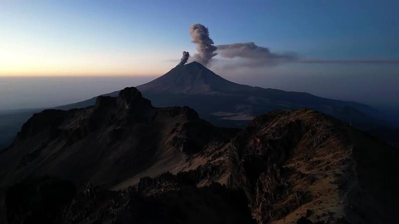
Hikes / Mexico City and Iztaccíhuatl / Kraig Adams's version
North America · Mexico
Mar 2023 · Huts

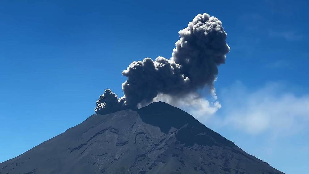
In March 2023 my wife and I spent a few days in Mexico City. When she flew home, I rented a little white car, drove out to the volcanoes and hiked up Iztaccíhuatl on my own. I started at Paso de Cortés, the pass between Iztaccíhuatl and Popocatépetl, walked about seven miles up to a small metal hut on the ridge with Popocatépetl erupting behind me, and spent the night there with a stray dog. The next morning I climbed by headlamp to the First Knee, about 16,500 ft (5,030 m) by my GPS, and turned around. It wasn't a true summit, but I'm still glad I did it. Two days, 14.4 miles by my GPS. It's the trip from my film 5 Days in Mexico City.
This is not a summit guide. I turned back at the First Knee, about a mile short of the summit (El Pecho) as the crow flies, because I was nearly out of water and food, the wind was strong and the altitude was giving me constant headaches. Everything up to that point is my own trip, with my GPS. Beyond it, the guide only tells you what the official sources and the people who run trips there say: see To the summit.
| Quick facts | |
|---|---|
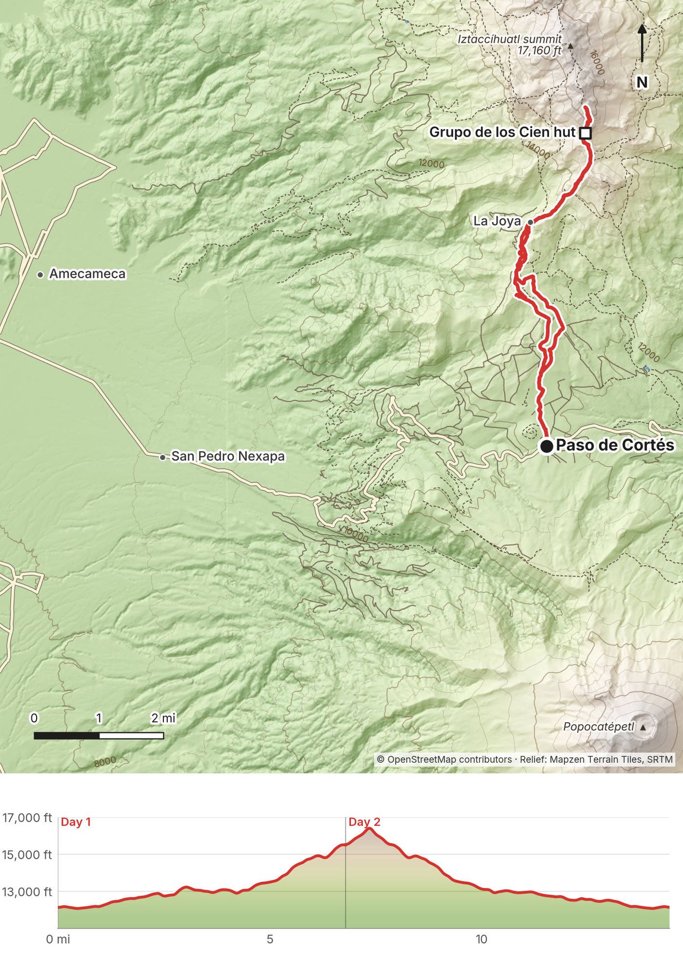
| Distance | 14.4 miles (23.2 km) by my GPS: 6.8 miles up to the hut, then 7.6 from the hut to the First Knee and all the way down |
| Climbing | About 5,850 ft (1,784 m) up and 5,860 ft (1,785 m) down |
| Start and finish | Paso de Cortés, the national park office, about 12,120 ft (3,695 m) by my GPS, about 23 km above Amecameca |
| High point | The First Knee (Primera Rodilla), about 16,500 ft (5,028 m) by my GPS. The summit, El Pecho, is 17,160 ft (5,230 m) |
| When | I went March 7 and 8, 2023 |
| Difficulty | An easy walk-in, then a steep, rocky, loose climb to over 15,000 ft with all your water, a freezing night and a windy ridge. The summit beyond my turnaround is mountaineering |
| Fees (2026) | MXN 125 (about US$7) per person per day at Paso de Cortés; a CONANP reservation to drive to La Joya. No guide required by the park's rules |
Distances and climbing are from my own GPS, smoothed the same way every day. The summit's height is the Smithsonian's 5,230 m (Mexican sources give 5,215 to 5,230 m); the other heights are from my GPS, so they're given as "about."
| Day | Route | Miles (km) | Up / down (ft) | Sleep |
|---|---|---|---|---|
| 1 | Paso de Cortés to the Grupo de los Cien hut | 6.8 (10.9) | 4,301 / 920 | The hut, about 15,500 ft |
| 2 | The hut to the First Knee and down to Paso de Cortés | 7.6 (12.3) | 1,551 / 4,938 |
Mexico City is the base. It sits at about 7,350 ft (2,240 m), which makes a few days there good preparation for the altitude. Flights land at Mexico City's airport (MEX). In March 2026, an authorized taxi from the airport to Roma or Condesa cost about MXN 275 to 620, and an Uber about MXN 190; app cars can only pick up at their marked spots outside the terminals.
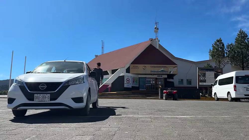
My way in, 2023. My wife and I spent three nights in an Airbnb in La Condesa. The morning she flew home, I took an Uber back to the airport ($8) and picked up a little white rental car ($90 for two days). It's about an hour's drive out of Mexico City to Amecameca. The road conditions were not fantastic: lots of potholes and lane lines missing much of the time. Then the outlines of the volcanoes appeared ahead, and after a cow crossing and a turn onto a dirt road, I was at my hotel near Amecameca.
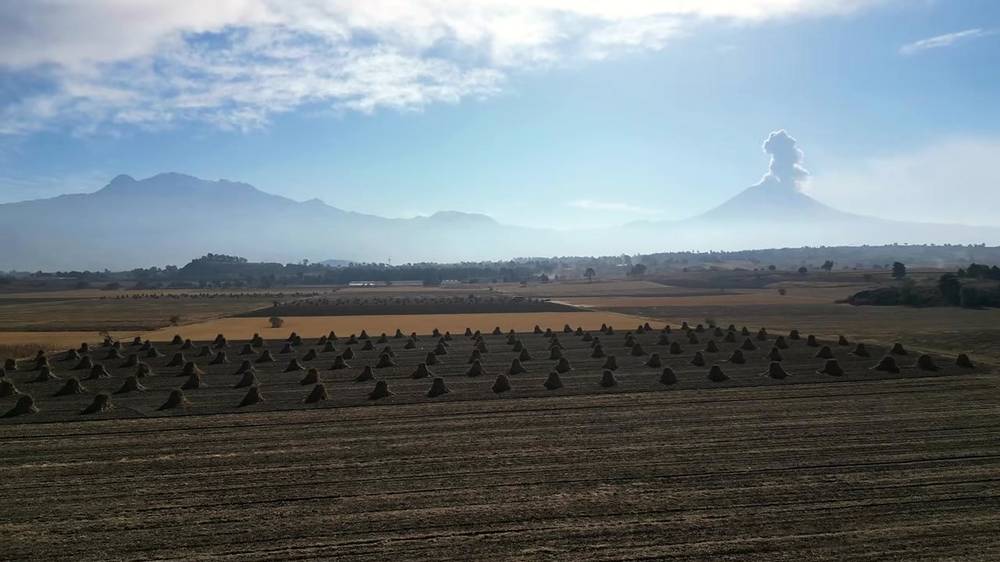
The next morning I drove about an hour up into the mountains, watching Popocatépetl's little eruptions grow larger as I drew closer. The road climbs from Amecameca through San Pedro Nexapa and the pine forest to Paso de Cortés.
By car (2026). Take the México-Puebla toll road to the Chalco exit (one toll, MXN 26 for a car in 2026), then the federal road through Chalco to Amecameca, then the paved road 23 km up to Paso de Cortés. From Paso de Cortés to La Joya it's about 8 km of wide dirt road that ordinary cars drive in the dry season; it can be muddy in the rains, and it needs your reservation. Drive in daylight. Fuel is about MXN 24 a liter.
By bus and taxi. CONANP says public transport only goes as far as Amecameca; from there you need a private vehicle. Buses run by the Volcanes and Sur lines leave Mexico City's TAPO bus station (next to Metro San Lázaro) for Amecameca about every 20 to 30 minutes from about 5 or 6 a.m. to 10 p.m.: about MXN 40 to 50 and 1.25 to 1.75 hours, as reported. From Amecameca's main square a taxi to Paso de Cortés or La Joya is about MXN 250 to 450 one way, or about MXN 1,000 round trip with waiting, as reported. Arrange the pickup for the way back in person: phones may not work up top. I found no sign that Uber goes up there.
With a tour. Tour companies in Mexico City run day trips to the Grupo de los Cien hut and summit trips, from about MXN 1,700 to 7,000 per person in 2026, as reported, usually with transport from Condesa, park fees and a guide.
| Item | What I paid (2023) |
|---|---|
| Two round-trip flights, Denver to Mexico City (for my wife and me) | $1,400 |
| Uber to the airport to pick up the car | $8 |
| Rental car from Mexico City's airport, two days | $90 |
| Hacienda San Andrés, one night with lunch, dinner and breakfast | $300 |
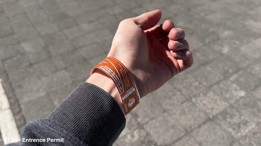
| Entrance permit (wristband) at Paso de Cortés | $1.50 |
| The hut | Nothing that I recorded |
For your budget (2026). Entrance MXN 125 (about US$7) per person per day. Bus from Mexico City to Amecameca about MXN 40 to 50; a taxi up about MXN 250 to 450 each way. Toll to Chalco MXN 26; fuel about MXN 24 a liter. Hotels in Amecameca from about US$32; Hacienda San Andrés about US$215 to $330 with breakfast. Tours MXN 1,700 to 7,000. The peso was about 18 to the US dollar on October 2, 2026 (Banco de México).
| Night | Where | Height |
|---|---|---|
| Before | Hacienda San Andrés, Ayapango, next to Amecameca | |
| 1 | The Grupo de los Cien hut (Day 1 mile 6.8) | About 15,500 ft (4,724 m) by my GPS |
Hacienda San Andrés. A small boutique hotel on a family-owned farm. My room was very large and overly nice for my solo traveling circumstances, but I felt like spoiling myself a little and having an interesting stay in an area that didn't have much: it was really the only nice hotel I could find. It was a weekday and I was the only guest. The food was by far the best part of that day: the family basically had two private chefs cooking for them and me, and a lot of it grew in the garden I walked past at sunset, with good views of the two volcanoes. The owner, Marco, was so friendly, and gave me a can of alcohol fuel so I could have hot food on the mountain. If you're ever in the area, please visit and say hello for me. I paid $300 for the night with lunch, dinner and breakfast.
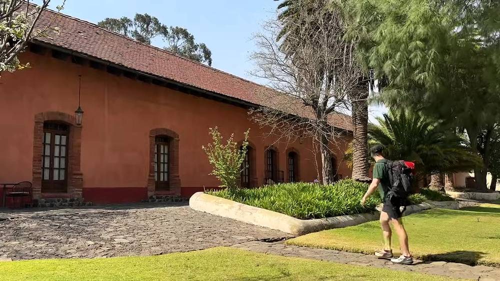
In 2026. Hacienda San Andrés is in Ayapango, next to Amecameca, and still takes guests: its own site lists rooms at MXN 3,900 to 5,950 a night (about US$215 to $330) with breakfast, booked by WhatsApp; ask about meals. Amecameca has simpler hotels and apartments from about US$32 to $77 a night.
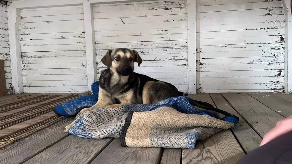
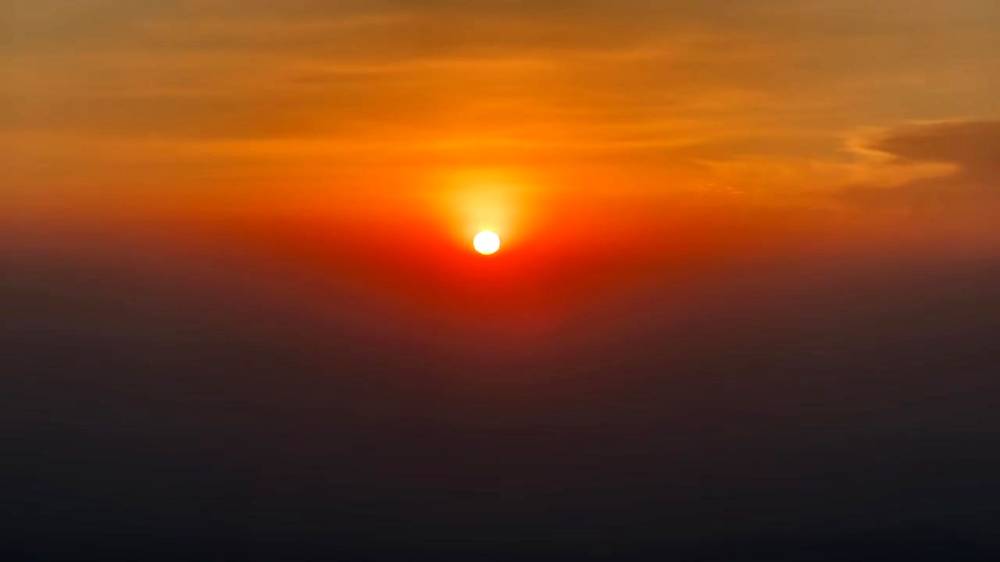
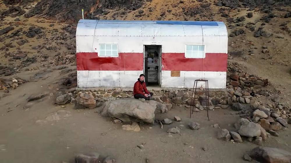
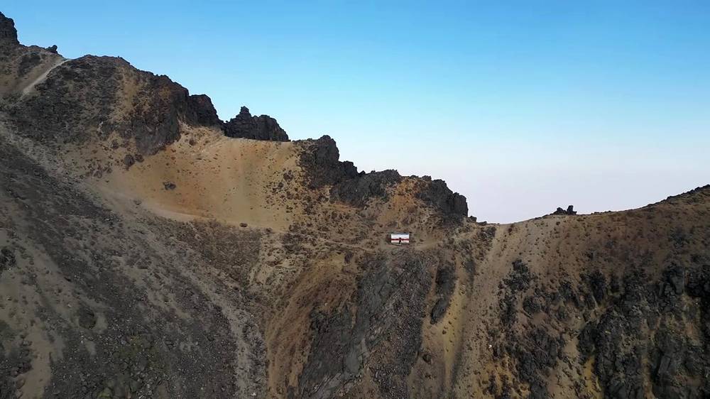
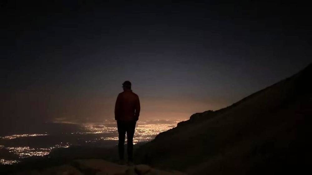
The hut. I was all alone in the hut except for a stray dog, who I named Nancy Wheeler. It has wooden bunks along white board walls. It was nice to have a safe spot to rest, but I was all alone on top of a mountain in Mexico, and the loneliness and isolation started to creep in with the fading daylight. Clouds rolled in as visibility dropped and it got darker and darker. I shared some of my precious water with Nancy, made my bed and heated water for dinner. When I could no longer keep myself busy with small chores, I watched the sunset and lounged around with Nancy. After the clouds disappeared, the lights of Mexico City shone brightly in the middle of the night.
What I brought. About two liters of water for both days. For dinner, freeze-dried macaroni and cheese with hot sauce, and coffee, heated on the alcohol fuel from the hotel. It was very good, but I was also very hungry, so I think anything would have tasted good. By the next morning I was almost out of water and food, which is part of why I turned around.
Water. There's none on the mountain: it's a dry volcano hike with no water sources. Carry all of it from Paso de Cortés or before. A tour company tells day hikers to the hut to carry 2 to 3 liters; for a night at the hut and a morning on the ridge, carry more than I did. Drink a lot before you start, as I did.
Food. CONANP says the food stands near the park open only on weekends; as reported, they sell quesadillas, tlacoyos, hot drinks and snacks at Paso de Cortés. On a weekday assume nothing is open. Buy what you need in Mexico City or Amecameca.
Stove fuel. You can't fly with any fuel, in checked or carry-on bags, and a stove is allowed only if it's empty and cleaned (TSA). Buy fuel in Mexico: check that a Mexico City outdoor store has gas canisters in stock before you go. Cans of alcohol gel fuel like mine work, slowly.
There's no gear list for this trip in my film or its description. What I had, from the film:
What this climb needs:
At the park office at Paso de Cortés I paid a very small fee to get a bracelet permit, and drank as much water as I could at the car. It was a dry volcano hike with no water sources: I would have to carry all of the water for the entire hike, so I brought just about two liters.
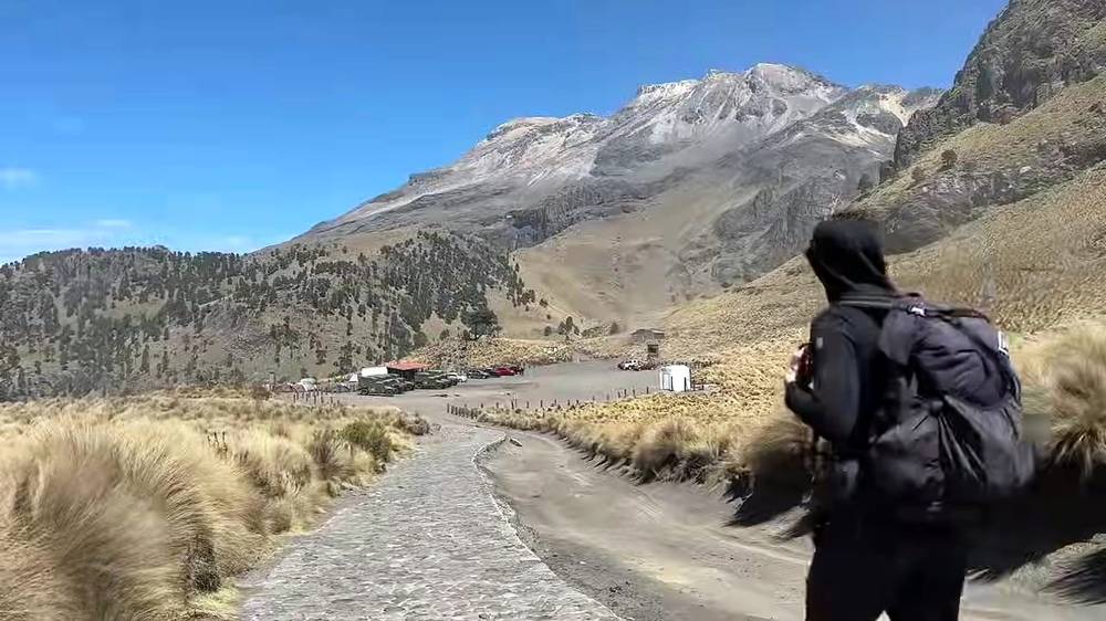
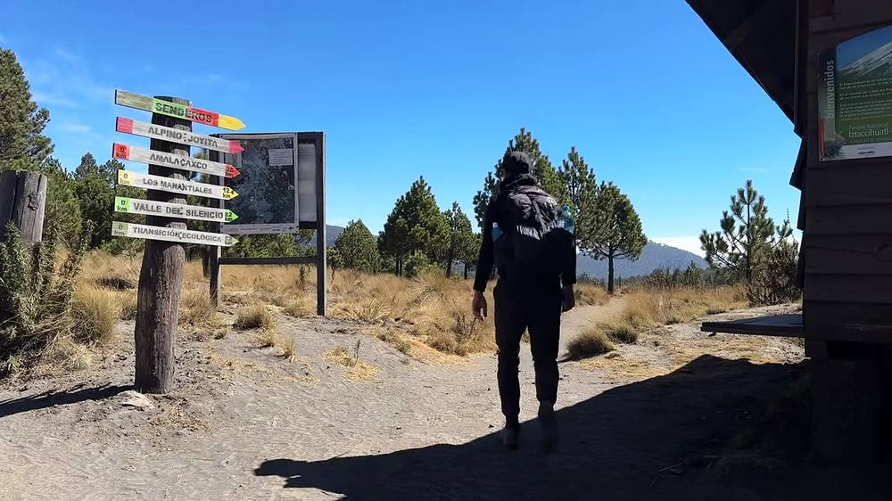
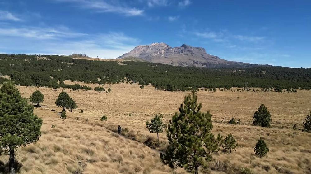
I started recording at 10:33 a.m. by the trail signs at Paso de Cortés. The first miles cross open grassland with scattered pines, with Iztaccíhuatl ahead and Popocatépetl erupting behind me. The trailhead at La Joya had a few cars and people, and the Mexican Army had trucks and tents in the parking area, but I didn't really pass many other hikers. I was definitely very alone on this hike.
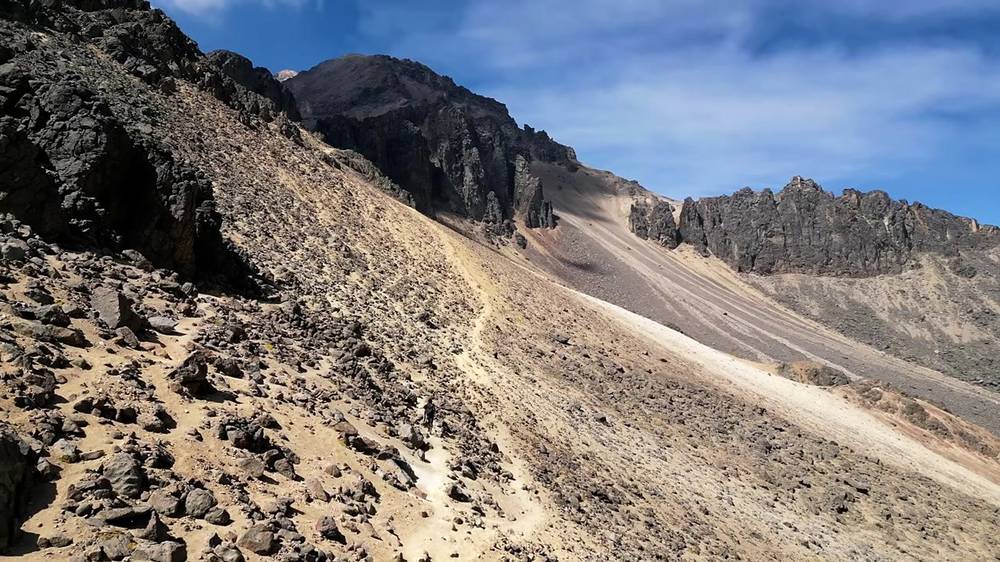
Above La Joya the trail climbs the ridge. It was hot and dry and sunny and rocky, and eventually the elevation started to get to me, so I took more and more breaks. I was hiking over 15,000 feet, which is higher than any peak in Colorado, and I live in Denver, which is just a mile high. I was well above where trees or bushes or plants could grow, and the air got colder even in the direct sunlight, which I hid from in my sun hoodie. By my GPS, the last 1.4 miles, from the first portillo to the hut, about 1,600 ft up, took me two hours and forty minutes.
I reached the little mountain hut at 3:54 p.m. and was greeted by a stray dog. In the film I said it took me about four hours to hike seven miles that first day; my GPS says 6.8 miles and 5 hours 20 minutes, about 4 of them moving.
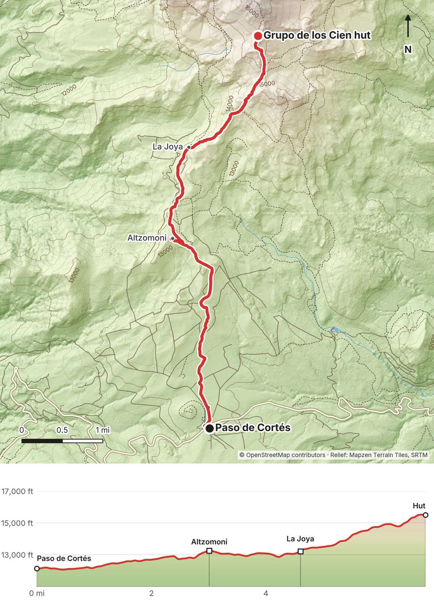
Paso de Cortés. The pass between Iztaccíhuatl and Popocatépetl, at about 12,120 ft (3,695 m) by my GPS, with the national park's office, parking and the trail signs. My recording starts by the signs and heads north.
To Altzomoni and La Joya. For the first 4.6 miles the trail runs north through bunchgrass and scattered pines, near the dirt road from Paso de Cortés to La Joya. It's the easy part: about 1,100 ft of gentle climbing to the Altzomoni station area at mile 3.0, about 13,250 ft (4,039 m), then a slight drop to La Joya.
La Joya. At mile 4.6, about 13,190 ft (4,019 m) by my GPS: the end of the dirt road, parking and toilets, and where most people start the climb. In 2023 the Army had trucks and tents here.
Up the ridge (the Portillos route). From La Joya the trail climbs east and then north up the ridge on a narrow path through the bunchgrass, past a series of notches called portillos: the first at mile 5.4 (about 13,890 ft, 4,232 m), the second at 5.7, the third at 6.2 and the fourth at 6.5 (about 15,190 ft, 4,628 m). Above the first portillo the grass gives out to rock, loose scree and crags, and the climbing gets steeper.
The hut. At mile 6.8, about 15,500 ft (4,724 m) by my GPS: the Grupo de los Cien hut, a small metal hut, white with a red band, on a stone base on the ridge.
The only way off is back down the way you came: 2.2 miles and about 2,300 ft down from the hut to La Joya, then 4.6 miles on to Paso de Cortés. Turn back if the altitude is hitting you hard (a headache that gets worse, vomiting, confusion, breathlessness at rest), if a storm is building, or if you're running low on water.
The drive up and Paso de Cortés · Day 1, up to the hut · The hut and the night
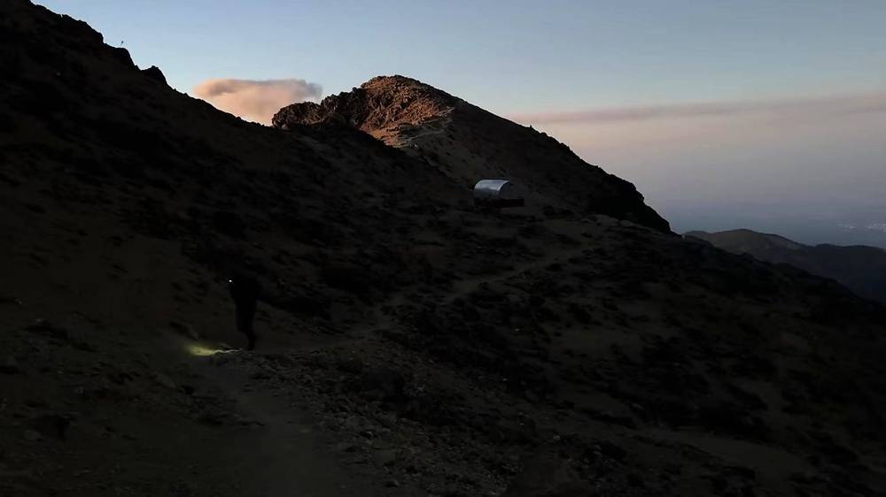
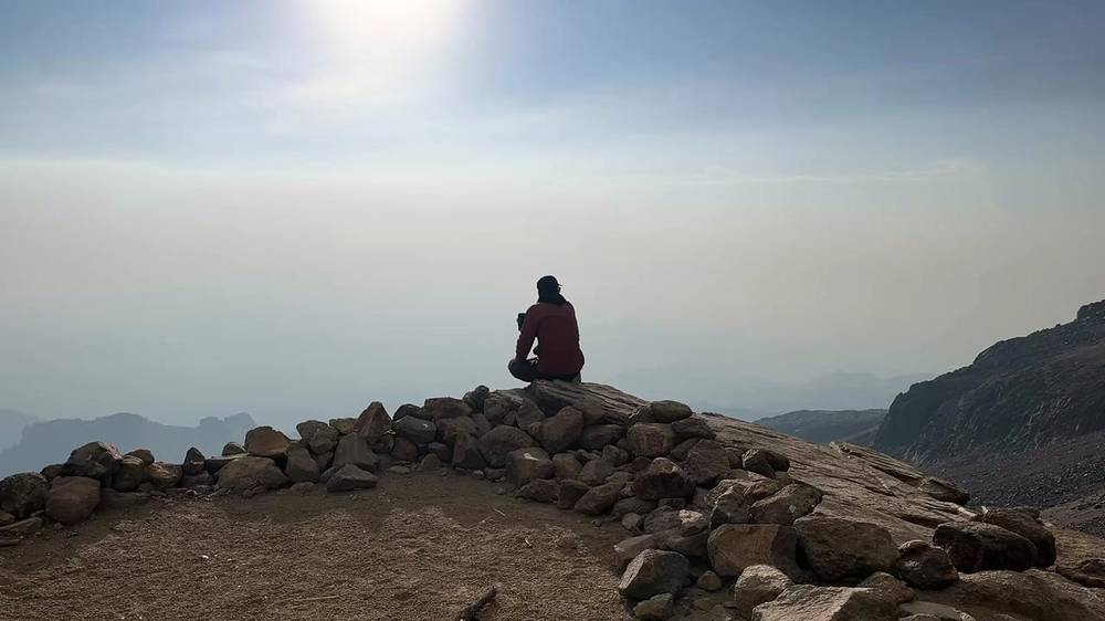
I left the hut early, because it's just too cold up that high to justify summiting before the sun breaks the horizon; my GPS starts at 6:25 a.m. I was almost out of water and food, so I wanted to reach some sort of goal before turning back and escaping down the mountain. The visibility was fantastic. Other Mexican peaks, including Orizaba, the highest peak in Mexico, broke through the low clouds on the horizon as Popocatépetl erupted softly at my back.
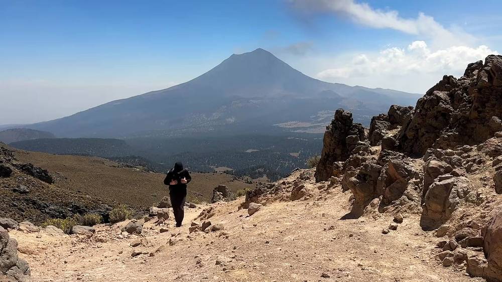
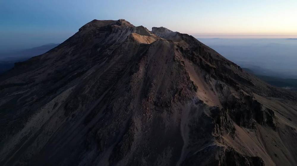
At 7:41 a.m. I reached my high point on the ridge, about 16,500 ft (5,028 m) by my GPS. In the film I called it the Glaciar de San Agustín, at almost 17,000 feet: the old San Agustín glacier, now gone, lay just beside it. On the map it's the First Knee (Primera Rodilla). I decided to call it a day there, because of the dwindling supplies and strong wind, and the elevation starting to give me constant headaches. I made it to a "good enough" spot on the top of the ridge line. I don't think it was technically a summit, but I was happy to make it this far.
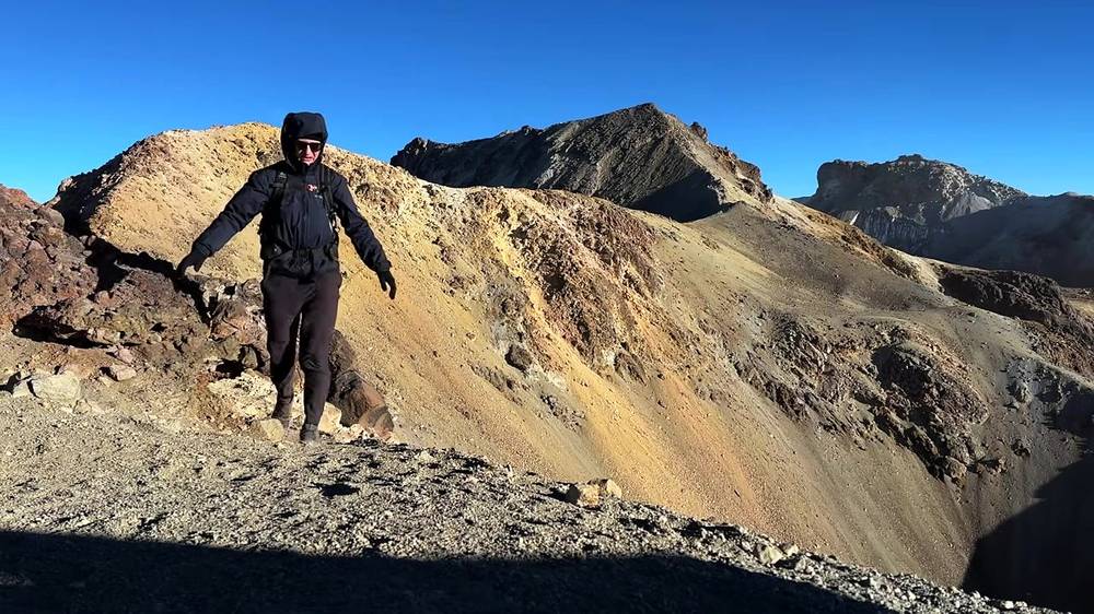
Then I walked all the way down: back past the hut at 8:15, La Joya at 9:10 and Paso de Cortés at 10:28 a.m.
The hut to the First Knee. Half a mile and about 1,000 ft up from the hut on a steep, loose path of rock and scree, past a cross on the ridge. It took me an hour and a quarter in the dark and first light. By my GPS the high point is 5,028 m; OpenStreetMap gives the First Knee 5,047 m (16,558 ft). The ruins of an old refuge are a few yards away.
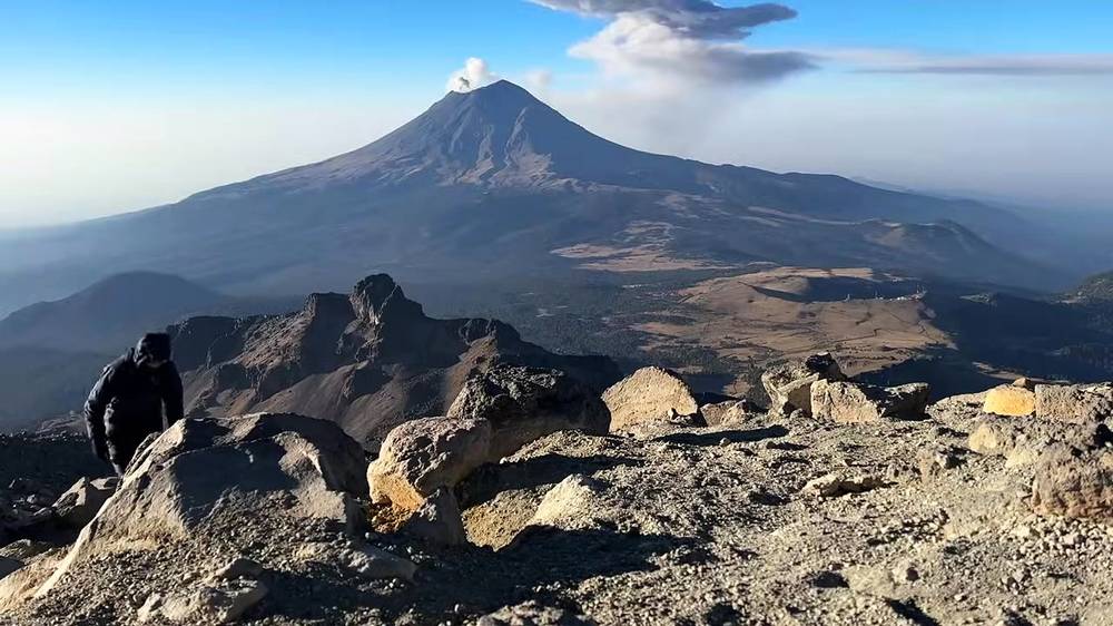
Beyond the First Knee. I didn't go farther, and there's no track for it in this guide. See To the summit.
Back down. The same trail as Day 1 to La Joya, at Day 2 mile 3.1. Below La Joya my track follows the dirt road down to Paso de Cortés, a little east of the trail I walked up past Altzomoni.
This is the way off. If the altitude is getting to you at the hut or on the ridge, the fix is to go down.
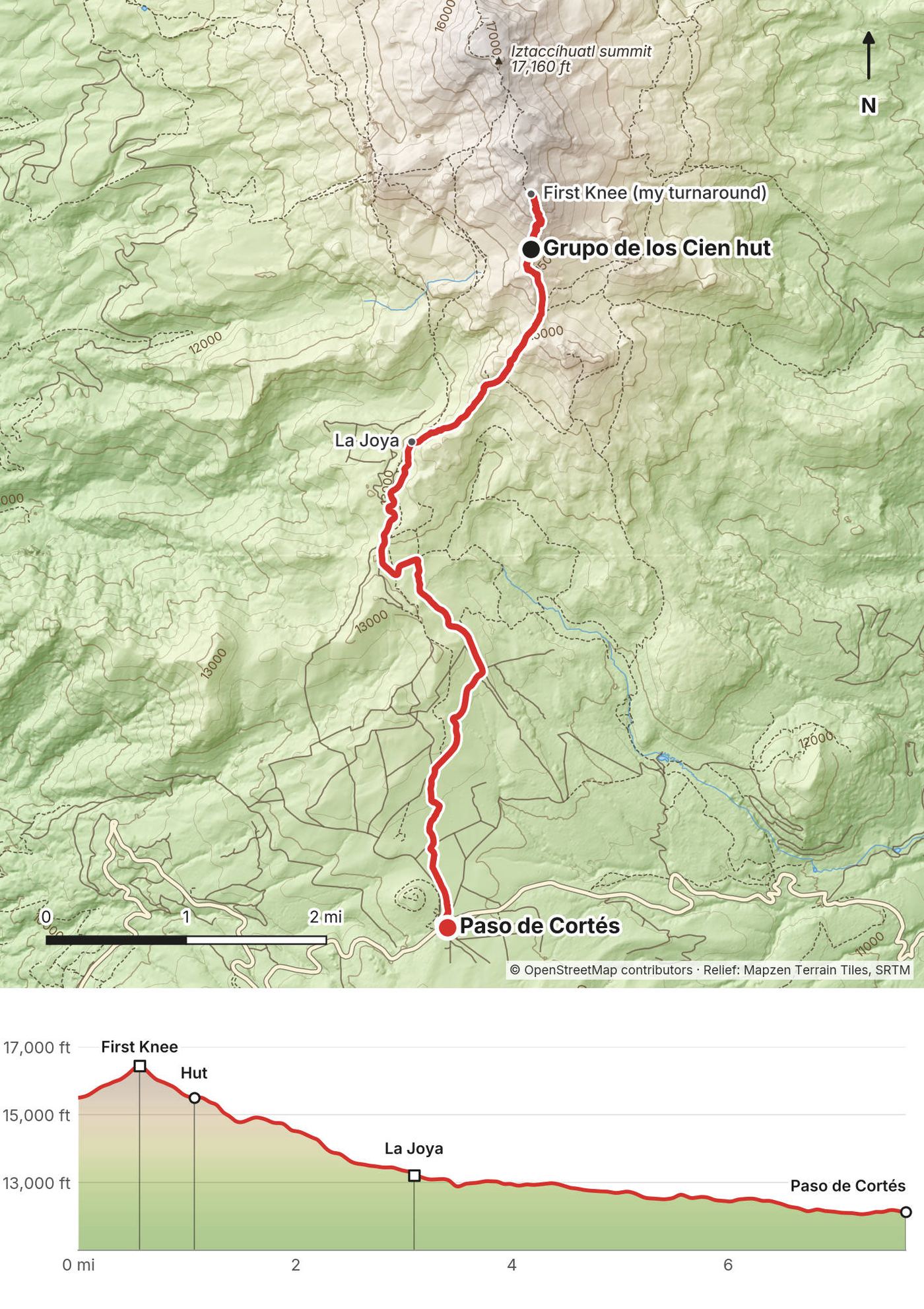
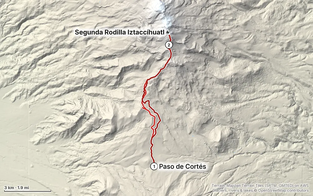
Elevation12,051–16,490 ft14.4 mi
Terrain: Mapzen Terrain Tiles (SRTM, GMTED) on AWS · Glaciers, rivers & lakes © OpenStreetMap contributors
Tap a map to open it full size.
Checked on CENAPRED's and CONANP's own pages, in the park's management rules, and in dated Mexican news, on October 3, 2026.
Open. No closure of the Parque Nacional Iztaccíhuatl-Popocatépetl was reported in 2026. CONANP, the national parks agency that runs it, says it's open every day of the year, and in summer 2026 it was in normal use: the state's mountain police were helping hikers on the Portillos route, my route, during the summer holidays, and the President held an event at Paso de Cortés on August 9.
Popocatépetl. On October 3, 2026, CENAPRED, Mexico's disaster agency, had Popocatépetl at Yellow Phase 2 (Amarillo Fase 2), with a 12 km (7.5 mile) exclusion zone around the crater and the advice not to go near it. It has been at Phase 2 since June 2023. It's very active: dozens of small exhalations a day, and ash falls in the towns around it. When I was there it puffed ash all the time, but I heard no noise and felt no earthquakes. Climbing Popocatépetl is not allowed.
When Popo gets worse, Paso de Cortés closes. Paso de Cortés is about 7.5 km from the crater, inside the 12 km zone; La Joya and the whole route on Iztaccíhuatl are outside it. When the alert went to Yellow Phase 3 on May 21, 2023, the authorities closed the road to Paso de Cortés, and the park reopened in June when it went back to Phase 2.
Other closures. CONANP closes the park, or the road to La Joya, at short notice for fires and bad weather: in December 2023 for a cold front, in March 2024 for a forest fire started by a campfire, in December 2024 for another fire, and for a day on March 31, 2026, when snow closed the La Joya road to cars. The park's rules let it close access without notice for weather or eruption risk. Keep a spare day.
What to do. The day before, read CENAPRED's daily Popocatépetl report (gob.mx/cenapred) and check the park's status with CONANP: (597) 978 3829 or (597) 978 3830, iztapopo@conanp.gob.mx.
Checked on October 3, 2026, on CONANP's park page, in the park's management rules (published in Mexico's official gazette in 2013), and in dated news. Some details come only from blogs and tour companies; those are marked "as reported."
Who runs it. CONANP, Mexico's national parks agency, runs the Parque Nacional Iztaccíhuatl-Popocatépetl from Paso de Cortés. CENAPRED watches Popocatépetl, and Civil Protection sets its alert level. For rescues, the Estado de México's mountain police (Policía de Alta Montaña) answer 911.
Entrance fee (2026). MXN 125 (about US$7) per person per day, paid at the park office at Paso de Cortés. Mexicans and foreign residents get 50% off with ID, students and teachers 75% off with a current card, and older adults, pensioners and retirees, people with disabilities and children under 12 go free. You can buy the wristband (the Brazalete de la Conservación, valid for one day) online in advance on CONANP's site, with an account, or at the park office. It's per day, so two days is MXN 250. If you pay at the office, bring cash in pesos: as reported, it's cash only there.
What I paid, 2023. A very small fee for a bracelet permit, an orange wristband: about $1.50.
Driving to La Joya. Since my trip, CONANP has required a reservation for any vehicle going up the road from Paso de Cortés to La Joya: reservaciones.conanp.gob.mx. As reported, you need an account and should book about 5 days ahead. The park lists vehicle hours of 9 a.m. to 6 p.m. Tuesday to Friday, 7 a.m. to 6 p.m. on Saturday and 7 a.m. to 4 p.m. on Sunday, with day visitors out by 8 p.m. Monday isn't listed: don't plan to drive up to La Joya on a Monday without asking CONANP first. Walking from Paso de Cortés, as I did, needs no vehicle reservation.
Staying overnight. If you're sleeping at the hut or camping, tell the staff at the Paso de Cortés office when you pay, and ask where to leave your car overnight. I left mine at Paso de Cortés.
Guides. The park's rules say "los visitantes podrán contratar los servicios de guías, preferentemente locales": visitors may hire guides, preferably local. Not required. Anyone selling guided trips needs CONANP's authorization. CONANP's 2026 safety advice includes not hiking alone.
The hut. The Grupo de los Cien hut (Refugio de los 100), built in 1996 by the Grupo de los Cien, a Mexican mountaineering association, is one of three huts still standing on Iztaccíhuatl. Its height is given as 4,730 to 4,780 m; my GPS said 4,724 m. In 2026 tour companies still take groups there. I found no fee and no booking: as reported, it's first come, first served, and it's an emergency shelter, not a hotel. Leave it cleaner than you found it.
Camping. Only in the areas set aside for it (La Joya and La Joyita, as reported), with no digging, leveling or clearing.
Rules. Pack out all your trash. No alcohol in the park. No campfires on the mountain: fires are only allowed in the public-use area, and a campfire started the March 2024 forest fire. Stay on the established routes. Pets are banned, as reported.
Drones. I flew a drone on this trip. I couldn't find the park's rules for hobby drones; commercial filming needs CONANP's authorization. Ask at Paso de Cortés before you fly.
March. I went on March 7 and 8, a Tuesday and a Wednesday. It was hot and dry and sunny on the way up, with no snow on my route. Visibility was great at sunrise and got worse through the day: clouds rolled in in the evening, and the next morning was clear again. The night at the hut was cold enough that I waited for first light before going up the ridge.
October to March. CONANP recommends visiting from October to March, the dry season. The rainy season runs about May to October, with afternoon storms. Operators call November to February the best months; January is the coldest.
Cold. Model data for the hut's height put the average night at about -4.5°C (24°F) in March and about -6.5°C (20°F) in January, with cold snaps near -12°C (10°F). In a winter storm it can be much colder. Snow can fall in any dry-season month: on March 31, 2026, it closed the La Joya road to cars for a day.
Daylight. Mexico doesn't change its clocks any more. At Paso de Cortés in March 2027 the sun rises about 6:53 a.m. on March 1, 6:42 on March 15 and 6:28 on March 31, and sets about 6:41 to 6:49 p.m. I left the hut at 6:25 a.m. on March 8 with a headlamp, and reached my high point at 7:41.
Weekdays. I went on a Tuesday and saw about a dozen other hikers, and had the hut to myself. Weekends are busier: CONANP capped the weekend parking at La Joyita in 2021. The La Joya vehicle reservation is required every day, weekdays included.
Emergencies. Call 911. On the mountain in the Estado de México, the state's Policía de Alta Montaña (mountain police) respond; they made hundreds of rescues and searches in the area in 2024, as reported. Don't count on a phone signal on the mountain. Leave your plan and your return time with someone.
Altitude. This is the biggest risk for most people. Mexico City is at about 7,350 ft (2,240 m); the hut is at about 15,500 ft, and my turnaround at about 16,500. I drove up from about 8,000 ft and slept at the hut the same day, and the elevation got to me: more and more breaks on the way up, and constant headaches the next morning. The CDC advises that above 10,000 ft (3,000 m) you raise the height you sleep at by no more than about 1,650 ft (500 m) a day; what I did was far more than that. Spend a few days in Mexico City first, consider a night at La Joya, go slowly and drink. Go down at once for a headache that gets worse, vomiting, confusion, loss of coordination, or breathlessness at rest.
Popocatépetl. Watch it from Iztaccíhuatl; never go toward it. Respect the 12 km exclusion zone around its crater, and read CENAPRED's daily report before you go. Ash can fall on the area, and if the alert goes to Yellow Phase 3, Paso de Cortés closes.
Cold. The hut is well below freezing on most nights of the dry season, and the wind on the ridge makes it colder. It was too cold for me to start up the ridge any earlier than first light. Carry a warm sleeping bag and layers.
The ridge. Above the hut the ground is steep, loose rock and scree, and the wind is strong. Snow and ice can turn it into a mountaineering route; in 2023 I had none on my route. Beyond the First Knee the route to the summit needs mountaineering skills (see To the summit).
Storms and lightning. In the rainy season, May to October, afternoon storms bring lightning to the open ridge. Be at the hut, or off the mountain, before the afternoon weather. The metal huts are a shelter in a storm.
Fires. Forest fires closed the park in March and December 2024. No campfires.
Going alone. I did, and I was very alone. CONANP's advice is not to hike alone. If you do, leave your plan with someone and carry what you'd need to wait out a night.
Safety in Mexico. The US State Department's Mexico advisory (dated August 12, 2025, still in force in October 2026) is at Level 2, "Exercise Increased Caution," and so are the Estado de México, where it says to use extra caution in remote areas, and Puebla. Drive in daylight: the roads have potholes, speed bumps and missing lane lines. I didn't research robberies at the trailheads; don't leave valuables in the car.
Phones. I used an eSIM for data. Since January 2026 every Mexican phone line must be registered (foreigners with a passport). A foreign travel eSIM isn't a Mexican line and didn't need registering in October 2026; if you buy a Mexican SIM, expect to register it.
Did you reach the summit? No. I turned around at the First Knee, about 16,500 ft by my GPS, the first of the bumps along Iztaccíhuatl's long ridge. The summit is about a mile farther along the ridge as the crow flies, and about 650 ft higher. I was out of water and food, the wind was strong and the altitude was giving me constant headaches. So this wasn't a true summit, but I'm still glad I did it.
How many days do I need? Two, with one night in the Grupo de los Cien hut, like me: up to the hut the first day, then the ridge early the next morning and down. Many people drive to La Joya and go to the hut and back in one day, which saves 4.6 miles each way. Add a day or two in Mexico City first for the altitude, and a spare day in case the park closes.
How hard is it? The first 4.6 miles to La Joya are easy. Above it the trail climbs steeply on rock and scree to over 15,000 ft, and the altitude gets to you: I took more and more breaks, and the last 1.4 miles to the hut took me two hours and forty minutes. Volcano hikes are tougher than my usual hikes. Above the hut it's steeper and looser, and the summit beyond my turnaround is real mountaineering.
Do I need a guide? The park's rules say visitors may hire guides, preferably local ones; they don't require one. I went alone. CONANP's advice in 2026 is not to hike alone, and above the hut a guide who knows the ridge makes sense. See Fees, rules and the hut.
Is there water? No. It's a dry volcano hike with no water sources. I brought about two liters for two days, and by the second morning I was almost out of water and food. Carry more. See Food and water.
Do I need crampons? I didn't: in early March 2023 there was no snow on my route and no need for spikes, and only a little ice left on the glacier remnants. Snow can fall in any month of the dry season, and the park's own page lists rope, crampons, an ice axe and a helmet for mountaineering on Iztaccíhuatl.
Can I stay in the hut? I did, alone except for a stray dog. In 2026 the hut is still standing and used; I found no fee or booking for it. Treat it as a shelter, not a hotel, and be ready to sleep on a wooden bunk at about 15,500 ft.
How do I get there? I drove a rental car from Mexico City's airport, about an hour to Amecameca and about another hour up to Paso de Cortés. Without a car, take a bus from Mexico City's TAPO station to Amecameca and a taxi from there. See Getting there.
I didn't go past the First Knee, so this section is research, not my trip. Read it as what the sources say, and go with someone who knows the ridge.
The route. From the First Knee the Portillos route goes on north along the ridge over the Second Knee (Segunda Rodilla, about 5,074 m), Monte de Venus (about 5,108 m) and the belly (La Panza), then up the Arista del Sol to the summit, El Pecho, 17,160 ft (5,230 m). By OpenStreetMap that's about 1.7 km (1 mile) along the ridge from my turnaround, with about 200 m of climbing plus the ups and downs between the bumps, all above 5,000 m. Tour companies give the whole climb from La Joya as about 12 km round trip and 10 to 14 hours.
What it takes. CONANP's page lists rope, crampons, an ice axe and a helmet for mountaineering on Iztaccíhuatl, as opposed to hiking. With its glaciers almost gone, the ridge is mostly rock and scree for much of the year, as reported, but winter snow and ice make crampons necessary. A climber died after a 50 m fall on the Arista de la Luz, a harder ridge, on December 21, 2025. Without mountaineering experience, go with a CONANP-authorized guide.
Drive to La Joya (with your reservation) and walk up the Portillos route to the hut and back: about 4.4 miles round trip by my GPS and about 2,300 ft of climbing, 9 km and 800 m by one tour company's count. This is what most day tours from Mexico City do. You skip the night at 15,500 ft, which is easier on your body, and the 9 miles of walking between Paso de Cortés and La Joya and back.
To go higher more gradually, camp at La Joya (about 13,190 ft), where camping is allowed, and go to the hut or the ridge the next day. It's closer to the CDC's advice than what I did. See Popocatépetl, altitude and safety.
These change every year, and with Popocatépetl they can change overnight. Everything else in this guide stays the same.
Is it open?
Fees and rules
Getting there and conditions
Your stuff
The film is at the top of this page.
Planning questions about Mexico City and Iztaccíhuatl, answered only from this page's facts, the creators' versions and hikers' public tracks, with where each answer comes from. When the data doesn't say, the answer says "not given".
From hikers
Sign in to comment. Free; your hikes stay private unless you share them.
Something wrong or missing on this page? Send feedback.