
Content made there
The film is at the top of this page.
Photos
Hikes / Huayhuash Circuit / Kraig Adams's version
South America · Peru
Aug 2022 · 11 days on foot · about 83 miles · Group trip · Tent

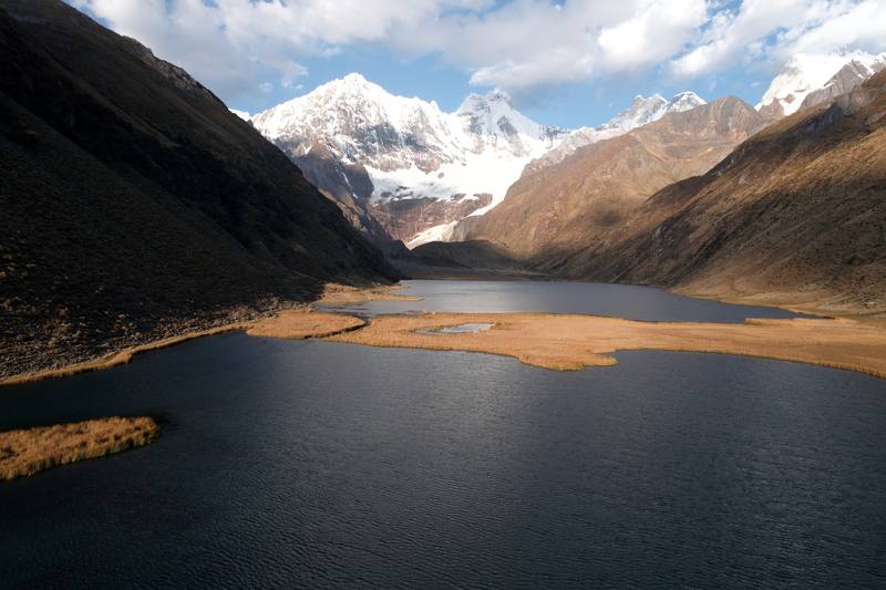
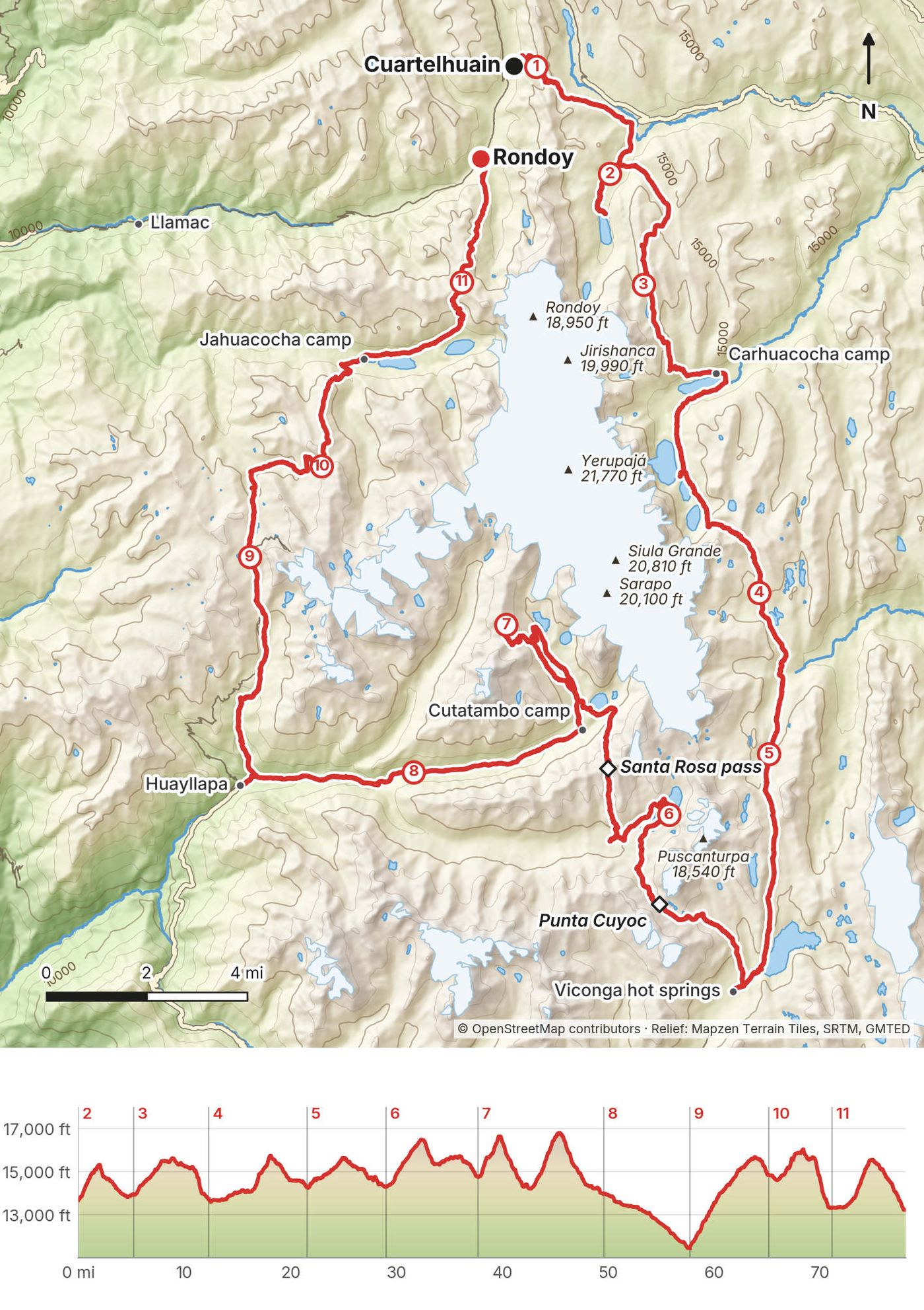
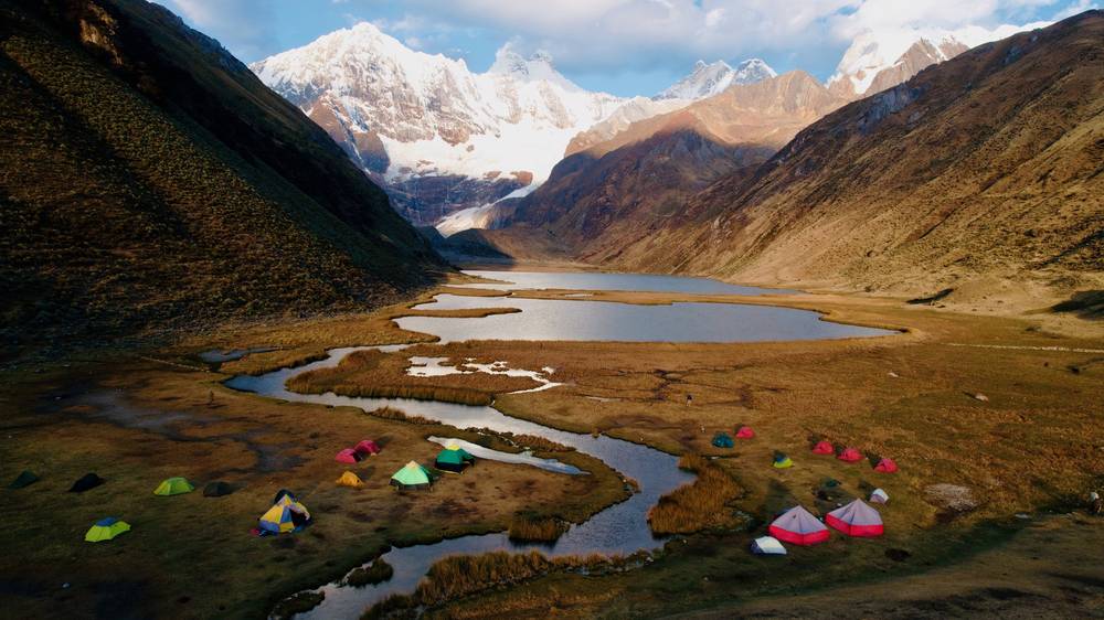
In August 2022 I spent eleven days walking around the Cordillera Huayhuash in Peru, one of the most beautiful ranges I've ever seen. Five subscribers joined me, along with two guides, a cook, muleteers and a string of pack donkeys carrying our camp. We started at Cuartelhuain, at the end of the road above Chiquián, and walked clockwise around the whole range: glacial lakes under Yerupajá and Siula Grande, passes over 16,000 feet, hot springs, and the village of Huayllapa, then out over one last pass to the road at Rondoy.
It was eleven days of hiking, a new record for me at the time. It was also a different kind of trip. This was a group hike: I sold tickets and invited five subscribers, and a Huaraz agency ran the whole thing. Having donkeys, a cook and two guides made it a very different vibe from hiking by myself.
| Quick facts | |
|---|---|
| Distance | 83.2 miles (133.8 km) over 11 days on foot |
| Climbing | about 24,360 ft (7,430 m) up and 24,900 ft (7,590 m) down |
| Start | Cuartelhuain, a campsite above the Matacancha road end, about 6 hours by road from Huaraz |
| Finish | Rondoy, at the end of a road, about 5 hours by road from Huaraz |
| High point | Cerro Gran Vista on Day 7: 16,802 ft (5,121 m) on my GPS. The highest pass: Santa Rosa, 16,636 ft (5,071 m) |
| Over 5,000 m | Punta Cuyoc (Day 6), the Santa Rosa pass and Cerro Gran Vista (both Day 7) |
| Highest camp | Cashpapampa, 14,840 ft (4,523 m) on my GPS |
| Nights | 9 in tents, 1 in a hostel in Huayllapa |
| How | With a Huaraz operator: two guides, a cook, muleteers and pack donkeys |
| When | The dry season, about May to September. I walked August 17 to 27, 2022 |
| Difficulty | Long, high and remote. Short walking days, but every camp is above 13,000 ft except Huayllapa |
| Base | Huaraz, about 8 hours by bus from Lima |
| Trip | A group trip I hosted, organized by Quechuandes in Huaraz |
| Day | Route | Miles (km) | Up / down (ft) | Camp (ft) |
|---|---|---|---|---|
| 1 | Huaraz to Cuartelhuain (drive, then a short walk) | 2.4 (3.9) | 1,089 / 1,183 | 13,730 |
| 2 | Cuartelhuain to Mitucocha | 7.9 (12.7) | 1,940 / 1,710 | 13,930 |
| 3 | Mitucocha to Carhuacocha | 7.1 (11.4) | 1,860 / 2,064 | 13,720 |
| 4 | Carhuacocha to Huayhuash | 9.3 (15.0) | 2,370 / 1,794 | 14,260 |
| 5 | Huayhuash to Viconga | 7.4 (11.9) | 1,728 / 1,681 | 14,290 |
| 6 | Viconga to Huanacpatay | 8.7 (14.0) | 2,714 / 2,218 | 14,750 |
| 7 | Huanacpatay to Cutatambo | 11.8 (19.1) | 4,597 / 5,381 | 13,960 |
| 8 | Cutatambo to Huayllapa | 8.2 (13.1) | 21 / 2,542 | 11,440 |
| 9 | Huayllapa to Cashpapampa | 7.5 (12.0) | 4,144 / 822 | 14,840 |
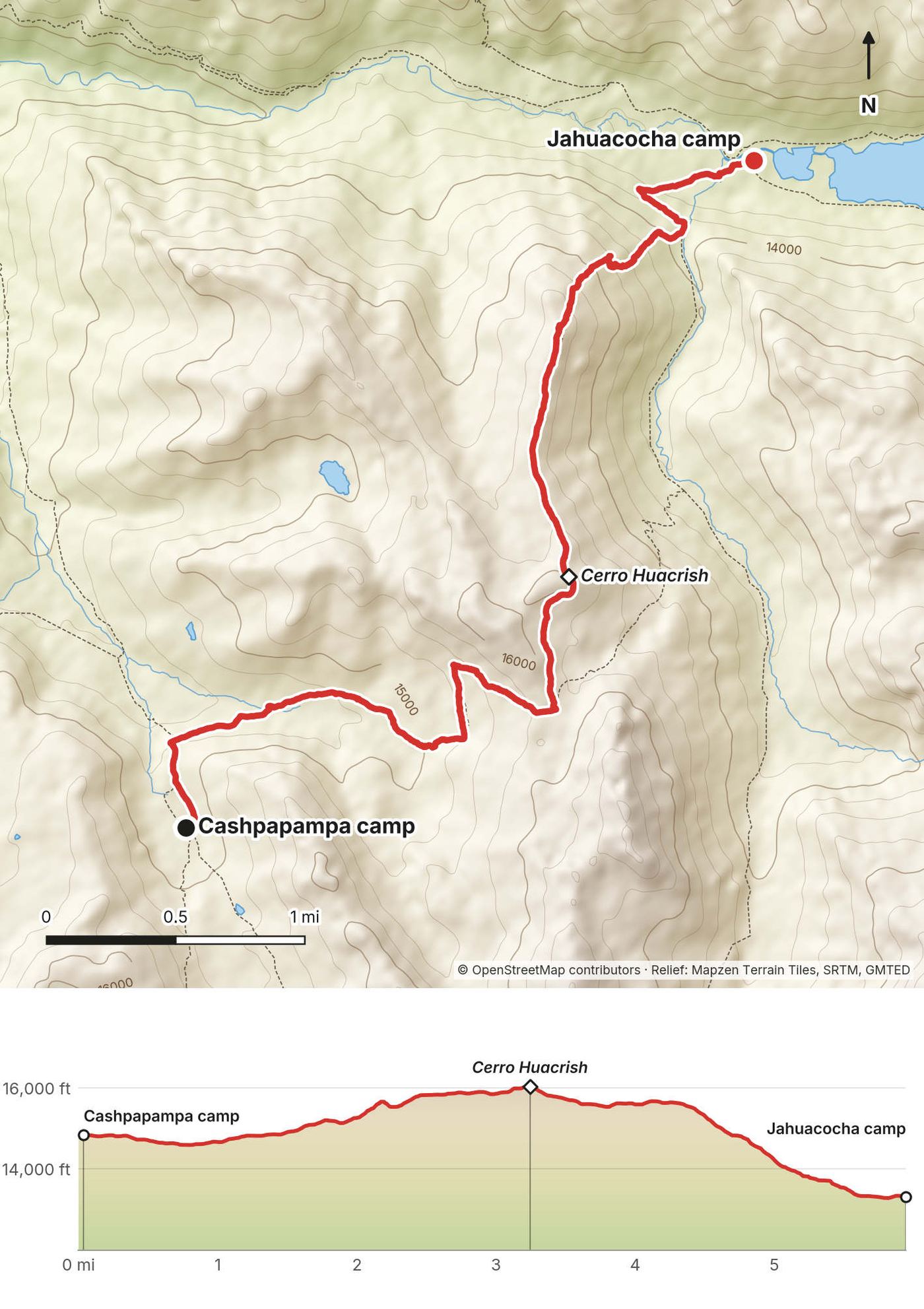
| 10 | Cashpapampa to Jahuacocha | 6.0 (9.6) | 1,633 / 3,139 | 13,320 |
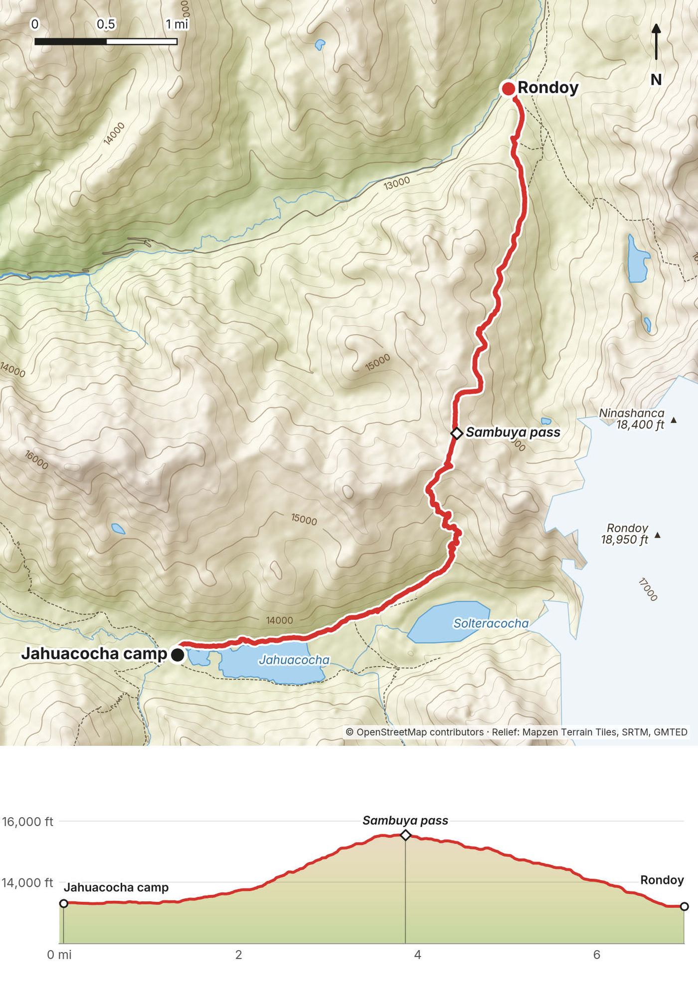
| 11 | Jahuacocha to Rondoy, drive to Huaraz | 7.0 (11.2) | 2,271 / 2,371 |
The numbers come from my own GPS recordings, smoothed the same way for every day. Day 2 includes a 2.7-mile walk to the lake after lunch. My Strava entry for the trip says 83 miles.
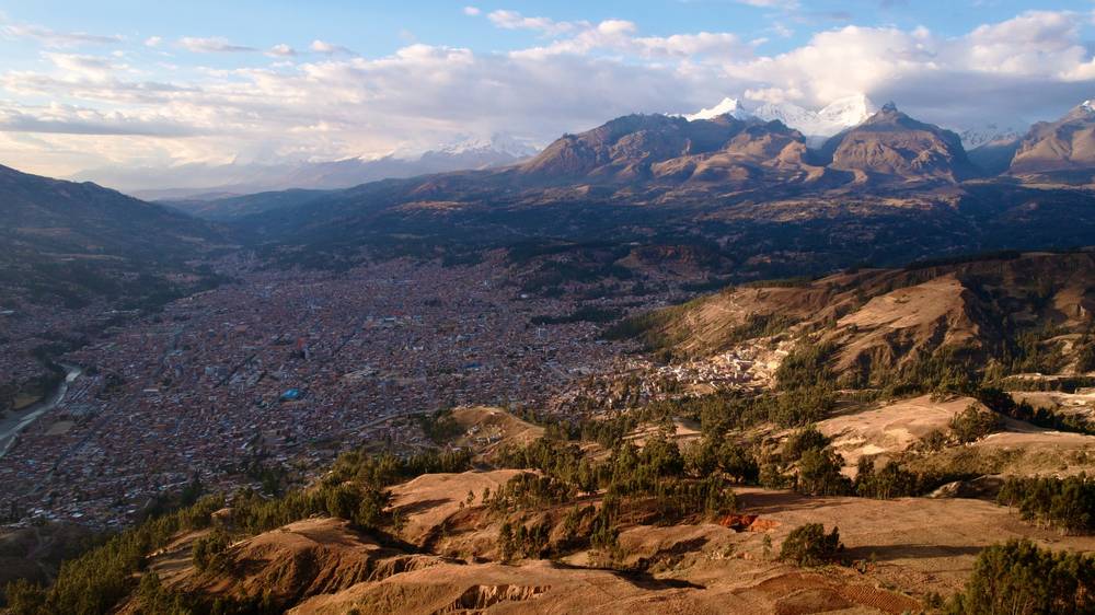
To Huaraz. Fly to Lima, then take the bus north to Huaraz. It was my third time in Huaraz, and I love this place: you wake up and look at mountains. Cruz del Sur, for one, runs 8 buses a day from Lima to Huaraz in 7.5 to 8.5 hours (2026 timetable, fares from S/87). I stayed at the agency the first night and in a hotel in town after that.
In Huaraz. Give yourself two or three days. Do an acclimatization hike (Laguna 69, Laguna Churup and Laguna Rajucolta are the ones people do), buy snacks, get cash in soles, and rent anything you need: I rented trekking poles, and they helped so much on the climbs. I had breakfast and did my editing at California Cafe.
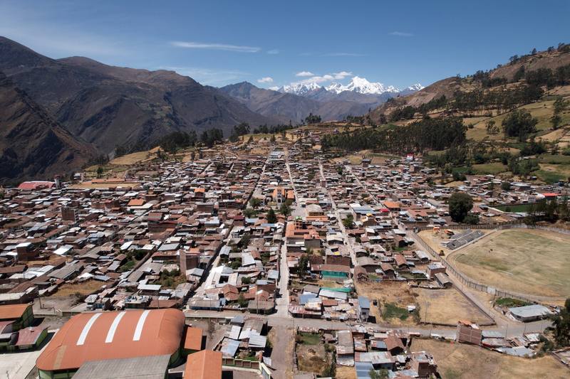
To the trailhead. Our agency drove us in a private van: about six hours from Huaraz in all, with a lunch stop in Chiquián, the last town before the trailhead, and the last three hours or so on dirt roads to the camp at Cuartelhuain, near the Matacancha road end, at 13,730 ft (4,185 m). Without an agency, the public route is a minibus from Huaraz to Chiquián (El Rápido, for one), then a local car to Llamac, Pocpa or Matacancha. These aren't timetabled like the Lima buses; ask in Huaraz the day before.
The trailheads. Llamac (about 10,800 ft, 3,300 m) is the classic start, with a first day's climb to Cuartelhuain or Jahuacocha. Matacancha and Cuartelhuain, where we started, sit at the road end high above Llamac. The road also reaches Rondoy, where we finished, and the villages of Queropalca, Huayllapa and Cajatambo.
The van picked us up at Rondoy and drove us back to Huaraz through Chiquián, most of the afternoon. That night we had a trek victory dinner in town. The next morning, August 28, I took the Cruz del Sur bus back to Lima and flew home that night.
From Huaraz, the buses to Lima leave from late morning into the night (Cruz del Sur's 2026 timetable: 6 to 8 departures a day from 11 a.m., 7.5 to nearly 10 hours). Keep a spare day before your flight.
Paid links: I earn a commission if you buy through these links, at no extra cost to you. As an Amazon Associate I earn from qualifying purchases.
Donkeys carried the camp, so I only carried a daypack. Here's what I had in August 2022, what I'd take now, and what I filmed with.
My records don't name the brands, so no links here.
What I'd bring for this trek from my current kit.
 Sleeping bag: Hyperlite Mountain Gear 20° Mummy Bag (Hyperlite). Nights are below freezing, with frost on the tents.
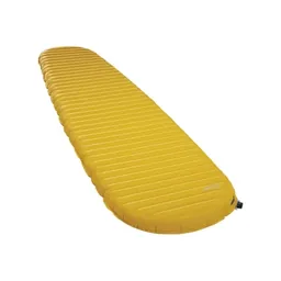 Sleeping pad: Therm-a-Rest NeoAir XLite NXT (Amazon). The operator doesn't supply a mat.
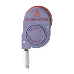 Pad inflator: AlpenBlow Micro Inflator (Garage Grown Gear). Easier than blowing up a pad at altitude.
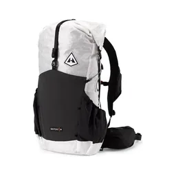 Daypack: Hyperlite Mountain Gear Waypoint 35 (Hyperlite). The donkeys carry the rest.
 Poles: Black Diamond Alpine Carbon Z Poles (Amazon). Rented poles helped so much on the passes over 16,000 feet.
 Puffy: Arc’teryx Cerium Hoody (Arc’teryx). For camp after sunset, below freezing.
 Rain shell: Arc’teryx Beta AR Jacket (Arc’teryx). On the operator's list.
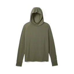 Sun hoodie: PATH Projects Pyrenees T19 Hoodie (PATH Projects). Strong sun on clear mornings.
 Hat: PATH Projects Hoyt Merino Beanie (PATH Projects). On the operator's list for the cold.
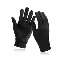 Gloves: Unigear Touchscreen Liner Gloves (Amazon). For the cold.
 Sunglasses: Goodr OG Sunglasses (Amazon). Strong sun at altitude.
 Water: Katadyn BeFree AC · 1L (Amazon). The cook boiled water morning and evening. Treat stream water: there are animals everywhere.
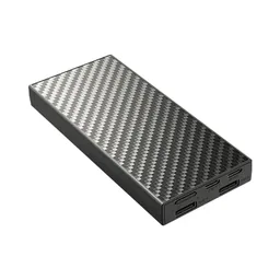 Power bank: Nitecore NB20000 (Amazon). There's no charging in camp. Huayllapa, on Day 8, was the only place I charged batteries.
What I filmed this trip with in 2022. My setup is different now (below). Check the current rules for flying a drone in Peru before you bring one.
Since September 2026 I film with a smaller setup: the Pocket 4 and the Mic 3 on the trail, and the Mini 5 Pro in the air.
 Camera: DJI Osmo Pocket 4 (Amazon)
 Mic: DJI Mic 3 · 1 TX + 1 RX (Amazon). It pairs with the Pocket 4.
 Drone: DJI Mini 5 Pro (Amazon)
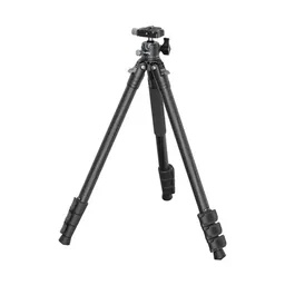 Tripod: SmallRig Carbon Fiber Tripod (Amazon)
We packed up in the morning. We had a lot of stuff, but we also had twelve donkeys helping us carry things. Breakfast, a toast, and a goodbye to David, the mastermind of the trip, and then a six-hour ride to the trailhead. We stopped for a quick lunch in the last town before the trailhead, with some interesting coffee, then another three hours to where we set up camp, at about 14,000 ft: our first taste of altitude.
At camp we did a quick little hike up and down, just to get some exercise. Then I changed, got warm because it was going to be cold, and we went for tea and dinner. The boys were hungry. Dinner was a romantic little pumpkin soup.
There isn't one today: this is the drive in and a warm-up walk. From Cuartelhuain I walked up the slope east of camp, toward the next day's pass, to about 14,960 ft (4,560 m) and back down. It's worth doing. It gives your body a first night's reminder of where it's going.
You're at the road. The vans that bring groups in go back to Chiquián and Huaraz.
Film, Day 1 · The acclimatization hike · Huaraz
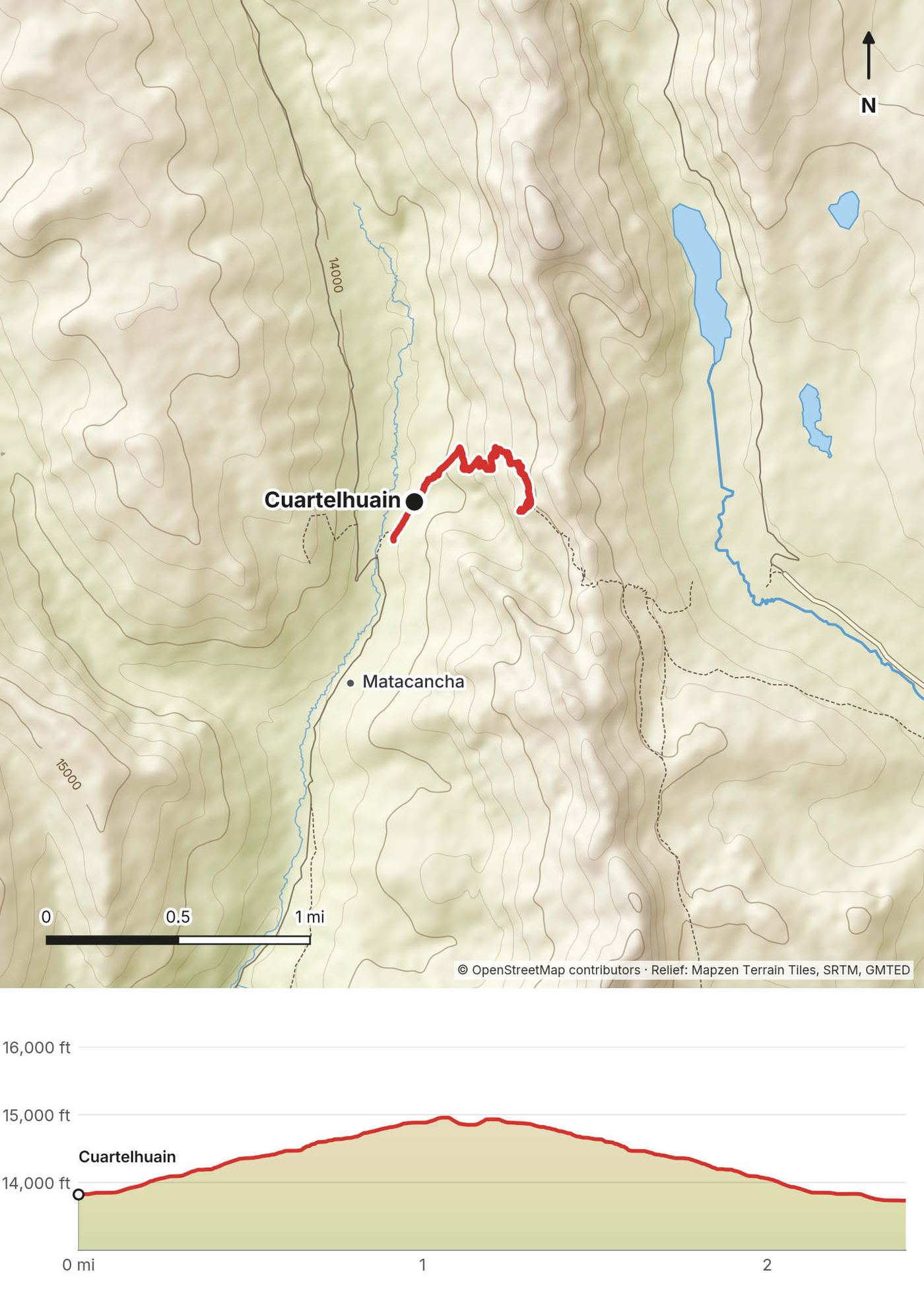
Last night was cold. I was wearing everything I could, and I couldn't wait to eat dinner and get in my sleeping bag. The morning was cold too. We approached our first pass in the shade, and after it we had nice views in the sunlight all the way to the lake.
We were in camp before lunch. The plan was to rest, then walk up to the lake before sunset. I had a slight headache, and it was suddenly really hot: the extremes out here, hot and cold. We took a nap. I didn't feel good at all. Before dinner we did a quick little hike to the lake, through golden grass. Dinner was cheese and potatoes.
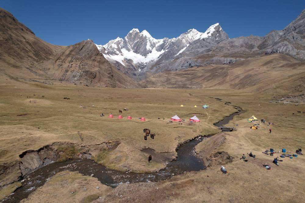
From Cuartelhuain the path climbs east up grassy slopes to the Cacanan pass, 2 miles in. It's the first test of the altitude, but not a hard one: about 1,600 ft of climbing on a clear path. From the pass the trail drops into a wide valley and follows it south, gently, to the Mitucocha camp in the meadows below Jirishanca and Rondoy. The lake itself is a mile and a half up the valley from camp: a good afternoon walk.
Back over the Cacanan pass to Cuartelhuain and the road. Or down the valley east to Janca and on to the road at Queropalca, a longer walk.
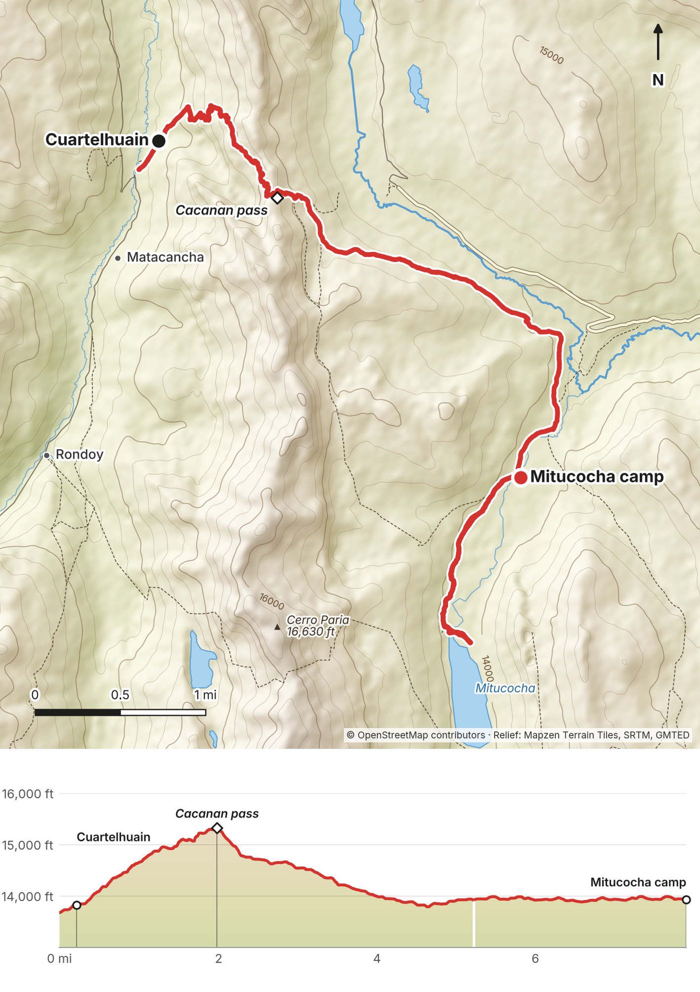
It was a bit overcast, which meant it had been much warmer overnight: the clouds trap the heat, and it was a nice night's sleep. Even with the cloud it was a good spot to fly the drone, and I got a couple of good shots. From up there you can see the lakes that we'd go up to the next day, the famous view of three lakes and the mountains.
We had lunch, then came down to camp. It's a pretty cool camp, right on the edge of the lake, with nice views of the mountains if the sunset comes through. I had a slight headache again and planned to hit the tent as soon as I was ready. On the menu that night: steak and eggs and a random banana.
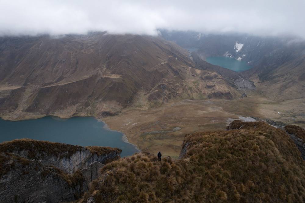
From Mitucocha the path climbs south up a side valley toward the Carhuac pass. My track doesn't go through the pass itself: our guides took a grassy ridge just west of it, about 400 ft higher, with a view down to Alcaycocha and across to the ice. In fog, stay with the path. From the ridge the trail runs south along the slope and drops steeply to Laguna Carhuacocha, under Yerupajá and Jirishanca. The camp is on the lake's northeast shore.
Down the valley east from Carhuacocha to Queropalca and the road. That's the main way out from here.
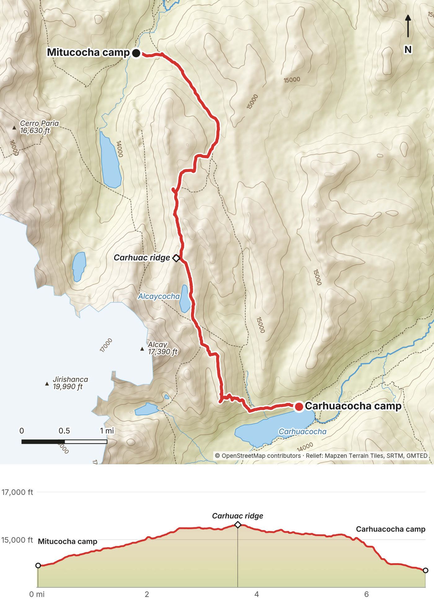
Clear skies. We got lucky: I was hoping for clear skies on this day. We heard a big avalanche. Breakfast was blueberry pancakes with peanut butter and honey. This was supposed to be one of the harder days, but we were powered by pancakes.
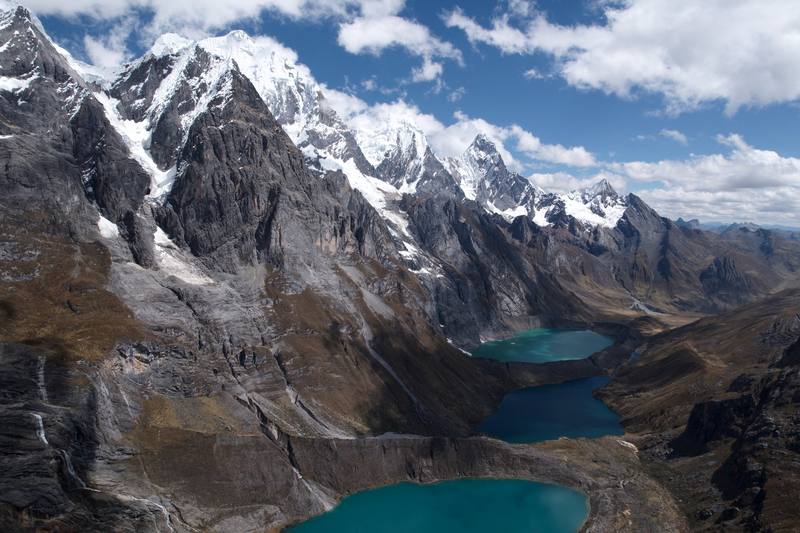
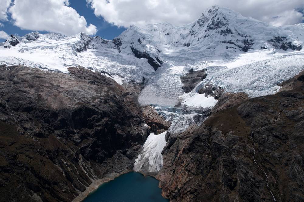
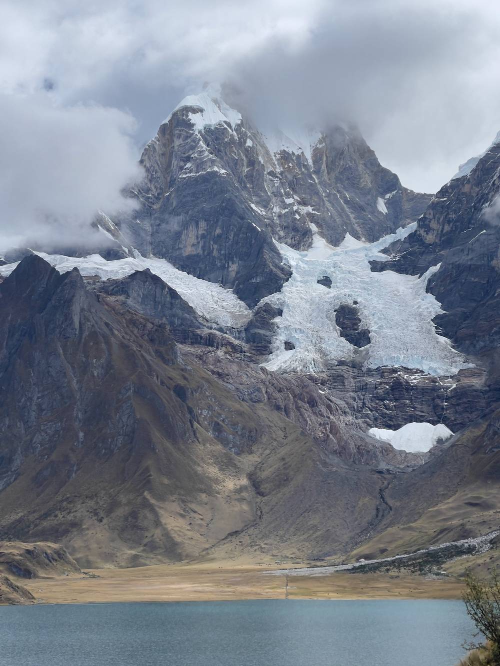
We made it to the first lake, turquoise blue, with beautiful weather, and kept climbing toward the view of the three lakes. This was really one of the most beautiful things I've ever seen, with the glacier right there above us. About a week earlier I'd been running around Mont Blanc, and now I was at a pass at the same height as the top of Europe, which felt like coming full circle. The lunch spot on the far side was pretty cool too.
From camp the path follows the south shore of Carhuacocha, then climbs south up the moraine past the three lakes: Gangrajanca, Siulacocha and Quesillacocha, under the ice of Siula Grande and Yerupajá. The famous view is from the slope above them. The path then turns east and climbs to the Siula pass at 5.8 miles, a rocky notch with a sign. From the pass it's an easy descent past small ponds (where we had lunch) and down a long valley to the Huayhuash camp.
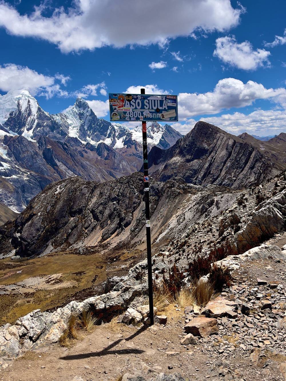
Back to Carhuacocha and out to Queropalca. From the Huayhuash camp, the valley to the east leads out toward the road at Queropalca too, a long walk.
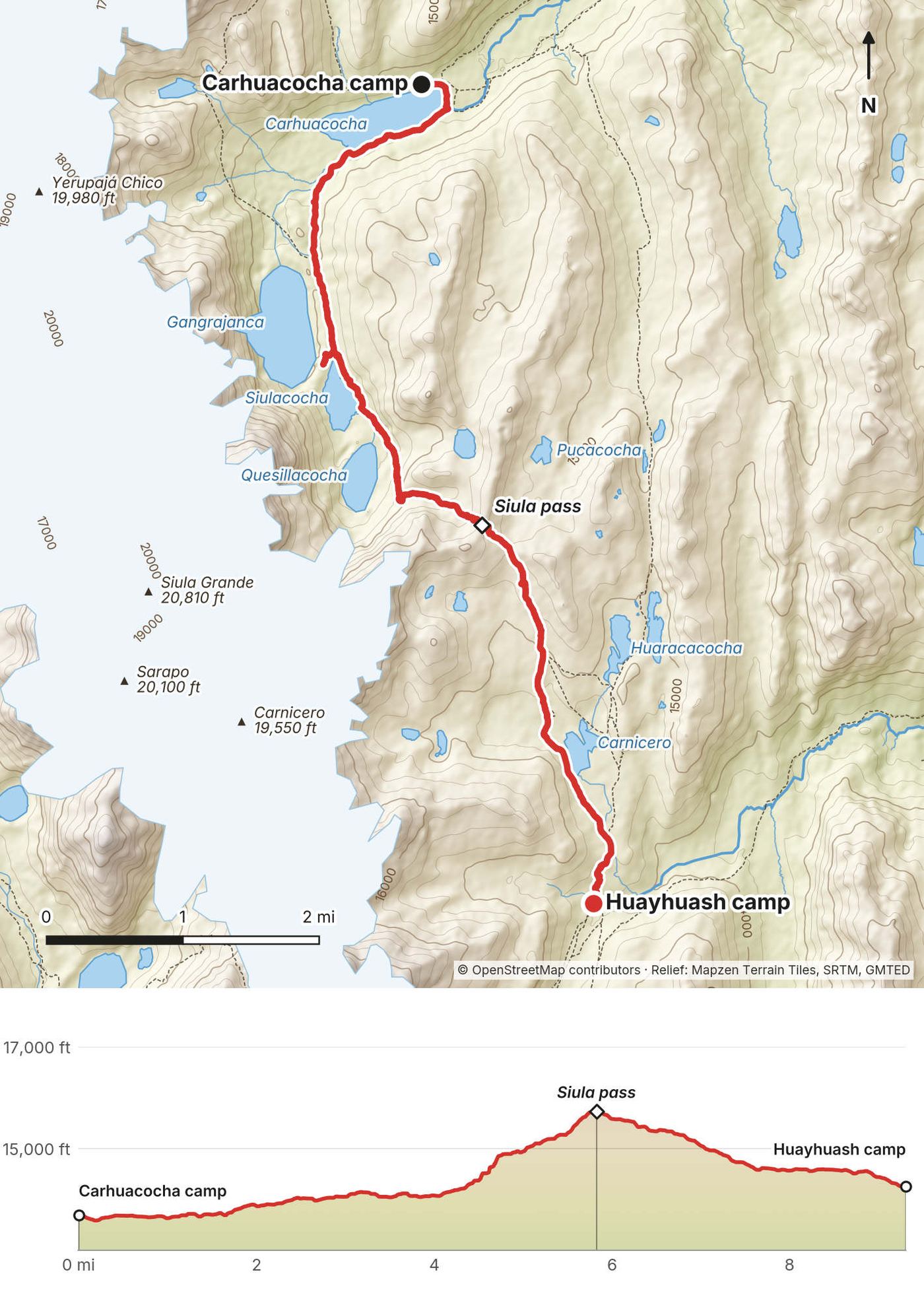
The coldest morning yet. It was freezing, with frost on the ground and frost on the tents. By early afternoon we reached the hot springs, our camp for the night. It allegedly had Wi-Fi and cerveza. Dinner was tuna, beans, carrots and fresh corn.
The easiest pass of the circuit. From the Huayhuash camp the path climbs gently south to the Portachuelo de Huayhuash, a wide saddle 3.3 miles in, with Trapecio and the Puscanturpa peaks to the west. It then drops past Laguna Viconga and follows the valley down to the hot springs. The Uramaza community collects the fee for the lake and the hot springs.
Down the valley west from Viconga toward Uramaza and Cajatambo, where there's a road. This is the usual way out on the south side of the range.
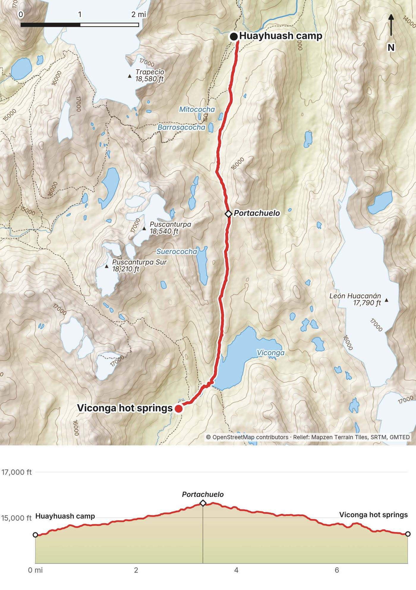
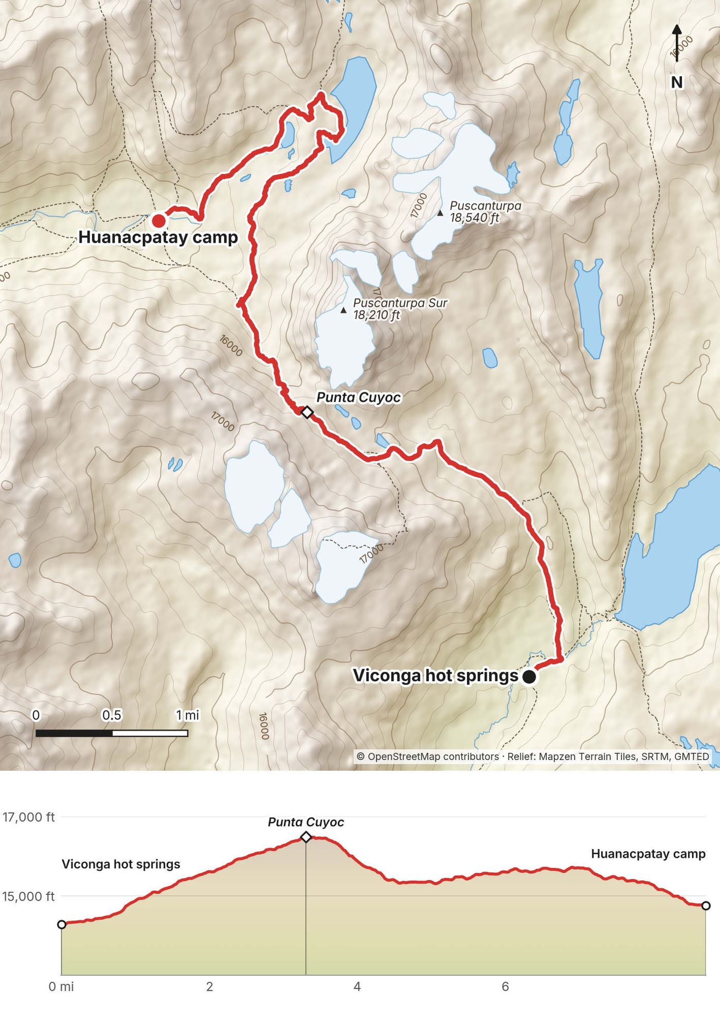
Day 6, very cold. I walked circles around camp just to warm up before breakfast. We were going over one of the highest passes, around 16,500 ft, a new record for most of the group.
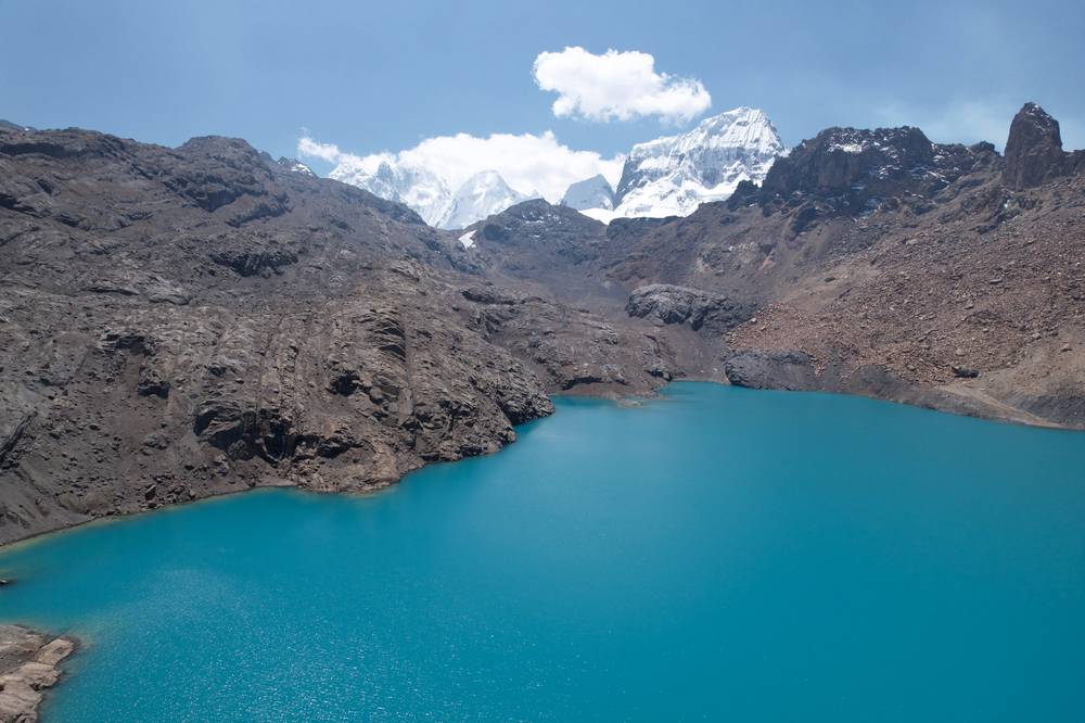
I felt great, crushing the uphill. The poles helped so much. It was a big effort. Because we'd have been in camp by about noon, two of the group and I went on to an extra lake for some extra miles. Not a bad spot for lunch.
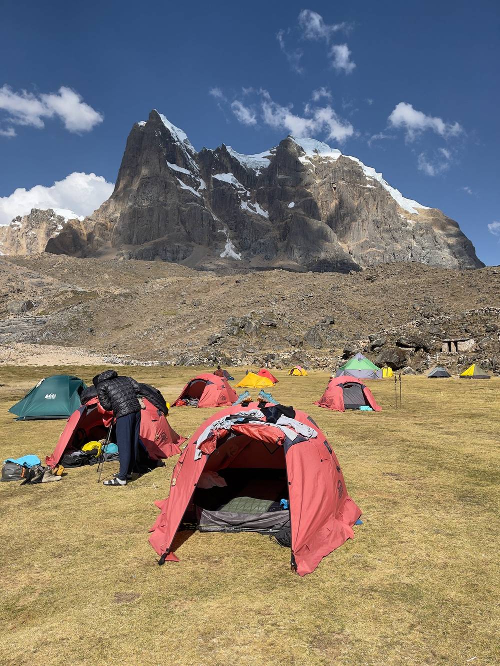
From Viconga the path climbs northwest, steadily, for about 3.3 miles and 2,200 ft to Punta Cuyoc, the first pass over 5,000 m, with the Puscanturpa peaks right beside it. The top is a stony saddle with big views. The descent on the far side is steep and loose at first, then eases into the grassy Huanacpatay valley. My side trip left the path where we had lunch and went north to a lake below Puscanturpa, then back down to camp: it added about 3 miles. The camp is lower down the valley, to the west.
Down the Huanacpatay valley west to Huayllapa, the one real village on the circuit, where there's a road out. That's the way to go from here.
Day 7, and the sun felt nice. This was 16,600 ft, a big pass. In general I just felt great. I think this was the most acclimatized I've ever been, getting up to almost 17,000 ft and feeling nothing.
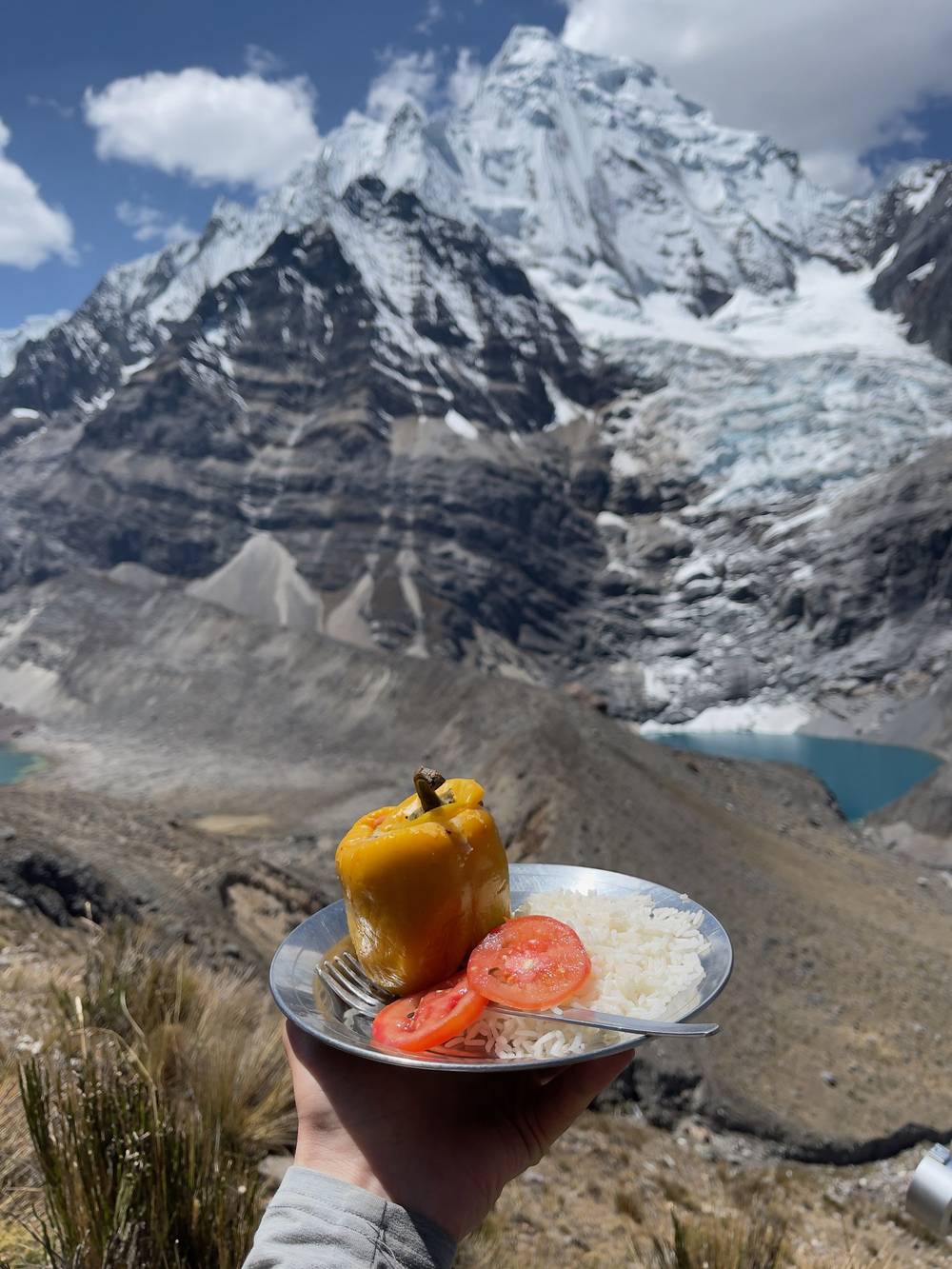
Lunch was a stuffed pepper. I was so hungry, and the view was amazing: this was one of the best lunches of my life. Then we headed up again to Cerro Gran Vista, over the lakes below Siula Grande, and then down, down, down to camp.
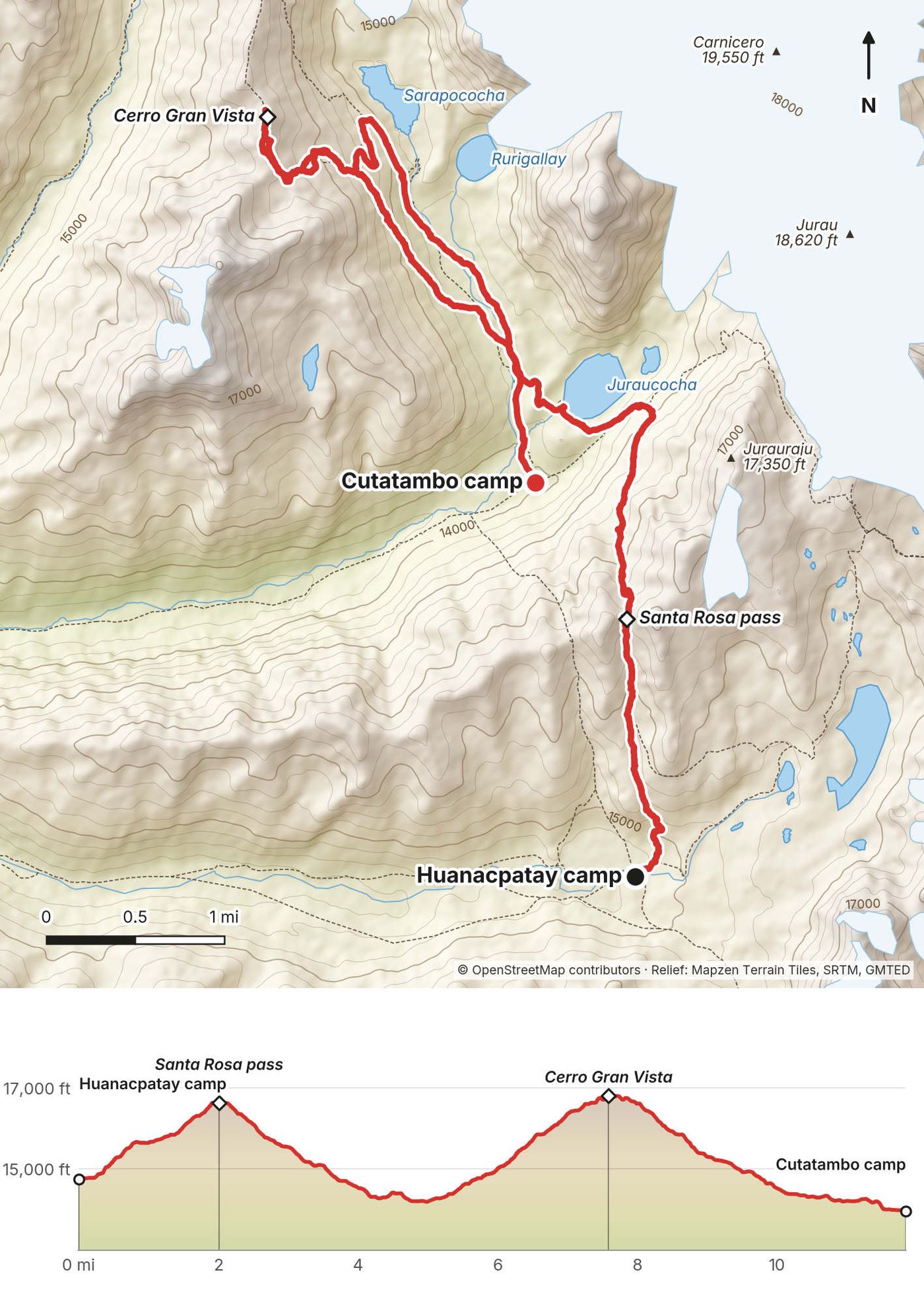
The biggest day of the circuit, and the highest. From Huanacpatay the path climbs north, steep and rocky near the top, to the Santa Rosa pass at 2 miles (named Paso Jurau on OpenStreetMap; the San Antonio pass is just east of it). The descent drops to Laguna Juraucocha under Jurau and Sarapo, where the trail meets the Cutatambo valley. We then climbed northwest to Cerro Gran Vista, a rocky viewpoint summit above Sarapococha, looking straight at the west face of Siula Grande, and came back down to the Cutatambo camp.
My operator's plan had Gran Vista as a separate day, a "rest day" from Cutatambo. We did it all in one. If you have the time, splitting it makes a long day into two easy ones.
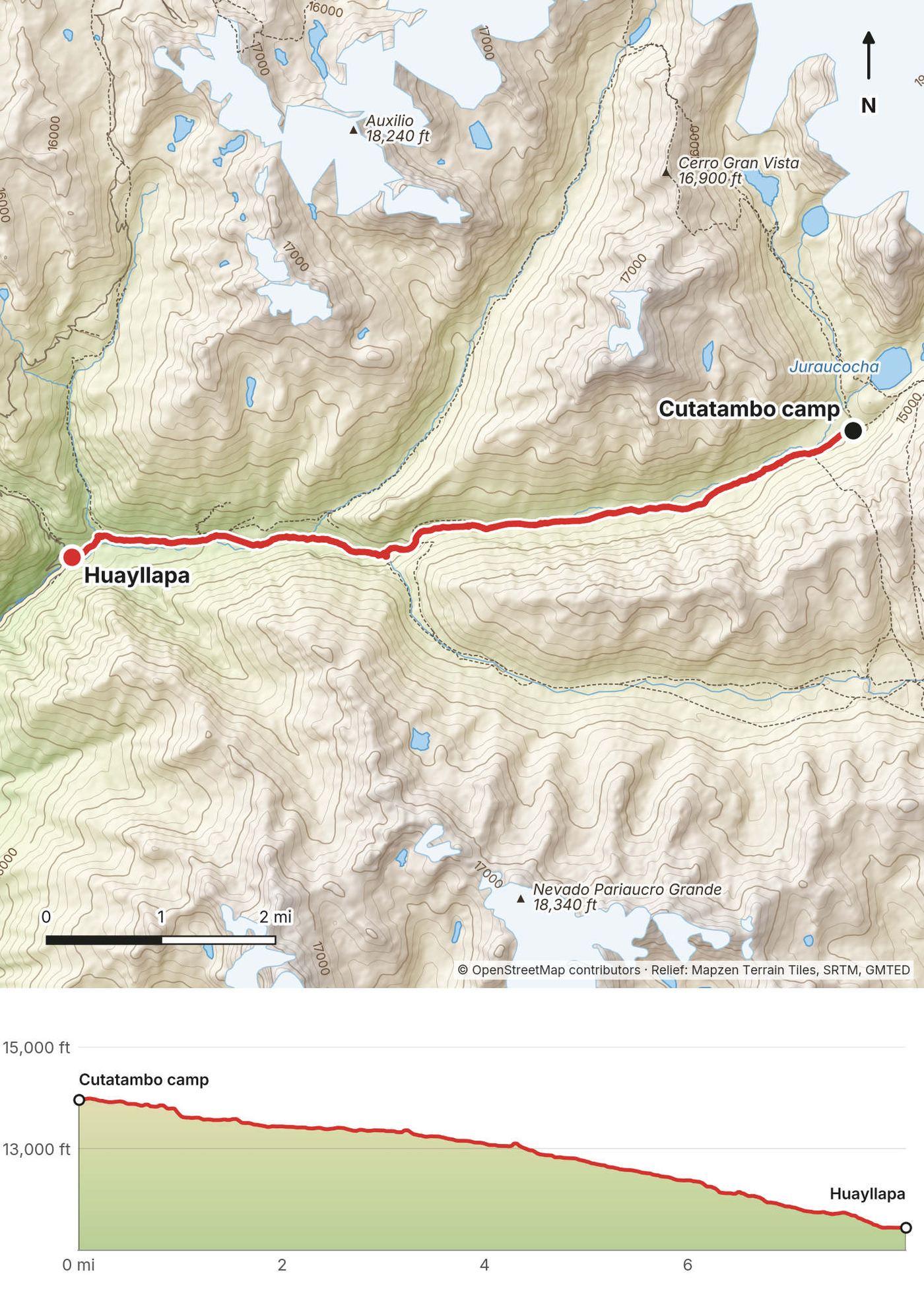
Down the Calinca valley to Huayllapa, which is the next day's walk (Day 8), about 8 miles and all downhill.
We headed down, down, down, all the way to the biggest village on the trek. Everyone was excited for a hostel, charging and a resupply of food, all those good things, though it's a very small town, so we'd see. I checked out hostels, and we ended up in a three-bedroom dorm for the night. Not bad. I hadn't seen myself in a week, and I looked gross.
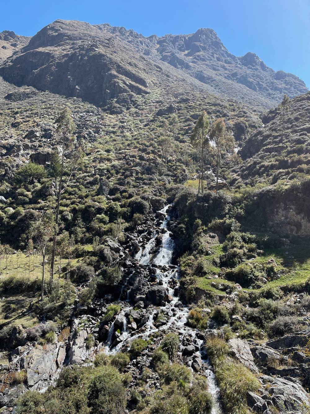
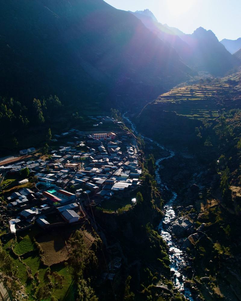
The easy day. From Cutatambo the path follows the Calinca valley west, gently at first, then down a steeper section past a waterfall into a green, wooded gorge, and on to Huayllapa. Huayllapa has small shops and simple places to stay, and a road out toward Cajatambo. The Huatiac camp, where my operator's plan put this night, is in the valley above the village.
This is the place to do it: a road runs out of Huayllapa toward Cajatambo.
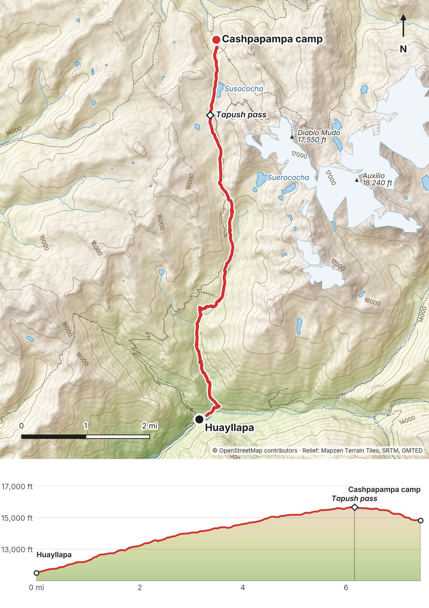
Day 9, well rested, and I felt better. From the village we started to go up. We'd been up high for so long, and now we were going back into the mountains. One pass, not too bad of a day. At the hostel I'd been able to charge three drone batteries, about a full battery of footage for each day left.
The biggest climb of the trip, but on a good path. From Huayllapa the trail climbs north up the valley past the Huatiac camp and keeps climbing, about 4,100 ft in 6 miles, to the Tapush pass. Take it slowly after a night low down. From the pass it's a short descent to the high meadow at Cashpapampa, with Diablo Mudo to the east.
Back down to Huayllapa and its road. From Cashpapampa, a path leads west down to Pacllón, a village on a road.
This should be the last big pass we had to do, and then a feast at camp that night, which I was very much looking forward to. This had been a very long trip. Eleven days is a lot, and I think we were all feeling it.
It was a really nice ridge hike, with views all the way around. On the way down we collected firewood for the fire. Jahuacocha is a really beautiful campsite. That night was a real feast.
From Cashpapampa the path climbs north to the Yaucha pass, then our guides took the ridge on toward Cerro Huacrish, the highest point of the day, with the whole western side of the range in view: Jahuacocha and Solteracocha below, Rondoy, Jirishanca and Yerupajá above. From the ridge a long, steep descent leads down to Laguna Jahuacocha. The camp is at the lake's east end.
From Jahuacocha, a path leads west down the valley to Llamac, the classic trailhead, on the road to Chiquián.
Day 11. We packed up for the final push: one quick pass, then the shuttle and the drive home to Huaraz. I soaked in the final views. This place is beautiful, and this trek was great, but I was excited to get home. And then we made it. We did it.
From Jahuacocha the path climbs north past Laguna Solteracocha, then up to the Sambuya pass, about 3.9 miles in, with a last look at Rondoy and Ninashanca. From the pass it drops north down a valley to the road at Rondoy, where our van was waiting. From there it's about 5 hours by road through Chiquián back to Huaraz.
Back down to Jahuacocha and west to Llamac. Or keep going: the road at Rondoy is closer than anything behind you.
Film, Day 11 · Behind the scenes
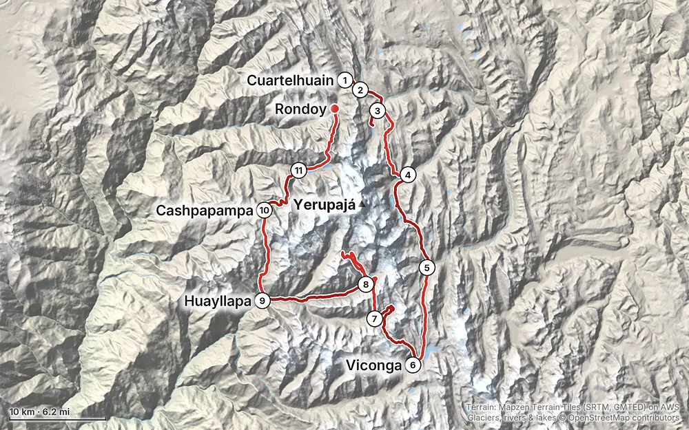
Elevation11,440–16,768 ft83.2 mi
Terrain: Mapzen Terrain Tiles (SRTM, GMTED) on AWS · Glaciers, rivers & lakes © OpenStreetMap contributors
Tap a map to open it full size.
Community fees in cash at checkpoints and camps: S/280, or S/290 with Cutatambo (2026)
From the hike's facts; check the official page before you go.
The Huayhuash is trekked in the dry season. Peru's tourism inventory recommends May to September. Outside those months the wet season, roughly November to March, brings snow on the passes and cloud on the peaks, and storms can start in late September and October.
I walked in the middle of August. We had clear, sunny days for the big passes (Days 4, 6 and 7), an overcast day with the peaks in cloud on Day 3, and a foggy morning on the ridge that same day. Nights were cold, with frost on the tents by Day 5, and middays were hot in the sun. Pack for both.
This is the part of the trek to take seriously. Huaraz is at about 10,000 ft (3,050 m). Our first camp was 13,730 ft (4,185 m), we crossed a pass nearly every day, and every camp except Huayllapa was above 13,300 ft.
How I acclimatized. I arrived in Huaraz on a long flight and a long bus ride and could feel the altitude hitting me the first night. I was so tired I couldn't tell if it was jet lag or altitude. The next day, August 15, I did a day hike with a few others to Laguna Rajucolta: about an hour's drive, then up the valley to the lake and back, 9.1 miles (14.7 km) to a high point of 14,030 ft (4,275 m). It felt pretty easy. The day after that was a prep day in town, with another short hike on the hills above the city. We left for the trek on August 17.
How it went. Day 2 over the Cacanan pass gave me a slight headache, and that afternoon I didn't feel good at all. I had a slight headache again at Carhuacocha on Day 3. From then on it got better, and on Day 7, crossing 16,600 ft and climbing Cerro Gran Vista, I felt great: the most acclimatized I've ever been.
My camp heights (from my GPS):
| Night after | Camp | Height |
|---|---|---|
| Before the trek | Huaraz | about 10,000 ft (3,050 m) |
| Day 1 | Cuartelhuain | 13,730 ft (4,185 m) |
| Day 2 | Mitucocha | 13,930 ft (4,245 m) |
| Day 3 | Carhuacocha | 13,720 ft (4,182 m) |
| Day 4 | Huayhuash | 14,260 ft (4,346 m) |
| Day 5 | Viconga hot springs | 14,290 ft (4,355 m) |
| Day 6 | Huanacpatay | 14,750 ft (4,497 m) |
| Day 7 | Cutatambo | 13,960 ft (4,256 m) |
| Day 8 | Huayllapa (hostel) | 11,440 ft (3,487 m) |
| Day 9 | Cashpapampa | 14,840 ft (4,523 m) |
| Day 10 | Jahuacocha | 13,320 ft (4,058 m) |
The rules of thumb. The US CDC's current guidance (Yellow Book, April 2025): once above 3,000 m (9,850 ft), don't raise your sleeping height by more than 500 m (1,650 ft) a night, and allow an extra night for every 1,000 m (3,300 ft) you gain. The jump from Huaraz to the first camp is more than that, about 1,100 m, which is why the days in Huaraz and the acclimatization hikes matter. After Day 1 most camps stay within a few hundred meters of each other; Day 9, Huayllapa to Cashpapampa, sleeps 1,040 m (3,400 ft) higher, twice the CDC's limit.
The signs. Headache is the main symptom of acute mountain sickness, usually with loss of appetite, dizziness, tiredness or nausea. Confusion, stumbling or drowsiness like being drunk can mean HACE (swelling of the brain); breathlessness at rest, a cough and chest congestion can mean HAPE (fluid in the lungs). Both are emergencies. The CDC's advice is to descend if symptoms get worse despite rest, and to ask your doctor about acetazolamide before you go. On this trek, going down means walking or riding the emergency horse to a lower valley; see each day's "If you need to get off" and Weather and safety.
Weather. On my trip in August: clear mornings, strong sun, a few cloudy days, and nights below freezing, with frost on the tents. Fog can hide the path on the high ridges (Day 3 for us).
Altitude is the main risk. Read Altitude. Tell your guide early if you feel unwell, and don't go higher with worsening symptoms.
Getting help. The Huayhuash is remote. Don't count on a phone signal, and help comes on foot or horseback first. My operator brought an emergency horse for exactly this. The ways out are the valleys to the roads at Queropalca, Cajatambo, Huayllapa, Pacllón and Llamac, a day's walk or more from most camps (each day's "If you need to get off" gives the route). Helicopter rescue in the Peruvian Andes is limited and can't be counted on. Carry a satellite messenger or make sure your operator has one, and have insurance that covers evacuation.
Emergency numbers in Peru (checked September 2026): 105 police, 106 ambulance (SAMU), 116 fire. The police high-mountain rescue unit (USAM) is based in the Huaraz area. In September 2026 rescues in the range were run from Huaraz by Socorro Andino Peruano with the police unit, and one hiker was carried out overland after cloud and wind stopped the helicopter. Get current rescue numbers from your operator or the Casa de Guías in Huaraz.
Dogs. Farm dogs guard their houses. On my prep day in Huaraz, a farm dog bit me while I was running. Walk past calmly, and carry your poles.
Water. Our cook boiled water morning and evening. Treat stream water: there are animals everywhere.
Did you do the whole circuit? Yes, the full loop around the range, clockwise, from Cuartelhuain to Rondoy in eleven days, with Cerro Gran Vista and the Siula Grande viewpoint on Day 7. The classic start is the village of Llamac, lower down; we drove past it to the road end at Matacancha, which saves a day or two. See Other ways to do it.
Can I do it on my own? People do, but it's a big trek to carry alone: ten nights of food and camp at 13,000 to 15,000 ft, with only one real village on the way. When I asked in 2021, my operator told me solo hikers were technically no longer allowed into the range, and that most people who go without a full agency at least hire a muleteer and donkeys. I haven't found an official rule on solo hiking; ask in Huaraz when you arrive. See How this trek works.
How many days do I need? Eleven on the trek, plus at least two or three days in Huaraz first to acclimatize, and a day each way between Lima and Huaraz. I arrived in Huaraz three days before we left, did an acclimatization hike and a day of prep, and took the bus back to Lima the day after we finished.
How hard is it? The walking days are short, 6 to 12 miles, and the donkeys carry the camp, so you only carry a daypack. What makes it hard is the altitude: we crossed a pass nearly every day, went over 5,000 m three times, and slept above 13,000 ft every night but one. It's also cold at night and long. By Day 10 I said it plainly: 11 days is a lot, and I think we were all feeling it.
Will I get altitude sickness? I had a slight headache on Days 2 and 3, and on Day 2 I didn't feel good at all. By Day 7, at almost 17,000 ft, I felt nothing: the most acclimatized I'd ever been. Read Altitude before you book anything.
When should I go? The dry season, roughly May to September. I went in the middle of August. See When to go.
What does it cost? In 2022 our private group of six paid the operator US$1,200 a person for everything on the trek: guides, cook, muleteers, donkeys, food, tents and transport from and back to Huaraz. On top of that you pay the community fees in cash, about S/290 a person in 2026. See What I paid.
What are the community fees? Each community whose land the trail crosses collects its own fee at its campsite or checkpoint, in soles. In 2026 the nine fees add up to S/290 if you visit Cutatambo, as we did. Every day in this guide lists that day's fee.
What's a day like? A cup of coca tea brought to the tent, breakfast in the dining tent, pack your duffel for the muleteers, then 3.5 to 9 hours of walking with a daypack. Most days we were in camp by early afternoon, with time to nap, walk to a lake, and eat dinner early.
Is there phone signal or Wi-Fi? Don't count on it. The hot springs camp at Viconga allegedly had Wi-Fi, and in Huayllapa I could charge batteries at the hostel. Download everything before you leave Huaraz, and consider a satellite messenger.
Can I charge my phone and camera? Not in camp on my trip. In Huayllapa, on Day 8, I charged three drone batteries at the hostel. Bring a power bank big enough for the whole trek.
My operator's plan. Quechuandes' 11-day plan, sent in December 2021, was: Day 1 drive to Matacancha; Day 2 Mitucocha; Day 3 Carhuacocha; Day 4 Huayhuash; Day 5 Viconga; Day 6 Pampa Cuyoc; Day 7 Cutatambo over the Santa Rosa pass; Day 8 a "rest day" at Cutatambo with Laguna Sarapococha and Cerro Gran Vista; Day 9 Huatiac via Huayllapa; Day 10 Jahuacocha over the Tapush and Yaucha passes and Cerro Huacrish; Day 11 Rondoy over the Sambuya pass and the drive home. On the trail we folded Day 8 into Day 7, slept in Huayllapa instead of Huatiac, and camped at Cashpapampa between Tapush and Yaucha. Same passes, same finish.
Starting at Llamac. The classic circuit starts and ends in the village of Llamac, lower down on the west side, with a climb to Cuartelhuain or Jahuacocha on the first day. It adds a day or two to what we walked.
Longer or shorter. My operator organized the trek in 9 to 12 days. A day to spare lets you split Day 7 or sit out bad weather. The south side (Viconga, Cuyoc, Cutatambo, Huayllapa) and the west side (Jahuacocha) are where most shorter trips cut in or out, using the roads to Cajatambo, Huayllapa and Llamac.
I walked the version in this guide. I haven't walked these other versions.
My trip was organized by Quechuandes, a trekking agency in Huaraz (quechuandes.com). I'd met them briefly on my 2021 trip to Peru. In October 2021 I wrote asking for help with the full circuit, and we settled on a private group: me plus five subscribers, starting August 15, 2022. I collected applications from my audience, and the agency took it from there.
On the morning of Day 1 we met at the agency, loaded twelve donkeys' worth of gear, and said goodbye to David, the mastermind of the trip. From there the team ran everything.
The agency's 2021 quote listed what was included, and it matches what I saw on the trail:
Not included in 2022, and still worth planning for: the community fees, a sleeping bag, an inflatable mat, tips, water and breakfast on Day 1, dinner on the last day, drinks, travel insurance, and any cost of leaving early or being rescued. The agency boiled water for our bottles each morning and evening at no charge.
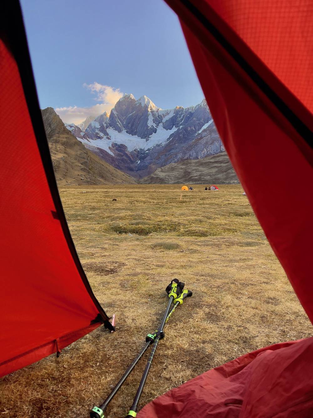
The food. The cook fed us well, and it's a big part of what I remember. Pumpkin soup on the first night. Cheese and potatoes. Steak and eggs, and a random banana, at Carhuacocha. Blueberry pancakes with peanut butter and honey before one of the harder days, so we were powered by pancakes. A stuffed pepper for lunch on Day 7, one of the best lunches of my life. On Day 10 the team cooked a feast at Jahuacocha, a real feast.
Mornings. Every morning we packed our stuff, rolled up the mat and left our duffel for the muleteers to load. Then daypack, tea, and into the dining tent to wait for breakfast.
The cold. Nights were cold. On Day 2 I was wearing everything I had. Day 5 started with frost on the ground and on the tents, the coldest morning of the trip, and on Day 6 I walked circles around camp to warm up before breakfast. The days swing the other way: by midday at Mitucocha it was really hot.
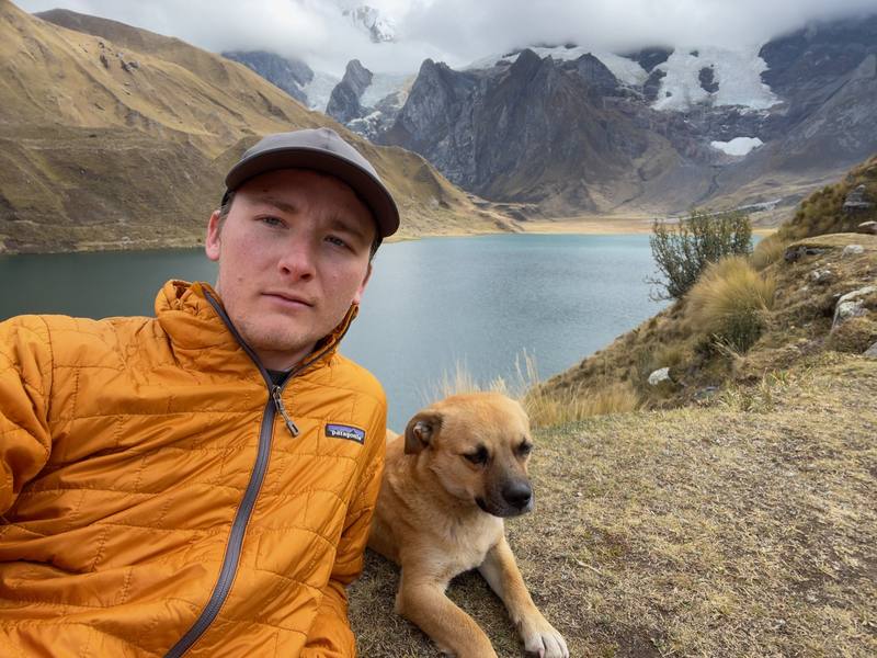
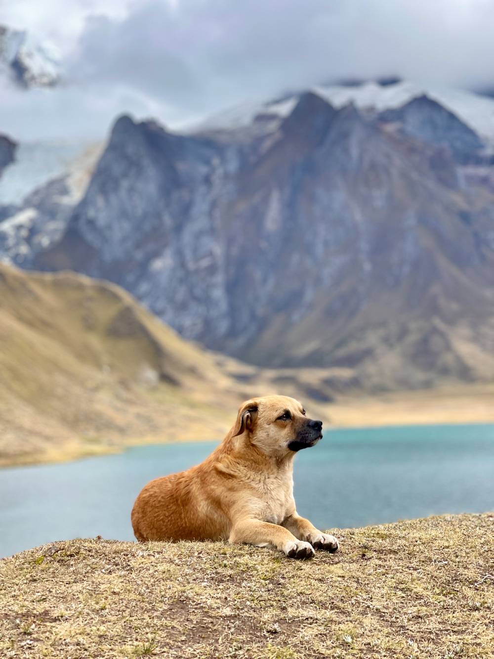
The dog. A dog we called Free Solo hiked with us every step, a beast of a dog.
The Cordillera Huayhuash is a reserved zone (Zona Reservada Cordillera Huayhuash, created in 2002), and most of the land around the circuit belongs to peasant communities. Each community charges for its own sector, at a checkpoint near its village or at its campsites. The 2026 list, published at huayhuash.com (checked September 26, 2026):
| Community | Where it's collected | 2026 fee |
|---|---|---|
| Llámac | Cuartelhuain and part of Jahuacocha | S/50 |
| Pocpa | On the way in | S/20 |
| Queropalca | Mitucocha and part of Carhuacocha | S/40 |
| Quisuarcancha | Part of Carhuacocha | S/30 |
| Tupac Amaru | The Huayhuash camp | S/30 |
| Uramaza | Laguna Viconga and the hot springs | S/30 |
| Huayllapa | Viconga, Huanacpatay and Huatiac | S/50 |
| Pacllón | Cashpapampa and part of Jahuacocha | S/30 |
| Cutatambo | The Siula Grande base camp valley (extra) | S/10 |
| Total | S/280, or S/290 with Cutatambo |
Carry it in cash, in soles, in small notes, and keep the receipts. On my trip the fees weren't in the operator's price; in 2021 the agency estimated them at about S/260 a person.
I hosted this trip, and the five subscribers' tickets covered my place, so my records don't hold a normal personal price. This is what the records show.
| Item | Cost |
|---|---|
| The operator's private trek for a group of six, all the inclusions above | US$1,150 a person quoted in December 2021 (US$6,900 for six); raised to US$1,200 a person in January 2022 because the dollar had dropped |
| Community fees | Cash on the trail; the agency's 2021 estimate was about S/260 a person. Not in my records |
| Trekking pole rental in Huaraz | A shop receipt, amount not legible |
| Hostel night in Huayllapa (Day 8), flights, Lima to Huaraz bus | Not in my records |
For scale, the agency's 2021 price was US$80 a person per day for its own groups of 5 to 8. A private trek for one person was quoted at US$4,000 for 2022, because the whole team costs the same for one person as for six.
These change from year to year; everything else in this guide stays the same. Checked September 26, 2026. Check them again when you book and the week you fly.
On the trail
Getting there
Health and safety
Money and gear
The film is at the top of this page.
Planning questions about Huayhuash Circuit, answered only from this page's facts, the creators' versions and hikers' public tracks, with where each answer comes from. When the data doesn't say, the answer says "not given".
From hikers
Sign in to comment. Free; your hikes stay private unless you share them.
Something wrong or missing on this page? Send feedback.