Follow the Hiker
Find my next hikeGearSavedKraig Adams
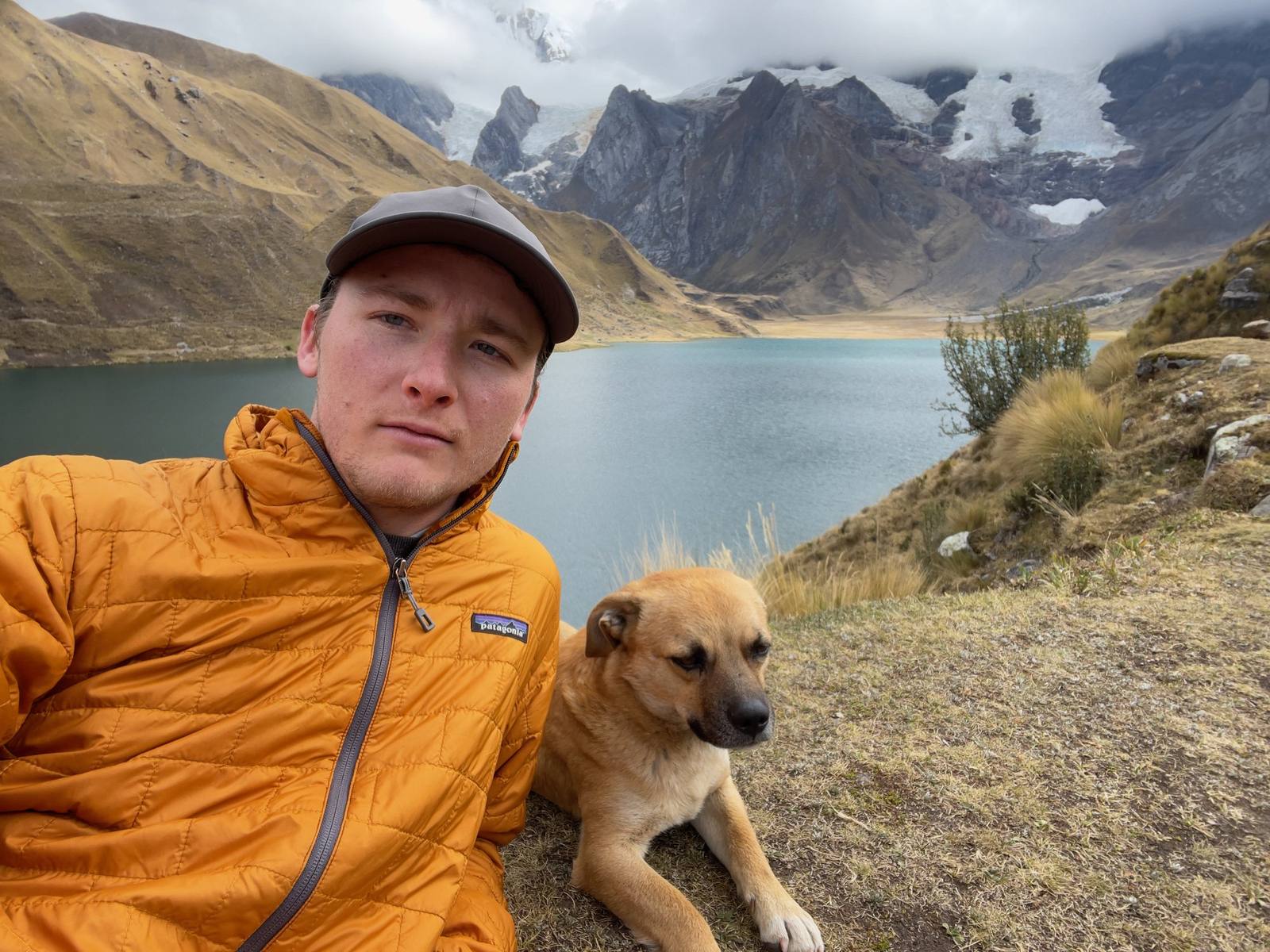
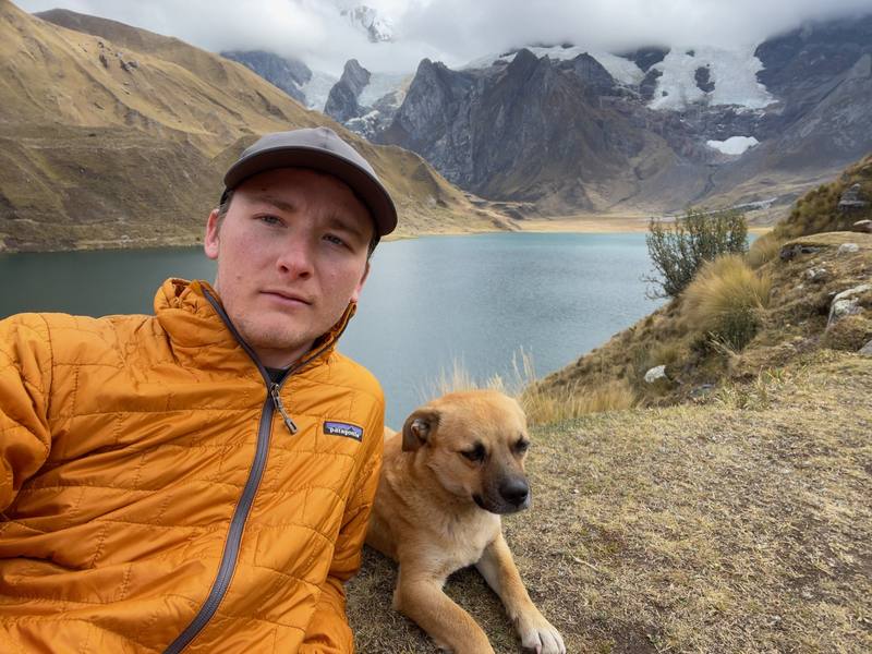
Me with Free Solo, the dog that hiked with us every step, at Carhuacocha on Day 3.

South America · Peru

Huayhuash Circuit

Cordillera Huayhuash, Peru

Distance
83.1 mi133.8 km
Days
11 days11 days on foot
Elevation gain
24,364 ft7,426 m
High point
16,801 ft5,121 m
Season
The dry season, about May to September
Lodging
Tent
Plan this hike

Hikes / South America / Huayhuash Circuit

In August 2022 I spent eleven days walking around the Cordillera Huayhuash in Peru, one of the most beautiful ranges I've ever seen. Five subscribers joined me, along with two guides, a cook, muleteers and a string of pack donkeys carrying our camp. We started at Cuartelhuain, at the end of the road above Chiquián, and walked clockwise around the whole range: glacial lakes under Yerupajá and Siula Grande, passes over 16,000 feet, hot springs, and the village of Huayllapa, then out over one last pass to the road at Rondoy.

Kraig Adams

Effort at this pace: Hard · about 8 mi (12 km) and 2,215 ft (675 m) of climbing a day over 11 days, up to 16,801 ft (5,121 m). Our grade for the days given, worked out from distance, climbing and altitude a day; it isn't the trail's usual difficulty rating (under Basics) and doesn't rate exposure, terrain or weather.

Where these numbers come from

From Kraig Adams's GPS recording and guide.

Plan this hikeSave this hike

Plan: dates, gear, deadlines and stays in a private link. Save: keeps it on your account.

From Kraig Adams's GPS

The route, day by day

Relief map of the Huayhuash Circuit route: 11 days drawn in red with numbered day starts, labelled Cuartelhuain, Rondoy, Yerupajá, Viconga, Huayllapa and Cashpapampa.

Elevation11,440–16,768 ft83.2 mi

From Kraig Adams's GPS. Terrain: Mapzen Terrain Tiles (SRTM, GMTED) on AWS · Glaciers, rivers & lakes © OpenStreetMap contributors

Tap a day for his map of it

  • Read day 1
  • Read day 2
  • Read day 3
  • Read day 4
  • Read day 5
  • Read day 6
  • Read day 7
  • Read day 8
  • Read day 9
  • Read day 10
  • Read day 11

The film

Watch it first

Hiking the Huayhuash Circuit in Peru

Kraig Adams · Aug 2022 · Group trip

Me with Free Solo, the dog that hiked with us every step, at Carhuacocha on Day 3.
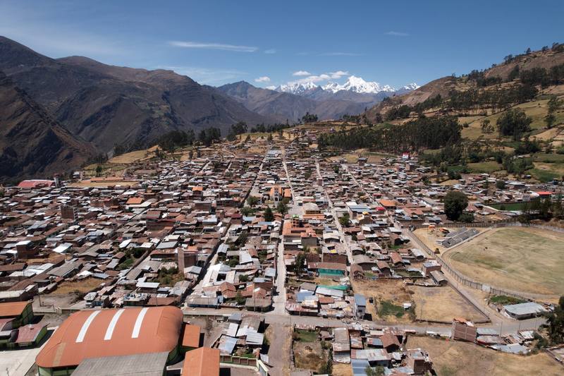
Chiquián, the last town before the trailhead, where we stopped for lunch on Day 1.
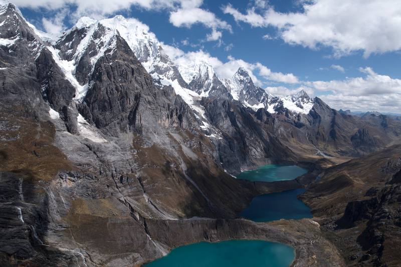
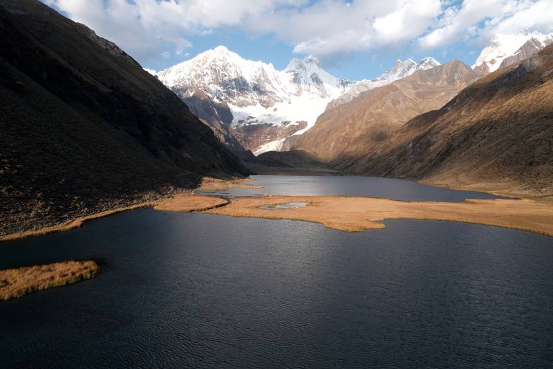
The three lakes below Siula Grande on Day 4.
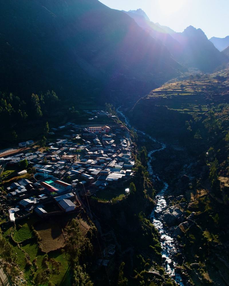
Huayllapa from above, early the morning after Day 8.
Laguna Jahuacocha, where Day 11 starts, the evening before.

Before you go

The basics

Start
Cuartelhuain, a campsite above the Matacancha road end, about 6 hours by road from Huaraz
Finish
Rondoy, at the end of a road, about 5 hours by road from Huaraz
Usual difficulty
Long, high and remote. Short walking days, but every camp is above 13,000 ft except Huayllapa
Best time
The dry season, about May to September. I walked August 17 to 27, 2022
Permits
Community fees in cash at checkpoints and camps: S/280, or S/290 with Cutatambo (2026)
Getting there
To Huaraz. Fly to Lima, then take the bus north to Huaraz. It was my third time in Huaraz, and I love this place: you wake up and look at mountains. Cruz del Sur, for one, runs 8 buses a day from Lima to Huaraz in 7.5 to 8.5 hours (2026 timetable, fares from S/87). I stayed at the agency the first night and in a hotel in town after that.
Lodging
Tent

From Kraig Adams's guide

Costs and gear

What it cost

US$1,200 a person for the operator's trek (2022), plus about S/290 in community fees (2026)

His costs, line by line

What Kraig carried

a daypack · a duffel · my sleeping bag and inflatable mat · rented trekking poles · Hyperlite Mountain Gear 20° Mummy Bag · Therm-a-Rest NeoAir XLite NXT · AlpenBlow Micro Inflator · Hyperlite Mountain Gear Waypoint 35 and 18 more.

The full gear list

From Kraig Adams's guide

Safety

Rescue numbers

  • Emergency numbers in Peru (checked September 2026): 105 police, 106 ambulance (SAMU), 116 fire. The police high-mountain rescue unit (USAM) is based in the Huaraz area. In September 2026 rescues in the range were run from Huaraz by Socorro Andino Peruano with the police unit, and one hiker was carried out overland after cloud and wind stopped the helicopter. Get current rescue numbers from your operator or the Casa de Guías in Huaraz.

Phone signal

  • Don't count on it.
  • The hot springs camp at Viconga allegedly had Wi-Fi, and in Huayllapa I could charge batteries at the hostel.

Insurance

  • Carry a satellite messenger or make sure your operator has one, and have insurance that covers evacuation.

Bail-out points

  • Day 1, Huaraz to Cuartelhuain. You're at the road. The vans that bring groups in go back to Chiquián and Huaraz.
  • Day 2, Cuartelhuain to Mitucocha. Back over the Cacanan pass to Cuartelhuain and the road. Or down the valley east to Janca and on to the road at Queropalca, a longer walk.
  • Day 3, Mitucocha to Carhuacocha. Down the valley east from Carhuacocha to Queropalca and the road. That's the main way out from here.
  • Day 4, Carhuacocha to Huayhuash. Back to Carhuacocha and out to Queropalca. From the Huayhuash camp, the valley to the east leads out toward the road at Queropalca too, a long walk.
  • Day 5, Huayhuash to Viconga. Down the valley west from Viconga toward Uramaza and Cajatambo, where there's a road. This is the usual way out on the south side of the range.
  • Day 6, Viconga to Huanacpatay. Down the Huanacpatay valley west to Huayllapa, the one real village on the circuit, where there's a road out. That's the way to go from here.
  • Day 7, Huanacpatay to Cutatambo. Down the Calinca valley to Huayllapa, which is the next day's walk (Day 8), about 8 miles and all downhill.
  • Day 8, Cutatambo to Huayllapa. This is the place to do it: a road runs out of Huayllapa toward Cajatambo.
  • Day 9, Huayllapa to Cashpapampa. Back down to Huayllapa and its road. From Cashpapampa, a path leads west down to Pacllón, a village on a road.
  • Day 10, Cashpapampa to Jahuacocha. From Jahuacocha, a path leads west down the valley to Llamac, the classic trailhead, on the road to Chiquián.
  • Day 11, Jahuacocha to Rondoy. Back down to Jahuacocha and west to Llamac. Or keep going: the road at Rondoy is closer than anything behind you.

From Kraig Adams's guide. For planning, not navigation: check before you go.

Their films and versions

Creators who've done it

1 creator so far: Kraig, 11 days, tent.

Walked Huayhuash Circuit? Be the first to share your track: log it with your GPX.

Your time

Sign in and log a few hikes to see how long this one would take you.

Typical: 11 days on foot (the hike's facts).

Ask this hike

Planning questions about Huayhuash Circuit, answered only from this page's facts, the creators' versions and hikers' public tracks, with where each answer comes from. When the data doesn't say, the answer says "not given".

    From hikers

    Comments

    Sign in to comment. Free; your hikes stay private unless you share them.

    Answered from the data

    Questions people ask

    How many days do you need for Huayhuash Circuit?

    I did the full circuit in eleven days, from Cuartelhuain to Rondoy. Add at least two or three days in Huaraz first to acclimatize, and a day each way between Lima and Huaraz.

    From Kraig Adams's trip and guide.

    How much does Huayhuash Circuit cost?

    Each community collects its own fee at its campsite or checkpoint, in soles. In 2026 the nine fees add up to S/290 a person including Cutatambo. Carry cash in small notes and keep the receipts.

    From Kraig Adams's trip and guide.

    When is the best time to hike Huayhuash Circuit?

    The dry season, about May to September. I walked August 17 to 27, 2022, and had clear days for the big passes, frost on the tents by Day 5 and hot middays.

    From Kraig Adams's trip and guide.

    Where do you sleep on the Huayhuash trek?

    In tents at community campsites, every one above 13,000 ft except Huayllapa. I slept 9 nights in a tent and 1 in a hostel in Huayllapa. My Huaraz operator supplied the tents, cook and donkeys.

    From Kraig Adams's trip and guide.

    How do you get to the Huayhuash trailhead?

    Fly to Lima and take the bus to Huaraz, about 8 hours. Our operator drove us from Huaraz to Cuartelhuain, about six hours via Chiquián. Without an agency, take a minibus to Chiquián and a local car to Llamac, Pocpa or Matacancha.

    From Kraig Adams's trip and guide.

    Plan this hikeThe route