
Content made there
The film is at the top of this page.
Photos
Hikes / Howe Sound Crest Trail / Kraig Adams's version
North America · Canada
Jul 2023 · a day and a half · Solo · Tent

In July 2023 I hiked the Howe Sound Crest Trail, the ridge walk above Howe Sound just north of Vancouver, in a day and a half. It was my first time in Vancouver. I started in the afternoon at the Cypress Mountain ski area, climbed past St. Mark's Summit and over Unnecessary Mountain, and camped on the ridge below the West Lion, one of the two rock peaks the city calls the Lions. The next morning I went north along the crest over Thomas, James and David Peaks to Magnesia Meadows, Brunswick Lake and Deeks Lake, and down to Highway 99 by Porteau Cove. About 19.3 miles by my GPS: 6.3 on the first day and 13 on the second. It's the trip from my film Hiking the Howe Sound Crest Trail in Vancouver.
It's point to point, and the big selling point for me was being able to wild camp: there are no campsites to book, so you can pick a spot with a view of the sound and watch the sunset.
| Quick facts | |
|---|---|
| Distance | 19.3 miles (31.1 km) by my GPS. BC Parks gives 29 km (18 miles) one way |
| Climbing | About 5,230 ft (1,595 m) up and 7,970 ft (2,430 m) down, going north like I did |
| Days | 2: 6.3 miles on Day 1 (an afternoon), 13 on Day 2 |
| Start | Cypress Mountain ski area, about 2,980 ft (909 m), above West Vancouver |
| Finish | The Porteau Road trailhead on Highway 99, about 300 ft (90 m), just south of Porteau Cove |
| High point | About 5,210 ft (1,589 m) by my GPS, on the shoulder of Brunswick Mountain |
| Sleep | Anywhere on the trail north of Strachan Meadows; I camped below the West Lion, Day 1 mile 6.3 |
| Difficulty | Experienced hikers only past Bowen Lookout (BC Parks). Rooty, rocky, with scrambles between the Lions and Magnesia |
| Permits (2026) | None. No reservation and no camping fee |
| Day | Route | Miles (km) | Up / down (ft) | Sleep |
|---|---|---|---|---|
| 1 | Cypress Mountain to below the West Lion | 6.3 (10.2) | 2,821 / 1,053 | My tent, about 4,760 ft |
| 2 | Below the West Lion to Highway 99 at Porteau | 13.0 (21.0) | 2,412 / 6,919 |
My way in, 2023. This was the first of four hiking films I shot in two weeks up and down the Pacific Northwest, with just a carry-on and three rental cars from three airports. I flew from New York to Vancouver the day before. Locals had told me to go to Nemesis Coffee, so I did. Because the trail is point to point, I asked for help, and a local subscriber went way out of his way to come after work, pick me up at the end of the trail where I'd left my car, and drive me to the beginning. I started walking at the ski area at 4:45 p.m.
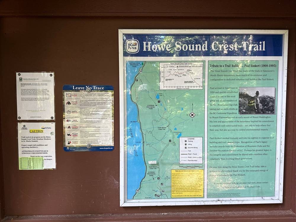
The start: Cypress Mountain. Take Highway 1 to exit 8 in West Vancouver and drive Cypress Bowl Road to the end, at the downhill ski area: about 40 km (25 miles) and 45 to 55 minutes from the airport outside rush hour. The trail starts near the bottom of the Lions Express chairlift, about 25 m north of the BC Parks kiosk in front of Cypress Creek Lodge. Cypress Bowl Road was being repaved in 2026, due to finish by the end of October.
Parking overnight: Lot 3B only. Parking at Cypress is free all year in Lot 3B. If you leave your car overnight anywhere else, BC Parks says it will be towed, and a search may be started for you. Lot 3B is below the lodge, about 1 km (0.6 miles) from the trailhead, as reported.
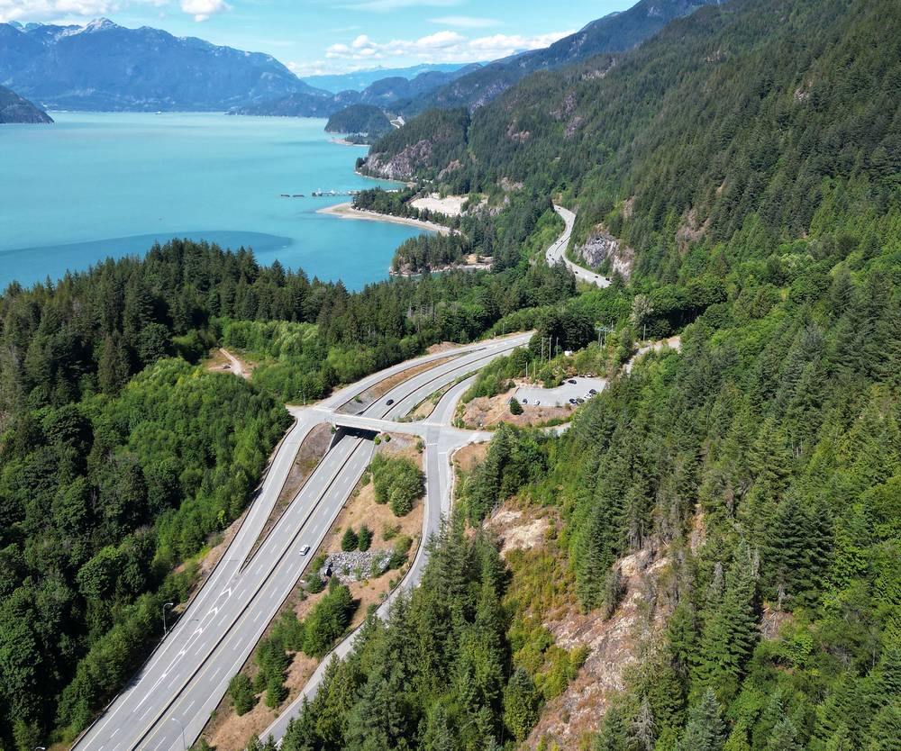
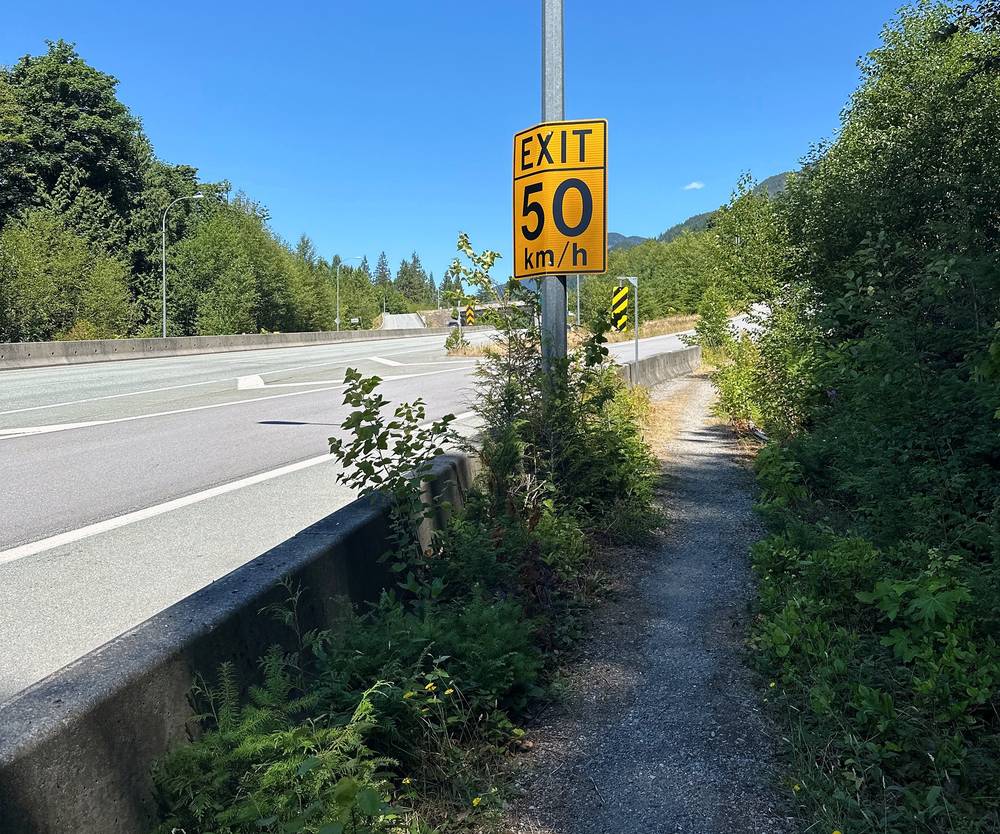
The finish: Porteau Road. The trail ends at a parking lot off Highway 99 (the Sea to Sky Highway), about 2 km south of Porteau Cove Provincial Park, as reported. Follow the kiosk's directions and the signed detour between the lot and the trail. Cypress to Porteau is about 45 minutes by car.
How to do the two ends.
Flying in. Bear spray and stove fuel aren't allowed on planes in either direction. Buy fuel in Vancouver; MEC, the big Canadian outdoor store, is at 111 East 2nd Avenue, as reported.
I didn't keep a list of what this trip cost me.
For your budget (Canadian dollars, as checked in October 2026; 2026 summer prices were pushed up by the World Cup in Vancouver):
| Item | Cost |
|---|---|
| Permits and camping | Free |
| Parking in Lot 3B | Free |
| A rental car from the airport, 4 days in July | About C$360 to C$650 (US$260 to US$470), as reported |
| A hostel dorm in Vancouver | From about C$45 a night |
| A budget hotel in Vancouver | About C$110 to C$240 a night |
| Cypress Coach Lines, one way | C$19 plus fees and tax, on its fares page |
| A ride from Porteau back to the city | About C$80 to C$130 (estimate) |
| Stove fuel, one canister | About C$10 |
| Bear spray | About C$68 to C$83 at MEC, as reported |
That's roughly C$385 to C$730 for one person for three nights from Vancouver on buses and in hostels, or C$1,130 to C$1,900 with a rental car and hotels, food included and flights not. Two people sharing a car and a room pay about C$650 to C$1,100 each. A second car, or a friend with one, saves the ride from Porteau.
These were checked on BC Parks' own pages and trail map on October 3, 2026.
No permit, no fee. Cypress isn't on BC Parks' list of parks with backcountry permits or fees, and its pages mention none for the trail.
Where to camp. Wilderness camping is allowed only on the Howe Sound Crest Trail in summer, north of Strachan Meadows. The preferred areas are Magnesia Meadows (14.5 km from the ski area by BC Parks' count), Brunswick Lake (19 km) and Deeks Lake (22 km). By my GPS they're farther: Magnesia Meadows 10.4 miles (16.7 km), Brunswick Lake 13 miles (20.8 km) and Deeks Lake 15.1 miles (24.3 km) from the trailhead. There are no tent pads; camp where others have camped before.
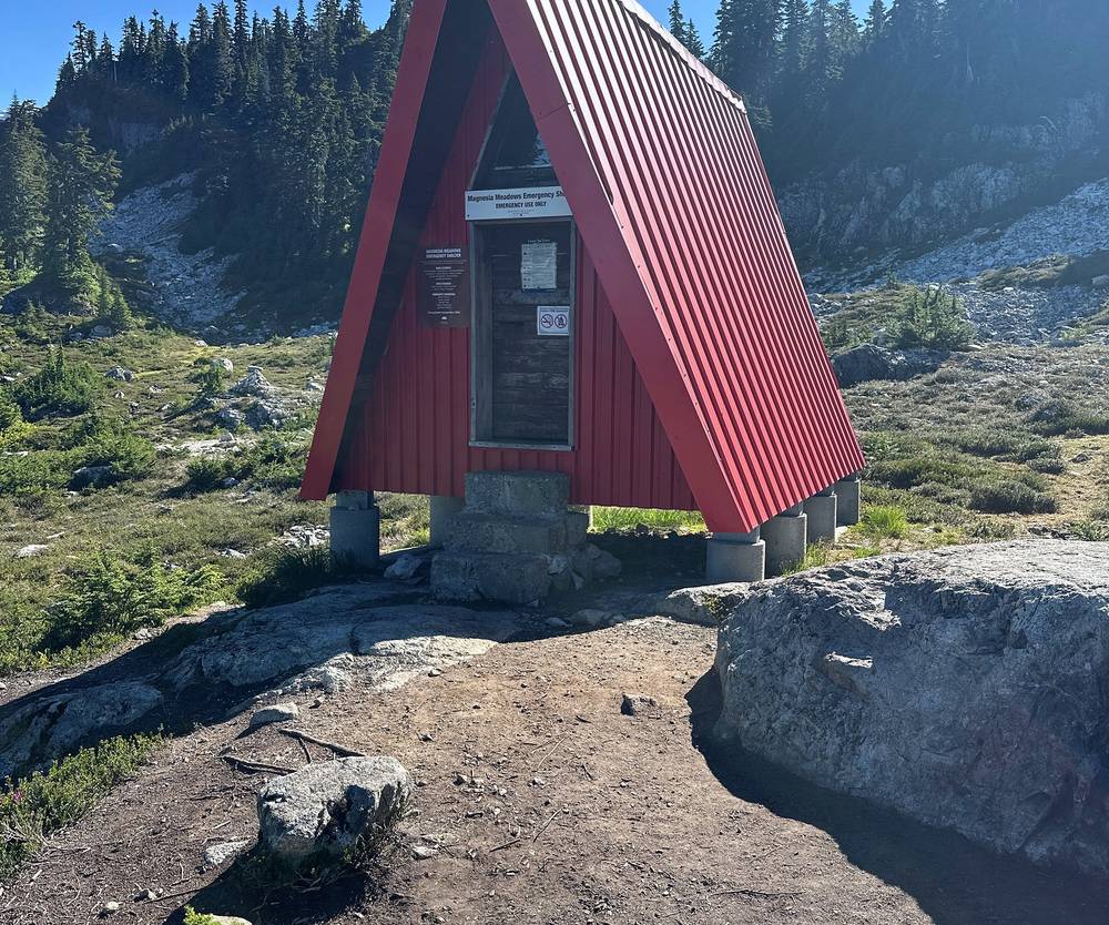
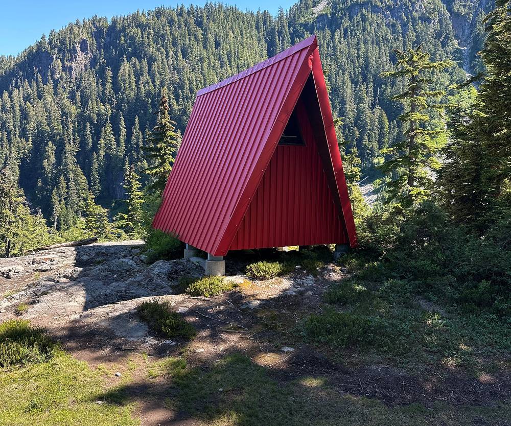
Shelters and the toilet. Magnesia Meadows and Brunswick Lake have small red A-frame emergency shelters. They're for emergencies, not for planning your nights around. The only toilet on the trail is a pit toilet at Magnesia Meadows. Elsewhere, bury your waste at least 100 m (330 ft) from the trail and any water.
Food. Hang all food and anything with a scent overnight; BC Parks also accepts a bear-proof canister. There are no food lockers on the trail.
Other rules. No campfires at any time. No drones without permission. Dogs on a leash. No smoking or vaping, no alcohol, no bikes or e-bikes. No entry to the Capilano watershed east of the crest, which includes the East Lion. Pack out everything you pack in.
| Night | Where | Height |
|---|---|---|
| Before | Vancouver | |
| 1 | My tent on the ridge below the West Lion (Day 1 mile 6.3) | about 4,760 ft (1,451 m) |
| After | I drove straight on to my next hike |
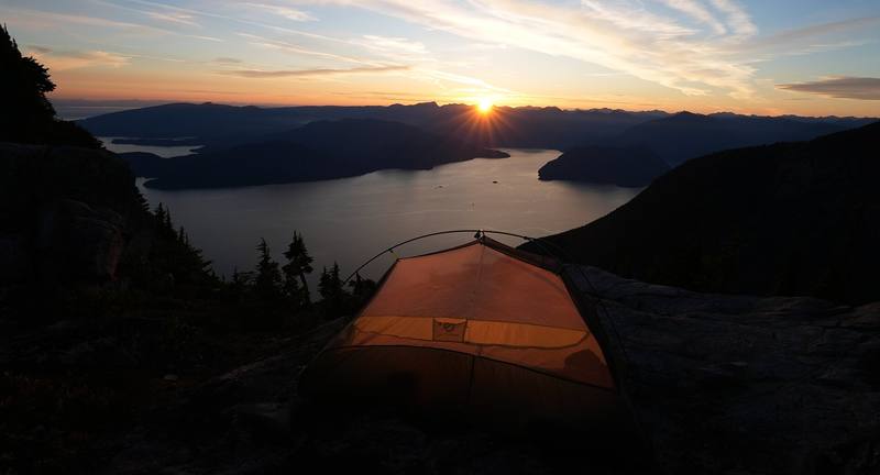
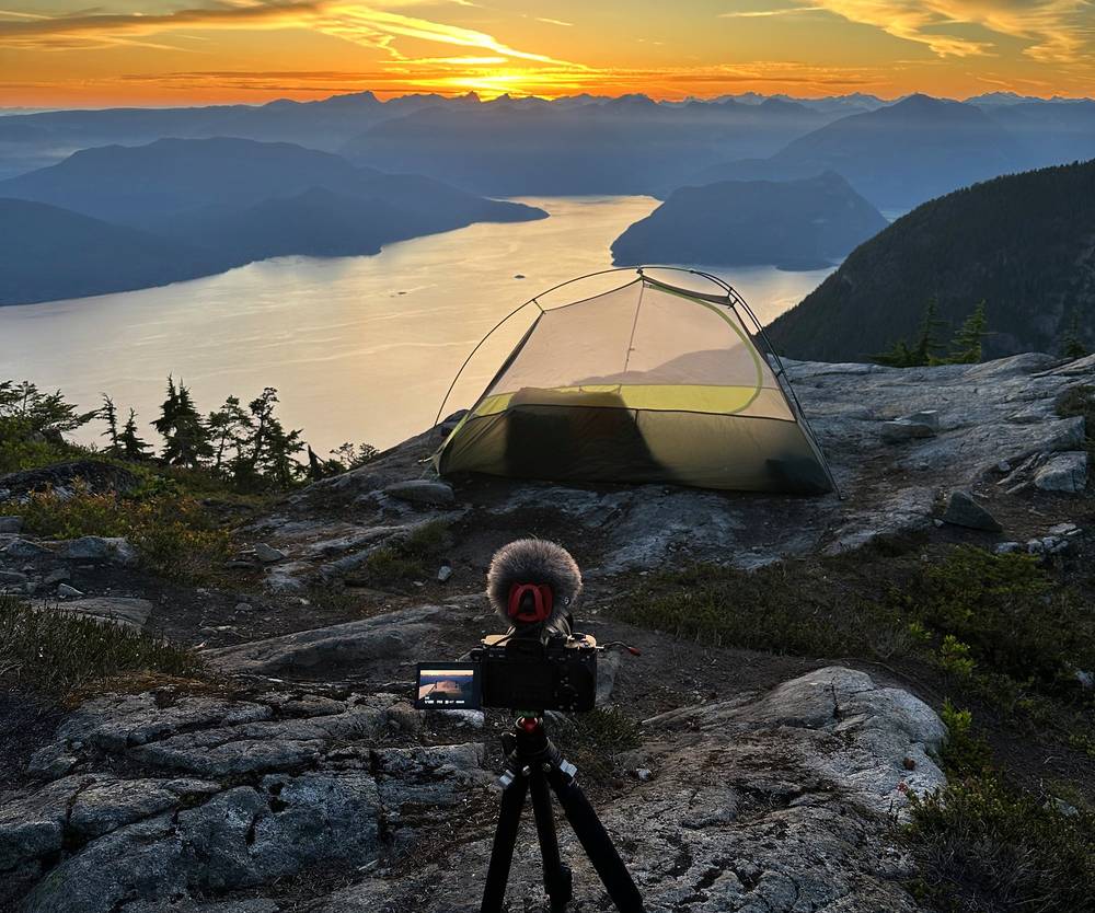
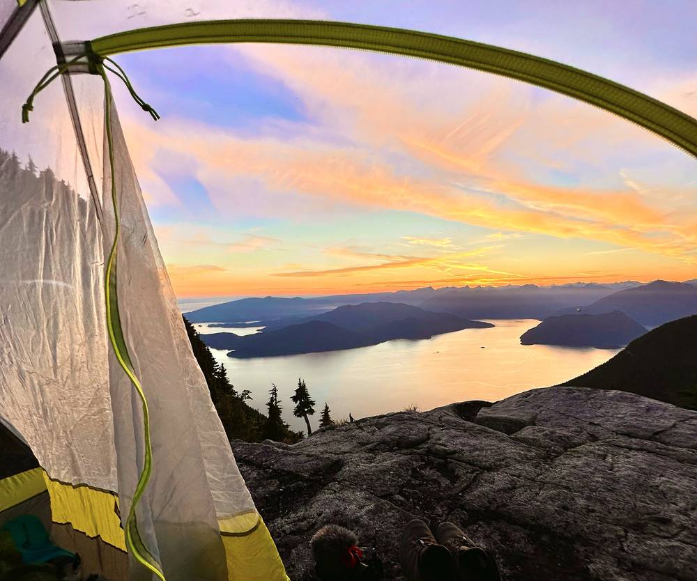
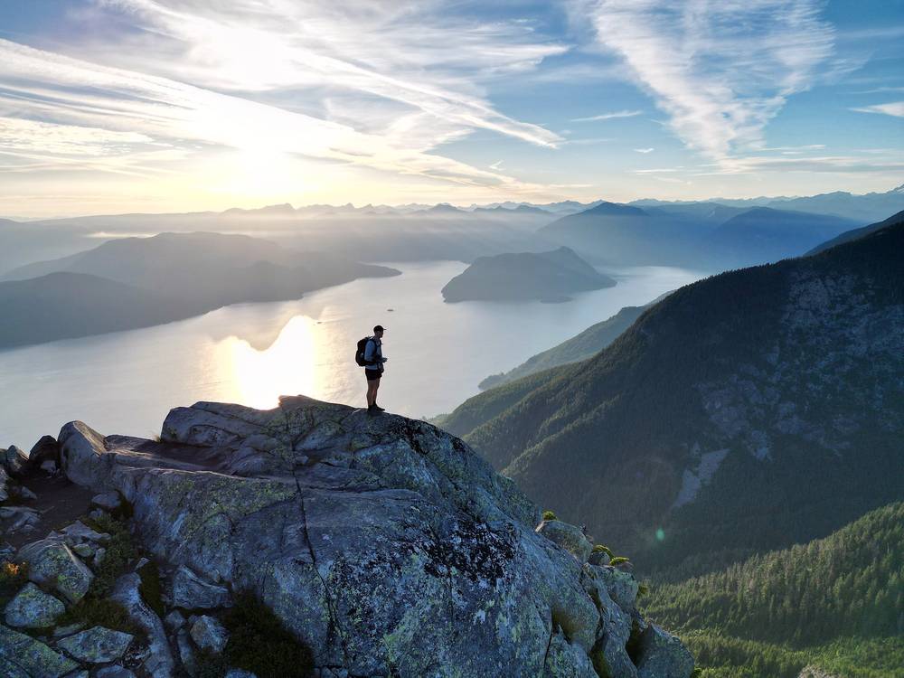
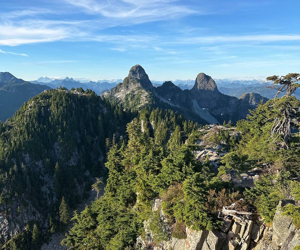
My camp. A rocky spot on the narrow ridge north of Unnecessary Mountain, below the West Lion, with the sound below to the west and the sunset over the water. No water, no toilet and very exposed: pick it only on a calm, clear night, with your water carried up.
What I ate. I cooked on a Jetboil and lit it with a flint starter, which always makes using it more fun. A new snack on this trip was salt and vinegar pistachios: top-tier delicious. At the end I ate some blueberries.
Water. Fill up at Strachan Meadows (Montizambert Creek), the last reliable water, or carry it from the car, and carry everything for the evening and the next morning if you camp near the Lions, about 4 liters per person, as hikers commonly advise. In mid-July there was some snow to melt in certain spots. From Magnesia Meadows on there's water in tarns, streams and lakes. Treat it all.
From my film and photos (I have no full gear list for this trip):
What this hike needs:
I started a little late in the day, at 4:45 p.m., at the ski resort. A few people were up there on day trips; a lot of people hike to St. Mark's Summit and back.
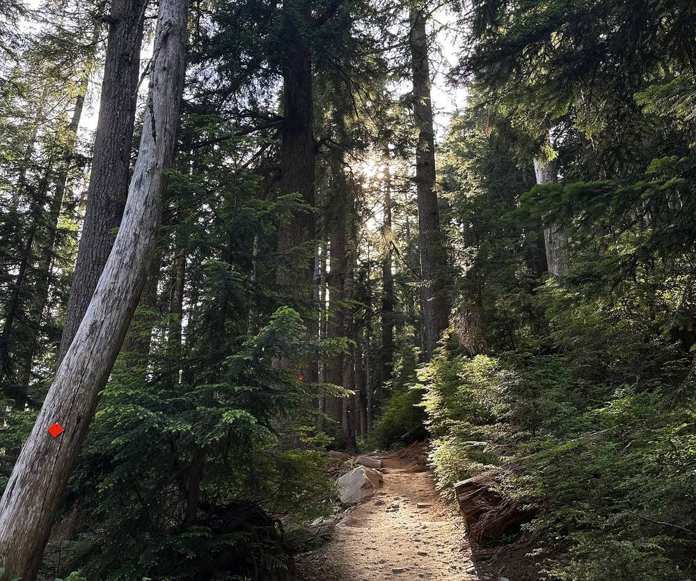
It was hotter than expected, but there was lots of tree cover. This first day was definitely more difficult than I expected: old-growth forest and rocky, rooty trail, like the Adirondacks.
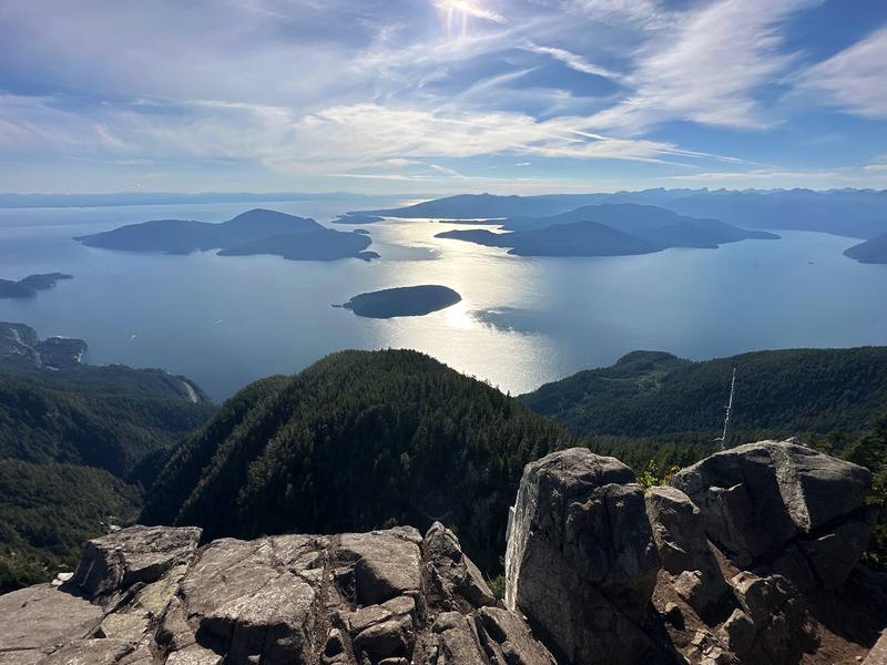
At St. Mark's you pop out of the tree line and start to get really good views of the sound. I passed it at 6:18 p.m., took a short break a little past it, then climbed Unnecessary Mountain, where I was at about 8 p.m.
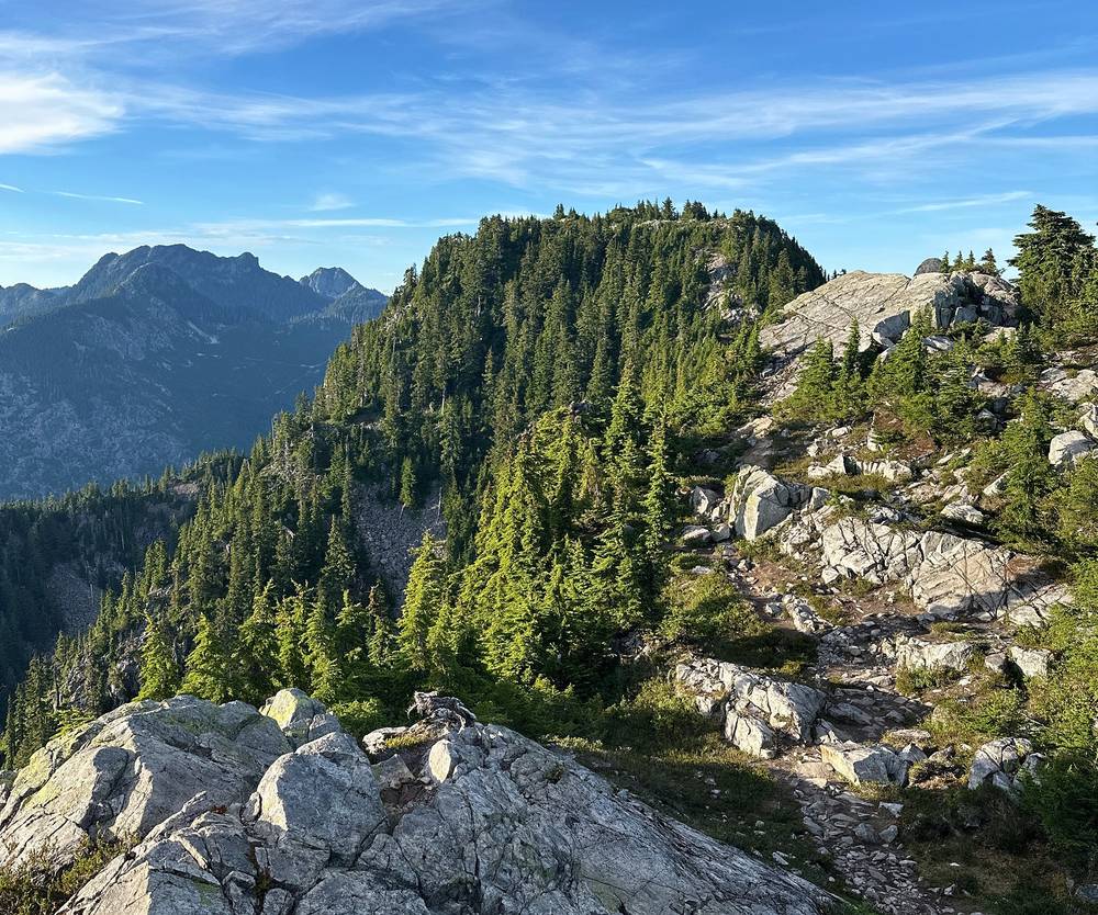
From there I hiked until I found a good camping spot, on the ridge north of Unnecessary below the West Lion, with a view straight down Howe Sound. I stopped at 9:02 p.m. and watched the sun set over the water. The little midges were super annoying at camp, so I basically had to hide in my tent. But it was a really nice place to sleep, with those views.
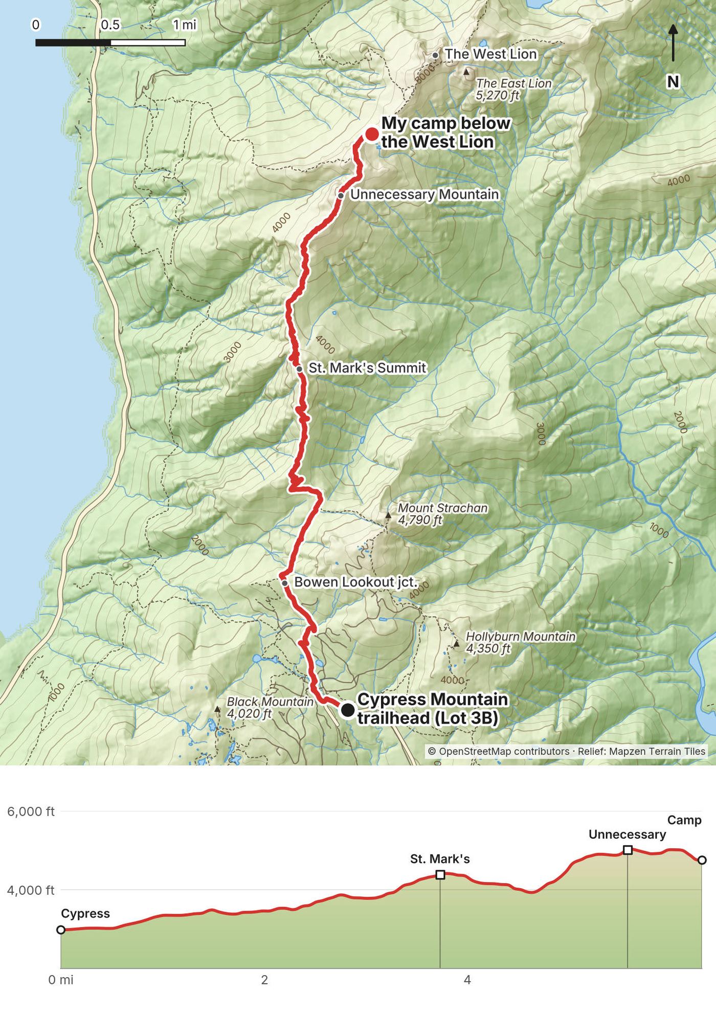
Cypress Mountain to Bowen Lookout. The trail starts at the ski area, about 2,980 ft (909 m), and climbs through the ski runs and forest. At mile 1.5 by my GPS a side trail goes to Bowen Lookout, a short walk to a view over the islands. BC Parks says only experienced, well-equipped hikers should go past this point. No camping here.
St. Mark's Summit. At mile 3.7, about 4,390 ft (1,337 m), the forest opens to a rocky viewpoint over Howe Sound. It's the usual day-hike turnaround. On the way you pass Strachan Meadows (Montizambert Creek): BC Parks' last reliable water until Magnesia Meadows, and the point north of which camping is allowed.
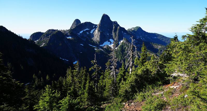
Unnecessary Mountain. Past St. Mark's the trail drops, then climbs steeply to Unnecessary Mountain: a South and a North Peak, about 5,050 ft (1,540 m) on my track at mile 5.6. It's rough, with roots, rock and short steep steps. The views of the Lions start here.
To the Lions. Past the North Peak the trail drops to a narrow, rocky ridge below the West Lion, where I camped at mile 6.3, about 4,760 ft (1,451 m). The spot is legal, but it isn't one of BC Parks' named camping areas: no water, no toilet, and exposed to wind and weather. The trail from Lions Bay (the Binkert trail) comes up to the Lions from the west.
Before Unnecessary, the easiest way off is back to Cypress; the Mount Unnecessary trail also drops steeply to Lions Bay. From the Lions the Binkert trail goes down to Lions Bay, a steep descent with very little parking in the village (pay parking, up to 72 hours, in 2026). Turn back if you're behind your plan by St. Mark's, if fog closes in (BC Parks says to stay where you are if you get lost or disoriented), or if you haven't got enough water for the night.
Day 1 · How I planned it, the bugs and the water (from 24:17)
I was up early and started at 5:36 a.m., with the first light on the sound below camp.
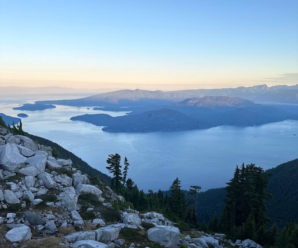
Right away the trail goes along the base of the West Lion and over Thomas Peak. I stopped below the West Lion and again by Thomas Peak. There was some snow to melt for water in certain spots.
The middle section, over James and David Peaks, was more intense than I expected. It's very up and down, with scrambles; it took me over an hour and a half to cover about 1.2 miles. It reminded me of hiking in the Adirondacks.
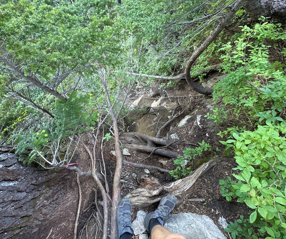
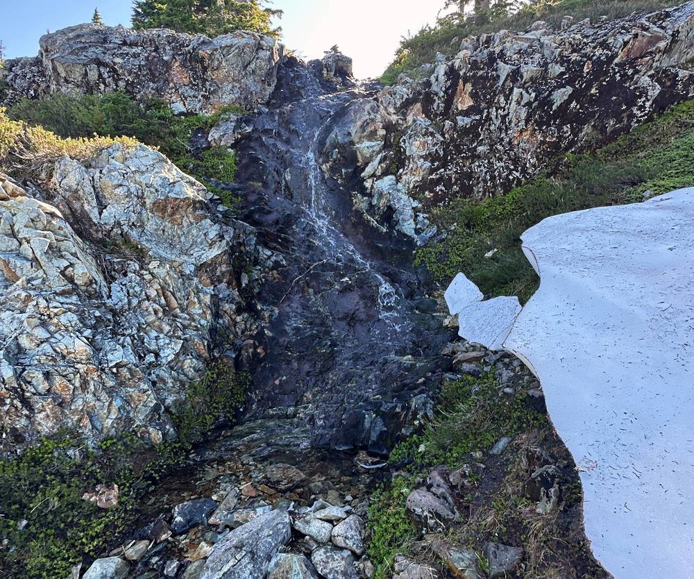
I got to the red emergency shelter at Magnesia Meadows at about 9:40 a.m., then climbed to the day's high point on the shoulder of Brunswick Mountain at 10:11.
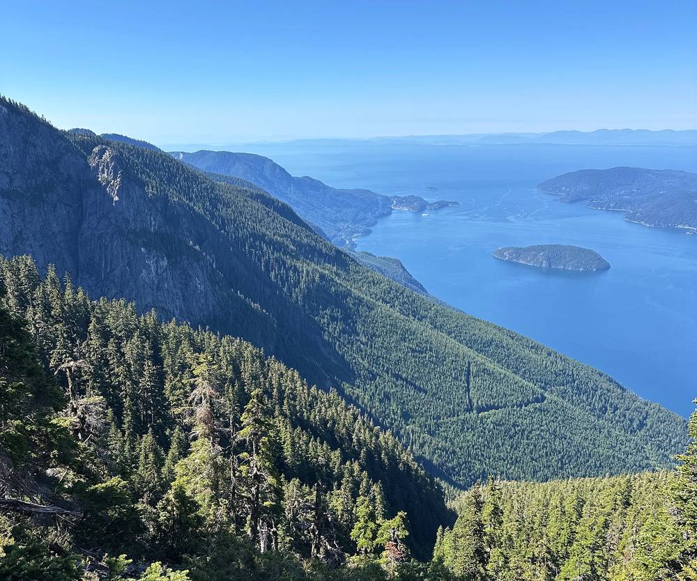
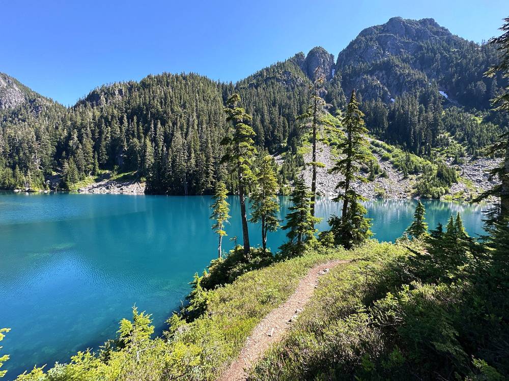
After that it's a really nice section with the lakes. I took a few short breaks between Brunswick Lake and Hanover Lake, from about 11:10 to 11:45, and further down it was very nice jumping into Deeks Lake.
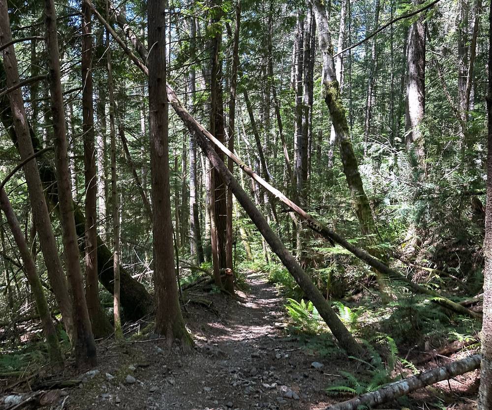
The last part is a bit boring, because it's just so easy: forest, then an old logging road down to the highway. I reached the trailhead at 2:12 p.m. and got back down to my car super tired, ate some blueberries, and set off for my next hike that same day.
The West Lion and Thomas Peak. From the ridge below the West Lion the trail runs along the base of the peak and over Thomas Peak, mile 1.1, about 5,060 ft (1,543 m). Below Thomas Peak hikers report a boulder field that holds snow early in the season. Trail markers are orange markers and flagging, and BC Parks warns they're intermittent north of the Lions.
James and David Peaks. The hardest part of the trail: steep climbs and drops over James Peak (mile 2.3) and David Peak (mile 2.9), with hands-on scrambling and exposed spots. Hikers report a false path over the top of James Peak that ends at a steep drop; look for the markers that lead down to the left just before the top. A couple were airlifted off near James Peak in July 2026, exhausted, as reported.
Magnesia Meadows. At mile 4.1, about 4,790 ft (1,459 m): the first of BC Parks' preferred camping areas, with the red A-frame emergency shelter, the trail's only pit toilet, and the first reliable water since Strachan Meadows (small tarns and streams; hikers report they can dry up by late August). The bugs here are notorious in July.
Over Brunswick Mountain's shoulder. Past Magnesia the trail climbs to the route's high point, about 5,210 ft (1,589 m) by my GPS, on the side of Brunswick Mountain, then drops to the lakes. The summit of Brunswick is a side trip, not the trail, and it's where Lions Bay Search and Rescue goes most often; a hiker died in a fall on its snowy slopes in March 2026, and a teenager died in a snowy gully coming down from it in May 2025, as reported.
Brunswick, Hanover and Deeks Lakes. Brunswick Lake, mile 6.6, has the second emergency shelter and is a preferred camping area. Hanover Lake is next, at mile 7.4, then Deeks Lake, the biggest, at mile 8.8, another preferred camping area. The stream between Brunswick and Deeks is the most reliable water on the trail.
Down to Highway 99. From Deeks Lake the trail drops steeply through forest, then follows an old logging road for about 4 km down toward the highway, with a signed detour around a quarry at the end. It's about 4.2 miles and over 3,000 ft down from Deeks Lake by my GPS: hard on tired knees.
Before Magnesia Meadows, the quickest ways off are back to the Lions and down the Binkert trail to Lions Bay, or on to Magnesia and down the Brunswick trail to Lions Bay, which is steep. Past Brunswick Lake it's quickest to keep going to the highway. If the scrambles over James and David Peaks are more than you want, or fog hides the markers, stop: camp at Magnesia Meadows or turn back to the Lions rather than push on.
Day 2 · Deeks Lake (from 8:02) · My recap of both days (from 27:41)
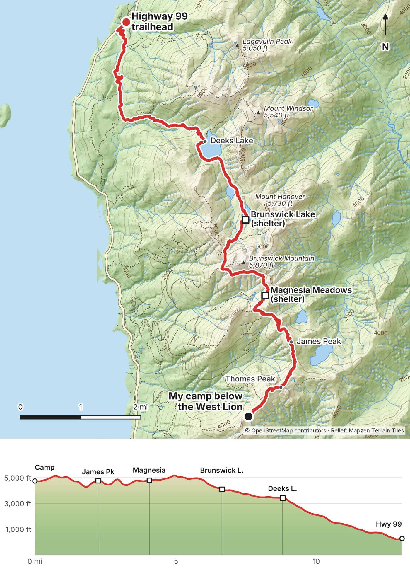
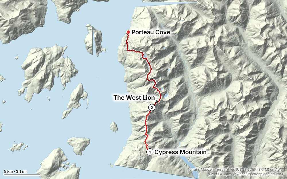
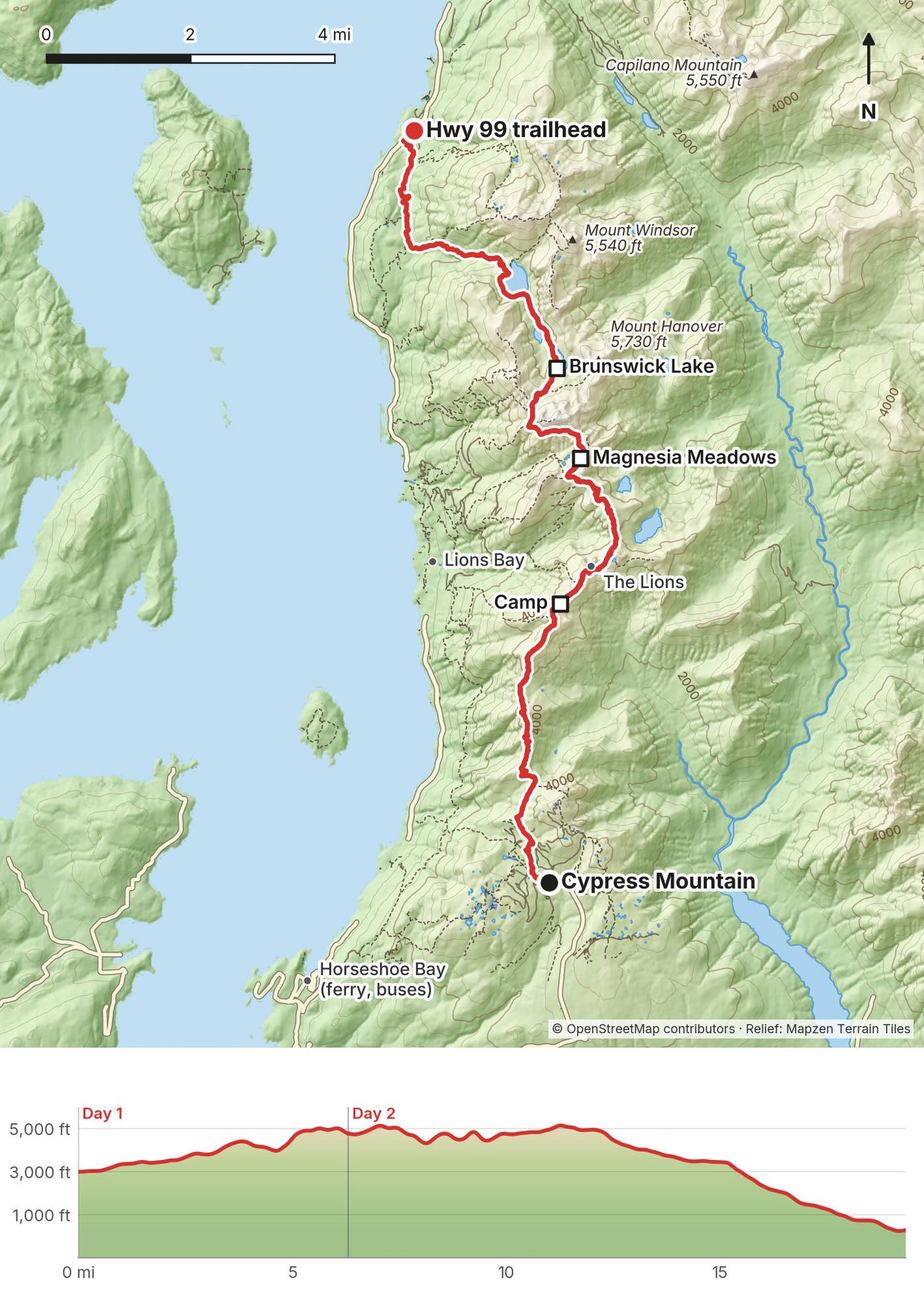
Elevation197–5,213 ft19.3 mi
Terrain: Mapzen Terrain Tiles (USGS 3DEP, SRTM) on AWS · Rivers & lakes © OpenStreetMap contributors
Tap a map to open it full size.
Checked on BC Parks' own pages for Cypress Provincial Park (the park page, its trail map, its trail report dated August 21, 2026, and its advisories) on October 3, 2026.
Open. BC Parks listed no closure on the Howe Sound Crest Trail. Its three advisories all showed the park open.
Construction at the camps. BC Parks posted that "facility construction will be occurring at Magnesia Meadows, Brunswick Lake, and Deeks Lake starting September 16" 2026, with no end date, and is writing a plan for the trail's facilities as more people hike it. It didn't say what's being built. Facilities, and maybe the camping rules, could be different in 2027, so check the park page before you go.
Seasons. The short stretch through the ski area, between Binkert Junction (near the resort, not the Binkert trail from Lions Bay) and the resort, is open to hikers only from June 1 to October 31, so it doesn't clash with skiing. BC Parks strongly discourages going past Bowen Lookout in winter: avalanche terrain. Hikers usually find the trail clear of snow from about July to early October.
Fire. A small lightning fire burned near Unnecessary Mountain above Lions Bay on August 23 and 24, 2026, and was held, as reported; the trail wasn't closed. In dry summers, fire bans and trailhead closures can come quickly: Lions Bay closed its trailhead parking for about a month in August 2023, a few weeks after my hike, as reported.
What to do. Check the BC Parks page for Cypress Park (its advisories) and its trail report the week before you go.
Update, November 2026. BC Parks' Cypress Park page (trail report dated November 5, 2026) now strongly discourages winter travel along the Howe Sound Crest Trail past Bowen Lookout, and warns of dangerous winter conditions in the park. From November 1 to May 31 backcountry users go through the ski area by the backcountry access corridor and pick up a free tag at the Brown Bag Room in Black Mountain Lodge. The October details above are how it stood when I checked.
Mid-July. I hiked on July 18 and 19, 2023. Day 1 was hotter than expected, but with lots of tree cover. There were barely any snow patches, plenty of flowing water on the second half toward the lakes, and the bugs were crazy. They didn't bite, but they tried to go in your eyes, your ears and your nose. At camp I basically had to hide in my tent. I need to hike in autumn more often.
Summer to early autumn. The trail is usually free of snow from about July to early October; in some years snow lingers past mid-July on the north sides of Unnecessary, below the Lions and on the drops off James and David Peaks. Hikers report the bugs at Magnesia Meadows are worst in July and early August. September is cooler, with fewer bugs and fewer people, and less water: some sources on the first half dry up by late August.
Late autumn to spring. Snow, short days and avalanche terrain. BC Parks says winter travel past Bowen Lookout isn't recommended, and the trail by the ski area is closed to hikers from November to May.
Weather. BC Parks says to expect cold, foggy and wet conditions even in summer, and it changes fast. Normals for Hollyburn Ridge, 930 m (3,050 ft), about the height of the Cypress trailhead (Environment Canada, 1971 to 2000, as published on Wikipedia). The ridge is 1,300 to 1,600 m (4,300 to 5,200 ft), so a few degrees colder:
| Month | High / low °F (°C) | Rain, in (mm) | Days with rain |
|---|---|---|---|
| June | 56 / 40 (13.3 / 4.7) | 6.1 (156) | 13 |
| July | 64 / 46 (17.5 / 7.6) | 4.7 (120) | 9 |
| August | 64 / 47 (17.7 / 8.2) | 4.8 (121) | 9 |
| September | 60 / 43 (15.3 / 5.9) | 5.9 (149) | 10 |
Heat waves do reach the ridge: the record highs in those months are over 86 °F (30 °C), and wildfire smoke can haze the views.
Emergencies. Call 911. Search and rescue is free in BC, helicopter included. The Howe Sound Crest Trail, the Lions and Brunswick Mountain are among Lions Bay Search and Rescue's busiest areas; most calls come between 3 and 6 p.m., often to hikers who misjudged the time and effort. Leave your plan with someone and carry a satellite messenger: the phone signal is unreliable.
Fog and navigation. BC Parks warns that the trail is easy to lose in bad weather, that the markers are intermittent north of the Lions, and that if fog closes in and you get lost, you should stay where you are. Have the GPX on your phone before you start.
Scrambles and drops. BC Parks: cliffs, scree slopes and exposed ridgelines. The hardest parts are between the Lions and Magnesia Meadows. Don't go up the Lions or Brunswick's summit in snow.
Water and heat. The first half is dry and can be hot. People get cramps and heat exhaustion near St. Mark's, as reported. Start early on hot days and carry enough water.
Bugs. I'd already been scarred by the bugs in Scotland. These didn't bite, but they were very annoying and went for my eyes, ears and nose. Bring a head net.
Wildlife. Black bears are common in the park, and cougars are seen sometimes. Make noise, never feed or approach them, hang your food, and carry bear spray: BC Parks' trail report says to.
Creeks. Some creeks in the park have no bridges and can be dangerous after heavy rain. If in doubt, don't cross.
How many days do I need? I did it in a day and a half: an afternoon to the Lions and a full day to the highway. You could do it as a really big day hike, but sleeping up on the ridge with the sunset was the whole point for me. Most people take two days; a slower pace or a later start makes it three.
How hard is it? Definitely more difficult than I expected. The first day reminded me of the old-growth, rocky, rooty trails in the Adirondacks, where I grew up. On the second day, up on the ridge, it's very up and down and deceivingly difficult; the scrambles in the middle were more intense than I expected. After the lakes it gets easy, and a bit boring. BC Parks says it's for experienced, well-equipped backcountry hikers only past Bowen Lookout, and it's one of the busiest rescue areas for Lions Bay Search and Rescue.
Do I need a permit or a reservation? No, in 2026. There's no permit, no reservation and no camping fee for the trail. Garibaldi, further up the Sea to Sky Highway, is the only BC park that needs a reservation for wilderness camping.
Where can I camp? Anywhere along the trail north of Strachan Meadows, in a spot earlier campers have already cleared. BC Parks names Magnesia Meadows, Brunswick Lake and Deeks Lake as the best areas. There are no tent pads. You can't camp in the ski area, at Bowen Lookout, or anywhere in the park's southern part (Black Mountain, Mount Strachan, Hollyburn, Yew Lake).
Is there water? Not reliably on the first half. BC Parks says there's no reliable water between Strachan Meadows (Montizambert Creek) and Magnesia Meadows. My camp below the West Lion is in that stretch. There was some snow to melt for water in certain spots when I went, in mid-July. Later in the summer, carry what you need for the night and the next morning.
Can I climb the Lions? The East Lion, no: it's inside the Capilano watershed, which is closed to everyone. BC Parks' map marks it "no entry." The West Lion is a scramble off the trail; I didn't climb it, and I found no official closure. The peaks matter to the Squamish Nation, who call them the Twin Sisters.
Can I bring my dog? Dogs must be on a leash, and BC Parks says the backcountry isn't suitable for dogs because of the wildlife.
Can I fly a drone? Not without BC Parks' permission. Flying a drone in a BC park without it is illegal, and the trail map lists drones as prohibited.
Can I have a campfire? No. There's a permanent campfire ban in the park. Bring a stove.
Is there a phone signal? Not reliably. BC Parks says it's unreliable on the trail. Carry a satellite messenger or a phone with satellite SOS.
My split, a short evening and a long second day, put all the scrambling and the dry stretch first thing in the morning. At a normal pace, start in the morning and camp at Magnesia Meadows (about 14.5 km from Cypress) or Brunswick Lake (19 km): water, a toilet at Magnesia, and a shorter, easier second day down past the lakes.
Strong, fast hikers do the whole trail in one day, about 12 to 14 hours, as reported. It's a very long day with the hardest terrain in the middle, and rescuers are often called to exhausted day hikers. Start at first light.
Starting at Porteau Road and finishing at Cypress means about 800 m more climbing, starting from near sea level, and reaching the dry stretch at the end. Northbound, the way I went, is the usual direction.
St. Mark's Summit and back from Cypress is the popular day hike, about 11 km (7 miles) round trip, as reported. The Lions from Lions Bay (the Binkert trail) is another, steep and with tiny parking.
These change every year. Everything else in this guide stays the same.
Is it open?
Getting there
Your stuff
The film is at the top of this page.
Planning questions about Howe Sound Crest Trail, answered only from this page's facts, the creators' versions and hikers' public tracks, with where each answer comes from. When the data doesn't say, the answer says "not given".
From hikers
Sign in to comment. Free; your hikes stay private unless you share them.
Something wrong or missing on this page? Send feedback.