
Content made there


Photos
Hikes / Hornstrandir / Kraig Adams's version
Europe · Iceland
Jul 10–13, 2019 · 4 days · nearly 60 miles · Solo · Tent

In July 2019 I spent four days backpacking alone across the Hornstrandir Nature Reserve, the remote northwest corner of Iceland's Westfjords. A boat dropped me at Hesteyri, I walked about 60 miles with a tent over passes and along empty beaches to Hornvík and the Hornbjarg cliffs, and another boat picked me up in Veiðileysufjörður. There are no roads, no shops and almost no phone signal in the reserve.
The film of this trip, "Hiking 60 miles Alone in Iceland," is the one that kind of launched my career as a silent solo hiking filmmaker. It's a magical place that I didn't know about until I researched it a week or two before the trip. I never did a guide with that video, and this trip deserves one. This is everything I used and learned, in one place, kept up to date.
| Quick facts | |
|---|---|
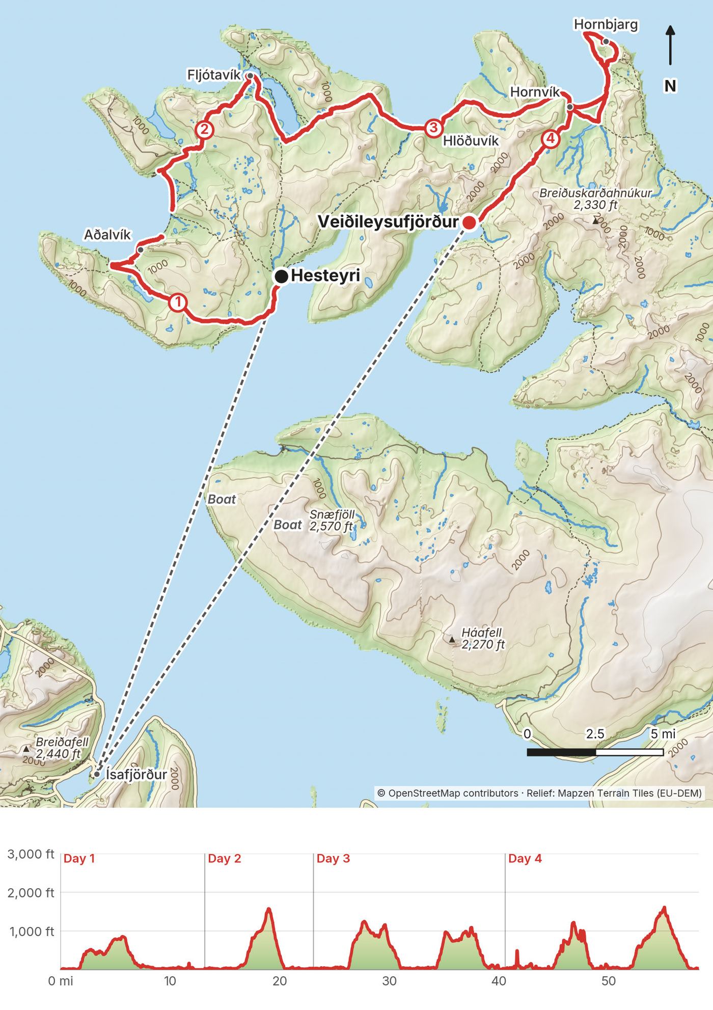
| Distance | 58.1 miles (93.5 km) of walking over 4 days |
| Climbing | about 10,600 ft (3,220 m) up and the same down |
| Days | 4 walking days, 3 nights in my tent |
| Start | Hesteyri (boat from Ísafjörður) |
| Finish | Veiðileysufjörður (boat back to Ísafjörður) |
| Highest point | 1,630 ft (497 m), Hafnarskarð, Day 4 |
| When | Summer. Scheduled boats run about June 1 to late August |
| Difficulty | A little harder than usual: no trees, but swampy, muddy and marshy in places, fords, snow on the passes, and a surprising amount of climbing for a coastal walk |
| Nearest airport | Ísafjörður (IFJ), from Reykjavík's domestic airport |
| Trip date | July 10 to 13, 2019, solo |
| Day | Route | Miles (km) | Up / down (ft) | Sleep |
|---|---|---|---|---|
| 1 | Hesteyri to Aðalvík | 13.2 (21.2) | 1,357 / 1,354 | My tent on the Aðalvík shore |
| 2 | Aðalvík to Fljótavík | 9.9 (15.9) | 1,609 / 1,612 | My tent at Fljótavík |
| 3 | Fljótavík to Hornvík | 17.5 (28.1) | 3,295 / 3,298 | Hornvík campsite |
| 4 | Hornvík, Hornbjarg, Veiðileysufjörður | 17.6 (28.4) | 4,317 / 4,308 | Nap, then the boat |
The numbers come from my own GPS recordings, smoothed the same way for every day. The route I planned said about 50 miles, and apps count climbing differently: AllTrails shows about 12,500 ft for my four days. My title says 60 miles; my GPS says 58.1.
What I did. I flew into Reykjavík and then took the quick flight on a very small plane from the city's domestic airport to Ísafjörður, a lovely little town between the fjords. The opening shot of my film is me landing there. You hop on a little shuttle that takes you around the water into town. You could also take a bus or rent a car, but I don't recommend it.
Flights (2026). Icelandair flies from Reykjavík's domestic airport, close to downtown, to Ísafjörður in under an hour. Icelandair had planned to drop the route after summer 2026, but in April 2026 it signed a state contract that keeps the flights going until at least August 31, 2030. International flights land at Keflavík, not at the domestic airport, so allow time to get across. Leave slack before your boat.
It's a very small, quaint town, and it's worth a day either side of the hike. I've been back since with my wife, and it was nice to reminisce about the hike.
The trail starts across the water, so you need a boat in and a boat out. You book both, you figure out the times from the schedules, and you plan your walking days around the pickup. Booking the boat is the hardest part, because once you're in the reserve you can't call to change it.
What I did. When I arrived in Ísafjörður I went straight to a boat office to book my ferry to the trailhead. I believe it was West Tours. I got very lucky: I showed up, booked, and left about 30 minutes later. It's probably more popular now, and the boats can sell out, so book as early as you can. I took the boat to Hesteyri, walked to Hornvík and the Horn, and got picked up in Veiðileysufjörður. My memory was almost ISK 20,000 each way, over $100, so up to about $300 for the round trip. It's the most expensive thing about this hike.
The companies (2026). Three companies run scheduled boats. You can go out with one and come back with another, but changing a booking between companies later may cost you.
| Company | From | Where (2026) | One way (2026) |
|---|---|---|---|
| Borea Adventures | Ísafjörður harbour; office Aðalstræti 17 | Hesteyri, Veiðileysufjörður, Hornvík, Grunnavík on request | Hesteyri or Veiðileysufjörður ISK 14,900; Hornvík ISK 19,300 |
| Sjóferðir (book through West Tours, Aðalstræti 7, +354 456 5111, or Sjóferðir directly, +354 825 5550) | Ísafjörður | Hesteyri, Veiðileysufjörður, Grunnavík, Aðalvík, Hornvík; other landings on request | Ask when booking |
| Hornstrandaferðir | Ísafjörður, 9:00 daily, June 1 to late August | Hesteyri daily; Veiðileysufjörður Mon, Wed, Fri, Sun | Hesteyri ISK 13,900; Veiðileysufjörður ISK 14,900 |
Sjóferðir's 2026 departures from Ísafjörður, as West Tours listed them: Hesteyri, Veiðileysufjörður and Grunnavík Monday 14:00, Tuesday 17:00, Wednesday 14:00, Friday and Saturday 9:00; Aðalvík Tuesday and Wednesday 9:00, Friday 17:30, Saturday 15:30; Hornvík Thursday 9:00, Sunday 13:00. As of October 11, 2026, none of the three companies had published 2027 timetables or prices, so check before you book.
Pickups. The companies can't tell you the exact pickup time on the return; it depends on the day's route, the weather and the luggage. Be at the landing early with your gear packed, and carry food for an extra day in case the boat can't come. Borea's fare includes one backpack of about 20 kg (44 lb); an extra bag is ISK 5,000. Be at the dock 20 minutes before departure.
Landings. At some landings, like Veiðileysufjörður when I left, you ride a small inflatable from the shore out to the bigger boat.
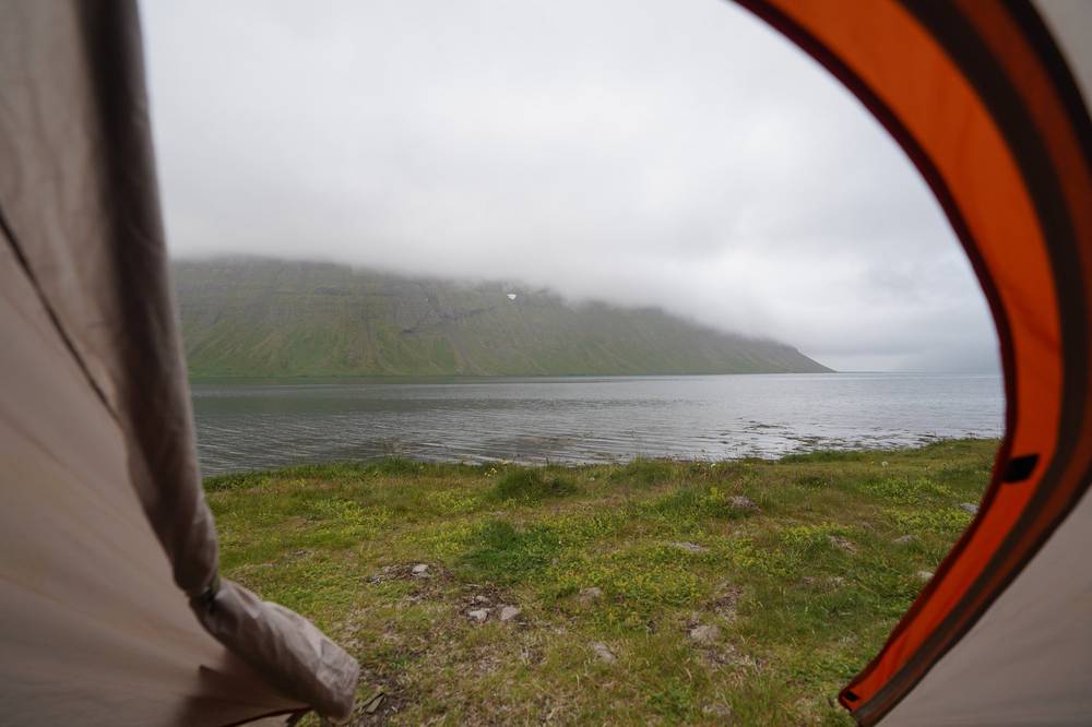
What I did. I set my tent up in Veiðileysufjörður and napped for a few hours to get out of the rain, and then the boat picked us up. We rode a small inflatable from the shore to the bigger boat. Back in Ísafjörður I had a big meal (it was nice to not eat ramen), found a puppy, and checked into a guesthouse. I stayed a few more days in town before flying out.
Boats from Veiðileysufjörður (2026). Borea and Sjóferðir both serve it, and Hornstrandaferðir sails there on Monday, Wednesday, Friday and Sunday. Book the return before you leave Ísafjörður, and ask where and roughly when to wait. See The boats.
Leave slack. Boats depend on the weather, and so do small planes. Don't book your flight home for the day you come out of the reserve.
My records for this trip are thin: no booking emails survive from 2019. This is what's on record.
| Item | What I paid |
|---|---|
| Boat Ísafjörður to Hesteyri, and back from Veiðileysufjörður | Almost ISK 20,000 each way, as I remembered it in 2023 (up to about $300 round trip) |
| Guesthouse in Ísafjörður before the hike | About $93 a night when I looked it up in 2023; it was cheaper when I stayed |
| Campsites in the reserve | Nothing on record |
| Mánagisting guesthouse, Ísafjörður, July 14 2019 | ISK 21,400 (card receipt) |
| Gas canister and groceries, Nettó | Not in my records |
| Flights | Not in my records |
For your budget (2026 prices). The boats are the big cost: Hesteyri out and Veiðileysufjörður back is ISK 29,800 with Borea, or ISK 28,800 with Hornstrandaferðir (Hesteyri ISK 13,900, Veiðileysufjörður ISK 14,900). Starting or ending at Hornvík is ISK 19,300 each way with Borea.
| Night | Where | Designated campsite? |
|---|---|---|
| July 9 | A guesthouse in Ísafjörður | |
| July 10 | My tent on the Aðalvík shore, northeast of Sæból | No |
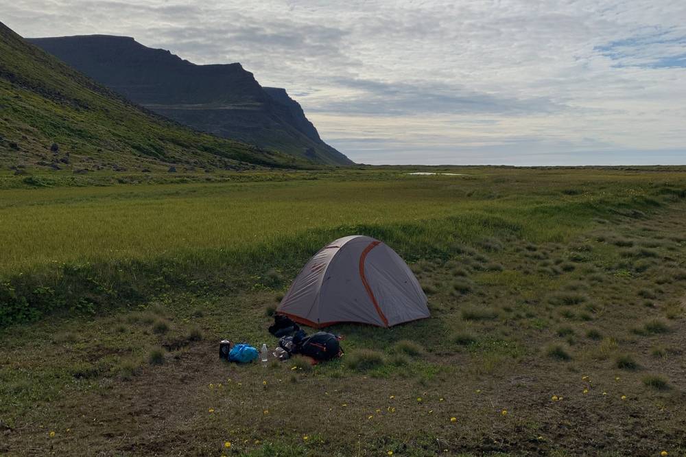
| July 11 | My tent on the west side of Fljótavatn, Fljótavík | No |
| July 12 | Hornvík campsite at Höfn | Yes |
| July 13 | Veiðileysufjörður campsite, a few hours before the boat | Yes |
| July 14 | Mánagisting guesthouse, Ísafjörður |
My two wild camps. On Day 1 I camped on the grass above the beach in Aðalvík, and on Day 2 at Fljótavík, because I'd had a rough day. Neither was a designated campsite, and camping is only allowed at those. Use the campsites below instead; the GPX waypoints mark them.
From the reserve's official map. Every campsite has a toilet (a dry latrine or a water toilet).
| Campsite | Where on my route |
|---|---|
| Hesteyri | Mile 0.3 of Day 1, by the boat landing. Ranger in summer |
| Sæból (Aðalvík) | Mile 9.5 of Day 1. Boats land here |
| Látrar (Aðalvík) | Mile 2 of Day 2. Emergency shelter next to it |
| Fljótavatn (south end) | Mile 1.7 of Day 3 |
| Atlastaðir (north Fljótavík) | Across the lake outlet from my Day 2 camp. Emergency shelter |
| Hlöðuvík | Mile 9.6 of Day 3. Emergency shelter |
| Hornvík (Höfn) | End of Day 3. Ranger house and boat landing |
| Horn | Mile 8.3 of Day 4, on the east side of Hornvík |
| Veiðileysufjörður | End of Day 4, by the boat landing |
So the fair version of my days is: Day 1 to Sæból (9.5 mi) or on to Látrar, Day 2 to the Fljótavatn campsite, then Days 3 and 4 as I did them.
Hornvík was the main campsite, where most of the people were. When I got there, other hikers were sitting at the picnic tables. Veiðileysufjörður had other hikers too, waiting for the boat.
Emergency shelters (the orange huts, run by the rescue association Landsbjörg) are for emergencies only, not for planned nights.
Food. There are no shops in the reserve. Buy everything in Ísafjörður, including stove fuel, and carry a spare day of food in case the boat can't come. I cooked my own food on a small gas stove, mostly ramen, and the big meal back in town tasted great. In 2019 the café at Hesteyri, in the old doctor's house, sold crêpes and coffee; check it's open before you count on it. Campfires are banned, so cook on a stove, and pack out all your rubbish.
Water. There are streams almost everywhere, and small lakes on the plateaus. I used a Sawyer Squeeze filter. Treat or filter everything, and fill up before the passes. The sea is salt, of course, so on the beaches fill up where the streams come out.
In Ísafjörður: Nettó for groceries and gas canisters, Tjöruhúsið for fish (book ahead), Dokkan Brugghús for beer.
Paid links: I earn a commission if you buy through these links, at no extra cost to you. As an Amazon Associate I earn from qualifying purchases.
I was a noob hiker in a lot of ways on this trip, with a small pack and four nights in my tent. Here's what I carried in 2019, what I'd take now (including what I wish I'd had), and what I filmed with.
 Tent: REI Passage tent. I'd had it since Peru. Similar: NEMO Hornet Elite OSMO 1P (Amazon).
 Water filter: Sawyer Squeeze. My first filter. Similar: Katadyn BeFree AC · 1L (Amazon).
My current kit for what this route needs, starting with what I wish I'd had in 2019.
 Cap: PATH Projects Muir Cap 2.0 (PATH Projects). It was bright for the first couple of days and I got sunburned. I wish I'd had a cap.
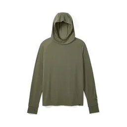 Sun hoodie: PATH Projects Pyrenees T19 Hoodie (PATH Projects). The other thing I wish I'd had for those sunny days, with sunscreen.
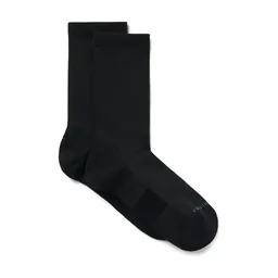 Socks: PATH Projects Joyner Crew Sock (PATH Projects). Bring an extra pair. If socks are the one thing you bring extra of, you can always have a dry pair.
 Rain shell: Arc’teryx Beta AR Jacket (Arc’teryx). Full rain gear, even in July: fog, rain and wind come in fast from the sea.
 Puffy: Arc’teryx Cerium Hoody (Arc’teryx). It's cold even in July.Tent: NEMO Hornet Elite OSMO 1P (Amazon). This route needs a tent that handles wind and rain.
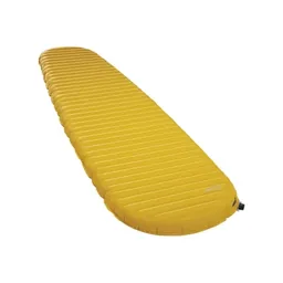 Sleeping pad: Therm-a-Rest NeoAir XLite NXT (Amazon)
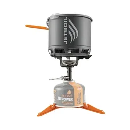 Stove: Jetboil Stash (Amazon). You can't fly with a gas canister: buy one at Nettó in Ísafjörður.Water filter: Katadyn BeFree AC · 1L (Amazon). The filter I carry now.
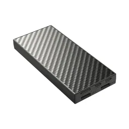 Power bank: Nitecore NB20000 (Amazon)
What I filmed this trip with in 2019. I'd set up the tripod, lock the exposure and focus, walk through the shot and come back for the camera, so every scene cost me about three times the energy. Check The reserve rules before you think of flying: since May 2026 the reserve gives no drone permits for hobby flying.
Since September 2026 I film with a smaller setup: the Pocket 4 and the Mic 3 on the trail, and the Mini 5 Pro in the air.
 Camera: DJI Osmo Pocket 4 (Amazon)
 Mic: DJI Mic 3 · 1 TX + 1 RX (Amazon). It pairs with the Pocket 4.
 Drone: DJI Mini 5 Pro (Amazon)
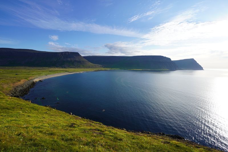
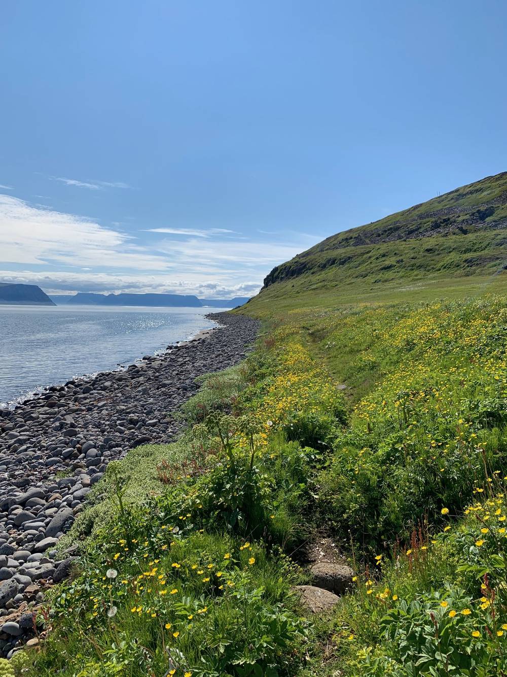
The boat ride was white-out fog almost the whole way, and I couldn't see anything. As we landed at Hesteyri it cleared up: blue sky, wildflowers everywhere. There was a crêpe and coffee place right there, in a house run by a single person.
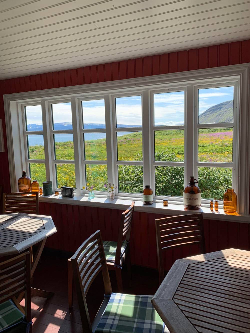
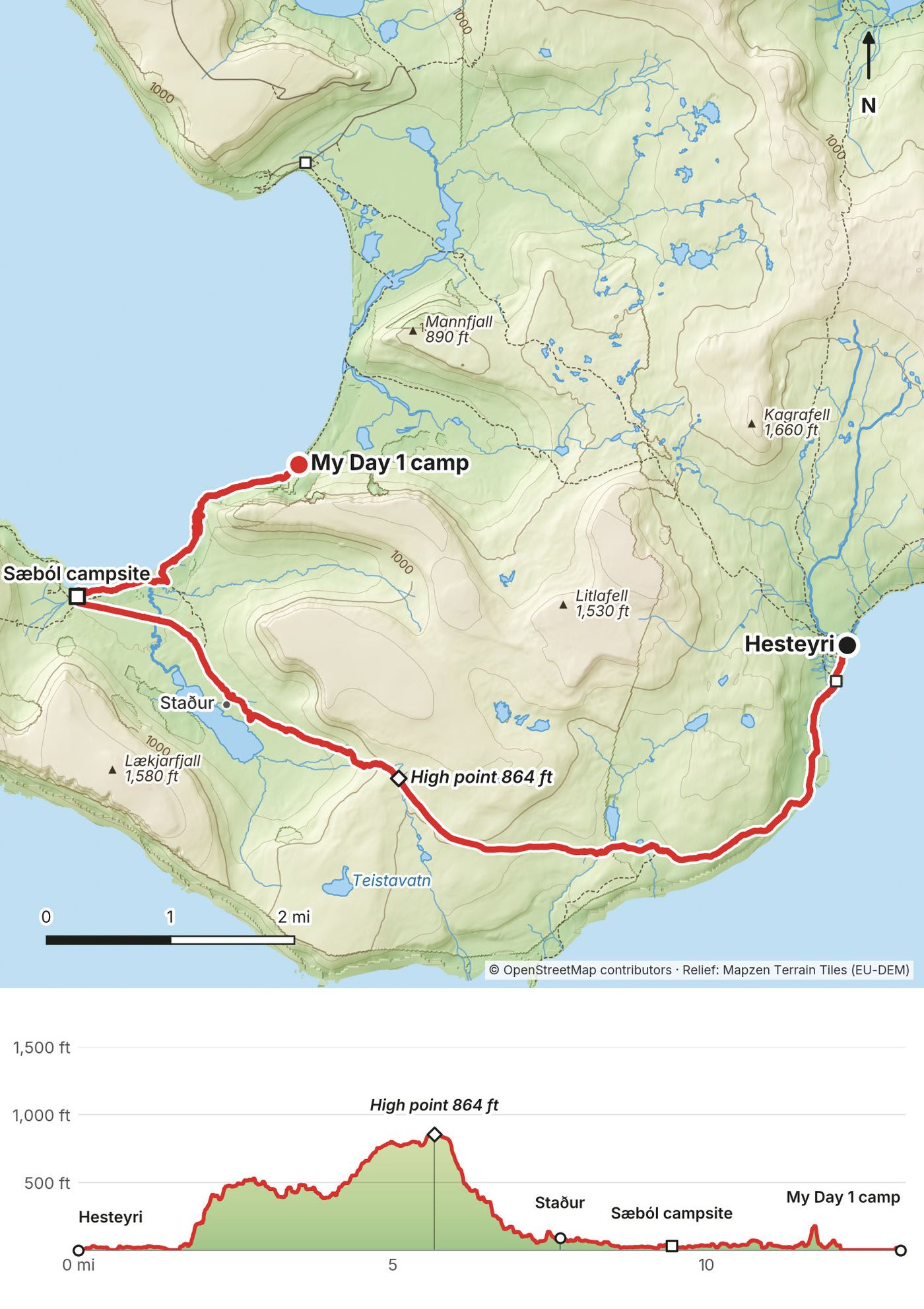
I walked south along the fjord, crossed a river on the stones, and climbed over the heath to Aðalvík, past the old houses at Staður. It was bright and sunny, and I had no cap, no sun hoodie and no sunscreen. I regretted that. This was also the first time I'd used a water filter, a Sawyer Squeeze, and I remember thinking for the first time that I couldn't filter the ocean, because it's salt.
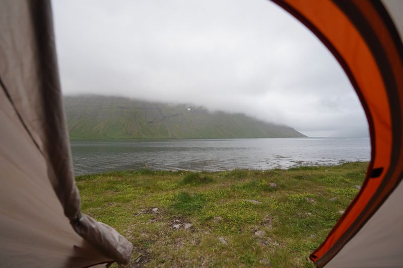
From Sæból I walked the beach, took my shoes off to cross the streams, and scrambled around a rocky point, descending on a rope. I camped on the grass above the beach. The flies attacked me every time I stopped, so I kept my hood up, ate as quickly as I could and went into the tent to escape them.
From the pier at Hesteyri, a marked path runs south along Hesteyrarfjörður for about 1.5 miles, then climbs west onto Sléttuheiði, the heath between the fjord and Aðalvík. The path is marked with cairns and mostly visible, but it can be wet and hard to see in places. The official description has you ford the Sléttuá river. My high point was 864 ft at about 5.6 miles. The descent reaches Staður, with its old church and houses by Staðarvatn, at about 7.6 miles, and the Sæból campsite and boat landing at 9.5 miles. The official route, Hesteyri to Sæból, is 12 km (7.5 mi) and about 6 hours.
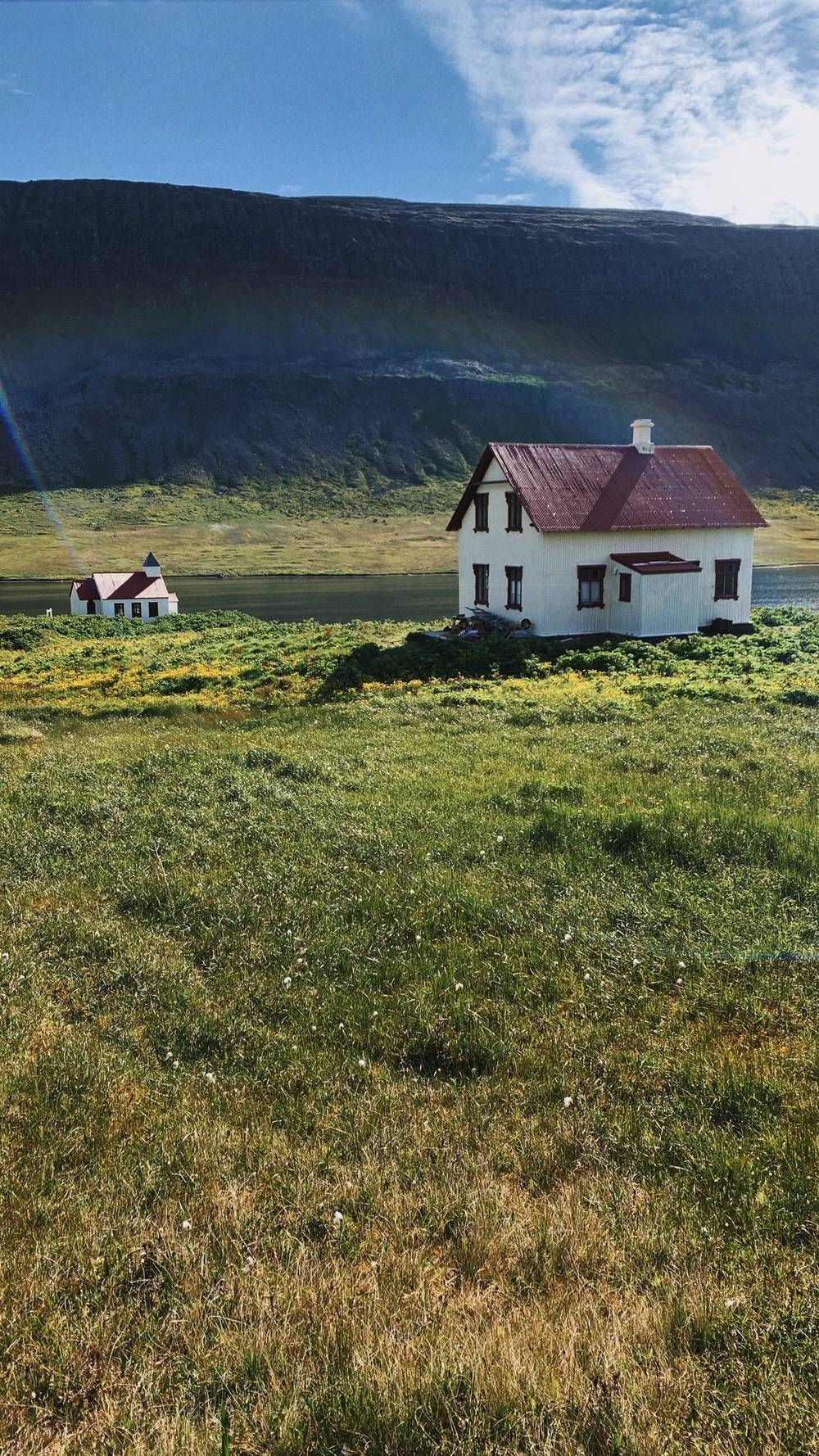
After Sæból my track follows the Aðalvík shore northeast. Around mile 11 to 12 there's a rocky point with a fixed rope and chain. It took me about an hour to cover less than a mile here. This shore between Sæból and Látrar isn't one of the reserve's described routes: it's beach, stream mouths and that rocky point, so check the tide before you go round it.
Hesteyri and Sæból both have boat landings, and there's a ranger at Hesteyri in summer. There are no scheduled boats you can just catch, so an early exit means waiting at a landing for a pre-booked boat, or calling for help from somewhere with signal. The Látrar emergency shelter is about 3 miles past my camp.
Film, Day 1 · The boat and Hesteyri, in my guide video
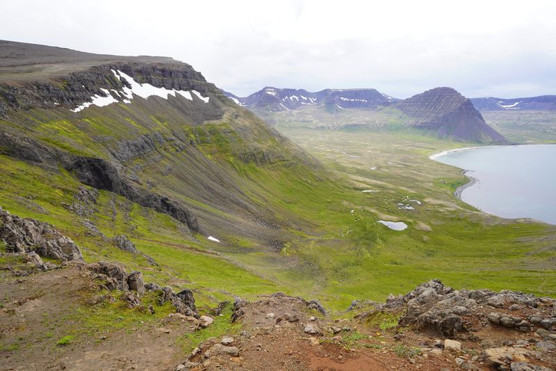
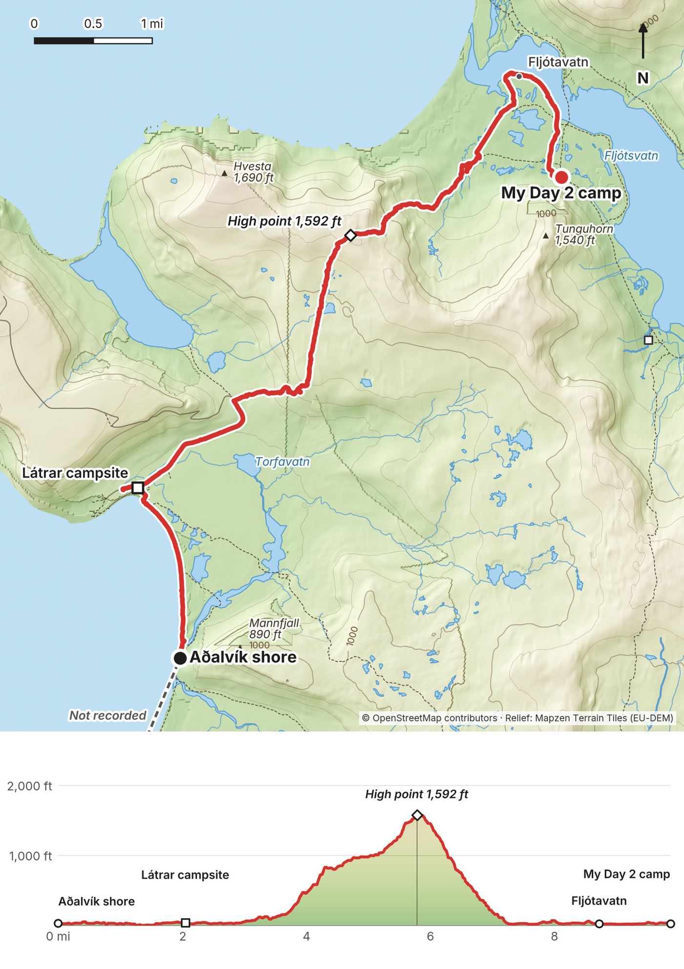
I started by wading across the river mouth before Látrar barefoot, with my shoes in my hand, then walked past Látrar and climbed onto the plateau over snow patches. On the way up I stripped down for a dip in a small pond. It was nice. It was cold. That's the "swimming pool" shot in the film.
Then I came down Tungudalur to Fljótavík. At the end of the day my GPS shows me walking out to where Fljótavatn drains into the sea: I saw an option to cross there, but with the tide it was all filled with water and it just wasn't possible. I turned back and camped, because I'd had a rough day.
The first stretch is Aðalvík beach, then the Stakkadalsós river mouth at about 0.2 miles. The official description says its bottom is mostly sand. Látrar, with its campsite and emergency shelter, is at 2 miles. From there the official route over Tunguheiði to Fljótavík is 10 km (6.2 mi), 4 to 5 hours, marked with cairns. You climb steadily to about 1,600 ft at 5.8 miles; the way down into Tungudalur is steep. At the bottom the route reaches the Fljótavík lowlands. The ford by Fljótavatn is marked, and the official description says the water can be up to your groin.
The Fljótavatn campsite is at the south end of the lake, where Day 3 goes anyway.
Látrar has an emergency shelter and an unequipped airstrip, and boats serve Aðalvík (Sjóferðir, on its Aðalvík days). Fljótavík also has an unequipped airstrip. As on every day, any exit needs a pre-arranged boat or a call for help.
Film, Day 2 · The swim and my Day 2 camp, in my guide video
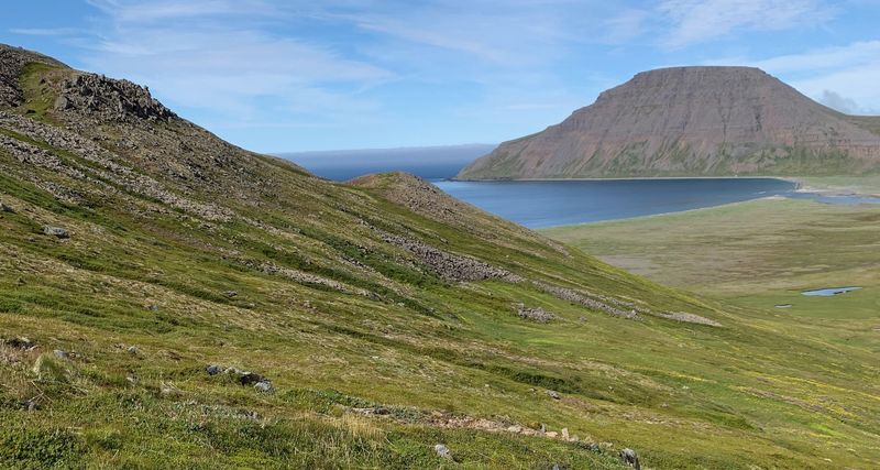
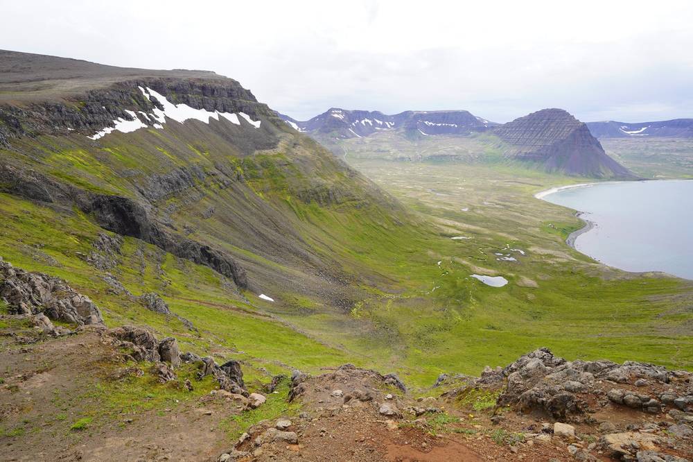
The flies found me as soon as I started. I went around the south end of Fljótavatn and climbed over the passes to the coast, then walked a beach piled with driftwood, cooked lunch on the beach, passed the orange emergency hut at Hlöðuvík and waded the river there.
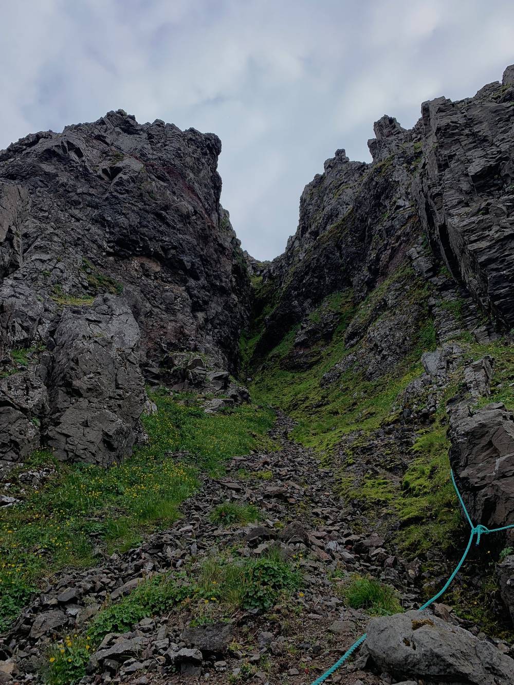
After the climb to Atlaskarð, the last stretch before Hornvík goes past a sea stack and down a steep, rocky gully on a fixed rope. I finally reached Hornvík, the main campsite, where most of the people were that I got to hang out with and talk to. I pitched my tent and ate.
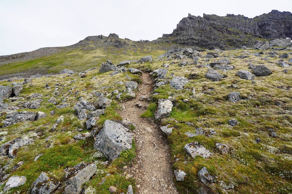
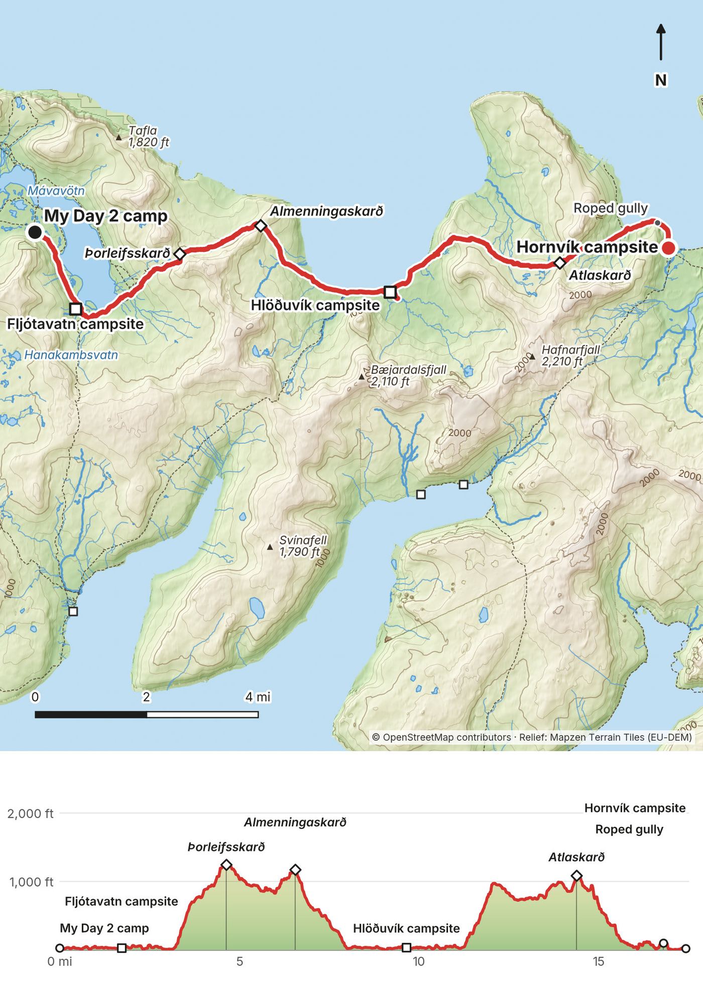
This is the longest and hardest day. From my camp the track follows the west shore of Fljótavatn to the campsite at its south end (1.7 miles), then climbs to Þorleifsskarð (about 1,300 ft) at 4.6 miles and Almenningaskarð (about 1,200 ft) at 6.5 miles. The official description of Fljótavík to Kjaransvík over Þorleifsskarð: 15 km, 7 to 8 hours, part marked with sticks, "a difficult hike and a slow journey," with steep rockslides and boulders, and easy to lose your way in fog.
You come down to Kjaransvík at about 8 miles and walk the shore to the Hlöðuvík campsite and shelter at 9.6 miles. The official route from Hlöðuvík to Hornvík over Atlaskarð is 10 km, 4 to 5 hours, well marked with cairns, and narrow and quite steep. I reached Atlaskarð (about 1,070 ft) at 14.3 miles, came down past Rekavík bak Höfn, and at 16.7 miles hit the roped gully: short, steep and rocky. The Hornvík campsite is at 17.4 miles.
Split it. Hlöðuvík is the natural halfway point: stop at its campsite and do Atlaskarð the next morning.
Hlöðuvík has an emergency shelter, and boats land there on request. Hornvík has a ranger in summer, an emergency shelter and scheduled boats (Borea and Sjóferðir). There's also an old route from Hlöðuvík south over Kjaransvíkurskarð to Hesteyri (14 km, 6 to 7 hours, cairns), if Hesteyri is where your boat can reach you.
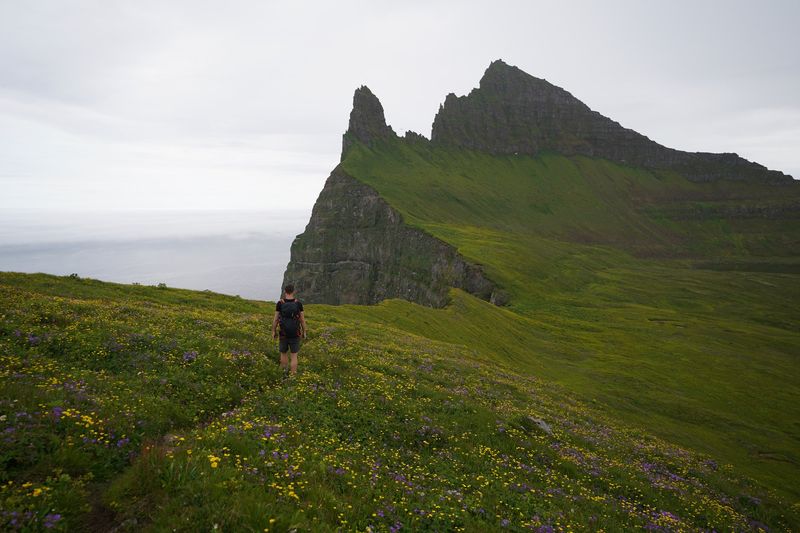
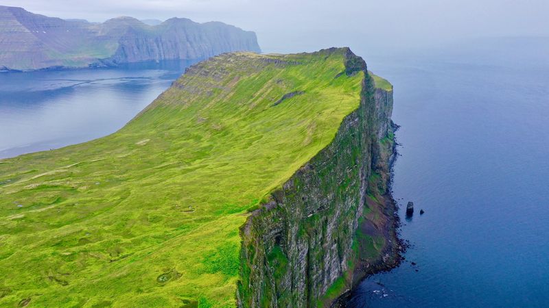
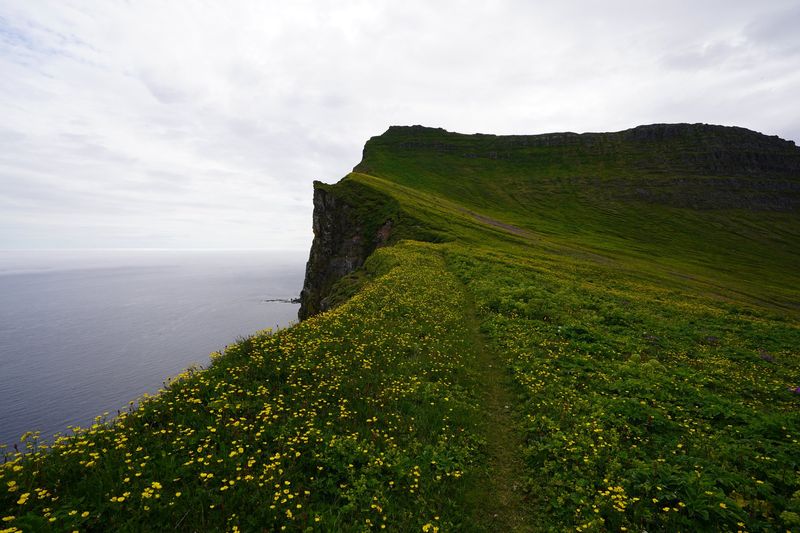
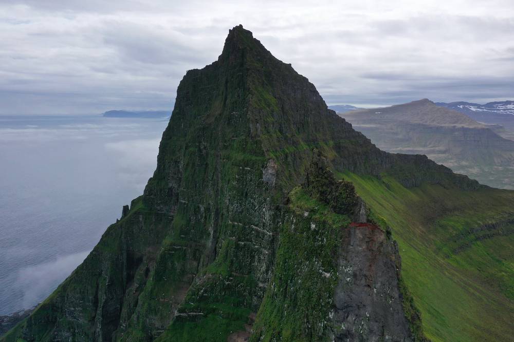
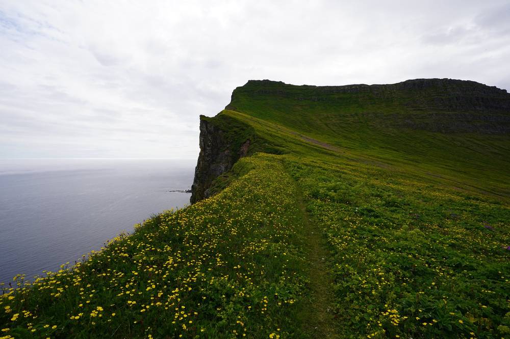
This was the part I was most excited about, the climax of the hike. I had a tight window before my boat, so I went up to Hornbjarg in the morning and left my tent at Hornvík. The weather was okay, but storm clouds were starting to come in, so I was a bit rushed. There were birds everywhere, the cliff was amazing, and the grass was so bright green. The sun came out in little bits and pieces, and I had the whole time up at the Horn to myself. I didn't see a single person. This was definitely the best part of the experience.
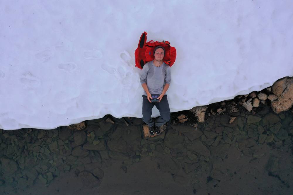
It started to rain, so I rushed back to my tent. I washed off, took a quick nap, packed up, and started over my last pass, booking it up past the snow. I got to the campsite in Veiðileysufjörður right on time: it started to pour just after I got my tent up, and I felt so good, because other people were arriving and having to set up in the rain.
Two hikers were camped there too. One of them had a white Hyperlite pack, the first one I'd ever seen. I asked him all about it, and that's why I later got my own black Southwest 2400 for the Tour du Mont Blanc.
From Höfn, my track goes around the lagoon at the head of Hornvík and north along the east side of the bay past the Horn campsite (3 miles), then climbs onto Hornbjarg. The official description of the Hornbjarg walk from Höfn: 13 km, 8 to 10 hours, and the path over Miðfell is steep and hard to walk, especially in the wet. I reached the cliff top at 6.3 miles, walked the edge to below Kálfatindar, the high point of Hornbjarg at 1,755 ft (535 m), and came down to the Horn campsite at 8.3 miles. From there I walked back along the beach and across the mouth of the lagoon to Höfn (10.7 miles). The official route has you wade Hafnarós, the lagoon outlet, here: cross it at low tide.
The cliffs drop straight into the sea. Stay back from the edge, especially in wind, fog or rain, and leave the birds alone.
The crossing to Veiðileysufjörður over Hafnarskarð is 10 km, 4 to 5 hours on the official description: well marked with cairns, steep, and it may be covered with snow long into the summer. In wet weather the streams can get too big to jump. I reached the pass at 14.5 miles. The Veiðileysufjörður campsite and boat landing are at 17.5 miles, on the shore where the path comes down to the fjord.
Split it. Most people would spend a day at Hornvík for Hornbjarg and cross Hafnarskarð the next day. See Other ways to do it.
Hornvík has the ranger house, an emergency shelter and scheduled boats, so it's the best place on the whole route to end early. Once you're over Hafnarskarð, Veiðileysufjörður is the boat landing.
Film, Hornbjarg · Film, Day 4 · The Horn and the last pass, in my guide video
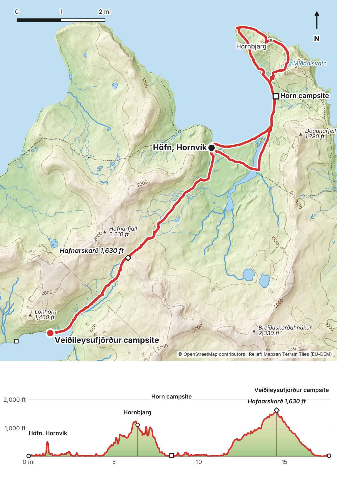
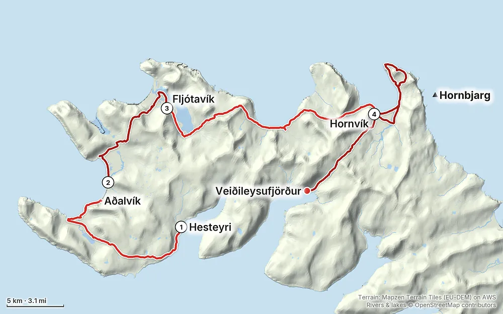
Elevation0–1,627 ft58.1 mi
Terrain: Mapzen Terrain Tiles (EU-DEM) on AWS · Rivers & lakes © OpenStreetMap contributors
Tap a map to open it full size.
Hornstrandir is a nature reserve, managed since 2025 by Náttúruverndarstofnun, Iceland's Nature Conservation Agency. Its visitor centre, Hornstrandastofa, is in Ísafjörður (665-2810, hornstrandastofa@nattura.is; summer 2026 hours June 1 to August 31, Monday to Saturday 8:00 to 15:30). The main rules, from the reserve's special rules as published in 2026:
The reserve's official map (campsites, emergency shelters and marked routes) and the route descriptions are on nattura.is and ust.is. Download both before you go.
Summer. The scheduled boats run from about June 1 to late August (2026), and the reserve's rangers are at Hesteyri and Höfn in Hornvík in summer. Outside summer you'd need a chartered boat, and in spring and autumn you must register your trip.
What I got. I walked July 10 to 13, 2019. For most of the boat ride out it was white-out fog, and I was worried it would be like that the whole hike. As we landed it cleared up: blue skies and wildflowers everywhere. The first couple of days were bright and sunny, and the flies were bad wherever the wind dropped. On Day 4 storm clouds were coming in at Hornbjarg, it started to rain as I went back to my tent, and it poured right after I got my tent up in Veiðileysufjörður.
Snow. I crossed snow patches on the passes in July, and Hafnarskarð can hold snow long into summer. Earlier in the season there's more of it.
Light. The reserve is just south of the Arctic Circle. On the north coast the sun doesn't fully set from about June 8 to July 6, and through July and early August it never really gets dark (computed). I was able to dry my socks more than usual because of it. Bring an eye mask if you need dark to sleep.
Weather changes fast. Fog can hide the cairns, rain makes the streams too big to jump, and it's cold even in July. Check the forecast at vedur.is before the boat and every morning you have signal.
Emergency: 112. If you can't connect, try 599-0112; from a satellite phone, +354 809 0112 (112 Iceland, 2026). Phone numbers don't give you signal, and there's almost none in the reserve. A satellite messenger or personal locator beacon is the real backup.
Leave a travel plan at safetravel.is and with someone at home, with your boat times, and update it when you're back. Rangers are at Hesteyri and Höfn (Hornvík) in summer.
Forecast. vedur.is (Icelandic Met Office) for the Westfjords, before the boat and whenever you have signal. Fog, rain and wind come in fast from the sea.
Where to be careful:
Emergency shelters. The orange huts at Látrar, Atlastaðir, Hlöðuvík and Höfn, run by the rescue association Landsbjörg, are for emergencies only.
Going solo. I hiked alone and saw almost no one between the campsites. If you go alone, be conservative about the weather, and don't cross a river you're not sure about.
How many days do I need? I walked it in four days and three nights, and I hiked faster than most people I saw. It's a three or four day trip at my pace, but you're the only person who can answer this, because you know how many miles you can do. This hike is a little harder than usual, so if you usually do 15 miles a day, plan on 10. That makes my line about six days. There's a plan in A slower version.
Is it hard? No trees, so the views are open, but it can be swampy, muddy and marshy, and there's a surprising amount of elevation gain for a walk that spends so much time on beaches. Day 3 crosses three passes, and Day 4 climbs onto Hornbjarg and then over Hafnarskarð. There are river crossings, snow patches on the passes, and two short spots with a fixed rope. The trail was much wetter than I showed in the video; my boots and socks were soaked most days.
Do I need a permit? No permit is needed in summer. From 1 March to 15 June and from 1 September to 1 November you must register your trip online with the reserve before you go. In summer you don't. See The reserve rules.
Can I camp anywhere? No. Camping is only allowed at the designated campsites (or on private land with the landowner's permission), and my Day 1 and Day 2 camps were not at one. Don't copy them. With small changes to Days 1 and 2 you can still do it in four days. See Camping.
How do I get there? Fly or drive to Ísafjörður, then take a boat. You have to book both the boat in and the boat out, and that's the most difficult and most expensive part of the trip. See The boats.
Can I fly with stove fuel? No. You can't take gas canisters on the plane to Ísafjörður. I bought a canister for my stove at the Nettó supermarket in town.
Is there food or water on the way? Water, yes: streams almost everywhere. Food, no. There are no shops in the reserve, so carry everything plus a spare day for weather. In 2019 there was a crêpe and coffee place at Hesteyri, where the boat dropped me.
Is there phone signal? There's really no cell service in Hornstrandir. You have to be very precise and have good planning for getting picked up. Carry offline maps, and think about a satellite messenger.
What about the bugs? The flies were terrible. They didn't bite, but they went for my eyes, nose, mouth and ears whenever there was no wind, especially at camp. I really wish I'd had a bug net.
Will I see arctic foxes? I saw one. They change color with the season. Keep at least 40 m (130 ft) from their dens and don't feed them.
Why is your film silent? My microphone broke on this trip, so I didn't bring one, and I only had the camera's own mic for natural sound. That's how the silent solo hiking style started for me.
Can I do it alone? I did. You'll see a few people at the boat landings and the main campsites, especially Hornvík, and almost no one in between. Leave your plan with SafeTravel and someone at home. See Weather and safety.
I walked the four days in this guide. These are other ways to use it, and I didn't do them.
My line, split where the campsites are. The distances come from my GPS.
If I were to do it again, I'd probably do something very similar to my own trip. But for most people the extra days make this a much better hike: time for the weather, and time to sit at Hornbjarg.
My pack was much smaller than other people's. I didn't bring as much, I didn't stay as long, and I hiked a bit faster than most. I was a noob hiker in a lot of ways on this trip. Learn from my list in Gear for this route.
These change every year. Everything else in this guide stays the same.
Boats and flights
The reserve
Prices, conditions and your stuff
Planning questions about Hornstrandir, answered only from this page's facts, the creators' versions and hikers' public tracks, with where each answer comes from. When the data doesn't say, the answer says "not given".
From hikers
Sign in to comment. Free; your hikes stay private unless you share them.
Some lodging links earn me a small commission at no cost to you.
Something wrong or missing on this page? Send feedback.