Follow the Hiker
Find my next hikeGearSavedKraig Adams
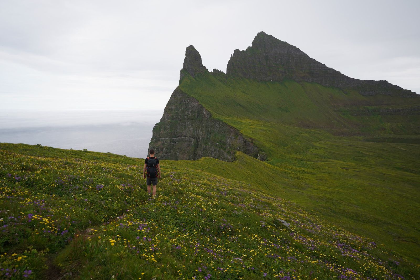
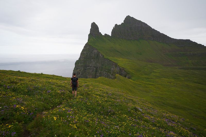
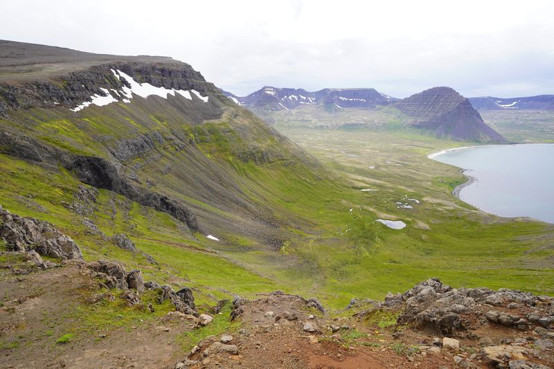
Walking toward the Kálfatindar pinnacles on Hornbjarg, Day 4.
Distance
58.1 mi93.5 km
Days
4 days
Elevation gain
10,577 ft3,224 m
High point
1,631 ft497 m
Season
Summer
Lodging
Tent
Plan this hike

Hikes / Europe / Hornstrandir

In July 2019 I spent four days backpacking alone across the Hornstrandir Nature Reserve, the remote northwest corner of Iceland's Westfjords. A boat dropped me at Hesteyri, I walked about 60 miles with a tent over passes and along empty beaches to Hornvík and the Hornbjarg cliffs, and another boat picked me up in Veiðileysufjörður. There are no roads, no shops and almost no phone signal in the reserve.

Kraig Adams

Effort at this pace: Hard · about 15 mi (23 km) and 2,644 ft (806 m) of climbing a day over 4 days, up to 1,631 ft (497 m). Our grade for the days given, worked out from distance, climbing and altitude a day; it isn't the trail's usual difficulty rating (under Basics) and doesn't rate exposure, terrain or weather.

Where these numbers come from

From Kraig Adams's GPS recording and guide.

Plan this hikeSave this hike

Plan: dates, gear, deadlines and stays in a private link. Save: keeps it on your account.

From Kraig Adams's GPS

The route, day by day

Relief map of the Hornstrandir route: 4 days drawn in red with numbered day starts, labelled Hesteyri, Veiðileysufjörður, Aðalvík, Fljótavík, Hornvík and Hornbjarg.

Elevation0–1,627 ft58.1 mi

From Kraig Adams's GPS. Terrain: Mapzen Terrain Tiles (EU-DEM) on AWS · Rivers & lakes © OpenStreetMap contributors

Tap a day for his map of it

  • Read day 1
  • Read day 2
  • Read day 3
  • Read day 4

The film

Watch it first

Hiking 60 miles Alone in Iceland

Kraig Adams · Jul 10–13, 2019 · Solo

Walking toward the Kálfatindar pinnacles on Hornbjarg, Day 4.
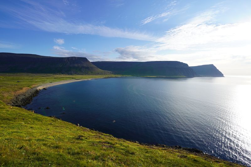
Aðalvík on the evening of Day 1.
Coming down Tungudalur toward Fljótavík on Day 2.
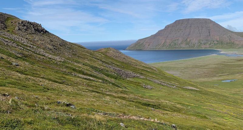
The climb from Hlöðuvík toward Atlaskarð on Day 3.
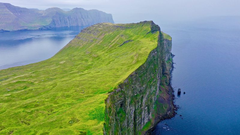
The Hornbjarg cliffs on Day 4.
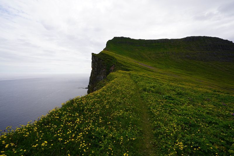
The path along the Hornbjarg cliff edge.
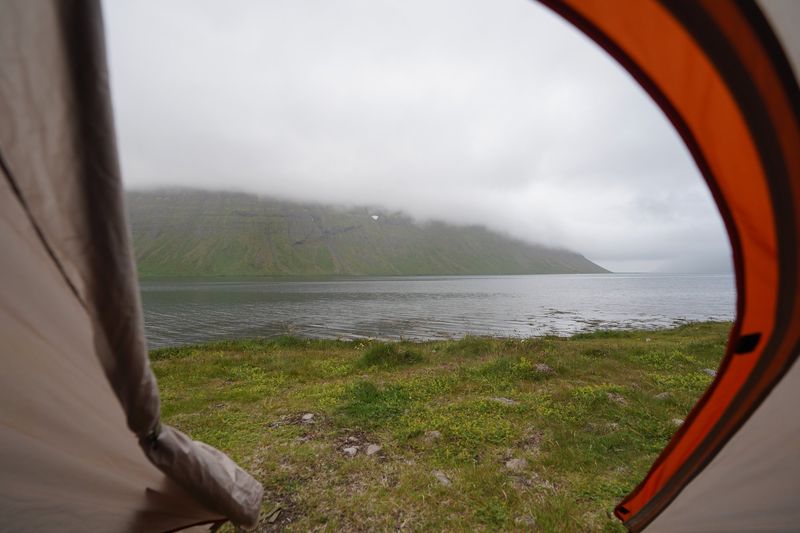
Veiðileysufjörður from my tent, waiting for the boat.

Before you go

The basics

Start
Hesteyri (boat from Ísafjörður)
Finish
Veiðileysufjörður (boat back to Ísafjörður)
Usual difficulty
A little harder than usual: no trees, but swampy, muddy and marshy in places, fords, snow on the passes, and a surprising amount of climbing for a coastal walk
Best time
Summer. Scheduled boats run about June 1 to late August
Permits
No permit is needed in summer. From 1 March to 15 June and from 1 September to 1 November you must register your trip online with the reserve before you go.
Getting there
What I did. I flew into Reykjavík and then took the quick flight on a very small plane from the city's domestic airport to Ísafjörður, a lovely little town between the fjords. The opening shot of my film is me landing there. You hop on a little shuttle that takes you around the water into town. You could also take a bus or rent a car, but I don't recommend it.
Nearest airport: Ísafjörður (IFJ), from Reykjavík's domestic airport
Lodging
Tent

From Kraig Adams's guide

Costs and gear

What it cost

The boats are the big cost: Hesteyri out and Veiðileysufjörður back is…

His costs, line by line

What Kraig carried

a small backpack · REI Passage tent · Nemo sleeping bag · a sleeping pad · pants and a shell · a beanie · my old boots · Sawyer Squeeze and 20 more.

The full gear list

From Kraig Adams's guide

Safety

Rescue numbers

  • Emergency: 112. If you can't connect, try 599-0112; from a satellite phone, +354 809 0112 (112 Iceland, 2026). Phone numbers don't give you signal, and there's almost none in the reserve. A satellite messenger or personal locator beacon is the real backup.

Phone signal

  • There's really no cell service in Hornstrandir.
  • You have to be very precise and have good planning for getting picked up.

Insurance

  • A GHIC or EHIC is not an alternative to travel insurance.
  • Get travel insurance that suits your trip, including the hiking you plan.

Bail-out points

  • Day 1, Hesteyri to Aðalvík. Hesteyri and Sæból both have boat landings, and there's a ranger at Hesteyri in summer. There are no scheduled boats you can just catch, so an early exit means waiting at a landing for a pre-booked boat, or calling for help from somewhere with signal. The Látrar emergency shelter is about 3 miles past my camp.
  • Day 2, Aðalvík to Fljótavík. Látrar has an emergency shelter and an unequipped airstrip, and boats serve Aðalvík (Sjóferðir, on its Aðalvík days). Fljótavík also has an unequipped airstrip. As on every day, any exit needs a pre-arranged boat or a call for help.
  • Day 3, Fljótavík to Hornvík. Hlöðuvík has an emergency shelter, and boats land there on request. Hornvík has a ranger in summer, an emergency shelter and scheduled boats (Borea and Sjóferðir). There's also an old route from Hlöðuvík south over Kjaransvíkurskarð to Hesteyri (14 km, 6 to 7 hours, cairns), if Hesteyri is where your boat can reach you.
  • Day 4, Hornvík to Veiðileysufjörður. Hornvík has the ranger house, an emergency shelter and scheduled boats, so it's the best place on the whole route to end early. Once you're over Hafnarskarð, Veiðileysufjörður is the boat landing.

From Kraig Adams's guide. For planning, not navigation: check before you go.

Their films and versions

Creators who've done it

1 creator so far: Kraig, 4 days, tent.

Walked Hornstrandir? Be the first to share your track: log it with your GPX.

Your time

Sign in and log a few hikes to see how long this one would take you.

Typical: 4 days (the hike's facts).

Ask this hike

Planning questions about Hornstrandir, answered only from this page's facts, the creators' versions and hikers' public tracks, with where each answer comes from. When the data doesn't say, the answer says "not given".

    From hikers

    Comments

    Sign in to comment. Free; your hikes stay private unless you share them.

    Answered from the data

    Questions people ask

    How many days do you need for Hornstrandir?

    I walked from Hesteyri to Veiðileysufjörður in four days and three nights, about 58 miles, and I hike faster than most. For most people a 6 to 7 day version split at the campsites is a better trip, with time for weather and for Hornbjarg.

    From Kraig Adams's trip and guide.

    How much does Hornstrandir cost?

    The boats are the big cost: Hesteyri out and Veiðileysufjörður back is ISK 29,800 with Borea, or ISK 28,800 with Hornstrandaferðir (Hesteyri ISK 13,900, Veiðileysufjörður ISK 14,900). Starting or ending at Hornvík is ISK 19,300 each way with Borea.

    From Kraig Adams's trip and guide.

    When is the best time to hike Hornstrandir?

    Summer. The scheduled boats run from about June 1 to late August, and rangers are at Hesteyri and Hornvík. I went July 10 to 13, 2019, and still crossed snow patches on the passes.

    From Kraig Adams's trip and guide.

    Do you need a permit for Hornstrandir?

    No permit is needed in summer. From 1 March to 15 June and from 1 September to 1 November you must register your trip online with the reserve before you go.

    From Kraig Adams's trip and guide.

    Where do you sleep in Hornstrandir?

    In your tent, and only at the designated campsites, such as Hesteyri, Sæból, Fljótavatn, Hlöðuvík, Hornvík and Veiðileysufjörður. Two of my camps were not at campsites, so don't copy them. The orange emergency shelters are for emergencies only.

    From Kraig Adams's trip and guide.

    How do you get to Hornstrandir?

    Fly from Reykjavík's domestic airport to Ísafjörður, then take a boat into the reserve. You book both the boat in and the boat out. In 2026 a one-way boat to Hesteyri or Veiðileysufjörður was ISK 13,900 to 14,900.

    From Kraig Adams's trip and guide.

    Plan this hikeThe route