
Content made there

Photos
Hikes / Haute Route, Chamonix to Zermatt / Kraig Adams's version
Europe · France, Switzerland
Aug 2–10, 2025 · 9 days on foot · about 79 miles · Group trip · Huts

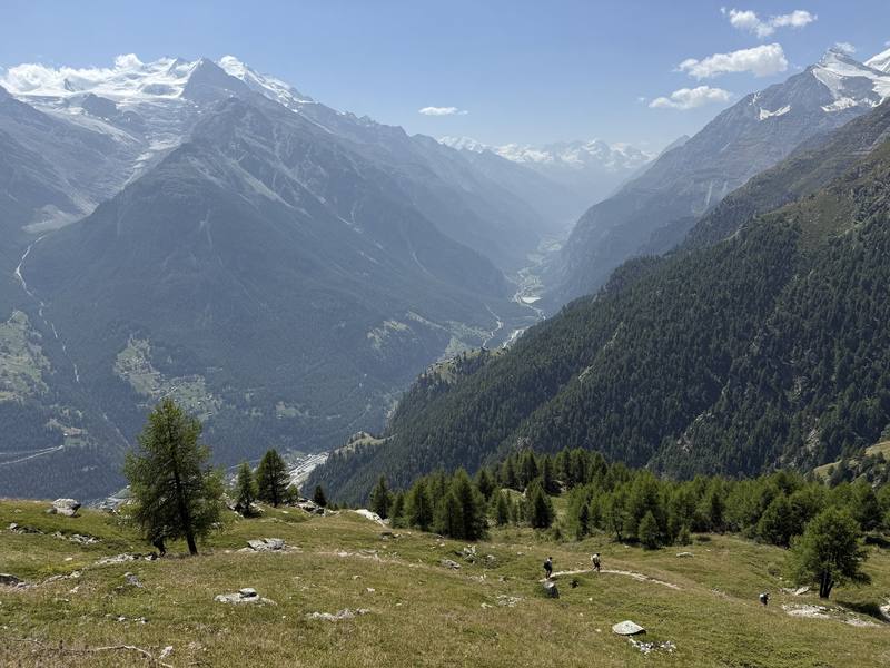
In August 2025 I hosted a group hiking trip on the Haute Route in the European Alps. We hiked hut to hut for nine days, from Chamonix, France, to Zermatt, Switzerland, over a pass or two almost every day, and finished beneath the Matterhorn. This trail was one of the best I had ever hiked.
This is the Walker's Haute Route, the summer hiking route between Chamonix and Zermatt. It is not the glacier Haute Route, the ski and mountaineering route with the same name. Nothing in this guide crosses a glacier.
| Quick facts | |
|---|---|
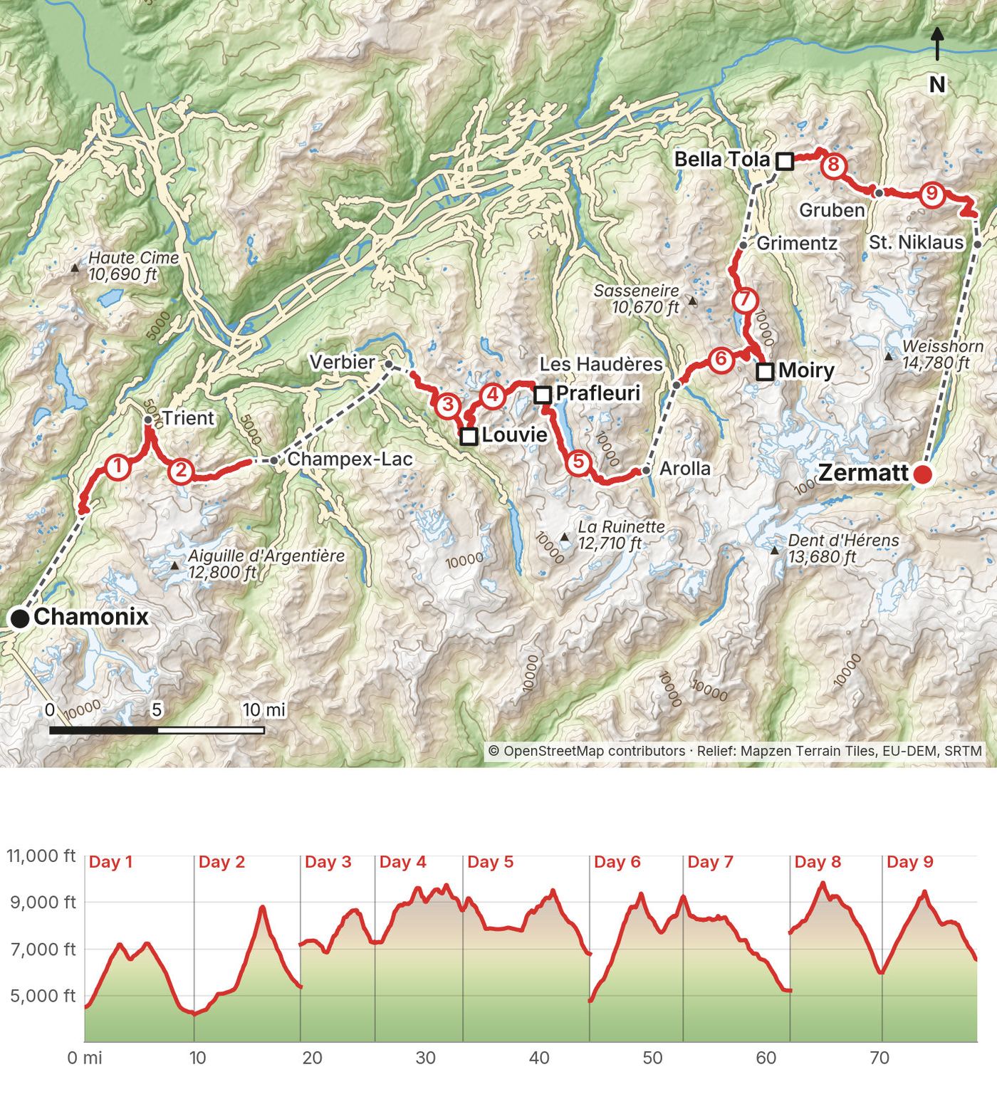
| Distance | 78.6 miles (126.5 km) on foot over 9 days |
| Climbing | about 27,650 ft (8,430 m) up and 27,980 ft (8,530 m) down |
| Days | 9 walking days, plus an arrival day in Chamonix |
| Start | Montroc, a short bus ride up the valley from Chamonix, France |
| Finish | Jungen above St. Niklaus, then a cable car and a train to Zermatt, Switzerland |
| Not walked | Champex to Les Ruinettes above Verbier (shuttle and two gondolas), Arolla to Les Haudères (bus), Grimentz to Cabane Bella Tola (bus and funicular), Jungen to Zermatt (cable car and train) |
| Nights on the way | 8: four mountain huts, two inns and two hotels |
| High points | Col de Prafleuri, 9,800 ft (2,987 m), the highest pass; the Bella Tola summit, 9,920 ft (3,025 m), on Day 8 |
| When | Summer. Most huts open from mid or late June to mid or late September. I went in early August |
| Difficulty | In my words: most people could do this trail. There are some big passes and some big days |
| Airport | Geneva, at both ends |
| Trip date | August 2 to 10, 2025, a group trip I hosted |
| Day | Route | Miles (km) | Up / down (ft) | Sleep |
|---|---|---|---|---|
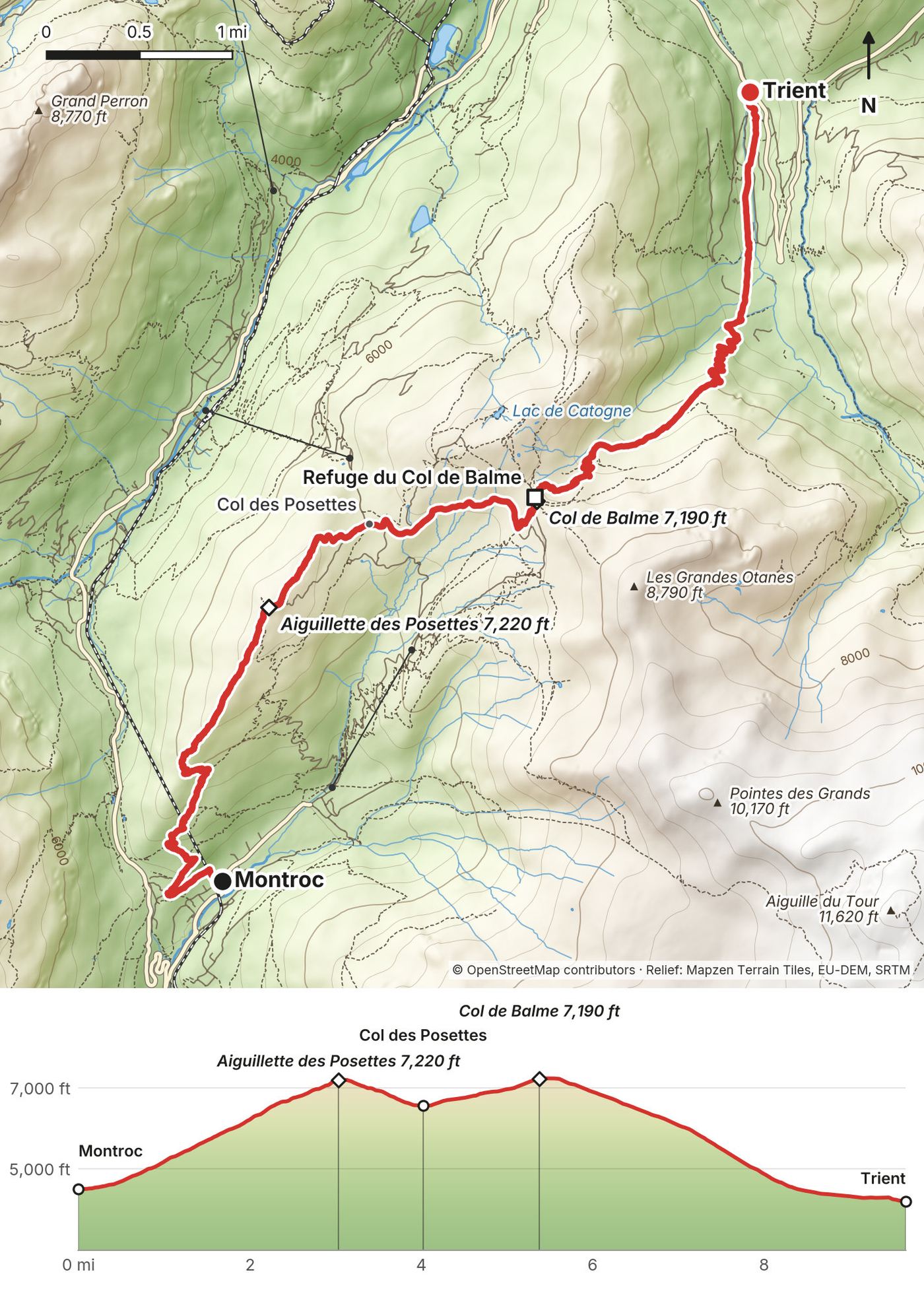
| 1 | Montroc to Trient | 9.7 (15.6) | 3,351 / 3,637 | Auberge du Mont-Blanc |
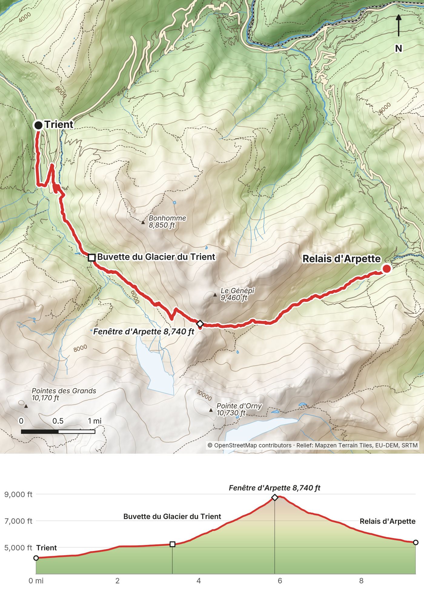
| 2 | Trient to Relais d'Arpette | 9.4 (15.1) | 4,593 / 3,417 | Relais d'Arpette |
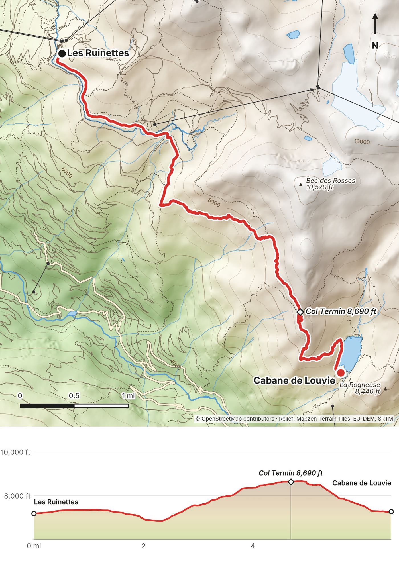
| 3 | Les Ruinettes to Cabane de Louvie | 6.5 (10.5) | 1,964 / 1,892 | Cabane de Louvie |
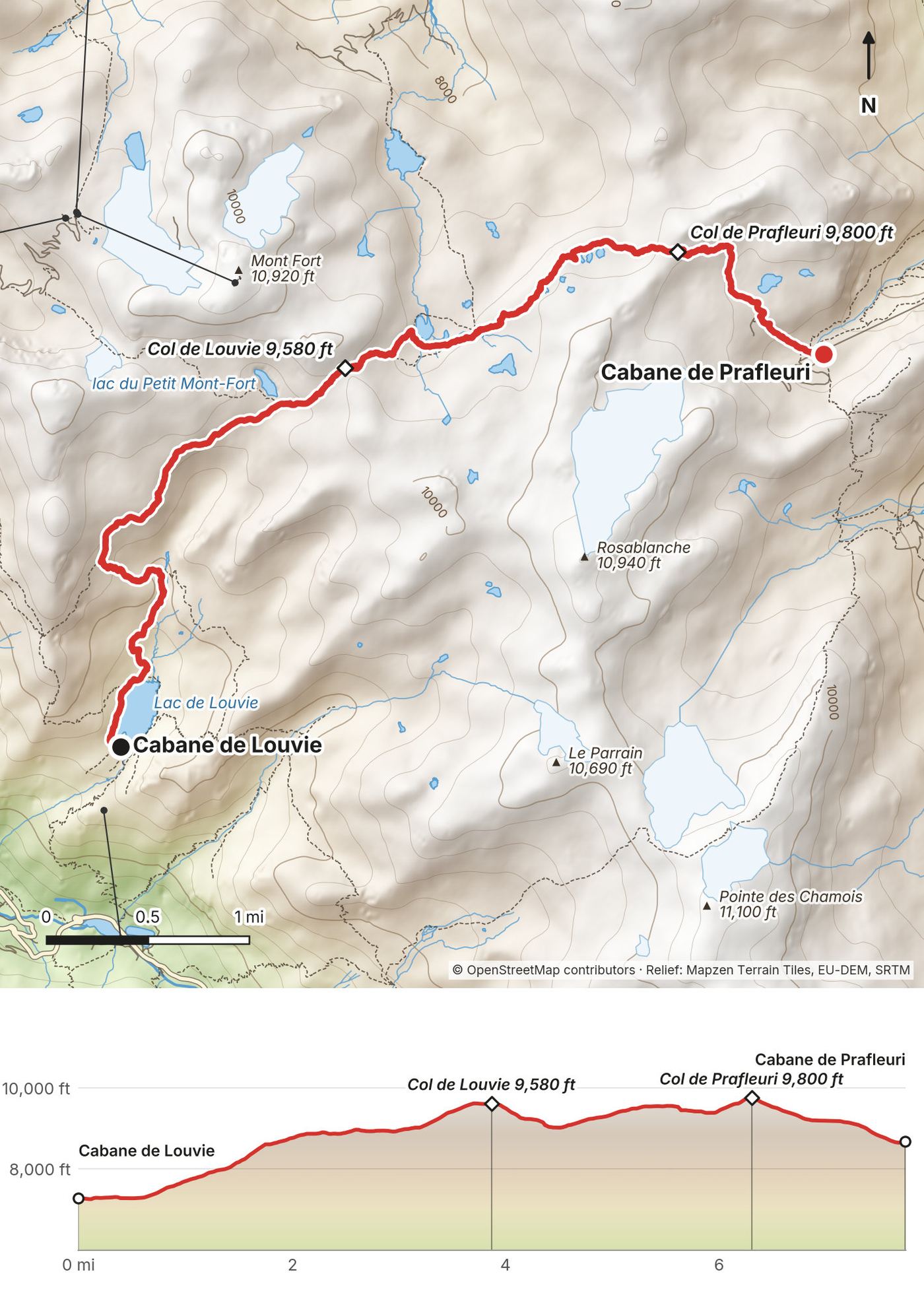
| 4 | Louvie to Prafleuri | 7.8 (12.5) | 3,230 / 1,848 | Cabane de Prafleuri |
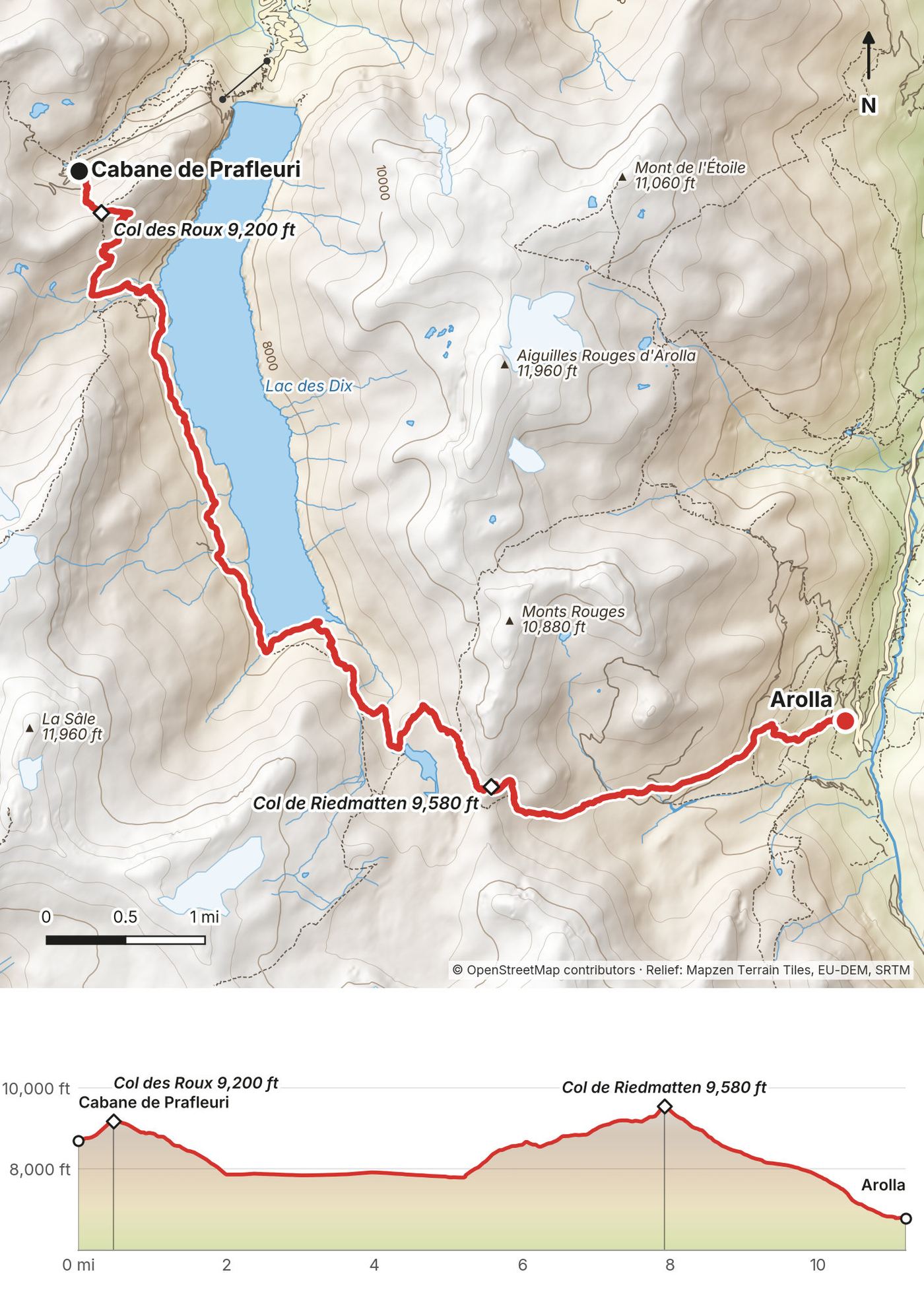
| 5 | Prafleuri to Arolla | 11.2 (18.0) | 2,296 / 4,213 | Hôtel des Haudères (bus) |
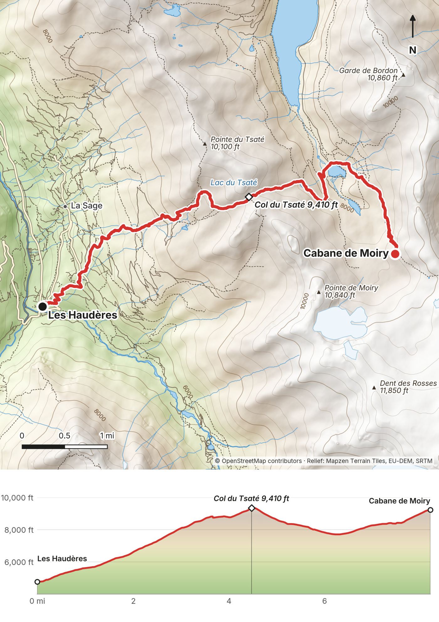
| 6 | Les Haudères to Cabane de Moiry | 8.2 (13.2) | 6,108 / 1,665 | Cabane de Moiry |
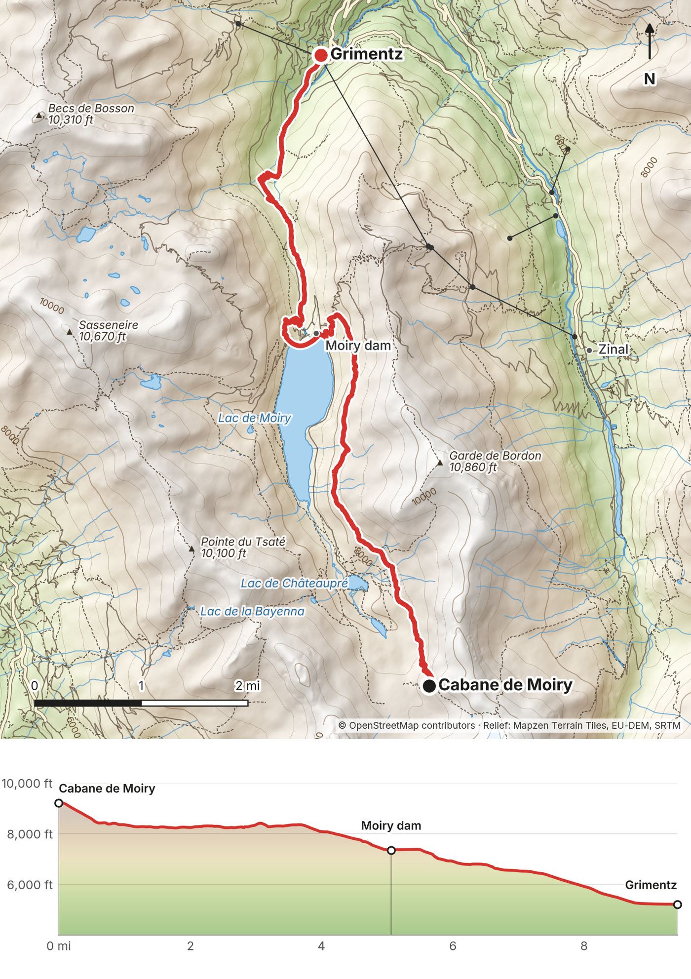
| 7 | Moiry to Grimentz | 9.4 (15.2) | 283 / 4,295 | Cabane Bella Tola (bus, funicular) |
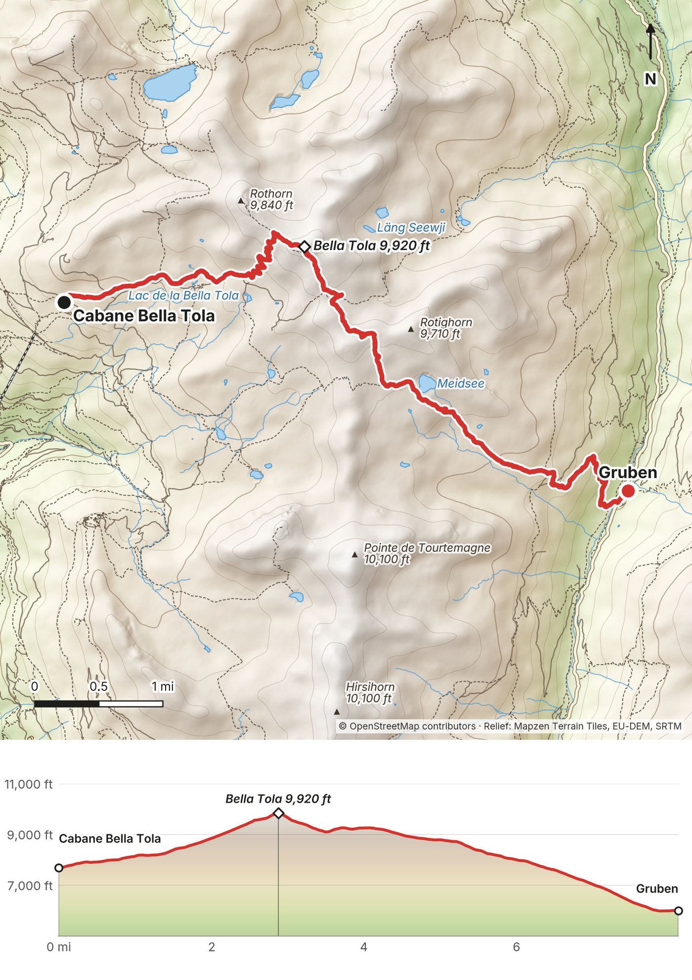
| 8 | Bella Tola to Gruben | 8.1 (13.1) | 2,301 / 4,000 | Hotel Schwarzhorn |
| 9 | Gruben to Jungen | 8.3 (13.4) | 3,523 / 3,010 | Zermatt (cable car, train) |
The numbers come from my own GPS recordings, smoothed the same way for every day. Strava shows a bit more (78.7 miles and about 29,050 ft). The film title says 100 miles; the rest of the way from Chamonix to Zermatt was buses, lifts and trains.
I flew from New York City to Geneva, Switzerland, and took a scheduled shuttle bus from the airport to Chamonix. We stayed two nights at a hotel and spa with frog art and forest-themed rooms. Hotels that nice are a little overkill for me when I travel on my own dime. On the morning of Day 1 the group met in the hotel lobby, and it's always interesting finally seeing what people decided to carry. We took the bus up the valley toward Le Tour and started walking at Montroc.
Fly into Geneva. It's the nearest big airport to both ends of the route.
Geneva Airport to Chamonix. Shared shuttles take about 1 hour 15 minutes to 1 hour 30 minutes; AlpyBus, the one I used, listed shared seats from €19.50 (no year shown, September 2026). FlixBus line S500 also runs from the airport to Chamonix, from €19 (2025 timetable). By train it's about 3 hours with three changes (Geneva, Annemasse, St-Gervais-Le Fayet), hourly.
Chamonix to the start. Chamonix bus line 2 runs to Le Tour, every 30 minutes in summer 2026 (June 20 to September 6), about 25 to 30 minutes. From July 1, 2026, a single ticket is €1.70 at a machine or online, €2.20 by card on board. The Chamonix guest card gives discounts but isn't a bus ticket. The Mont-Blanc Express train runs from Chamonix to Montroc-Le Planet in 22 minutes, free with the guest card between Servoz and Vallorcine. From September 28 to November 6, 2026, rail works replace some trains with buses and Montroc isn't served.
Shortcut. The Le Tour lifts (Charamillon gondola and Autannes chairlift) ran June 20 to September 20, 2026, and go most of the way to the Col de Balme: €31 one-way for both (2026 adult price).
Bring a passport or ID. Day 1 crosses from France into Switzerland. Chamonix's 2026 guide says you need an identity card or passport for Switzerland.
Every bus, lift and train this route uses, with 2026 facts from the official Swiss timetable, the operators and the lift companies. Plan the whole chain with the SBB app or sbb.ch, which covers PostBus and most lifts too.
| Where | What | 2026 facts |
|---|---|---|
| Geneva Airport to Chamonix | Shared shuttle, FlixBus S500 or train | Shuttle about 1 h 15 to 1 h 30; train about 3 h, three changes |
| Chamonix to Le Tour | Chamonix bus line 2 | Every 30 min, June 20 to Sept 6; €1.70 single |
| Chamonix to Montroc | Mont-Blanc Express train | 22 min; free with the guest card (Servoz to Vallorcine) |
| Le Tour to Col de Balme | Charamillon gondola, Autannes chairlift | June 20 to Sept 20; €31 one-way for both |
| Trient to Martigny | PostBus 213, via the Col de la Forclaz | 4 or 5 buses a day, 43 min |
| Champex to Orsières | TMR bus 271 | About hourly, 25 min |
| Orsières to Le Châble | RegionAlps train, change at Sembrancher | Every 30 to 60 min; Champex to Le Châble from CHF 15 |
| Le Châble to Verbier | Gondola | All year except spring and late-October breaks; CHF 6.40 one-way |
| Verbier to Les Ruinettes | Médran gondola | Daily June 20 to Oct 25; CHF 15 one-way |
| Lac des Dix to Sion | Bus 12.372 from the Grande Dixence dam | June 27 to Oct 25; 4 a day, last 16:58 |
| Arolla to Les Haudères and Sion | PostBus 381 | About 6 a day; about 1 h 20 to Sion, CHF 23.80 |
| Les Haudères to La Sage and La Forclaz | PostBus 383 | About 8 a day in July |
| Grimentz to St-Luc | PostBus 452 to Vissoie, then 454 | About 55 min; 20 departures a day in July |
| St-Luc to Tignousa | Funicular | Every 30 min, 8:00 to 17:00 (18:00 in July and August) |
| Zinal to Sorebois | Cable car (Zinal line) | June 27 to Oct 25, up until 16:00 |
| Gruben to Oberems | Summer bus 2246, then cable car to Turtmann | June 13 to Sept 13 (call-bus until June 30) |
| Jungen to St. Niklaus | Cable car | CHF 12 one-way; no Half Fare discount |
| St. Niklaus to Zermatt | Matterhorn Gotthard train | Every 30 min, 40 min, CHF 27 |
| Zermatt to Geneva Airport | Train, change at Visp | About 4 h; CHF 106, Supersaver from about CHF 76 |
Passes. The Swiss Half Fare Card (CHF 150 for a month, 2026) halves most train, bus and lift fares. If you sleep a night in Verbier or the Val de Bagnes and pay the tourist tax, the free VIP Pass covers the Le Châble to Verbier and Médran to Les Ruinettes gondolas for walkers, one day of use per night. Our group used transfers the operator arranged, so I didn't buy these tickets myself.
This was a hosted group trip, so my own costs were small, and they won't look like yours.
| Item | What I paid |
|---|---|
| Flight, New York to Geneva | Covered (I hosted) |
| The trip: hotels, huts, meals, transfers, luggage and guide | Covered. Other guests paid €4,250 (2025) |
| Shared shuttle, Geneva Airport to Chamonix | Booked in my name; the price isn't in my records |
| Travel insurance, World Nomads Standard, Switzerland, Aug 1 to 11 | $104.76 |
| Beers, pizza, the spa day pass in Grimentz, snacks | Extra; not in my records |
The same eight nights with dinner and breakfast come to roughly CHF 700 to 800, about CHF 90 a night, plus lunches, drinks and a night each in Chamonix and Zermatt. The 2026 fares in this guide add up to roughly CHF 100 to 150 for the buses, lifts and trains between Chamonix and Zermatt, plus the shuttle from Geneva (from about €20) and the train back to Geneva (CHF 106 full fare, less with a Supersaver or the Half Fare Card).
The nights, at 2026 prices per person:
| Night | Where | 2026 price |
|---|---|---|
| 1 | Auberge du Mont-Blanc, Trient | CHF 70 to 88 |
| 2 | Relais d'Arpette | CHF 83 to 88, plus tax |
| 3 | Cabane du Mont Fort (Louvie is closed) | CHF 115 to 135 |
| 4 | Cabane de Prafleuri | CHF 80 |
| 5 | Les Haudères or Arolla | from CHF 88 (Arolla dorm) |
| 6 | Cabane de Moiry | CHF 91 to 109 |
| 7 | Cabane Bella Tola | Not published; ask |
| 8 | Hotel Schwarzhorn | CHF 85, plus tax |
How a hut night works. Swiss huts (cabanes) have shared dorms, dinner and breakfast (demi-pension, half board), drinks and lunch to buy, and bathrooms. Most want you there by about 17:00 or 18:00, dinner is at a set time, and a sleeping-bag liner is required almost everywhere (2026). At Louvie we folded our blankets before we left. On my trip, beds at Prafleuri were packed into dorms like sardines.
Booking. Almost every hut books online, through its own site or the Swiss Alpine Club (SAC) system. In 2026, Cabane de Moiry took online bookings only, with half board required, and it opens 2027 bookings on February 10, 2027. Most huts let you cancel up to 48 hours before, sometimes minus a small fee (Moiry keeps 8 to 10 percent in 2026), and from 2027 the SAC reservation fee isn't refunded. For July and August, book as soon as your hut opens bookings; the huts on the Tour du Mont Blanc stretch (Days 1 and 2) fill first.
New SAC charges in 2027. From as early as January 1, 2027, SAC huts (on this route Moiry, Mont Fort and the backup Cabane des Dix) charge a CHF 10 reservation fee per person per night when you book. It's taken off your bill on arrival but not refunded if you cancel. SAC huts also add a solidarity contribution from 2027 to 2029: CHF 3 a night for members, CHF 5 for non-members.
Cabane de Louvie is closed in 2027. It shuts after October 8, 2026, for renovation until spring 2028. Use Cabane du Mont Fort instead; the way is in Other ways to do it.
| Night | Where we slept | Backup |
|---|---|---|
| 1 | Auberge du Mont-Blanc, Trient | Other beds in Trient, or the hotel at the Col de la Forclaz |
| 2 | Relais d'Arpette | Hotels in Champex-Lac |
| 3 | Cabane de Louvie (closed 2027) | Cabane du Mont Fort |
| 4 | Cabane de Prafleuri | Cabane des Dix (split Day 5) |
| 5 | Hôtel des Haudères | Hôtel du Glacier, Arolla (dorm), or hotels in La Sage and Evolène |
| 6 | Cabane de Moiry | The classic line over the Col de Torrent (see Other ways) |
| 7 | Cabane Bella Tola | Hôtel Weisshorn, above St-Luc, or Zinal |
| 8 | Hotel Schwarzhorn, Gruben | Gruben is tiny: book it early |
English. Subject: Booking request, [number] beds, [date]
Hello, I'd like to book [number] beds for [number] people on the night of [day, date], with half board (dinner and breakfast). We are hiking the Walker's Haute Route and will arrive on foot from [previous stop]. Dietary needs: [none / vegetarian / gluten-free]. Could you please confirm the total price per person including the tourist tax, your cancellation terms, whether you take cards, and the latest arrival time? Name: [name]. Phone: [with country code]. Thank you very much!
Français. Objet : Demande de réservation, [nombre] places, [date]
Bonjour, je souhaite réserver [nombre] places pour [nombre] personnes pour la nuit du [jour, date], en demi-pension. Nous faisons la Haute Route à pied et arriverons de [étape précédente]. Régime : [aucun / végétarien / sans gluten]. Pourriez-vous me confirmer le prix total par personne avec la taxe de séjour, vos conditions d'annulation, si vous acceptez les cartes et l'heure d'arrivée maximale ? Nom : [nom]. Téléphone : [avec indicatif]. Merci beaucoup, meilleures salutations.
2026 prices from each place's own site, per person, with dinner and breakfast unless it says otherwise. My notes are what I said on the trip; where there's no note, I didn't say anything about it.
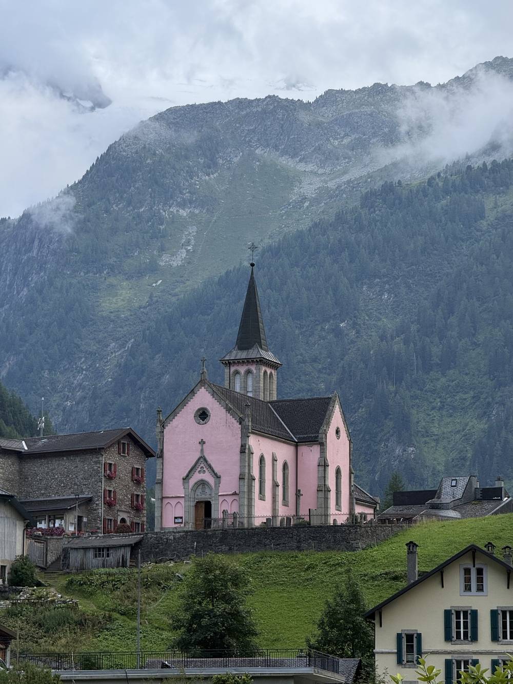
Auberge du Mont-Blanc, Trient (night 1). +41 77 420 08 14, aubergemontblanc.com. About 4,270 ft (1,300 m). Dorm CHF 70, 4-bed dorm CHF 77, private room CHF 88 (booking-site prices, no year shown). Sauna, dinner at 19:00. My private room looked at the pink church, and dinner was raclette.
Relais d'Arpette (night 2). +41 27 783 12 21, arpette.ch. 5,350 ft (1,631 m). Open from early June to late September. Dorm CHF 83 to 88, plus tourist tax. Liner required. Booked and paid in advance through montourdumontblanc.com.
Cabane de Louvie (night 3). +41 27 778 17 40, louvie.ch. 7,380 ft (2,250 m). Closed after October 8, 2026, to spring 2028. In 2025, dorm CHF 79. Cash preferred; no phone network or Wi-Fi. Our first small mountain hut, isolated, with a lake, a big painting in the dining room, and a cat named Chip.
Cabane de Prafleuri (night 4). +41 27 281 17 80, visit-grande-dixence.ch. 8,730 ft (2,662 m). 2026: June 20 to October 22, weekends only in June and October. CHF 80. Online booking required. Cash or card. Duvets provided; bring a liner; water is limited. Beds packed like sardines, and a delicious rösti.
Hôtel des Haudères (night 5). +41 27 283 15 41, hoteldeshauderes.ch. 4,760 ft (1,450 m). Old wooden rooms that felt very Swiss, and raclette scraped to order.
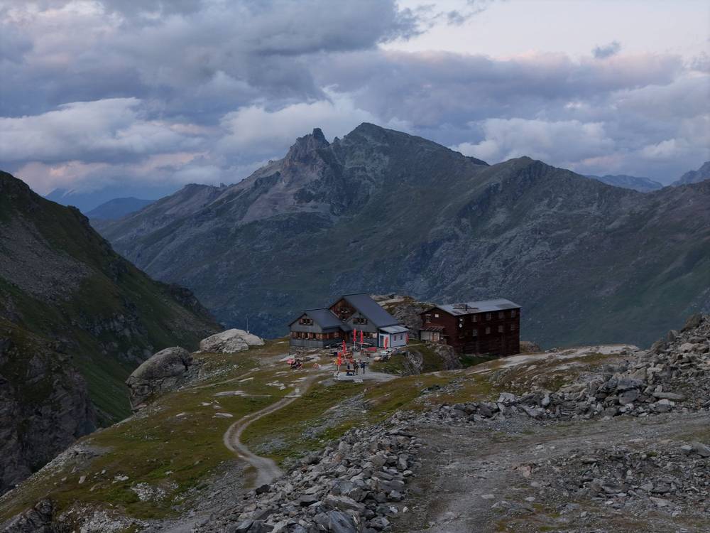
Cabane de Moiry (night 6). +41 27 475 45 34, cabane-moiry.ch. 9,270 ft (2,825 m), Swiss Alpine Club. Mid-June to the end of September. 2026: CHF 91 for SAC members, CHF 109 for non-members, tourist tax included. Online only, half board required, liner required; pay the balance at the hut in cash or by card. 2027 bookings open February 10, 2027. One of the coolest places I've ever slept.
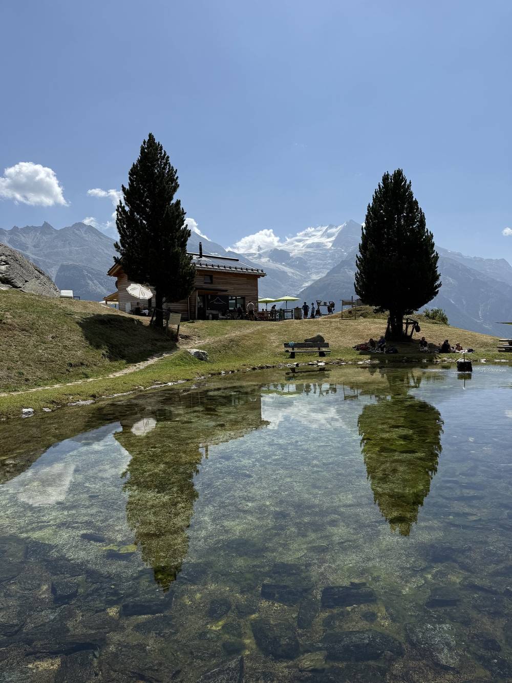
Cabane Bella Tola (night 7). +41 27 476 15 67, cabanebellatola.ch. 7,700 ft (2,346 m). 2026: June 27 to September 21. 6- and 8-bed rooms, half board compulsory; sheets, towels and a shower included. Off-season ski-hut vibes.
Hotel Schwarzhorn, Gruben (night 8). +41 27 932 14 14, hotelschwarzhorn.ch. 5,970 ft (1,820 m). Dorm CHF 85 with dinner and breakfast, plus CHF 1.80 tourist tax; silk liner required. The rösti was mid; the ice cream was amazing.
Refuge du Col de Balme (Day 1). +33 6 07 06 16 30, refugeducoldebalme.com. Mid-June to the end of September (2026). Soup, local dishes, cakes and drinks; also 10 to 12 beds (EUR 62 half board in 2026). Cash (CHF or EUR) or Visa in CHF. Our coffee stop in the rain.
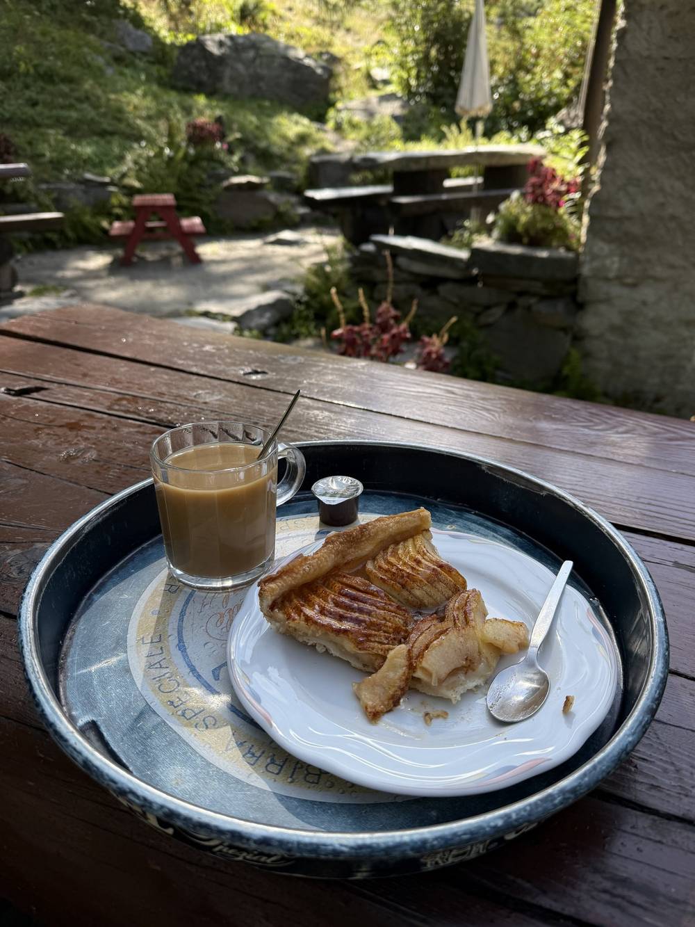
Buvette du Glacier du Trient (Day 2). +41 79 635 96 44, buvetteduglaciertrient.ch. Daily June 1 to September 30. Tarts, light meals, no beds. The fruit tarts were exceptional.
Grand Hôtel & Kurhaus, Arolla (Day 5). +41 27 283 70 00, grandhotelkurhaus.com. Early June to end of October, restaurants open to walkers. Where I had pasta and beer.
Hotel Alpina, Grimentz (Day 7). +41 27 476 16 16, alpina-grimentz.com. Summer 2026: June 27 to October 25. Where we had pizza and I bought a spa day pass. (In 2026 the site only lists the spa for hotel guests, so ask.)
Bergrestaurant Jungeralp, Jungen (Day 9). +41 79 374 11 48, jungeralp.ch. Summer 2026: daily 8:30 to 19:00. Where the walking ends.
Cabane du Mont Fort (the 2027 stand-in for Louvie). +41 77 269 45 27, cabanemontfort.com. 8,060 ft (2,457 m). 2025 and 2026 price: CHF 135, SAC members CHF 115, including trail tea and tourist tax. Cash, TWINT or card. Staffed all of July and August, partly in June and September (SAC listing), so check dates early or late in the season.
Cabane des Dix (Day 5 backup). +41 27 281 15 23, cabanedesdix.com. 9,610 ft (2,928 m), off my line near the head of Lac des Dix. Members CHF 81, non-members CHF 97. Online only.
Hôtel du Glacier, Arolla. +41 27 283 12 18, hotelduglacier.ch. Dorm CHF 88 with dinner and breakfast (2026), plus tax.
Hôtel Weisshorn (above St-Luc). +41 27 475 11 06, weisshorn.ch. 7,670 ft (2,337 m). Summer 2026: June 13 to October 11. Rooms with half board, no dorm.
Paid links: I earn a commission if you buy through these links, at no extra cost to you. As an Amazon Associate I earn from qualifying purchases.
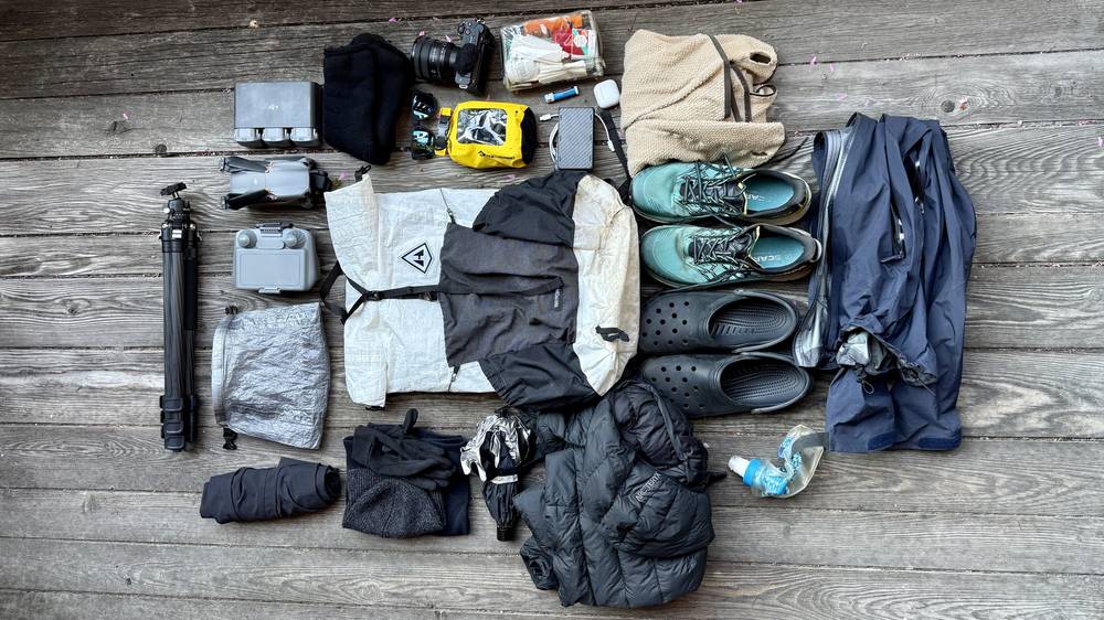
With huts, my pack was a lot lighter than on a camping trip. Here's what I carried in August 2025, what I'd take now, and what I filmed with.
I didn't need the tent, the Jetboil or most of my sleeping things. I had the extra weight of drone batteries and camera gear, some clothes, and of course Crocs.
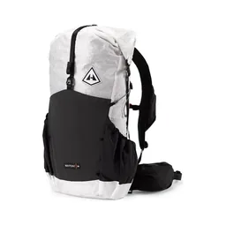 Pack: Hyperlite Mountain Gear Waypoint 35 (Hyperlite)
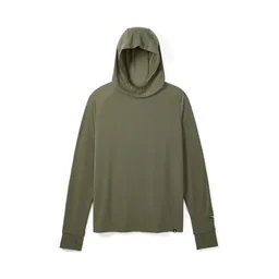 Sun hoodie: PATH Projects Pyrenees T19 Hoodie (PATH Projects). On the hottest day I was glad I had it.
 Fleece: Senchi Designs A90 Half Zip Hoodie. Great to have on the trail, and so cozy. Similar: PATH Projects Lomond Hoodie (PATH Projects).
 Puffy: Arc’teryx Cerium Hoody (Arc’teryx). We put on warm puffs for the sunsets at the huts.
 Rain shell: Arc’teryx Beta AR Jacket (Arc’teryx). The rain came down on Day 1 as we reached the Col de Balme.
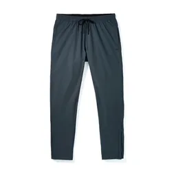 Pants: PATH Projects Killam PX Pant (PATH Projects)
 Shorts: Territory Run Co. Long Haul Short. Similar: PATH Projects Sykes PX Short (PATH Projects).
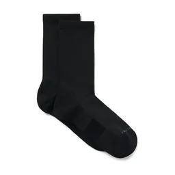 Socks: PATH Projects Joyner Crew Sock (PATH Projects)
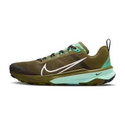 Shoes: Nike React Terra Kiger 9 (Amazon)
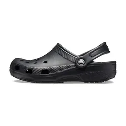 Hut shoes: Crocs Classic Clog (Amazon). A must if you're doing hut to hut in the Alps.
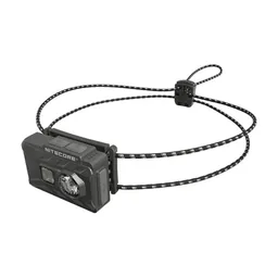 Headlamp: Nitecore NU20 Classic (Amazon)
 Water: Katadyn BeFree AC · 1L (Amazon)
 Wipes: Sea to Summit Wilderness Wipes (Amazon)
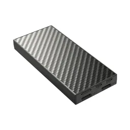 Power bank: Nitecore NB20000 (Amazon)
What I'd add for this route, from my current kit.
 Sleeping-bag liner: Naturehike ZY20 Sleeping Bag Liner (Amazon). Most huts on the route require one.
 Poles: Black Diamond Alpine Carbon Z Poles (Amazon). For the long descents and the boulder fields of the Fenêtre d'Arpette.
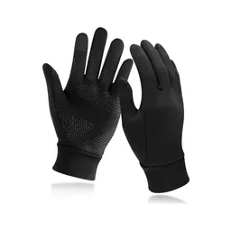 Gloves: Unigear Touchscreen Liner Gloves (Amazon). Day 5 started cold even in August.
 Sunglasses: Goodr OG Sunglasses (Amazon). The high days are exposed.
What I filmed this trip with in 2025. My setup is smaller now (below). Read the drone note in Weather and safety before you fly.
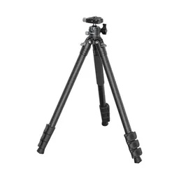 Tripod: SmallRig Carbon Fiber Tripod (Amazon)
 Tripod head: Joby BallHead 3K (now the 3K PRO) (Amazon)
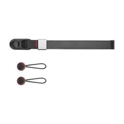 Wrist strap: Peak Design Cuff Wrist Strap (Amazon)
Since September 2026 I film with a smaller setup: the Pocket 4 and the Mic 3 on the trail, and the Mini 5 Pro in the air.
 Camera: DJI Osmo Pocket 4 (Amazon)
 Mic: DJI Mic 3 · 1 TX + 1 RX (Amazon). It pairs with the Pocket 4.
 Drone: DJI Mini 5 Pro (Amazon)
Today we'd be hiking only 10 miles and stopping for lunch up at the high point. Before then we found wild raspberries, wooden statues and dense fog. The views at the top were limited as clouds filled the valley and rain clouds started to appear. We reached the Refuge du Col de Balme as the rain came down, covering my camera lens.
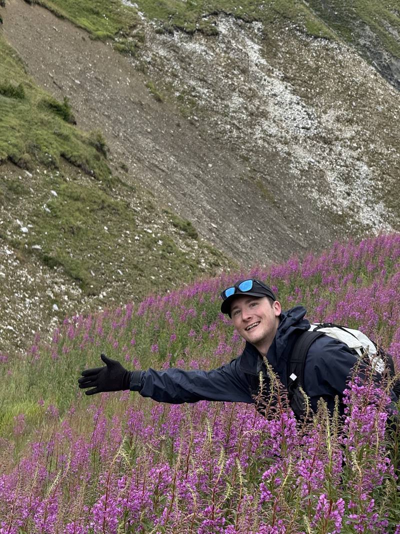
After a nice coffee break the sun came back out, and we started down into Switzerland. We passed purple flowers, took a group photo, and descended into pine forest until we reached a campsite in the valley. This stretch is also the Tour du Mont Blanc, so a few subscribers stopped to say hello.
In Trient we toured the pink church, decorated with flowers and flags with the local Valais coat of arms. We slept at the Auberge du Mont-Blanc, and I was lucky to have a private room with a view of the church. Dinner was traditional Swiss raclette, and I flew the drone at sunset to see the mountains around and what I think was Mont Blanc's white top in the distance.
From Montroc the path zigzags up through forest and meadow to the Aiguillette des Posettes at 3.1 miles, a grassy top at 7,220 ft (2,201 m) that was in fog for us. It drops to the Col des Posettes (6,550 ft, 1,997 m) at 4 miles and climbs again to the Col de Balme at 5.4 miles. The refuge sits right on the pass, on the border between France and Switzerland. From the col it's a long, steady descent of about 3,000 ft (900 m): open slopes, then pine forest, down to the campsite at Le Peuty and the village of Trient at 9.7 miles. None of it is steep or exposed.
Before the Col de Balme, go back down to Montroc or down from the Col des Posettes to Le Tour for the Chamonix bus. In summer the Charamillon gondola and the Autannes chairlift at Le Tour run up toward the Col de Balme, so you can also ride down. After the col, keep going to Trient.
Narrated film, Day 1 · Ambient film, Day 1
The next morning was crystal clear. I packed up my Hyperlite and started off before the sun hit the valley. We bought falafel next to the campsite, filled up water, and mixed in with the Tour du Mont Blanc hikers already packing up their tents. We started with a climb through the forest and past a bridge, and the valley eventually turned into glacier, reflecting the bright sunlight as we climbed. The fruit tarts at the Buvette du Glacier du Trient were exceptional with a coffee.
I broke from the group a little as we continued the climb to the pass, following the white and red trail markers. We ate lunch at the Fenêtre d'Arpette, and I climbed a little higher to have some alone time while shooting drone shots of the glacier. The sharp peaks with a dusting of snow looked beautiful against the blue sky. We started down once the entire group reached the pass. Trees and green grass came back as we reached the end of the day in the Val d'Arpette. We had plenty of time to relax and look back at the pass we'd come over. I shared a double room and made sure to recharge my batteries. Another fantastic meal and a fantastic sunset ended the day.
From Trient the path follows the valley south through forest to the Buvette du Glacier du Trient at 3.4 miles and 5,190 ft (1,583 m), below the snout of the Trient Glacier. Then the real climb starts: about 3,500 ft (1,070 m) in 2.5 miles, steep, ending in a boulder field below the Fenêtre d'Arpette at 5.9 miles. The descent on the other side starts in more big boulders, where you pick your way from one paint mark to the next, then eases into the grassy Val d'Arpette and down to the Relais d'Arpette at 9.4 miles, about 5,350 ft (1,631 m). This is the Tour du Mont Blanc's high variant. It's a hard day in bad weather; the boulders are slow when wet.
Before the steep climb, go back to Trient. In bad weather, skip the Fenêtre: from Trient, walk up to the Col de la Forclaz and take the Tour du Mont Blanc's lower route over the Bovine alp to Champex-Lac. After the pass, keep going down the Val d'Arpette.
Narrated film, Day 2 · Ambient film, Day 2
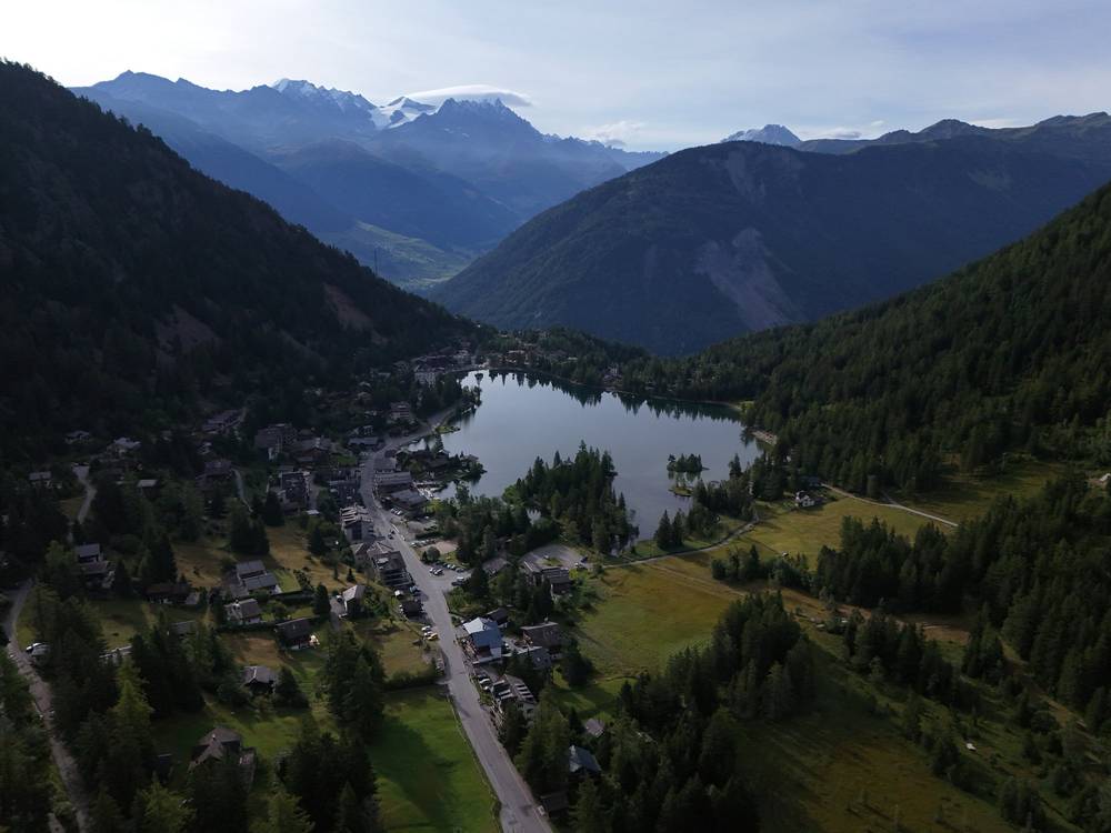
The day started with a quick walk down to Champex-Lac, where we grabbed groceries and coffee and waited for our shuttle bus. This transfer was the biggest of the trip. It took us to Le Châble in the Val de Bagnes, and from there we rode the cable car up to Verbier. The town has huge wooden buildings that look amazing from the window of the cable car. I'd love to come back in winter to see everything covered in snow. We took another ride to the top and started our easy 7-mile hike.
Keeping together in a long line, the group stopped for a photo with my drone. Lunch at the pass was elevated by some fancy mustard, and we had time to take photos and relax before hiking down to the hut. That section was pretty steep, with grassy slopes and the Dents du Midi in the distance. I hiked past them for a video years ago, and it was cool to see the teeth from this new perspective.
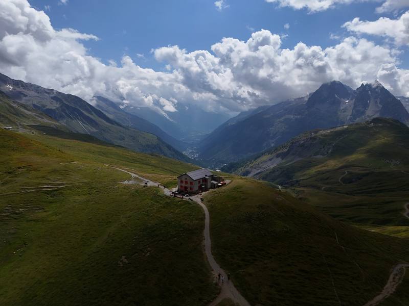
Cabane de Louvie was our first small mountain hut, more isolated, with great views. The whole group was in the dorms, and we quickly snagged the premium spots. Some folks swam or dipped their feet in the lake. It was another afternoon with plenty of time for chess, beer and warming up in the last of the sun. Dinner was soup and pasta at a large table in front of a massive, beautiful painting. Our guide gathered everyone for a meeting about the next day, then we rushed to take the last photos of the sunset. The hut cat, Chip, made an appearance.
From Les Ruinettes (7,190 ft, 2,190 m) the path heads southeast across the slopes above Verbier, drops gently to about 6,840 ft (2,085 m) at 2.3 miles, then climbs steadily to the Col Termin at 4.7 miles. From the col a steep, grassy path zigzags down to Lac de Louvie; the hut is on the far side of the lake, at 6.5 miles and about 7,380 ft (2,250 m). An easy day, and the lifts do the big climb from the valley for you.
Before the Col Termin, go back to Les Ruinettes and ride the gondolas down to Verbier (check the last lift). From Cabane de Louvie, a steep path goes down to Fionnay in the Val de Bagnes.
Narrated film, Day 3 · Ambient film, Day 3
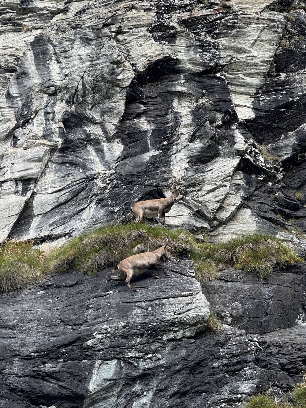
Day 4 was another clear morning. We folded our blankets before leaving the hut. The sun reflected off the lake as we started the climb past flowers at its head, and I got to see some alpine ibex. I rushed to the pass alone so it was easier to film and fly the drone, and met some Polish hikers who subscribed to my channel.
After chatting, I crossed some small patches of snow under wild-looking clouds. This landscape is dark gray rock, white snow patches and blue sky, and with those zebra clouds it was a nice day to be doing this section. The bright sunlight made it all ultra contrast and really beautiful. I waited for the group, and we hiked past a gigantic trail marker and a set of turquoise lakes.
Eventually we reached Cabane de Prafleuri, where I ate a delicious Swiss rösti. We only had to hike about 8 miles, so we had a lot of downtime at the hut. The clouds mixed dramatically with the sunset, making for some of my favorite drone shots of the trip.
From the hut the path follows Lac de Louvie and climbs north up a long valley, steep in places, to the Col de Louvie at 3.9 miles (9,580 ft, 2,921 m). Beyond it is the Grand Désert, the bowl left by a melted glacier: rock, old moraine, snow patches into August and small glacial lakes. The way across is marked with paint and cairns. It rolls for about 2.5 miles, then climbs to the Col de Prafleuri at 6.3 miles, and drops steeply for 1.5 miles down loose ground to the hut at 7.8 miles, about 8,730 ft (2,662 m). There's no easy way off in the middle, so check the weather before you leave Louvie.
Before the Col de Louvie, go back down to Louvie and Fionnay. After it, you're committed to Prafleuri. From Prafleuri a track goes down to the Grande Dixence dam, which has a summer bus to Sion (see Day 5).
Narrated film, Day 4 · Ambient film, Day 4
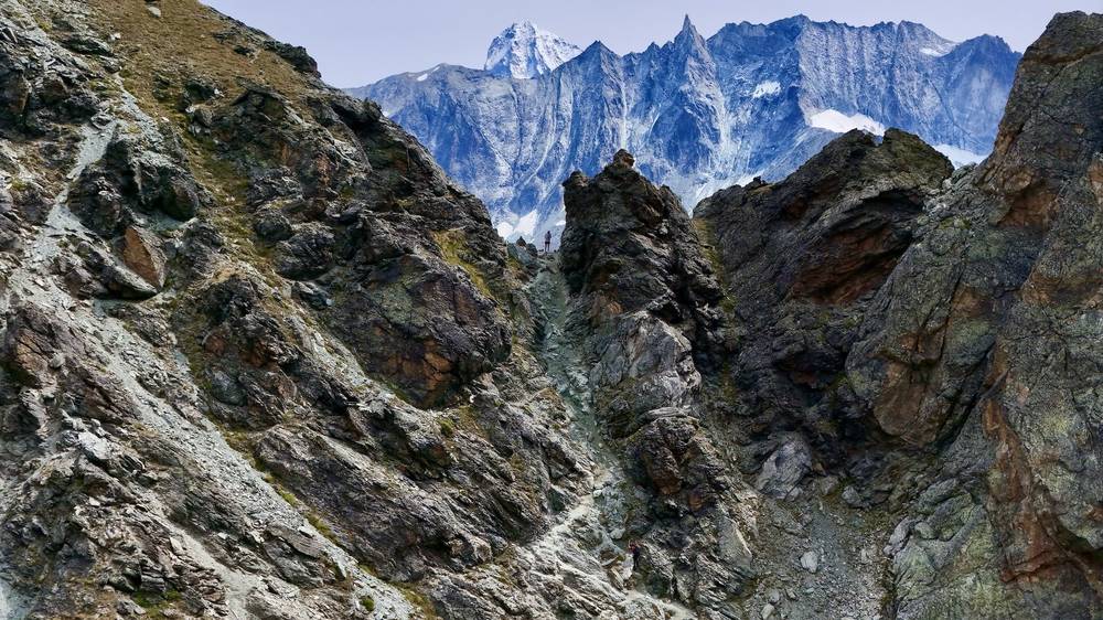
This was the coldest morning of the trip, and I layered up with everything I had. We had some last-minute coffee while our guide briefed us. The day had two passes, so we set off earlier. Lac des Dix came into view, vast and still. After a long, flat walk along the shore we ate lunch, then started the final climb. The Col de Riedmatten was a steep gap, zigzagging up with chains. The way down was surrounded by melting glaciers and huge peaks, including the tip of our destination, the Matterhorn.
I pushed through the forest ahead of everyone and found a nice hotel in Arolla. While sheep grazed and tourists lounged, I treated myself to pasta and beer before the rest of the group arrived and we boarded our bus out of Arolla. That night's hotel in Les Haudères had old wooden rooms that felt very Swiss. Dinner was raclette again, but this time cooked and scraped to order, which was more interesting to watch. We drank and hung out well into the night.
The Col des Roux is just above the hut, at 0.5 miles (9,200 ft, 2,804 m). The path drops to Lac des Dix, a reservoir, and follows its west shore, nearly flat, for about 3 miles. Past the south end of the lake it climbs through moraine and rock to the Col de Riedmatten at 7.9 miles. The last few hundred feet are a steep, loose gully with fixed chains to hold. The Pas de Chèvres, a notch with tall ladders, is just south of it; in September 2026 the Cabane des Dix site said it was closed until further notice. From the Col de Riedmatten the path descends on open slopes, then through forest to Arolla at 11.2 miles, about 6,790 ft (2,070 m).
From the north end of Lac des Dix, a track goes to the Grande Dixence dam (Le Chargeur). In 2026 bus 12.372 ran from there to Sion station four times a day from June 27 to October 25 (last bus 16:58). Past the lake, the only way is over the Col de Riedmatten to Arolla.
Narrated film, Day 5 · Ambient film, Day 5
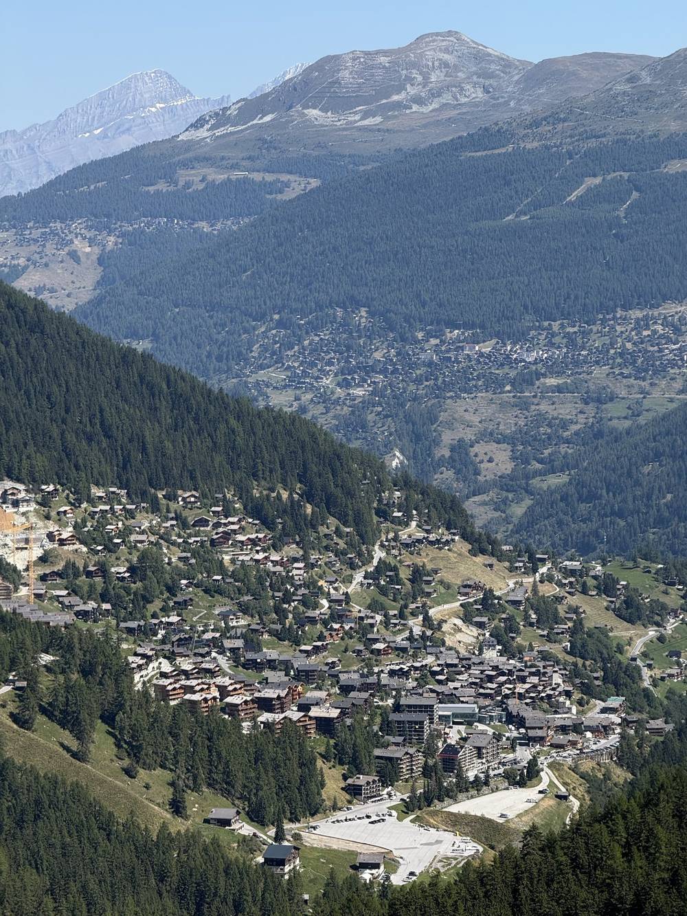
In the morning I laid out all my gear for a top-down photo. We grabbed our takeaway lunches and filled up water. I decided to skip the shuttle bus and walk up to our pass instead. My favorite shot of the whole trip was a slanted grass field with mountains in the background. It was really nice moving at my own pace past the last houses, but the flies were terrible and attacked me relentlessly. I stopped for lunch looking back at the valley I'd left. This was probably the hottest and sweatiest day of the trip, and I was glad I had my sun hoodie to help me cool down.
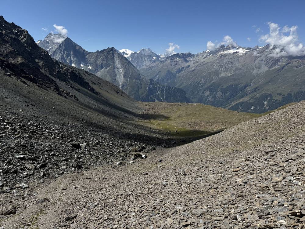
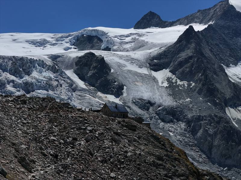
I beat the group to the col and then entered my favorite section of the entire trip, the head of the Moiry valley. Massive walls of dirt from a retreating glacier, turquoise water, and the hut, perched up all alone against the glacier. It's technically out of the way of the trail, but totally worth the extra detour. This was one of the coolest places I've ever slept, and I recommend anyone who can book a night to do so.
The hut has an older stone part and a newer part of aluminum and glass, with great views of the glacier from inside. We had Appenzeller beers and made up our beds in the dorm. When the day hikers left, I flew my drone at sunset and found a statue of a woman on top of a peak hundreds of feet above the glacier, one of the most surprising things I've ever found with a drone. A group of climbers was leaving at 3 or 4 a.m., and we were making a little too much noise outside their window, so we had to be quiet and go to bed.
From Les Haudères (4,760 ft, 1,450 m) the path climbs through the hamlets and meadows above the village, then up open slopes, about 4,640 ft (1,410 m) in 4.5 miles to the Col du Tsaté. This is the longest climb in the guide, and it gets the afternoon sun. From the col the path drops about 1,700 ft (520 m) toward the Moiry reservoir and the glacier lake at the head of the valley, where the road from Grimentz ends. Our group got ready for the last climb at the buvette there, among a couple of car tourists. The last 1.9 miles climb about 1,560 ft (480 m), finishing on a steep, rocky moraine path to Cabane de Moiry at 8.2 miles. The hut is a detour off the main line to Zinal, which is part of why it's worth it.
Before the Col du Tsaté, go back down to Les Haudères. After the col, head down to the reservoir, where a road runs down the valley to Grimentz.
Narrated film, Day 6 · Ambient film, Day 6
This was an easy 9.4 miles, almost entirely downhill to Grimentz. With the glacier at our backs we came down to the lake and its massive dam. The water was so solid in color and still against the curving concrete wall. Hikers crossing it looked tiny, with shimmering reflections of the white glacier behind them. As I hiked on, the dam grew smaller until I reached town.
We had pizza at the Hotel Alpina, and I took advantage of the downtime with a day pass to the hotel spa. It was lovely taking my first shower of the trip and soaking in the hot tub for a bit. Then we took a bus and the funicular up to Cabane Bella Tola, which had off-season ski-hut vibes. More beers and more sunsets, including on the Bella Tola, the peak we'd climb the next day.
From the hut, go back down the moraine path to the valley floor and follow the path along the east side of the Moiry reservoir to the dam at 5.1 miles (about 7,380 ft, 2,250 m). From the dam, paths and tracks go down the valley through pasture and forest to Grimentz at 9.4 miles, about 5,220 ft (1,590 m). Easy walking, but 4,300 ft of descent is hard on the knees.
The Zinal alternative. The classic walker's route leaves the reservoir for the Col de Sorebois and drops to Zinal. We only went to Grimentz because a hut booking fell through. See Other ways to do it.
This is a day of walking downhill toward a road. From the dam, the road runs down to Grimentz.
Narrated film, Day 7 · Ambient film, Day 7
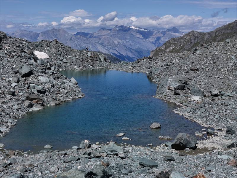
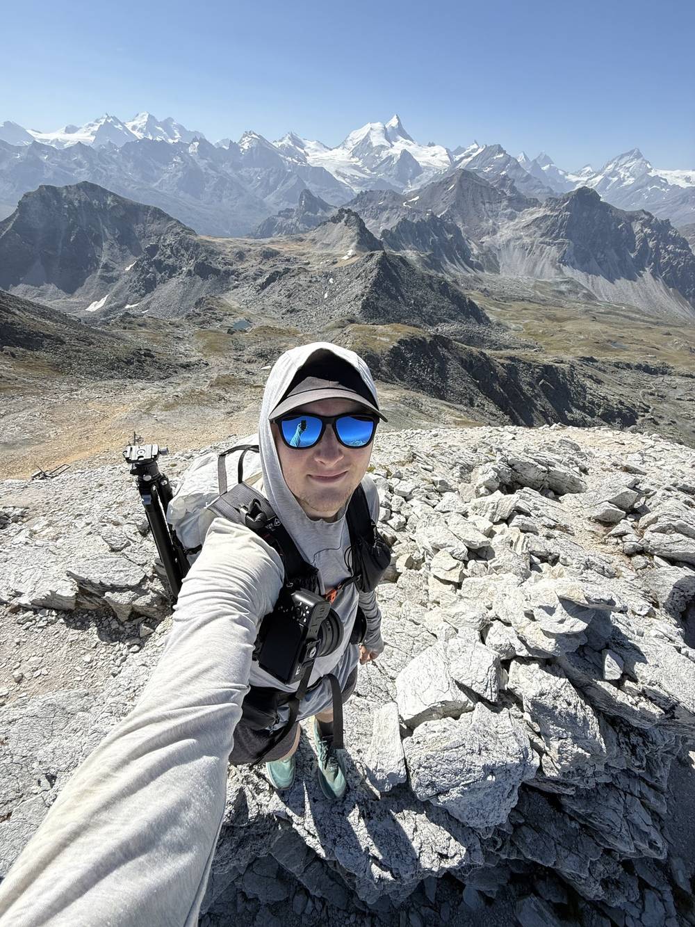
This was a hot 8 miles up the Bella Tola and down to Gruben. On the way up I came across a mountain biker carrying a bike up to the peak, which meant he'd ride down eventually. That seems crazy. At some point a couple of us stopped for lunch and a quick dip in an alpine pond, a nice moment of the trip to just relax. The rest was a dry slog across loose rock under hot sun. I came down alone into the valley to our stop for the night, the Hotel Schwarzhorn.
My rösti there was mid, but the ice cream was amazing. It was our last night sleeping together in dorms, and yes, we all smelled by this point. With bottles of wine in hand, the group settled in by a stream nearby. Eight days of hiking together had formed a unique dynamic, and I think we all felt equal parts comfortable and ready for the trip to be done.
From the hut the path climbs east over grass and then scree to the summit of the Bella Tola at 2.9 miles. The last part is a loose, rocky path to a wide top with a cross and a big view of the Valais peaks. From the summit you drop to the Pas de Boeuf saddle at 3.3 miles and follow a rocky path down past the Meidsee lake, then down pasture, with a steep last mile, into the Turtmanntal at Gruben, at 8.1 miles and about 5,970 ft (1,820 m). The Bella Tola is a real summit, not a pass: in bad weather, skip it.
Before the summit, go back to Cabane Bella Tola and the St-Luc funicular. Gruben has a summer bus down the Turtmanntal.
Narrated film, Day 8 · Ambient film, Day 8
I started the final climb in the shade of the valley, my legs completely warmed up and used to hiking day after day. One last lunch at the pass with the group marked the halfway point. The weather was hazier than usual, but the views of our final valley were exceptional. I found a good thumbnail for my YouTube videos here, and our hike officially ended at a restaurant, where we drank Coke while cooling off.
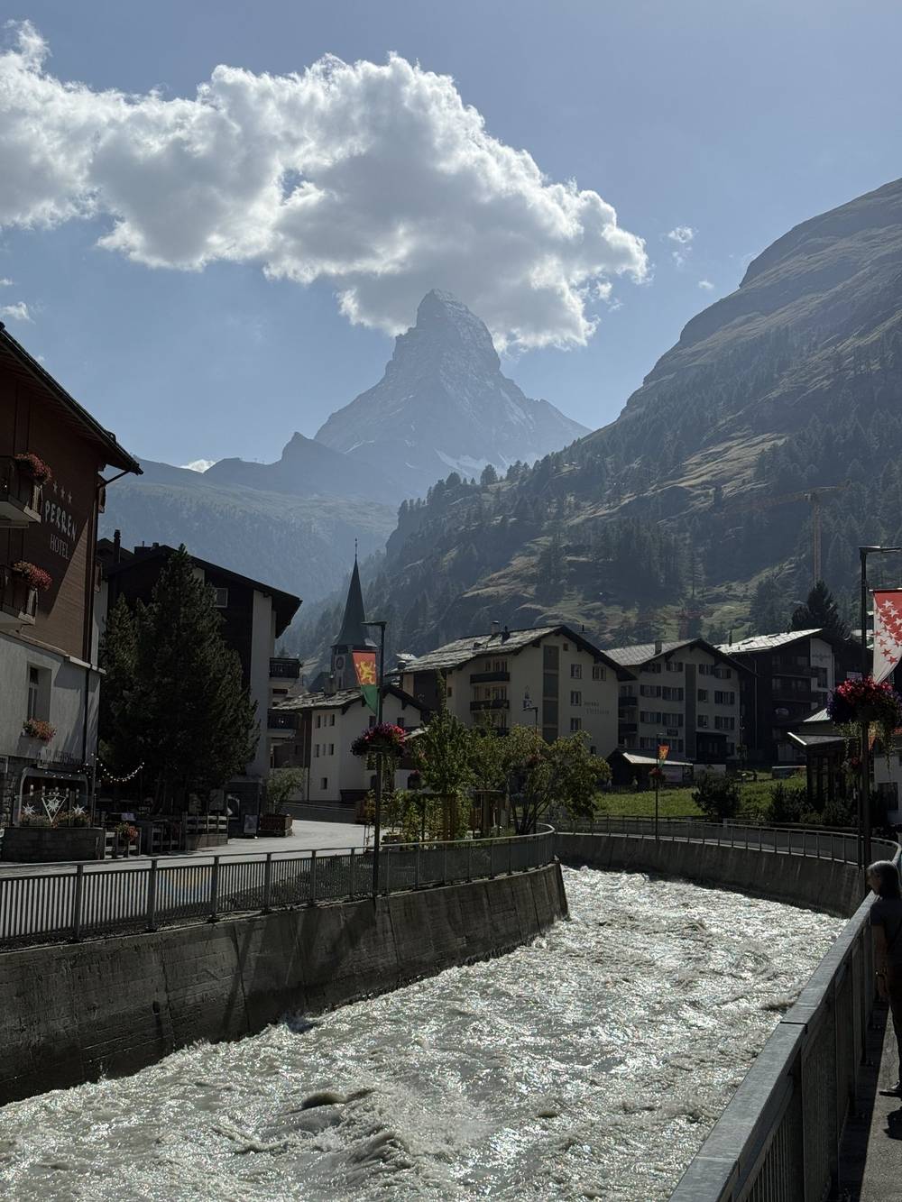
We took the cable car down to the train station at St. Niklaus and rode to Zermatt, at the foot of the Matterhorn. I stopped filming and just enjoyed my time there before we all went our separate ways the next morning.
From Gruben the path climbs east through forest and then open pasture and rock, about 3,500 ft (1,070 m) in 3.7 miles, to the Augstbordpass. On the far side it drops through a rocky bowl, then turns along the slopes high above the Mattertal, the valley that runs up to Zermatt. The last 1.8 miles zigzag down about 1,500 ft (460 m) to Jungen, at 8.3 miles and about 6,420 ft (1,955 m): a hamlet with the Jungeralp restaurant and the small cable car down to St. Niklaus.
Before the pass, go back to Gruben. After the pass, keep going to Jungen. If the cable car isn't running, a steep path goes down from Jungen to St. Niklaus.
Narrated film, Day 9 · Ambient film, Day 9 · Why I hosted this trip · Behind the scenes
From Jungen. The Jungen cable car goes down to St. Niklaus in about 9 minutes: 4-person cabins, CHF 12 one-way (2026), and the Swiss Half Fare Card isn't valid on it. In autumn 2026 it ran every half hour from 8:00 to 18:00 (plus 6:30); the summer times weren't online in September 2026, so check at jungeralp.ch or call the valley station, +41 27 956 22 80.
St. Niklaus to Zermatt. The Matterhorn Gotthard train runs every 30 minutes, about 40 minutes, CHF 27 full fare (CHF 13.50 with the Half Fare Card, 2026).
Zermatt to Geneva Airport. Train to Visp, then a direct train to Geneva Airport: about 4 hours, twice an hour. In 2026 a second-class ticket was CHF 106 full fare, with Supersaver fares from about CHF 76 if you book ahead (sbb.ch).
What I did. We rode the cable car down to St. Niklaus and the train to Zermatt, spent the night there, and went our separate ways the next morning. By then I was kind of burnt out, so there are only one or two shots of the Matterhorn and the town. I was flying from Switzerland straight to Pakistan for my K2 Base Camp trek.
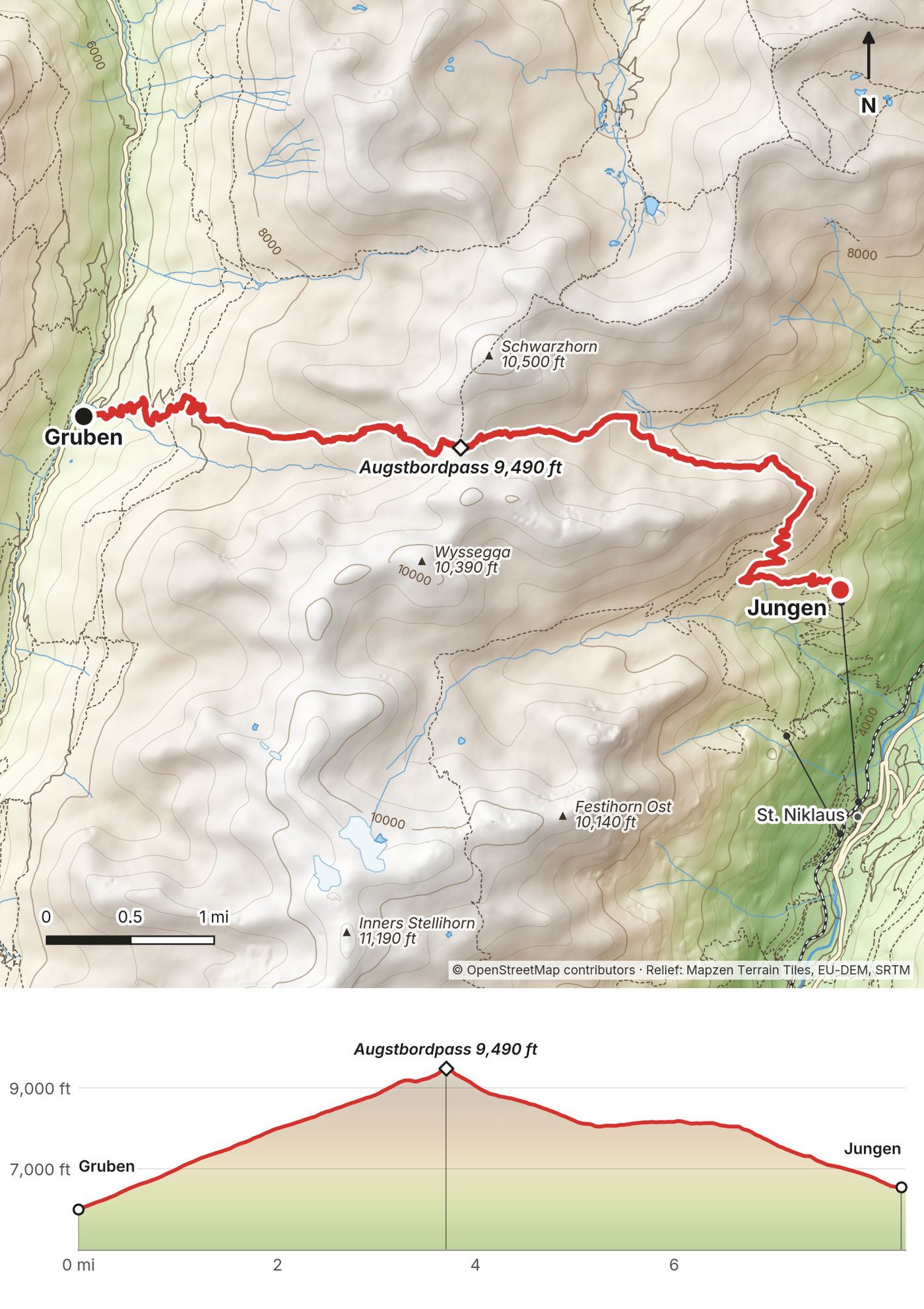
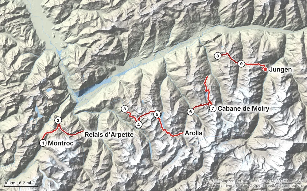
Elevation4,203–9,810 ft78.6 mi
Terrain: Mapzen Terrain Tiles (EU-DEM, SRTM) on AWS · Glaciers, rivers & lakes © OpenStreetMap contributors
Tap a map to open it full size.
Book every hut and hotel ahead, online through the hut's own site or the Swiss Alpine Club system, months ahead for July and August. From 2027 SAC huts charge a CHF 10 reservation fee per person per night (not refunded if you cancel) and a solidarity contribution of CHF 3 a night for members, CHF 5 for non-members (2027 to 2029)
From the hike's facts; check the official page before you go.
The season. Most huts open from mid or late June to mid or late September. For 2026: the Col de Balme refuge from mid-June to the end of September, Cabane de Prafleuri from June 20 (weekends only in June and October), Cabane de Moiry from mid-June to the end of September, Cabane Bella Tola from June 27 to September 21. The buses and lifts in the side valleys run a summer timetable too. Early in the season, expect snow on the high passes; late in the season, huts close one by one.
What I got. I walked August 2 to 10. The first day had some rain and mostly clouds. All the other days were crystal clear, perfect, beautiful days. Day 5 started as the coldest morning, and Day 6 was probably the hottest and sweatiest day of the trip. I still crossed some small patches of snow on Day 4.
Crowds. Days 1 and 2 share the trail with the Tour du Mont Blanc, so expect company, full huts and a lot of tents at the campsite near Trient. After Champex it's much quieter.
Storms. Summer afternoons in the Alps can bring thunderstorms. Start early, and be over the high passes by early afternoon if the forecast shows storms.
Forecasts. Check every evening and ask the hut staff about the passes ahead. For the Swiss side, the MeteoSwiss app has local and mountain forecasts and official warnings. For Day 1, use Météo-France's Chamonix mountain forecast.
Emergencies. 112 works everywhere, in France and Switzerland. In Switzerland, 144 is the ambulance and 1414 is Rega, the Swiss air rescue. From a foreign phone, Rega's number is +41 333 333 333, and the Rega app sends your position with the alarm. On the French side (Day 1, up to the Col de Balme), call 112; Chamonix's guide also lists 18 for mountain rescue and 15 for medical emergencies. Get travel insurance that covers mountain rescue and helicopter evacuation.
None of my route needs a rope or climbing gear, but these spots need care:
Drones. Swiss drone rules and no-fly areas come from the Federal Office of Civil Aviation (bazl.admin.ch); on Day 1, French rules apply until the border.
Is this the glacier Haute Route? No. The original Haute Route is a ski and mountaineering route over glaciers. The Walker's Haute Route stays on hiking trails over high passes. My line never set foot on a glacier; the closest it gets is Cabane de Moiry, which sits on rock above one.
Did you walk every step? No. We rode a shuttle and two gondolas on Day 3, a bus after Day 5, a bus and a funicular after Day 7, and a cable car and a train at the end. Usually I'm a completionist. I like to do a trail from point A to point B on foot. But these little detours actually made sense. If you want to walk them, see Other ways to do it.
How many days do I need? I walked 9 days, plus a day in Chamonix before the start. Our days were short: 6.5 to 11.2 miles and 4 to 8 hours with stops. You can add days or take days away depending on your experience.
Do I need a guide? Not for the walker's route. Most of the way is signed and marked with white and red paint, and there's no glacier. We had a certified International Mountain Leader because we were an operator's group. On your own, you need to find your way in fog on the high passes and be fine on steep rock with chains (the Col de Riedmatten on Day 5).
Am I fit enough? I think most people could do this trail. There were some big passes and some big days. Try this at home: walk 8 miles with 4,000 ft of climbing and a day pack, two days in a row. If you're fine on the second morning, you can do these days. The biggest climb is Day 6: 6,100 ft (1,860 m) up in 8.2 miles.
Where do you sleep? In mountain huts (dorms, dinner and breakfast included), village inns and hotels. There's no camping in this guide. You don't need a tent, stove or sleeping bag. You do need a sleeping-bag liner, which most huts require.
What does it cost? Our operator sold this trip for €4,250 per person in 2025, with everything but drinks and flights included. On your own, a hut night with dinner and breakfast is about CHF 80 to 110 (2026), plus hotels, lifts and buses. See What I paid.
Who moves my big bag? Our operator sent our big bags ahead from Chamonix to Zermatt. My huge 100 L roller duffel went with them. On your own, carry everything you need for nine days, or arrange a luggage service before you go. Huts can't store or forward bags.
Is there phone signal? Not everywhere. Cabane de Louvie, for one, has no phone network or Wi-Fi (2026). Carry offline maps and the GPX files.
Cash or cards? Switzerland uses francs (CHF). In 2026 most huts on this route took cards, some prefer cash, and the Col de Balme refuge takes cash or a Visa card charged in francs. Carry some francs and a few euros for Day 1.
How busy is it? Days 1 and 2 follow the Tour du Mont Blanc, which is busy in summer. Once we left the Tour du Mont Blanc, the trail got a lot quieter.
What did you film on? A Sony ZV-E1 with the 16 to 35 mm f/4 lens, using its onboard microphone, plus a DJI drone.
I walked the nine days in this guide, with the transfers. These are other ways to use it, and I didn't do them.
Cabane de Louvie is closed for renovation until spring 2028. The classic walker's route goes by Cabane du Mont Fort (8,060 ft, 2,457 m) above Verbier instead. From Les Ruinettes, the hut says it's an easy walk that anyone can do. The next day, go over the Col de la Chaux (9,650 ft, 2,940 m) to the Col de Louvie, where you join my Day 4 for the Grand Désert and Prafleuri. That makes a short Day 3 and a longer Day 4.
This was the operator's original plan. From Cabane de Moiry, go back along the reservoir and climb to the Col de Sorebois, then down to Zinal (a cable car from Sorebois saves the knees; see Buses, lifts and trains). From Zinal, the Forcletta pass (9,430 ft, 2,874 m) leads to Gruben, where you join my Day 9. Hôtel Le Trift in Zinal, a traditional walkers' stop, was being renovated from October 2025 to October 2026, so check what's open.
Shorter trips. Start at Les Ruinettes on Day 3 for a 7-day Verbier to Zermatt that skips the busy Tour du Mont Blanc section, or walk only the first two or the last four days.
This was a group trip, so it's worth being clear about what was done for us.
Vagabond Trails planned the route, booked every hut and hotel, arranged the shuttle and bus transfers, sent our big bags from Chamonix to Zermatt, and provided breakfasts, packed lunches and dinners. A certified International Mountain Leader led the group and briefed us on each day. The trip was 10 nights from Geneva Airport to a last night in Zermatt, for 7 to 12 people, and cost €4,250 per person in 2025 (the operator's page, read September 2026). Flights, drinks, snacks, the optional cable cars and insurance were extra.
It was the fourth time I'd worked with them. I hosted: I sold places to subscribers, and my own place and flight were covered. They did all of the difficult work of planning, booking the huts, making the itinerary and managing the group. The guide took care of everyone, so all I had to do was complete the hike and make my video.
I usually hike alone, but that makes more sense in remote places, camping in a tent. When you sleep in nice huts and have a lot of downtime, it's better to have companions. Eating lunch at a pass or drinking beers after hiking all day is much more fun with people. The trade-offs are shorter days, fewer miles, more downtime and a less complete route. We had a big mix of people with different experience, and we all completed the trail.
The operator's published plan and what we actually did were different on a few days. This guide follows what we did, from my GPS and my films.
| The plan | What we did | |
|---|---|---|
| Night 2 | Hotel in Champex-Lac | Relais d'Arpette, above Champex |
| Night 5 | Hotel in La Sage | Hôtel des Haudères, Les Haudères |
| Day 6 | Shuttle to La Sage, then walk | I walked up from Les Haudères |
| Days 7 and 8 | Col de Sorebois to Zinal, then the Forcletta to Gruben | Down to Grimentz, up to Cabane Bella Tola, then over the Bella Tola to Gruben |
| Day 9 | Walk down to St. Niklaus | Cable car down from Jungen |
Why Bella Tola and not Zinal? A viewer asked me that. We had a hut booking get cancelled, and that caused the alternative path with a new place to sleep that night. That's the only reason. Both lines are in this guide.
Everything the operator did, you book yourself: each hut and hotel (online, most with half board), the buses, the lifts, the Jungen cable car and the train to Zermatt, a luggage plan, and travel insurance that covers mountain rescue. Or book any operator's guided or self-guided trip. The rest of this guide gives you each piece.
These change every year. Everything else in this guide stays the same.
Huts and hotels
Buses, lifts and trains
Trails, weather and your stuff
When bookings open, from the sources named under each. Dates move: confirm on the official site.
Cabane de Moiry opens 2027 bookings on February 10, 2027 (online only, half board). Most other huts book through their own sites or the Swiss Alpine Club system; for July and August, book as soon as each hut opens.
Next: Feb 10, 2027
Book on cabane-moiry.ch.
Source: Kraig Adams's Haute Route guide: Huts and hotels. Checked October 2026.
Planning questions about Haute Route, Chamonix to Zermatt, answered only from this page's facts, the creators' versions and hikers' public tracks, with where each answer comes from. When the data doesn't say, the answer says "not given".
From hikers
Sign in to comment. Free; your hikes stay private unless you share them.
Some lodging links earn me a small commission at no cost to you.
Something wrong or missing on this page? Send feedback.