
Content made there

Photos
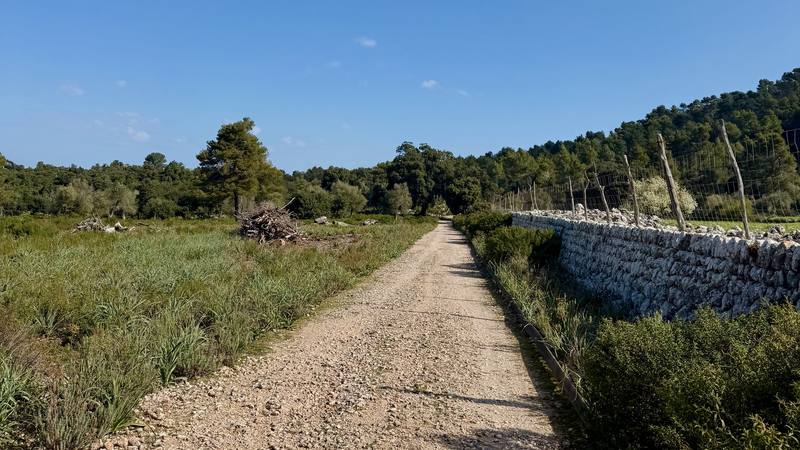
Hikes / GR221, the Dry Stone Route / Kraig Adams's version
Europe · Spain
Mar 20–24, 2026 · 5 days · 80 miles · Solo · Tent

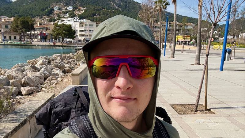
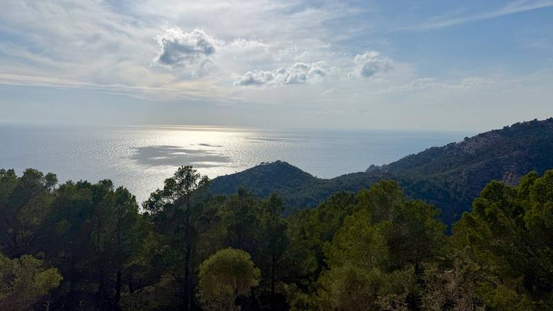
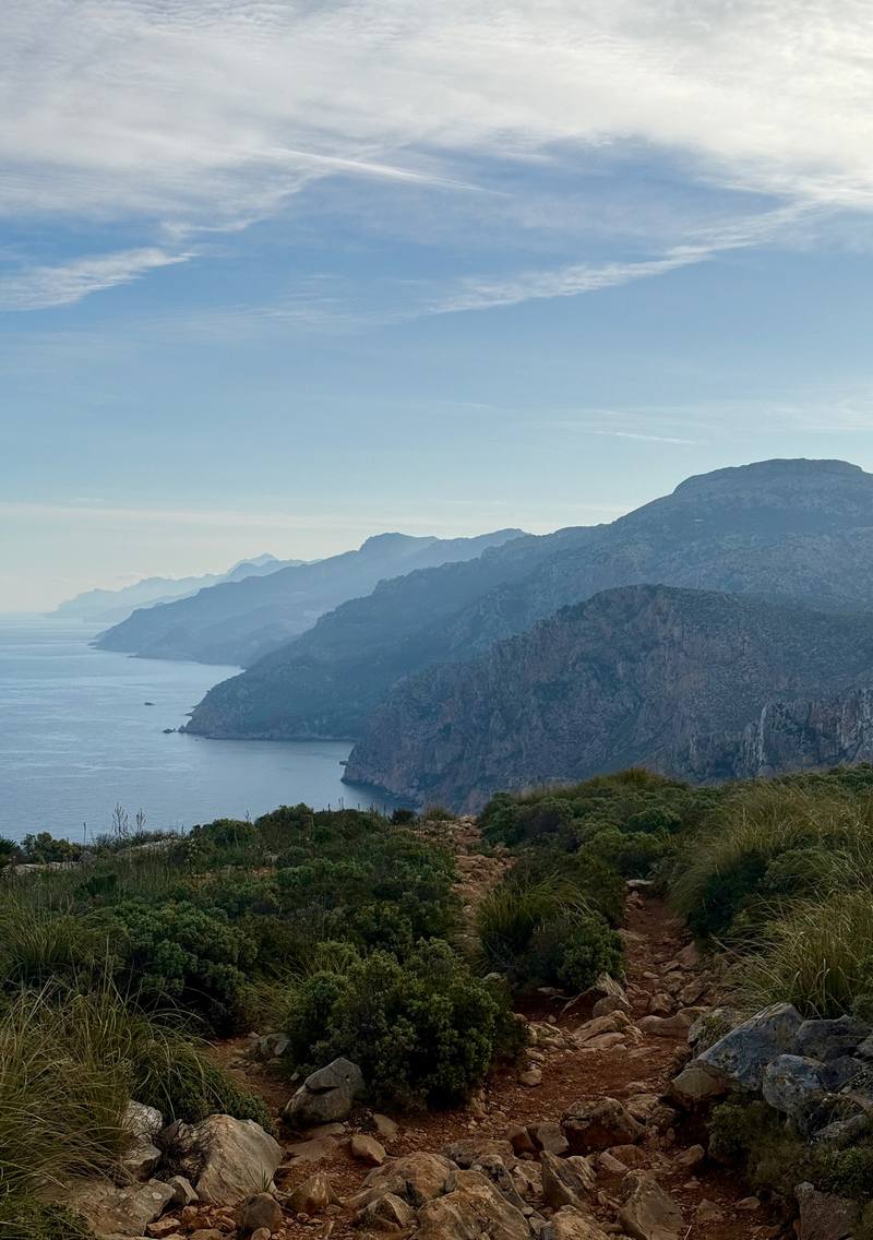
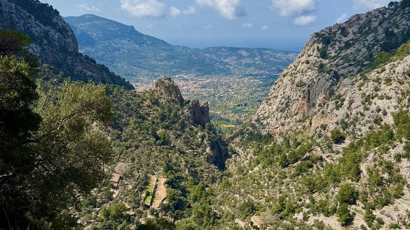
I hiked 88 miles alone across Mallorca on the GR221, the Dry Stone Route, in March 2026. It took me five days, from the harbor at Port d'Andratx to the old town of Pollença in the north. It was early in the season and none of the huts were open yet, so I slept three nights in my tent and one night in a hotel to recharge batteries. I carried everything for the whole trip on my back.
There were only a handful of other hikers doing the full traverse, but hundreds of cyclists on every paved road on the island. The weather was perfect: a puff jacket for the chilly mornings waking up in my tent, and shorts for the rest of the day. It felt so good going at my true pace and escaping the New York winter for a week.
| Distance | 88.1 miles (141.8 km) on my GPS |
| Climbing | 18,340 ft (5,590 m) up and 18,268 ft (5,568 m) down |
| Days | 5: one short afternoon, then four long days |
| Nights | 3 in my tent, 1 in a hotel in Deià |
| Start | Port d'Andratx, southwest Mallorca |
| Finish | Pollença town. The official route ends 4.2 miles (6.7 km) later at Port de Pollença. I took the bus. |
| High point | 4,039 ft (1,231 m) on my GPS, on the high ground at Coll des Prat on Day 4 |
| Official route | 93.3 miles (150.1 km) of main route in 9 stages, Port d'Andratx to Port de Pollença |
| Difficulty | Not a casual hike the way I did it: two 23-mile days and 8 to 12 hours of walking on the long days. The official stages are graded easy to difficult. |
| Nearest airport | Palma de Mallorca (PMI) |
| Trip date | March 20 to 24, 2026, solo |
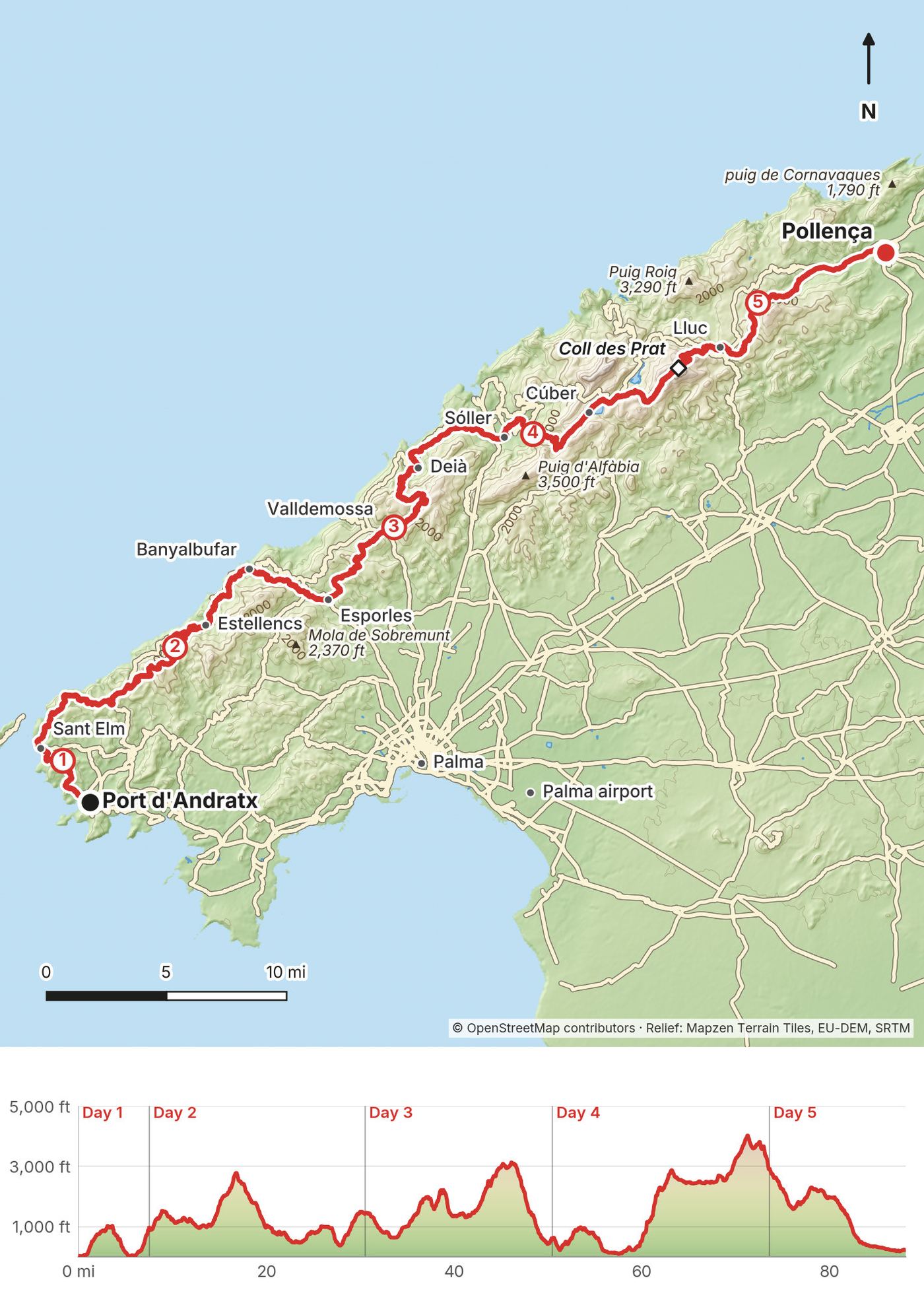
| Day | Route | Miles (km) | Up / down (ft) | Sleep |
|---|---|---|---|---|
| 1 | Port d'Andratx and Sant Elm | 7.5 (12.1) | 1,953 / 1,105 | Tent |
| 2 | On to Estellencs and Banyalbufar | 23.0 (37.1) | 4,732 / 4,253 | Tent |
| 3 | Banyalbufar to Deià | 20.0 (32.1) | 4,566 / 5,440 | Hotel in Deià |
| 4 | Deià over Coll des Prat | 23.1 (37.2) | 6,151 / 3,858 | Tent |
| 5 | Down to Lluc and Pollença | 14.5 (23.3) | 937 / 3,612 | Done |
All distances and climbing in this guide come from my own GPS recordings, measured the same way for every day. My films round the distance down to 80 miles. My old write-up gave higher climbing figures, because apps count climbing differently. Distances along a day ("at 9.9 miles") are from my GPS file for that day.
Each day in this guide has the numbers, my notes from the trip, the trail, where to get off, links to that day in my films, and a map with an elevation profile. "Time to allow" is my own estimate from my old write-up, for a steady hiker with breaks. My recorded time, with stops and filming, is beside it.
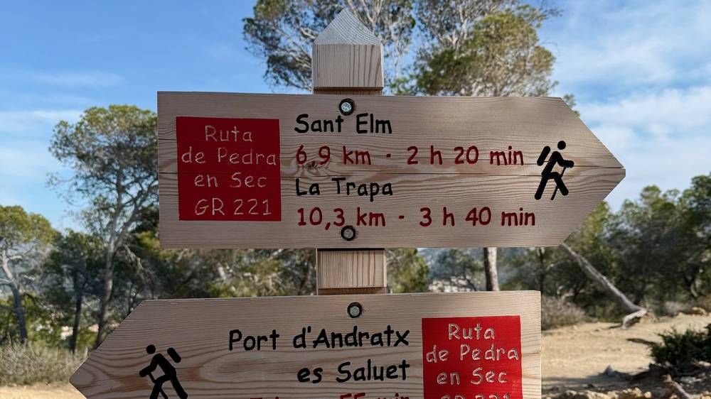
The trail is signed "Ruta de Pedra en Sec GR 221" at junctions. I left the official line in a few places, like the high route from Cúber over Coll des Prat on Day 4. The GPX files follow me, not the official stages.
The GR221 runs along the Serra de Tramuntana, the mountain range on Mallorca's northwest coast. UNESCO lists the range as a World Heritage cultural landscape. The route mostly follows old footpaths restored by the island council, the Consell de Mallorca, through terraces, olive groves and villages. That's where the "dry stone" name comes from.
I flew into Palma de Mallorca. It was my first time on the island. Technically I'd passed by on a cruise ship the year before. I took the bus from the airport into Palma and bought stove fuel, which was very easy. From there it was a 15-minute walk to the next bus, and within the hour I was at the trailhead in Port d'Andratx. I'd picked up groceries on the way: avocado, banana and some noodles and pasta.
Buy your food and fuel before you start. Options get less consistent once you're on the route.
Palma airport to Palma. EMT city bus line A1 runs from the airport terminal to the center of Palma.
Palma to Port d'Andratx. TIB bus 101 runs from the Estació Intermodal in Palma to Port d'Andratx, via Andratx. Timetables are at tib.org.
Starting at Sant Elm instead. TIB bus 121 links Andratx, Port d'Andratx and Sant Elm, which is the end of the first official stage.
Fly into Palma. Take the A1 bus to the center, walk to the Estació Intermodal, and take bus 101 to Port d'Andratx. Buy food and stove fuel in Palma. If you land late, sleep in Palma or Port d'Andratx and start in the morning.
I finished the walk in Pollença and took the bus to Port de Pollença for the ending shot at the sea. I had an extra day before my flight, so the next day I rented an e-bike and rode up to the Formentor cliffs. It was the nicest e-bike I've ever been on. Then I took the bus for an hour back to Palma, got a hotel for about $115, one of the cheapest I could find, and flew home the next morning at 9:00.
Don't book a flight for the day you finish. Sleep in Palma or near the airport, then take EMT bus A1 to the terminal.
Buses. TIB bus 301 runs from Port de Pollença through Pollença, Sa Pobla and Inca to the Estació Intermodal in Palma (timetables). Bus 301 links Pollença and Port de Pollença all year, and bus 231 does too from late March to October; bus 334 runs from the port out to Formentor in summer.
These are the costs I recorded from March 2026. I didn't keep a full record of everything else.
| Item | What I paid |
|---|---|
| Hotel in Deià, 1 night (after Day 3) | about $150 |
| Hotel in Palma, 1 night (after the walk) | about $115 |
| Tent nights | nothing |
| Food | my biggest expense besides the hotel. I brought a good amount of meals and snacks from home. |
| Buses, meals in towns, e-bike rental, flights | not recorded |
Here's what a refuge night cost in 2026 at the Consell's prices:
| Item | 2026 price |
|---|---|
| Dorm bed with shower | €14 |
| Dinner | €9.50 |
| Breakfast | €5.50 |
| Packed lunch | €8 |
| Sheets | €4.50 |
| Towel | €2 |
A bed, dinner and breakfast comes to €29 a night, or €33.50 with sheets. On the official 9-stage plan you'd use five refuges (Can Boi, Muleta, Tossals Verds, Son Amer and Pont Romà), so about €145 to €170 for those five nights. Add hotels in Sant Elm, Estellencs and Esporles for the first three nights, plus food and drinks in towns.
Because the huts weren't open yet, I carried my tent. I slept three nights in it, after Days 1, 2 and 4, and one night in a hotel in Deià after Day 3 to shower and charge my batteries. The hotel was about $150.
I'd heard it's hard to find spots for tents on this trail, and it is. There aren't many clearings, flat areas or soft grass. Finding somewhere to sleep became the main focus at the end of each day. Camping on forest land here needs authorization, so I don't mark my spots or recommend them.
The Consell de Mallorca runs a network of refuges for GR221 hikers, in old houses, an olive mill, a telegraph station and a former slaughterhouse. The five main ones have dorms, showers, meals and Wi-Fi.
| Refuge | Where | Beds | Phone |
|---|---|---|---|
| Can Boi | Deià (end of my Day 3) | 32 | +34 971 636 186 |
| Muleta | Cap Gros, above Port de Sóller | 30 | +34 971 634 271 |
| Tossals Verds | Below Puig des Tossals Verds | 42 | +34 971 182 027 |
| Son Amer | Above Lluc (Day 5) | 52 | +34 971 517 109 |
| Pont Romà | Pollença (end of Day 5) | 38 | +34 971 534 444 |
| Coma d'en Vidal | On Day 2, above Estellencs | 24 | +34 971 173 700 |
2026 prices at Can Boi, Muleta, Tossals Verds, Son Amer and Pont Romà: €14 per person for a dorm bed with a shower (€9 up to age 16), breakfast €5.50, lunch €13, dinner €9.50, packed lunch €8, sheets €4.50 and a towel €2. Breakfast is 8:00 to 9:00 (to 9:30 at Muleta), dinner at 20:30, and checkout is before 10:00.
Coma d'en Vidal is different: its page says you book the whole refuge (24 beds), by phone, though the Consell said in 2025 that a group can book a single room, so ask. For one or two hikers it isn't practical.
Booking. Book online through the Consell's refuge booking portal. You can check each refuge by date, or search availability for the whole route at once. Questions: +34 971 173 700 or xarxaderefugis@conselldemallorca.net. The two-bed room at Tossals Verds can only be booked by email to that address.
Every town I walked through has hotels: Port d'Andratx, Sant Elm, Estellencs, Banyalbufar, Esporles, Valldemossa, Deià, Sóller and Pollença. On the main route there's no Consell refuge between Port d'Andratx and Esporles that you can book for one person (Galatzó is off the route, on a variant from Es Capdellà), so plan hotels for those first nights.
Near Lluc there are three official camping areas run by the Balearic forestry agency (IBANAT): Sa Font Coberta, Es Pixarells and Marjanor. You need a reservation. I walked past Sa Font Coberta at the start of Day 5. Details are on the Serra de Tramuntana page of the Balearic government.
English
Subject: Booking request, [number] beds, [date]
Hello,
I'd like to book [number] beds for [number] people on the night of [day, date]. We are walking the GR221 and will arrive on foot from [previous town or refuge].
We would like dinner and breakfast. Dietary needs: [none / vegetarian / gluten-free].
Could you please tell me:
Name: [your name]
Phone: [with country code]
Thank you very much!
Español
Asunto: Solicitud de reserva, [número] plazas, [fecha]
Hola:
Quisiera reservar [número] plazas para [número] personas la noche del [día, fecha]. Estamos haciendo la GR221 y llegaremos a pie desde [pueblo o refugio anterior].
Queremos cena y desayuno. Necesidades alimentarias: [ninguna / vegetariano / sin gluten].
¿Podrían indicarme, por favor:
Nombre: [tu nombre]
Teléfono: [con prefijo internacional]
¡Muchas gracias!
All of these are run by the Consell de Mallorca. Book through the refuge booking portal, +34 971 173 700, xarxaderefugis@conselldemallorca.net. The prices were listed in September 2026. Can Boi, Muleta, Tossals Verds, Son Amer and Pont Romà each have toilets, hot showers, electricity, heating and Wi-Fi, and sell meals. Doors close at 22:00 from November to March and 23:00 from April to October.
Can Boi (Deià). +34 971 636 186. An old house with an olive mill inside, on Carrer des Clot 5 in Deià. 32 beds in four dorms. I walked right past it at the end of Day 3, but I stayed in a hotel.
Muleta (above Port de Sóller). +34 971 634 271 or +34 971 630 042. A former army telegraph station near the Cap Gros lighthouse. 30 beds in one dorm. It's on the official stage 5 from Deià. I walked from Deià straight to Sóller and didn't pass it.
Tossals Verds. +34 971 182 027. 19th-century buildings at 1,720 ft (525 m) on a public estate. 42 beds, including one two-bed room that you book by email only. The official stage 6 ends here. My high route from Cúber didn't pass it.
Son Amer (above Lluc). +34 971 517 109. On a hilltop above the Lluc valley, at 1,740 ft (530 m). 52 beds. I passed it early on Day 5.
Pont Romà (Pollença). +34 971 534 444. In the old town slaughterhouse near the Roman bridge in Pollença. 38 beds in five dorms. The last refuge before Port de Pollença. The Calvari steps (365 of them) are close by.
Coma d'en Vidal (above Estellencs). +34 971 173 700. 24 beds, and you must book the whole refuge, so it's for groups. No meals. I walked past it on Day 2.
Galatzó (on the Galatzó variant from Es Capdellà). +34 971 074 616. 50 beds, meals. It's off the main route I walked.
This trip was special because I carried everything for the whole trip on my back. I didn't store a bag in any hotel.
The production gear and all its batteries were the heaviest extras. If I'd just been hiking, not making a video, that weight reduction would have been massive. Other than bringing the silk liner and forgetting my pillow, I was very efficient with the gear on this trip.
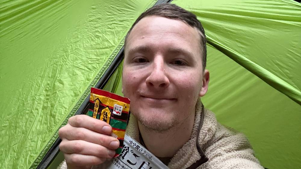
I was traveling super light, and everything I needed for the whole trip fit in my pack. It was my first tent hike since Kyrgyzstan the summer before, and I was excited and nervous.
About a mile in, I was still road walking. The start is always the toughest part of a hike for me. I didn't know if the trip would work out, and that uncertainty was stressful. I wanted to get away from the roads and the town and into the mountains. When the path finally turned to dirt, it was nice to be on a trail. I told myself to slow down, control my breathing and relax. I had five days to do 80 miles, so I was in no rush.
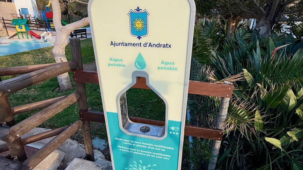
In Sant Elm the goal was to get in, fill up water, maybe have a beer and a bite, then get out through the town and the beach to find somewhere to sleep. On the way out I walked past a free water fountain I could have filled up at. I was surprisingly tired, maybe from jet lag, so I planned on ramen and an early night. Goats kept making noise nearby, and the view was absolutely gorgeous.
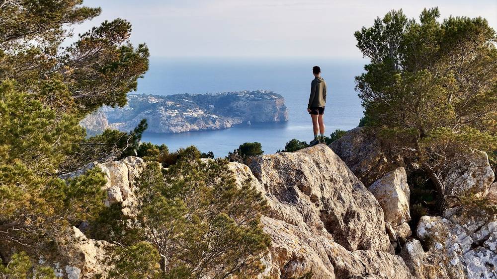
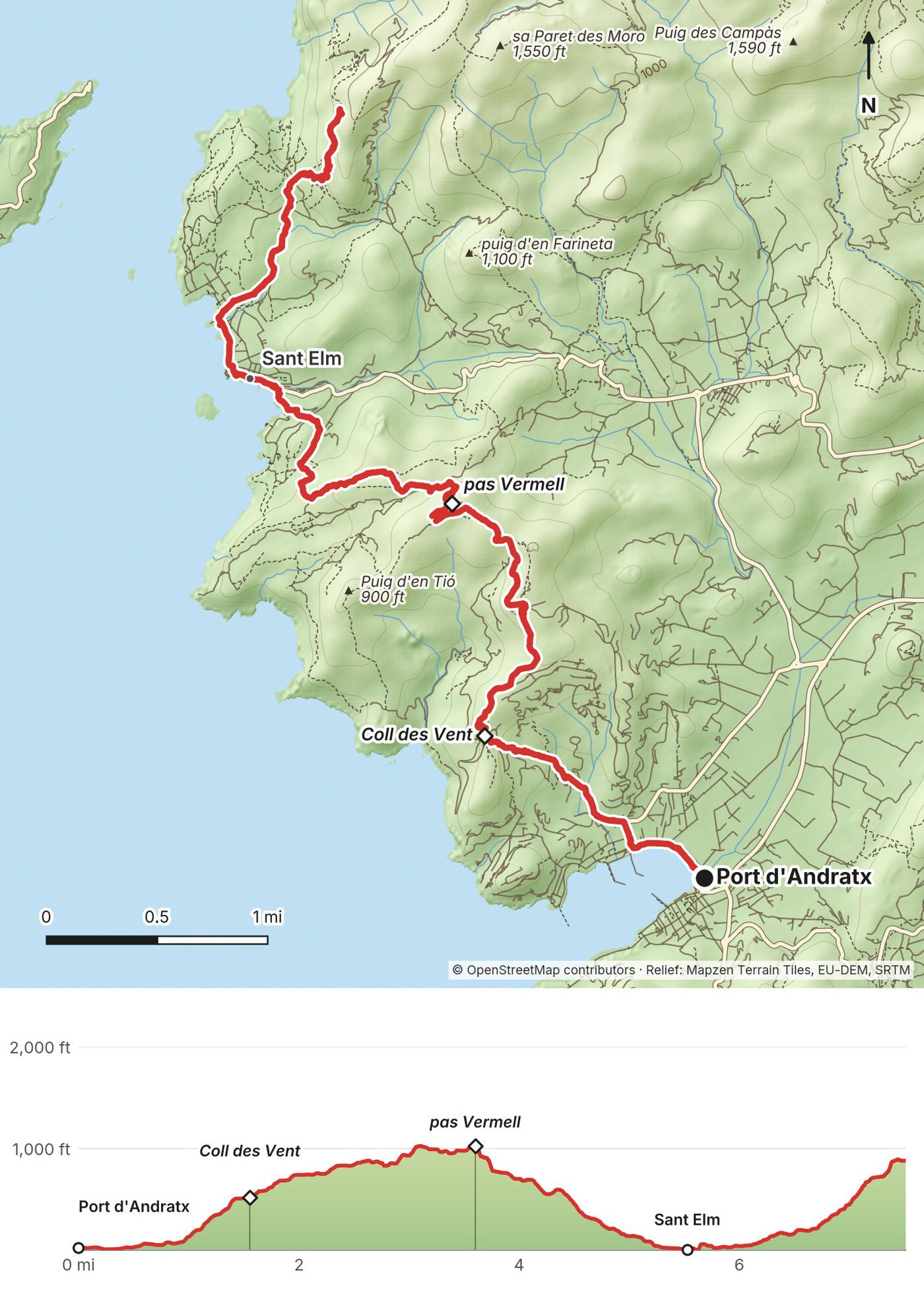
From the harbor at Port d'Andratx the route climbs straight up, with very little warm-up. You go over Coll des Vent at 1.6 miles (2.5 km) and the pas Vermell at 3.6 miles (5.8 km), the high point of the day at about 1,030 ft (314 m), then drop to the sea at Sant Elm at 5.5 miles (8.9 km). A signpost on the climb gives 6.9 km and 2 hours 20 minutes to Sant Elm, and 10.3 km and 3 hours 40 minutes to La Trapa. From Sant Elm the trail climbs again toward La Trapa, with views of the island of Sa Dragonera.
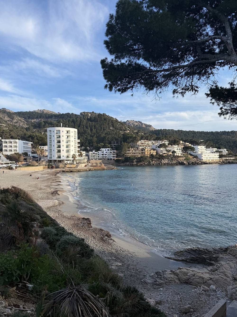
Fill your water before you leave Port d'Andratx. In March 2026 there was a public drinking-water fountain in Sant Elm, on the way out of the village toward La Trapa, at 6.0 miles (9.7 km). Sant Elm has shops, cafes and hotels.
The official stage 1 ends in Sant Elm (9.2 km, graded easy, 3 hours 20 minutes). If you're starting after a flight, stopping there is the easy choice.
Sant Elm is the exit. TIB bus 121 runs from Sant Elm to Port d'Andratx and Andratx, where you can connect to bus 101 for Palma.
Behind the scenes, getting to the start · Behind the scenes, Day 1 · The film, Day 1
I slept really well, and I needed it after all those flights. It was a little cold that morning, so I wore my puff jacket and was glad I'd brought gloves. There's not much water, so finding a refill was the only thing on my mind. I split an avocado with my spork for breakfast. It's my favorite trail breakfast.
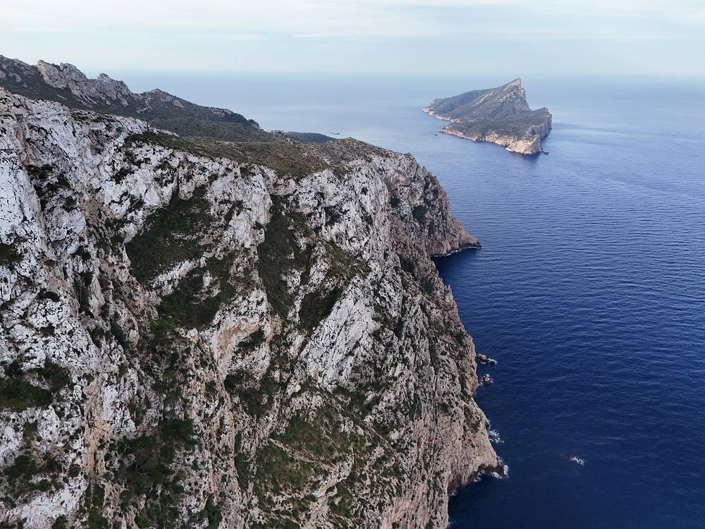
The big pass came first. After it I had meat tortellini with no sauce, and it was totally fine. That was one of the three big passes done. I ran out of water on the way down and was starting to get a headache.
The first big town was great. I got a pizza, a beer, an espresso and water, and the waiter was nice. It was 3:00 and I'd done about 15 miles. I kept going uphill with the plan to stop between 6:00 and 7:00, past 20 miles. I got pretty lucky with my campsite that night and had plenty of water for tea and ramen.
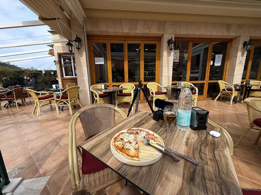
This is one of the two hardest days, and it's hard because it keeps going, not because of one big climb. It starts cold and warms up fast.
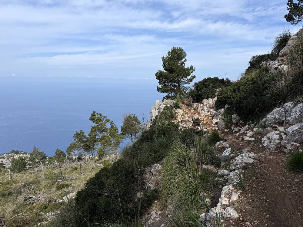
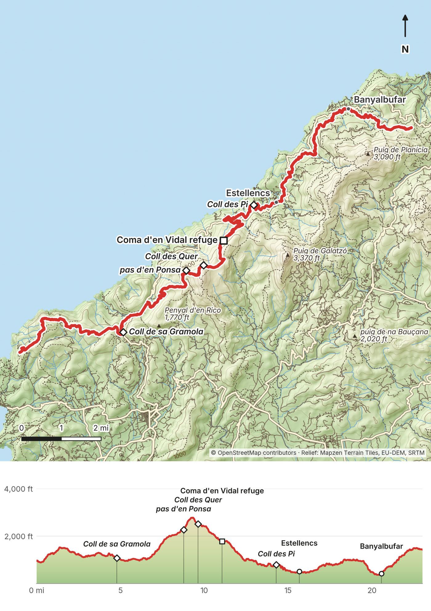
Above Sant Elm, the trail passes La Trapa and reaches Coll de sa Gramola at 4.8 miles (7.7 km), where the route follows the Ma-10 road for a while. Then comes the long climb: pas d'en Ponsa at 8.8 miles (14.1 km) and Coll des Quer at 9.6 miles (15.5 km), with my high point of about 2,782 ft (848 m) near there. The trail comes down past the Coma d'en Vidal refuge at 11.1 miles (17.8 km) and Coll des Pi at 14.3 miles (23.0 km), and reaches Estellencs at 15.7 miles (25.2 km). From there it's terraces and stone paths to Banyalbufar at 20.6 miles (33.1 km).
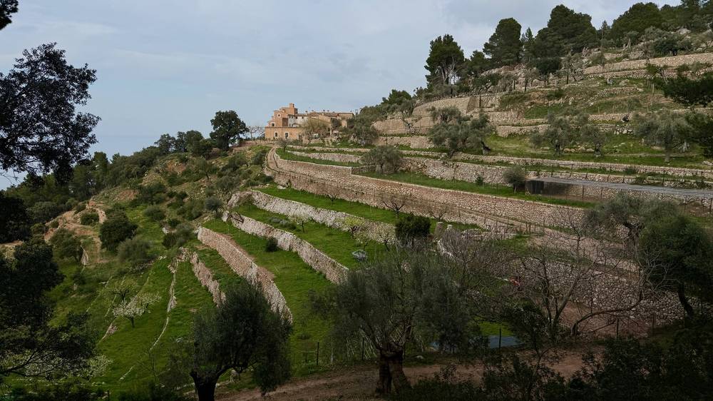
Water is the problem. My Day 2 line runs 15.7 miles (25.2 km) to Estellencs with no village on the way, and that's where I ran out. Carry more than you think. Maps show a spring and a water point near the Coma d'en Vidal refuge, but don't count on them. Estellencs and Banyalbufar have food and water. In March 2026 there was a public drinking-water dispenser in Banyalbufar.
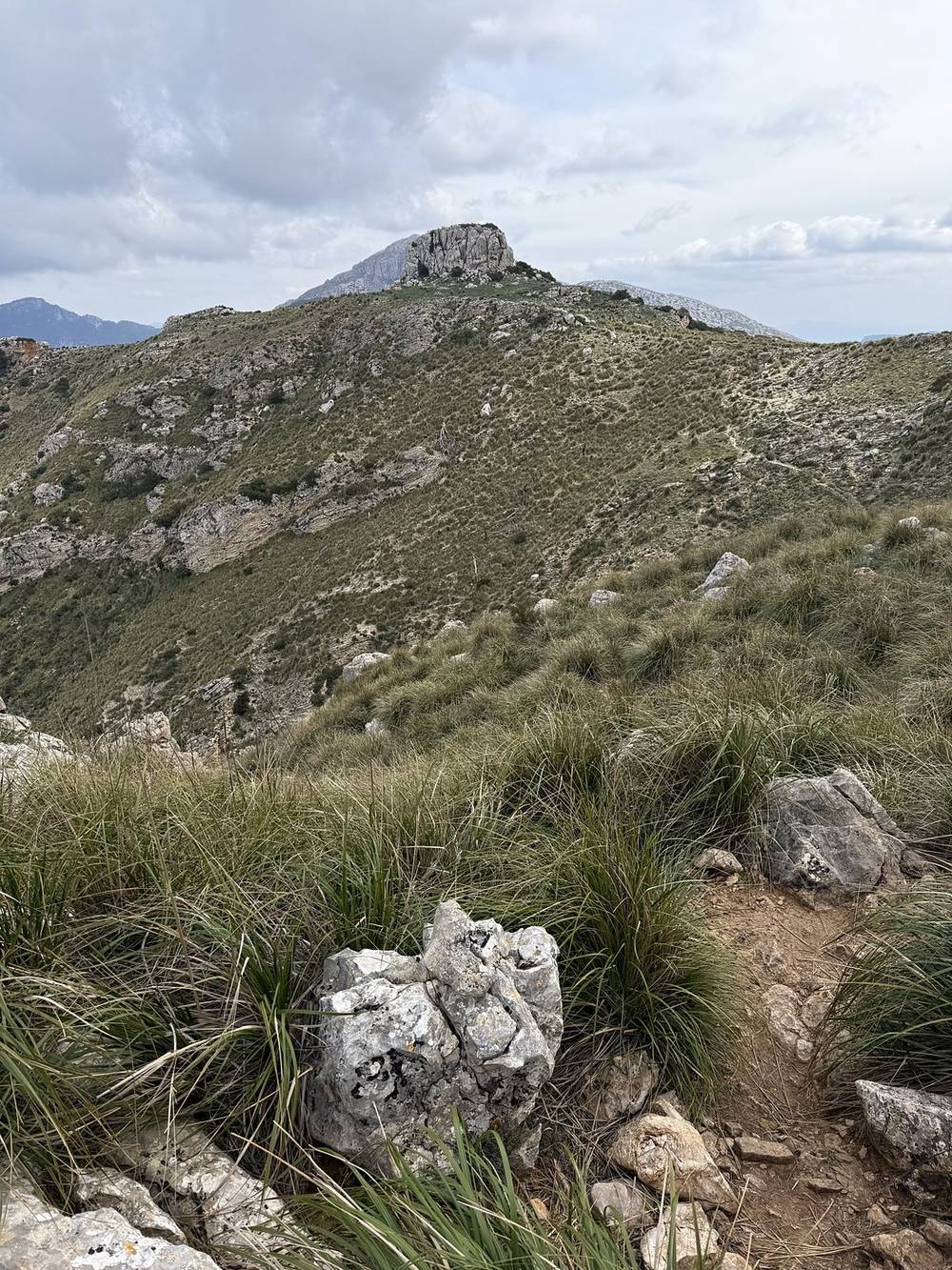
The official stage 2, Sant Elm to Estellencs, is 24.7 km (15.4 miles), graded high, with 8 hours 40 minutes of walking. Estellencs to Esporles (stage 3) is another 14.4 km (8.9 miles).
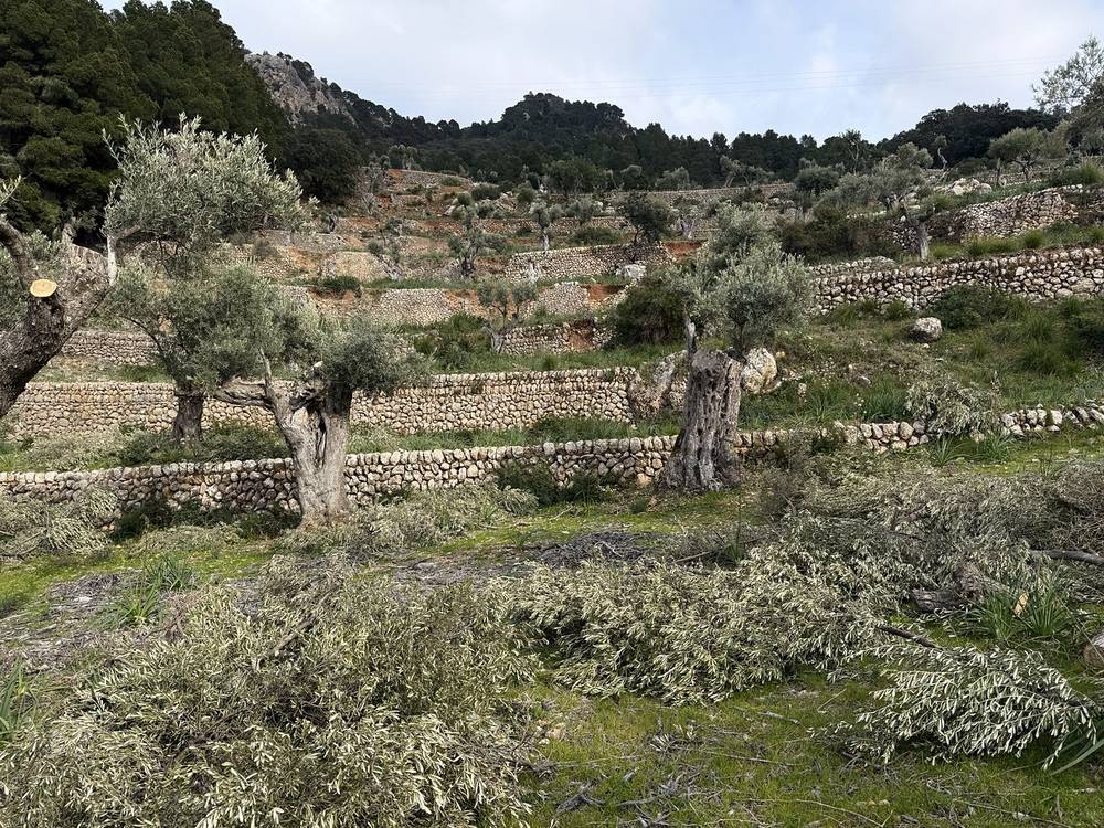
Before the big climb, go back to Sant Elm. The route also meets the Ma-10 road near Coll de sa Gramola. After the climb, Estellencs and Banyalbufar are both on the Ma-10, with TIB bus 202 to Esporles and Palma all year, and from May to September bus 131 toward Andratx.
Behind the scenes, Day 2 · The film, Day 2
I slept in an extra half hour, even after 10 hours of sleep. It was my first trip with some new tent stakes, and two of them were already broken. The first water fountain of the day wasn't working, so I went to a supermarket for water and a banana.
The plan for the day was a big climb, a small town, an even bigger climb, then a big town. It was a lot clearer than the day before, and much hotter in the direct sun. I talked to my first group of other hikers. They were German, they knew I was American, and we joked about that.
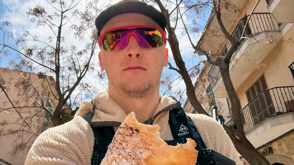
I stopped in Valldemossa for a nice lunch and a delicious pastry with Nutella. The morning section wasn't that interesting to me: it was low, with a lot of forest. I knew the big climb after Valldemossa would be better up high, so I put on some Blackpink to get jazzed up for it. It was hot and sweaty, and worth it. I spent more time filming up there than I should have, and I was running low on batteries and water, so I focused on the long downhill.
I decided to stay in a hotel that night to charge and relax. It was about $150, and the shower felt really good. It was nice to have a full set of clean clothes with me. My batteries were all low: the power bank was dead and I was starting to run out of camera batteries.
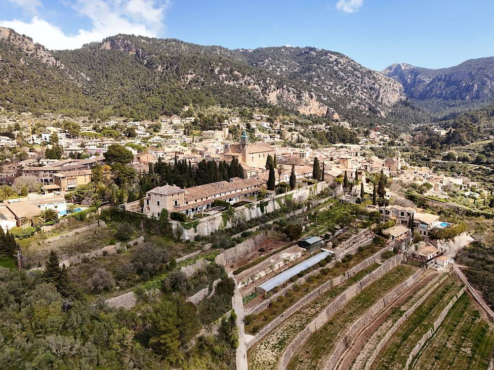
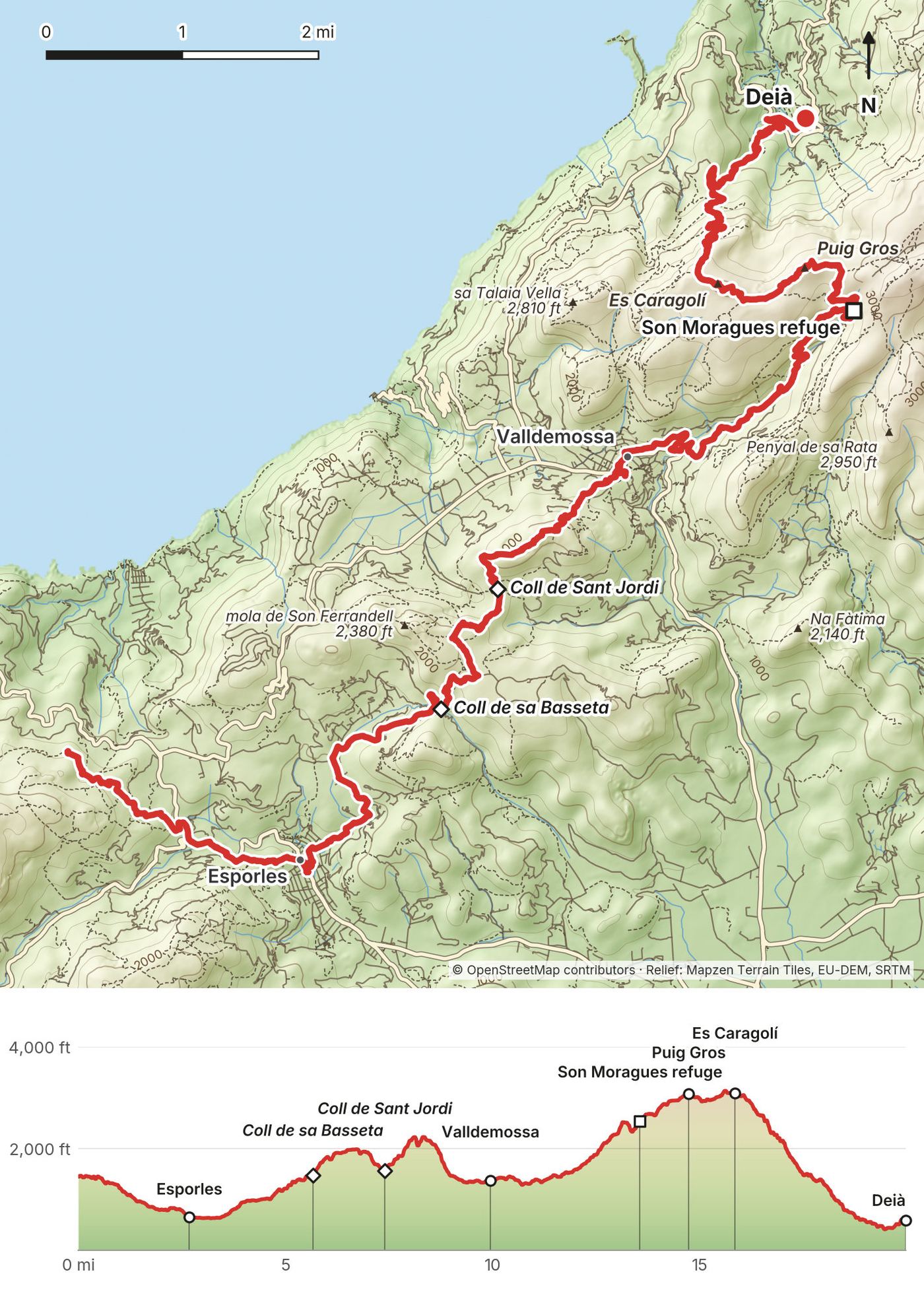
From above Banyalbufar the trail drops to Esporles at 2.7 miles (4.3 km). Then it climbs over Coll de sa Basseta at 5.7 miles (9.1 km) and Coll de Sant Jordi at 7.4 miles (11.9 km) and comes down into Valldemossa at 9.9 miles (16.0 km). The Consell notes a short section of the official stage through a housing estate that's passable but not signposted.
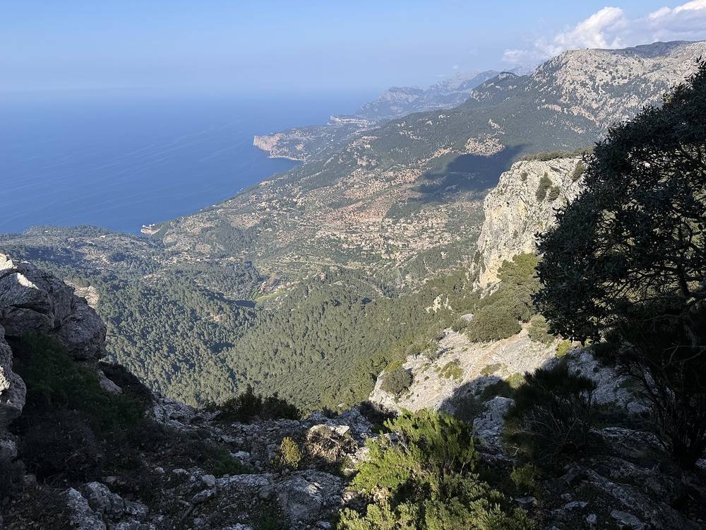
After Valldemossa comes the biggest climb of the day, onto the ridge path past the Son Moragues refuge at 13.5 miles (21.8 km) and over Puig Gros and Es Caragolí, around 15.8 miles (25.5 km). My high point was about 3,140 ft (957 m). Then it's a long, steep descent of about 2,600 ft (800 m) to Deià at 19.9 miles (32.0 km).
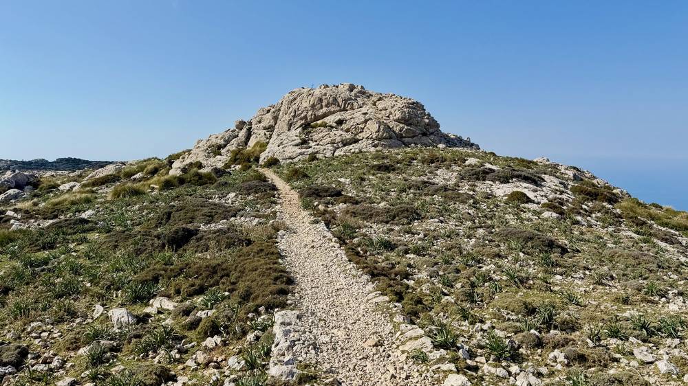
The trail is very well marked, with markers and signs at every junction, and well maintained. I think a lot of people trail run and hike on it.
Esporles and Valldemossa have shops and cafes. Fountains can be dry, so be ready to buy water. The ridge after Valldemossa has no services, and it's exposed to the sun. Fill up in Valldemossa.
The official stage 4, Esporles to Can Boi, is 23.2 km (14.4 miles), graded difficult, with 8 hours 10 minutes of walking.
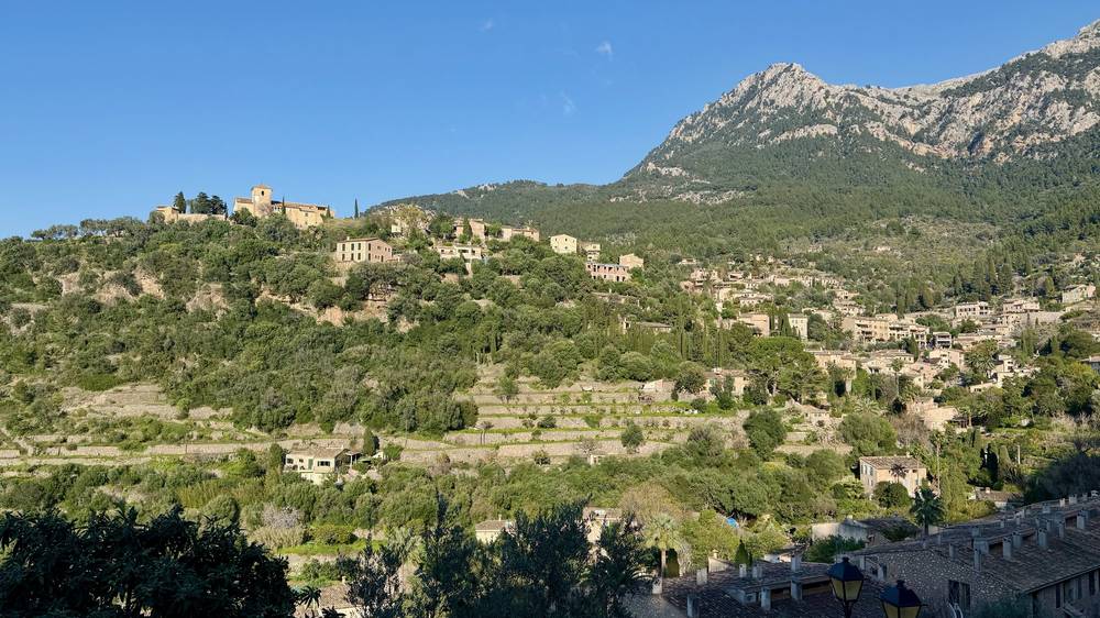
Esporles has TIB bus 202 to Palma. Valldemossa and Deià are both on bus 203. Once you're on the ridge after Valldemossa, the way off is to keep going to Deià or go back.
Behind the scenes, Day 3 · The film, Day 3
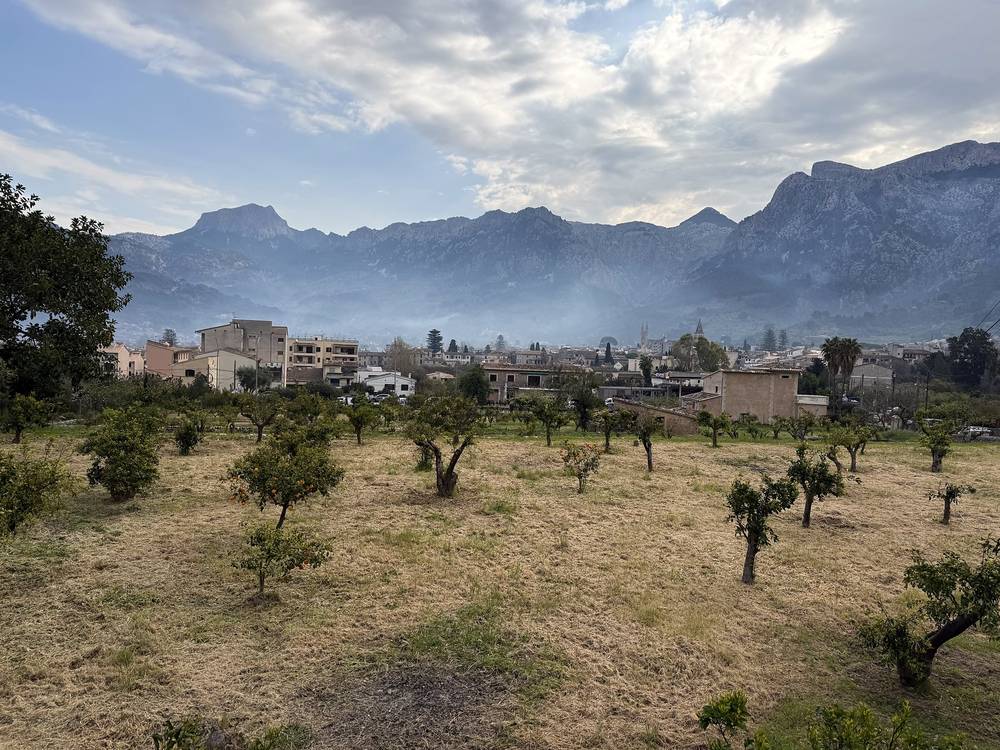
I was happy to be walking again, and I felt like I had everything I needed to finish. I still needed two more days of over 20 miles each. It was overcast, the cloudiest I'd seen it.
It was an easy morning over to Sóller. My plan there was to eat and drink as much as I could and fill up on water before heading up into the mountains. I was finishing the last of my energy gels and listening to the Frieren soundtrack. A little friend got some of my bread and then wouldn't leave me alone, so I named him Baguette.
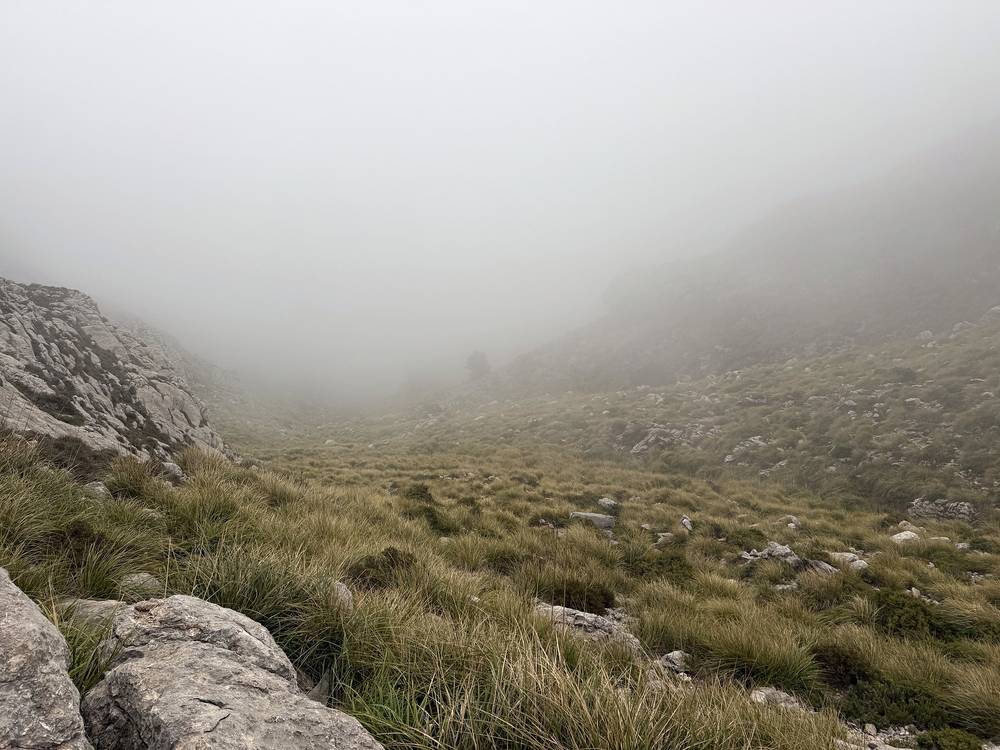
Up high it was cold and windy for the first time. The clouds looked nasty. There were a lot of people up there because of a parking lot. The next part was the highest of the trip, and I didn't want to be up there if it rained, so I decided to push on and get over the high point that evening. There was no visibility over the pass. That night I had rice with seasoning and the last of my food from Japan.
This is the hardest day, with the most climbing and the highest ground. It's also the day most worth splitting in two.
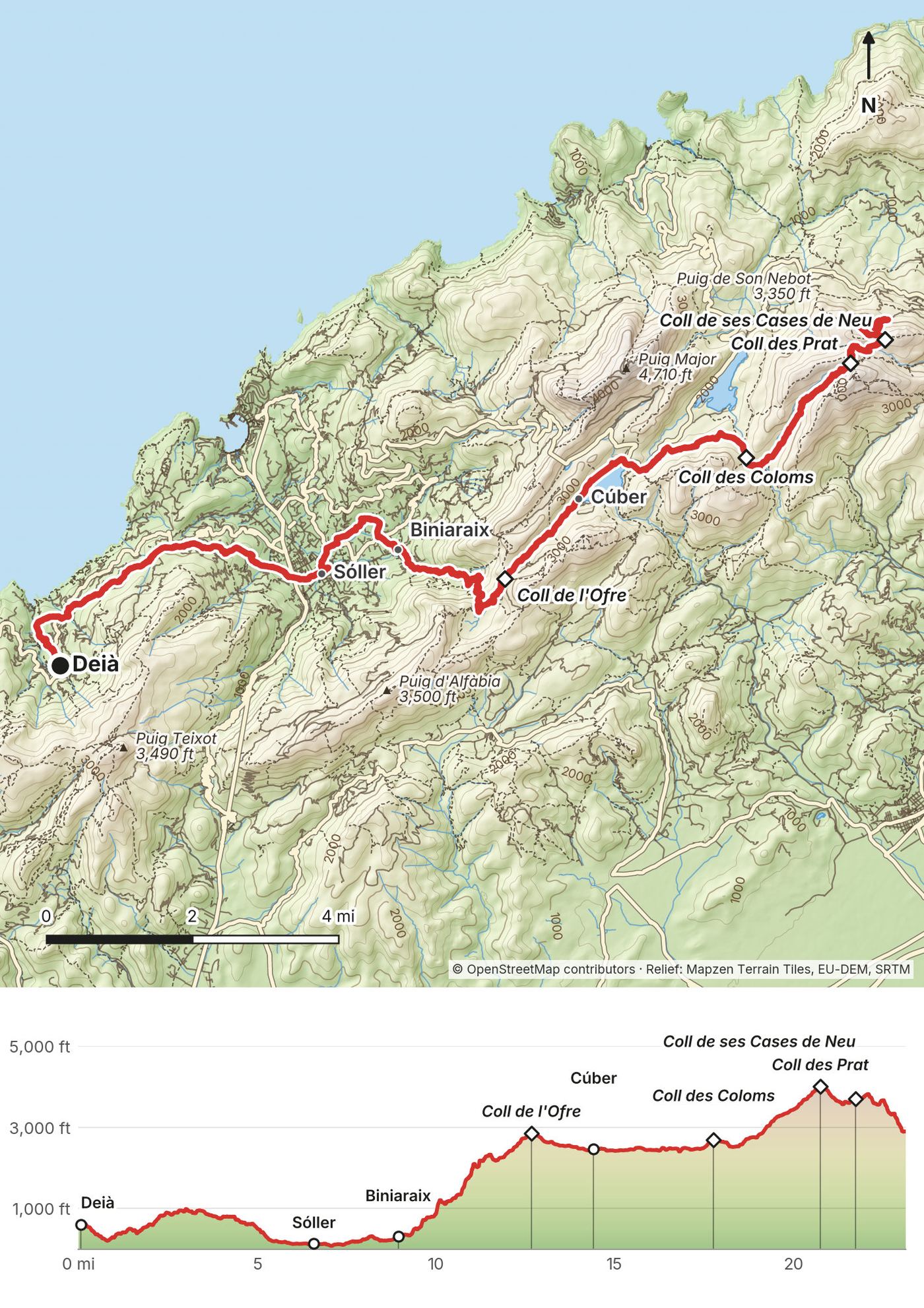
From Deià the path to Sóller is easy, through olive groves. You reach Sóller at 6.6 miles (10.6 km). This is the last real town until Lluc, about 19 miles (30 km) later on my line. Eat, fill every bottle and buy food here.
From Sóller the route passes Biniaraix at 8.9 miles (14.4 km) and climbs the Barranc de Biniaraix, a stone-stepped gorge, to Coll de l'Ofre at 12.7 miles (20.4 km), at about 2,890 ft (881 m on my GPS). Then it drops to the Cúber reservoir at 14.4 miles (23.2 km), which has a road and a parking lot, and follows the water past Font des Noguer.
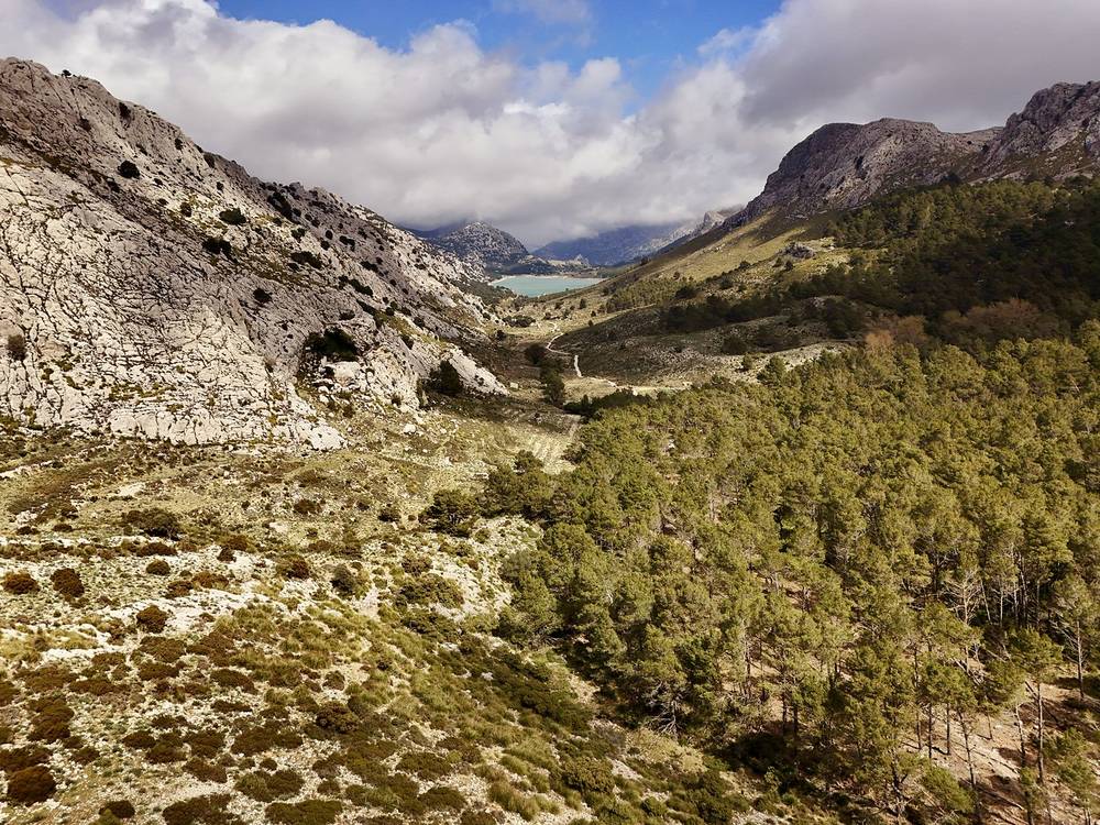
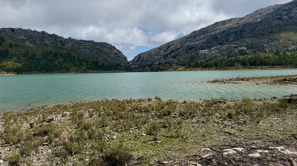
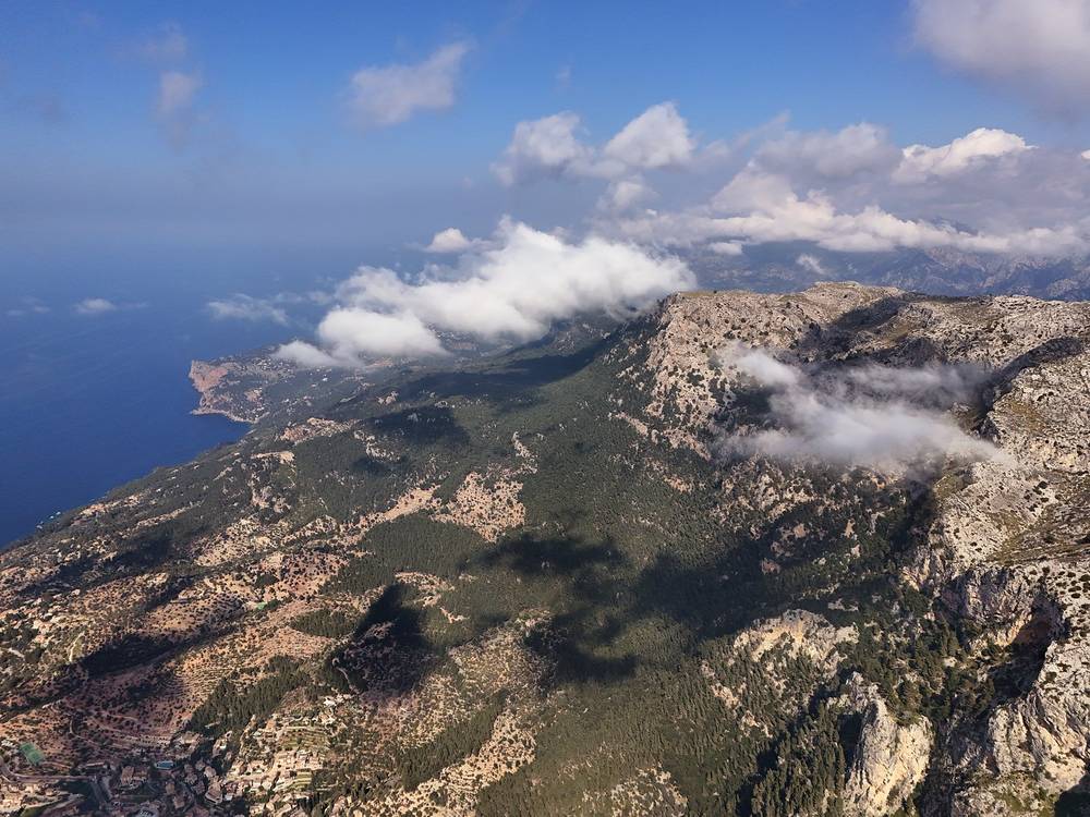
After Cúber, the official route goes down to the Tossals Verds refuge. I didn't. I took the high route via Coll des Coloms at 17.8 miles (28.6 km) and up to Coll des Prat, at about 3,950 ft (1,205 m on the map), at 20.8 miles (33.4 km). Just past it is the high point of my whole trip, 4,039 ft (1,231 m) on my GPS. The trail then crosses Coll de ses Cases de Neu at 21.7 miles (35.0 km), which the Consell de Mallorca names as the highest point on the GR221, and joins the official stage 7 toward Lluc. It's open, rocky mountain ground. In wind, rain or fog it's no place to be.
The official stage 6 (Muleta to Tossals Verds) is 27.8 km (17.2 miles), graded difficult, 9 hours 5 minutes. Stage 7 (Tossals Verds to Son Amer, over Coll de ses Cases de Neu) is 15.1 km (9.4 miles), graded average, 5 hours 35 minutes.
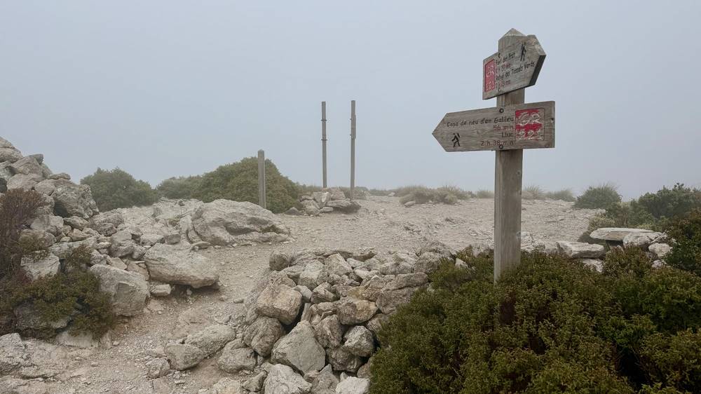
Sóller has TIB bus 204 to Palma all year, and from late March to October bus 231 toward Lluc and Pollença. Cúber is on the Ma-10 road, and from late March to October bus 231 stops there. After Cúber there's no road until Lluc: your choices are to go back to Cúber or drop to the Tossals Verds refuge. Decide at Cúber, and don't start the climb to Coll des Prat in bad weather.
Behind the scenes, Day 4 · The film, Day 4
It was the last day, and I was excited. It's not an easy day, though: long and full, with a road walk at the end. Early on I came up on a campsite near Lluc, where I wanted to use the bathrooms and fill water. The weather was much better than the day before.
The flat part at the end felt good. I was looking forward to breakfast, and I wanted eggs. It had been really big days, almost a marathon each day. I saw a lot more hikers and people than on any other day, and the cyclists were everywhere. I think every single European was out cycling in Mallorca.
In Pollença there are giant stairs up to a chapel. I stopped for a bit of lunch and then hopped on the bus to the port, because there's no reason to walk alongside a major highway for four, five, six miles. I think I made the right decision ending here. I think this is where everyone should end the hike, honestly.
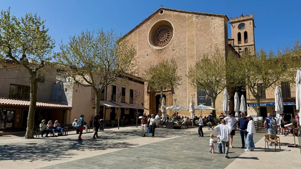
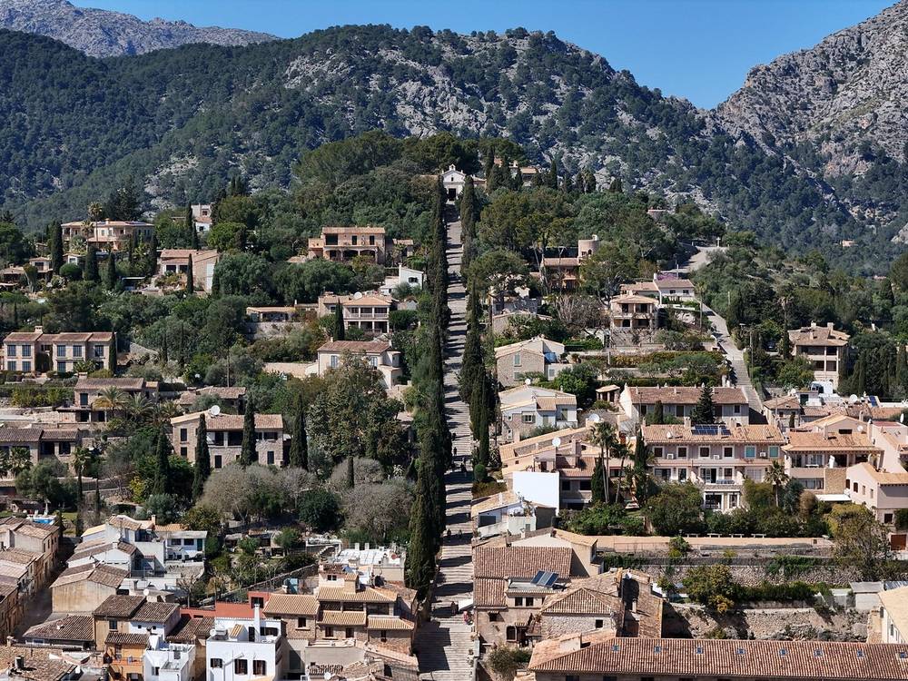
Day 5 starts on the descent toward Lluc. The trail drops to the Sa Font Coberta camping area and Lluc at about 2.4 miles (3.8 km), then passes the Son Amer refuge at 3.0 miles (4.9 km). From there it's the old path to Pollença, over Coll Pelat at 4.5 miles (7.2 km) and through holm oak forest, then a long descent out of the mountains. It comes into Pollença by the Pont Romà refuge at 13.9 miles (22.4 km), and my file ends in town at 14.5 miles (23.3 km).
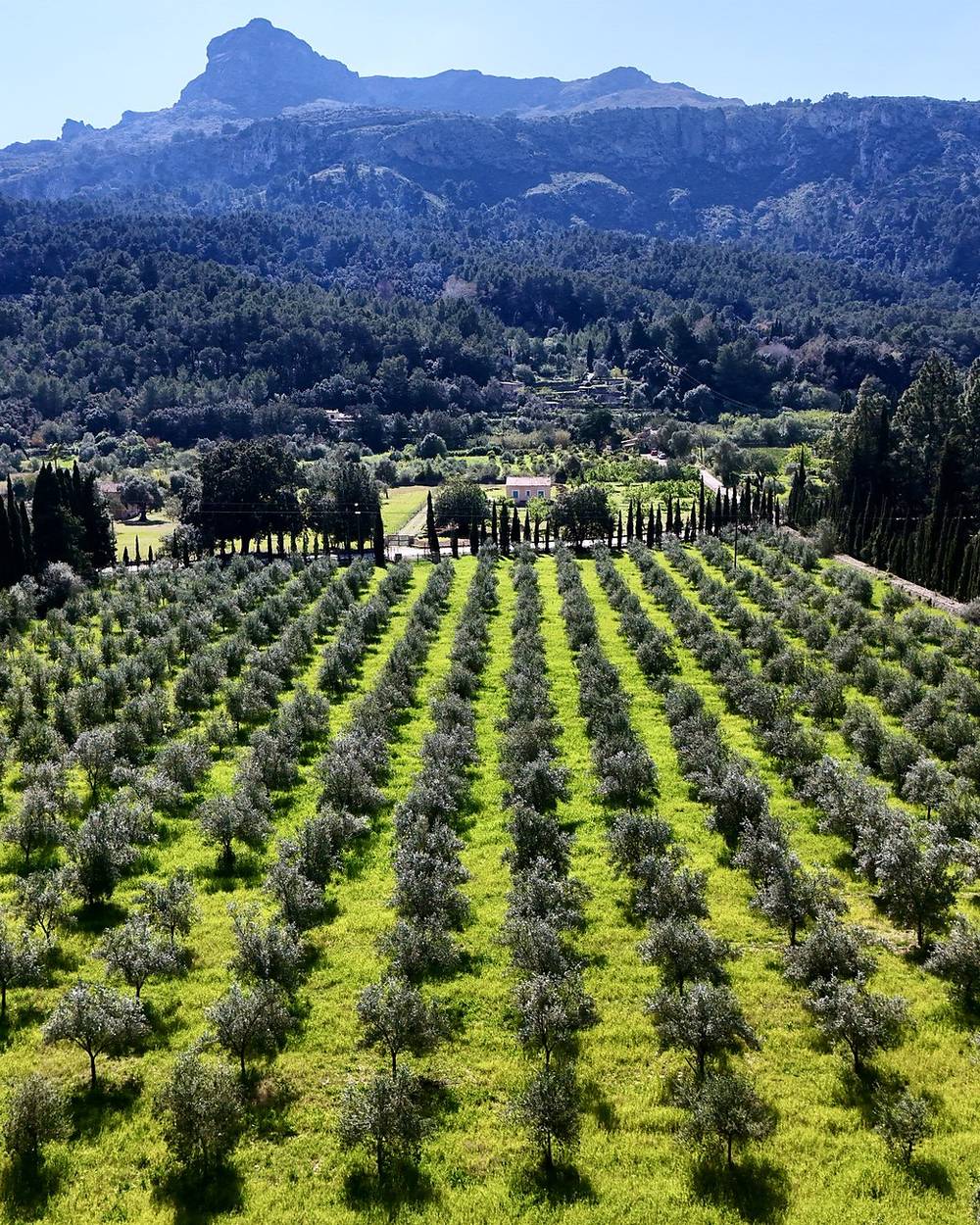
Lluc has the monastery and a bus stop. After Lluc there are no towns until Pollença. Pollença has everything: shops, cafes, hotels and buses.
The official stage 8, Son Amer to Pont Romà, is 17.5 km (10.8 miles), graded average, 4 hours 45 minutes, and mostly downhill. Stage 9 continues 6.7 km (4.2 miles) across the flat plain to Port de Pollença. I took the bus for that part.
Lluc has TIB bus 312 to Inca all year, and from late March to October bus 231 toward Sóller and toward Pollença. In Pollença, bus 301 runs to Port de Pollença and to Palma.
Behind the scenes, Day 5 · The film, Day 5
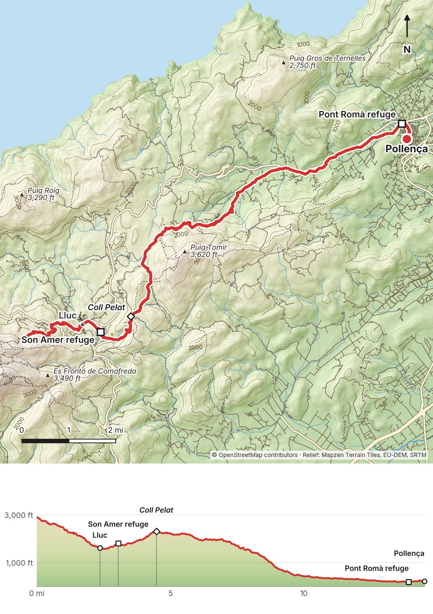
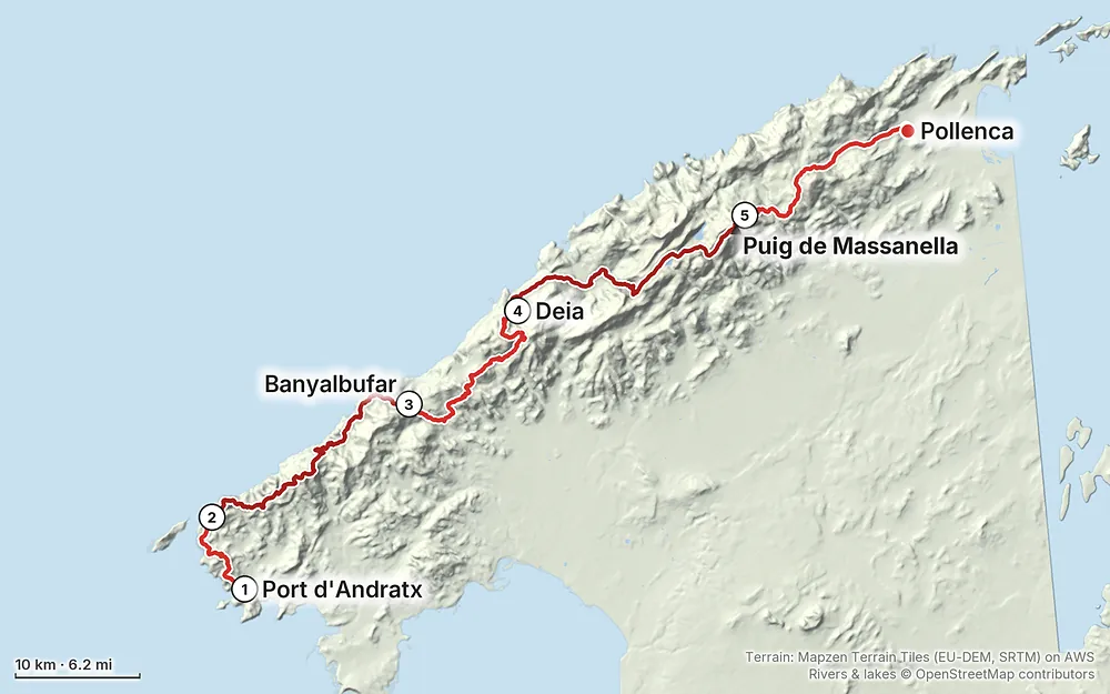
Elevation7–4,029 ft88.1 mi
Terrain: Mapzen Terrain Tiles (EU-DEM, SRTM) on AWS · Rivers & lakes © OpenStreetMap contributors
Tap a map to open it full size.
Not to walk the signposted route. Refuge beds need a booking, and camping, fires and drones need authorization (below).
From the hike's facts; check the official page before you go.
My March. I hiked March 20 to 24, 2026. It was early in the hiking season and none of the huts were open yet. The temperatures were perfect. I needed my puff jacket and gloves on the cold mornings, and shorts and a sun hoodie the rest of the day. Day 3 was a lot clearer than Day 2, with not a cloud in the sky, and much hotter in the direct sun. I was sweating off my sunscreen on the climbs. Day 4 was the cloudiest I'd seen it. It was cold and windy up high for the first time, and there was no visibility over the pass. On Day 5 the weather was much better again.
I like early spring island hikes. Before this one I'd done the Canary Islands, the Azores and Madeira.
Crowds. In March the trail was quiet. On Day 4 there were a lot of people up high near a parking lot, and on the last day I saw more hikers than on any other day. Cyclists were everywhere on the paved roads.
Other months. I've only hiked it in March. Spring and autumn are the usual walking seasons. Summer is hot on the open ridges, water is harder to find, and fire rules are strict. In winter the days are short, the refuge doors close at 22:00 (November to March), and cold, wind and fog on the high ground are more likely.
Fire season. In the Balearic Islands the high forest-fire risk period runs from May 1 to October 15. In 2026 that meant no fire within 50 m of forest land or in recreation areas. The rest of the year, the Balearic government says making fire on forest land needs authorization. Cook in towns, at refuges or at official camping areas, and ask before using a stove anywhere else.
Refuges. When I went in March, the huts weren't open yet. In September 2026 the Consell's refuge pages list beds every day with prior booking. Look at the booking portal for your dates before you plan your nights around them.
This is the thing to plan on the GR221. The route is dry, with very little running water to filter, and fountains don't always work. On my trip:
Carry at least 2 liters and fill up in every town, even if you're not empty. Camping means extra water for cooking, tea and breakfast. Treat water from springs and troughs.
Look at the forecast every evening. AEMET, Spain's weather service, has forecasts and warnings for Mallorca, including the mountains. The high ground on Day 4 is the most exposed part of the route. I pushed over Coll des Prat in wind and no visibility. If you're there in bad weather, stop at Cúber or go down to Tossals Verds instead. On clear days, sun and heat are the problem. I sweated off my sunscreen on the climbs on Day 3.
I hiked the whole thing alone. It was quiet: only a handful of other hikers were doing the full traverse. I felt a bit lonely on the first night and missed my family. Talking to the camera gave me someone to talk to. Leave your itinerary with someone at home, check in when you have signal, and carry an offline map and a charged power bank.
How many days do I need? I did it in five: a short first afternoon and then four full days, some of them close to a marathon each. I had an extra buffer day in my plan and used it at the end for an e-bike ride. The official route is 9 stages between refuges and towns, and splitting my hardest day makes my plan six days. Both are in Other ways to do it.
When should I go? I went March 20 to 24. It was early in the season, and none of the huts were open yet. The weather was perfect for me: cold mornings, shorts in the day, and one cold, windy, foggy afternoon on the high pass. Open fires are banned on forest land from May 1 to October 15. See When to go.
Where do you sleep? The Consell de Mallorca runs a chain of hiker refuges along the route: Can Boi in Deià, Muleta near Port de Sóller, Tossals Verds, Son Amer above Lluc and Pont Romà in Pollença. A dorm bed was €14 (2026 price). The towns on the route have hotels. I slept in my tent three nights and in a hotel in Deià one night. See Where to sleep.
Do I need a permit? Not to walk the signposted route. Refuge beds need a booking, and camping, fires and drones need authorization (below).
Can I camp? Not freely. In the Serra de Tramuntana, camping and bivouacking on forest land need authorization all year, and almost 95% of the protected area is private land. There are official camping areas near Lluc that you reserve. I don't mark my tent spots in this guide, the maps or the GPX files. Plan your nights around refuges, hotels and official campsites.
Am I fit enough? This is not a casual hike the way I did it. My three long days took me about 10 to 11 hours each (9 hours 46 minutes to 11 hours 14 minutes), with stops and filming. Day 2 and Day 4 were the hardest: 23 miles each, with 4,732 ft and 6,151 ft of climbing. Before you commit to my plan, walk 20 miles with your pack two days in a row at home. If that's too much, walk the official stages. They run from 4.2 to 17.2 miles.
Is there water? Not much on the trail. I'd heard the Dry Stone Route is dry, and it is. There's very little running water to filter, so I got most of my water in towns and carried an extra 1-liter bottle for the long stretches. I still ran out on Day 2 and got a headache. Fill up in every town. See Water, weather and safety.
Is it easy to follow? Mostly, yes. The trail is very well marked, with little markers and signs at every junction. I thought you could almost follow it without a phone or a map. There are still sections where it can be unclear, so carry the GPX files and an offline map anyway.
What will it cost? My hotel in Deià was about $150 and my hotel in Palma at the end about $115. The rest was buses, food and flights. A refuge night in 2026 cost €14 for a bed, plus €9.50 for dinner and €5.50 for breakfast. See What I paid.
Is it OK to go solo? I hiked it alone. It was quiet: only a handful of other hikers were doing the full traverse. I talked to a group of German hikers on Day 3, and I saw more hikers on the last day. Leave your plan with someone at home, and read Water, weather and safety.
Can I fly a drone? Only with authorization. Drone flights in the Serra de Tramuntana protected area need authorization from the park, and crossing private land needs the owner's permission too.
I only have 2 or 3 days. Where should I go? Start in Sóller. If you have less time, the middle and northern sections give you the most for your time. See Other ways to do it.
Is there phone signal? Can I charge? I had signal in the towns: I FaceTimed my family from town stops on Days 2 and 3. Don't count on it in the mountains between towns. You can charge in hotels and refuges. By the end of Day 3 my power bank was dead and my camera batteries were running out, which is part of why I took the hotel in Deià. Bring a European plug adapter. I could have sworn I'd packed one and couldn't find it, and the guy at the hotel gave me two.
I walked the 5-day plan. I didn't walk any of these, so treat them as plans, not trip reports. The numbers for the official stages come from the Consell de Mallorca.
This is the route the refuge network is built around. Stages 1 to 3 end in towns without a bookable refuge, so plan hotels for those nights.
| Stage | Route | Miles (km) | Up / down (m) | Walking time | Sleep |
|---|---|---|---|---|---|
| 1 | Port d'Andratx to Sant Elm | 5.7 (9.2) | 372 / 372 | 3 h 20 | Hotel |
| 2 | Sant Elm to Estellencs | 15.4 (24.7) | 1,010 / 912 | 8 h 40 | Hotel |
| 3 | Estellencs to Esporles | 8.9 (14.4) | 670 / 629 | 4 h 50 | Hotel |
| 4 | Esporles to Can Boi (Deià) | 14.4 (23.2) | 1,325 / 1,387 | 8 h 10 | Can Boi |
| 5 | Can Boi to Muleta | 6.2 (9.9) | 362 / 385 | 3 h 06 | Muleta |
| 6 | Muleta to Tossals Verds | 17.2 (27.8) | 1,111 / 696 | 9 h 05 | Tossals Verds |
| 7 | Tossals Verds to Son Amer | 9.4 (15.1) | 869 / 848 | 5 h 35 | Son Amer |
| 8 | Son Amer to Pont Romà (Pollença) | 10.8 (17.5) | 189 / 677 | 4 h 45 | Pont Romà |
| 9 | Pont Romà to Port de Pollença | 4.2 (6.7) | 2 / 54 | 1 h 25 | Home |
The official times are walking times without breaks. The Consell says stage 6 is easier and faster in the other direction, because of the climb from Sóller at 100 ft (30 m) to Coll de l'Ofre at about 2,950 ft (900 m). Stage 4 has a short section through a housing estate that's passable but not signposted.
My old write-up says Day 4 is the day most worth breaking into two. Walk from Deià through Sóller and over Coll de l'Ofre to Cúber, then down to the Tossals Verds refuge for the night. The next day, climb over the high ground to Son Amer (official stage 7) and continue to Pollença, or stop at Son Amer. That turns my five days into six, with every night from Deià onward in a refuge.
If you have less time, start in Sóller. The middle and northern sections give you the most for your time.
Sóller is on TIB bus 204 from Palma. From Pollença, bus 301 goes back to Palma.
These change every year. Everything else in this guide stays the same.
Where you'll sleep
Buses
Prices
Weather and conditions
Your stuff
Planning questions about GR221, the Dry Stone Route, answered only from this page's facts, the creators' versions and hikers' public tracks, with where each answer comes from. When the data doesn't say, the answer says "not given".
From hikers
Sign in to comment. Free; your hikes stay private unless you share them.
Something wrong or missing on this page? Send feedback.