
Content made there
The film is at the top of this page.
Photos
Hikes / Goat Rocks / Kraig Adams's version
North America · United States
Aug 2020 · 3 days · 40 miles · Solo · Tent

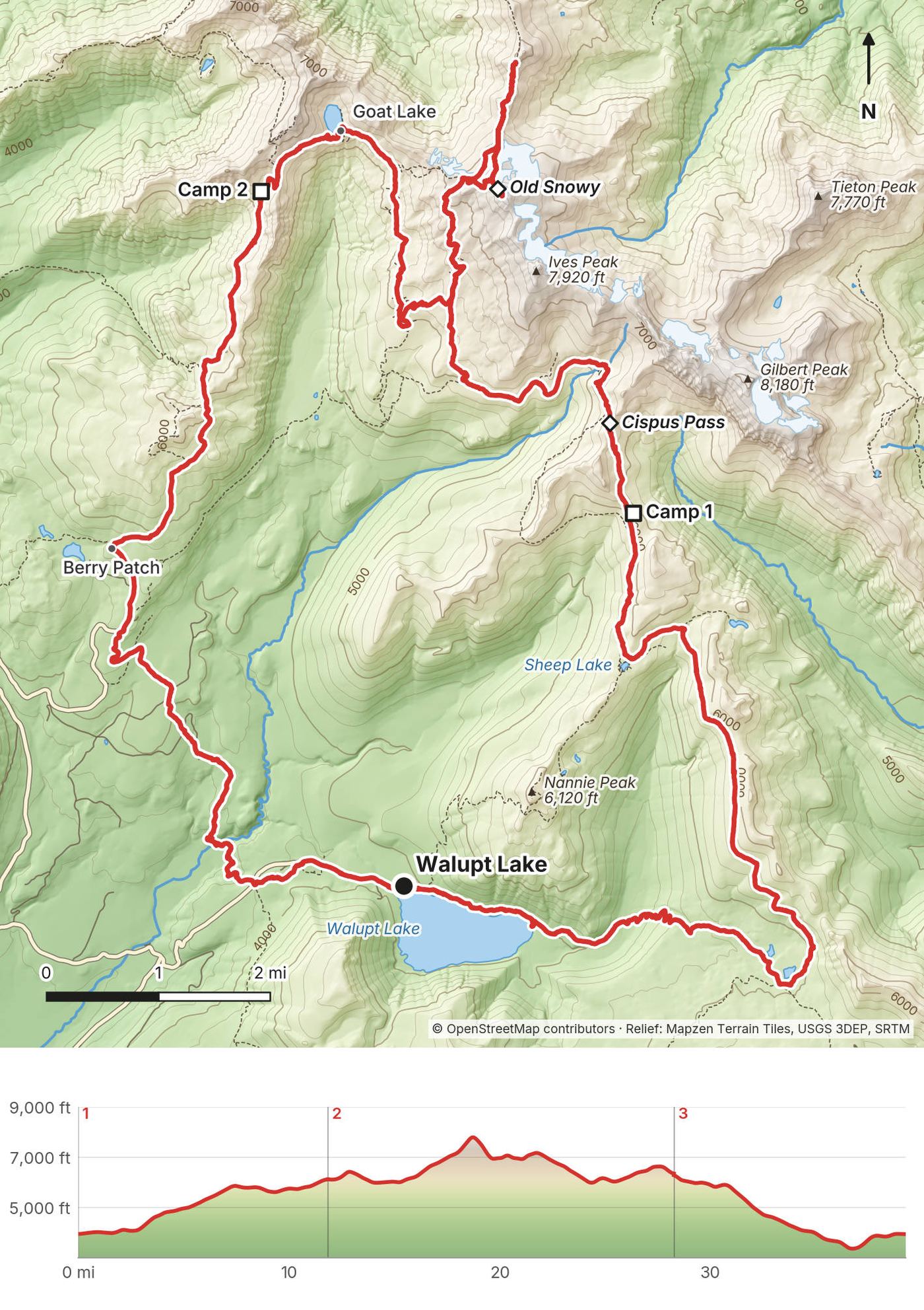
In August 2020 I spent three days backpacking a 40-mile loop alone in the Goat Rocks Wilderness in Washington: from Walupt Lake up to the Pacific Crest Trail, over Cispus Pass, to the top of Old Snowy Mountain, out along the Knife's Edge, down to Goat Lake, and back over Goat Ridge. It's the trip from my film Hiking 40 miles on the Goat Rocks Loop in Washington.
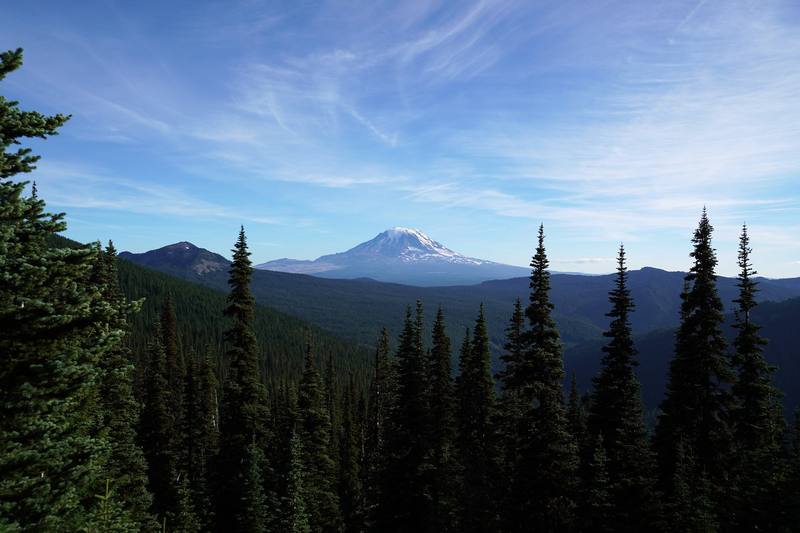
I was recommended this trail because it's got amazing views of three volcanoes, Adams, Saint Helens and Rainier, and it's partly on the PCT. There were a lot of people out there, for a good reason: it's beautiful. The wildflowers, the volcanoes, the alpine views once you get up out of the woods.
| Quick facts | |
|---|---|
| Distance | 39.3 miles (63.2 km) over 3 days, a loop |
| Climbing | about 7,490 ft (2,280 m) up and 7,420 ft (2,260 m) down |
| Days | 3 days, 2 nights in my tent, alone, carrying all my food. I started at 3 p.m. on Day 1 |
| Start and finish | Walupt Lake trailhead, 3,930 ft (1,199 m), an hour's drive from Packwood |
| High point | Old Snowy Mountain, 7,897 ft (2,407 m) on my GPS, Day 2 |
| When | Late July to September, when the snow is mostly gone. I walked August 7 to 9, 2020 |
| Difficulty | Good trails, one steep scramble to the top of Old Snowy, a narrow ridge on the Knife's Edge, and snowfields that can last into August |
| Permit | Free, filled out at the trailhead (2026). Parking needs a Northwest Forest Pass or a day pass |
| Day | Route | Miles (km) | Up / down (ft) | Sleep |
|---|---|---|---|---|
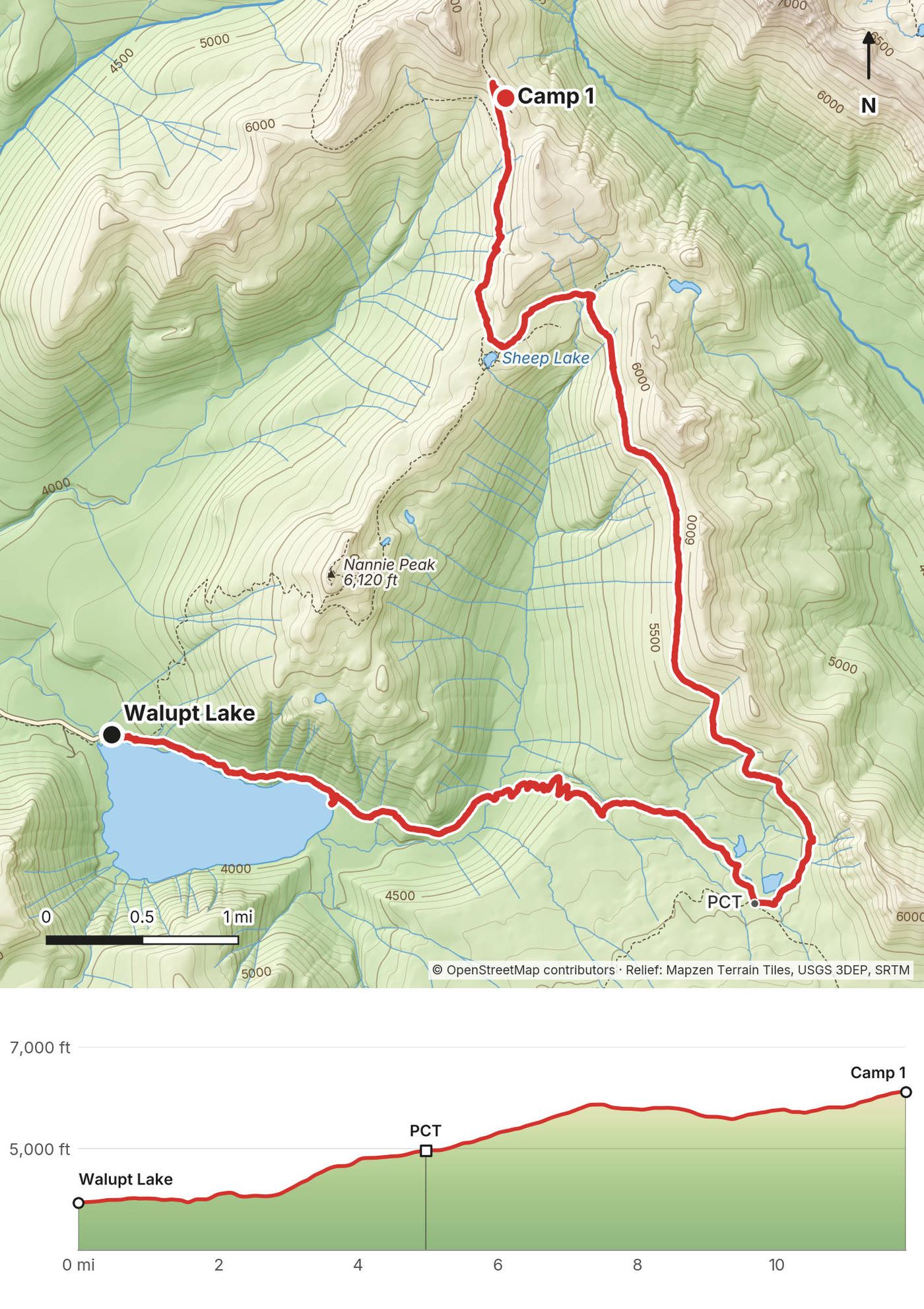
| 1 | Walupt Lake up to the PCT and north to below Cispus Pass | 11.9 (19.1) | 2,664 / 477 | My tent near the PCT, 6,120 ft |
| 2 | Cispus Pass, Old Snowy and the Knife's Edge to Goat Lake | 16.4 (26.4) | 3,967 / 3,736 | My tent on Goat Ridge, 6,320 ft |
| 3 | Goat Ridge to Berry Patch and back to Walupt Lake | 11.0 (17.7) | 855 / 3,207 | Home |
The numbers are from my own GPS, smoothed the same way every day. The film says 40 miles; my GPS says 39.3.
Packwood. I drove out to Packwood, Washington, the last big town. It's a small touristy town, busy because it's in the foothills of Mount Rainier National Park, with good coffee, restaurants, lodges and any supplies you might need for the hike. It's the last stop before the wilderness.
To Walupt Lake. From Packwood it was a really long ride, about an hour, on a dirt road through the woods. Forest Road 21 leaves US 12 about 2.7 miles west of Packwood and runs south, mostly gravel and often washboarded. From US 12 it's about 17 miles south on Forest Road 21 to a three-way junction, then left on Forest Road 2160, a paved road, for 4 to 5 miles to Walupt Lake Campground, where the trailhead is (Washington Trails Association; the Forest Service's two pages give 4.7 and 5.4 miles for that last part). In 2026 the road was graded in May and washboarded again by September, fine for ordinary cars. Don't follow phone maps onto Forest Road 2140, a dead end, according to a September 2026 trip report.
Walupt Lake Campground. Reserve it on recreation.gov: $25 a single site in 2026. It's open about mid-May to mid-September (the Forest Service's pages give different dates, so check), has no drinking water, and has a small lot that fills quickly. When I arrived in 2020 it was full, so there was zero chance of me sleeping there, and I started hiking that afternoon.
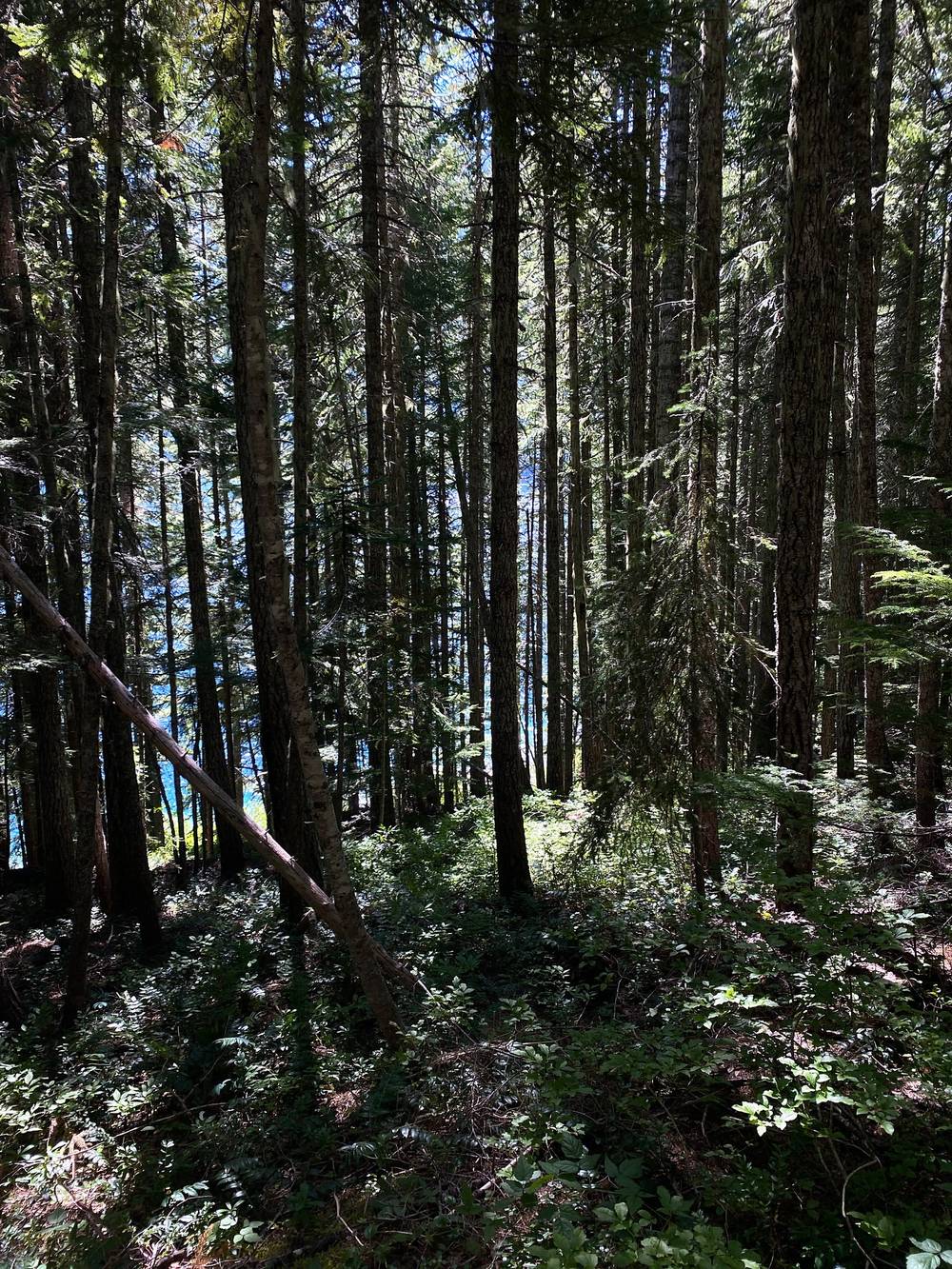
Starting late. I headed out around 3 p.m. I'm actually starting to really like starting a hike in the afternoon, especially in low, dense forest, when there's direct sunlight coming in. It doesn't have to be the crack of dawn.
| Item | What I paid in 2020 |
|---|---|
| Wilderness permit | Free |
| Parking | Covered by my annual Northwest Forest Pass, $30, bought that week for the Enchantments |
| Campground | Nothing: it was full and I started hiking |
| Food | Bought before the trip; not in my records |
| Car rental, gas, flights | Not in my records |
For your budget (2026). Northwest Forest Pass $30 a year or $5 a day, or an Interagency pass. Walupt Lake Campground $25 a night if you want a site before or after. The permit is free.
| Night | Where | Height (my GPS) |
|---|---|---|
| Before Day 1 | Walupt Lake Campground was full | |
| 1 | My tent near the PCT, about a mile short of Cispus Pass (Day 1 mile 11.8) | 6,120 ft (1,866 m) |
| 2 | My tent on the Goat Ridge Trail, about a mile southwest of Goat Lake (Day 2 mile 16.4) | about 6,320 ft (1,925 m) |
Both are high and open. My second night was so windy my tent folded over on top of me. Pick a sheltered spot, stake everything down, and pitch with the narrow end into the wind.
I knew this would only be 40 miles, two nights, three days at the most, so I didn't pack too much, especially food. I ate everything on this hike and came off the trail with nothing, so it was the perfect amount:
There's nothing to buy on the trail. Buy what you need in Packwood.
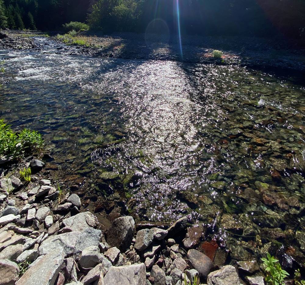
There was more than enough water flowing throughout this entire hike, so I only brought my one-liter BeFree filter water bottle. That was early August. Later in the season small creeks dry up: an August 2026 trip report found many little creeks dry and no water at the camps near Snowgrass Flat, with Goat Creek and the creeks on the Lily Basin Trail still flowing. Carry more capacity than I did if you go late, and treat or filter everything. There's no drinking water at Walupt Lake Campground or the trailheads.
There's a vault toilet at the Walupt Lake trailhead. On the trail, bury waste 6 to 8 inches deep, at least 200 feet from water, camps and trails, and pack out your toilet paper.
Paid links: I earn a commission if you buy through these links, at no extra cost to you. As an Amazon Associate I earn from qualifying purchases.
Everything I brought in 2020, hiking and filmmaking, was in the gear list in my film's original description. Here's what I carried, what I'd take now, and what I filmed with.
From my film's gear list.
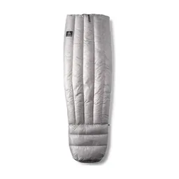 Sleeping bag: UGQ Bandit quilt. Similar: Hyperlite Mountain Gear 20° Quilt (Hyperlite).
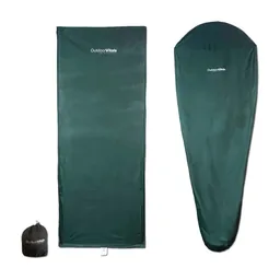 Liner: Outdoor Vitals Sleeping Bag Liner (Amazon)
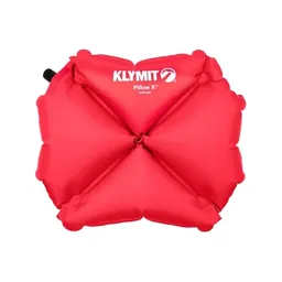 Pillow: Klymit Pillow X (Amazon)
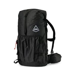 Pack: Hyperlite Mountain Gear Southwest 2400 (Hyperlite)
 Water: Katadyn BeFree AC · 1L (Amazon). The one-liter filter bottle.
 Sunglasses: Warby Parker Barkley sunglasses. Similar: Goodr OG Sunglasses (Amazon).
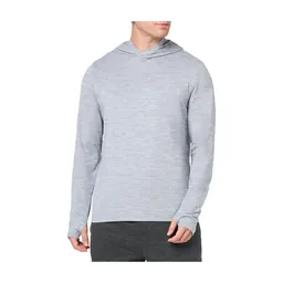 Shirt: Amazon Essentials Quick-Dry Tech Hoodie (Amazon)
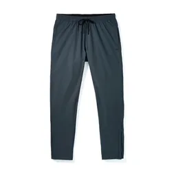 Pants: Patagonia Terrebonne Joggers. Similar: PATH Projects Killam PX Pant (PATH Projects).
 Shell: The North Face Dryzzle jacket. Similar: Arc’teryx Beta AR Jacket (Arc’teryx).
 Down jacket: Patagonia Nano Puff Jacket. Similar: Arc’teryx Cerium Hoody (Arc’teryx).
What I'd add for this loop from my current kit.
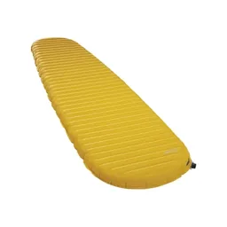 Sleeping pad: Therm-a-Rest NeoAir XLite NXT (Amazon)Rain shell: Arc’teryx Beta AR Jacket (Arc’teryx). Storms with high wind, rain and snow can come in any month.
 Traction: Yatta Life Ice Spikes (Amazon). Snowfields often last into August. The Forest Service also recommends an ice axe on this section all summer, and the skills to use them.
 Poles: Black Diamond Alpine Carbon Z Poles (Amazon). For the snowfields and the loose slopes.
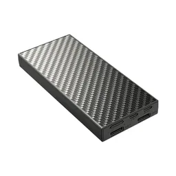 Power bank: Nitecore NB20000 (Amazon)
What I filmed this trip with in 2020. My setup is much smaller now (below). No drones in the wilderness: see Permits and rules.
 Mic: Rode VideoMic NTG (Amazon)
Since September 2026 I film with a smaller setup: the Pocket 4 and the Mic 3 on the trail.
 Camera: DJI Osmo Pocket 4 (Amazon)
 Mic: DJI Mic 3 · 1 TX + 1 RX (Amazon). It pairs with the Pocket 4.
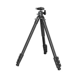 Tripod: SmallRig Carbon Fiber Tripod (Amazon)
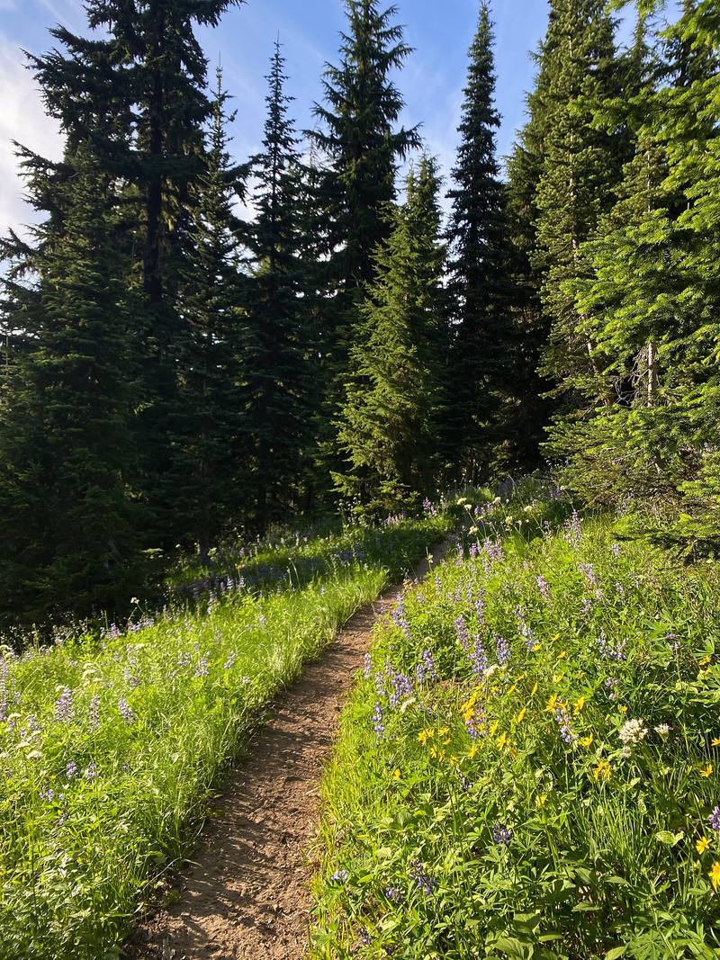
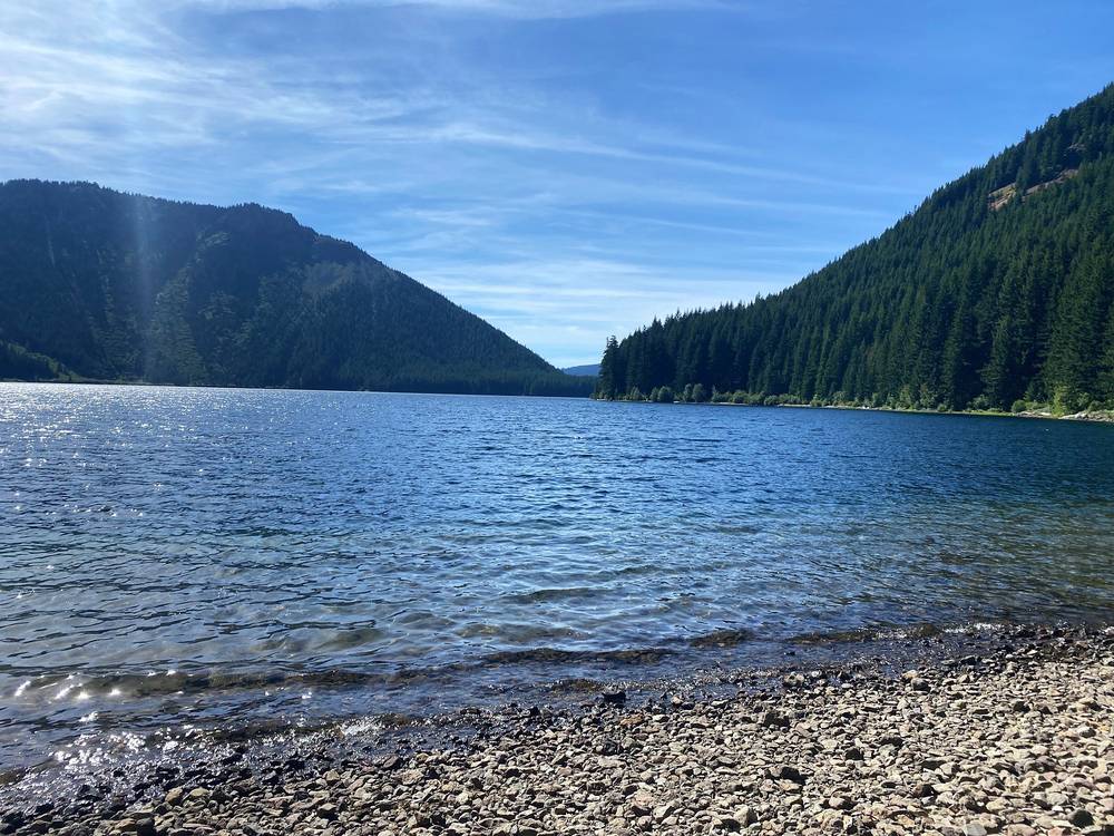
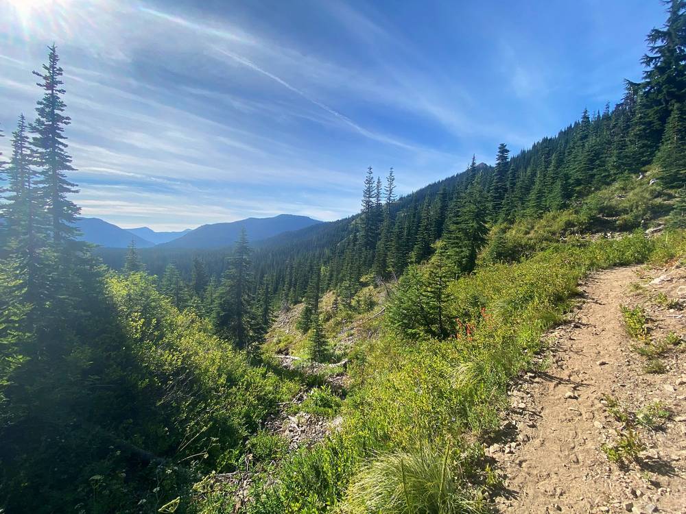
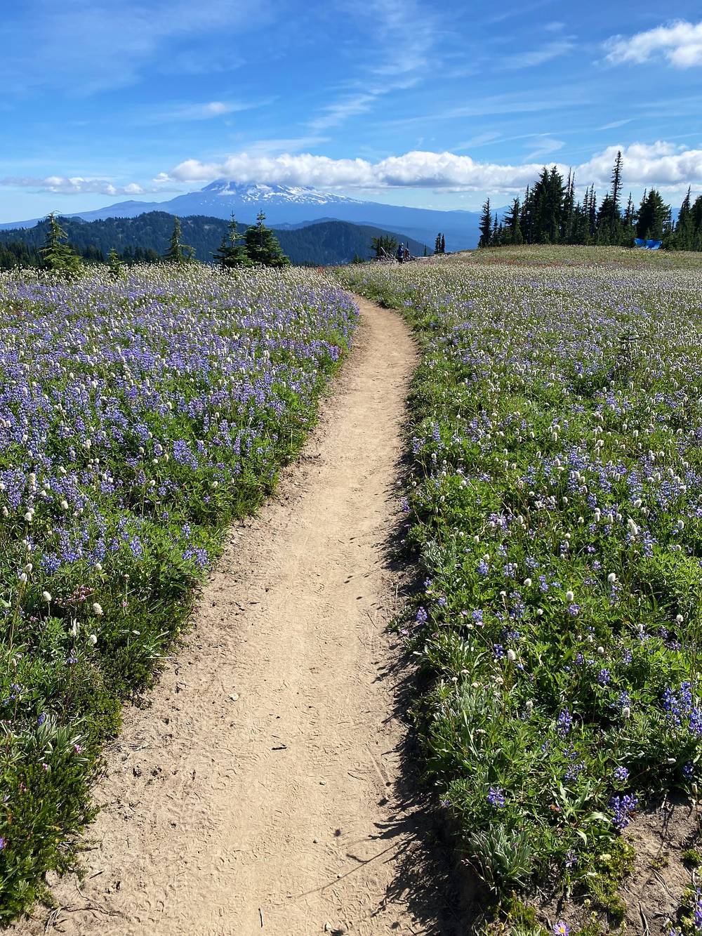
Starting this hike was in the forest. I set off around 3 p.m. along Walupt Lake, and eventually you come out and start to have views. The first time you see Mount Adams it's right there and beautiful. Every time you see a volcano it's just stunning: the slope up, the snow at the top, and it just stands out. It reminds me of Mount Fuji and Kilimanjaro. Volcanoes are awesome in general.
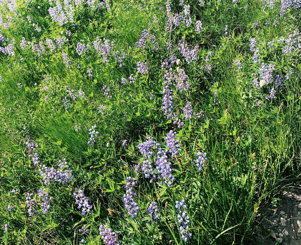
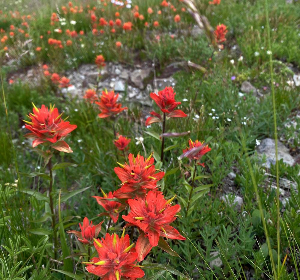
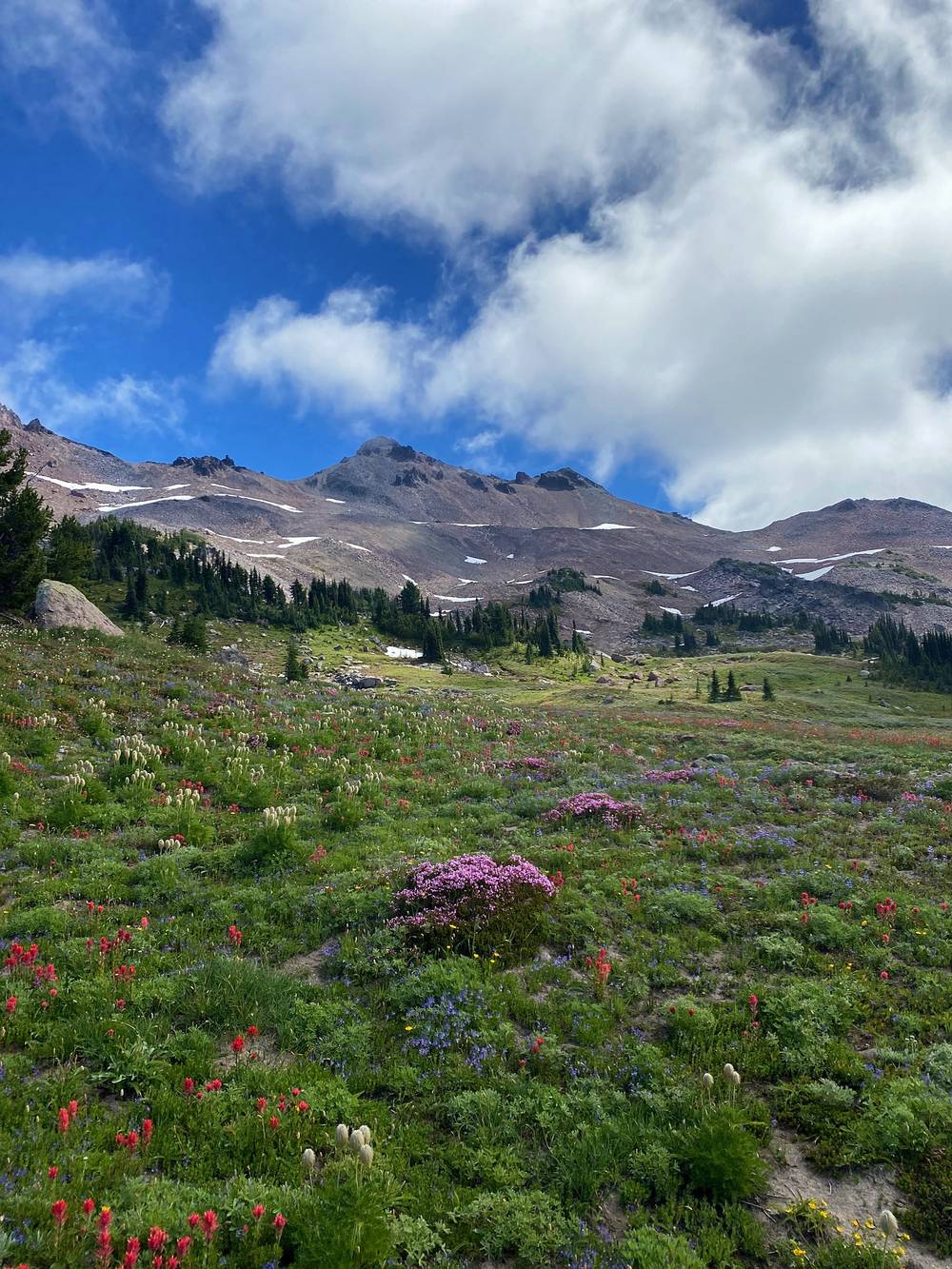
There were so many wildflowers, all different colors, especially on the grassy, sunny slopes on the side of the trail. I went about 12 miles with 3,000 feet of elevation gain in about four hours, for this late half a day. My GPS says 11.9 miles and 2,664 ft.
The Walupt Lake Trail #101 leaves the campground and runs along the north shore of Walupt Lake for about a mile and a half, mostly flat, then climbs gently up the valley east of the lake. After mile 3 it climbs harder through forest to the Pacific Crest Trail at mile 5.0 (4,960 ft), where the Gertrude Lake trail also meets it.
Turn left, north, on the PCT. Within half a mile you get your first view of Mount Adams. The PCT climbs north along the slopes, in and out of trees and meadows, past Sheep Lake at mile 10.1, then up into open country below Cispus Pass. I camped at mile 11.8, about a mile short of the pass, at 6,120 ft.
Camping. Camping is banned within 100 feet of the PCT and of any lake, including Sheep Lake. Pick a durable spot well off the trail.
Go back the way you came, down the Walupt Lake Trail to the trailhead.
Film, Day 1 · How I did it (behind the scenes)
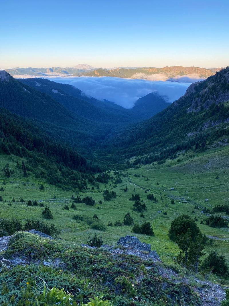
The next morning I definitely hit the snooze a couple of times, because every time I poked my head out I saw a blanket of fog and morning mist. I was in no rush, and I was shooting a video, so I wanted to start my day when the clouds and the mist were breaking, which happened around 9 a.m.
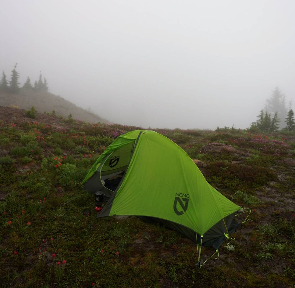
As the sun burns that off and you steadily climb and gain elevation, the views up there are just constant: 360 degrees of alpine rolling hills, some snow, some pine trees every so often. It's just amazing up there. There were a lot of people, and to all the subscribers who stopped to say hi: it's so nice to get to talk to someone and meet y'all in person on the trail. It's always funny when I'm up there by myself and then someone yells "Kraig" in the distance.
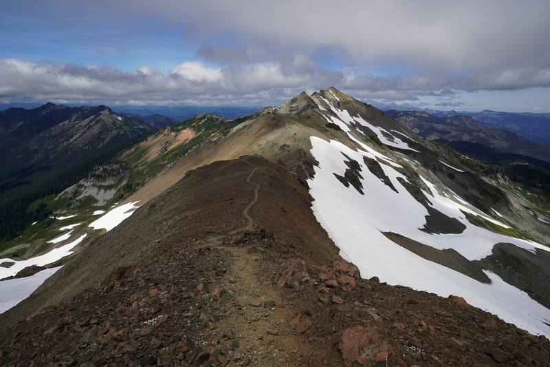
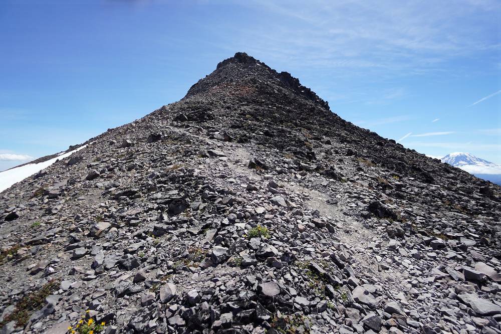
Eventually I made my way to the summit of the hike, Old Snowy Mountain. It was a very small top, but I made some friends and chatted with some people up there. Then I made my way down to the Knife's Edge, a very thin ridge where you just hike right along the top. I went out there, took my time, and eventually turned back and headed to Goat Lake.
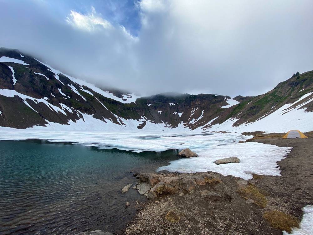
Goat Lake was packed: a lot of tents, a lot of dogs, a lot of people. It was also so windy, and the lake was frozen. That's always interesting to see in the dead of summer.
This was my main day of hiking, but I definitely took my time and didn't hike too much compared to other full days I've done: 17 miles with 4,000 feet of elevation gain, in about seven hours. My GPS says 16.4 miles, 3,967 ft, and about 7 hours moving out of 9.4.
That night the pass where I camped got super windy. It was the worst gusts I've ever felt in my tent, and I woke up at three o'clock to my tent completely folding over on top of me. I got up to make sure nothing would completely fail. I didn't want the thing to blow away, so I made sure the stakes were in. I'm super glad I had the rain fly that night. There were some extra straps I could have put on the poles to hold them together with the fly better, and I could have positioned my tent so it was splitting the wind instead of flat against it. I'm learning more about how windy it can get at night, and the right way to fight the wind with this tent.
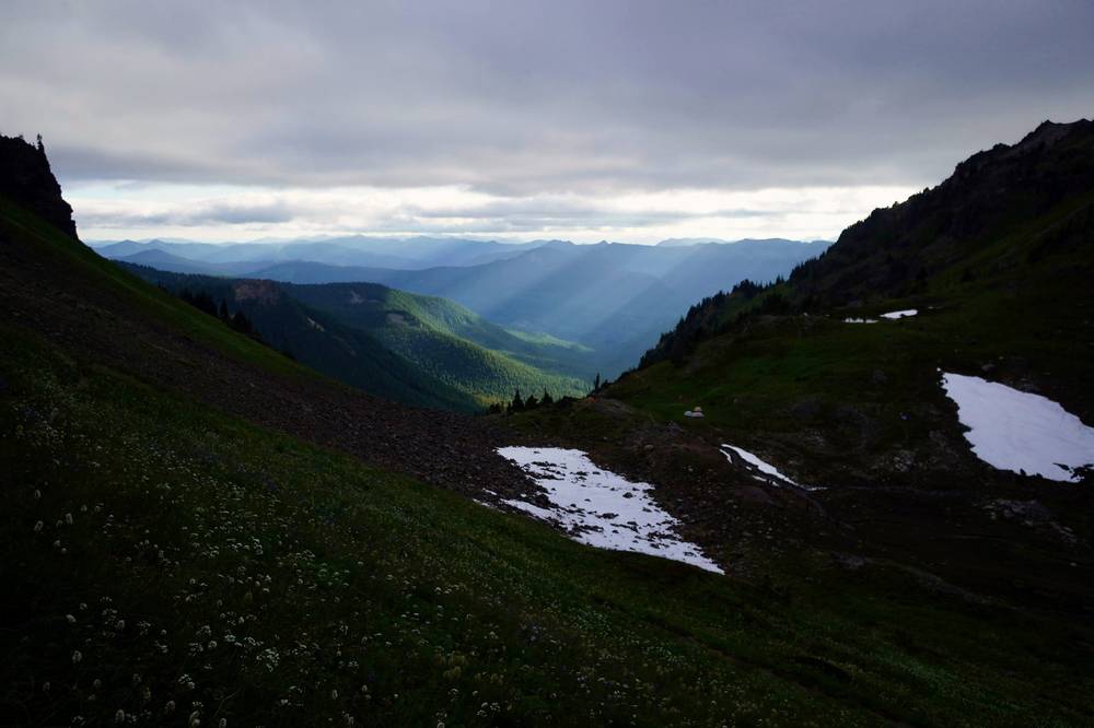
Cispus Pass to the Snowgrass Trail. From my camp the PCT climbs to Cispus Pass at mile 1.0 (about 6,460 ft), then traverses the open basins under the peaks, crossing streams and meadows, to the junction with the Snowgrass Trail #96 at mile 4.5 (about 6,420 ft).
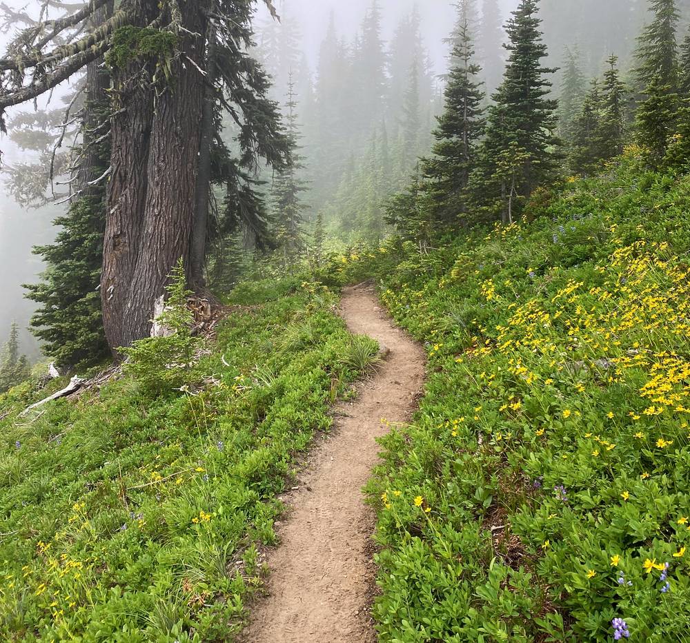
Up to Old Snowy. North of the junction the PCT climbs steadily. At mile 6.2 (about 7,180 ft) I took the Old Snowy Alternate, the hikers' route over the shoulder of Old Snowy, and the scramble path to the summit at mile 6.9: 7,897 ft (2,407 m) on my GPS. The PCT itself traverses lower, across the slopes of the Packwood Glacier. The top is loose rock, steep in places, and small.
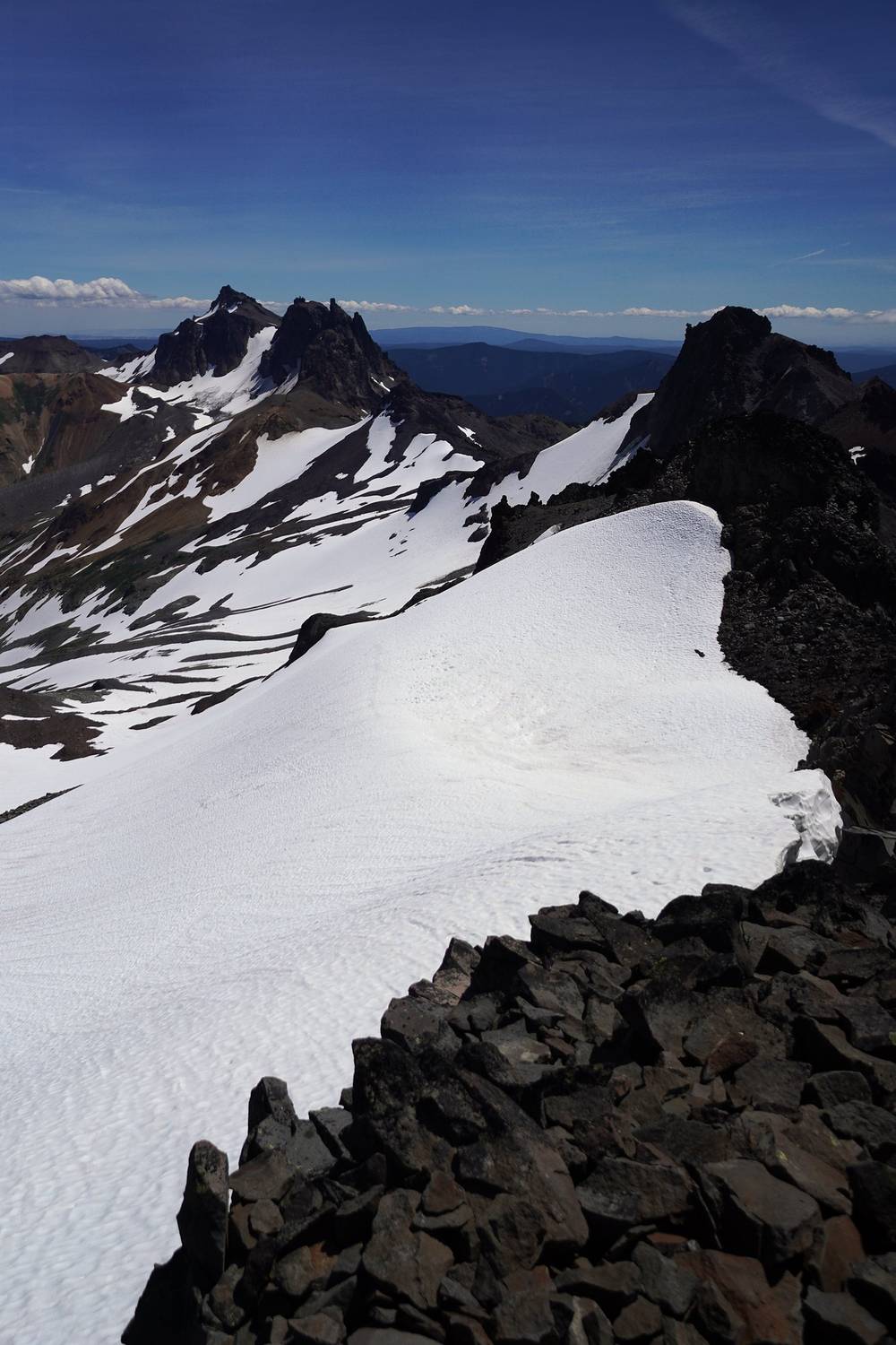
The Knife's Edge. From the summit I went down the north side to the PCT at mile 7.7 and followed it out along the Knife's Edge, the narrow ridge north toward Elk Pass, to mile 8.5, where I turned back (about 7,130 ft). That out-and-back is about 0.8 mile each way. The Forest Service calls this stretch "narrow, rugged, and treacherous," with loose rock, and snow on it early in the season. Don't go out there in a storm or high wind.
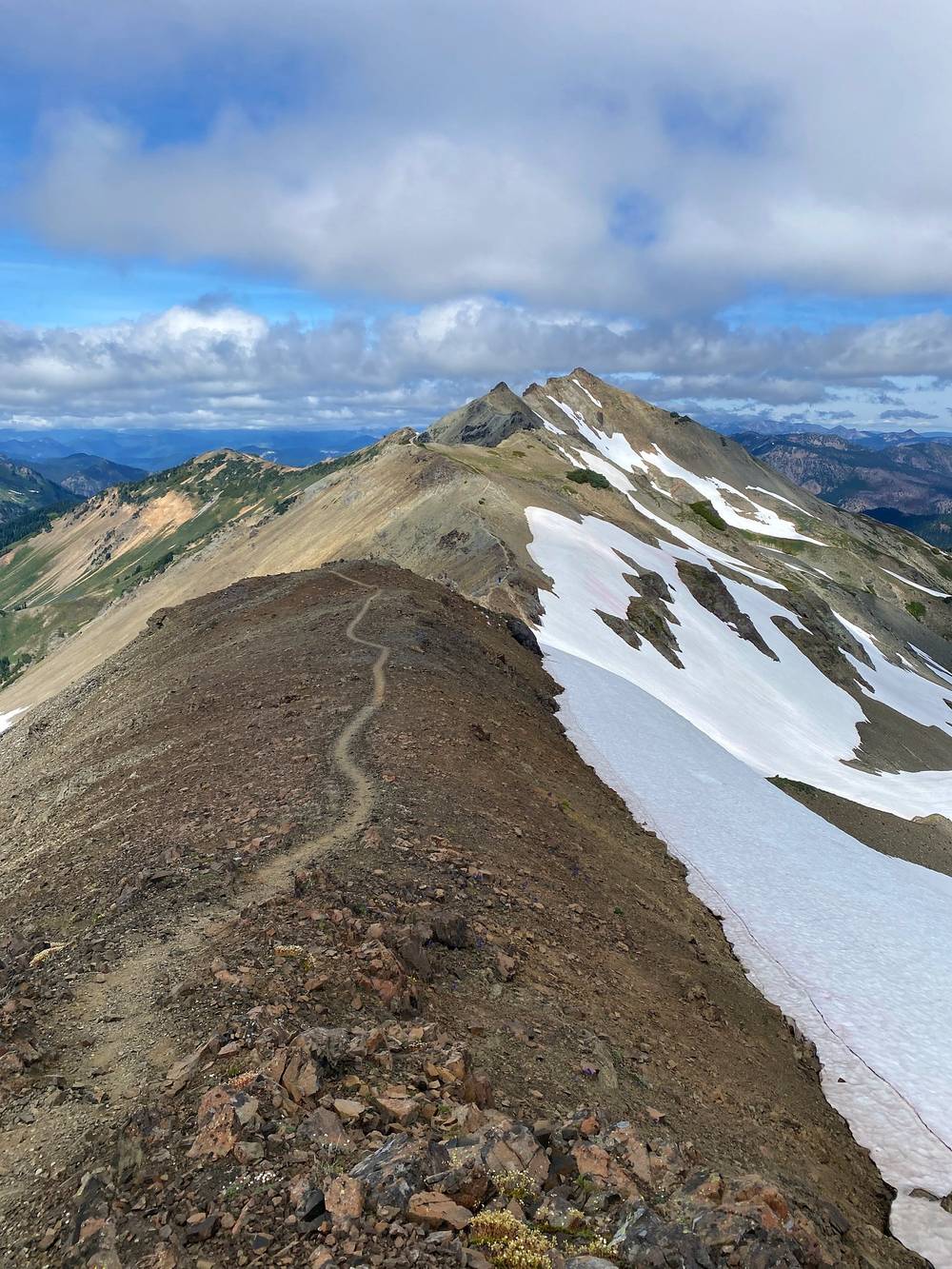
Back down. I came back south on the PCT itself, the lower traverse below Old Snowy, to the Old Snowy Alternate junction at mile 10.0, then down the PCT to the Snowgrass Trail at mile 11.6. In 2026 trip reports call that traverse loose and icy late in the season; snow lingers there into August.
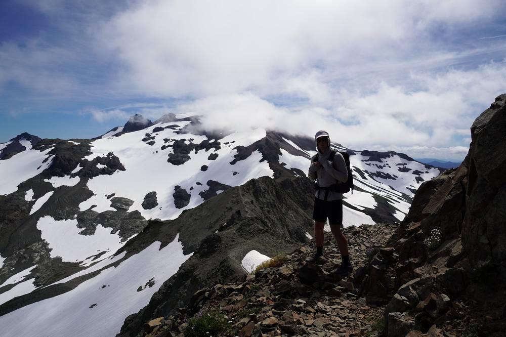
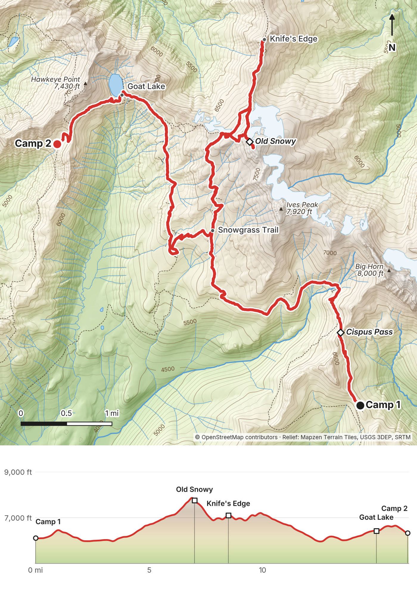
To Goat Lake. Down the Snowgrass Trail, past Snowgrass Flat, to the Lily Basin Trail #86 at mile 12.4 (about 5,970 ft). Camping is banned in Snowgrass Flat. The Lily Basin Trail heads north, drops to the day's low point and climbs to Goat Lake at mile 15.0 (about 6,420 ft), under Hawkeye Point. Then it goes on west to the Goat Ridge Trail #95 at mile 15.9. I camped just past it, on the saddle at mile 16.4.
At Goat Lake. No camping within 100 feet of the shore and no campfires within a quarter mile of it. In 2026 the Lily Basin Trail page warned of a snowfield traverse and very loose, rocky slopes below Hawkeye Point on the upper Lily Basin side; trekking poles and good shoes help.
From the Snowgrass Trail junction (mile 4.5 or 11.6), the Snowgrass Trail #96 goes down to the Berry Patch trailhead, which Day 3 passes; from Berry Patch my Day 3 route back to Walupt Lake is 6.7 miles. Before Cispus Pass, the PCT and the Walupt Lake Trail take you back to Walupt Lake. In bad weather, get off the Knife's Edge and Old Snowy first: they are the most exposed places on the loop.
Film, Day 2 · How I did it (behind the scenes)
I woke up and packed up really quickly, because the wind was still going, and headed out. I did about 11 miles with 1,000 feet of elevation gain in only four hours, so it was a quick exit. My GPS says 11.0 miles, 855 ft up and more than 3,200 ft down.
I looped back to my car, but not before I was ambushed by three adorable, identical little dogs. There was a group of four or five horseback riders, and these three little dogs were scouting in front of the pack. You know how much I love dogs. It was the last thing I saw before I stopped the hike, and it was just perfect.
The Goat Ridge Trail #95 runs south along Goat Ridge, past the Jordan Creek Trail (mile 2.0) and both ends of the Goat Ridge Lookout trail #95A (miles 2.3 and 3.0), then drops through forest to the Berry Patch trailhead at mile 4.3 (about 4,650 ft), where the Snowgrass Trail also starts.
From Berry Patch I walked 0.7 mile on the Berry Patch and Chambers Lake forest roads to the Klickitat Trail at mile 5.1. It follows old roads and trail south and east through forest, down to a small stream crossing at mile 8.5, the lowest point of the loop (3,333 ft). From mile 9.3 the Coleman Weedpatch horse trail #121A, the Walupt Lake road and the Walupt horse trail beside it took me back to the trailhead at mile 11.0. The trails here are open to horses: step off on the downhill side and let them pass.
Berry Patch, at mile 4.3, is a trailhead with a road out. Otherwise keep going: the rest of the day is downhill and low.
Film, Day 3 · How I did it (behind the scenes)
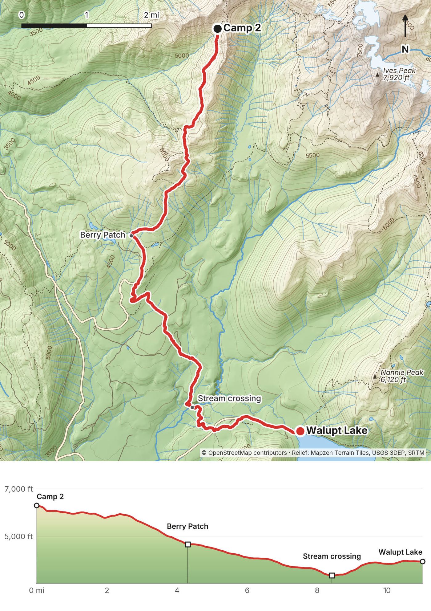
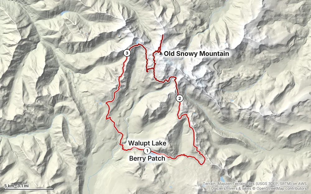
Elevation3,333–7,897 ft39.3 mi
Terrain: Mapzen Terrain Tiles (USGS 3DEP, SRTM) on AWS · Glaciers, rivers & lakes © OpenStreetMap contributors
Tap a map to open it full size.
All of this was checked on the Forest Service's own pages in September 2026.
Wilderness permit. Free and self-issued at the trailhead, under forest order R-93-007. Fill it out at the box, keep your copy with you. I found no quota, reservation or limited-entry system for the Goat Rocks in 2026, and none announced for 2027, but check.
Parking. Walupt Lake (the day-use lot), Berry Patch and Snowgrass are Forest Service fee sites. A Northwest Forest Pass is $30 a year or $5 a day, and the Interagency (America the Beautiful) passes are accepted. I used the annual Northwest Forest Pass I'd bought for my Enchantments hike that same week: I hung it on my mirror and parked for free. Campground fees don't cover day-use parking at Walupt Lake.
Group size. At most 12, counting people and pack animals together.
Camping. No camping within 100 feet of any lake shore or of the PCT. No camping in Snowgrass Flat or in Shoe Lake Basin. Stay at most 14 days in one spot. Don't leave gear unattended for more than 48 hours.
Fires. No campfires within a quarter mile of Goat Lake, in Snowgrass Flat, or in Shoe Lake Basin, and none anywhere while summer fire restrictions are on. The Forest Service's Goat Rocks page lists "No campfires". Carry a stove.
Other rules. Don't cut switchbacks or walk into areas posted closed for restoration. No drones, bikes or wheeled carts in the wilderness. Stock must stay 200 feet from lakes. Bear canisters aren't required (2026), but store your food well.
Mountain goats. Washington's wildlife department asks you to stay at least 50 yards from mountain goats and never to urinate within 50 yards of a trail: goats come for the salt.
The season. The Forest Service says the high trails in the Goat Rocks typically melt out by mid-July, that through travel on the PCT may not be possible until late July, and that half-mile snowfields can be common in August. The roads to the trailheads are open about June to October. The busiest time is August and September.
What I got. I started on a Friday afternoon, August 7, 2020, in sun. Day 2 started in a blanket of fog and morning mist, which broke around 9 a.m., then I had sun and big clouds over the peaks. Goat Lake was still frozen, and I crossed snowfields near Old Snowy. That night was the windiest I've ever had in my tent. Day 3 was clear, but the wind was still going when I packed up.
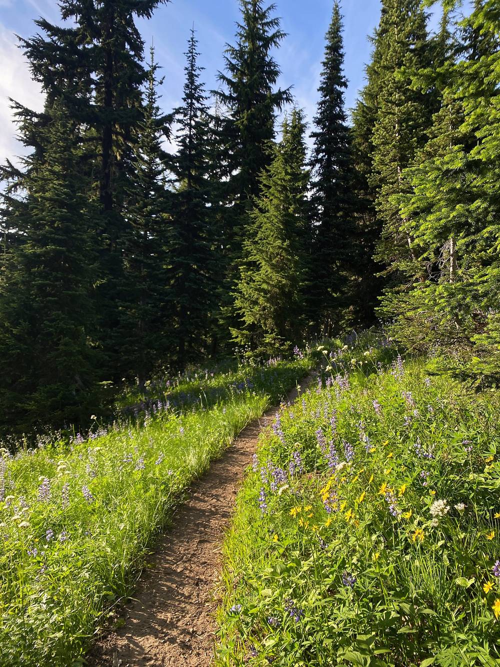
Wildflowers. Late July and August is when the meadows are full of them. On Day 1 there were so many wildflowers, all different colors, especially on the grassy, sunny slopes beside the trail.
Smoke and fire. Late summer brings fire season. In 2025 smoke from the Wildcat Fire, outside the wilderness, filled the Goat Rocks. In 2026 there was no fire in the Goat Rocks, and the forest lifted its fire restrictions on September 18. As of November 2026, the Gifford Pinchot National Forest has a Backbone Fire closure near Packwood (order 06-03-05-26-07, October 10 to December 31, 2026) that closes Forest Road 5290 and its spurs; the forest's page does not say whether it affects the Goat Rocks trailheads, so check the alert before you drive. Check the forest's alerts and the air quality before you go.
Emergencies. Call 911. Don't count on cell service anywhere on the loop: the Forest Service says so too. A satellite messenger is the real backup. Lewis County Sheriff's search and rescue, with a Packwood unit, covers the west side.
Wind and cold. Storms with high wind, rain and snow can come in any month. My second night my tent folded flat on me in the gusts. In late September 2026, a hiker camped at about 7,000 ft on the PCT in the Goat Rocks became hypothermic when a storm with snow and 60 mph gusts collapsed his tent; he called for help with his inReach, and rescuers hiked about 8 miles through the night to reach him, because helicopters couldn't fly. Carry warm, waterproof layers, camp out of the wind, and check the forecast.
Snow. Snowfields can last into August near Old Snowy, on the Packwood Glacier traverse and around Goat Lake. Early in the season carry traction and an ice axe, or turn back. Loose rock under the snow and on the scree can shift.
The Knife's Edge and Old Snowy. Narrow, rocky and exposed, with long drops. Go in good weather, take your time, and turn back if you're not comfortable. I turned back partway along.
Lightning. Old Snowy, the Knife's Edge and the high ridges are no place to be in a thunderstorm. Get down before it arrives.
Mountain goats. Stay at least 50 yards away and don't urinate within 50 yards of the trail. Washington's wildlife department asks you to leave pets at home in goat country; if you bring a dog, keep it leashed and close.
Bears. Canisters aren't required (2026), but store food well and never feed wildlife.
Leave a plan with someone at home: your trailhead, your route and when you'll be out.
How many days do I need? I did it in three: an afternoon on Day 1, a long Day 2, and a quick morning on Day 3. Four days would give you more time up high. See Other ways to do it.
How hard is it? The trails are good and well used. Day 1 climbs steadily through forest to the PCT. Day 2 is the big one: about 4,000 ft of climbing, the scramble up Old Snowy and the narrow Knife's Edge, much of it over 6,000 ft. The Forest Service calls the PCT between Elk Pass and the Packwood Glacier "narrow, rugged, and treacherous."
Do I need a permit? Yes, but it's free and you fill it out yourself at the trailhead. It was a very simple walk-up, self-issue permit for me in 2020, and it still is in 2026. There's no quota or reservation. You also need a parking pass. See Permits and rules.
Where do I park? I parked at Walupt Lake, at the end of Forest Road 2160. The lot is small and fills up. The campground was full when I got there, so I just packed my stuff and headed out.
Is there water? For me there was more than enough water flowing on the whole loop, in early August. Later in summer small creeks dry up. There's no drinking water at the Walupt Lake trailhead or campground. Treat or filter everything.
Can I have a campfire? Bring a stove. Fires are banned within a quarter mile of Goat Lake and in Snowgrass Flat, and summer fire restrictions ban them everywhere when they're on. The Forest Service's Goat Rocks page says no campfires at all.
Will I see other people? Lots. I ran into a lot of PCT hikers, and Goat Lake was packed, with a lot of tents and a lot of dogs. The Forest Service says to expect a hundred or more people on the trails around Snowgrass, Goat Lake and Old Snowy in summer.
Do I have to go up Old Snowy or out on the Knife's Edge? No. Both are side trips from the PCT, and you can skip either one. See Other ways to do it.
I started at 3 p.m. on Day 1 and had a long Day 2. With a full first day you could camp nearer Cispus Pass and spend two nights up high. Remember the rules: no camping within 100 feet of the PCT or a lake, and none in Snowgrass Flat.
Old Snowy and the Knife's Edge are both optional. You can stay on the PCT below Old Snowy, or turn back at the Old Snowy Alternate and save the Knife's Edge, about 0.8 mile each way from where I joined it. In snow, wind or cloud, skip them.
The Berry Patch trailhead, at the end of Forest Road 2150, is where the Snowgrass and Goat Ridge trails start, and it's on my Day 3. You could start the loop there instead of at Walupt Lake. It serves the busiest part of the Goat Rocks: on an August Sunday in 2026 cars were lining the road.
My loop uses the PCT from the Walupt Lake Trail to the Knife's Edge. Thru-hikers and section hikers carry on north past Elk Pass to White Pass on US 12. I didn't walk that part, and it isn't in this guide. I'd planned to hike the whole PCT in 2020, but it got postponed because of COVID. I plan to hike it in the future, which makes me not want to spoil it too much.
These change every year. Everything else in this guide stays the same.
Rules and permits
Getting there
Conditions
Your stuff
The film is at the top of this page.
Planning questions about Goat Rocks, answered only from this page's facts, the creators' versions and hikers' public tracks, with where each answer comes from. When the data doesn't say, the answer says "not given".
From hikers
Sign in to comment. Free; your hikes stay private unless you share them.
Something wrong or missing on this page? Send feedback.