
Content made there
The film is at the top of this page.
Photos
Hikes / Four Pass Loop / Kraig Adams's version
North America · United States
Sep 2021 · 4 days · about 44 miles · Solo · Tent

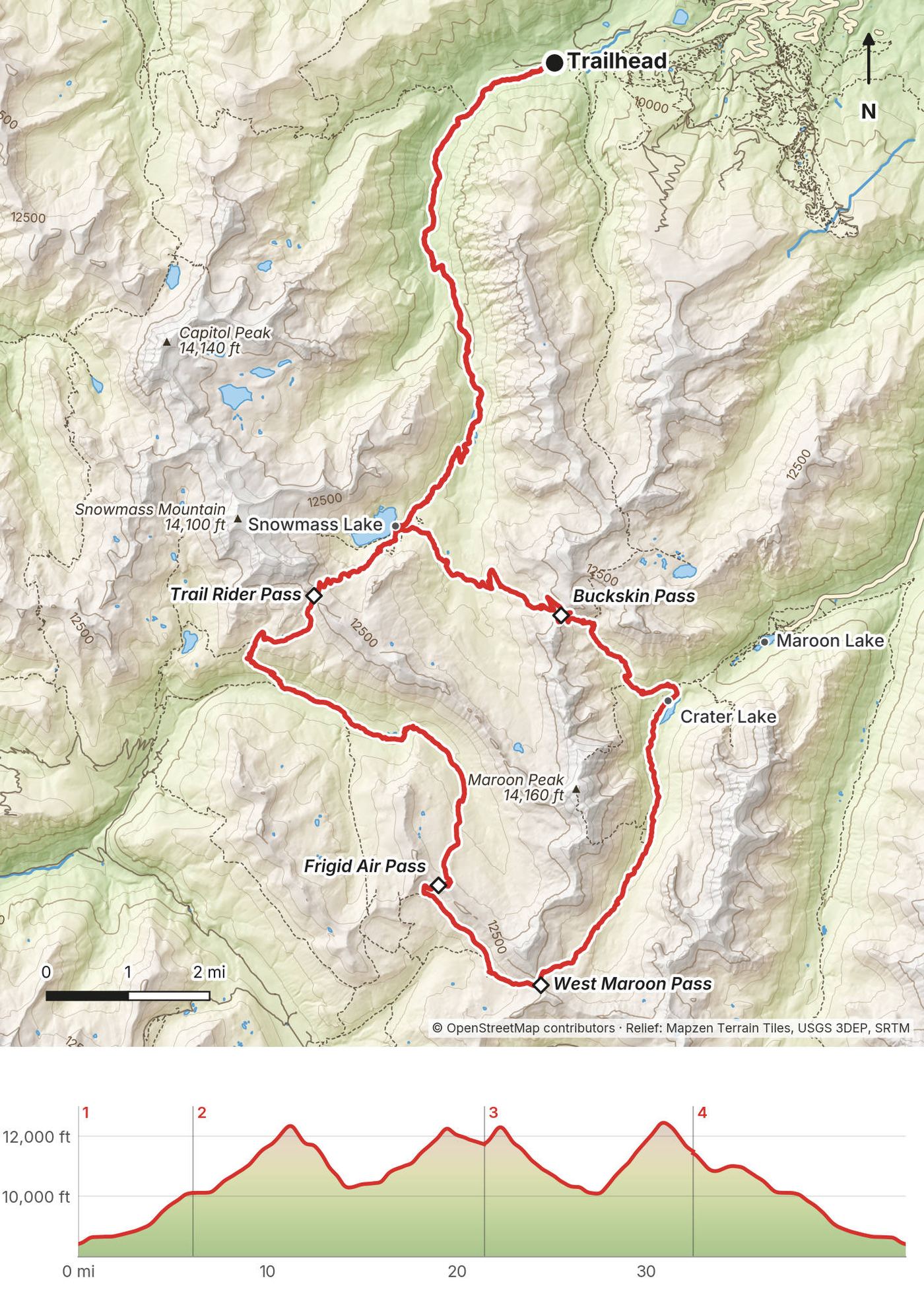
In late September 2021 I flew to Denver, drove to Snowmass Village and hiked the Four Pass Loop in Colorado's Maroon Bells-Snowmass Wilderness: four days and about 44 miles, from the trailhead at the end of Snowmass Creek Road up to Snowmass Lake, over Trail Rider Pass, Frigid Air Pass, West Maroon Pass and Buckskin Pass, past Crater Lake under the Maroon Bells, and back down the way I came. It's the trip from my film Hiking 40 miles on the Four Pass Loop in Colorado.
It wasn't my first time. A year before, I did it with my brother Kurtis, a couple of weeks later in the season. All of the colors had left and the leaves had fallen off the trees, and we ducked out after the second day. This time I timed it for the yellow aspens.
| Quick facts | |
|---|---|
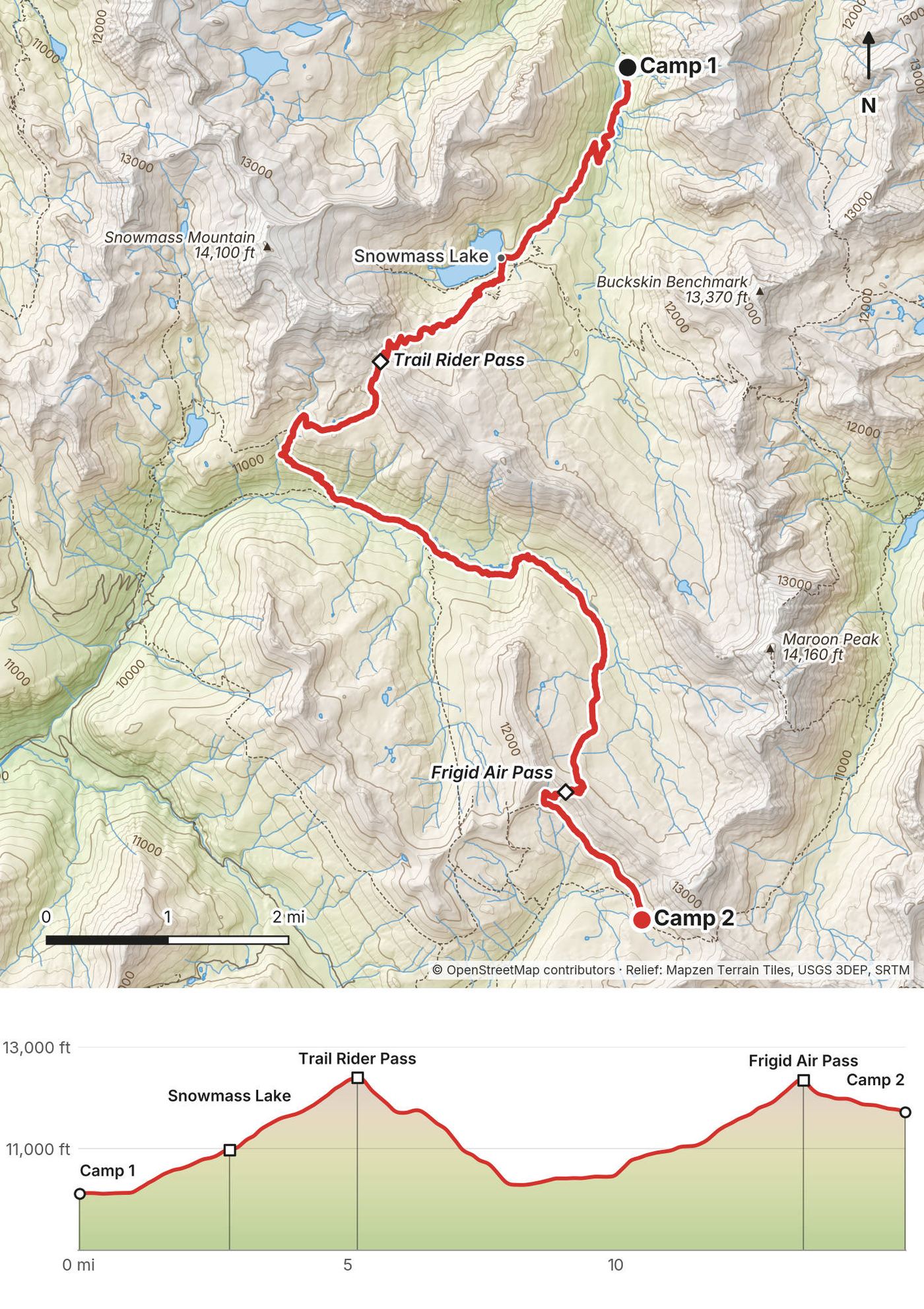
| Distance | 43.7 miles (70.4 km) on my GPS over 4 days, from the Snowmass Creek side. The loop itself, from Snowmass Lake back to Snowmass Lake, is about 26 miles; the rest is Snowmass Creek in and out |
| Climbing | about 9,680 ft (2,950 m) up and the same down |
| Days | 4 walking days, 3 nights in my tent. My first and last days were half days |
| Start and finish | The Maroon-Snowmass Trailhead (also called the Snowmass Creek Trailhead), at the end of Snowmass Creek Road above Snowmass Village, 8,400 ft (2,560 m) |
| The four passes | Trail Rider, about 12,420 ft; Frigid Air, about 12,410 ft; West Maroon, 12,500 ft; Buckskin, 12,462 ft |
| Direction | Counterclockwise from Snowmass Lake: Trail Rider, Frigid Air, West Maroon, then Buckskin |
| When | Mid-July to September. I walked September 25 to 28, 2021, with the aspens turning |
| Permits (2026) | An overnight permit from Recreation.gov for every night in a permit zone, $10 a person a night (May to October) plus $6 a permit. A bear canister is required |
| Difficulty | A clear trail, but four passes above 12,400 ft, long climbs, and no way out on a road in the middle |
| Base | Snowmass Village or Aspen |
| Day | Route | Miles (km) | Up / down (ft) | Camp |
|---|---|---|---|---|
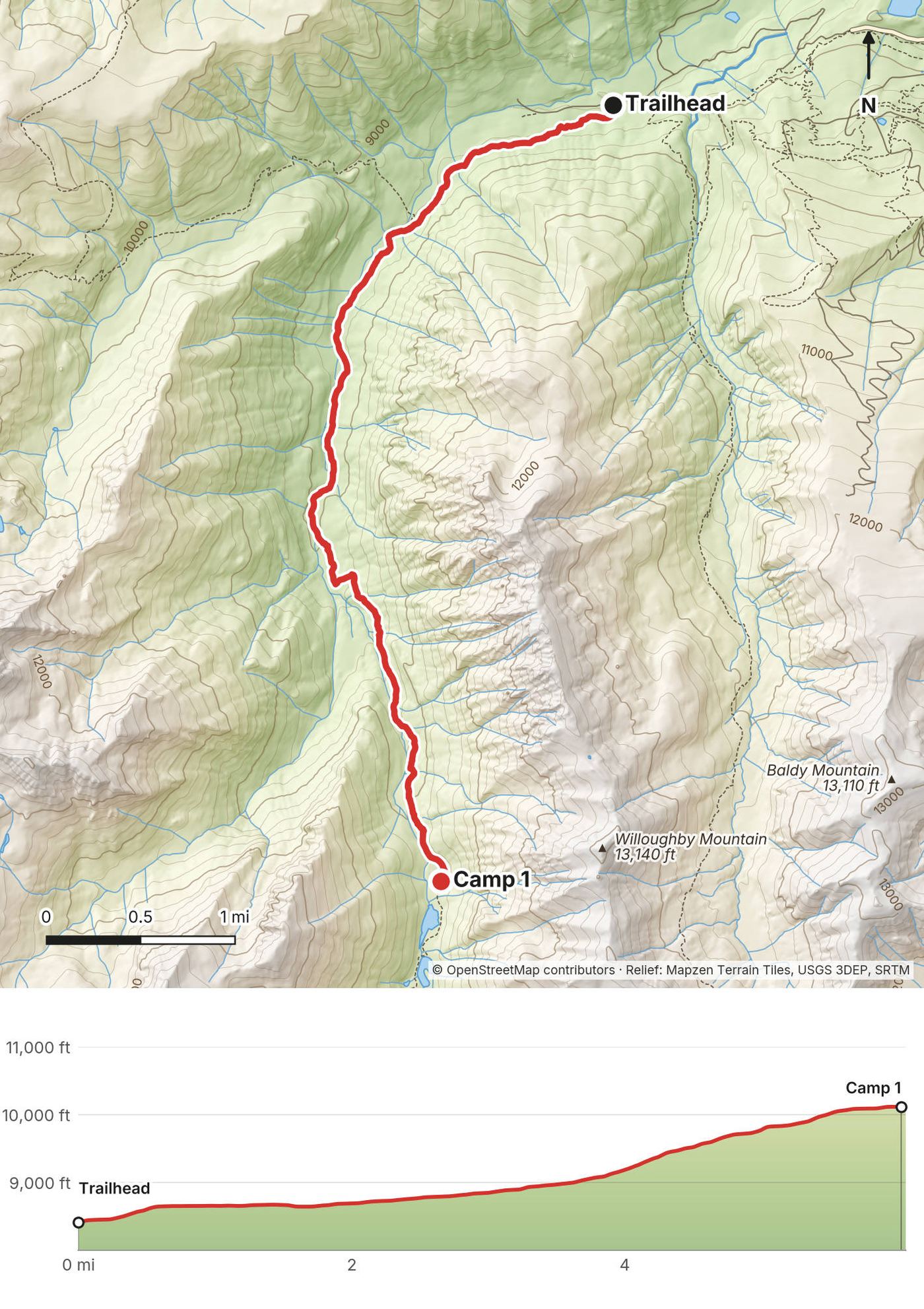
| 1 | Trailhead up Snowmass Creek | 6.1 (9.8) | 1,719 / 23 | Camp 1, below Snowmass Lake, 10,120 ft |
| 2 | Snowmass Lake, Trail Rider Pass, Frigid Air Pass | 15.4 (24.8) | 4,514 / 2,892 | Camp 2, below Belleview Mountain, 11,710 ft |
| 3 | West Maroon Pass, Crater Lake, Buckskin Pass | 11.0 (17.8) | 3,198 / 3,428 | Camp 3, west of Buckskin Pass, 11,460 ft |
| 4 | Snowmass Lake and out to the trailhead | 11.2 (18.1) | 248 / 3,305 | Home |
The numbers come from my own GPS recordings, smoothed the same way for every day. The film calls it 40 miles and my description added up the days as 44; my GPS says 43.7. Apps count climbing differently: see each day for what I said at the time.
What I did. I flew from my home in New York to Denver, direct, rented a car at the airport, and made the 4-hour drive up into the mountains toward Aspen. I went to Snowmass Village, stocked up on supplies, and drove out to the trailhead at the end of Snowmass Creek Road.
Most people take the shuttle up to Maroon Lake and start there, or stay in the campsites, but you have to pay for it and there's a reservation system. You can't just go and do what you want to do, which isn't my style. So option number two is to park at this trailhead. I parked there for three nights, no problem. The road from Snowmass Village is a dirt road, but you don't need four-wheel drive. Parking was free. There were about 12 to 20 other cars in the lot and alongside the road. I signed into the log book and started my hike right before sunset.
The two starts today.
To the area. Aspen/Pitkin County Airport (ASE) is closest; RFTA's buses into Aspen and Snowmass Village are free. From Denver it's about 199 miles by I-70 and Glenwood Springs, about 3.25 hours in good conditions, more with traffic, or 159 miles over Independence Pass in summer. In 2026 Independence Pass opened May 21; it usually closes in late October or early November, and vehicles 35 ft or longer are banned on it.
Water at the trailheads. There's none. Fill up in town.
My records for this trip are a United receipt and what I said in the film.
| Item | What I paid in 2021 |
|---|---|
| United, New York LaGuardia to Denver, one way | $198.40 |
| Parking at the trailhead, 3 nights | Free |
| Permits | None then: I signed the log book at the trailhead |
| Rental car, food and supplies in Snowmass Village, flight home | Not in my records |
For your budget (2026). The overnight permit: $10 a person a night (May to October) plus $6 a permit, so a solo three-night trip costs $36. A bear canister (rent or borrow one if you don't own one). From Maroon Lake: $10 a vehicle for parking or $16 for the bus. A rental car from Denver or a flight to Aspen. A CORSAR card is $5 a year (see Weather and safety).
What I did. In 2021 there was no reservation system on the loop. I parked at the trailhead, signed into the log book, started my hike, and camped where I liked. You can't do that now.
The overnight permit (2026). Under a Forest Service order in force since April 2023, the busiest parts of the Maroon Bells-Snowmass Wilderness need a reserved overnight permit. You book it only on Recreation.gov ("Maroon Bells-Snowmass Wilderness Overnight Permits"); ranger stations don't issue them.
Where you can camp (2026).
My camps in 2026 terms. On the Forest Service's permit zone map (January 2023), my first camp, about 2 miles below Snowmass Lake, is outside the pink permit zones: there you self-register at the trailhead. My second camp, below Belleview Mountain between Frigid Air and West Maroon passes, is near where the North Fork, East Fork and Maroon zones meet; my third, west of Buckskin Pass, is in the Upper Snowmass zone. Check the zone map when you book. My camp 3 was "not too far from water": make sure yours is at least 100 ft away.
Bear canisters. Required for every backpacker in this wilderness: all food, trash and scented things in a container certified by the Interagency Grizzly Bear Committee. People without one are ticketed and sent out. Recreation.gov says a bear canister or an Ursack. The Aspen-Sopris Ranger District lends some canisters, (970) 963-2266, and shops in Aspen rent them. Hanging food isn't an option here.
Other rules (2026). Fires: none above 10,800 ft, within a quarter mile of Crater Lake, or within 100 ft of water and trails. Dogs: on a leash shorter than 6 ft (banned only in the Conundrum valley, off this route). Human waste: pack it out in a WAG bag (free at the Snowmass Lake trailhead) or bury it 6 to 8 inches deep, 200 ft from water, camps and trails.
Day hikes need no permit, but driving to Maroon Lake does need a reservation (see Getting there).
| Night | Where | Height (my GPS) | My note |
|---|---|---|---|
| Sept 25 | Tent, Snowmass Creek valley, about 2 miles below Snowmass Lake | 10,120 ft (3,084 m) | "Reached this tent spot in the dark. Running water nearby. Nothing special and no views here." |
| Sept 26 | Tent below Belleview Mountain, between Frigid Air and West Maroon passes | 11,710 ft (3,570 m) | "Not the best spot to sleep but there was a good sunset view and running water for cooking." |
| Sept 27 | Tent on an overlook west of Buckskin Pass | 11,460 ft (3,492 m) | "A bunch of nice campsites in this area." |
The night before, I was in New York (my photos); there's no night in Aspen or Snowmass Village in my record.
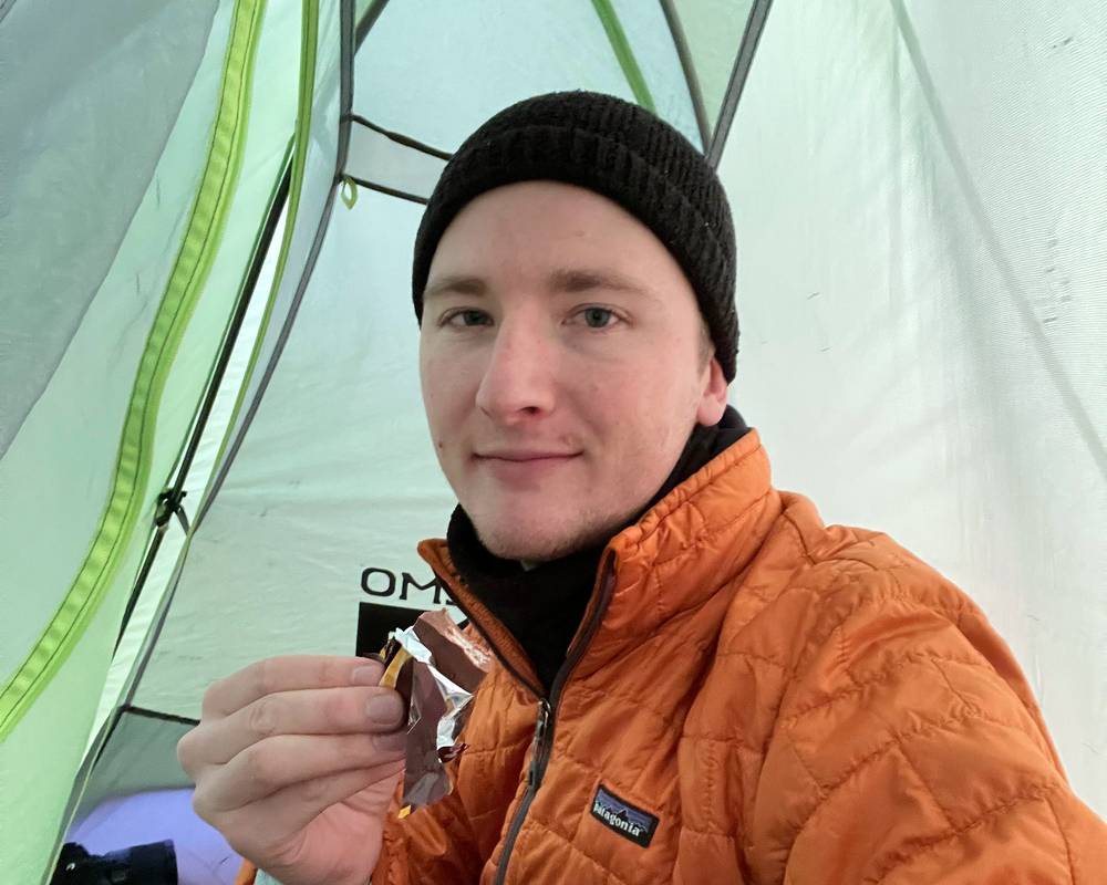
All three camps are in the GPX files as waypoints. In 2026 camp where your permit and the rules allow: Crater Lake only in its numbered sites, and anywhere else at an existing site 100 ft from water and trails (see Permits and camping).
There's water every few miles: Snowmass Creek and its ponds, Snowmass Lake, the North Fork and its streams, West Maroon Creek, Crater Lake, and streams near both high camps. There's no drinking water at the trailheads. The CDC says boiling (1 minute, 3 above 6,500 ft) or a filter takes out Giardia and Cryptosporidium; chemicals alone may not.
There's nothing to buy on the loop. I stocked up in Snowmass Village and carried four days of food, with a stove for hot breakfasts and dinners: coffee and a warm meal at Snowmass Lake on both mornings I was there. Everything scented goes in your bear canister.
Paid links: I earn a commission if you buy through these links, at no extra cost to you. As an Amazon Associate I earn from qualifying purchases.
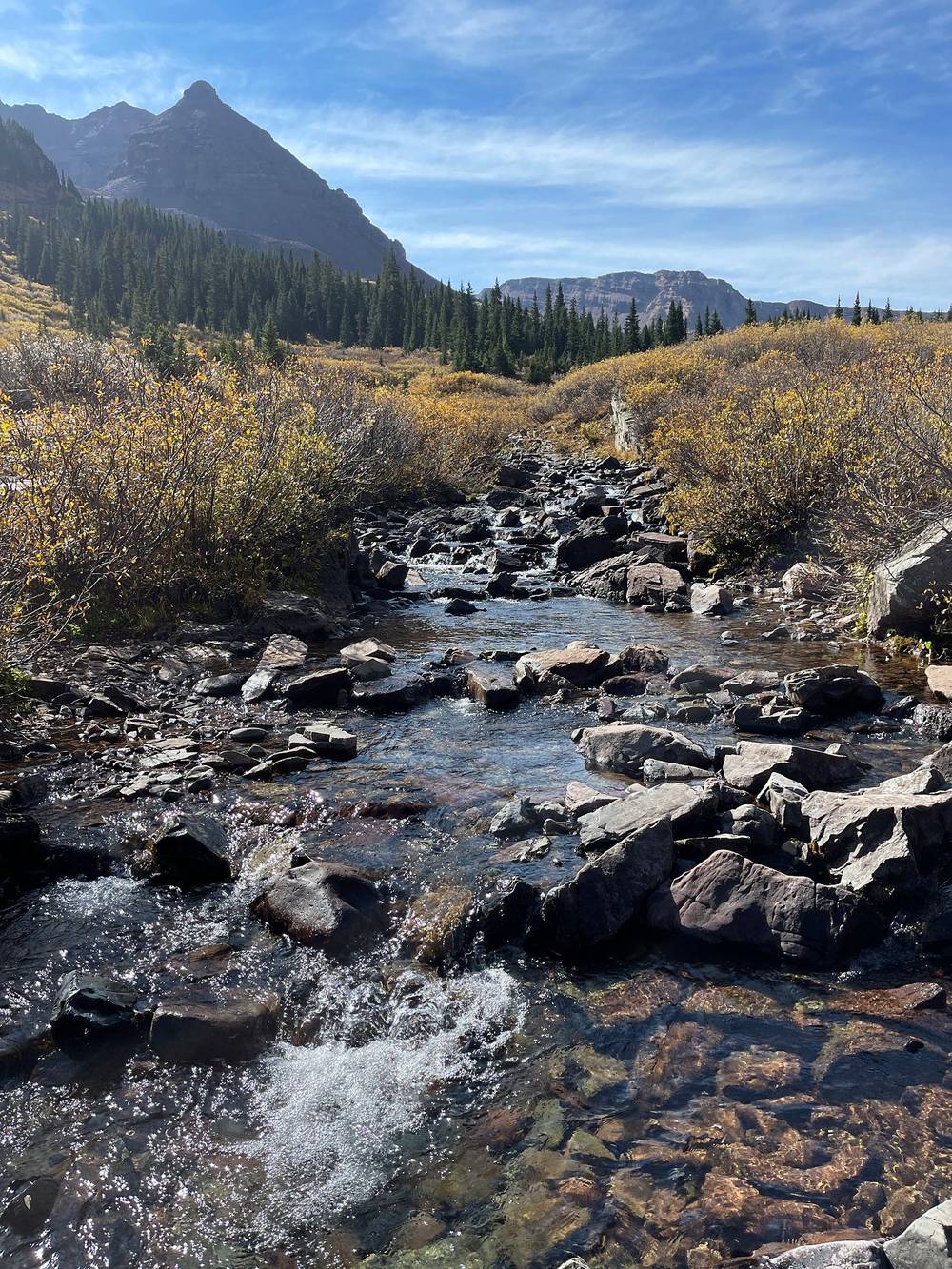
From the film and my photos.
 Warm layer: Arc’teryx Cerium Hoody (Arc’teryx). Late-September mornings at 11,000 ft are cold.
 Hat: PATH Projects Hoyt Merino Beanie (PATH Projects)
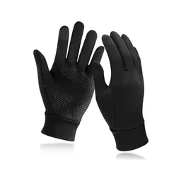 Gloves: Unigear Touchscreen Liner Gloves (Amazon)
 Rain shell: Arc’teryx Beta AR Jacket (Arc’teryx). For afternoon storms.
 Poles: Black Diamond Alpine Carbon Z Poles (Amazon). For the four passes.
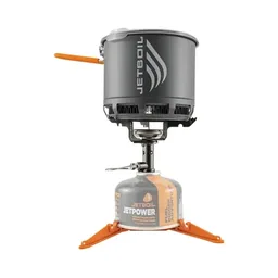 Stove: Jetboil Stash (Amazon). No fires at the camps.
 Water: Katadyn BeFree AC · 1L (Amazon). Treat or filter every stream.
What I filmed with in 2021.
 Camera: DJI Osmo Pocket 4 (Amazon)
 Mic: DJI Mic 3 · 1 TX + 1 RX (Amazon). It pairs with the Pocket 4.
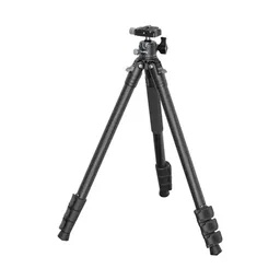 Tripod: SmallRig Carbon Fiber Tripod (Amazon)
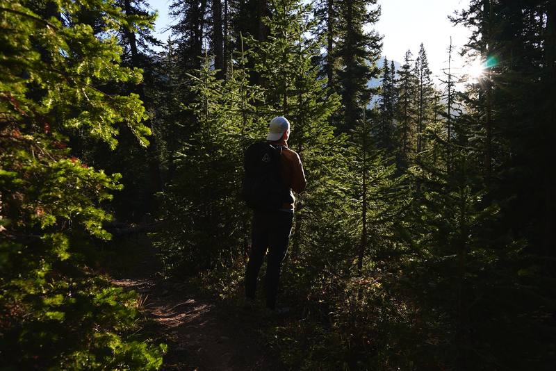
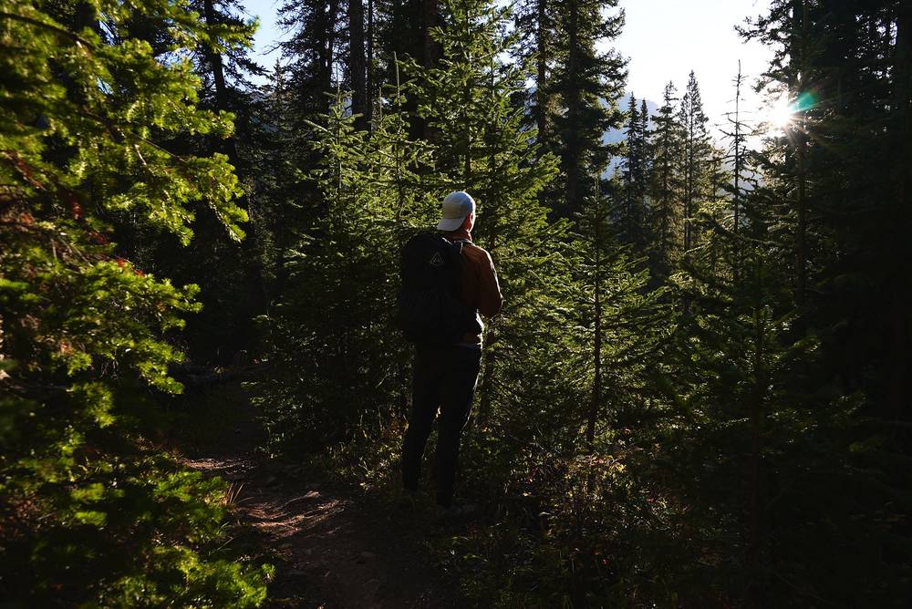
I arrived right before sunset, so I parked and hiked in as much as I could up the valley. It's not really that entertaining, because it's low and it's mostly forest. There aren't really views until you come up to the ponds and little lakes. I hiked for about 2 hours up to the first campsite. I lost the light, turned on my headlamp, and kind of hiked until it was too cold to hike. I pitched the tent without cooking and settled in for the night.
My campsite had running water nearby, but nothing special and no views.
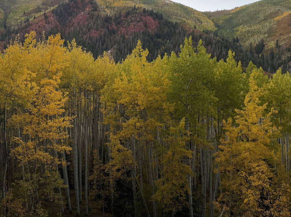
From the trailhead (8,400 ft) the Maroon-Snowmass Trail (#1975) climbs gently south up the Snowmass Creek valley, through aspen and spruce, past beaver ponds and small lakes. Most of the 1,700 ft of climbing comes in the last 2 miles. Snowmass Lake is about 8.8 miles from the trailhead on my GPS; I stopped at mile 6.1.
Starting late. If you start in the evening like me, carry a headlamp. My first camp was below the Snowmass Lake permit zone; for a night outside the zones you self-register at the trailhead (2026). Check where the zone starts on the Forest Service's zone map.
Walk back down the valley to the trailhead.
Film, Day 1 · The guide part of the film
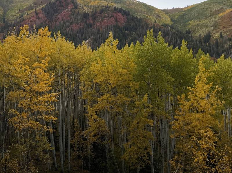
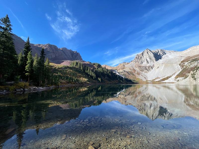
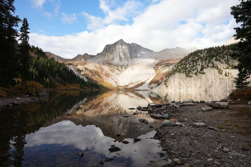
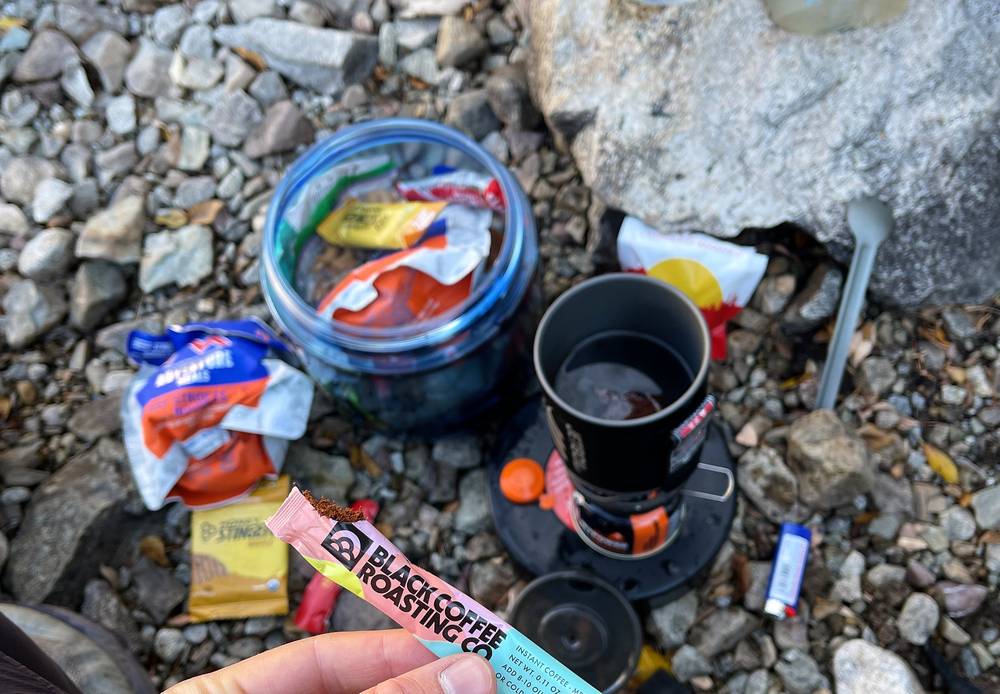
The next morning I had views of the yellow aspens and the fall colors. I woke up super early, about 6:30 or 7, for the sunrise, and started up the slope to finish at Snowmass Lake for a nice breakfast. Right as I got to the shore, the sunlight was just coming up over the trees and hitting the lake right where I was cooking. So many people came up and said hi. Thank you.
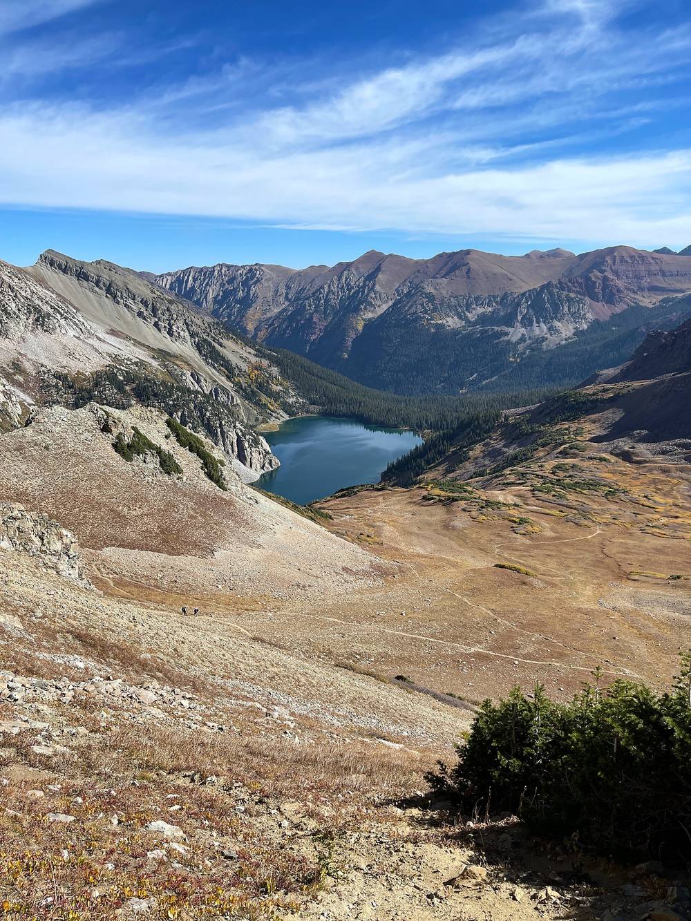
This area is gorgeous. You can just see the tops of the peaks, and there are a couple of fourteeners right here. The light really reflects off the white gravel. You're officially on the loop at this point, so you start making your way up toward the first of the four passes. There are campsites, and the view looking back down at the lake is probably one of the best of the area, with the light spilling in over the ridge. I saw a couple of deer. You really take your time, because every time you look over your shoulder at the lake, it's even more beautiful than the last view.
Then my first taste of switchbacks, and the altitude was starting to get to me. At the top of the first pass, about 12,500 ft, I felt it. It was nice going down into the valley. I knew I had a full day of hiking. My plan was to do at least two passes, maybe three, and get down to the campsites in the wooded area past the third. Turns out I only made it over two, because I was absolutely feeling the altitude: a headache, and I couldn't breathe. Today just kicked my butt.
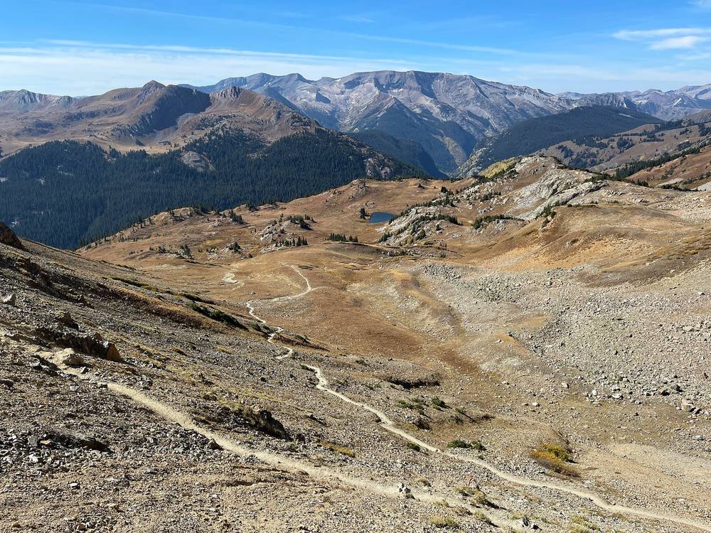
I camped with a nice view, with the sunset looking down into the valley. It wasn't the best spot to sleep, but there was running water for cooking.
From my first camp the trail climbs to Snowmass Lake at mile 2.8 (10,990 ft). Below the lake it crosses Snowmass Creek; trip reports describe a log-jam crossing, slippery when wet, and wading in high water. Past the lake the Maroon-Snowmass Trail climbs west on switchbacks to Trail Rider Pass at mile 5.2, about 12,420 ft, the first of the four passes.
The west side drops into the valley of the North Fork of the Crystal River, through aspen slopes, to its low point at mile 8.4, about 10,290 ft, where I stopped for lunch. Then the North Fork Trail (#1974) heads up the valley through big meadows, past a waterfall on the valley wall at mile 9.9, and climbs the last open slopes to Frigid Air Pass at mile 13.5, about 12,410 ft. From the pass it's a short, gentle walk down toward West Maroon Pass to where I camped, at mile 15.4.
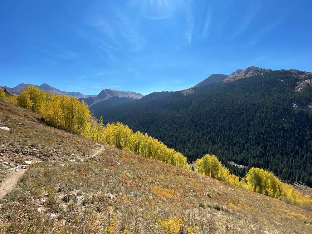
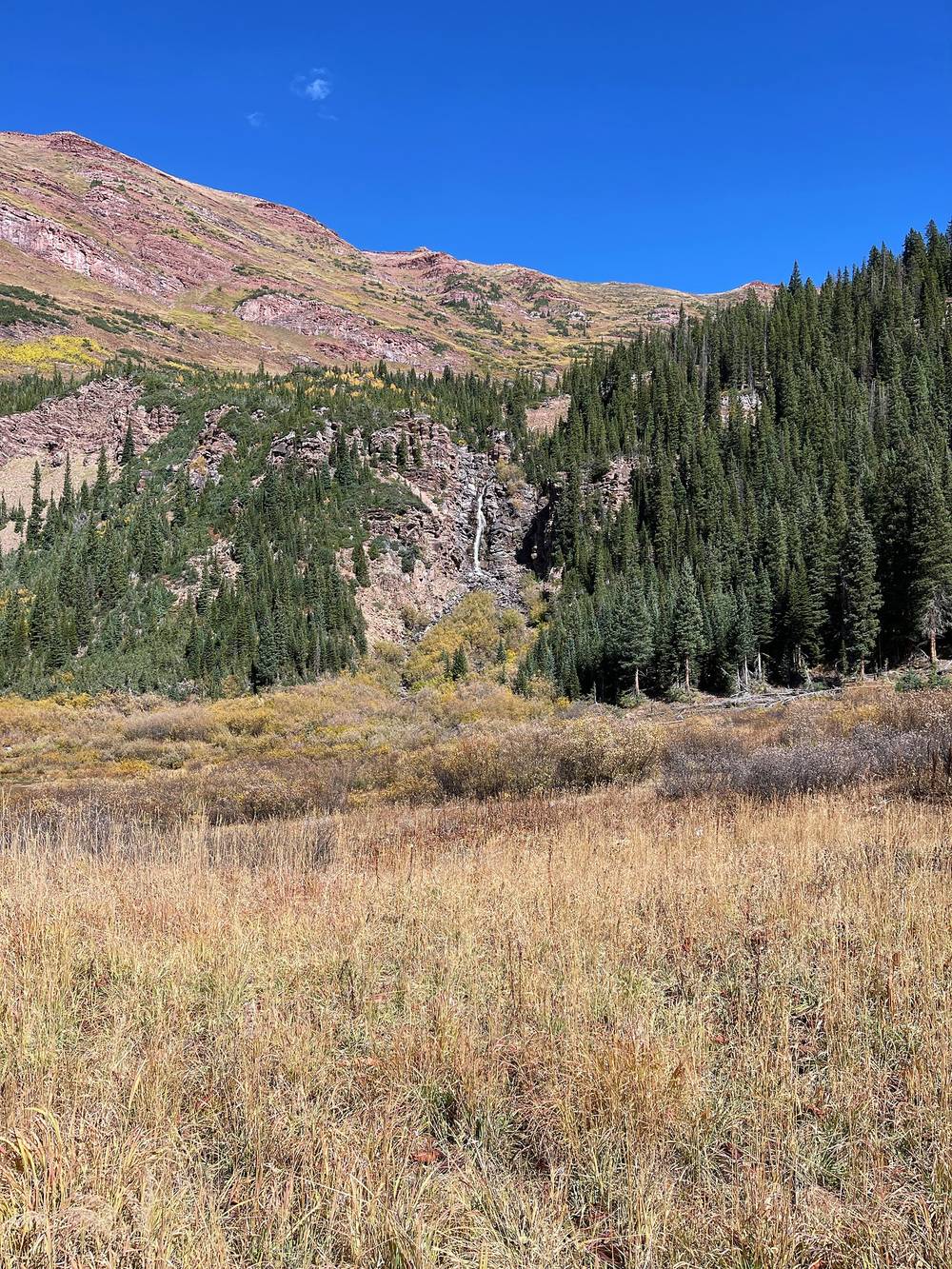
The long day. From Snowmass Lake to Frigid Air Pass is about 10.7 miles with two big climbs. Many people split it with a night in the North Fork valley. That was my plan for the third pass, and it's what I'd do with fresh lungs or not. See Other ways to do it.
A bear cub. I marked one on my recording about 1.2 miles below Snowmass Lake (Day 2, mile 1.6). Keep every scented thing in your canister.
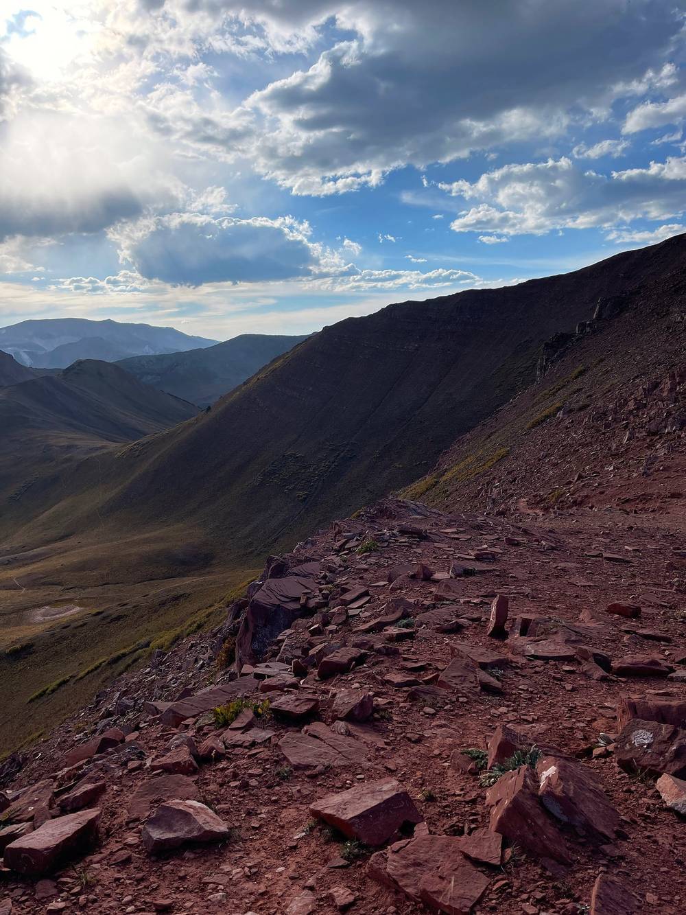
Before Trail Rider Pass, go back down Snowmass Creek to the trailhead. In the North Fork valley, trails lead out west and south toward the roads near Marble and Schofield Pass, a long way from your car; the practical ways out are back over Trail Rider Pass or on over Frigid Air Pass. After Frigid Air Pass, the quickest way out is over West Maroon Pass and down to Maroon Lake, where the buses run in season.
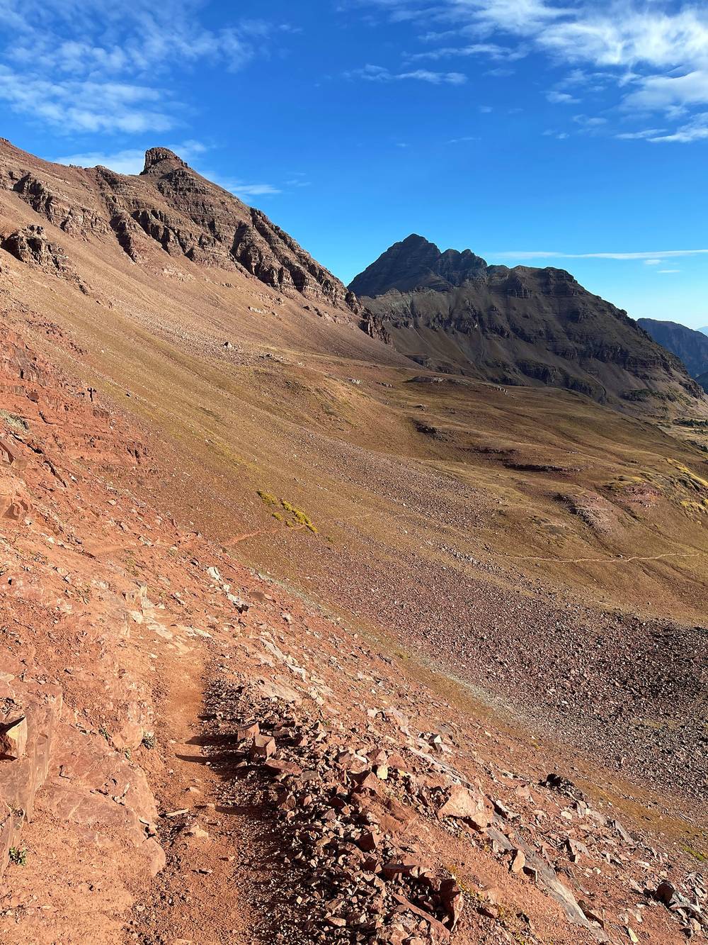
I woke up early again, made some breakfast and started up and over the third pass. I busted out the trekking poles, and when I do that, you know I'm feeling it, because it makes my filmmaking much harder. To be honest, I was a little disappointed in my effort on this hike.
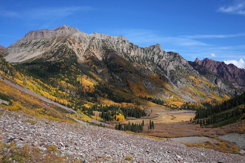
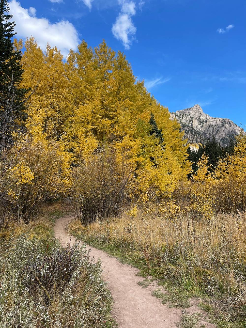
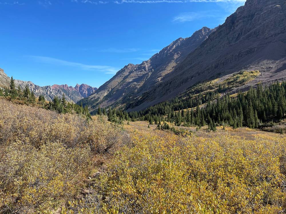
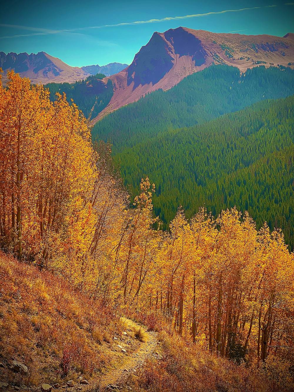
Then I made my way down an incredibly long valley and gained speed, momentum and energy as I dropped and things got easier. The lower I went, the more fall colors. Coming down toward Crater Lake there are tremendous views of the aspens, and there's a pretty famous view of the Maroon Bells and all of the peaks coming up this valley. This is where you get a lot of the fall colors. I assumed this would be my thumbnail, but a bit of cloud came in for the first time on my hike right when I got to that view. I waited around for about 30 minutes, but it never cleared.
So I begrudgingly started the climb up the last pass, and it took a while. I took my time, had a nice meal, and had a break before the last set of switchbacks in the exposed alpine area. I went all the way up over the top. I knew I'd either camp on the far side or make it to Snowmass Lake, but by the time I got to the campsite area for night three, I was exhausted. The spot wasn't that bad. It was on the edge of an overlook, with all of that as my view, running water, and a couple of other options for campsites. A few people were spending the night there. It was a good spot.
From my camp it's a short climb to West Maroon Pass at mile 0.8, 12,500 ft. The West Maroon Trail (#1970) then drops north down the long West Maroon Creek valley, crossing the creek on the way (the Forest Service warns the crossings can be extremely dangerous in high spring runoff). Lower down come the aspens and the big views of the Maroon Bells. At mile 6.0 you reach Crater Lake (10,076 ft, Forest Service), the low point of the day.
At Crater Lake the loop turns northwest up Minnehaha Gulch on the Maroon-Snowmass Trail (#1975), a steady climb of 2,400 ft in 3.5 miles, the last part on switchbacks in open alpine country, to Buckskin Pass at mile 9.5, 12,462 ft. The trail drops west from the pass toward Snowmass Creek; I camped at mile 11.0.
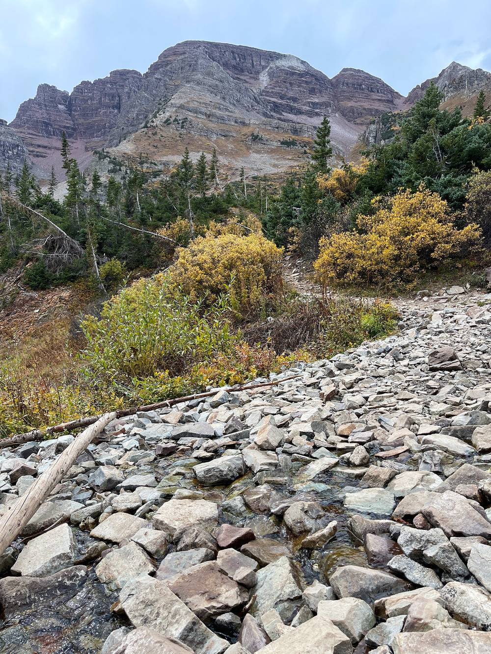
Crater Lake in 2026. Camping only in the 11 numbered sites you reserve, no camping within a quarter mile except there, and no fires. Maroon Lake, the bus and the Maroon Bells Scenic Area are about 2 miles below the lake.
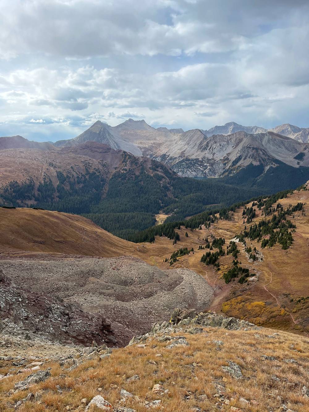
At Crater Lake, walk down to Maroon Lake, about 2 miles, for the RFTA bus to Aspen Highlands (in 2026, May 22 to October 18; the last bus down at 5 p.m.; a one-way ticket for hikers is $10). Before that, go back over West Maroon Pass the way you came, or on down the valley. After Buckskin Pass, it's about 12.7 miles down Snowmass Creek to the trailhead on my GPS, or about 5.5 miles back down to Crater Lake and Maroon Lake for the bus.
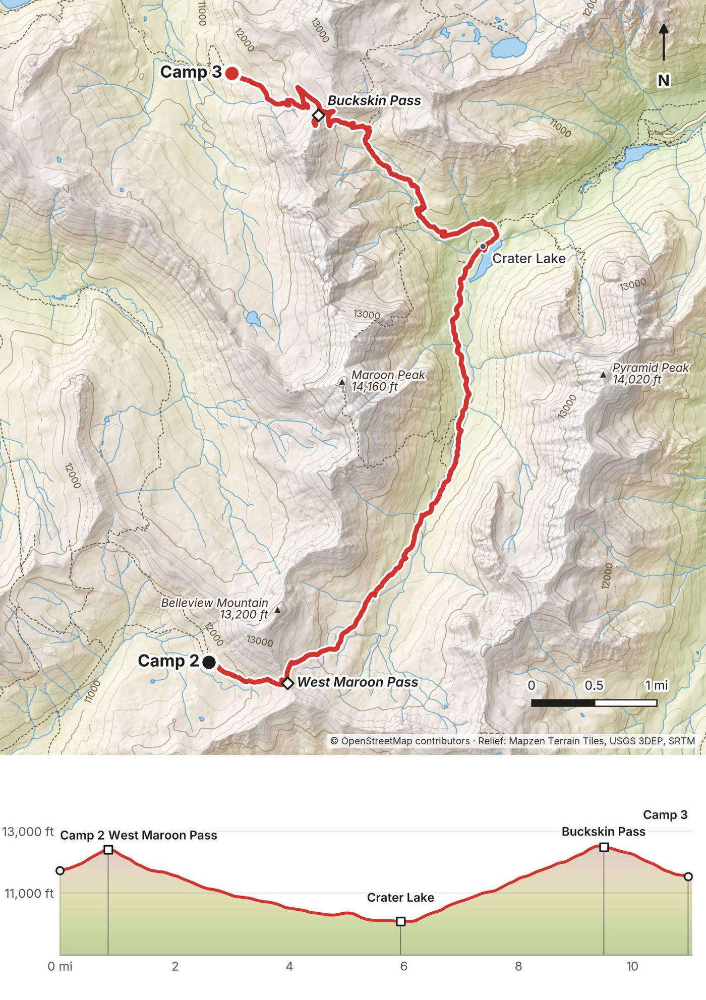
This last day was technically my fourth, but the first day wasn't even half a day and this one wasn't either. I knew the rain was coming, so I put on the trekking poles and got down to the lake for a nice breakfast. Breakfast is always nice when you have coffee and a warm meal. I had the light hitting me again and got my last shots of the video.
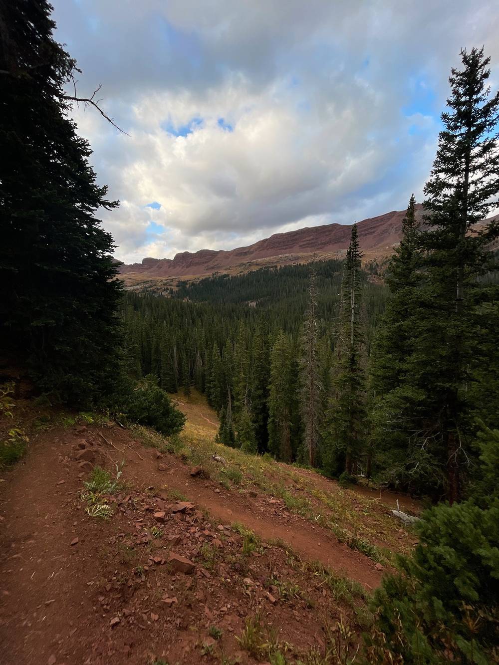
Then, because I was just doubling back through the same valley, I put the camera away, busted out the trekking poles and huffed it, over 3 miles an hour down the valley with podcasts, music and audiobooks, and made it back to the trailhead in no time. I practically trail ran it without running.
From my camp the Maroon-Snowmass Trail drops west into the Snowmass Creek basin, then climbs a little to the trail junction just below Snowmass Lake. I went up to the lake shore for breakfast at mile 2.6. From there it's the Day 1 and Day 2 trail in reverse, about 8.6 miles and 2,600 ft down Snowmass Creek to the trailhead.
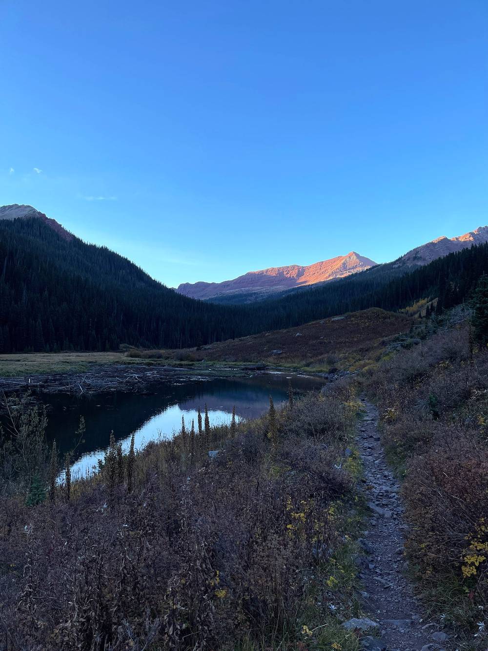
It's the way out. The trailhead is at the end of the valley.
Film, Day 4 · How I did it, with the map
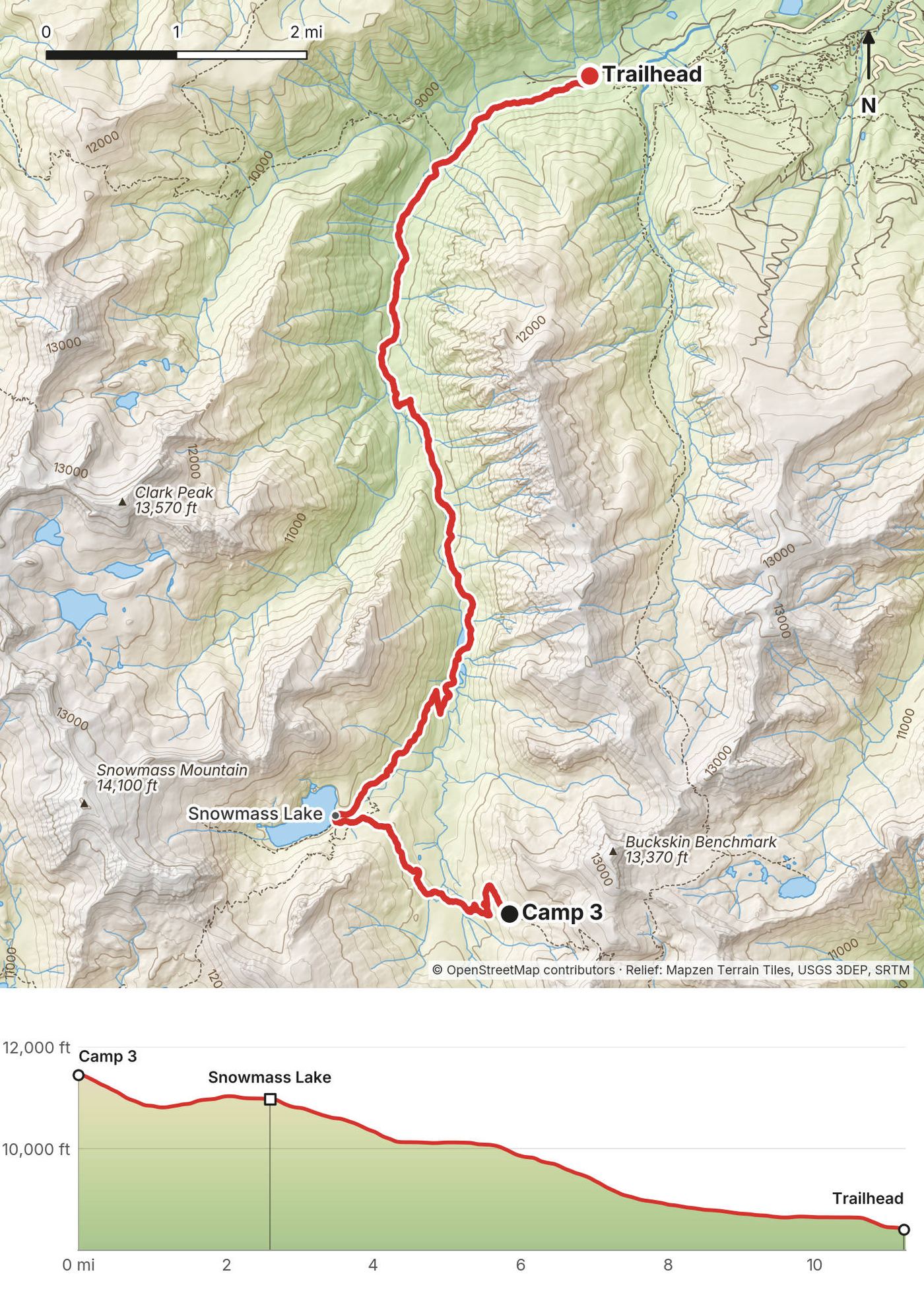
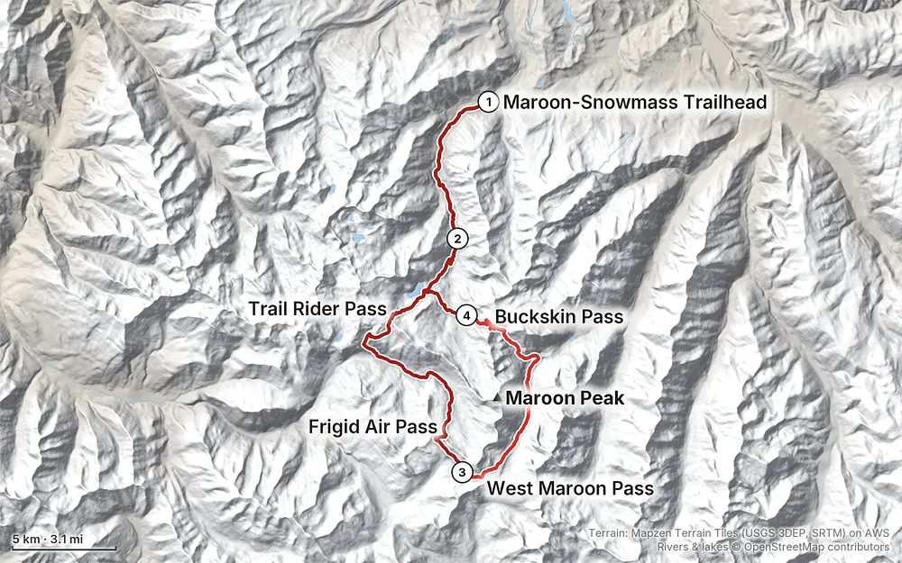
Elevation8,392–12,559 ft40.1 mi
Terrain: Mapzen Terrain Tiles (USGS 3DEP, SRTM) on AWS · Rivers & lakes © OpenStreetMap contributors
Tap a map to open it full size.
An overnight permit from Recreation.gov for every night in a permit zone, $10 a person a night (May to October) plus $6 a permit. A bear canister is required
From the hike's facts; check the official page before you go.
Summer and early fall. The Forest Service says the Four Pass Loop is often snow-bound from October through June; from early October to late June the camps, trails and passes are usually under snow, the trailheads may be closed, and there's avalanche danger. In July and August afternoon thunderstorms are the thing to plan around: be over the passes early.
Fall colors. I went for the aspens. In Aspen and Snowmass the colors usually peak between mid-September and early October, and the Maroon Bells are at their best in late September (Aspen Snowmass, the local tourism office). The year before, I came a couple of weeks later and the leaves had all fallen.
What I got. Four days of mostly blue sky at the end of September. The mornings were cold. On Day 3 a bit of cloud came in for the first time, right at the Maroon Bells view. On Day 4 I knew rain was coming, so I hurried out.
Late September in 2026. Hunting season: Visit Maroon Bells says hunters are allowed in the area, so wear orange if you go off trail. Snow can come early to the passes. Most of the Forest Service's developed campgrounds around Aspen close by early October.
This is the part I underestimated. Denver is at about 5,300 ft, the trailhead at 8,400 ft, my first camp at about 10,100 ft, and all four passes are above 12,400 ft.
I'd been testing my lungs, my body and my blood with how I deal with altitude, and coming from sea level the day before, it hit me hard. At the top of the first pass, about 12,500 ft, I felt it. It wasn't the worst I've ever felt. But I was absolutely feeling the altitude on Day 2, feeling really like crap, not being able to breathe, with a headache. I probably could have drunk more water. I was completely winded on all of these passes, and I didn't even get to 13,000 ft. As I dropped lower, things got easier, and I gained speed and energy.
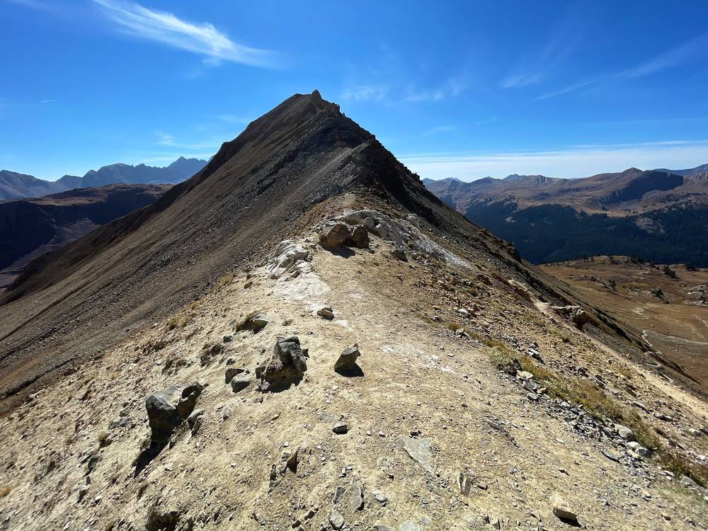
| Where | Height (my GPS) |
|---|---|
| Denver | about 5,300 ft (1,610 m) |
| The trailhead | 8,402 ft (2,561 m) |
| My camp 1 | 10,120 ft (3,084 m) |
| Snowmass Lake | 10,990 ft (3,349 m) |
| Trail Rider Pass | 12,425 ft (3,787 m); about 12,420 ft on local maps |
| Low point of Day 2, the North Fork valley | about 10,290 ft (3,137 m) |
| Frigid Air Pass | 12,398 ft (3,779 m); about 12,410 ft on local maps |
| My camp 2 | 11,710 ft (3,570 m) |
| West Maroon Pass | 12,503 ft (3,811 m); 12,500 ft (Forest Service) |
| Crater Lake | 10,082 ft (3,073 m) |
| Buckskin Pass | 12,480 ft (3,804 m); 12,462 ft (Forest Service) |
| My camp 3 | 11,460 ft (3,492 m) |
The rules of thumb. The US CDC's guidance (Yellow Book, April 2025): altitude illness becomes a risk when you sleep above about 8,000 ft (2,450 m); above 9,800 ft (3,000 m), don't raise your sleeping height by more than 1,650 ft (500 m) a night, and add a rest night for every 3,300 ft (1,000 m). I went from sea level to a tent at 10,100 ft in one day. A night or two in Aspen or Snowmass Village (around 8,000 ft) first, and a short first day, would have made Day 2 easier.
Going down helps. Headache is the first sign. If it gets worse despite rest, go lower. On this loop that means back down the valley you came up: Snowmass Creek, the North Fork, or West Maroon Creek to Maroon Lake.
Emergency (2026). Call 911. From a phone with an out-of-area number, Pitkin County dispatch is 970-920-5310; Mountain Rescue Aspen answers through them. There is no cell service on the loop and, as Visit Maroon Bells puts it, rescue can take several hours to reach you: be ready to get yourself out. A satellite messenger is the real backup.
CORSAR card. Colorado's search and rescue card helps fund rescue teams, but it isn't insurance and doesn't pay for medical transport. It is $5 for a year or $20 for five (Colorado Parks and Wildlife).
Lightning. In the mountains thunderstorms usually build in the early afternoon (National Weather Service), and the passes are far above treeline. Be over each pass by midday in summer, and get off ridges when a storm comes.
Snow. The Forest Service says the loop is often snow-bound from October through June, and snow returns to the high country early. Check the forecast before each pass in September.
September 2026. On September 14, 2026 heavy rain set off debris flows in the wilderness, including on the Four Pass Loop. The trails stayed open; Maroon Creek Road reopened with delays while crews clear debris. Read the current Forest Service alerts before you go.
Leave a plan with someone at home, with your trailhead, your route, your permit nights and when you'll be out.
Where to be careful:
Going solo. I walked alone. If you do, leave a plan, carry a satellite messenger, and don't push over a pass when you feel as bad as I did on Day 2 or when a storm is building.
How many days do I need? I took four, but the first was a 6-mile walk in after sunset and the last was a fast 11 miles out by lunchtime. I'd call it maybe a three-day hike if you add them together. From Maroon Lake, the loop itself is about 26 miles (the Forest Service's figure), and most people take three or four days. See Other ways to do it.
How hard is it? The trail is clear, but you cross four passes above 12,400 ft. Coming from sea level the day before, the altitude hit me hard. I'd planned two or three passes on Day 2 and only made it over two, with a headache and no breath. See Altitude.
Do I need a permit? In 2026, yes, for every night you camp in a permit zone, and the whole loop is in permit zones: you reserve each zone for each night on Recreation.gov. Bear canisters are required. See Permits and camping. In 2021 I signed the log book at the trailhead; that was before the permit system.
Where do I start? Most people start at Maroon Lake, which in 2026 needs a parking or bus reservation. I started from the Snowmass side, at the end of Snowmass Creek Road: no shuttle and, in 2021, no fee. It adds about 9 miles each way. See Getting there.
Which way round? I went counterclockwise from Snowmass Lake: Trail Rider, Frigid Air, West Maroon, then Buckskin. From Maroon Lake, the same direction means Buckskin first.
Will I see other people? Yes. So many people came up and said hi at Snowmass Lake. If you're on the trail and you spot me and you're a subscriber, say hi: it always makes my day.
Can I have a campfire? Not at most of the loop's camps: fires are banned above 10,800 ft (including Snowmass Lake), within a quarter mile of Crater Lake, and within 100 ft of water and trails. Bring a stove.
Is there phone signal? No. There's no cell service on the loop. Download everything before you go.
I walked the four days in this guide. These are other ways to use it, and I didn't do them.
The way most people do it. From Maroon Lake the loop is about 26 miles (the Forest Service's figure) and doesn't need the 9 miles up Snowmass Creek and back. Counterclockwise from Maroon Lake, as I went: up past Crater Lake and Minnehaha Gulch to Buckskin Pass, down to Snowmass Lake, over Trail Rider Pass, the North Fork, Frigid Air Pass, West Maroon Pass, and down West Maroon Creek to Crater Lake and Maroon Lake. You'll need Maroon Lake overnight parking, booked through your permit email, or the bus (see Getting there), and a permit for each zone you sleep in. My Days 2 and 3 and the first 2.6 miles of Day 4 cover the loop from Crater Lake round to Crater Lake; I didn't walk the 2 miles between Crater Lake and Maroon Lake, or the Day 1 and Day 4 Snowmass Creek walk you'd skip.
My Day 2 was 15 miles with two passes, and it destroyed me. The night I'd planned and didn't make was in the woods of the North Fork valley, between Trail Rider and Frigid Air passes. That splits the long day in two. Book each zone for each night.
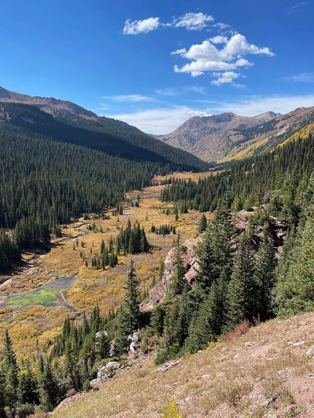
West Maroon Pass is also the way to Crested Butte. The West Maroon Trail goes on south to the Schofield Park parking area; the Forest Service says to arrange transport to Crested Butte ahead. It's a classic one-way day hike, not the loop, and I didn't do it.
These change every year. Everything else in this guide stays the same.
Permits and rules
Getting there
Conditions
Your stuff
The film is at the top of this page.
When bookings open, from the sources named under each. Dates move: confirm on the official site.
On set dates at 8 a.m. Mountain time: February 15 for April to July, June 15 for August to November, October 15 for December to March. Leftovers can be booked up to the day of your trip.
Next: Feb 15, 2027
Book on recreation.gov.
Source: Kraig Adams's Four Pass Loop guide: Permits and camping (2026). Checked October 2026.
Planning questions about Four Pass Loop, answered only from this page's facts, the creators' versions and hikers' public tracks, with where each answer comes from. When the data doesn't say, the answer says "not given".
From hikers
Sign in to comment. Free; your hikes stay private unless you share them.
Something wrong or missing on this page? Send feedback.