Follow the Hiker
Find my next hikeGearSavedKraig Adams
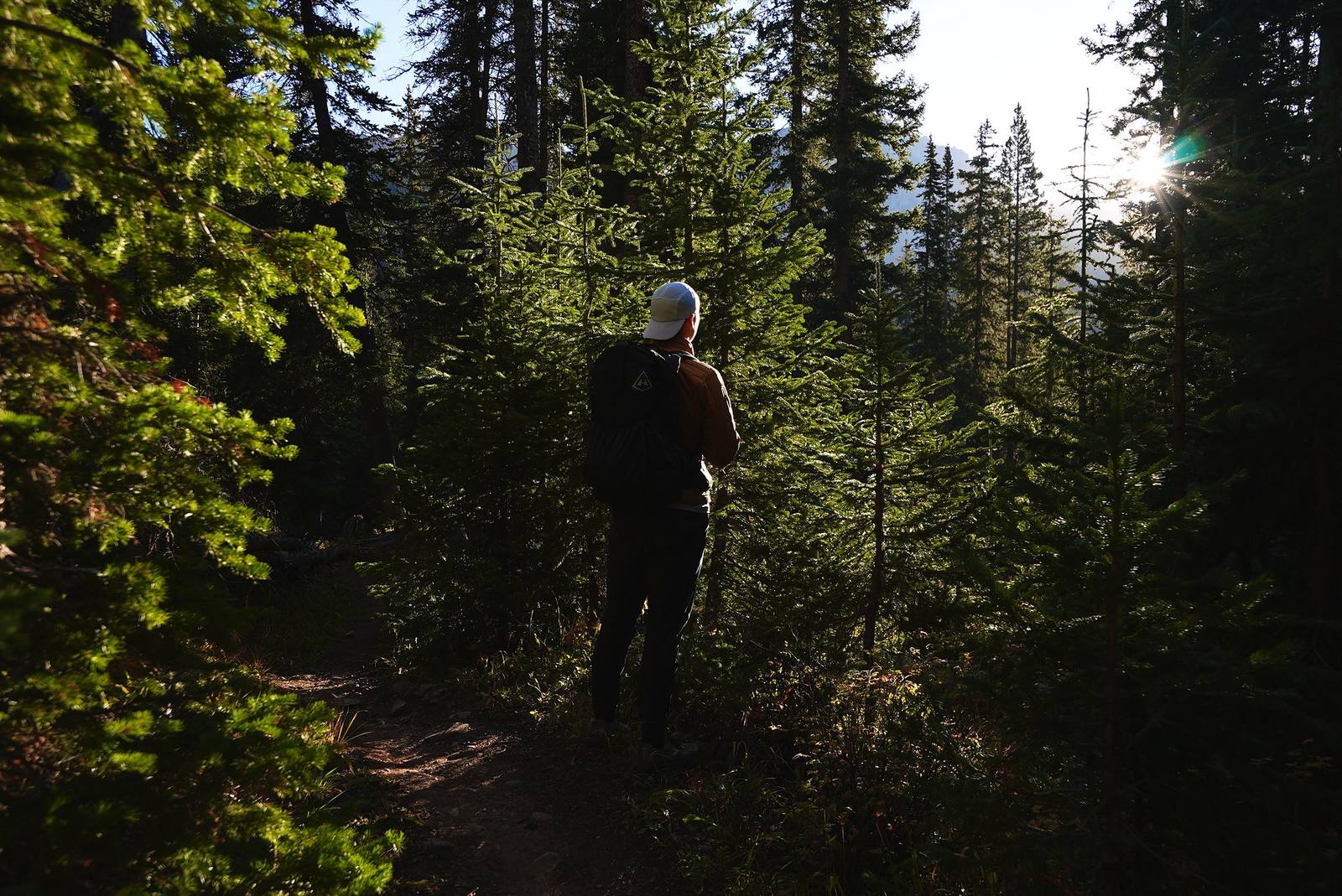
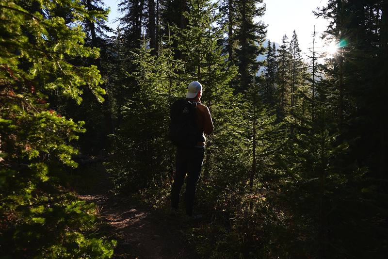
On the trail through the forest below Snowmass Lake, the morning of Day 2.

North America · United States

Four Pass Loop

Maroon Bells, Colorado

Distance
43.7 mi70.4 km
Days
4 days
Elevation gain
9,682 ft2,951 m
High point
12,569 ft3,831 m
Season
Mid-July to September
Lodging
Tent
Plan this hike

Hikes / North America / Four Pass Loop

In late September 2021 I flew to Denver, drove to Snowmass Village and hiked the Four Pass Loop in Colorado's Maroon Bells-Snowmass Wilderness: four days and about 44 miles, from the trailhead at the end of Snowmass Creek Road up to Snowmass Lake, over Trail Rider Pass, Frigid Air Pass, West Maroon Pass and Buckskin Pass, past Crater Lake under the Maroon Bells, and back down the way I came. It's the trip from my film Hiking 40 miles on the Four Pass Loop in Colorado.

Kraig Adams

Effort at this pace: Hard · about 11 mi (18 km) and 2,420 ft (738 m) of climbing a day over 4 days, up to 12,569 ft (3,831 m). Our grade for the days given, worked out from distance, climbing and altitude a day; it isn't the trail's usual difficulty rating (under Basics) and doesn't rate exposure, terrain or weather.

Where these numbers come from

From Kraig Adams's GPS recording and guide.

Plan this hikeSave this hike

Plan: dates, gear, deadlines and stays in a private link. Save: keeps it on your account.

From Kraig Adams's GPS

The route, day by day

Relief map of the Four Pass Loop route: 4 days drawn in red with numbered day starts, labelled Maroon-Snowmass Trailhead, Maroon Peak, Trail Rider Pass, Frigid Air Pass, West Maroon Pass and Buckskin Pass.

Elevation8,392–12,559 ft40.1 mi

From Kraig Adams's GPS. Terrain: Mapzen Terrain Tiles (USGS 3DEP, SRTM) on AWS · Rivers & lakes © OpenStreetMap contributors

Tap a day for his map of it

  • Read day 1
  • Read day 2
  • Read day 3
  • Read day 4

The film

Watch it first

Hiking 40 miles on the Four Pass Loop in Colorado

Kraig Adams · Sep 2021 · Solo

On the trail through the forest below Snowmass Lake, the morning of Day 2.
Yellow aspens above Snowmass Creek, the evening of Day 1.
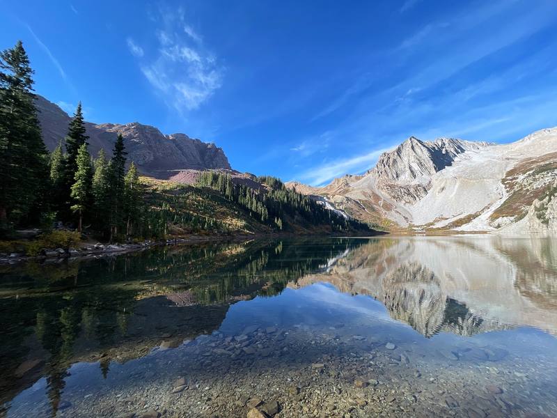
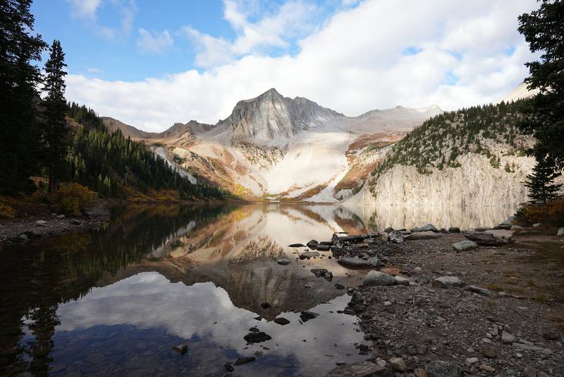
Snowmass Lake from its east shore, the morning of Day 2.
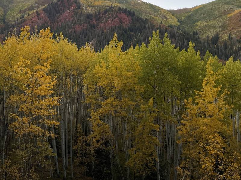
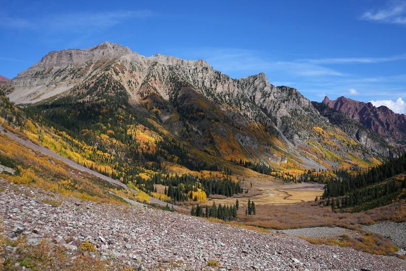
Aspens and peaks above the West Maroon Creek valley, Day 3.
Snowmass Lake under cloud, the morning of Day 4.

Before you go

The basics

Start
The Maroon-Snowmass Trailhead (also called the Snowmass Creek Trailhead), at the end of Snowmass Creek Road above Snowmass Village, 8,400 ft (2,560 m)
Finish
The Maroon-Snowmass Trailhead (also called the Snowmass Creek Trailhead), at the end of Snowmass Creek Road above Snowmass Village, 8,400 ft (2,560 m)
Direction
Counterclockwise from Snowmass Lake: Trail Rider, Frigid Air, West Maroon, then Buckskin
Usual difficulty
A clear trail, but four passes above 12,400 ft, long climbs, and no way out on a road in the middle
Best time
Mid-July to September. I walked September 25 to 28, 2021, with the aspens turning
Permits
An overnight permit from Recreation.gov for every night in a permit zone, $10 a person a night (May to October) plus $6 a permit. A bear canister is required
Getting there
What I did. I flew from my home in New York to Denver, direct, rented a car at the airport, and made the 4-hour drive up into the mountains toward Aspen. I went to Snowmass Village, stocked up on supplies, and drove out to the trailhead at the end of Snowmass Creek Road.
Lodging
Tent

From Kraig Adams's guide

Costs and gear

What it cost

The overnight permit: $10 a person a night plus $6 a permit, so a solo…

His costs, line by line

What Kraig carried

a tent and my sleeping gear · a small stove and pot, a mug, four days of food · a hooded shirt and shorts in the day, an orange puffy jacket and a beanie in camp · trekking poles · a headlamp · my phone · Arc’teryx Cerium Hoody · PATH Projects Hoyt Merino Beanie and 11 more.

The full gear list

Bookings and permits

When bookings open, from the sources named under each. Dates move: confirm on the official site.

Maroon Bells-Snowmass overnight permits

On set dates at 8 a.m. Mountain time: February 15 for April to July, June 15 for August to November, October 15 for December to March. Leftovers can be booked up to the day of your trip.

Next: Feb 15, 2027

Book on recreation.gov.

Source: Kraig Adams's Four Pass Loop guide: Permits and camping (2026). Checked October 2026.

Alert me when bookings open

We'll email you when bookings open: just that, nothing else. Your email is never shown or shared, and every alert has a delete link. Emails start once sign-ups open; nothing is sent yet.

From Kraig Adams's guide

Safety

Rescue numbers

  • Emergency (2026). Call 911. From a phone with an out-of-area number, Pitkin County dispatch is 970-920-5310; Mountain Rescue Aspen answers through them. There is no cell service on the loop and, as Visit Maroon Bells puts it, rescue can take several hours to reach you: be ready to get yourself out. A satellite messenger is the real backup.

Phone signal

  • No.
  • There's no cell service on the loop.

Insurance

  • Colorado's search and rescue card helps fund rescue teams, but it isn't insurance and doesn't pay for medical transport.

Bail-out points

  • Day 1, Trailhead up Snowmass Creek. Walk back down the valley to the trailhead.
  • Day 2, Snowmass Lake over Trail Rider Pass and Frigid Air Pass. Before Trail Rider Pass, go back down Snowmass Creek to the trailhead. In the North Fork valley, trails lead out west and south toward the roads near Marble and Schofield Pass, a long way from your car; the practical ways out are back over Trail Rider Pass or on over Frigid Air Pass. After Frigid Air Pass, the quickest way out is over West Maroon Pass and down to Maroon Lake, where the buses run in season.
  • Day 3, West Maroon Pass, Crater Lake and Buckskin Pass. At Crater Lake, walk down to Maroon Lake, about 2 miles, for the RFTA bus to Aspen Highlands (in 2026, May 22 to October 18; the last bus down at 5 p.m.; a one-way ticket for hikers is $10). Before that, go back over West Maroon Pass the way you came, or on down the valley. After Buckskin Pass, it's about 12.7 miles down Snowmass Creek to the trailhead on my GPS, or about 5.5 miles back down to Crater Lake and Maroon Lake for the bus.
  • Day 4, Down to Snowmass Lake and out to the trailhead. It's the way out. The trailhead is at the end of the valley.

From Kraig Adams's guide. For planning, not navigation: check before you go.

Their films and versions

Creators who've done it

1 creator so far: Kraig, 4 days, tent.

Walked Four Pass Loop? Be the first to share your track: log it with your GPX.

Your time

Sign in and log a few hikes to see how long this one would take you.

Typical: 4 days (the hike's facts).

Ask this hike

Planning questions about Four Pass Loop, answered only from this page's facts, the creators' versions and hikers' public tracks, with where each answer comes from. When the data doesn't say, the answer says "not given".

    From hikers

    Comments

    Sign in to comment. Free; your hikes stay private unless you share them.

    Answered from the data

    Questions people ask

    How many days do you need for Four Pass Loop?

    I took four, but the first was a 6-mile walk in after sunset and the last was a fast 11 miles out by lunchtime. I'd call it maybe a three-day hike if you add them together. From Maroon Lake, the loop itself is about 26 miles (the Forest Service's figure), and most people take three or four days. See Other ways to do it.

    From Kraig Adams's trip and guide.

    How much does Four Pass Loop cost?

    The overnight permit: $10 a person a night (May to October) plus $6 a permit, so a solo three-night trip costs $36. A bear canister (rent or borrow one if you don't own one). From Maroon Lake: $10 a vehicle for parking or $16 for the bus. A rental car from Denver or a flight to Aspen. A CORSAR card is $5 a year (see Weather and safety).

    From Kraig Adams's trip and guide.

    When is the best time to hike Four Pass Loop?

    Mid-July to September. The Forest Service says the loop is often snow-bound from October through June. For the yellow aspens, the colors usually peak from mid-September to early October; I walked it September 25 to 28.

    From Kraig Adams's trip and guide.

    Do you need a permit for Four Pass Loop?

    Yes, in 2026 you need a Recreation.gov overnight permit for each permit zone and each night you camp in it: $10 a person a night from May 1 to October 31, plus a $6 reservation fee per permit. Permits go on sale on set dates (February 15, June 15 and October 15 in 2026). Bear canisters are required.

    From Kraig Adams's trip and guide.

    How long is the Four Pass Loop?

    From Maroon Lake the loop is about 26 miles (the Forest Service's figure). I started from the Snowmass Creek trailhead, which adds about 9 miles each way: 43.7 miles in four days on my GPS, September 25 to 28, 2021.

    From Kraig Adams's trip and guide.

    How high are the passes on the Four Pass Loop?

    Buckskin Pass is 12,462 ft and West Maroon Pass 12,500 ft (Forest Service). Trail Rider Pass and Frigid Air Pass are both about 12,400 ft; my GPS read 12,425 ft and 12,398 ft.

    From Kraig Adams's trip and guide.

    Can you start the Four Pass Loop from Snowmass instead of Maroon Lake?

    Yes. I parked at the Maroon-Snowmass Trailhead (also called the Snowmass Creek Trailhead) at the end of Snowmass Creek Road and walked up to Snowmass Lake, about 8.8 miles, so I didn't need the Maroon Lake shuttle. In 2026 parking there is limited to about 25 spaces from August 14 to November 14 while the trailhead is rebuilt.

    From Kraig Adams's trip and guide.

    Which direction should you hike the Four Pass Loop?

    I went counterclockwise from Snowmass Lake: Trail Rider, Frigid Air, West Maroon, then Buckskin. From Maroon Lake the same direction starts with Buckskin Pass.

    From Kraig Adams's trip and guide.

    Plan this hikeBookings