
Content made there
The film is at the top of this page.
Photos
Hikes / Dientes de Navarino / Kraig Adams's version
South America · Chile
Mar 2025 · 3 days · about 32 miles · Solo · Tent

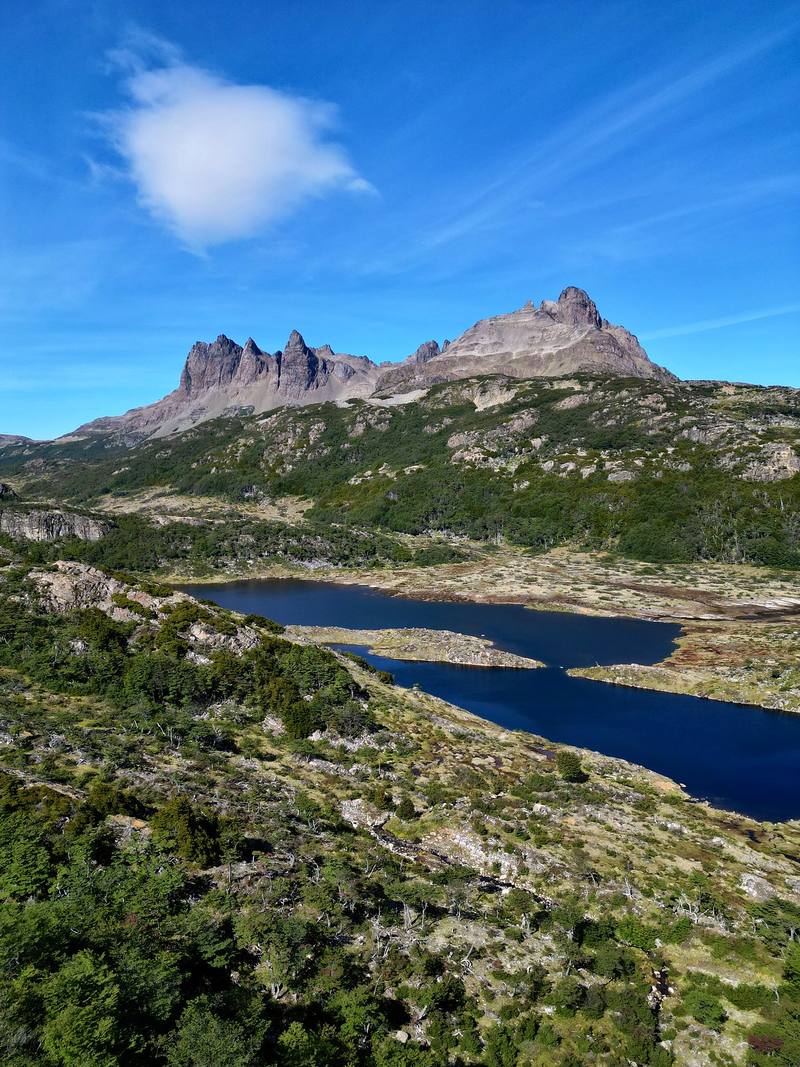
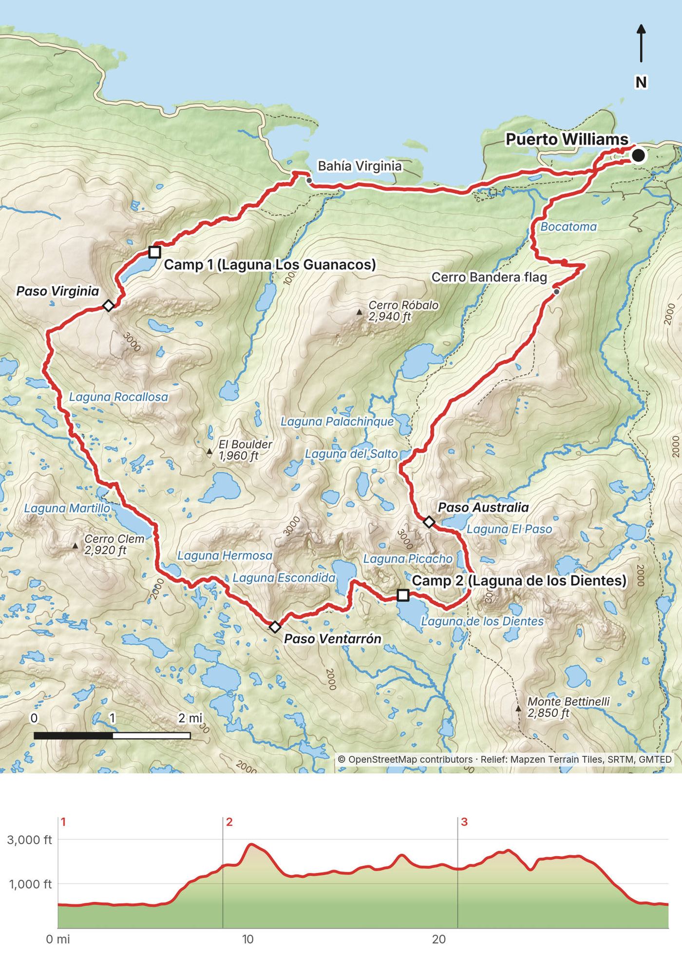
In March 2025 I hiked the Dientes de Navarino circuit on Navarino Island, Chile: the southernmost trek in the world. About 32 miles in three days, a loop on foot from Puerto Williams around the jagged peaks of the Dientes (the "Teeth of Navarino"), past dozens of lakes and over five passes, with the Beagle Channel below. It's the trip from my film Hiking the Dientes de Navarino Trail in Chile.
I didn't know this hike existed before my friend Ryan hit me up asking if I wanted to join. Because it's a loop, I decided to go separate from Ryan and Dave, the opposite way. So I hiked it alone, and we met once, halfway, for a high five.
| Quick facts | |
|---|---|
| Distance | 32.1 miles (51.6 km) in 3 days and 2 nights, a loop on foot from Puerto Williams (sea level). About 7.3 miles of it on roads |
| Climbing | about 6,630 ft (2,020 m) up and the same down |
| High point | Paso Virginia, 2,810 ft (856 m) on my GPS, Day 2 |
| When | November to March; the main circuit is closed every year from early April to October 31 (April 1 in 2026). I walked March 1 to 3, 2025 |
| Difficulty | Faint, badly marked trail, mud and bog, steep loose slopes, wind and fast weather. The municipality rates it medium to high |
| Registration | Free and required: the Carabineros in Puerto Williams, before and after |
| Huts, signal | None. Wild camps by the lakes, no phone signal |
| Day | Route | Miles (km) | Up / down (ft) | Sleep |
|---|---|---|---|---|
| 1 | Puerto Williams to Laguna Los Guanacos | 8.7 (13.9) | 1,985 / 269 | Tent, 1,790 ft |
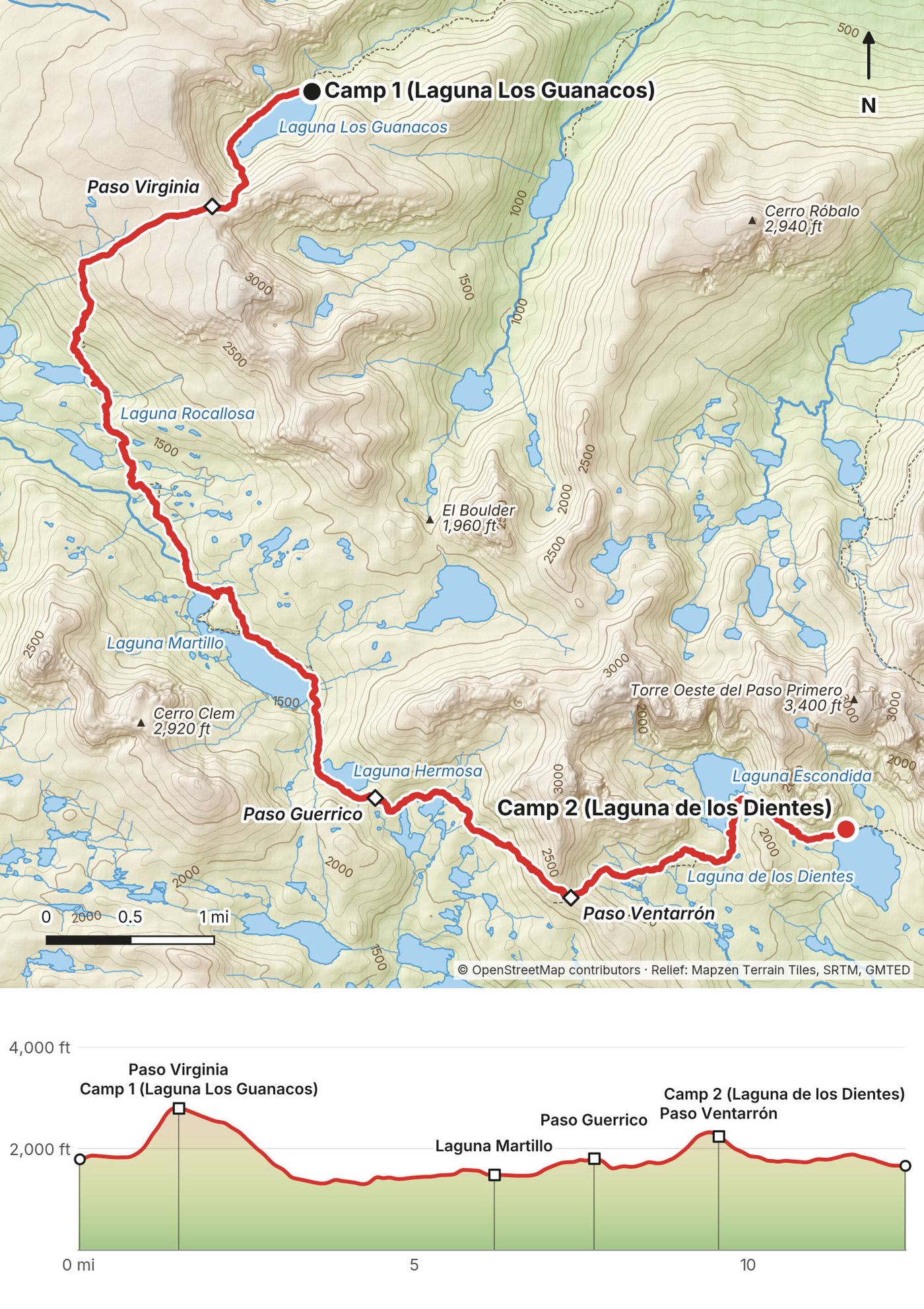
| 2 | Laguna Los Guanacos to Laguna de los Dientes | 12.3 (19.9) | 2,680 / 2,804 | Tent, 1,660 ft |
| 3 | Laguna de los Dientes to Puerto Williams | 11.1 (17.8) | 1,961 / 3,552 | Town |
Numbers are from my own GPS (the film says 30 miles). I went alone, in reverse of the official direction, which starts up Cerro Bandera from town. The official plan is 4 to 5 days.
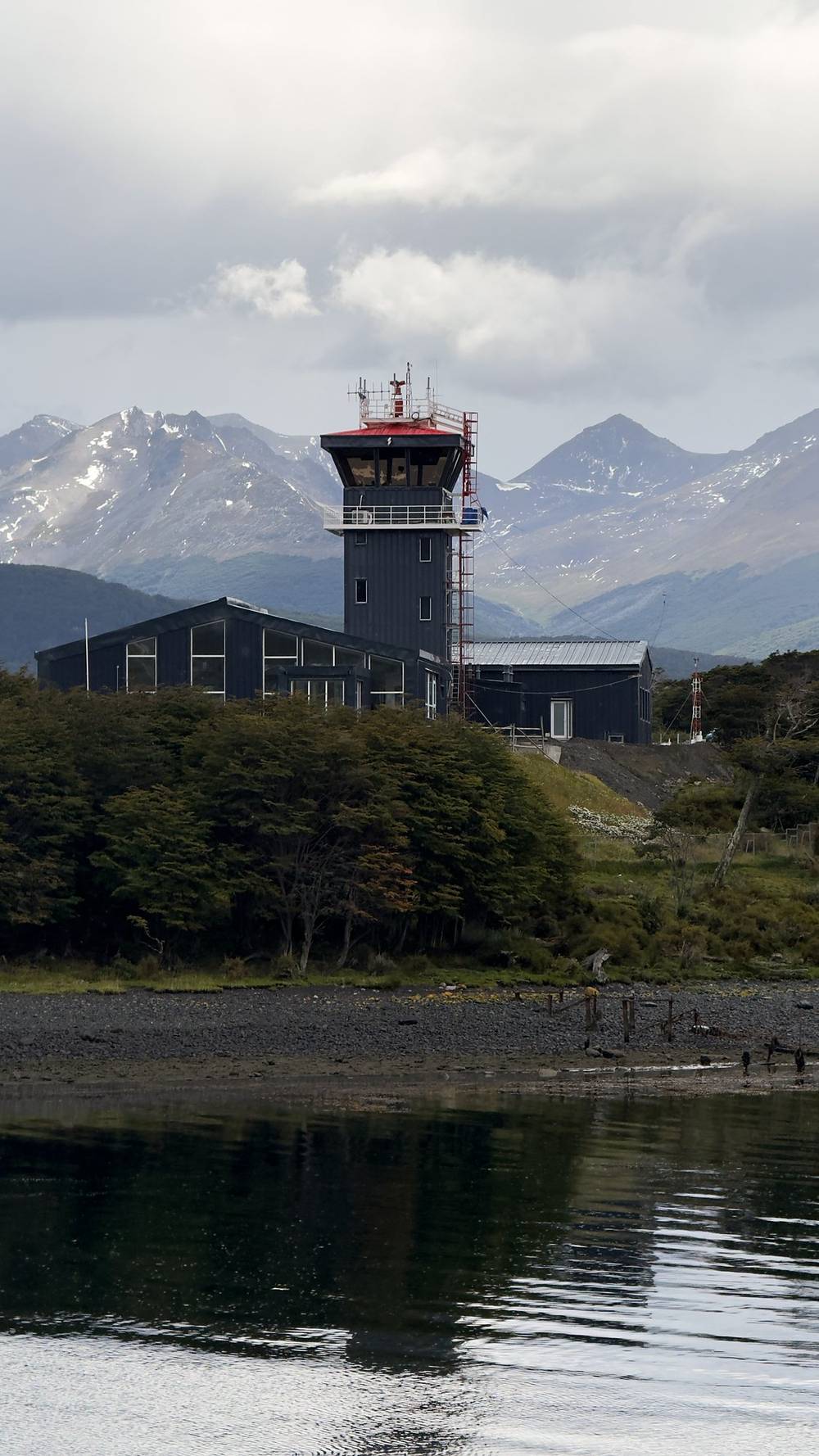
Puerto Williams. The town is the trailhead. It's on the north shore of Navarino Island, across the Beagle Channel from Ushuaia, Argentina, and it can only be reached by air from Punta Arenas or by boat. This was my third time in the area, after hiking the W and the O in Torres del Paine and a group trip with my wife and a bunch of subscribers.
How we got there. Ryan made the plan. We met in New York and flew to Santiago, then all the way down to Punta Arenas. We met Ryan's photographer friends in town at Lito's for sandwiches and stayed that night at the Hotel Cabo de Hornos. The next morning we checked our bags with the front desk, took a taxi to the airport, and took a very short flight to Puerto Williams. I had a window seat, so I had some pretty good views of the mountain ranges with snow caps. The tiny airport there had a wonderful mural. The shuttle left without us, so we had to walk all the way into town, but there were cows and dogs everywhere, just hanging around.

By plane. Aerovías DAP flies Punta Arenas to Puerto Williams. On its schedule page in October 2026: Monday, Wednesday, Thursday and Friday, leaving Punta Arenas at 12:00 and Puerto Williams at 13:30, on a 90-seat jet (in March 2025 I flew a smaller plane in DAP's Antarctic Airways colors). Summer schedules can change, so check dapairline.com before you book. The baggage allowance on this route is 10 kg (22 lb) in the hold plus 5 kg (11 lb) in the cabin; extra weight is CLP 2,000 a kilo if there's room, paid at the airport. DAP's office in Puerto Williams is at O'Higgins 264. The airfield is about 1.5 km (1 mile) from town.
By ferry. The Yaghan ferry (Transbordadora Austral Broom, TABSA) from Punta Arenas takes about 30 hours through the channels, about once a week. I couldn't read its 2026-27 schedule or fares on TABSA's site; check tabsa.cl.
From Ushuaia. In season (October to March, Monday to Saturday) boats cross from Ushuaia to Puerto Navarino, then a van drives about 55 km to Puerto Williams. One operator lists USD 160 each way (checked October 2026). You go through Chilean immigration at the PDI (police) office in Puerto Williams, so bring your passport. Chile's farm service (SAG) checks food at the border: declare any fruit, meat, dairy, honey or seeds on the SAG form, or buy fresh food in Puerto Williams.
Stove fuel. You can't fly with gas canisters. We got stove fuel at Turismo Shila, O'Higgins 220, which sells gas and rents gear (stoves, GPS units, poles, gaiters). Other shops in town sell gas too.
Food. There's nothing to buy on the circuit. Bring or buy all your food before you start.
| Item | What I paid in 2025 |
|---|---|
| Registration with the Carabineros | Free |
| Camps | Free (wild camping) |
| Flights, hotels, stove fuel | Not in my records (Ryan made the plan) |
For your budget (2026). Registration and camping are free. DAP doesn't publish its fares outside its booking page; travel sites showed roughly CLP 100,000 to 120,000 one way from Punta Arenas in 2025-26 (check dapairline.com), plus CLP 2,000 a kilo over the baggage allowance. The Ushuaia boat and van was USD 160 one way with one operator in 2025-26. In March 2025 the notice board at the Hotel Forjadores in my photos listed a single room at CLP 70,000 a night with breakfast. Add a gas canister, and a guide if you want one.
| Night | Where | Height (my GPS) |
|---|---|---|
| Before Day 1 | Hotel Cabo de Hornos, Punta Arenas (we flew in that morning) | |
| 1 | My tent at Laguna Los Guanacos (Day 1 mile 8.7) | 1,790 ft (546 m) |
| 2 | My tent at Laguna de los Dientes (Day 2 mile 12.3) | 1,660 ft (507 m) |
| After Day 3 | Hotel Forjadores, Puerto Williams (from my photos) |
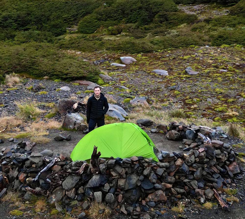
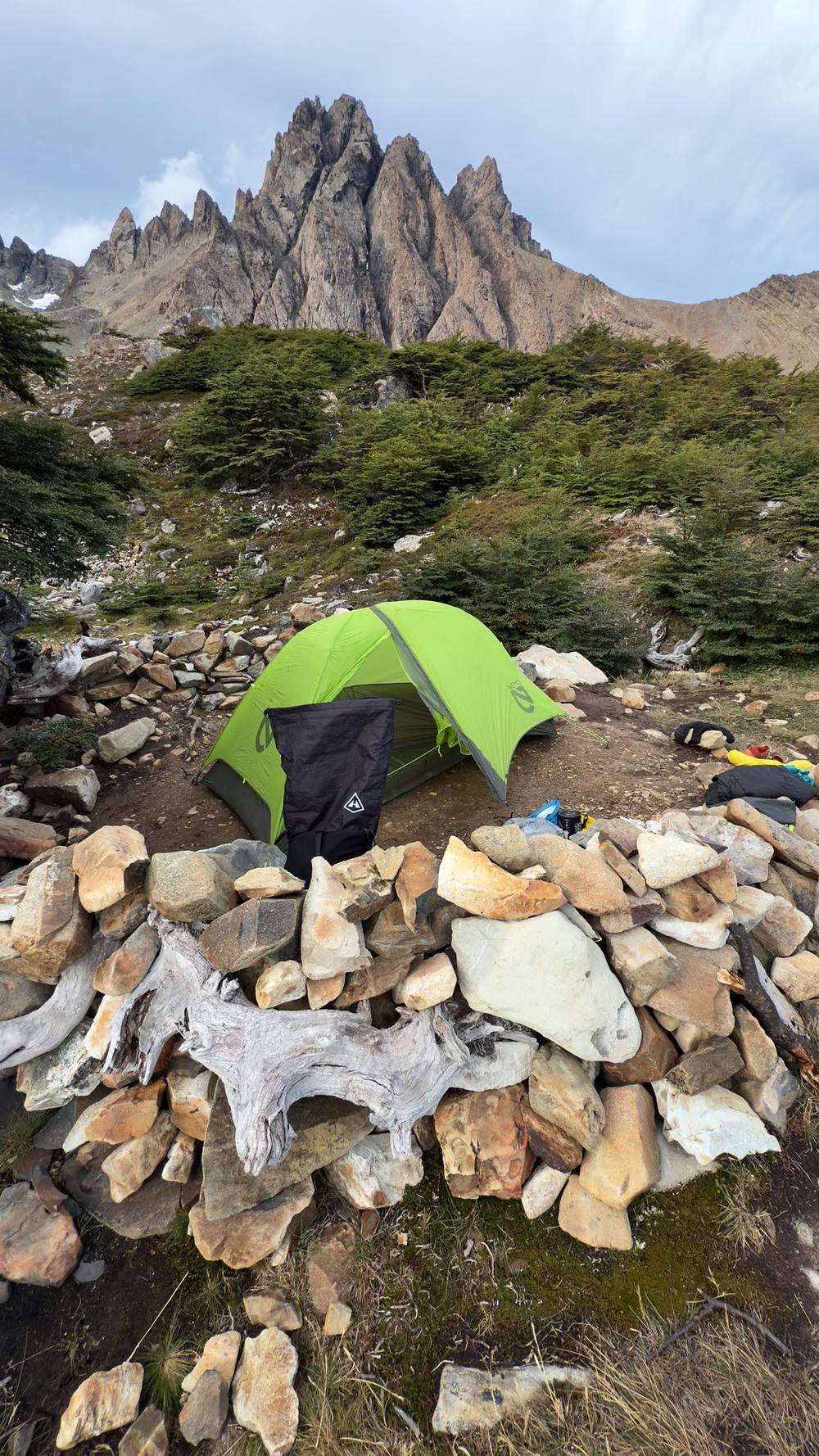
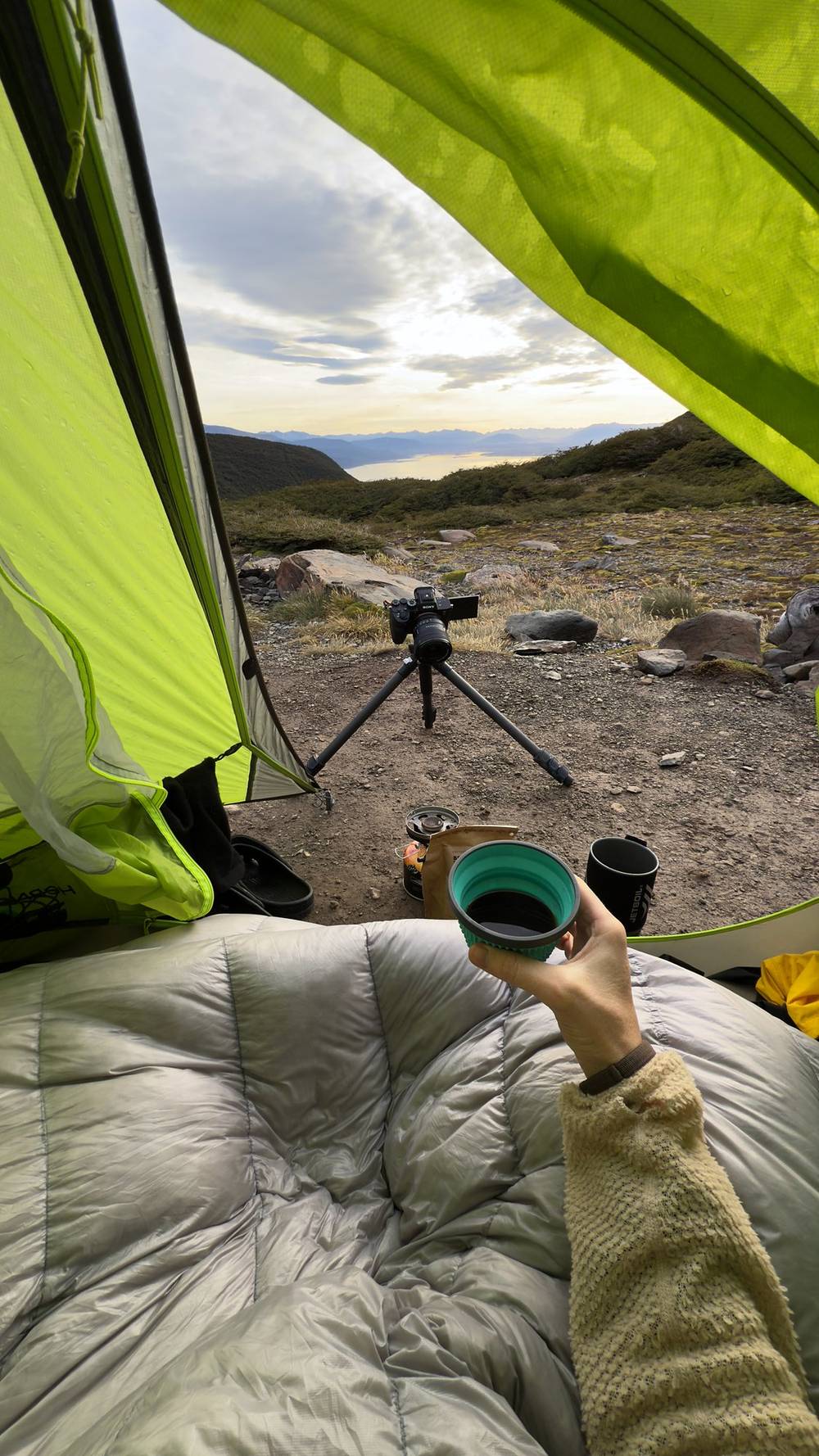
Both camps had tent spots with low rock walls against the wind. The campsites were great. Until we flew back the next day, we were just in our hiking clothes.
The record doesn't show what I ate on the trail. There's nothing to buy on the circuit: carry all your food from town, and a gas stove, since fires are banned. Back in Puerto Williams I had a nice meal at a restaurant and coffee in the plaza.
Lakes and streams most of the way, and both of my camps were on a lake. Treat or filter it: the official leaflet mentions beaver dams at Laguna Escondida and beaver-damaged forest below Laguna Los Guanacos. There are no toilets on the circuit: go well away from lakes and streams, bury your waste, and carry out all your trash.
My 2025 kit, from the gear list in the film's description, the film and my photos. Everything I brought, hiking and filmmaking, is listed there by type.
What this circuit needs:
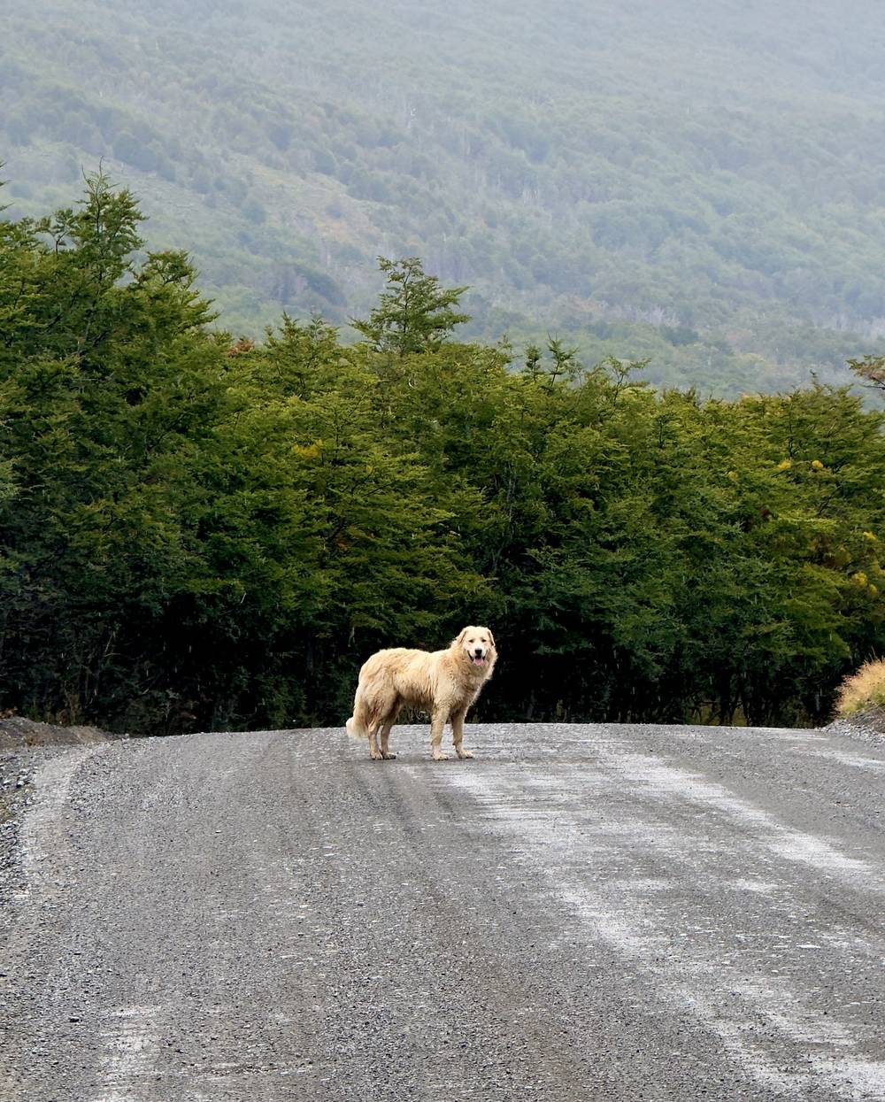
We flew in that morning, walked from the airport into town, bought stove fuel, and I set off from the plaza a little after 1 p.m. It was a short road walk to the trailhead from town (about 5.4 miles on my GPS), and a few dogs followed me for this section. A white golden retriever followed me out of town, and it was nice having a dog companion again. He kept throwing me shade whenever I'd set up my tripod. Right before I got onto the actual trail off the road, he went somewhere. Who knows where he lives.
For the first time ever, I crashed my drone, flying backwards into a tree. It got stuck pretty high up, and it took me almost two hours of collecting rocks and chucking them at it to get it down. Only a little damage on one of the plastic pieces, but I was so tired and sweaty and frustrated by the end.
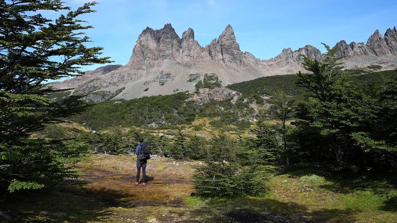
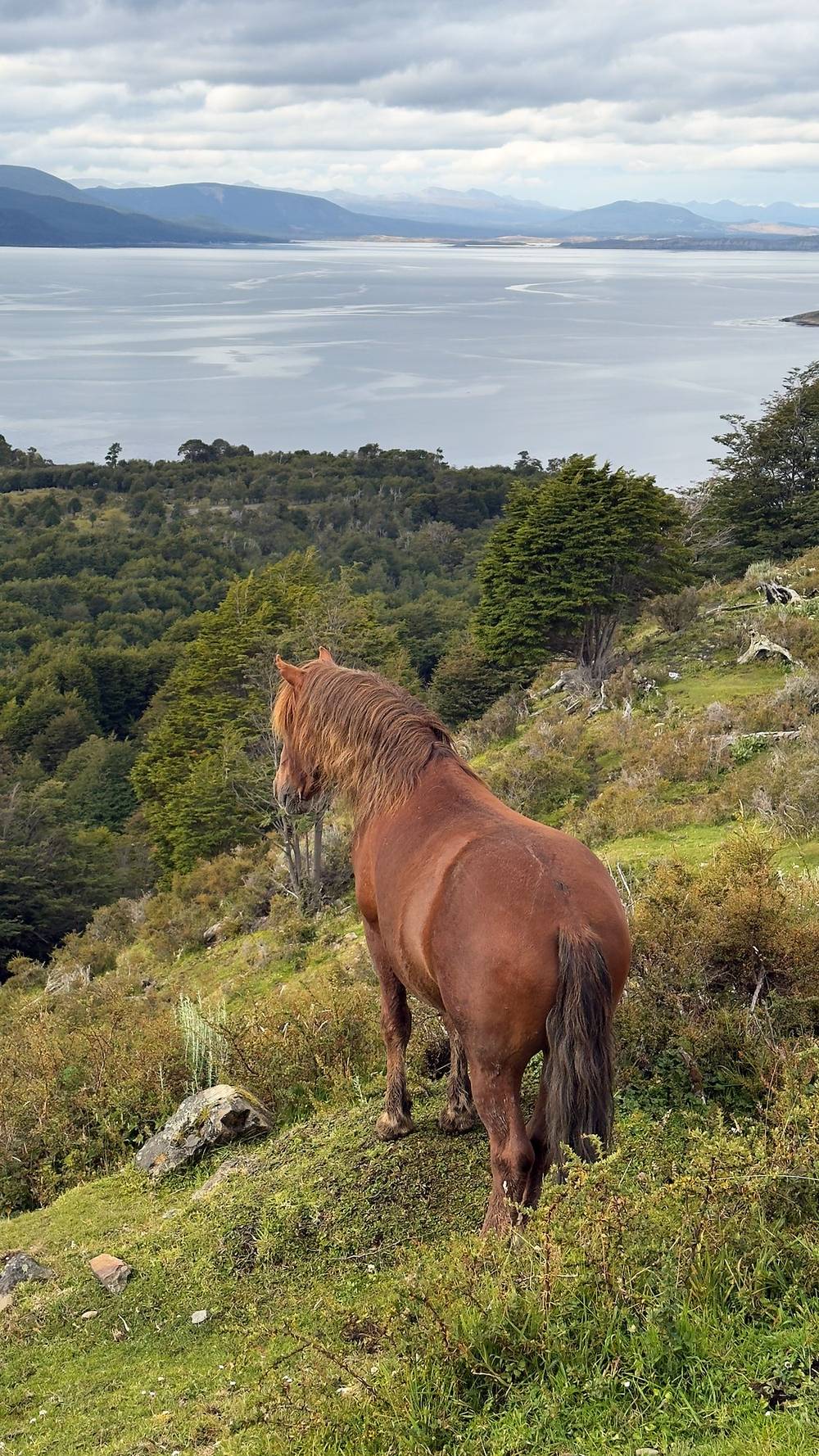
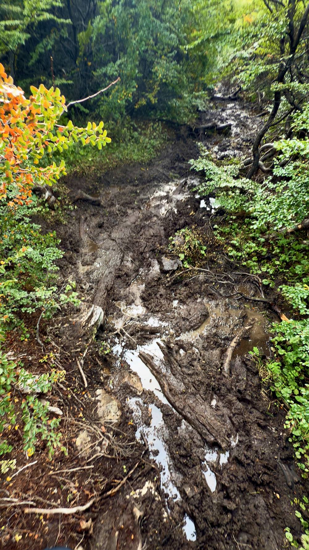
This first day had a lot of hills, and there were some random horses just chilling. The trail was muddy, hard to follow and a bit of a maze at times. Not many hikers go through here and it shows. I would get lost without AllTrails downloaded. I camped up at the lake all alone.
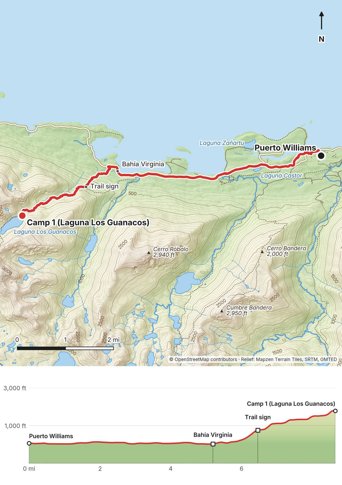
The road. From the plaza in Puerto Williams the route follows the town streets west to the coast road (Y-905 on OpenStreetMap), past the airport and along the Beagle Channel. It's about 5.4 miles of gravel road, flat and at sea level, past Laguna Castor and the houses at Caleta Róbalo to the old fishery at Bahía Virginia (mile 5.2). In the official direction this is where the circuit ends: hikers coming the other way finish on this road and walk it back to town.
Up to the circuit. Just past Bahía Virginia a path leaves the road and climbs through the forest. At mile 6.5, about 760 ft up, is a trail sign that OpenStreetMap marks as the trail's end. From here the trail climbs steadily, often through mud and roots, over open slopes with views back over the channel, to the camp at Laguna Los Guanacos at mile 8.7 (1,790 ft). The official leaflet names this forest as the place where it's easiest to lose the trail, and says to follow the red and yellow marks on the trees.
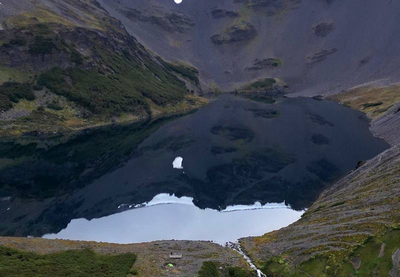
The camp. The tent spots sit on a shelf by the lake, ringed with low stone walls against the wind, with a view north to the channel. The lake lies in a cirque below the slope the trail climbs the next morning. The official leaflet calls this camp very exposed to the wind, and mentions a smaller lake, Laguna Las Guanacas, about 15 minutes below it.
Turn around: everything on Day 1 is within a few hours of the road, and the road goes back to town.
Film, Day 1 · How I did it (behind the scenes)
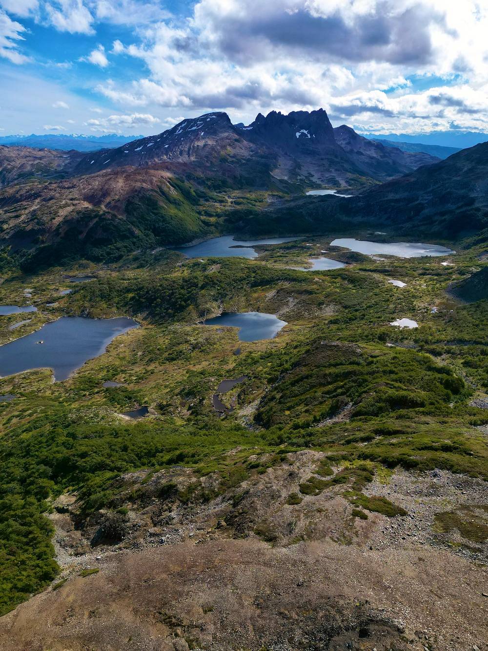
My first full day started at 7 a.m. with clear skies. The "choose-your-own-adventure" trail continued, with difficulty finding the path at most times. Beautiful lakes, and the big pass of the hike.
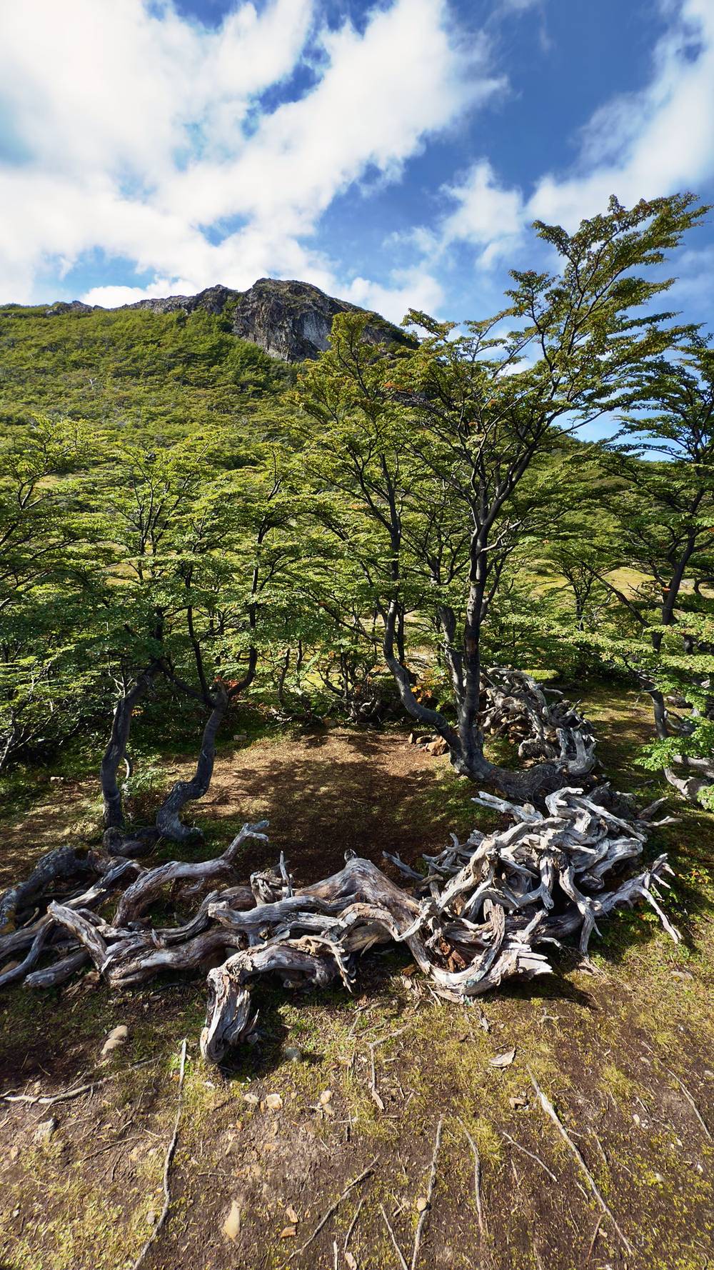
The campsites were great. There were these dead white tree branches that people had placed around the spot where tents go, and I think it looks pretty cool.
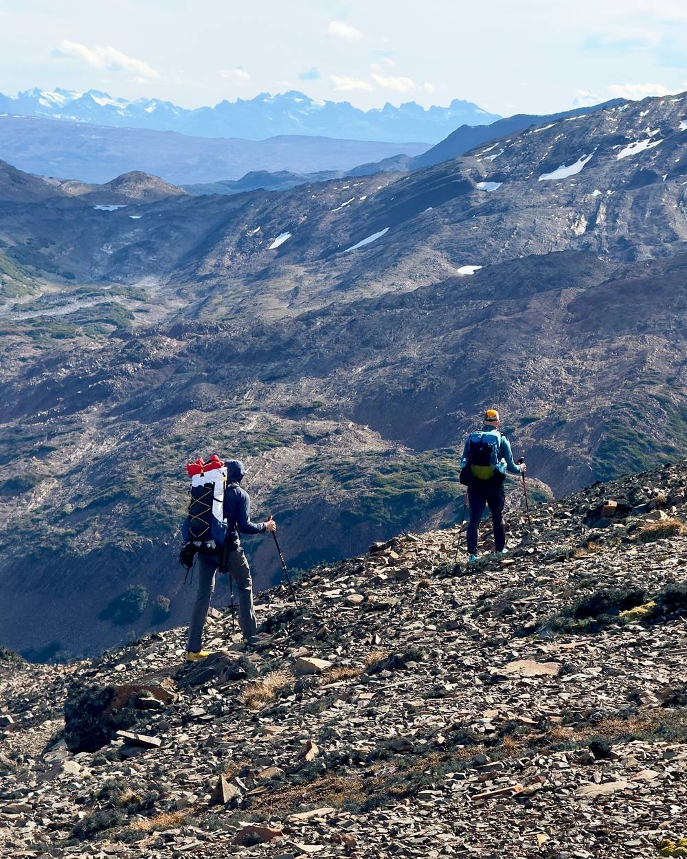
At the halfway point, near Paso Ventarrón, I met Ryan and Dave coming the other way. We high-fived and then went our separate ways.
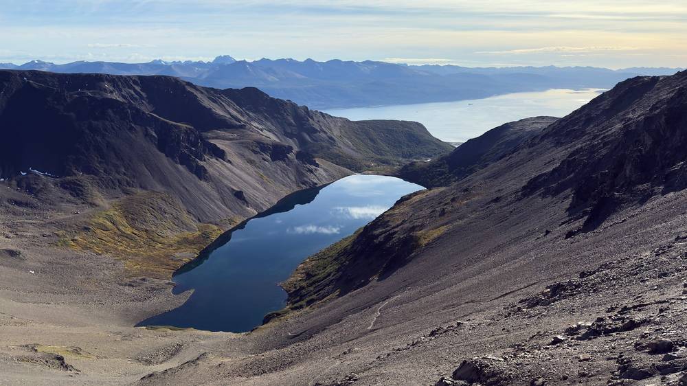
I set up camp right before a moderate rain shower that continued for a few hours as I fell asleep.
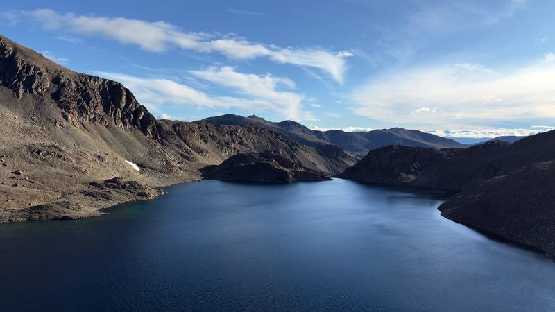
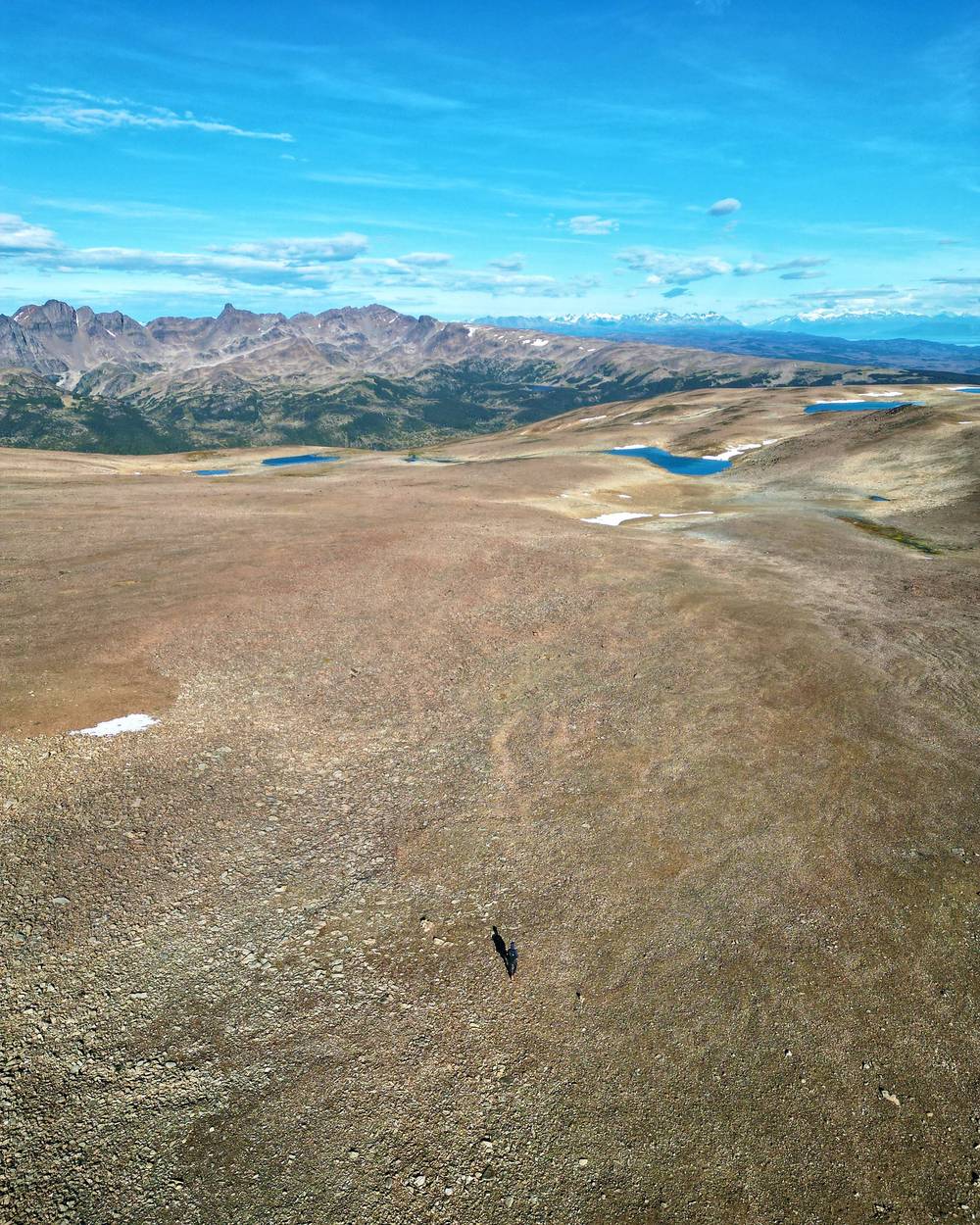
Paso Virginia. From the camp the trail passes Laguna Los Guanacos and climbs about 1,000 ft in a mile and a half, up a slope of loose rock (in the official direction this is the scree descent), to Paso Virginia at mile 1.5: 2,810 ft (856 m) on my GPS, 850 m on the official leaflet, the high point of the whole loop. The top is a broad, bare plateau, exposed to the wind, with the Dientes to the southeast.
Down to the lakes. The descent is long and steep on open, stony ground, about 1,500 ft down to Laguna Islote and Laguna Rocallosa (mile 4.0, about 1,350 ft). Watch for the cairns. My GPS shows almost an hour and a half for the two miles from the pass to Laguna Islote.
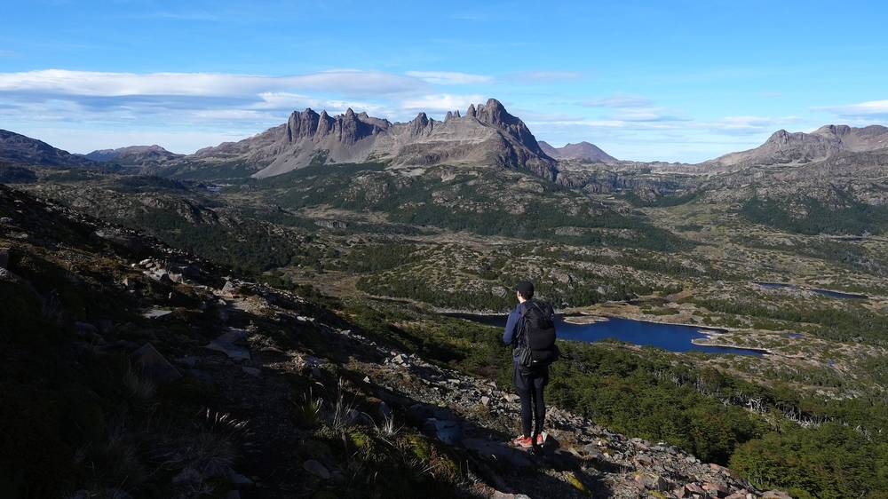
The lake country. For the next three miles the trail wanders through low forest, bog and open ground between small lakes, past several campsites (around miles 4.5 to 6.8, including the one with the white branches), along Laguna Martillo (mile 6.2) and up to Laguna Hermosa (mile 7.3). The path splits and fades often here, and my GPS track leaves the mapped path in several places.
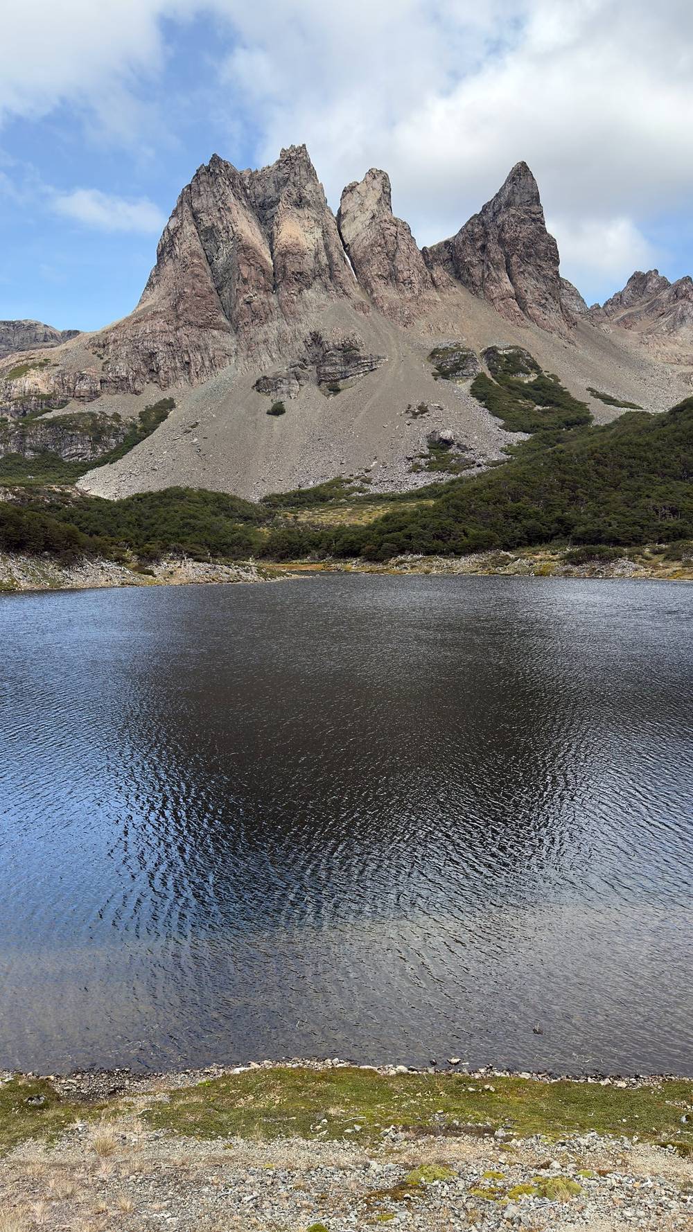
Paso Guerrico and Paso Ventarrón. Just past Laguna Hermosa the trail crosses Paso Guerrico (mile 7.7, 1,830 ft), a low saddle, then climbs over open rock to Paso Ventarrón at mile 9.6 (2,250 ft on my GPS, 691 m on the official leaflet). This is where I met Ryan and Dave. The leaflet calls the stretch between Laguna Escondida and Laguna Martillo the most remote part of the whole route.
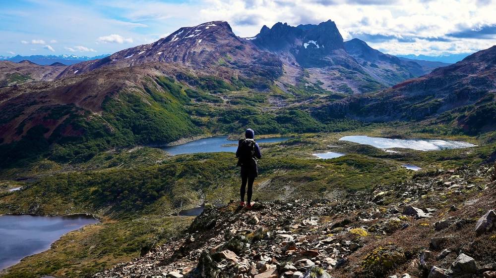
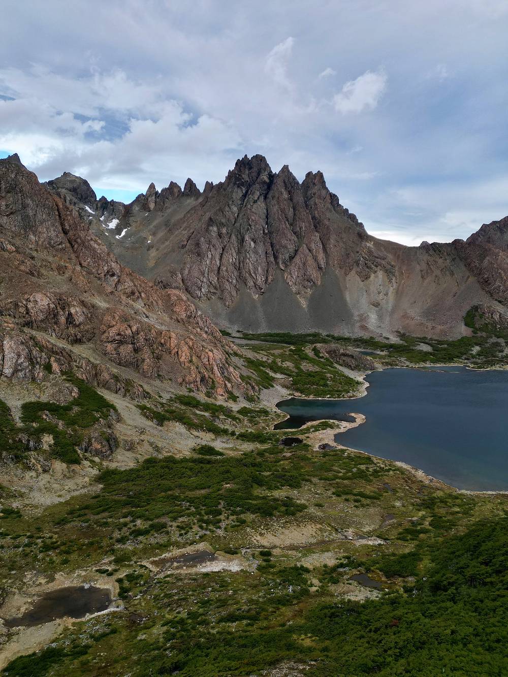
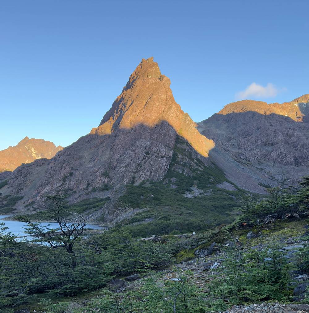
Laguna Escondida and camp. From Paso Ventarrón the trail drops to Laguna Escondida (mile 11.2, 1,780 ft); the leaflet says its outlet is crossed on beaver dams, and the path is intermittent here. It then runs east under the spires of the Dientes to Laguna de los Dientes. I camped there at mile 12.3 (1,660 ft), in a spot with a low rock wall.
Before Paso Virginia, go back down to the road the way you came. From Paso Virginia to the climb to Paso Ventarrón, the shortest way out is back over Paso Virginia to the coast road: from Laguna Martillo that's about 9.5 miles and one pass on my GPS, then 5 miles of road to town. Once you're over Paso Ventarrón, keep going: it's about 12 miles over Paso de los Dientes, Paso Australia and Cerro Bandera to the trailhead above town. Either way it's a long day or more. Don't cross Paso Virginia or Paso Ventarrón in high wind or fog.
Film, Day 2 · How I did it (behind the scenes)
Another day of sunlight and cinematic clouds. Conditions were so nice for hiking and filming. Such a nice time out here. Thanks, Chile.
I finished the hike a few hours before Ryan and Dave, and enjoyed a nice meal at a restaurant and sipped some coffee in the plaza outside. There were dogs hanging out. It was just really pleasant to sit and chill.
Two passes. From camp the trail climbs east past Laguna Picacho (mile 1.7) to Paso de los Dientes at mile 2.1 (2,430 ft), with Laguna El Paso just below it, then turns northwest and climbs a little more to Paso Australia at mile 2.6: 2,590 ft (789 m) on my GPS, 790 m on the official leaflet's profile, the last pass.
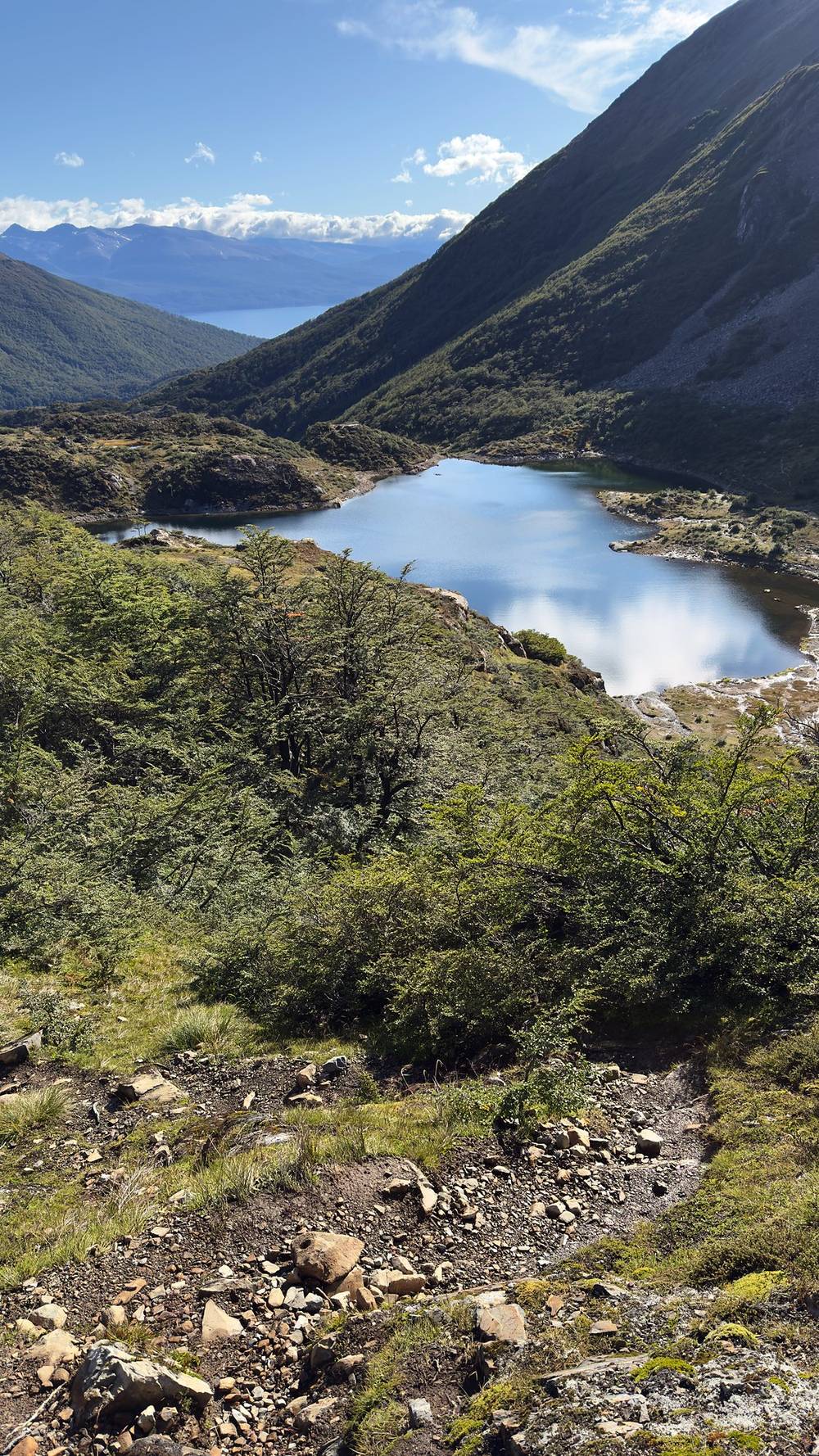
Laguna del Salto. The trail drops steeply about 1,000 ft to Laguna del Salto at mile 3.8 (1,590 ft), with camps near the lake. In the usual direction this is the first camp.
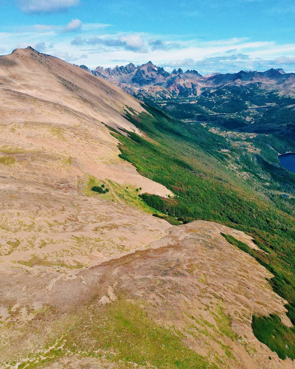
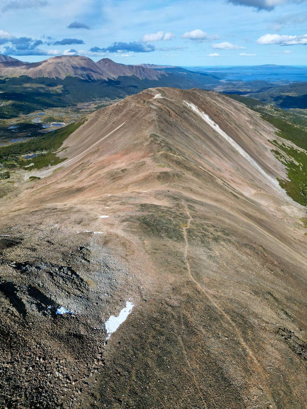
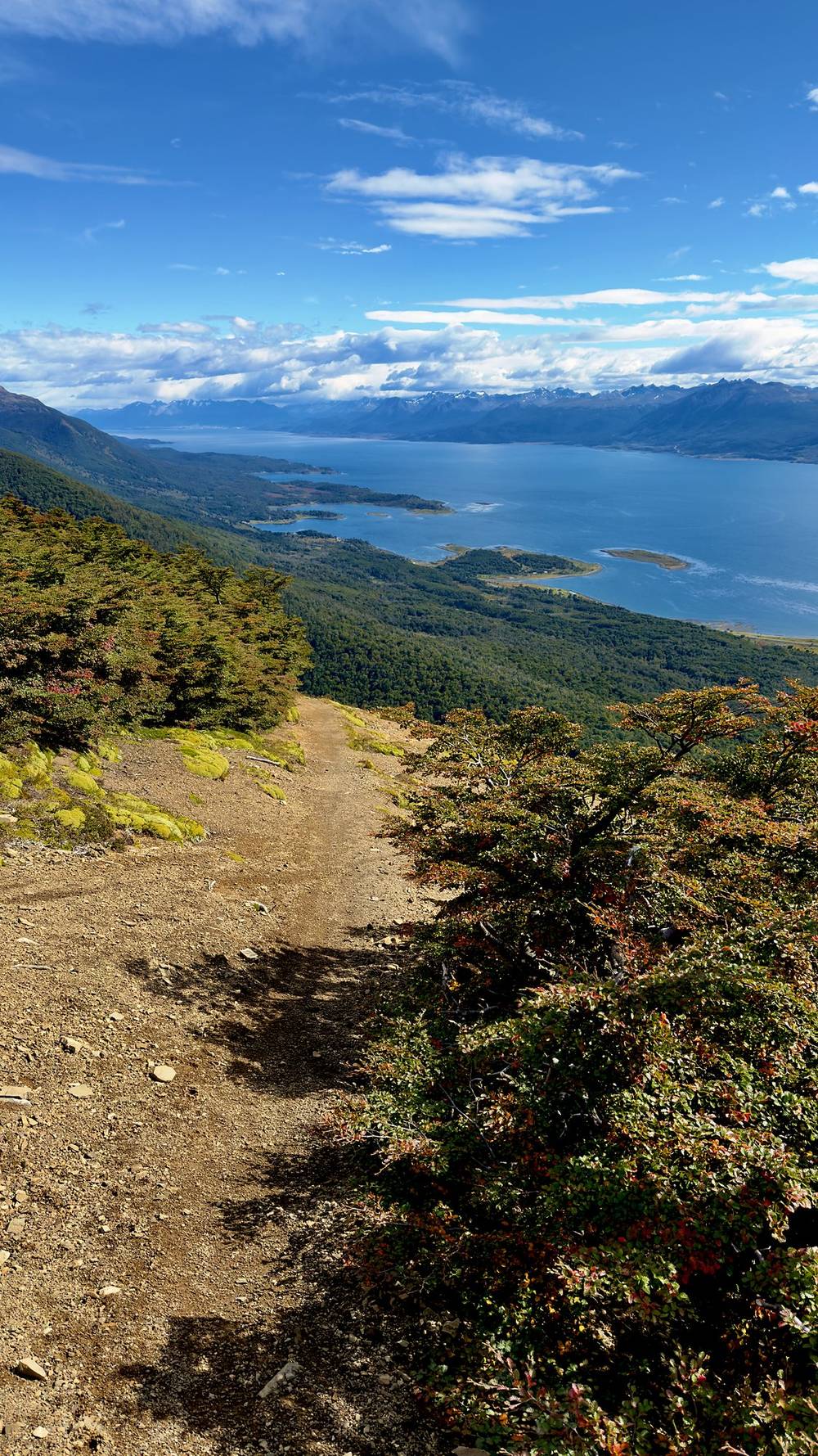
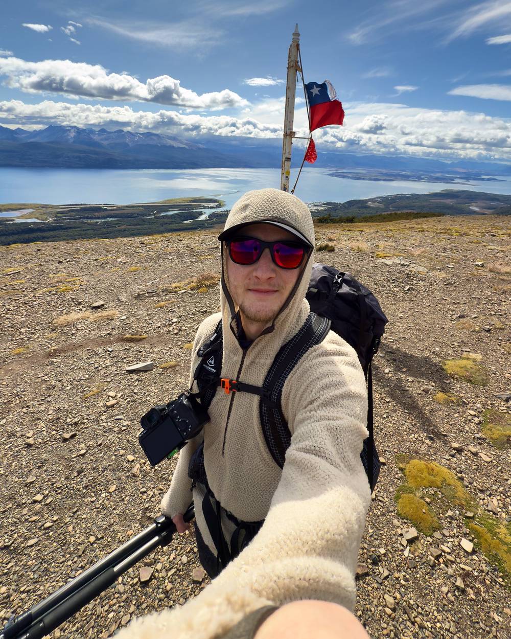
The ridge to Cerro Bandera. From the lake the trail climbs back onto a long, bare ridge, about 2,150 to 2,250 ft, and follows it northeast for about two and a half miles, with the Beagle Channel ahead. At mile 7.2 is the Chilean flag on Cerro Bandera, on a shoulder below the summit (about 2,000 ft; the official leaflet gives 613 m), above Puerto Williams.
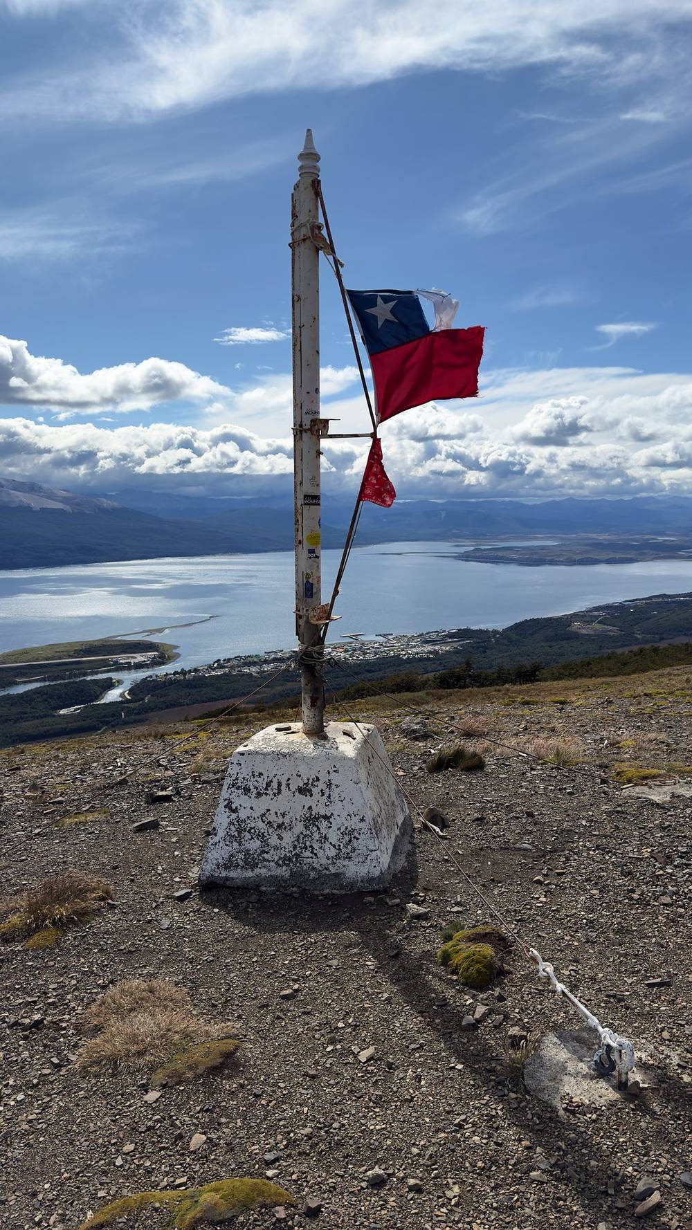
Down to town. From the flag the trail drops steeply through the forest, about 1,700 ft in two miles, to the trailhead by a small dam at mile 9.2, the official start of the circuit. A gravel road runs back into Puerto Williams, and I reached the plaza at mile 11.1.
From camp, Paso de los Dientes and Paso Australia are the way out, and from there it's downhill to Laguna del Salto and town. After Laguna del Salto you're on the busiest part of the circuit: day hikers walk up to the flag on Cerro Bandera from town.
Film, Day 3 · How I did it (behind the scenes)
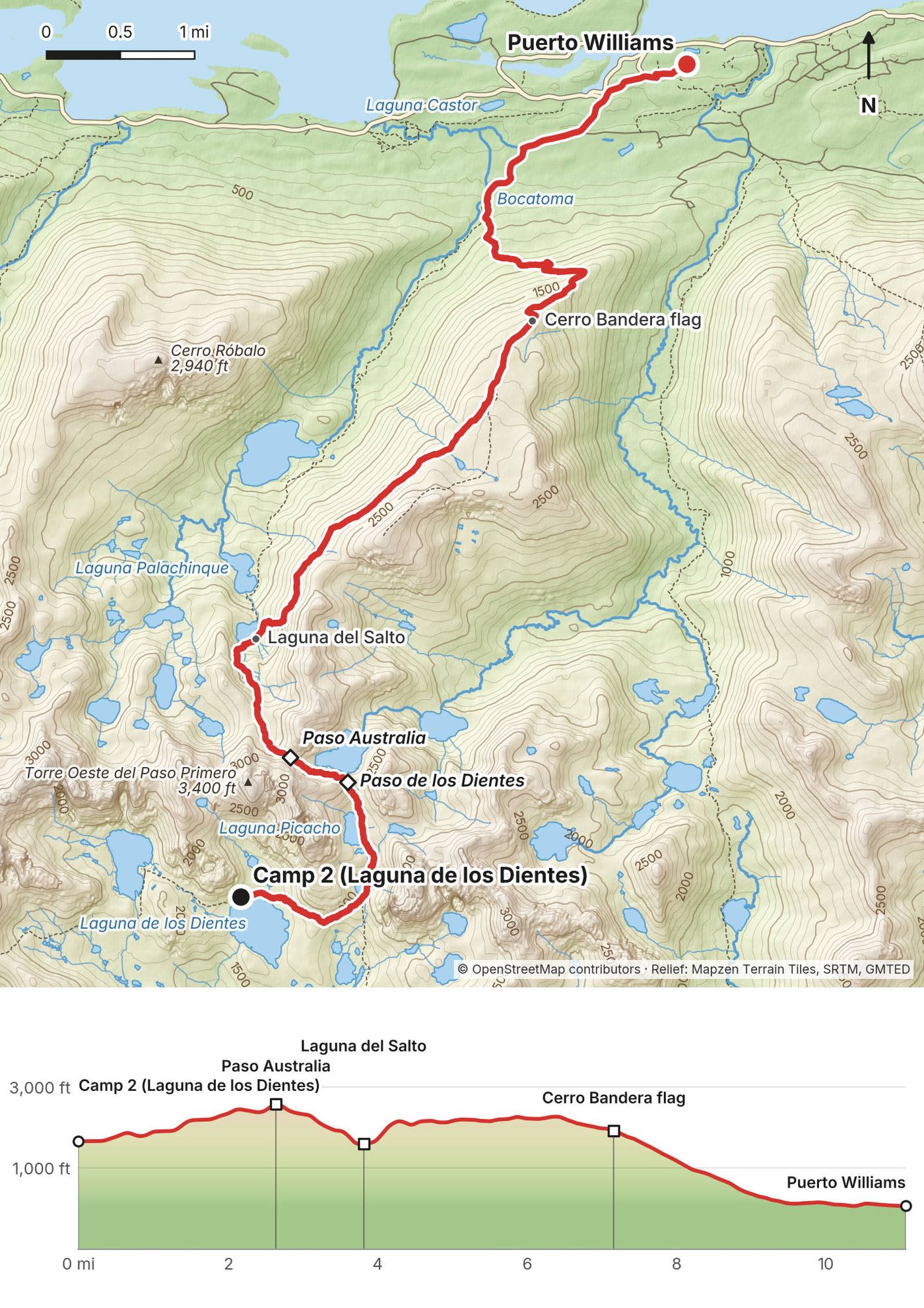
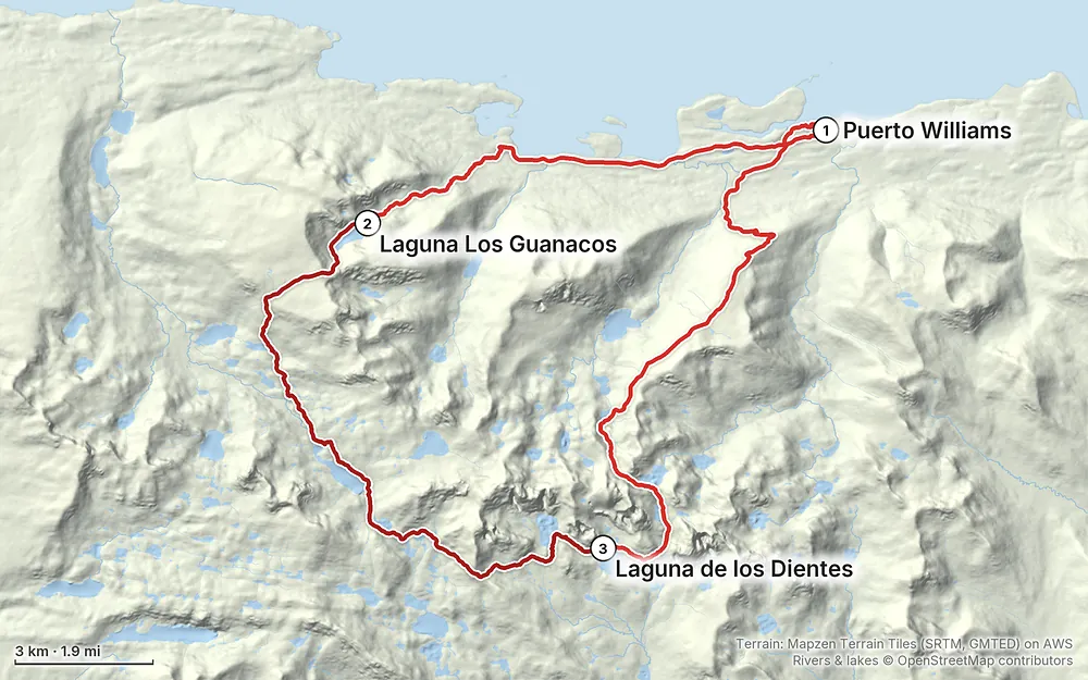
Elevation13–2,808 ft32.1 mi
Terrain: Mapzen Terrain Tiles (SRTM, GMTED) on AWS · Rivers & lakes © OpenStreetMap contributors
Tap a map to open it full size.
All of this was checked on official pages (the municipality of Cabo de Hornos, Chile's tourism board, the regional council and the national lands ministry, Bienes Nacionales) on October 1, 2026, except where it says otherwise.
Registration. Required and free. Go to the Carabineros station (the IV Comisaría) at Piloto Pardo 287 in Puerto Williams before you start, and again when you're back. The official leaflet says to give them your itinerary, a contact and your safety gear. Trip reports say to bring your passport and that the form asks about your experience, camps and insurance. I found no online form.
Fees. None that I found: no entry fee, no permit, no camp fee.
Whose land. The circuit is a Ruta Patrimonial (heritage route) on state land, managed by the municipality of Cabo de Hornos under a free concession from the Ministry of National Property (Bienes Nacionales), inside the Cabo de Hornos Biosphere Reserve. It's not a national park, so there's no CONAF registration. In March 2026 the regional council backed a five-year renewal of the concession, with plans for standard signs, camp areas, dry toilets and boardwalks over the bogs. Those weren't built yet as far as I could find; the trail may be better marked in coming seasons.
The seasonal closure. From about April 1 to October 31 each year (by municipal decree, reported in the regional press; in 2026, April 1 to October 31), the route beyond Cerro Bandera is closed and walking it is strictly prohibited.
Camping. Wild camping by the lakes; there are no huts or shelters. The official leaflet names camps at Laguna del Salto, Laguna Escondida, Laguna Martillo and Laguna Los Guanacos. The two camps I used had low stone walls built against the wind.
Fires. Strictly prohibited. Cook only on a gas stove.
Gear the municipality names. A base layer, a sleeping bag, a four-season tent, trekking poles, high-ankle hiking boots, spare clothes, a stove and gas, and satellite gear to navigate and call for help. It's worded as what you need, not a list anyone checks.
Respect the route. Stay on the trail, follow the signs, and carry out all your trash. I found no official rule on dogs or drones on the route.
Now (November 2026). The 2026 closure ended on October 31, so the circuit is open from November 1 for the November to March season. Registering with the Carabineros in Puerto Williams before and after is still required, and there is no phone signal on the route.
The season. November 1 to the end of March, when the circuit is open. The official leaflet says the best time is December to February. Even in summer, it says, you often have to push through snow on the high passes.
What I got. I started on March 1, 2025. Day 1 was overcast in my photos, and the trail was muddy. My first full day started at 7 a.m. with clear skies, and I set up camp right before a moderate rain shower that continued for a few hours as I fell asleep. Day 3 was another day of sunlight and cinematic clouds. Conditions were so nice for hiking and filming.
Daylight. At this latitude you get about 17 hours of daylight in December and January, about 15 hours 45 minutes on February 1, and about 13 hours 45 minutes on March 1, when I started.
Weather in town. The Chilean weather service's 1991-2020 averages for the Puerto Williams airfield give a January high of about 15 °C (59 °F) and a low of about 5 °C (41 °F), with rain on about 10 days of the month. The passes are 1,800 to 2,800 ft higher, colder and much windier.
Emergencies. There's no phone signal on the circuit. Carabineros (police): 133, station at Piloto Pardo 287. The hospital is the Hospital Comunitario de Puerto Williams Cristina Calderón, O'Higgins 246, +56 61 245 3635. Rescues on this route are run by the Carabineros, with a helicopter from Punta Arenas. At least 13 people had to be rescued in the 2025-26 season, including an injured hiker found after a three-day search in the Guerrico valley in February 2026. Carry a satellite messenger and register before and after: your registration is how anyone knows you're out there.
Getting lost. This is the main risk. This trail is pretty remote and not that popular, so it's kind of bushwhacking for some parts, and some sections are very muddy and a little difficult to get through. Keep the GPX open, check it often, and don't follow a side path just because it's there. The official leaflet and trip reports point to the forest below Laguna Los Guanacos and the stretch around Laguna Escondida, and my own GPS wandered off the mapped path in the lake country around Laguna Martillo.
Wind and weather. This trail is remote, so the weather can change a lot. The municipality warns of snow, strong wind, low visibility and low temperatures, and the leaflet says snow on the passes is normal even in summer. Paso Virginia and the ridge to Cerro Bandera are wide open. The leaflet says that if it's very windy on the ridge, it can be safer to drop into the forest on the side of the hill. Wait out bad weather rather than cross a pass in fog or a gale.
Steep, loose ground. The slopes on both sides of Paso Virginia and the drop from Paso Australia to Laguna del Salto are steep and loose. Poles help.
Cold and rain. Rain, snow and cold can come in any month. Keep your sleeping bag and a set of clothes dry.
Fire. Fires are banned. Use your stove carefully, on rock, out of the wind.
Leave a plan with someone at home and with the Carabineros: your route, your camps and when you'll be out.
Do I need a permit? No permit and no fee, but you must register. The municipality of Cabo de Hornos says it's mandatory to notify the Carabineros before and after the trek, at their station at Piloto Pardo 287 in Puerto Williams. Give them your route, your dates, an emergency contact and the safety gear you carry, and check back in when you return. See Permits and rules.
Is it open? From November 1 to about the end of March. Every year the section from Cerro Bandera to the end of the route is closed by municipal decree from early April to October 31; in 2026 the closure ran April 1 to October 31, and walking it is strictly prohibited. The day hike up to the flag on Cerro Bandera stays open.
How hard is it to follow? Hard. The official leaflet calls the trail poorly marked and intermittent, with cairns on the passes and paint marks on trees in the last forest. In my words: muddy, hard to follow and a bit of a maze at times, a choose-your-own-adventure trail with difficulty finding the path at most times. I would get lost without AllTrails downloaded. Carry the GPX files on your phone and a backup. See Using the GPX files.
Do I need a guide? No rule requires one. The municipality says to hire a local guide if you don't have the experience for a medium-to-high difficulty trek. I went alone, while my friends did the circuit the other way. The official leaflet says never to split from your companions and to reach each day's destination in daylight; if you go alone, carry a satellite messenger and leave a detailed plan with the Carabineros and someone at home.
How many days? I did it in three days of 9 to 12 miles. The municipality and Chile's tourism board say 4 to 5 days, and the official leaflet plans 5. Add a spare day for weather.
Which direction? The official direction starts in Puerto Williams, climbs Cerro Bandera and ends on the coast road near Bahía Virginia, about 5 miles west of town. I went the other way: the road walk first, Cerro Bandera last. My GPX files work in either direction.
How long is it? It depends on what you count. My loop was 32.1 miles (51.6 km) from the plaza and back, about 24.7 miles (39.8 km) of it on the trail. The official leaflet gives about 41 km of trail, and the Bienes Nacionales website 52.5 km.
Is there water? Mostly: lakes and streams most of the way. The official leaflet warns that some stretches have none, and that you should carry water for the first two hours from town, over Cerro Bandera. Going my way, that's the end: fill up at Laguna del Salto and carry at least a liter (1 quart) for the ridge and the descent. Treat or filter it.
Will I see other people? Not many. Not many hikers go through here, and it shows. I camped up at the lake all alone the first night. The Carabineros registered 1,217 hikers in the whole 2024-25 season. Near town you'll meet day hikers on Cerro Bandera.
Is there phone signal? No. The municipality calls the route isolated, with no phone signal, no shelters and no permanent patrols, and says to carry satellite gear: a GPS messenger like an inReach, a VHF radio or a satellite phone.
The official leaflet runs the circuit the other way, in five stages: Puerto Williams over Cerro Bandera to Laguna del Salto (8.7 km); Laguna del Salto over Paso Australia and Paso de los Dientes to Laguna Escondida (8.7 km, the stage it rates difficult); Laguna Escondida over Paso Ventarrón and Paso Guerrico to Laguna Martillo (6.6 km); Laguna Martillo over Paso Virginia to Laguna Los Guanacos (11.5 km); and down through the forest to the coast road (4.6 km), then 7.4 km by road to town. My GPX files work in that direction too: read my days backwards.
I went the opposite way and did it in three days, with the road walk first and Cerro Bandera last. My days were 8.7, 12.3 and 11.1 miles, and the middle one took 9.3 hours.
The trail from town to the flag on Cerro Bandera is a day hike, and it stays open when the rest of the circuit is closed. On my GPS it's about 3.9 miles (6.3 km) from the plaza to the flag, with about 1,850 ft of climbing, and the flag looks out over the Beagle Channel.
These change every year. Everything else in this guide stays the same.
Rules and status
Getting there
Conditions
Your stuff
The film is at the top of this page.
Planning questions about Dientes de Navarino, answered only from this page's facts, the creators' versions and hikers' public tracks, with where each answer comes from. When the data doesn't say, the answer says "not given".
From hikers
Sign in to comment. Free; your hikes stay private unless you share them.
Some lodging links earn me a small commission at no cost to you.
Something wrong or missing on this page? Send feedback.