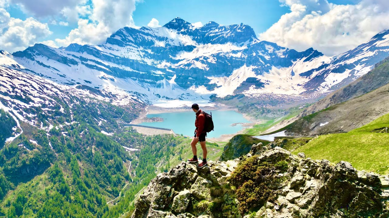
Content made there
The film is at the top of this page.
Photos
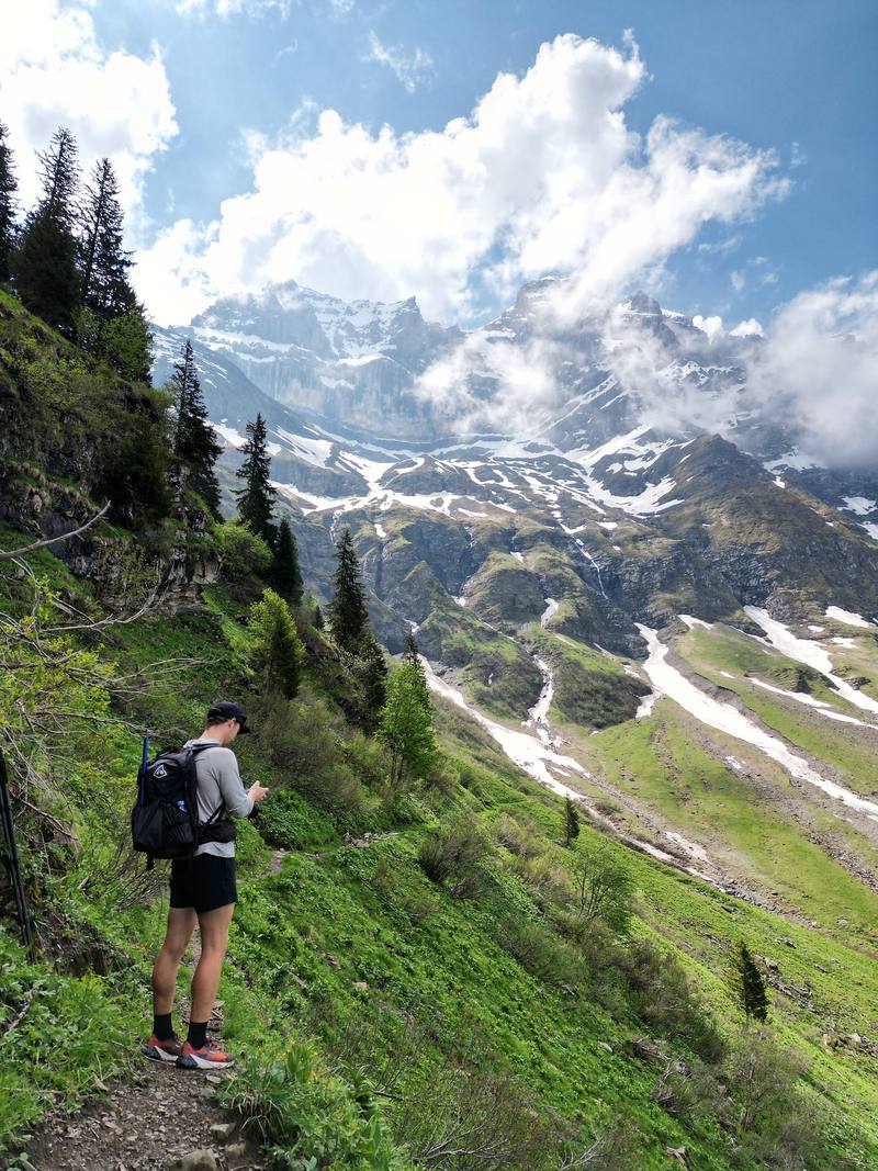
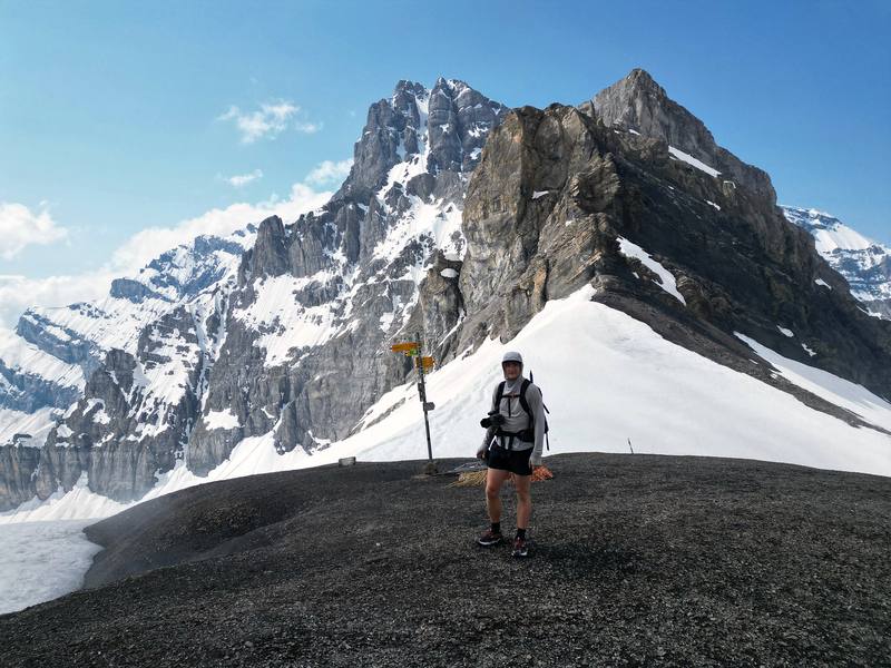
Hikes / Tour des Dents du Midi / Kraig Adams's version
Europe · Switzerland
Jun 2023 · about 42 miles · Solo · Huts

In early June 2023 I flew into Geneva, picked up an ice axe, took the train to Saint-Maurice in the Rhône valley and hiked the Tour des Dents du Midi in Valais, Switzerland: a loop around the Dents du Midi from Saint-Maurice, up to the Auberge de Chindonne, along the high meadows past Anthème to the Refuge de Bonavau above Champéry, over the snowy Col de Susanfe to Lac de Salanfe, over the Col du Jorat and down through Mex back to Saint-Maurice. It's the trip from my film Hiking 50 miles on the Dents du Midi in Switzerland.
It didn't go to plan. On the first day I got hailed on so hard I turned back. On the second I walked up to a hut to meet my friend Omar for his birthday. On the last day I crossed the biggest snowy pass of the trip with microspikes on and an ice axe in hand. It was early June, right on the edge of when this hike is safe and doable with all the snow.
| Quick facts | |
|---|---|
| Distance | The loop: 42.5 miles (68.3 km) on my GPS in 3 days, Saint-Maurice to Saint-Maurice. With my turned-back first day, 52.6 miles (84.6 km). The official tour is 46 km (28.6 miles) |
| Climbing | The loop: about 12,200 ft (3,720 m) up and the same down |
| Days | 4 walking days, 3 nights in huts and a guesthouse |
| Start and finish | Saint-Maurice station, 1,384 ft (422 m), in the Rhône valley, 1 hour 35 minutes by train from Geneva Airport |
| High point | The Col de Susanfe, 8,182 ft (2,494 m), on Day 4 |
| Direction | Counterclockwise: Chindonne, Anthème, Bonavau, Susanfe, Salanfe, Mex |
| When | Officially June to October, depending on the snow. I walked June 2 to 5, 2023, with snow on the high pass |
| Huts (2026) | Half board about CHF 72 to 85 a night. Book every night ahead. The Cabane de Susanfe is closed for rebuilding in 2027 |
| Difficulty | T2 and T3 on the Swiss hiking scale: mountain paths, a chained rock step and a high pass that holds snow into summer |
| Day | Route | Miles (km) | Up / down (ft) | Sleep |
|---|---|---|---|---|
| 1 | Saint-Maurice to Mex and back | 10.1 (16.3) | 2,440 / 2,420 | Saint-Maurice |
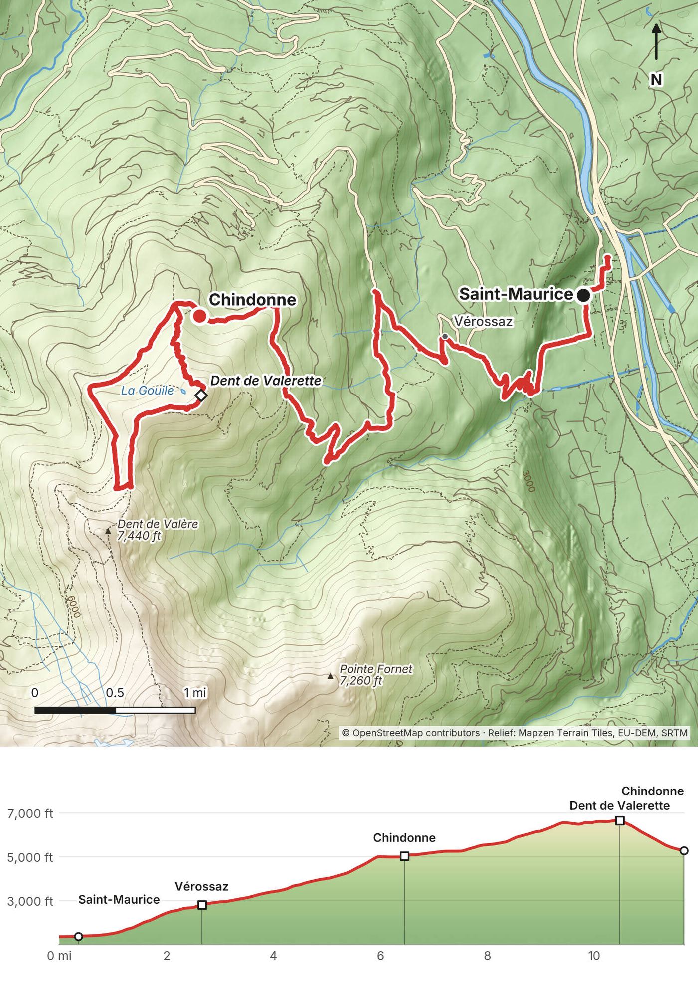
| 2 | Saint-Maurice to Chindonne, and the Dent de Valerette | 11.7 (18.8) | 5,420 / 1,480 | Auberge de Chindonne |
| 3 | Chindonne to Bonavau | 12.8 (20.7) | 2,540 / 2,800 | Refuge de Bonavau |
| 4 | Bonavau over the Col de Susanfe to Saint-Maurice | 17.9 (28.9) | 4,240 / 7,940 |
The numbers come from my own GPS recordings, smoothed the same way for every day. The film calls it 50 miles; my chapters added up to 54, and so does Strava. Day 2 includes a 4.1-mile side trip from the auberge; the walk from Saint-Maurice to Chindonne is 7.5 miles.
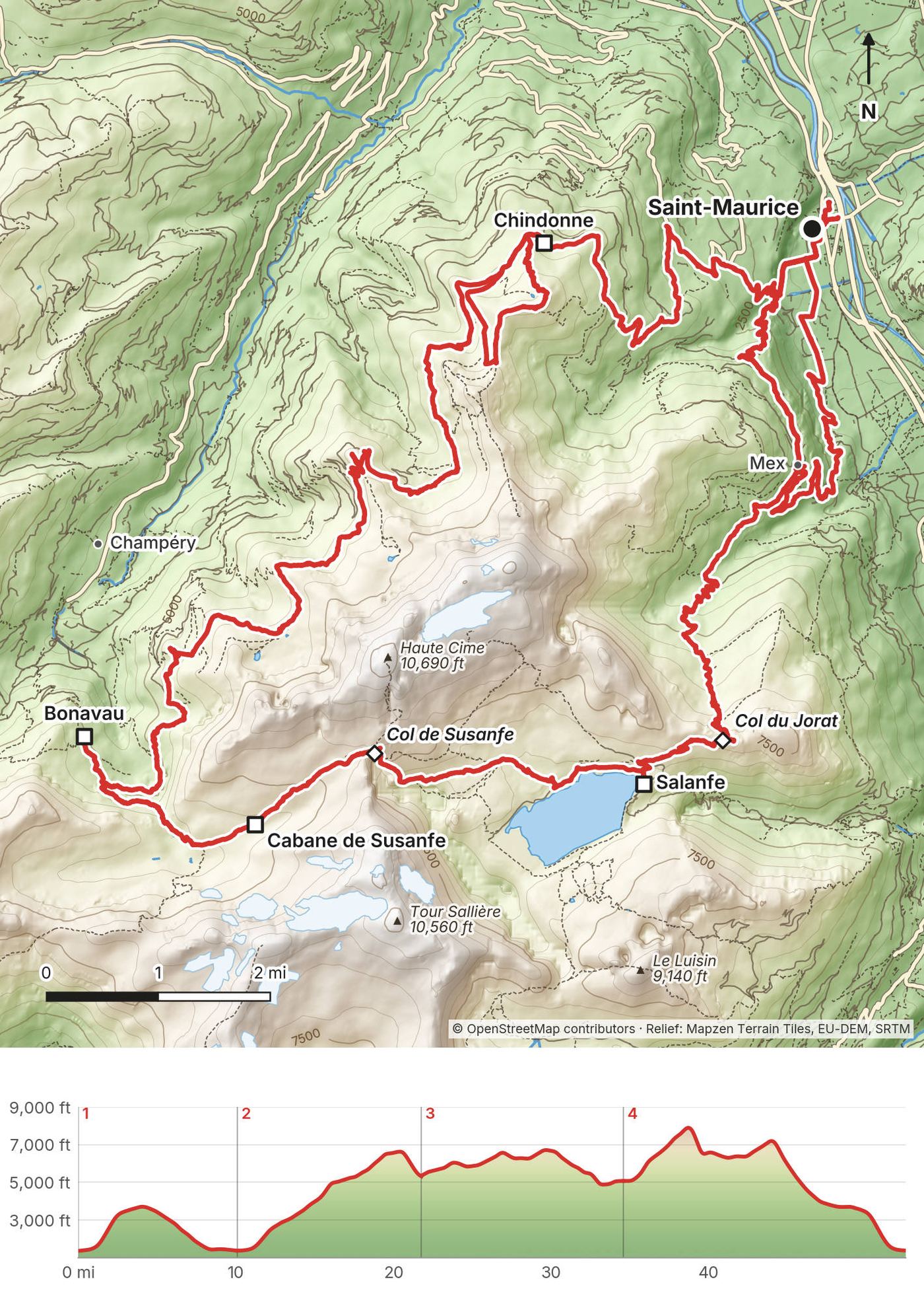
What I did. I flew into Geneva, went to Decathlon to get an ice axe, and took the train to Saint-Maurice, at the base of the mountains. My photos put me at Geneva Airport at 1:47 p.m. and at Saint-Maurice station at 5 p.m., and I started walking at 5:25. At the end I took the train out of Saint-Maurice the same evening.
By train. Saint-Maurice is on the main line up the Rhône valley. In 2026 a direct InterRegio ran every hour from Geneva Airport to Saint-Maurice in 1 hour 35 minutes, and other trains with a change at Lausanne took about 1 hour 48 (SBB timetable). Book on sbb.ch or the SBB app.
Buses to shorten the climbs (2026).
Road work (2026). The road up to Mex was partly closed for stabilization work from September 28 to December 18, 2026. The Armailli stayed reachable.
Taxis in Saint-Maurice (Saint-Maurice Tourisme): Taxi Street 079 893 15 77, Taxiphone 024 485 31 31, Taxi Alex 079 470 46 14.
My receipts for this trip, in Swiss francs, June 2023.
| Item | What I paid |
|---|---|
| Room, Hôtellerie Franciscaine, Saint-Maurice (June 2) | CHF 46.00 |
| Les 3 tables, a restaurant in Saint-Maurice (June 2) | CHF 26.20 |
| Auberge de Chindonne (June 3; the receipt doesn't say what it covered) | CHF 84.70 |
| Refuge de Bonavau (June 4) | Not in my records |
| Auberge de Salanfe, my midday stop (June 5) | CHF 17.80 |
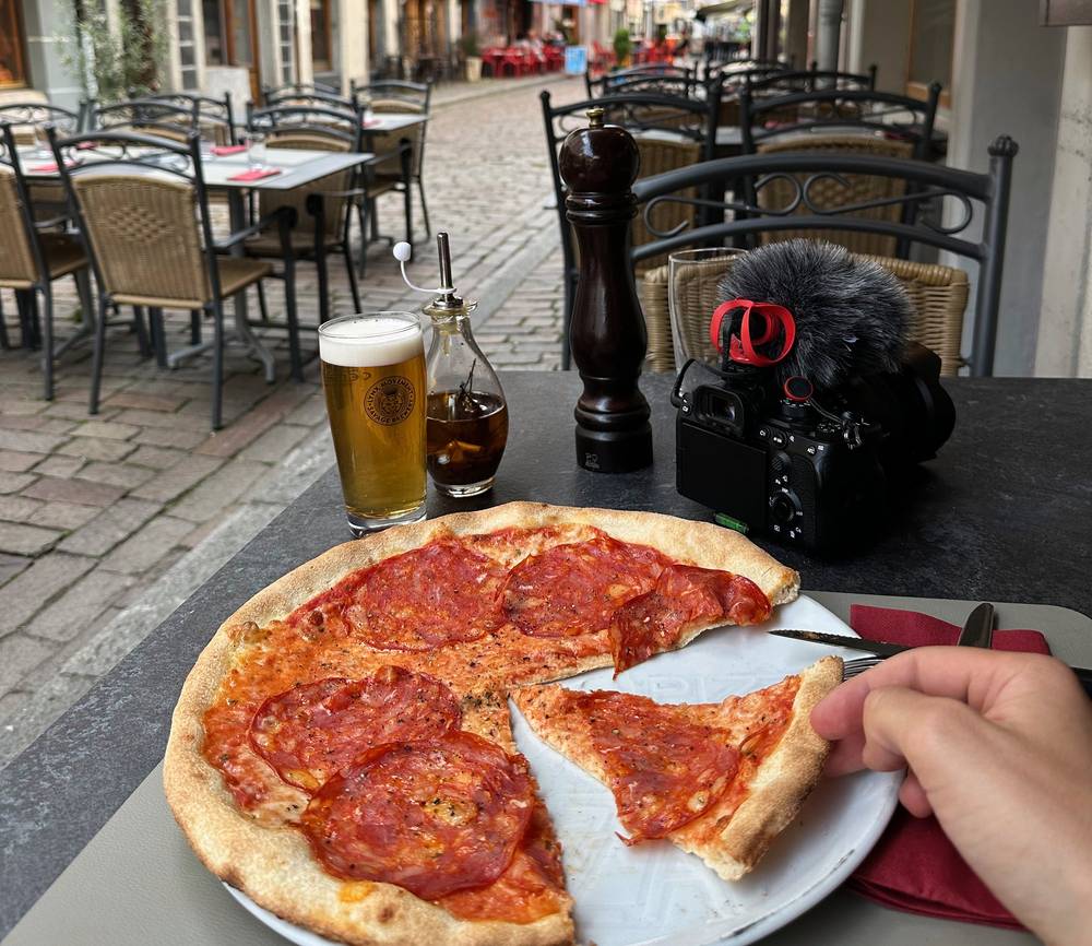
| Pizza, Les 3 tables, Saint-Maurice (June 5) | CHF 30.40 |
| Train ticket from Saint-Maurice station (June 5) | CHF 42.00 |
| Flight, train from Geneva, ice axe | Not in my records |
For your budget (2026). Half board CHF 72 to 85 a night per person in the huts (Chindonne 85, Bonavau 75, Salanfe 75, Anthème 72), plus picnic lunches at CHF 15. Trains from Geneva Airport to Saint-Maurice and back. Microspikes or crampons and an ice axe if you go early. An Air-Glaciers rescue card, CHF 35 a year (see Weather and safety). At Swiss Alpine Club huts from 2027, a CHF 3 or 5 solidarity contribution a night (the CHF 10 booking fee comes off your bill when you stay, and is lost if you cancel).
What I did. I slept in Saint-Maurice the first night, at the Auberge de Chindonne the second (for my friend's birthday) and at the Refuge de Bonavau the third. I'd booked the last night at the Auberge de l'Armailli in Mex with half board, but I walked through on a Monday, it was closed, so I continued down to Saint-Maurice. The owners had left their phone number on the door because they had to be out for 25 minutes that afternoon. Call ahead.
How booking works. There's no central booking. The official site (dentsdumidi.ch) has a planning tool and a list of places to stay, and you book each hut directly, online or by phone. Booking is compulsory at most huts, and they're small, so book early for July and August.
Camping. Wild camping is generally banned in Switzerland, and the Cabane d'Anthème says camping and bivouac are banned in the communes of Champéry and Val-d'Illiez. There's no official campsite on the tour. The Auberge de l'Armailli allows a bivouac beside the inn. No fires.
Money. Everything is in Swiss francs. Bonavau takes no cards (its network is too weak) and Anthème wants cash or Revolut, so carry enough francs for those two nights.
| Place | Height | 2026 season | Half board 2026 | Pay with | Book |
|---|---|---|---|---|---|
| Auberge de Chindonne | 1,604 m | June to Oct 18 (closed Mon and Tue from late Sept) | CHF 85 (dorm) | Cash, cards | aubergechindonne.ch, deposit online; +41 24 552 89 99 |
| Cabane d'Anthème | about 2,040 m | June 20 to Sept 26 | CHF 72 | Cash (CHF or EUR), Revolut | antheme.ch; +41 79 473 71 40 |
| Refuge de Bonavau | 1,550 m | May 14 to Oct 4 | CHF 75 plus tourist tax | Cash, Twint; no cards | bonavau.ch; +41 78 245 21 25 |
| Cabane de Susanfe (SAC) | 2,102 m | Open in 2026; closed for nights in 2027 | CHF 77 (67 for SAC members) | Cash, cards (+3.45%) | susanfe.ch; +41 24 479 16 46 |
| Auberge de Salanfe | 1,950 m | June 4 to Oct 4 | CHF 75 (dorm) | Cash, Twint, cards | salanfe.ch; +41 27 761 14 38 |
| Auberge de l'Armailli, Mex | 1,118 m | All year; closed Mondays and Tuesdays (open daily in summer, per the official site) | Ask | Cash, cards, Twint | +41 27 767 19 79 |
Prices are per adult in a dorm, from each hut's own site in 2026. Bring a sleeping bag liner: it's compulsory at Anthème, Bonavau, Salanfe and the Armailli. Dinner is usually at 6:30 or 7 p.m.
2027 changes.
| Night | Where | Height | What I know |
|---|---|---|---|
| June 2 | The Hôtellerie Franciscaine, Saint-Maurice | 422 m | My receipt: CHF 46 |
| June 3 | Auberge de Chindonne | 1,604 m | My friend's birthday there. My receipt: CHF 84.70 |
| June 4 | Refuge de Bonavau | 1,550 m | "Reached the hut at 4pm for dinner and sleep." No receipt (no cards there) |
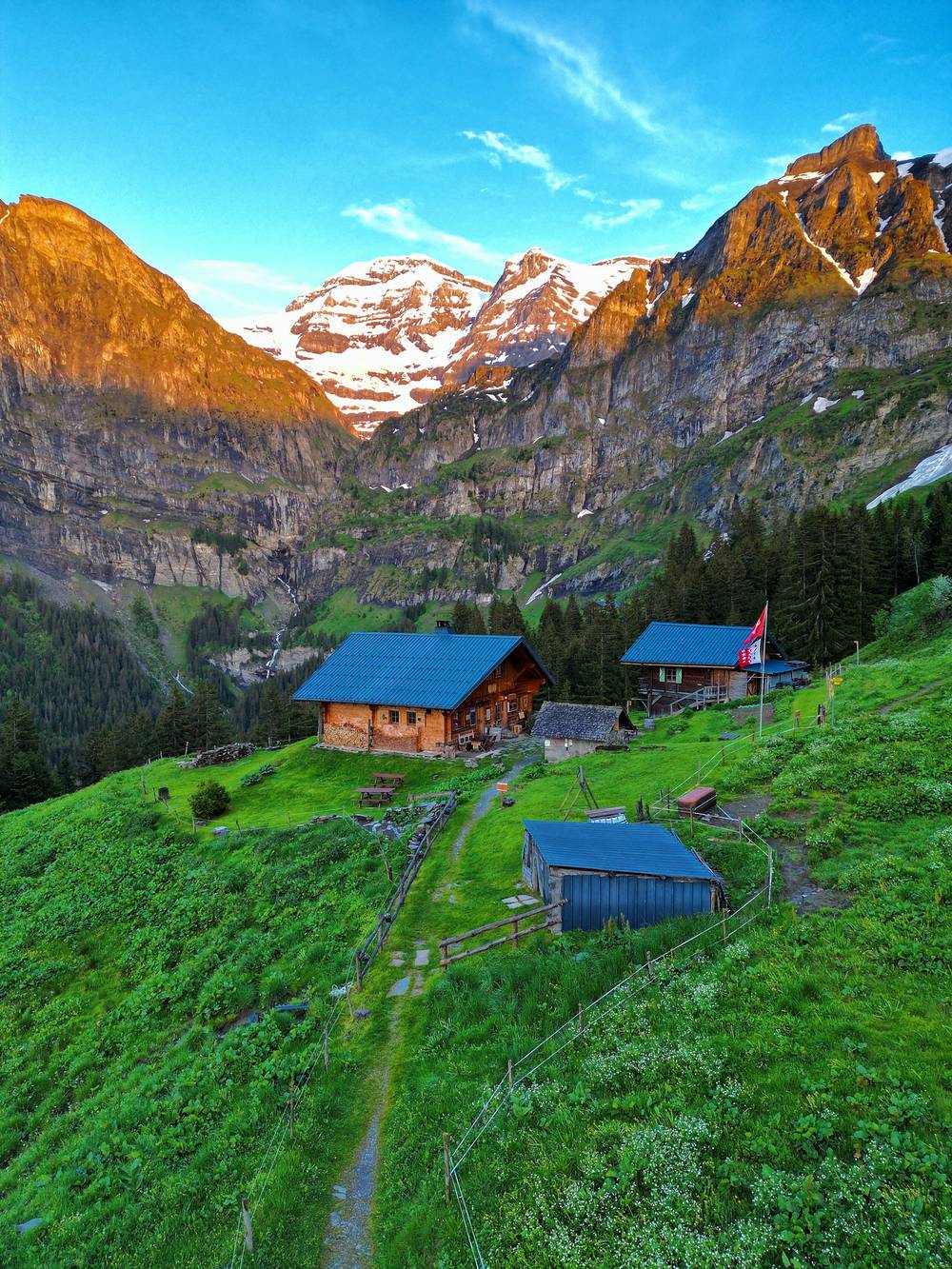
All of them are in the GPX files as waypoints, with the other huts on the loop. For 2026 prices and 2027 changes see Huts and booking.
The huts do half board (dinner and breakfast) and sell picnic lunches, CHF 15 in 2026 where they list one. I ate in the huts, stopped at the Auberge de Salanfe on the last day, and ate in Saint-Maurice on the first and last nights. Carry snacks for the long stretches: with Susanfe closed in 2027, there may be nothing to buy between Bonavau and Salanfe.
There are streams and lakes all round the loop, full of meltwater in June. The Cabane d'Anthème lists its water as not drinkable, and Bonavau's comes from a small spring. Fill up at the huts, and treat or filter stream water: cows graze the pastures.
My 2023 kit, from the film, my Strava notes and my photos.
What this loop needs:
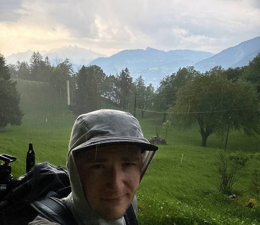
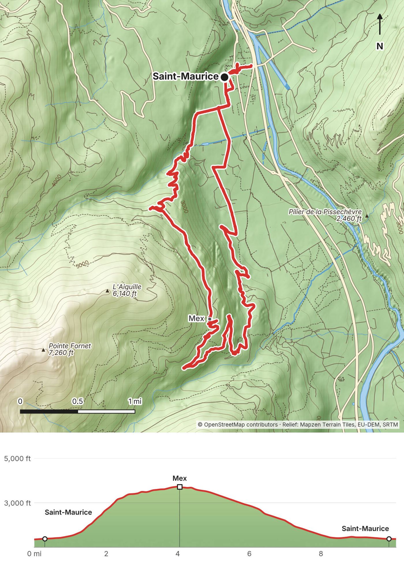
I got to Saint-Maurice in the late afternoon and started walking right away, south along the valley and up the steep climb to the village of Mex. When I got up there it hailed so hard. I'd never seen anything like it, a river of hail flowing down the center of town. I got absolutely dumped on and hailed on at elevation, and I had to turn back down once I realized the trail was blocked and my backup hut wasn't open. A mess of a day.
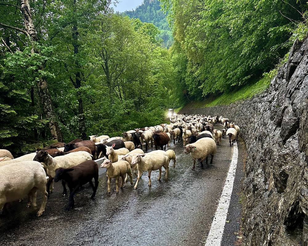
On the way down I ran into a herd of sheep just going up the road. I was back in Saint-Maurice after 9 p.m. and slept there.
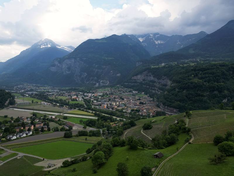
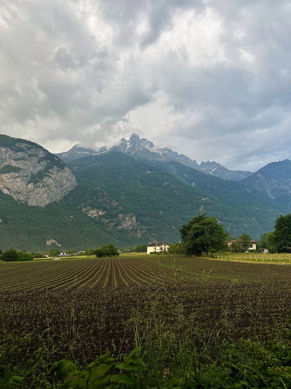
From the station the path runs south along the Rhône valley, then climbs steeply through the forest to Mex, a small village at 1,118 m on a shelf above the valley. I went a little past the village (my low point beyond it was about 3,190 ft, 973 m) before turning around, and came back down the other side of the slope to Saint-Maurice. Mex is the start of the official stage up to Salanfe over the Col du Jorat, the way I came down on Day 4.
In 2027. This day isn't part of the loop: it's my first try, cut short by the weather. If you want to go clockwise from Saint-Maurice, Mex is your first stop (the Armailli, or the bus), then Salanfe the next day. See Other ways to do it.
You're never far from Saint-Maurice: walk back down, or take the PostBus from Mex (book some runs by phone).
Film, Day 1 · Behind the scenes
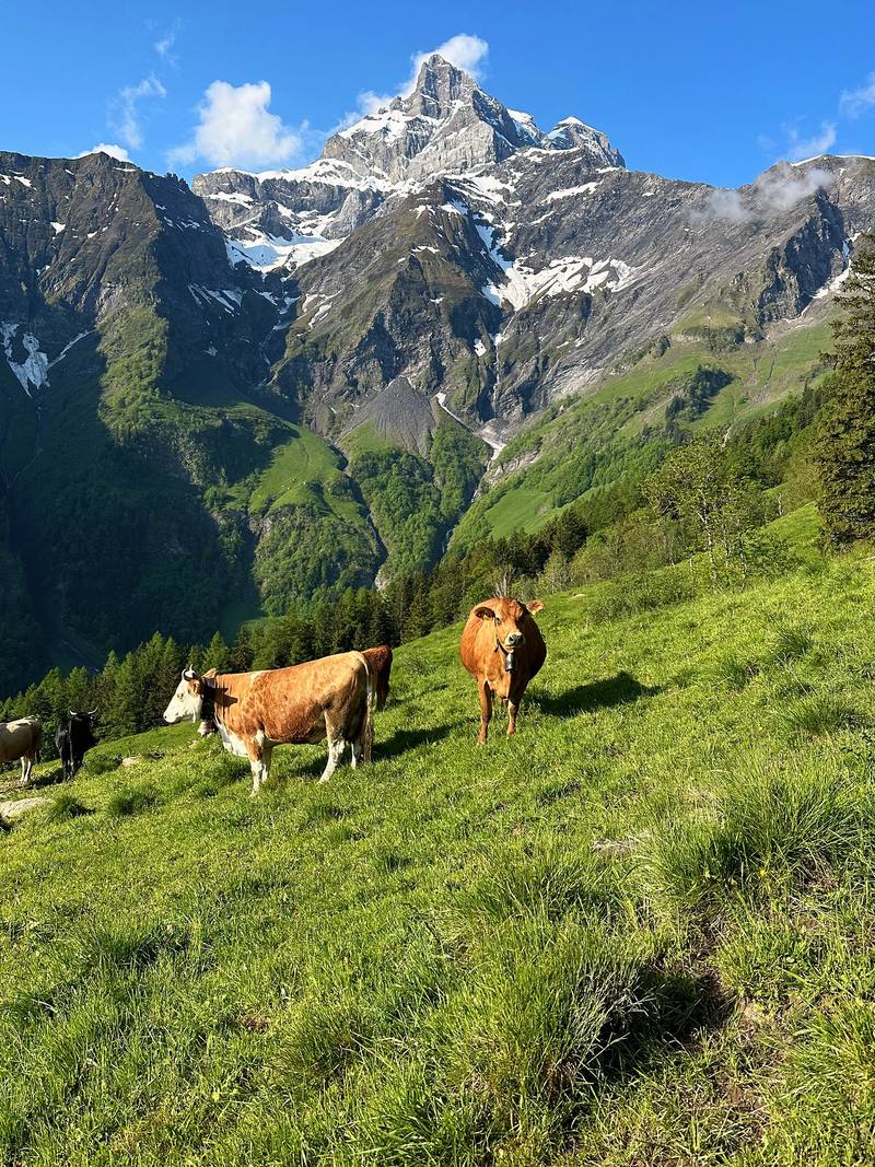
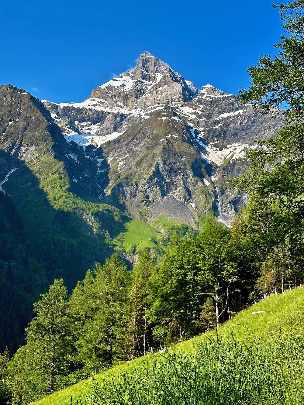
An early 6 a.m. start from Saint-Maurice. I hiked up to meet my friend Omar and his friends for his birthday at this Swiss hut, the Auberge de Chindonne. That was the reason for me going to this place at this time, so it was nice to see him and celebrate. Day 2 had some beautiful blue skies and cows.
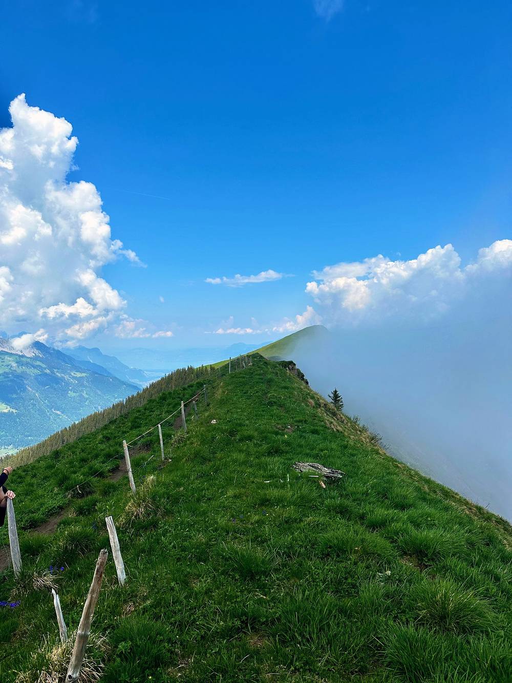
In the afternoon we did a little summit hike with the group and our 10 dogs, up the ridge to the Dent de Valerette. The mornings seemed clear, then clouds came in later and eventually dropped rain around 4 p.m. I slept at the auberge and started back out on my own again the next morning.
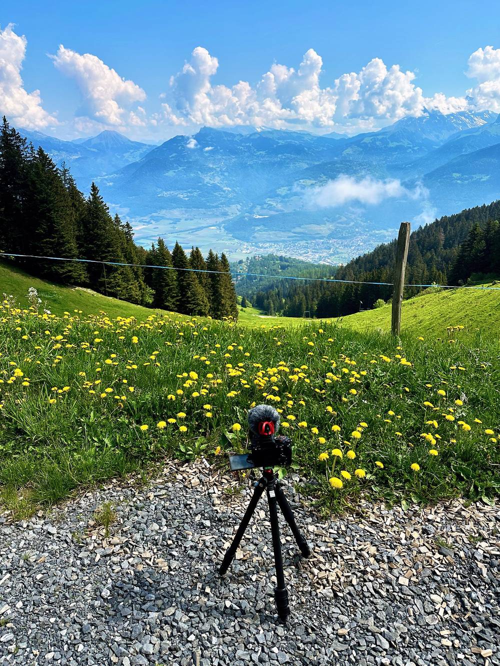
From Saint-Maurice the path climbs west out of the valley to the village of Vérossaz at mile 2.7, about 2,820 ft (860 m) on my GPS. The PostBus from Saint-Maurice gets you here too. From Vérossaz it climbs steadily through meadows and forest on the north side of the Dents du Midi, with the peaks in view, to the Auberge de Chindonne at mile 7.5, 1,604 m. I got there at 9:18 a.m., about three hours from town.
The Dent de Valerette. The official site lists it as a variant: "a very nice, easily accessible summit." From the auberge our group went up the grassy ridge to the west and south and round to the summit, 2,058 m, and back down to Chindonne: 4.1 miles and about 1,450 ft up and down on my GPS.
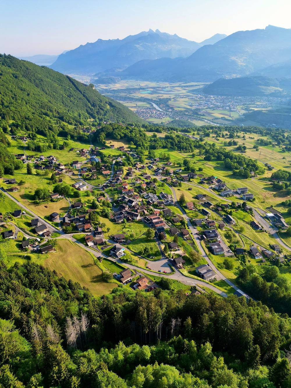
Below Vérossaz, walk back down to Saint-Maurice, or take the PostBus from Vérossaz. From Chindonne a road leads down toward Monthey; bus 63 runs from Les Cerniers, about an hour's walk below the auberge.
A late start, because I wanted to have breakfast and say goodbye to the group. Then a great day of hiking and crossing big snowmelt streams. I was almost all alone up there.
Day 3 started out beautiful, but eventually clouds rolled in and the rain came. The 3 p.m. thundershowers showed up as always. A lot of you told me my Arc'teryx shell wasn't waterproof anymore, so I got the spray stuff afterward and sprayed it down. I reached the hut at 4 p.m. for dinner and sleep. Big pass tomorrow.
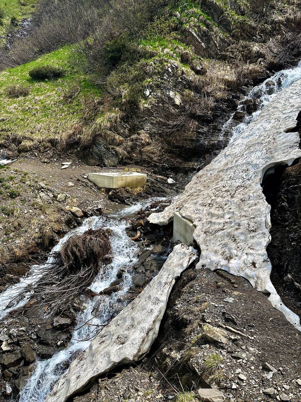
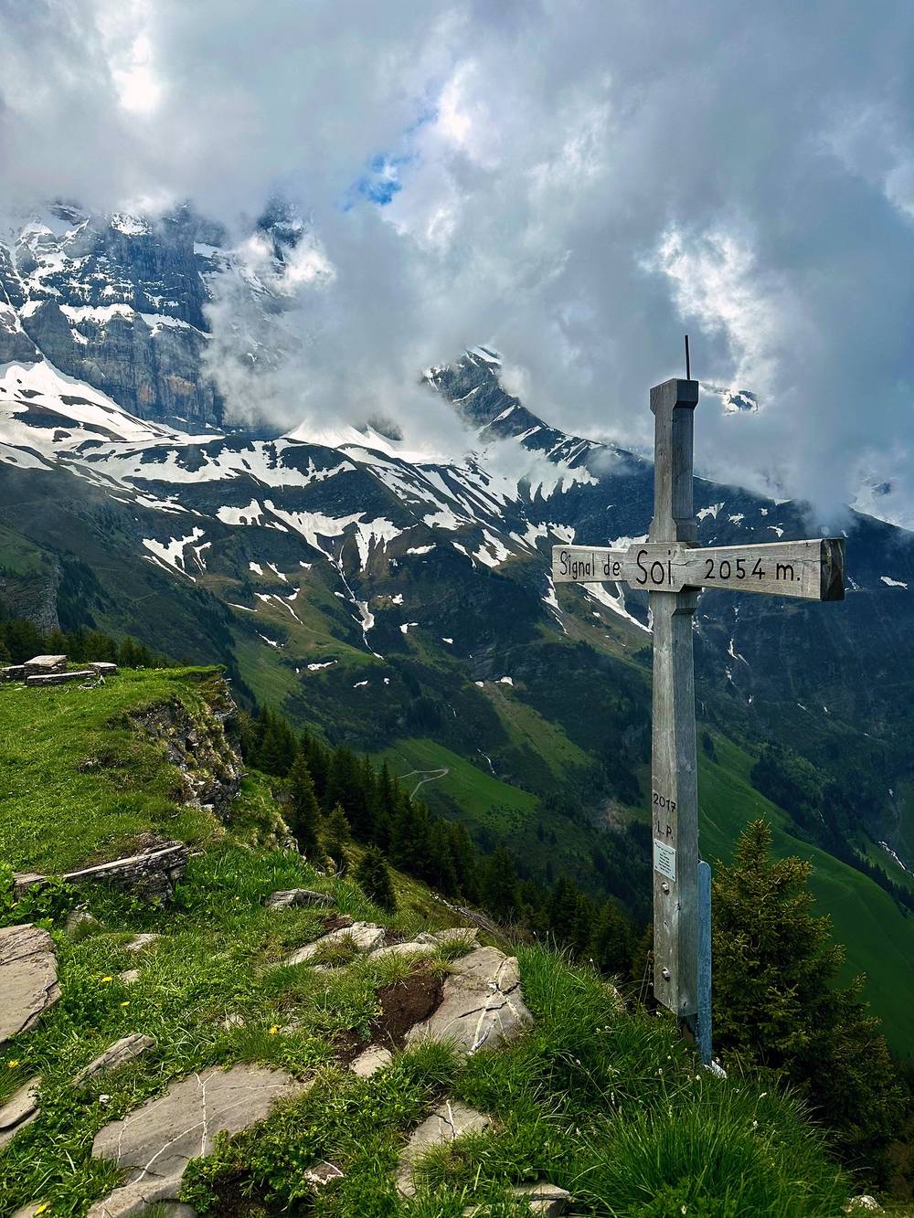
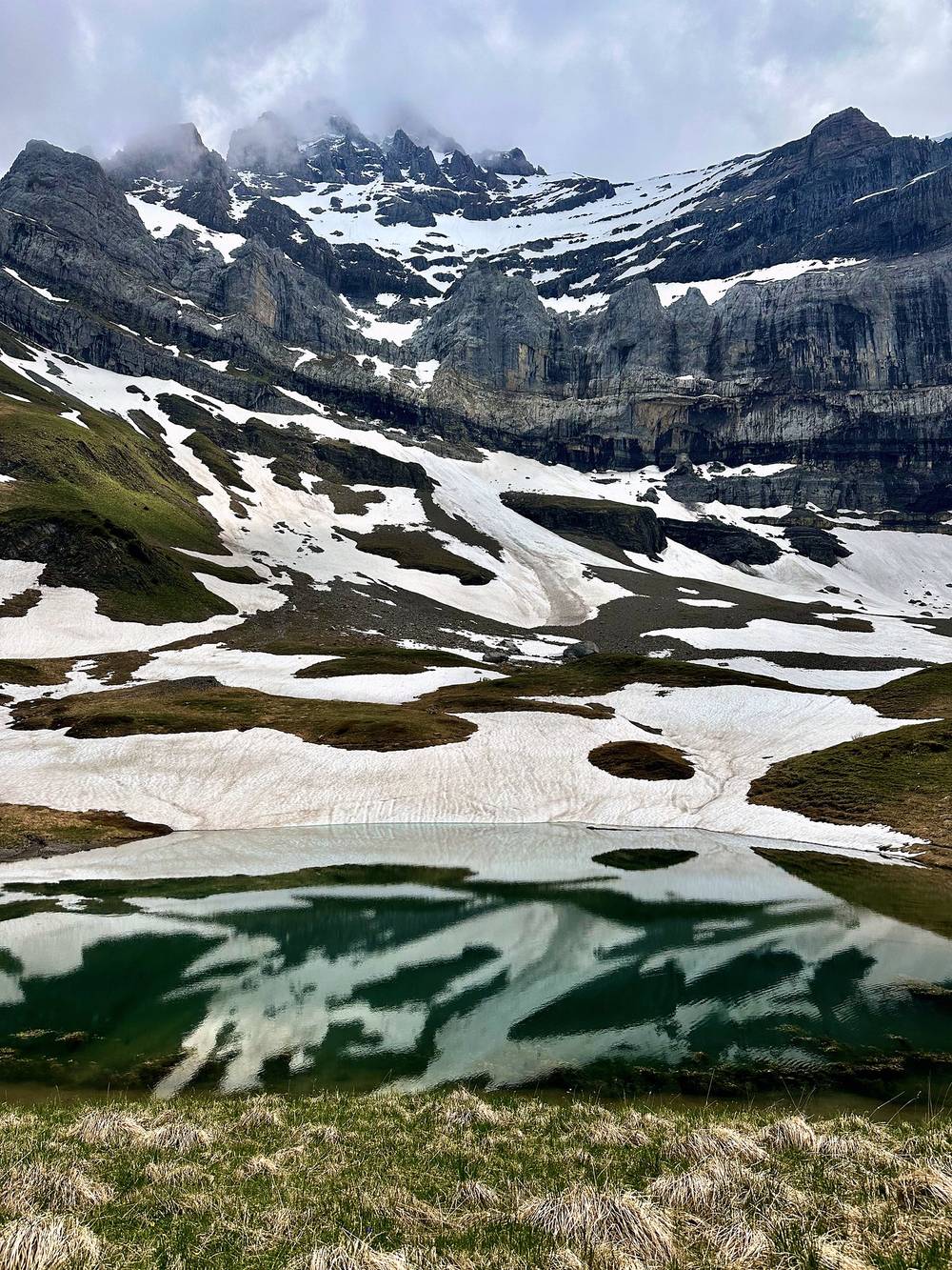
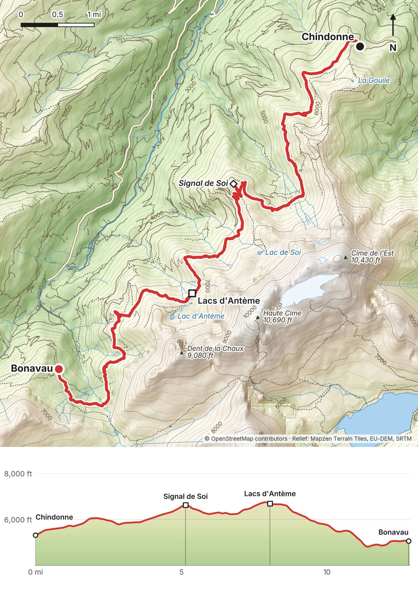
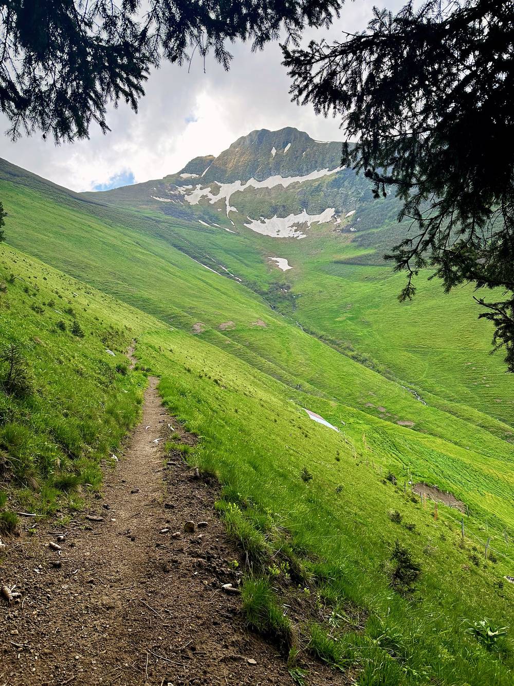
From Chindonne the path heads south along the slopes on the west side of the Dents du Midi, high above the Val d'Illiez, mostly between 5,600 and 6,700 ft (1,700 and 2,060 m). There's a short side climb to the summit cross on the Signal de Soi at mile 5.1, then the path rolls on through pasture and around side valleys, with the streams to cross. In early June there was still old snow in the hollows and the streams were full of meltwater.
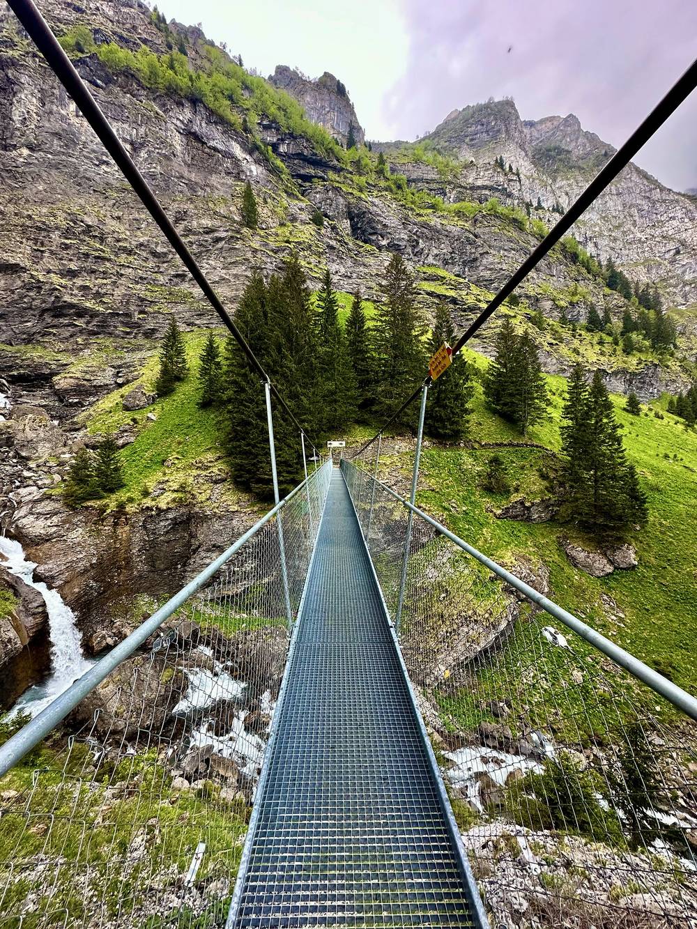
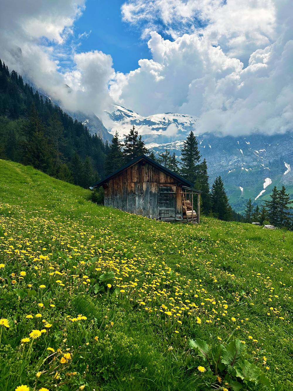
At mile 8.0 the trail passes the Cabane d'Anthème by the Lacs d'Antème, the high point of the day. Then it drops past a chalet in the meadows to the slopes above Champéry and the Bonavau waterfall, crosses a long suspension footbridge above it at mile 11.7 (on this approach from Anthème, the Bonavau site describes the Belle-Etoile footbridge above the Sauflaz waterfall: 55 m long and 25 m high), and climbs back up to the Refuge de Bonavau at mile 12.8.
Shorter days. The official stages break here: the Cabane d'Anthème is a hut stop between Chindonne and Bonavau, with half board at CHF 72 in 2026 (cash or Revolut).
Paths lead down west into the Val d'Illiez toward Champéry and Val-d'Illiez, where the regional train runs to Monthey and Aigle; check them on the map before you leave the trail. From Bonavau it's about 2 hours down to Champéry station (Bonavau's figure).
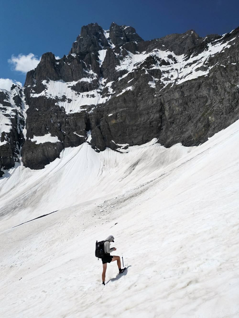
Finally a full day, starting at 6 a.m. The last day was the biggest and most fun, because I'd be going up and over this giant snowy pass. One thing about this hike: it was early June, and just right on the edge of when it's kind of safe and doable to do this hike with all the snow.
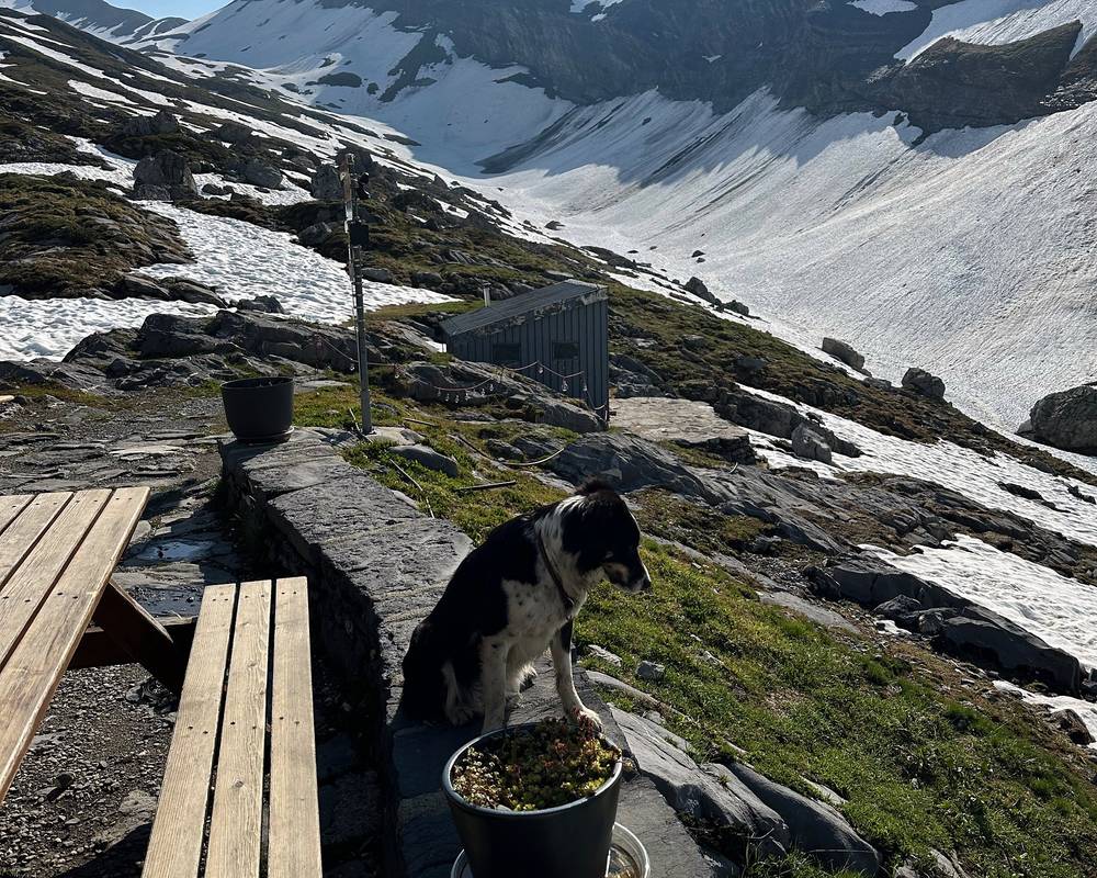
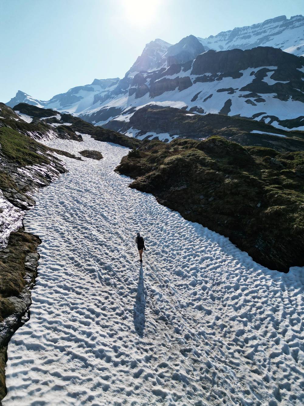
Of course I found a great dog at the hut right before the pass. Then a big pass with microspikes on and the ice axe in hand. I made it up to the top safely, and then, with the ice axe in hand, slowly and steadily made my way down.
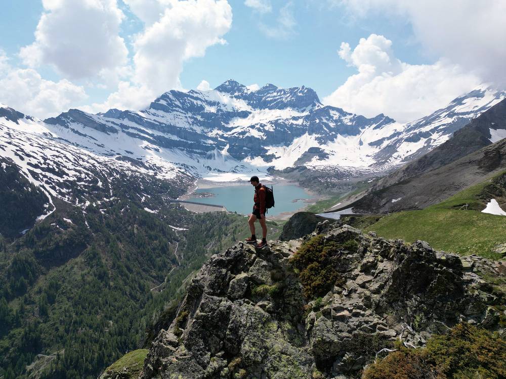
Eventually I made the second pass, which turned out to be a great spot for a YouTube thumbnail. I'd booked the inn in Mex for the night, but I passed by and everything looked closed, so I continued down to Saint-Maurice. I made it to the end of the Tour des Dents du Midi and rewarded myself with a pizza.
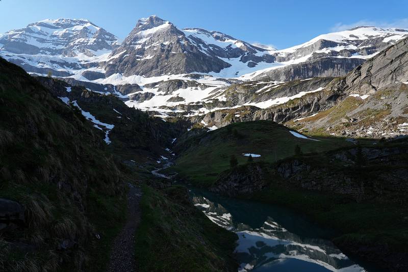
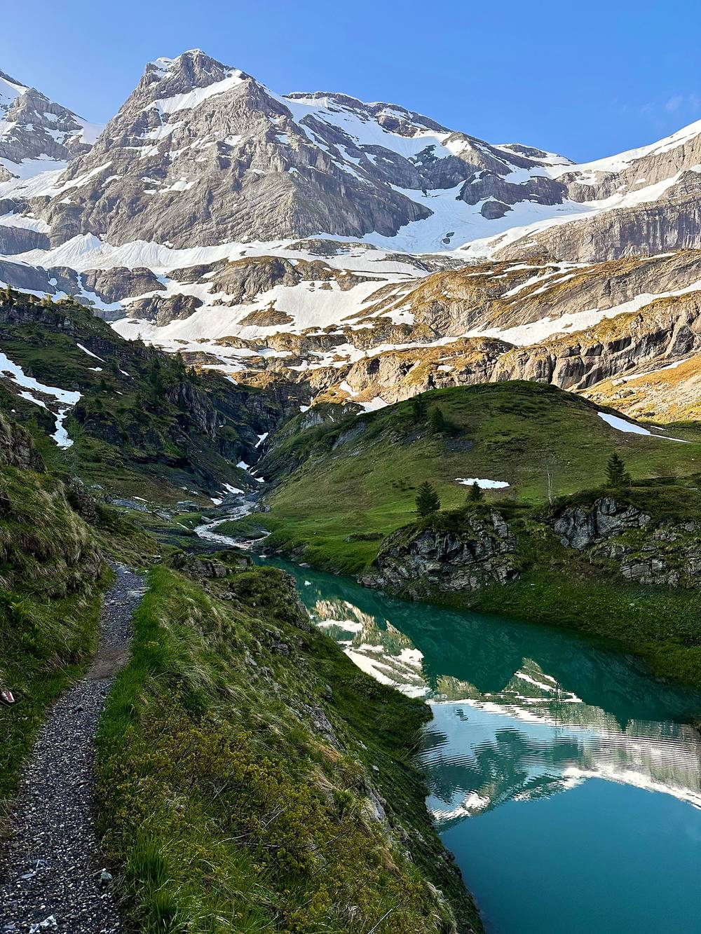
From Bonavau the path heads east to the Pas d'Encel at mile 1.4, a steep rock step with chains and fixed cable, often wet (the Swiss Alpine Club calls the route T3). Above it the path climbs into the Susanfe valley, past a small lake, onto the long snowfields I crossed in June, to the Cabane de Susanfe at mile 2.7 (2,102 m).
From the hut it's 1.7 miles and about 1,300 ft up a bare, stony valley to the Col de Susanfe at mile 4.4, 2,494 m, the high point of the tour, between the Haute Cime and the Tour Sallière. In June I was on snow most of the way up and down. My phone read 2,394 m at the col; the map height is 2,494 m.
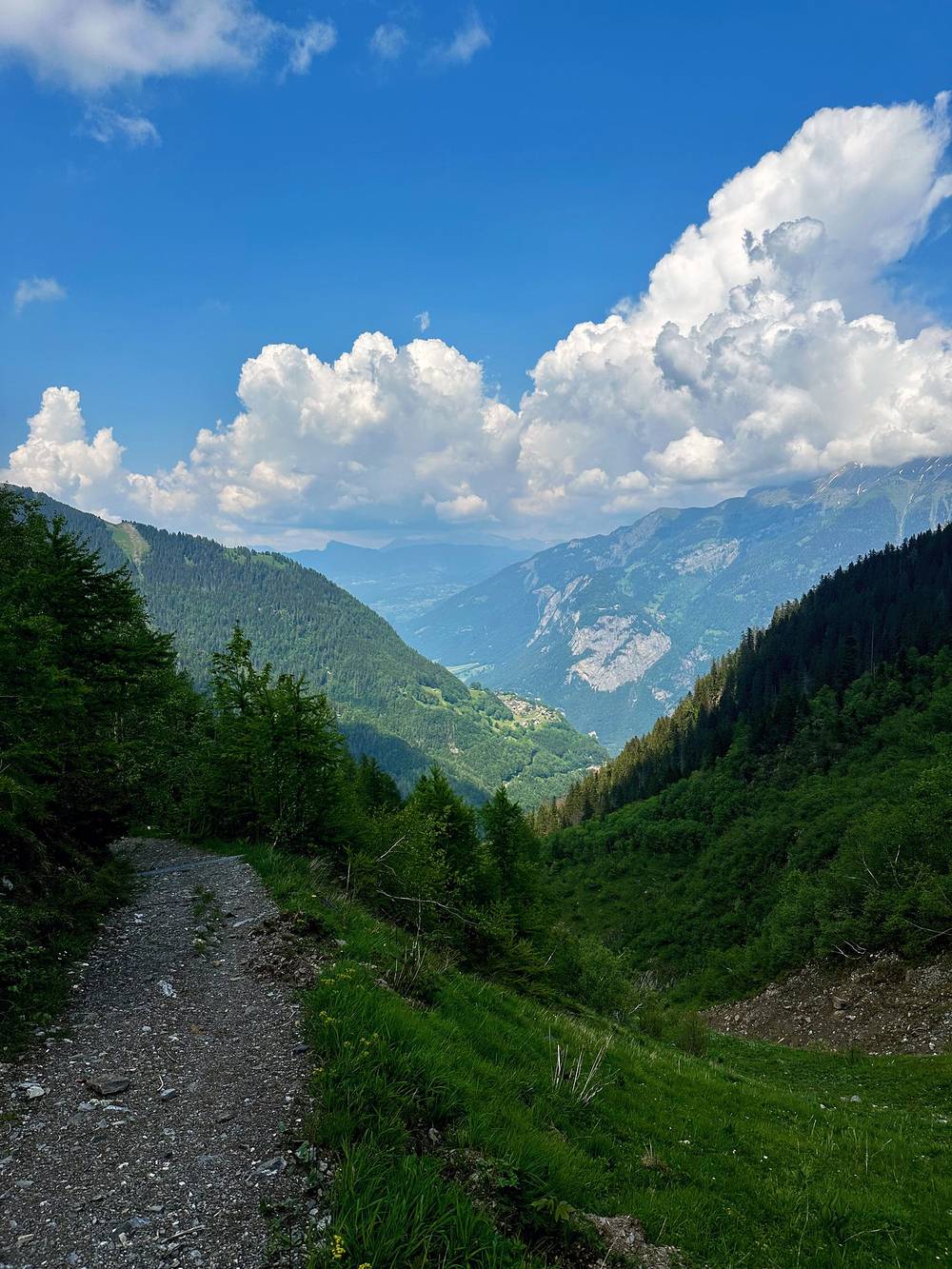
The east side drops down a lunar, rocky slope (the official site's words) to the head of Lac de Salanfe, then along the lake to the Auberge de Salanfe at mile 7.8 (1,950 m), where I stopped for 45 minutes. From the auberge the path climbs again to the Col du Jorat at mile 9.3, about 2,200 m, the spot of my thumbnail, then drops a long way north through pasture and forest to Mex at mile 14.3 and on down to Saint-Maurice at mile 17.9. That last part is nearly 5,900 ft (1,790 m) of descent from the Col du Jorat.
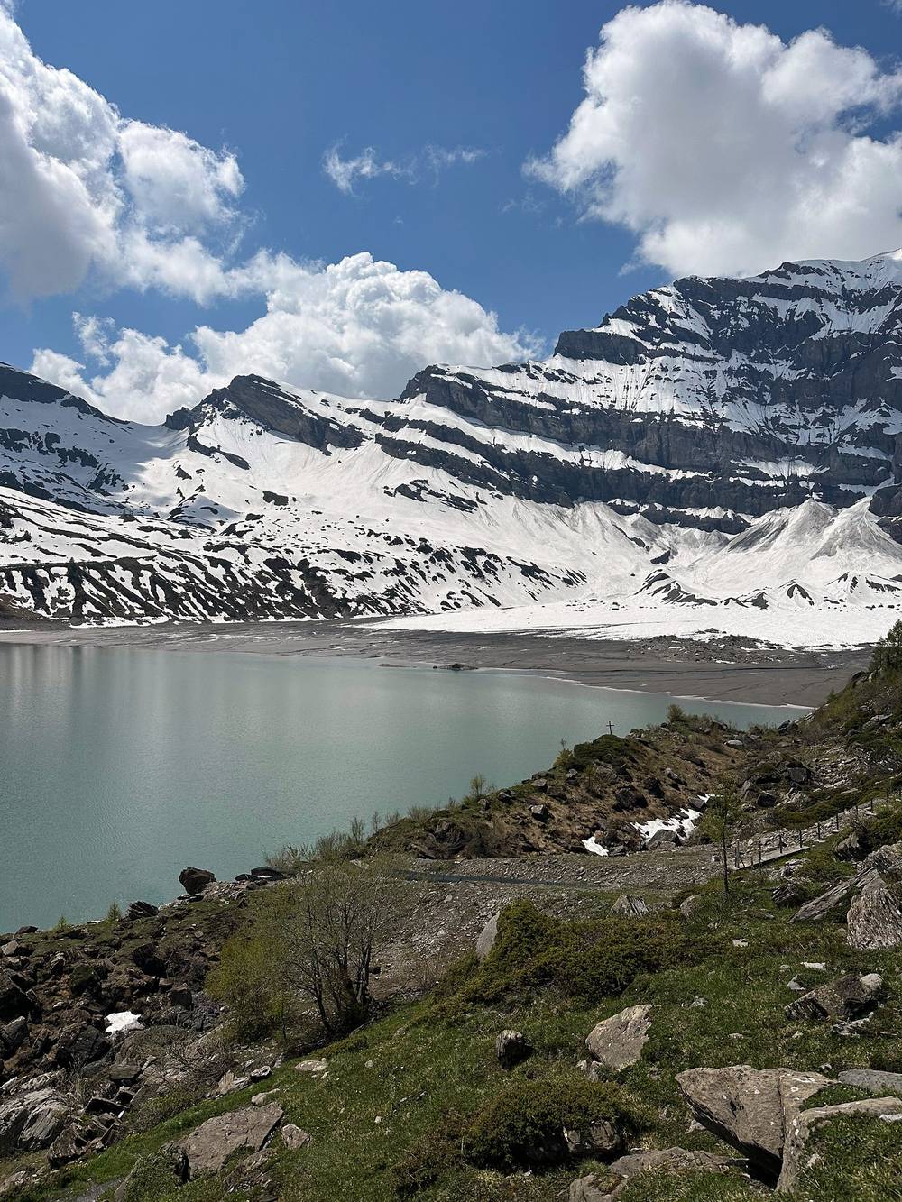
The diversion (2026). The official site carries a notice that the route between the Col de Susanfe and Salanfe is diverted, with no date or reason given. Summaries of SwitzerlandMobility's closures list say this section was closed for rockfall from June 24, 2025 to December 31, 2026, with walkers sent on the old "winter path", which is signed. My GPS line is the 2023 line: follow the signs on the day.
Snow. If the col is snowy, the official site says to bring crampons and an ice axe. I wore microspikes and carried an ice axe in early June. Start early, while the snow is firm, and go back to Bonavau if you're not comfortable.
Before the Pas d'Encel, go back to Bonavau and down to Champéry. At Salanfe, a path goes down to Van d'en Haut (1.5 to 2 hours) for the Vallon de Van bus to Salvan in summer and the Mont-Blanc Express to Martigny. At Mex, the PostBus goes down to Saint-Maurice (book some runs by phone).
Film, Day 4 · Behind the scenes
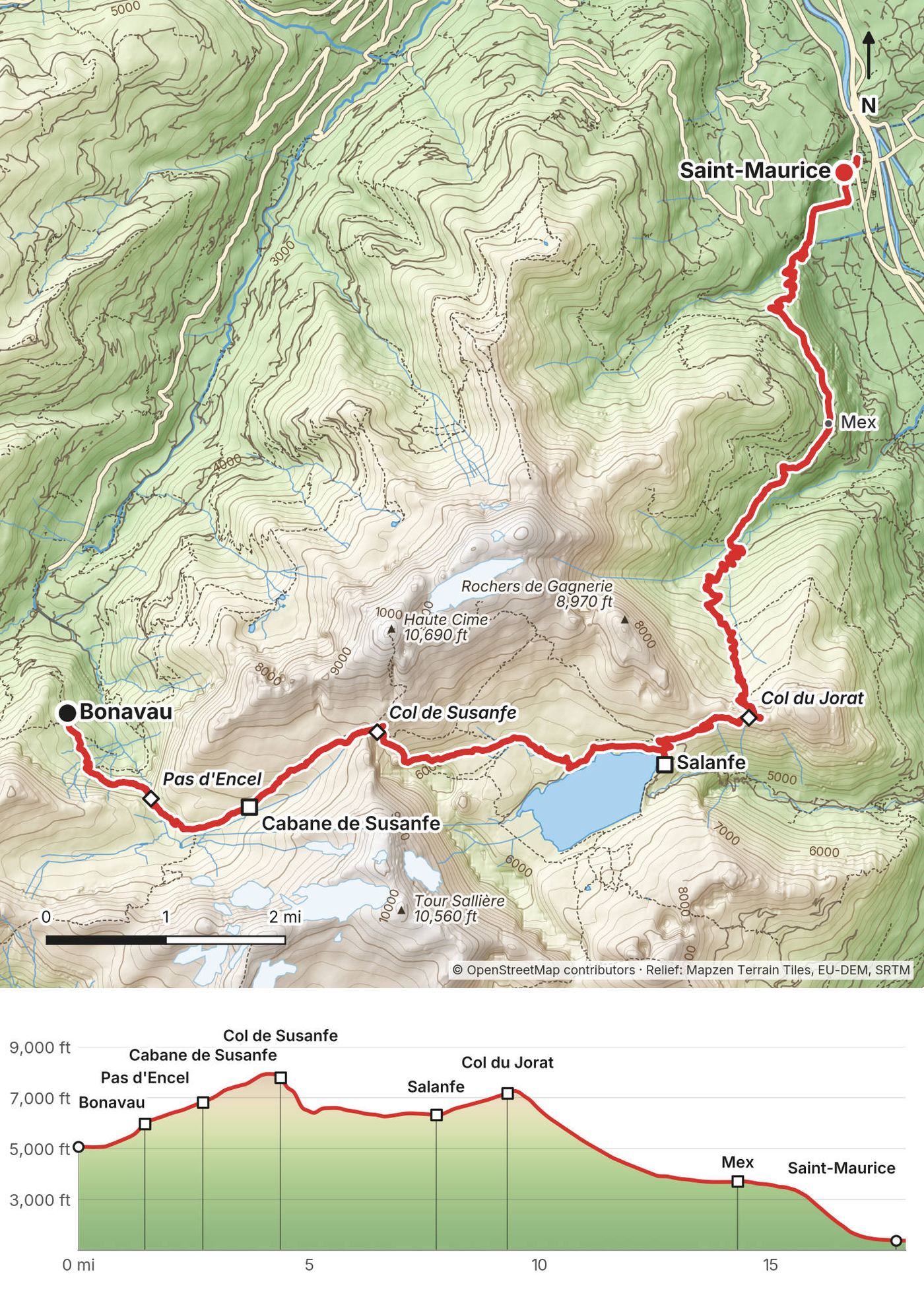
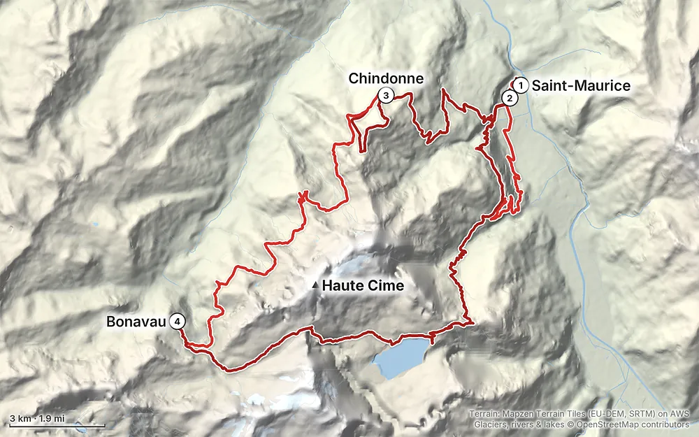
Elevation1,348–7,959 ft52.7 mi
Terrain: Mapzen Terrain Tiles (EU-DEM, SRTM) on AWS · Glaciers, rivers & lakes © OpenStreetMap contributors
Tap a map to open it full size.
No central booking: book every hut ahead, directly with each hut; booking is compulsory at most huts. Camping is banned in most of the area
From the hike's facts; check the official page before you go.
Now (November 2026). The huts are closed for the winter and the Col de Susanfe and the chains at the Pas d'Encel are under snow. Wait for the season below. The Cabane de Susanfe is also closed for rebuilding in 2027.
The season. The official site says the tour is done from June to October, depending on the snow. Most huts open in June: in 2026 the Refuge de Bonavau was open May 14 to October 4, the Auberge de Salanfe June 4 to October 4, the Cabane d'Anthème June 20 to September 26, and the Auberge de Chindonne from June to October 18. The full loop with every hut open is roughly late June to late September.
Snow on the Col de Susanfe. This is the thing to plan around early in the season. The official site says to carry crampons and an ice axe when the Col de Susanfe is snowy, and in early season with a lot of snow to use the old route to the col, the "Chemin d'hiver" (winter path). In June 2026 the Auberge de Salanfe reported the col path well visible and walked, with two or three snow patches left on the Salanfe side. I found no official date for when the col usually clears.
What I got. It was early June, and just right on the edge of when it's kind of safe and doable to do this hike with all the snow. On Day 1 it hailed so hard I'd never seen anything like it, a river of hail flowing down the center of town. Day 2 had some beautiful blue skies and cows. The mornings seemed clear, then clouds came in later and dropped rain around 4 p.m. Day 3 started out beautiful, but eventually clouds rolled in and the rain came: the 3 p.m. thundershowers showed up as always. Day 4 was the biggest and most fun day, up and over a giant snowy pass.
If you go in June: take microspikes and an ice axe and know how to use them, start the pass early while the snow is firm, and check with the huts at Salanfe or Bonavau about the snow before you set off. The innkeeper in Mex told me to ask the huts up in the mountains, and that's still the best advice.
Emergency. Call 144 (in Valais, the cantonal rescue service, OCVS, handles mountain rescue), or 112. Rega's number is 1414 (from a foreign phone, +41 333 333 333), and its app sends your position. Signal is patchy on the loop.
Rescue costs. In Switzerland the patient pays for a rescue; a helicopter rescue can cost thousands of francs and basic insurance covers only part. Check your travel insurance covers mountain rescue. An Air-Glaciers patron card costs CHF 35 a year and covers helicopter rescues (Air-Glaciers, 2026).
Thunderstorms. On my trip the clouds came in every afternoon and the rain arrived around 3 or 4 p.m. Start early, and be over the Col de Susanfe and the Col du Jorat by early afternoon.
Snow. The Col de Susanfe holds snow into summer. In early June I crossed long snowfields on both sides of it with microspikes and an ice axe. Don't go up a steep snow slope you can't come back down.
The Pas d'Encel. A steep, exposed rock step with chains, often wet. Take it slowly, and don't go up it in a storm.
Livestock guard dogs. The official site says several pastures on the trail are guarded by livestock protection dogs. Slow down, talk, stay calm if one comes to you, don't raise your poles, and give the herd a wide berth. The official site points to the map on protectiondestroupeaux.ch; the SwitzerlandMobility and swisstopo apps show them too, updated once a year in early June. Bringing your own dog is strongly discouraged.
Fire. No fires. In 2026 Valais banned outdoor fires from June 25 to September 15.
Leave a plan with someone at home and with your huts, so they know when to expect you.
Where to be careful:
Going solo. I walked alone, apart from the birthday day. If you do, book your huts so someone expects you, carry a way to call for help, and turn back at the snow if it isn't right.
How many days do I need? The loop took me three days, Saint-Maurice to Saint-Maurice, and my last day was nearly 18 miles and almost 11 hours. The official site says two, three or four days. Four days with a bed every night is the comfortable version; in 2027 you'll have to plan around the Cabane de Susanfe being closed. See Other ways to do it.
How hard is it? The paths are good and signed, and most of it is meadow and forest. The hard parts are the Pas d'Encel, a steep rock step with chains, and the Col de Susanfe, at 8,182 ft, which holds snow into summer. In early June I needed microspikes and an ice axe there. Later in the summer the snow is gone, but it's still a T3 mountain path, and the Pas d'Encel's chains are there all season.
Do I need to book? Yes. I stayed in huts for this entire hike, which was a bit more expensive, and I had to have a very specific schedule to make reservations, but it worked out in the end. The huts are small and you book each one directly. Camping is banned in most of the area. See Huts and booking.
Is it expensive? It's a little bougie and expensive to hike in Switzerland. Half board in the huts was CHF 72 to 85 a night in 2026. My receipts are in What I paid.
Can I do it in early June like you? Only if you're ready for snow and know how to use an ice axe. Three weeks before my trip the inn in Mex told me the tour wasn't possible yet, with a lot of snow above 1,800 m. See When to go.
Which way round? I went counterclockwise from Saint-Maurice: up to Chindonne first, the Col de Susanfe on the last day. The Swiss Alpine Club's four-day tour from Champéry goes the same way; the official stage list runs the other way, clockwise.
Will I see other people? On the high part of Day 3 I was almost all alone up there. The huts were busier.
Is there phone signal? In places. The huts list mobile coverage at Chindonne and Anthème, a weak network at Bonavau and 4G only near the chapel at Salanfe. Download everything before you go.
I walked the days in this guide. These are other ways to use it, and I didn't do them.
My last day, Bonavau to Saint-Maurice, was 17.9 miles and 7,900 ft of descent. With the Cabane de Susanfe closed in 2027, the natural split is at Salanfe:
| Night | Sleep | From the night before |
|---|---|---|
| 1 | Auberge de Chindonne | Saint-Maurice or Vérossaz, my Day 2 |
| 2 | Refuge de Bonavau (or the Cabane d'Anthème, to split Day 3) | My Day 3 |
| 3 | Auberge de Salanfe | Over the Pas d'Encel and the Col de Susanfe, about 7.8 miles on my GPS; Bonavau gives 5.5 hours |
| 4 | Home, or the Auberge de l'Armailli in Mex | Over the Col du Jorat to Mex and Saint-Maurice |
Call the Armailli about its days off: in 2026 its own site listed Mondays and Tuesdays closed; the official site said it opens every day in July and August.
The official site splits the loop into six stages, starting from Anthème: Anthème to Chindonne or Les Jeurs (11.26 km, 3 hours 40), Chindonne to Mex (11.55 km, 3 hours), Mex to Salanfe (8.75 km, 4 hours), Salanfe to Susanfe (7.22 km, 3 hours), Susanfe to Bonavau (3.81 km, 1 hour 30) and Bonavau to Anthème (4.55 km, 3 hours). Saint-Maurice isn't one of the stage points; I used it as my start and finish. Starting from Champéry, Vérossaz or Mex by train and bus cuts out the climbs from the Rhône valley.
The way I first tried on Day 1: up to Mex, over the Col du Jorat to Salanfe, over the Col de Susanfe to Bonavau, and back by Anthème and Chindonne. The official stage list runs this way round. In early season the Col de Susanfe is the same snow either way.
The highest of the Dents du Midi, 3,257 m, is listed by the official site as a variant for good walkers. It needs crampons and an ice axe when snowy. I didn't climb it.
These change every year. Everything else in this guide stays the same.
Huts
Route and conditions
Getting there
Your stuff
The film is at the top of this page.
Planning questions about Tour des Dents du Midi, answered only from this page's facts, the creators' versions and hikers' public tracks, with where each answer comes from. When the data doesn't say, the answer says "not given".
From hikers
Sign in to comment. Free; your hikes stay private unless you share them.
Some lodging links earn me a small commission at no cost to you.
Something wrong or missing on this page? Send feedback.