Follow the Hiker
Find my next hikeGearSavedKraig Adams
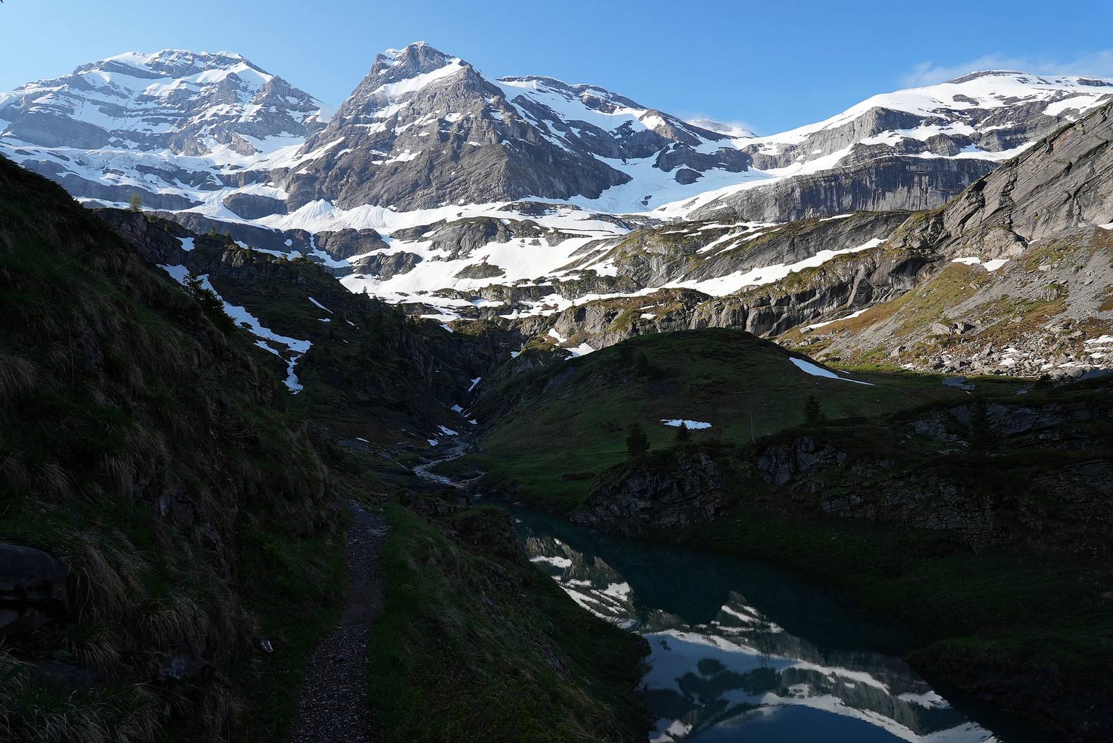
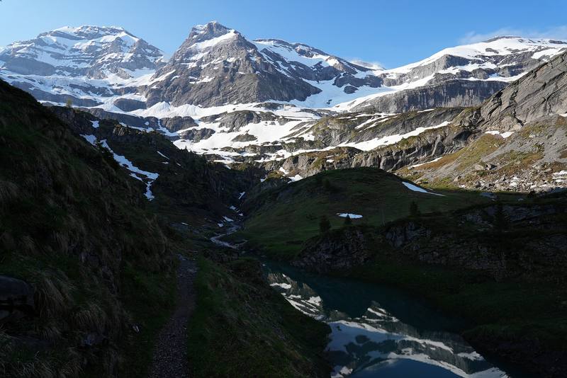
Early on Day 4, just past the Pas d'Encel: a small lake and the mountains at the head of the Susanfe valley.

Europe · Switzerland

Tour des Dents du Midi

Valais, Switzerland

Distance
42.4 mi68.3 km
Days
4 days4 walking days, 3 nights in huts and a guesthouse
Elevation gain
12,195 ft3,717 m
High point
8,182 ft2,494 m
Season
Officially June to October, depending…
Lodging
Huts
Plan this hike

Hikes / Europe / Tour des Dents du Midi

In early June 2023 I flew into Geneva, picked up an ice axe, took the train to Saint-Maurice in the Rhône valley and hiked the Tour des Dents du Midi in Valais, Switzerland: a loop around the Dents du Midi from Saint-Maurice, up to the Auberge de Chindonne, along the high meadows past Anthème to the Refuge de Bonavau above Champéry, over the snowy Col de Susanfe to Lac de Salanfe, over the Col du Jorat and down through Mex back to Saint-Maurice. It's the trip from my film Hiking 50 miles on the Dents du Midi in Switzerland.

Kraig Adams

Effort at this pace: Hard · about 11 mi (17 km) and 3,049 ft (929 m) of climbing a day over 4 days, up to 8,182 ft (2,494 m). Our grade for the days given, worked out from distance, climbing and altitude a day; it isn't the trail's usual difficulty rating (under Basics) and doesn't rate exposure, terrain or weather.

Where these numbers come from

From Kraig Adams's GPS recording and guide.

Plan this hikeSave this hike

Plan: dates, gear, deadlines and stays in a private link. Save: keeps it on your account.

From Kraig Adams's GPS

The route, day by day

Relief map of the Tour des Dents du Midi route: 4 days drawn in red with numbered day starts, labelled Saint-Maurice, Haute Cime, Bonavau and Chindonne.

Elevation1,348–7,959 ft52.7 mi

From Kraig Adams's GPS. Terrain: Mapzen Terrain Tiles (EU-DEM, SRTM) on AWS · Glaciers, rivers & lakes © OpenStreetMap contributors

Tap a day for his map of it

  • Read day 1
  • Read day 2
  • Read day 3
  • Read day 4

The film

Watch it first

Hiking 50 miles on the Dents du Midi in Switzerland

Kraig Adams · Jun 2023 · Solo

Early on Day 4, just past the Pas d'Encel: a small lake and the mountains at the head of the Susanfe valley.
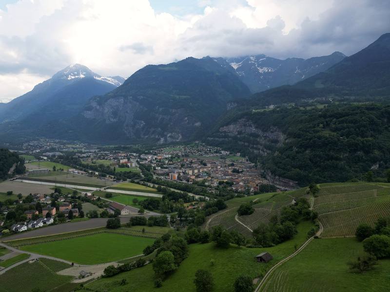
The Rhône valley at Saint-Maurice from my drone, at the start of Day 1.
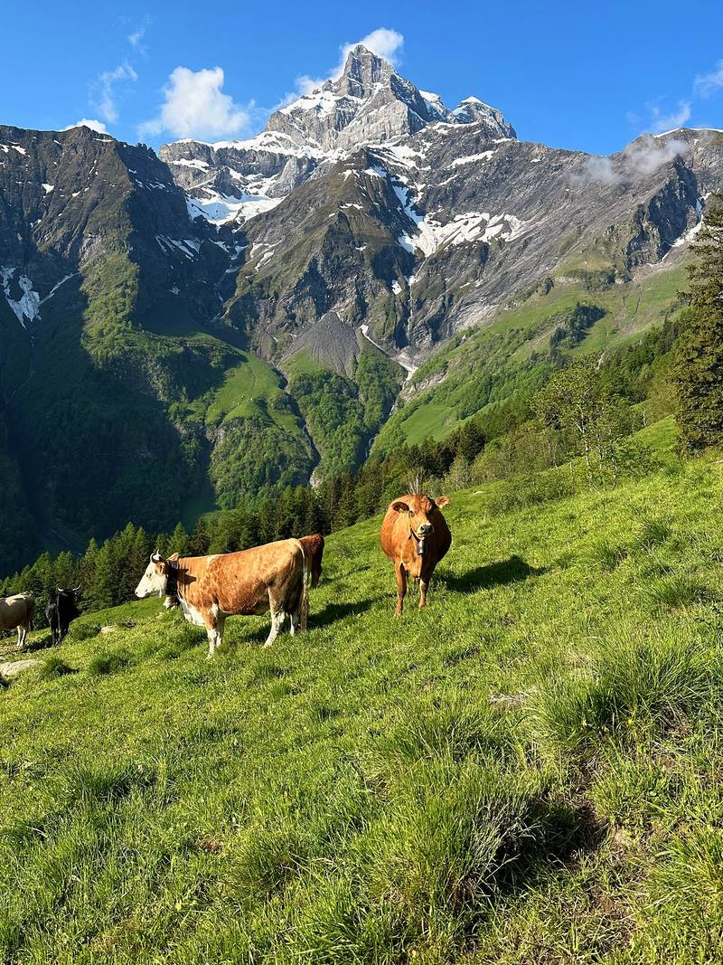
Cows in the meadows above Vérossaz, Day 2.
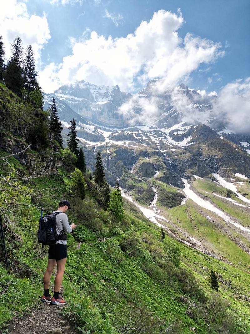
On the trail under the Dents du Midi, Day 3, from my drone.
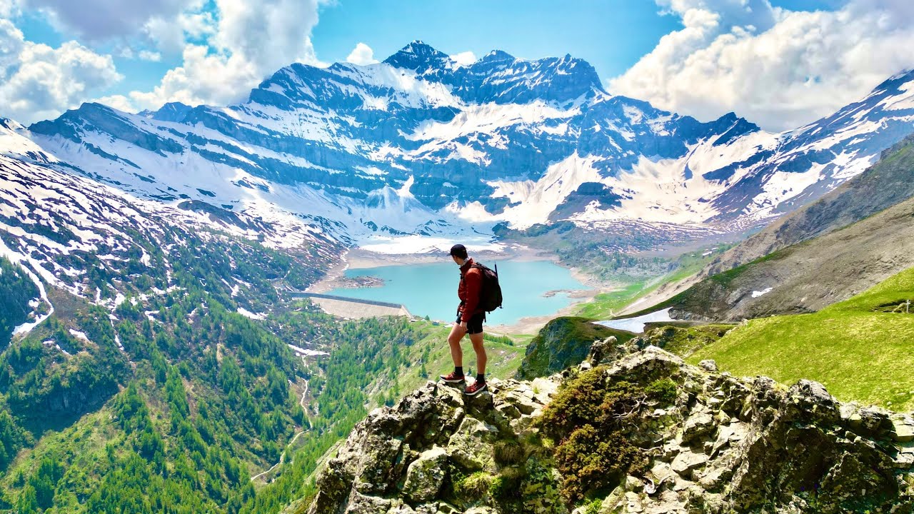
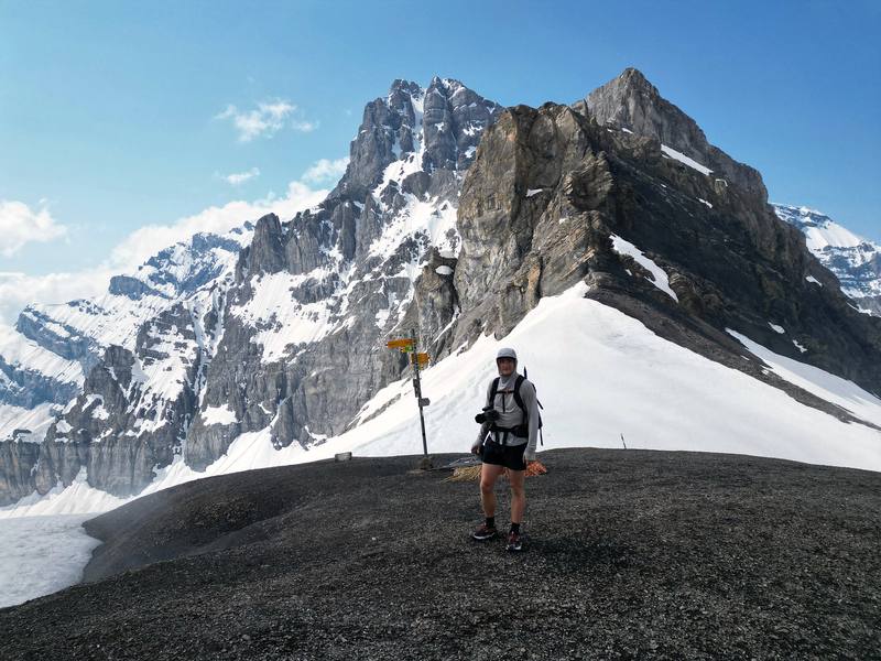
Me at the Col de Susanfe signpost, 2,494 m, Day 4, from my drone.

Before you go

The basics

Start
Saint-Maurice station, 1,384 ft (422 m), in the Rhône valley, 1 hour 35 minutes by train from Geneva Airport
Finish
Saint-Maurice station, 1,384 ft (422 m), in the Rhône valley, 1 hour 35 minutes by train from Geneva Airport
Direction
Counterclockwise: Chindonne, Anthème, Bonavau, Susanfe, Salanfe, Mex
Usual difficulty
T2 and T3 on the Swiss hiking scale: mountain paths, a chained rock step and a high pass that holds snow into summer
Best time
Officially June to October, depending on the snow. I walked June 2 to 5, 2023, with snow on the high pass
Permits
No central booking: book every hut ahead, directly with each hut; booking is compulsory at most huts. Camping is banned in most of the area
Getting there
What I did. I flew into Geneva, went to Decathlon to get an ice axe, and took the train to Saint-Maurice, at the base of the mountains. My photos put me at Geneva Airport at 1:47 p.m. and at Saint-Maurice station at 5 p.m., and I started walking at 5:25. At the end I took the train out of Saint-Maurice the same evening.
Lodging
Huts

From Kraig Adams's guide

Costs and gear

What it cost

Half board CHF 72 to 85 a night per person in the huts, plus picnic…

His costs, line by line

What Kraig carried

Not given

The full gear list

From Kraig Adams's guide

Safety

Rescue numbers

  • Emergency. Call 144 (in Valais, the cantonal rescue service, OCVS, handles mountain rescue), or 112. Rega's number is 1414 (from a foreign phone, +41 333 333 333), and its app sends your position. Signal is patchy on the loop.

Phone signal

  • In places.
  • The huts list mobile coverage at Chindonne and Anthème, a weak network at Bonavau and 4G only near the chapel at Salanfe.

Insurance

  • In Switzerland the patient pays for a rescue; a helicopter rescue can cost thousands of francs and basic insurance covers only part.
  • Check your travel insurance covers mountain rescue.

Bail-out points

  • Day 1, Saint-Maurice to Mex and back. You're never far from Saint-Maurice: walk back down, or take the PostBus from Mex (book some runs by phone).
  • Day 2, Saint-Maurice to Chindonne. Below Vérossaz, walk back down to Saint-Maurice, or take the PostBus from Vérossaz. From Chindonne a road leads down toward Monthey; bus 63 runs from Les Cerniers, about an hour's walk below the auberge.
  • Day 3, Chindonne to Bonavau. Paths lead down west into the Val d'Illiez toward Champéry and Val-d'Illiez, where the regional train runs to Monthey and Aigle; check them on the map before you leave the trail. From Bonavau it's about 2 hours down to Champéry station (Bonavau's figure).
  • Day 4, Bonavau over the Col de Susanfe to Saint-Maurice. Before the Pas d'Encel, go back to Bonavau and down to Champéry. At Salanfe, a path goes down to Van d'en Haut (1.5 to 2 hours) for the Vallon de Van bus to Salvan in summer and the Mont-Blanc Express to Martigny. At Mex, the PostBus goes down to Saint-Maurice (book some runs by phone).

From Kraig Adams's guide. For planning, not navigation: check before you go.

Their films and versions

Creators who've done it

1 creator so far: Kraig, 4 days, huts.

Walked Tour des Dents du Midi? Be the first to share your track: log it with your GPX.

Your time

Sign in and log a few hikes to see how long this one would take you.

Typical: 4 walking days, 3 nights in huts and a guesthouse (the hike's facts).

Ask this hike

Planning questions about Tour des Dents du Midi, answered only from this page's facts, the creators' versions and hikers' public tracks, with where each answer comes from. When the data doesn't say, the answer says "not given".

    From hikers

    Comments

    Sign in to comment. Free; your hikes stay private unless you share them.

    Answered from the data

    Questions people ask

    How many days do you need for Tour des Dents du Midi?

    The official site says two, three or four days. My loop took three days from Saint-Maurice, with a last day of 17.9 miles; four days with a bed every night is the comfortable version.

    From Kraig Adams's trip and guide.

    How much does Tour des Dents du Midi cost?

    It's a little bougie and expensive to hike in Switzerland. Half board in the huts was CHF 72 to 85 a night in 2026. My receipts are in What I paid.

    From Kraig Adams's trip and guide.

    When is the best time to hike Tour des Dents du Midi?

    Officially June to October, depending on the snow. I walked June 2 to 5, 2023, with snow on the high pass.

    From Kraig Adams's trip and guide.

    How long is the Tour des Dents du Midi?

    The official tour is 46 km (about 28.6 miles) with about 3,350 m of climbing. I walked it from Saint-Maurice in the Rhône valley, which adds the climbs from the valley: 42.5 miles (68.3 km) and about 12,200 ft (3,720 m) up on my GPS, June 3 to 5, 2023.

    From Kraig Adams's trip and guide.

    Where do you sleep on the Tour des Dents du Midi?

    In huts and mountain inns: the Auberge de Chindonne, the Cabane d'Anthème, the Refuge de Bonavau, the Auberge de Salanfe and the Auberge de l'Armailli in Mex. Half board was CHF 72 to 85 a night in 2026. The Cabane de Susanfe is closed for nights in 2027 while it is rebuilt. Book each one directly.

    From Kraig Adams's trip and guide.

    When can you hike the Tour des Dents du Midi?

    The official site says June to October, depending on the snow. The Col de Susanfe (2,494 m) holds snow into summer; the official advice is crampons and an ice axe while it is snowy. I crossed it on June 5 with microspikes and an ice axe.

    From Kraig Adams's trip and guide.

    How do you get to the Tour des Dents du Midi?

    By train to Saint-Maurice: in 2026 a direct train from Geneva Airport took 1 hour 35 minutes. PostBus lines run from Saint-Maurice to Vérossaz and Mex, and the regional train runs to Champéry.

    From Kraig Adams's trip and guide.

    Can you camp on the Tour des Dents du Midi?

    Wild camping is generally banned in Switzerland, and camping and bivouac are banned in the communes of Champéry and Val-d'Illiez. There is no official campsite on the tour. The Auberge de l'Armailli in Mex allows a bivouac beside the inn.

    From Kraig Adams's trip and guide.

    Plan this hikeThe route