
Content made there
The film is at the top of this page.
Photos
Hikes / Los Nevados / Kraig Adams's version
South America · Colombia
Mar 2021 · 3 days · 38 miles · Solo · Tent

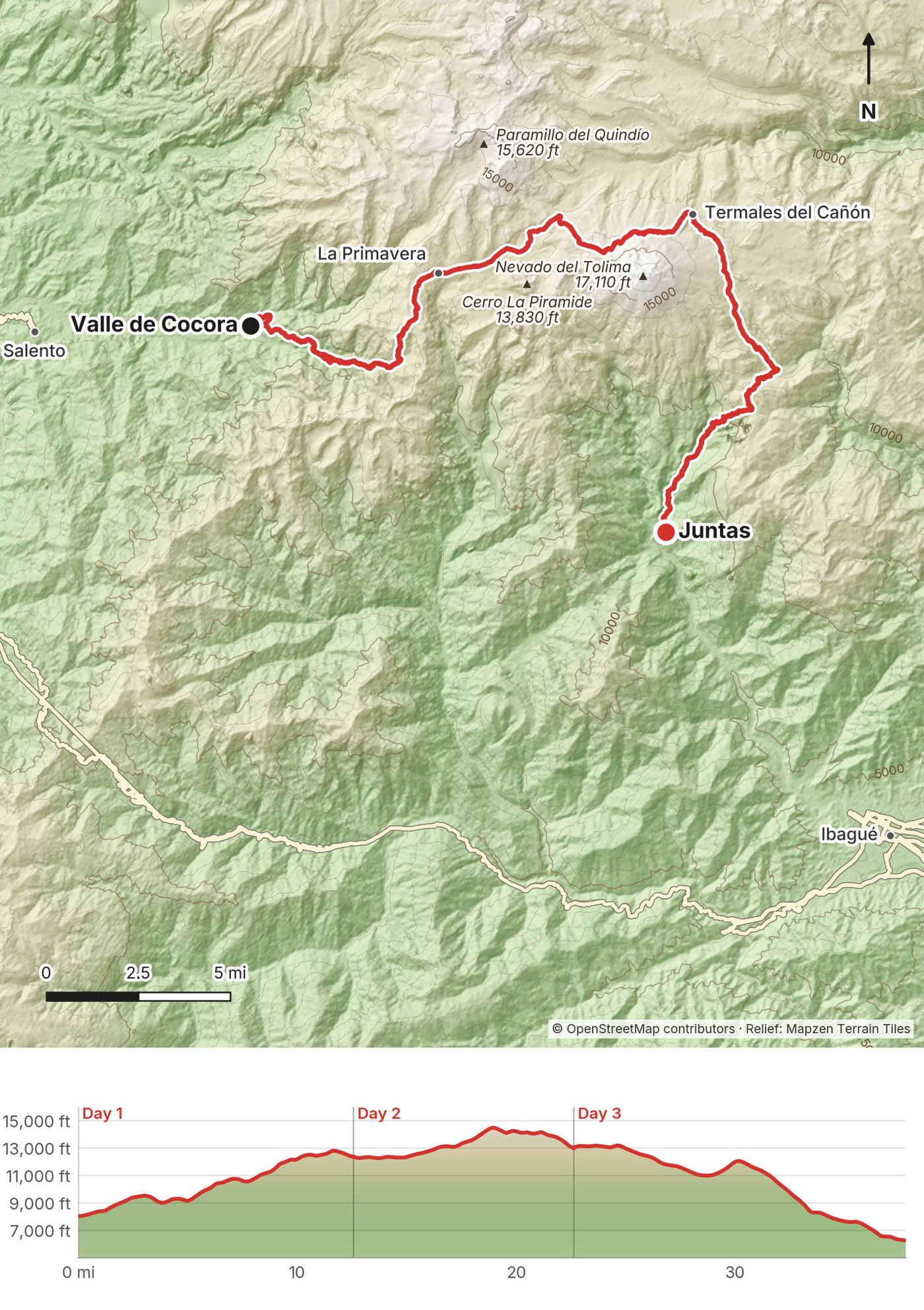
In March 2021 I hiked alone across Los Nevados National Natural Park in the Colombian Andes. I took a jeep from Salento to the Valle de Cocora, walked up through the wax palms and the cloud forest into the paramo, slept at a mountain farm, crossed the high paramo below the glacier of Nevado del Tolima to the hot springs at Termales del Cañón, and walked down the other side to the village of Juntas above Ibagué. About 37.8 miles (60.9 km) over three days by my GPS. It's the trip from my film Hiking Alone in Colombia.
It was my first time in Colombia. It rained on all three days and the mud was deep.
| Quick facts | |
|---|---|
| Distance | 37.8 miles (60.9 km) over 3 days by my GPS |
| Climbing | About 12,500 ft (3,800 m) up and 14,300 ft (4,360 m) down, by my GPS |
| Days | 3, all long: 8.5 to 10 hours each |
| Start | The Valle de Cocora, about 8,020 ft (2,445 m), 30 minutes by jeep from Salento |
| Finish | Juntas, about 6,220 ft (1,895 m), at the top of the Combeima canyon road from Ibagué |
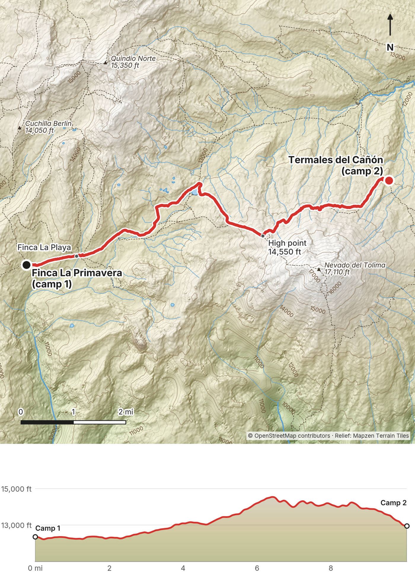
| High point | About 14,550 ft (4,435 m) by my GPS, on Day 2 near Campamento Arenales below Nevado del Tolima |
| Sleep | Finca La Primavera, about 12,370 ft (3,770 m); Termales del Cañón, about 12,960 ft (3,950 m), in a tent |
| Difficulty | Hard: long days, deep mud, altitude, cold rain and fog, and no marked route on parts of the paramo |
| Water | Streams and farm taps most of the way. Treat it |
| Rules (2026) | A registered guide is required, booked 5 business days ahead, with accident and rescue insurance |
| Day | Route | Miles (km) | Up / down (ft) | Sleep |
|---|---|---|---|---|
| 1 | Valle de Cocora to Finca La Primavera | 12.6 (20.2) | 6,845 / 2,504 | Finca La Primavera, about 12,370 ft |
| 2 | Finca La Primavera to Termales del Cañón | 10.1 (16.2) | 3,575 / 2,971 | Termales del Cañón, about 12,960 ft |
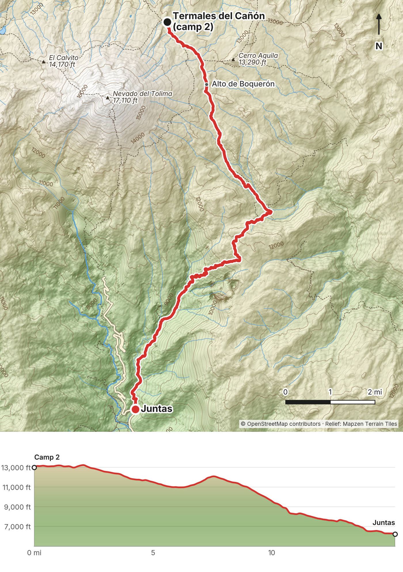
| 3 | Termales del Cañón to Juntas | 15.2 (24.5) | 2,066 / 8,837 |
My way in, 2021. I flew from New York to Bogotá, then on to Pereira, and arrived at night in the rain. The next morning I took a bus to Salento and spent a day there. On the morning of the hike I packed, bought some fruit from a street vendor, and rode a Willys jeep from the main square to the Valle de Cocora.
Flying in. Fly into Bogotá or Medellín and connect to Pereira (PEI) or Armenia (AXM). Pereira's airport closed after the August 2026 earthquake and reopened on August 25 with fewer flights. Armenia is about an hour from Bogotá by air.
To Salento. Buses from Armenia leave every 15 to 20 minutes, about 1 hour, about 5,000 pesos. From Pereira, about hourly, 50 to 60 minutes, about 9,000 pesos (as reported, 2026).
To the Valle de Cocora. Willys jeeps leave the main square in Salento when they're full, from about 6:30 a.m.; the ride is about 30 minutes and 5,000 to 7,000 pesos each way (as reported, 2026). On a guided trip your operator will usually take care of it. The Salento to Cocora road was closed for about a week in March 2026 by a flooded creek.
Out from Juntas. Juntas is about 11 miles (18 km) up the Combeima canyon from Ibagué. Buseta 48 runs from Ibagué to Juntas from about 5 a.m. (about 3,800 pesos in 2025). Buses from Ibagué to Armenia take about 2.5 to 3.5 hours, 31,500 to 63,000 pesos, then Armenia to Salento as above (as reported).
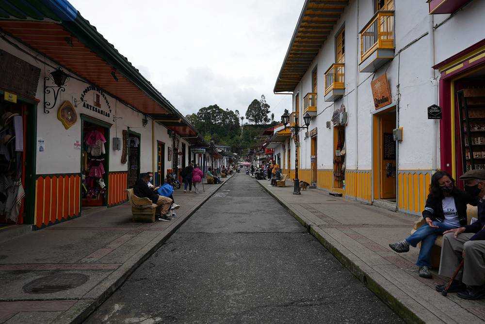
The night before. Salento has everything from hostel dorms at a few dollars a night to boutique hotels at $100 or more. I stayed in a small hotel with a balcony over the valley, and spent the day walking the town and eating.
I didn't keep a list of what this trip cost me, and I went without a guide, which you can't do now.
For your budget (as checked in October 2026, at about 3,300 pesos to the dollar):
| Item | Cost |
|---|---|
| A guided 3-day trek (guide, farms, meals; often transport) | About $290 to $730 a person (as reported: Xperiencia from about $290 for the Juntas side, Aventure Colombia $436 and Viator $460 for 3-day treks from Salento, The Colombian Way from about $694) |
| Park entry | None listed for this sector in 2026; 68,000 pesos (about $21) in the park's other sectors |
| Farm fees in the Valle de Cocora | About 10,000 to 30,000 pesos each (as reported) |
| The jeep from Salento to Cocora | 5,000 to 7,000 pesos each way |
| Salento, 2 nights | About $15 to $120 |
| Buses (airport to Salento, Juntas to Ibagué to Armenia) | About $15 to $30 |
| A coffee tour | About $9 to $30 |
That's about $365 to $1,135 for one person, before flights; a shared guided trek with budget lodging and buses comes to about $550 to $650. Carry cash: there's no ATM at Cocora.
| Night | Where | Height |
|---|---|---|
| Before | A small hotel in Salento | about 6,500 ft |
| 1 | Finca La Primavera (Day 1 mile 12.6), a bunk in a wooden room | about 12,370 ft (3,770 m) |
| 2 | Termales del Cañón (Day 2 mile 10.1), my tent by the hot pools | about 12,960 ft (3,950 m) |
| After | A room in Juntas | about 6,220 ft |
Finca La Primavera. A family farm high in the paramo that takes hikers: bunk rooms, a kitchen, a hose and an outdoor sink. Dinner and breakfast are served. With the 2026 rules your operator books it.
Termales del Cañón. A camping area with natural hot pools and a stone hut where a family lives. It's one of only three places you're allowed to camp in the park. Bring a tent, a warm sleeping bag and a pad; it's near freezing at night.
Food. At La Primavera I had dinner and breakfast at the farm. In between I ate my own snacks and drank a meal shake. On guided trips the farms or the operator usually provide meals; ask. There's nothing to buy between Estrella de Agua and Juntas.
Water. Streams, bogs and lakes on the paramo, and the farms' taps. Treat all of it: cattle graze up to the paramo, and some streams below Tolima carry sulfur from the volcano.
Paid links: I earn a commission if you buy through these links, at no extra cost to you. As an Amazon Associate I earn from qualifying purchases.
It rained on all three days and it's near freezing on the paramo. Here's what I carried in 2021, what I'd take now, and what I filmed with.
From my film and photos. I have no full gear list for this trip.
My current kit for what this crossing needs.
 Rain shell: Arc’teryx Beta AR Jacket (Arc’teryx). It rained every day.
 Umbrella: Six Moon Designs Silver Shadow Carbon (Amazon). What I carry now.
 Puffy: Arc’teryx Cerium Hoody (Arc’teryx). Near freezing on the paramo.
 Hat: PATH Projects Hoyt Merino Beanie (PATH Projects)
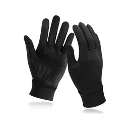 Gloves: Unigear Touchscreen Liner Gloves (Amazon)
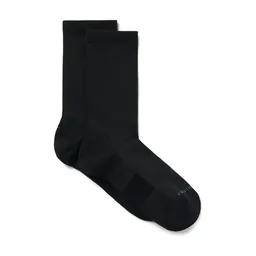 Socks: PATH Projects Joyner Crew Sock (PATH Projects). A dry pair for the night.
 Sunglasses: Goodr OG Sunglasses (Amazon). With 100% UV protection for the paramo sun.
 Tent: NEMO Hornet Elite OSMO 1P (Amazon). For Termales del Cañón.
 Sleeping bag: Hyperlite Mountain Gear 20° Mummy Bag (Hyperlite). Warm, for the paramo.
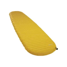 Sleeping pad: Therm-a-Rest NeoAir XLite NXT (Amazon)
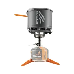 Stove: Jetboil Stash (Amazon). Gas only: no fires in the park.
 Water filter: Katadyn BeFree AC · 1L (Amazon)
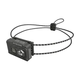 Headlamp: Nitecore NU20 Classic (Amazon)
 Power bank: Nitecore NB20000 (Amazon). No signal for most of the crossing.
What I filmed this trip with in 2021, from my photos' camera data. My setup is smaller now (below). Check the drone rules in Straight answers before you fly: the parks service allows drones only with a filming permit.
Since September 2026 I film with a smaller setup: the Pocket 4 and the Mic 3 on the trail, and the Mini 5 Pro in the air.
 Camera: DJI Osmo Pocket 4 (Amazon)
 Mic: DJI Mic 3 · 1 TX + 1 RX (Amazon). It pairs with the Pocket 4.
 Drone: DJI Mini 5 Pro (Amazon)
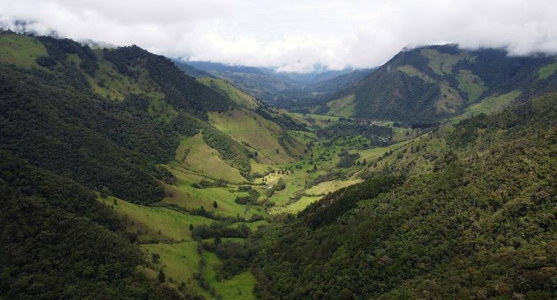
The jeep dropped me at the Valle de Cocora at about 9:30 a.m. and I walked up the dirt road between the tall wax palms, Colombia's national tree, into the clouds.
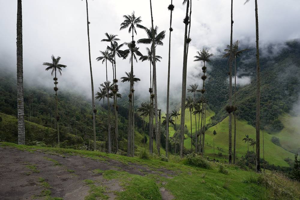
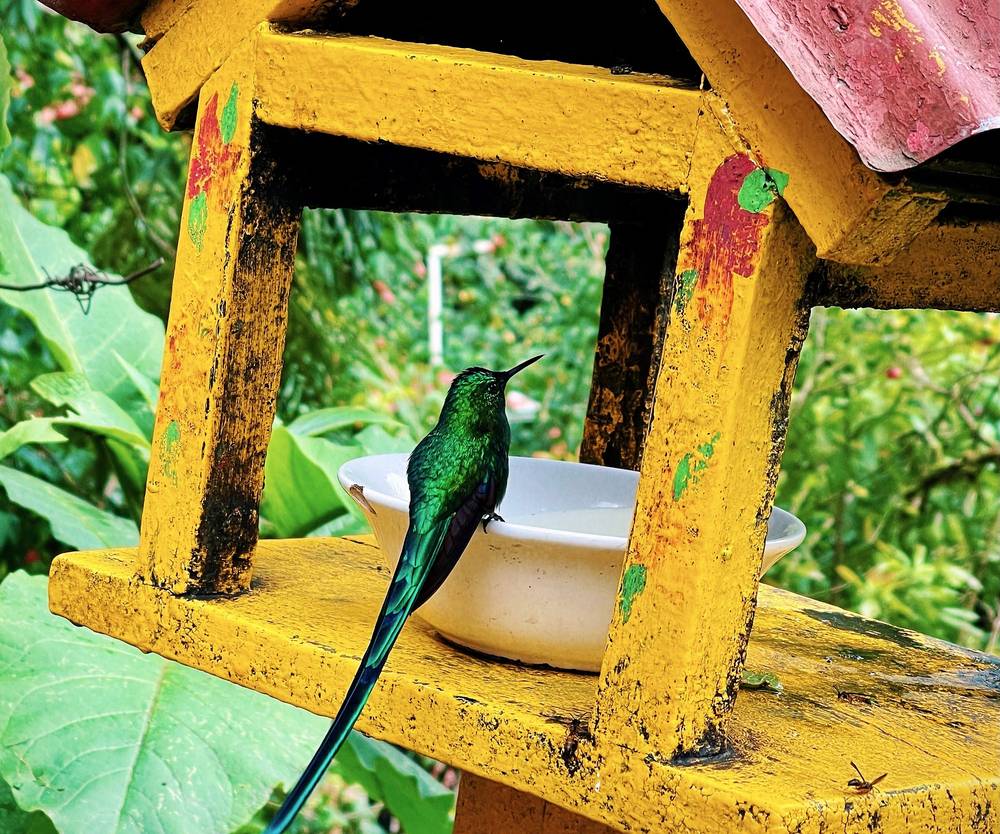
The trail goes up the valley into the cloud forest. At Acaime, the hummingbird house, I stopped at 11:28 a.m. for a drink while the hummingbirds came to the feeders. A string of pack mules ran past me on the narrow trail.
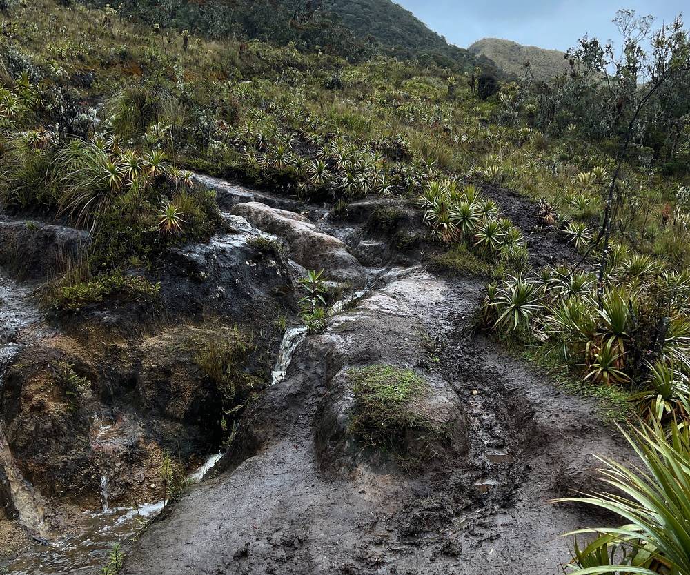
I got to Estrella de Agua at 2:12 p.m. and sat in the grass by the building to eat. Then the rain came. The trail above is a deep, muddy trench through the forest. I walked it under my umbrella, crossed a wooden bridge covered in hail, and washed the mud off my shoes in a stream when it stopped.
Above the trees the paramo opened up, and in the evening I saw Nevado del Tolima. I reached the top of the day at 6:40 p.m. and Finca La Primavera at 7:25 p.m., in the dark. In the film you see me at the table with my head in my hand. They passed my dinner through a little window in the kitchen wall, I washed my legs with a hose by headlamp, and I slept in a bunk in a wooden room.
The Valle de Cocora. From the jeep stop the dirt road climbs gently through the wax palm pastures. The valley isn't in the national park: it's farmland, and the farms charge for walking through (in May 2026, as reported: about 10,000 pesos at Finca El Portón, 30,000 at La Esperanza, 20,000 at Acaime with a drink). Carry cash.
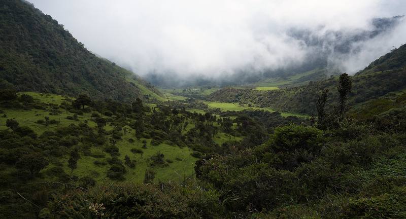
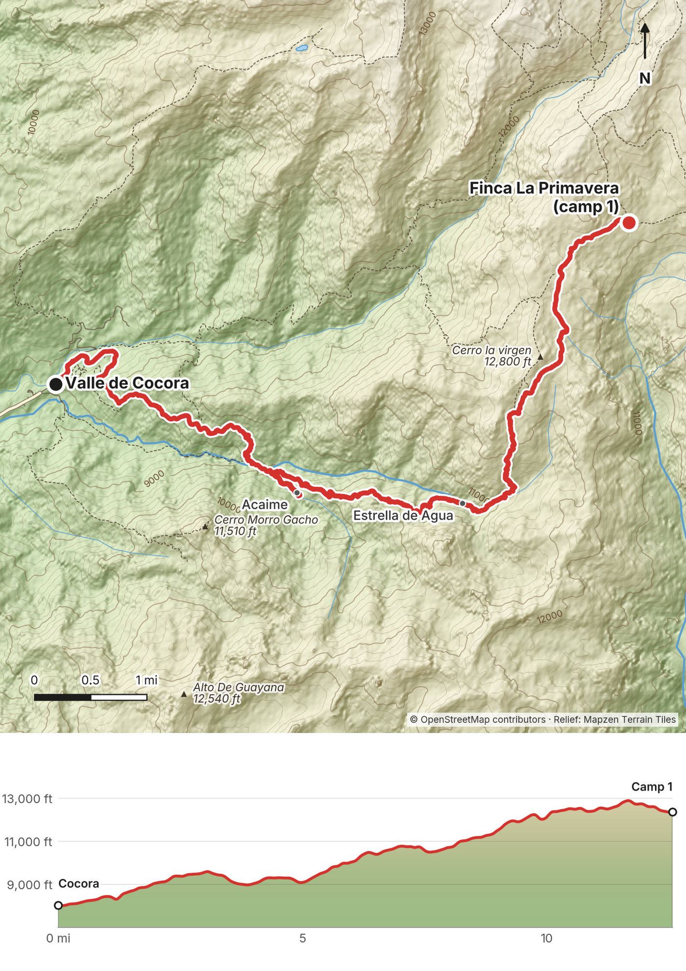
Acaime and the cloud forest. The trail follows the river into the cloud forest, with a few log bridges, to Acaime, the hummingbird house, at mile 4.4 by my GPS (about 9,310 ft). The popular day loop turns around here; the crossing goes on up.
Estrella de Agua. The trail climbs steadily through the forest to Estrella de Agua, a forest station at mile 7.9 (about 10,610 ft). It no longer takes overnight guests, and you can't camp there. Above it, the mud is the deepest of the trip.
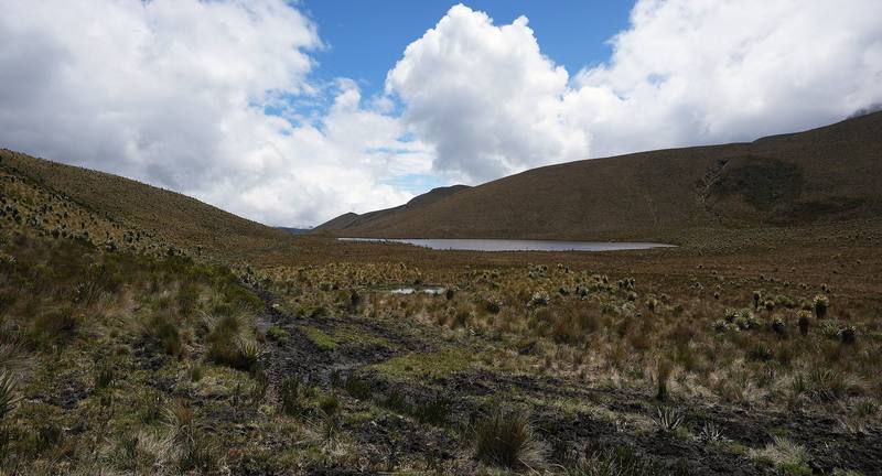
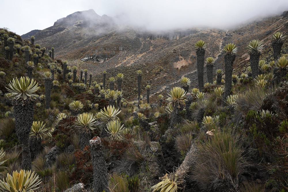
The paramo to La Primavera. At about 11,500 ft the forest gives way to the paramo: grass, bog and frailejones. The trail crosses the Páramo de Romerales and the line between Quindío and Risaralda, tops out at about 12,930 ft by my GPS, and drops a little to Finca La Primavera at mile 12.6.
Acaime is the last easy turnaround: Cocora is about 4.4 miles back down, and the day loop returns from there. If you reach Estrella de Agua after about 2 p.m., or anyone in the group is struggling, talk to your guide about turning back: the rest of the climb is the steepest and muddiest part, and you don't want to be on the paramo in the dark.
The Valle de Cocora (from 4:51) · Day 1 in Los Nevados (from 5:40)
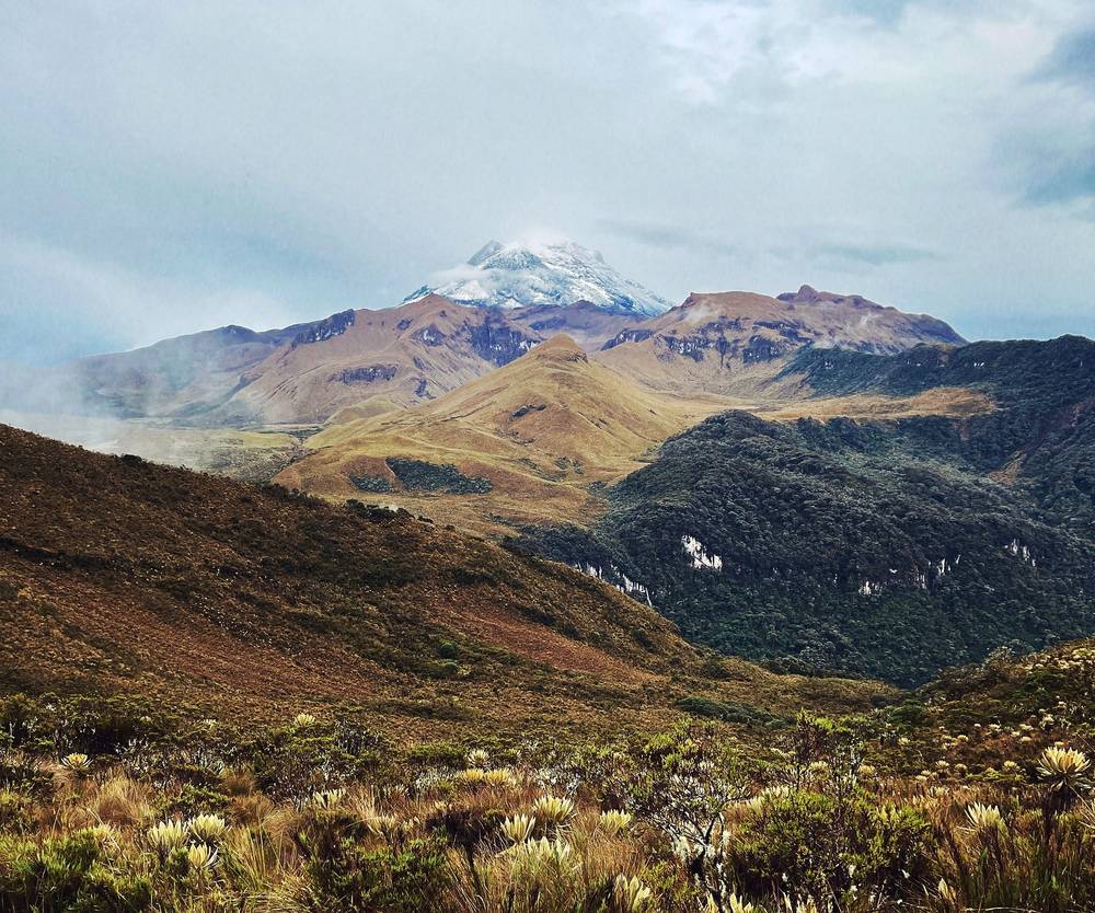
The morning at the farm was clear, with the snow of Tolima above the valley. There were chickens in the yard and a brown dog that walked a little way with me. I had breakfast at the wooden table, washed my dishes at the outdoor sink and left at 8:21 a.m.
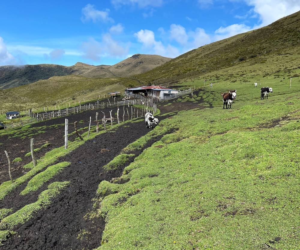
I passed Finca La Playa at 9:09 a.m. and climbed into the high paramo. Cows grazed among the frailejones. I stopped by a small lake to eat and look at the water, then walked on through fields of frailejones toward the mountain.
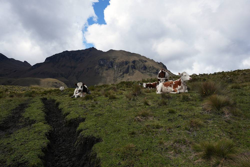
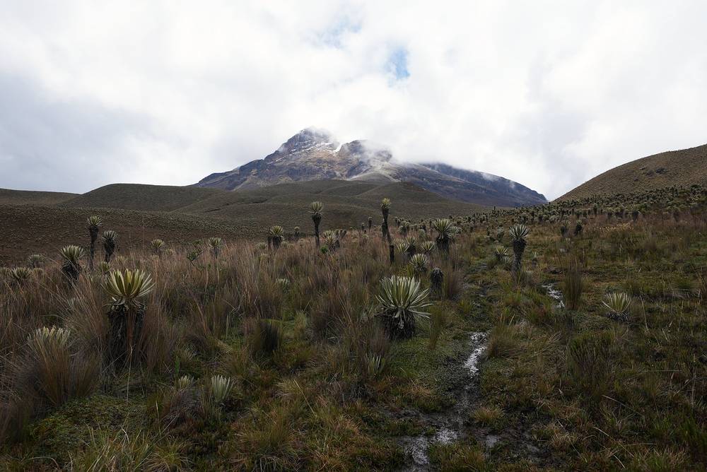
I reached the highest point of the whole trip at 1:20 p.m., below the glacier of Nevado del Tolima, and stayed about 20 minutes. Then the fog came in and I walked through it under my umbrella.
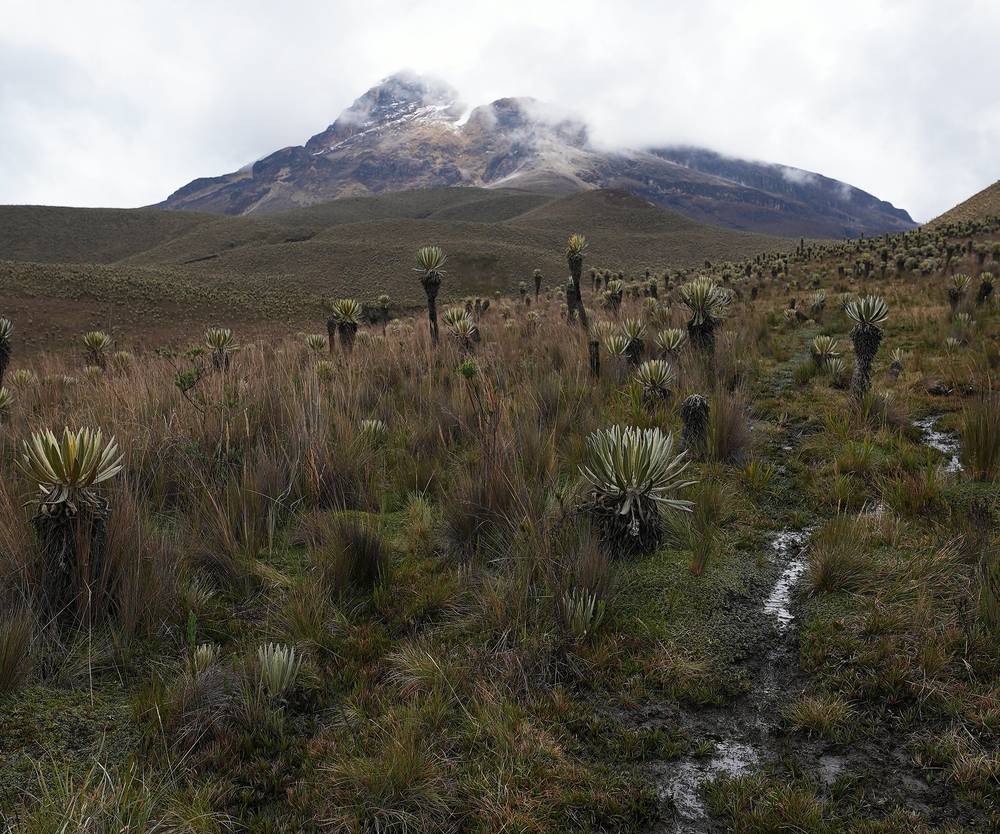
I got to Termales del Cañón at 4:49 p.m., with steam rising from the pools. A family lives in a stone hut there; I said hello, pet their dogs, and pitched my tent on the grass beside a pool. Then I got in. It's a natural pool with a muddy bottom, and it was warm.
To Finca La Playa. From La Primavera the trail heads east along the valley to Finca La Playa (also called Aquilino), at mile 1.1, about 12,240 ft.
Over the high paramo. The route climbs east through the paramo past small lakes and the Valle del Placer area toward the west side of Nevado del Tolima. The trail is faint in places, and in fog it's easy to lose. It tops out at about 14,550 ft by my GPS at mile 6.4, near Campamento Arenales, the camp used for climbing Tolima. El Calvito, the rocky hill above, is about 14,170 ft.
Down to Termales del Cañón. From the high point the trail drops gradually north and east across the slopes below the volcano, then down into the valley of the hot springs at mile 10.1, about 12,960 ft. Termales del Cañón is a camping area only, with natural hot pools; it's also the base for the guided climb of Tolima.
The high point is the place to decide. Back at La Primavera you can sleep in a bed. If the fog is thick, someone has a bad headache or is short of breath, or it's past about 1 p.m., don't go on over the top: altitude sickness and getting lost in the fog are the two real dangers here. Going down is the cure for altitude sickness.
Day 2 in Los Nevados (from 11:04)
I sat in the hot pool in the morning, looking out at the fog. Then I packed the tent and left at 8:21 a.m., up through the frailejones to Alto de Boquerón, the last high point, at 9:38 a.m.
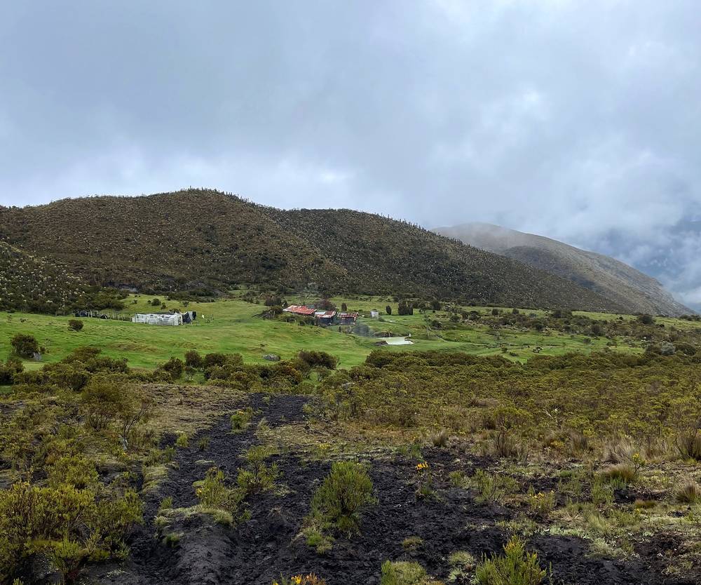
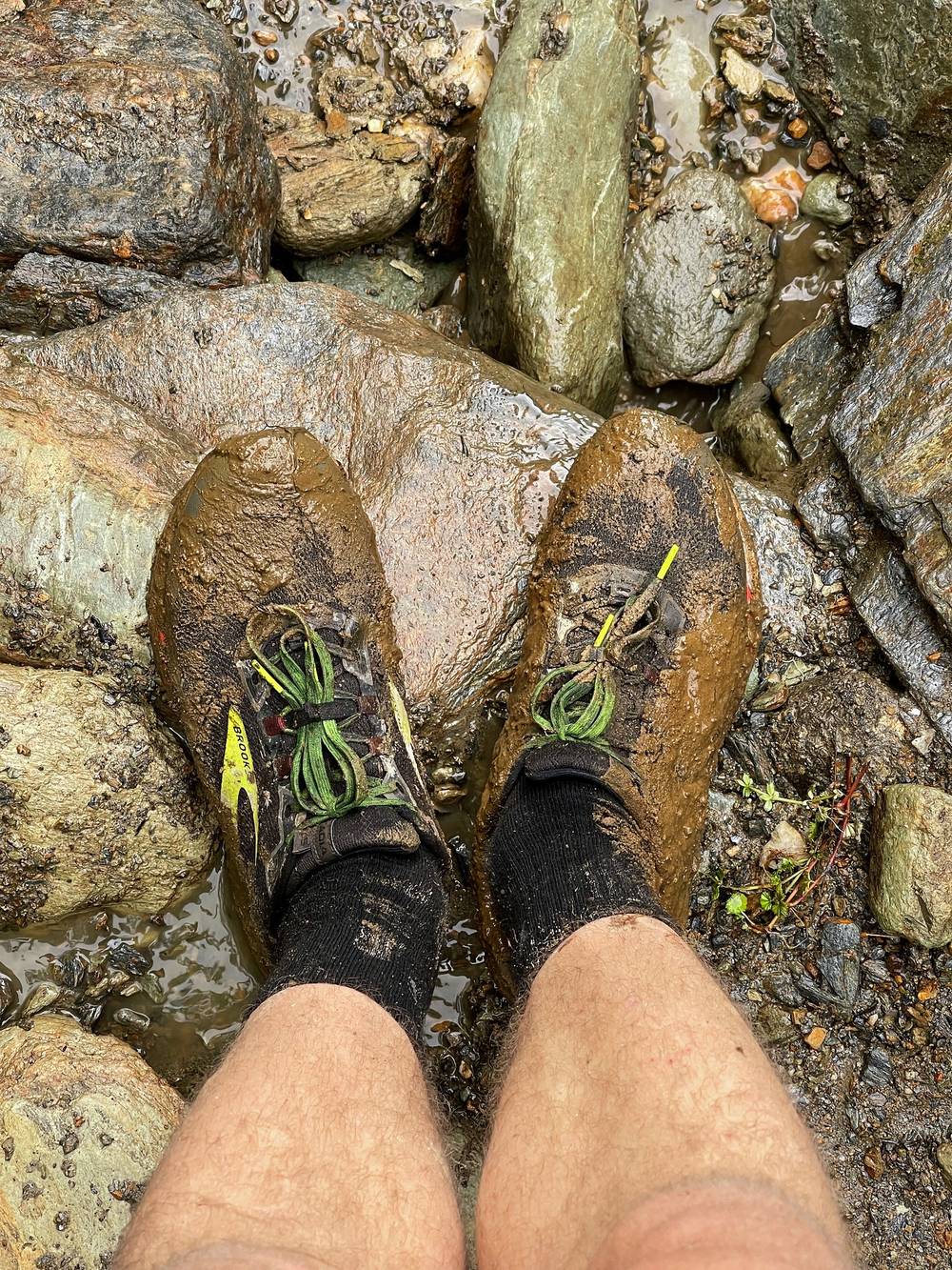
From there it's mostly downhill, with one more climb in the middle of the day. I passed Mesetas and the old school at El Salto before noon, climbed again to about 12,100 ft by Alto de Las Nieves, Finca Las Nieves at about 1:30 p.m. and Estambul at about 2:50 p.m. On the way down there's a fast, rocky river to cross; I used a long stick for balance. Then the rain came again. "Rainy again," I said into the camera.
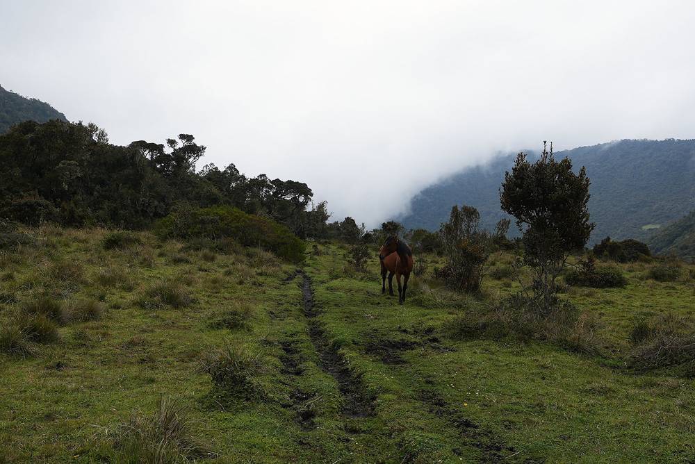
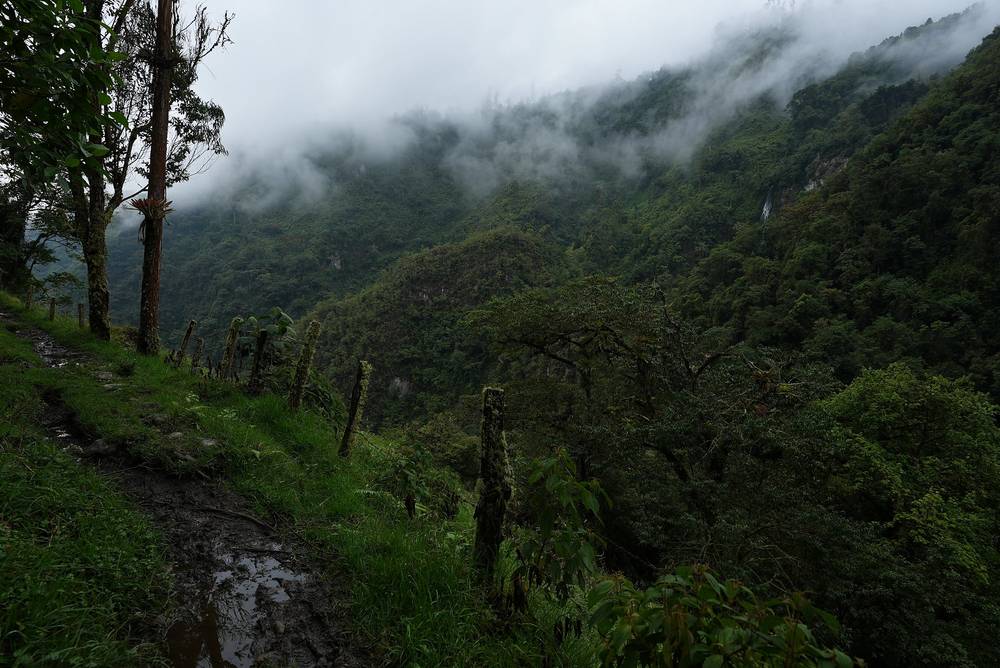
The last miles go down through the cloud forest on a muddy track, under my umbrella, to a paved road and the village of Juntas. I got there at 5:44 p.m., had a bowl of soup with a piece of cheese in a little roadside shop, and slept in Juntas.
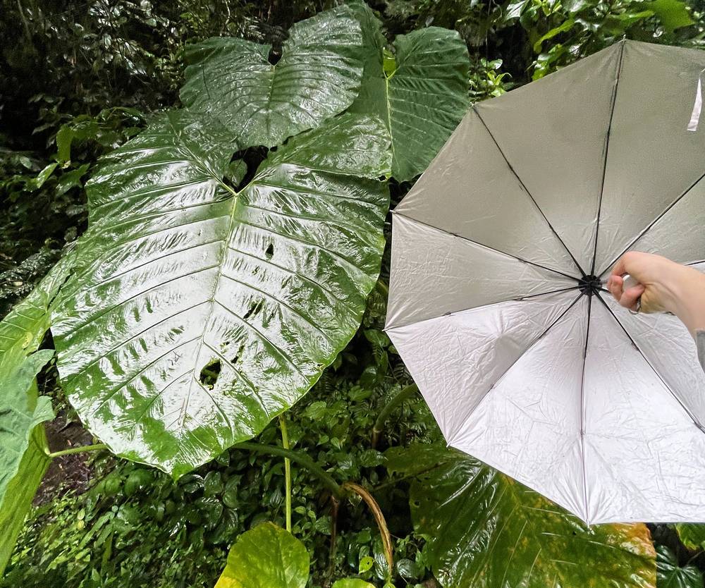
Alto de Boquerón. From the hot springs the trail climbs south through the frailejones to Alto de Boquerón, about 13,270 ft, at mile 2.1.
Down past El Salto. The trail drops south along the ridge past the Mesetas camp area to the El Salto school (about 10,970 ft, mile 6.0), then climbs about 1,100 ft to Alto de Las Nieves (about 12,100 ft, mile 7.5) before dropping to Finca Las Nieves (about 11,430 ft) and the hut at Estambul (about 9,360 ft). The park's entry route from Juntas comes up this way, and some guided trips sleep at El Salto.
The cloud forest to Juntas. Below Estambul the trail gets steep and muddy through the cloud forest, past Alto El Cebollal, down to the Combeima river and the end of the road at Juntas, about 6,220 ft, at mile 15.2. The total descent is about 8,800 ft: hard on the knees.
Termales del Cañón is the place to decide. If the August 2026 landslides have closed the trail to Juntas, or someone in the group isn't up to a 15-mile day downhill, go back the way you came, over the paramo to La Primavera and down to Cocora, as most guided trips do. Once you're past Estambul, keep going down to Juntas: it's closer than anything else.
Day 3 in Los Nevados (from 17:01)
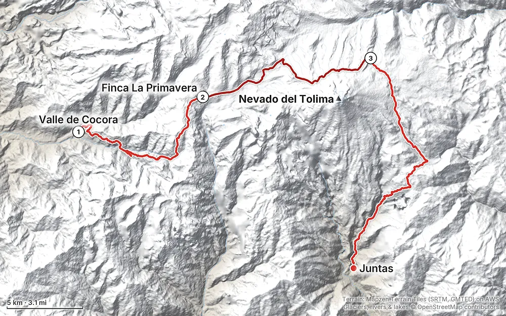
Elevation7,999–14,551 ft22.6 mi
Terrain: Mapzen Terrain Tiles (SRTM, GMTED) on AWS · Glaciers, rivers & lakes © OpenStreetMap contributors
Tap a map to open it full size.
Checked on the pages of Parques Nacionales Naturales de Colombia (the national parks service) for Los Nevados, its 2023 visitor regulation, the Servicio Geológico Colombiano's volcano bulletins and Colombian news, on October 3, 2026.
Open, with a guide. The park's south sector, Quindío-Dulima (Nevado del Tolima), is open, and the crossing from Juntas to the Valle de Cocora is one of its authorized routes, limited to 82 people a day. But the park now says guiding is required "in all sectors." You book through a registered tour operator at least five business days ahead, buy accident and rescue insurance from one of the approved insurers, and go with a guide. Solo hiking without a guide, the way I did it in 2021, isn't allowed.
Entry times. From Cocora, 6 to 10 a.m. From Juntas, 6 to 11 a.m. There's a short safety talk at the entrance, and you check in and out at the control points.
The earthquake. A magnitude 7.4 earthquake on August 10, 2026 damaged houses in Salento, which reopened to visitors within days; the jeeps to Cocora are running. On the Ibagué side it set off landslides in the upper Combeima canyon, and the road to Termales El Rancho closed indefinitely. That's a different route from mine, but I found no notice that the trail from Juntas to Termales del Cañón has reopened. Ask your operator before planning to come out at Juntas.
Park closures. The park closes for five days three times a year so the paramo can recover: after Easter, in late September and in late November. By the park's rule the November 2026 closure would be November 23 to 27; check the dates. There was an extra closure in May 2026.
The volcanoes. In September 2026 Nevado del Tolima was at Green, the lowest alert level. Nevado del Ruiz, about 15 miles north, was at Yellow and restless. Its alert level mostly affects the park's north sector, but in 2023 an Orange alert at Ruiz closed the whole park for about three months.
Camping. Inside the park you can only camp at Termales del Cañón, Arenales and El Calvito, 35 people each. Estrella de Agua no longer takes overnight guests.
These were checked on the Parques Nacionales Naturales de Colombia pages for Los Nevados and its 2023 visitor regulation on October 3, 2026. A new five-year ecotourism plan for the park started in March 2026, with 15 trails; its route list wasn't published, so ask your operator whether the full crossing is still sold.
The guide. Required in every sector. Choose an operator registered with the park and with Colombia's tourism registry (REPSE), and book at least five business days ahead. Guides take up to 8 hikers each on trails.
Insurance. Accident and rescue insurance is required, from Colasistencia, Magenta or Seguros Médicos Internacionales. Your operator usually arranges it.
Who can go. Ages 15 to 69 for treks like this one. People with heart or lung conditions, a past case of high-altitude pulmonary or cerebral edema, or pregnancy can't enter.
Camping. Only at Termales del Cañón, Arenales and El Calvito, 35 people each. The farms take hikers in beds.
Fires. None. Bring a gas stove.
Other rules. No single-use plastics. No alcohol, drugs, weapons, knives or fishing gear: bags are checked at the entrance. Pack mules only as far as the farms. Carry out all your trash. Drones only with a filming permit.
What the park says to carry. Sunglasses with 100% UV protection, sunscreen of SPF 50 or more, a headlamp and spare batteries, waterproof and warm layers, gloves, a balaclava and proper footwear.
Contact. The park: nevados@parquesnacionales.gov.co.
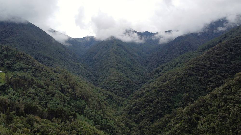
March. I hiked March 13 to 15, 2021, at the start of the first rainy season. It rained every day, mostly in the afternoons; the morning of Day 2 had views of Tolima before the clouds came in.
The best months. The drier seasons are December to February and July to August. Rain is possible any month, and fog rolls over the paramo every day. The wettest months are April and May, and October and November.
Closures. Avoid the park's five-day closures: the week after Easter, late September and late November.
Weather. Salento, about 6,500 ft (1,990 m), is mild all year: highs about 70 to 72 °F (21 to 22 °C), lows about 56 °F (13 °C). Average monthly rain there, in millimeters (WeatherSpark):
| Month | Rain (mm) |
|---|---|
| January | 107 |
| March | 145 |
| April | 203 |
| July | 119 |
| August | 124 |
| October | 211 |
Up on the paramo, at 11,500 to 14,500 ft, expect 3 to 14 °C (37 to 57 °F), wind, fog, hail and cold rain.
Light. Colombia is near the equator, so the days are about 12 hours long all year: sunrise about 6 a.m., sunset about 6 p.m. Plan to reach the farm or the camp before dark.
Emergencies. Call 123, Colombia's emergency number; there's no signal for most of the crossing, so your guide and a satellite messenger are your link out. Leave your route and dates with someone at home.
Altitude. You go from about 8,000 ft to over 14,500 ft in two days. Spend a night or two in Salento first. Headache, nausea, dizziness or breathlessness at rest are warning signs: tell your guide and go down. Anyone who has had high-altitude pulmonary or cerebral edema can't enter the park.
Cold and rain. Rain, hail, wind and fog at near freezing temperatures are normal on the paramo. Keep a dry layer and dry socks for the night, and don't let wet clothes chill you.
Fog. The paramo trail is faint in places and the fog comes in every day. Stay with your guide and don't change your route without telling the park.
Mud and rivers. The trail between Cocora and the paramo is deep mud. On Day 3 there's a fast, rocky river to cross; after heavy rain, wait or ask your guide.
Landslides. After the August 2026 earthquake, slopes on the Ibagué side are unstable. Check the trail and the Combeima road before you go.
Safety in Colombia. The US State Department rates Colombia Level 3, "Reconsider travel" (March 2026). Quindío and Tolima aren't among the departments it says not to travel to. Check the advisory before you go.
Can I still do it alone? No. A registered guide is now required in every sector of the park. Some blogs still describe hiking it without one; don't. Two people died on Cocora-side trips in recent years, one lost in bad weather in October 2025 and one of pulmonary edema in December 2024 after his group changed its route without telling the park.
How hard is it? Hard. Day 1 climbs about 6,800 ft from the Valle de Cocora to the paramo, most of it in mud. I got to the farm at 7:25 p.m., after almost ten hours, and washed my legs with a hose by headlamp. Day 2 goes over 14,500 ft. Day 3 drops about 8,800 ft to Juntas. The paths are clear in the forest but faint in places on the paramo, and the fog comes in fast.
How far is it? 37.8 miles (60.9 km) by my GPS: 12.6, 10.1 and 15.2 miles a day. The film's description says 38 miles.
Is there a fee? The park's official fee table lists no entry fee for the Quindío-Dulima sector in 2026, even for foreigners; the other sectors charge foreigners 68,000 pesos. The farms in the Valle de Cocora charge for walking through them, and the guide, the insurance and the farms all cost money. See What it costs.
Is there water? Yes: streams, bogs and the farms' taps. Treat it all; cattle graze up to the paramo.
How cold is it? The paramo runs from about 3 to 14 °C (37 to 57 °F) on this route, with rain, wind and fog, and nights near freezing at Termales del Cañón. I had rain on all three days and hail on a bridge on Day 1.
Do I need rubber boots? Many people rent them in Salento for the mud between Cocora and the paramo. I hiked in trail runners and washed them in streams.
Can I see the glacier? Yes, if the clouds part. On Day 2 the trail passes right below Nevado del Tolima, about 17,100 ft, with its glacier above you. Climbing it is a separate trip with a high-mountain guide.
Can I fly a drone? Not without a filming permit from the parks service: Parques Nacionales says drones may only be used in its parks under a filming and photography permit (Resolution 396 of 2015).
Is there a phone signal? In Salento, Cocora and Juntas. Mostly not in between.
Most guided trips go out and back from the Valle de Cocora in three or four days: Cocora to La Primavera or La Playa, on to Termales del Cañón, and back the same way, about 40 miles. You finish in the Valle de Cocora with a jeep back to Salento, and you avoid the Juntas side.
The park's other entrance: from Juntas up past Estambul and El Salto to Termales del Cañón, usually over two days, and back (or on over to Cocora). Operators in Ibagué sell it as a four-day trip (from about 950,000 pesos, about $290, as reported). Check that the trail is open after the 2026 landslides.
The summit, about 17,100 ft, is climbed from Termales del Cañón by Arenales and the Schimmer glacier, with a high-mountain guide, as an extra day or two on this trip. Only that route is open to visitors.
A three-day guided trip from Cocora by La Argentina and Finca Buenos Aires to the top of the Paramillo del Quindío, about 15,600 ft (sources give 4,750 to 4,760 m). The 2026 park plan added a new trail to it.
The classic day loop: about 7.5 to 8 miles, 5 to 7 hours, through the wax palms and up to Acaime and Finca La Montaña. It's outside the national park, so no guide is needed. You pay the farm fees.
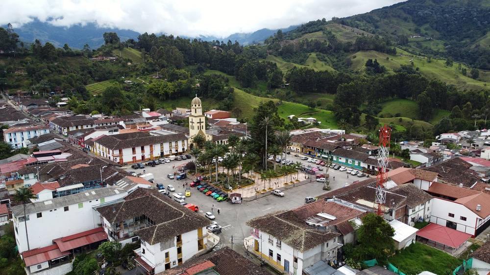
I spent a day in Salento before the hike: the colorful streets, a big plate of beans, rice, meat and avocado, coffee, the rain in the square, and a huge St. Bernard at my hotel. Salento is the place to rent rubber boots, buy snacks and meet your guide.
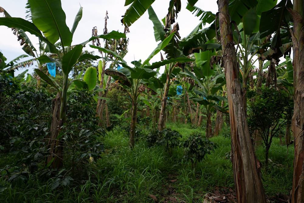
After the hike I went back to Salento, then spent a night at a coffee farm in the hills west of town. We walked through the coffee and banana trees, opened red coffee cherries, picked limes and dug yucca. A man broke open a cacao pod and I ate the white seeds around the beans: "Wow, so sweet."
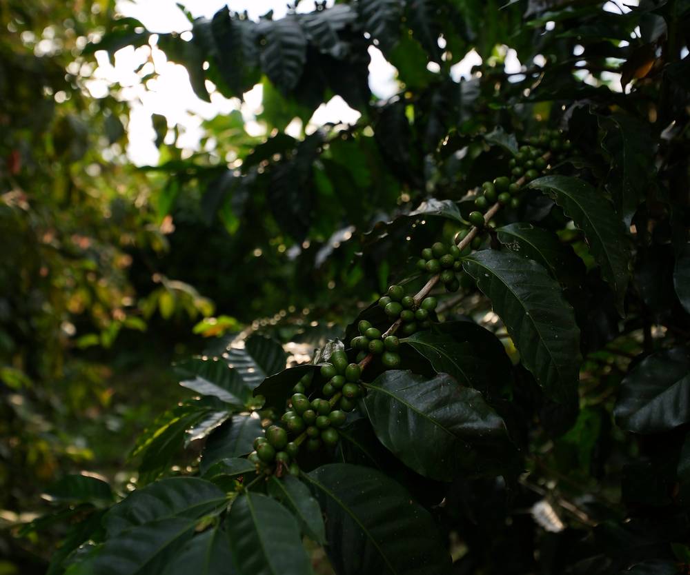
Coffee tours near Salento (as reported): Finca El Ocaso, about 2 hours, from 40,000 pesos (about $12); Don Elías, about 1 hour 15 minutes, 35,000 pesos; Las Acacias, about 1 hour, 30,000 pesos. Most are on the road north of town.
These change every year. Everything else in this guide stays the same.
Is it open?
Getting there
Your stuff
The film is at the top of this page.
Planning questions about Los Nevados, answered only from this page's facts, the creators' versions and hikers' public tracks, with where each answer comes from. When the data doesn't say, the answer says "not given".
From hikers
Sign in to comment. Free; your hikes stay private unless you share them.
Something wrong or missing on this page? Send feedback.