Follow the Hiker
Find my next hikeGearSavedKraig Adams
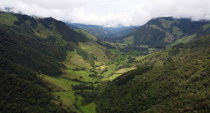
The Valle de Cocora, Day 1 near the start.

South America · Colombia

Los Nevados

Cordillera Central, Colombia

Distance
37.8 mi60.9 km
Days
3 days
Elevation gain
12,487 ft3,806 m
High point
14,551 ft4,435 m
Season
The drier seasons are December to…
Lodging
Tent
Plan this hike

Hikes / South America / Los Nevados

In March 2021 I hiked alone across Los Nevados National Natural Park in the Colombian Andes. I took a jeep from Salento to the Valle de Cocora, walked up through the wax palms and the cloud forest into the paramo, slept at a mountain farm, crossed the high paramo below the glacier of Nevado del Tolima to the hot springs at Termales del Cañón, and walked down the other side to the village of Juntas above Ibagué. About 37.8 miles (60.9 km) over three days by my GPS. It's the trip from my film Hiking Alone in Colombia.

Kraig Adams

Effort at this pace: Very hard · about 13 mi (20 km) and 4,162 ft (1,269 m) of climbing a day over 3 days, up to 14,551 ft (4,435 m). Our grade for the days given, worked out from distance, climbing and altitude a day; it isn't the trail's usual difficulty rating (under Basics) and doesn't rate exposure, terrain or weather.

Where these numbers come from

From Kraig Adams's GPS recording and guide.

Plan this hikeSave this hike

Plan: dates, gear, deadlines and stays in a private link. Save: keeps it on your account.

From Kraig Adams's GPS

The route, day by day

Relief map of the Los Nevados route: 3 days drawn in red with numbered day starts, labelled Valle de Cocora, Juntas, Nevado del Tolima and Finca La Primavera.

Elevation7,999–14,551 ft22.6 mi

From Kraig Adams's GPS. Terrain: Mapzen Terrain Tiles (SRTM, GMTED) on AWS · Glaciers, rivers & lakes © OpenStreetMap contributors

Tap a day for his map of it

  • Read day 1
  • Read day 2
  • Read day 3

The film

Watch it first

Hiking Alone in Colombia

Kraig Adams · Mar 2021 · Solo

The Valle de Cocora, Day 1 near the start.
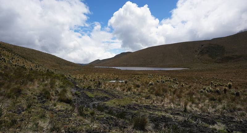
A lake in the paramo, Day 2.
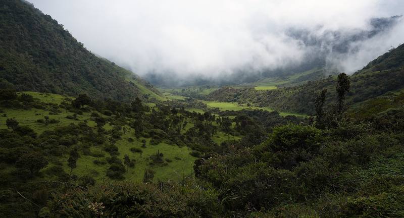
The valley toward Juntas, Day 3.

Before you go

The basics

Start
The Valle de Cocora, about 8,020 ft (2,445 m), 30 minutes by jeep from Salento
Finish
Juntas, about 6,220 ft (1,895 m), at the top of the Combeima canyon road from Ibagué
Usual difficulty
Hard: long days, deep mud, altitude, cold rain and fog, and no marked route on parts of the paramo
Best time
The drier seasons are December to February and July to August. Rain and fog are possible any month, and the park closes for five days after Easter, in late September and in late November.
Permits
A registered guide is required, booked 5 business days ahead, with accident and rescue insurance
Getting there
My way in, 2021. I flew from New York to Bogotá, then on to Pereira, and arrived at night in the rain. The next morning I took a bus to Salento and spent a day there. On the morning of the hike I packed, bought some fruit from a street vendor, and rode a Willys jeep from the main square to the Valle de Cocora.
Lodging
Tent

From Kraig Adams's guide

Costs and gear

What Kraig carried

a hiking backpack · a small green tent, a sleeping bag and a pad · a large umbrella · trail runners · a headlamp · snacks and a meal shake · the AllTrails app · Arc’teryx Beta AR Jacket and 23 more.

The full gear list

From Kraig Adams's guide

Safety

Rescue numbers

  • Emergency: 123. Little signal on the crossing.

Phone signal

  • In Salento, Cocora and Juntas.
  • Mostly not in between.

Insurance

  • As of 2026, Colombia's national parks service requires a registered guide in every sector of Los Nevados, booked through a registered operator at least five business days ahead, with accident and rescue insurance.
  • But the park now says guiding is required "in all sectors." You book through a registered tour operator at least five business days ahead, buy accident and rescue insurance from one of the approved insurers, and go with a guide.

Bail-out points

  • Day 1, Valle de Cocora to Finca La Primavera. Acaime is the last easy turnaround: Cocora is about 4.4 miles back down, and the day loop returns from there. If you reach Estrella de Agua after about 2 p.m., or anyone in the group is struggling, talk to your guide about turning back: the rest of the climb is the steepest and muddiest part, and you don't want to be on the paramo in the dark.
  • Day 2, Finca La Primavera to Termales del Cañón. The high point is the place to decide. Back at La Primavera you can sleep in a bed. If the fog is thick, someone has a bad headache or is short of breath, or it's past about 1 p.m., don't go on over the top: altitude sickness and getting lost in the fog are the two real dangers here. Going down is the cure for altitude sickness.
  • Day 3, Termales del Cañón to Juntas. Termales del Cañón is the place to decide. If the August 2026 landslides have closed the trail to Juntas, or someone in the group isn't up to a 15-mile day downhill, go back the way you came, over the paramo to La Primavera and down to Cocora, as most guided trips do. Once you're past Estambul, keep going down to Juntas: it's closer than anything else.

From Kraig Adams's guide. For planning, not navigation: check before you go.

Their films and versions

Creators who've done it

1 creator so far: Kraig, 3 days, tent.

Walked Los Nevados? Be the first to share your track: log it with your GPX.

Your time

Sign in and log a few hikes to see how long this one would take you.

Typical: 3 days (the hike's facts).

Ask this hike

Planning questions about Los Nevados, answered only from this page's facts, the creators' versions and hikers' public tracks, with where each answer comes from. When the data doesn't say, the answer says "not given".

    From hikers

    Comments

    Sign in to comment. Free; your hikes stay private unless you share them.

    Answered from the data

    Questions people ask

    How many days do you need for Los Nevados?

    About 22.6 miles (36.4 km) by my GPS over two days: 12.6 miles from Cocora to Finca La Primavera and 10.1 more over the high paramo to the hot springs. I came out the other side to Juntas, 15.2 more miles, for 37.8 in all.

    From Kraig Adams's trip and guide.

    How much does Los Nevados cost?

    I didn't keep a list of what this trip cost me, and I went without a guide, which you can't do now.

    From Kraig Adams's trip and guide.

    When is the best time to hike Los Nevados?

    The drier seasons are December to February and July to August. Rain and fog are possible any month, and the park closes for five days after Easter, in late September and in late November.

    From Kraig Adams's trip and guide.

    Do you need a permit for Los Nevados?

    A registered guide is required, booked 5 business days ahead, with accident and rescue insurance.

    From Kraig Adams's trip and guide.

    Can you hike Los Nevados without a guide?

    Not anymore. Since 2026 Parques Nacionales requires a registered guide in every sector of Los Nevados National Natural Park, booked through a registered operator at least five business days ahead, with accident and rescue insurance.

    From Kraig Adams's trip and guide.

    How high does the Los Nevados trek go?

    About 14,550 ft (4,435 m) by my GPS, on the paramo below Nevado del Tolima near Campamento Arenales. Termales del Cañón is about 12,960 ft (3,950 m).

    From Kraig Adams's trip and guide.

    Where can you camp in Los Nevados?

    Only at Termales del Cañón, Arenales and El Calvito, 35 people each. The farms on the route, like Finca La Primavera, take hikers in beds.

    From Kraig Adams's trip and guide.

    Is Los Nevados open after the 2026 earthquake?

    The park's south sector is open with a guide. The August 10, 2026 earthquake damaged houses in Salento, which reopened within days, and set off landslides on the Juntas side, so check with your operator before planning to finish at Juntas.

    From Kraig Adams's trip and guide.

    Plan this hikeThe route