
Content made there

Photos
Hikes / Choquequirao and Ausangate / Kraig Adams's version
South America · Peru
May 2019 · 3 days to Choquequirao · about 30 miles · Solo · Tent

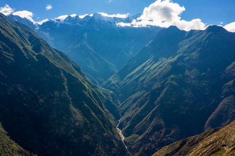
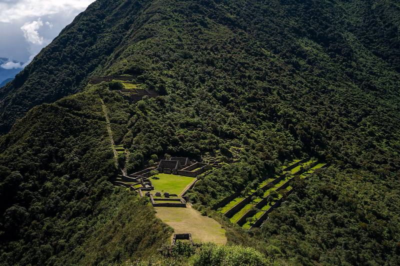
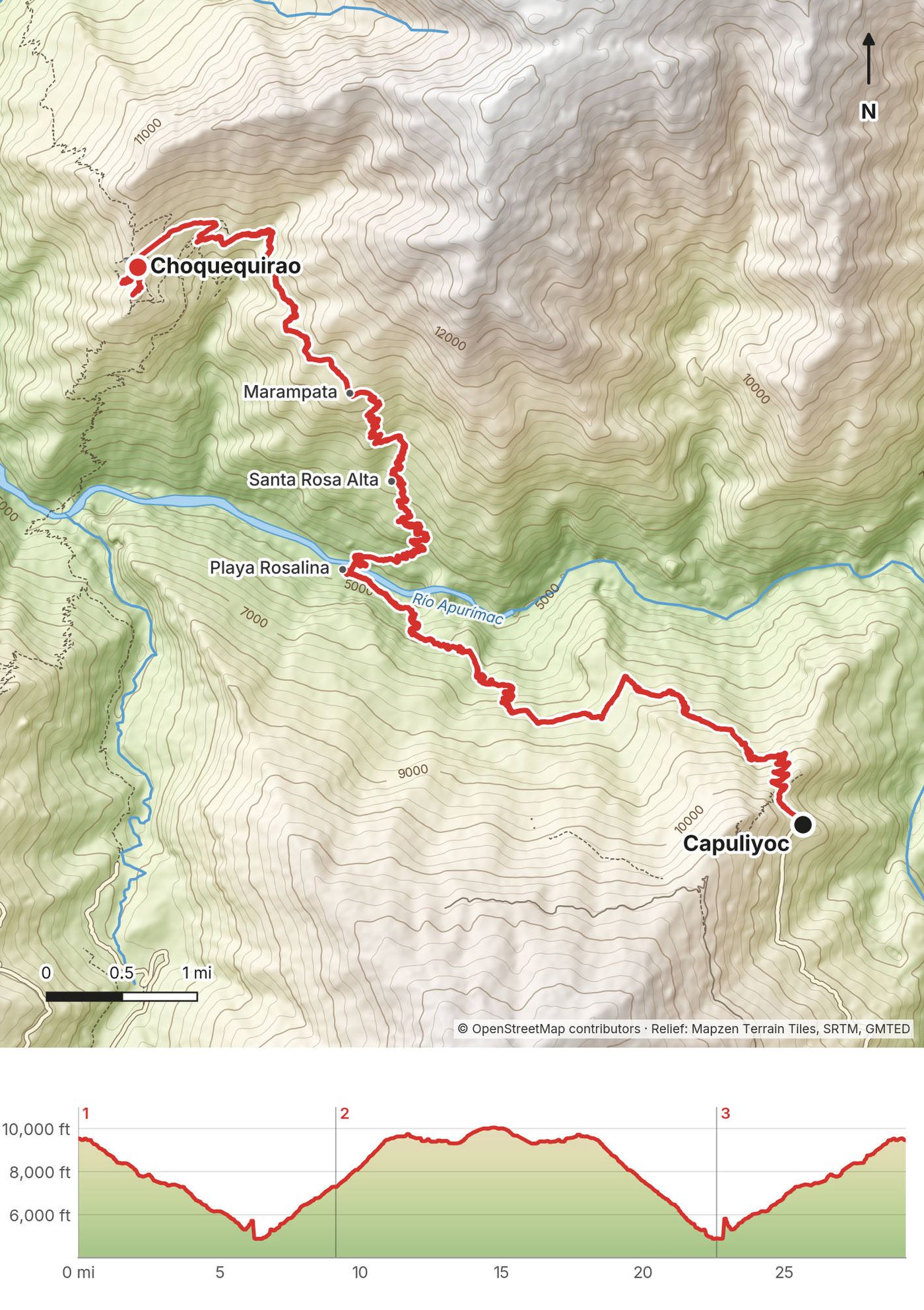
In May 2019 I flew to Peru with one goal: to hike to Choquequirao and make a film about it. Choquequirao is an Inca site high on a ridge above the Apurímac canyon, often called the sister city of Machu Picchu. There's no road to it. You walk down one side of the canyon, cross the river and climb the other side, then come back the same way. I did it alone in three days, from the Capuliyoc trailhead above the village of Cachora, about 30 miles with a tent.
Why not Machu Picchu? Machu Picchu has been done. This is kind of the new Machu Picchu, and that's why I did it. I saw maybe 20 or 25 people on the whole three-day hike, and the ruins were basically empty, which was amazing compared to my experiences at Machu Picchu.
| Quick facts | |
|---|---|
| Distance | 29.3 miles (47.2 km) of walking over 3 days, out and back |
| Climbing | about 12,460 ft (3,800 m) up and the same down |
| Days | 3 walking days, 2 nights in my tent. Most people take 4 or 5 |
| Start and finish | Capuliyoc, at the end of the road 11 km (7 mi) above Cachora |
| Direction | Out and back: down to the Apurímac, up to Choquequirao, and back the same way |
| High point | 10,052 ft (3,064 m), at the top of the ruins, Day 2 |
| Low point | 4,852 ft (1,479 m), the bridge over the Río Apurímac at Playa Rosalina |
| When | The dry season, about May to September. I walked May 25 to 27, 2019 |
| Difficulty | Steep: two big climbs in the heat each way, on a clear mule trail. My Day 2 was one of the toughest things I've ever done |
| Base | Cusco, about 3 hours by road from Cachora |
| Ticket (2026) | S/60 general, S/30 students, valid for one day |
| Trip | Solo, no guide, no mules |
| Day | Route | Miles (km) | Up / down (ft) | Sleep |
|---|---|---|---|---|
| 1 | Capuliyoc to Santa Rosa Alta | 9.1 (14.7) | 3,008 / 5,239 | Santa Rosa Alta campsite |
| 2 | Santa Rosa Alta to Choquequirao, then back down to Playa Rosalina | 13.5 (21.7) | 4,169 / 6,579 | Playa Rosalina campsite |
| 3 | Playa Rosalina to Capuliyoc | 6.7 (10.8) | 5,282 / 713 | Cachora |
The numbers come from my own GPS recordings, smoothed the same way for every day. In 2019 I wrote that I hiked over 30 miles with 13,500 ft of elevation change; my GPS says 29.3 miles, and apps count climbing differently (AllTrails shows about 13,600 ft of climbing for my three days).
What I did. I flew to Cusco on May 22, 2019 and spent a couple of days there getting supplies. The airline lost my luggage. I left my computer and everything I didn't need at my hostel in Cusco. On May 24 I took a 4 p.m. Ferkaxi bus from Cusco toward Abancay (S/20) and got off at the Ramal de Cachora, the turnoff for Cachora. There was a little drama getting to the trailhead with the bus. From the turnoff I hired a taxi to Cachora (about $10).
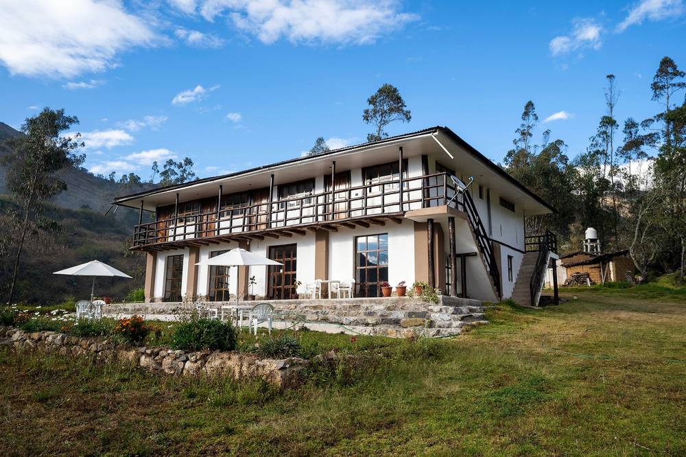
I stayed at a lovely hotel called Casa Nostra, just outside the town, with great food, for about $11 with breakfast included. In the morning I took a taxi to the trailhead at the Capuliyoc viewpoint (another $10), signed in at the booth and paid my ticket. The roads were no joke: they drive like crazy, they just gun it down these roads.
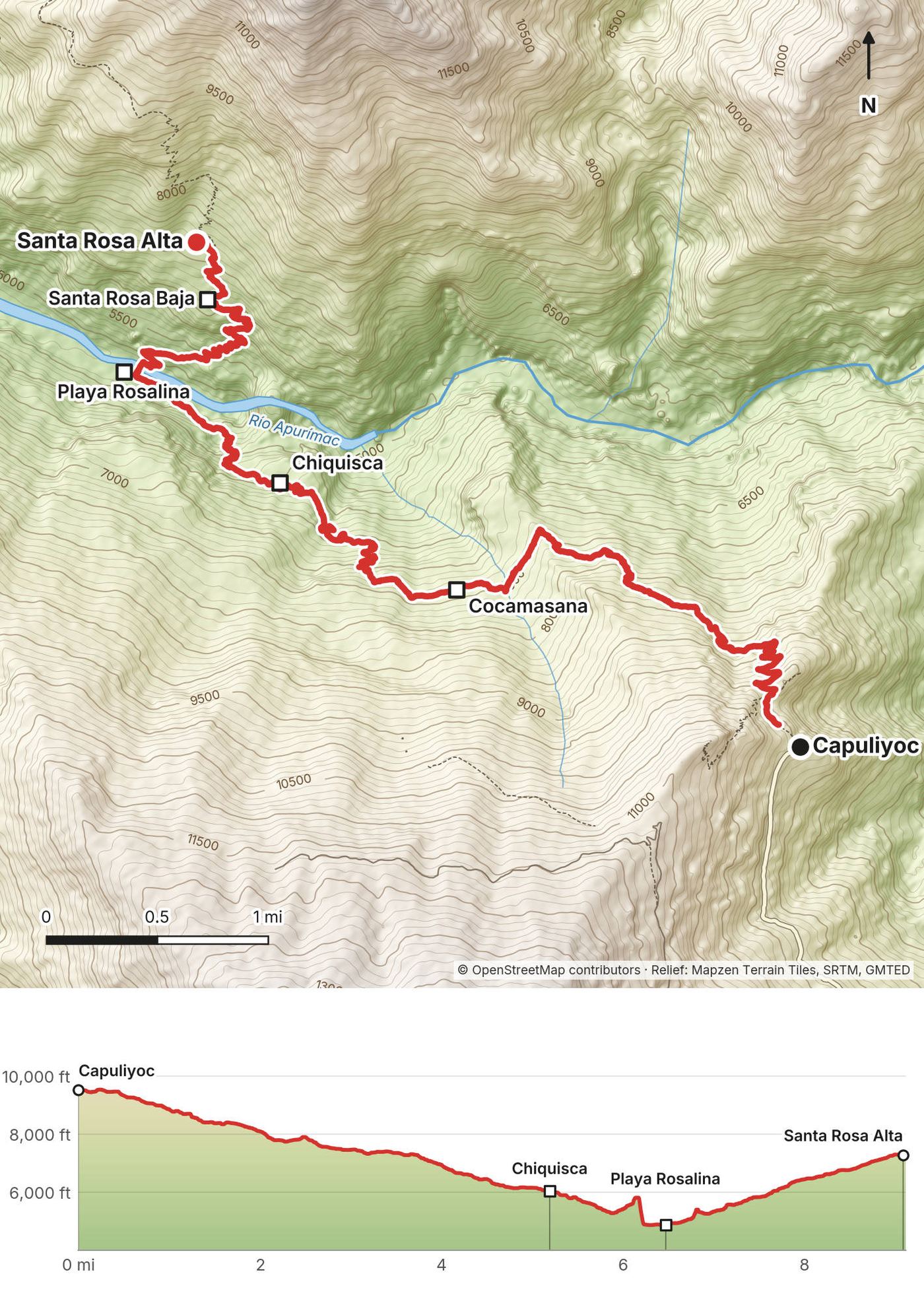
The route today.
Bus companies and fares change and weren't on any official site I could check; the fares above are what I paid in 2019.
Cusco. Cusco is at about 3,400 m (11,150 ft), much higher than anything on this trek. Give yourself a couple of days there before you start.
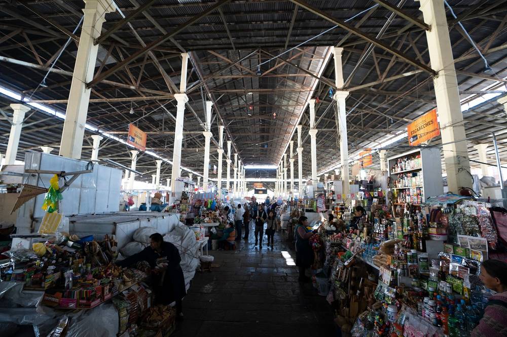
What I did. From Capuliyoc I went back down to Cachora, and the next morning I had my coffee there with a view of the valley. It took me about a day or two to get back to Cusco. I'd booked about a week in Peru for the trip: three days hiking, and the rest of the time I enjoyed Cusco and edited the film.
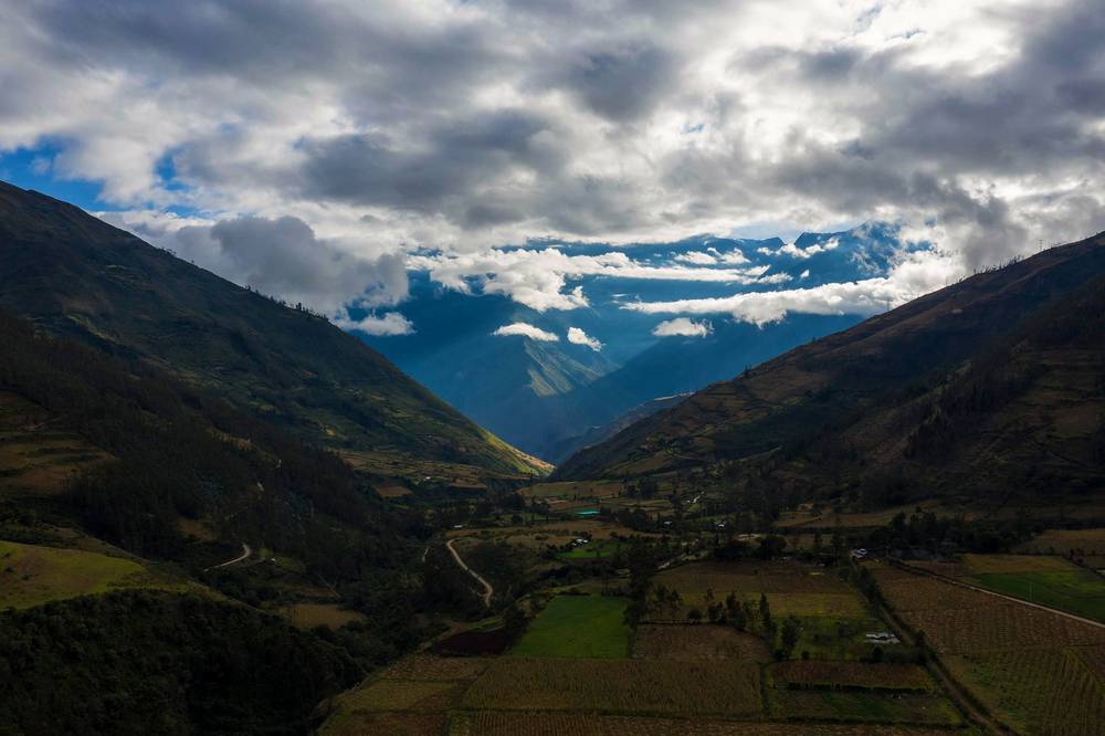
The way back today. Taxi from Capuliyoc to Cachora (11 km), then a taxi or colectivo to the Cachora turnoff on the Cusco to Abancay road, and a bus back to Cusco (about 3 hours by road from Cachora). Arrange the taxi from Capuliyoc before you set off, or ask at the campsite at the road end. Leave a spare day before any flight: the canyon days can take longer than planned.
My records for this trip are some receipts and what I wrote in the film's description in 2019.
| Item | What I paid in 2019 |
|---|---|
| Bus, Cusco toward Abancay, to the Cachora turnoff (Ferkaxi, May 24) | S/20 (receipt) |
| Taxi, the turnoff to Cachora | About $10 |
| Casa Nostra hotel, Cachora, with breakfast | About $11 a night |
| Taxi, Cachora to Capuliyoc | About $10 |
| Choquequirao ticket (May 25, valid one day) | S/60 (receipt) |
| Food from Cusco, and drinks on the trail | Not in my records |
| Flights to Cusco | Not in my records |
In 2019 I wrote that the entire cost of the trip can be less than S/500, not counting flights. Make sure you have small bills and coins while hiking.
For your budget (2026). The ticket is still S/60 (S/30 for students). Bus fares, taxis, campsites and food on the trail are cash in soles; I couldn't check 2026 prices for them on any official site.
| Night | Where |
|---|---|
| May 24 | Casa Nostra hotel, Cachora (about $11 with breakfast) |
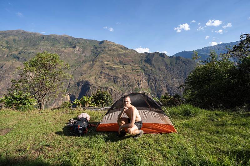
| May 25 | My tent at Santa Rosa Alta campsite, 2,220 m (7,280 ft) |
| May 26 | My tent at Playa Rosalina campsite, by the river, 1,485 m (4,870 ft) |
| May 27 | Cachora |
From OpenStreetMap, each within about 50 m of my track. Heights are from my GPS. Miles are from Capuliyoc along my Day 1 and Day 2.
| Campsite | Mile | Height |
|---|---|---|
| Capuliyoc (road end) | 0 | 2,881 m (9,450 ft) |
| Cocamasana | 3.3 | 2,254 m (7,390 ft) |
| Chiquisca | 5.2 | 1,838 m (6,030 ft) |
| Playa Rosalina (the bridge) | 6.5 | 1,485 m (4,870 ft) |
| Santa Rosa Baja | 8.5 | 2,060 m (6,760 ft) |
| Santa Rosa Alta | 9.1 | 2,220 m (7,280 ft) |
| Marampata (village, several campsites) | 11.0 | about 2,900 m (9,500 ft) |
| Campsite below the ruins | 13.4 | about 2,840 m (9,320 ft) |
The Ministry of Culture names Capuliyoc, Cocamasana, Chiquisca, Playa Rosalina and Marampata in its notices; it doesn't publish a list of campsites or their services, so what's on offer can change.
What I found in 2019. You pass campsites with hot food, drinks and plenty of dogs to pet. There was Gatorade waiting for me at every campsite, so I probably wouldn't have packed as much water and Gatorade. Marampata is where I'd camp at least one night, for the views and the hot village food.
Fill up at every campsite, and carry enough for the long climbs between them. I carried a water filter and a hydration bladder, and I still ran out of water completely on the last climb. Treat or filter everything you don't buy sealed.
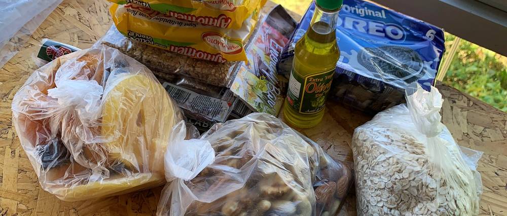
You can buy food at the campsites or pack your own. I packed my own and bought it in Cusco. What I recommended in 2019: ramen noodles, oatmeal, rice, tuna, olive oil, cheddar cheese, beef jerky, dried mangos, lentils, fresh fruit, coca leaves and coffee.
One thing I will never do again: chicken ramen with tuna. I thought protein on protein would be good. It was disgusting.
Paid links: I earn a commission if you buy through these links, at no extra cost to you. As an Amazon Associate I earn from qualifying purchases.
I carried everything myself on this trek, with no mule. Here's what I packed in 2019, what I'd take now, and what I filmed with.
From my film's description and my talk about the trip that July. I left my computer and everything else at my hostel in Cusco.
 Tent: REI Passage tent. Similar: NEMO Hornet Elite OSMO 1P (Amazon).
My current kit for a self-carried trek in the canyon: heat, sun, mosquitoes and long climbs.
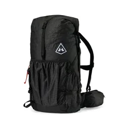 Pack: Hyperlite Mountain Gear Southwest 2400 (Hyperlite). Big enough for a tent, sleeping bag and mat if you don't hire a mule.
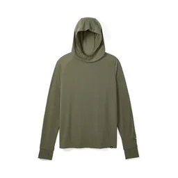 Sun hoodie: PATH Projects Pyrenees T19 Hoodie (PATH Projects). Long sleeves for the sun and the bugs: the canyon slopes are exposed.
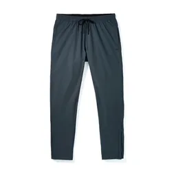 Pants: PATH Projects Killam PX Pant (PATH Projects). Long pants for the mosquitoes.
 Hat: PATH Projects Muir Cap 2.0 (PATH Projects)
 Water filter: Katadyn BeFree AC · 1L (Amazon). Carry 2 to 3 liters between campsites on the big climbs.Tent: NEMO Hornet Elite OSMO 1P (Amazon)
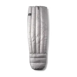 Quilt: Hyperlite Mountain Gear 20° Quilt (Hyperlite)
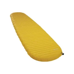 Sleeping pad: Therm-a-Rest NeoAir XLite NXT (Amazon)
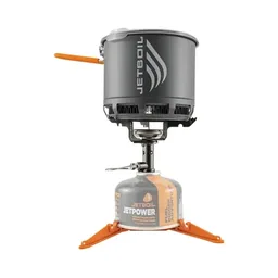 Stove: Jetboil Stash (Amazon)
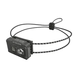 Headlamp: Nitecore NU20 Classic (Amazon)
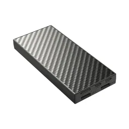 Power bank: Nitecore NB20000 (Amazon). There's nowhere to charge on the trail.
What I filmed this trip with in 2019. My setup is smaller now (below). No drones at the site without written permission: see The park: tickets, hours and rules.
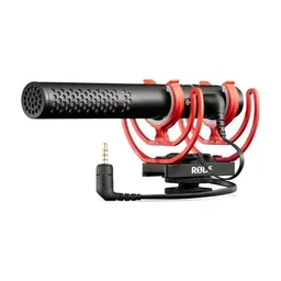 Mic: Rode VideoMic Pro+. Similar: Rode VideoMic NTG (Amazon).
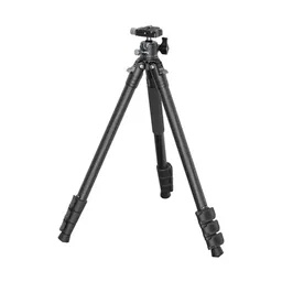 Tripod: Peak Design Travel Tripod. Similar: SmallRig Carbon Fiber Tripod (Amazon).
Since September 2026 I film with a smaller setup: the Pocket 4 and the Mic 3 on the trail, and the Mini 5 Pro in the air.
 Camera: DJI Osmo Pocket 4 (Amazon)
 Mic: DJI Mic 3 · 1 TX + 1 RX (Amazon). It pairs with the Pocket 4.
 Drone: DJI Mini 5 Pro (Amazon)
This was the start of my Choquequirao trek. When I signed in at the booth, I saw that there were only four other people who'd left that morning. Not many people on this trail, which is a good thing.
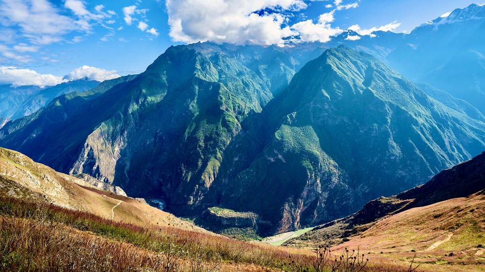
It was all downhill to the river, and I was already sweating. I couldn't imagine what it would be like to go up it. It's pretty, though. From high above you can see the bridge way down there, where you cross the Apurímac.
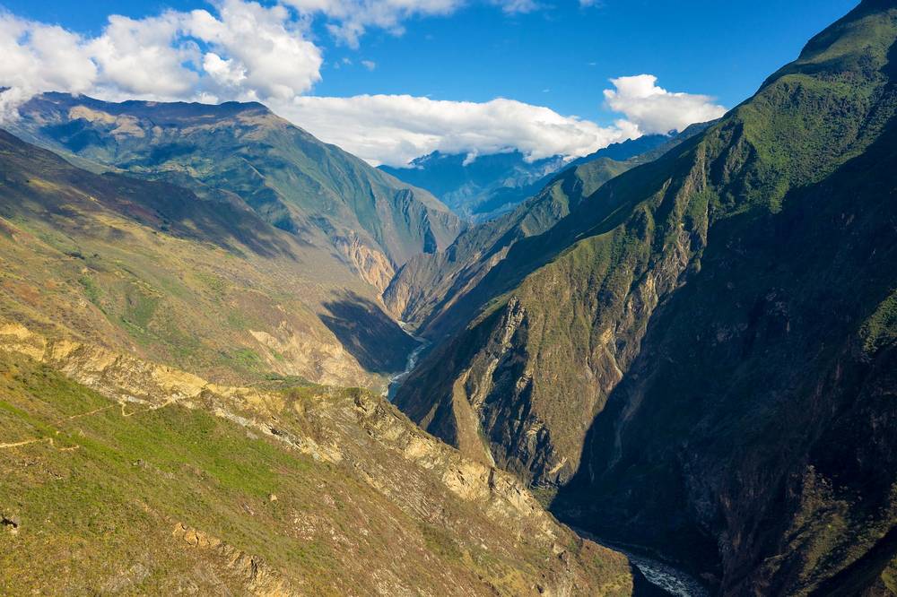
On the way down I passed a campsite with about half a dozen people, a lot of food and a lot of stuff. It was fancy. It wasn't even half the day done, so I kept going: from the bridge, it's all uphill. I just needed to make it to the campsite before dark. I was very tired when I finally made it to Santa Rosa Alta, and I was dead. That night's specialty was an evening coffee I'd been given in Guatemala. That's not bad at all.
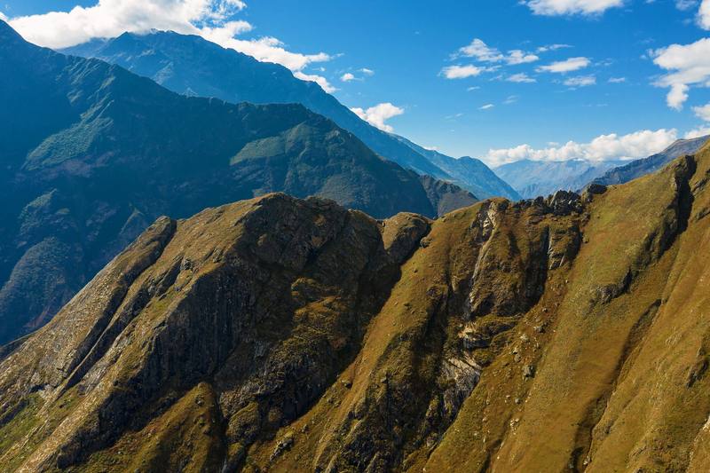
From the road end, the path passes the Capuliyoc viewpoint (mile 0.2), your first look down into the canyon, then zigzags down the dry, open side of the canyon: little shade, lots of sun. Cocamasana (mile 3.3, 2,254 m on my GPS) and Chiquisca (mile 5.2, 1,838 m) are campsites on the way down. Below Chiquisca the path drops to Playa Rosalina, a campsite by the bridge over the Río Apurímac at 1,485 m (4,870 ft), the lowest point of the trek, at mile 6.5.
Across the bridge the climb starts at once: about 735 m (2,410 ft) in the next 2.6 miles, past Santa Rosa Baja (mile 8.5) to Santa Rosa Alta (mile 9.1, 2,220 m). It's steep and exposed to the afternoon sun.
Where to stop. To take things slow and easy, I recommend camping at Playa Rosalina for the first night, and starting the climb early the next morning. If you push the first day, you can make it up to Marampata for lunch on Day 2. See Other ways to do it.
Turn around and walk back up to Capuliyoc: the only way out is the way you came. The campsites have people on them in the season. The longest and hottest part of the walk out is the last few miles to Capuliyoc.
This one is all uphill for a long time. I went really slow while I had the nice cool morning air and shade from the clouds, all the way up to the village. When I saw buildings and a campsite I knew I was getting close to the top, and that was quick. The village is Marampata: an adorable mountainside village with plenty of places to rest and farm animals to say hello to. I started to think it would probably be the best campsite.
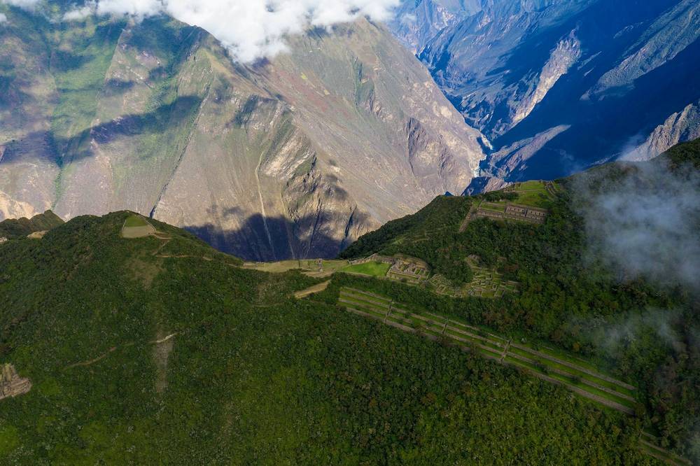
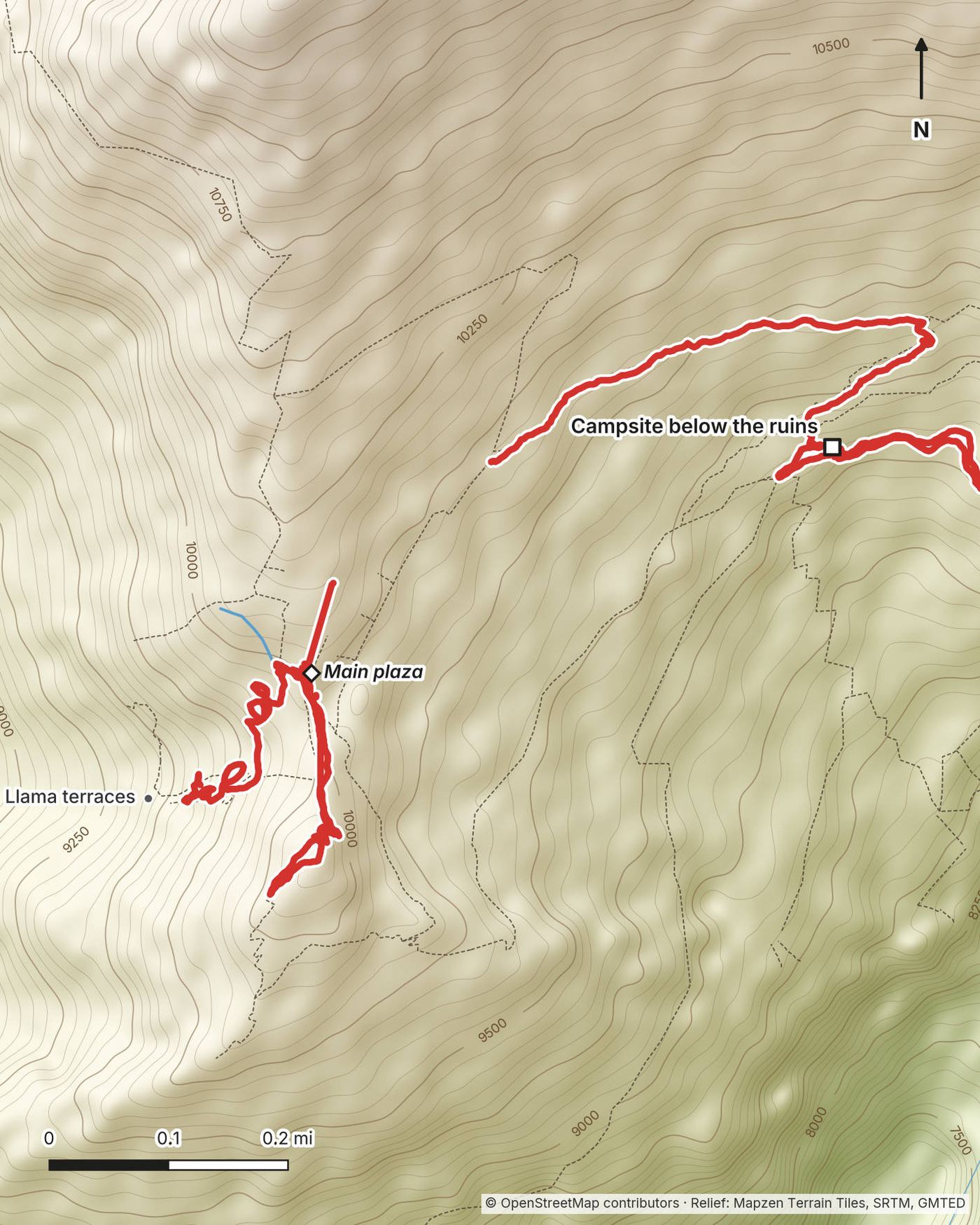
From Marampata it was uphill just a little bit, but pretty much smooth sailing to the campsite below the ruins, where I dropped my stuff and went up to the ruins. It's a pretty gradual and easy ascent. I followed the signs that say Plaza Principal and eventually reached the terraces. There were a few people at the top, a little party, and they were very nice. I took my time exploring, then went down to see the llama terraces. It's quite the descent, so be prepared for that.
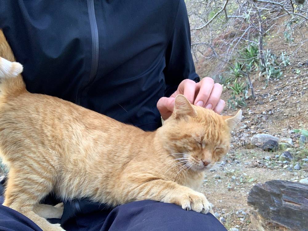
Then I headed back to my pack to get some water. I still had some sunlight, so I grabbed a bite to eat and started back down to the river. By the time I could hear the river I was just spent. I was so happy to be there: solid, flat, smooth ground. I don't recommend anyone do that. Honestly, it was one of the toughest things I've ever done. I was tired, but I had to get my tent up. A white and orange cat came into my tent that night and we formed a bond.
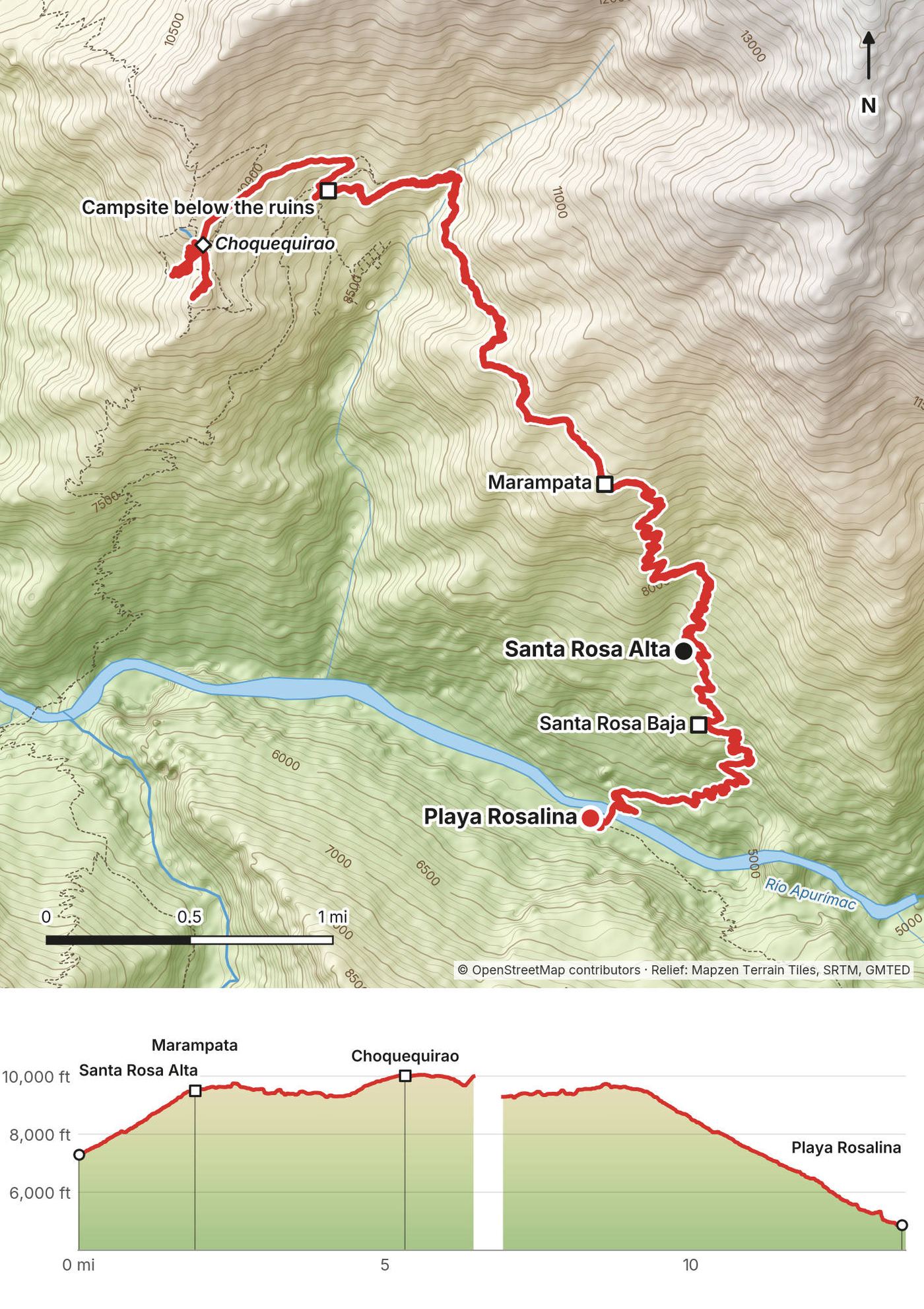
From Santa Rosa Alta the path keeps climbing in switchbacks, mostly in trees and shade in the morning, to Marampata at mile 1.9 (about 2,900 m, 9,500 ft on my GPS): about 680 m (2,230 ft) of climbing. Marampata has several campsites and places to eat. From there the path contours around the hillside, with a small climb and descent, to the campsite below the ruins at mile 4.3 (about 2,840 m).
From the campsite I walked up to the main plaza at mile 5.3, about 3,050 m (10,010 ft). My GPS shows about 1 mile of wandering around the terraces and buildings, and my highest point, 3,064 m, at the top of the site. The llama terraces, with their white stone llamas set into the walls, are a steep walk down from the main site: I reached them at mile 6.3. My recording paused a few times at the ruins, most of all between the llama terraces and the campsite: almost a mile in all wasn't recorded, so the true day was a little longer than my 13.5 miles.
Bring snacks and plenty of water if you leave your big pack at the campsite, but remember that food isn't allowed inside the site. The site is open 7 a.m. to 4 p.m.
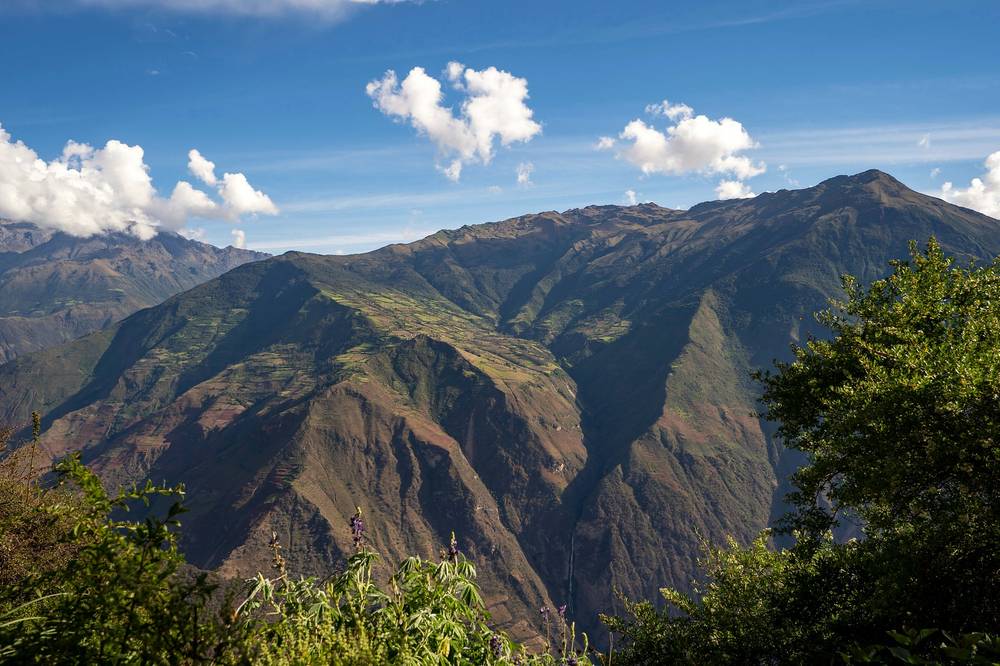
The way back is the way you came: back past Marampata (mile 9.2), then down about 1,410 m (4,630 ft) past Santa Rosa Alta and Santa Rosa Baja to Playa Rosalina (mile 13.5). It took me about 2 hours 45 minutes from Marampata to the river, and I got there after sunset.
Split it. This is two days' walking in one. Stay at Marampata or the campsite below the ruins, see the ruins in the morning, and go down in the afternoon.
Marampata is the place to stop and rest: it has campsites, food and people. From anywhere on this day, the only way out is back down to the river and up to Capuliyoc.
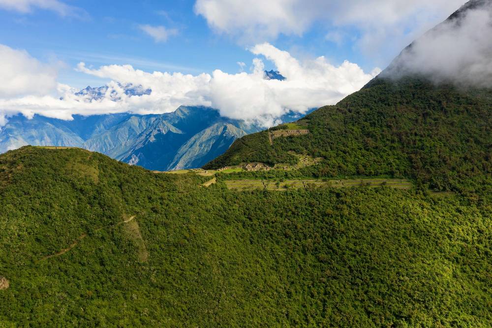
Film, Day 2 · Almost to the ruins
Good morning: the cat was back in my tent. I started the climb planning to take it very slow. The rest of the day was going to be me complaining a ton, and I knew it.
I heard running water on the way up. Near the top I could see the end up there, but I took a break in the shade first. I was out of water, 100% out of water. The dog I'd seen on the way down was still lying there when I got back. I reached the Capuliyoc trailhead just after 1 p.m. and went back down to Cachora for the night.
This is Day 1 in reverse, and the biggest single climb of the trek: about 1,430 m (4,700 ft) from the bridge to Capuliyoc in 6.4 miles, most of it on the dry, sunny side of the canyon. Chiquisca (mile 1.4) and Cocamasana (mile 3.2) are the last campsites and the last places to fill up, so fill every bottle there. Start as early as you can: by late morning the upper slopes are in full sun.
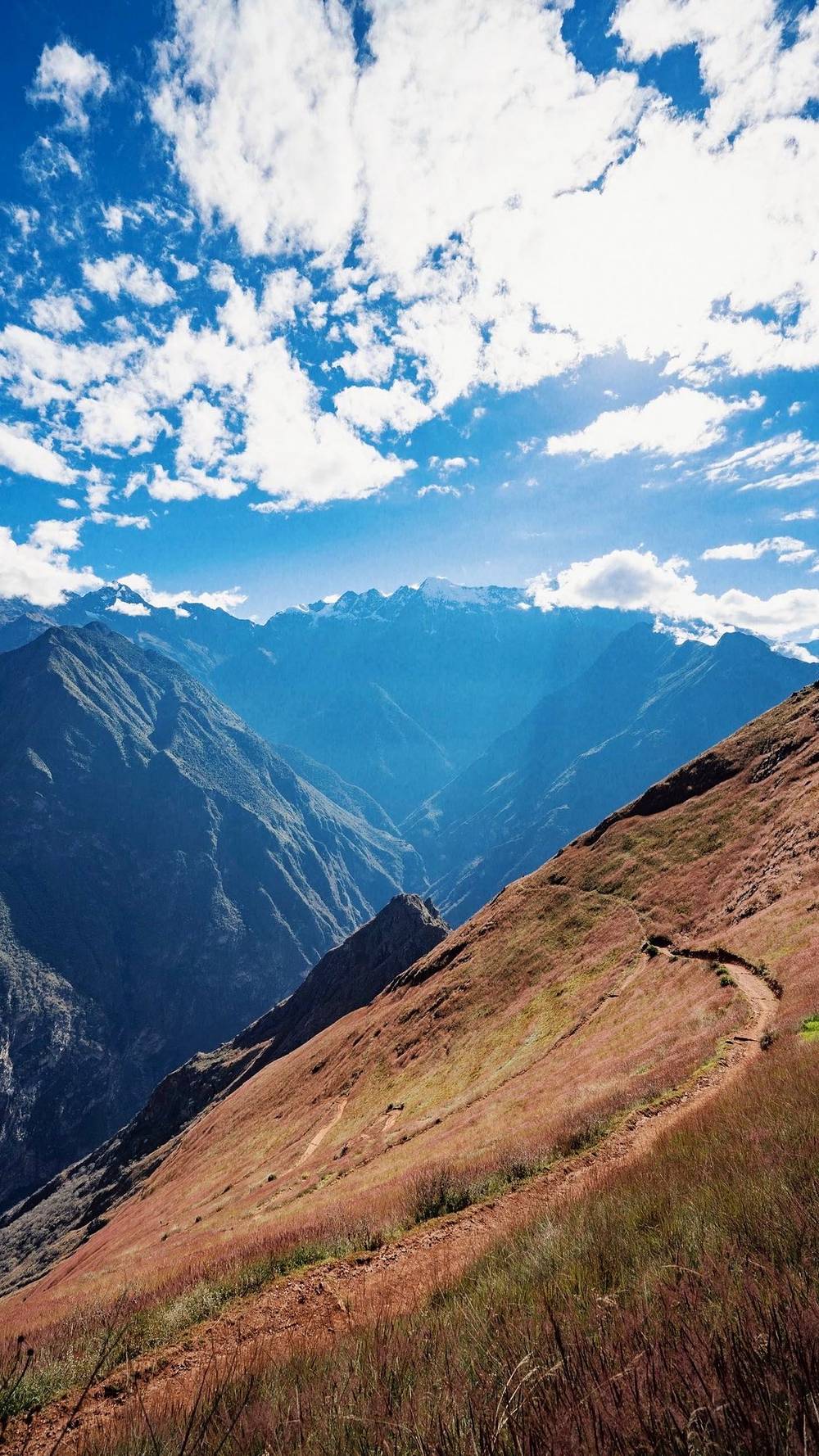
There's nowhere else to go: keep climbing, slowly. Rest at Chiquisca or Cocamasana, or camp there and finish in the morning.
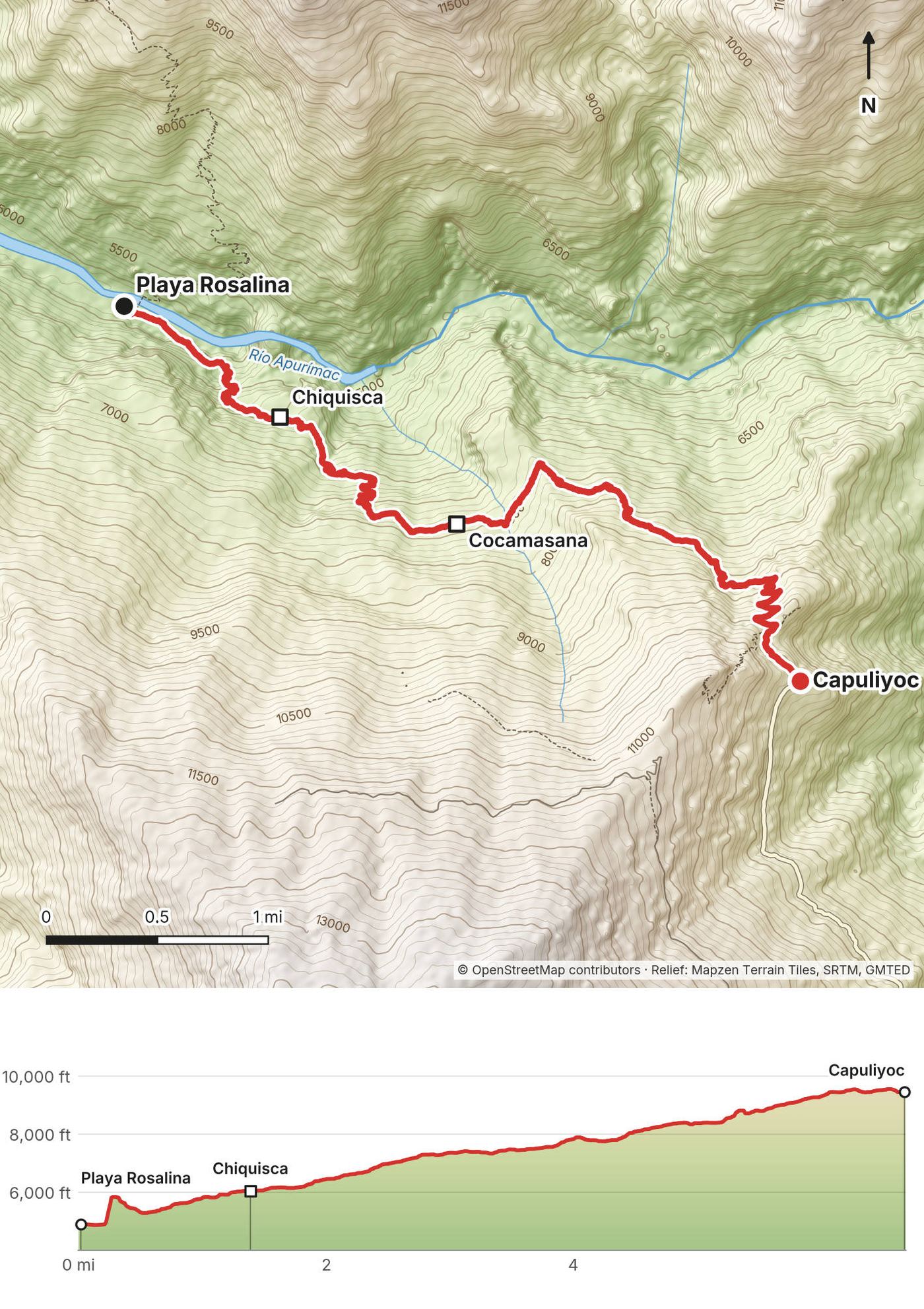
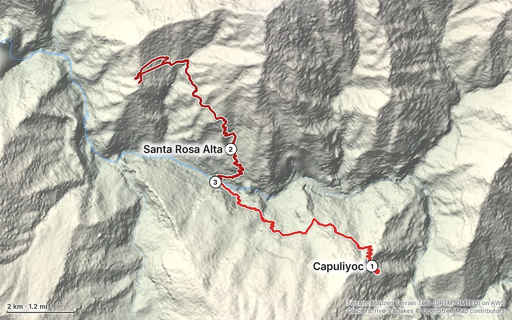
Elevation4,856–10,052 ft29.3 mi
Terrain: Mapzen Terrain Tiles (SRTM, GMTED) on AWS · Glaciers, rivers & lakes © OpenStreetMap contributors
Tap a map to open it full size.
Choquequirao is managed by Peru's Ministry of Culture through its office in Cusco (the Dirección Desconcentrada de Cultura Cusco). The official name of the park is the Parque Arqueológico de Vilcabamba (Choquequirao).
Ticket (2026). S/60 general; S/30 for university and technical students with a valid card; S/25 for children 3 to 17; half price for people 60 and over, teachers and people with disabilities. There's no separate rate for foreigners. The ticket is valid for one day. In September 2026 the Ministry's online ticket site sold only Machu Picchu, Kuélap and Sipán, not Choquequirao, so plan to pay at the park. Bring cash in soles.
What I did. I signed in and paid at a little booth at the Capuliyoc trailhead on May 25, 2019. My receipt says S/60, valid for one day. At the ruins, a single attendant ripped my ticket and hassled me about my tripod.
Hours. The site is open 7 a.m. to 4 p.m. (2026).
The rules (Ministry of Culture, 2026):
The Playa Rosalina bridge. When the park reopened in April 2025 after a rockslide damaged it, the Ministry allowed at most 6 people and 2 pack animals on the bridge at a time. Follow any sign there.
Closures. The trail is closed some years in the rainy season. The Ministry posts notices on gob.pe (search "Choquequirao"). As of September 29, 2026, the last notice was the reopening of the Capuliyoc to Cachora route from April 15, 2026.
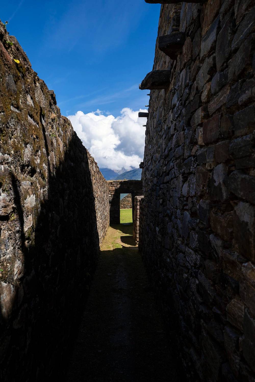
The dry season. Plan on May to September. The rains start around September and the worst of them is January to March, when landslides damage the trail: the park closed from February 1, 2026 until the Cachora route reopened on April 15, 2026, and it closed in early 2023 and March 2025 too. Peru's weather service expects an El Niño in 2026 and 2027 with generally below-normal rain in the southern Andes, which doesn't rule out damage. Avoid January to April.
What I got. I walked May 25 to 27, 2019, at the start of the dry season. The days were sunny and hot on the dry canyon side. In May the sun set about 6 p.m. Going to bed at 7 meant sleeping for 11 hours and waking with the dawn. It seems crazy, but after a day like that your body doesn't mind, so embrace the rest.
Heat and shade. The canyon floor is low, about 1,480 m (4,850 ft), and the slopes above it get the full sun. On the climbs, start early: on the morning of Day 2 I had cool air and shade from the clouds and the trees for most of the way up, and on Day 3 I ran out of water on the last climb in the heat.
Emergency numbers (2026). Police 105, fire service 116. The SAMU ambulance number 106 isn't listed for Cusco or Apurímac. iPerú, the government's tourist information service, answers on WhatsApp at 944 492 314; it isn't an emergency line. Don't count on phone signal in the canyon; a satellite messenger is the real backup.
Leave a plan with someone at home and at your hotel in Cusco or Cachora, with your dates.
The US advisory (2026). The US State Department rates Peru Level 2 (exercise increased caution). It puts the VRAEM area, which it says includes Vilcabamba, at Level 4. It doesn't mention Cachora or Choquequirao, but it matters if you plan the longer routes through Vilcabamba.
Altitude. The trek itself is lower than Cusco: 1,480 to 3,060 m (4,850 to 10,050 ft). Cusco, at about 3,400 m, is where you'll feel the altitude. A couple of days there before the trek helps.
Where to be careful:
Going solo. I hiked alone and saw only a few people each day, mostly at the campsites. If you go alone, be conservative about water and heat, and camp early rather than push on in the dark.
How many days do I need? Three or four days is what's usually recommended for the whole out and back, and I did it in two and a half. Unless you're fast and used to big climbs, plan four days on the trail, and five if you want a slow morning at the ruins. See Other ways to do it.
How hard is it? It's a steep mule trail, easy to follow, but the climbs are brutal. You drop about 1,430 m (4,700 ft) from Capuliyoc to the river, climb about 1,580 m (5,180 ft) from the river to the ruins, and then do both again in reverse. My Day 2, when I went up to the ruins and all the way back down to the river, was one of the toughest things I've ever done. I don't recommend anyone do that.
Is it open? Usually, but not always. The park was closed to all visitors from February 1, 2026 after rainy-season damage to the trail, and the Cachora route reopened on April 15, 2026. It also closed in early 2023 and in March 2025. Check the Ministry of Culture's notices before you book. See The park.
Do I need a guide or a permit? No guide was required on my trip, and I found no official rule requiring one in 2026. You need an entry ticket for the park. I signed in and paid at the little booth at Capuliyoc.
Can I buy food and water on the way? In 2019, yes: you could buy food at the campsites, there was Gatorade waiting at every campsite, and Marampata, the village below the ruins, had hot food. Carry small bills and coins. I still carried my own food. See Campsites, food and water.
Where do I sleep? At the campsites along the trail. You can't camp inside the archaeological site itself. I slept at Santa Rosa Alta and Playa Rosalina, and I'd recommend at least one night at Marampata.
Is it hot? The canyon side you walk down from Capuliyoc is very dry and desert-like because of the direct sun, and I was sweating on the way down. Start the climbs early, while you're in the shade.
What about bugs? I ended up with dozens of mosquito bites all over my legs and arms. Even when it's hot, wear pants and long sleeves whenever you can.
Can I do it alone? I did. There were only four other people signed in the morning I started, and I saw about 20 to 25 people in three days. Say hi to everyone. There's no phone signal to count on, so leave your plan with someone at home.
Can I go on to Machu Picchu? There's a longer trek from Choquequirao to Machu Picchu via Yanama, but I didn't do it. In March 2026 the Ministry of Culture said its Río Blanco section was not passable, and I found no notice since saying it has reopened. See Other ways to do it.
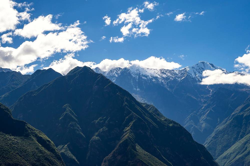
I walked the three days in this guide. These are other ways to use it, and I didn't do them.
My line, split the way I'd recommend it in 2019: a first night at the river, a night at Marampata, and the ruins without a big pack. Distances from my GPS.
A fifth day gives you a whole morning at the ruins, or a rest day. Peru's tourism board suggests hiring local muleteers (arrieros) to carry your gear; I carried mine.
My three days worked, but my Day 2 was far too long. If you only have three days, camp at Marampata on the first night (11 mi and about 1,600 m of climbing from Capuliyoc, a very big day) or at the campsite below the ruins, see the ruins early on Day 2, and go down to Chiquisca or Playa Rosalina that afternoon.
A longer trek continues from Choquequirao over the mountains via Yanama toward Machu Picchu, and there's a Huancacalle route from Vilcabamba. I didn't do either. In March 2026 the Ministry of Culture said the Río Blanco section of the route beyond Choquequirao was not passable, and I found no later notice reopening it. In December 2025 the La Convención provincial government opened a new path from Abra San Juan, near Yanama, to Choquequirao. The US State Department's advisory for Peru puts the VRAEM area, which it says includes Vilcabamba, at Level 4 (do not travel) in 2026. Check both before you plan anything beyond Choquequirao.
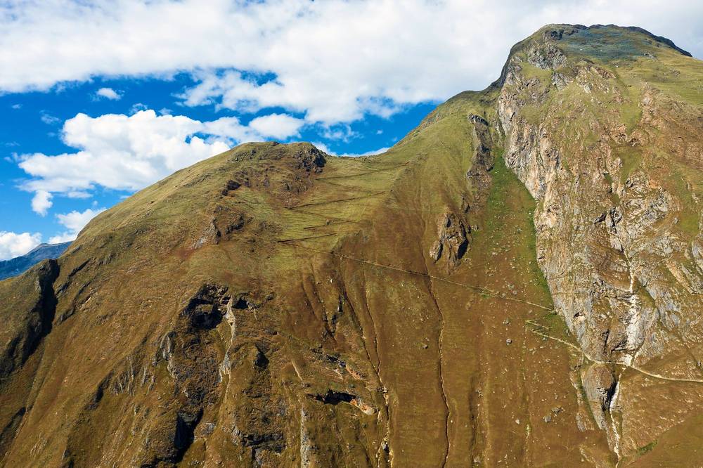
These change every year. Everything else in this guide stays the same.
The park
Getting there
Prices, conditions and your stuff
Planning questions about Choquequirao and Ausangate, answered only from this page's facts, the creators' versions and hikers' public tracks, with where each answer comes from. When the data doesn't say, the answer says "not given".
From hikers
Sign in to comment. Free; your hikes stay private unless you share them.
Some lodging links earn me a small commission at no cost to you.
Something wrong or missing on this page? Send feedback.