
Content made there
The film is at the top of this page.
Photos
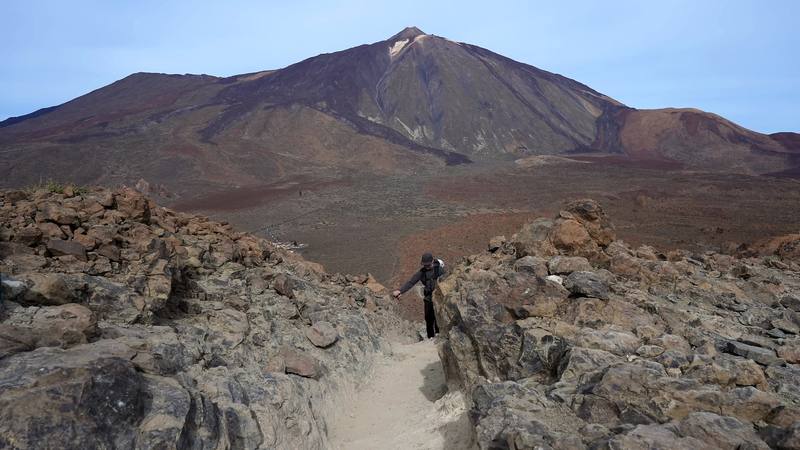
Hikes / Across Tenerife / Kraig Adams's version
Europe · Spain
Dec 2024 · 5 days · Solo · Tent

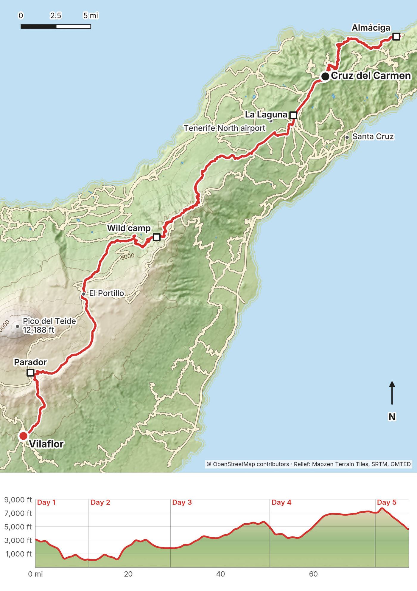
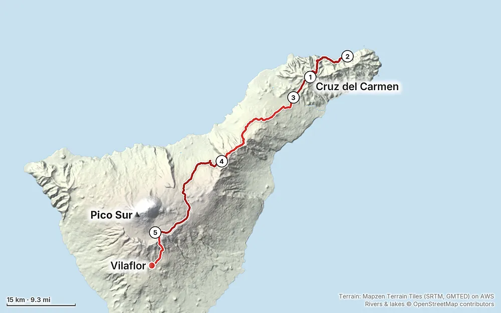
In December 2024 I set out to walk across Tenerife, the biggest of the Canary Islands, alone: from the green, steep Anaga mountains in the northeast, over the spine of the island through the pine forest, up to Las Cañadas below Teide, Spain's highest mountain, and down to the south coast. I walked five days, about 80.5 miles by my GPS. I didn't make the coast. I got sick on the way up to Teide, kept going for two more days, and stopped in the mountain village of Vilaflor. It turned out to be walking pneumonia. It's the trip from my film Hiking Alone in the Canary Islands.
It wasn't an easy trip, and I said so in the film: bad weather in Anaga, a zero day waiting for it to clear, long days with a lot of climbing, and getting sick. This guide is the honest version: the five days as I walked them, and everything you need to plan your own crossing, or just the best parts of it.
| Quick facts | |
|---|---|
| Island | Tenerife, the largest of the Canary Islands (Spain) |
| Distance | 80.5 miles (129.5 km) over 5 walking days, by my GPS |
| Climbing | About 16,640 ft (5,070 m) up and 15,120 ft (4,610 m) down |
| Days | 5 walking days and a zero day, December 9 to 14, 2024 |
| Start | Cruz del Carmen, about 3,120 ft (950 m), in the Anaga mountains above La Laguna |
| Finish | Vilaflor, about 4,590 ft (1,400 m), where I stopped. The GR 131 goes on to the south coast at Arona |
| High point | About 7,910 ft (2,411 m) by my GPS, at the Degollada de Ucanca on Day 5 |
| Highest mountain | Pico del Teide, 12,188 ft (3,715 m): I didn't go up it |
| Sleep | A hostel (two nights), a small hotel, one wild camp, the Parador in Las Cañadas, a B&B |
| Difficulty | Long days with big climbs; well-marked trails and forest tracks, some steep and rough in Anaga |
| Permits (2026) | None for the trails I walked. A booked permit for a camping zone (no fee shown); a paid one (€15) for Teide's summit trail |
| Day | Route | Miles (km) | Up / down (ft) | Sleep |
|---|---|---|---|---|
| 1 | Cruz del Carmen to Almáciga | 11.5 (18.5) | 1,444 / 4,459 | Casanaga hostel, Almáciga (2 nights) |
| 2 | Almáciga to La Laguna | 17.5 (28.2) | 4,529 / 2,831 | La Asomada del Gato, La Laguna |
| 3 | La Laguna to a camp above Aguamansa | 21.5 (34.6) | 5,033 / 1,997 | My tent, about 4,820 ft |
| 4 | Above Aguamansa to the Parador | 22.7 (36.5) | 4,638 / 2,400 | Parador de las Cañadas del Teide |
| 5 | The Parador to Vilaflor | 7.3 (11.7) | 992 / 3,429 | Ziggy's B&B, Vilaflor |
My way in, 2024. I arrived at about 8 a.m. and went straight to a cafe for coffee and wifi, bought an eSIM, and took about €300 out of the airport ATM. Then I took a bus that I think was $9, a 45-minute ride to Santa Cruz. I had a carry-on duffel with extra clothes I wasn't going to hike with, so I went to a hotel in Santa Cruz, the Iberostar Heritage Grand Mencey, and booked one night there for a week later, at the end of the trip; as long as I had a reservation, they didn't mind storing the bag for me. They called me a taxi, about $35, to a camping store in La Laguna, Tenerife Outdoor, for stove fuel and some food, and then I went up to the trailhead at Cruz del Carmen.
Flying in. Tenerife has two airports. Tenerife South (TFS) gets most international flights; TITSA's bus 10 runs to Santa Cruz in about 55 minutes, about every 40 minutes, for about €9.35, as reported. My $9, 45-minute bus fits that. Tenerife North (TFN), next to La Laguna, gets mostly flights from mainland Spain and the other islands; bus 20 runs to La Laguna and Santa Cruz in about 20 minutes for about €2.65.
Buses (TITSA). Pay by bank card or cash on board. A Ten+ card (€2) gives cheaper fares, and a 24-hour pass is €10, 7 days €50. Free buses in 2026 are for registered residents, not visitors. TITSA's winter 2026 timetables, as published in October 2026:
| Where | Line | How often |
|---|---|---|
| Santa Cruz to Taganana and Almáciga | 946 | About 8 a day on weekdays, 6 to 7 at weekends, 60 min |
| La Laguna to Cruz del Carmen | 076, 275, and 273 at weekends | 076 about 5 a day, 275 about 9 on weekdays and 6 at weekends; 273 takes 30 min |
| Puerto de la Cruz and La Orotava to Aguamansa | 345 | About every 45 to 60 min |
| Puerto de la Cruz to El Portillo and the Parador | 348 | One a day: up at 9:30, back from the Parador at 4 p.m. |
| Costa Adeje and Los Cristianos to Vilaflor and the Parador | 342 | One a day: up at 9:25, back from the Parador at 4 p.m. |
| Vilaflor to Los Cristianos | 482 | About 8 on weekdays, 3 at weekends, 40 min |
| Airports to Santa Cruz | 10 (TFS), 20 (TFN) | Often |
La Esperanza, where the GR 131 leaves the plateau for the forest, is served by a small local company from La Laguna; check its times there.
Taxis. Metered, with a regulated tariff. Santa Cruz to La Laguna is about €16; La Laguna or Santa Cruz to Cruz del Carmen has no published fare: about €20 to €30 at the meter rates (an estimate). At the end, I shared a taxi with some German hikers I'd met while wild camping, back toward Santa Cruz.
Stove fuel. You can't fly with gas canisters. Tenerife Outdoor in La Laguna (Avenida de la República Argentina 79), where I bought mine, is open Monday to Saturday, 10 a.m. to 2 p.m. and 5 to 8 p.m.; call ahead (922 252 631) to check they have your canister. Decathlon has stores in La Laguna and Santa Cruz.
Your luggage. What worked for me: book your last night's hotel ahead and ask it to hold your bag until then.
What I paid, as I said it in the film (US dollars, December 2024): the bus from the airport, $9; a taxi to the camping store, $35; the hostel, $100 a night; the La Laguna hotel, $100; the Parador, $200; the cable car, $30, booked and cancelled. A private Teide summit trip was $140, but had no space.
For your budget (October 2026, as reported unless official):
| Item | Cost |
|---|---|
| Airport bus, TFS to Santa Cruz (line 10) | About €9.35 |
| Other buses | €2 to €10 a ride; 24-hour pass €10 |
| A bed in Anaga | About €19 to €75 |
| A bed in La Laguna | About €39 to €125 |
| The Parador | About €146 a night |
| A bed in Vilaflor | About €39 to €130 |
| A Cabildo camping zone | No fee shown on Tenerife ON; booked permit needed |
| Teide summit trail permit, visitors | €15 (official, since January 19, 2026) |
| Teide cable car, return | €42 (official) |
| Refugio de Altavista | €71 a night (official) |
| Stove fuel, one canister | About €6 to €10 (estimate) |
As a rough estimate from those prices (food prices not checked): a budget day (hostel or camping, shop food) is about €50 to €80; a mid-range day (guesthouse, eating out) about €110 to €170; a night at the Parador with dinner about €200 to €250. So a week on the island walking the crossing comes to roughly €500 to €1,200 for one person, flights not included.
My crossing was a line, sleeping somewhere new every night. If you'd rather keep one or two bases and day hike, TITSA's buses link these places, though the high country gets only one bus a day each way (see Getting there and around).
Anaga: Almáciga, Taganana or Benijo. Little villages on the north coast under steep green mountains, with black sand beaches and a few restaurants. I stayed two nights at the Casanaga hostel in Almáciga. Bus 946 runs from Santa Cruz to Taganana and Almáciga; Benijo is about 1.5 km on foot from Almáciga.
La Laguna (San Cristóbal de La Laguna). The old university town on the plateau between Anaga and the forest, with a walkable old centre, lots of restaurants and cafes, hotels, and buses to Cruz del Carmen and the airports. It's about 1,800 ft up and cooler and wetter than the coast.
Puerto de la Cruz or La Orotava. On the north coast and above it, with buses up the Orotava valley to Aguamansa and, once a day, to El Portillo and the Parador.
Las Cañadas: the Parador. The only hotel inside Teide National Park, about 7,050 ft up, near the cable car. Book ahead. The Refugio de Altavista, high on Teide, is a hut for one night before the summit.
Vilaflor. A small mountain village at about 4,600 ft on the south side, with guesthouses, a few restaurants, and a bus down to Los Cristianos on the coast.
Checked on Tenerife ON, the Teide National Park's pages and the Refugio de Altavista's own site on October 3, 2026.
Trails: no permit. The GR 131 and the Anaga trails I walked need no permit or booking. In Anaga only two trails do: El Pijaral (La Ensillada to Cabezo de Tejo) and La Asomada to Cruz de Afur (Monte Aguirre). Those permits are free, booked on Tenerife ON up to 14 days ahead, for up to 5 people, and carried with your ID. My route didn't go into either. A fee and a shuttle for the Cruz del Carmen trails are announced for late 2026 (see Is it open?).
Camping: zones only. Camping in Tenerife's protected natural spaces and public forests, which is most of the land the GR 131 crosses, is allowed only with an authorization, and the national park says plainly that free camping isn't allowed. The Cabildo lists a €400 fine for camping in a restricted zone. The legal way is a Cabildo camping zone (zona de acampada), booked on Tenerife ON. No fee is shown. Every person needs a booking, at most 7 nights per person (then a 7-day gap), stays run noon to noon, and you show the booking with your ID if asked. Gas bottles up to 3 kg only, no barbecues, and the fountain water isn't drinkable. New places open on Mondays at 7 a.m. Canary time for about the next two weeks, as reported. Near the route:
| Camping zone | Where |
|---|---|
| Las Raíces | Near the GR 131 past La Esperanza, about 3,300 ft (1,000 m); 30 places, foggy and cold, busy at weekends |
| Las Calderetas | About 500 m off the GR 131 at the PR-TF 25 junction, near my Day 3 mile 9.6 |
| La Caldera | By the GR 131 and the La Caldera recreation area above Aguamansa, my Day 4 mile 2.7 |
| Ramón Caminero | Off the GR 131 on the climb to El Portillo, by the PR-TF 36 link |
Teide National Park. No camping. Sleeping out without a tent is allowed only in four areas above 2,500 m (Teide, Montaña Blanca, Degollada de Pico Viejo and Alto de Guajara), one night each, booked on Tenerife ON. No fires, no drones, no collecting rocks or plants, stay on the authorized paths, and no smoking or vaping anywhere in the park. The summit trail needs a permit: see Teide.
Drones. Recreational drones are banned in Teide National Park. Elsewhere on the island, check the rules for the protected area you're in before you fly.
Hunting and culls. Tenerife's hunting season in 2026 runs from August 2 to November 8, on Thursdays and Sundays only, and there's no hunting in the national park. Mouflon culls close sectors of the high country on set days (Tenerife ON publishes the calendar). The gunfire I heard on Day 3 was in December, outside the season; OpenStreetMap shows a shooting range about 1 km off the GR 131 near Las Calderetas.
| Night | Where | Height | What I paid |
|---|---|---|---|
| Dec 9 and 10 | Casanaga hostel, Almáciga | about 110 ft (34 m) | $100 a night |
| Dec 11 | Hotel Rural La Asomada del Gato, La Laguna | about 1,840 ft (559 m) | $100 |
| Dec 12 | My tent, near Portillo el Topo (not allowed: use a camping zone) | about 4,820 ft (1,470 m) | |
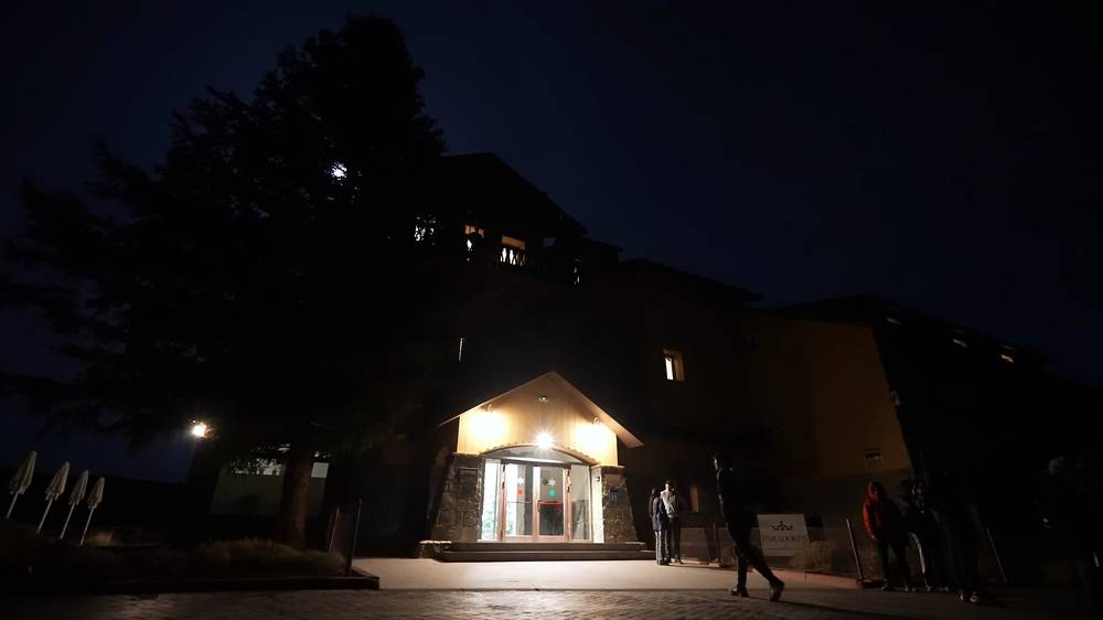
| Dec 13 | Parador de las Cañadas del Teide | about 7,050 ft (2,150 m) | $200 |
| Dec 14 | Ziggy's Boutique B&B, Vilaflor | about 4,630 ft (1,410 m) | |
| After | My hotel in Santa Cruz, then home |
Prices for a December weeknight in 2026 (Booking.com, as reported): Anaga beds about €19 to €75 (Casanaga from about €47); La Laguna about €39 to €125 (La Asomada del Gato from about €87); the Parador about €146; Vilaflor about €39 to €130 (Ziggy's, now Ziggy's Mountain Retreat, about €79). The Refugio de Altavista on Teide is €71.
What I ate. Coffee and an apple at a village cafe in Anaga; breakfast at the hotels; fruit, juice and coffee at the Cruz de Tea restaurant in Aguamansa; a salami sandwich, coffee and a donut at El Portillo; a burger and a beer at the Parador; grilled meat and fries at Casa Pana in Vilaflor. I cooked on my stove on a hillside above the sea in Anaga, and by the end of Day 3 I was running out of food.
Opening days. The restaurant at Cruz del Carmen was closed on the Wednesday I came through. Carry a day's food.
Water. I filled my bottle at village fountains and taps in Anaga and at a fountain in the forest, and filtered water from a puddle on the trail once. Between La Esperanza and El Portillo there's no reliable drinking water on the trail; the taps at the picnic areas and camping zones are often marked not drinkable. Fill up in La Esperanza and Aguamansa and carry 2 to 3 liters (a suggestion). Treat or filter anything not marked drinkable.
From my film (I have no full gear list for this trip):
What this crossing needs:
I started the hike at Cruz del Carmen just before 1 p.m., the same day I landed. The weather wasn't ideal, but I'd rather just start going and hope it clears up. Up there at the start it wasn't that interesting: cloudy skies. My plan was to hike down to the coast, mostly downhill, to a hostel I'd booked near where I hoped to get a thumbnail for the film if the sun came out. My pack was heavy, because the plan was to keep walking and not go back to the hotel for a week.
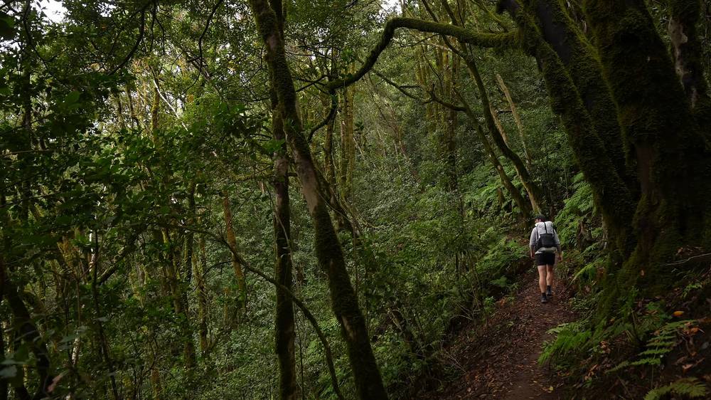
Partway down I put my tripod away; it was just a scouting day. The trail became more difficult, and I still had quite a ways to go. I missed my wife, my baby and my dog: it felt like I'd been with them yesterday, and now I was out there alone.
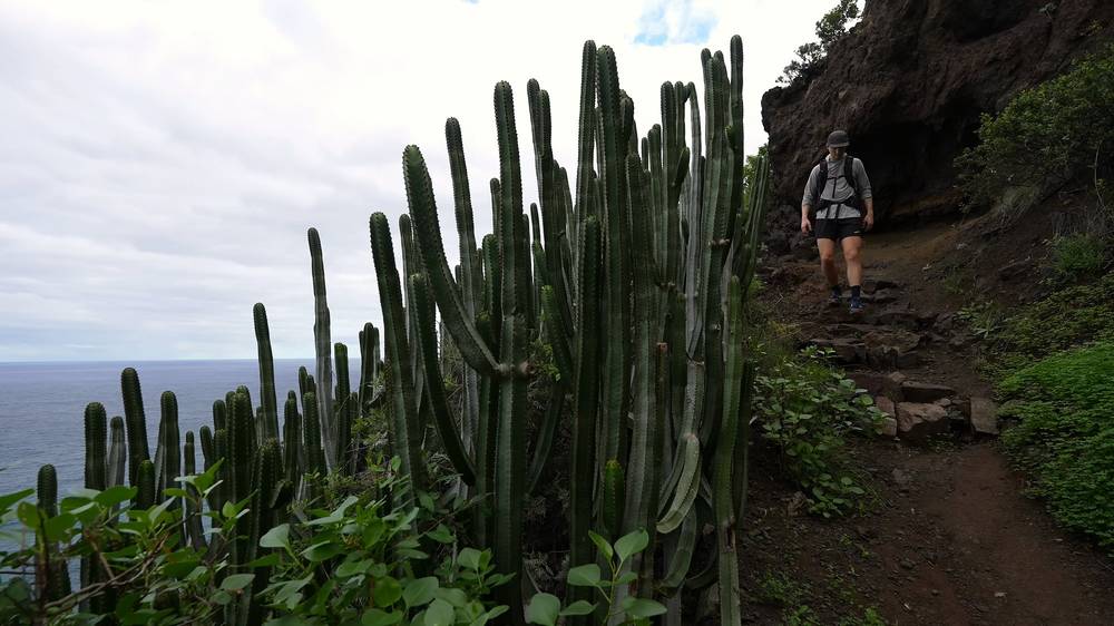
I got to Almáciga at 6:08 p.m., about 12 miles. The views were great. On Strava I wrote: "Taxi up to the top then long hike down to the beaches and surfers. But rainy and overcast. Ended up halting my filming."
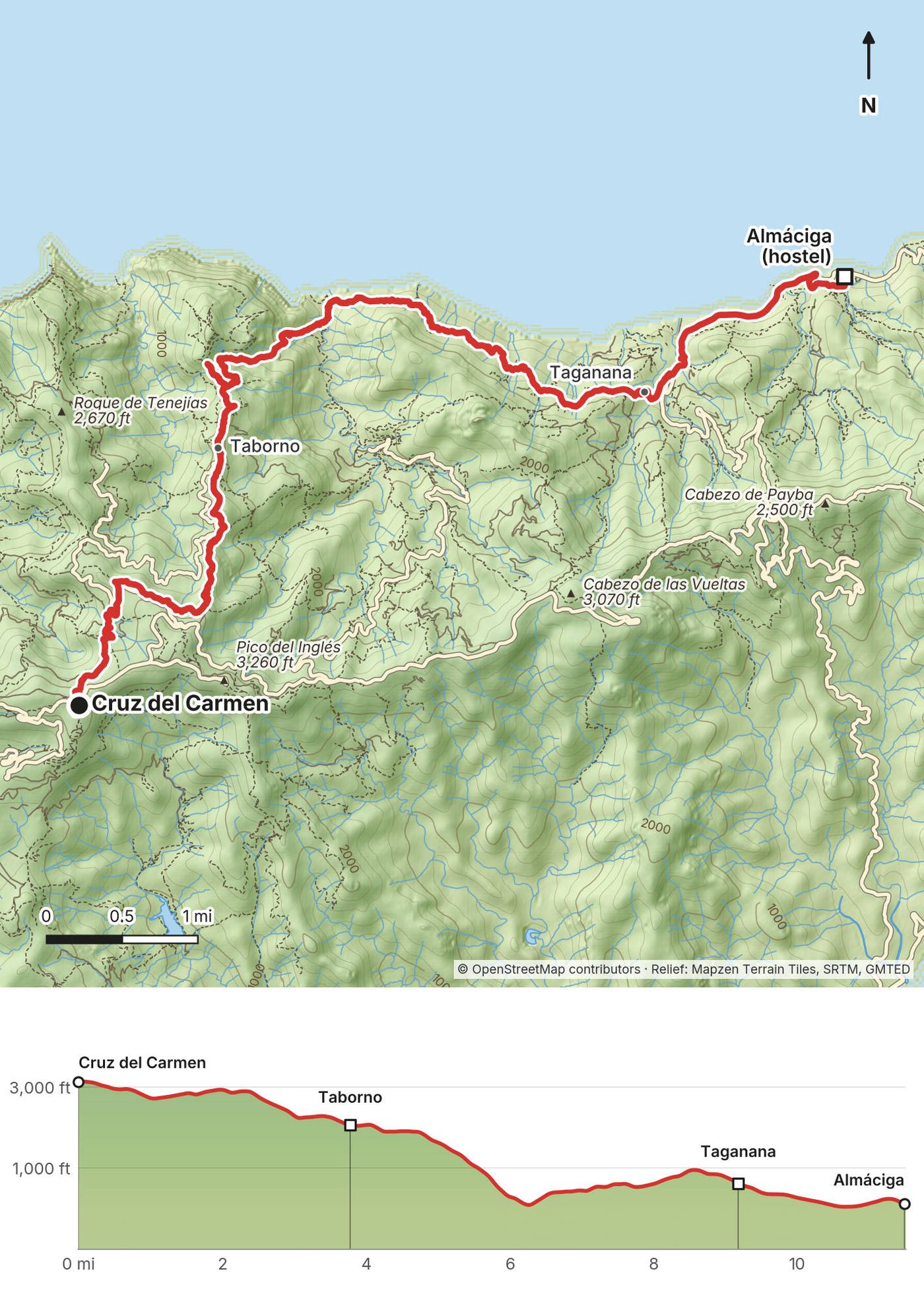
Cruz del Carmen to Taborno. Cruz del Carmen is a viewpoint and visitor centre on the Anaga ridge road, about 3,120 ft (950 m), at the edge of the laurel forest, with a restaurant and the start of several marked trails. My track goes north along the ridge through the forest past Llano Frío, then down to Taborno, a hamlet on a narrow ridge, at mile 3.8. It's PR-TF 10 at first, then PR-TF 2 into Taborno, both waymarked.
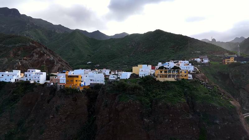
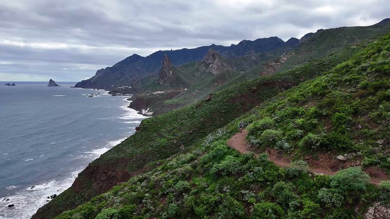
Down to the coast. From Taborno my track drops steeply north to the sea on a path that isn't a numbered trail, called Palos Hincados on OpenStreetMap, to Playa de Tamadite at mile 6.3, a beach at the mouth of the Afur ravine. From there PR-TF 8 climbs and drops along the coast, a narrow path on steep, green slopes with cactus, to the village of Taganana at mile 9.2.
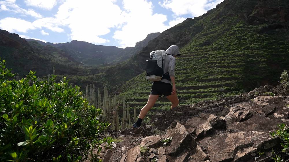
Taganana to Almáciga. From Taganana I followed the road down to the black sand beaches at Roque de las Bodegas, then up into Almáciga, where the hostel sits above the sea.
Taganana and Almáciga have the 946 bus to Santa Cruz (road works at Almáciga may change it from mid-October 2026). Back at the start, Cruz del Carmen has buses to La Laguna. If the cloud is down and the trail is wet, the steep descent to the coast is slippery: stay on the ridge or take the bus.
The Anaga coast (from 0:00) · Arriving and Day 1 (from 13:49)
The day before, I'd stayed at the hostel. I slept 12 hours, which felt good, but the weather was bad again, so I took a zero day there: drone shots, a sleepy cat, killing time. It wasn't fun, and I kind of wished I'd just powered through.
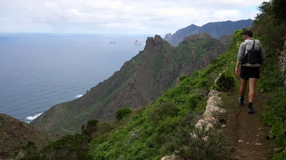
On Day 2 I started back the way I'd come. I wasn't in a good mood. I'd waited for the weather, and it was even more overcast than the first day, so I'd killed an entire day in the same place for nothing. If I'd just kept going the first day, the video would have turned out better. I was tired and wanted to go home and cancel the video, and I had a lot of uphill to do.
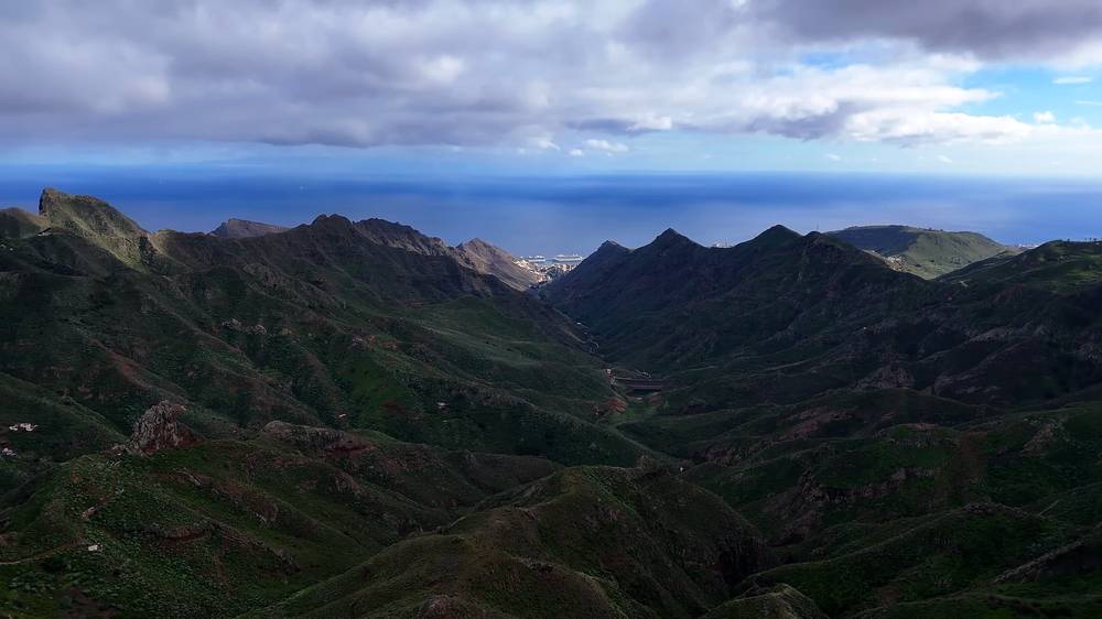
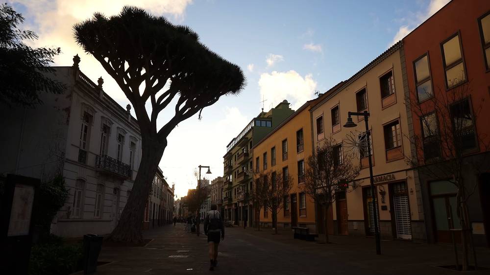
I stopped at Playa de Tamadite for about 20 minutes at 11:11, and again at Taborno. Almost back at the trailhead at the top, I wanted a hot meal, but I only had about three hours of light left. The restaurant at Cruz del Carmen was closed: it was a Wednesday. I knew there was a campsite just down the hill, but I decided to go all the way down, and from the city outskirts I booked a hotel in La Laguna, $100, a really small place with plants.
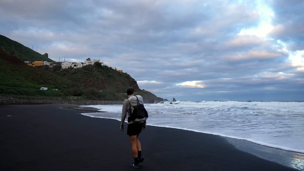
By the time I reached the city I was in a much better mood. Mentally it's nice to be making progress, and I ran into a couple of subscribers from Germany, Iceland and Spain on the way, which helped. At the hotel, all the moka pots for breakfast were already prepped with coffee grounds, which I'd never seen before. That night I booked the rest of the trip.
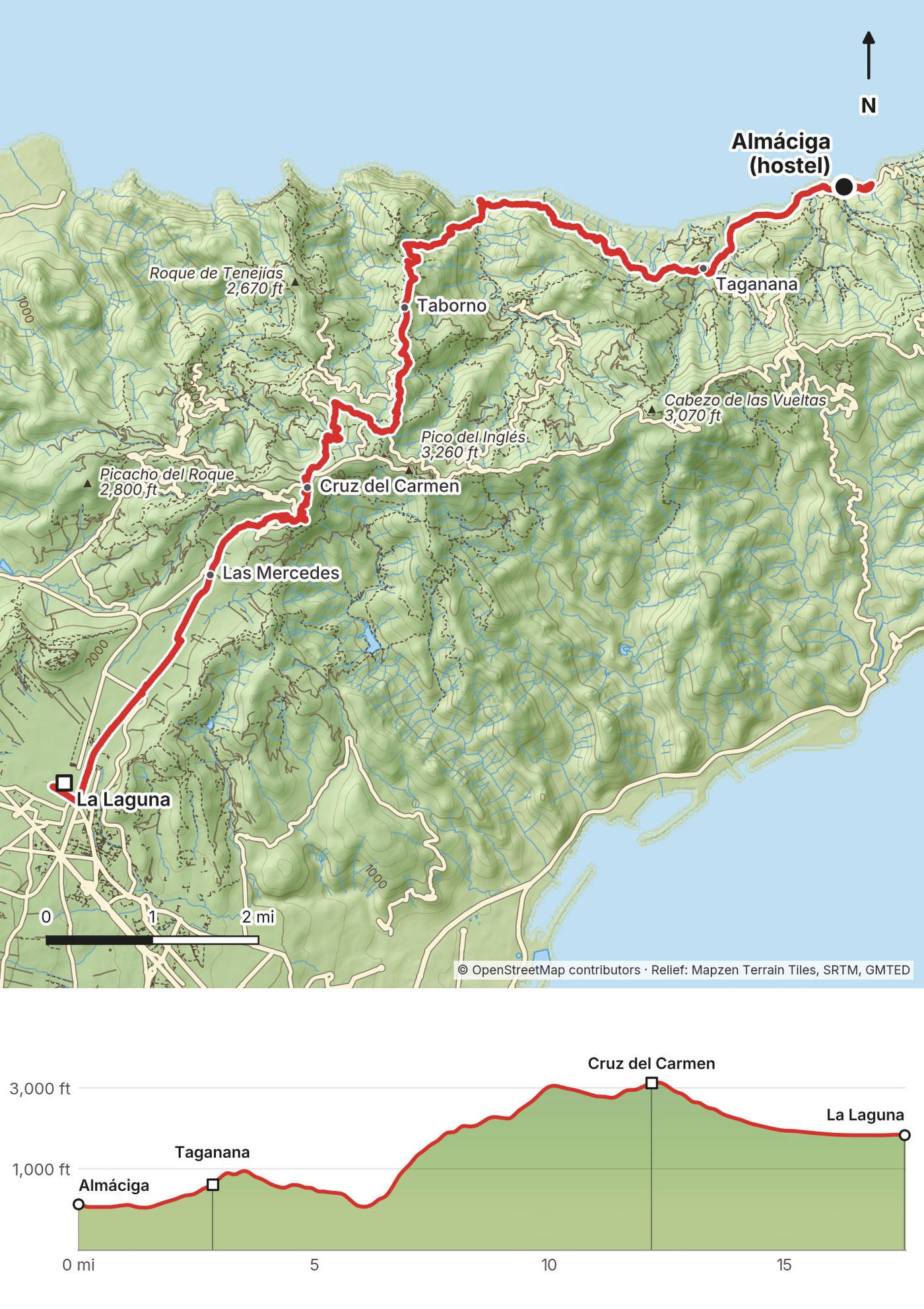
Almáciga back to Cruz del Carmen. The same way as Day 1, uphill this time: the road to Taganana, PR-TF 8 along the coast to Playa de Tamadite at mile 6.1, the long climb up the Palos Hincados path to Taborno (mile 8.3), then PR-TF 2 and PR-TF 10 to Cruz del Carmen at mile 12.2.
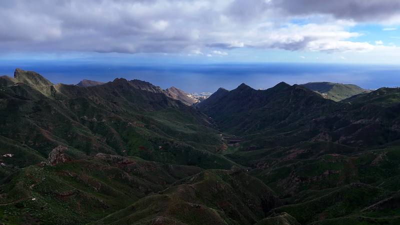
Down to La Laguna. From Cruz del Carmen my track takes PR-TF 1 south through the forest past the Llano de los Loros viewpoint and down to Las Mercedes at mile 14.3, at the edge of the forest. Strava note: "Last few miles into town on a road." The last 3 miles to the old centre of La Laguna are on roads and through the Vega de las Mercedes.
Do this day the other way round, or skip the return: from Almáciga the 946 bus goes to Santa Cruz, and from Cruz del Carmen buses 076 and 275 go down to La Laguna.
The zero day (from 17:18) · Day 2 (from 18:18) · La Laguna and my plan (from 20:21)
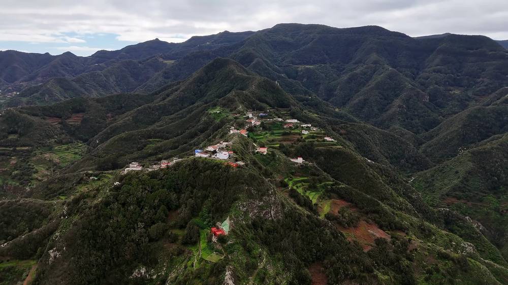
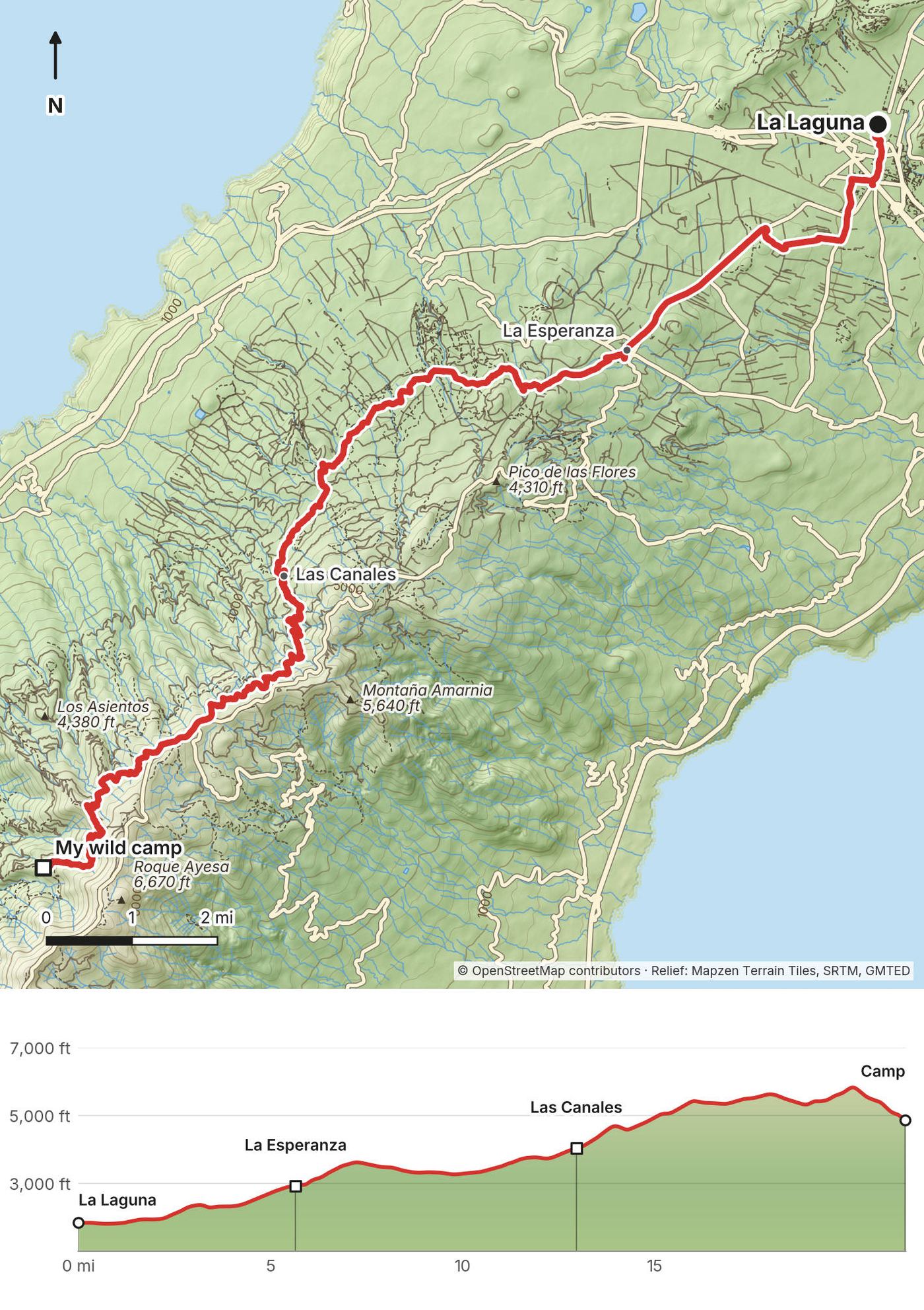
It's about a two-hour walk from La Laguna through the city, past the airport and up through some suburbs to the trailhead. I could very easily have hopped in a taxi and started at the trailhead, but I wanted a true coast-to-coast crossing on foot, so I walked it. As I expected, it wasn't fun.
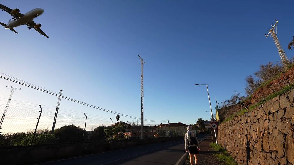
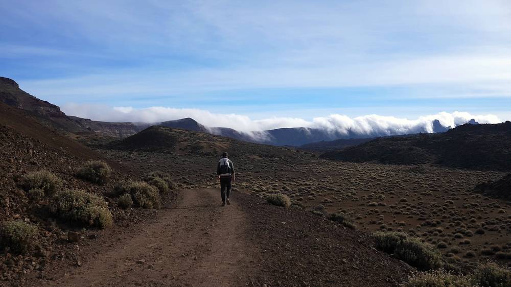
Past La Esperanza I finally got onto the trail, but much of it barely seemed like a trail: wide forest tracks for horses, bikes and logging, with logging everywhere, and a gun range near the trail. So much climbing for not very pretty trails or views. At least I could see Teide on the horizon. I stopped for about half an hour at the Las Canales picnic area around 1 p.m.
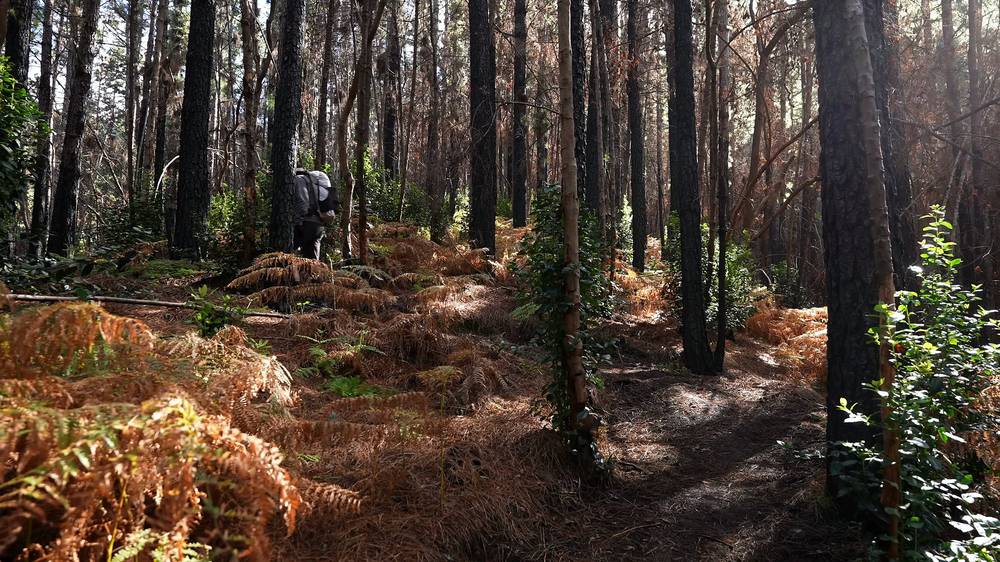
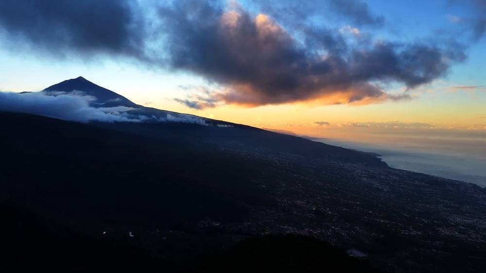
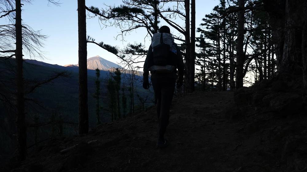
With the climbing it was not an easy day; I'd be lucky to make camp before sunset. It was colder up there, I was running out of food, and I was starting to feel sick. I stopped at 5:43 p.m., once I had a view of the volcano at sunset, and wild camped. Exhausted.
La Laguna to La Esperanza. About 5.7 miles: out of town on the Camino de Candelaria, a waymarked pilgrim route, then on roads past Tenerife North airport (around mile 3.4) and up to the village of La Esperanza, about 2,930 ft (892 m). Most hikers skip it by bus or taxi.
La Esperanza to Las Canales. At La Esperanza you join the GR 131, signed "Camino Natural Anaga-Chasna" with white and red waymarks: its first official stage, La Esperanza to La Caldera, about 30 km (19 miles), almost all on forest tracks. It climbs southwest through the forest of the Corona Forestal Natural Park past the Montaña el Haya sign and Cruz del Villero to the Las Canales picnic area at mile 13.0, about 4,040 ft (1,230 m).
Las Canales to Portillo el Topo. The climb steepens past Siete Fuentes, mile 13.8, through pine forest, some of it burnt. Between about miles 16.5 and 18.3 my track leaves the GR 131 for the TF-24 road and a forest track (Pista Lomo Atravesado), then rejoins it. It reaches the day's high point, about 5,850 ft (1,784 m), around mile 20.2, then drops to Portillo el Topo, where I camped, at mile 21.5, inside the Corona Forestal Natural Park.
Closed in October 2026. The national Caminos Naturales site says the last kilometer of the stage before the La Caldera recreation area is closed for maintenance, and asks walkers to plan alternatives; Tenerife ON's map marks closures around Mamio, by my camp. I found no signed detour. Check Tenerife ON before you go, and if it's still closed, don't walk it: see the plan's Day 4 for a way around.
Start at La Esperanza by bus or taxi and save 5.7 miles of roads. Sleep at a camping zone, with a permit, instead of pushing to the end: Las Raíces and Las Calderetas are near the GR 131 a few miles past La Esperanza, and La Caldera, above Aguamansa, is 2.7 miles past my camp on the next morning's trail. From the forest, the quickest way down to a bus is to Aguamansa.
Day 3 (from 5:38) · The walk out of La Laguna (from 22:01)
In the morning I walked down to a restaurant at Aguamansa, the Cruz de Tea. It was supposed to open at 10, and it was 10 when I got there; I gave it a few minutes. I wasn't feeling good: I was pretty sick, my lungs, my throat, I'd been coughing. I was really thinking about taking taxis for a bit. I couldn't get eggs, but I had some fruit and juice and coffee, and that put me in a better mood to attempt the uphill part.
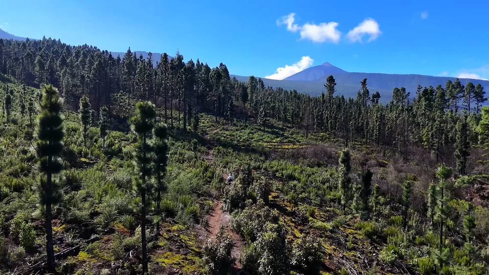
From there I told the camera I just had to go six miles uphill to El Portillo, where there's a bunch of restaurants (it's closer to 8 by my GPS), and lunch was what was motivating me. It was tough, and I was behind schedule. At El Portillo, at about 3 p.m., I had a salami sandwich, coffee and a donut.
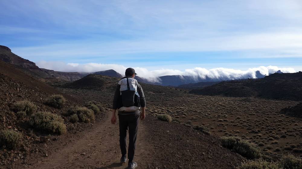
The last few miles across Las Cañadas were flat, in the desert, below the cliffs of the old caldera, and I walked the end by headlamp. I could see the lights of the hotel. It was a really tough day, and after Day 3, back to back, I was exhausted. I was craving hot chocolate and a salad, maybe a beer. I got to the Parador at 7:39 p.m.
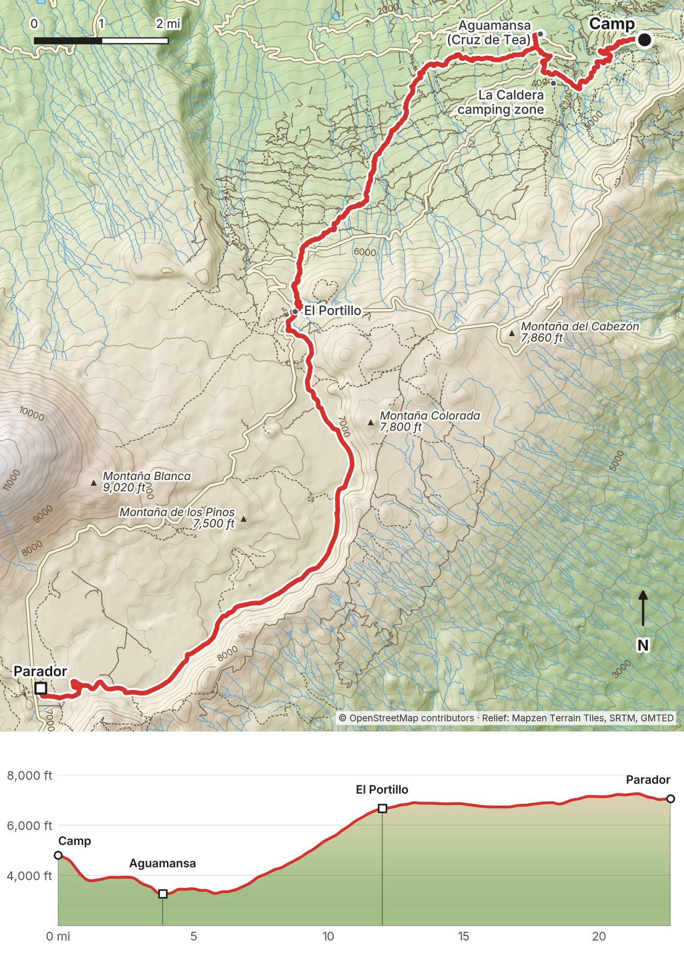
Down to Aguamansa. From Portillo el Topo the GR 131 drops through the forest past the Choza de Pedro Gil shelter and the La Caldera camping zone and recreation area (mile 2.7) to Cruz de Tea in Aguamansa, mile 3.9, about 3,270 ft (996 m), the lowest point of the day. Aguamansa has bars and a bus down the Orotava valley.
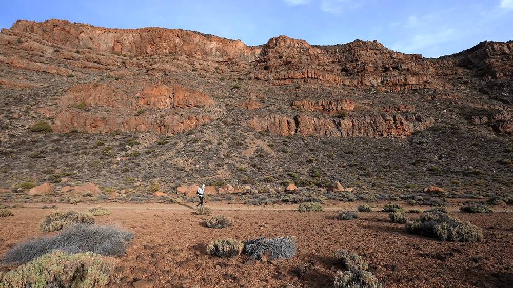
The climb to El Portillo. The GR 131's second stage, La Caldera to El Portillo, on the old Camino de Chasna, and the long climb of the crossing: from about 3,250 ft (990 m) to El Portillo, about 6,730 ft (2,050 m), in about 8 miles, past the Cruz del Dornajito picnic area (mile 6.2) and up through pine forest with Teide ahead. El Portillo, at mile 12.0, is the north entrance of Teide National Park, with a visitor centre and restaurants.
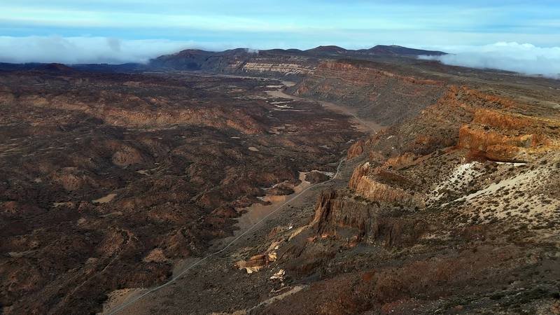
Across Las Cañadas. From El Portillo my track crosses Las Cañadas, the flat floor of the old caldera, on national park trail 4, Siete Cañadas, which is the GR 131 here: the old royal road, 16.4 km (10.2 miles) on Tenerife ON, at 6,700 to 7,270 ft (2,040 to 2,215 m), below the caldera wall on the left and Teide on the right. For the last 2 miles the GR 131.1 branch leads to the Parador, at mile 22.7. Mouflon cull days close this sector: check the calendar.
Split it. Sleep at the La Caldera camping zone (permit) and start the big climb fresh, or end the day at El Portillo and take the 348 bus, which leaves the Parador at 4 p.m. and passes El Portillo on its way down to Aguamansa, La Orotava and Puerto de la Cruz. Check its time: it's the only one.
Day 4 (from 8:00) · Sick, and the climb to El Portillo (from 23:18)
I'd left the Teide area, and I was for sure sick. I didn't get much sleep at the Parador; I'd been coughing a lot and felt like absolute crap. I was supposed to take the cable car up the volcano that morning, but they cancelled it because of strong winds. I was still committed to walking to the coast, even though it wasn't smart. Luckily the day was easy.
I started late, at 10:40, and moved slowly, mostly downhill through the pines. At Vilaflor I had lunch, grilled meat and fries, at Casa Pana, and stopped. I was incredibly sick and done hiking. On Strava: "Final day due to sickness. Didn't quite make it to the coastline." It turned out I had walking pneumonia.
Then I shared a taxi with some German hikers I'd met while wild camping, back to Santa Cruz to get my bag from the hotel; they were a little confused that I was there early. Three days later, still very sick, I flew home.
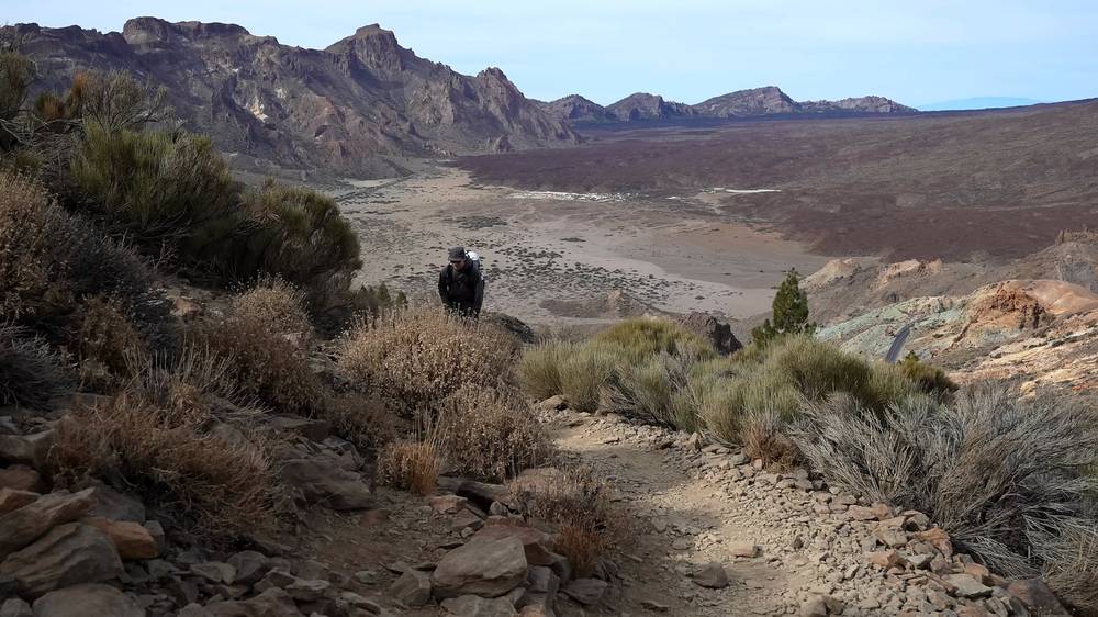
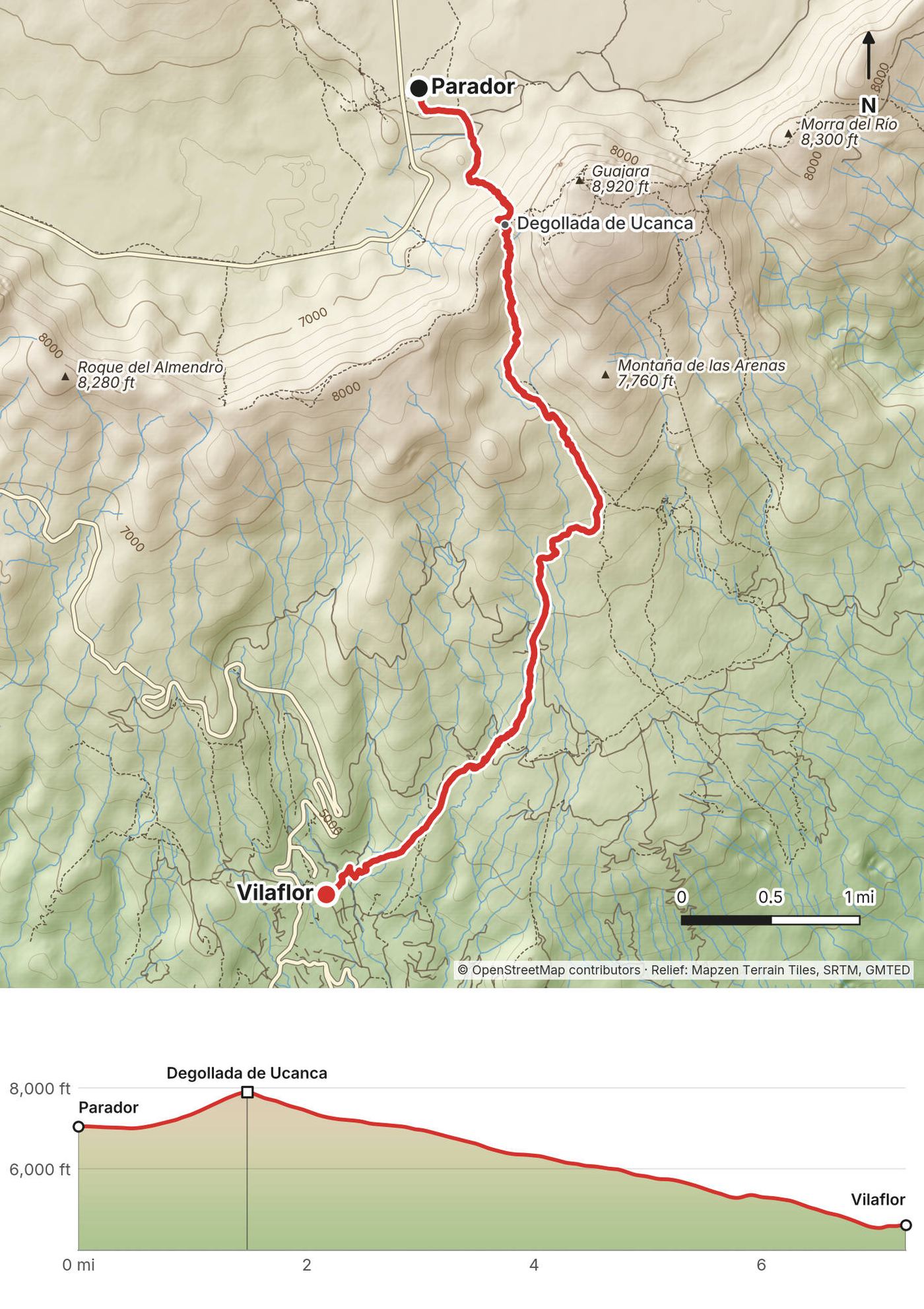
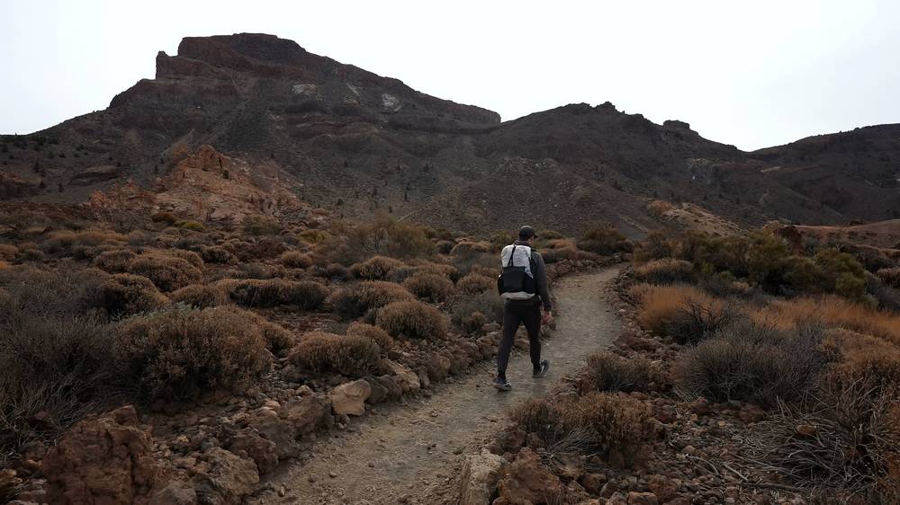
Up to the Degollada de Ucanca. From the Parador my track climbs south out of Las Cañadas on national park trail 31, Cumbres de Ucanca (no booking needed), by an old zigzag path, to the Degollada de Ucanca, a pass on the caldera wall west of Guajara, about 7,910 ft (2,411 m) on my track at mile 1.5. It's the highest point of my crossing.
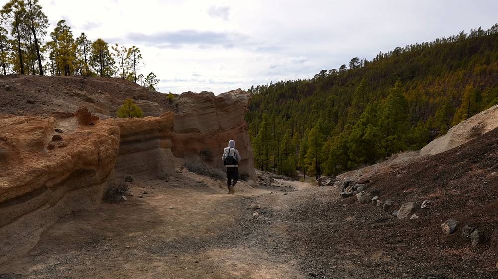
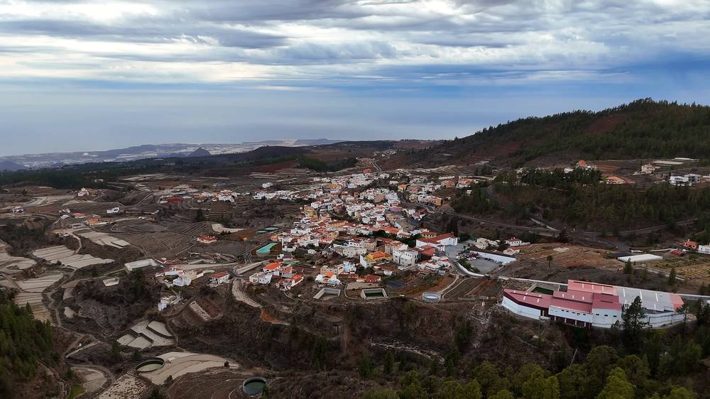
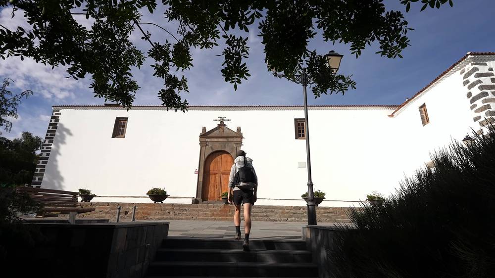
Down to Vilaflor. From the pass I came down a steep path that isn't a numbered trail (Sendero Caseta del Agua on OpenStreetMap) and rejoined the GR 131 at about mile 3.7. From there the GR 131's fourth stage, shared with PR-TF 72 (Camino de Chasna, Paisaje Lunar), drops south through pine forest and pumice, past the turnoff to the Paisaje Lunar rock formations (mile 5.5), to Vilaflor at mile 7.3, about 4,590 ft (1,400 m), the highest village in the Canaries.
The official way. The waymarked GR 131 doesn't use my line over the Degollada de Ucanca. From the Parador it takes the GR 131.1 branch (3.6 km) to the GR 131, then national park trail 5 climbs 1.2 km and about 710 ft (216 m) to the Degollada de Guajara, about 2 km east of my pass at about 7,820 ft (2,385 m), and the GR 131 drops from there to Vilaflor. Take that one; it's longer than my 7.3 miles. Mouflon cull days close the Vilaflor to Degollada de Guajara section.
From the Parador, the 342 bus goes down to Vilaflor and Los Cristianos at 4 p.m. From Vilaflor, bus 482 goes down to Los Cristianos.
Day 5 (from 10:33) · Sick, and done (from 25:22)
Elevation43–7,874 ft80.5 mi
Terrain: Mapzen Terrain Tiles (SRTM, GMTED) on AWS · Rivers & lakes © OpenStreetMap contributors
Tap a map to open it full size.
Checked on the Cabildo de Tenerife's trail site, Tenerife ON, the Teide National Park's incidents page and AEMET on October 3, 2026.
Open, with one stretch closed. Tenerife ON shows no closures on the Anaga trails I used (PR-TF 1, 2, 8 and 10). The GR 131 is open, but its page carries notices of closed stretches (after the 2023 forest fire, and for rockfalls) and of intermittent closures during conservation work. Its map marks the closed stretch just before La Caldera, around Mamio above Aguamansa, and the national Caminos Naturales site says the last kilometer of the stage from La Esperanza to La Caldera is closed. That's where I camped at the end of Day 3 and walked down the next morning. Check Tenerife ON before you go: I found no signed detour.
Fire. The August 2023 wildfire burned much of the Corona Forestal. The Cabildo's list of trails still closed because of it (November 7, 2025, updated daily) includes several around La Caldera and Aguamansa; all the national park's trails are open. Since September 26, 2026, the island has been on preventive fire measures only, with no active alert. At higher fire risk the Cabildo closes the camping zones and recreation areas, as it did in July 2026.
Teide National Park. No active alerts on October 3, 2026. On set days the park culls mouflon (wild sheep) and closes the trails in that sector: the Siete Cañadas sector, which includes the GR 131 from El Portillo to the Parador, is closed on December 14 and 15, 2026, for example. Snow and ice close the summit trails at times in winter.
Coming changes. On September 30, 2026, the Cabildo told Anaga residents that before the end of 2026, visitors will pay a fee and ride a shuttle bus from La Laguna to walk the four trails that start at Cruz del Carmen, with barriers and paid parking there; prices weren't set yet, as reported. Teide may get access control at its entrances by the end of 2026 and shuttle buses in 2027, also as reported. Road works at Benijo and Almáciga, with traffic limits for about two months each, were due to start in mid-October 2026, as reported.
December, like me. I walked December 9 to 14, 2024. Anaga was rainy and overcast at the start; I waited a day for the weather and it was "even more overcast" the next day. Higher up it was colder, and on my last morning, at the Parador, it was too windy for the cable car. The days are short: about 10 hours and 20 minutes from sunrise around 7:50 a.m. to sunset around 6:10 p.m. in mid-December. I finished Day 4 well after dark, by headlamp.
The best months. By AEMET's averages (1981 to 2010), the crossing is best from March to May, when the rain falls off and the days get longer, and from October to early November. From December to February, Anaga and La Laguna get the most rain and the least sun, and nights in Las Cañadas are near freezing. Summer is dry and sunny up high, but hot on the south side and the season with the highest fire risk; Anaga is often under cloud even then.
Weather. AEMET's averages for three of its stations (1981 to 2010):
| Station | Height | December high / low °F (°C) | December rain days | Year rain, in (mm) |
|---|---|---|---|---|
| Santa Cruz, the coast | 118 ft (36 m) | 72 / 62 (22.1 / 16.6) | 5.4 | 8.9 (226) |
| Tenerife North airport, by La Laguna | 2,073 ft (632 m) | 63 / 53 (17.1 / 11.5) | 8.8 | 20.5 (520) |
| Izaña, about the height of Las Cañadas | 7,772 ft (2,369 m) | 48 / 36 (8.8 / 2.4) | 5.6 | 15.4 (392) |
At Izaña, December averages 8 frost days and 1.6 days of snow; January and February a few more. Snow and ice on Teide can close its trails and the park roads.
Emergencies. Call 112, anywhere in Spain. Leave your plan with someone: much of the GR 131 is far from villages.
Getting sick. I started feeling sick on Day 3 and kept walking two more days with lung trouble and a cough. It was walking pneumonia. Almost every day of this route passes a village, a bus or a road within a few hours: use them.
Cold, wind and snow. Las Cañadas is about 7,000 ft up. In December, Izaña, at about the same height, averages 48 °F by day and 36 °F at night, with frost 8 days a month (AEMET). Strong wind closed the cable car on my last morning. Snow and ice close Teide's trails and sometimes the park roads. Check AEMET's mountain forecast for Teide and its warnings (Meteoalerta) for wind, calima (Saharan dust) and snow.
Short days. In December you get about 10 hours and 20 minutes of light. I finished Day 4 in the dark by headlamp. Carry one, and plan shorter days than mine.
Water. There's no reliable drinking water on the trail between La Esperanza and El Portillo. Fill up in La Esperanza and Aguamansa.
Fire. Summer and calima bring high fire risk. The Cabildo closes trails, recreation areas and camping zones at higher risk levels. No fires at any time.
Anaga. Steep, and in winter often wet under cloud: I had rain and overcast skies there. Take care on the steep descents to the coast. Storms close trails: Storm Therese closed several on the north side of the island in spring 2026.
Culls and shooting. Mouflon cull days close trail sectors in the high country; check the calendar on Tenerife ON. There's a shooting range about 1 km off the GR 131 near Las Calderetas.
Volcano. Tenerife's volcanic alert level was green in late August 2026, as reported.
Can I walk across Tenerife? Yes. The GR 131, a long-distance trail the island calls the Anaga-Chasna, crosses Tenerife from the Anaga mountains in the northeast to Arona in the south, over the spine of the island and through Las Cañadas below Teide. I walked most of it, with a detour at the start: two days in Anaga, then La Laguna to La Esperanza on roads, then the GR 131 to Vilaflor, where I stopped.
How many days do I need? I walked about 80 miles in five days, with a zero day in Anaga waiting for the weather. Days 2, 3 and 4 were 17.5, 21.5 and 22.7 miles, each with 4,500 to 5,000 ft of climbing. Day 3 was "not an easy day... really tough," and back to back with Day 4 I was exhausted. Split into shorter days, the same ground takes seven or eight, plus a day for Teide. See A plan for your crossing.
How hard is it? The trails are waymarked, but the climbing adds up: from La Laguna, about 1,800 ft, the GR 131 climbs through the forest to about 5,850 ft, drops to Aguamansa at about 3,250 ft, and climbs again to El Portillo at about 6,730 ft, the edge of Teide National Park. Anaga's trails are steep, and often wet in winter.
Do I need a permit? Not for the trails I walked. You need a booked permit (no fee shown) to camp in one of the Cabildo's camping zones, and since January 19, 2026, a paid permit (€15 for visitors) for the last part of the trail to Teide's summit. See The rules.
Can I wild camp? No. Camping outside the Cabildo's camping zones isn't allowed, and you can be fined. I wild camped the night of Day 3 in the forest above Aguamansa; the official La Caldera camping zone is about 2.7 miles further on the trail I walked the next morning.
Can I climb Teide? Yes, with planning. I'd booked the cable car up for the morning of Day 5, but it was cancelled because of strong winds, and when I'd tried to book a guided tour and permit for the very top, there was no availability. The summit trail permit costs €15 for visitors since January 2026, or you can sleep at the Refugio de Altavista hut, whose booking includes an early-morning summit permit. See Teide.
Is there water on the trail? Not reliably on the long climb from La Esperanza to El Portillo: the taps at the picnic areas are often marked not drinkable. I filled up at fountains and taps in the villages and at the bars and restaurants on the way.
Can I do it on the bus instead? Yes. TITSA's buses reach Cruz del Carmen, Almáciga, La Laguna, Aguamansa, El Portillo, the Parador and Vilaflor; the high stops get one bus a day each way. You can base yourself in La Laguna and Puerto de la Cruz and walk the best sections as day hikes. See Getting there and around.
Is there a phone signal? With an eSIM I bought on arrival, I booked my La Laguna hotel from the edge of the city on Day 2, and the rest of the trip from there. Expect gaps in Anaga's deep valleys and in the forest. The emergency number is 112.
What about the other islands? I wanted to go to another island but didn't have time. This guide is Tenerife only. See Other islands.
I didn't walk it. The GR 131's last stage is 17.7 km (11 miles), about 7 hours 20 minutes, 597 m (1,960 ft) up and 1,394 m (4,570 ft) down, from the Plaza de San Pedro in Vilaflor, about 4,680 ft (1,426 m), to Arona, about 2,060 ft (628 m). It climbs past the Ermita de San Roque into dry pine forest, then drops through the Ifonche protected landscape, past Roque Imoque and Roque del Conde, to Arona. Bus 482 links Arona with Los Cristianos on the coast and with Vilaflor.
The official GR 131 on Tenerife runs 85.55 km (53 miles) from El Rosario and La Esperanza to Arona, with about 17,350 ft (5,290 m) of climbing and 18,260 ft (5,566 m) of descent, rated very difficult, in five stages: La Esperanza to La Caldera (about 30 km), La Caldera to El Portillo (about 14 km), El Portillo to the Degollada de Guajara, the Degollada de Guajara to Vilaflor, and Vilaflor to Arona. The Anaga trails north of La Laguna aren't part of it; my two days there were separate marked trails. No booking is needed for the GR itself.
From a base in La Laguna or on the north coast: PR-TF 8, the Afur to Taganana loop through Playa de Tamadite (14.3 km, about 5,260 ft up and down, Tenerife ON); PR-TF 10 from Cruz del Carmen to Punta del Hidalgo through Chinamada (9.9 km); PR-TF 1, Las Mercedes to Cruz del Carmen (2.4 km); and PR-TF 6.2 along the coast from Roque de las Bodegas past Almáciga and Benijo to El Draguillo (4.4 km, as reported). El Pijaral needs a free permit. Check whether the new fee and shuttle for the Cruz del Carmen trails have started.
Sleep in La Laguna for Anaga, in Puerto de la Cruz or La Orotava for the Orotava valley and El Portillo (bus 348), and at the Parador or in Vilaflor for Las Cañadas and Teide (bus 342), and walk the best days as day hikes: my Day 1 in Anaga, El Portillo to the Parador across Las Cañadas, and the Parador to Vilaflor.
I wanted to go to another island too, but I didn't have time, so I haven't hiked any of them. The essentials, as checked in October 2026 (from official pages, partly through search summaries):
My Days 2 to 4 were 17.5 to 22.7 miles each, and by the end of Day 4 I was exhausted. Here's the same ground split into shorter days, sleeping in beds and camping zones, with the distances from my GPS. It's a suggestion built from my track and the official stages, not a trip I walked; miles are from my GPS, rounded, except Day 9 (the official 17.7 km). Book the camping zones, the Teide permit and the Parador ahead, and check the once-a-day 348 bus.
| Day | Route | Miles | Sleep |
|---|---|---|---|
| 1 | Cruz del Carmen to Almáciga (my Day 1) | 11.5 | Almáciga or Taganana |
| 2 | Bus 946 to Santa Cruz, then on to La Laguna; or walk back to Cruz del Carmen (12.2) and take the bus down | 0 or 12.2 | La Laguna |
| 3 | La Laguna to the Las Calderetas camping zone, or the bus to La Esperanza and 4 miles of the GR 131 | 10 or 4 | Las Calderetas or Las Raíces (permit) |
| 4 | Las Calderetas to La Caldera on the GR 131. If its last kilometer is still closed and there's no signed detour, skip it: the local bus from La Esperanza to La Laguna, bus 102 to Puerto de la Cruz, and bus 345 up to Aguamansa | About 14.5 | La Caldera camping zone (permit) |
| 5 | La Caldera to El Portillo, then bus 348 down to Puerto de la Cruz | 9.3 | Puerto de la Cruz or La Orotava |
| 6 | Bus 348 back up to El Portillo, then the GR 131 across Las Cañadas | 10.7 | The Parador |
| 7 | Teide: the cable car and the summit permit; or walk up trail 7 to the Refugio de Altavista and take its sunrise summit slot on Day 8 | The Parador, or the Refugio de Altavista | |
| 8 | The Parador to Vilaflor; take the official GR 131 over the Degollada de Guajara | 7.3 on my line; the official way is longer | Vilaflor |
| 9 | Vilaflor to Arona, the last stage (not walked), then bus 482 down | 11 (official) | The coast |
What I planned. The night of Day 2 I booked the cable car up the volcano for the morning after my night at the Parador, about $30. I tried to get an expensive guided tour and permit to the very top, but there was no availability; on screen I noted a $140 private option. On the morning of Day 5 the cable car was cancelled because of strong winds, so I never went up.
The cable car (Teleférico del Teide). From a base station at 7,730 ft (2,356 m) by the road through Las Cañadas, a few minutes by bus from the Parador, to La Rambleta at 11,663 ft (3,555 m), in under 8 minutes. In 2026 a return is €42 for visitors (€23.50 one way). It opens at 9 a.m.; from October 25 to December 31 the last ride up is at 4 p.m. and the last down at 4:50 p.m. It stops in strong wind. The ticket doesn't include the summit.
The summit permit (trail 10, Telesforo Bravo). The permit covers only the last 0.66 km, about 600 ft up, from La Rambleta to the crater rim at 12,188 ft (3,715 m). Book it on Tenerife ON, the Cabildo's site (you register first). New places open each Monday at 7 a.m. Canary time for the next 56 days (the January 2026 announcement said 28). One booking per person every 15 days, no changes, and you carry it with your passport or ID, which must match. Since January 19, 2026, slots between 9 a.m. and 5 p.m. cost €15 for visitors, €6 for residents of the other Canary Islands, and nothing for Tenerife residents and under-14s. Confirmed bookings can't be changed or cancelled, and they're refunded only if the trail closes or the cable car doesn't run (the Cabildo, January 2026); check Tenerife ON's booking conditions for any cancellation window. Walking it without a booking can be fined.
What you must wear. Checked on the trail: boots or closed trekking shoes with grip, long trousers (worn or carried) and a warm layer. With ice or snow, crampons and an ice axe and a signed declaration of alpine experience. No leaving the path or going into the crater.
Walking up. Trail 7, Montaña Blanca to La Rambleta, also needs a booking: €6 on weekdays and €10 at weekends and holidays for visitors, in slots from 9 a.m. to 3 p.m.
The Refugio de Altavista. A hut at 10,696 ft (3,260 m) on the way up, closed from 2019 and reopened on July 20, 2026, so it wasn't an option for me. €71 a night for visitors, one night only, 49 places in shared bunk rooms; bring a sleeping bag; no meals. Closed the nights of December 24 and 31. A night's booking includes the summit permit for 6 to 9 a.m. the next morning: sunrise on the top without the cable car.
Altitude and winter. The summit trail starts at about 11,650 ft. Tenerife ON warns that the low oxygen can cause extreme fatigue, dizziness and malaise, and says the route isn't for people with heart, breathing or mobility problems. In winter, snow and ice close the summit trails at times (in January 2025, trails 7, 10 and 11), and winds at Altavista can pass 200 km/h (125 mph).
These change every year. Everything else in this guide stays the same.
Is it open?
Bookings
Getting around
Your stuff
The film is at the top of this page.
Planning questions about Across Tenerife, answered only from this page's facts, the creators' versions and hikers' public tracks, with where each answer comes from. When the data doesn't say, the answer says "not given".
From hikers
Sign in to comment. Free; your hikes stay private unless you share them.
Some lodging links earn me a small commission at no cost to you.
Something wrong or missing on this page? Send feedback.