Follow the Hiker
Find my next hikeGearSavedKraig Adams
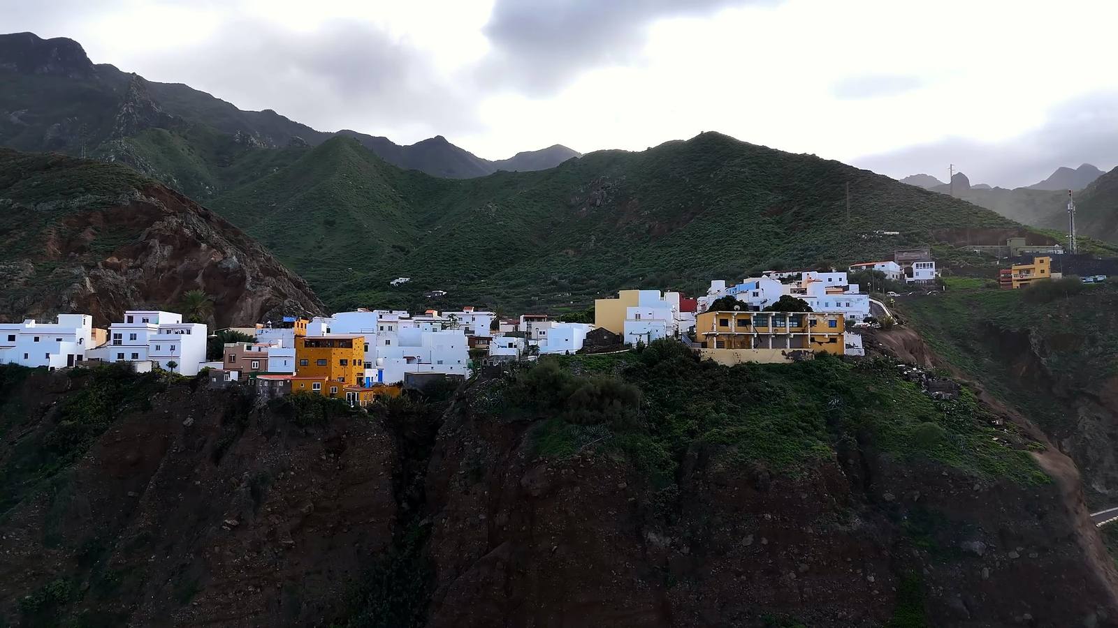
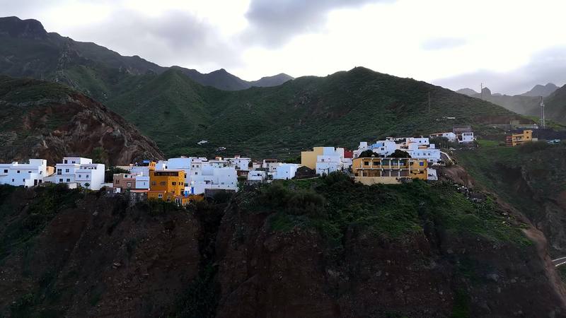
A village on the cliffs of the Anaga coast, from my drone.

Europe · Spain

Across Tenerife

Tenerife, Canary Islands, Spain

Distance
80.5 mi129.5 km
Days
5 days
Elevation gain
16,634 ft5,070 m
High point
7,910 ft2,411 m
Season
By AEMET's averages, March to May and…
Lodging
Tent
Plan this hike

Hikes / Europe / Across Tenerife

In December 2024 I set out to walk across Tenerife, the biggest of the Canary Islands, alone: from the green, steep Anaga mountains in the northeast, over the spine of the island through the pine forest, up to Las Cañadas below Teide, Spain's highest mountain, and down to the south coast. I walked five days, about 80.5 miles by my GPS. I didn't make the coast. I got sick on the way up to Teide, kept going for two more days, and stopped in the mountain village of Vilaflor. It turned out to be walking pneumonia. It's the trip from my film Hiking Alone in the Canary Islands.

Kraig Adams

Effort at this pace: Very hard · about 16 mi (26 km) and 3,327 ft (1,014 m) of climbing a day over 5 days, up to 7,910 ft (2,411 m). Our grade for the days given, worked out from distance, climbing and altitude a day; it isn't the trail's usual difficulty rating (under Basics) and doesn't rate exposure, terrain or weather.

Where these numbers come from

From Kraig Adams's GPS recording and guide.

Plan this hikeSave this hike

Plan: dates, gear, deadlines and stays in a private link. Save: keeps it on your account.

From Kraig Adams's GPS

The route, day by day

Relief map of the Canary Islands route: 5 days drawn in red with numbered day starts, labelled Cruz del Carmen, Vilaflor and Pico Sur.

Elevation43–7,874 ft80.5 mi

From Kraig Adams's GPS. Terrain: Mapzen Terrain Tiles (SRTM, GMTED) on AWS · Rivers & lakes © OpenStreetMap contributors

Tap a day for his map of it

  • Read day 1
  • Read day 2
  • Read day 3
  • Read day 4
  • Read day 5

The film

Watch it first

Hiking Alone in the Canary Islands

Kraig Adams · Dec 2024 · Solo

A village on the cliffs of the Anaga coast, from my drone.
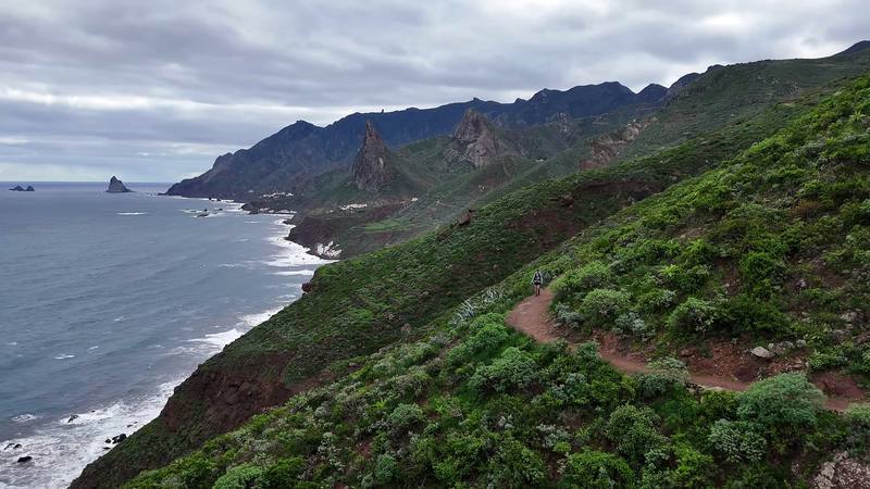
The coast path on Anaga's north shore.
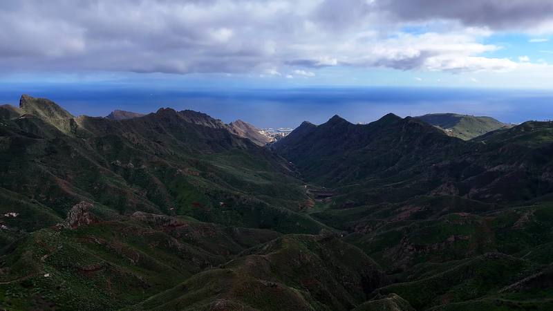
The Anaga mountains from my drone.
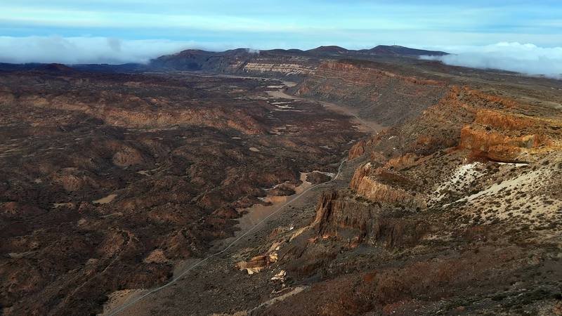
Las Cañadas, the old caldera below Teide, from my drone, Day 4.
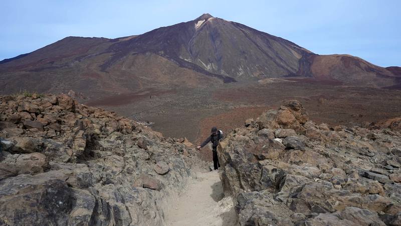
Teide from the trail up to the Degollada de Ucanca, Day 5.

Before you go

The basics

Start
Cruz del Carmen, about 3,120 ft (950 m), in the Anaga mountains above La Laguna
Finish
Vilaflor, about 4,590 ft (1,400 m), where I stopped. The GR 131 goes on to the south coast at Arona
Usual difficulty
Long days with big climbs; well-marked trails and forest tracks, some steep and rough in Anaga
Best time
By AEMET's averages, March to May and October to early November. December to February brings rain and cloud in Anaga and frost, snow and wind up high; summer is hot in the south and the season of highest fire risk.
Permits
None for the trails I walked. A booked permit for a camping zone (no fee shown); a paid one (€15) for Teide's summit trail
Getting there
My way in, 2024. I arrived at about 8 a.m. and went straight to a cafe for coffee and wifi, bought an eSIM, and took about €300 out of the airport ATM. Then I took a bus that I think was $9, a 45-minute ride to Santa Cruz. I had a carry-on duffel with extra clothes I wasn't going to hike with, so I went to a hotel in Santa Cruz, the Iberostar Heritage Grand Mencey, and booked one night there for a week later, at the end of the trip; as long as I had a reservation, they didn't mind storing the bag for me. They called me a taxi, about $35, to a camping store in La Laguna, Tenerife Outdoor, for stove fuel and some food, and then I went up to the trailhead at Cruz del Carmen.
Lodging
Tent

From Kraig Adams's guide

Costs and gear

What Kraig carried

Not given

The full gear list

From Kraig Adams's guide

Safety

Rescue numbers

  • Call 112, anywhere in Spain.

Phone signal

  • With an eSIM I bought on arrival, I booked my La Laguna hotel from the edge of the city on Day 2, and the rest of the trip from there.
  • Expect gaps in Anaga's deep valleys and in the forest.

Insurance

  • A GHIC or EHIC is not an alternative to travel insurance.
  • Get travel insurance that suits your trip, and call 112 for mountain rescue.

Bail-out points

  • Day 1, Cruz del Carmen to Almáciga. Taganana and Almáciga have the 946 bus to Santa Cruz (road works at Almáciga may change it from mid-October 2026). Back at the start, Cruz del Carmen has buses to La Laguna. If the cloud is down and the trail is wet, the steep descent to the coast is slippery: stay on the ridge or take the bus.
  • Day 2, Almáciga to La Laguna. Do this day the other way round, or skip the return: from Almáciga the 946 bus goes to Santa Cruz, and from Cruz del Carmen buses 076 and 275 go down to La Laguna.
  • Day 3, La Laguna to a camp above Aguamansa. Start at La Esperanza by bus or taxi and save 5.7 miles of roads. Sleep at a camping zone, with a permit, instead of pushing to the end: Las Raíces and Las Calderetas are near the GR 131 a few miles past La Esperanza, and La Caldera, above Aguamansa, is 2.7 miles past my camp on the next morning's trail. From the forest, the quickest way down to a bus is to Aguamansa.
  • Day 4, Above Aguamansa to the Parador. Split it. Sleep at the La Caldera camping zone (permit) and start the big climb fresh, or end the day at El Portillo and take the 348 bus, which leaves the Parador at 4 p.m. and passes El Portillo on its way down to Aguamansa, La Orotava and Puerto de la Cruz. Check its time: it's the only one.
  • Day 5, The Parador to Vilaflor. From the Parador, the 342 bus goes down to Vilaflor and Los Cristianos at 4 p.m. From Vilaflor, bus 482 goes down to Los Cristianos.

From Kraig Adams's guide. For planning, not navigation: check before you go.

Their films and versions

Creators who've done it

1 creator so far: Kraig, 5 days, tent.

Walked Across Tenerife? Be the first to share your track: log it with your GPX.

Your time

Sign in and log a few hikes to see how long this one would take you.

Typical: 5 days (the hike's facts).

Ask this hike

Planning questions about Across Tenerife, answered only from this page's facts, the creators' versions and hikers' public tracks, with where each answer comes from. When the data doesn't say, the answer says "not given".

    From hikers

    Comments

    Sign in to comment. Free; your hikes stay private unless you share them.

    Answered from the data

    Questions people ask

    How many days do you need for Across Tenerife?

    I walked about 80 miles in five days, with a zero day in Anaga waiting for the weather. Days 2, 3 and 4 were 17.5, 21.5 and 22.7 miles, each with 4,500 to 5,000 ft of climbing. Day 3 was "not an easy day... really tough," and back to back with Day 4 I was exhausted. Split into shorter days, the same ground takes seven or eight, plus a day for Teide. See A plan for your crossing.

    From Kraig Adams's trip and guide.

    How much does Across Tenerife cost?

    In 2026 a return ticket is 42 euros for visitors (23.50 one way). From October 25 to December 31 the last ride up is at 4 p.m. It closes in strong wind, and the ticket doesn't include the summit permit.

    From Kraig Adams's trip and guide.

    When is the best time to hike Across Tenerife?

    By AEMET's averages, March to May and October to early November. December to February brings rain and cloud in Anaga and frost, snow and wind up high; summer is hot in the south and the season of highest fire risk.

    From Kraig Adams's trip and guide.

    Do you need a permit for Across Tenerife?

    Yes, for the last 0.66 km to the summit (trail 10, Telesforo Bravo). Book it on Tenerife ON; since January 19, 2026, slots between 9 a.m. and 5 p.m. cost 15 euros for visitors. A night at the Refugio de Altavista, reopened in July 2026, includes an early-morning summit permit.

    From Kraig Adams's trip and guide.

    Can you walk across Tenerife?

    Yes. The GR 131 (Anaga-Chasna) crosses Tenerife for 85.55 km from El Rosario and La Esperanza, through the Corona Forestal and Las Cañadas below Teide, to Arona in the south, with no booking needed. I walked from Cruz del Carmen in Anaga to Vilaflor in five days, about 80.5 miles by my GPS, and stopped there sick, one stage short of the coast.

    From Kraig Adams's trip and guide.

    Can you wild camp on Tenerife?

    No. Camping in Tenerife's protected natural spaces and public forests needs an authorization, which means booking one of the Cabildo's camping zones on Tenerife ON (no fee shown in 2026, 7 nights at most per person), and camping isn't allowed in Teide National Park. The Cabildo lists a 400 euro fine for camping in a restricted zone.

    From Kraig Adams's trip and guide.

    Is there water on the GR 131 on Tenerife?

    Not reliably between La Esperanza and El Portillo: the taps at picnic areas and camping zones are often marked not drinkable. Fill up in La Esperanza and Aguamansa and carry 2 to 3 liters.

    From Kraig Adams's trip and guide.

    Plan this hikeThe route