Follow the Hiker
Find my next hikeGearSavedKraig Adams
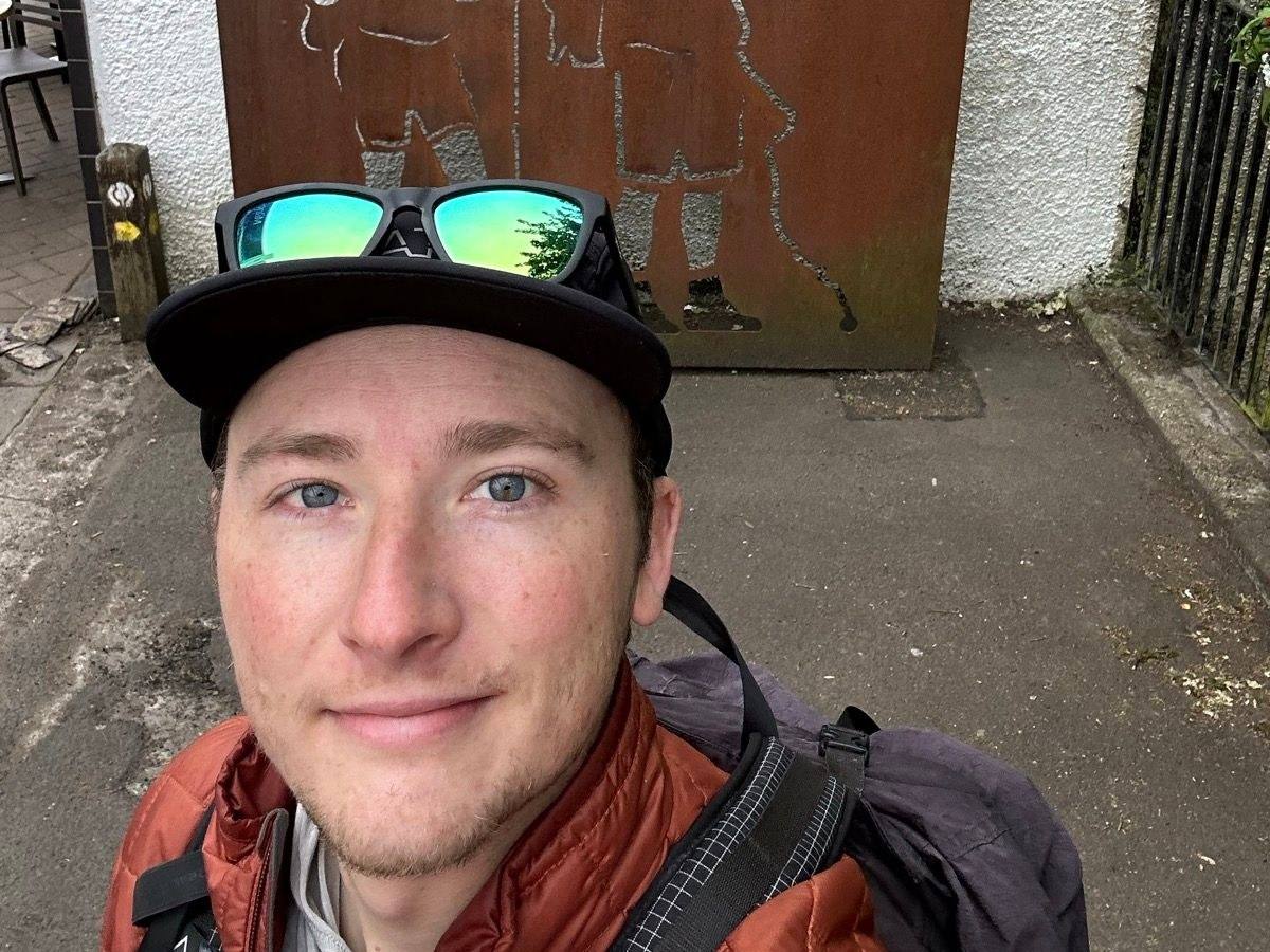
Me at the start in Milngavie, the morning of Day 1.

Europe · United Kingdom

West Highland Way and Ben Nevis

Scottish Highlands, Scotland

Distance
105 mi169.5 km
Days
4 days
Elevation gain
10,144 ft3,092 m
High point
1,821 ft555 m
Season
I walked June 8 to 11, 2023, and…
Lodging
Tent
Plan this hike

Hikes / Europe / West Highland Way and Ben Nevis

In June 2023 I hiked the whole West Highland Way alone, from Milngavie, on the edge of Glasgow, to Fort William, in four days. The next morning I climbed Ben Nevis, the highest mountain in the UK, by the Carn Mor Dearg Arete. It was my first time in Scotland. Scottish subscribers had been asking me to come and hike for a while. Most higher trails in Europe and North America were still under snow, so after four days in Switzerland, early June seemed like a nice time.

Kraig Adams

Effort at this pace: Very hard · about 26 mi (42 km) and 2,536 ft (773 m) of climbing a day over 4 days, up to 1,821 ft (555 m). Our grade for the days given, worked out from distance, climbing and altitude a day; it isn't the trail's usual difficulty rating (under Basics) and doesn't rate exposure, terrain or weather.

Where these numbers come from

From Kraig Adams's GPS recording and guide.

Plan this hikeSave this hike

Plan: dates, gear, deadlines and stays in a private link. Save: keeps it on your account.

From Kraig Adams's GPS

The route, day by day

Relief map of the West Highland Way route: 5 days drawn in red with numbered day starts, labelled Milngavie, Ben Nevis, Inversnaid and Bridge of Orchy.

Elevation20–1,821 ft106 mi

From Kraig Adams's GPS. Terrain: Mapzen Terrain Tiles (EU-DEM, SRTM) on AWS · Rivers & lakes © OpenStreetMap contributors

Tap a day for his map of it

  • Read day 1
  • Read day 2
  • Read day 3
  • Read day 4
  • Read day 5

The film

Watch it first

Hiking 100 miles on the West Highland Way in Scotland

Kraig Adams · Jun 2023 · Solo

Me at the start in Milngavie, the morning of Day 1.
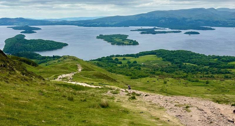
Loch Lomond and its islands from the path over Conic Hill, Day 1.
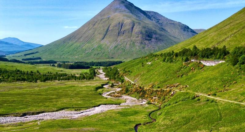
Beinn Dorain above the valley on Day 2.
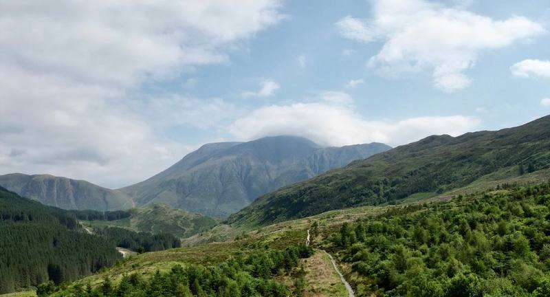
The Way through the forest above Glen Nevis, Day 4.
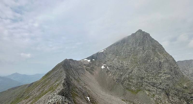
On the Carn Mor Dearg Arete, Day 5.

Before you go

The basics

Start
Milngavie, a town on the northern edge of Glasgow, about 25 minutes by train from the city centre
Finish
Gordon Square, Fort William, at the west end of the High Street
Direction
South to north, the usual way: the easier stages come first
Usual difficulty
In my words: one of my easiest long-distance hikes ever. Long, low, well marked and busy; rough underfoot along Loch Lomond; exposed on Rannoch Moor
Best time
I walked June 8 to 11, 2023, and climbed Ben Nevis on June 12
Permits
Only to camp: a Loch Lomond camping permit (£4.50 a tent a night, 2026) to camp in the Camping Management Zones, March 1 to September 30
Getting there
To Glasgow. Glasgow Airport is the nearest. The Glasgow Airport Express, bus 500, runs to the city centre (Buchanan Bus Station, Queen Street and Central stations) 24 hours a day, every 10 minutes at busy times, in about 15 minutes. Since September 7, 2026, it has been covered by Scotland's £2 bus fare cap, cash or contactless on the bus. If you're from the US, you need a UK Electronic Travel Authorisation (ETA) before you fly: £20 in 2026, from the official UK ETA app or gov.uk/eta, valid for two years.
Lodging
Tent

From Kraig Adams's guide

Costs and gear

What it cost

Not given

His costs, line by line

What Kraig carried

a small green tent · a mosquito head net · Brooks trail runners · Shokz OpenFit · a black backpack, a cap and a light sun hoodie · NEMO Hornet Elite OSMO 1P · Hyperlite Mountain Gear Waypoint 35 · PATH Projects Pyrenees T19 Hoodie and 12 more.

The full gear list

From Kraig Adams's guide

Safety

Rescue numbers

  • In an emergency call 999 or 112 and ask for Police, then Mountain Rescue. Have ready where you are (a grid reference and a named landmark), who's hurt and how, and your phone numbers. Register for emergency texts before you go: text the word "register" to 999 and follow the reply. The distress signal is six whistle blasts or torch flashes a minute.

Phone signal

Not given

Insurance

  • NHS Scotland can charge overseas visitors for hospital treatment.
  • Get health travel insurance that covers your whole stay, and repatriation.

Bail-out points

  • Day 1, Milngavie to Inversnaid. Milngavie has trains back to Glasgow. Drymen and Balmaha are on roads; check traveline.info for buses. At Rowardennan the road ends; a waterbus crosses to Tarbet, but only on some days in summer (Fridays and Saturdays, May 2 to September 27, in 2026). From Inversnaid the Cruise Loch Lomond waterbus crosses to Tarbet (March 27 to November 1, 2026), where there are trains and Citylink buses.
  • Day 2, Inversnaid to Bridge of Orchy. At the head of the loch, the Ardlui Hotel runs a small ferry from Ardleish across to Ardlui, which has a station (you raise a signal ball to call the boat; it runs about hourly in the daytime, and its 2026 timetable ends in late October). Inverarnan, Crianlarich, Tyndrum and Bridge of Orchy are all on the Citylink coach route between Glasgow and Fort William, and Crianlarich, Upper Tyndrum and Bridge of Orchy have stations on the West Highland Line.
  • Day 3, Bridge of Orchy to Kinlochleven. After Inveroran there's nothing for about 9 miles across Rannoch Moor. The Citylink coach stops at the Glencoe Ski Centre road end, near the Kingshouse Hotel. From Kinlochleven, Shiel Buses route 44 runs to Fort William in about 55 minutes, several times a day.
  • Day 4, Kinlochleven to Fort William. There's no road between Kinlochleven and Glen Nevis. For the first few miles, turning back to Kinlochleven is quickest; after the Lairigmor, keep going. From the Ben Nevis Visitor Centre it's about 3 miles by road into Fort William.
  • Day 5, Ben Nevis by the Carn Mor Dearg Arete. On the Carn Mor Dearg Arete the safe way off is to go back or go on: the sides are steep. From the summit of Ben Nevis the way down is the Mountain Track. In cloud, the summit plateau is dangerous: the path passes close to the tops of steep gullies on the north face. Mountaineering Scotland's advice for poor visibility: from the summit, walk 150 m on a grid bearing of 231 degrees, then follow 282 degrees to reach the zigzags.

From Kraig Adams's guide. For planning, not navigation: check before you go.

Their films and versions

Creators who've done it

1 creator so far: Kraig, 4 days, tent.

Walked West Highland Way and Ben Nevis? Be the first to share your track: log it with your GPX.

Your time

Sign in and log a few hikes to see how long this one would take you.

Typical: 4 days (the hike's facts).

Ask this hike

Planning questions about West Highland Way and Ben Nevis, answered only from this page's facts, the creators' versions and hikers' public tracks, with where each answer comes from. When the data doesn't say, the answer says "not given".

    From hikers

    Comments

    Sign in to comment. Free; your hikes stay private unless you share them.

    Answered from the data

    Questions people ask

    How many days do you need for West Highland Way and Ben Nevis?

    The official site says most people take six to seven days, and its suggested itineraries run from five to seven. I hiked it alone in four days in June 2023: 37, 29, 22 and 17 miles. Unless you're a fast, fit hiker who wants long days, plan six to eight.

    From Kraig Adams's trip and guide.

    How much does West Highland Way and Ben Nevis cost?

    My records don't show what I spent on this trip. For 2026: a Loch Lomond camping permit is £4.50 a tent a night, a tent pitch at Glen Nevis £13.50 to £17 a person, baggage transfer £80 a bag, and a UK Electronic Travel Authorisation (for US citizens) £20.

    From Kraig Adams's trip and guide.

    When is the best time to hike West Highland Way and Ben Nevis?

    The official site says May is the most popular month. I went in early June and had hot, sunny weather and bad midges. Looking back, I'd go a little earlier. See When to go.

    From Kraig Adams's trip and guide.

    How hard is the West Highland Way?

    For me it was one of my easiest long-distance hikes: close to sea level, very well marked, with little climbing for its distance. The highest point is the top of the Devil's Staircase, 1,821 ft (555 m) on my GPS. What makes it hard is the distance, the rough lochside path north of Rowardennan, the open moor and the weather.

    From Kraig Adams's trip and guide.

    Can you wild camp on the West Highland Way?

    Outside the Loch Lomond camping zones, yes, under the Scottish Outdoor Access Code. On the east shore of Loch Lomond, from March 1 to September 30, you may only camp in a campsite or with a camping permit: £4.50 per tent per night in 2026, booked online up to four weeks ahead.

    From Kraig Adams's trip and guide.

    Are the midges bad on the West Highland Way?

    They can be. Midges are out from about May to October, worst in midsummer, early and late in the day and on calm, overcast days. In early June 2023 I had the worst bug experience of my life packing up my tent one morning, though during the day the sun and wind kept them away. Bring a proper midge head net.

    From Kraig Adams's trip and guide.

    Can someone carry your bag on the West Highland Way?

    Yes. Travel-Lite and AMS Scotland move bags between your nights for the whole Way: £80 a bag in 2026, from March 21 to October 18. I carried everything myself.

    From Kraig Adams's trip and guide.

    Can you climb Ben Nevis after the West Highland Way?

    Yes, straight from Fort William. The Mountain Track from Glen Nevis is the ordinary way, 6 to 9 hours up and down. The morning after I finished, I went up by the Carn Mor Dearg Arete, a longer route with an easy scramble: 17.5 miles and about 4,930 ft of climbing my way.

    From Kraig Adams's trip and guide.

    Plan this hikeThe route