Content made there
The film is at the top of this page.
Photos
Hikes / Trans-Catalina Trail / Kraig Adams's version
North America · United States
Jul 2020 · 2 days · about 42 miles · Solo · Tent

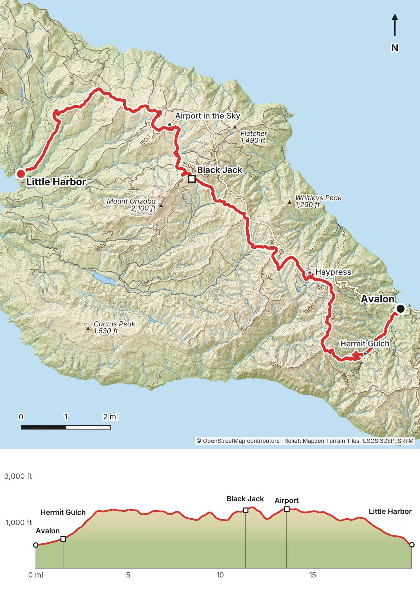
In July 2020 I hiked the Trans-Catalina Trail across Santa Catalina Island, off the coast of Southern California, in two days. I took the ferry to Avalon, walked up to Hermit Gulch, where the trail starts, and crossed the island's dry interior past Black Jack and the Airport in the Sky to a night at Little Harbor Campground, on the beach. The next day I went over the hills to Two Harbors, up the Silver Peak Trail along the island's west end, down to Parsons Landing, and back along the coast road to a night at the Banning House Lodge above Two Harbors. Two days, about 42 miles by my GPS. It's the trip from my film Hiking the Trans-Catalina Trail in California.
It was kind of a weird hike. It was a desert island with no running water, no rivers, no streams. It was very hot, with a lot of direct sunlight, but the sea fog would roll in over the hills every morning and sometimes in the evening. A lot of the campsites were full with car campers and bikepackers, but no one else was hiking the trail: I didn't see a single other hiker. I'm glad I did it, to say that I did it and to know what it's like.
| Quick facts | |
|---|---|
| Distance | 42.2 miles (67.9 km) by my GPS. My film says 40; the official trail is 38.5 |
| Climbing | About 7,530 ft (2,290 m) up and 7,390 ft (2,250 m) down |
| Days | 2: 20.4 miles on Day 1, 21.9 on Day 2 |
| Start | Avalon. The trail starts at Hermit Gulch Campground, 1.5 miles up the canyon |
| Finish | Two Harbors, with its boat to San Pedro |
| When | I went July 28 and 29, 2020 |
| Difficulty | Long climbs and descents on dirt roads and steep trail, with almost no shade. Heat and water are the hard part |
| Permits | A free hiking permit, and a booked campsite for every night |
| Day | Route | Miles (km) | Up / down (ft) | Sleep |
|---|---|---|---|---|
| 1 | Avalon to Little Harbor | 20.4 (32.8) | 3,637 / 3,612 | Little Harbor Campground |
| 2 | Little Harbor to Two Harbors by way of Parsons Landing | 21.9 (35.2) | 3,888 / 3,780 | Banning House Lodge |
Distances and climbing are from my GPS (see Using the GPX files), with the walk to the trailhead, a side trip to the airport and the climb to my lodge.
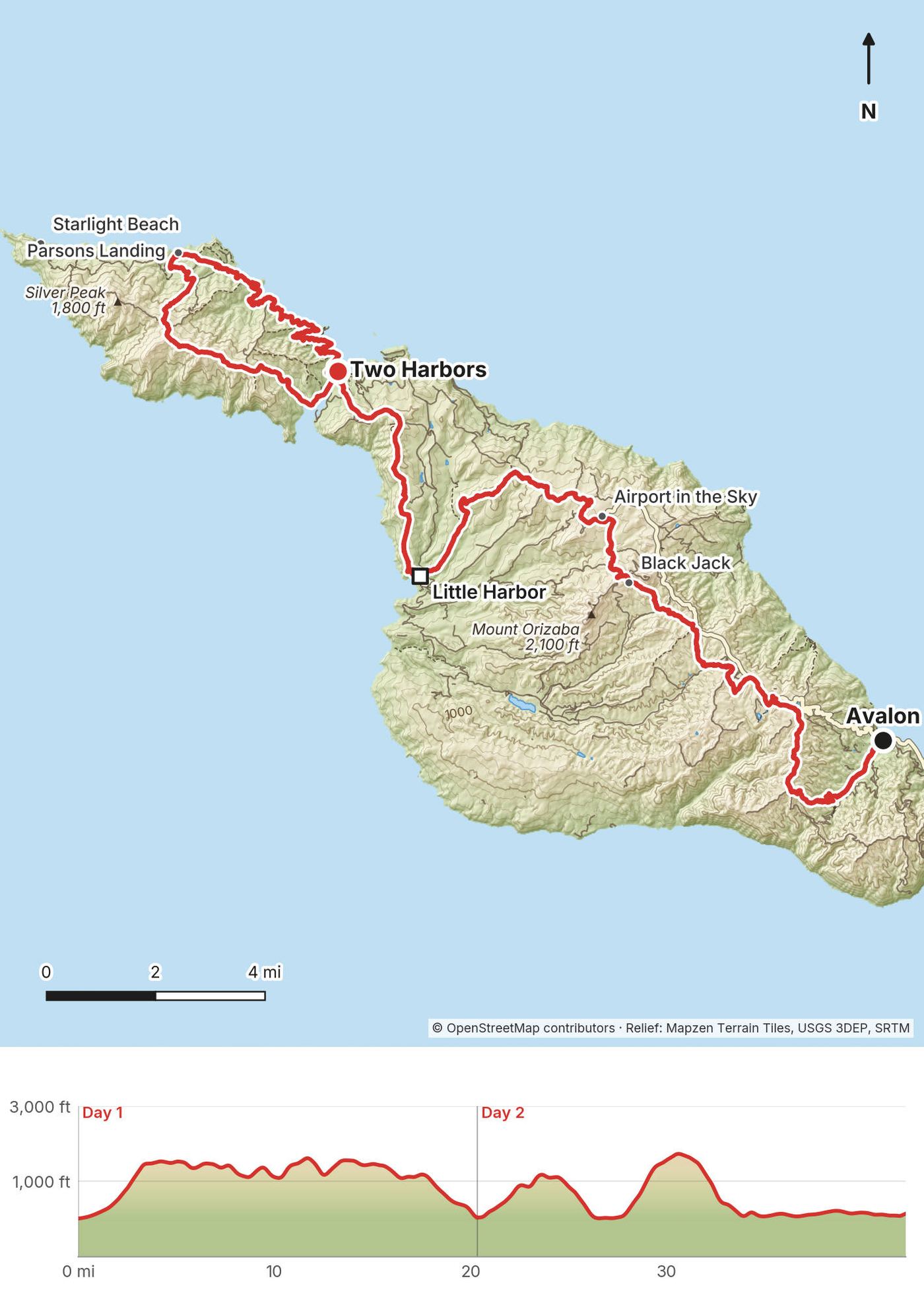
My way in, 2020. I flew into Los Angeles (LAX), took an Uber down to Long Beach and spent the night. Early the next morning I dropped my bag off at a hotel there that I'd been to before: I'd booked my after-the-hike room there, so they let me store my duffel bag for a couple of extra days. At seven I boarded the ferry and headed over to Avalon, the main town on the island. You should spend some time there if you can. It's a little pricey, but very cool and unique. A lot of people have golf carts; it's a thing. At the end I took the ferry from Two Harbors to San Pedro and went back to the hotel to grab my bag.
The boats (2026). Catalina Express runs from San Pedro, Long Beach and Dana Point to Avalon, and it's the only boat between the mainland and Two Harbors, which it serves only from San Pedro. So the easy plan is out of San Pedro to Avalon and back from Two Harbors to San Pedro: you park once. If you sail from Long Beach, plan on a taxi or rideshare back from San Pedro at the end. The crossings take about 1 hour from Long Beach, 1 hour 15 minutes from San Pedro to Avalon or to Two Harbors, and 1 hour 30 minutes from Dana Point; boats from Two Harbors that stop in Avalon take about 2 hours 30 minutes.
Parking (2026). San Pedro (Catalina Sea and Air Terminal, Berth 95): $23 a day. Long Beach (Catalina Landing): $26.95 a day. Dana Point: $24 a day, on level 3 of the harbor parking structure only.
Avalon to the trailhead. The trail starts at the back of Hermit Gulch Campground, at the top of Avalon Canyon Road: 1.5 miles from the waterfront by my GPS, mostly uphill along the road. Avalon's on-demand shuttle, COAST, runs anywhere within the city limits from 7 a.m. to 9 p.m., from $2, and Hermit Gulch Campground is inside the city limits.
Stove fuel. Buy it on the island. The Two Harbors General Store lists MSR IsoPro canisters, but that's near the end. In Avalon, hikers report canisters at Chet's Hardware (117 Catalina Avenue, 310-510-0990); call ahead. I didn't carry a stove.
Shuttles on the island (2026). The old Safari Bus no longer runs. The Conservancy's Wildlands Express (book ahead) runs from Avalon to the Airport in the Sky and from the Airport to Little Harbor, with a stop at Black Jack Junction: $27.16 a leg, one backpack on your lap or at your feet. Nothing runs by road to Two Harbors except private shuttles (from $320 a vehicle from Avalon). Between Two Harbors and Avalon, the Cyclone boat ($29) runs only from May to early October.
Two Harbors is going cashless. The Catalina Island Company's businesses there, the boat ticket window included, are moving to cards and phone payments only. There's a cash-to-card kiosk outside the General Store.
My film puts the trip at about $500 to $550, very expensive compared to most hikes. If you just get rid of the hotel, you could probably do this hike for $150, with just the campsite and groceries.
| Item (2020) | What I paid |
|---|---|
| Round-trip ferry tickets | $80 |
| My campsite at Little Harbor | $35 |
| The Banning House Lodge, one night | $300 |
| Restaurants and trail snacks | $120 |
| Total | $535 |
For your budget (prices posted in 2026). Catalina Express, adult: $44.50 each way online, plus taxes and fees (round trips $103 to Avalon and $101 to Two Harbors, wharfage included). Parking at San Pedro $23 a day. Campsites: per person, per night, dynamic, plus a $9.25 reservation fee. Parsons Landing locker $27. Wildlands Express $27.16 a leg. Cyclone boat $29. The hiking permit is free.
| Night | Where | Height |
|---|---|---|
| Before the hike | In Long Beach | |
| 1 | Little Harbor Campground, in my tent | Sea level |
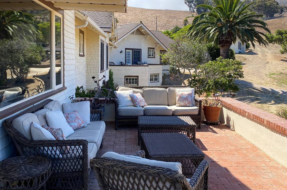
| 2 | The Banning House Lodge, Two Harbors | About 160 ft |
| After the hike | My hotel in Long Beach |
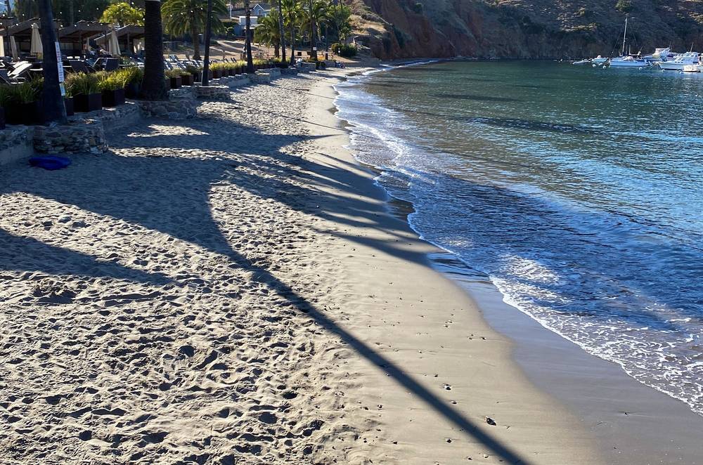
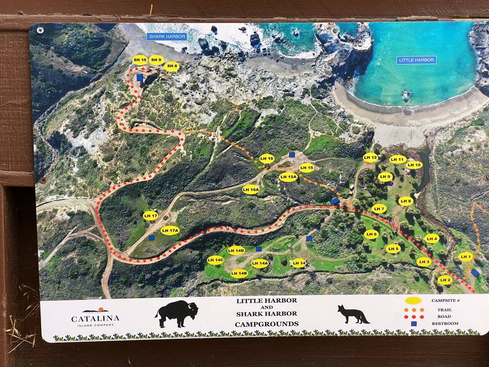
Little Harbor Campground. A sandy beach campground on the island's back side, the only campground there. My site had a shade shelter and a concrete fire ring. Water, toilets and a cold outdoor shower; a live-in ranger in summer. Shark Harbor, the next beach south, has sites too.
The Banning House Lodge. Built in 1910 as the Banning brothers' summer home, on the hill above Two Harbors, and run by the Catalina Island Company. It has 12 rooms with their own bathrooms, a continental breakfast, and a wine and cheese hour from 5 to 6 p.m. with two glasses of wine per guest. A shuttle runs between the lodge and the village from 8 a.m. to 8 p.m. The lodge's prices are on its booking page.
I didn't bring my Jetboil Mini, no camping stove on this trip, just because it was two days and I knew there were options to buy hot food. A bit lighter pack without that stuff. I brought the usual snacks: cashews, an orange, Meal2Go bars and a sausage, which I cooked over the fire at Little Harbor. At the Airport I had a burger. At the Banning House I had wine and cheese.
Where to buy food (2026). The only meals for sale on the trail are at the Airport in the Sky Restaurant (breakfast and lunch, 8:30 a.m. to 4 p.m. daily) and in Two Harbors: the General Store (9 a.m. to 6 p.m., to 7 p.m. on Fridays and Saturdays), the West End Galley (breakfast and lunch) and the Harbor Reef Restaurant (dinner from 5 p.m.). The Catalina Island Company delivers groceries to Little Harbor ($53.50) and Two Harbors ($48) campsites. Avalon has restaurants and shops.
There's no running water on the island; I was entirely dependent on the taps along the trail, mostly at the campgrounds. I had only my one-liter filter bottle and ran out on the west end on Day 2. Bring more than one liter.
The taps (Conservancy's miles). Hermit Gulch Campground; Haypress Reservoir (5.6), the first water after Avalon; Black Jack Campground (10.7); the Airport (12.75); Little Harbor Campground (18.9); Two Harbors (24.2). None between Two Harbors and Parsons Landing, none at Parsons Landing (buy the locker), and none on the West End Road back.
How much to carry. The Conservancy says to be able to carry 3 liters, and in its newer guidance about a gallon per person for a full day of hiking. Most of the island's streams dry up by May, and natural water isn't safe to drink.
Paid links: I earn a commission if you buy through these links, at no extra cost to you. As an Amazon Associate I earn from qualifying purchases.
I carried everything for two days in my backpack in 2020, with my tent and sleeping bag, and no stove. Here's my kit from the film's gear list, what I'd take now, and what I filmed with.
From my film's original gear list.
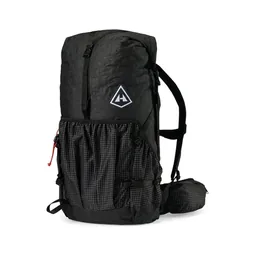 Pack: Hyperlite Mountain Gear Southwest 2400 (Hyperlite)
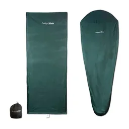 Liner: Outdoor Vitals Sleeping Bag Liner (Amazon)
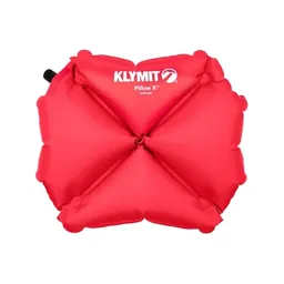 Pillow: Klymit Pillow X (Amazon)
 Water: Katadyn BeFree AC · 1L (Amazon). A one-liter filter bottle, which I absolutely love: it's collapsible, it doesn't break like the water bladders I've had before, and it filters the water.
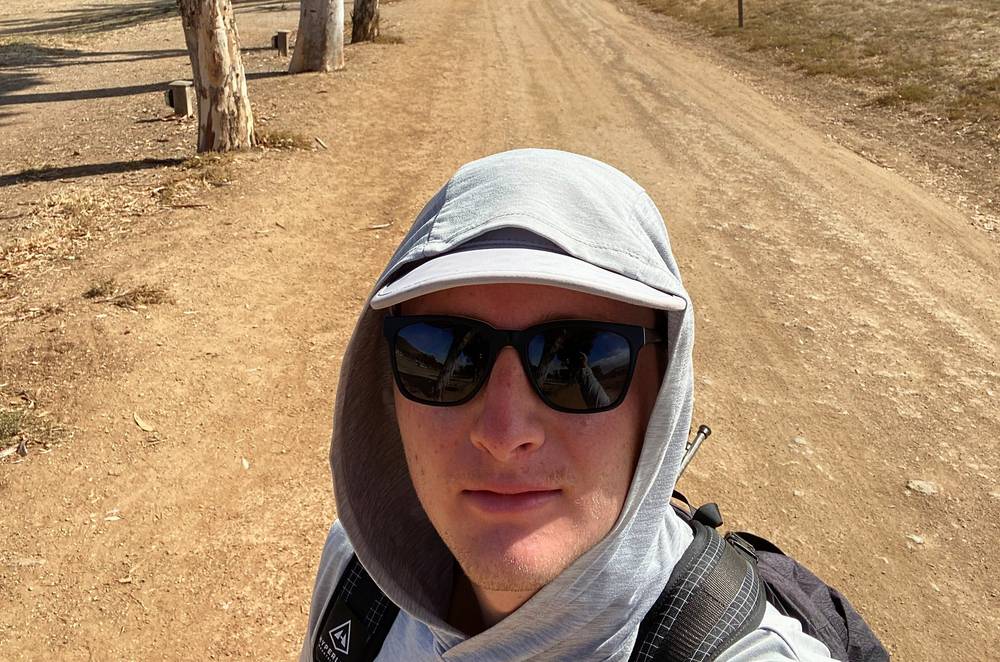
 Sun hoodie: Amazon Essentials Quick-Dry Tech Hoodie (Amazon). I didn't use any sunscreen, because that's not my thing; I like to cover up with my long-sleeve hoodie, and I definitely needed it. I still got a little sunburned on my chin and the backs of my calves.
 Sunglasses: Warby Parker Barkley sunglasses. Similar: Goodr OG Sunglasses (Amazon).
 Rain shell: The North Face Dryzzle jacket. Similar: Arc’teryx Beta AR Jacket (Arc’teryx).
 Puffy: Patagonia Nano Puff Jacket. Similar: Arc’teryx Cerium Hoody (Arc’teryx).
 Pants: Patagonia Terrebonne Joggers. Similar: PATH Projects Killam PX Pant (PATH Projects).
What I'd add for this route from my current kit.
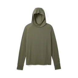 Sun hoodie: PATH Projects Pyrenees T19 Hoodie (PATH Projects). Cover your arms: there's almost no shade.
 Cap: PATH Projects Muir Cap 2.0 (PATH Projects)
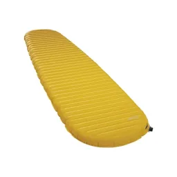 Sleeping pad: Therm-a-Rest NeoAir XLite NXT (Amazon)
 Poles: Black Diamond Alpine Carbon Z Poles (Amazon). For the steep dirt trails.
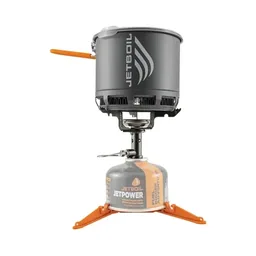 Stove: Jetboil Stash (Amazon). If you cook, buy fuel on the island.
What I filmed this trip with in 2020. My setup is much smaller now (below). Drones are banned on Conservancy land without written permission: see Permits, campgrounds and rules.
 Mic: Rode VideoMic NTG (Amazon)
 Tripod head: Joby ball head (Amazon)
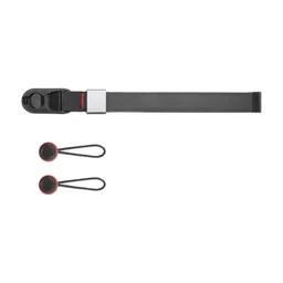 Wrist strap: Peak Design Cuff Wrist Strap (Amazon)
 Drone: DJI Mavic Air 2. With six batteries, of which I used three. Similar: DJI Mini 5 Pro (Amazon).
Since September 2026 I film with a smaller setup: the Pocket 4 and the Mic 3 on the trail, and the Mini 5 Pro in the air.
 Camera: DJI Osmo Pocket 4 (Amazon)
 Mic: DJI Mic 3 · 1 TX + 1 RX (Amazon). It pairs with the Pocket 4.Drone: DJI Mini 5 Pro (Amazon)
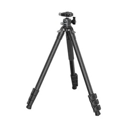 Tripod: SmallRig Carbon Fiber Tripod (Amazon)
I came over on the morning ferry and started walking from the Avalon waterfront at 8:49. Hermit Gulch Campground, at the top of the canyon road, is the official start; from there the trail climbs out of the canyon. There were distractions everywhere on this hike: telephone poles, power lines, roads, fences, cell towers, just stuff. Maybe because there were no trees to hide it.
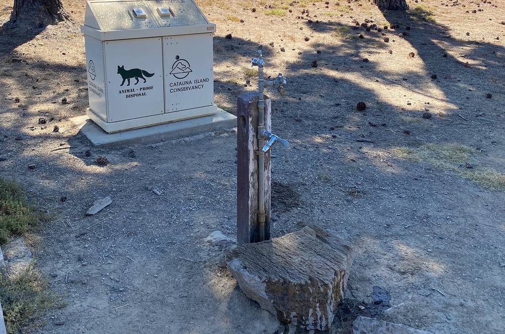
There's no running water on the island, so I was entirely dependent on the water taps along the trail, mostly at campsites. I filled up at the tap by Haypress Reservoir. I passed Black Jack around lunchtime and kept going: Black Jack Campground is something I skipped, for a good reason. There was no one there, and it's kind of a crappy campsite. If you can push through, do the extra miles to Little Harbor.
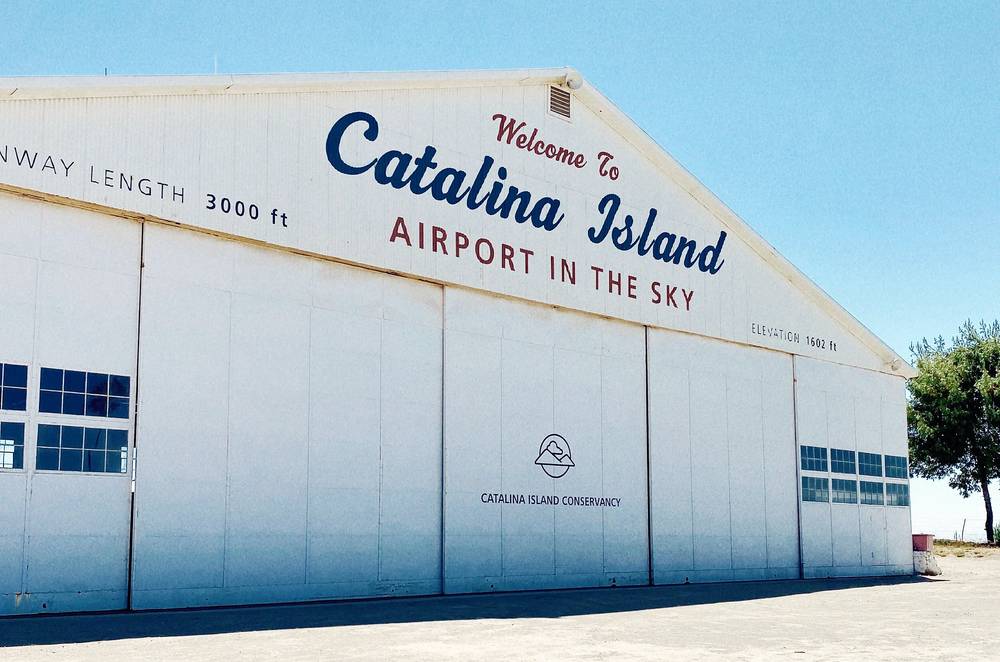
The little airport was actually kind of nice. At the grill I got a burger and got to talk to some pilots, and it's just right off the trail, so make sure to stop.
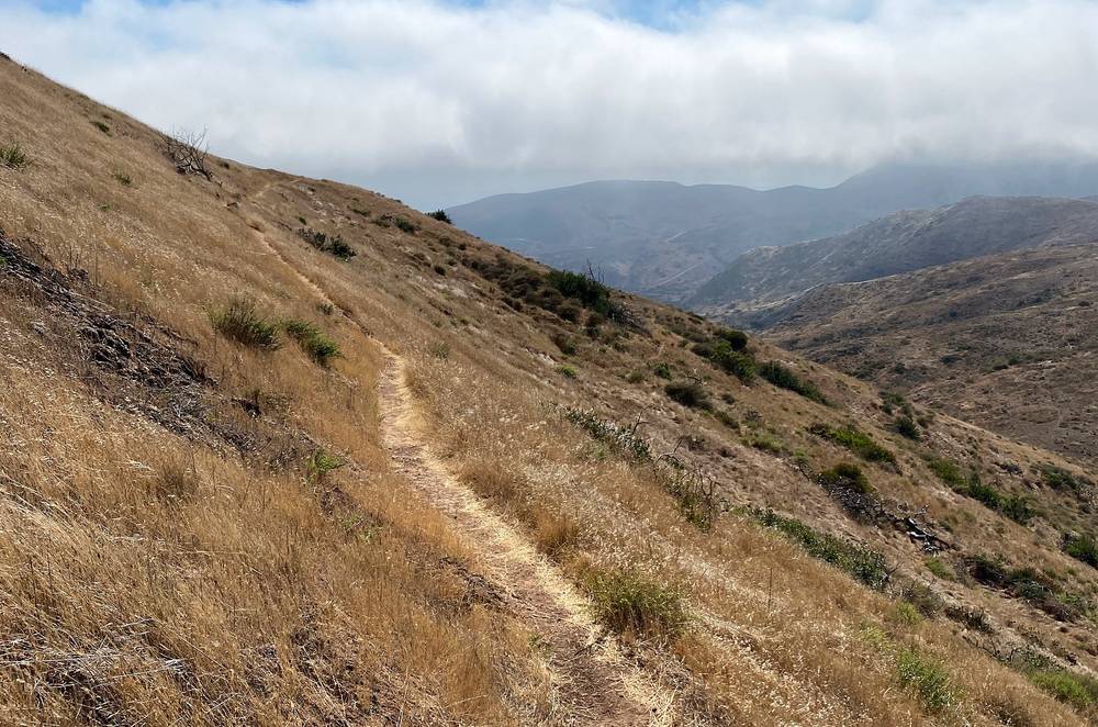
I reached Little Harbor at 5:45. There's a beach, and it's just much nicer. I set up my tent under the shade shelter at my site and made a fire in the fire ring. I'd brought a sausage I didn't plan on cooking over an open fire, but that was awesome: it tasted great, and it was really fun to cook. At night I charged my iPhone from my used drone batteries and went through my footage.
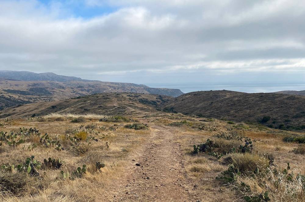
Avalon to Hermit Gulch. From the waterfront I walked through town and up Avalon Canyon Road to Hermit Gulch Campground (about 280 ft) at mile 1.5. The trail starts at the back of the campground.
The Hermit Gulch Trail. The first big climb: about 1,160 ft (354 m) up in 1.8 miles of singletrack, out of the canyon to Divide Road at about 1,475 ft (mile 3.3). The Conservancy lists a sun shelter and a toilet near the top.
Divide Road to Haypress. The trail follows the dirt road along the ridge for 1.8 miles, then drops to Haypress Reservoir (mile 5.9): a water tap, toilets and picnic tables, the first water after Avalon.
Haypress to Black Jack. About 5.5 rolling miles across the island's interior, crossing Airport Road, Renton Pass Road and Middle Ranch Road (mile 8.3), down to about 1,070 ft at Upper Cape Reservoir Road (mile 10.1), then up to Black Jack Campground (1,600 ft, mile 11.3): water, toilets, a cold outdoor shower. On the Conservancy's 2026 map, the trail from about Middle Ranch Road to Black Jack is inside its night closure area.
Black Jack to the Airport. Up past the campground to the day's high point (1,660 ft by my GPS, mile 11.8) on Cape Canyon Road, down to about 1,100 ft, and back up to the Airport in the Sky (1,602 ft, mile 13.6). The restaurant, water and toilets are at the terminal building, a short walk off the trail. The restaurant was open daily from 8:30 a.m. to 4 p.m. in 2026.
The Airport to Little Harbor. From the airport the trail, then Empire Landing Road, heads west for about 2.3 miles. Then the Big Springs Ridge Trail runs about 4 miles down the ridge to the coast, losing about 1,200 ft, to Little Harbor Campground (mile 20.3). The Conservancy lists a sun shelter on the way.
From Black Jack Junction and the Airport, the Conservancy's Wildlands Express goes back to Avalon (book ahead), and taxis come up from Avalon. Before Haypress, walk back down to Avalon. From Little Harbor the Wildlands Express runs to the Airport and on to Avalon only with a reservation, once or twice a day. In an emergency call 911.
Film, Day 1 · My talk about the trip after the hike
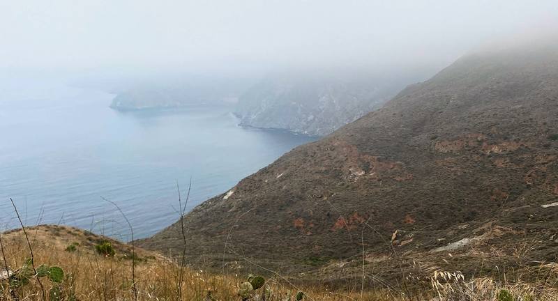
I started out of Little Harbor very early, at 6:48, and the sea fog was still rolling through, so it was very foggy up on the ridges. That area was still very beautiful and very isolated. Once again I didn't see anyone on the trail; just me out there hiking, and some deer running up the hill. Honestly, the trail after Little Harbor is much better than the first half. Things get better as you go, getting toward Two Harbors.
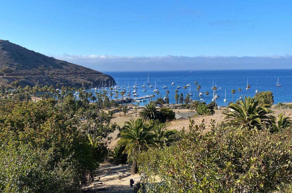
Eventually you get to Two Harbors. It's a lovely little town: there's a hotel, a restaurant, people renting out paddleboards and bikes, and a general store where you can get food. The town has Wi-Fi, and LTE worked for me. I stopped there for about half an hour before heading out on the last section, around the west end and back.
Bring extra water for that section, from Two Harbors back to Two Harbors, because there was barely any water, especially high up. All I had was one liter, and I was definitely without water for a couple of miles in the hot sun up there. Bring more than one liter: that's what I'm suggesting.
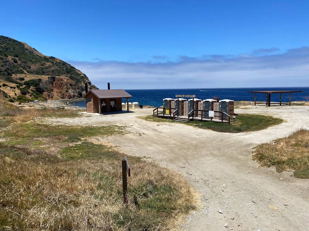
From the ridge I came down to the beach at Parsons Landing and walked back along the coast road to Two Harbors, then up to the Banning House Lodge. It was very expensive, but treat yourself, am I right? Staying at the lodge was definitely extra. It was fancy, and I wanted to treat myself a little bit. I made friends with some older couples staying there, sipping wine and eating cheese. At night a fox showed up and was just barking at us, and eventually it jumped up on the table looking for scraps. It was very cute, very nice to see a fox.
Little Harbor to Two Harbors. From the campground the trail climbs Lower Jensen Hunting Road, about 880 ft in 2 miles, then follows the hills north to Banning House Road (about 1,135 ft, mile 4.1) and drops about 1,100 ft down it into Two Harbors (mile 6.2). The Conservancy says there's only one shade shelter between Little Harbor and Two Harbors, and no water until Two Harbors.
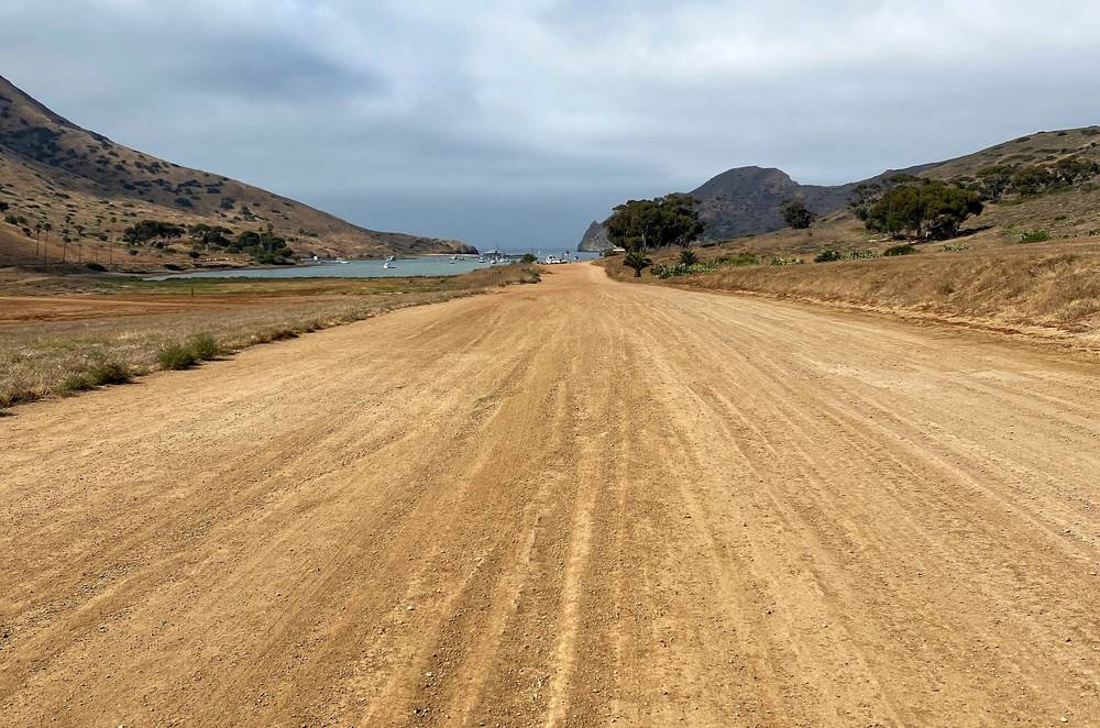
Two Harbors. The village on the island's narrow isthmus: the boat pier, the General Store, the Harbor Reef Restaurant, showers, lockers and Two Harbors Visitor Services (Parsons Landing lockers, gear haul, boat tickets). Fill up with all the water you'll need to Parsons Landing and back: there's none on the way.
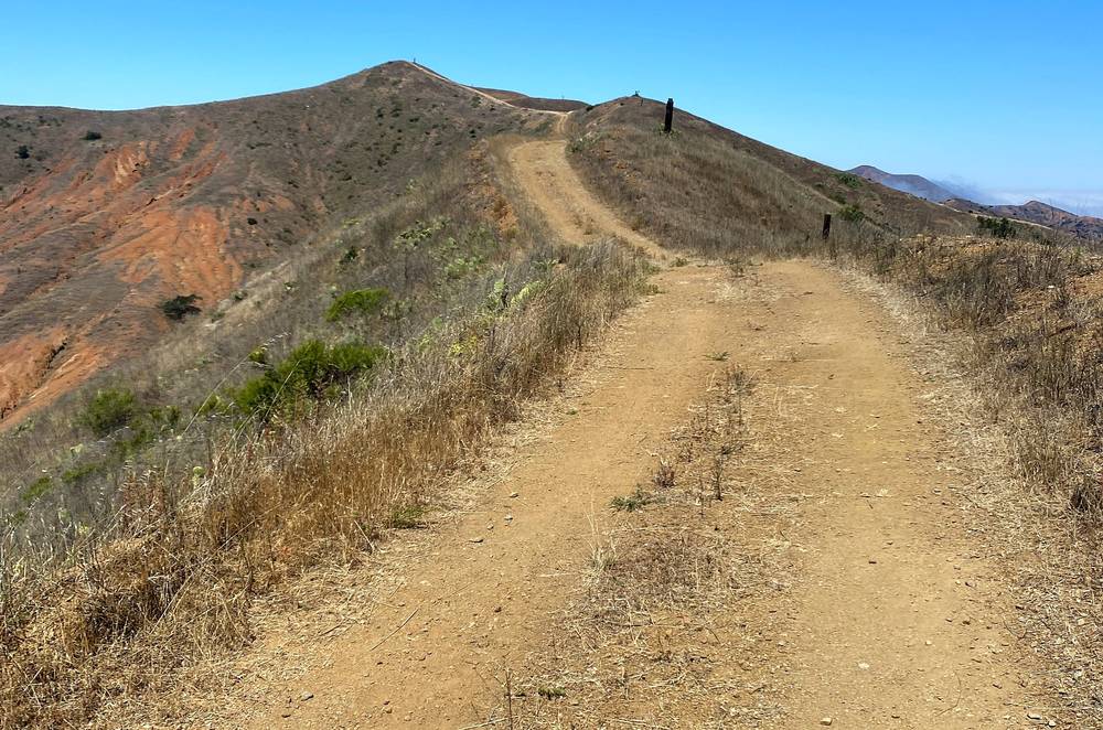
The Silver Peak Trail. From the village the route crosses the isthmus to Catalina Harbor (mile 6.6), follows its shore, then climbs the Silver Peak Trail, a dirt road, about 1,400 ft in 1.8 miles to the ridge of the island's west end. The road rolls along the ridge to the day's high point (1,765 ft, mile 10.1) and on to the Fenceline Road junction (about 1,530 ft, mile 11.2). Silver Peak itself (1,804 ft) is about a mile farther west along the ridge, off the official route. The Conservancy lists a few sun shelters between Two Harbors and Parsons Landing.
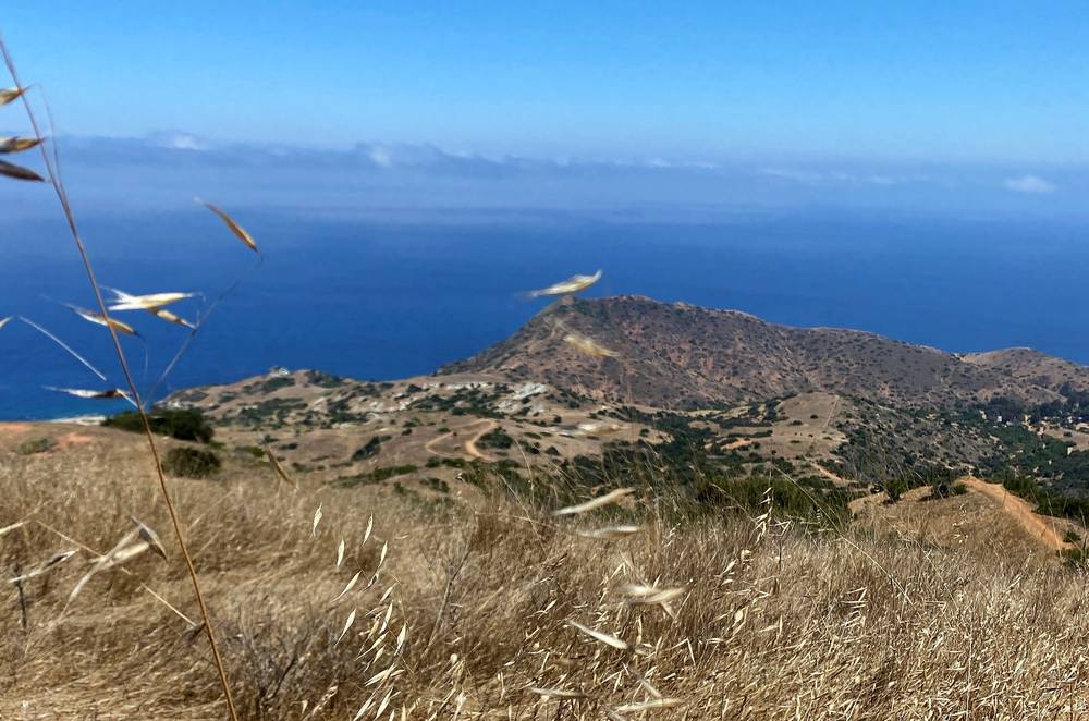
Down to Parsons Landing. Fenceline Road drops steeply, about 1,120 ft in 1.6 miles, to the West End Road, which leads down to Parsons Landing (mile 13.6): eight primitive campsites on the beach, a pit toilet and the lockers, and no running water.
Back along the West End Road. A short stretch of trail climbs above the road east of Parsons Landing, then the dirt road follows the coast about 7 miles back to Two Harbors, between sea level and about 200 ft, past coves full of anchored boats. The Conservancy lists a toilet and a shade structure at Lion Head (my mile 18.6). The road reaches Two Harbors at mile 21.0. I went on up Banning House Road to the lodge (mile 21.9).
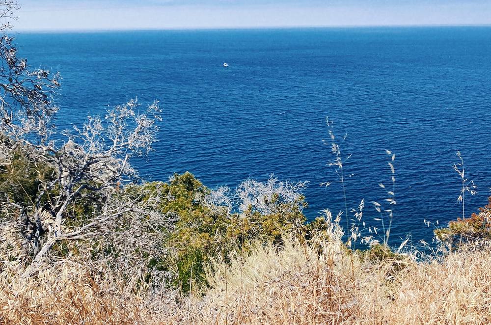
The only way off the west end is back to Two Harbors: the West End Road is the easier way to Parsons Landing and back, and the Catalina Island Company calls the coastal route fairly flat. From Two Harbors, Catalina Express goes to San Pedro, and from May to early October the Cyclone goes to Avalon. Between Little Harbor and Two Harbors, the shortest way out is on to Two Harbors. In an emergency call 911.
Film, Day 2 · My talk about the trip after the hike
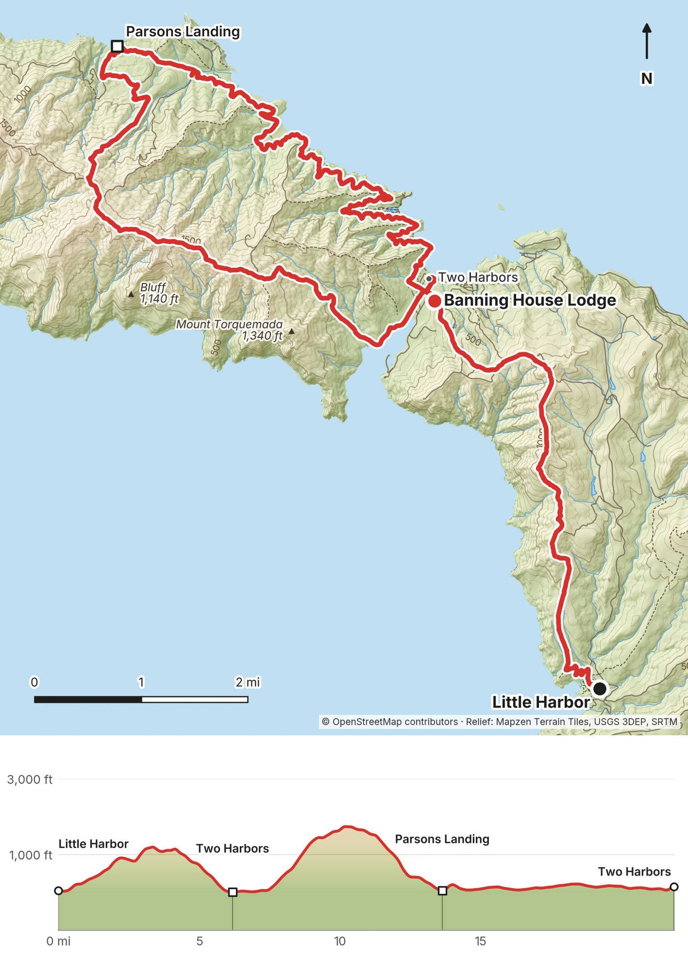
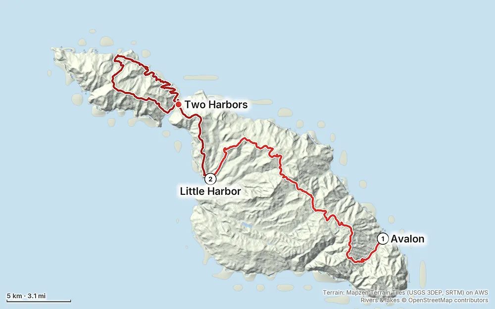
Elevation7–1,765 ft42.2 mi
Terrain: Mapzen Terrain Tiles (USGS 3DEP, SRTM) on AWS · Rivers & lakes © OpenStreetMap contributors
Tap a map to open it full size.
Checked on the official pages on October 1, 2026.
Open. No closure, fire damage or reroute is posted on the trail, and the Conservancy's fire danger was LOW. Its last storm notice, in January 2026, closed roads but not the hiking trails.
Closed at night near Black Jack (through October 2026). The Conservancy is removing the island's mule deer. Through October 2026, hiking in its area around Middle Ranch, "including portions of the Trans-Catalina Trail," is suspended from 90 minutes before sunset to 90 minutes after sunrise (on October 1, 5:07 p.m. to 8:17 a.m.). In those hours use the main roads (Airport, El Rancho Escondido and Middle Ranch Roads), and stay off its four-wheel-drive roads. Black Jack Campground stays open, and daytime hiking isn't affected. The work is permitted to January 2036, so expect more notices like this in 2027.
Deer hunting (fall 2026). From October 24 to December 18, 2026, island residents may hunt deer in daylight, in zones that rotate around Conservancy land. The Conservancy says it's the last recreational hunting season.
The trail now ends at Two Harbors. In the Conservancy's words, the trail "previously ended at the remote Starlight Beach before it was redirected for a more logical end in Two Harbors." It now loops from Two Harbors up the Silver Peak Trail to Parsons Landing and back on the West End Road, the way I walked on Day 2.
The permit. Still free and still required: book it by date on the Conservancy's website, or pick it up at its Trailhead visitor center in Avalon. See Permits, campgrounds and rules.
The boats. From October 20, 2026 to January 4, 2027 no boats go to or from Two Harbors on Tuesdays and Thursdays, Thanksgiving excepted. The Catalina Island Company says this happens every winter, from late October to late March; last winter it ran to March 30, 2026. The 2027 timetables weren't out yet. See Getting there.
From the pages of the Catalina Island Conservancy, which looks after the island's interior, and the Catalina Island Company, which takes the campground bookings, checked on October 1, 2026.
The hiking permit. Free and required for everyone hiking on Conservancy land, so that rangers can reach you about wildfire, damaging winds or heavy rain. Book the "Complimentary Hiking Permit" for your dates on catalinaconservancy.org, or get it in person at the Conservancy's Trailhead visitor center at 708 Crescent Avenue in Avalon (8 a.m. to 5 p.m. daily). In 2020, once I had my campsite reservation, I filled out some extra things online, and that was my permit. Today get the permit on its own, even with a campsite booked.
Booking the campgrounds. All five campgrounds on the trail are booked through the Catalina Island Company, online or by phone at 310-510-4205 (Two Harbors Visitor Services, 8 a.m. to 5 p.m. daily). Each year's dates open on January 5 at 8 a.m. Pacific time; January and February open on December 1. You can put several nights at different campgrounds in one cart. Fees are per person, per night, and change with the season: you see the price when you search your dates. A $9.25 reservation fee isn't refunded; cancel at least 14 days ahead to get the rest back. The campgrounds' minimum stay doesn't apply to Trans-Catalina hikers. Check-in is at 2 p.m. and check-out at 11 a.m., quiet hours are 10 p.m. to 9 a.m., and hammocks aren't allowed. Conservancy members get 50% off at Black Jack, Little Harbor and Parsons Landing (membership starts at $50).
The campgrounds, in trail order
| Campground | Conservancy's mile | Water | Fires | Dogs | Notes |
|---|---|---|---|---|---|
| Hermit Gulch | The trailhead, 1.5 miles from the Avalon waterfront | Yes | No | No | Coin showers, a live-in ranger, tent cabins |
| Black Jack | 10.7 | Yes | No | Yes | 1,600 ft. Toilets, a cold outdoor shower, shade from pines. The coldest camp |
| Little Harbor | 18.9 | Yes | In the rings | Yes, not at Shark Harbor | On the beach. Toilets, a cold outdoor shower, a live-in ranger in summer |
| Two Harbors | 24.2 | Yes | In the fire pits | No | About a quarter mile from the village. Cold showers, chemical toilets |
| Parsons Landing | 30.8 | No | In the rings | Yes | Eight primitive beach sites, a pit toilet. Buy a locker with water and firewood in Two Harbors |
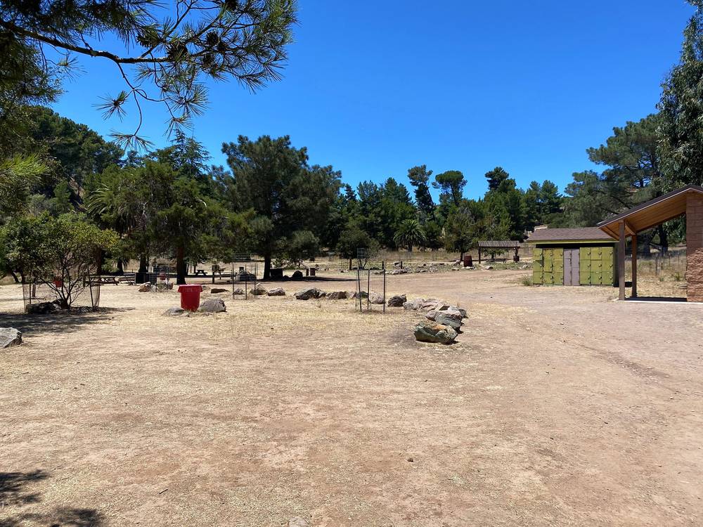
Parsons Landing locker. There's no water at Parsons Landing. Order a locker from Two Harbors Visitor Services: in 2026 it held a 2-gallon jug of water, a bundle of firewood and a fire starter for $27, and you pick up its key or code there before you hike. The Catalina Island Company recommends at least a gallon of water per person per day.
Gear haul and rentals. The Catalina Island Company hauls gear to Two Harbors ($10 round trip) and Little Harbor ($42 round trip, $21 one way), not to Black Jack or Parsons Landing. Little Harbor, Two Harbors and Hermit Gulch rent tents ($40 a night) and sleeping pads ($7), and sell firewood ($14 a bundle), 16 oz propane ($16) and sleeping bags ($60).
Fires and stoves. Campfires only in the fire rings at Little Harbor, Two Harbors and Parsons Landing; none at Hermit Gulch or Black Jack. Collecting wood, driftwood included, isn't allowed. Use a camp stove, flame low, in the campgrounds' cooking areas. All open flames are banned island-wide during Red Flag Warnings, and there's no smoking anywhere in the wildlands.
No wild camping. Camp only in a campground you've booked. Starlight Beach isn't a campground. Campsites can't be used for day use without an overnight reservation, though you can walk through a campground to reach the beach.
Wildlife. Don't feed, approach or disturb any animal. Stay at least 125 feet from bison. A sign in my film says "Do Not Feed Foxes."
Drones. Flying a drone on Conservancy land, recreational or commercial, isn't allowed without the Conservancy's written permission. I flew a drone on this trip in 2020; today you'd need that permission first.
Other rules. Stay on roads and trails open to the public, and don't hike from sundown to dawn. Hitchhiking is prohibited on Conservancy land. Bikes need a Conservancy pass and a reservation for each ride. Dogs on a leash at all times.
Late July, as I did. I went on July 28 and 29, 2020. It was hot with a lot of sun, even with the morning sea fog rolling in until around 9 a.m. On Day 2 I started very early, at like 6 or 7 a.m., and the sea fog was still rolling through, so it was very foggy up on the ridges. If I'd waited an hour or two it probably would have cleared up.
The seasons. The trail is open all year. The Conservancy calls spring and fall the most temperate months for hiking, with a chance of rain in spring. Summer has the longest days but the most heat; plan to hike earlier in the day. Winter is the rainy season: mud, and sometimes closures. Nights can drop to about 40°F, especially at Black Jack.
Average temperatures at the Airport in the Sky (NOAA, 1991 to 2020). The airport sits at 1,602 ft, near the middle of the trail and at about its height. In Avalon's older records (1909 to 1988), summer days on the waterfront ran about 5°F cooler.
| Month | High / low (°F) | Rain (in) | Days of 90°F or more |
|---|---|---|---|
| January | 62 / 50 | 3.0 | 0 |
| February | 60 / 49 | 2.8 | 0 |
| March | 61 / 49 | 1.7 | 0 |
| April | 64 / 50 | 0.8 | 0.2 |
| May | 67 / 52 | 0.4 | 0.6 |
| June | 70 / 55 | 0.2 | 1.2 |
| July | 77 / 59 | 0.1 | 2.0 |
| August | 79 / 62 | 0.0 | 3.4 |
| September | 78 / 63 | 0.1 | 4.5 |
| October | 73 / 58 | 0.5 | 1.9 |
| November | 67 / 54 | 1.0 | 0.1 |
| December | 60 / 49 | 2.2 | 0 |
Fog. Low cloud from the sea is common in late spring and early summer; Southern Californians call it May Gray and June Gloom. On my trip it rolled over the hills in the mornings and sometimes in the evenings.
Santa Ana winds. Hot, dry winds from the mainland, mostly in fall and winter and most often in December, with high fire danger and rough seas that can cancel boats.
Daylight (2027, Avalon). Mid-March: sunrise 7:04 a.m., sunset 7:01 p.m. Mid-June: 5:43 a.m. and 8:04 p.m. Mid-September: 6:37 a.m. and 7:00 p.m. Mid-December: 6:50 a.m. and 4:47 p.m. The campground rules say no hiking from sundown to dawn.
Emergencies. Call 911. Cell service is limited or missing on much of the trail, says the Conservancy, which suggests a satellite messenger; LTE worked for me in Two Harbors. Catalina Island Health in Avalon has a 24-hour emergency room (310-510-0700). Sheriff, Avalon station: 310-510-0174. Conservancy rangers: 310-510-2595. Leave a plan with someone at home: your route, your campsites and your boat home.
Heat and sun. There's very little shade, and the Conservancy says daytime temperatures can top 90°F; there was an Extreme Heat Warning for Catalina in early October 2026. Heat stroke and dehydration are the main risks. Start early, drink often, cover up, and rest in the shade shelters.
Bison. The bison on the island aren't native: they were brought there and left after a Hollywood movie used them in a film. They're big, a little scary and formidable, so you definitely want to respect them. There are bison warning signs all over, for a good reason. I tried to bypass some on the trail and they didn't like that: I got a little too close for their comfort, and they all started walking toward me, slowly. It was a scary, very aggressive and intense moment, so I doubled back and went all the way around them, and they were looking at me the entire time. The Conservancy says to stay at least 125 feet away, never to block a bison's path, and to know your escape route. Bison can run 35 mph and jump more than six feet.
Snakes, ticks, poison oak and foxes. Rattlesnakes are around all year, most of all from April to October; a bite is an emergency, so call 911. Check yourself for ticks. Poison oak grows in the canyons and creek beds. Don't feed the foxes, however cute: one jumped onto our table at the lodge looking for scraps.
Fire, rain and wind. On Catalina, the Conservancy says, fire season is every season: no open flames during Red Flag Warnings, and no smoking in the wildlands. Report a fire to 911. Winter storms make the trails muddy and can close them, and strong winds and high seas can delay or cancel boats.
How many days do I need? I crushed it in two days. I know a lot of people take three or four days to do it, but if you can, I think two days is the way to go. Spend some extra time in Avalon, and spend some extra time at Two Harbors. The Conservancy plans it in three to five days and calls three days very challenging. See Other ways to do it.
How hard is it? It's 42 miles and about 7,500 ft of climbing by my GPS, about 9 hours each day with my stops. In my film I called it not that difficult compared to other hikes I've done. The Conservancy warns that many people underestimate the elevation gain and loss, and there's very little shade. The trail is a mix of dirt roads and steep singletrack.
Do I need a permit? Yes: a free hiking permit from the Conservancy, and a reservation for every campground you sleep in. Wild camping isn't allowed.
Is there water on the trail? Only from taps. There are no streams you can count on, and the Conservancy says natural water isn't safe to drink. There's water at every campground except Parsons Landing, at Haypress and at the Airport, and none between Two Harbors and Parsons Landing. I had one liter and ran out on Day 2. See Where I slept, food and water.
When should I go? Spring and fall, says the Conservancy. I went in late July and it was hot. Most of the rain falls from November to March, and rain can close the trails. See When to go.
How do I get there and back? By boat. Catalina Express runs from San Pedro, Long Beach and Dana Point to Avalon, and only from San Pedro to Two Harbors. Go out of San Pedro and come back to San Pedro, and you park once.
Can I fly a drone? Not without written permission from the Conservancy: drones are banned on its land.
What about the bison? They're wild, big and fast. The Conservancy says to stay at least 125 feet away. See Weather and safety.
Can I bring my dog? On a leash, and only to Black Jack, Little Harbor and Parsons Landing: dogs aren't allowed at the Hermit Gulch or Two Harbors campgrounds, or on any beach in Los Angeles County, which includes Catalina's. On Catalina Express a dog needs its own ticket, a signed waiver for each trip, a leash and a muzzle or an airline-style carrier, and dogs can't ride the Wildlands Express. The Conservancy requires current rabies, distemper and Bordetella shots.
Avalon to Little Harbor, then Little Harbor around the west end to Two Harbors: about 20 miles a day by my GPS, with almost all the water at the campgrounds. You need only one campsite. Start early: there's little shade, and you can't hike after sundown.
The Conservancy's planning page offers three days and two nights (very challenging), four days and three nights, or five days and four nights. Its guided Trans-Catalina Trek takes five days, with these figures:
| Day | From, to | Miles | Up / down (ft) |
|---|---|---|---|
| 1 | Avalon to Black Jack | 10.7 | 3,432 / 1,936 |
| 2 | Black Jack to Little Harbor, by the Airport | 8.3 | 1,023 / 2,505 |
| 3 | Little Harbor to Two Harbors | 5.6 | 1,550 / 1,563 |
| 4 | Two Harbors to Parsons Landing, by the Silver Peak Trail | 6.6 | 2,071 / 2,071 |
| 5 | Parsons Landing to Two Harbors, by the West End Road | 7.7 | 742 / 742 |
With your own bookings you can join days: Little Harbor in one long day from Avalon, as I did, or Black Jack to Two Harbors (13 miles, says the Conservancy). Some hikers keep food in a locker at Two Harbors for the next night so they can pack lighter.
Avalon to Little Harbor, Little Harbor to Parsons Landing (11.5 miles, says the Conservancy), and Parsons Landing back to Two Harbors along the coast in the morning, in time for a boat. Order your Parsons Landing locker in advance.
If the campsites are full on your dates, the Conservancy suggests walking the trail the other way. From Two Harbors the boat goes only to San Pedro, so starting there also means one port.
Until the Conservancy changed the route, the trail ended at Starlight Beach, near the island's west tip. It's now a side trip from Parsons Landing along the West End Road, about 4.5 miles each way by the map, and it isn't a campground. Carry all your water.
Rain can close the trails; then the Conservancy sends hikers onto the main roads. In heat, start at first light and carry more water than you think.
These change every year. Everything else in this guide stays the same.
Is it open?
Getting there and back
Conditions
Your stuff
The film is at the top of this page.
When bookings open, from the sources named under each. Dates move: confirm on the official site.
Each year's dates open on January 5 at 8 a.m. Pacific; January and February open on December 1. The hiking permit is free and separate.
Next: Dec 1, 2026
Source: Kraig Adams's Trans-Catalina Trail guide: Permits, campgrounds and rules (checked Oct 1, 2026). Checked October 2026.
Planning questions about Trans-Catalina Trail, answered only from this page's facts, the creators' versions and hikers' public tracks, with where each answer comes from. When the data doesn't say, the answer says "not given".
From hikers
Sign in to comment. Free; your hikes stay private unless you share them.
Some lodging links earn me a small commission at no cost to you.
Something wrong or missing on this page? Send feedback.