
Content made there
The film is at the top of this page.
Photos
Hikes / Sawtooth Wilderness / Kraig Adams's version
North America · United States
Jul 17–19, 2020 · 3 days · 70 miles · Solo · Tent

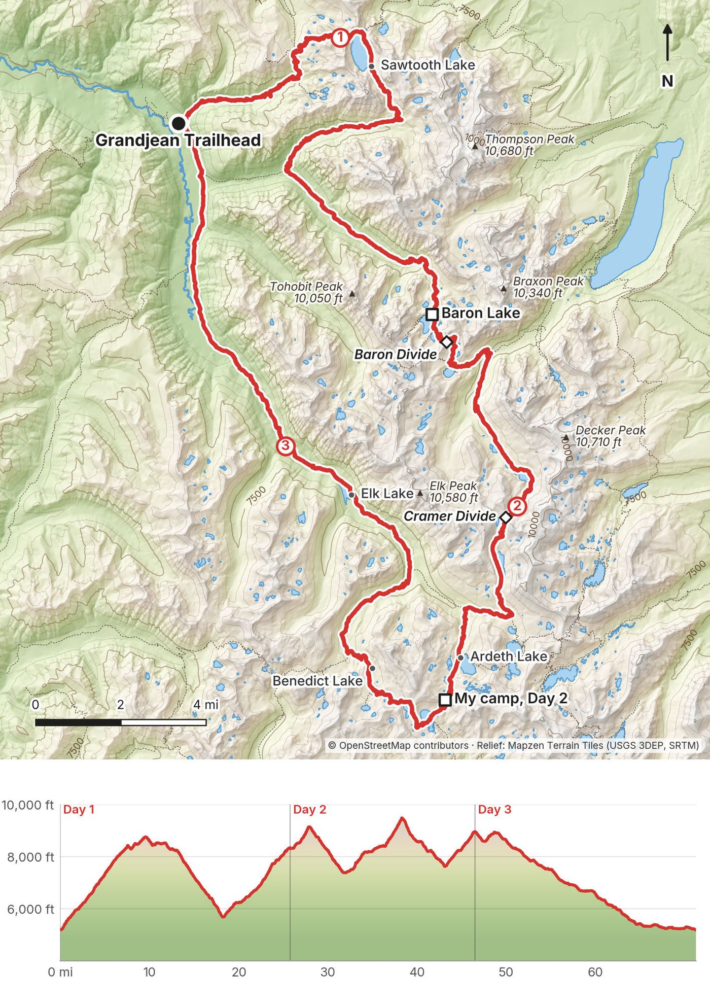
In July 2020 I hiked a 70-mile loop through the Sawtooth Wilderness in Idaho, alone, in three days. I started and finished at the Grandjean Trailhead on the west side of the range, went up Trail Creek to Sawtooth Lake, over to the Baron Lakes, the Cramer Lakes and the Ten Lake Basin, and walked back down the South Fork of the Payette River. I'd never been to Idaho before. I found the loop on AllTrails, and I liked that it was a loop, so I could park my car and come back to it.
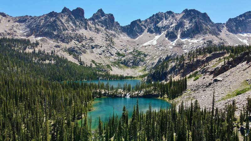
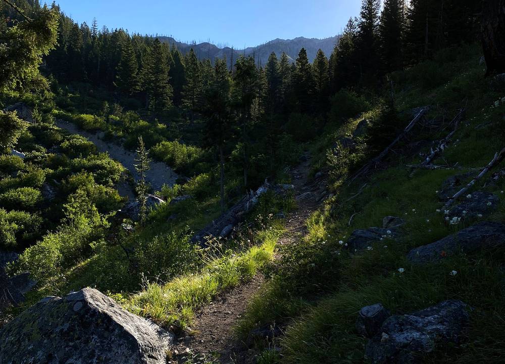
The wildflowers were amazing, and calling this area Sawtooth makes so much sense: the tall peaks have such jagged tops. And man, I've never seen more lakes in my life. Little lakes, big lakes, all blue and turquoise, lake after lake after lake.
| Quick facts | |
|---|---|
| Distance | 71.3 miles (114.7 km) by my GPS, a loop |
| Climbing | about 11,350 ft (3,460 m) up and the same down |
| Days | 3 for me. I recommend 4 or 5 |
| Start and finish | Grandjean Trailhead, 5,190 ft (1,580 m) |
| 2026 closure | Grandjean is closed through Dec 31, 2026 (Forest Service order 0414-04-165). Start from the Stanley side instead: Iron Creek Trailhead or Redfish Lake. See The Grandjean closure |
| Highest point | Cramer Divide, 9,490 ft (2,894 m) by my GPS, Day 2 |
| Passes | Four, none technical |
| Permit | Free, self-issued at the trailhead |
| Nearest airport | Boise (BOI) |
| Nearest towns | Lowman on the west side, Stanley on the east |
| Trip date | July 17 to 19, 2020, solo |
| Day | Route | Miles (km) | Up / down (ft) | Sleep |
|---|---|---|---|---|
| 1 | Grandjean to Baron Lake | 25.7 (41.4) | 6,480 / 3,340 | My tent at Baron Lake |
| 2 | Baron Lake to the Ten Lake Basin | 20.8 (33.5) | 4,310 / 3,670 | My tent above Ardeth Lake |
| 3 | Ten Lake Basin to Grandjean | 24.8 (39.9) | 560 / 4,320 | Back at my car |
The numbers come from my own GPS recordings, smoothed the same way as in all my guides. The AllTrails map I found said 62 miles, but I tracked way more than that, because the map didn't show all the switchbacks. There are so many switchbacks on this trail. My recording app's own totals came to 73.7 miles and about 12,100 ft of climbing, before I cut out a few minutes at the trailhead and the drive at the end (see Using the GPX files).
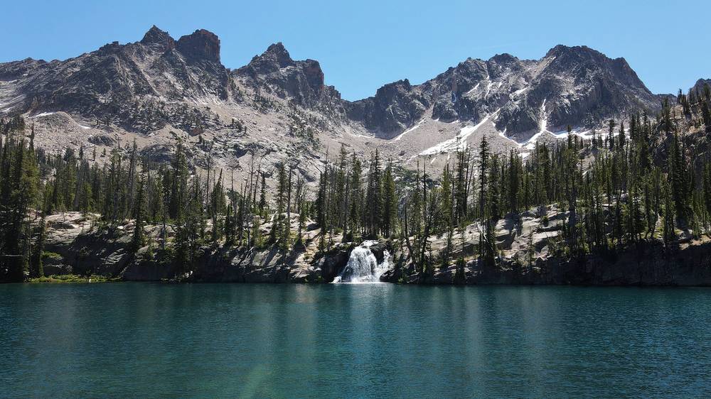
What I did. I flew into Boise, rented a car at the airport, and drove about two and a half hours into the mountains to the Grandjean Campground. There are a lot of places to get into the Sawtooth Wilderness, but I recommended Grandjean: it's a great little campground, and there's a backpackers' parking lot where you don't have to pay anything to park. I bought my food at Walmart before I drove into the mountains. After the hike I camped for free on public land close to Grandjean.
The drive (when it's open). From Boise, Idaho Highway 21 runs north and east through Idaho City and Lowman. The Forest Service gives the way from the other side: from Stanley, 35 miles on Highway 21, then 7 miles east on the Grandjean Road (Forest Road 524) to Sawtooth Lodge, and left to the campground and trailhead. Check road conditions at 511.idaho.gov: Highway 21 closes in winter between Idaho City and Lowman and east of Grandjean for avalanche danger, and a mudslide closed it for four days in July 2026.
Grandjean (normal times). The campground has 31 first-come sites (10 for horse campers), vault toilets and drinking water; $22 a night on the Forest Service's 2025 fee list (I remembered $16 in 2020). The trailhead page lists no drinking water. All of it is closed through 2026.
Near the trailhead. Sawtooth Lodge, near the end of the Grandjean Road, is outside the closure: cabins, a restaurant with craft beer and a pool fed by hot water (sawtoothlodge.com, 208-259-3331). In 2020 it was kind of closed because of COVID, but I could still get a beer there. Along the South Fork there are hot springs: rocks in the river where hot water sits. Sacajawea Hot Springs is outside the closure too.
From the Stanley side. Iron Creek Trailhead: from Stanley, 2.5 miles northwest on Highway 21, then 4 miles on Forest Road 619. No drinking water. Redfish Lake: the lodge's boat crosses the lake to the inlet trailhead (2026: $20 one way, $28 round trip; no reservations; inlet pickups 9 a.m., noon, 3, 5 and 7 p.m. in summer, only 9 a.m. and 7 p.m. for sure after Labor Day; last day October 11), and the backpacker parking lot is free.
My records for this trip are thin: no booking emails or receipts survive from July 2020.
| Item | What I paid |
|---|---|
| Wilderness permit | Free |
| Backpacker parking at Grandjean | Free |
| Food, about five days' worth, from Walmart | Not in my records |
| Flight to Boise and the rental car | Not in my records |
| Grandjean Campground | I didn't stay; I remembered about $16 a night in 2020 ($22 on the Forest Service's 2025 list) |
For your budget (2026 prices). The loop itself costs nothing. From the Stanley side, the Redfish Lake boat is $20 one way or $28 round trip, and Redfish day use was $12 on the Forest Service's 2025 list.
| Night | Where | Height |
|---|---|---|
| July 17 | Baron Lake | 8,330 ft (2,540 m) |
| July 18 | High on the Ten Lake Basin Trail, above Ardeth Lake | 8,950 ft (2,730 m) |
| July 19 | Free camping on public land near Grandjean |
Wild camping. There are no huts or designated campgrounds inside the Sawtooth Wilderness: you camp where you want within the rules. Almost every lake had one or a couple of campsites. Use a site that's already bare, at least 100 feet from the trail and the water, and no campfires within a quarter mile of a trail.
Free camping outside. I love camping for free on public land; I feel like I'm getting away with something. After the hike I found a good spot near Grandjean, cooked some hot dogs, and slept in my tent in the good weather. The Forest Service doesn't list dispersed campsites near Grandjean, and in 2026 the whole area is closed.
Food. I got about five days' worth of food at Walmart before I drove into the mountains, because I didn't know how long I'd be out there. I knew it would be three or four days, so five was good, and if I wanted to camp out in my car afterward I wouldn't have to go back to a grocery store. There's nothing to buy on the loop.
Hot or cold. I brought my Jetboil, and I do enjoy a hot meal at least once a day: a backpacker meal, a rice side, or Idaho potatoes (I had to do something Idaho related). But I don't want to take out the stove every time I eat, especially at breakfast, when I just want to pack up and go. So almost every morning on this trip I had nut butter and some granola. I might be getting away from coffee and tea too, because you have to boil water for them. I'd rather keep walking and drink water, and if I need the extra caffeine, a squirt of MiO.
Water. Lakes and streams all the way round, and it's never far to the next one. Treat or filter it. In the heat I drank a lot more than usual.
Food storage. No bear canister is required in the wilderness, but hang your food or hide it at night.
Paid links: I earn a commission if you buy through these links, at no extra cost to you. As an Amazon Associate I earn from qualifying purchases.
I did this loop in three hot July days with mosquitoes at every lake. Here's what I carried in 2020, what I'd take now, and what I filmed with.
 Pack: Hyperlite backpack. Similar: Hyperlite Mountain Gear Southwest 2400 (Hyperlite).
 Tent: Nemo tent. I left the rain fly off with those clear skies. Similar: NEMO Hornet Elite OSMO 1P (Amazon).
 Stove: Jetboil stove. For a hot meal once a day. Similar: Jetboil MicroMo (Amazon).
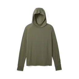 Sun hoodie: PATH Projects Pyrenees T19 Hoodie (PATH Projects). Cover up against mosquitoes and sun.
 Cap: PATH Projects Muir Cap 2.0 (PATH Projects)
 Sunglasses: Goodr OG Sunglasses (Amazon)Tent: NEMO Hornet Elite OSMO 1P (Amazon). A tent that keeps bugs out.
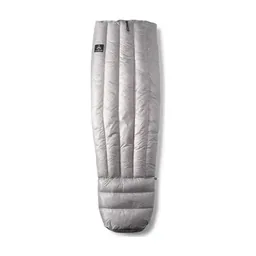 Quilt: Hyperlite Mountain Gear 20° Quilt (Hyperlite)
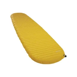 Sleeping pad: Therm-a-Rest NeoAir XLite NXT (Amazon)
 Warm layer: Arc’teryx Cerium Hoody (Arc’teryx). Nights above 8,000 ft.
 Water filter: Katadyn BeFree AC · 1L (Amazon). Treat or filter the lakes and streams.
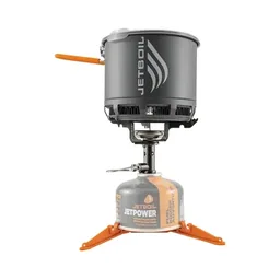 Stove: Jetboil Stash (Amazon). If you want hot food.
More in How I filmed it. No drones in the wilderness: see Permits and rules.
Since September 2026 I film with a smaller setup: the Pocket 4 and the Mic 3 on the trail, and the Mini 5 Pro in the air where drones are allowed.
 Camera: DJI Osmo Pocket 4 (Amazon)
 Mic: DJI Mic 3 · 1 TX + 1 RX (Amazon). It pairs with the Pocket 4.
 Drone: DJI Mini 5 Pro (Amazon)
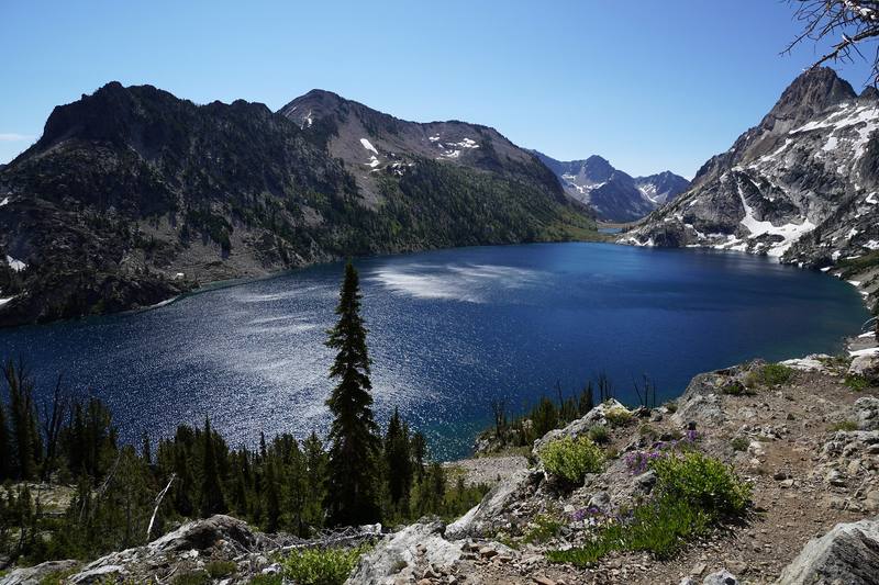
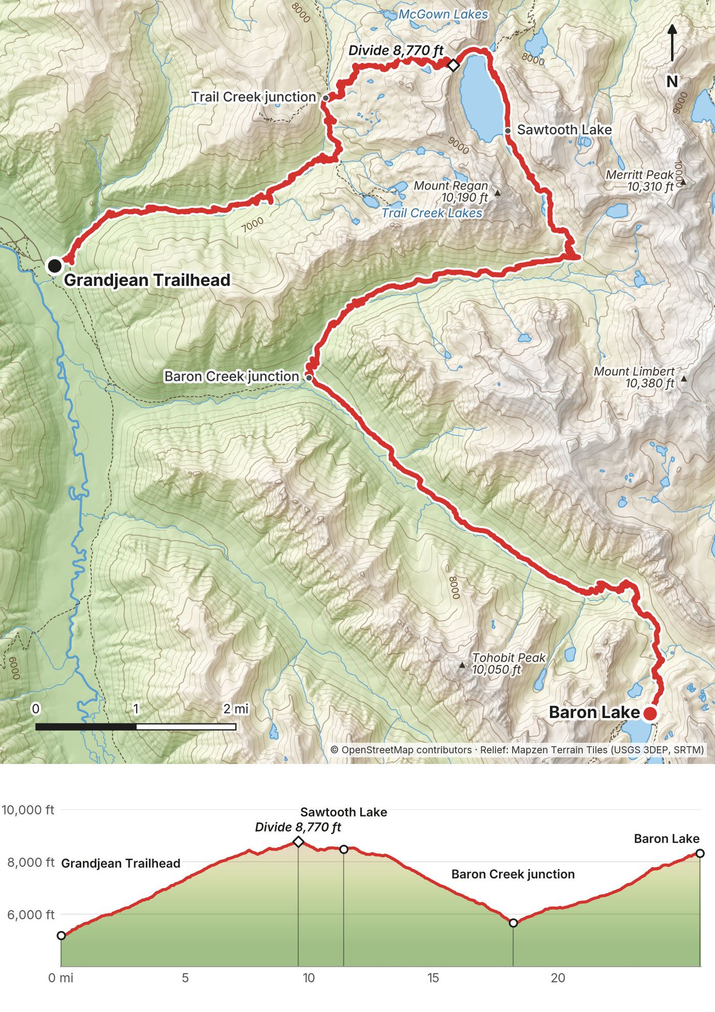
I started at the Grandjean Trailhead at 6:27 in the morning and climbed Trail Creek in the shade. By 10:46 I was on the divide above Sawtooth Lake, and I spent the next hour and a half around the lake. This was the busy part of the loop: I saw at least a dozen, a dozen and a half people there, and almost all of them were fishing.
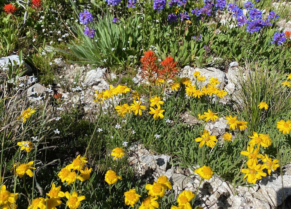
The wildflowers here were amazing. Then I went down the North Fork of Baron Creek, a long way down into the heat of the afternoon, walking from shade to shade. The bottom of the day is the junction with Baron Creek at 5,680 ft, reached a little before 5 p.m. From there it's a long climb back up Baron Creek to Baron Lake. I got there at 9 p.m.
My times and heights are from my GPS.
Grandjean Trailhead to the Trail Creek junction: 6.5 miles, 6:27 to 9:19. The Trail Creek Trail climbs steadily out of the South Fork Payette valley through forest and then open slopes, from 5,190 ft to 8,040 ft. At the top it meets the Observation Peak Trail and the Iron Creek-Stanley Lake Trail. Keep going toward Sawtooth Lake. (Closed in 2026: order 0414-04-165 closes the Grandjean Trailhead and the Trail Creek Trail through December 31, 2026, and the trail was washed out in July 2026. Until Grandjean reopens, start from the Iron Creek Trailhead near Stanley, about 5 miles to Sawtooth Lake, or from Redfish Lake: see The Grandjean closure.)
To the divide and Sawtooth Lake: about 4.5 miles (3 to the divide), 9:19 to about 12:10. On the Iron Creek-Stanley Lake Trail past the basin of the McGown Lakes to the divide at 8,770 ft (9.5 miles), then down to Sawtooth Lake, about 8,430 ft. The trail follows the lake shore with Mount Regan at the far end. No campfires within 200 yards of the lake.
Sawtooth Lake to the Baron Creek junction: about 7 miles, 12:10 to 4:57. The North Fork Baron Creek Trail drops about 2,800 ft down the North Fork to where it meets Baron Creek (18.2 miles, 5,680 ft). The Forest Service lists it as 5 miles; my GPS measured more.
Up Baron Creek to Baron Lake: 7.5 miles, 4:57 to 9:01. The Baron Creek Trail climbs 2,650 ft up the valley to Baron Lake at 8,330 ft. The July 2026 floods damaged sections of this trail; the Forest Service called it passable.
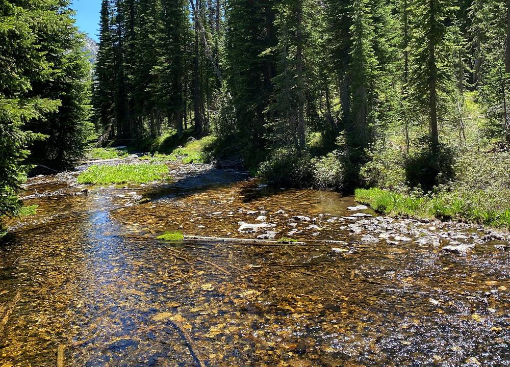
Back the way you came, or from Sawtooth Lake north on the Iron Creek-Stanley Lake Trail, about 5 miles to the Iron Creek Trailhead near Stanley (on the other side of the range from a car at Grandjean). From the Baron Creek junction, Baron Creek runs down to Grandjean in about 10 miles (the Forest Service figure; it's inside the 2026 closure).
Film, Day 1 · The route, in the guide part of my film
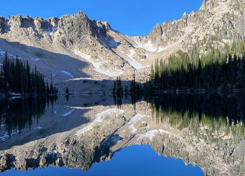
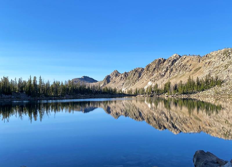
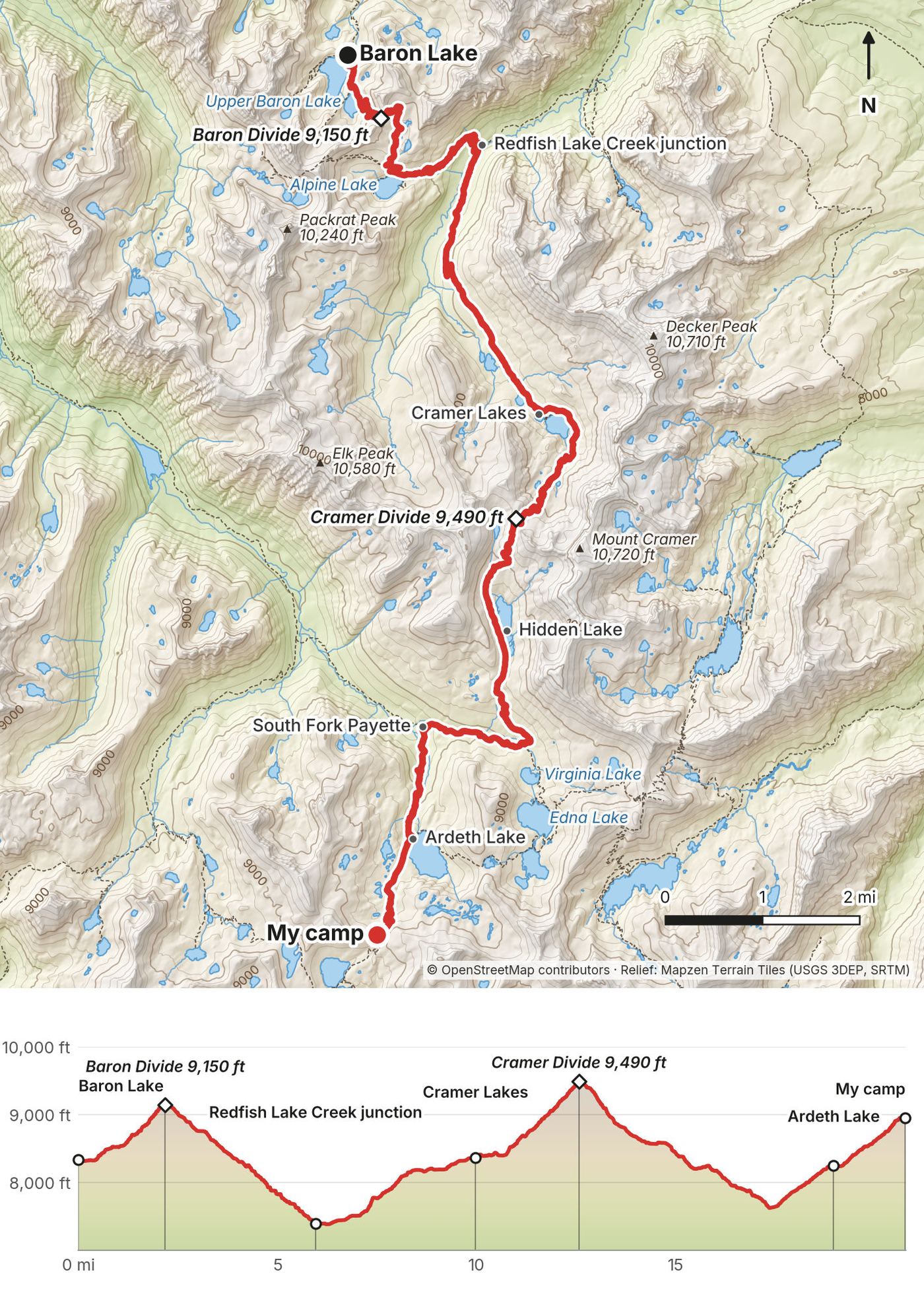
The first two days were up higher, with lakes and peaks and passes, and this one had two passes and the most lakes. In the morning Upper Baron Lake was completely still, with the peaks reflected in it. Then over the Baron Divide at 9 a.m. and down past Alpine Lake into the Redfish Lake Creek valley.
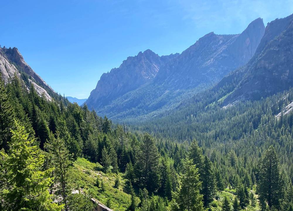
Then I climbed to the Cramer Lakes, where I took a break by the water, and over the Cramer Divide, the highest point of the loop, in the heat of the afternoon. There was still some snow up there. I came down past Hidden Lake to the South Fork Payette, climbed past Ardeth Lake into the Ten Lake Basin, and set up my tent high on the trail at 7:40 in the evening. On this trip I camped in my Nemo tent without the rain fly for the first time, so I could watch the colors of the sky and see the light in the morning to know when to wake up.
Baron Lake over the Baron Divide to Alpine Lake: 3.8 miles, 7:45 to 9:47. Past Upper Baron Lake (1.1 miles), then up to the Baron Divide at about 9,150 ft by my GPS (2.2 miles), and down to Alpine Lake, 8,340 ft. No campfires within 200 yards of Alpine Lake.
Alpine Lake to the Redfish Lake Creek junction: 2.2 miles, 9:47 to 10:41. Switchbacks down to 7,390 ft, where the Baron Creek Trail meets the Mount Cramer Trail by Redfish Lake Creek (6.0 miles). The Forest Service calls it Flatrock Junction. The Forest Service warns that the creek crossing here "is usually very high in spring and early summer." The trail to the Redfish Lake inlet and the boat goes down the valley from here.
Up to the Cramer Lakes: 4.4 miles, 10:41 to about 1:20. The Mount Cramer Trail climbs to Lower Cramer Lake (9.6 miles) and on past Middle and Upper Cramer Lake, about 8,300 to 8,400 ft.
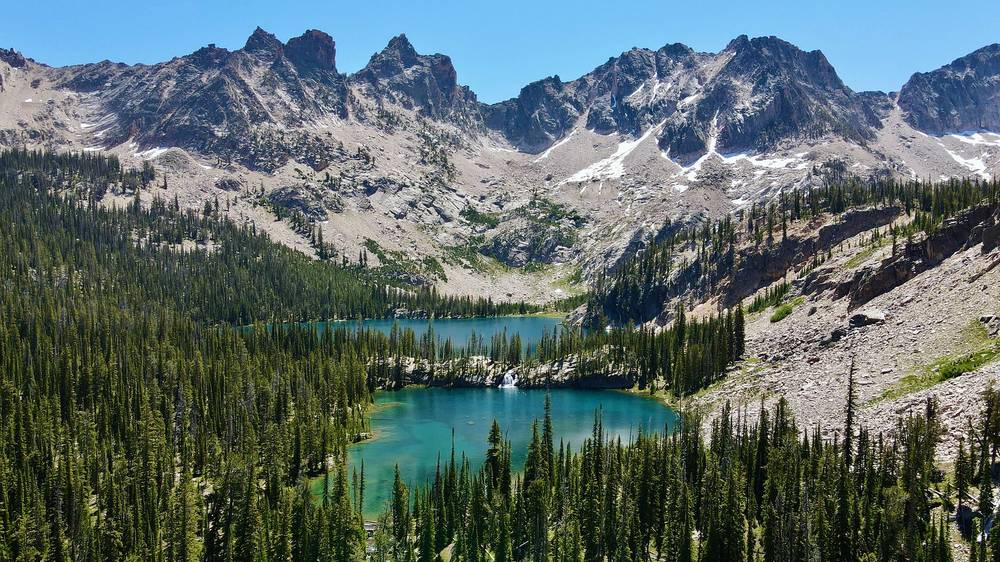
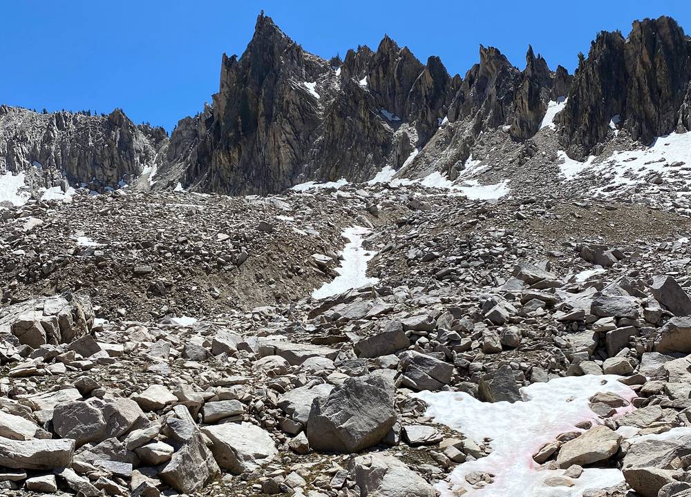
Over the Cramer Divide to the South Fork Payette: 5.6 miles, about 1:20 to 4:49. A steady climb over rock and scree to the Cramer Divide, 9,490 ft by my GPS (the Forest Service says 9,500), at 12.6 miles. Then down past Hidden Lake (14.3 miles) to the South Fork Payette River Trail (16.0 miles).
Down the South Fork and up into the Ten Lake Basin: 4.8 miles, 4:49 to 7:40. Down the South Fork Payette River Trail to the Ten Lake Basin Trail (17.4 miles, the low point of the afternoon at about 7,650 ft), then up past Ardeth Lake (19.0 miles, 8,250 ft) to my camp at about 8,950 ft (20.8 miles). My camp was near the top of the pass between Ardeth Lake and Spangle Lake, which some maps call Glens Pass; it's not an official name.
From the Redfish Lake Creek junction (mile 6.0), the Baron Creek Trail goes down the valley 3.75 miles to the Redfish Lake inlet, where the lodge's boat crosses the lake to Redfish Lake Lodge (in season, at set times). That's the best way out on this day. Once you're over the Cramer Divide, going on is the way out: the South Fork Payette runs all the way down to Grandjean.
Film, Day 2 · Water crossings, in the guide part
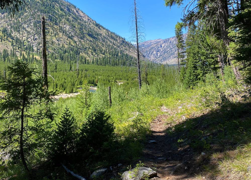
The last day was just a huff to get out. It's almost all downhill, and after the lakes in the morning it was almost entirely a tree tunnel, low down and hot. It wasn't that fun to shoot, so I didn't capture many clips. On camera that day I said, "It is hot, dry, I'm tired." I reached the Grandjean Trailhead at 5:44 p.m. After the hike I camped for free on public land near Grandjean and went to the hot springs by the river.
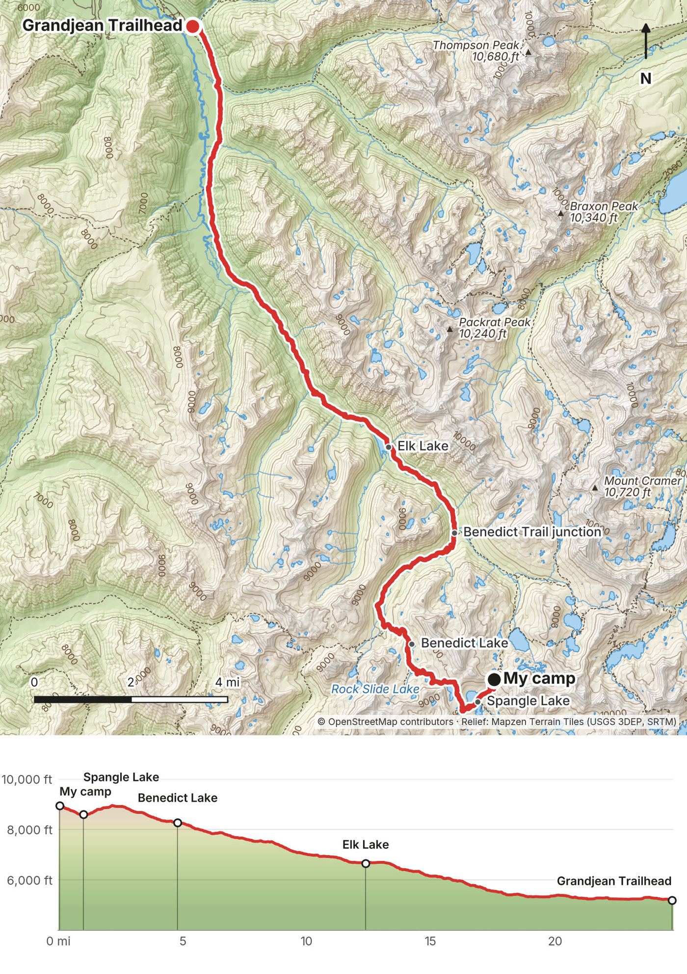
The Ten Lake Basin to Benedict Lake: 4.8 miles, 6:26 to 8:50. Down to Spangle Lake (1.0 mile, 8,590 ft), where the Ten Lake Basin, Benedict Creek and Middle Fork Boise River trails meet. Keep right on the Benedict Creek Trail, over a short rise at 8,950 ft (2.2 miles) to Lake Ingeborg, then past Rock Slide Lake (3.2 miles) to Benedict Lake (4.8 miles, 8,270 ft).
Down Benedict Creek to the South Fork Payette: 4.8 miles, 8:50 to 10:49. The Benedict Creek Trail drops through forest and past granite slabs to the South Fork Payette River Trail at 7,110 ft (9.6 miles).
Down the South Fork Payette to Grandjean: 15.1 miles, 10:49 to 5:44. A long, gentle descent down the valley, past Elk Lake (12.5 miles, 6,680 ft), mostly in forest, to the Grandjean Trailhead at 5,190 ft. The river and its side streams are the water. The Forest Service lists the South Fork Payette River Trail as 13.8 miles from Grandjean to Smith Falls. The first miles above Grandjean and the trailhead are inside the 2026 closure (order 0414-04-165, through December 31, 2026); while it's in force, leave the high country toward Stanley instead, by Redfish Lake or Iron Creek.
This whole day is the way out. At Spangle Lake the Middle Fork Boise River Trail heads south, away from any car at Grandjean; don't take it by mistake.
Film, Day 3 · Heat and midday hiking, in the guide part
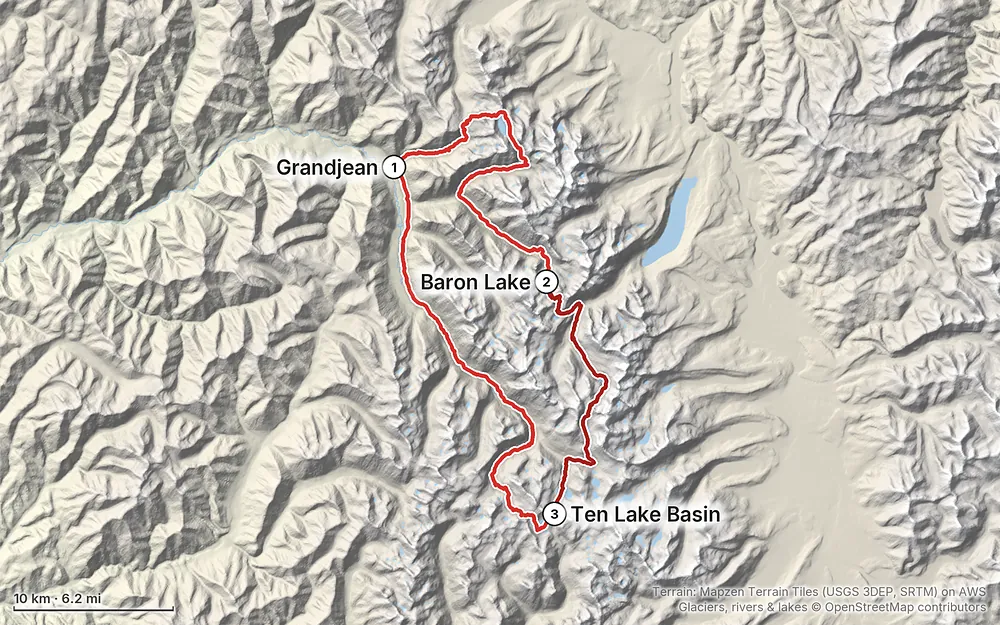
Elevation5,184–9,478 ft71.3 mi
Terrain: Mapzen Terrain Tiles (USGS 3DEP, SRTM) on AWS · Glaciers, rivers & lakes © OpenStreetMap contributors
Tap a map to open it full size.
From the Sawtooth National Forest, checked September 29, 2026. The main rules come from the Sawtooth Wilderness occupancy and use order (0414-04-161, in effect March 1, 2025 to March 1, 2030).
What I got. I hiked July 17 to 19, 2020: three days of clear skies, bright sun and no chance of rain. The wildflowers were amazing. Every morning the petals would open up, and you'd see entire meadows or hillsides with five different colors. There were still a few snow patches near the Cramer Divide.
Heat. This was probably one of my hottest hikes ever. From noon to 5 p.m. I think it was in the high 80s. I walked from shade to shade, took way more water breaks, washed my face in the water whenever I could, and took a couple of naps around 3 p.m. to cool down. A siesta. The last day, low down in the valley, was hot and dry.
Mosquitoes. They were the worst part of the hike in July. Expect them wherever there's water and no wind.
Clear skies. One downside of clear skies is that you don't have any clouds to light up in the evening or morning, so I kind of missed out on sunset and sunrise colors.
The season. Before the 2026 closure the Grandjean Campground was open into September (its Forest Service page gives a September 21 closing). Idaho Highway 21 to Grandjean closes in places in winter for avalanche danger. Snow lingers on the high passes into early summer: the Forest Service's June 21, 2026 trail report noted snow making the trail near Sawtooth Lake confusing. Stage 1 fire restrictions were in force across the forest in August 2026, and wildfire smoke is possible in late summer.
Forecast. The National Weather Service point forecast for the Baron Lakes area: forecast.weather.gov (44.08, -115.03).
Emergency: 911. By the USGS place records, most of this loop is in Boise County, whose Sheriff's office handles search and rescue there (208-392-4411); Sawtooth Lake and the Stanley-side ways in from Iron Creek and Redfish Lake are in Custer County (Custer County Sheriff, 208-879-2232). Don't count on phone signal: carry a satellite messenger or personal locator beacon.
Heat. From noon to 5 p.m. it was in the high 80s for me. Start early, drink more than you think, rest in the shade in the middle of the day, and cool off in the lakes and streams.
Mosquitoes. Cover up: long sleeves, long pants, a head net. Camp away from the water and with a breeze if you can.
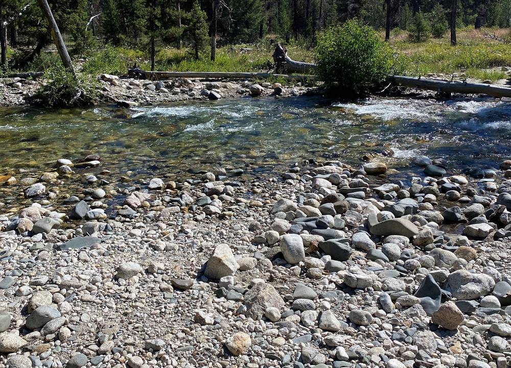
Water crossings. Only a couple, and easy for me in July. The Forest Service warns that the crossing at the Redfish Lake Creek (Flatrock) junction is usually very high in spring and early summer.
Passes. Four, none technical: the divide above Sawtooth Lake, the Baron Divide, the Cramer Divide and the pass above Ardeth Lake. Expect snow on them early in the season, and don't be on a pass in a thunderstorm.
After the Wapiti Fire. The burn around Grandjean brings flash floods and debris flows in heavy rain, which is what closed it in 2026, and burned forest drops trees for years. The Forest Service also warns that many wilderness loops may still have downed trees.
Bears. There are bears in the area. Hang or hide your food, and carry bear spray if it makes you feel better. I didn't see any.
Fire. Check the current fire restrictions before you go (idl.idaho.gov fire restrictions finder) and the wilderness campfire rules in Permits and rules.
Going solo. I hiked alone and saw few people except around Sawtooth Lake. Leave your route and your return time with someone at home.
Can I hike this loop now? Not from Grandjean while it's closed. Forest Service order 0414-04-165 closes the Grandjean area, its trailheads and the first miles of the trails through December 31, 2026, "unless rescinded," and the Trail Creek Trail was washed out in July 2026. Until it reopens, the high part of the loop, Sawtooth Lake, the Baron Lakes and the Cramer Lakes, can be reached from the Stanley side: the Iron Creek Trailhead or Redfish Lake. Check the Sawtooth National Forest alerts before you plan anything. See The Grandjean closure.
How many days do I need? I did the whole 70 miles in three days, so that's over 20 miles a day, and I pushed through way faster than I probably should have. I recommend doing it in four or five days, just to take your time and not go at an insane speed. There's a plan in Other ways to do it.
Is it hard? It wasn't bad at all. It's a long loop, so you have to be a bit more experienced, but the elevation gains are not that extreme. There's no technical climbing or scrambling at any point. You go over three or four passes (four, by my GPS), and none of it is technical. You don't summit any peaks, though you can if you want.
I'm new to this. Is there something shorter? If you're starting out and you're unsure about that length of time and carrying that much food, I'd recommend just doing an overnight at Sawtooth Lake. Hike up, find a camp spot, spend some time there, and hike out the same way or a different way. There are multiple ways up to that lake. See Other ways to do it.
Do I need a permit or a reservation? You didn't really need reservations or permits beyond a self-permit, which is part of why I thought it was an easy one to do. At the trailhead you write your information, rip off the page, put it in the box, and carry your paper permit with you the whole time. In 2026 that free permit is still required for every visitor, day or overnight, and there's no quota. See Permits and rules.
Where do I camp? Almost every single lake had one or a couple of campsites, so it was really easy to find a spot to set up a tent. There are no huts or campgrounds inside the wilderness. See Camping.
Will it be crowded? It was a pretty isolated trail, except for the Sawtooth Lake area, where I saw at least a dozen, a dozen and a half people. Almost everyone out there had a fishing pole.
What about bears? I read that there are bears in the area. You aren't required to have a bear can, but it's recommended that you hang your food or hide it. I brought bear spray, didn't have to use it, and didn't see a single bear. There wasn't much wildlife at all, just the occasional woodchuck or squirrel.
What's the worst part? The mosquitoes, for me, in mid July. As soon as you stop and you're by water they swarm you. See Weather and safety.
Are there river crossings? Only a couple of water crossings. It was so hot that they were refreshing. I walked right through in my trail runners, and in that heat they dried in about 20 minutes.
Is there phone signal? My record doesn't say. Plan as if there's none, and carry a satellite messenger if you can.
What did it cost? Technically this hike didn't cost me anything other than the food I bought before I drove into the mountains. The permit is free and so was the backpacker parking. See What I paid.
I walked the three days in this guide. These are other ways to use it, and I didn't do them. The distances come from my GPS unless they're marked as the Forest Service's.
I recommend four or five days. My line, split at lakes, for when Grandjean reopens:
For six days, stop at Elk Lake on the way down: Benedict Lake to Elk Lake is about 7.7 miles, and Elk Lake to Grandjean about 12.2.
What I'd recommend to someone starting out. From the Iron Creek Trailhead near Stanley, the Iron Creek-Stanley Lake Trail goes past the other Alpine Lake to Sawtooth Lake: about 5 miles one way (Forest Service trail report). Camp at a lake, spend some time there, and hike out the same way. No campfires within 200 yards of Sawtooth Lake or that Alpine Lake.
The middle of my loop, from the Stanley side, as a one-way hike:
That's about 29.5 miles. You need a way between the two trailheads, and the boat only runs in season (to October 11 in 2026). If you miss the boat, the trail goes on around the lake from the inlet to the Redfish trailhead, about 5 miles. Check that the Baron Creek Trail is open and passable after the 2026 floods.
Checked September 29, 2026, on the Sawtooth National Forest's alerts and conditions pages.
What happened. The 2024 Wapiti Fire burned the country around Grandjean. On July 17, 2026 flash floods damaged the trails, and on July 23 debris flows destroyed the Grandjean Campground and Trailhead. The Forest Service's conditions page (updated August 25, 2026) says the Trail Creek Trail "was also wiped out" and asks hikers to go into the Sawtooth Wilderness from another trailhead.
The closure order. Order 0414-04-165, "Grandjean Area, Road, and Trail Closure," is in effect from July 28, 2026 through December 31, 2026, "unless rescinded." It closes all the national forest land, roads and trails inside its boundary: the campground, the hiker and horse trailheads, the campground road, the end of the Grandjean Road, the Trail Creek Trail and the first part of the South Fork Payette River Trail. Sawtooth Lodge and Sacajawea Hot Springs are left out of it. In September 2026 the Forest Service said the campground would stay closed for the rest of the season. There's no word yet on 2027.
Other damage. The July 22, 2026 trail report says the July 17 flooding damaged sections of the Baron Creek Trail (my Day 1 afternoon), which was still "passable" between the Baron Divide and the North Fork. The Grandjean Road was being rebuilt from August to late November 2026, with delays of up to four hours Monday to Thursday.
What it means for you.
I love making silent films, because I can just focus on showing and not telling. The second half of the film is more of a guide, where I explain the experience, but I want the hiking part to be silent, relaxing and immersive.
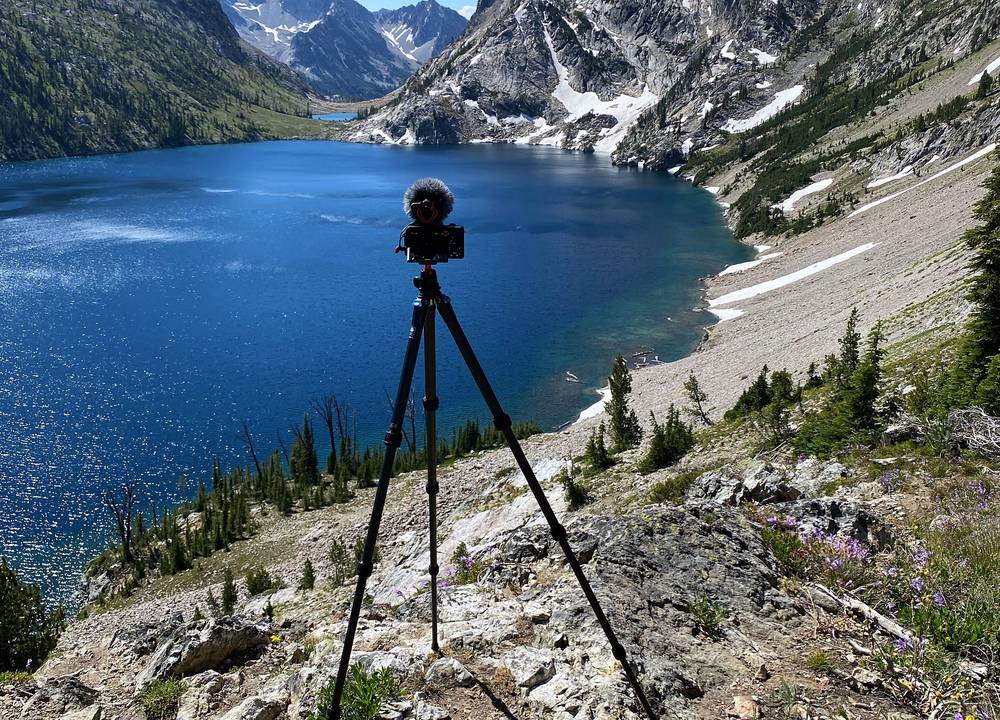
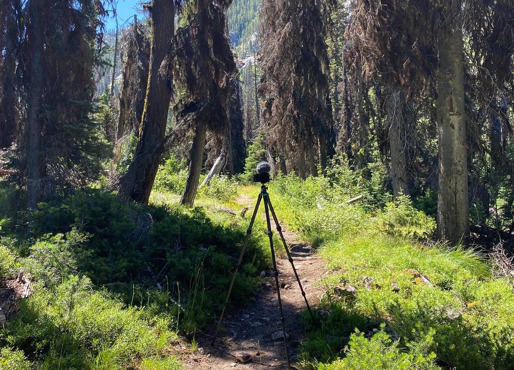
All of my shots are locked down on the tripod. I set it up, walk past, come back, grab the tripod and carry on. A lot of people say that's extra miles, but it's not too bad: I was out there for three days and showed only about 15 minutes of footage, a tiny sliver of the hiking, so I'm not walking past the camera that much.
The camera was a Sony a6600 with a 10-18 mm lens (about 16-30 mm on full frame). I locked the white balance at a daylight Kelvin setting for the whole trip, so you can tell when it's morning, midday or getting dark, and I shot everything with Sony's standard picture profile, no color grading, in 4K. This was also the first hike I shot at 30 frames per second.
Say hi. It was really fun to run into a couple of subscribers on the trail. One man told me his whole story: he was on day eight of his own hike, 67 miles in, and aiming for 100. If you see me on the trail, say hi, especially when I'm hiking alone.
These change every year. Everything else in this guide stays the same.
Closures and roads
Permits and rules
Trail and weather
The film is at the top of this page.
Planning questions about Sawtooth Wilderness, answered only from this page's facts, the creators' versions and hikers' public tracks, with where each answer comes from. When the data doesn't say, the answer says "not given".
From hikers
Sign in to comment. Free; your hikes stay private unless you share them.
Some lodging links earn me a small commission at no cost to you.
Something wrong or missing on this page? Send feedback.