
Content made there
The film is at the top of this page.
Photos
Hikes / Salkantay Trek / Kraig Adams's version
South America · Peru
May 5–8, 2022 · 4 days · Solo · Huts

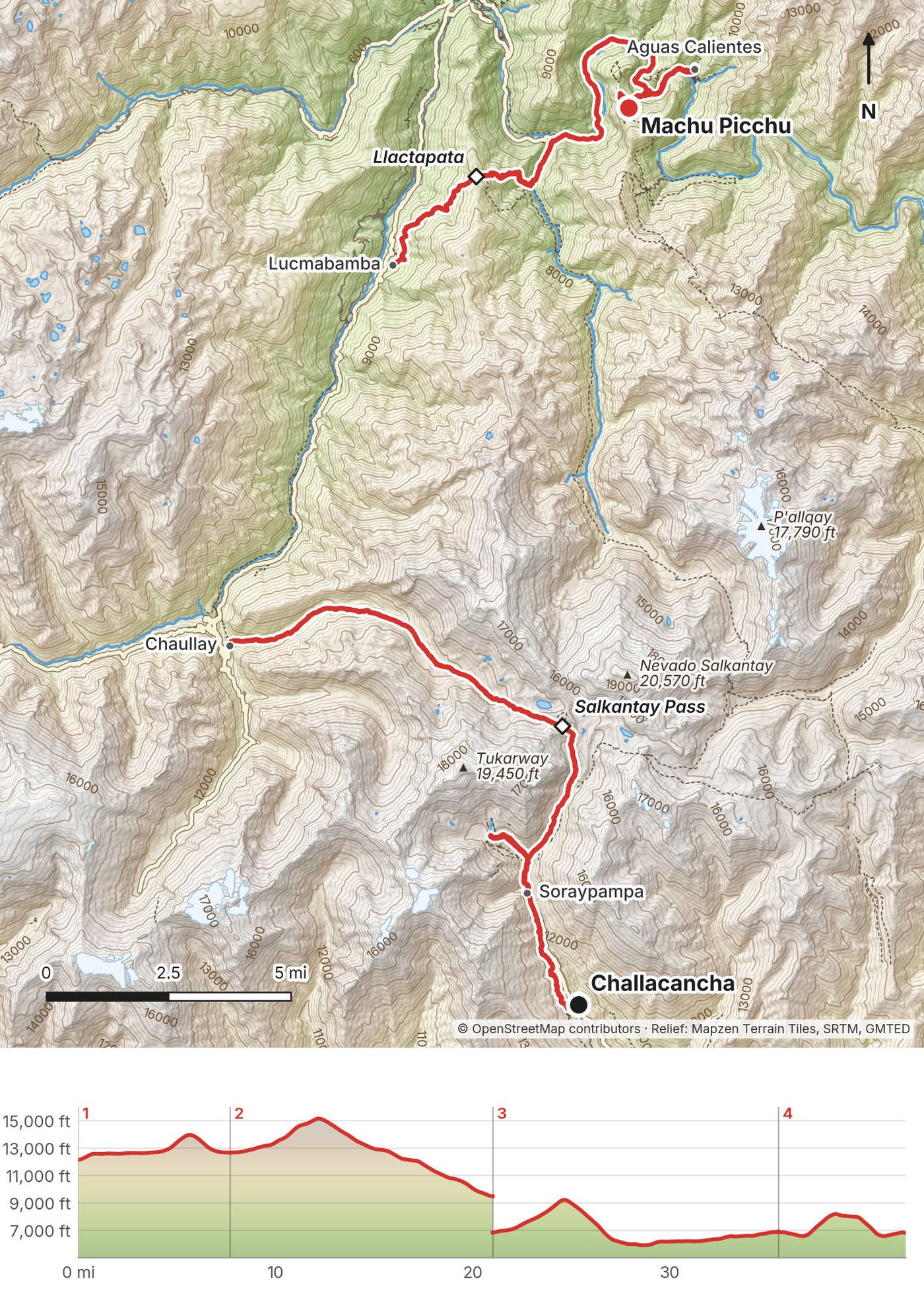
In May 2022 I flew to Cusco and hiked the Salkantay Trek to Machu Picchu: four days and about 42 miles on foot, from the end of the road at Challacancha over the Salkantay Pass, down into the cloud forest and the coffee farms, over Llactapata to Aguas Calientes, and up to Machu Picchu. It's the trip from my film Hiking 40 miles on the Salkantay Trek in Peru.
The reason to come is the change. You go from the high alpine, under the white peak of Salkantay, down into the lush green jungle in a couple of days, and you finish at Machu Picchu. You've got to visit that spot: it's really unique.
| Quick facts | |
|---|---|
| Distance | 42.0 miles (67.6 km) on foot over 4 days, with Machu Picchu; the trek itself, Days 1 to 3, is 35.5 miles (57.2 km) |
| Climbing | about 11,330 ft (3,450 m) up and 13,970 ft (4,260 m) down, with Machu Picchu |
| Days | 4 walking days, 3 nights (a lodge, a coffee farm, a hotel), plus a day in Cusco before |
| Start | Challacancha, at the end of the road above Mollepata, 12,100 ft (3,689 m) |
| Finish | Machu Picchu, from Aguas Calientes, then the train to Cusco |
| High point | The Salkantay Pass, 15,211 ft (4,636 m) on my GPS, Day 2 |
| When | The dry season, April to October. I walked May 5 to 8, 2022 |
| Difficulty | A clear, busy path. One big pass near 15,200 ft, then long descents |
| Base | Cusco, about 11,150 ft (3,400 m) |
| Trip | A 4-day package with Refugios Salkantay: lodges, meals, transfers, the Machu Picchu ticket and the train. I walked alone |
| Day | Route | Miles (km) | Up / down (ft) | Sleep |
|---|---|---|---|---|
| 1 | Challacancha to Soraypampa, and Humantay Lake | 7.7 (12.4) | 2,141 / 1,619 | Lodge at Soraypampa, 12,660 ft |
| 2 | Soraypampa over the Salkantay Pass to Chaullay | 13.3 (21.4) | 2,602 / 5,809 | Coffee farm at Lucmabamba, 6,810 ft (after a 1-hour drive) |
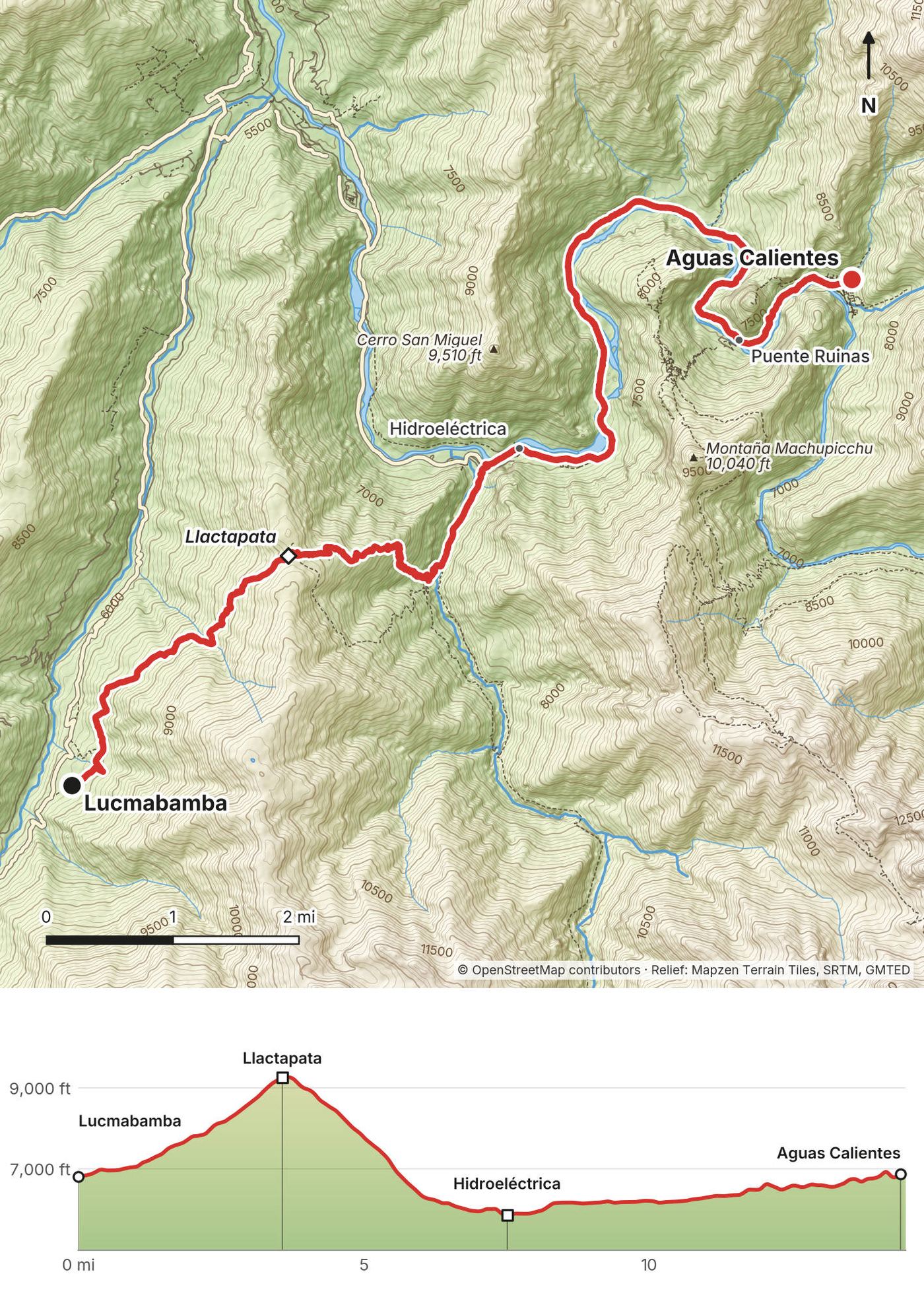
| 3 | Lucmabamba over Llactapata to Aguas Calientes | 14.5 (23.3) | 4,153 / 4,054 | Hotel in Aguas Calientes, 6,890 ft |
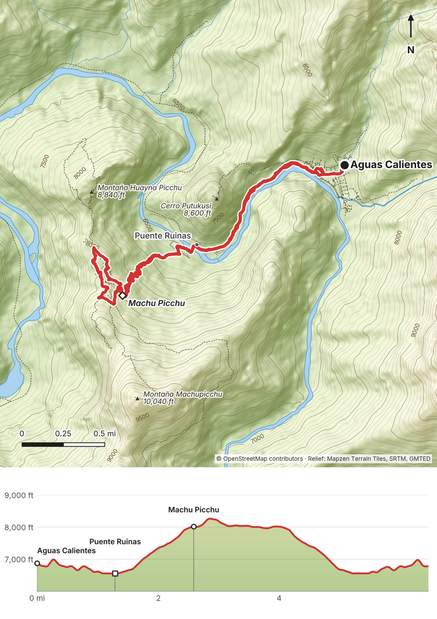
| 4 | Aguas Calientes to Machu Picchu and back | 6.5 (10.4) | 2,430 / 2,487 | Cusco, by train |
The numbers come from my own GPS recordings, smoothed the same way for every day. The film calls it 40 miles; my GPS says 42.0 on foot, with Machu Picchu. I drove the road section from Chaullay to Lucmabamba, and it isn't in these numbers. Apps count climbing differently, and the steep valley walls confuse them: see each day for what I said at the time.
What I did. I flew from New York to Lima and on to Cusco on May 3, 2022. The day after, I did a day hike straight out of Cusco (see Altitude). On May 5 I woke up at 5 a.m. A private shuttle took me from Cusco along winding roads to Mollepata, where I had breakfast, then up even more winding roads to Challacancha. There was no check-in station. They basically dropped me off on the side of the road and said go that way.
The route today.
None of the local transport is timetabled on an official site; ask in Cusco the day before.
Entering Peru. In 2026 the US State Department says your passport must be valid for at least six months from the day you enter, and to make sure your entry is recorded when you arrive. Carry the same passport you use for your Machu Picchu ticket and train.
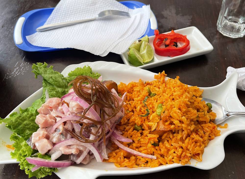
What I did. After the hot springs I took the train back to Cusco, grabbed the duffel I'd been storing at my hotel there, and the next morning jumped on a plane: just an hour's flight back to Lima. I had five or six hours to kill before my flight back to New York, so I went around to cafes, had some fancy ceviche and walked around the city. It was my third time in Lima.
The way back today.
My records for this trip are a PayPal receipt, my Machu Picchu ticket and what I said in the film.
| Item | What I paid in 2022 |
|---|---|
| Refugios Salkantay, the 4-day "Independent" trip (paid April 27) | $108 ($100 plus $8 tax). They helped sponsor the film, so this isn't their normal price |
| Machu Picchu ticket, May 8, 7:00 entry (bought by the company) | S/152 |
| Hot springs in Aguas Calientes | About $4 or $5 |
| My Cusco day hike | Free |
| Flights, hotels in Cusco, the ceviche | Not in my records |
For your budget (2026). Machu Picchu: S/152 for most routes, S/200 with a mountain (foreign adult), plus the S/11 conservation fee from May 2026. The bus up about US$12 each way. Trains back to Cusco or Ollantaytambo: check fares when you book; they change by date and hour. Small cash fees on the road to Soraypampa and at Humantay Lake. Companies sell the whole trip as a package with lodges, meals, transfers, the ticket and the train; compare what each one includes.
| Night | Where |
|---|---|
| May 3 and 4 | A hotel in Cusco |
| May 5 | The refugio at Soraypampa, 12,660 ft (3,860 m) |
| May 6 | A coffee farm at Lucmabamba, 6,810 ft (2,075 m) |
| May 7 | A hotel in Aguas Calientes |
| May 8 | Cusco, after the train |
From OpenStreetMap, each within 60 m of my track. Heights are from my GPS.
| Place | Day, mile | Height | What's there |
|---|---|---|---|
| Challacancha | Day 1, 0 | 12,100 ft (3,689 m) | End of the road |
| Soraypampa | Day 1, 3.6 | 12,660 ft (3,860 m) | Lodges and campsites |
| Salkantaypampa | Day 2, 2.6 | 13,630 ft (4,155 m) | A dwelling and a camp |
| Wayramachay | Day 2, 8.0 | 12,790 ft (3,897 m) | Hamlet and campsite |
| Rayanpata | Day 2, 10.6 | 11,150 ft (3,399 m) | Hamlet |
| Chaullay | Day 2, 13.3 | 9,440 ft (2,876 m) | Village, campsites, road |
| Lucmabamba | Day 3, 0 to 0.7 | 6,810 to 6,960 ft (2,075 to 2,123 m) | Coffee farms, campsites, a lodge |
| Llactapata pass | Day 3, 3.6 | 9,276 ft (2,827 m) | Campsites, a viewpoint, the ruins at mile 4.0 |
| Hidroeléctrica | Day 3, 7.5 | 5,860 ft (1,785 m) | Railway, restaurants, the road to Santa Teresa |
| Aguas Calientes | Day 3, 14.2 | 6,890 ft (2,100 m) | Town: hotels, restaurants, the train station |
OpenStreetMap shows many more small campsites and lodges, especially at Soraypampa, Chaullay, Lucmabamba and Llactapata. Nobody publishes an official list, so what's there can change.
There are streams almost the whole way on Day 2, and lodges and small shops at the stops. There are villages, horses and mules on the route: filter or treat anything from a stream.
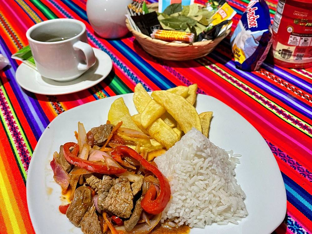
On my trip all the meals came from the company: breakfast in Mollepata on the drive, lunch and dinner at the lodge, lunch on Day 2 from the cook, and dinner and breakfast at the coffee farm. In Aguas Calientes there's everything. Try lomo saltado, ceviche, and an alpaca burger in Cusco.
Paid links: I earn a commission if you buy through these links, at no extra cost to you. As an Amazon Associate I earn from qualifying purchases.
The company's lodges and cooks meant I didn't carry a tent, a stove or food for the trail in 2022, and I left a duffel at my hotel in Cusco. Here's what I had, what I'd take now, and what I filmed with.
From the film and my photos. No brands, so no links.
What I'd bring for this trek from my current kit.
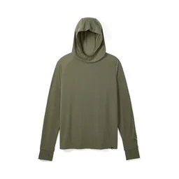 Sun hoodie: PATH Projects Pyrenees T19 Hoodie (PATH Projects). The sun is strong up high.
 Cap: PATH Projects Muir Cap 2.0 (PATH Projects)
 Sunglasses: Goodr OG Sunglasses (Amazon)
 Rain shell: Arc’teryx Beta AR Jacket (Arc’teryx). Rain and mist on Day 3 and at Machu Picchu.
 Puffy: Arc’teryx Cerium Hoody (Arc’teryx). For Soraypampa and the pass.
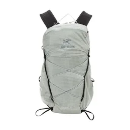 Small pack: Arc’teryx Aerios 15 (now the Aerios 18) (Arc’teryx). Big bags aren't allowed in Machu Picchu.
 Water: Katadyn BeFree AC · 1L (Amazon). Filter or treat anything from a stream.
 Poles: Black Diamond Alpine Carbon Z Poles (Amazon). For the pass, not for Machu Picchu.
What I filmed this trip with in 2022. My setup is smaller now (below). Drones aren't allowed at Machu Picchu: see Machu Picchu: tickets and rules.
Since September 2026 I film with a smaller setup: the Pocket 4 and the Mic 3 on the trail, and the Mini 5 Pro in the air.
 Camera: DJI Osmo Pocket 4 (Amazon)
 Mic: DJI Mic 3 · 1 TX + 1 RX (Amazon). It pairs with the Pocket 4.
 Drone: DJI Mini 5 Pro (Amazon)
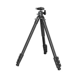 Tripod: SmallRig Carbon Fiber Tripod (Amazon)
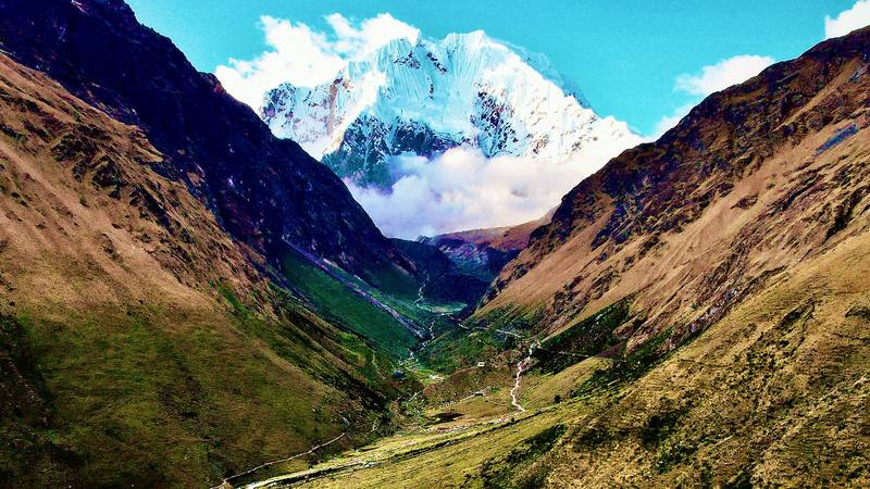
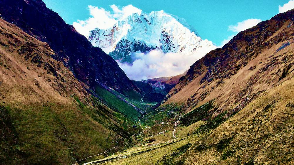
It was very overcast in the morning, and I was a little worried, but every so often I'd catch glimpses of Salkantay, the crown jewel of the hike, the thing you're always in wonder of. The walk from Challacancha is only about 3.6 miles, up and then along a ridge to Soraypampa, where there are buildings and the refugio I was staying at. I had some tea, had lunch and took a nap, because I was starting to feel it at 12,000 ft.
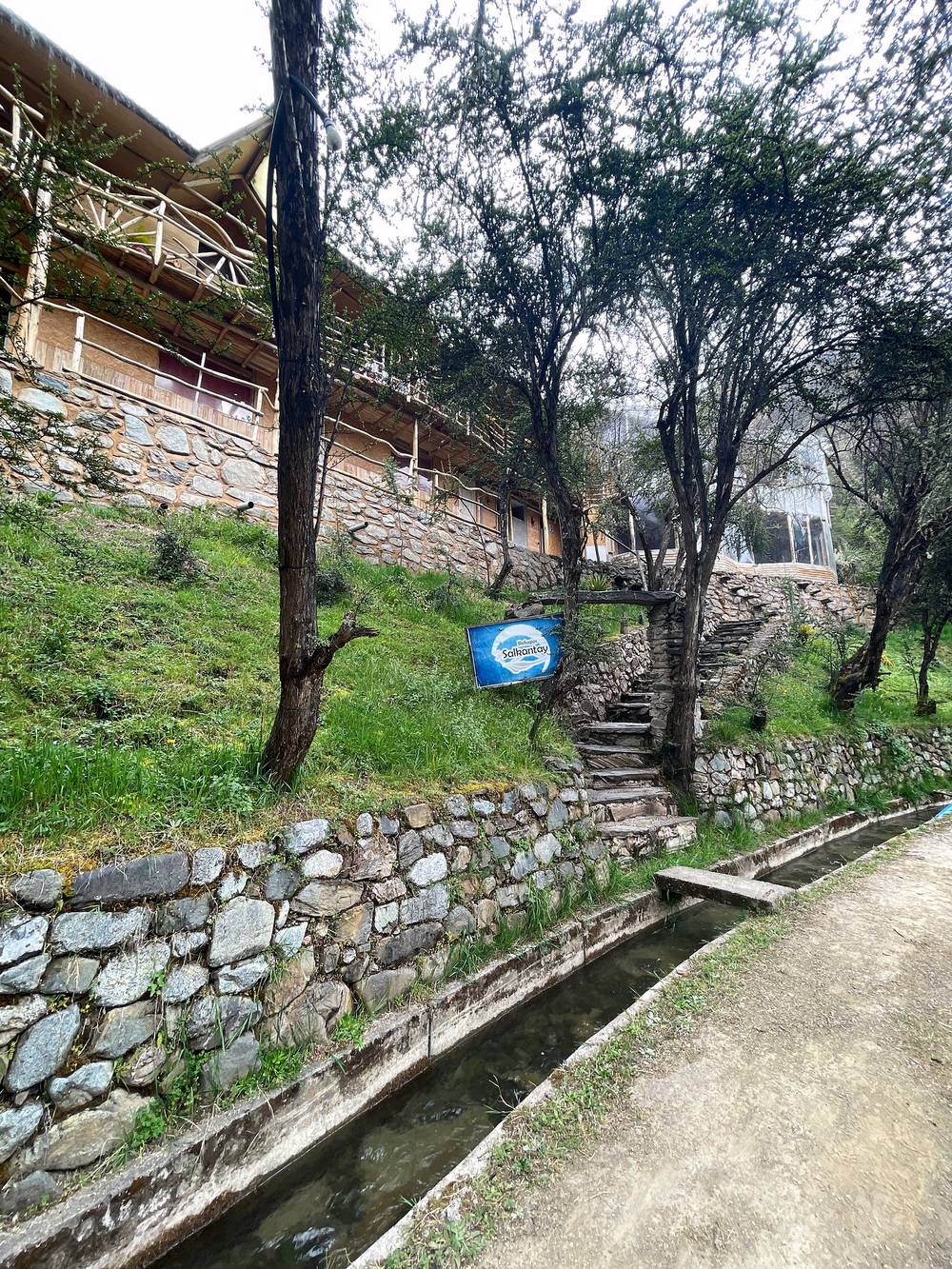
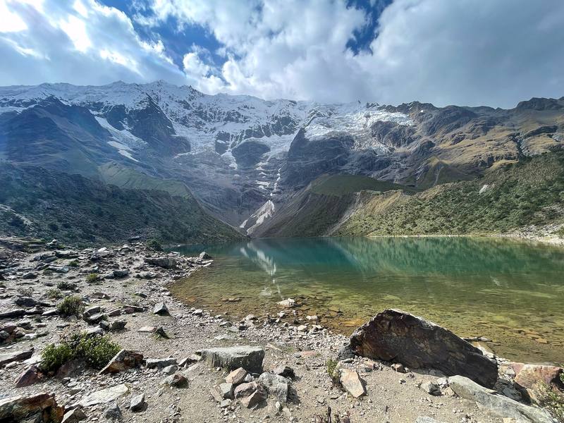
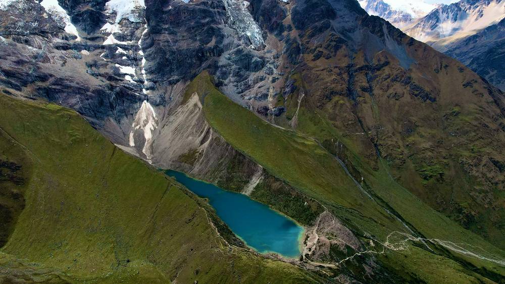
As soon as I'd finished lunch and felt up to it, someone from the refugio escorted me up to Humantay Lake: past the other lodges, past the main area where there are a bunch of horses, and then up, up, up. It doesn't look too bad, but it took a while. At about 14,000 ft there's this beautiful turquoise alpine lake with the white snowy mountains and glaciers behind it. It was really nice and peaceful up there. I spent some time, took a nap and said hello to a couple of people. A couple of subscribers said hi on the trail too, which is so nice, especially when you're hiking solo.
Back at the lodge I had popcorn and soup and a really good dinner. The chefs were crushing it, and popcorn after a long hike is good. Then the mountain started to light up for sunset.
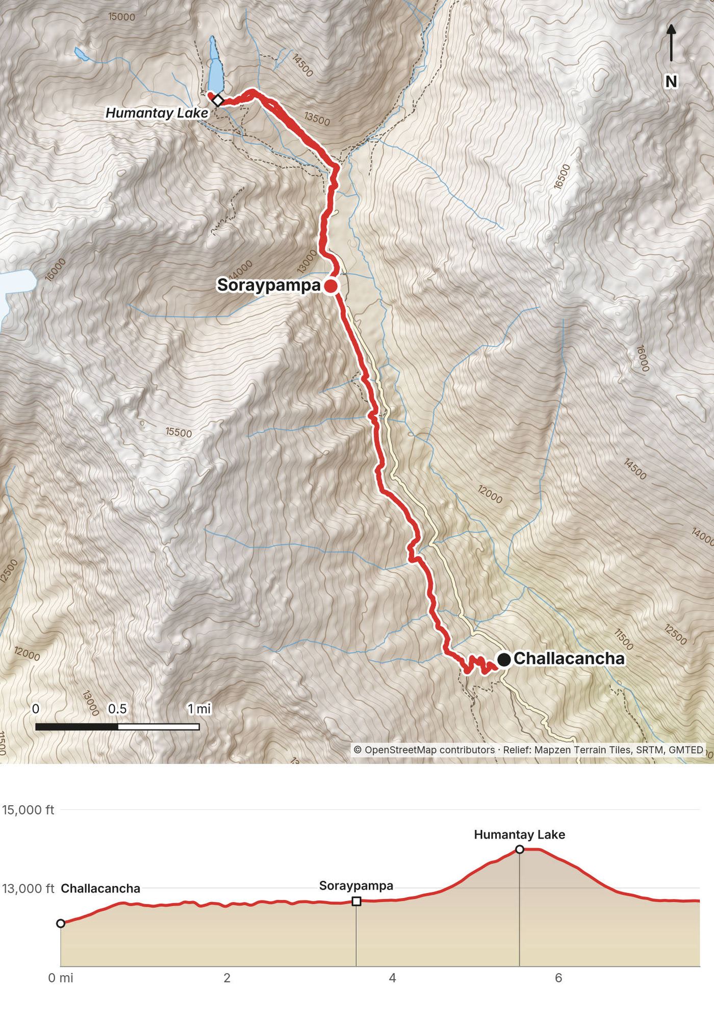
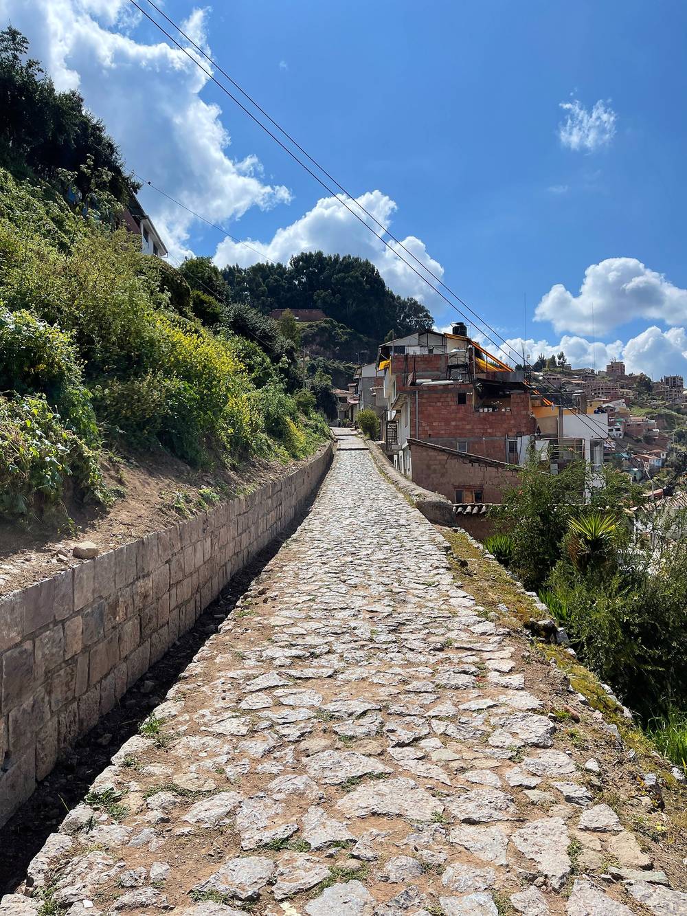
From the end of the road at Challacancha (3,689 m) the path climbs a little and then runs almost level beside a stone water channel along the side of the valley, with Salkantay ahead. At mile 3.6 it reaches the lodges and camps at Soraypampa, about 3,860 m.
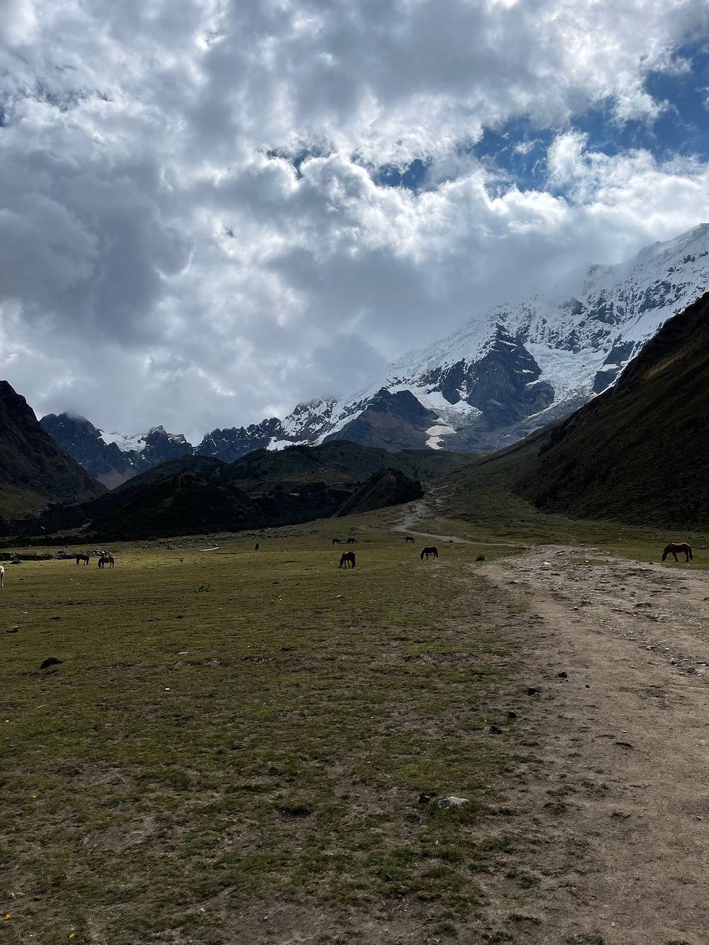
The Humantay Lake path starts from the lodges and goes up the side valley to the northwest: about 2 miles and 1,300 ft of climbing to the lake at 4,266 m, under the glaciers of Nevado Humantay, and back the same way. It's steep near the top. It's a popular day trip from Cusco too, so expect people.
AllTrails and cliffs. When you hike next to a cliff, the app sometimes doesn't know exactly where you are and counts it as climbing. These recordings are not perfect. The numbers here are smoothed the same way for every day.
Go back down the path to Challacancha and the road to Mollepata. On this day that's also going lower, the best thing for altitude sickness.
Film, Day 1 · Humantay Lake · The guide part of the film
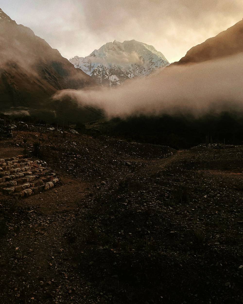
I set out at 5:46. It was so beautiful: the morning golden light was lighting up the fog and the mist, and apart from the low-hanging fog it was clear, with Salkantay just waiting for me. This was a long day, 13.3 miles, and I called it almost 3,000 ft of climbing at the time. Take that with a grain of salt: these maps aren't perfect.
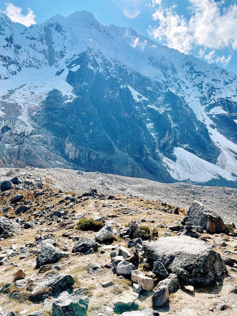
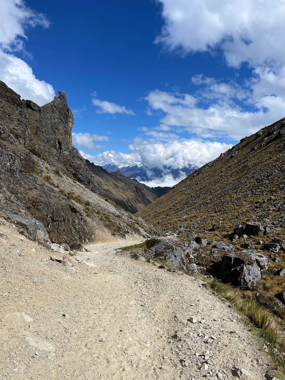
Out of the refugio and past the camps there were a bunch of people, two or three dozen other hikers in groups. Below the pass you can go the low route or the high route. The high one is a set of switchbacks they call the seven snakes or something; I took the stream route. It doesn't matter in the end, but when I have the option of going left or right, I'll usually take the path that has fewer people. I made my way up slowly to the pass, the Abra Salkantay, where there's a sign to touch, lots of people chatting and laughing, a couple of little lakes, and big peaks. From there it's down, down, down for a while.
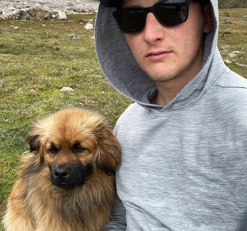
I had lunch before Wayramachay. The cook had run ahead to prepare it, and I think I got there a little sooner than he expected, so he rushed to get me some food. A dog hung out with me the whole time. He was very happy to get some soup and some bread, and when I gave him some chicken, that just made his day: his tail was wagging so much. He particularly liked the bread dipped in the soup.
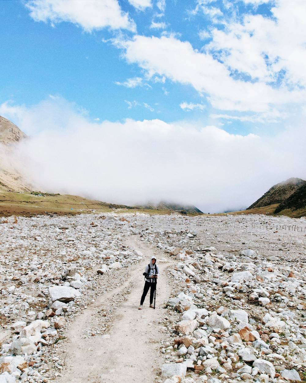
Past that, I got out of the alpine zone into tall bushes, then much more green, with a lot more flowing water. That's the nice thing about this hike: you go from the high alpine down into the lush jungle. The path becomes very easy and smooth, less rocky, more dirt, so it's very easy to rush down. As soon as I got to Chaullay there was a shuttle waiting for me, so I didn't shoot much there. I did the day pretty quickly: 6 hours moving, 8 hours in all.
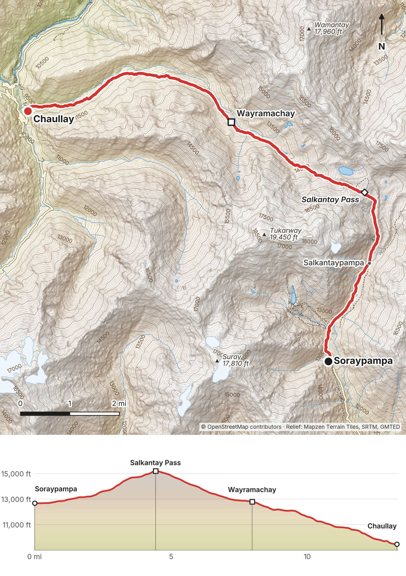
From Soraypampa (3,860 m) the path climbs north up the valley past Salkantaypampa (mile 2.6, 4,155 m). The last part to the pass is the steepest, on switchbacks or the rougher line by the stream, to the Salkantay Pass at mile 4.4: 4,636 m on my GPS, right under the ice of Nevado Salkantay (6,271 m in OpenStreetMap).
The west side drops across a wide, stony valley floor, then past lunch spots and the hamlet and campsite of Wayramachay (mile 8.0, about 3,900 m). Below it the path goes into bushes and then green forest, past Rayanpata (mile 10.6), down to Chaullay at mile 13.3 (2,876 m), where the road starts. From the pass to Chaullay it's about 1,760 m (5,770 ft) down in 9 miles.
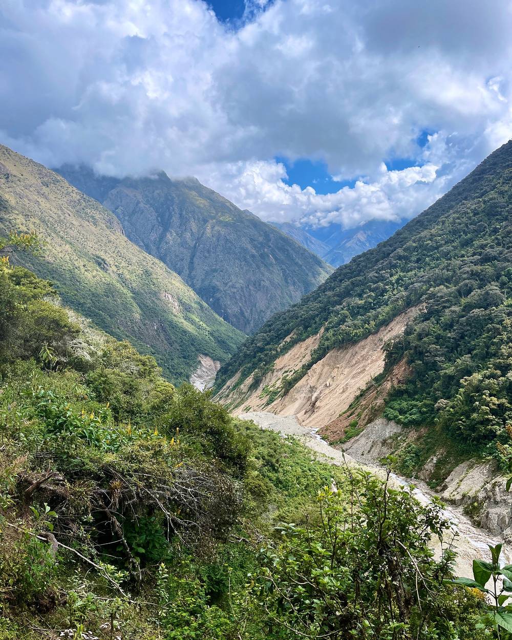
The point at Collpapampa. Just across the river from Chaullay, where the two valleys meet, there's a sharp point with cliffs down to the river, a lodge, and a campground right on the tip. It's way more dramatic than the map shows. It would be so cool to sleep in either. If you want to spend an extra night here, I recommend it.
The road to Lucmabamba. From Chaullay I took an hour-long car ride, with reggae music playing the whole time, to the coffee farm where I stayed. Technically this is part of the Salkantay and people walk it, but it's a road with cars, you're in a valley on a winding road, and it would probably take you all day. I'm a completionist, but not to the degree of walking on a road. The view out the window was way more dramatic than the map shows, with big cliffs.
Timing. I left at 5:46 and was over the pass before 9 a.m., with Salkantay clear; by mid-morning low cloud filled the valley below it (my photos).
Before the pass, go back down to Soraypampa and Challacancha. After the pass, keep going down to Chaullay, where there's a road. If you feel really unwell with the altitude, go down, whichever side is closer.
Film, Day 2 · Wayramachay to Chaullay · The coffee farm
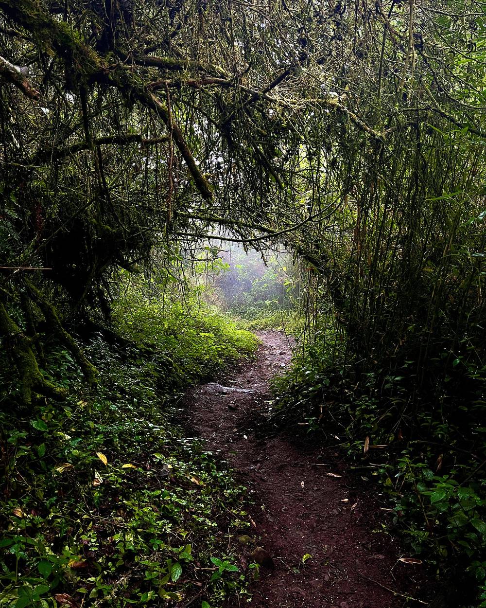
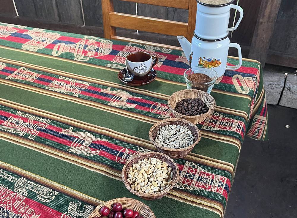
The coffee farm was a nice part of the trip. It was really cool to literally pick coffee cherries and go through every step of the process, all the way to a cup of delicious coffee. The farm had dogs, chickens, roosters, coffee and fruit, and just really cool vibes.
This was the route from the coffee farm over the mountain, through the valleys to Aguas Calientes. It's quite the climb, through the jungle, so every so often you get glimpses out into the valley. It was very overcast and foggy that day, 14 miles in rain and mist, and I couldn't see anything by the time I got to the top. I could have waited, but I'd probably have been waiting two or three hours for blue skies, so I pushed on.
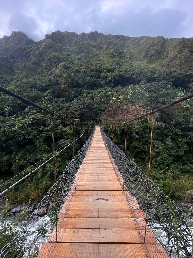
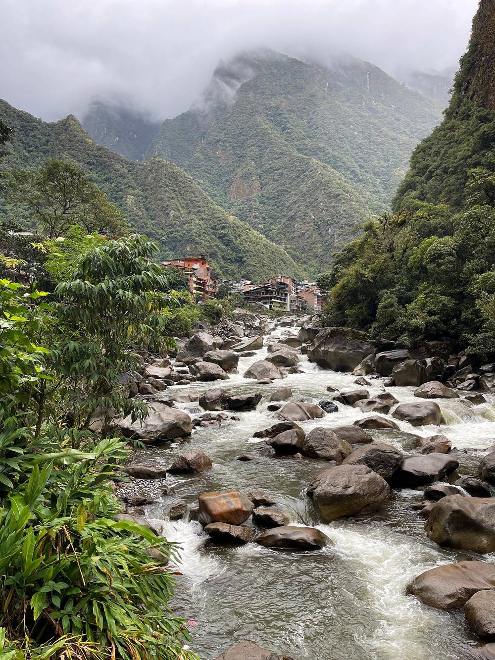
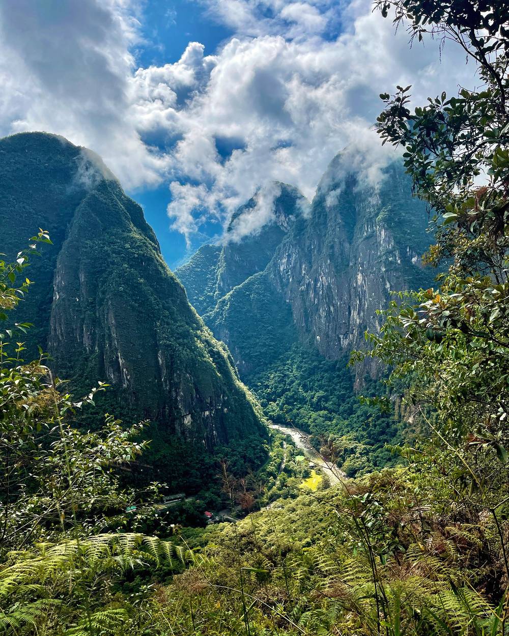
I rushed up and over, down across the bridge, along a road, and then you start to hit the train tracks, at the hydroelectric plant. Following train tracks isn't much fun: there are really no views, and every so often you come across a person going the other way. I just put on a podcast and trucked it. Past the point where you go up to Machu Picchu there are more and more people, and then you hit town. This town is crazy: definitely touristy, and just wild. I made it to my hotel at the top of town, the nicest hotel of my stays: almost 14 and a half miles in 5 and a half hours. I was booking it.
From Lucmabamba (2,075 m) the path climbs through farms and forest to the Llactapata pass at mile 3.6 (2,827 m). There are campsites and a viewpoint up there, and the Inca site of Llactapata is just past it at mile 4.0, on the ridge across the valley from Machu Picchu. On a clear day you can see Machu Picchu from here.
From Llactapata it's a steep descent, about 1,040 m (3,410 ft) in 3.5 miles, past Ahobamba and across the river to the railway at Hidroeléctrica, the low point of the day at mile 7.5 (1,785 m). From there the way to Aguas Calientes follows the railway up the Urubamba valley for about 6.7 miles, past Mandor (mile 11.5) and Puente Ruinas (mile 13.1), where the path and the bus road go up to Machu Picchu, to Aguas Calientes at mile 14.2.
The Hidroeléctrica control. The park service's control on the railway path from Hidroeléctrica (Intiwatana, km 122) is open from 7:30 a.m. to 4:30 p.m. (SERNANP, 2026). Be past it well before 4:30, or take the train. I went through at about 10:15.
After the hydro plant. There are lots of different ways to go here. I followed my AllTrails route, and it led me through a section that kind of sucked: very overgrown and difficult. I recommend that as soon as you get past the hydro plant, you go straight up and then follow the train tracks all the way, around and across the bridge.
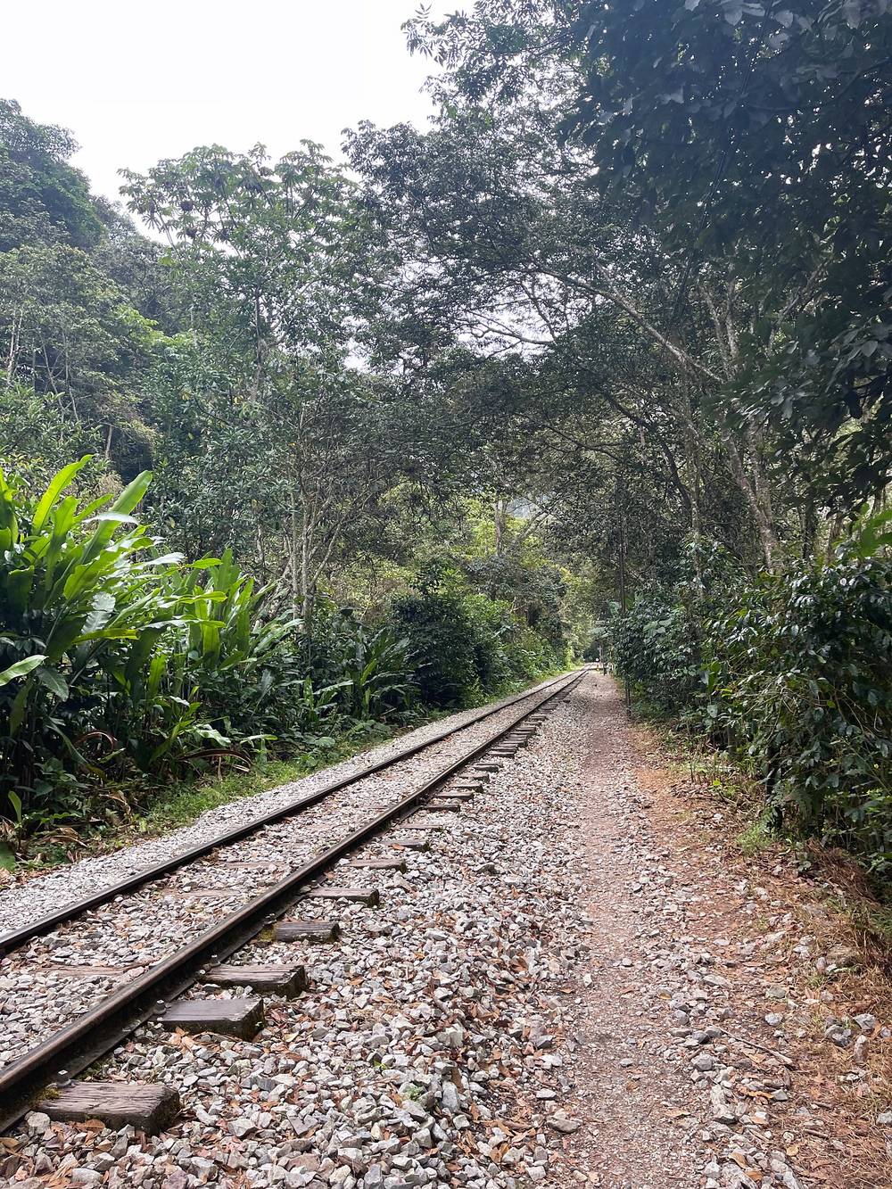
Walk beside the tracks, not on them. Trains run on this line; step well off the rails when you hear one.
Sleeping at Llactapata. There were campgrounds up there. As fun as the coffee farm was, it would have been cool to hike up the night before and sleep up there, with views for sunset. My needs are different from most hikers' when I'm taking video and photos, and I'm faster than most. The more you know yourself, the more you can customize your hike to get the most out of it.
Before Llactapata, go back down to Lucmabamba and the road. After it, keep going down to Hidroeléctrica: it has a road to Santa Teresa and a train to Aguas Calientes.
I had a time slot for 7 a.m., so I set off at about 6. It takes about 15 minutes to walk to the trailhead for Machu Picchu, where they check your ticket, and then it took me half an hour to 45 minutes to get up. I wasn't going as fast as I could; I think I could do it in 25 minutes. Most people take 45 minutes to an hour hiking, and most people take the bus. I've never done that. Maybe next time.
If you walk up. My GPS says I left the hotel at 6:25 and reached the entrance control at 7:40. In 2026 that would have been too late for a 7:00 slot: you get 30 minutes (45 from June to mid-October), and tickets can't be refunded. Walking up, leave 1.5 to 2 hours before your slot.
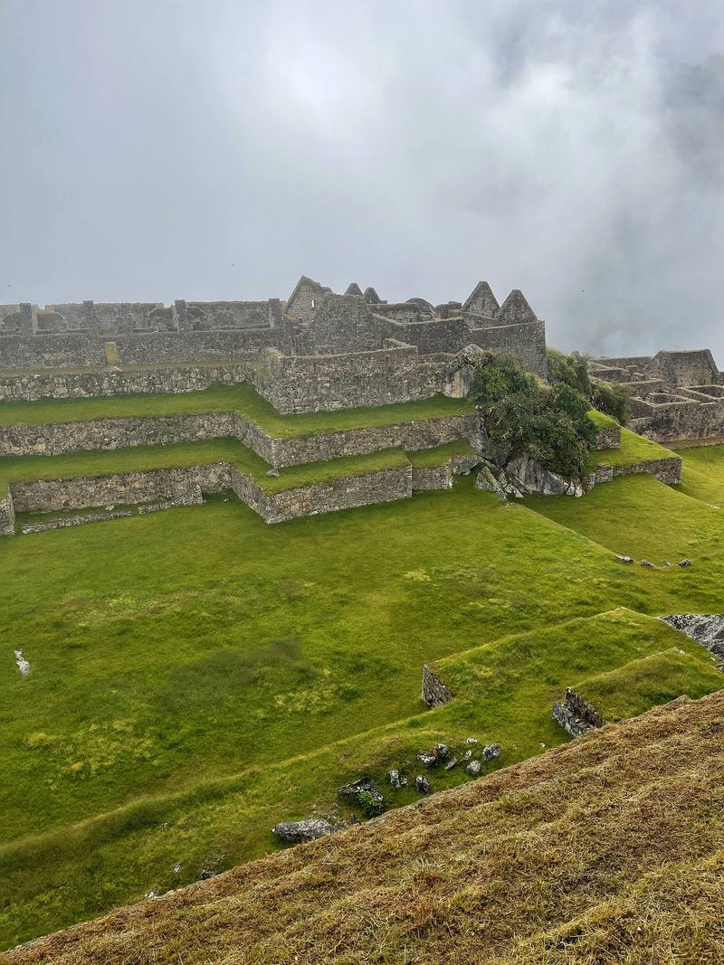
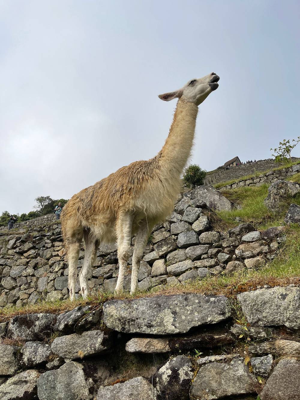
It was raining and cloudy, and I waited a while to get the views that I did. This was my second time at Machu Picchu, so it was more for the video, but I walked around and did the thing. You've got to visit this spot: it's really unique. I kept wondering how they brought water up to this city. As soon as I left and hiked back down to town, the blue skies opened up, which was ridiculous. In all, round trip, 6.5 miles and almost 3,000 ft of climbing (as I called it) in under 4 hours.
Then I went straight to a ceviche place, very local, and then to the hot baths at the top of Aguas Calientes: you just walk up into the mountains from town. I think it was 4 or 5 bucks for entry, and you can buy drinks, like a pisco sour, and soak in the hot baths. I had two or three hours before my train back to Cusco, so I tried a side trail near town. You can see AllTrails had no idea what was going on, because it's so steep. Once I got to a wall with a rope, pretty tough, slippery, very steep, I trusted the rope, but it's just dumb to be out there by yourself, so I didn't go up. Above that there's an even tougher set of ladders. It's a weird, very unmaintained trail, so be careful if you attempt it.
From Aguas Calientes the road runs down the river to Puente Ruinas (mile 1.3), the bridge where your ticket is checked for the footpath. From there a long stone stairway climbs straight up through the forest, crossing the bus road several times, to the entrance at mile 2.6, about 2,450 m: 450 m (1,480 ft) up in 1.3 miles. Inside the site you follow your circuit one way. I came back down the same stairway.
The footpath (2026). The ticket and passport check for walkers is at the Puente Ruinas bridge; trekking sites say it opens about 5 a.m. and most people take 1.5 to 2 hours up. Leave enough time to reach the entrance for your slot.
The bus (2026). Buses run from Aguas Calientes to the entrance while the local government re-tenders the concession; in September 2026 two companies, Consettur and San Antonio de Torontoy, ran them, about US$12 each way (trekking sites; not on an official page).
The buses between the entrance and Aguas Calientes are the quick way down. In 2026 two companies ran them, about US$12 each way. Or go back down the stairway to Puente Ruinas and walk the road to town.
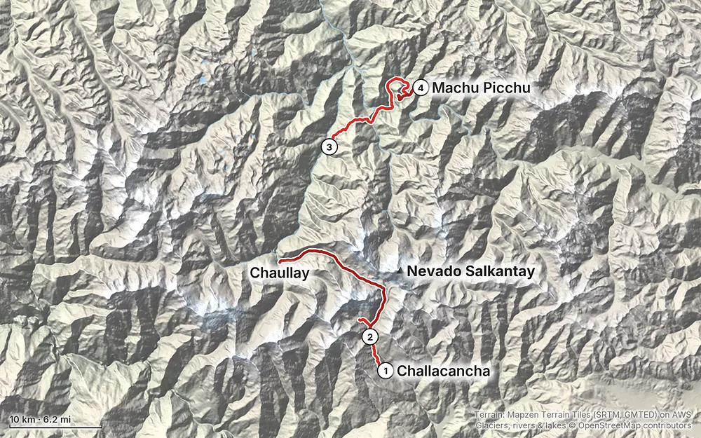
Elevation5,860–15,203 ft42.0 mi
Terrain: Mapzen Terrain Tiles (SRTM, GMTED) on AWS · Glaciers, rivers & lakes © OpenStreetMap contributors
Tap a map to open it full size.
Machu Picchu (the Ministry of Culture calls it the Llaqta de Machupicchu) is sold as timed tickets: a day, an entry hour and a route. These are the 2026 rules; 2027 prices and numbers weren't out in September 2026.
Buying (2026). Only on the Ministry of Culture's site, Tu Boleto (tuboleto.cultura.pe), or through a travel agency registered with the Ministry in Cusco. Since September 22, 2026 you have 15 minutes to pay in full, and the ticket carries your name and passport number. It can't be moved to another day or person, and there are no refunds. Tickets sold anywhere else aren't official. The Ministry was still trialling the system until about October 21, 2026. Up to 1,000 tickets a day are also sold in person in Aguas Calientes, for the next day; treat that as a backup, not a plan.
Price (2026, foreign adult). S/152 for most routes; S/200 for the routes with Machu Picchu Mountain, Huayna Picchu or the Great Cavern. On top of that, the park service (SERNANP) set a conservation fee of S/11 for foreigners from May 1, 2026, after postponing it several times, so expect about S/163 and S/211 in all; check the total when you pay. Students with a valid university card pay less (S/77 and S/125). The cheaper 2026 rates are only for Peruvians, residents and Andean Community citizens.
Circuits and routes. There are three circuits and ten routes:
You follow your route one way. Plan on 2 to 3 hours in the ruins, more with a mountain.
Numbers. In 2026 the site took 5,600 visitors a day from June 19 to November 2 and 4,500 on most other days, in hourly slots from 6 a.m. to 3 p.m. The mountain routes have only a couple of slots a day and go first. Book as soon as you know your date. Tickets for a year go on sale only when the Ministry opens that year's calendar on Tu Boleto (the 2026 one opened from November 2025 into January 2026), so watch the site.
Getting in on time. The Ministry's posted schedule allows you up to 30 minutes late for your slot (45 minutes from June 1 to October 15); the gates to the mountains allow none.
The rules (Ministry of Culture, 2026):
Breaking the rules can get you put out with no refund.
What I did. The company bought my ticket in Cusco five days ahead: Machu Picchu for May 8, 2022, entry at 7:00, S/152 for an adult, with my passport number printed on it. It was my second time at Machu Picchu.
The dry season. The Machu Picchu sanctuary's own page recommends April to October; November to March is the rainy season. In 2026 every closure fell in that rainy window: landslides closed Humantay Lake and the Salkantay area from February 6 to March 6, and a mudslide at Mandor cut the railway from Hidroeléctrica from March 30 to about April 6. Peru's weather service expects an El Niño in 2026 and 2027 with generally below-normal rain in the southern Andes, which doesn't rule out landslides. Avoid January to March.
What I got. I went at the start of May. The first morning was very overcast; it started to clear a little, not quite as much as I wanted. Day 2 started beautiful, with golden light and fog in the valley; by mid-morning low cloud filled the valley below the pass. Day 3 was 14 miles in rain and mist, very foggy over Llactapata. At Machu Picchu it was raining and cloudy, and as soon as I left and hiked back down to town, the blue skies opened up.
Mornings. Everyone tells you to start at 5 a.m., but they don't know your speed. The weather always improved through the day for me. If you're a fast hiker and you're sleeping in a valley, there's not much point waking up that early; if you're sleeping up on a ridge, get up for the sunrise.
Cold and heat. Soraypampa is at 12,660 ft and the pass near 15,200 ft, so bring warm layers for the evening and the morning of Day 2. Two days later you're in the cloud forest at 6,000 ft, warm and wet. Bring rain gear for both.
This is the part to take seriously. Cusco is at about 11,150 ft (3,400 m). My first night on the trek was at 12,660 ft, Humantay Lake is near 14,000 ft, and the pass is near 15,200 ft.
I flew from sea level in New York straight to Cusco and felt it. For the next two days it was day hikes, no alcohol, plenty of tea and salads. The day before the trek I did a day hike to almost 14,000 ft and felt good and ready. Then on Day 1 I was very sleep deprived, I hadn't slept the night before, and the first day up into the altitude just hit me really hard. I didn't do too many miles or too much climbing, but I was tired that night. Sometimes you can't predict it.
| Where | Height (my GPS) |
|---|---|
| Cusco | about 11,150 ft (3,400 m) |
| Katunki, top of my Cusco day hike | 13,747 ft (4,190 m) |
| Challacancha, the start | 12,102 ft (3,689 m) |
| The lodges at Soraypampa, night 1 | 12,660 ft (3,860 m) |
| Humantay Lake | 13,995 ft (4,266 m) |
| The Salkantay Pass | 15,211 ft (4,636 m) |
| Chaullay, end of Day 2 | 9,437 ft (2,876 m) |
| Lucmabamba, night 2 | 6,810 ft (2,075 m) |
| Llactapata pass | 9,276 ft (2,827 m) |
| Hidroeléctrica | 5,856 ft (1,785 m) |
| Aguas Calientes, night 3 | about 6,890 ft (2,100 m) |
| Machu Picchu | about 8,000 to 8,275 ft (2,450 to 2,522 m) |
The rules of thumb. The US CDC's current guidance (Yellow Book, April 2025): once above 3,000 m (9,800 ft), don't raise your sleeping height by more than 500 m (1,650 ft) a night, and allow an extra night for every 1,000 m (3,300 ft) you gain. Cusco is already at 3,400 m, so two nights there first matter. From Cusco to the Soraypampa lodges is about 460 m, within that. After the pass, every night is lower.
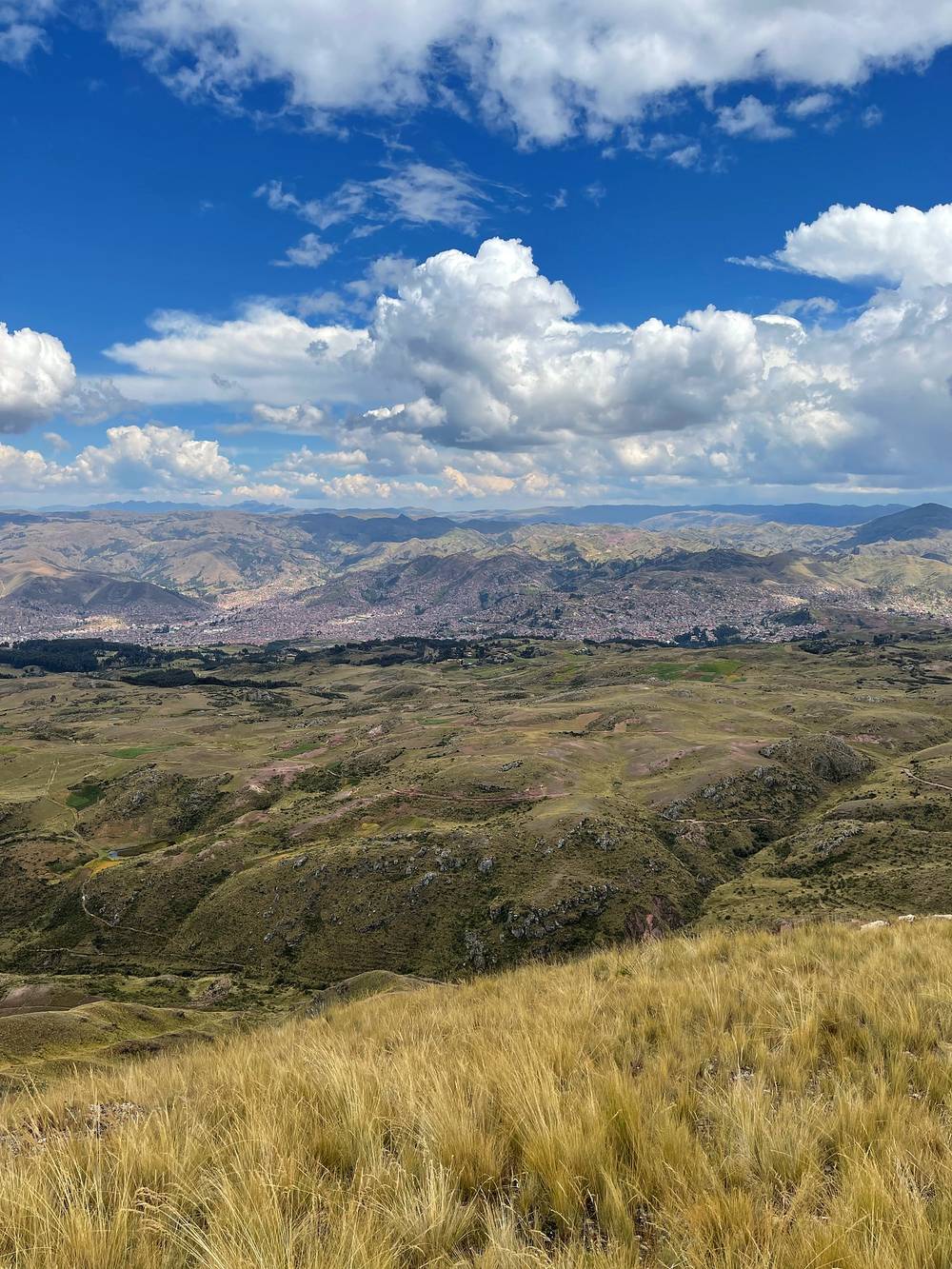
My Cusco day hike. After breakfast I walked straight out of Cusco, up the stairs out of the city, into the farmland past a couple of ancient ruins, up a valley and to a little peak, Katunki. Nothing crazy, but it's almost 14,000 ft up there, a few feet short of a Colorado 14er. It was free, and a good day hike right out of Cusco. It's in the GPX files (cusco-acclimatization-hike.gpx): 10.4 miles, about 2,680 ft of climbing, 4.5 hours. Right after, I went to get an alpaca burger. If you're in Peru, you've got to try it.
Going down helps. If you feel really unwell, the best treatment is to go lower. On Day 1 and the morning of Day 2 that means back down the road to Mollepata; after the pass, down the valley toward Chaullay.
Emergency numbers (2026). Police 105, fire service 116. The SAMU ambulance number 106 isn't listed for Cusco. iPerú, the government's tourist information service, answers on WhatsApp at 944 492 314; it isn't an emergency line. Don't count on phone signal on the trail; a satellite messenger is the real backup.
Rescue. In September 2026 a German trekker who fell on the stretch below Collpapampa was carried out by rope and stretcher by the Santa Teresa municipality and the police, over several hours. The US State Department says local rescue capability is severely limited and responders can take hours or days to reach you. Get travel insurance that covers trekking at this height, rescue and medical evacuation.
Humantay Lake. In July, August and September 2026 ice and snow avalanches from Nevado Humantay fell toward the lake; nobody was hurt, and the route stayed open. There's no warning system yet. Stay on the path and don't linger under the glacier or at the water's edge.
Water. In 2025 the rivers near Soraypampa met the standards for irrigation and animals, not for drinking, and there were cases over sewage there. Filter or treat everything.
Leave a plan with someone at home and at your hotel in Cusco, with your dates.
The US advisory (2026). The US State Department rates Peru Level 2 (exercise increased caution), updated September 3, 2026. Its Level 4 areas include the VRAEM (with Vilcabamba) and the cities of Abancay, Ayacucho, Huancavelica and Huancayo; it says Cusco, the Sacred Valley, the Inca Trail and Machu Picchu are outside them, and the Salkantay route isn't named. It warns that demonstrations can shut roads and trains, and it tells US citizens not to use coca products, such as tea or candy.
Where to be careful:
Going solo. I walked alone, with the company's staff at each stop. If you go on your own, leave a plan, carry a way to call for help, and don't cross the pass in bad weather.
How many days do I need? I walked four days, the Salkantay "4 days, 3 nights" with Machu Picchu at the end, and I drove one road section. Many companies also sell five days, with one more night on the way. Add at least two days in Cusco before you start. See Other ways to do it.
How hard is it? The path is clear and there are people on it. The hard part is the altitude: the first day up at the lodge hit me really hard, even though I'd felt fine on a day hike before it. Day 2 has the pass, about 15,200 ft, and a long way down. See Altitude.
Do I need a guide or a company? I walked it alone, with a company taking care of the lodges, meals and transfers. In September 2026 no permit is needed for this route: it isn't one of the Inca Trail routes. But the park service's (SERNANP) page for the Machu Picchu sanctuary says visitors must go with an operator it has authorized, and the Ministry of Culture checks visitors at the Lucmabamba control post on the Llactapata path; in December 2025 it listed people entering without a guide as a problem and said checks would increase. Ask your company or iPerú before you plan it without one. See Going with a company or on your own.
How do I get into Machu Picchu? With a timed ticket for a set day, hour and circuit, bought ahead. In 2026 you buy it only on the Ministry of Culture's Tu Boleto site, pay at once, and can't change or refund it: S/152 for a foreign adult on most routes, S/200 with Huayna Picchu or Machu Picchu Mountain, plus a S/11 conservation fee from May 2026. See Machu Picchu.
Do I have to walk the road? No. From Chaullay I took a car for an hour to the coffee farm at Lucmabamba. People walk that section, but it's a road with cars on it, the same sight over and over again, and it would probably take you all day. I don't recommend it.
Will I see other people? Yes. On Day 2 I'd say two or three dozen other hikers, in groups. I didn't really see anyone else by themselves. A couple of subscribers said hello on Day 1.
Where do you sleep and eat? In lodges, camps and small hotels along the way. Mine were a refugio at Soraypampa, a coffee farm at Lucmabamba and a hotel in Aguas Calientes, with meals made by the company's cooks. You don't need a tent unless you want one.
Is there phone signal? Don't count on it on the trail. Download everything in Cusco.
I walked the four days in this guide. These are other ways to use it, and I didn't do them.
Many companies also sell five days, with one more night on the way (Refugios Salkantay does, for one). From my trip, the two nights I'd add:
With your own tent or with beds in the lodges and camps along the way, and the same stages as mine. You'll need your own rides at both ends of the Chaullay road, the Machu Picchu ticket for a set day and hour, and the train back. See Going with a company or on your own for what's allowed in 2026.
From Hidroeléctrica you can take PeruRail's train to Aguas Calientes (about 30 minutes) instead of walking the 6.7 miles along the tracks. Foreigners can't use the local train.
Most people take the bus up from Aguas Calientes. Then Day 4 is just the site and the walk down, or the bus both ways.
What I did. I went through a company, Refugios Salkantay, a family-run business with lodges along the route, and they helped sponsor my film: they took care of some things. I booked their Salkantay "Independent" trip, four days and three nights with Machu Picchu at the end, a train ride, and a couple of transfers and taxis between places. After meeting with the guide at my hotel in Cusco, we went through the whole thing: a sheet with the transfers between the locations, the hiking times, little pictures of what to expect, and where I'd have meals and with whom. I walked alone, and at every stop someone was waiting: the lodge, the cook who ran ahead to make lunch, a car at Chaullay, the coffee farm.
2026. Refugios Salkantay is still running in September 2026. Its site lists an "Independent 4-Day" trek to Machu Picchu (the short one I did) and a 5-day version, plus full-service trips with a guide; on the Independent trip you walk on your own, with lodging with local families, meals, water, and horses to carry your bag (7 kg, 15 lb). Its page doesn't say whether the Machu Picchu ticket, the train or the transfers are included, as they were on my trip, so ask. There are many other companies in Cusco that run this route.
Going without a company. People do. There's no permit for the route over the Salkantay Pass, though SERNANP's page for the Machu Picchu sanctuary says visitors must use an authorized operator, and there are lodges, camps and small shops at Soraypampa, Chaullay, Lucmabamba, Llactapata and Hidroeléctrica. What you'd arrange yourself: the ride to Mollepata and Challacancha, your beds, the Chaullay to Lucmabamba road, the Machu Picchu ticket and the train back. Two things to know in 2026: the Ministry of Culture checks visitors at the Lucmabamba control post and in December 2025 called unguided visitors there a problem; and the regional government ran checks on guides and transport at Hidroeléctrica in August and September 2026. Rules can change. Ask iPerú (WhatsApp 944 492 314) or a company in Cusco before you go.
Local fees. Expect small cash fees on the road to Soraypampa and at Humantay Lake, collected by the Mollepata municipality or community. The tourism ministry's inventory lists S/10 for foreigners at Humantay; amounts in 2026 vary. Carry small notes.
Why I didn't carry a tent. If you're hiking in a place that has huts and hotels, why not stay there? If I'm going to camp, I want to camp in the wilderness, where there's nothing. And if there's a road, I'm going to take a shuttle if possible, because there's no point hiking on a road.
These change every year. Everything else in this guide stays the same.
The trek
Getting there and back
Conditions and your stuff
The film is at the top of this page.
When bookings open, from the sources named under each. Dates move: confirm on the official site.
A year's tickets go on sale only when the Ministry of Culture opens that year's calendar on Tu Boleto: the 2026 one opened from November 2025 into January 2026. Watch the site.
Next: about Nov 1, 2027 (a typical date: confirm on the official site)
Book on tuboleto.cultura.pe.
Source: Kraig Adams's Salkantay Trek guide: Machu Picchu tickets and rules (Sept 2026). Checked September 2026.
Planning questions about Salkantay Trek, answered only from this page's facts, the creators' versions and hikers' public tracks, with where each answer comes from. When the data doesn't say, the answer says "not given".
From hikers
Sign in to comment. Free; your hikes stay private unless you share them.
Something wrong or missing on this page? Send feedback.