
Content made there
The film is at the top of this page.
Photos
Hikes / Routeburn Track / Kraig Adams's version
Oceania · New Zealand
Nov 20–21, 2023 · Two days · 25.9 miles · Solo · Tent

Part of his longer trip, Four tracks across New Zealand. Its miles and days count once, in that trip.
Two days, 25.9 miles (41.7 km), November 20 to 21, 2023, solo. A one-way Great Walk from Routeburn Shelter, near Glenorchy, over Harris Saddle (1,255 m, about 4,120 ft) to The Divide on the Milford Road. DOC's track is 33.1 km (20.6 miles), usually 2 to 4 days. My total includes the climb to Lake Wilson and back.
How I did it. It was the fourth hike of my trip and my first solo track in New Zealand. When I asked subscribers what to hike, a bunch of people recommended the Great Walks, and the Routeburn in particular. At this distance and difficulty I could have done it all in one day, but since I was making a video I wanted to take my time and spend a night out there. I couldn't find hut bookings, so I searched a bit more and discovered the Valley of the Trolls, far enough away that I could wild camp and for sure not see anybody. I was alone the entire time I was up there.
Days 7 to 8 of his Four tracks across New Zealand trip (three weeks). Getting there, huts, costs, food, gear and safety below are from his guide to the whole trip.
Two days, 25.9 miles (41.7 km), November 20 to 21, 2023, solo. A one-way Great Walk from Routeburn Shelter, near Glenorchy, over Harris Saddle (1,255 m, about 4,120 ft) to The Divide on the Milford Road. DOC's track is 33.1 km (20.6 miles), usually 2 to 4 days. My total includes the climb to Lake Wilson and back.
How I did it. It was the fourth hike of my trip and my first solo track in New Zealand. When I asked subscribers what to hike, a bunch of people recommended the Great Walks, and the Routeburn in particular. At this distance and difficulty I could have done it all in one day, but since I was making a video I wanted to take my time and spend a night out there. I couldn't find hut bookings, so I searched a bit more and discovered the Valley of the Trolls, far enough away that I could wild camp and for sure not see anybody. I was alone the entire time I was up there.
What I think. Most people would really like the Routeburn. It's a Great Walk, so it's very well maintained, and there are lots of huts and campsites, but in the busy season it might be hard to get a space. If you're a bit more experienced and looking for something extra, an overnight wild camp up at Lake Wilson is the thing to do. Check the rules below first.
Routeburn huts and campsites (DOC): Routeburn Flats Hut (20 bunks) and campsite (30), Routeburn Falls Hut (48), Lake Mackenzie Hut (50) and campsite (18). Lake Howden Hut was destroyed by a storm and landslide in February 2020 and is gone. The Harris Saddle shelter is for day use only.
Flying in. I flew direct from New York to Auckland, about 18 hours, then on to Queenstown. Queenstown has direct flights from Auckland, Wellington and Christchurch, and from Melbourne, Sydney, Brisbane and the Gold Coast. At the end I flew Queenstown to Auckland (NZD 172 on Jetstar) and home from there.
NZeTA and the levy. Most visitors, including Americans, need a New Zealand Electronic Travel Authority (NZeTA) before they fly. In 2026 it costs NZD 17 in the official app or NZD 23 on the official website, and you also pay the International Visitor Conservation and Tourism Levy, NZD 100. Allow 72 hours. My NZeTA was still pending days before my flight, and I paid a third-party website to rush it. Don't: Immigration New Zealand says to use only its own app or nzeta.immigration.govt.nz. Apply weeks ahead.
Where to base yourself. Queenstown for the Rees-Dart and the Routeburn: the shuttles leave from town and go through Glenorchy, about 45 minutes away. Te Anau for the Kepler and the Milford: the Kepler starts at the edge of town and the Milford boats leave from Te Anau Downs, up the road toward Milford Sound. I stayed around Queenstown for most of the trip, including at a small retreat run by a subscriber's family, and went to Te Anau for the Kepler.
How I got to each track
| Track | In | Out |
|---|---|---|
| Rees-Dart | Info & Track shuttle, Queenstown to Glenorchy, smaller bus to Muddy Creek (round-trip tickets) | Info & Track shuttle from Chinamans Bluff |
| Kepler | Driven to the Kepler Track car park by the friend I started with | Walked back into Te Anau |
| Routeburn | Shuttle from Queenstown through Glenorchy to Routeburn Shelter | Bus from The Divide back to Queenstown |
| Milford | Guided walk coach from Queenstown, boat across Lake Te Anau to Glade Wharf | Boat from Sandfly Point to Milford Sound, cruise and coach back the next day |
The road from Queenstown to Glenorchy is a beautiful view but it's twisty, and I definitely felt sick.
Info & Track (Queenstown and Glenorchy, infotrack.co.nz), scheduled services November 2026 to May 1, 2027, adult one way:
Tracknet (Te Anau, tracknet.net), November 1, 2026 to May 1, 2027, adult one way:
Kepler Water Taxi (Fiordland Outdoors) runs from the Te Anau lakefront to Brod Bay in 15 minutes, which skips the first 3.5 miles of the Kepler. NZD 30 on the company's own page, NZD 50 on Tracknet's page. October 1 to April 30.
Milford boats. RealNZ runs the boats from Te Anau Downs to Glade Wharf (usually 10:30 a.m. and 2:00 p.m.) and from Sandfly Point to Milford Sound in the afternoon. Book them through a transport operator: DOC lists Tracknet, Fiordland Outdoors, Cheeky Kiwi and Easyhike. There's no road to either end of the Milford Track.
My receipts from this trip are incomplete. Here's what's on record, in NZD where I paid in NZD.
| Item | What I paid |
|---|---|
| Luxmore Hut, Kepler, November 17, 2023 | NZD 102 |
| Moturau Hut, Kepler, November 18, 2023 | NZD 102 |
| Jetstar, Queenstown to Auckland, November 30 | NZD 172 |
Not on record: the guided Milford walk, the Rees-Dart shuttles and huts, the Routeburn shuttle and bus, and my flights to Auckland and Queenstown.
For an international adult, walking independently, per person, NZD. Not included: flights, the NZeTA and levy (NZD 117 to 123), rooms in Queenstown and Te Anau, and food. The guided Milford (NZD 2,925 shared) would replace the Milford huts and transport.
| Item | Cost |
|---|---|
| Rees-Dart: shuttles in and out (Info & Track) | 170 |
| Rees-Dart: Dart Hut and Daleys Flat Hut, weekday | 56 |
| Kepler: Luxmore and Moturau huts | 264 |
| Routeburn: shuttle in and bus out from The Divide | 179 |
| Routeburn: one night at Lake Mackenzie Hut (or campsite, 42) | 132 |
| Milford: three huts | 456 |
| Milford: transport package from Te Anau | 243 |
| Total on the tracks | about 1,500 |
All Great Walk huts and campsites are booked on the DOC website, bookings.doc.govt.nz. In season you can't stay without a booking, and the penalty for doing so is the normal fee plus the full adult fee.
When bookings open. For the 2026-27 season, bookings opened at 9:30 a.m. New Zealand time on May 13, 2026 for the Milford, May 15 for the Routeburn and May 19 for the Kepler. DOC uses a virtual queue: anyone in the waiting room before 9:30 gets a random place in line; anyone who arrives later goes to the back. The 2027-28 dates will be announced by DOC early in 2027.
How to give yourself the best chance.
The Milford is one way, 4 days and 3 nights, starting at Glade Wharf, with a night each at Clinton, Mintaro and Dumpling huts on the nights you booked. There's no camping on the Milford. You also need to book the boats at both ends (see Milford Track).
Changes and cancellations (2026-27 DOC terms). Free on the booking day or the day after (if more than two days before arrival). A 10% fee from 48 hours after booking to 15 days before arrival, 50% between 14 and 4 days out, 75% from 3 days out, and no refund from the day before arrival. No refund if you leave early.
Per person per night, NZD, in the Great Walks season. "Resident" means New Zealand citizens and residents.
| Track | Hut, international adult | Hut, resident adult | Campsite, international adult | Campsite, resident adult |
|---|---|---|---|---|
| Milford | 152 | 106 | no camping | no camping |
| Routeburn | 132 | 88 | 42 | 28 |
| Kepler | 132 | 88 | 42 | 28 |
Children (5 to 17 for residents, 0 to 17 for international visitors) pay half. Outside the season huts are NZD 30 a night (NZD 35 at Luxmore Hut and on the Routeburn in May and June). International visitors have paid 1.5 times the resident rate since July 2021.
My booking story. I found the Kepler huts easy: I booked Luxmore Hut and Moturau Hut online on November 15, 2023, two days before I started, at NZD 102 a night. For the Milford I couldn't find any hut availability at all. It's a very popular trek and very competitive, so I signed up for a guided walk. On the Routeburn I looked for hut bookings and couldn't really find any, so I found a place to wild camp instead.
Shelter Rock, Dart and Daleys Flat huts are DOC "serviced" huts, and DOC says to book them online. There's one price for everyone. 2026-27 prices, adult per night, NZD: 28 on weekdays and 32 on weekends from October to April, 29 and 34 from December to February, and 25 from May to September. There are campsites at all three huts. Most of the hikes in New Zealand need hut nights, and when the Great Walks are booked up you go with what's left. The Rees-Dart was less popular, which is why we chose it.
I joined an all-inclusive guided walk with Ultimate Hikes, the company that runs the private lodges on the Milford. 2026-27 prices, per person, NZD: 2,925 in a shared room (up to six, bunks, shared bathrooms), 3,750 each for two in a private room with a bathroom, 6,075 for one person in a private room. It includes transport from Queenstown or Te Anau, four nights in lodges, all meals, and a Milford Sound cruise on the last morning. You pay in full when you book, and cancelling within 30 days of the trip costs the full fare. Minimum age is 10.
My booking was nearly a disaster. A travel disruption and a late NZeTA meant I'd have missed my original departure. The company moved me to a later date at no extra cost, and I walked from November 25.
On the tracks there's nothing to buy. Great Walk huts have gas cookers in season, cold running water, toilets and heating, but no food, no cooking pots or utensils, and no showers. Bring everything, including a pot, a mug, a spoon and a lighter. Rees-Dart huts are simpler.
Water. DOC says hut water comes from rain or streams and Giardia may be present: boil it for 3 minutes if you're unsure. I treat it.
What I ate. On the Rees-Dart one of my friends is a great trail chef, and it was cool to learn a few things from how she cooks. At Lake Mackenzie I ate an avocado, one of my favorite new trail foods. On the Milford the lodges fed us, and I packed a chicken pesto wrap, or two, every day.
In town. Queenstown is full of places to eat. There's a really popular burger spot named Fergburger, and the chocolate chip cookies at Cookie Time are flawless. After the Kepler I did a speed run back to Te Anau for pies and coffee. Stock up at the supermarkets in Queenstown and Te Anau; Glenorchy is small.
Bring a sleeping bag (huts have mattresses only), a stove only outside the season, a pot, mug, utensils and lighter, all your food, a headlamp (lighting is only in the kitchen), rain jacket and pants, warm layers and a hat, insect repellent, a water treatment method, a first aid kit, and a personal locator beacon.
Paid links: I earn a commission if you buy through these links, at no extra cost to you. As an Amazon Associate I earn from qualifying purchases.
I walked four tracks in three weeks, mostly hut to hut, with one wild camp on the Routeburn and a guided Milford where I barely carried anything. Here's what I carried in 2023, what I'd take now, and what I filmed with.
I don't have a full packing list from this trip. This is what my films and their gear lists show.
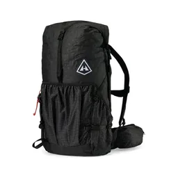 Pack: Hyperlite Mountain Gear Southwest 2400 (Hyperlite)
 Sun hoodie: Amazon Essentials Quick-Dry Tech Hoodie (Amazon)
 Water bottle: Katadyn BeFree AC · 1L (Amazon). Hut water comes from rain or streams. I treat it.
My current kit for a Great Walk hut trip. All of it is on my gear page: kraigadams.com/gear.
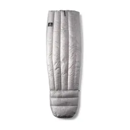 Sleeping bag: Hyperlite Mountain Gear 20° Quilt (Hyperlite). Huts have mattresses only.
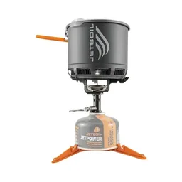 Stove: Jetboil Stash (Amazon). Only outside the season: Great Walk huts have gas cookers in season.
 Mug: Sea to Summit Frontier Camp Cup (Amazon). Huts have no pots or utensils.
 Spoon: TiTo Long Handle Spork (Amazon)
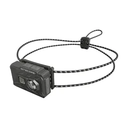 Headlamp: Nitecore NU20 Classic (Amazon). Hut lighting is only in the kitchen.
 Rain jacket: Arc’teryx Beta AR Jacket (Arc’teryx)
 Warm layer: Arc’teryx Cerium Hoody (Arc’teryx). The Kepler ridge and Mackinnon Pass are exposed. Carry warm layers even in summer.
 Hat: PATH Projects Hoyt Merino Beanie (PATH Projects)
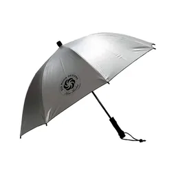 Umbrella: Six Moon Designs Silver Shadow Carbon (Amazon)
 Tent: NEMO Hornet Elite OSMO 1P (Amazon). For a camp like mine at Lake Wilson.
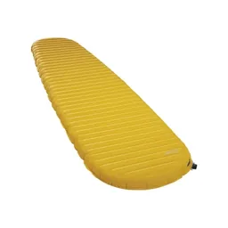 Sleeping pad: Therm-a-Rest NeoAir XLite NXT (Amazon). If you camp.
What I filmed these tracks with in 2023. My setup is smaller now (below). Check the drone rules in Weather and safety before you fly: conservation land needs a DOC permit.
Since September 2026 I film with a smaller setup: the Pocket 4 and the Mic 3 on the trail, and the Mini 5 Pro in the air.
 Camera: DJI Osmo Pocket 4 (Amazon)
 Mic: DJI Mic 3 · 1 TX + 1 RX (Amazon). It pairs with the Pocket 4.
 Drone: DJI Mini 5 Pro (Amazon)
I took the shuttle from Queenstown with a bunch of other hikers, up through Glenorchy to the Routeburn trailhead. There were lots of people on this very maintained trail. The hike was pretty easy: about 11 miles for the day with about 4,000 ft of gain on the app.
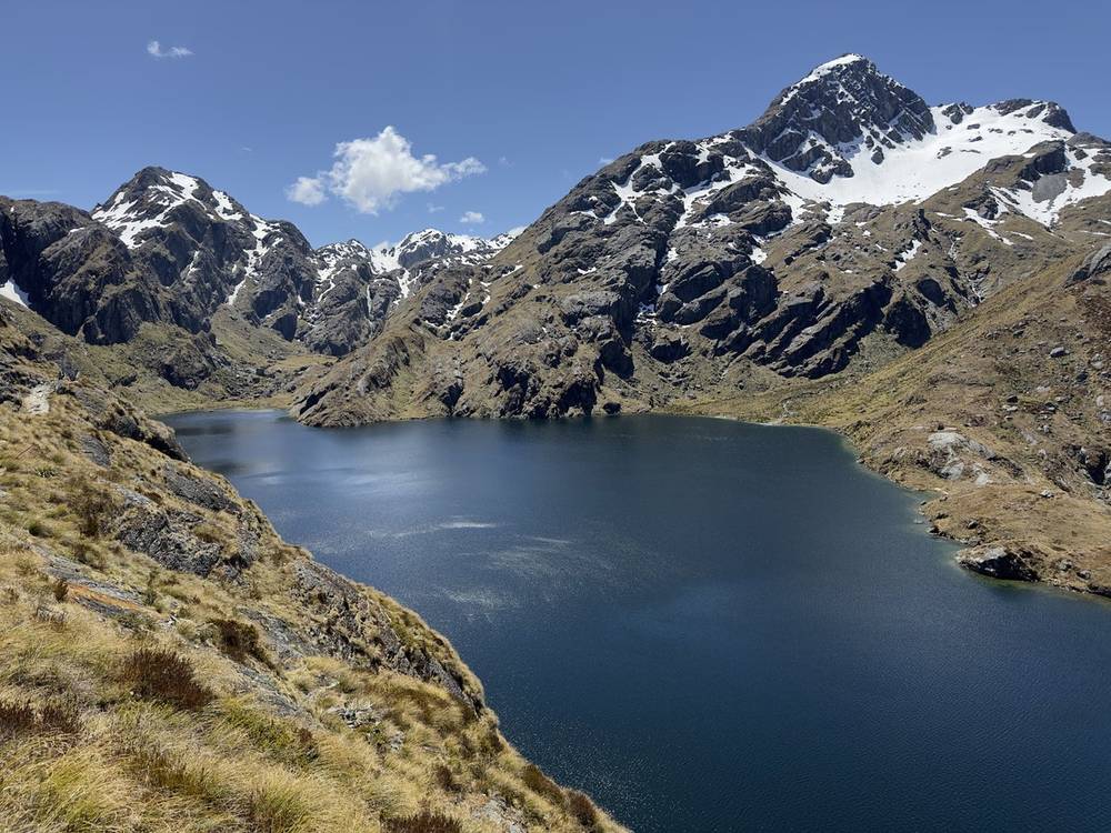
Up near Lake Harris and the saddle, my AllTrails turned off for some reason, so I lost some tracking. I had lunch at a hut up there. I was hoping to do Conical Hill, but it was closed because of snow and ice. There was snow and ice going up to Lake Wilson, too, but I had nothing but time, so I made my way up slowly, got over the top and found a nice spot for my tent.
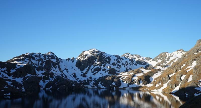
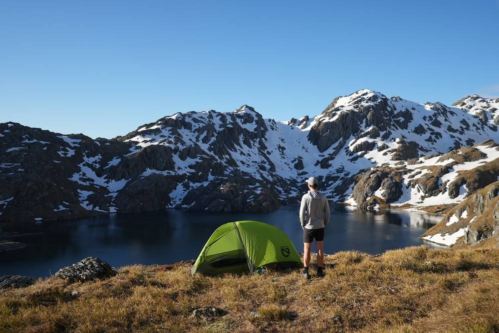
Camping at Lake Wilson was fantastic, worth the extra miles just for the isolation. I was the only one up there, with fantastic views, sunrise, sunset and kea. I expected wind in the night and built a small rock wall around the tent, but there was no wind.
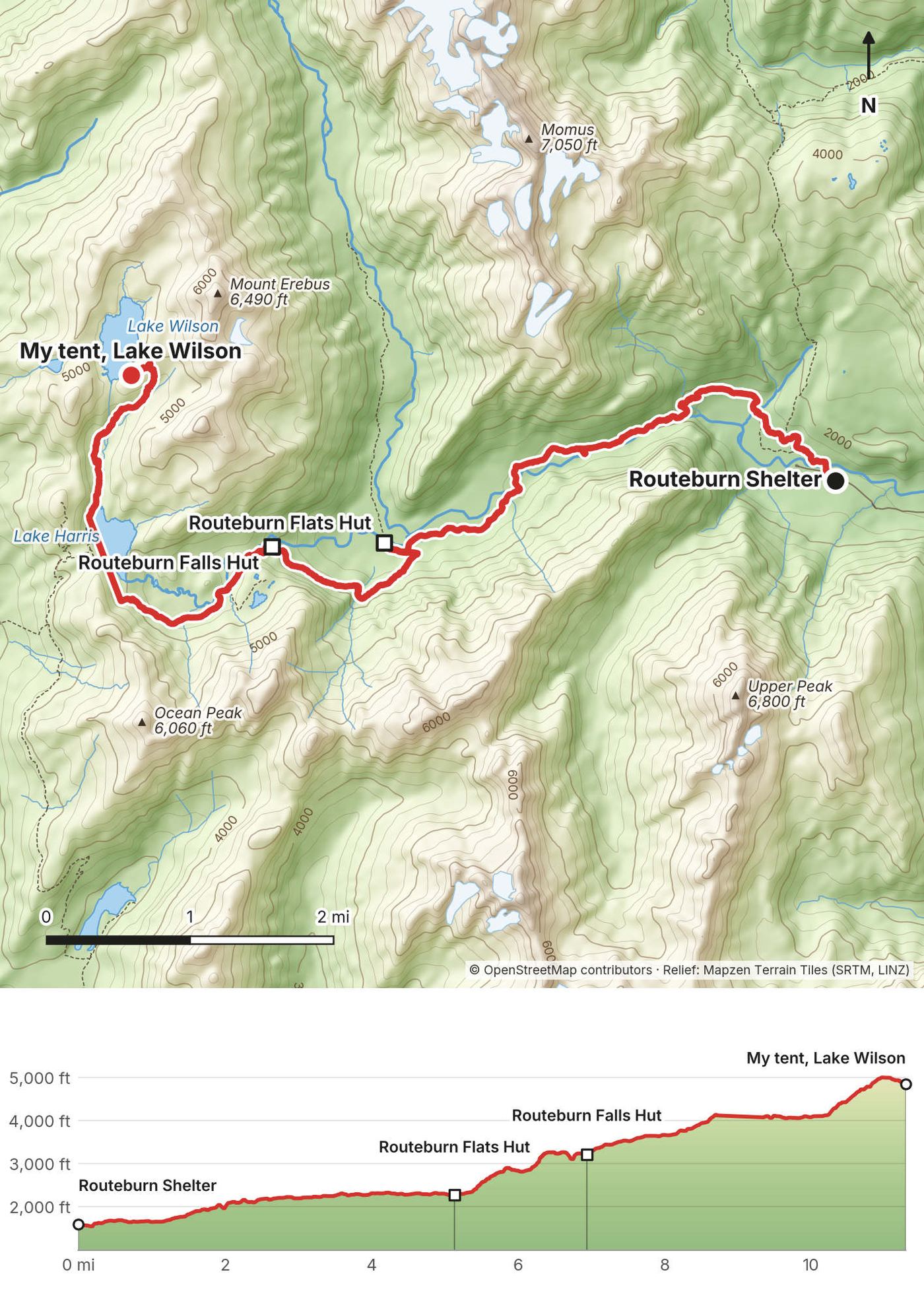
From Routeburn Shelter the track climbs gently through beech forest beside the Route Burn to Routeburn Flats Hut: 4.7 miles (7.5 km), 1.5 to 2.5 hours. Then a steeper climb of 1.4 miles (2.3 km), 1 to 1.5 hours, to Routeburn Falls Hut at the bushline. Above the hut the track climbs through open alpine ground past Lake Harris to Harris Saddle. The alpine section is exposed to weather and avalanches: DOC counts 32 avalanche paths on the Routeburn, says the risk can run into December, and may close sections when there's avalanche hazard.
Lake Wilson is not on the Great Walk. There's no marked track and in November there was snow on the way up. My GPS line shows where I went; I lost the recording for a while near Lake Harris.
Walk back down to Routeburn Falls Hut, Routeburn Flats Hut or the shelter. The shuttle leaves Routeburn Shelter for Queenstown at 9:45 a.m. and 2:15 p.m. (2026-27).
Routeburn film, Routeburn Shelter · Harris Saddle · Lake Harris · Lake Wilson · Campsite · The Routeburn in the 160-mile film
I woke up to kea jumping on my tent. They're very curious about people, they're so cute, they play, they fly around. I love the kea.
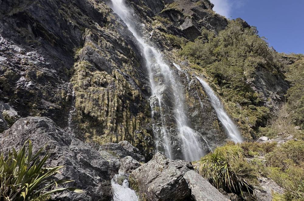
It was about half a day of hiking, mostly downhill, past some lakes. It was pretty quiet because I started early, except near Lake Mackenzie, where there were a few people. It was nice to step into the lake and eat an avocado, one of my favorite new trail foods. Then more downhill, past a waterfall, and a few subscribers said hello. I made it to the main road at The Divide and took a bus back to Queenstown.
Back down to Harris Saddle, then a long traverse along the mountainside and a descent to Lake Mackenzie Hut. DOC gives Routeburn Falls Hut to Lake Mackenzie Hut, over the saddle, as 7 miles (11.3 km) and 4.5 to 6 hours. From Lake Mackenzie the track rolls through forest past Earland Falls (174 m high) and Lake Howden to The Divide: 7.5 miles (12 km), 4 to 5.5 hours. The Key Summit side trip near the end is 1 to 1.5 hours return.
The Divide is on the Milford Road, 85 km from Te Anau. The road distance between the two ends of the Routeburn is 325 km, so book the bus before you start.
Lake Mackenzie Hut is the halfway point. The Harris Saddle shelter is day use only. In bad weather on the alpine section, turn back to the nearest hut.
Routeburn film, kea · Lake Mackenzie to The Divide · Hiking guide and behind the scenes
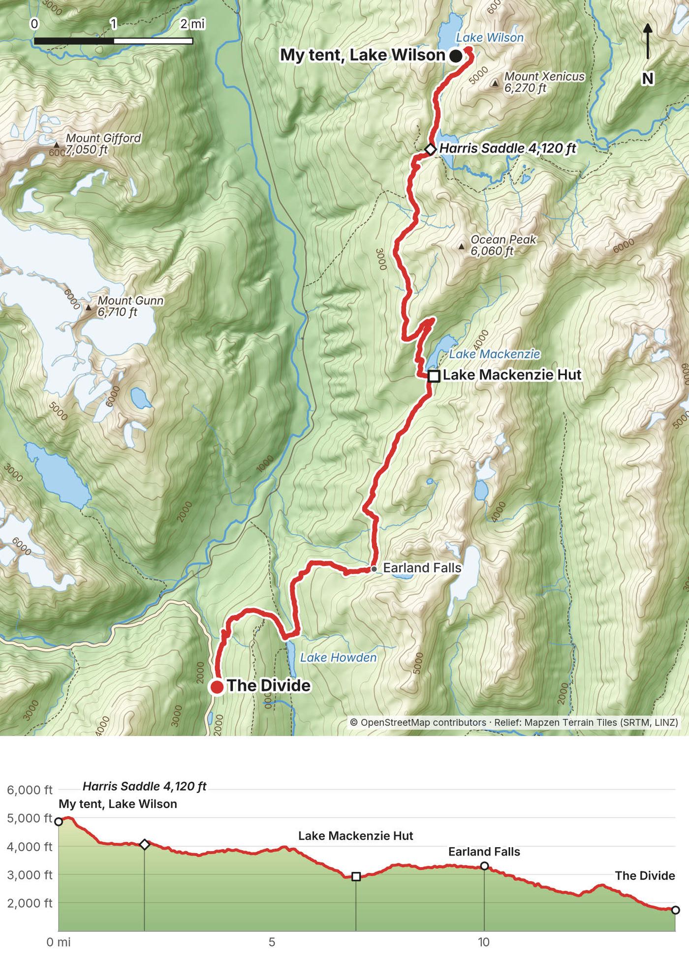
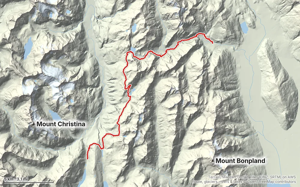
Terrain: Mapzen Terrain Tiles (LINZ, SRTM) on AWS · Route, glaciers, rivers & lakes © OpenStreetMap contributors
Tap a map to open it full size.
Huts and campsites must be booked online with DOC in the Great Walks season; adult hut fees are NZ$88 (NZ) or NZ$132 (international) a night. Off season fees drop to NZ$30-35 for adults; check DOC on whether a booking is needed then. DOC says bookings are open for stays up to 30 June 2027.
From the hike's facts; check the official page before you go.
The season. The Great Walks season runs from late October or November 1 to April 30. For 2026-27 that's October 27 to April 30 on the Kepler and November 1 to April 30 on the Routeburn and the Milford (last Milford departure April 28). In season the huts have gas cookers, flush toilets, running water and a ranger, and the bridges are in.
Outside the season the tracks become alpine winter routes: gas, flush toilets and indoor water are taken out, some bridges are removed, and there are dozens of avalanche paths (DOC counts more than 57 on the Milford and 32 on the Routeburn). DOC says winter trips need alpine skills and gear such as an ice axe, crampons, and an avalanche beacon, shovel and probe.
What I got in November. It was early in the season, early spring in New Zealand, and the snow was melting. That was totally fine, but it was a bit boggy down low. There was snow on Rees Saddle and around Harris Saddle and Lake Wilson, and Conical Hill on the Routeburn was closed because of snow and ice. A seasonal bridge over Snowy Creek on the Rees-Dart had been put in a few days before we started. Many days were clear. Rain caught us on the last day of the Rees-Dart, and the last day of the Milford was rain and cloud.
Early season notes. Avalanche risk on the Milford, Routeburn and Kepler can run into December, and the upper Snowy Creek bridge on the Rees-Dart can go back in as late as December. If you go in early November like I did, check DOC's alerts for each track the week before.
Weather can turn any time. DOC warns that cold, snow, strong winds and heavy rain can happen in any month in Fiordland and Mount Aspiring national parks. Keep a spare day where you can.
Emergency: 111. There's no cell coverage on most of these tracks. Rent a personal locator beacon (PLB) before you go: in Te Anau at the Fiordland National Park Visitor Centre, Caltex Te Anau or Bev's Tramping Gear Hire; in Queenstown at the DOC Visitor Centre, Macpac, Small Planet Sports or Mobil Frankton. 2026 prices from the Southland Locator Beacon Trust: from NZD 30 for three days, NZD 40 for a week.
Forecasts. MetService has national park forecasts for Fiordland (with the Milford Track, Routeburn, Mackinnon Pass and Harris Saddle) and Mount Aspiring: metservice.com/mountains-and-parks. Check DOC's alerts on each track page the week before and the day before.
Tell someone. Leave your plans with a trusted contact. The AdventureSmart Outdoor Intentions form does this by email.
Rivers. Both Milford valleys become impassable in heavy rain. On any track, DOC's advice: don't cross a flooded river or stream, or if you can't find a safe way in and out, or if you're unsure. Turn back or wait for it to drop. On the Rees-Dart, watch Snowy Creek and Cattle Flat.
Avalanches and snow. Early in the season there's snow on Rees Saddle, Harris Saddle and Mackinnon Pass, and avalanche risk on the Milford can run into December. Outside the Great Walks season these are winter alpine routes.
Wind and cold. The Kepler ridge and Mackinnon Pass are exposed, with no water on the Kepler ridge. Carry warm layers even in summer.
Sandflies. Repellent, long sleeves, and keep hut doors shut.
Kea. Don't feed them. Put away loose clothing, food and gear. They're endangered.
Drones and dogs. Flying a drone on conservation land needs a DOC permit (NZD 180 for a recreational green-zone permit in 2026). No pets are allowed in national parks.
Most people walk it in three days: Routeburn Shelter to Routeburn Falls Hut (9.8 km, 2.5 to 4 hours), Routeburn Falls Hut to Lake Mackenzie Hut over Harris Saddle (11.3 km, 4.5 to 6 hours), Lake Mackenzie to The Divide (12 km, 4 to 5.5 hours). Campers use Routeburn Flats and Lake Mackenzie. Add Conical Hill (1.5 to 2 hours return from Harris Saddle) if it's open, and Key Summit near the end.
My order worked: Rees-Dart from Queenstown, a few days off, the Kepler from Te Anau, back to Queenstown for the Routeburn, a few days off, and the Milford last. Book the Great Walk huts first, on the opening days in May, and fit the Rees-Dart and the rest days around them. The Milford is the hardest to book, so build the trip around the Milford dates you get.
These change every year. Everything else in this guide stays the same.
Bookings
Track status
Transport and entry
Conditions and your stuff
The film is at the top of this page.
When bookings open, from the sources named under each. Dates move: confirm on the official site.
Opens in May for the season starting that November: for 2026-27, 9:30 a.m. New Zealand time on May 15, 2026. DOC announces the 2027-28 dates early in 2027.
Next: about May 15, 2027 (a typical date: confirm on the official site)
Book on bookings.doc.govt.nz.
Source: Kraig Adams's Routeburn Track guide: Booking the huts; Department of Conservation: Great Walks. Checked November 2026.
Planning questions about Routeburn Track, answered only from this page's facts, the creators' versions and hikers' public tracks, with where each answer comes from. When the data doesn't say, the answer says "not given".
From hikers
Sign in to comment. Free; your hikes stay private unless you share them.
Something wrong or missing on this page? Send feedback.