Follow the Hiker
Find my next hikeGearSavedKraig Adams
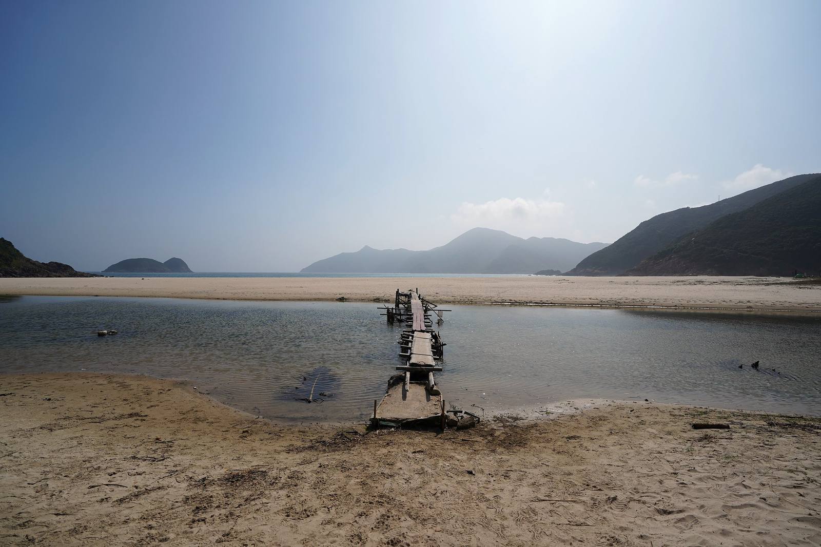
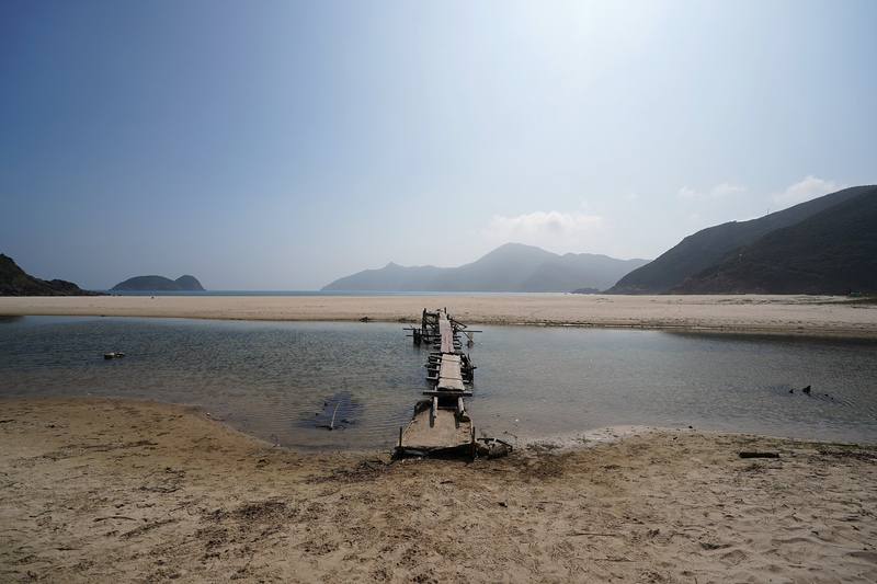
Ham Tin beach and its footbridge, Day 2.
Distance
71.4 mi114.9 km
Days
5 days
Elevation gain
15,299 ft4,663 m
High point
3,140 ft957 m
Season
October to March, the cool, dry season
Lodging
Tent
Plan this hike

Hikes / Asia / MacLehose Trail

In January 2020 my friend Ryan and I hiked the whole MacLehose Trail across Hong Kong, from Pak Tam Chung in Sai Kung to Tuen Mun: about 71 miles on foot on my GPS, camping four nights, with a break in the city for Lunar New Year. It's the trip from my film Hiking 60 miles on the MacLehose Trail in Hong Kong.

Kraig Adams

Effort at this pace: Very hard · about 14 mi (23 km) and 3,060 ft (933 m) of climbing a day over 5 days, up to 3,140 ft (957 m). Our grade for the days given, worked out from distance, climbing and altitude a day; it isn't the trail's usual difficulty rating (under Basics) and doesn't rate exposure, terrain or weather.

Where these numbers come from

From Kraig Adams's GPS recording and guide.

Plan this hikeSave this hike

Plan: dates, gear, deadlines and stays in a private link. Save: keeps it on your account.

From Kraig Adams's GPS

The route, day by day

Relief map of the MacLehose Trail route: 5 days drawn in red with numbered day starts, labelled Pak Tam Chung, Tuen Mun, Tai Mo Shan and Sha Tin Pass.

Elevation13–2,989 ft67.6 mi

From Kraig Adams's GPS. Terrain: Mapzen Terrain Tiles (SRTM, GMTED) on AWS · Rivers & lakes © OpenStreetMap contributors

Tap a day for his map of it

  • Read day 1
  • Read day 2
  • Read day 3
  • Read day 4
  • Read day 5

The film

Watch it first

Hiking 60 miles on the MacLehose Trail in Hong Kong

Kraig Adams · Jan 2020 · With friends

Ham Tin beach and its footbridge, Day 2.
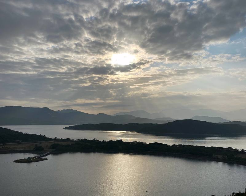
High Island Reservoir from the road on Section 1, late on Day 1.
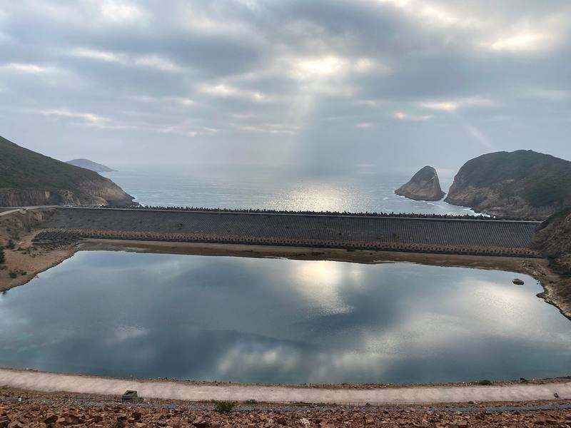
The East Dam of High Island Reservoir, early on Day 2.
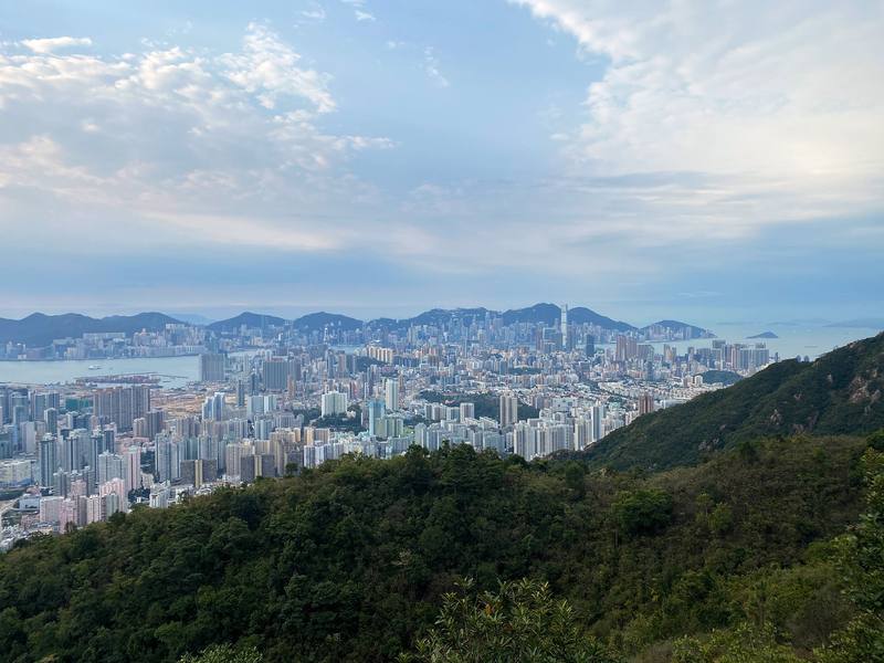
Kowloon from the ridge by Lion Rock, early on Day 4.
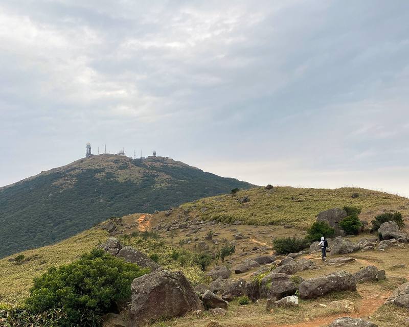
The path toward Tai Mo Shan, the morning of Day 5.

Before you go

The basics

Start
Pak Tam Chung, Sai Kung (bus stop and visitor center)
Finish
Tuen Mun, in the New Territories
Usual difficulty
Clear, signed paths, roads and lots of stairs, with a numbered post every 500 m. Hot and humid outside winter
Best time
October to March, the cool, dry season. I walked in late January
Permits
No. The trail is free and open, with no permit or booking. Camping is free too, but only at AFCD's designated campsites; one of them, Twisk, now needs a booking. See Planning the nights.
Getting there
What I did. I flew into Hong Kong from Kilimanjaro on January 21, 2020, and met up with Ryan. I took the Airport Express into the city (HK$115). The next afternoon we started from the bus stop at Pak Tam Chung, where the 94, 96R and 289R buses stop, at 3:40 p.m.
Lodging
Tent

From Kraig Adams's guide

Costs and gear

What it cost

The trail and campsites are free

His costs, line by line

What Kraig carried

Hyperlite Mountain Gear Southwest 2400 · UGQ Bandit quilt · Outdoor Vitals Sleeping Bag Liner · SLONIK rechargeable headlamp · Amazon Essentials Quick-Dry Tech Hoodie · The North Face Dryzzle jacket · Patagonia Nano Puff Jacket · Amazon Essentials crewneck fleece sweatshirt and 27 more.

The full gear list

From Kraig Adams's guide

Safety

Rescue numbers

  • Emergency numbers (2026). Call 999 or 112. Tell them the number on the nearest distance post: the MacLehose has posts M001 to M200, about every 500 m, and AFCD publishes a grid reference for each. The Hong Kong Police "HKSOS" app sends your location to the 999 center. A 112 call works on any mobile network that has signal there.

Phone signal

  • Often, because the city is close, but not everywhere.
  • Hong Kong's telecom regulator warns of blind spots in the country parks.

Insurance

  • Medical treatment for uninsured visitors to Hong Kong is expensive, so make sure your travel insurance covers local treatment and medical evacuation.

Bail-out points

  • Day 1, Pak Tam Chung to Pak Lap campsite. Walk back along the road to Pak Tam Chung for buses 94 and 96R. On Saturdays, Sundays and public holidays, green minibus 9A runs between the East Dam and Pak Tam Chung (about 9:30 a.m. to 7 p.m.).
  • Day 2, Pak Lap to Cheung Sheung. At Sai Wan, a path leads to Sai Wan Pavilion on the road, where the NR29 minibus runs to Sai Kung town (a few times a day; check the 2026 times). At Pak Tam Au, the end of Section 2, buses 94 and 96R and minibus 7 stop on the road.
  • Day 3, Cheung Sheung over Ma On Shan to Sha Tin Pass. At Kei Ling Ha (Shui Long Wo bus stop), buses 99 and 299X run to Sai Kung and Sha Tin. From the Ngong Ping plateau I walked down to Tai Chung Hau on Hiram's Highway, by Sai Kung: 2.8 miles and an hour and 20 minutes from the campsite, the last 1.6 miles off the trail on a path down. From Tate's Cairn there's no transport: walk Fei Ngo Shan Road and Clear Water Bay Road about 45 minutes to the Anderson Road stop (buses 91, 91M, 92 and 96R, minibus 73).
  • Day 4, Sha Tin Pass to Lead Mine Pass. At Tai Po Road (Shek Lei Pui Reservoir bus stop), buses 72 and 81. At Shing Mun (Pineapple Dam), green minibus 82 runs to Tsuen Wan, or walk 20 minutes to the Ho Fung College bus stop. From Lead Mine Pass there's no road: walk the Wilson Trail about 1.5 hours down to Yuen Tun Ha for minibuses 23K and 23S to Tai Po.
  • Day 5, Lead Mine Pass to Tuen Mun. At Route Twisk (the Tai Mo Shan Country Park stop), bus 51 to Tsuen Wan: every 15 to 30 minutes on weekend days, only hourly on weekdays. From Tin Fu Tsai there's no road: walk about 1.5 hours down to Sham Tseng for buses on Castle Peak Road.

From Kraig Adams's guide. For planning, not navigation: check before you go.

Their films and versions

Creators who've done it

1 creator so far: Kraig, 5 days, tent.

Walked MacLehose Trail? Be the first to share your track: log it with your GPX.

Your time

Sign in and log a few hikes to see how long this one would take you.

Typical: 5 days (the hike's facts).

Ask this hike

Planning questions about MacLehose Trail, answered only from this page's facts, the creators' versions and hikers' public tracks, with where each answer comes from. When the data doesn't say, the answer says "not given".

    From hikers

    Comments

    Sign in to comment. Free; your hikes stay private unless you share them.

    Answered from the data

    Questions people ask

    How many days do you need for MacLehose Trail?

    I walked it in 5 days in January 2020, with two days off in the city in the middle, camping four nights. The official trail is 100 km in 10 sections, and the parks department adds up to about 37 hours of walking. Many people walk it a section or two at a time from the city, because buses reach almost every section end.

    From Kraig Adams's trip and guide.

    How much does MacLehose Trail cost?

    The trail and campsites are free (Twisk needs a free booking). A Tourist Octopus card is HK$39 with no deposit; load it for buses, minibuses and the MTR. Budget for meals at the village restaurants and a hotel in the city if you break the walk.

    From Kraig Adams's trip and guide.

    When is the best time to hike MacLehose Trail?

    October to March, the cool and dry season. The Hong Kong Observatory calls November and December the best months of the year; May to September is hot, humid and rainy, with typhoons most likely from July to September. I went in late January.

    From Kraig Adams's trip and guide.

    Do you need a permit for MacLehose Trail?

    No. The trail is free and open, with no permit or booking. Camping is free too, but only at AFCD's designated campsites; one of them, Twisk, now needs a booking. See Planning the nights.

    From Kraig Adams's trip and guide.

    Can you camp on the MacLehose Trail?

    Yes, but only at the parks department's (AFCD) designated campsites, which are free. On or by the trail they include Pak Lap, Long Ke Wan, Sai Wan, Ham Tin Wan, Pak Tam Au, Cheung Sheung, Shui Long Wo, Ngong Ping, Lead Mine Pass, Rotary Park, Twisk, Ho Pui and Tin Fu Tsai. Twisk needs a booking. There is no campsite on Sections 5, 6 or 10.

    From Kraig Adams's trip and guide.

    Where does the MacLehose Trail start and finish?

    It starts at Pak Tam Chung in Sai Kung, reached by bus 94 from Sai Kung town (and 96R and 289R on weekends and holidays), and finishes at Tuen Mun, near buses, the light rail and Tuen Mun MTR station.

    From Kraig Adams's trip and guide.

    Is there water on the MacLehose Trail?

    Only in places. AFCD's filling stations are at Pak Tam Chung, Pak Tam Au, Sai Sha Road at Kei Ling Ha, Shing Mun and Kowloon Hill, and there are village restaurants at Sai Wan and Ham Tin. There are none on Sections 4, 5 or 7 to 10, so carry plenty and treat stream water.

    From Kraig Adams's trip and guide.

    How long is the MacLehose Trail?

    100 km (62 miles) by the official sections. My GPS read 71.4 miles because of my detours: down to the Sai Kung road for Lunar New Year, up to the top of Lion Rock, and down to shops in Kwai Chung.

    From Kraig Adams's trip and guide.

    Plan this hikeThe route