
Content made there

Photos
Hikes / K2 Base Camp / Kraig Adams's version
Asia · Pakistan
Aug 2025 · 12 days on foot · about 100 miles · Group trip · Tent

In August 2025 I spent twelve days hiking about 100 miles through Pakistan's Karakoram range to see K2, the second highest mountain in the world. A small group of subscribers joined me, along with guides, porters, cooks, a goat, a few chickens and a caravan of pack animals carrying everything we needed. We walked from Askole, the last village, up the Baltoro Glacier to Concordia and K2 Base Camp, then went out over the Gondogoro La, a pass we climbed in the dark with crampons and fixed ropes, and down to the village of Hushe.
It was my first time in Pakistan and one of the hardest things I've ever done. It was the longest trek I've ever done and one of the highest passes I've ever gone over. A Pakistani operator organized the whole thing: the logistics, the permits, the food and the team.
| Quick facts | |
|---|---|
| Distance | 99.9 miles (160.8 km) over 12 walking days |
| Climbing | about 11,150 ft (3,400 m) up and 10,860 ft (3,310 m) down |
| Start | Askole, where I started. Some operators now drive on to Jhola when the road is open |
| Finish | Hushe, at the end of the jeep road on the other side |
| High point | The Gondogoro La: 17,936 ft (5,467 m) on my GPS; usually published as 18,323 ft (5,585 m) |
| Highest camp | Ali Camp, 16,237 ft (4,949 m) on my GPS |
| Nights | 11 in tents on the trek |
| How | With a licensed operator, guides, porters, cooks and pack animals. A permit is required |
| When | Summer. I walked August 18 to 29, 2025 |
| Difficulty | One of the hardest things I've ever done. Short days, but high, cold, remote, and a pass with ropes |
| Airports | Islamabad, then a domestic flight to Skardu (or two days by road) |
| Trip | A group trip I hosted, organized by a licensed Pakistani operator |
| Day | Route | Miles (km) | Up / down (ft) | Camp (ft) |
|---|---|---|---|---|
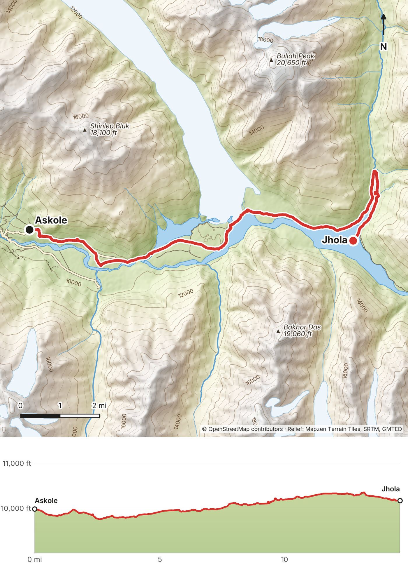
| 1 | Askole to Jhola | 14.6 (23.5) | 879 / 691 | 10,160 |
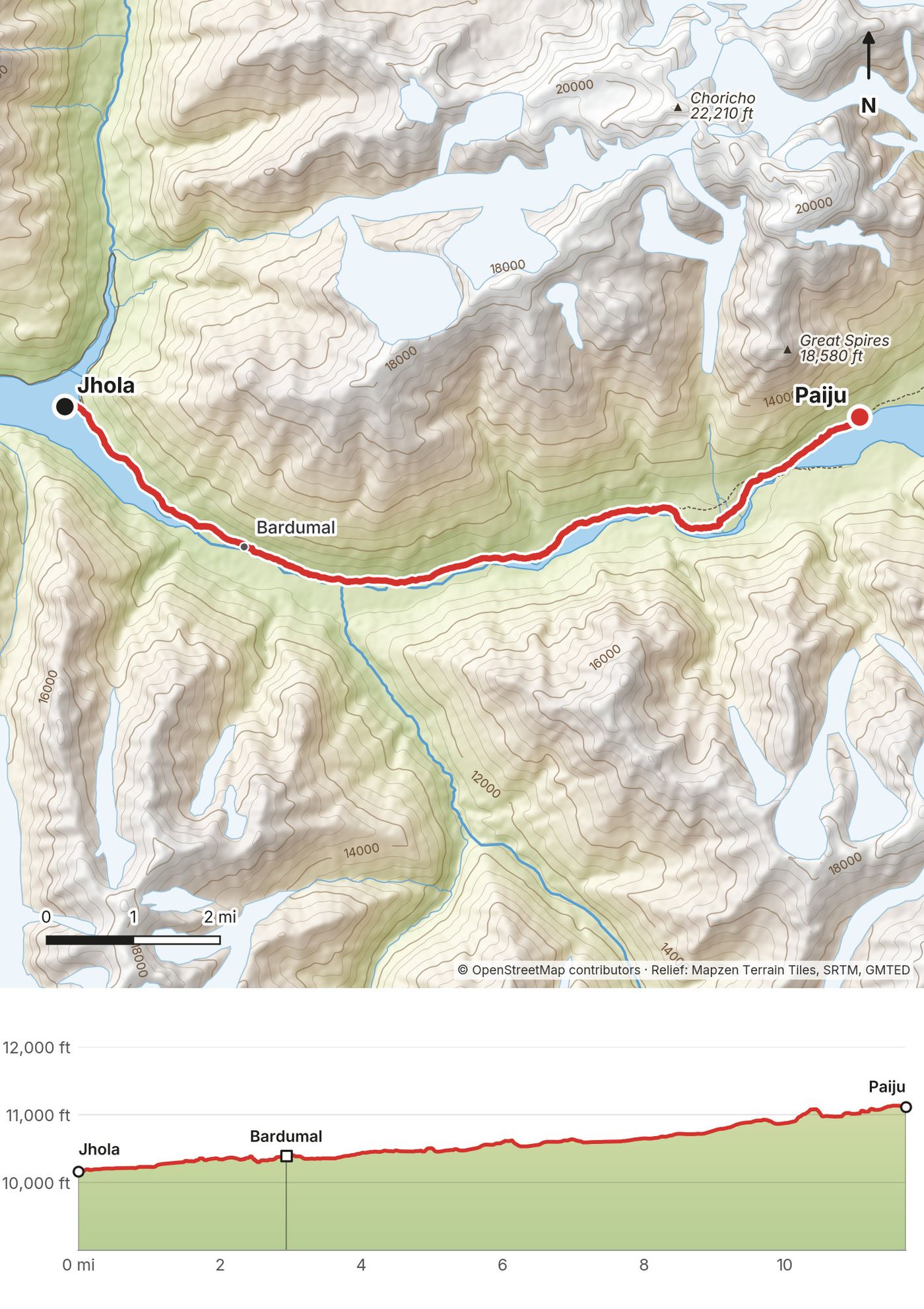
| 2 | Jhola to Paiju | 11.7 (18.9) | 1,318 / 352 | 11,120 |
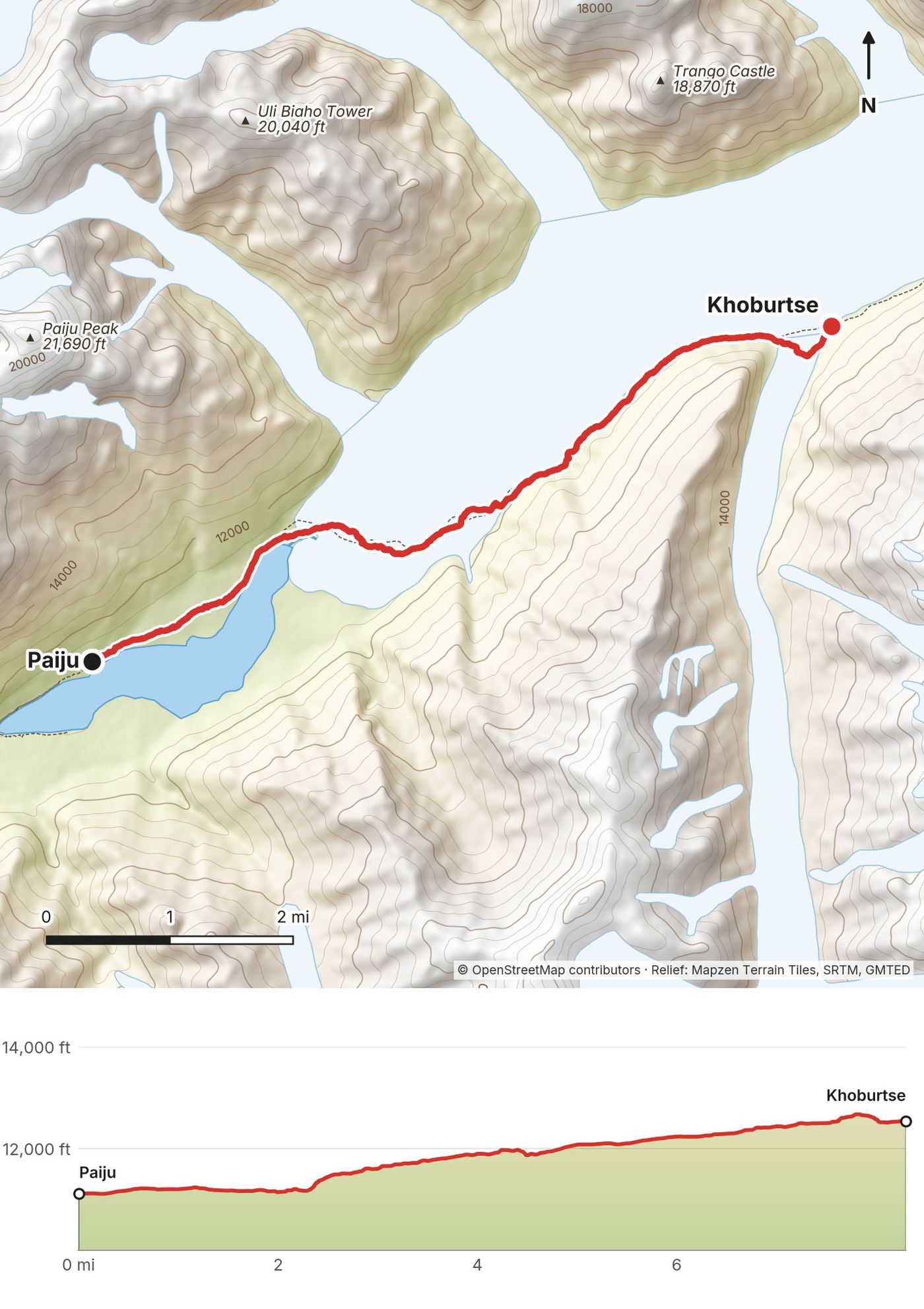
| 3 | Paiju to Khoburtse | 8.3 (13.4) | 1,740 / 314 | 12,550 |
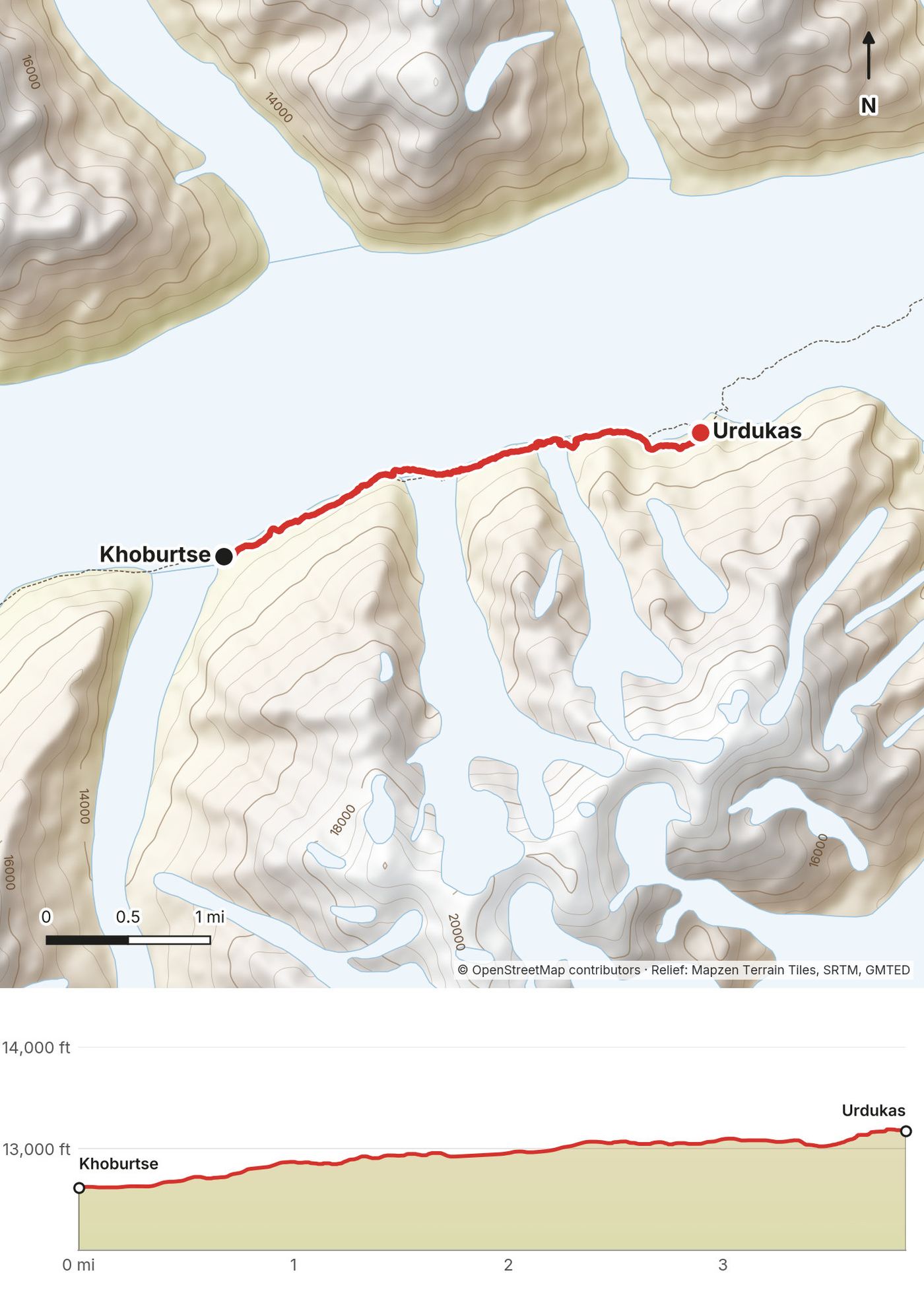
| 4 | Khoburtse to Urdukas | 3.8 (6.2) | 645 / 83 | 13,170 |
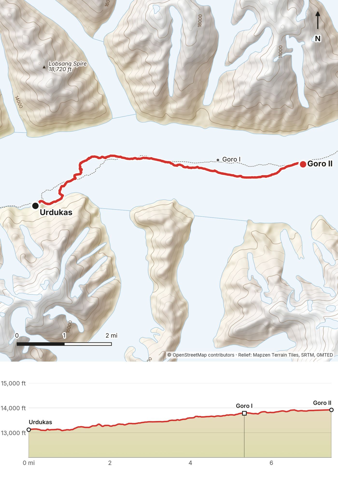
| 5 | Urdukas to Goro II | 7.5 (12.0) | 1,011 / 229 | 13,920 |
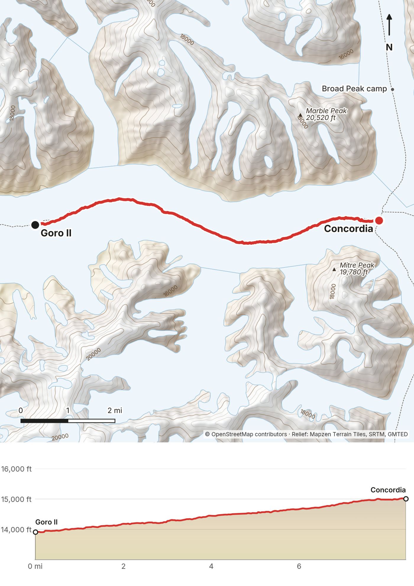
| 6 | Goro II to Concordia | 8.4 (13.6) | 1,124 / 23 | 15,010 |
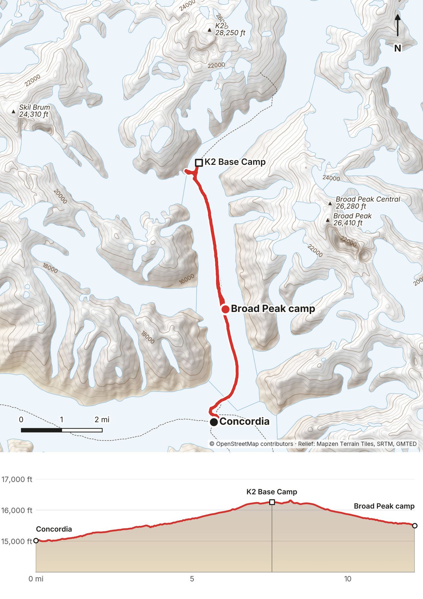
| 7 | Concordia to K2 Base Camp, Broad Peak camp | 12.1 (19.5) | 1,380 / 891 | 15,500 |
| 8 | Broad Peak camp to Concordia | 3.5 (5.6) | 14 / 502 | 15,010 |
| 9 | Concordia to Ali Camp | 6.5 (10.4) | 1,275 / 84 | 16,240 |
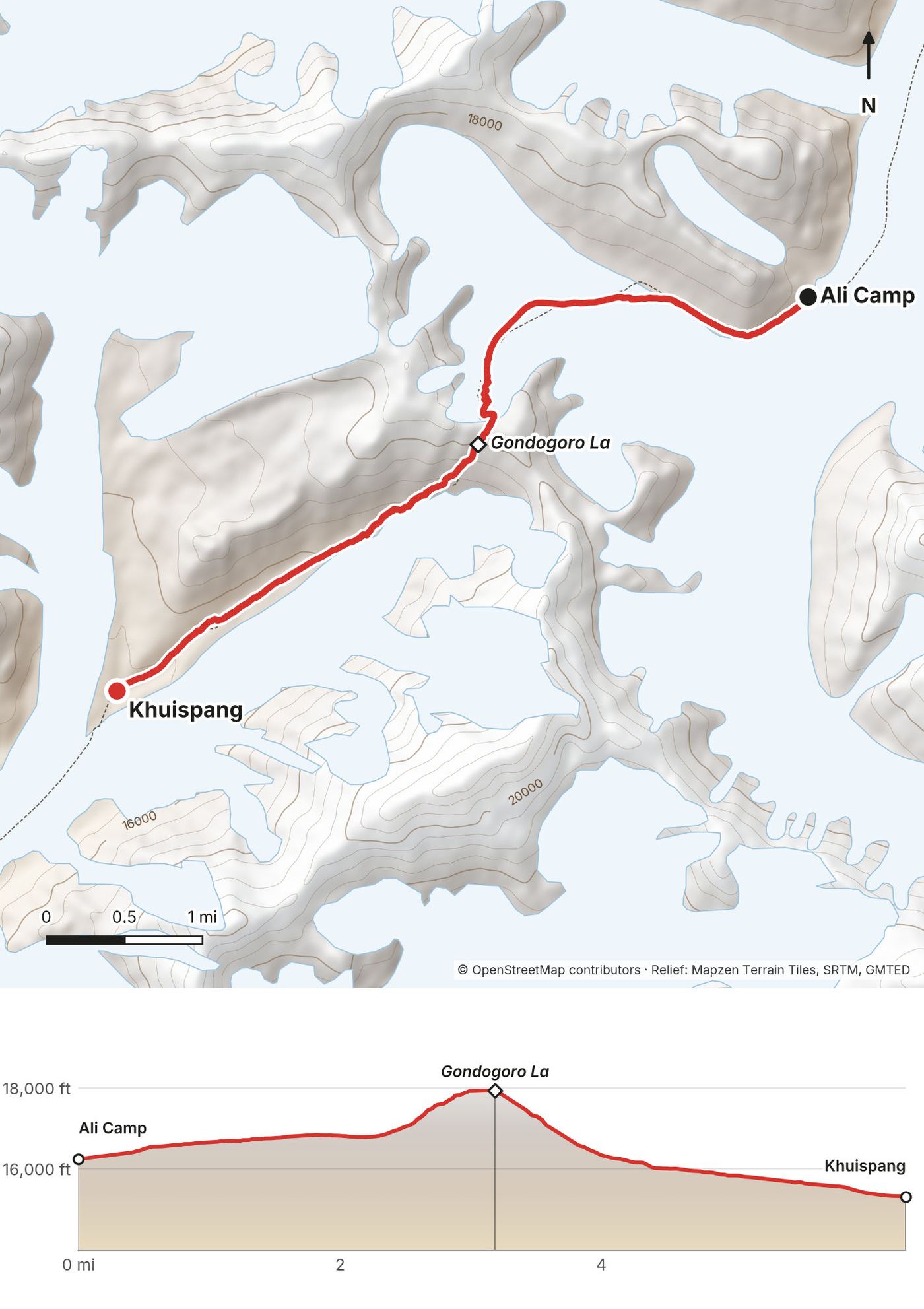
| 10 | Ali Camp over the Gondogoro La to Khuispang | 6.3 (10.2) | 1,707 / 2,628 | 15,320 |
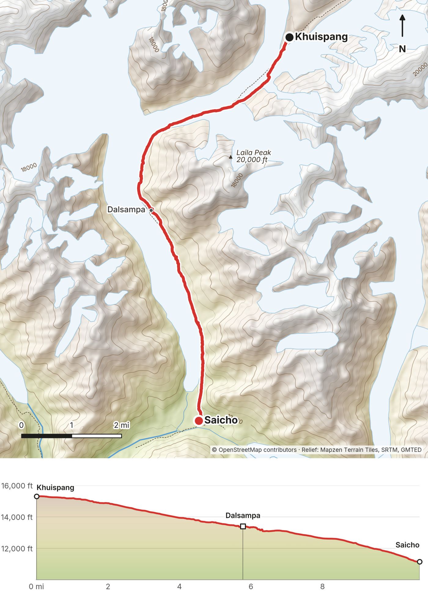
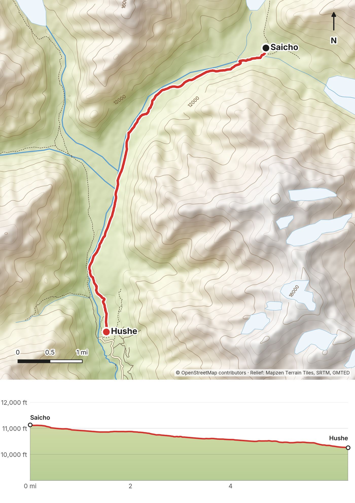
| 11 | Khuispang to Saicho | 10.7 (17.3) | 36 / 4,192 | 11,150 |
| 12 | Saicho to Hushe | 6.4 (10.2) | 20 / 866 | Hushe, 10,260 |
The numbers come from my own GPS recordings, smoothed the same way for every day. Apps count climbing differently: Strava shows 99.99 miles and about 14,300 ft for the trip. My GPS heights read a little low near the top; see Altitude.
What I did. I flew into Islamabad through Abu Dhabi after hiking the Haute Route in the Alps. Our group met for the first time in Islamabad and spent the day exploring. We exchanged money, walked around the Shah Faisal Mosque and visited the Pakistan Monument. I did not see another tourist anywhere, and locals stopped us constantly for photos and conversation. After lunch at a tandoori restaurant we drove up to the Daman-e-Koh viewpoint and watched the sun drop and the city lights come on, with monkeys watching us.
The next morning a short flight took us north to Skardu, a desert valley surrounded by sharp peaks and braided rivers. That evening, on the roof of the guesthouse, I listened to the call to prayer echo across the valley.
From Skardu we drove toward the trailhead at Askole. The road was barely a road: floods and landslides had taken out whole sections. Where a bridge was missing, the team unloaded the jeeps, carried everything across by hand and loaded it again on the other side.
Flights to Skardu. In 2026 PIA, Airblue and AirSial fly Islamabad to Skardu (AirSial since May 2026; I didn't check schedules on the airlines' own sites). Flights to the northern mountains are often delayed or cancelled by weather, so leave spare days. Operators drive when flights are cancelled: my operator's plan is Islamabad to Chilas (12 to 13 hours) and Chilas to Skardu (8 to 9 hours).
By road. Gilgit-Baltistan is reached on the Karakoram Highway or over the Babusar Pass (seasonal, and closed by floods in July 2025). The UK advises against all travel on the Karakoram Highway between Mansehra and Chilas. The Babusar road crosses Khyber Pakhtunkhwa too, so both road routes cross the province the US says not to travel to (September 2026). If your flight is cancelled, ask your operator which road they would use and check the current advice for it. Don't drive the highway at night.
Skardu to Askole. About 5 to 6 hours by jeep (operator figure, 2026), on a road that floods can break.
Paid links: I earn a commission if you buy through these links, at no extra cost to you. As an Amazon Associate I earn from qualifying purchases.
My operator's team carried the tents, the kitchen and the food. Here's the hiking gear I brought in August 2025, what I'd take now, and what I filmed with.
The hiking gear from my film's gear list, which I used and brought on this trip.
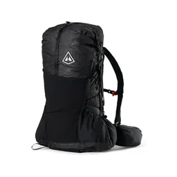 Pack: Hyperlite Mountain Gear Unbound 55 (Hyperlite)
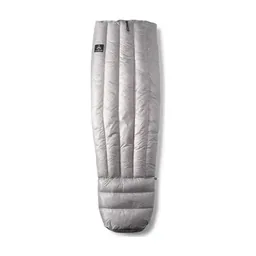 Quilt: Hyperlite Mountain Gear 20° Quilt (Hyperlite). Nights were below freezing: our water bottles froze at Goro II.
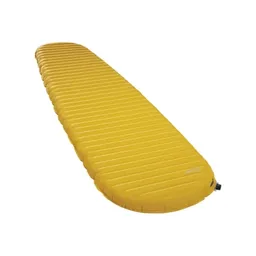 Sleeping pad: Therm-a-Rest NeoAir XLite NXT (Amazon). I slept on two pads.
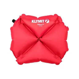 Pillow: Klymit Pillow X (Amazon)
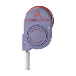 Pad inflator: AlpenBlow Micro Inflator (Garage Grown Gear)
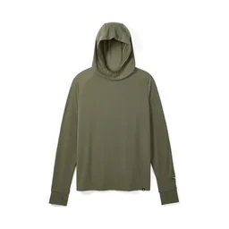 Sun hoodie: PATH Projects Pyrenees T19 Hoodie (PATH Projects)
 Fleece: Senchi Designs A90 Half Zip Hoodie. Similar: PATH Projects Lomond Hoodie (PATH Projects).
 Puffy: Arc’teryx Cerium Hoody (Arc’teryx)
 Rain shell: Arc’teryx Beta AR Jacket (Arc’teryx)
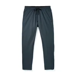 Pants: PATH Projects Killam PX Pant (PATH Projects)
 Shorts: Territory Run Co. Long Haul Short. Similar: PATH Projects Sykes PX Short (PATH Projects).
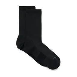 Socks: PATH Projects Joyner Crew Sock (PATH Projects)
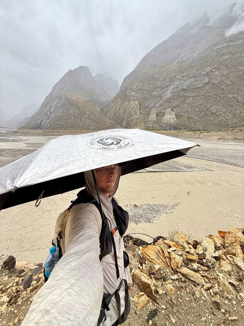
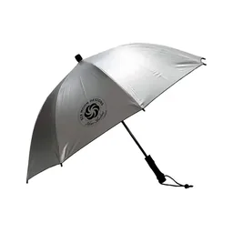 Umbrella: Six Moon Designs Silver Shadow Carbon (Amazon). The reflective umbrella, the MVP of the trip, for the sun on the glacier and for the rain.
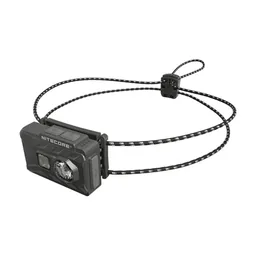 Headlamp: Nitecore NU20 Classic (Amazon). For the midnight start on the pass.
 Water bottle: Katadyn BeFree AC · 1L (Amazon)
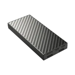 Power bank: Nitecore NB20000 (Amazon). The team ran a generator for a couple of hours each evening. Bring a power bank for the rest of the day.
What I'd add for this trek, from my current kit.
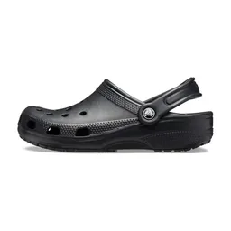 Camp shoes: Crocs Classic Clog (Amazon)
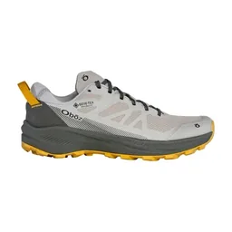 Shoes: Oboz Katabatic LT Low GTX (Amazon). I wore them on Alta Via 1: lightweight and stable, and no blisters.
 Poles: Black Diamond Alpine Carbon Z Poles (Amazon). For the rocks and ice of the Baltoro Glacier.
 Cap: PATH Projects Muir Cap 2.0 (PATH Projects). The days are hot and bright low down and on the glacier.
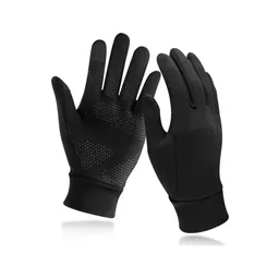 Gloves: Unigear Touchscreen Liner Gloves (Amazon)
What I filmed this trip with in 2025. My setup is smaller now (below). Read the drone note in Weather and safety before you bring one.
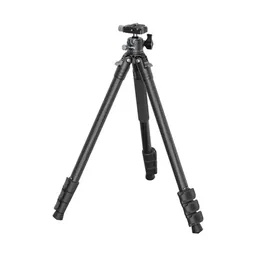 Tripod: SmallRig Carbon Fiber Tripod (Amazon)
 Tripod head: Joby BallHead 3K (now the 3K PRO) (Amazon)
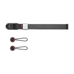 Wrist strap: Peak Design Cuff Wrist Strap (Amazon)
Since September 2026 I film with a smaller setup: the Pocket 4 and the Mic 3 on the trail, and the Mini 5 Pro in the air.
 Camera: DJI Osmo Pocket 4 (Amazon)
 Mic: DJI Mic 3 · 1 TX + 1 RX (Amazon). It pairs with the Pocket 4.
 Drone: DJI Mini 5 Pro (Amazon)
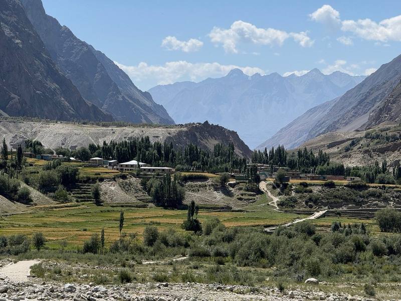
Askole is the last village before the wilderness: small stone homes, terraced fields and kids playing everywhere. It was the final touch of civilization before we stepped onto the trail.
The first day was long and hot. Lunch was fresh fruit, mangoes and melon cut that morning. The porters and pack animals passed us, including our goat, who the group named Messi, because Messi is the goat. Rain came in and the umbrellas came out. That umbrella ended up being one of the most useful pieces of gear I brought.
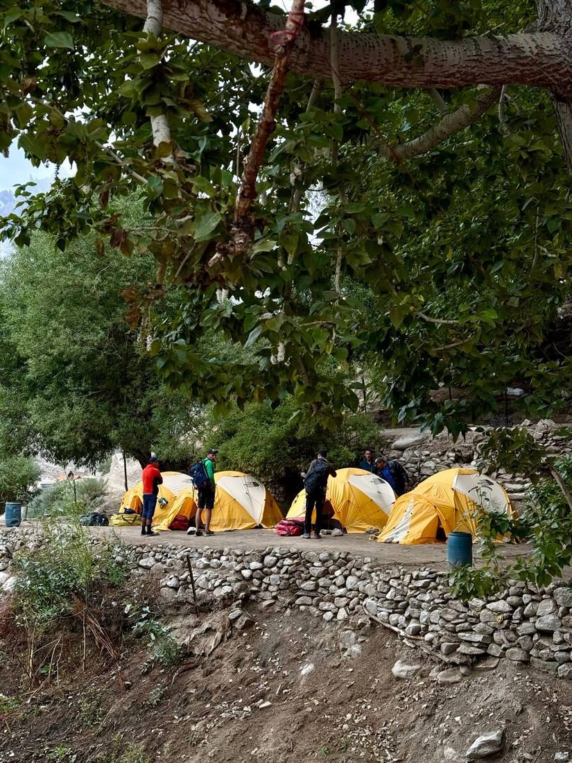
We reached camp tired but excited. Our bags were already waiting at the tents. We changed into dry clothes and settled into the rhythm of life out here: a big dining tent went up, tea boiled, chickens wandered around camp, and dinner was Chinese food.
From Askole a dirt path follows the Braldu river east. It's a long day but not a steep one: my GPS stays between about 9,800 and 10,350 ft all day. About 12 miles in, the path turns north into a side valley, crosses the river and comes back down the far side to the Jhola camp. The heat and the sun are the hard part, not the climbing.
Walk back down the valley to Askole, where the jeep road ends. On every day of this trek, getting off is your guide's call: see Weather and safety for rescue.
Narrated film, Day 1 · Ambient film, Day 1
The mornings started with bread, eggs, porridge, fruit, coffee and tea. I appreciated the warm water stations set out each morning and before each meal. Being able to wash your face and hands on a trek like this is a small thing that makes a huge difference.
We followed the river, which was brown and violent from flooding. The team carried so much Coca-Cola for us it became a running joke. As the clouds cleared, huge mountains appeared on both sides of the valley, and crossing a stream gave us our first real look at the sharp peaks we'd be hiking toward.
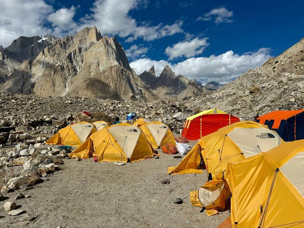
Paiju was our last green campsite before the glacier. Camp shoes were essential. The team ran a generator for a couple of hours each evening so we could recharge cameras, phones and drone batteries.
The path keeps to the Braldu valley, passing the Bardumal camp at about 3 miles on my GPS, and climbs gently all day, from about 10,160 ft to 11,120 ft at Paiju. There are streams to cross on the way. Paiju has trees and shade, and it's the last camp with any green around it.
Walk back down the valley to Askole, one or two days.
Narrated film, Day 2 · Ambient film, Day 2
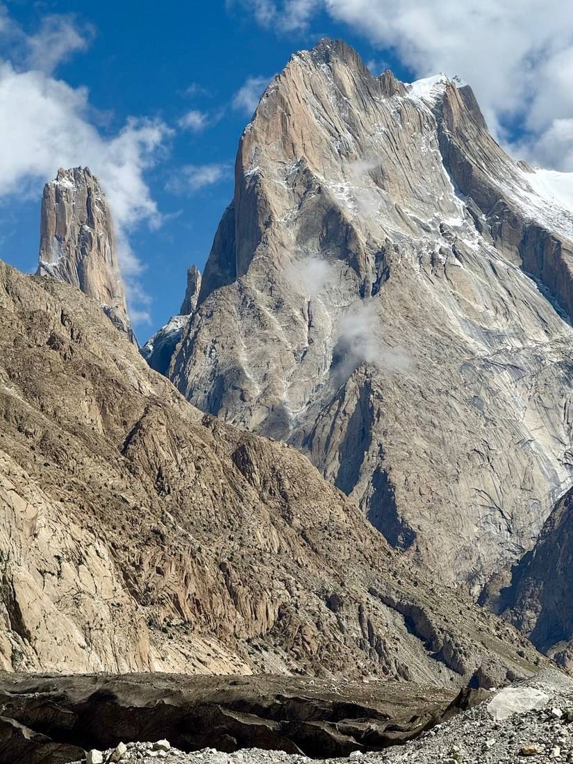
This was the day we stepped onto the Baltoro Glacier. Rocks shifted over the ice and water seeped through the cracks. The trail narrowed in places and demanded full focus. The sun was strong, and the umbrella saved me again. We passed the Trango Towers, some of the most famous climbing walls on Earth.
Around midday the long train of pack animals caught up to us, bells echoing across the glacier. Khoburtse was a military outpost, with old fuel drums scattered everywhere. That evening Aziz, one of our two guides, noticed holes in my trail runners and patched them up for me. That small act probably saved my shoes for the rest of the trip.
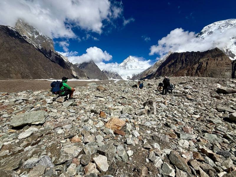
From Paiju the path follows the moraine to the snout of the Baltoro Glacier. My GPS crosses onto the mapped glacier about 2.3 miles in, and from here on most days are on the ice. The glacier here is covered in stones and gravel, so it doesn't look like ice until a stone rolls or you see a meltwater pool. The path climbs about 1,700 ft over the day, most of it gradually.
Back down the glacier to Paiju, then down the valley to Askole.
Narrated film, Day 3 · Ambient film, Day 3
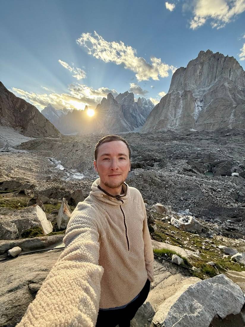
The next morning we hiked to Urdukas. A shorter day, but all uphill, and we reached camp by lunchtime. I wanted to move faster through the trek, but I quickly realized it wasn't just about my pace. The porters, cooks and animals all had difficult jobs that longer days would have made even harder.
Each afternoon the cooks rolled fresh chapati by hand. Dinner was noodles, chicken and fried potatoes: simple and comforting. Urdukas sits on a cliff with unbelievable views in every direction.
The shortest day of the approach, and the first above 13,000 ft. The path works along the glacier and climbs to Urdukas, a camp of terraces on the slope above the ice. We were in camp at 11:40 a.m. A short day at this height is part of acclimatizing: see Altitude.
Back down the glacier to Paiju and Askole, two or three days.
Narrated film, Day 4 · Ambient film, Day 4
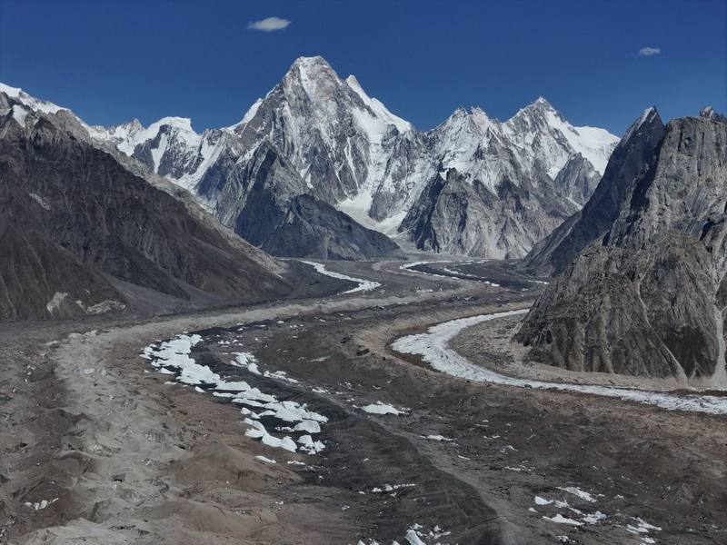
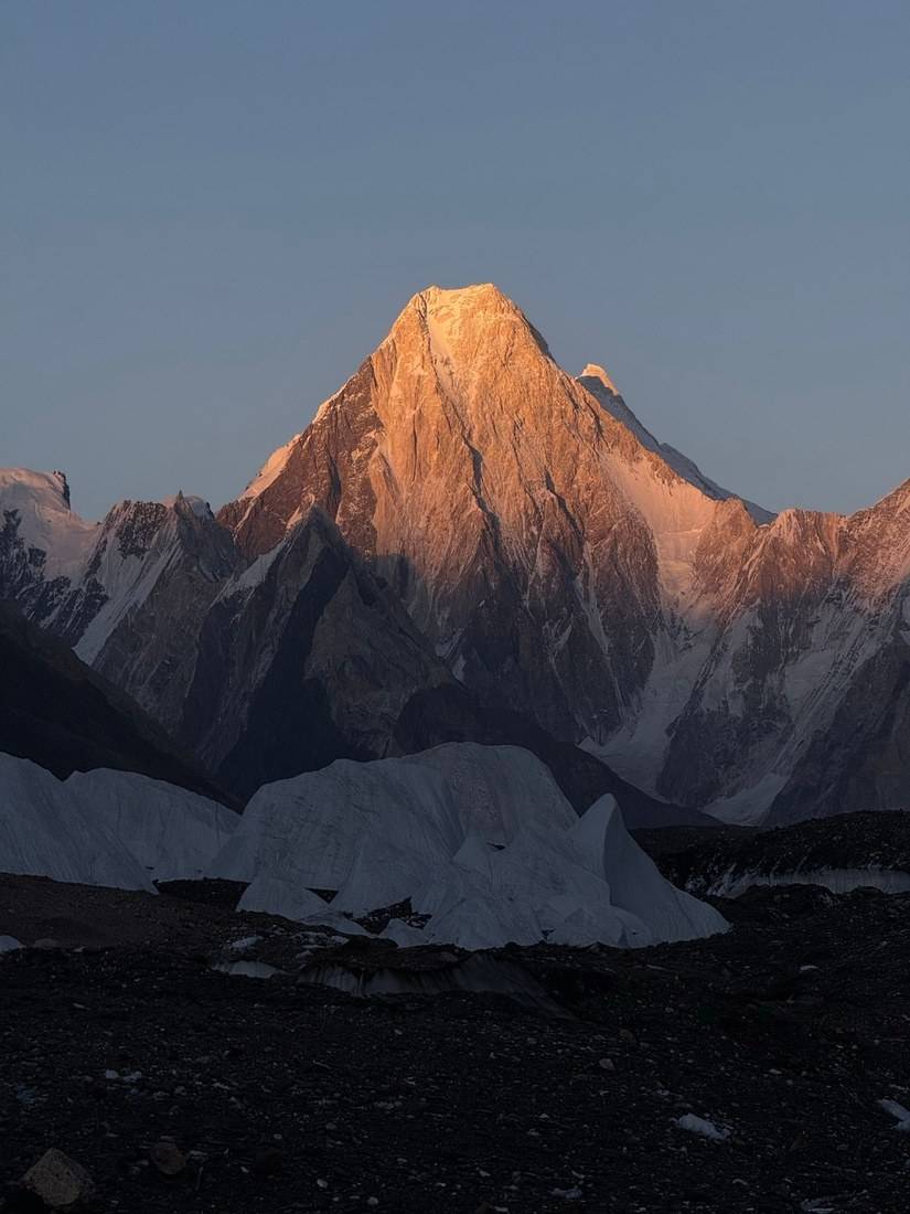
We walked straight up the glacier, past huge ice melt towers and deep crevasses. Gasherbrum IV glowed in the morning light. At lunch my appetite was endless. I had seconds, then thirds. I feel like I eat way more than most hikers.
At camp, popcorn really hit the spot. As the sun dropped, the glacier melted just enough to reflect the light. That night, sadly, Messi the goat's journey ended, and we had goat for dinner.
The nights were getting colder, but I felt fully prepared with warm layers and my own tent, which the team provided. This was the first time I ever had two pads underneath me while sleeping, and it kept me warm.
Almost all of today is on the glacier: 95 percent of my track is inside the mapped glacier. The path runs up the middle of the Baltoro past the Goro I camp at about 5.3 miles to Goro II, a camp on the ice. Stay on the line your guide takes: the ice towers and crevasses are right beside the path.
Back down the glacier the way you came, to Urdukas and Paiju.
Narrated film, Day 5 · Ambient film, Day 5
The morning was the coldest yet. Water bottles left outside were frozen solid. We passed more exposed ice, but the terrain slowly flattened, and the chaotic maze of broken glacier opened up into a wide valley. Then we reached Concordia.
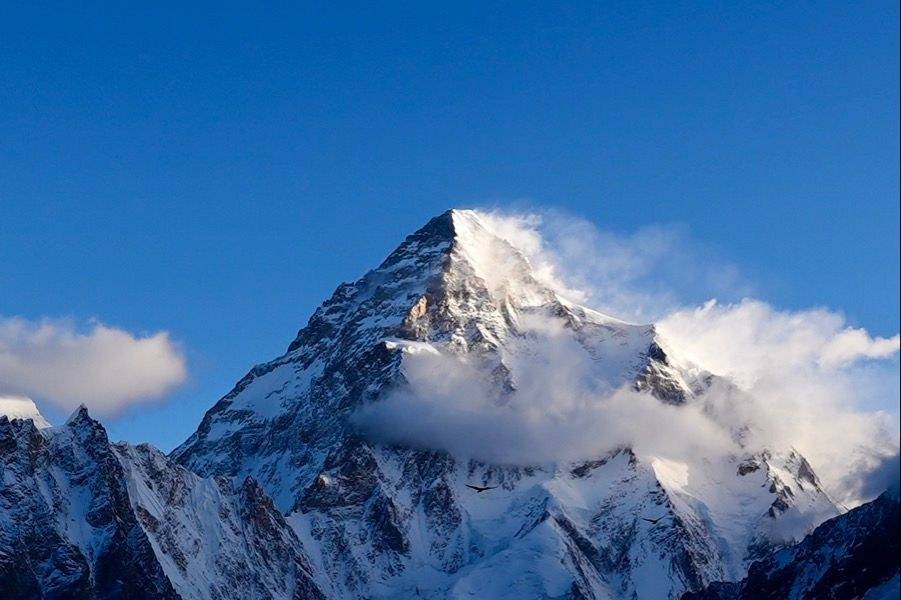
This was the first time I saw K2. After days of walking, it just appears and everything goes quiet. You don't talk. You just stand there trying to take it in.
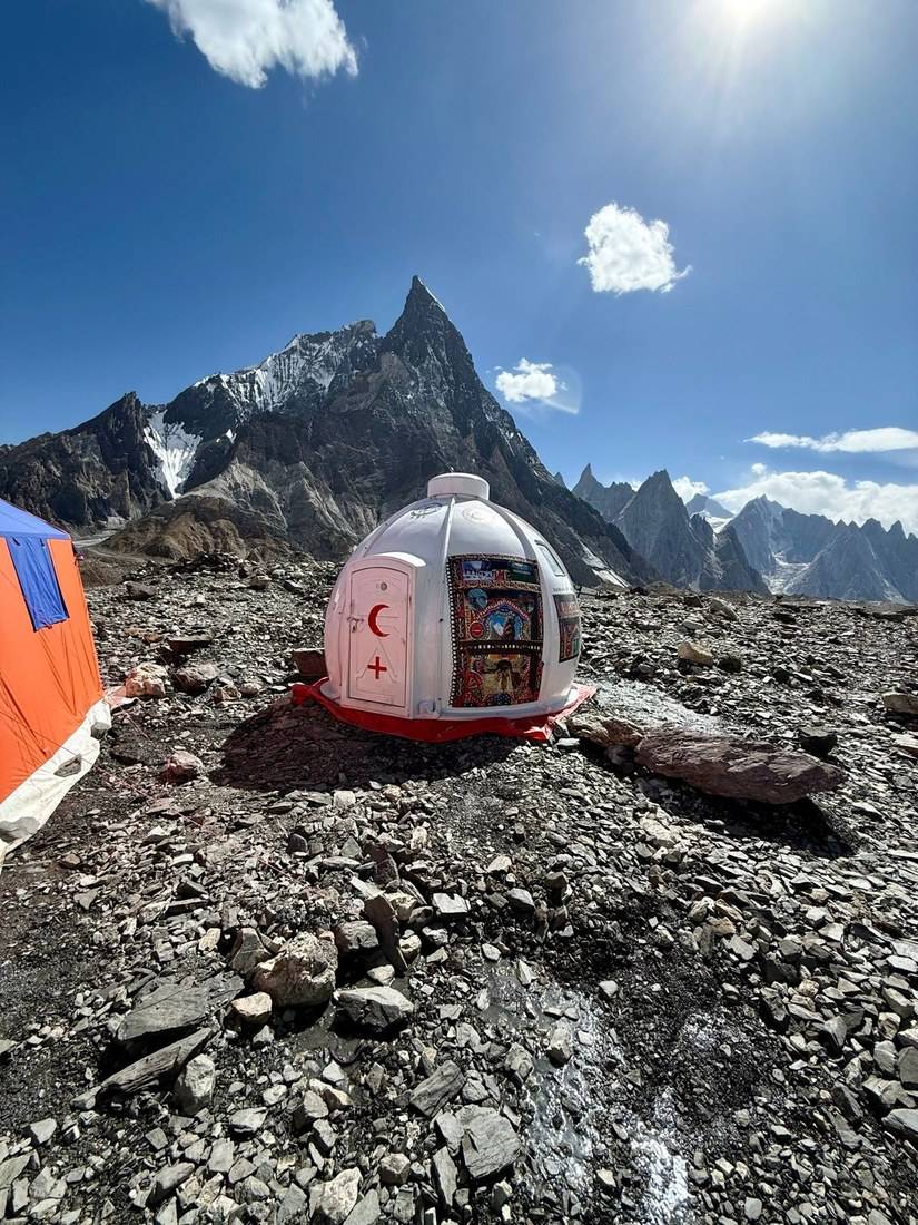
K2 looks unreal. Compared to Everest, which hides behind other peaks from its base camp viewpoint, K2 stands alone, perfectly centered between the mountain ranges, with a glacier rising up to its clean triangular summit. Looking back, the way we came was just as beautiful. Concordia might be one of the most beautiful places I have ever stood. We had clear skies and perfect conditions while we were there. There was even a small medical dome with a doctor on call.
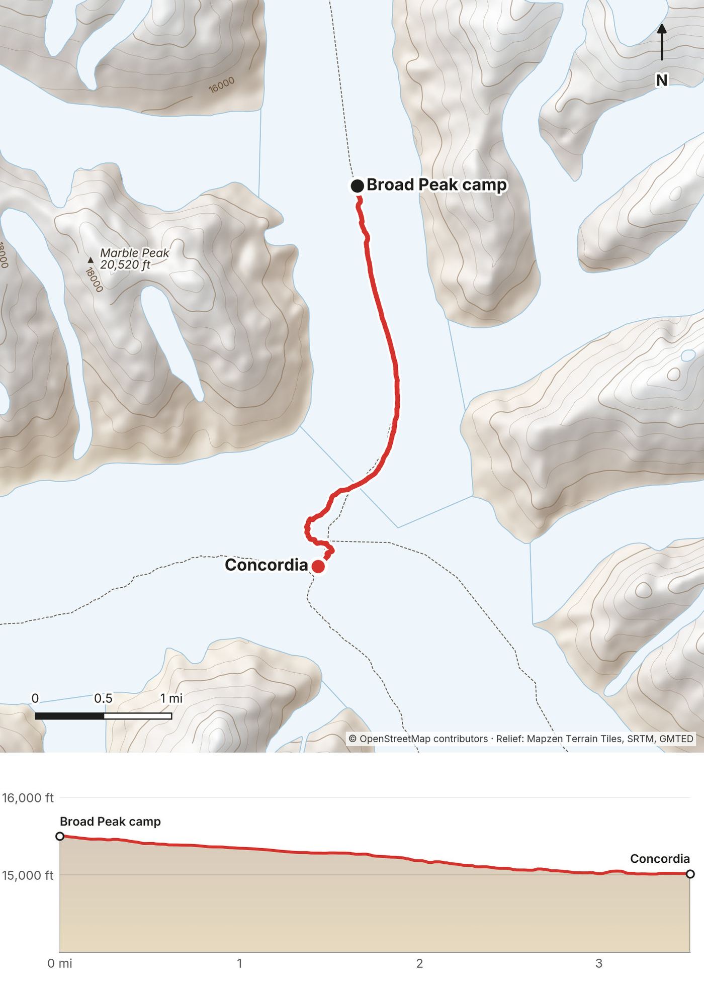
All on the glacier, gently uphill, about 1,100 ft on the day. Concordia is the junction where the Baltoro meets the Godwin-Austen Glacier, which runs north to K2. It's also where the route to the Gondogoro La turns south, so you'll be back here on Day 8.
Back down the Baltoro the way you came: four days or more to Askole on foot. See Weather and safety.
Narrated film, Day 6 · Concordia views of K2 · Ambient film, Day 6
We woke to rain and clouds hiding K2. It was one of the tougher days, so I locked in with my umbrella and music. At lunch everyone squeezed into the dining tent, which immediately steamed up from the stove flames. Fresh snow covered the whole landscape toward K2 Base Camp.
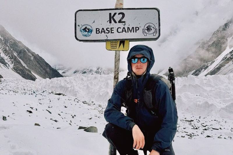
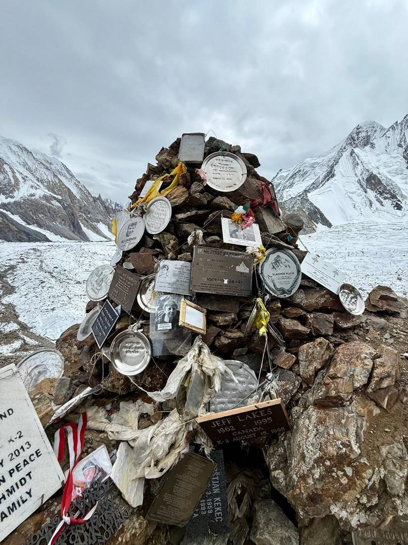
When we reached the base camp sign, next to a Pakistani flag and a single tent, it felt surreal: a milestone after days of walking toward this one mountain. We celebrated, of course, with some Coke and boiled potatoes. Then we visited the Gilkey Memorial, a cliff covered in plaques for climbers who died attempting K2. A heavy moment, and something not many people get to see in their lifetime.
From Concordia the route goes north up the Godwin-Austen Glacier, past the camp below Broad Peak, to the K2 Base Camp sign at 7.5 miles on my GPS. My high point of the day was 16,317 ft, about 0.7 miles past the sign and an hour later. Then we walked back down the glacier to the Broad Peak camp for the night, 12.1 miles in all. This was the longest day since Day 1, at the highest heights yet, and on my trip it was in snow.
Back down the Godwin-Austen Glacier to Concordia, then down the Baltoro.
Narrated film, Day 7 · Ambient film, Day 7
The next morning everything was coated in frost. The sun came out and gave us our last close views of K2. My tripod fell over at this point and cracked my lens, which hurt, but the camera survived. I ate a lot of Snickers on this trek and drank a lot of tea. It was a short rest day with an incredible sunset.
A short walk back down the glacier to Concordia, mostly downhill. We were in camp before noon, which gives you an afternoon to rest before the long push toward the pass.
This is the last easy exit. From Concordia you either go back down the Baltoro or on over the Gondogoro La. If anyone in your group is struggling with the altitude, this is the day to say so.
Narrated film, Day 8 · Ambient film, Day 8
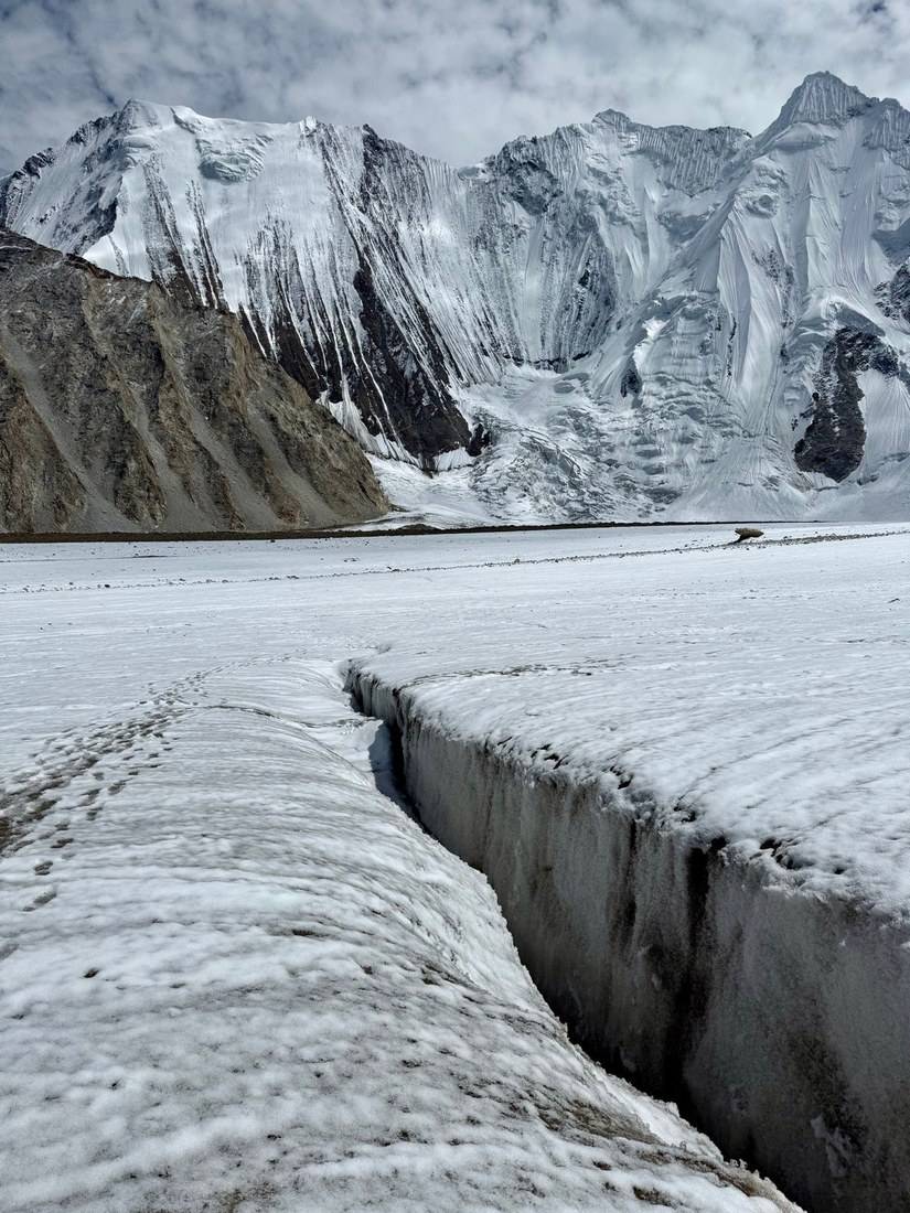
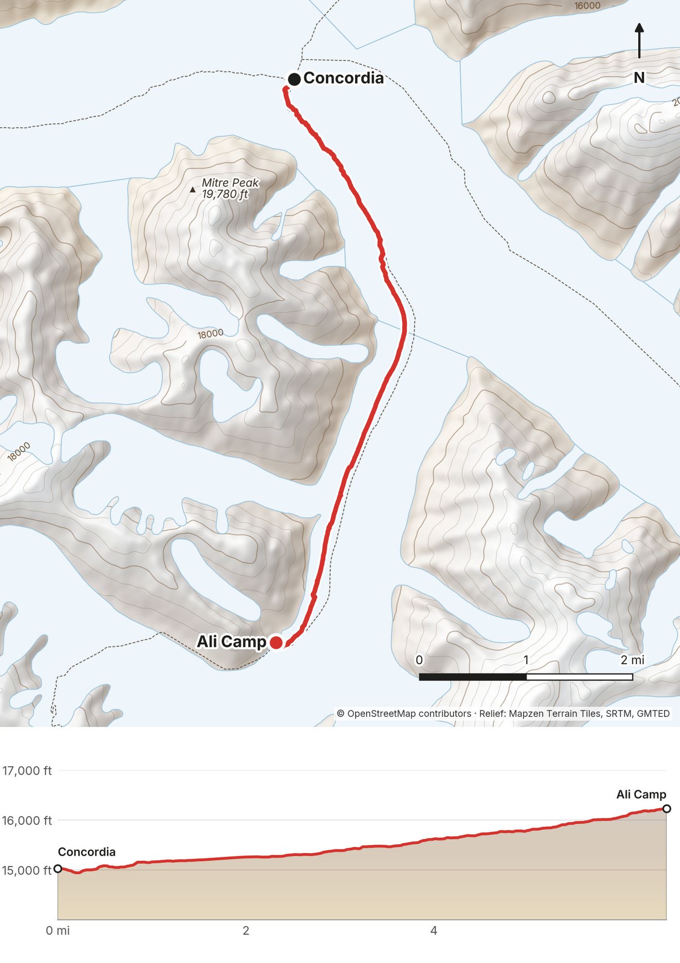
The next day the team split. The pack animals and some of the gear went back the way we came. From here on we traveled light. The ground was covered in snow and deep ravines slowed us down.
This was the day I realized alpine glasses are essential. The reflection off the snow was intense, and I wish I'd had more protective glasses. We checked our alpine gear for the next day and went to bed early, because we'd be waking up at midnight.
From Concordia the route turns south up the Vigne Glacier to Ali Camp, the base for the Gondogoro La. It's all on the glacier: snow over ice, and crevasses that you walk around or step across. Your guide picks the line. Ali Camp was our highest camp, and the night there is short.
Back down the Vigne Glacier to Concordia and out down the Baltoro, the way the pack animals went. If the pass is closed or the weather is wrong, that's the way out too.
Narrated film, Day 9 · Ambient film, Day 9
It was complete darkness when my midnight alarm went off. A quick breakfast, a coffee and a prayer for safe passage. We hiked uphill until the slope became too steep to continue without gear. It was freezing, so we wore every layer we had. Then we put on alpine boots, crampons, helmets and harnesses. I had never done anything like this. It was scary and exciting at the same time.
We climbed a steep snow staircase and clipped from rope to rope. The altitude, the cold, the darkness and the lack of sleep made this one of the craziest experiences of my life. Reaching the top was a relief. The team unrolled a banner for a photo, but it was still too dark to film the moment the way I wanted. We took off our crampons and waited for sunrise. I stayed at the top as long as I could, but eventually it was just too cold for me and the drone.
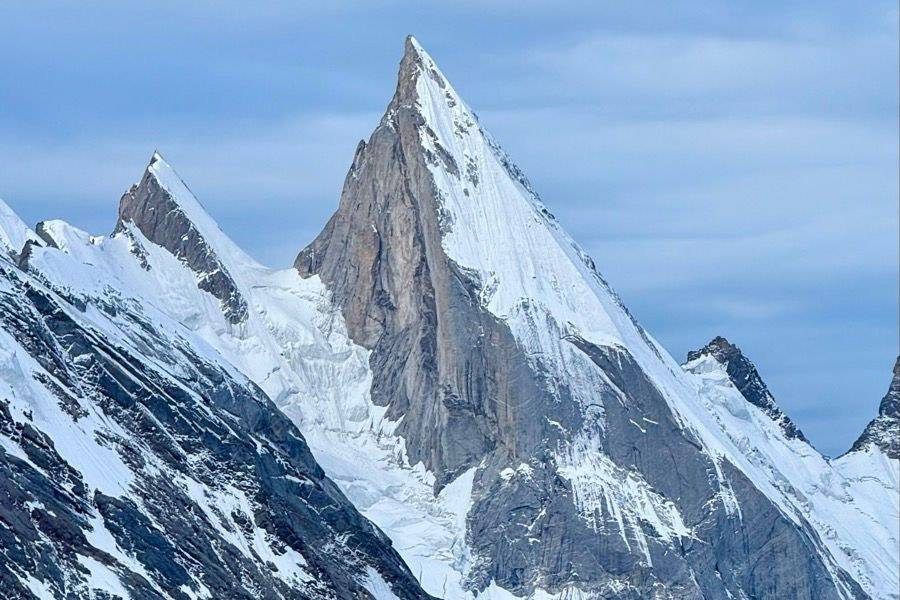
After a little bit of descent the light finally hit, and I got some of the best footage of the trip. Descending was tough, though. I couldn't really film myself while rappelling. Laila Peak, towering over Khuispang camp, is one of the coolest peaks I've ever seen. I recovered with tea and sleep. The hardest part was behind us.
My GPS shows how the night went. We left Ali Camp at 11:30 p.m. and covered the first 2 miles on the glacier in about 1 hour 40 minutes, to about 16,820 ft. The next mile, the steep slope on the fixed ropes, took about three hours and climbed about 1,100 ft to the pass. We were at the top from about 4:40 to 5:30 a.m. The first mile down, steep and roped, took about an hour and dropped about 1,570 ft. Then the path eases off down to Khuispang, which we reached at 7:40 a.m.
My GPS reads 5,467 m at the pass. Most published sources give the Gondogoro La as 5,585 m (18,323 ft), and some give up to 5,650 m. My GPS reads low up here, so plan for the published figure.
Before the pass, the only way out is back to Concordia and down the Baltoro. Once you're over, keep going down: Khuispang, Saicho and Hushe are all downhill. The pass is not something to try in bad weather or without your guide and the ropes in place.
Narrated film, Day 10 · Ambient film, Day 10
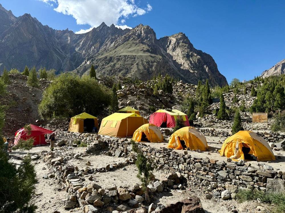
We rested at Khuispang the day we came over the pass and walked on the next morning. It was warmer and all downhill. Breathing felt easier, and I even ran parts of the trail. We had one big stream crossing, and I watched the landscape slowly turn green again. The trees came back, and so did softer ground. At camp, tables and chairs were waiting.
About 4,200 ft down over 10.7 miles. The first part follows the Gondogoro Glacier: about half of my track is on the mapped ice. Below it the path runs down the valley past the Dalsampa meadows to Saicho, the first camp among trees. The big stream crossing is on this day; follow your guide and cross together.
Keep going down to Saicho and Hushe, where the road starts.
Narrated film, Day 11 · Ambient film, Day 11
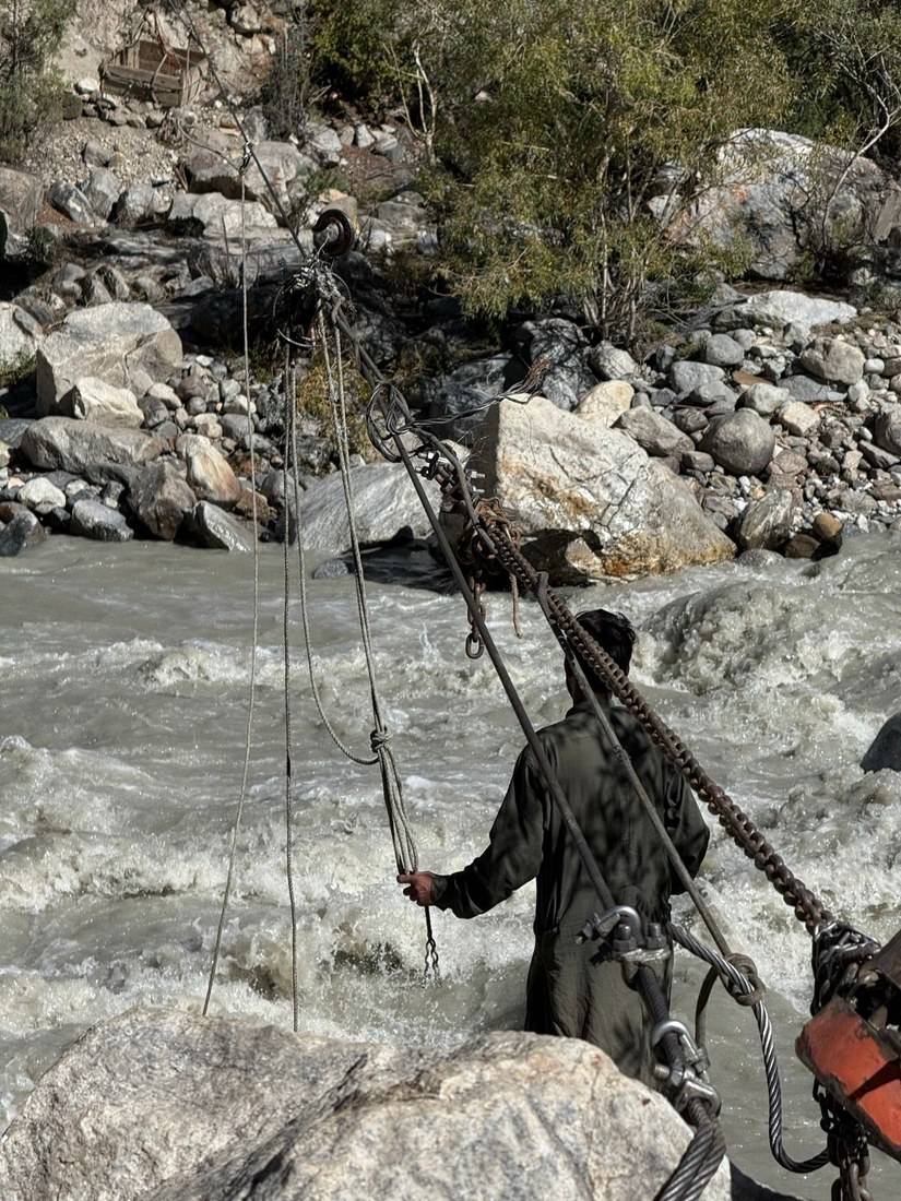
On the final day we said goodbye to the old man who owned the camp. The last obstacle was a river crossing in a hanging basket surrounded by ropes. We crossed slowly, one at a time.
My shoes were destroyed by this point, but thanks to Aziz's patch job earlier in the trek, they survived to the very end. We reached Hushe, a small farming village, and the trek officially ended. The team got paid, the jeeps were loaded, and we began the long drive back to Skardu, over the same broken bridges we had crossed on the way in.
An easy last morning down the valley to Hushe, about 870 ft down in 6.4 miles. The one thing to take seriously is the basket crossing: one person at a time, and do what the crew tells you.
You're walking out. The road starts at Hushe.
Narrated film, Day 12 · Ambient film, Day 12 · Behind the scenes
What I did. At Hushe the team got paid, the jeeps were loaded, and we began the long drive back to Skardu, crossing the same broken bridges we had crossed on the way in. My records don't show how I got from Skardu back to Islamabad. I was in Islamabad on September 1 and 2, and flew home through Istanbul on September 3.
Hushe to Skardu. About 5 to 6 hours by jeep (operator figure, 2026). From Skardu, fly or drive back to Islamabad as in Getting there. Flights are often cancelled by weather, so don't book your flight home for the day after the trek.
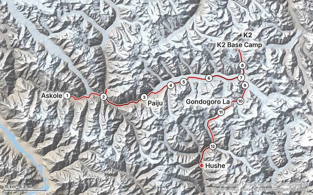
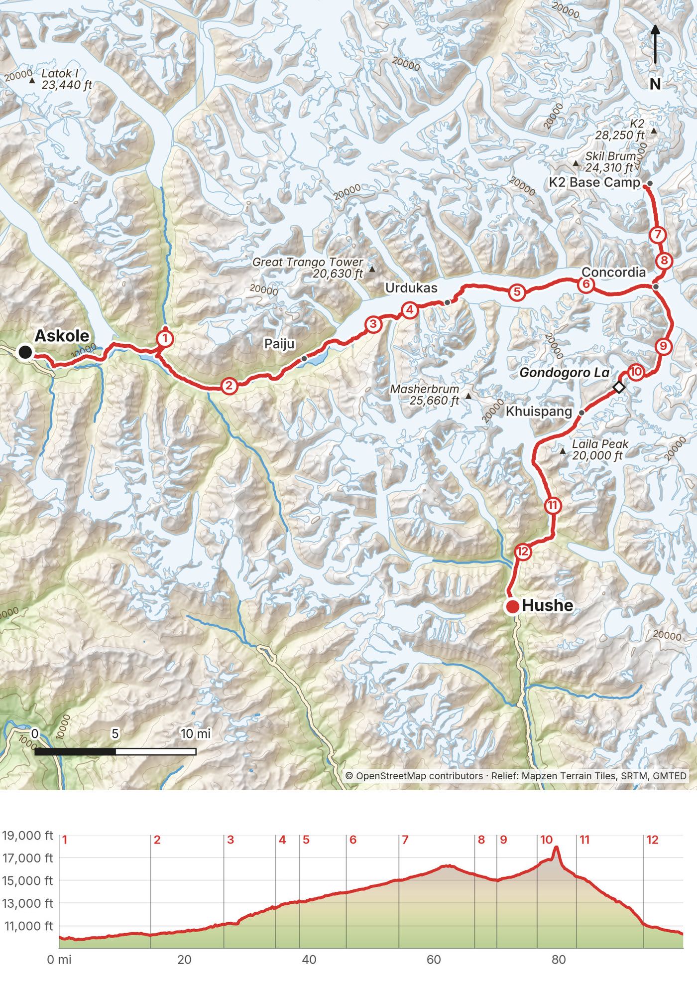
Elevation9,751–17,930 ft99.9 mi
Terrain: Mapzen Terrain Tiles (SRTM, GMTED) on AWS · Glaciers, rivers & lakes © OpenStreetMap contributors
Tap a map to open it full size.
A Gilgit-Baltistan trekking permit, US$150 per person from April to September, and the Central Karakoram National Park fee, US$190 per person (2026). Your operator files the permit, and the visa normally takes about 4 weeks.
From the hike's facts; check the official page before you go.
The season. The Gilgit-Baltistan tourism department gives June to September as the time to go. The Gondogoro La is normally crossed from late June to about the end of August, while the Hushe team keeps ropes on it; there's no official season notice, so ask your operator for your year's dates. I crossed on August 27, 2025.
What I got. The first day was long and hot, and rain came in the afternoon. The sun on the glacier was strong. From Day 5 the nights got colder, and on Day 6 water bottles left outside froze solid. We had clear skies at Concordia, then rain, cloud and fresh snow on the day to K2 Base Camp, frost the next morning, snow and hard glare on the way to Ali Camp, and a freezing night on the pass. It was very cold at times and very hot at times.
Floods and roads. Monsoon rain, floods and landslides are a risk from late June to early October (UK advice, 2026). In 2025 floods and landslides had taken out whole sections of the road to Askole, and the team carried our supplies across missing bridges by hand. In 2026 the floods came again. On June 30 the Hushe River cut the road to Hushe, where this trek ends (news reports in late July still had the Hushe Valley road closed for repairs), and in July floods closed the Jaglot to Skardu road until a temporary bridge went in on July 27. Ask your operator whether the jeep roads to Askole and from Hushe are open for your dates.
Go soon. This trek still feels wild. You feel like you're getting away with something, because there's hardly anyone else doing it. It will become popular as infrastructure and money pour in. I said it at the time: do it as soon as you can.
This is the part of the trek to take most seriously. You sleep seven nights above 13,000 ft, the highest at 16,240 ft, and cross a pass of about 18,300 ft in the middle of the night.
| Night | Camp | Sleeping height, my GPS | Change |
|---|---|---|---|
| Before Day 1 | Askole | 9,980 ft (3,042 m) | |
| 1 | Jhola | 10,160 ft (3,098 m) | +56 m |
| 2 | Paiju | 11,120 ft (3,389 m) | +291 m |
| 3 | Khoburtse | 12,550 ft (3,824 m) | +435 m |
| 4 | Urdukas | 13,170 ft (4,015 m) | +191 m |
| 5 | Goro II | 13,920 ft (4,244 m) | +229 m |
| 6 | Concordia | 15,010 ft (4,575 m) | +331 m |
| 7 | Broad Peak camp | 15,500 ft (4,725 m) | +150 m |
| 8 | Concordia | 15,010 ft (4,575 m) | -150 m |
| 9 | Ali Camp | 16,240 ft (4,949 m) | +374 m |
| 10 | Khuispang | 15,320 ft (4,669 m) | -280 m |
| 11 | Saicho | 11,150 ft (3,400 m) | -1,269 m |
Highest points on foot: 16,317 ft (4,973 m) near K2 Base Camp on Day 7, and the Gondogoro La on Day 10. My GPS reads lower than most published heights up high (5,467 m at the pass, against the usual 5,585 m), and published camp heights differ from each other by up to about 300 m. Use these as a guide to the steps between camps.
From the CDC's 2026 guidance on altitude illness, based on the Wilderness Medical Society's recommendations:
Going down fast is hard here. From Concordia it's days back down the glacier on foot, the pass is only possible with the ropes in place and good weather, and helicopters fly only in daylight, when they're available. Askari Aviation's briefing gives a maximum landing height of 5,000 m and advises moving casualties on the Baltoro to Concordia. In 2025 there was a small medical dome at Concordia with a doctor on call. Tell your guide early if you feel unwell, and turn around below the pass if anyone in the group is getting worse.
On the pass, the altitude, the cold, the darkness and the lack of sleep made it one of the craziest experiences of my life. Coming down the other side, breathing felt easier.
Emergency numbers (September 2026). 1122 for ambulance and fire, 15 for police. Gilgit-Baltistan Tourist Police: 1422 inside the region, 05811-930055 from elsewhere in Pakistan. Rescue 1122 Skardu: 05815-1122.
Helicopter rescue. Askari Aviation flies rescue with army helicopters: not guaranteed, daylight only, and only if you're registered before the trek (see What you need to arrange). Its briefing gives a maximum landing height of 5,000 m and advises moving casualties on the Baltoro to Concordia.
Where to be careful:
Go with the group. The UK's advice for Gilgit-Baltistan is to use a reputable trekking agency, stay on established routes, walk in groups and never trek alone, and to register with the local authorities (ask your operator how).
Photos. Don't photograph military sites, airports, bridges or dams (UK advice), and photography is banned near military installations in Gilgit-Baltistan. Khoburtse, where we camped on Day 3, was a military outpost. Ask your guide before you point a camera.
Drones. I flew a drone on this trip. Reports from 2024 and 2025 conflict on whether Pakistan's civil drone rules are in force, and I found no official page for visitors in September 2026. Ask your operator and the Pakistan Civil Aviation Authority before you bring one.
Can I do this trek on my own? No. The route from Askole up the Baltoro to Concordia and out over the Gondogoro La to Hushe is on the Pakistani government's list of restricted-zone treks. You need a trekking permit, your trekking visa needs a sponsor letter from a tour operator licensed by the Department of Tourist Services, and a licensed guide and porters are mandatory (all checked September 2026). See How this trek works.
How many days do I need? I walked 12 days from Askole to Hushe, with no full rest day. Add a day in Islamabad, the flight to Skardu, a jeep day each way and spare days for flights and weather. My card records put me in Pakistan for about 19 days. The Gilgit-Baltistan tourism department gives 14 to 20 days for the trek, depending on the route.
How hard is it? It was one of the hardest things I've ever done, a double diamond compared to anything I'd done before. The daily distances are short, 3.5 to 14.6 miles, and the team carries the camp. What makes it hard is the altitude (seven nights above 13,000 ft), walking on loose rock over glacier ice, cold nights and hot days, being far from home for a long time, and a pass climbed at night on fixed ropes.
Do I need climbing experience for the Gondogoro La? I didn't have any. I had never done anything like it. We wore alpine boots, crampons, helmets and harnesses, climbed a steep snow slope clipped from rope to rope, and rappelled on the way down. A team from Hushe fixes and looks after the ropes each season. Ask your operator what gear they provide, and practice walking in crampons and clipping in before you go.
Is it safe? There are two separate questions. Altitude is the big physical risk: read Altitude. Security advice changes. In September 2026 the US rated Pakistan Level 3 (reconsider travel) and said not to travel to Khyber Pakhtunkhwa, Balochistan or near the Line of Control; Gilgit-Baltistan, where this trek is, isn't named. The UK doesn't list Gilgit-Baltistan in its warnings, but advises against all travel on the Karakoram Highway between Mansehra and Chilas. Details and links: Before you go, check these.
When should I go? I went in August. The season is June to September, and the Gondogoro La is normally crossed from late June to about the end of August. See When to go.
What does it cost per person? Plan on roughly US$3,000 to US$4,500 all in with a Pakistani operator. Their 2026-27 packages run from about US$1,500 (trek only) to US$1,800-2,500 (all inclusive, about 21 days); Western-run trips cost far more, up to about US$9,500. On top of that come international flights, a visa, insurance, tips and spare nights, and a helicopter rescue deposit you get back if it isn't used. I hosted my group, so my own trek price isn't in my records. See What I paid.
What's a day like? Warm water to wash with, breakfast, then 2.5 to 9.5 hours of walking at the group's pace, with a lunch stop. At camp the tents are up and your bag is waiting. Tea, dinner in the dining tent, and an early night.
Where do you sleep? In tents the team puts up. I had my own tent, and two pads under me, which kept me warm.
Can I charge my phone and camera? On my trip the team ran a generator for a couple of hours each evening for cameras, phones and drone batteries. Bring a power bank for the rest of the day.
Are there showers? No. The lack of showers was one of the challenges for me. There was warm water for washing your face and hands each morning and before each meal.
What was your most useful gear? The reflective umbrella. It was the MVP of this trip, for the sun on the glacier and for the rain.
I walked the twelve days in this guide. These are other ways operators run the trip, and I didn't do them.
From Concordia you can walk back down the Baltoro the way you came, as our pack animals did on Day 9. It skips the Gondogoro La, its night climb and its ropes, and it's the way out if the pass is closed. My operator lists a 21-day K2 Base Camp trek of this kind, with a high point of about 5,100 m (2026 page).
My operator's current K2 and Gondogoro La itinerary runs 23 days door to door, with a rest day at Paiju and a day at Concordia for K2 Base Camp, Broad Peak and the memorial, before the pass. On my trip we had no full rest day, and we slept at the Broad Peak camp on the way back from K2 Base Camp. By the altitude rules in Altitude, the extra days are worth having.
The Hushe valley, with Saicho and the camps below the Gondogoro La on the south side, is its own restricted-zone trek on the government list. The GPX files for Days 11 and 12 cover the lower part of it.
My trip was organized by Spantik Expeditions (spantikexpeditions.com), a licensed company in Skardu led by Aziz and his son Abdul. A year earlier, Abdul messaged me on Instagram inviting me to come hike in Pakistan. That message eventually brought me here, with a small group of subscribers.
The company took care of everything: the logistics, the permits and the food. Then they took care of us through the whole trek, helping with crampons and food, giving advice, making sure the tents were good, translating for us and dealing with currencies. Aziz and Abdul, a father and son, were the two guides you see throughout my films. Behind them were porters, cooks and a caravan of pack animals, and a goat and a few chickens.
On the road in, when a bridge was missing, the team unloaded the jeeps, carried the supplies across by hand and loaded everything again on the other side, several times. The dedication was obvious from the start.
The food. The cooks fed us three meals a day. Breakfast was bread, eggs, porridge, fruit, coffee and tea. On Day 1, lunch was fresh fruit, mangoes and melon cut that morning. Each afternoon the cooks rolled fresh chapati by hand. Dinner was Chinese food on the first night, and noodles, chicken and fried potatoes at Urdukas. At Goro II, popcorn really hit the spot, and that night we had our goat for dinner. At lunch my appetite was endless: seconds, then thirds.
The extras. The team carried so much Coca-Cola for us that it became a running joke; we celebrated at K2 Base Camp with Coke and boiled potatoes. I ate a lot of Snickers on this trek and drank a lot of tea.
Camp. The team put up the tents, a big dining tent and a kitchen, and our bags were waiting when we arrived. There were warm water stations every morning and before each meal. A generator ran for a couple of hours each evening for charging. My operator's 2026 package lists member, dining, kitchen and toilet tents. Camp shoes were essential.
Water. The river was brown and violent from flooding on the way in. My records don't show how our drinking water was treated. Ask your operator, and carry a filter or tablets as a backup.
The pace. I wanted to move faster, but it wasn't just about my pace. The porters, cooks and animals all had difficult jobs that longer days would have made even harder. Traveling with a group was part of the challenge for me, and there were a lot of moments that didn't make the video: the long conversations, the meals, the jokes and the struggles.
I hosted this trip, so my records don't have a normal trek price in them. This is what my card and bank records show, and it isn't the full picture.
| Item | What I paid |
|---|---|
| Etihad ticket, the only one on my card that year (I flew into Islamabad through Abu Dhabi) | $778.65, bought in May 2025 |
| The trek itself: operator, permit, park fee, food, staff | Not in my records |
| Islamabad to Skardu and back | Not in my records |
| Meals and coffee in Islamabad after the trek | $3.69 to $12.69 each |
| Cash from an Islamabad ATM | PKR 10,000, $39.07 plus $6.17 in fees |
| Flight home through Istanbul | Not in my records |
The rules below were checked on official Pakistani government pages on September 26, 2026. They change, so confirm them with your operator.
These change every year; everything else in this guide stays the same. Checked September 26, 2026. Check them again, with your own government's advice, when you book and the week you fly.
Security
Permits and paperwork
The pass and the travel
Money, health and gear
Planning questions about K2 Base Camp, answered only from this page's facts, the creators' versions and hikers' public tracks, with where each answer comes from. When the data doesn't say, the answer says "not given".
From hikers
Sign in to comment. Free; your hikes stay private unless you share them.
Something wrong or missing on this page? Send feedback.