
Content made there
The film is at the top of this page.
Photos
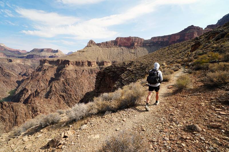
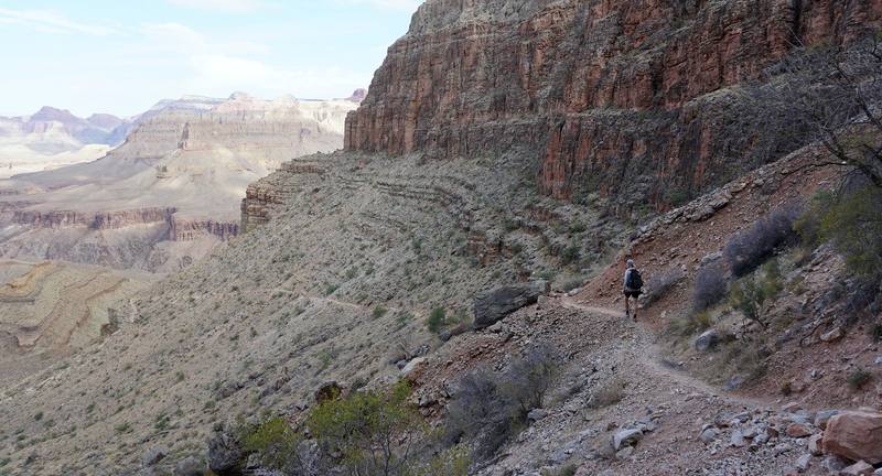
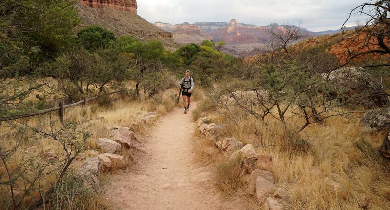
Hikes / Grand Canyon Tonto Trail / Kraig Adams's version
North America · United States
Nov 2020 · 2 days · about 26 miles · With friends · Tent

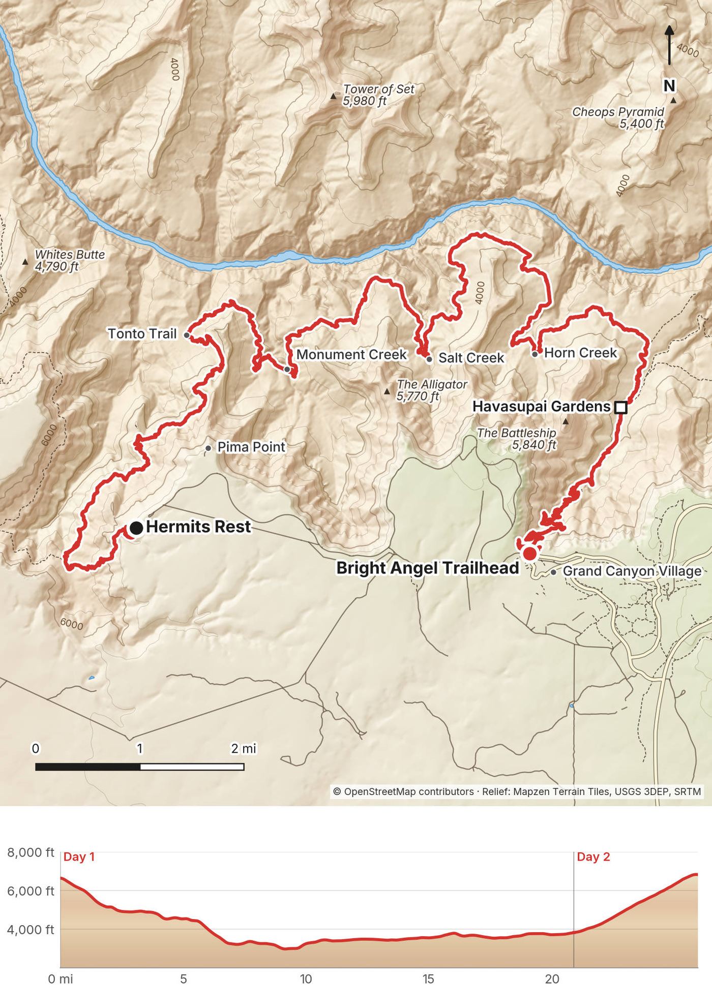
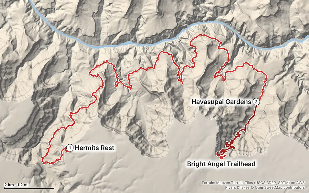
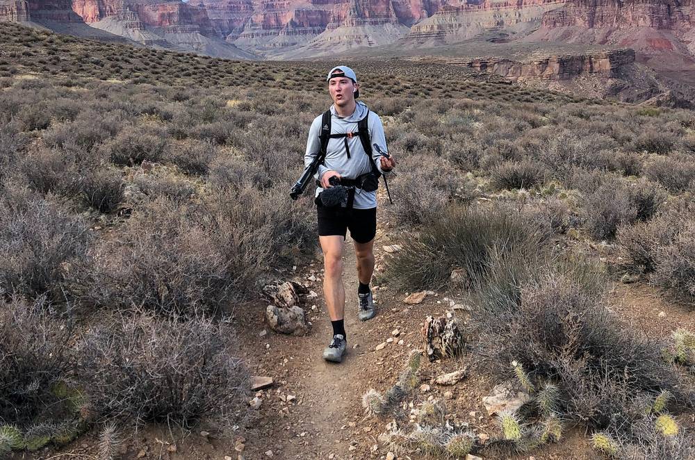
At the beginning of November 2020 I hiked the Tonto Trail in the Grand Canyon with my brother Kurtis. We went down the Hermit Trail from Hermits Rest, at the west end of the South Rim, east along the Tonto Trail on the platform above the inner gorge, and spent the night at Indian Garden Campground, now called Havasupai Gardens. The next morning we hiked out the Bright Angel Trail to Grand Canyon Village. Two days, about 26 miles by my GPS: 21 on the first day and 5 on the second. It's the trip from my film Hiking the Grand Canyon Tonto Trail.
I'd been in the Grand Canyon around the same time the year before, when I hiked rim to rim, and it was interesting to do yet another Grand Canyon negative mountain desert hike, this time with my brother.
| Quick facts | |
|---|---|
| Distance | 26.0 miles (41.8 km) by my GPS. I called it "about 26 miles" in the film; NPS gives 24.8 to 25.3 |
| Climbing | About 4,990 ft (1,520 m) up and 4,830 ft (1,470 m) down |
| Days | 2: 20.9 miles on Day 1, 5.0 on Day 2 |
| Start | Hermits Rest, at the end of Hermit Road, 6,640 ft (the Hermit Trailhead) |
| Finish | The Bright Angel Trailhead in Grand Canyon Village, 6,860 ft, about 8 miles by road from the start |
| When | I went November 2 and 3, 2020 |
| Difficulty | A steep, rough descent of the Hermit Trail, a long, shadeless day on the Tonto, then a 3,000 ft climb out. NPS calls this area "recommended for experienced Grand Canyon hikers" |
| Permit | A backcountry permit for every night below the rim, by lottery on Recreation.gov. Not needed to do it in one day |
| Day | Route | Miles (km) | Up / down (ft) | Sleep |
|---|---|---|---|---|
| 1 | Hermits Rest to Havasupai Gardens | 20.9 (33.6) | 1,968 / 4,803 | Havasupai Gardens Campground |
| 2 | Havasupai Gardens to the Bright Angel Trailhead | 5.0 (8.1) | 3,023 / 26 |
Distances and climbing are from my own GPS, smoothed the same way every day. Heights of the trailheads, campsites and creeks are NPS's figures. My GPS reads a little long next to NPS's mileages (see Using the GPX files), so both are given.
The South Rim. By NPS's figures it's about 90 minutes (81 miles) from Flagstaff, an hour from Williams, four hours from Phoenix and 278 miles from Las Vegas. Flagstaff's airport has American Airlines flights from Phoenix and Dallas–Fort Worth. Without a car, Groome Transportation runs from Flagstaff (from $49 plus an $8 park entry fee, by reservation) and the Grand Canyon Railway runs daily from Williams. There are no rental cars at the canyon.
My way in, 2020. The day before, we were at the Backcountry Information Center in the morning for our permit, and in the afternoon we rode the park's shuttle bus out Hermit Road to Pima Point and looked down at the Tonto Platform. On the morning of the hike we drove out in the dark: my film shows us parking out at Hermits Rest at 6:13 a.m. and packing up at the car.
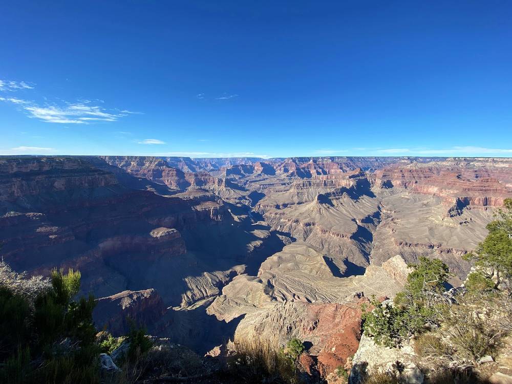
Getting to Hermits Rest (2026). Hermits Rest is at the west end of Hermit Road, about 7 to 8 miles from the village. The Hermit Trail starts a quarter mile west of the Hermits Rest building, along a dirt road from the restrooms. Your options:
Parking for overnight hikers. Lot D at the Backcountry Information Center, near Maswik Lodge, a short walk (NPS says 0.25 or 0.4 miles) from the Bright Angel Trailhead and the start of the Hermits Rest shuttle. It fills by 2 p.m. NPS's advice with one car: park where you come out.
The Backcountry Information Center is near Maswik Lodge, open daily 8 a.m. to noon and 1 to 5 p.m. Email (grca_bic@nps.gov) is the best way to ask a question; the phone (928-638-7875) is for information only, weekdays.
Where to stay (2026). Mather Campground is open all year: $30 a night, by reservation on Recreation.gov up to six months ahead from March 1 to November 30, with a $6 per person site for hikers and cyclists. The in-park lodges book up well ahead; Tusayan, 7 miles south, has hotels. In October 2026 the lodges are closed to overnight guests and Mather is dry camping only (see Is it open?).
| Item | What I paid |
|---|---|
| Backcountry permit for Indian Garden, 2020 | Not in my records |
| Getting there, food and the night before | Not in my records |
For your budget (2026). Backcountry permit: $10, plus $15 per person per night below the rim (two people, one night: $40). Park entrance: $35 per car, or $20 per person on foot; non-US residents add $100 each. Mather Campground: $30 a night. The shuttle buses are free. Groome from Flagstaff: from $49 plus $8 park entry.
| Night | Where | Height |
|---|---|---|
| 1 | Indian Garden (Havasupai Gardens) Campground (Day 1 mile 20.9) | 3,800 ft (1,160 m) |
Havasupai Gardens Campground. Called Indian Garden until November 2022, when it was renamed at the Havasupai Tribe's request. 15 small group sites and one large one, 4.5 miles below the South Rim on the Bright Angel Trail. It has a ranger station staffed all year, an emergency phone and toilets, and normally drinking water all year (off since September 6, 2026). Every site has a picnic table, a pack pole and a metal food can, which you must use. At most two nights per trip (four from November 15 to February 28).
I cowboy camped, for the first time: I just slept on my mat with a sleeping bag.
The other camps on this route (all designated sites, by permit): Horn Creek, Salt Creek, Cedar Spring, Monument Creek and Granite Rapids on the Tonto; Hermit Creek and Hermit Rapids off the Hermit Trail.
All our own, carried in. My gear list from the film has Mountain House meals and a Jetboil. NPS suggests eating about twice what you normally would, with salty snacks. Keep food in the can at Havasupai Gardens and in a critter-proof container elsewhere: rock squirrels are the main cause of animal bites in the park.
Every source on this route (NPS's Hermit and Tonto bulletins and Recreation.gov's camp notes):
How much. It's 10.7 miles from Monument Creek to Havasupai Gardens with nothing to rely on. NPS says about a gallon (4 liters) a day per person in warm months; drink when you're thirsty, and eat salty food. Recreation.gov's notes say many hikers carry all their water from Havasupai Gardens or Monument Creek. In 2026 that means treating creek water at Havasupai Gardens too, or carrying it from the rim.
Treating it. NPS's method: a filter of 1 micron or finer, then bleach or iodine, or boiling. I carried a filter bottle.
There are toilets at the trailheads, Horn Creek, Salt Creek, Monument Creek, Hermit Creek, Havasupai Gardens and both Bright Angel resthouses. Pack out everything, toilet paper included. Away from toilets, dig a hole 6 inches deep at least 200 feet from water, the trail and camp.
From my film's original gear list:
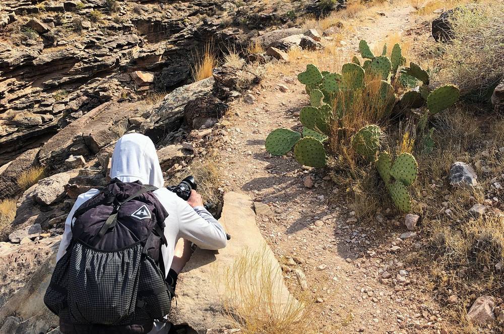
What this route needs:
We drove out Hermit Road in the dark, parked at 6:13, and started down from Hermits Rest at 6:44, just before sunrise. We were at Santa Maria Spring before 8, at the bottom of the Hermit Trail, where it meets the Tonto Trail, at about 10, and down in Monument Creek before 11.
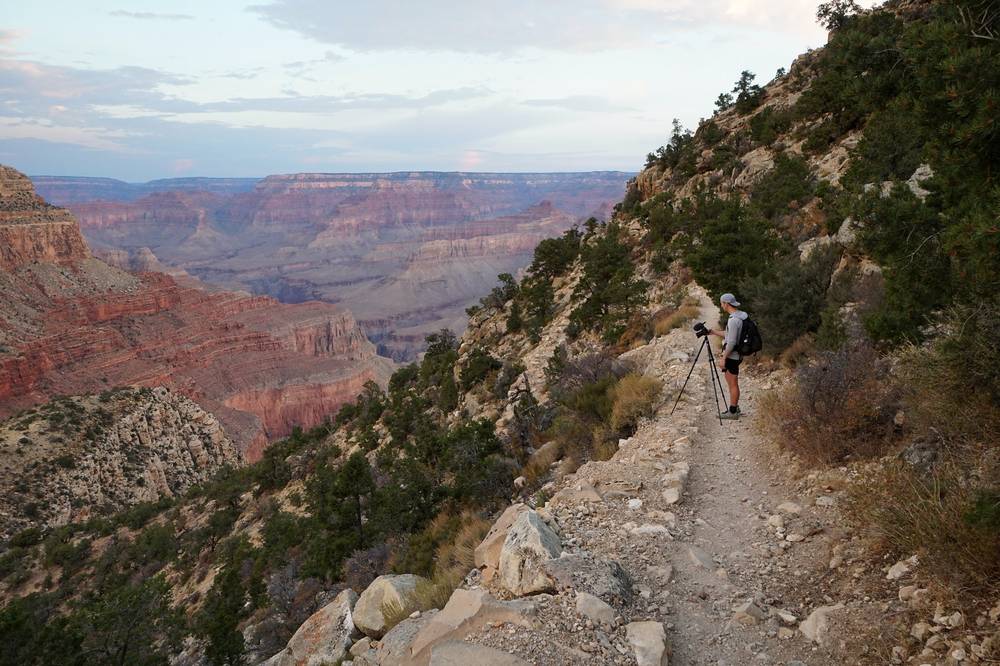
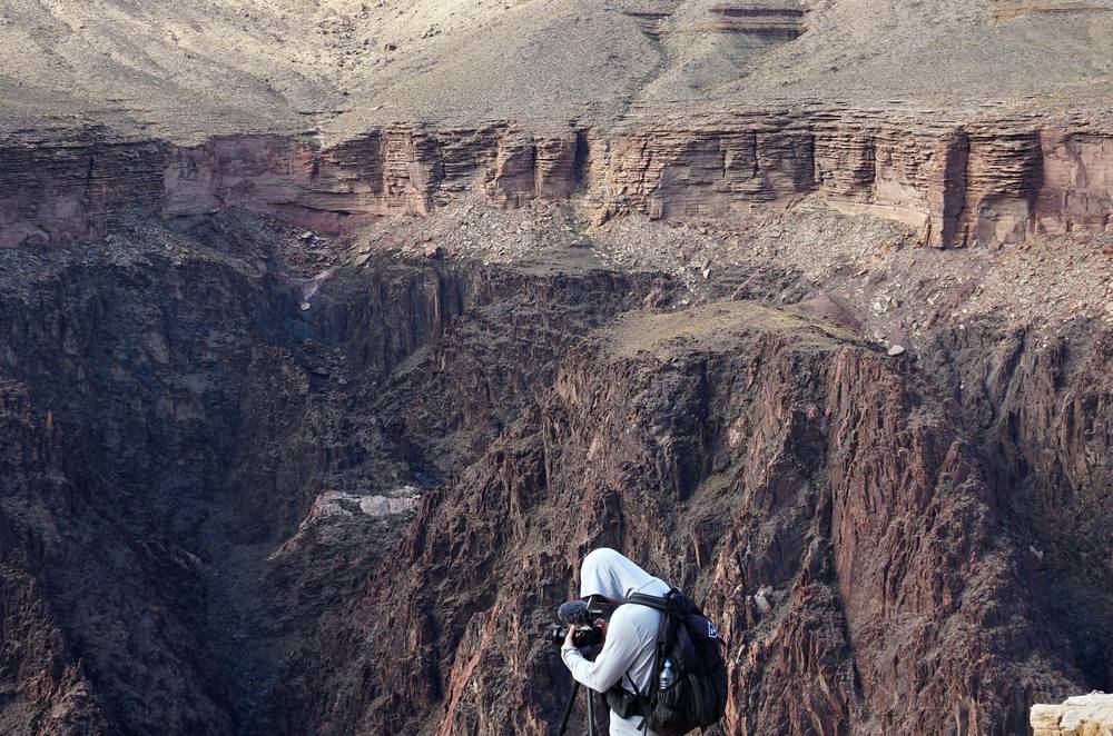
From Monument Creek we followed the Tonto Trail east across the platform, past Cedar Spring at noon, and stopped at Salt Creek from about 12:50 to 1:15. In the afternoon we stopped above the Colorado River, where the trail runs along the edge of the inner gorge, and I set up my camera. We passed Horn Creek at 3 and were at Indian Garden Campground, now Havasupai Gardens, at 4.
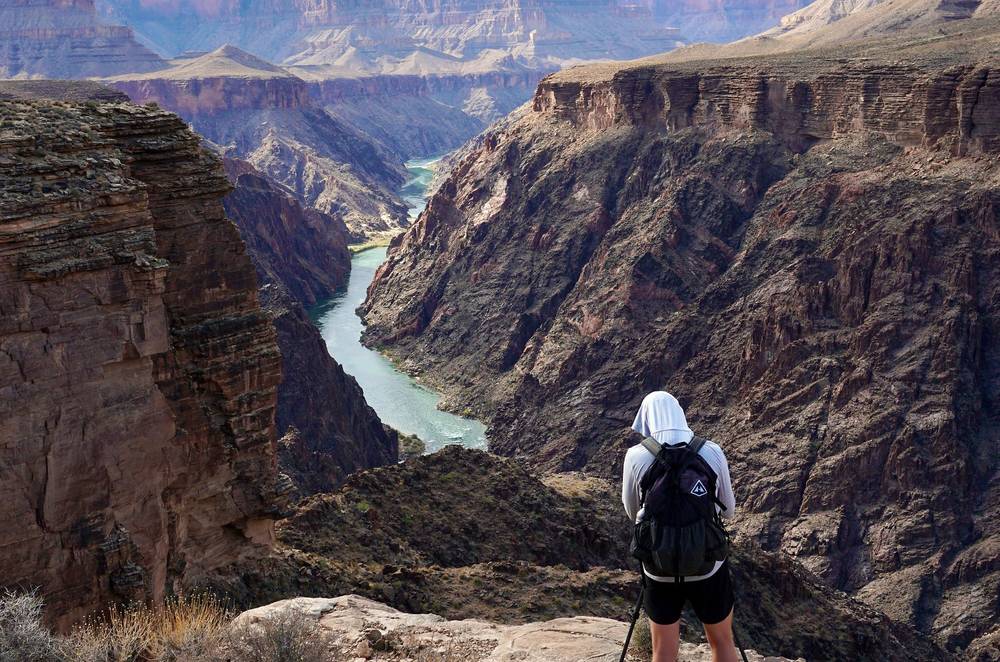
It was very hot in the direct sunlight during the midday, but at night it was comfortable and warm, and I cowboy camped down in the canyon for the first time: I just slept on my mat with a sleeping bag. I didn't have any crawling things on my face at night, as far as I know of. All we saw were goats and deer, during the day. A couple of people who watch my videos said hello in the canyon.
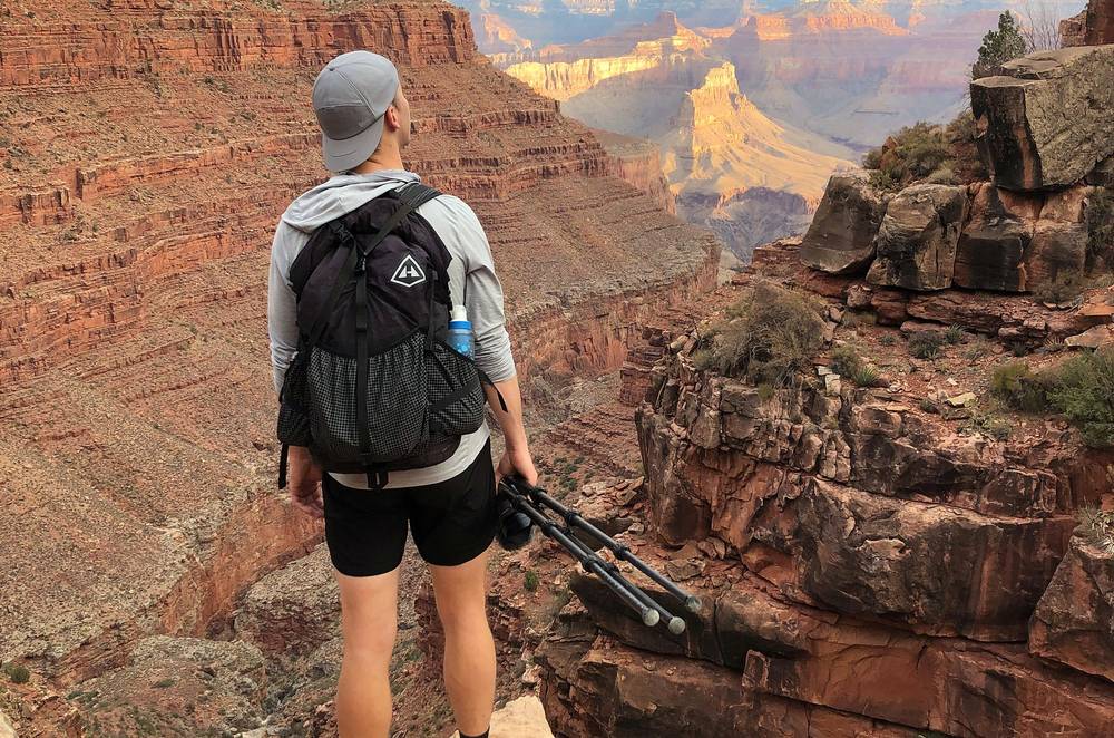
The Hermit Trail. It starts a quarter mile west of the Hermits Rest building, at 6,640 ft, and drops almost 2,000 ft in the first 2.5 miles on switchbacks through the pale Kaibab and Coconino cliffs. The trail was built in 1911 and paved with hand-fitted slabs, and a few stretches of that paving survive. It's unmaintained now: steeper, narrower and looser than the corridor trails.
Waldron and Dripping Springs junctions. At mile 1.5 on my GPS the Waldron Trail leaves to the south, and at 1.8 the Dripping Springs Trail leaves to the west. Stay right at both, on the Hermit Trail.
Santa Maria Spring. At mile 2.3 (NPS: 2.2 miles, 5,000 ft) there's a historic stone rest house and a spring that gives a trickle of water. Treat it.
The Supai traverse. From Santa Maria Spring to the top of the Redwall, the trail makes long traverses under the west-facing cliffs, which gives it some shade on hot mornings. Breezy Point is at 5.5 miles (NPS).
The Cathedral Stairs. Here, as NPS puts it, "the descent becomes unrelenting": rocky switchbacks through the Redwall cliff and down the talus below Cope Butte to the Tonto Trail.
The Tonto Trail junction. At mile 6.9 (NPS: 7 miles, 3,210 ft), marked with a wooden sign. Hermit Creek, with campsites, a toilet and water all year, is about a mile to the west (left). We turned east (right) toward Monument Creek.
Monument Creek. At mile 9.4 (NPS: 9.3 miles from the trailhead, 2,995 ft) the trail drops into Monument Creek, the biggest drainage between the Hermit and Bright Angel trails. Water can always be found at or below the trail crossing. There are designated campsites and a toilet; Granite Rapids, on the Colorado River at the mouth of the creek, is 1 to 1.6 miles down it (NPS's figures differ).
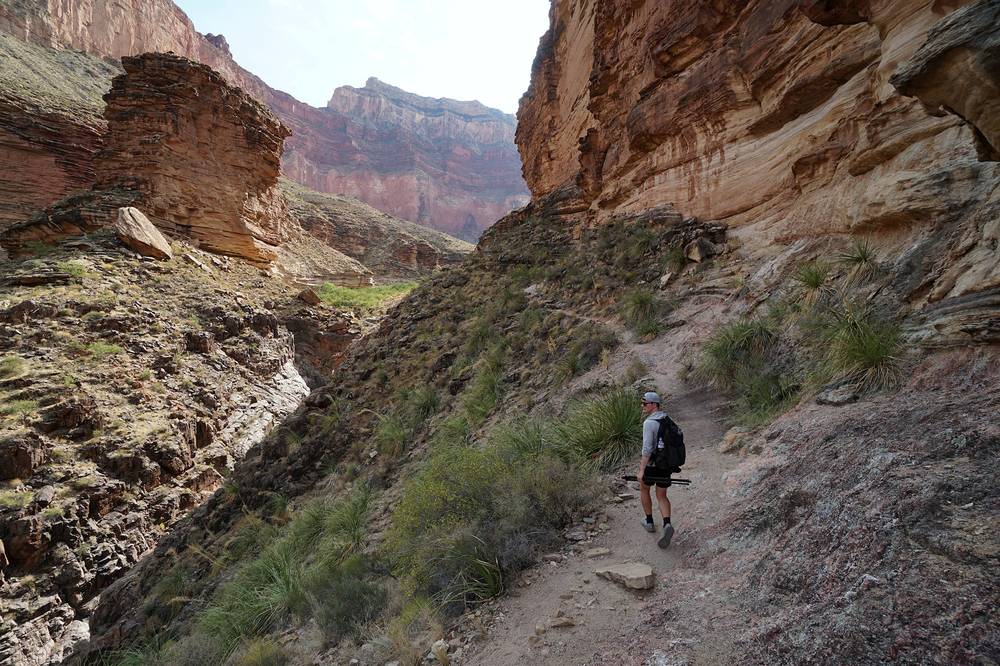
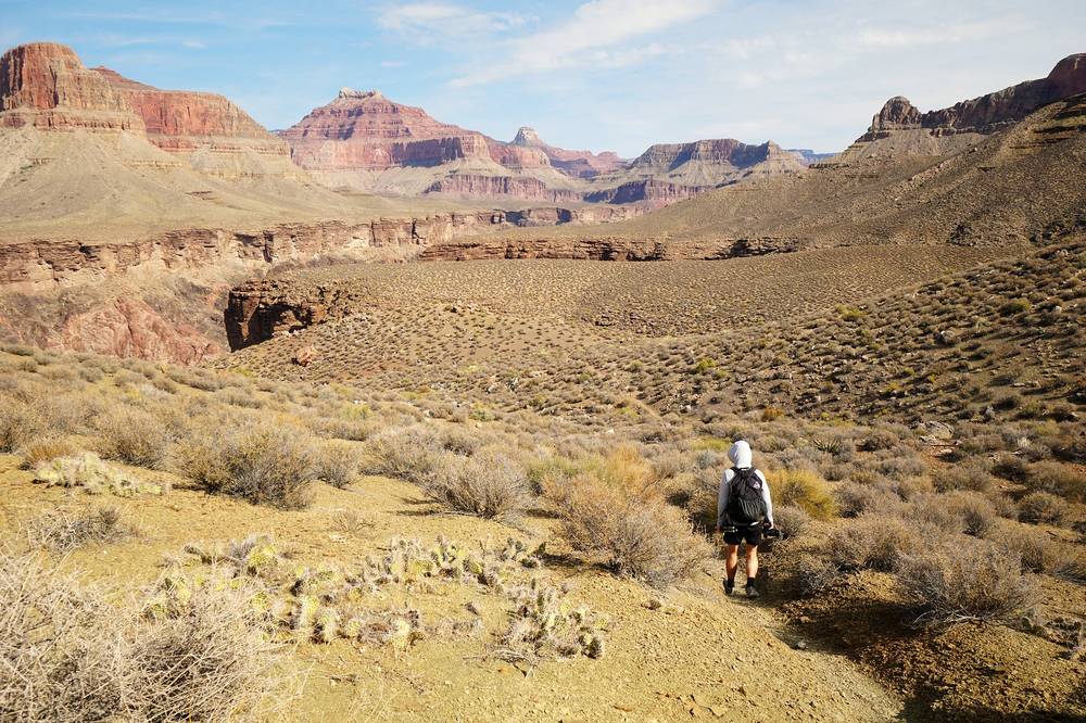
Across the Tonto Platform. From Monument Creek the trail climbs back onto the Tonto Platform and heads east. NPS compares it to a contour line: it keeps to one height and winds in and out of every side canyon. It can seem infuriatingly indirect, NPS says, but it almost always takes the line of least resistance. Cedar Spring (mile 11.2; NPS: 1.3 miles past Monument) is a small, unreliable seep with a campsite.
Salt Creek. At mile 13.5 (NPS: 2.1 miles past Cedar Spring, 3,550 ft): campsites and a toilet. West of Salt Creek, NPS says, the trail comes within 20 feet of a sheer cliff for about a quarter mile.
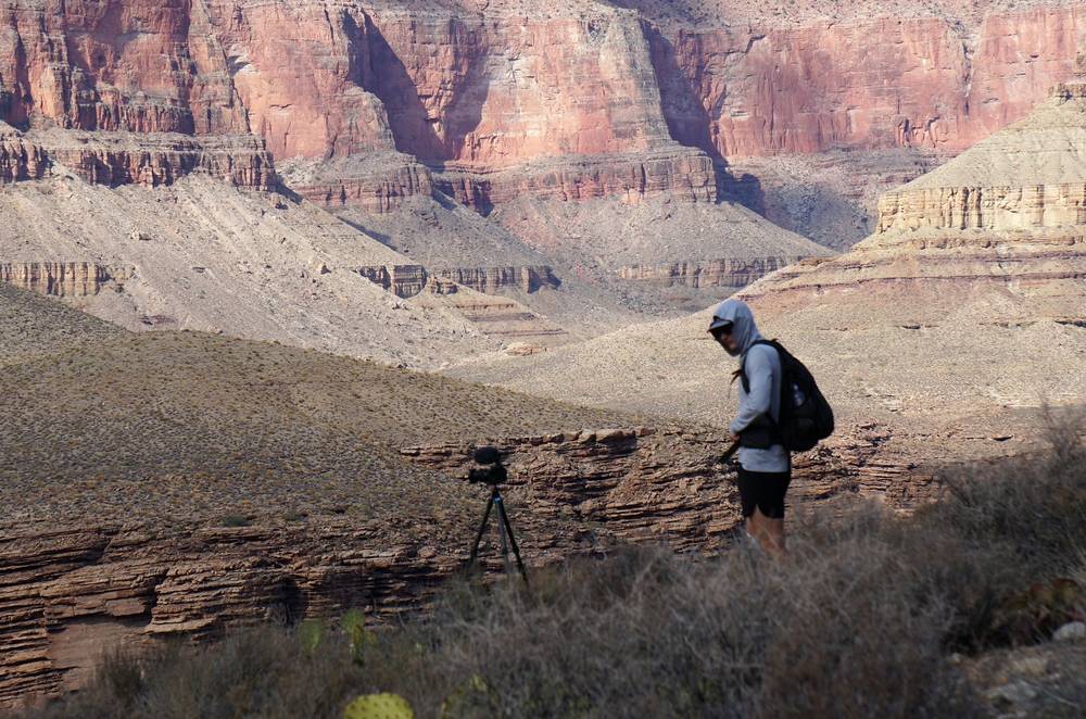
Horn Creek. At mile 18.1 (NPS: 4.8 miles past Salt Creek, 3,550 ft): campsites and a toilet. Don't drink Horn Creek's water: it carries uranium from the old Orphan Mine near the rim.
To Havasupai Gardens. Past a small ridge north of Dana Butte, the trail meets the Plateau Point Trail at mile 19.9; turn south. Havasupai Gardens Campground, 3,800 ft, is about a mile on by my GPS, just past where the Tonto Trail meets the Bright Angel Trail (NPS puts the junction about 3/4 mile from Havasupai Gardens).
On the Hermit Trail, the only way off is back up. East of Monument Creek, Havasupai Gardens and the Bright Angel Trail are the nearest way out. There are no emergency phones or rangers until Havasupai Gardens, 20 miles from Hermits Rest. If you're slow or hot, rest in shade through the middle of the day.
Film, Day 1 · How I did it (my talk at the end)
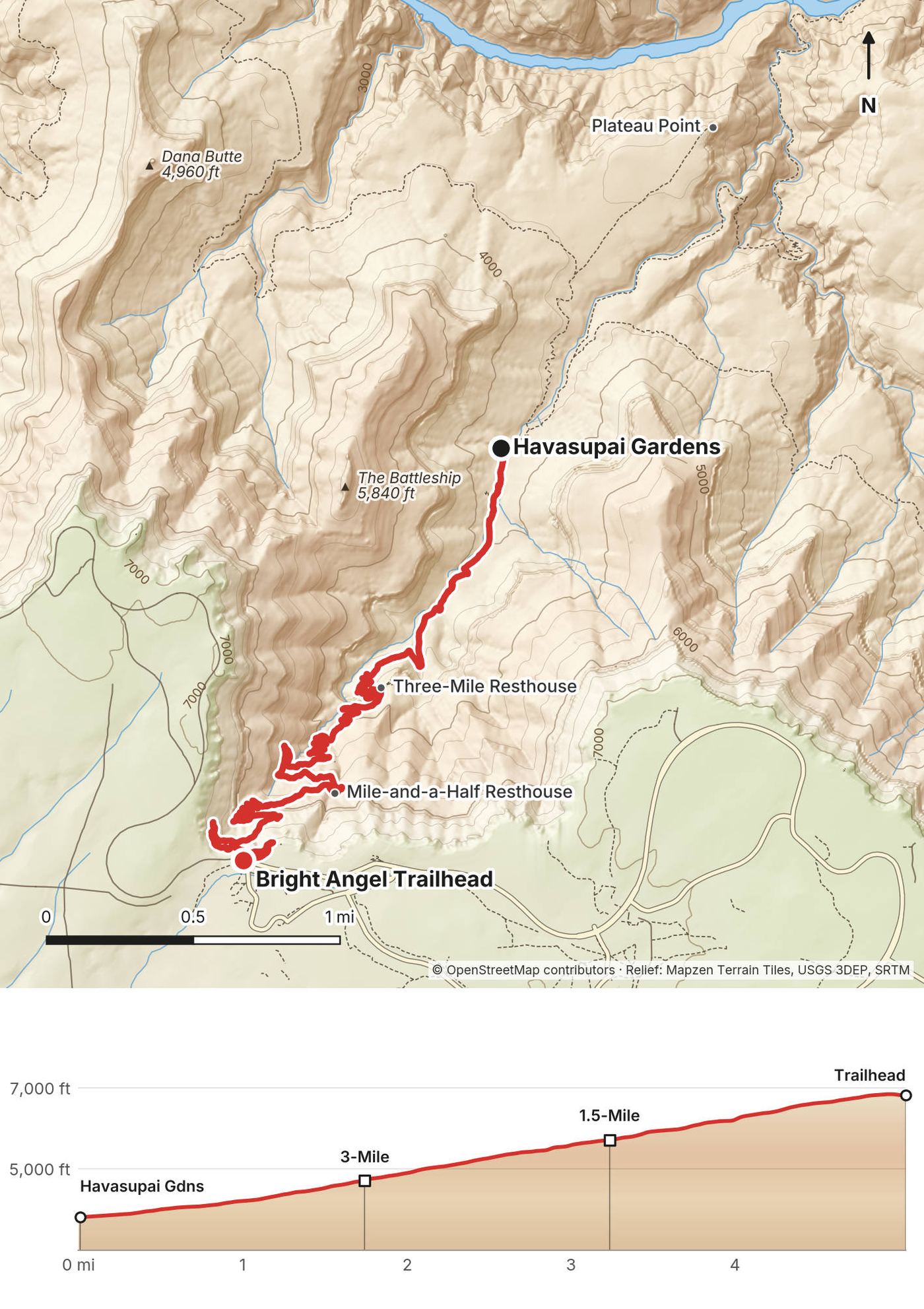
We hiked out in the morning, leaving Havasupai Gardens at 7:10. We were at the Three-Mile Resthouse at 7:50, the Mile-and-a-Half Resthouse at 8:23, and the top at 9:09.
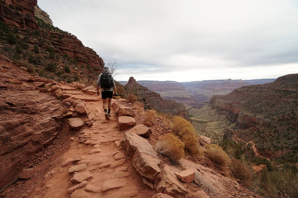
Havasupai Gardens. The campground, the ranger station and the old cottonwoods by Garden Creek, 4.5 miles below the rim (NPS gives 4.5 and 4.8). Its tap is off in October 2026.
Three-Mile Resthouse. At mile 1.8 on my GPS (NPS: 3.0 to 3.1 miles below the rim, 4,748 ft): a shelter, toilets and an emergency phone, and, in a normal year, water from about May to October.
Mile-and-a-Half Resthouse. At mile 3.2 (NPS: 1.5 to 1.6 miles below the rim, 5,729 ft): a shelter, toilets and an emergency phone, with seasonal water in a normal year.
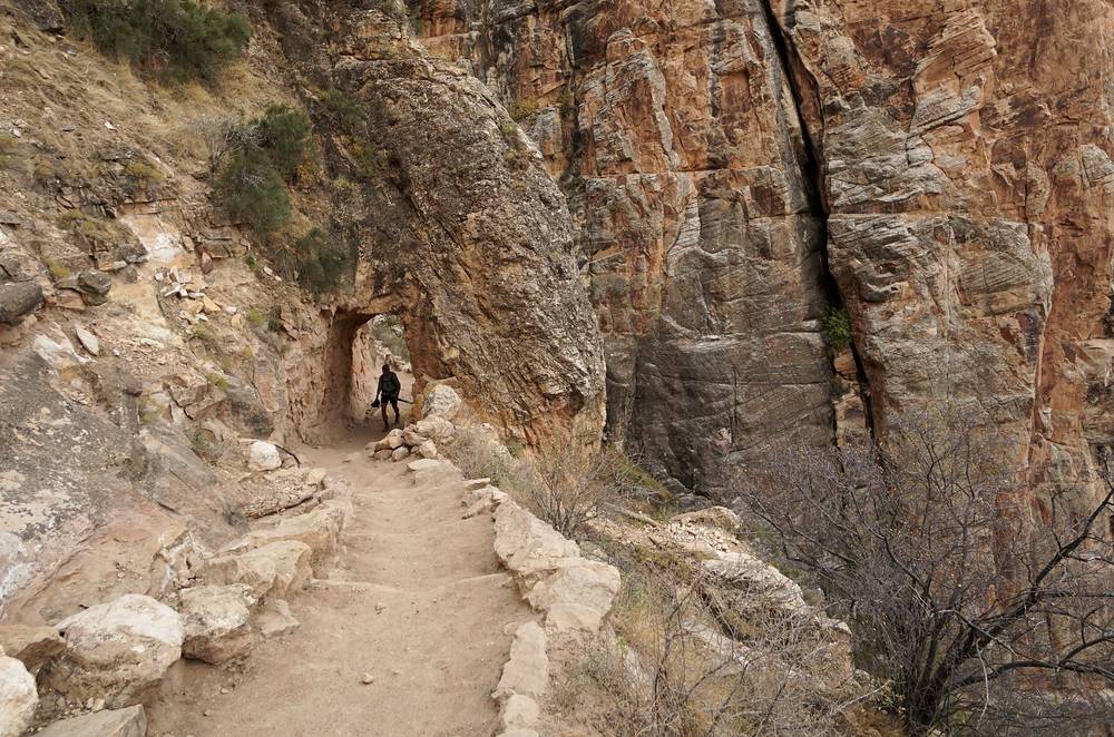
To the rim. Above the Mile-and-a-Half Resthouse the trail switchbacks on up the fault through the upper cliffs to the trailhead at 6,860 ft, by Bright Angel Lodge. Mules use this trail every day: give them the right of way. NPS says the top three miles hold packed snow and ice in winter.
On this side there's only up, or back down to Havasupai Gardens, which has a ranger station staffed all year. The emergency phones are at Havasupai Gardens and the two resthouses. NPS: plan on taking twice as long to hike up as down, and most first-time Grand Canyon hikers walk uphill at about a mile an hour.
Film, Day 2 · How I did it (my talk at the end)
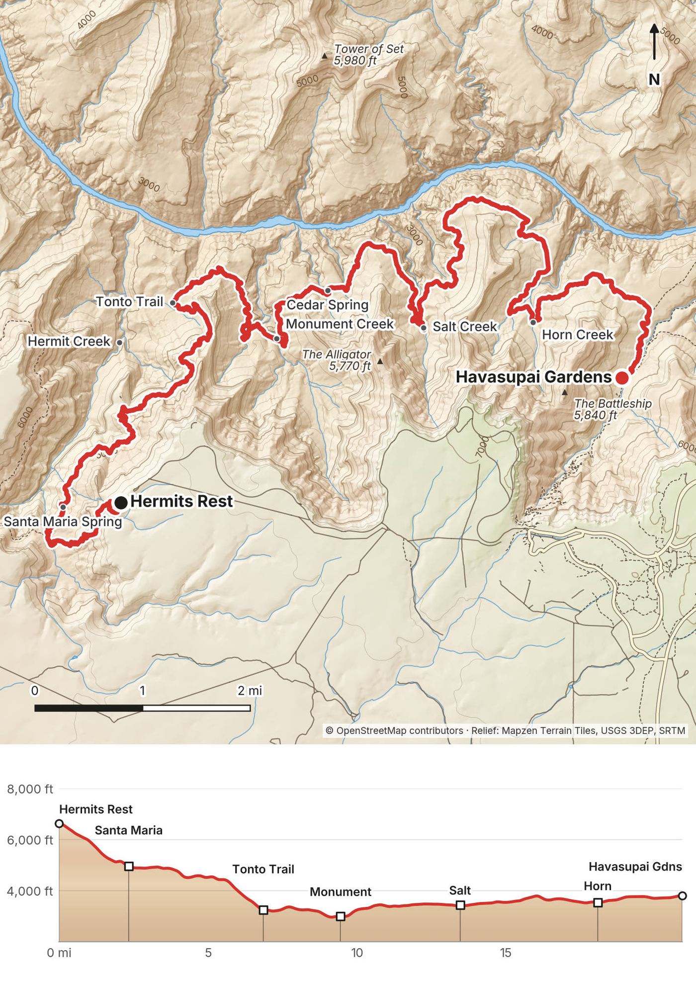
Elevation2,927–6,844 ft25.9 mi
Terrain: Mapzen Terrain Tiles (USGS 3DEP, SRTM) on AWS · Rivers & lakes © OpenStreetMap contributors
Tap a map to open it full size.
Checked on the NPS pages, the NPS alerts and Recreation.gov on October 1, 2026.
Open. NPS's Key Hiking Messages page (updated September 28, 2026) lists the Bright Angel Trail as open from the trailhead to the River Resthouse, and the trail closures from the August 29 flood are all east of this route: the South Kaibab Trail below the Tipoff, both bridges over the Colorado River, the River Trail east of the River Resthouse, all of Phantom Ranch with Bright Angel Campground, and the whole North Kaibab Trail. NPS has posted nothing for the Hermit Trail or the Tonto Trail west of Havasupai Gardens. Havasupai Gardens Campground is open by permit.
As of November 2026: NPS's October 27 update reopened the South Kaibab Trail down to the Black Bridge and the River Trail between the River Resthouse and the South Kaibab Trail. The bridges, Phantom Ranch and the North Kaibab Trail were still closed.
No tap water below the rim. Since September 6, 2026 there's no drinking water anywhere in the inner canyon, including Havasupai Gardens and the Three-Mile and Mile-and-a-Half resthouses on the Bright Angel Trail. The only tap on this route is a tank by the restrooms at the Bright Angel Trailhead, where you finish. NPS's advice: "carry sufficient water for their trip or be prepared to collect and properly treat water from natural sources." See Water.
The South Rim in October 2026. The flood also broke the pipeline that supplies the South Rim. Under Stage 4 water restrictions, every hotel in the park stopped taking overnight guests on August 31, 2026 (Xanterra's closure runs through at least October 31), Mather Campground is dry camping only, and fires are banned. NPS hopes to have water back around Thanksgiving 2026 and calls the date "tentative." Tusayan's hotels, 7 miles south, are open.
Getting to the start. Hermit Road is closed to private cars from March to November, and in 2026 the first shuttle to Hermits Rest left at 8 a.m. See Getting there.
What to do. Check NPS's Key Hiking Messages page (nps.gov/grca) for closures and water before you go.
These are the NPS rules for the backcountry of Grand Canyon National Park, checked on the park's own pages and Recreation.gov on October 1, 2026.
Backcountry permit. You need one for every night you camp below the rim, and you must carry it on paper: a copy on your phone doesn't count. You can print it from a month before your start; if it isn't printed 3 days before, it's cancelled, and once printed it can't be refunded. Day hikes don't need one, even the whole route in a day. Since 2024 every permit goes through Recreation.gov. Permits are first offered through an early access lottery: you apply in a window of about two weeks that ends on or near the 1st of the month four months before your start month, and on the 1st of the next month whatever is left opens to everyone. Each person can send one application per lottery. Online booking closes 5 days before the start; inside 4 days, permits are only sold in person at the Backcountry Information Center.
2027 windows (posted on Recreation.gov; each closes at 5 p.m. Arizona time): March starts, October 16 to November 2, 2026; April, November 16 to December 1, 2026; May, December 16, 2026 to January 1, 2027; September, April 13 to May 3, 2027; October, May 12 to June 1, 2027; November, June 15 to July 1, 2027. NPS doesn't let the public book these camps online in summer.
Our one-night plan needs a ranger. Recreation.gov only lets you book a pre-approved list of camps for each night, and from the Hermit Trailhead that list appears to be Hermit Creek, Monument Creek or Boucher, not Havasupai Gardens. To do it the way we did, in one long day, NPS says to reach out to a ranger once your lottery booking time arrives and ask for help with a more aggressive itinerary. The bookable version is two nights: Monument Creek, then Havasupai Gardens.
Previous experience. Recreation.gov lists every camp on the Hermit and Tonto trails as "Requires Previous Grand Canyon Experience": they're for hikers who have already backpacked overnight below the rim here. If this would be your first night in the canyon, Havasupai Gardens alone, by the Bright Angel Trail, is the camp meant for you.
Fees (2026). $10 per permit or lottery application, plus $15 per person per night below the rim. The $10 isn't refundable; the nightly fees are, until 30 days before your start. For two people and one night, like us, that's $40.
Where you can camp. On this stretch you camp only at the designated sites: Havasupai Gardens Campground, Horn Creek, Salt Creek, Cedar Spring, Monument Creek, Granite Rapids, Hermit Creek and Hermit Rapids. There's no camping along the Hermit Trail itself. The camps are small: Horn Creek, Salt Creek and Cedar Spring each take one group of up to 6 a night, and Monument Creek and Hermit Creek three small groups and one large one. At most two nights per camp per trip. Toilets are at Havasupai Gardens, Horn Creek, Salt Creek, Monument Creek and Hermit Creek.
Last-minute permits. In 2026 the Backcountry Information Center gave out walk-up permits only for one night at Havasupai Gardens, March 1 to November 30, and "availability is not guaranteed." You can't buy one more than a day ahead, and waits are typically two to three days.
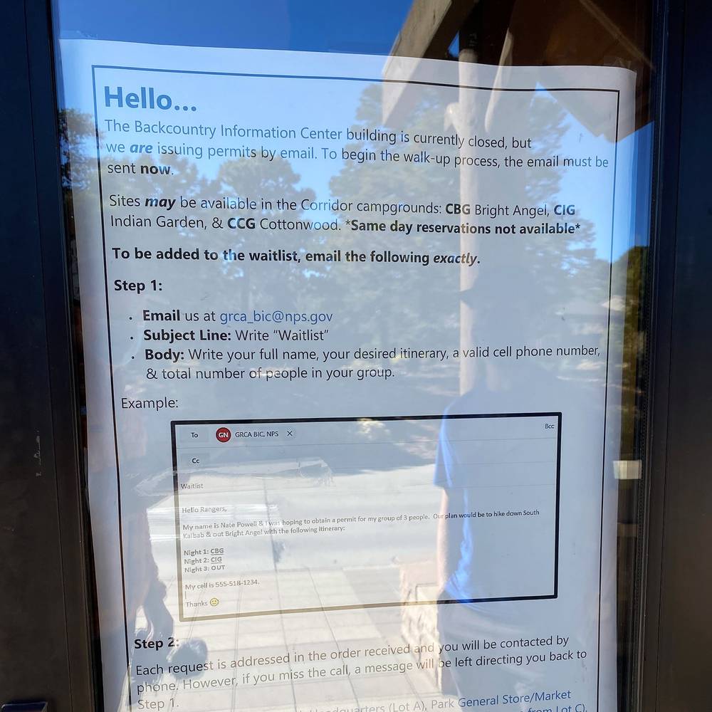
What I did, 2020. The Backcountry Information Center was closed for COVID and handled permits by email. I emailed the rangers, figured out an itinerary, got it okayed, and they taped the permit to the door for us to pick up, because there was no in-person exchange. We got a permit for Indian Garden with a reservation the night before.
Food storage. Critter-proof storage is required: a metal tin, metal mesh bag or bear canister. Havasupai Gardens has a metal food can at every site.
Other rules. No campfires below the rim (stoves are fine). No pets below the rim. No drones anywhere in the park. Carry out all trash and toilet paper. No soap in the creeks, no feeding wildlife, no rolling rocks, no cutting switchbacks.
Park entrance (2026). $35 per car for 7 days, or $20 per person on foot or bike; the America the Beautiful pass is $80 a year for US residents. Non-US residents aged 16 and over pay an extra $100 each, unless they have the $250 nonresident annual pass. The entrance stations don't take cash.
Autumn. We went on November 2 and 3. It was very hot in the direct sunlight during the middle of the day, but at night it was comfortable and warm.
Average temperatures (NPS, °F high / low). The rim, and the inner canyon at Phantom Ranch, in the shade. The Tonto Trail is about 600 to 1,300 ft higher than Phantom Ranch, so a few degrees cooler; NPS's rule is about 5.5°F for every 1,000 ft. In the sun it's 15 to 20°F hotter.
| Month | South Rim | Inner canyon |
|---|---|---|
| March | 51 / 25 | 71 / 48 |
| April | 60 / 32 | 82 / 56 |
| May | 70 / 39 | 92 / 63 |
| September | 76 / 47 | 97 / 69 |
| October | 65 / 36 | 84 / 58 |
| November | 52 / 27 | 68 / 46 |
Summer. NPS: "There is almost no shade along the Tonto Trail," and for every camp on this route, "it is not recommended to hike here from late May through mid-September." Four hikers died of apparent heat illness on the inner-canyon trails in June 2026, one of them below Havasupai Gardens, and in June 2021 a backpacker on this same route, Hermit to Bright Angel, died of heat near Monument Creek. Don't hike between 10 a.m. and 4 p.m. in the hot months.
The best windows are mid-September to November and March to April. In spring and fall the days are short, the nights on the rim are below freezing, and there can be ice at the top of both trails.
Monsoon. Thunderstorms and flash floods are most likely from mid-July to early September, though floods can come any time of year.
Winter. NPS says the Hermit Trail has less snow and ice than any other South Rim trail, but its upper part can be dangerously icy. The Bright Angel Trail, mostly north-facing, usually has packed snow and ice for its top three miles. Carry traction.
Daylight. Arizona doesn't change its clocks. On November 2 the sun rises about 6:52 a.m. and sets about 5:32 p.m.; we started at 6:44 and reached Havasupai Gardens at 4:01. Mid-month sunrise and sunset (NPS): March 6:39 a.m. and 6:35 p.m.; April 5:55 and 7:01; September 6:11 and 6:36; October 6:35 and 5:53; November 7:05 and 5:21.
Emergencies. Call 911. Leave the park's dispatch number, 928-638-7805, with someone at home, with your itinerary. There are no emergency phones on the Hermit Trail or this part of the Tonto; the first are at Havasupai Gardens and the Bright Angel resthouses. Your phone will probably not work in the canyon. NPS says rescue is not guaranteed and can take hours or days: be ready to get yourself out.
Heat. This is the big danger on the Tonto. There's almost no shade. NPS warns that many fatalities on the Tonto come from heat exposure, and in June 2021 a backpacker died of heat near Monument Creek on this route. From May to September, don't hike between 10 a.m. and 4 p.m. Eat salty food and drink when you're thirsty: NPS warns that drinking lots of water while losing salt in sweat causes hyponatremia (low blood sodium).
The trail itself. The Hermit Trail and this part of the Tonto are in NPS's Threshold zone: "Recommended for experienced Grand Canyon hikers. Non-maintained trails. Scarce water sources." NPS calls the Tonto "a rough, unmaintained route" with washouts and narrow, eroding sections, and west of Salt Creek it runs within 20 feet of a sheer cliff for about a quarter mile. Watch for rockfall during and after rain.
Flash floods. They can come at any time of year, from storms you can't see. If you hear a roar, get to higher ground at once; never camp in a dry wash.
Cold. The rim is below freezing on many nights in spring and fall, and NPS says hypothermia can happen at 50°F. Carry a warm layer.
Mules. On the Bright Angel Trail, step to the side away from the edge and stand still when mules pass.
Wildlife. Never feed animals: rock squirrels bite. Mountain lions live in the canyon; NPS says solo hikers are at greater risk.
Leave a plan with someone at home: your route, your camps and when you'll be out.
How many days do I need? We did it in two: 21 miles on the first day and 5 on the second. The ranger who okayed our itinerary said we should rethink it, that it was extremely ambitious, but we killed it: we were doing about 3 miles an hour the whole time. Three or four days, with nights at Monument Creek, Salt Creek or Horn Creek, is the usual plan. See Other ways to do it.
How hard is it? The Hermit Trail is steep, rough and unmaintained: NPS says it drops almost 2,000 ft in the first 2.5 miles and that it's harder than the Bright Angel and South Kaibab trails. The Tonto Trail is easier underfoot but long, with almost no shade and little water. Then you climb about 3,000 ft out. By my GPS it was about 4,990 ft of climbing for the whole trip; I said about 5,500 in the film, and my map card in it says 2,500 ft gained on Day 1 and 3,000 on Day 2.
Do I need a permit? Yes, for a night below the rim; not for a day hike. Permits go by lottery on Recreation.gov about four months ahead, and our one-night plan, Hermits Rest to Havasupai Gardens in a day, needs a ranger's help to book. In 2020 the Backcountry Information Center was closed for COVID: I emailed the rangers, they okayed our itinerary, and they taped the permit to the door for us to pick up. That's gone; see Permits and rules.
Is there water on the trail? Not much, and none from a tap in October 2026. Santa Maria Spring is a trickle, Monument Creek always has water, Cedar Spring is unreliable, and NPS doesn't recommend Salt Creek (highly mineralized) or Horn Creek (radioactive). It's 10.7 miles from Monument Creek to Havasupai Gardens. Treat everything. See Water.
When should I go? We went at the start of November. It was very hot in the direct sunlight at midday, but at night it was comfortable and warm. NPS doesn't recommend these camps from late May through mid-September. See When to go.
Which way should I go? We went west to east: down the Hermit Trail, out the Bright Angel. That puts the steepest, roughest descent first and the easier, better-known climb at the end, near the village and your car. The Bright Angel Trailhead also has the only tap on the route.
How do I get back to the start? You don't need to: you finish in Grand Canyon Village, close to the overnight hikers' parking lot. Hermits Rest is about 8 miles from the village by road; the shuttle bus runs out there from 8 a.m. in season.
Can I bring my dog? No. Pets aren't allowed anywhere below the rim (service animals are; check in with the Backcountry Information Center first).
Can I fly a drone? No. Drones are banned everywhere in the park.
The usual plan is to spread the Tonto over two or three nights at its designated camps: for example Monument Creek (9.3 miles from the Hermit Trailhead by NPS), then Horn Creek, then out; or Monument Creek, Salt Creek, then Havasupai Gardens. Salt Creek and Cedar Spring can't be your first or last night. That splits the long day and puts you near water at Monument Creek. Each camp needs its own night on your permit, and Monument Creek's permit comes with the Hermit Road gate code.
Turn west at the Tonto junction to Hermit Creek (about a mile), camp there, and come back east the next day: Hermit Creek to Monument Creek is 3.5 miles (NPS). Hermit Creek has water all year, and Hermit Rapids on the Colorado is 1.5 miles below the campsite.
No permit is needed for a day hike, and NPS says groups under 12 don't need a special permit for it. It's a long, hot day with almost no water and no phones for the first 20 miles. Start before dawn: from March to November that means walking or biking the 7 to 8 miles of Hermit Road in the dark, because the gate code is only for backpackers with a Hermit-area permit and day hikers can't park at the trailhead while the shuttle runs. From December to February you can drive there, but no shuttle runs to bring you back to the car.
Down the Bright Angel Trail and west on the Tonto to the Hermit Trail. You'd finish with the steepest, roughest climb, at the far end of Hermit Road. In October 2026 the Tonto east of Havasupai Gardens is also open, to the South Kaibab Trail at the Tipoff (4.6 miles by NPS).
These change every year, and in 2026 they changed a lot. Everything else in this guide stays the same.
Is it open?
Getting there
Conditions
Your stuff
The film is at the top of this page.
When bookings open, from the sources named under each. Dates move: confirm on the official site.
You apply in a window of about two weeks that ends on or near the 1st of the month four months before your start month; on the 1st of the next month what's left opens to everyone. Day hikes need no permit.
Opens a set time before your start date: make a plan with your dates to see yours.
Book on recreation.gov.
Source: Kraig Adams's Grand Canyon (Tonto Trail) guide: Permits and rules (checked Oct 1, 2026). Checked October 2026.
Planning questions about Grand Canyon Tonto Trail, answered only from this page's facts, the creators' versions and hikers' public tracks, with where each answer comes from. When the data doesn't say, the answer says "not given".
From hikers
Sign in to comment. Free; your hikes stay private unless you share them.
Some lodging links earn me a small commission at no cost to you.
Something wrong or missing on this page? Send feedback.