
Content made there
The film is at the top of this page.
Photos
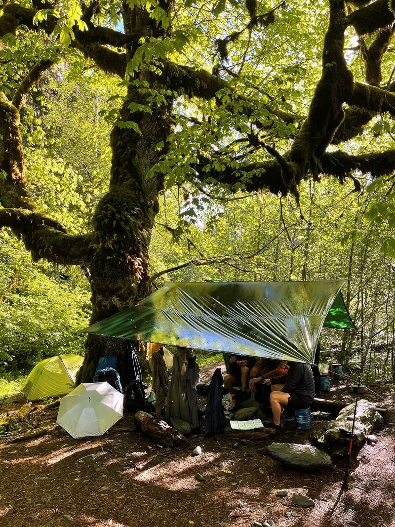
Hikes / Enchanted Valley, my first group trip / Kraig Adams's version
North America · United States
Jun 2022 · 5 days · Group trip · Tent

In June 2022 I spent five days backpacking into the Enchanted Valley in Olympic National Park, Washington: up the East Fork Quinault River from Graves Creek through old-growth temperate rainforest, into the valley under the snowy peaks and the old chalet, up to Anderson Pass in the snow, and back out the same way. It's the trip from my film Hiking 50 Miles Through Washington's Enchanted Valley.
This wasn't a solo hike. It was a guided group trip: my first subscriber group backpacking trip, booked through TrovaTrip, with nine subscribers, me, and two guides from Wildland Trekking, twelve of us in all. The guides took care of the logistics, the tents, the gear and the food, and I got to hike, shoot the video and hang out around the campfire. So this guide gives you my GPS files, maps, photos and notes for every day, and plain, checked facts for everything the company handled for us: the permit, the road in, the food storage rules and the river crossings.
| Quick facts | |
|---|---|
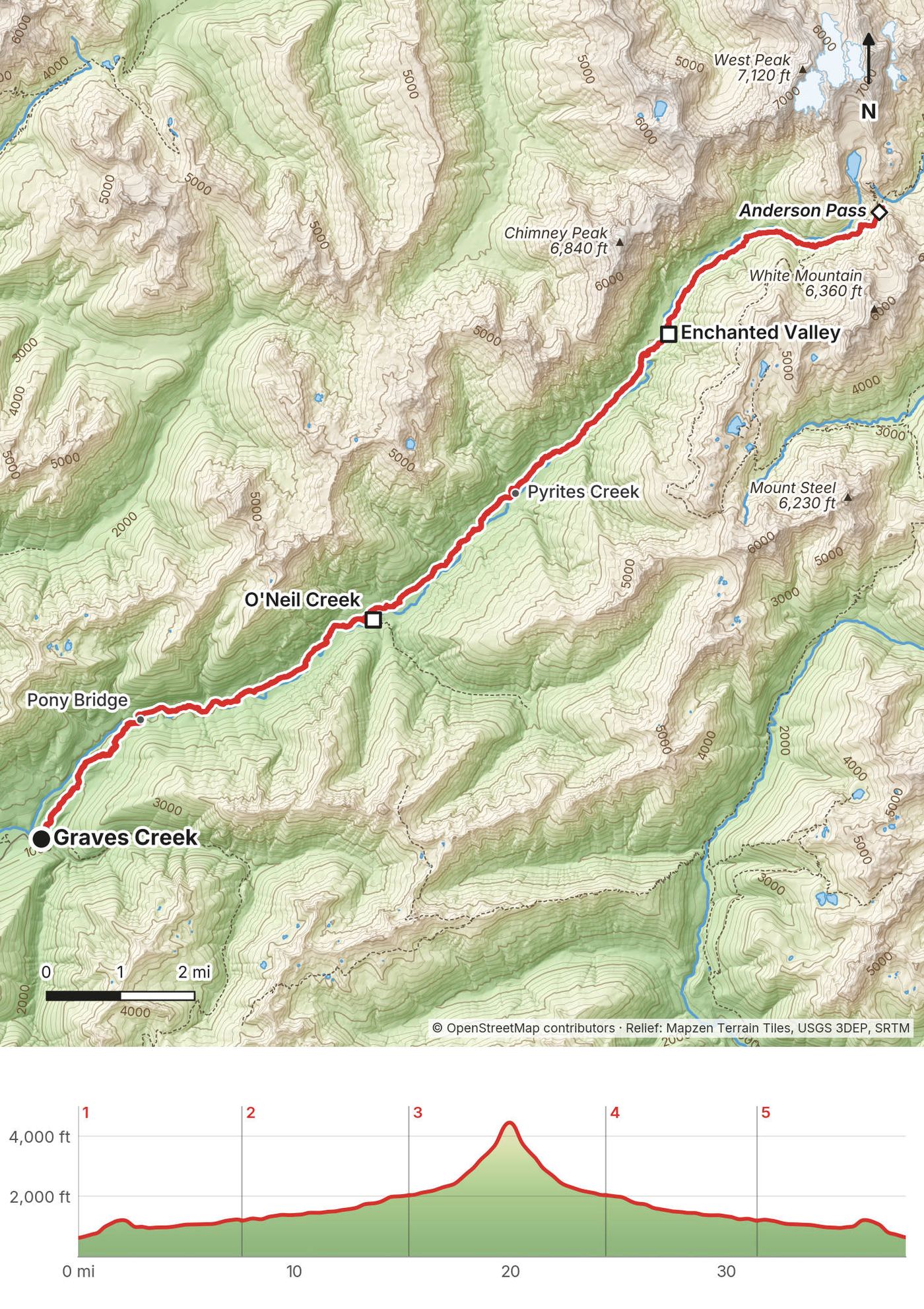
| Distance | 38.3 miles (61.6 km) over 5 days on my GPS, out and back from Graves Creek, with a day hike to Anderson Pass |
| Climbing | about 5,380 ft (1,640 m) up and down |
| Days | 5 days, 4 nights: two at O'Neil Creek and two in the Enchanted Valley |
| How | A guided group trip, 12 of us. Everyone carried a pack, with a bear canister and some of the group gear |
| Start and finish | Graves Creek trailhead, 620 ft (189 m), at the end of Graves Creek Road above Lake Quinault |
| High point | Anderson Pass, 4,464 ft (1,361 m; my GPS read about 4,510 ft), on Day 3 |
| When | The valley from May to September. Anderson Pass is snow covered into June most years. I went June 6 to 10, 2022 |
| Permit | A wilderness permit from Recreation.gov for every night, and the park entrance fee (2026) |
| Day | Route | Miles (km) | Up / down (ft) | Sleep |
|---|---|---|---|---|
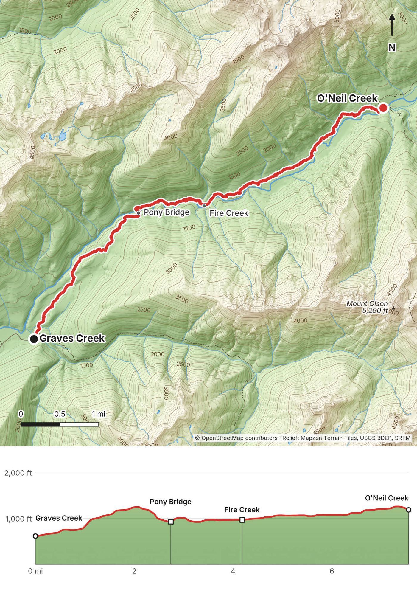
| 1 | Graves Creek to O'Neil Creek | 7.6 (12.2) | 1,140 / 528 | Tent, O'Neil Creek camp |
| 2 | O'Neil Creek to Enchanted Valley | 7.7 (12.5) | 1,053 / 214 | Tent, Enchanted Valley camp |
| 3 | Anderson Pass and back | 9.1 (14.7) | 2,492 / 2,484 | Tent, Enchanted Valley camp |
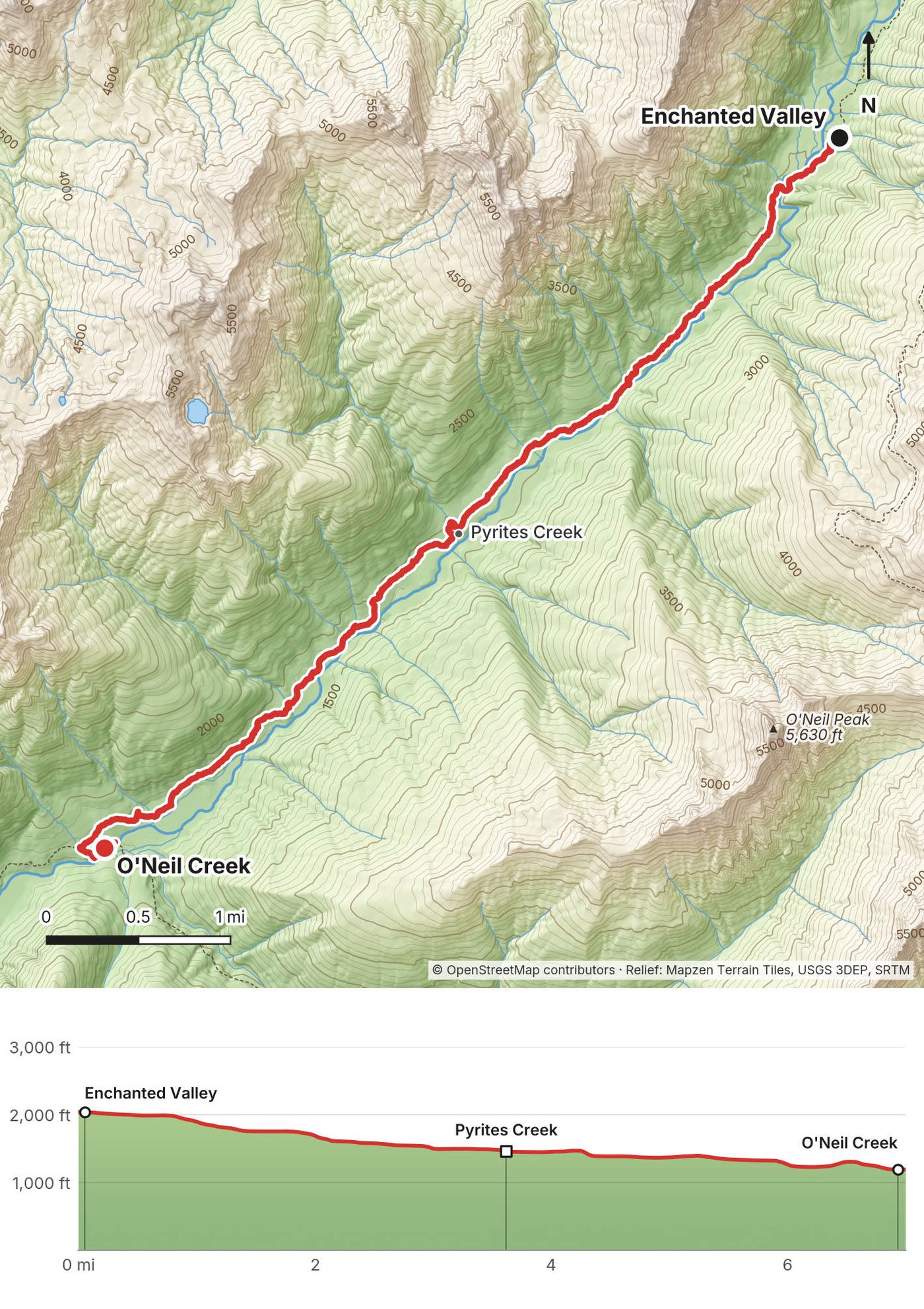
| 4 | Enchanted Valley to O'Neil Creek | 7.0 (11.3) | 151 / 1,005 | Tent, O'Neil Creek camp |
| 5 | O'Neil Creek to Graves Creek | 6.9 (11.1) | 546 / 1,105 | Home |
The numbers are from my own GPS, smoothed the same way every day. AllTrails showed more (9.2, 10.4, 11.1, 7.9 and 8.6 miles), and the film title says 50, but in a deep valley under big trees the GPS wanders, and I was zigzagging back for the camera all day. I said it in the film: "take the elevation gain and the length with a grain of salt when it comes to AllTrails." My estimate at the end was "just under 40 miles." The Park Service puts the Enchanted Valley 13 miles from the trailhead and Anderson Pass 18.2.
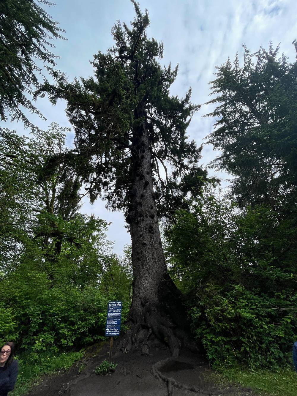
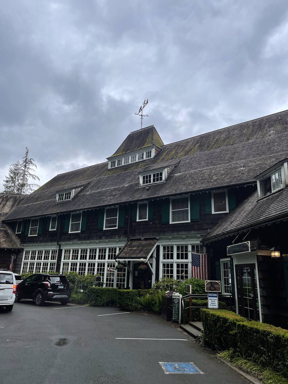
How my trip got there. On June 5 we met at the Seattle airport (all but one of us made it on time) and took a shuttle to a hotel in Olympia, where our guides met us for a group dinner and a pre-trip meeting. They fitted packs, handed out food, and everyone picked snacks to carry. The next morning we loaded a trailer with everything we needed and drove about two hours into the Olympic National Park area, stopping to see the world's largest Sitka spruce near Lake Quinault. The company arranged all of that.
Driving yourself (2026). Graves Creek is at the end of the road up the Quinault valley, about 3 hours from Seattle to Lake Quinault and another hour of slower road to the trailhead. In 2026 the South Shore Road is closed by a washout about 8 miles from US 101, outside the park, so the only way to Graves Creek is the North Shore Road: about 14 miles of paved and gravel road from US 101 at Amanda Park to the junction, then 6 miles of narrow, winding gravel on Graves Creek Road. No RVs or trailers on Graves Creek Road. A July 2026 trip report said any car can make it if you take it easy. Jefferson County expected the South Shore repair to finish in mid-October 2026; check before you go. As of November 2026 the South Shore Road has reopened and the seasonal bridge on the North Shore Road is out for the winter, so use the South Shore Road to Graves Creek (National Park Service conditions page, updated November 5, 2026). Coming from Port Angeles or Forks, US 101 crosses the Hoh River Bridge, under repair until 2028 with one lane and some full closures: check WSDOT before you go.
The big spruce. It's 3.2 miles up the South Shore Road from US 101, on the open part before the washout, then a 0.3-mile walk.
No bus to the trailhead. Grays Harbor Transit's Route 50 (free to ride in 2026) runs from Aberdeen to Amanda Park and the North Shore Road junction on US 101, about 20 road miles short of the trailhead.
Parking and camping at the trailhead. Parking at Graves Creek is limited. The Graves Creek Campground is next to it, with 30 sites and no drinking water, so bring water or a filter.
Ranger station. The Quinault Rain Forest Ranger Station (Wilderness Information Center) is at 913 North Shore Road, (360) 288-2444. It's normally open part-time from Memorial Day weekend to the end of September, but the park said it was closed for the 2026 season, so don't count on borrowing a bear canister there: bring your own. The Port Angeles Wilderness Information Center is open all year, (360) 565-3100.
| Item | What I paid in 2022 |
|---|---|
| The guided trip | I was the host, so my costs aren't a guide to yours; the guests booked through TrovaTrip |
| Flight to Seattle | Not in my records |
| Permits and park entrance | Handled by the company |
| Food | Supplied by the company |
For your budget (2026). Wilderness permit $8 per adult per night plus $6 per permit: for one person on a 4-night trip, $38. Park entrance $30 per vehicle. A guided trip with Wildland Trekking from $1,942 a person (4 days, September 2026 listing). Bear canister loans are free at Wilderness Information Centers while they last.
| Night | Where | Height (my GPS) |
|---|---|---|
| Before Day 1 | A hotel in Olympia, arranged by the company | |
| 1 | Tent, O'Neil Creek camp (about 7 miles in) | 1,190 ft (363 m) |
| 2 | Tent, Enchanted Valley camp (about 13 miles in) | 2,040 ft (622 m) |
| 3 | Tent, Enchanted Valley camp | 2,040 ft (622 m) |
| 4 | Tent, O'Neil Creek camp | 1,190 ft (363 m) |
The company supplied the tents, sleeping pads and sleeping bags. Book your own camps on your permit; with a quota there's no switching on the trail.
I did not expect our two guides to pack fresh fruit, vegetables and meat every day, for breakfast, lunch and dinner. We had sandwiches, charcuterie, Middle Eastern food, lentils, chicken salad, spinach wraps, pasta with pine nuts, pancakes, oatmeal and coconut yogurt. Every meal was something you were really looking forward to. The star of the trip was a last-minute purchase at REI that the guides picked up: a hot sauce. We almost went through the entire bottle, because everyone was adding it to everything.
There was also a big selection of snacks, and we grabbed whatever we wanted to carry for ourselves. On your own, carry everything you'll eat, and plan for it all to fit in your bear canister. There's nothing to buy on the trail.
There was so much water, almost too much: you can stop at any stream to fill up and filter water to drink, which is what I did. Filter or treat everything.
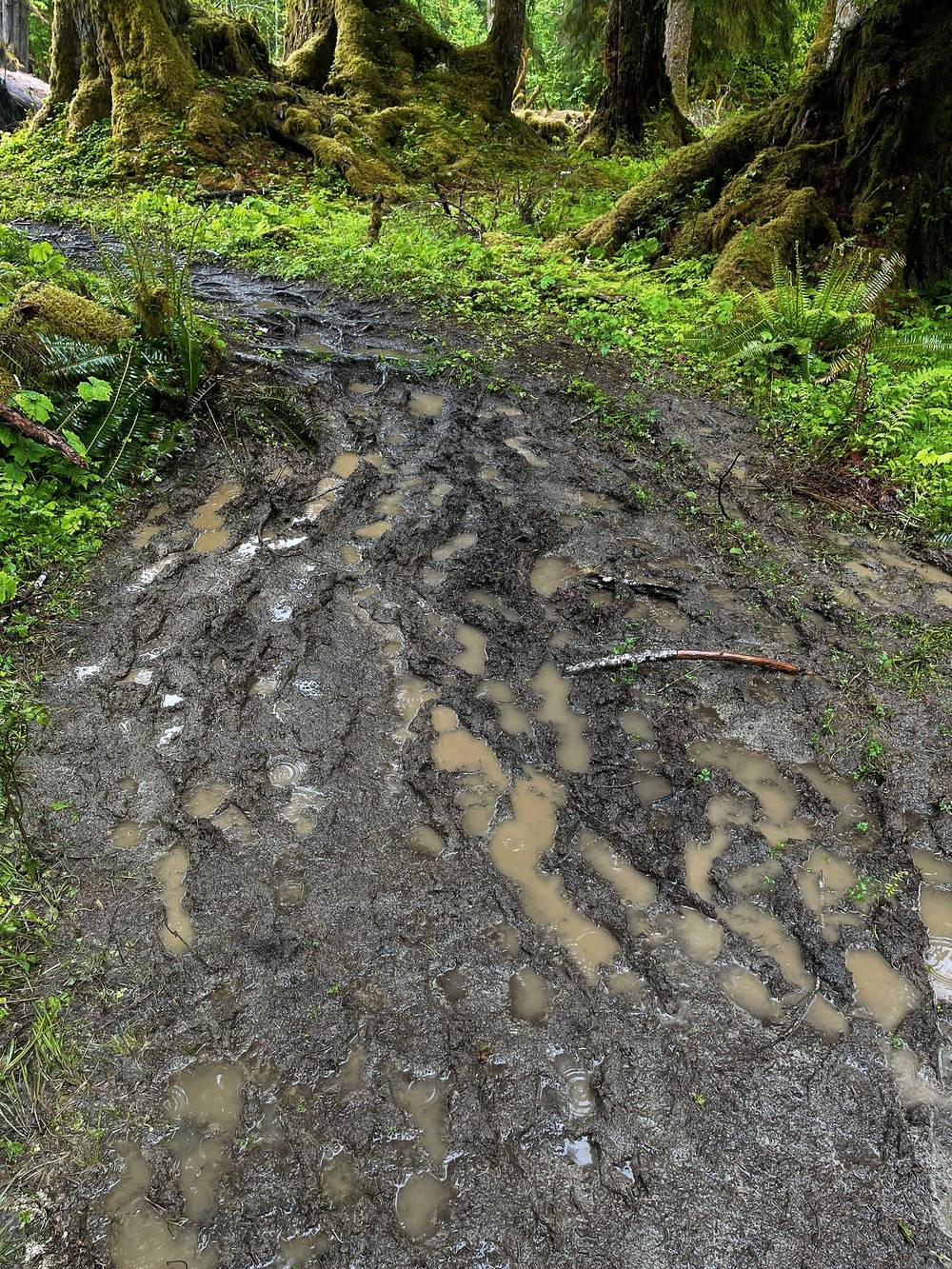
The big river crossings have bridges, but the streams coming down from the slopes into the river you have to cross. I never took my shoes off: on a bright, sunny, dry day, trail runners and socks dry within half an hour if you just keep hiking. That's what I'm used to and what I like. The mud was probably the most annoying thing: it's a rainforest. Try to stick to the trail as much as you can, even when it's a muddy minefield, to keep erosion down.
Paid links: I earn a commission if you buy through these links, at no extra cost to you. As an Amazon Associate I earn from qualifying purchases.
From the film and my photos. The company supplied the tents, sleeping pads and bags, packs for anyone who wanted one, trekking poles, cooking gear, water filtration, food and microspikes.
My current kit for what this trip needs, if you go on your own.
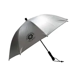 Umbrella: Six Moon Designs Silver Shadow Carbon (Amazon). Plan on rain at least one of the days.
 Rain shell: Arc’teryx Beta AR Jacket (Arc’teryx). For the open snow toward Anderson Pass.
 Warm layer: Arc’teryx Cerium Hoody (Arc’teryx). The guides said: warm layers for the evenings.
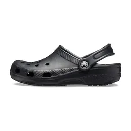 Camp shoes: Crocs Classic Clog (Amazon). The guides said: camp shoes for creek crossings.
 Traction: Yatta Life Ice Spikes (Amazon). If you're going to Anderson Pass before July, with the skills for steep snow.
 Water: Katadyn BeFree AC · 1L (Amazon)
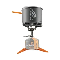 Stove: Jetboil Stash (Amazon). No fires above 3,500 ft or in a fire ban.
What I filmed with in 2022. No drones anywhere in the park: see Permits and rules.
 Camera: DJI Osmo Pocket 4 (Amazon)
 Mic: DJI Mic 3 · 1 TX + 1 RX (Amazon). It pairs with the Pocket 4.
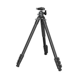 Tripod: SmallRig Carbon Fiber Tripod (Amazon)
We packed and divided our gear at the trailhead, did some final checks, handed out the bear cans last, and were ready to go. The weather looked good, and as long as it wasn't raining I feel like everyone was pretty happy and excited to hit the trail.
A lot of people weren't used to carrying packs, especially ones this heavy. At the beginning of the hike you're carrying all the food, so it's the heaviest moment, and people were like whoa. We approached the park from the south, going up toward the Enchanted Valley. The first day was not too bad: some elevation gain for a little bump right at the beginning, and everything else was just a slow grind without too much grade, but definitely going up the valley.
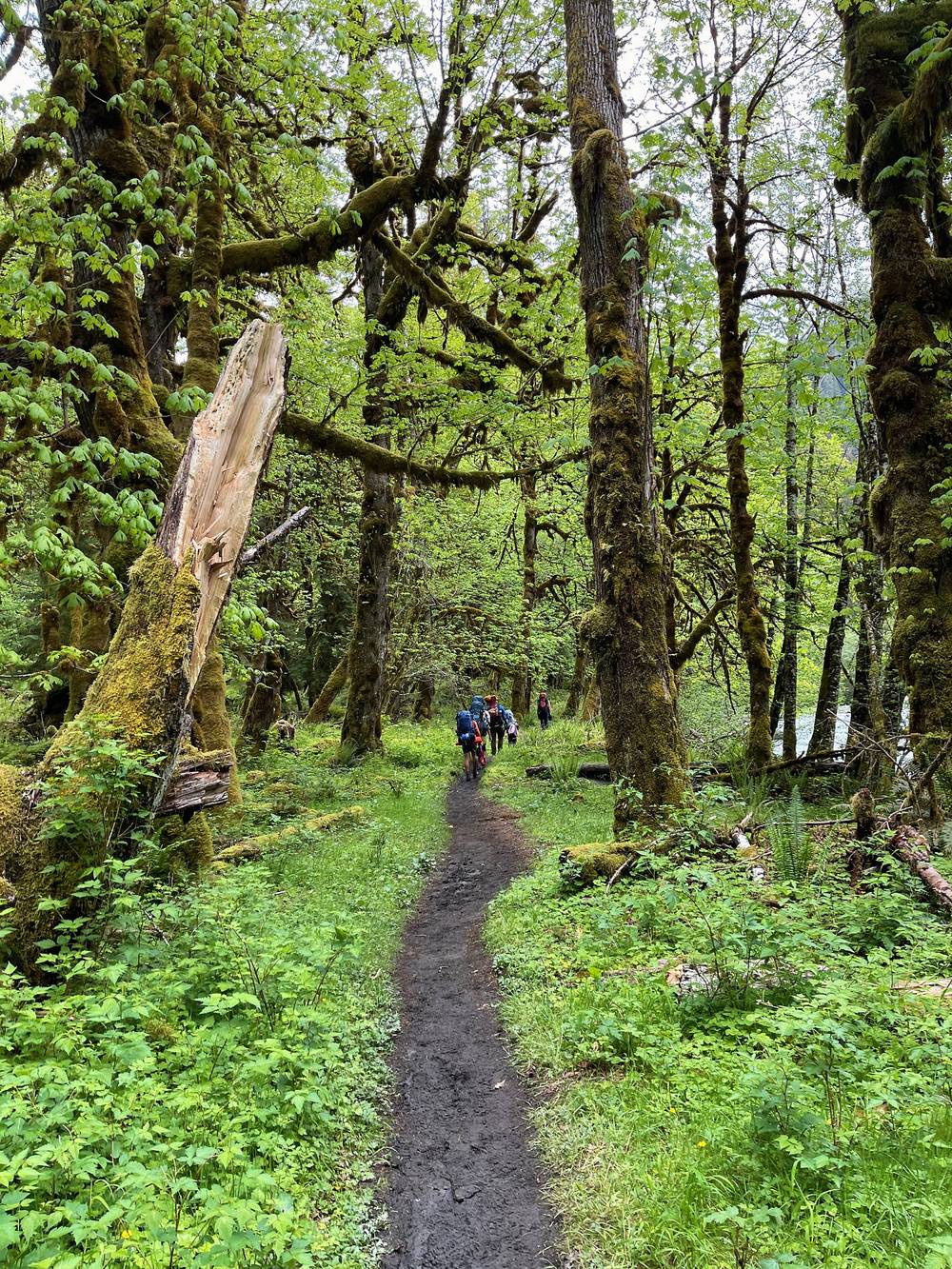
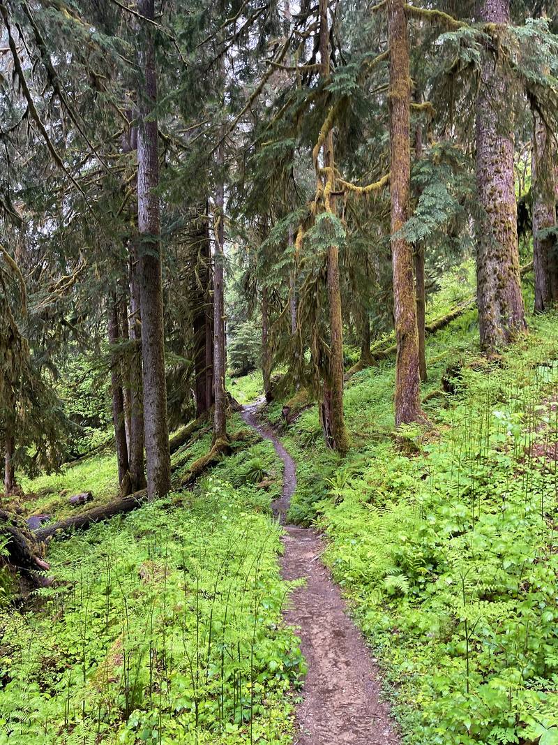
Our pace was gingerly, nice slow and steady, with frequent breaks. We were in the thick of it: temperate rainforest, very thick and covered. You don't really have to worry about the sun here, because you're in a deep valley with lots of water. It was early summer, so the streams were flowing, and there were some river crossings. AllTrails told me about 9.2 miles; my GPS line says 7.6.
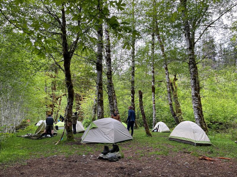
We got to O'Neil Creek, I think around five, and it gets dark around nine, so that's a lot of time to set up your tent, hang around, throw a frisbee, cook some food, light a fire and just vibe. It was so nice not to be in a drought or a fire restriction area. With lots of people, it's just fun to sit next to the campfire.
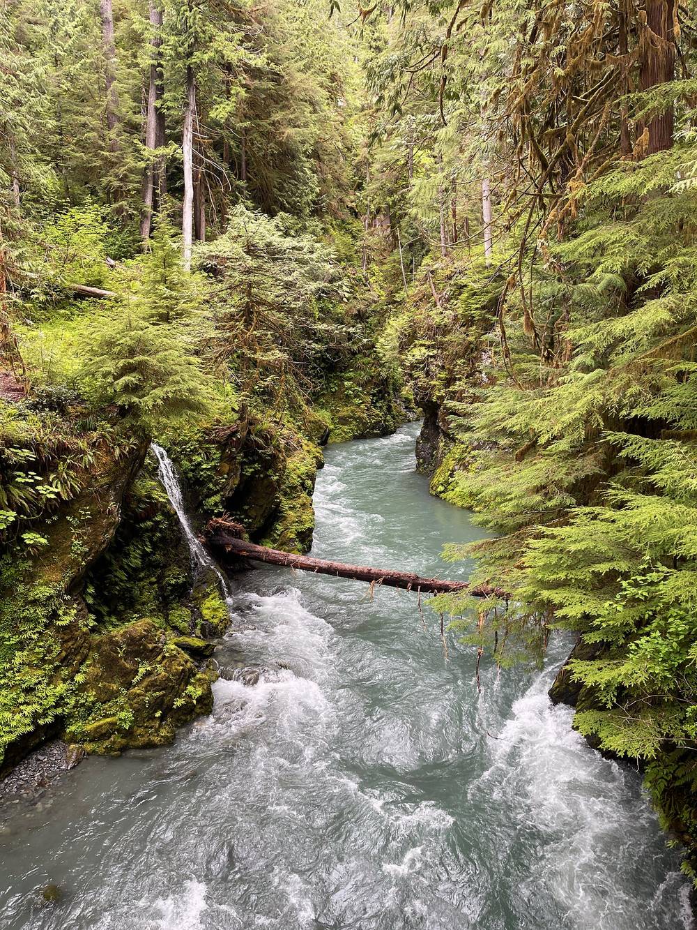
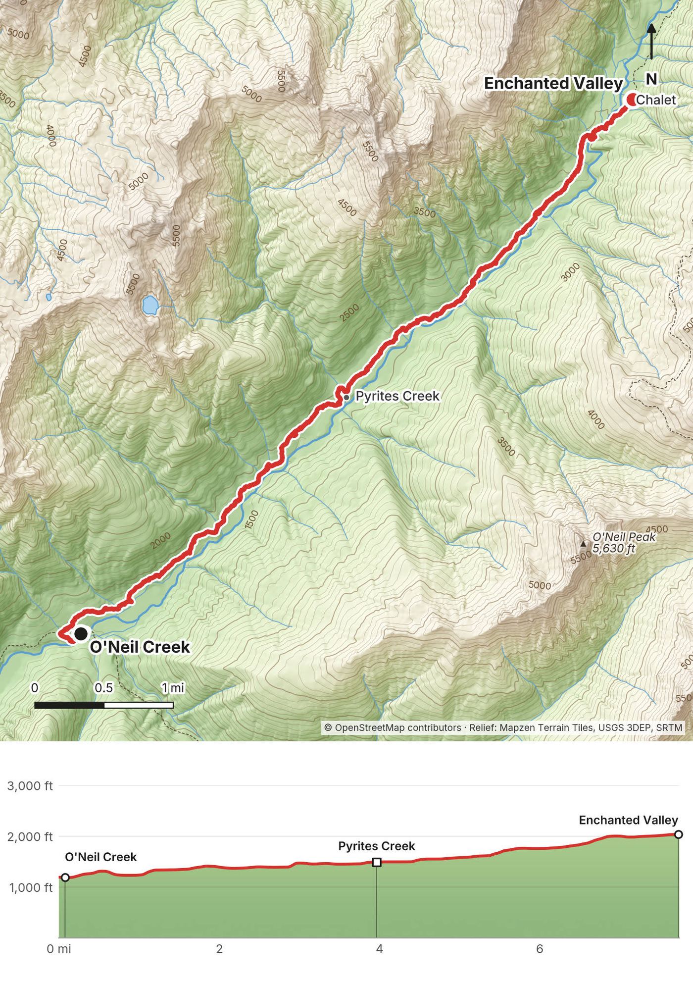
The East Fork Quinault River Trail leaves the Graves Creek trailhead, crosses a high bridge over Graves Creek and follows an old road grade up about 500 ft to a low saddle, the day's high point at about 1,290 ft, then drops steeply to Pony Bridge at mile 2.7 on my GPS (2.5 on the Park Service's figures), where the trail crosses the river high above a narrow gorge. There's a camp and a pit toilet at Pony Bridge.
From the bridge the trail climbs above the gorge and drops back to the river, in and out of the old-growth forest and along river flats, with small streams to cross. Fire Creek camp is about mile 4. O'Neil Creek camp, our stop, is about 7 miles from the trailhead (6.9 on the Park Service's segment figures), at about 1,190 ft, with a pit toilet.
Go back the way you came. Everything on this trip is out and back on one trail, and the trailhead is the only road.
Film, Day 1 · Hiking guide and behind the scenes
Day 2 continued up the valley. I mapped just over 10 miles and just over a thousand feet of elevation gain, and I doubted that was correct: it seemed like too much. My GPS line says 7.7 miles and about 1,050 ft.
We packed up our tents, headed out, and this is when we saw our first bears. There was a bear on the trail ahead of us, a really slow hiker. He was chill, we were chill; he was a little chunky and a little slow, and he held up the whole caravan behind him, looking back over his shoulder like, hurry up, what are you doing.
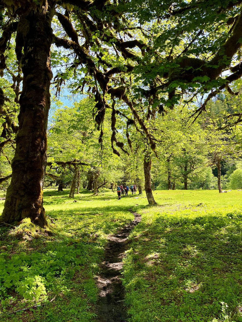
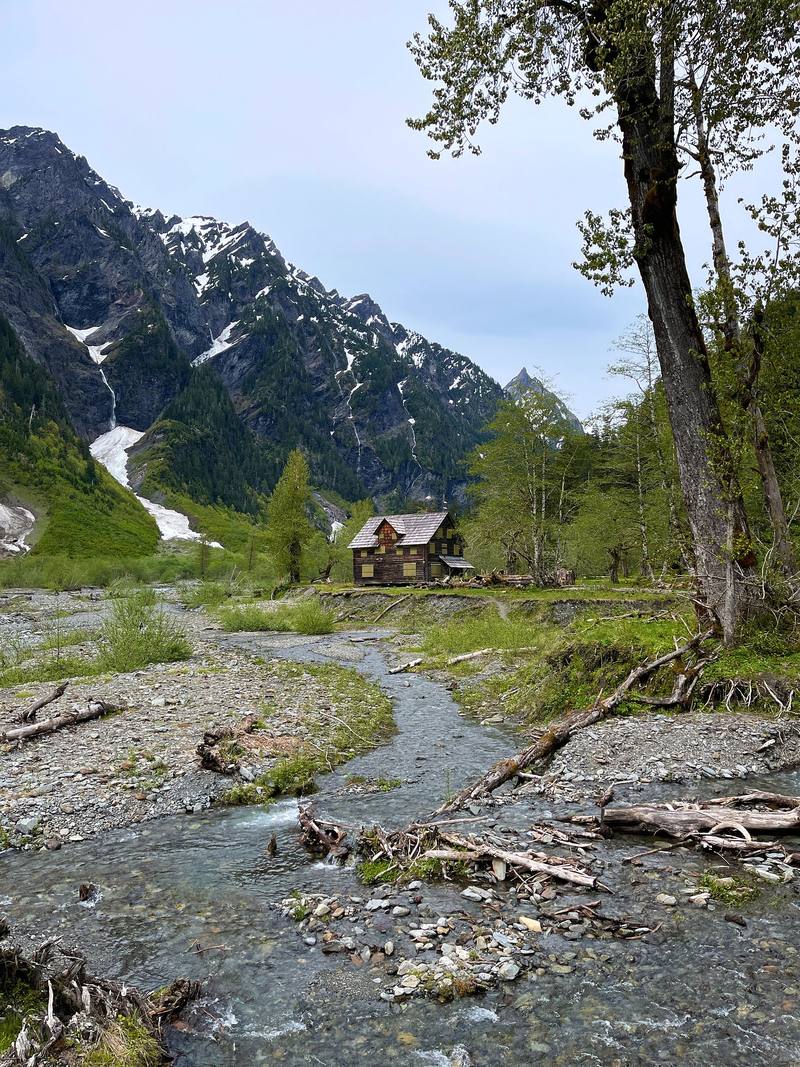
We finally made it into a different area: it opens up into the Enchanted Valley. There were one or two river crossings, and then we started to get our first views of white peaks. There was still a lot of snow on the peaks. We passed the chalet and set up camp. We were a large group, so we had to take a large space at the camp, but there were other people hiking, and it wasn't too crazy.
Above O'Neil Creek the trail keeps climbing gently up the north side of the river, through forest and across side streams, to Pyrites Creek camp, about 3 miles on. From Pyrites Creek it's about 3.2 more miles to the Enchanted Valley. Just before the valley the trail crosses back over the river on a high bridge, and the chalet comes into view soon after. The forest opens into a wide, flat valley floor with cliffs and waterfalls on both sides. The camp is at about 2,040 ft, close to the chalet, with two pit toilets. The Park Service gives 13 miles from the trailhead to the valley; Recreation.gov says 14.
The washout (2026). In September 2026 the Park Service reported a washed-out section of trail shortly before the chalet and the camps: hikers have to either ford the river or find a way up a steep hillside. An August 2026 trip report found a Washington Trails Association crew building a temporary trail through a large washout near the valley, ahead of a permanent detour. Check the trail conditions page before you go.
The chalet. The Enchanted Valley Chalet was built in 1930 and 1931 by the Olympic Recreation Company, whose members included the five Olson brothers, as a backcountry lodge. The river undercut it, and in 2014 the Park Service moved it about 100 ft back from the bank. In 2026 it is closed and boarded up; don't plan on it as a shelter. In 2020 the Park Service's preferred plan was to take it down, and no final decision has been posted.
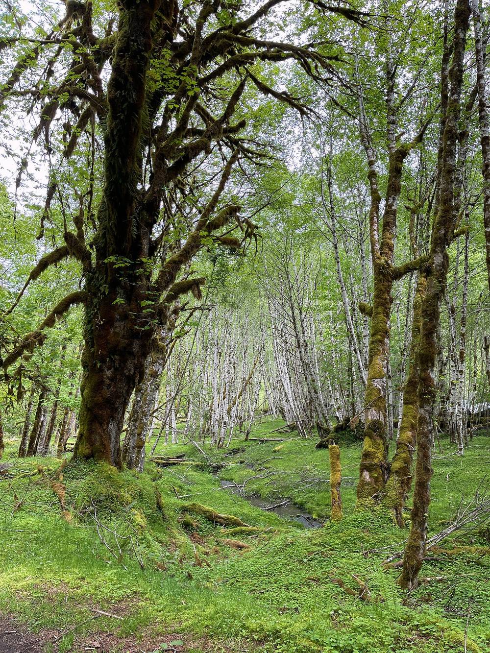
Bears. The canister rule at the Enchanted Valley dates from 2015, when bears there got into human food and the park closed the camp for a month. Keep everything in the can, even during the day.
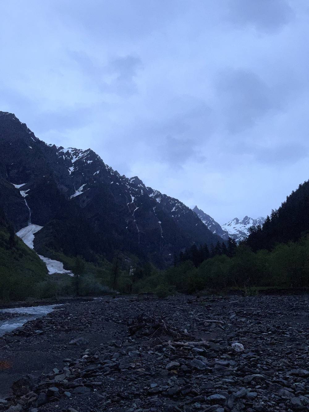
Back down the valley the way you came: 7 miles to O'Neil Creek, about 13 to the trailhead.
Film, Day 2 · Hiking guide and behind the scenes
The third day was what it was all about: getting up into some altitude and into the snow, starting to see views, and trying to get to this pass. There's a lake up there, and you can see the glacier higher up if you make it up the switchbacks. But we quickly came to realize that it was more difficult to go up with the snow, and it was a lot more elevation gain.
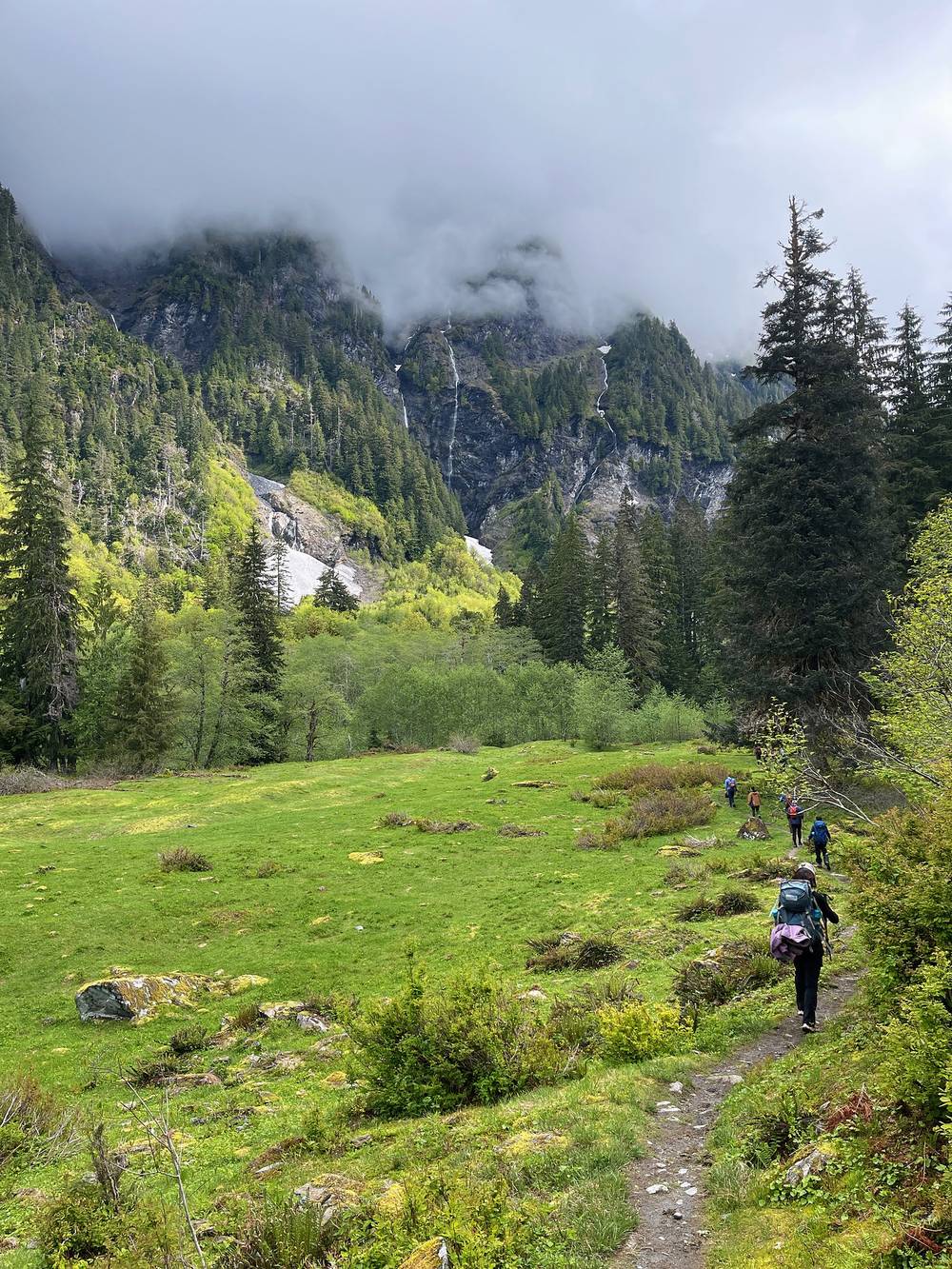
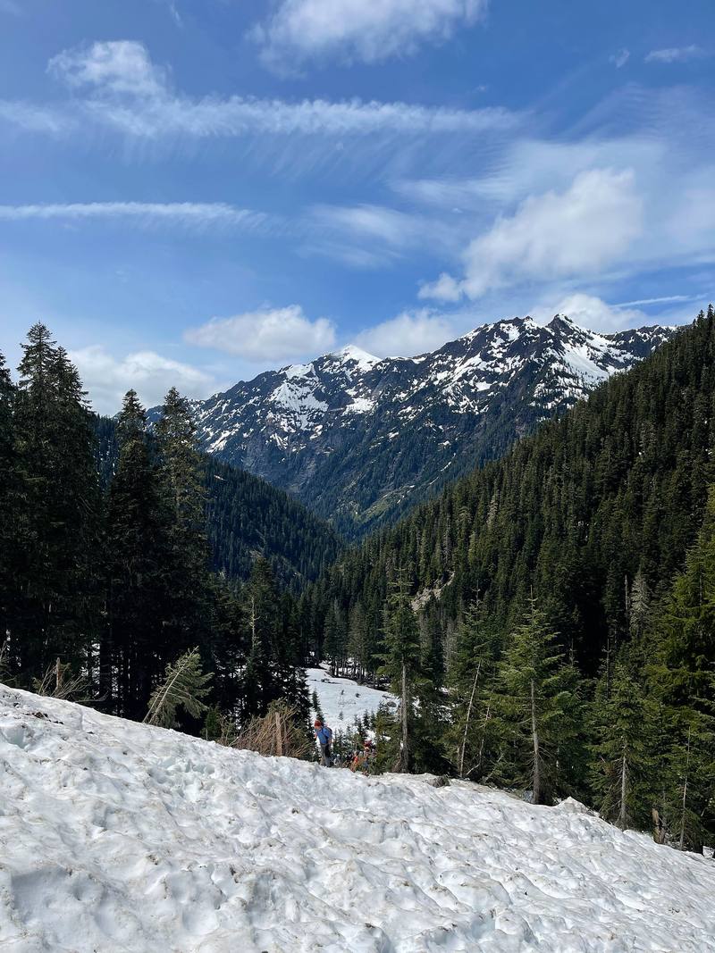
I think we hit snow right around a big stream crossing. Most people took off their shoes; I just goated straight across. Then you can start to see the craziness that was us trying to find the path through the snow. Snow is tough because sometimes you can't see the trail. We made our way across the slope until we reached a very steep area. You might wonder why we didn't use the switchbacks: we couldn't see them, and if there's just a straight slope of snow, it's sometimes easier to make steps and go straight up. So that's what we did. Snow changes everything.
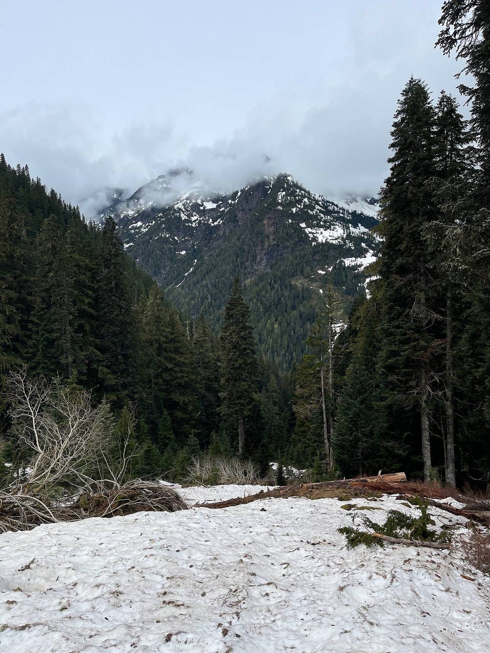
People started to lose gas, because going up in the snow was tiring. If we'd had clean trails with the switchbacks, I guarantee everyone would have made the pass. But it was getting kind of sketchy up there: it was an avalanche area, with a couple of streams under the snow that you didn't want to fall into. I totally understand if people didn't want to go up that sheer ski slope. Half the group, six of us plus a guide, made our way over; it was so nice having two guides, because we could split up. We'd set a couple of turnaround times: if we weren't at the pass by a certain time, we'd head back. Wildland Trekking gave us microspikes, which was fantastic: we absolutely needed them. We made a lot of snow steps, and toward the end we were chanting "good steps, good steps." The person in front does most of the work, so we traded off, and I'm lucky we had some strong hikers to help.
We pushed up the last slope right into the pass and had somewhat of a view on the other side. It was nice to accomplish it as a goal. By myself I'd have started earlier and gone faster, and might have worked my way higher for the view, but we were running out of daylight and people were tired. So we made our way down, sliding down the snow, which was so fun, and goated all the way back for a hot meal. We stayed safe, we were smart, and we accomplished our little made-up goal of reaching the pass.
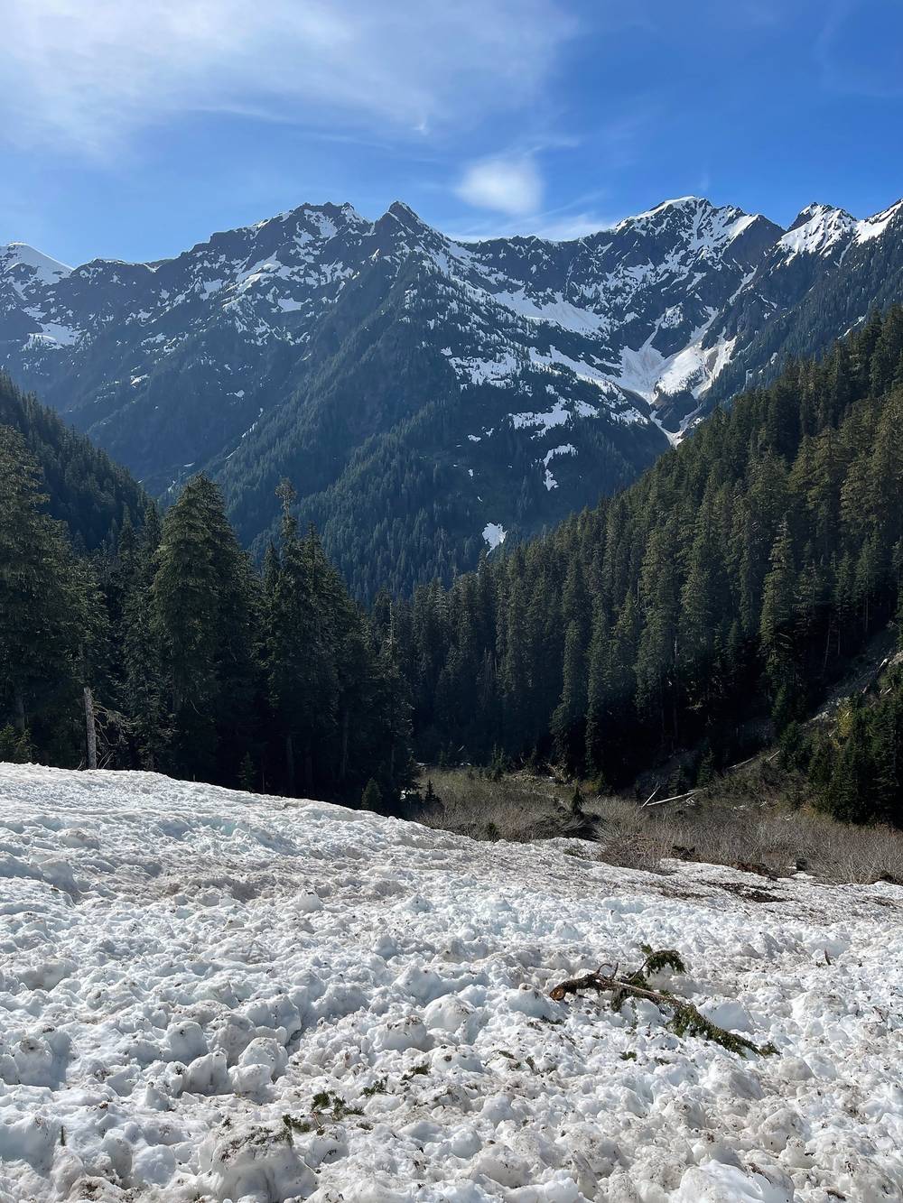
From the Enchanted Valley camp the trail heads up the valley past the chalet, gently at first, then climbs through forest above the river. About half a mile below the O'Neil Pass Trail junction is the big stream crossing where we hit snow; the Park Service says White Creek, below the junction, must be forded and can be swift and deep after heavy rain or in snowmelt, and you may not be able to cross. The O'Neil Pass Trail leaves to the right at about 3,260 ft (mile 3.3 on my GPS).
Above the junction the trail climbs by switchbacks to Anderson Pass at 4,464 ft. The Park Service gives about 5.2 miles and 2,500 ft of climbing from the Enchanted Valley to the pass; we went straight up the snow instead of the switchbacks, so my GPS says 4.6. Above about 3,500 ft the trail is snow covered from November to June and crosses avalanche terrain. On the far side the trail goes down the West Fork Dosewallips; the Anderson Moraine trail leaves near the pass toward the glacier.
Over the pass (2026). In June 2026 the Park Service reported the Dosewallips side snow-free to Anderson Pass, with fords between Diamond Meadows and Honeymoon Meadows, the footbridge above Diamond Meadow out, and the Dosewallips Road still washed out, adding 6.5 miles of walking. We didn't go that way.
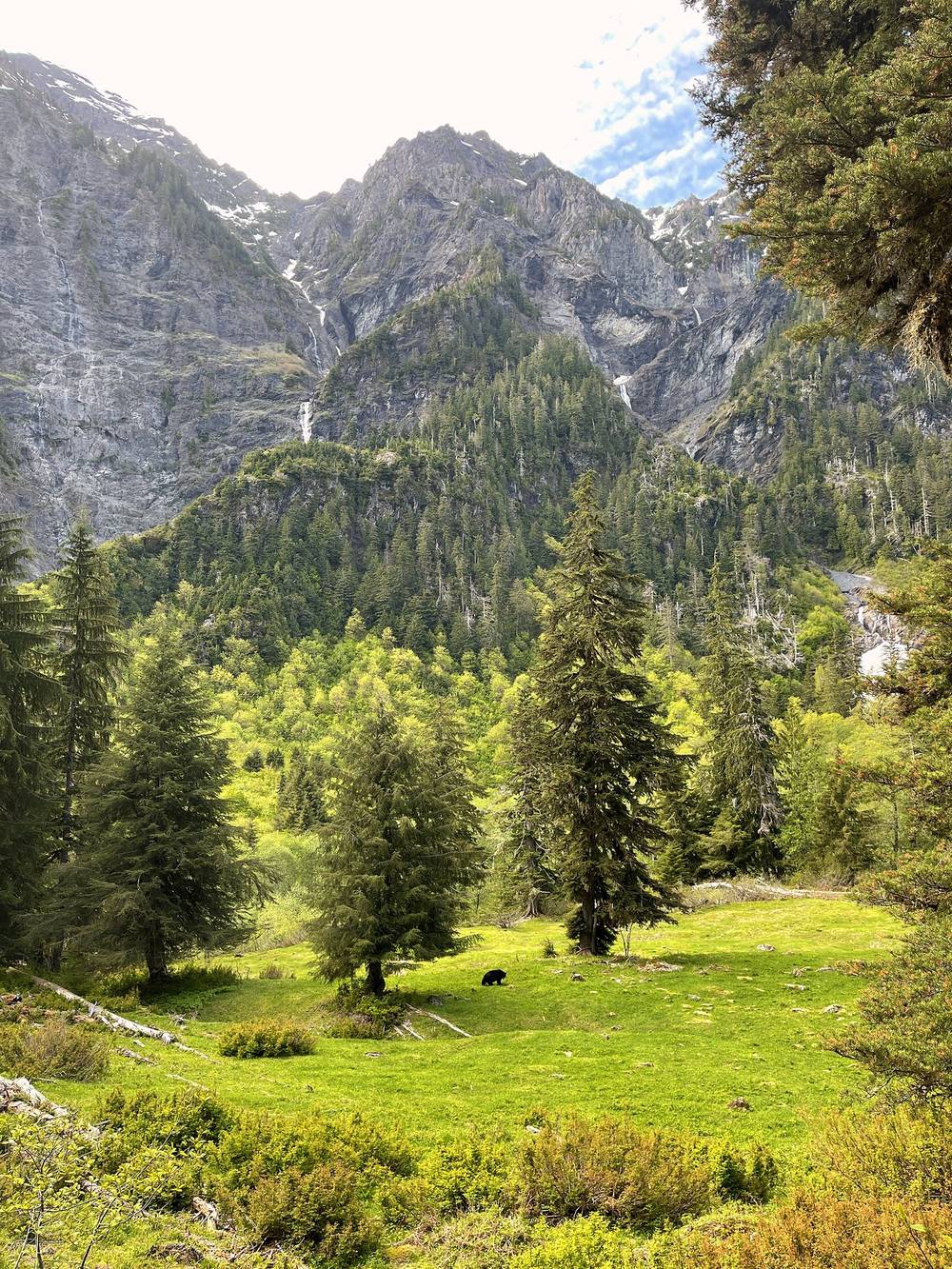
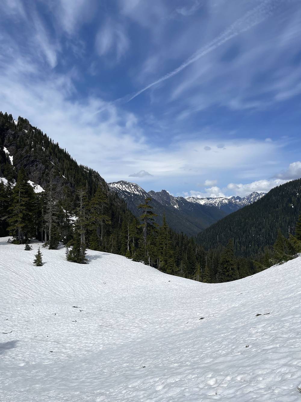
Turn around and go back down to the Enchanted Valley. Set a turnaround time before you leave camp, and stick to it, as we did. Don't cross White Creek if it looks too high: it's lower in the morning.
Film, Day 3 · Hiking guide and behind the scenes
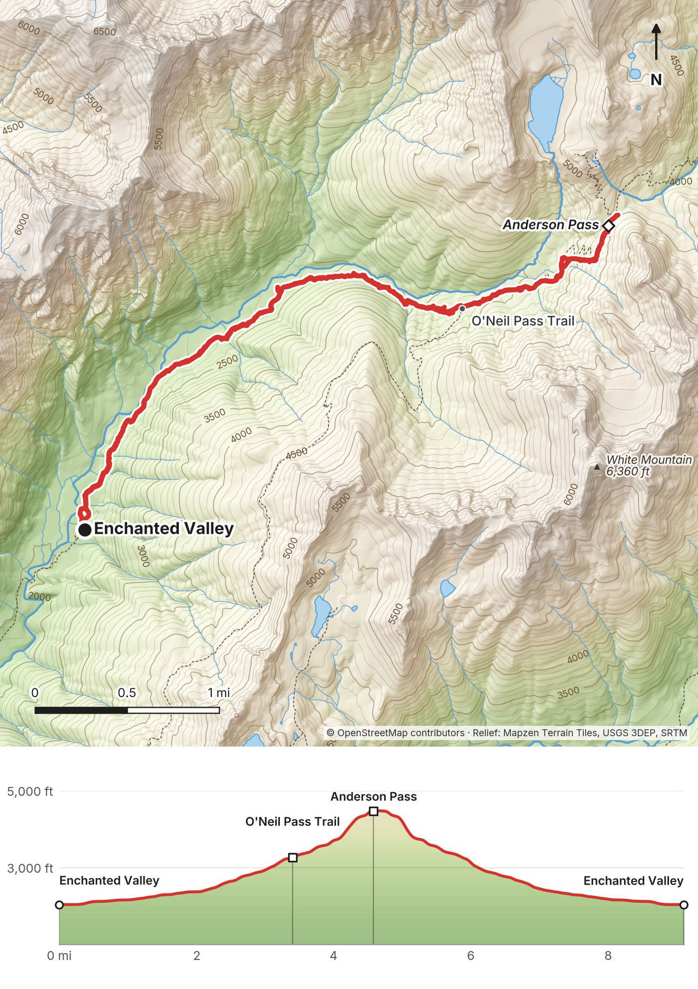
The bears were waiting for us. When I woke up and opened my tent, people were like, you know there's a bear behind you, right? They were hanging around that whole area, and we were careful not to leave any food out and to do the whole bear can thing.
The last two days were the escape. It started raining that night, and Day 4 was a whole day of rain. We had breakfast under the trees with tarps to stay dry, then reluctantly set off in the rain, the entire way down, just under 8 miles back to O'Neil Creek, the first camp we stayed at. My GPS says 7.0.
It was still raining, so we set up tents in the rain and tarps in the rain. It was the first day we couldn't have a fire: we'd set the tarps over the sitting area, and everything was too wet to burn, so we didn't even try. It was a bit cold and a bit sad. Setting up a tent in a downpour is no fun, because everything is wet and you just have to get it done as quickly as you can. We huddled around our fake, nonexistent fire, ate our food, and went to bed with it still raining.
The same trail as Day 2, downhill: about 1,000 ft down over 7 miles, past Pyrites Creek camp. In rain the side streams rise and the trail gets muddy.
Keep going down the valley: the trailhead is about 13 miles from the Enchanted Valley.
Film, Day 4 · Hiking guide and behind the scenes
We woke up and it was sunny and beautiful. We were so happy not to have rain. We dried things off as much as we could, and I think we had eggs and hash browns, which will brighten anyone's day. Then we made our way down, about 8.5 miles by my count in the film (7 on my GPS line), down, down, down, with the little hump again near the end.
We made it. It was very nice to complete this thing. Five days is a lot to be out there.
The same trail as Day 1, downhill: past Fire Creek camp, over Pony Bridge, up over the forested bump and down to Graves Creek.
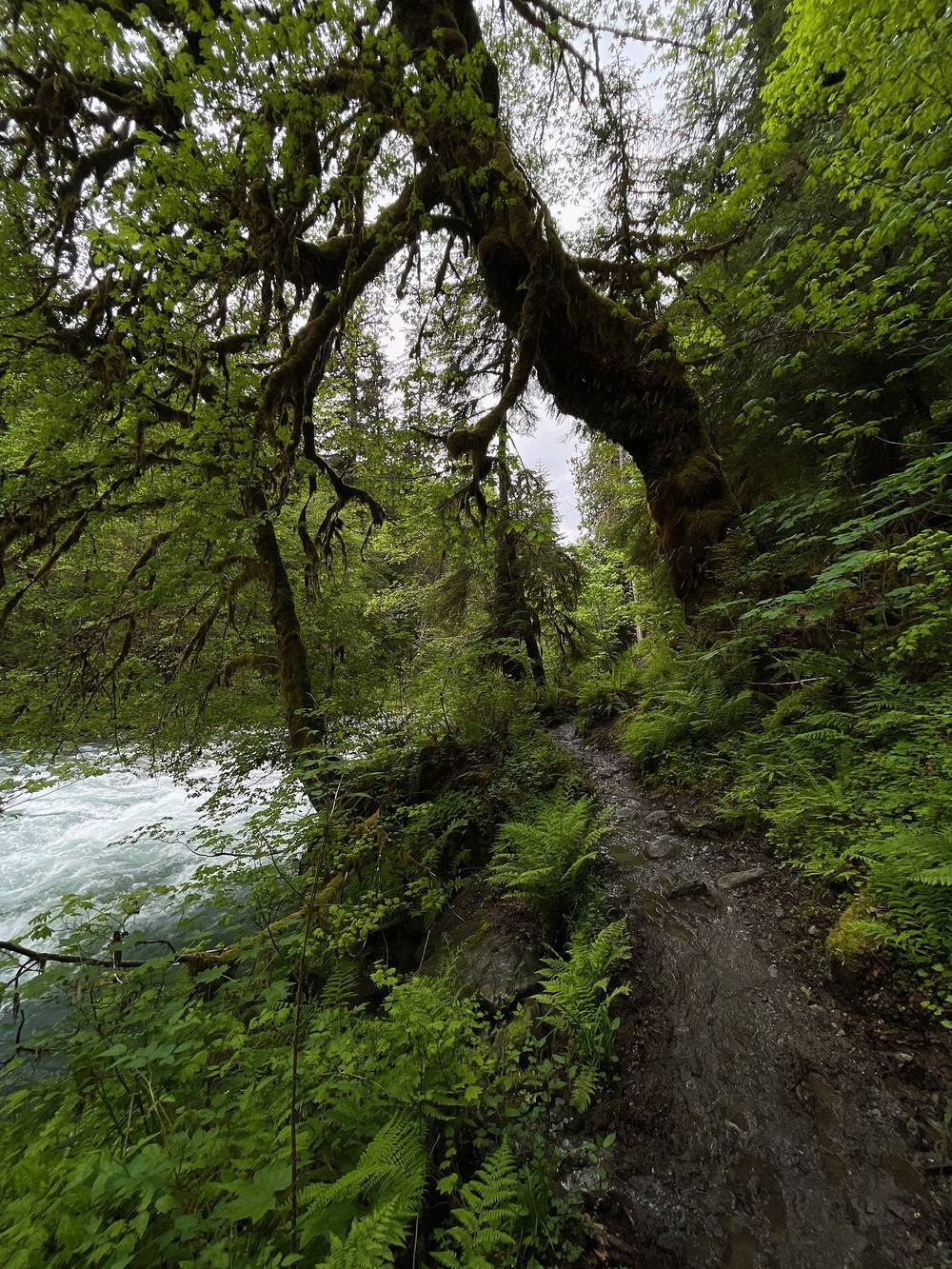
You're on the way out. The trailhead is the end.
Film, Day 5 · Hiking guide and behind the scenes
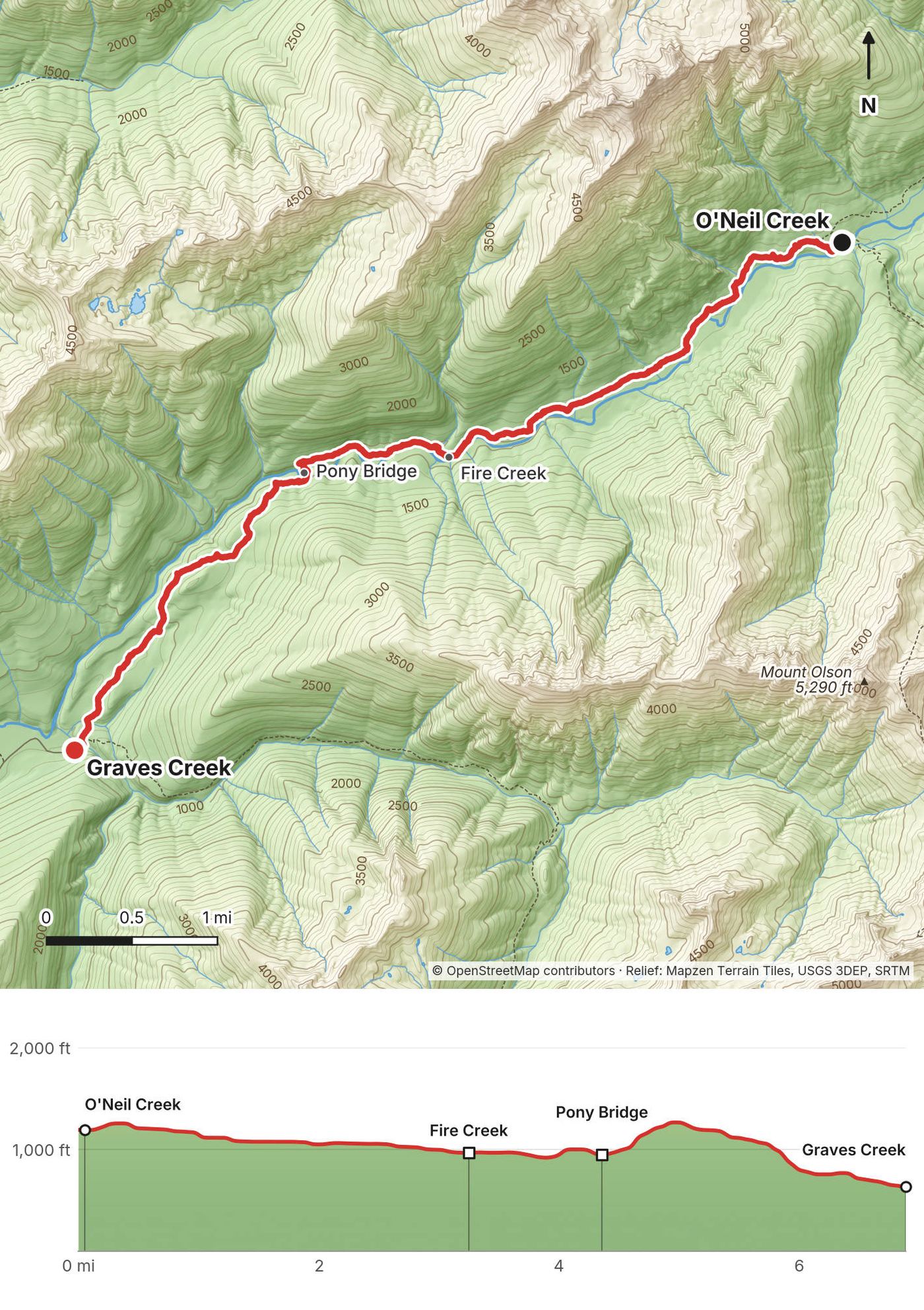
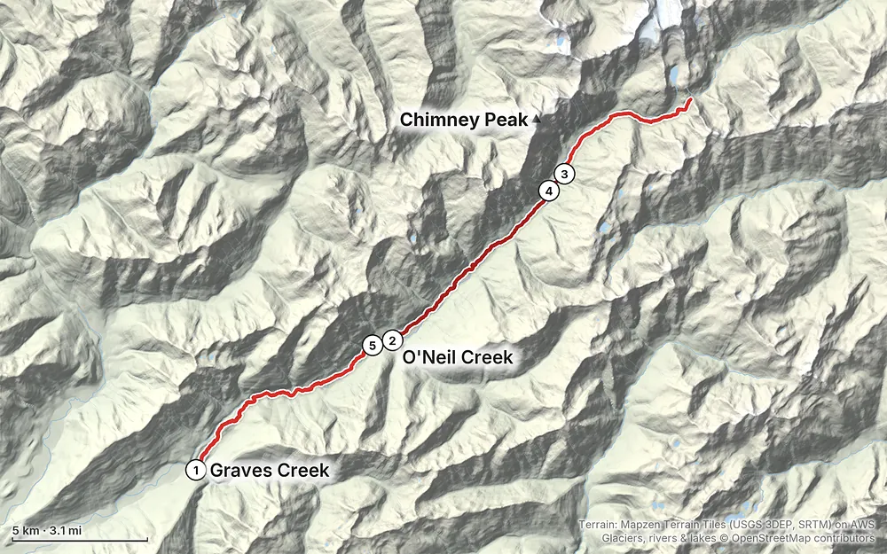
Elevation614–4,508 ft38.3 mi
Terrain: Mapzen Terrain Tiles (USGS 3DEP, SRTM) on AWS · Glaciers, rivers & lakes © OpenStreetMap contributors
Tap a map to open it full size.
All of this was checked on the National Park Service's and Recreation.gov's pages in September 2026. On my trip the guides handled the permit; this is what you need to do yourself.
Wilderness permit. Required for every overnight trip, all year, booked on Recreation.gov. There are no paper permits at the trailhead and no same-day walk-up sites. Summer permits (May 15 to October 15) are released on April 15 at 7 a.m. Pacific; book that day for summer weekends. Permits booked ahead are issued about 3 days before your trip, and then you print it yourself.
Fees (2026). $8 per person per night for ages 16 and up, plus a $6 reservation fee per permit. Kids 15 and under are free but count toward group size. An annual Olympic wilderness pass is $45 and covers the nightly fee, not the reservation fee.
The quota. Since 2024 the East Fork Quinault and the Enchanted Valley have been a quota area, on a trial of up to three years: at most 30 permits or 208 people a night. In a quota area you have to stick to the camps on your permit. Check whether the quota still applies in 2027.
Camps. On Recreation.gov, from the trailhead: Pony Bridge (2.5 miles), Fire Creek (4), O'Neil Creek (7), Pyrites Creek (10) and Enchanted Valley (14). Above the valley there are smaller camps toward Anderson Pass, and Anderson Glacier Camp, with no campfires.
Group size. At most 12 people. Most sites fit 1 to 6, so a group of 7 or more should call the Wilderness Information Center, (360) 565-3100, before booking. We were 12, the guides had warned us some camps were too small for us, and at the Enchanted Valley we had to take a large space.
Bear canisters. Required in all wilderness camps in the park. Food, garbage and anything scented go in it, and hanging food is not allowed in the Enchanted Valley. You can borrow canisters at Wilderness Information Centers, first come, first served, but the park asks you to bring your own, and the Quinault center, the one nearest the trailhead, was closed for the 2026 season. On my trip everyone carried a bear can with group meals and our own snacks.
Fires. Only in existing fire rings, below 3,500 ft, and never during a fire ban. That rules out fires at Anderson Pass.
Other rules. No dogs on park trails or overnight trips. No drones anywhere in the park. Stay at least 50 yards from bears, elk and all wildlife. Use the pit toilets at Pony Bridge, O'Neil Creek and the Enchanted Valley; elsewhere bury waste 6 to 8 inches deep, 200 ft from water and camp, and pack out your toilet paper. Guided groups need a park Commercial Use Authorization.
Park entrance. $30 per vehicle for 7 days (2026), or the $55 Olympic annual pass or an America the Beautiful pass. The park doesn't take cash.
The season. The Park Service gives May through September as the best season for the East Fork Quinault. Above about 3,500 ft, on the way to Anderson Pass, the trail is snow covered from November to June and crosses avalanche terrain. For the pass without snow, aim for July to September. July and August are the busiest months.
What I got. We went June 6 to 10, 2022. It was early summer, so the streams were flowing and there was still a lot of snow on the peaks, even more than the film shows. The first three days were good weather. It rained from the third night through all of Day 4, then the last day was sunny and beautiful. The guides' note before the trip said to expect highs in the high 60s and lows in the mid 40s in June.
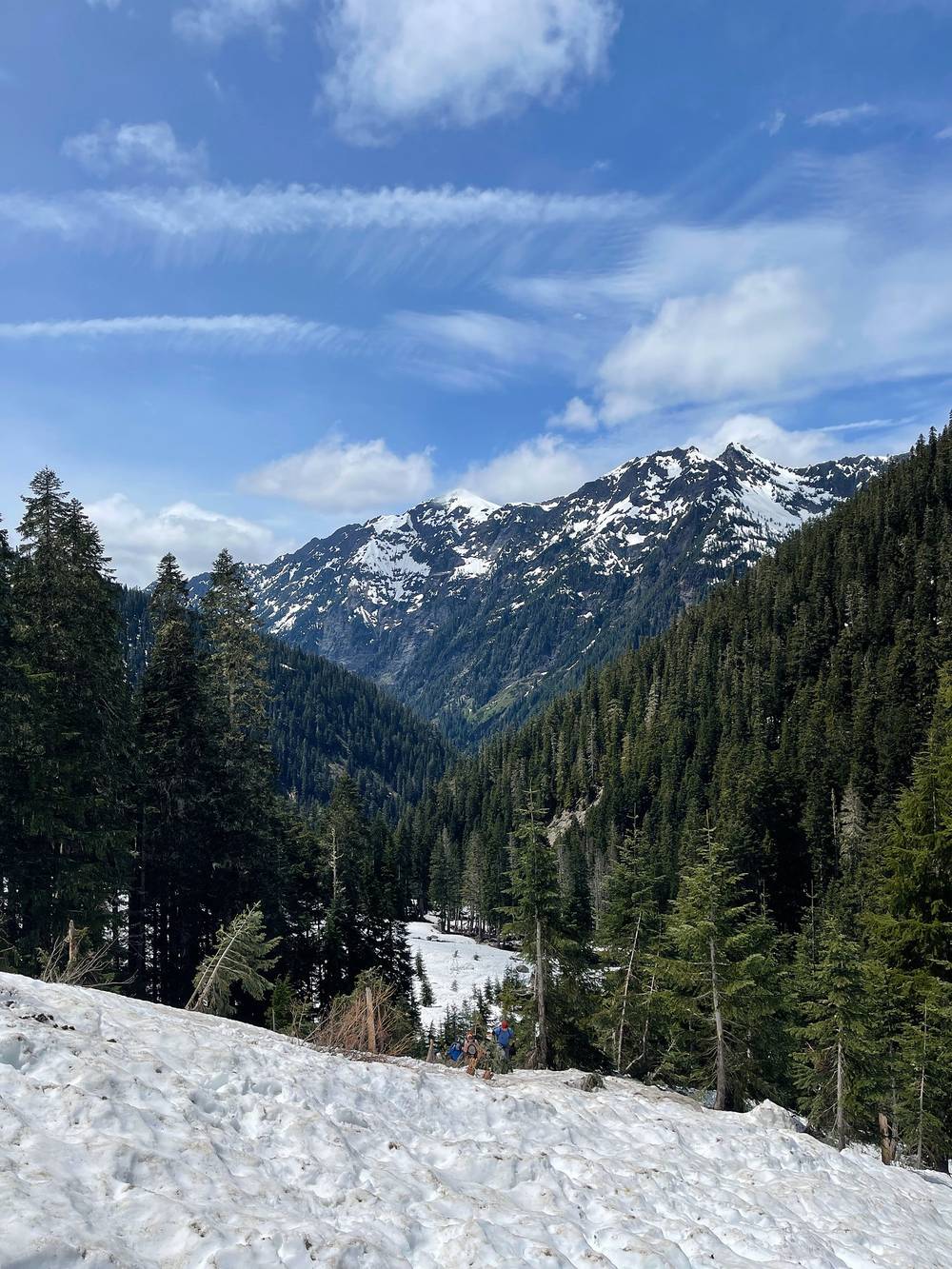
Snow in June. We hit snow around the big stream crossing above the valley, and the rest of the climb to Anderson Pass was on snow. We'd have been faster that day without it. If you go in June, expect the same, bring traction, and decide on the pass that morning.
Rain. It's a rainforest. Expect rain at least one of the days, whatever the month. Most of the year's rain falls November to April.
Fire season. Late summer can bring fire bans. In 2026 a campfire ban started across Olympic National Park and National Forest on August 7. Check the park's alerts before you go.
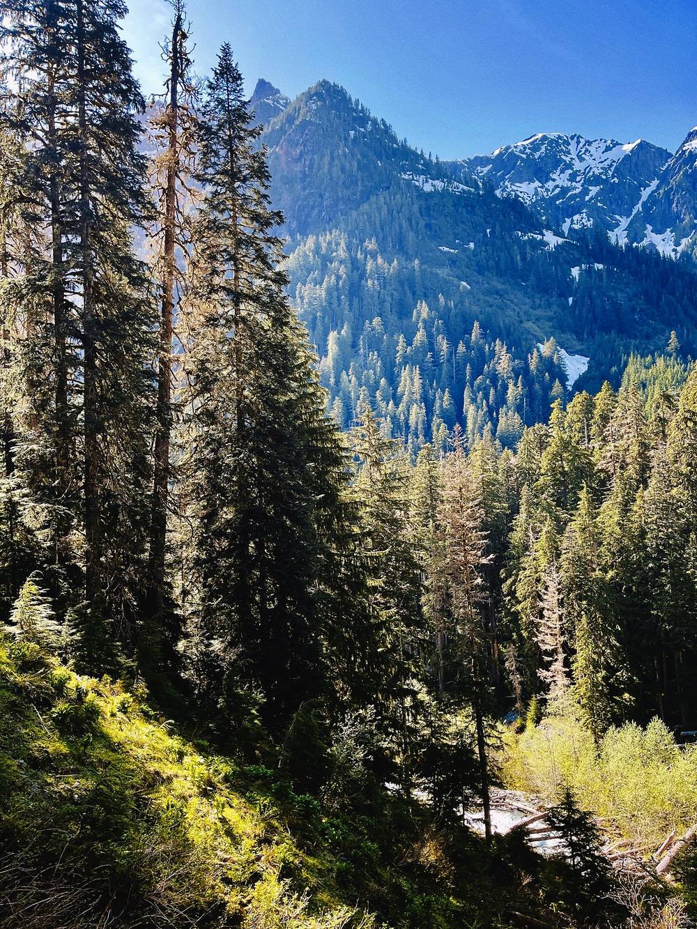
Emergencies. Call 911. Don't count on your phone: the Park Service says coverage is very patchy, and there's none on most of this trail. Carry a satellite messenger. The nearest emergency room is in Aberdeen, more than two hours from the trailhead.
Rain and cold. It's a rainforest, and a soaking day can chill you even in summer. We had a full day and night of rain. Keep a dry set of clothes for camp, and pitch quickly.
River crossings. The Park Service's advice: cross in the morning, before snowmelt raises the water; unbuckle your pack straps; never tie yourself in. White Creek, on the way to Anderson Pass, may be impossible to ford after heavy rain or in snowmelt. Turn back.
Washouts. The river moves. In 2026 a washout before the Enchanted Valley meant a ford or a steep scramble. Read the trail conditions page the week you go, and don't follow the "cutoff routes" some GPS maps show (the Hart Lake and Lacrosse Lake routes): the Park Service says they aren't trails.
Snow and avalanches. Above about 3,500 ft, the trail to Anderson Pass is snow covered into June and crosses avalanche terrain. Steep snow needs traction and an ice axe and the skills to use them. Set a turnaround time.
Bears. One or two black bears every day for us, and very chill: lumbering around minding their own business, looking at you, then getting back to munching on berries and roots. Stay 50 yards away, keep everything in the canister, and if a bear comes into camp, don't give up your food: bang pots and pans, and tell a ranger.
Elk and cougars. The Park Service calls elk one of the most dangerous animals in the park, especially bulls in the fall rut. Give them space. If you meet a cougar, don't run: face it, look big, back away, and fight back if it attacks.
Leave a plan with someone at home: your permit, your camps and when you'll be out.
How many days do I need? We took five, at a group's pace: about 7 miles a day, plus a day hike to Anderson Pass. On my own I'd have gone faster. See Other ways to do it.
How hard is it? The trail up the valley is long but gentle: a little bump at the start, then a slow grind with not much grade, about 1,400 ft from the trailhead to the valley. The hard part is above the valley. Anderson Pass is about 2,500 ft higher, and in early June that meant snow, steep slopes and making steps.
Do I need a permit? Yes, for every night, booked on Recreation.gov. The East Fork Quinault has been a quota area since 2024, and there are no walk-ups. See Permits and rules.
Can I go without a guide? Yes. It's a national park trail, not a guided-only route. I went on a guided trip, and the guides handled the logistics and the food, but you can do it on your own with a permit, a bear canister and a car. Or hire guides like Wildland Trekking.
Is the road open? The South Shore Road was closed by a washout from the end of 2024, and Jefferson County expected the repair to finish in mid-October 2026. Until it reopens, get to Graves Creek by the North Shore Road. See Getting there.
Update, November 2026. The Park Service says the South Shore Road has reopened and the temporary bridge between the North Shore and South Shore roads has been removed for the winter. Until it goes back in, reach Graves Creek by the South Shore Road, not the North Shore Road. The roads above are how I got there in 2026.
Will I see bears? Probably. This was probably the most bears I'd ever seen, even compared to Alaska: one or two black bears at least every day. The Park Service says the Enchanted Valley "has a large population of bears." Everything goes in a bear canister.
Will it rain? Plan on it. I feel like it's impossible to go to the Enchanted Valley without rain at least for some of it. We had one full night and day of rain.
Can I have a campfire? In 2022 we had one most nights. In 2026 fires are allowed only in existing fire rings below 3,500 ft, and not during seasonal fire bans. None at Anderson Pass.
If I was doing this by myself, it would have been quicker: it's always easier to go at your own pace, and without campfires and people to talk to, I've got nothing else to do but hike. I'd push all the way up to the Enchanted Valley from the trailhead on the first day, probably past it, because that's when it starts to get really beautiful. I'd try to get a campsite up there, then go over the pass and down and around, weather and snow permitting. The snow would have slowed me down. And I'd definitely exit from the Enchanted Valley, the chalet, back to the trailhead all in one day: it's under 20 miles and downhill. With the quota, your permit has to name every camp, so plan this before you book.
Most people go to the Enchanted Valley and back: about 13 miles each way, with a night at O'Neil Creek or Pyrites Creek on the way in, or a long first day straight to the valley. Add a day in the valley if you can. Anderson Pass is a big extra day from there, and in early summer a snow climb.
From the pass, the trail continues down the West Fork Dosewallips to the east side of the park. It's a through-hike that needs a car shuttle, and in 2026 the Dosewallips Road was still washed out, adding 6.5 miles of walking. We didn't do it, and it isn't in this guide.
I went with Wildland Trekking on a trip I hosted through TrovaTrip. In September 2026 Wildland Trekking listed an Enchanted Valley trip of 4 days and 3 nights from Olympia, from $1,942 a person, without the Anderson Pass day. The price includes the tents, sleeping gear, packs, food, the wilderness permit, the park entrance fee and transport from a hotel in Olympia.
These change every year. Everything else in this guide stays the same.
Permits and rules
Getting there
Conditions
Your stuff
The film is at the top of this page.
When bookings open, from the sources named under each. Dates move: confirm on the official site.
Summer permits are released on April 15 at 7 a.m. Pacific; book that day for summer weekends.
Next: Apr 15, 2027
Book on recreation.gov.
Source: Kraig Adams's Enchanted Valley guide: Permits and rules (checked Sept 2026). Checked September 2026.
Planning questions about Enchanted Valley, my first group trip, answered only from this page's facts, the creators' versions and hikers' public tracks, with where each answer comes from. When the data doesn't say, the answer says "not given".
From hikers
Sign in to comment. Free; your hikes stay private unless you share them.
Some lodging links earn me a small commission at no cost to you.
Something wrong or missing on this page? Send feedback.