
Content made there
The film is at the top of this page.
Photos
Hikes / Cerro Huemul Circuit / Kraig Adams's version
South America · Argentina
Mar 2025 · 3 days · about 45 miles · With friends · Tent

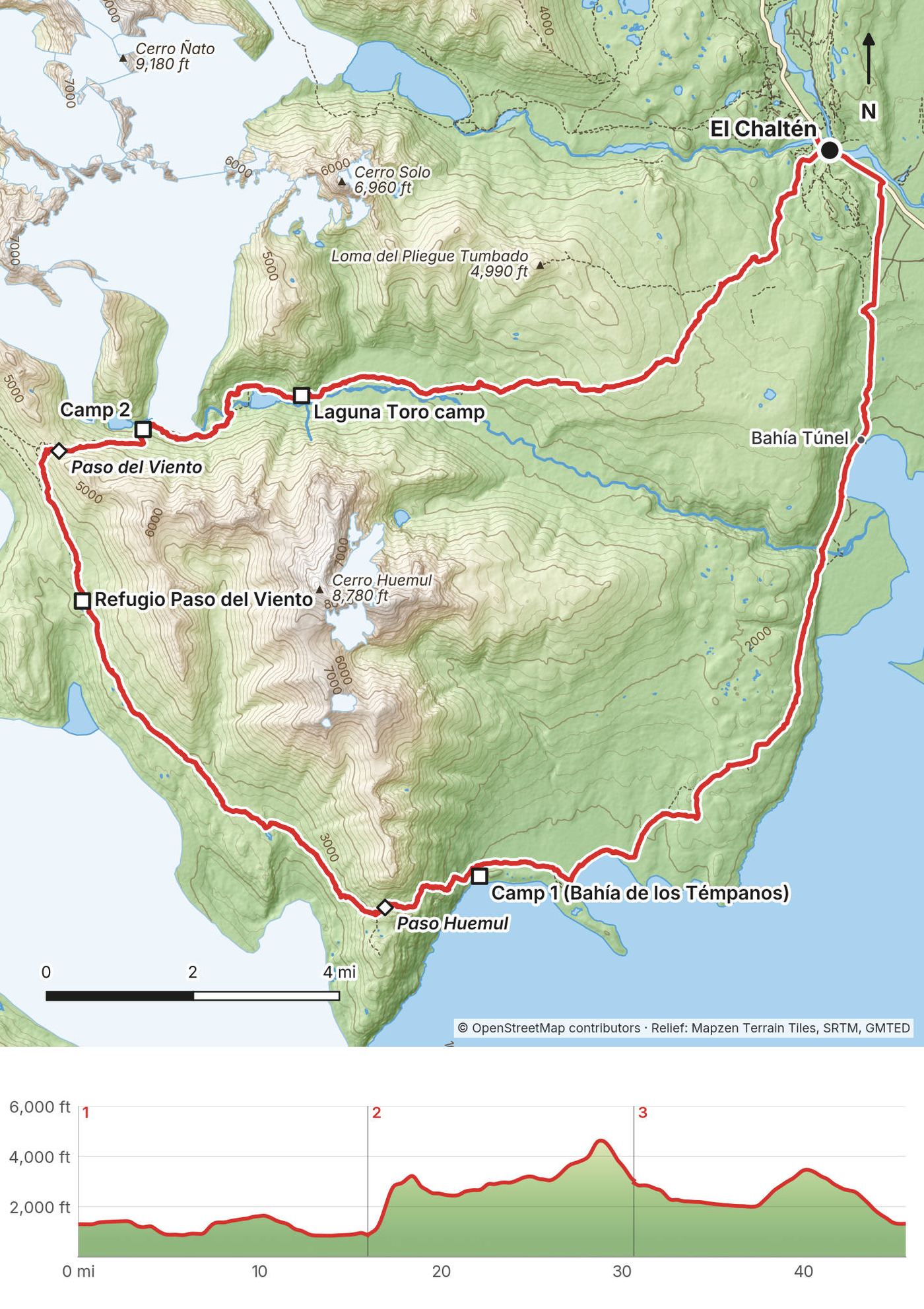
In March 2025 I hiked the Cerro Huemul Circuit with three friends: about 45 miles in three days, a loop from El Chaltén, Argentina, down to Lago Viedma, over Paso Huemul and Paso del Viento above the Glaciar Viedma, and back past the Glaciar Túnel and Laguna Toro. It's the trip from my film Hiking 45 miles on the Cerro Huemul Trail in Argentina.
It's one of the more remote and demanding trails I've done, known for wild river crossings, glacial traverses, and wind that tries to blow you over. If you're visiting that area and considering this hike, I highly recommend it. It was beautiful. The glaciers were fantastic. It's a great loop, and you know I love loops.
| Quick facts | |
|---|---|
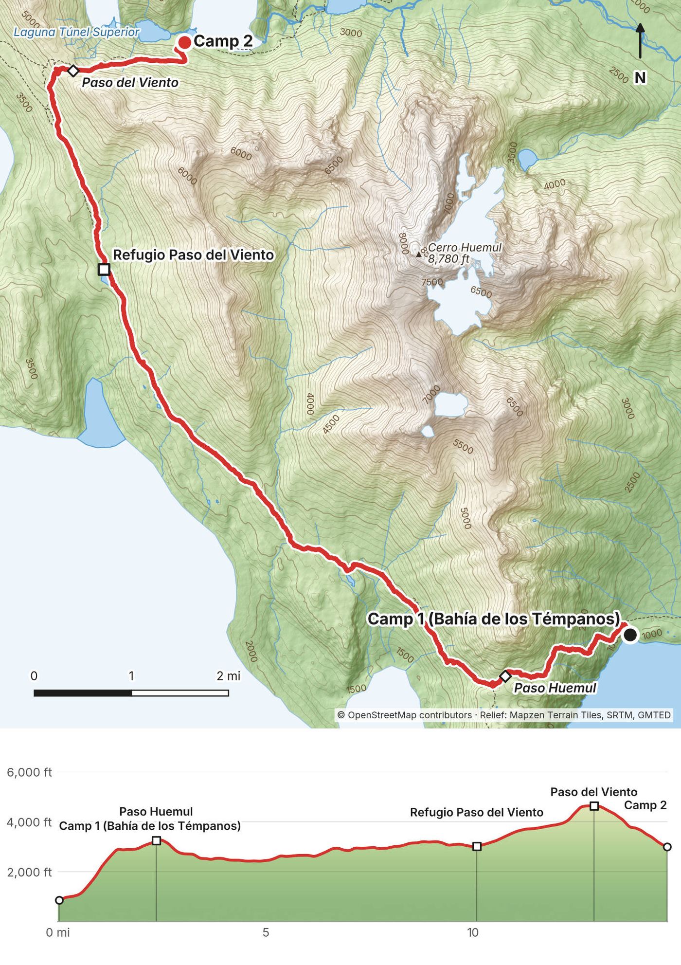
| Distance | 45.6 miles (73.4 km) in 3 days and 2 nights, a loop on foot from El Chaltén (1,290 ft) |
| Climbing | about 8,070 ft (2,460 m) up and 8,000 ft (2,440 m) down |
| High point | Paso del Viento, 4,640 ft (1,414 m) on my GPS, Day 2 |
| When | Roughly November to March. I walked March 6 to 8, 2025 |
| Difficulty | Two cable crossings with a harness, steep loose climbs, moraine and wind. The park says mountaineering experience is essential |
| Registration | Free and required, online, one form per person (2026), plus a park entry ticket |
| Status | Most of the loop closed after a January 2026 fire. Confirm before you go |
| Day | Route | Miles (km) | Up / down (ft) | Sleep |
|---|---|---|---|---|
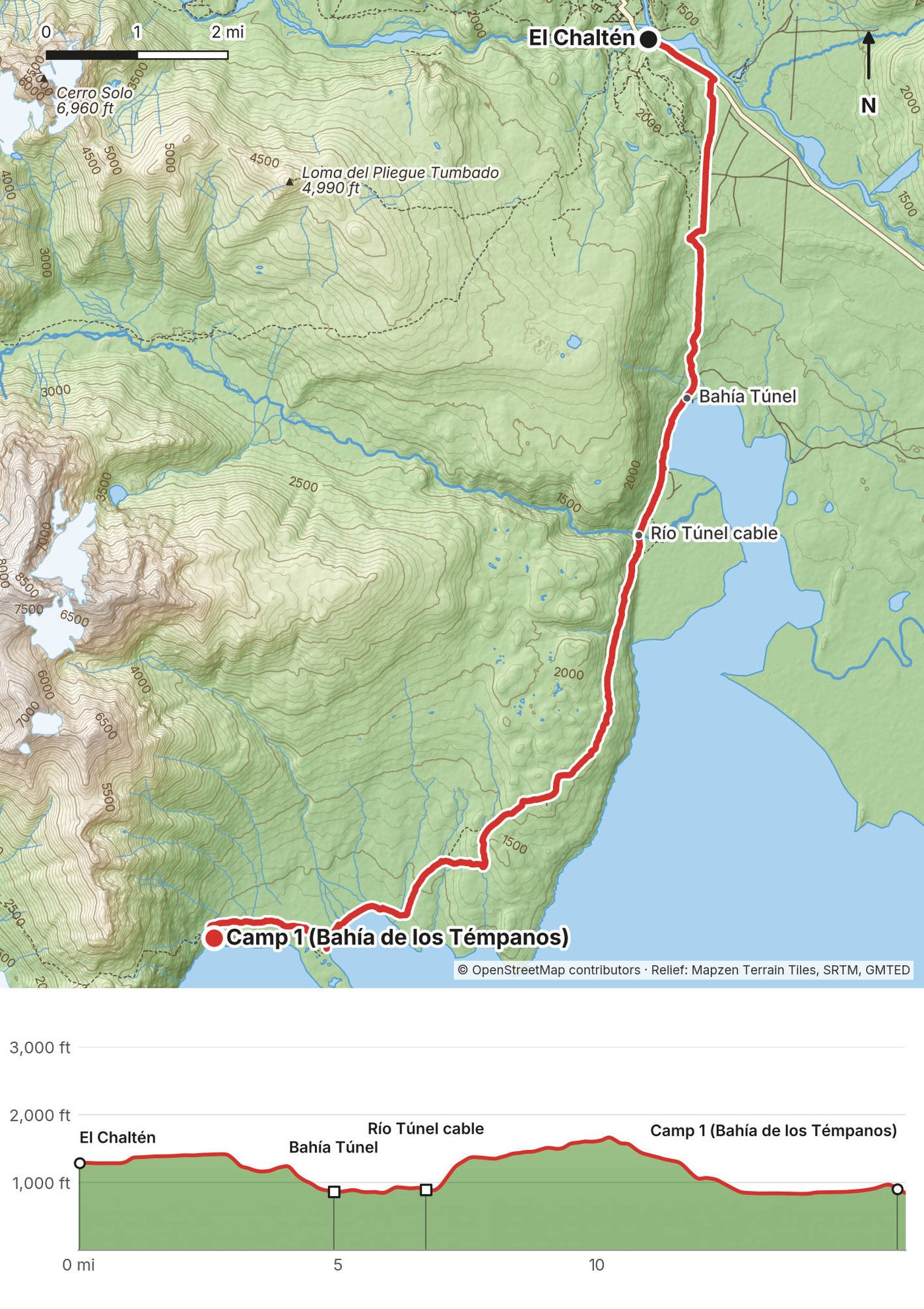
| 1 | El Chaltén to Bahía de los Témpanos | 16.0 (25.7) | 1,263 / 1,695 | Tent, 900 ft |
| 2 | Over Paso Huemul and Paso del Viento | 14.7 (23.6) | 5,147 / 2,987 | Tent, 3,000 ft |
| 3 | Laguna Toro to El Chaltén | 15.0 (24.2) | 1,664 / 3,315 | Town |
Numbers are from my own GPS (the film says 45 miles). I went with three friends, opposite to the park's usual direction, which starts at Laguna Toro, and the park plans 4 days.
El Chaltén. The town is the trailhead. It was pleasant for me getting back to El Chaltén: this was my third time in Argentina, and I have fond memories of traveling around there with a group hike and my wife a couple of years earlier.
From El Calafate. Most people fly into El Calafate (FTE) and take a bus to El Chaltén: about 3 hours on paved road, with Cal-Tur, Chaltén Travel and TAQSA, and buses stop at the airport. A one-way fare was ARS 60,000, plus a ARS 2,000 terminal fee in El Chaltén, in September 2026 (El Chaltén's tourism site, not an operator).
How we got there. We drove. After a hike in Chile we came up from Punta Arenas by car and reached the El Chaltén welcome sign on the evening of March 5, 2025. It's a good photo spot. After the hike we drove on to the Perito Moreno glacier and back to Punta Arenas.
Parking. We parked early in the morning by the park's visitor center at the south edge of town and left the car there the entire hike, three days. It was free, with no permits or issues, and lots of other cars and camper vans. I'm not sure if you're allowed to sleep there in your car.
Entering Argentina. Since 2025 (Decree 366/2025), foreign visitors have to declare on arrival that they have health insurance. Bring proof of a travel medical policy, ideally one that also covers mountain rescue, helicopter and search.
Cash. El Chaltén has few ATMs and they can run out. Park tickets are card only, but bring some pesos from El Calafate for anything else.
| Item | What I paid in 2025 |
|---|---|
| Registration | Free |
| Park entry | Not in my records (the park began charging in El Chaltén in October 2024) |
| Camps | None in my records; no camp fee found |
| Parking by the visitor center | Free |
| Food, gear rental, lodging, car | Not in my records |
For your budget (2026). Park entry ARS 50,000 a day for foreigners, ARS 100,000 for a 3-day Flexipass or ARS 175,500 for 7 days (from June 1, 2026), card only. Registration is free. The bus from El Calafate was ARS 60,000 one way, plus a ARS 2,000 terminal fee, in September 2026. Add a harness rental if you don't have one, and mountain rescue insurance.
| Night | Where | Height (my GPS) |
|---|---|---|
| Before Day 1 | In El Chaltén | |
| 1 | My tent in the trees at Bahía de los Témpanos (Day 1 mile 15.8) | 900 ft (274 m) |
| 2 | My tent in a small clearing east of Paso del Viento (Day 2 mile 14.7) | 3,000 ft (913 m) |
| After Day 3 | In El Chaltén |
The record doesn't show where we stayed in town. The park's three camps on the circuit are Laguna Toro, Paso del Viento (by the refugio) and Bahía de los Témpanos / Cabo de Hornos. My second camp wasn't one of them.
We were all eating freeze-dried meals made with boiling water, with nice oats and stuff. Alex, a true hiker, very experienced in ultralight and minimal, cold-soaked what we call sad meals: the same cold chili every night. In my film: pesto pasta at Bahía de los Témpanos and tortellini at the second camp. There's nothing to buy on the circuit. Buy food in El Chaltén or El Calafate.
There's water everywhere: the lake, streams and glacier melt. At my second camp it was a little walk up to the stream. I filtered from streams. The park says the water is pure, but don't drink standing water where cattle graze near Bahía Túnel.
There are no toilets on the circuit apart from what the camps may have. Go at least 50 steps from water, bury waste, and carry out your trash and food scraps.
My 2025 kit, from the gear list in the film's description, the film and my photos. Everything I brought, hiking and filmmaking, is listed there by type.
What this circuit needs:
Grey skies and rain along the lake, especially at camp. Mostly flat and wet. We left the car at the edge of town early and walked south on the fenced route across farmland, over and under the fences, past cows, down to the turquoise water at Bahía Túnel.
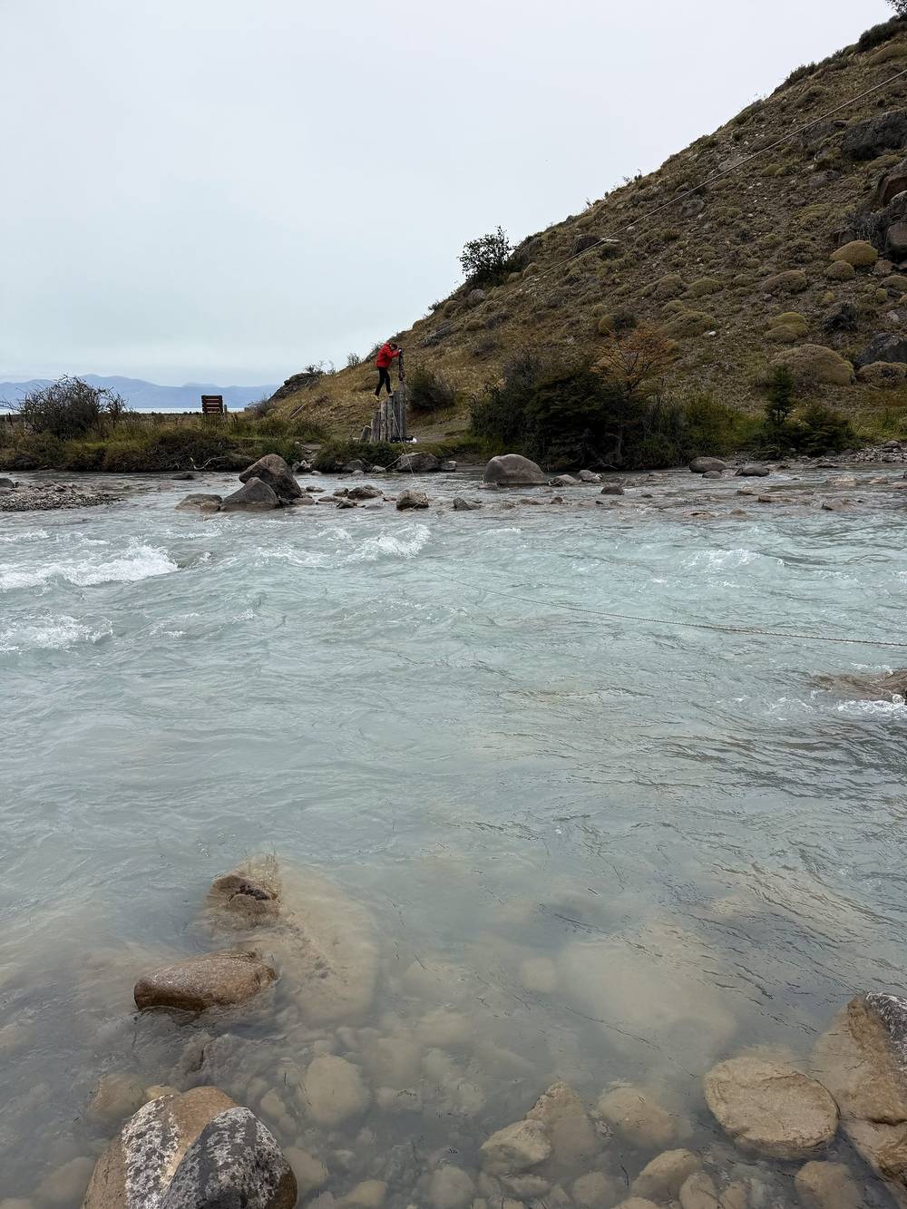
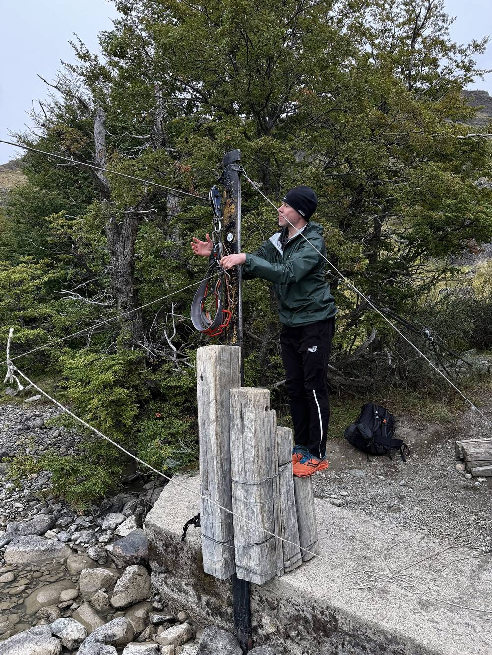
Then the first cable crossing over the Río Túnel. Cables are set up for a suspended crossing. We brought our own harness and passed it back to the next person with the attached rope each time. I'd recommend bringing a long thin rope as well as the harness. We could have walked across the river, but it would have been high up on us and really cold, like pack-above-your-head deep. Water levels are probably very different depending on rainfall and season, so be careful out there.
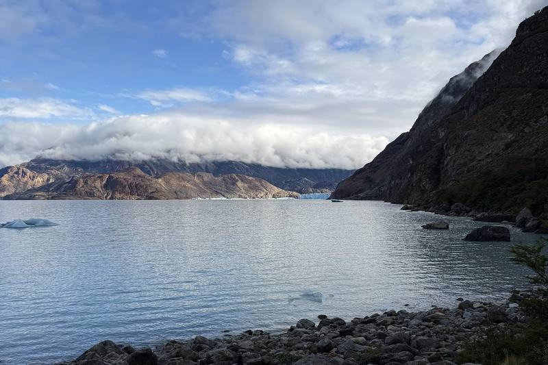
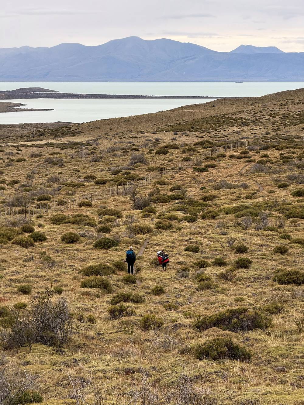
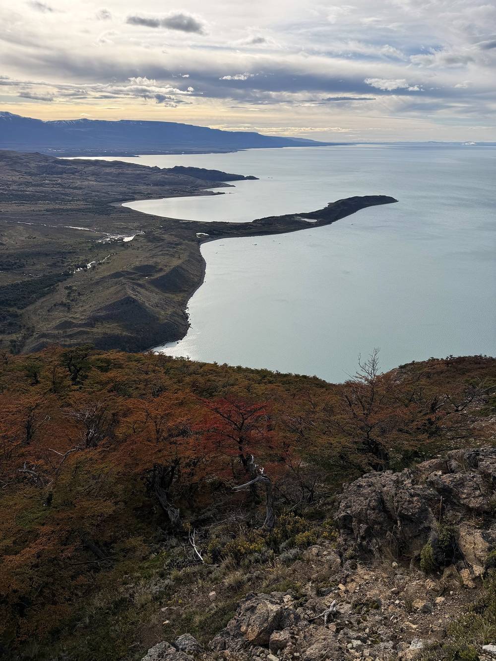
After that the trail climbs over the hills above Lago Viedma and drops back to the shore. We were socked in, with no view, but no wind either: honestly, this was the day to do it. There's a black sand beach along the way.
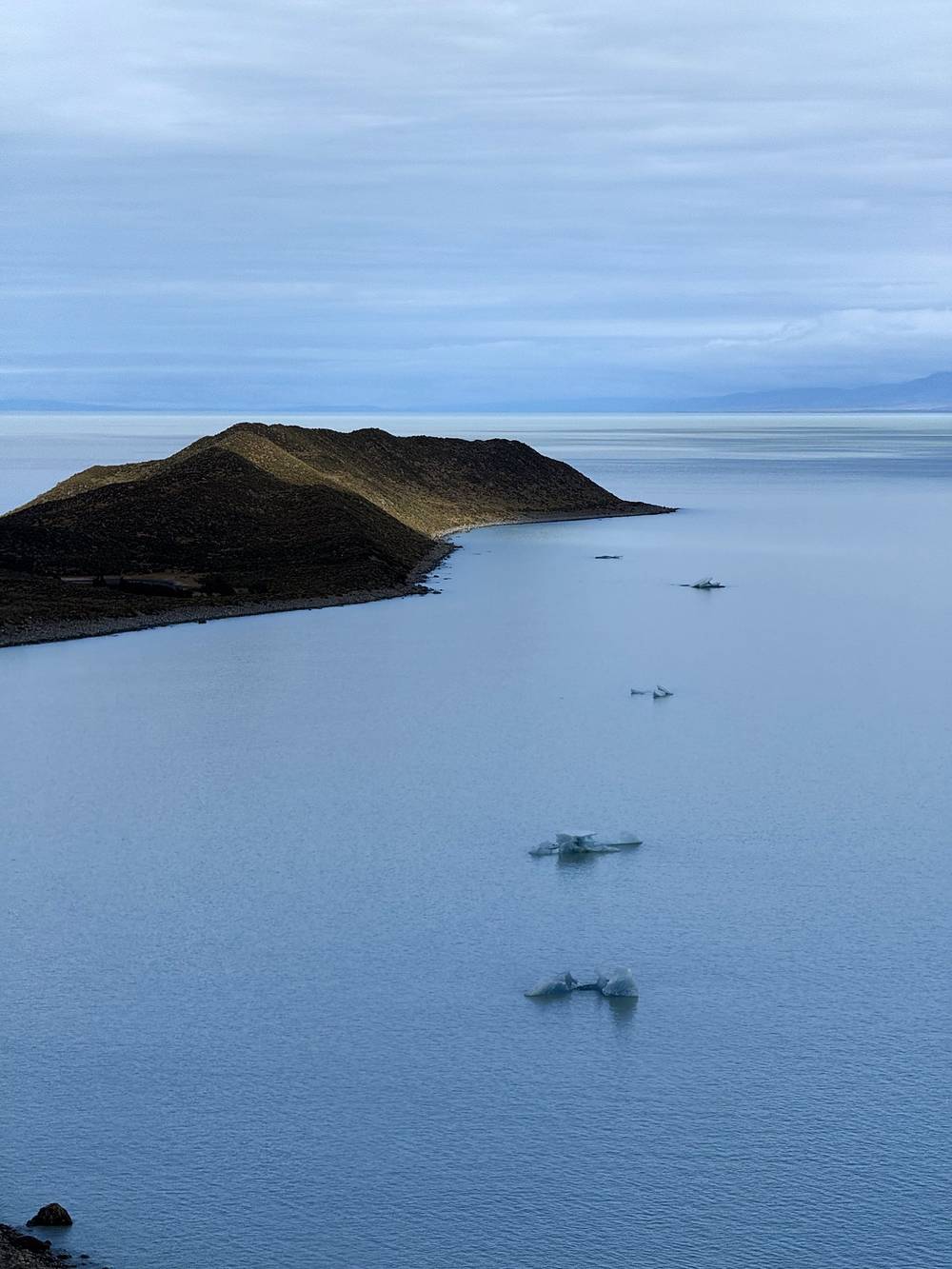
The camp at Bahía de los Témpanos is very unique: right along the lake and covered with trees and bushes, with a big rocky beach for sitting and eating, and little icebergs floating in the lake. That night was pesto pasta. There's a nice little hill near camp to climb for sunset photos.
From the parking area by the visitor center, the route crosses the provincial road and heads south on the walking route to Bahía Túnel, along farm fences marked in yellow, with Lago Viedma ahead. It drops to the pier at Bahía Túnel at mile 4.9 (860 ft).
The trail follows the lakeshore south past the Estancia Río Túnel to the lower Río Túnel. The cable crossing is at mile 6.7 (890 ft), with the anchor in the trees on the near bank. The park's briefing says to stay beside the wire fence between the cable and the pier; follow the markers. This is where the January 2026 fire started, so expect burned ground, and the trail, markers or cable may have changed.
Across the river the trail climbs to about 1,680 ft over the hills above the lake (mile 10.2), then drops to the shore. It passes the Cabo de Hornos camp at mile 14.0 and follows the beach and the bush to Bahía de los Témpanos at mile 15.8, where the camp sits in the trees above the shore.
Before the cable, walk back to town. After it, the way out is back over the cable to Bahía Túnel and its pier, then the fenced route to town; in January 2026 hikers at Bahía de los Témpanos were taken out by boat to Bahía Túnel during the fire, but there's no scheduled boat for hikers. Don't recross the cable in high water.
Film, Day 1 · How I did it (behind the scenes)
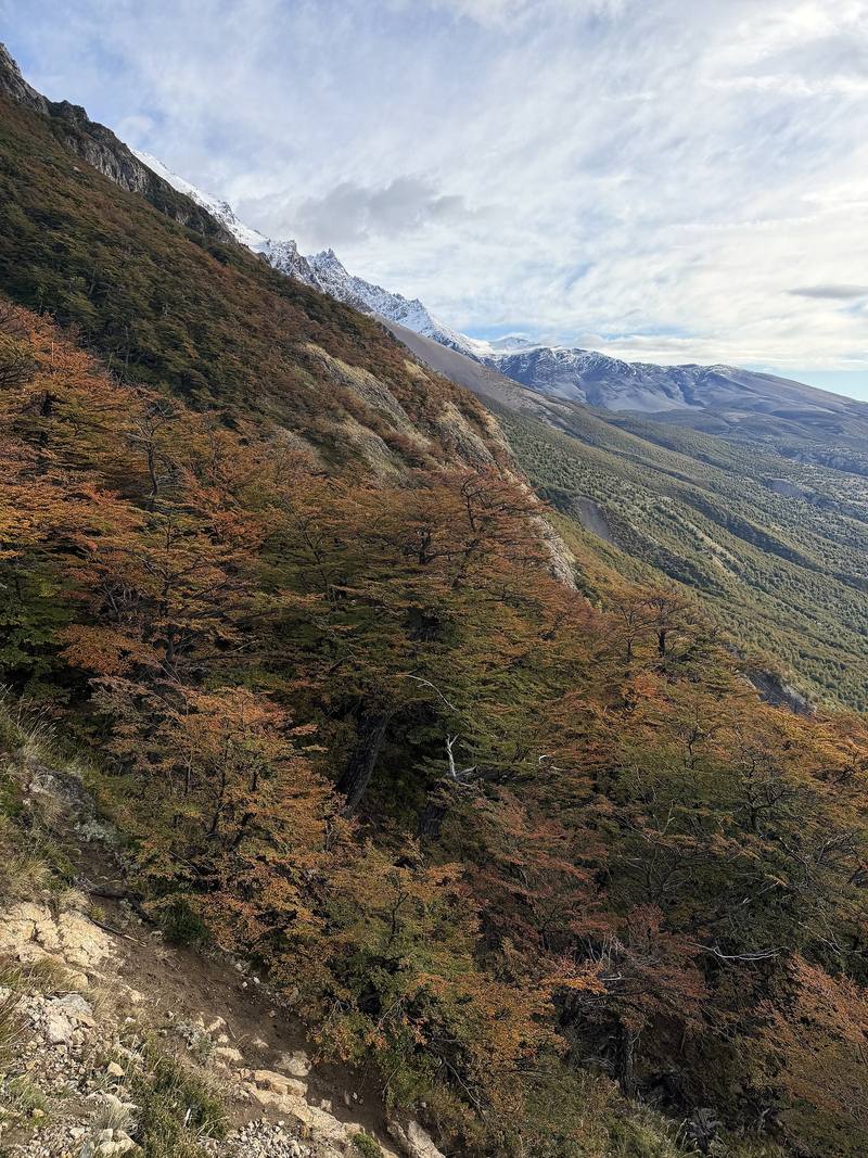
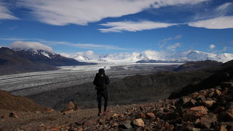
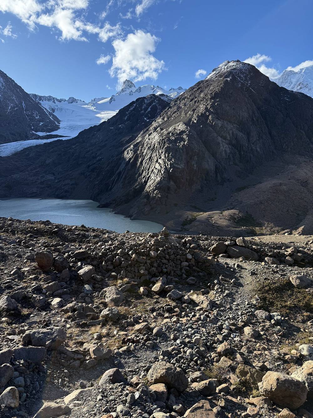
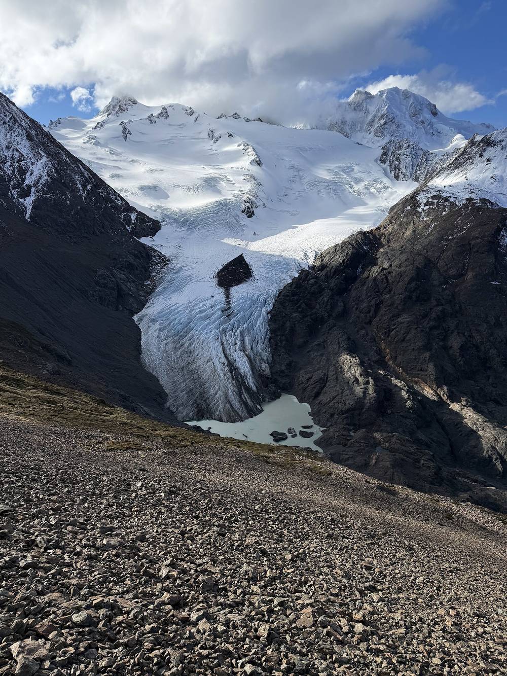
Amazing day of hiking. It started with a steep but colorful climb, with a rope fixed on one scramble, up to our first view of the glacier. Just past Paso Huemul there's a high vantage point for the glacier: the Glaciar Viedma, huge and striped, filling the valley below.
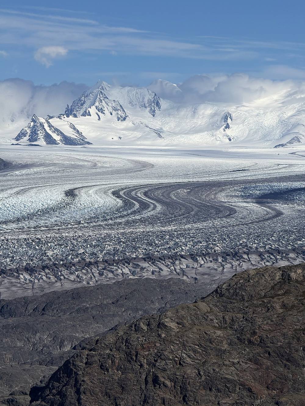
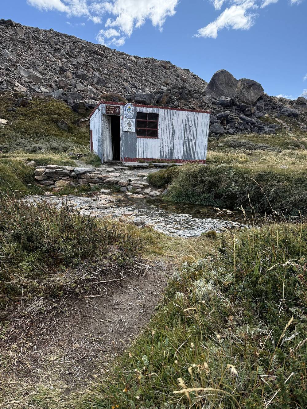
Then a long traverse north above the glacier, the four of us sometimes together and sometimes spread out. I'd go back and forth between hiking by myself and hiking with the others. We passed the little Refugio Paso del Viento hut in the afternoon.
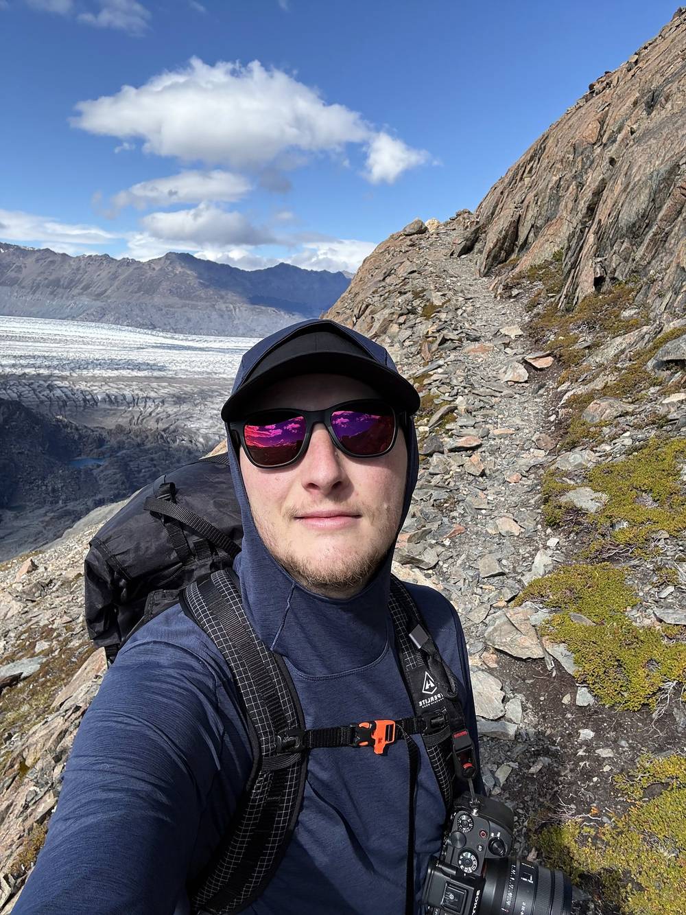
The big summit of the day was Paso del Viento: a big summit with wind, but incredible views. Then the campsite down the other side, with even more wind. It's a very small clearing with only a few rock circles, for mostly small tents. Very windy, but nice views, and a little walk up to the stream to get water. That night was tortellini, with the moon coming up over the peaks.
Up to Paso Huemul. From the camp the trail climbs steeply through lenga forest and rock, about 2,400 ft in 2.4 miles, with a fixed rope on one rocky step. Paso Huemul is at mile 2.4 (3,250 ft on my GPS). The park doesn't allow camping at the pass. Just beyond it, at mile 2.6, the view opens over the Glaciar Viedma. In the park's usual direction this is the steep descent to the lake, with ropes; going my way it's a climb.
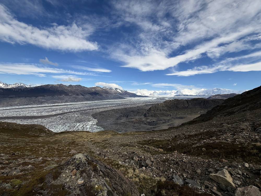
Above the Glaciar Viedma. The trail drops to about 2,450 ft and runs north for about 7 miles on the slopes above the glacier, past small lakes and over streams, slowly climbing to about 3,000 ft. The park warns that the Río Paula, on this stretch, can rise: cross early in the day, and don't cross it in flood.
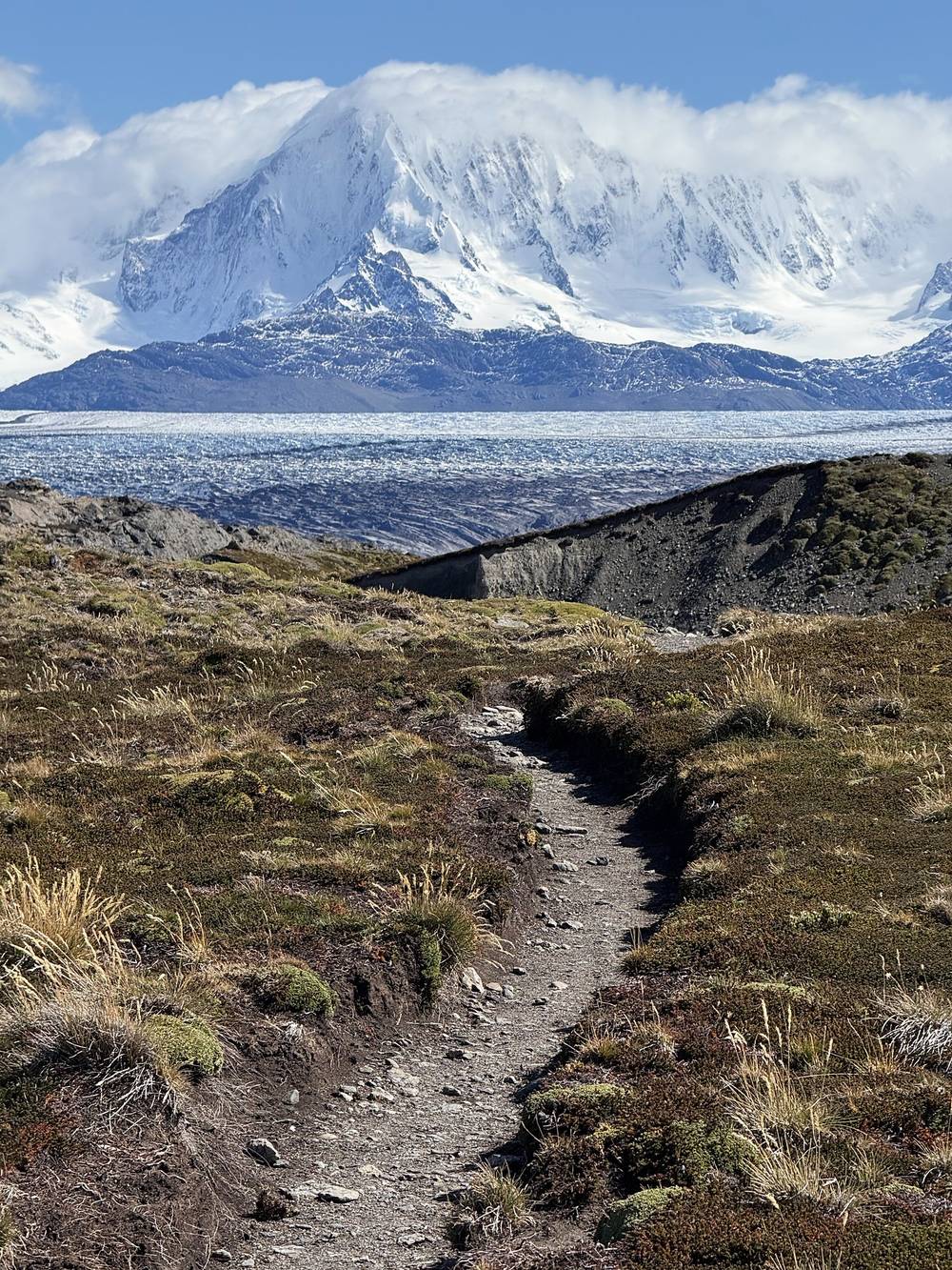
Refugio Paso del Viento. At mile 10.1 (3,010 ft) is the small Refugio Paso del Viento, beside a stream, and the Paso del Viento camp. It's one of the park's three camps on the circuit. The hut is for shared use: the park says to sleep in your tent and keep food and trash out of the hut because of mice.
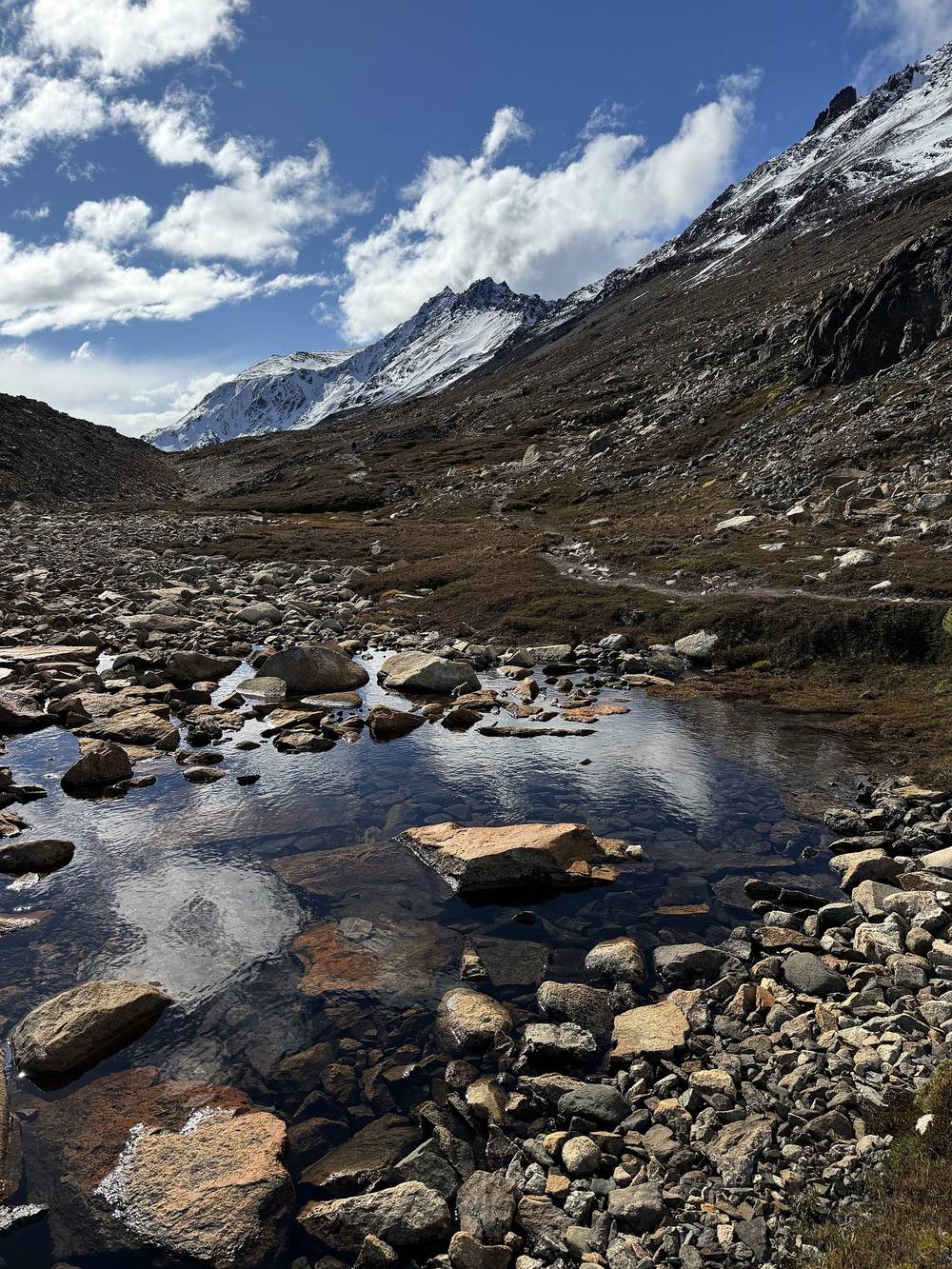
Paso del Viento. From the refugio the trail climbs about 1,600 ft in under 3 miles over rock and old snow to Paso del Viento at mile 12.9, 4,640 ft (1,414 m) on my GPS, the high point of the loop. On the far side it drops steeply on loose rock toward the Glaciar Túnel and Laguna Túnel Superior.
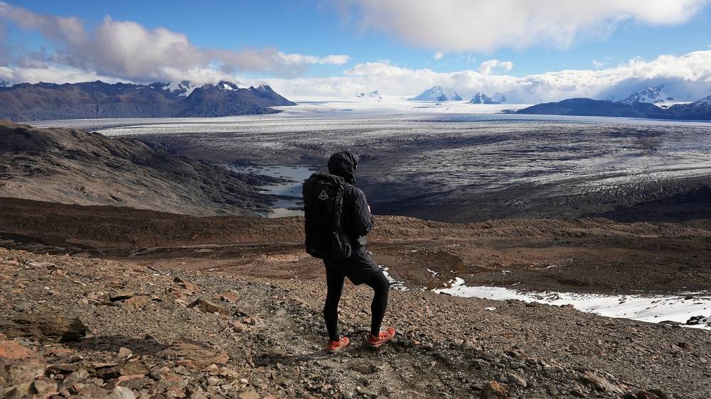
My camp. I camped at mile 14.7 (3,000 ft), a small clearing with rock windbreaks above the Glaciar Túnel. It isn't one of the three camps listed on the park's registration form, and the park's briefing says not to go down to Laguna Túnel Superior, so ask the rangers before planning on it. The park's own plan is to sleep at the Paso del Viento camp, before the pass.
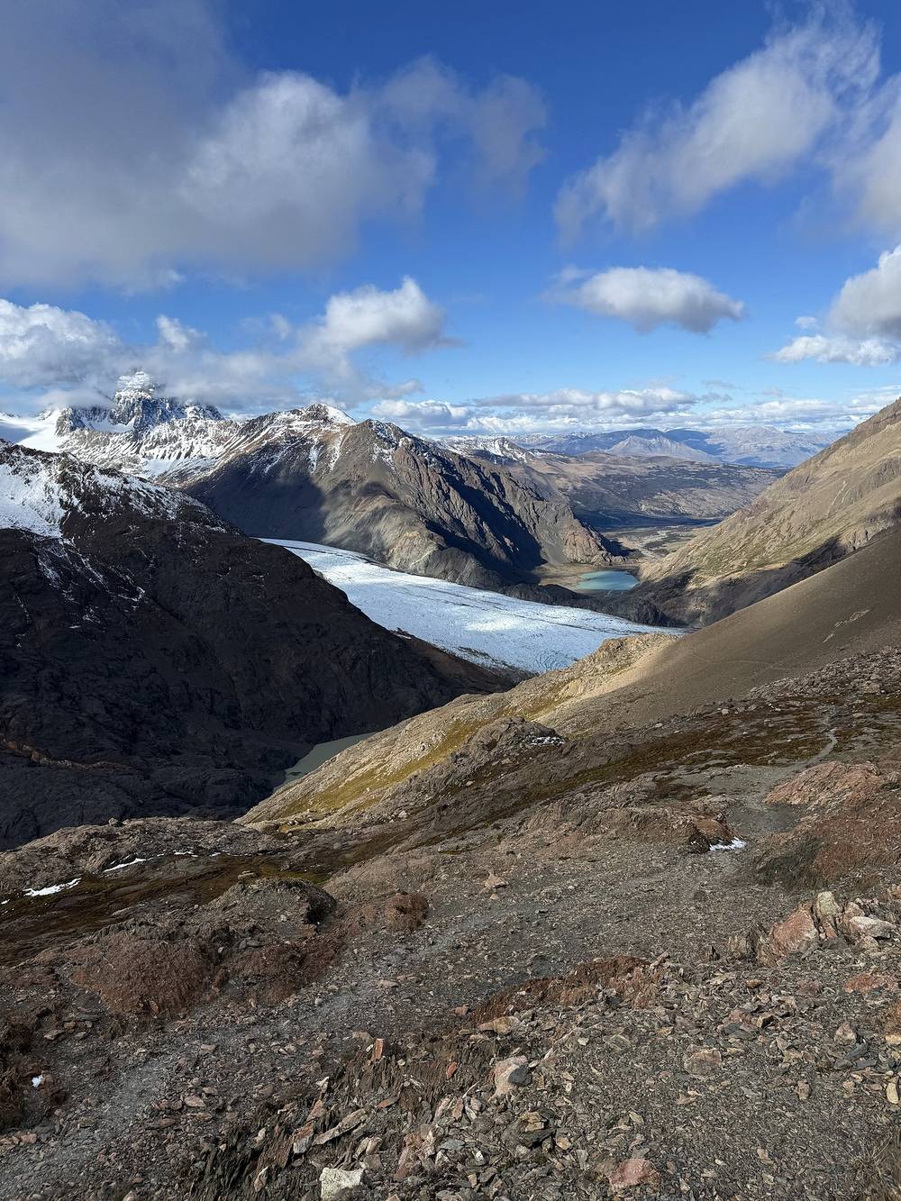
Before Paso Huemul, go back to Bahía de los Témpanos and the shore. Past it, you're committed: the nearest way out is over Paso del Viento and down to Laguna Toro and El Chaltén. Don't go over either pass in high wind. The refugio is a shelter if you're stuck.
Film, Day 2 · How I did it (behind the scenes)
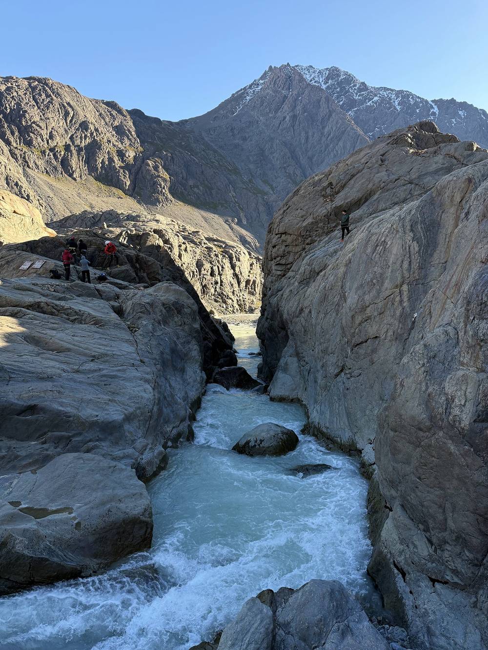
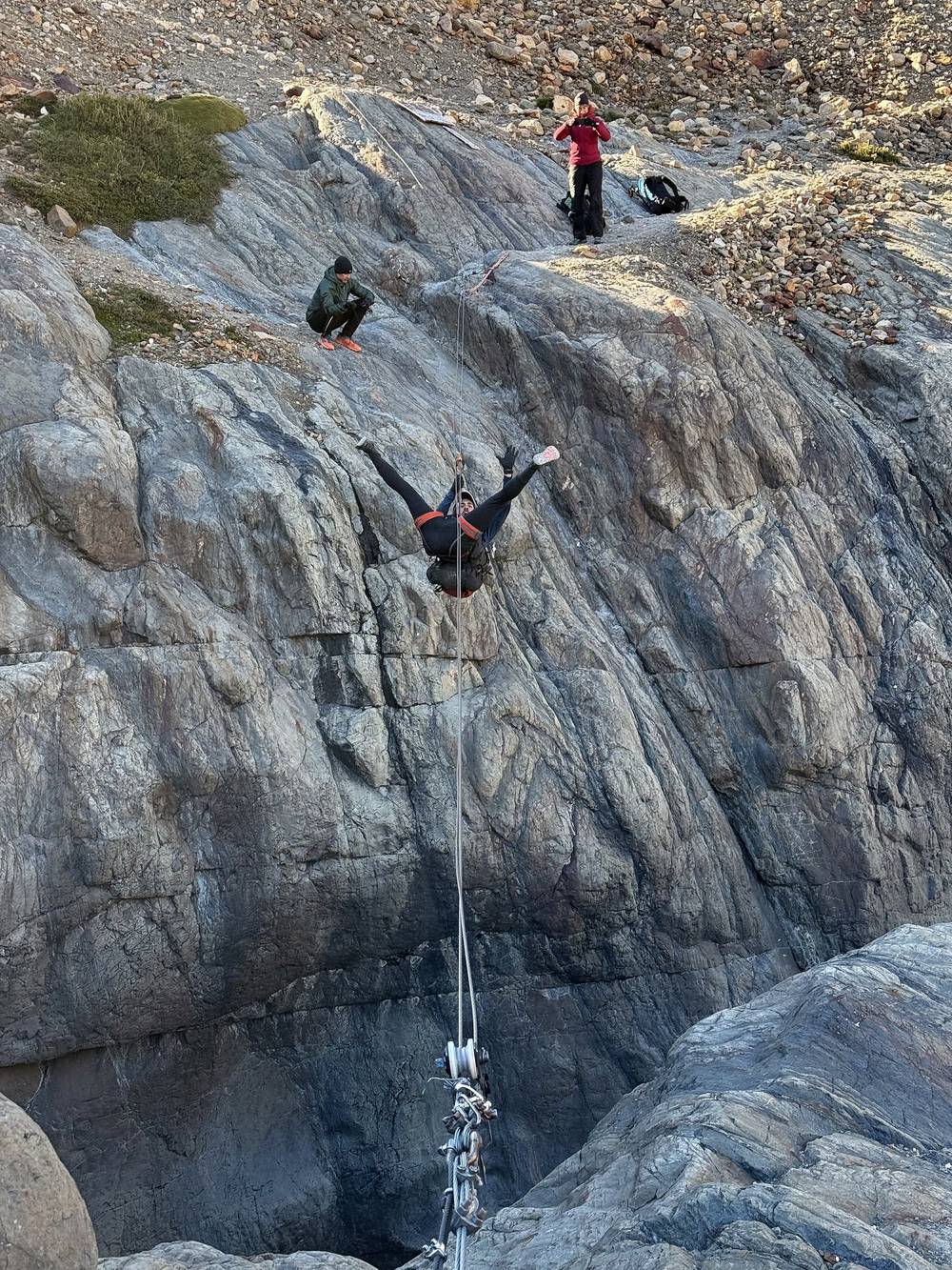
We had the upper campsite all to ourselves, but also had crazy wind ruffling the tents all night long. Then down past the small glacier and over the last cables. This was our second and last river crossing, in a big gorge, so a much more dangerous and scary crossing on the cable with a harness. We didn't explore it, but I could kind of see where I'd cross if I didn't have a harness. It would get wet and wouldn't be fun, but doable in our season.
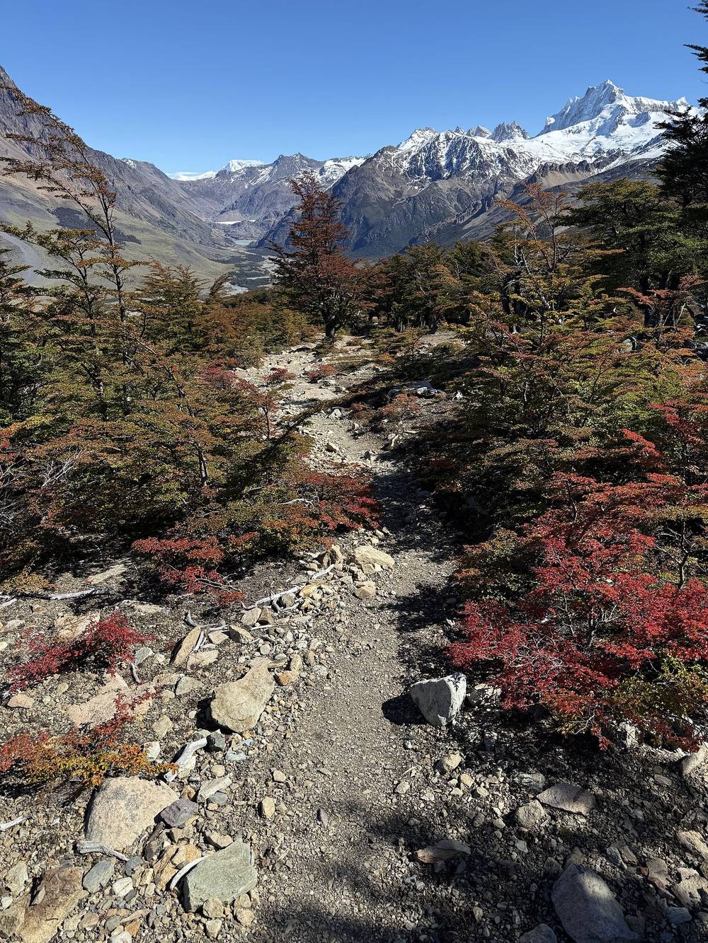
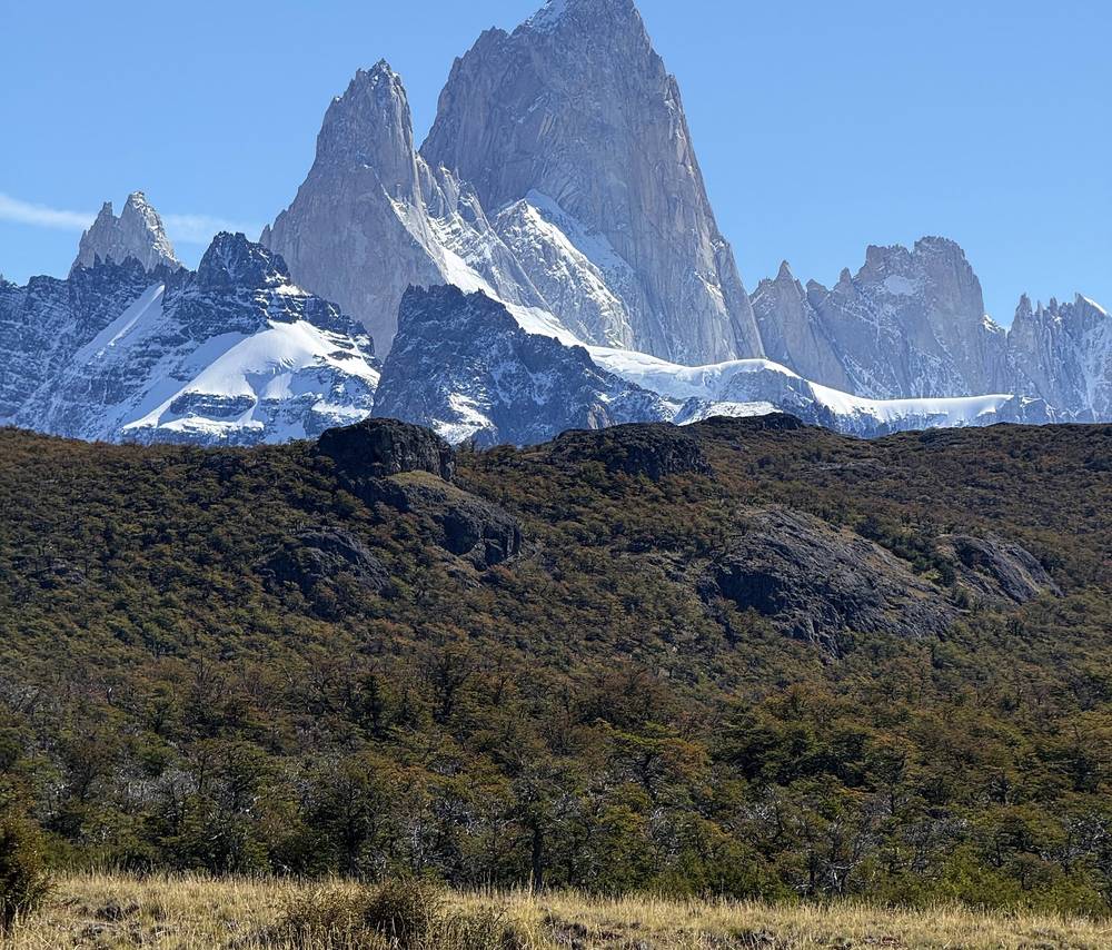
Then long relaxing last few hours through quiet forest, with classical music off my phone, and a view of Fitz Roy before town. Great time. After the hike: really good pizza and beer, a great dessert spot, and Monopoly Deal.
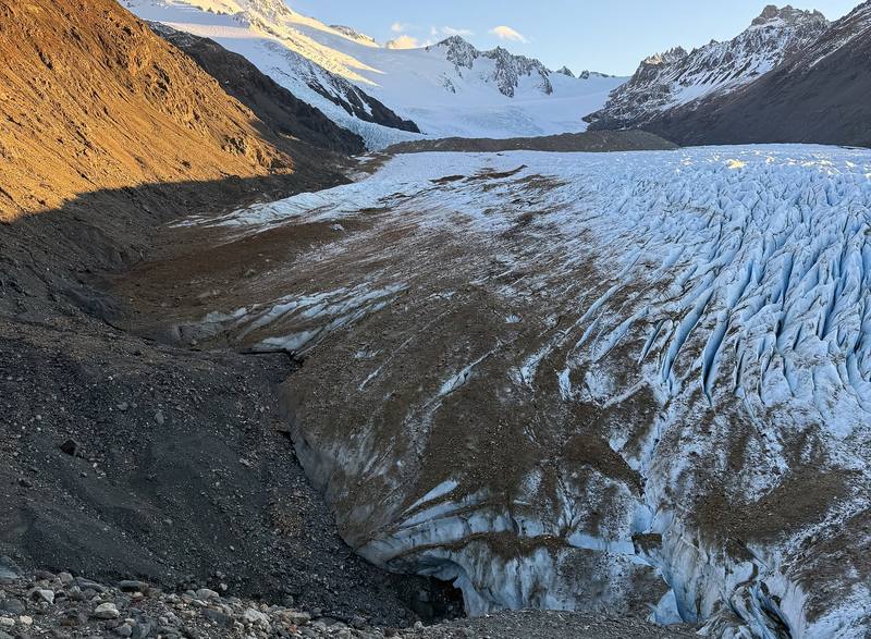
Down beside the Glaciar Túnel. From the camp the route drops along the moraine at the edge of the Glaciar Túnel, steep and loose, with the crevassed ice beside you. In the park's usual direction you cross a short stretch of the glacier here; the park says the way on and off the ice changes over time and is dangerous, with rockfall. Stay off unstable slopes and watch for falling rock.
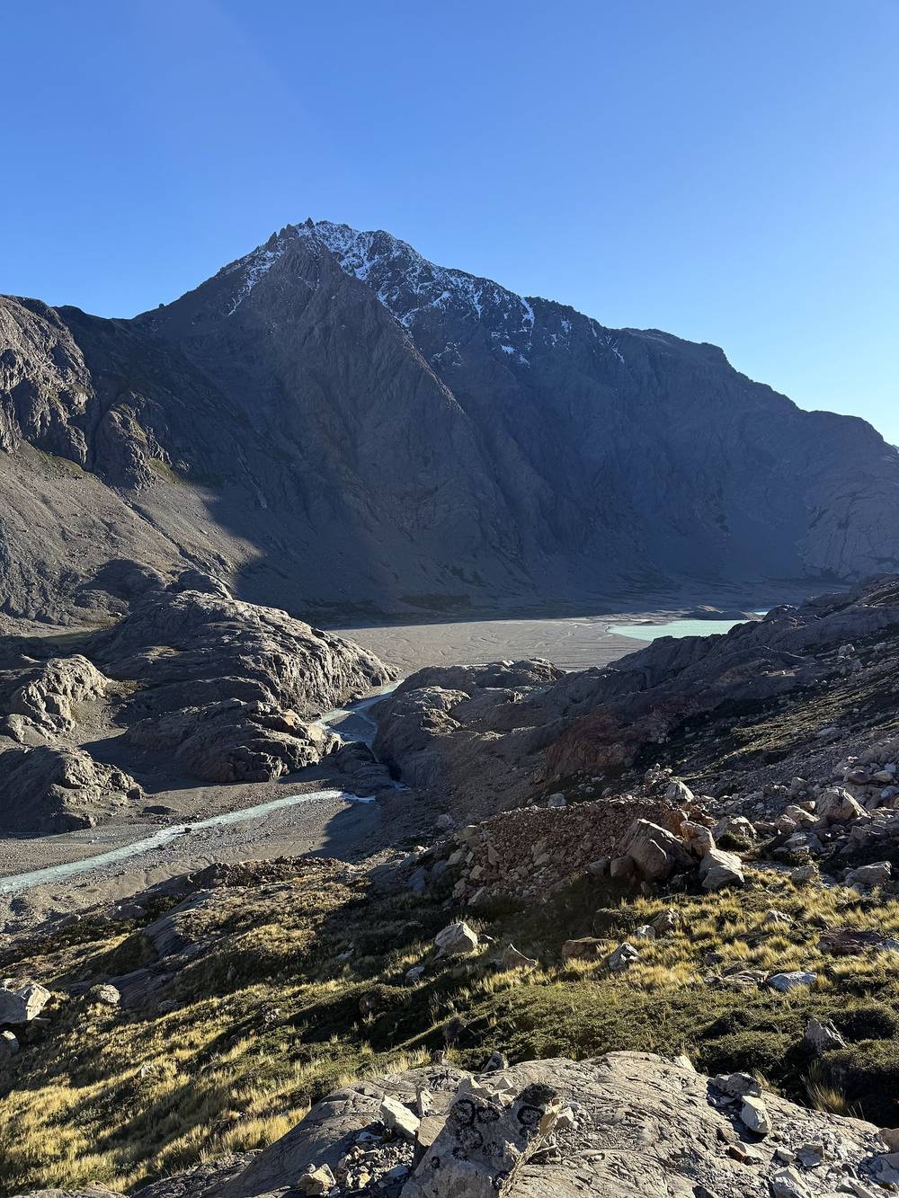
The upper cable. At mile 2.0 (2,240 ft) the cable crosses the Río Túnel where it runs through a narrow rock gorge. My GPS shows our group of four at the crossing for about 50 minutes, getting everyone and their packs across. The park lists fording the river as the alternative, in suitable water levels.
Laguna Toro. The trail follows the river down to Laguna Toro and the Laguna Toro camp at its east end, mile 3.9 (2,150 ft), with a small emergency shelter. This is the park's first camp in its usual direction.
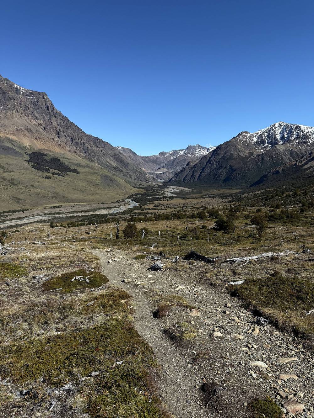
Back to town. From Laguna Toro the trail runs east down the wide Río Túnel valley for about 3 miles, then climbs through lenga forest to about 3,490 ft (mile 9.6) on the ridge south of Loma del Pliegue Tumbado, and drops back down, with a view of Fitz Roy at about mile 11.7. It ends at the park entrance and ticket control at the south end of El Chaltén, mile 14.4, by the visitor center.
Before the upper cable, the only way out is the cable or the river. After it, the trail to El Chaltén is the way out, and it's the busy, marked Laguna Toro trail.
Film, Day 3 · How I did it (behind the scenes)
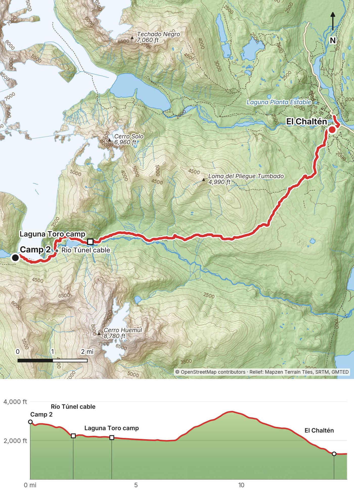
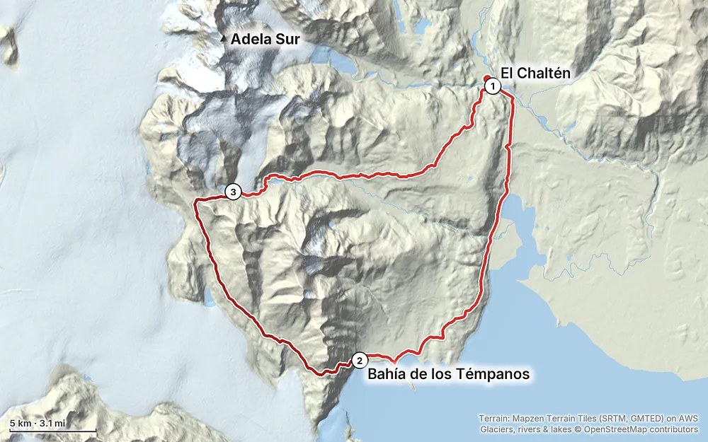
Elevation827–4,639 ft45.6 mi
Terrain: Mapzen Terrain Tiles (SRTM, GMTED) on AWS · Glaciers, rivers & lakes © OpenStreetMap contributors
Tap a map to open it full size.
All of this was checked on the park's own pages and its registration form in September 2026, except where it says otherwise.
Registration. Required and free. Fill in the park's online form, "Registro de uso de montaña en áreas remotas," linked from the Los Glaciares activities page. One form per person: group registrations aren't accepted. It's a sworn statement and asks for your ID, where you're staying, your vehicle, itinerary, dates, campsites, companions, experience, equipment, health, insurance and an emergency contact. Do it every trip.
Check your route is open. The form says to go to the visitor center in El Chaltén (Centro de Visitantes, Seccional Lago Viedma, at the entrance to town), open daily 9 a.m. to 5 p.m., and ask whether your itinerary is open. Some trip reports say rangers also give a briefing and may check your gear; I couldn't confirm whether they still do.
Park entry fee. From June 1, 2026, entry to the El Chaltén side of Los Glaciares is ARS 50,000 a day for foreigners (half price for a second day within 72 hours), ARS 100,000 for a 3-day Flexipass or ARS 175,500 for a 7-day Flexipass. Ask at the visitor center which ticket covers a multi-day trek. In El Chaltén the park charges in the main season, from October 1. Tickets are bought online (ventaweb.apn.gob.ar) or by scanning the QR code at the trail entrance, card only, no cash. The park began charging entry on the El Chaltén side in October 2024.
Private land. The walk between town and Bahía Túnel crosses fenced farmland: follow the yellow markers along the wire fence. We climbed over the fence on a stack of crates and crawled under a wire, and walked past cows. My records show no payment on the trail, and I found no official fee for 2026; if someone asks, ask the park.
A guide. Not required by any rule I found. Experience on cables and in the mountains is.
Gear for the cables. The park's briefing (the 2022-2023 version is the newest I found) lists, per person, a harness, two locking carabiners and a safety line (a rope or a daisy chain), and per group a steel carabiner, 35 m (115 ft) of thin cord, a stove and a topographic map. Never clip an aluminum carabiner straight onto the steel cable: use a steel one. Shops in El Chaltén rent harnesses (trip reports, not an official source).
Camping. Camp only at the sites the park allows. Its form lists three for the Huemul: Laguna Toro, Paso del Viento, and Bahía de los Témpanos / Cabo de Hornos. No camping at Paso Huemul. At the Refugio Paso del Viento, sleep in your tent, not in the hut. I found no camp fees.
Fires and waste. Campfires are strictly forbidden; a stove is required. Carry out all your trash, food scraps too. Go 50 steps from any water to use the toilet or wash, and don't use soap in streams.
Rescue. The park can bill you for an extraordinary rescue. Get insurance that covers mountain rescue, helicopter and search.
The season. The circuit is a summer trek, roughly November to March; the trails out of El Chaltén are busiest December to February. I found no official opening and closing dates for the Huemul. Ask the park.
What I got. We started on March 6, 2025, in grey skies and rain along the lake, especially at camp. Mostly flat and wet. We were trying to figure out the best schedule for the weather, and I think it all worked out: honestly, the rainy day was the day to do the flat lake section, with no wind. Day 2 was an amazing day of hiking, mostly sunny with big clouds, with wind on the pass and even more wind at camp. Day 3 was clear, after a night of crazy wind.
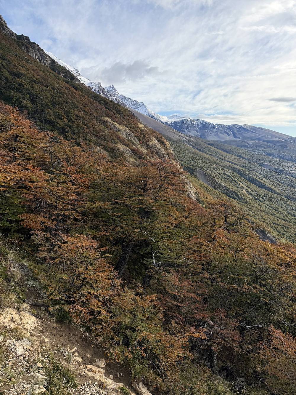
Autumn colors. In early March the lenga trees were starting to turn red and orange on the climb from Lago Viedma and in the forest on Day 3.
Wind. Patagonian wind is the thing to plan around. The park advises against the high days in strong wind, and warns about wind at Paso Huemul in particular. Check a forecast for the passes before you go up, and keep a spare day.
Emergencies. There's no phone signal on the circuit. The park's numbers (from its 2026 registration form): 24-hour emergencies +54 9 2966 383 599, also reachable by inReach at icepnlgzn@gmail.com; the ranger station in El Chaltén +54 2962 493 004; Gendarmería (border police) +54 2962 493 140; VHF 150.395 MHz. Carry a satellite messenger. Tell the park, and someone at home, when you're back.
Wind. It's what Patagonia is known for. We had wind on Paso del Viento and crazy wind at camp all night. The park advises against the high days in strong wind and warns about Paso Huemul in particular. Wait it out rather than cross a pass in a gale.
The cables. A fall on a cable crossing or into the river is the biggest risk. Use the right harness and carabiners, check everything twice, and have someone experienced in the group. Dave made sure everyone was safe and confident before they went over. Don't ford the Río Túnel when it's high; the park warns it can be deeper on your return.
Glacier and moraine. The edge of the Glaciar Túnel and the slopes below Paso del Viento are steep, loose and prone to rockfall. Move carefully and don't linger under loose slopes.
Fire. Fires are banned for a reason: the January 2026 fire burned about 704 hectares (1,740 acres) and hikers had to be evacuated, some by boat. Use your stove carefully, on rock, out of the wind.
Cold and rain. Rain, snow and cold can come in any month. Carry warm and waterproof layers and keep your sleeping bag dry.
Leave a plan with someone at home: your route, your camps and when you'll be out. Registering doesn't start a search if you're late: the park's form says search and rescue starts only when someone reports a specific emergency. Give your contact the park's 24-hour number, +54 9 2966 383 599, and tell them when to call it.
Is the circuit open? Check before anything else. A wildfire started on January 4, 2026, next to the lower Río Túnel cable crossing and burned about 704 hectares (1,740 acres). From January 17, 2026, the park allowed only Laguna Toro to Paso del Viento and back, the same way. Going on to Bahía de los Témpanos or coming out by Bahía Túnel was not allowed. That closed part is my whole Day 1 and most of my Day 2. As of September 2026 I found no announcement that the full loop has reopened. The park's registration form tells everyone to ask at the visitor center in El Chaltén whether their route is open.
Do I need a guide? No park rule requires one; the park says you can go on your own or with a guide. But the park says mountaineering experience is essential, and that you and your partners have to be self-sufficient if anything goes wrong. I went with three friends. Dave in our group had great experience with the cables, and he took the lead and made sure everyone was safe and confident before they went over. If nobody in your group has used a harness on a fixed cable, hire a guide or learn it first.
What are the cables? There are two river crossings with a steel cable strung across the Río Túnel: one near Bahía Túnel and one in a gorge below the Glaciar Túnel. You clip your harness to a pulley on the cable and pull yourself across (a Tyrolean traverse); a cord pulls the pulley back for the next person. The park says the cables are there to evacuate injured people, and it isn't responsible for hikers' use of them. I'd never done it before. It was a bit scary: it's such a scary moment when you fully commit and all your weight is on the cable. The park lists a harness, two locking carabiners and a safety line for each person. See Permits and rules.
Is there glacier travel? The park's usual route crosses a short stretch of the Glaciar Túnel. Going my direction, my GPS track runs down the moraine along the edge of the ice, past the small glacier, and doesn't cross it on the map's glacier outline. The park says crampons normally aren't needed there, but that the way on and off the ice changes and has rockfall.
How many days do I need? I did it in three long days of 15 to 16 miles each. The park plans four days, with camps at Laguna Toro, Paso del Viento and Bahía de los Témpanos. Add a spare day for wind.
Do I need to register? Yes. Registration is free and online, one form per person, every trip. You also need a park entry ticket for the El Chaltén trails, card only. See Permits and rules.
Is there water? Plenty: lakes, streams and glacier melt the whole way. The park says the water is pure, but avoid standing water where cattle graze near Bahía Túnel. I filtered from streams.
Will I see other people? Some: other hikers registered for the circuit, and day hikers near town. On our second night we had the upper campsite all to ourselves.
The park presents the circuit the other way around: El Chaltén to Laguna Toro (about 15 km), Laguna Toro over the Glaciar Túnel and Paso del Viento to the refugio (about 12 km), the refugio over Paso Huemul to Bahía de los Témpanos (about 16 km), and Bahía de los Témpanos to Bahía Túnel and town (about 20 km). It gets the glacier and the upper cable done first, and Paso Huemul becomes a steep descent to the lake. My GPX files work in either direction.
I went the opposite way and did it in three long days, starting with the flat lake section on a rainy, windless day. It worked, but each day was 15 to 16 miles, and Day 2 was more than 10 hours.
After the January 2026 fire this was the only part the park allowed: Laguna Toro to Paso del Viento and back the same way, with the upper cable and the glacier. It's my Day 3 in reverse, plus the climb to the pass.
The trail from El Chaltén to Laguna Toro is a long day hike or an overnight without any cables: 16 km (10 miles) each way on the park's leaflet, 11.1 miles from the Laguna Toro camp to town on my GPS.
These change every year. Everything else in this guide stays the same.
Rules and status
Getting there
Conditions
Your stuff
The film is at the top of this page.
Planning questions about Cerro Huemul Circuit, answered only from this page's facts, the creators' versions and hikers' public tracks, with where each answer comes from. When the data doesn't say, the answer says "not given".
From hikers
Sign in to comment. Free; your hikes stay private unless you share them.
Something wrong or missing on this page? Send feedback.