
Content made there
The film is at the top of this page.
Photos
Hikes / The Azores / Kraig Adams's version
Europe · Portugal
Feb 29 – Mar 8, 2024 · a week · Solo · Tent

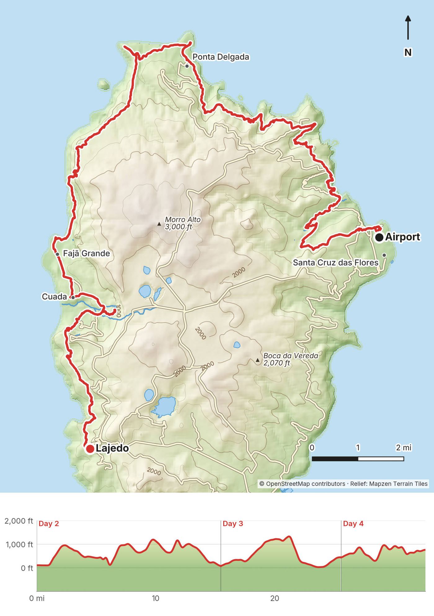
In late February and early March 2024 I spent a week alone in the Azores, the Portuguese islands in the middle of the Atlantic. I hiked the rim of the Sete Cidades crater on São Miguel, flew to Flores and walked the Grande Rota das Flores in three days, from the airport at Santa Cruz round the north and west coasts to Lajedo, with a night in my tent at Ponta Delgada and a night at Aldeia da Cuada, and then flew to Corvo, the smallest island, to walk the rim of its crater, the Caldeirão. Five hikes, about 47.3 miles (76.1 km) by my GPS. It's the trip from my film Hiking Alone in the Azores.
It was the very quiet season. I didn't see a single other hiker on the trail, I camped on my own at empty campsites, and wind and a stormy sea kept me on Corvo for two extra nights.
| Quick facts | |
|---|---|
| Distance | 47.3 miles (76.1 km) over 5 hikes by my GPS: 8.5 on São Miguel, 32.7 on Flores, 6.2 on Corvo |
| Climbing | About 8,150 ft (2,480 m) up and 10,760 ft (3,280 m) down in all, by my GPS |
| Islands | São Miguel (the main island and airport), Flores and Corvo (the far west, about 316 miles from São Miguel) |
| Days | 5 hiking days in a week: one on São Miguel, three on Flores, one on Corvo |
| Trails | Sete Cidades (much of official trail PR04SMI); the Grande Rota das Flores (GR01FLO); on Corvo, the Caldeirão rim and the road down |
| Highest point | About 2,770 ft (845 m) on the Sete Cidades rim, by my GPS |
| Difficulty | Moderate. No scrambling, but steep, slippery climbs and descents on Flores, cliff-edge paths, mud and rain |
| Sleep | Free campsites in Sete Cidades and Ponta Delgada (Flores), a rural guesthouse at Aldeia da Cuada, a hotel on Corvo |
| Rules (2026) | No permits and no trail fees. No camping outside campsites. Drones need permission in the parks |
| Day | Island and route | Miles (km) | Up / down (ft) | Sleep |
|---|---|---|---|---|
| 1 | São Miguel: Lagoa do Canário to Sete Cidades | 8.5 (13.7) | 604 / 2,129 | Sete Cidades campsite |
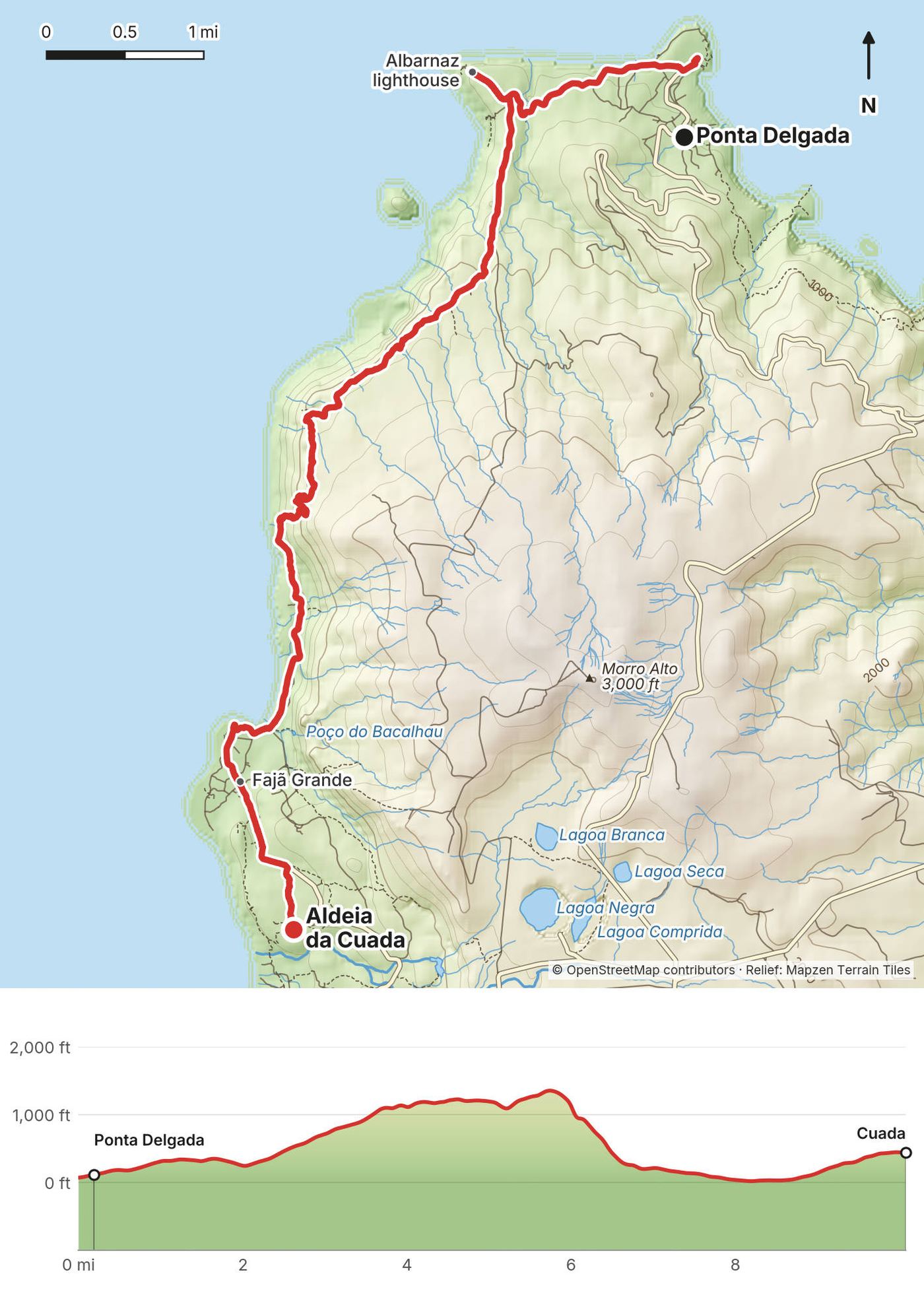
| 2 | Flores: the airport to Ponta Delgada | 15.5 (24.9) | 3,553 / 3,579 | Ponta Delgada campsite |
| 3 | Flores: Ponta Delgada to Aldeia da Cuada | 10.1 (16.2) | 1,933 / 1,564 | Aldeia da Cuada |
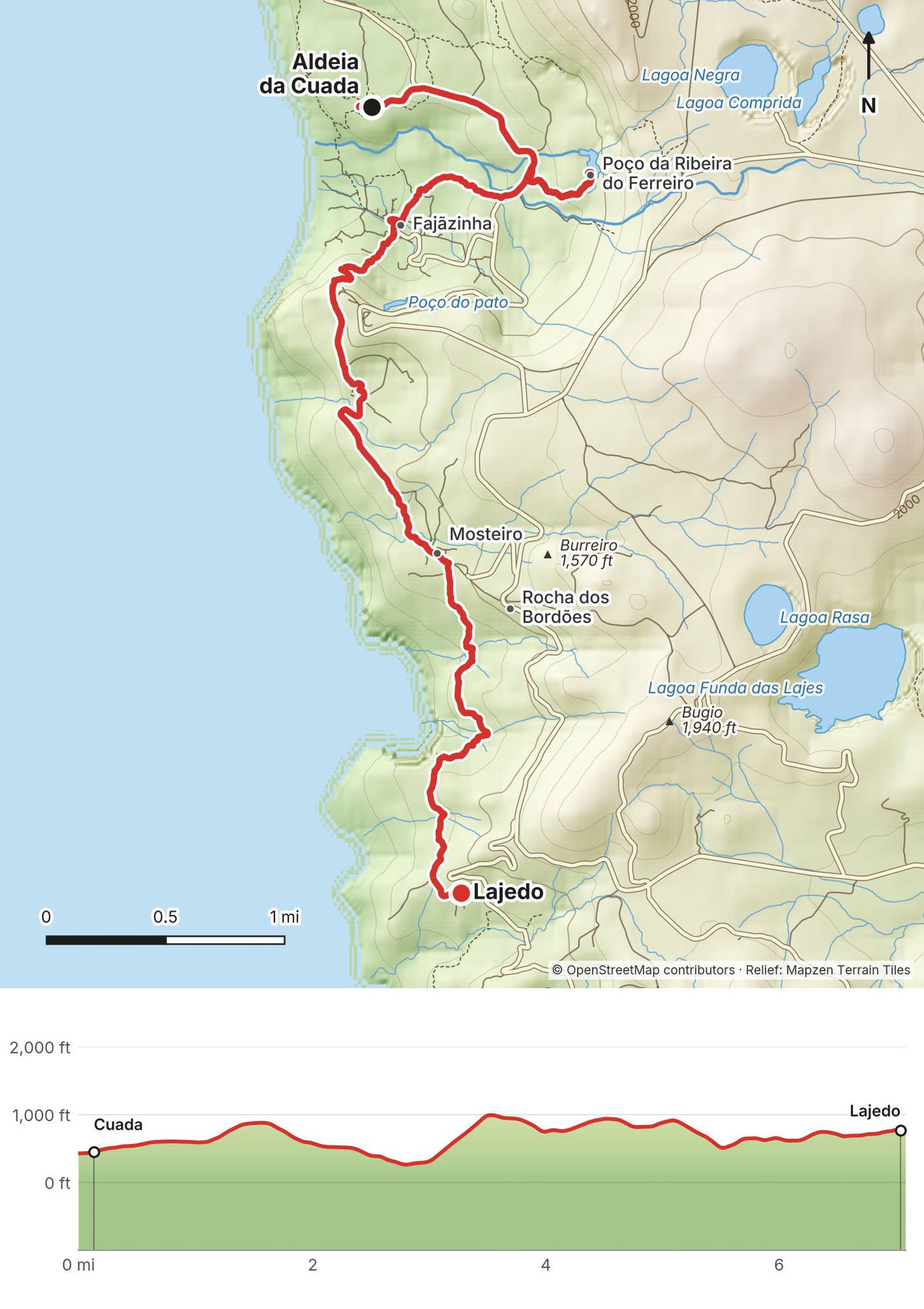
| 4 | Flores: Aldeia da Cuada to Lajedo | 7.1 (11.4) | 1,756 / 1,410 | On Flores |
| 5 | Corvo: the Caldeirão to Vila do Corvo | 6.2 (9.9) | 306 / 2,079 | Vila do Corvo |
Flying to the Azores. Azores Airlines flies to Ponta Delgada (São Miguel) from Boston (about six times a week, about 6 hours), New York JFK, Toronto and Montreal. Round trips from Boston were shown from about $623 for February 2027 (Azores Airlines, October 2026). United flies from Newark in summer only. From Lisbon or Porto, Azores Airlines and TAP fly to Ponta Delgada; Ryanair left the Azores in March 2026 (as reported).
São Miguel to Flores. SATA Air Açores flies Ponta Delgada to Flores direct in small propeller planes, about 1.5 hours on one published schedule (as reported; check the timetable). Round trips were shown from €161 to €188 for winter 2026-27. Cheap fares may include only 10 kg of checked baggage (as reported). The €60 inter-island fare you may read about is for Azores residents only.
Flores to Corvo. By plane, the shortest flight in the islands: a few minutes in the air. Round trips were shown from €68 (October 2026). By ferry, Atlânticoline's Pink Line from Santa Cruz das Flores to Vila do Corvo takes about 40 minutes and costs €16.30 one way for visitors (as reported, August 2026). It sails most often from June to September and on only some days, or not at all, in winter (as reported): check Atlânticoline's timetable for your dates. Both the boat and the plane are cancelled in bad weather. I flew there, then my booked ferry back was cancelled, and then two flights.
Gas for your stove. You can't fly with camping gas. I bought a canister at Decathlon in Ponta Delgada and airport security took it the next morning. Buy gas on the island where you'll use it, or plan to eat in restaurants.
On São Miguel. I took a taxi from Ponta Delgada to the start near Lagoa do Canário. Buses run from Ponta Delgada to Sete Cidades about four times on weekdays, about an hour and €3 to €4 (as reported).
On Flores. I walked out of the airport and started hiking. Taxis are the way to get around: about €5 from the airport to Santa Cruz, €20 from Santa Cruz to Fajã Grande or Lajedo, €15 from Fajã Grande to Lajedo and €30 from Fajã Grande to Ponta Delgada (as reported; ask the fare when you book). Buses run Santa Cruz to Fajã Grande twice on weekdays only. Book the taxi at the end of the trail for the right time: I hiked faster than I planned and waited two hours in the cold.
On Corvo. A van or taxi from the village up to the Caldeirão costs about €5 each way (as reported); I paid about $10 for the ride up. Walking up the road takes 1.5 to 2 hours (as reported).
Money. There's no cash machine on Corvo, and the one in Fajã Grande is reported to be often broken. Bring euros from Santa Cruz das Flores. Small cafés are often cash only.
I didn't keep a list of what this trip cost me.
For your budget, a week like mine for one person (prices shown in October 2026, as reported):
| Item | Low | High |
|---|---|---|
| Ponta Delgada to Flores and back, with Corvo | €161 | €260 |
| Flores to Corvo, ferry or plane | €16 | €40 |
| Taxis on São Miguel and Flores | €60 | €130 |
| Corvo van to the Caldeirão | €5 | €10 |
| 2 nights in Ponta Delgada | €40 | €160 |
| 2 nights on Flores (Santa Cruz, Aldeia da Cuada) | €110 | €250 |
| 1 night on Corvo, plus a spare night | €0 (campsite, May to October) | €200 |
| Campsites (Sete Cidades, Ponta Delgada) | €0 | €0 |
| Food, 7 days | €140 | €280 |
| Total, without your flight to the Azores | about €530 | about €1,330 |
Add the flight to Ponta Delgada (from about $623 round trip from Boston in February 2027) and travel insurance that covers medical evacuation and delays.
The Azores are nine islands in three groups. This trip uses two of them: São Miguel, in the east, where the international flights land, and Flores and Corvo, the western group, about 316 miles (509 km) from São Miguel. Flores and Corvo are about 15 miles (24 km) apart.
São Miguel. The biggest island and the way in: Ponta Delgada has the international airport, the shops and the most beds. The Sete Cidades crater is about an hour away by bus (as reported), or a taxi ride. Spend your first and last nights in Ponta Delgada.
Flores. The island for walking: steep green valleys, waterfalls down sea cliffs, and small villages along the coast. The Grande Rota starts at Santa Cruz das Flores, the main town, where the airport is. Base yourself in Santa Cruz for the start, then at Ponta Delgada (end of stage 1, a free campsite), and in Fajã Grande or Aldeia da Cuada for the west coast. There's no campsite or much else at Lajedo, where the trail ends: book a taxi back to Santa Cruz.
Corvo. One village, Vila do Corvo, with the airport and the harbour, and the Caldeirão crater above it. It's a day trip from Flores if the weather lets you back; I'd sleep there and leave a spare day, as I had to.
| Night | Where | Cost |
|---|---|---|
| 1 | My tent at the Sete Cidades campsite (São Miguel) | Free |
| 2 | My tent at the Ponta Delgada campsite (Flores) | Free |
| 3 | A stone house at Aldeia da Cuada (Flores) | From about €107 now (as reported) |
| 4 | On Flores, before the flight to Corvo | |
| 5 to 7 | A hotel in Vila do Corvo the first night, then two more nights in the village waiting for the weather |
Sete Cidades campsite. In the village, a few minutes from the lake: free, cold showers and toilets (as reported). I was the only one there, and honestly I'd rather have been in a hotel. It has had closures while waiting for upgrade works (as reported): check before you rely on it.
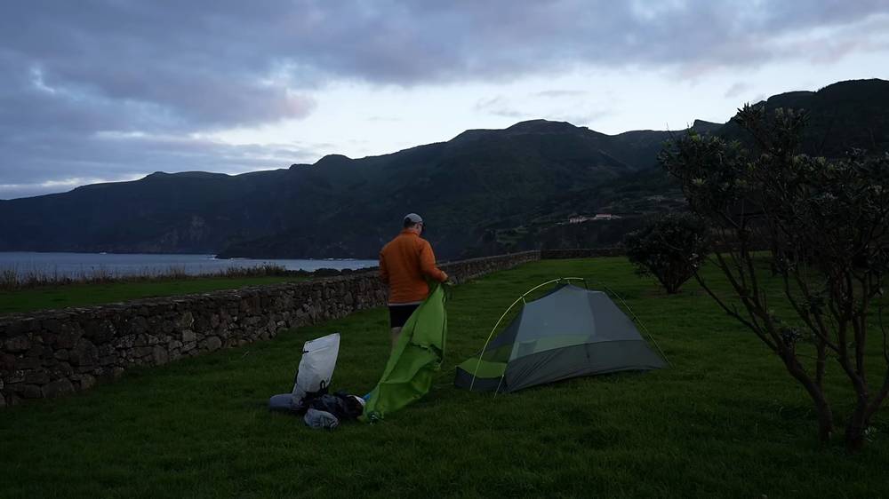
Ponta Delgada campsite (Flores). By the sea at the end of stage 1: free, drinking water and cold showers (as reported). I pitched my tent on the grass at dusk.
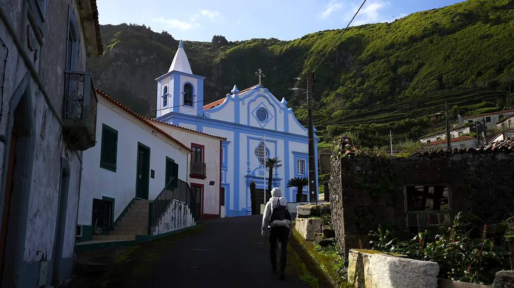
Aldeia da Cuada. A 17th-century hamlet above Fajã Grande, emptied by emigration in the 1960s and restored as 17 stone houses with kitchens, a restaurant and a laundry. From about €107 a night for one bedroom, less in the off season (as reported).
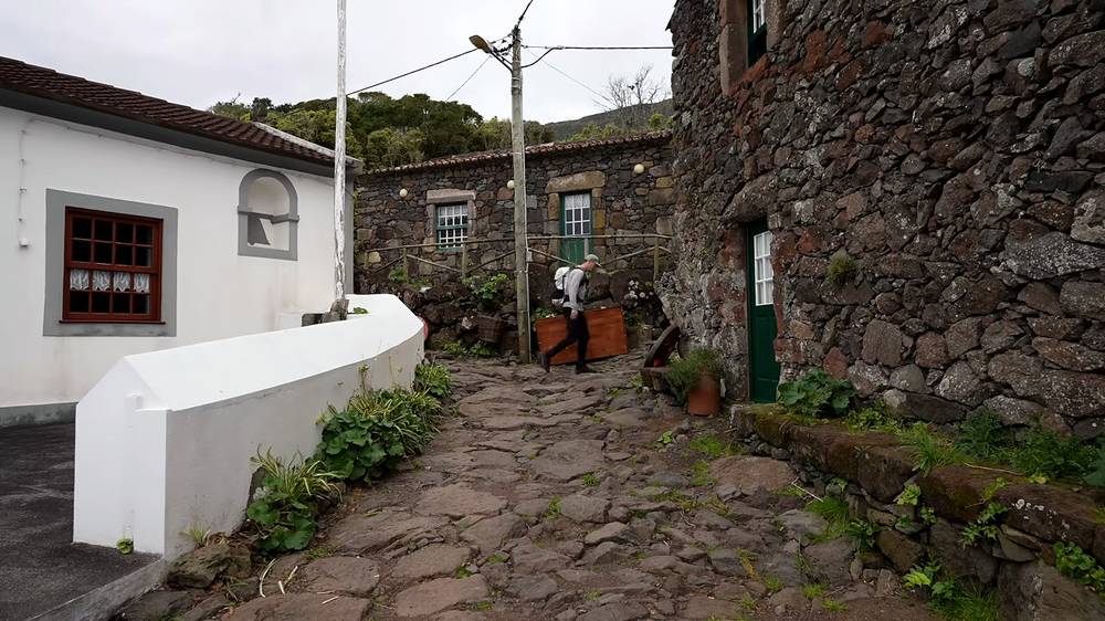
Corvo. One hotel (the Comodoro, 13 rooms), a few small rentals, and the campsite at Praia da Areia with written permission (as reported). If wind strands you, those few beds are all there is: book something flexible.
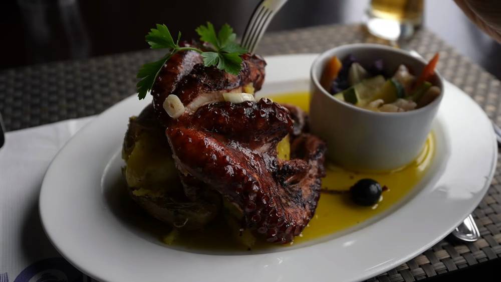
What I ate. Coffee and a pastry in Ponta Delgada, a salad in a café in Sete Cidades, noodles at the campsite, a sandwich and coffee at Flores airport, octopus in Fajã Grande, a steak at Aldeia da Cuada, and ham and cheese sandwiches on Corvo. I planned each day around which restaurants were open and carried snacks to the next village.
Shops. Supermarkets in Ponta Delgada and Santa Cruz das Flores (one is open on Sunday afternoons). Fajã Grande has a small grocery, closed on Sundays, and restaurants that may close off season (as reported). Corvo has two small shops with short hours, closed on Sundays, and a couple of places to eat.
I filled my bottle at village fountains (at the airport, in the villages along the coast) and once at a stream, and carried a filter. Villages on Flores have fountains; treat stream water, which runs through pasture. Carry enough for the long stretches: Day 3 has nothing between Ponta Delgada and Fajã Grande.
Paid links: I earn a commission if you buy through these links, at no extra cost to you. As an Amazon Associate I earn from qualifying purchases.
I have no full gear list for this trip: this is from my film, its description and my live stream.
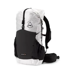 Pack: Hyperlite Mountain Gear Waypoint 35 (Hyperlite). The new pack on this trip. I just don't like how you can see through it sometimes.
 Sun hoodie: PATH Projects Pyrenees T19 Hoodie (PATH Projects)
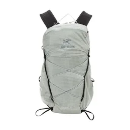 Daypack: Arc’teryx Aerios daypack (Arc’teryx)
My current kit for what these islands need.
 Rain shell: Arc’teryx Beta AR Jacket (Arc’teryx). Flores gets about 1,665 mm of rain a year.
 Warm layer: Arc’teryx Cerium Hoody (Arc’teryx). For the cold crater rims.
 Shoes: Oboz Katabatic LT Low GTX (Amazon). Waterproof, with grip for slippery rock, mud and wet grass.
 Poles: Black Diamond Alpine Carbon Z Poles (Amazon). For the steep, slippery descents on Flores.
 Water: Katadyn BeFree AC · 1L (Amazon). Treat stream water: it runs through pasture.
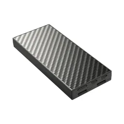 Power bank: Nitecore NB20000 (Amazon). For the phone you navigate with.
What I filmed this trip with in 2024. My setup is smaller now (below). Drones need permission in the parks: check The rules before you fly.
 Camera: DJI Osmo Pocket 4 (Amazon)
 Mic: DJI Mic 3 · 1 TX + 1 RX (Amazon). It pairs with the Pocket 4.
 Drone: DJI Mini 5 Pro (Amazon)
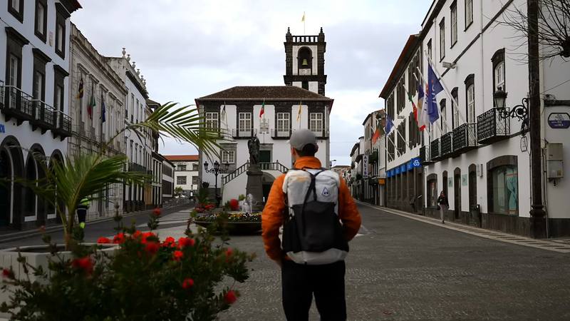
I flew into Ponta Delgada that morning, had a coffee and a pastry, bought food at a supermarket and a gas canister at the Decathlon, and packed my bag. Then I took a taxi up to the start, on the road by Lagoa do Canário.
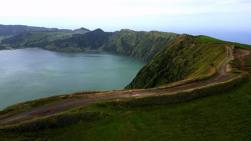
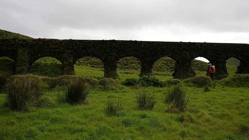
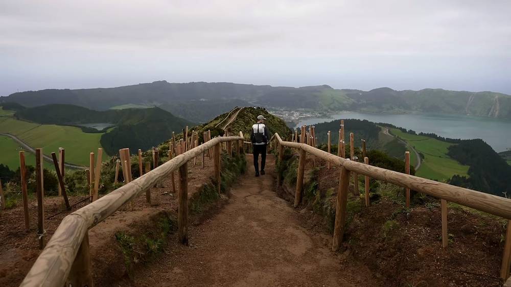
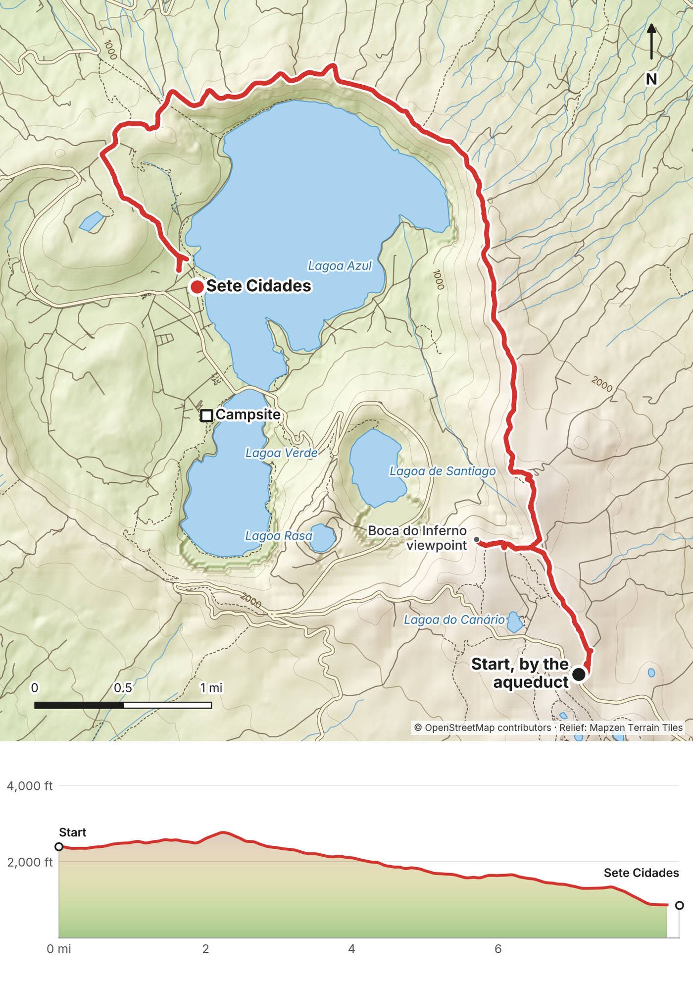
The walk starts past the Muro das Nove Janelas, an old stone aqueduct across a field. At mile 1.5 I went out to the Boca do Inferno viewpoint, a path with wooden railings along a ridge between the crater lakes, and back. Then I followed the dirt road along the east and north rim of the crater, high above Lagoa Azul, and dropped down into the village of Sete Cidades by the lake, at 2:40 p.m. It was overcast all day. The viewpoint was the best of it; the rest was mostly road, with a farm truck or two.
In the village I petted a ginger cat in a café, ate a salad, and walked to the campsite. I had it to myself. I cooked noodles and slept in my tent.
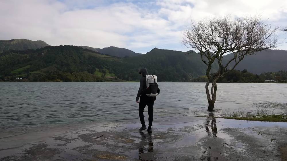
The start. The official trail PR04SMI starts near the Mata do Canário, on the east side of the crater. My recording starts on the road by Lagoa do Canário (about 2,400 ft), where the taxi from Ponta Delgada dropped me.
The aqueduct and Boca do Inferno. The trail passes the Muro das Nove Janelas, an aqueduct rebuilt in 1830, at mile 0.5. The spur to the Boca do Inferno viewpoint leaves at about mile 1.4: a short ridge path with railings and a view over Lagoa de Santiago, Lagoa Rasa and the big lakes. It's the busiest spot on the walk.
The rim. From the viewpoint road my track climbs to the high point (about 2,770 ft) and follows the dirt road along the east rim and round the north side of the crater, with the lake below on your left. At mile 5.3 it passes the Cumeeiras viewpoint.
Down to the village. The last miles drop steeply into the crater to Sete Cidades. The official page calls the descent "very slippery and inclined". The official trail ends at the church of São Nicolau; I walked down to the lake.
It's a road almost all the way, with no shelter. In fog you'll see nothing: Boca do Inferno alone, from the road near Lagoa do Canário, is the short version, and you can come back another day. If you only want the view, do that and skip the rim.
Ponta Delgada (from 0:42) · Sete Cidades (from 1:13)
A taxi took me to the airport before dawn, and I flew to Flores in a little propeller plane. I landed, had a sandwich and a coffee, bought a few groceries, filled my bottle at a stone fountain and started walking straight from the airport at 10:51 a.m.
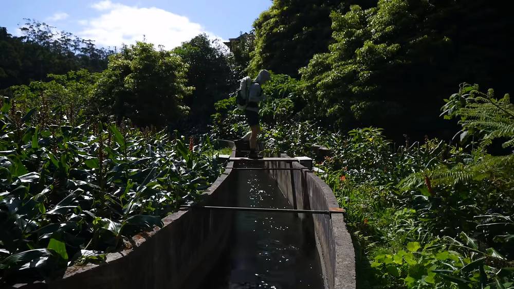
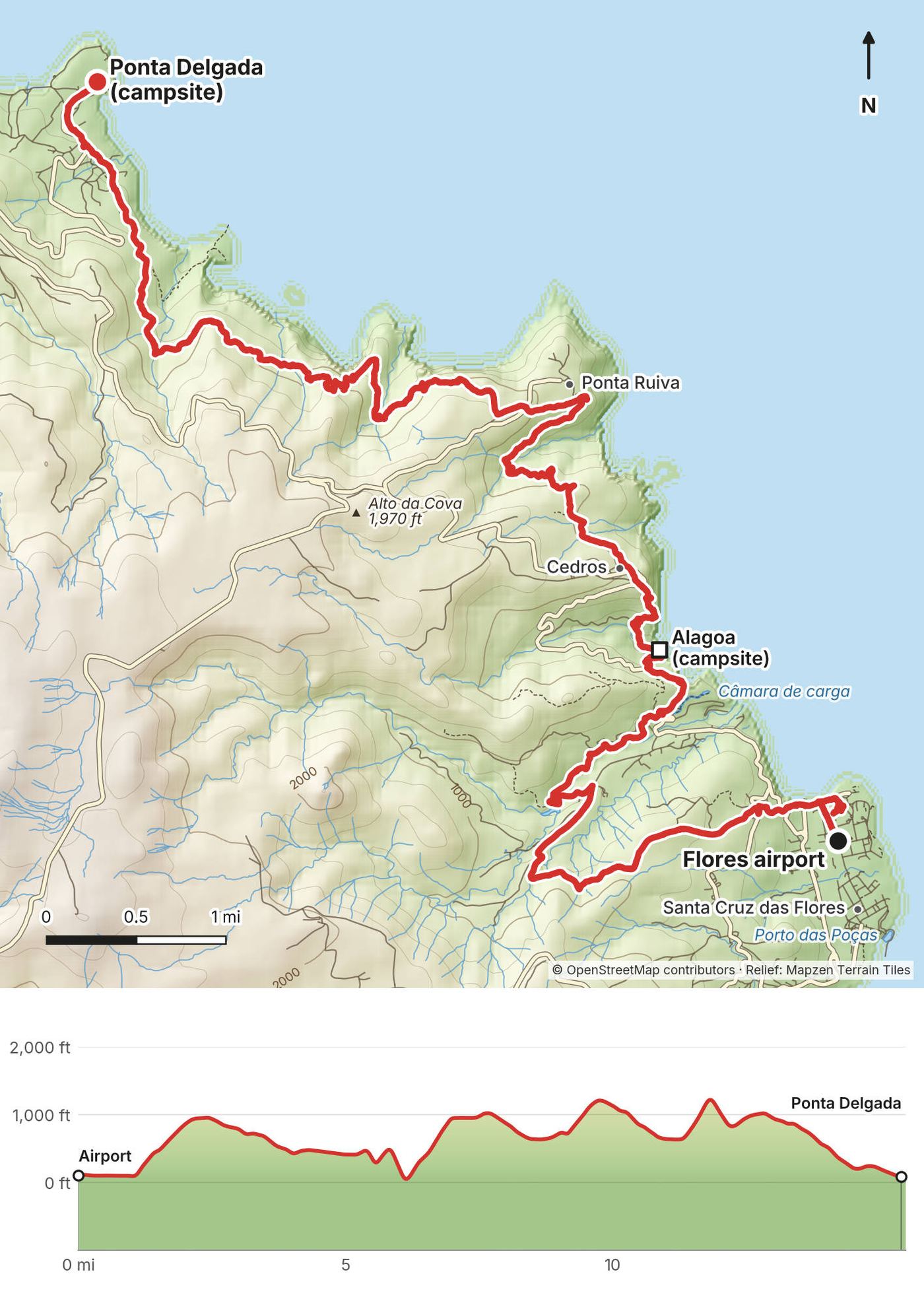
The trail climbs out of Santa Cruz past farmhouses, then over a hill and down along a levada, a concrete water channel through the forest, with a muddy stretch on the way. At mile 6.1 I came down to the coast at the little Alagoa campsite and its sea stacks, and stopped for 24 minutes. I could have slept there, but I kept going.
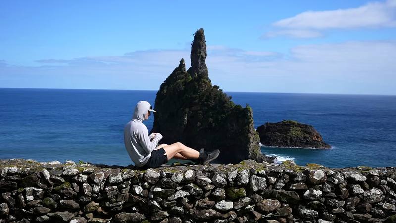
The sun came out over the farmland on the cliffs, with the stone walls and the waves below: my favorite stretch of the whole trip. I passed through Cedros and Ponta Ruiva. In every village the dogs barked at me, and I filled my water at a fountain with blue and white tiles. I didn't see another hiker all day. I reached the campsite at Ponta Delgada at 6:41 p.m., at dusk, and pitched my tent on the grass above the sea.
Santa Cruz. From the airport my track goes past the hotels at the north end of Santa Cruz das Flores to the official start of the Grande Rota (mile 0.9), then climbs through the hamlet of Monte (1.4) and inland over the hills.
The levadas. Between about mile 2 and 6 the trail runs on forest paths and along concrete water channels. Walk carefully on the channel edges: they're narrow and wet. The official page warns of "water lines and slippery rocks".
The north-east coast. The trail comes down to sea level at Alagoa (mile 6.1, a free campsite and picnic area with cold showers and no drinking water, as reported), then climbs again to Cedros (7.1). From there it crosses steep valleys and cliff-top farmland to Ponta Ruiva (9.2) and past the day's high point (mile 11.8) before the long descent to Ponta Delgada (14.7).
Ponta Delgada. The end of stage 1. The campsite is down by the sea at mile 15.4 (drinking water and cold showers, as reported). OpenStreetMap shows a restaurant, O Meireles, on the trail as you come into the village.
Cedros (mile 7.1) and Ponta Ruiva (9.2) are on the road: a taxi can pick you up there. Or stop at the Alagoa campsite (6.1). After heavy rain, streams in the valleys rise fast; wait or turn back rather than cross a strong one.
Grande Rota das Flores, Day 1 (from 2:42)
Closed in October 2026. The first 8 miles of this day, from Ponta Delgada to the edge of Fajã Grande, are on PR01FLO, listed as temporarily closed. While it's closed, take a taxi from Ponta Delgada to Fajã Grande (about €30, as reported) and walk the last 1.2 miles up to Aldeia da Cuada, or spend the afternoon on the waterfalls at the start of Day 4.
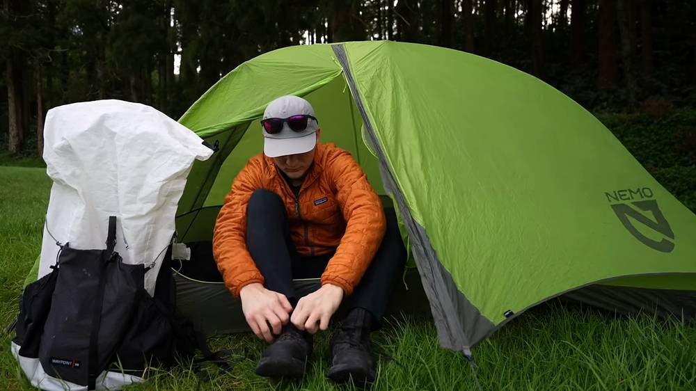
I got lucky with the weather: a clear sunrise over the sea. It was colder, so no shorts. I left the campsite at 8:41 a.m. and walked out past the Albarnaz lighthouse at the north-west tip, where you look out toward the westernmost point of Europe. I stopped to tie my shoes on the wall by the lighthouse.
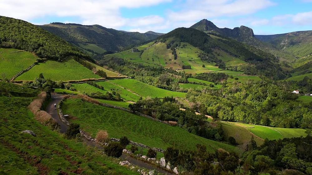
Then the path went along the high west coast, over grassy cliff tops and down steep paths with the coast and Fajã Grande far below, and past a tall waterfall coming down the cliffs. It was an easy day, partly overcast, and I was totally alone on the trail again.
In Fajã Grande I had octopus for lunch. Then I walked up to Aldeia da Cuada, a village of old stone houses restored as places to stay, and got there at 2:37 p.m. An orange cat followed me into my house. I had a shower, and that night one of my top 10 steaks ever in the restaurant. I was the only one there. I'd totally recommend staying there.
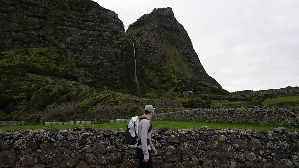
The lighthouse. From Ponta Delgada the road climbs west to the Albarnaz lighthouse (built in 1925) at about mile 2. The islet of Monchique, off this coast, is counted as the westernmost point of Europe.
The west coast (closed in October 2026). From the lighthouse the trail goes along and down the high cliffs, through farmland and patches of forest, to its high point (mile 5.8), then down past the hamlet of Ponta (7.3) to Fajã Grande. The closed trail ends at mile 8.1. The official page calls it hard and "not recommended for people who suffer from vertigo". The whole section runs under the cliffs the reported rockfall risk is about.
Fajã Grande to Aldeia da Cuada. Fajã Grande (mile 8.9) is the biggest village on the west coast, with guesthouses, restaurants, a small grocery and a fountain. From there a lane climbs 1.2 miles to Aldeia da Cuada.
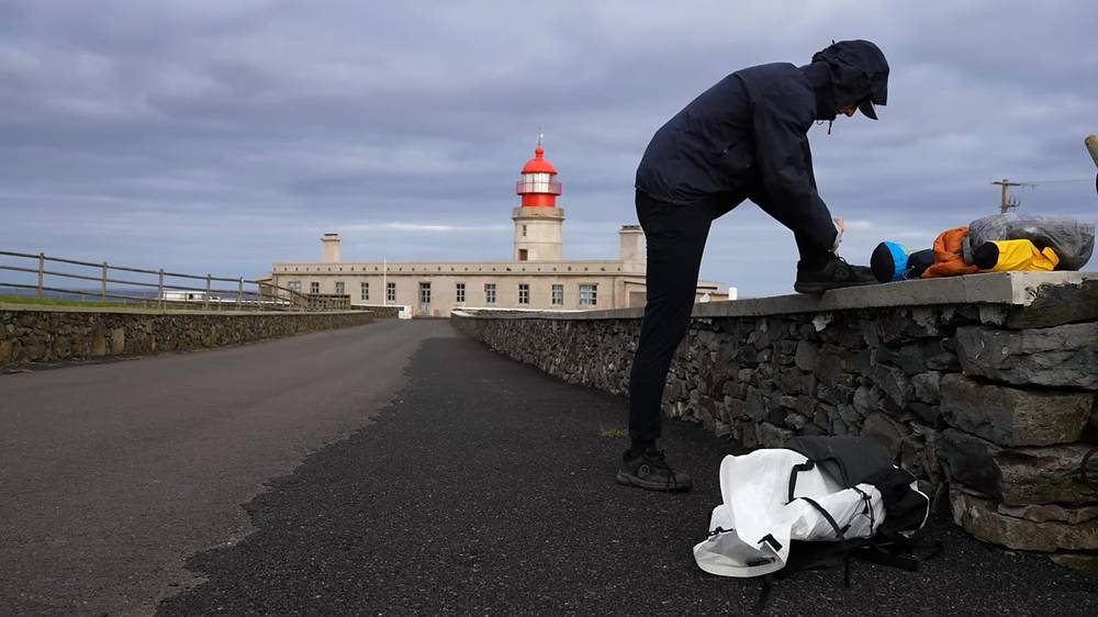
While PR01FLO is closed, the whole day is the taxi to Fajã Grande and the short walk up to Cuada. If it reopens: there's no road or way off the cliff path between the lighthouse and Ponta, so decide at the lighthouse. In rain or strong wind, don't go on.
Grande Rota das Flores, Day 2 (from 6:38) · Aldeia da Cuada (from 9:17)
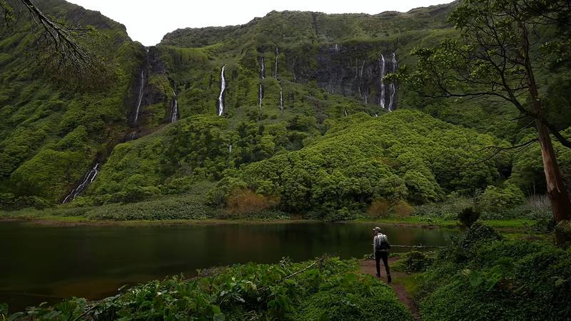
I packed in my room and left Cuada at 9:32 a.m. on a stone-walled lane. It was overcast and cold again, and it got me down a bit, but I'm glad I took the detour to the waterfalls: a pool under a green cliff with waterfalls all the way down it, and nobody else there. I stayed 22 minutes.
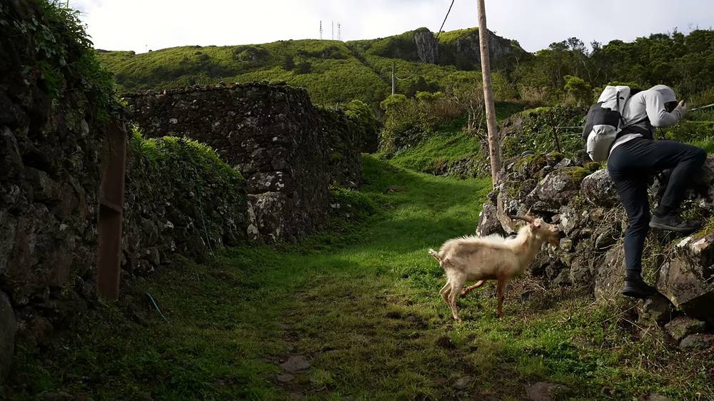
Later a goat with long horns stood in the middle of a narrow walled path and wouldn't move. "This is not a problem for me, I just have to go all the way back up." So I turned back up the path. Then the trail climbed past the Rocha dos Bordões, a cliff of basalt columns, to Lajedo, the end of the Grande Rota, at 1:14 p.m.
I'd booked a taxi to pick me up at the end, but I'd hiked too fast and waited two hours in the cold.
Poço da Ribeira do Ferreiro. From Cuada my track goes to the waterfall pool, also called Lagoa das Patas or Poço da Alagoinha, at about mile 1.5, and back down. It's in the Flores Natural Park; the regional government said in 2025 that access stays free. Stay on the path and off the wet rocks.
Fajãzinha and the Portal. The trail goes down to Fajãzinha (mile 2.8), with a café and a shop, then climbs to the day's high point (mile 3.5), below the Portal viewpoint.
Mosteiro and the Rocha dos Bordões. It continues to Mosteiro (mile 5.0) and past the Rocha dos Bordões, a natural monument of basalt columns, to Lajedo (mile 7.1), where the Grande Rota ends. The official page says to take extra care on wet rock after rain.
Getting back. There's no campsite at Lajedo and no bus to count on. Book a taxi to Santa Cruz (about €20, as reported) or Fajã Grande (about €15) for an hour or two after you expect to finish, and keep a warm layer for the wait.
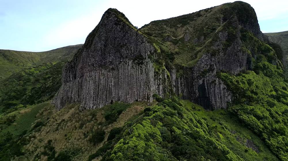
Fajãzinha (mile 2.8) and Mosteiro (mile 5.0) are on the road for a taxi. The waterfalls are the highlight: if the weather is bad, do just Cuada to the waterfalls and back.
Grande Rota das Flores, Day 3 (from 10:02)
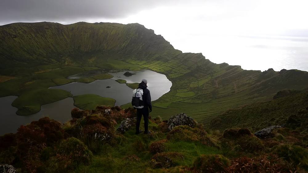
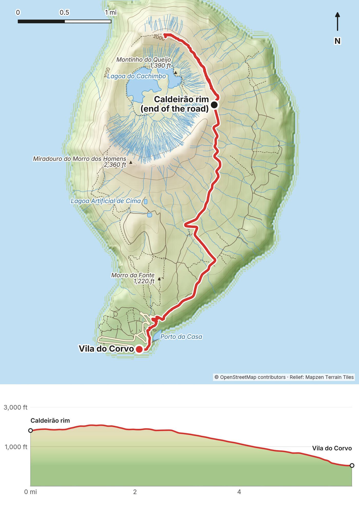
The flight from Flores to Corvo took a few minutes in the air. In the village I took a taxi up to the crater rim, about $10 one way with a local man and his car, and started at 3:11 p.m.
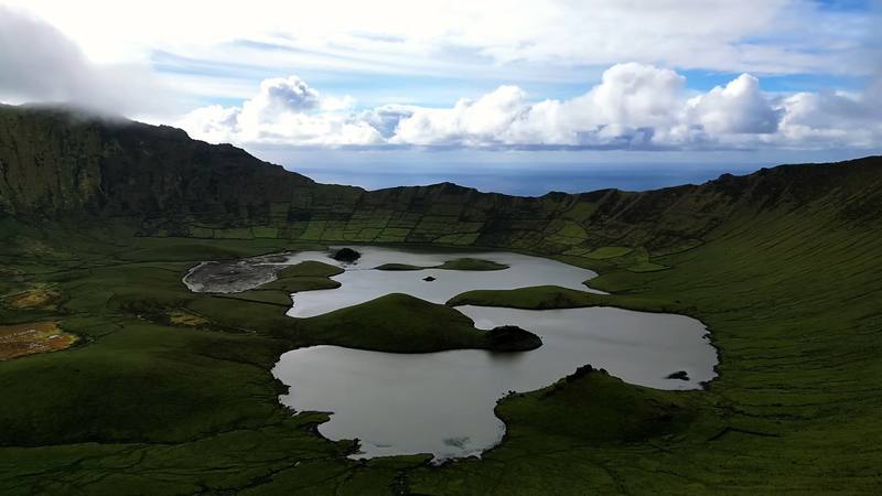
The Caldeirão is a huge green crater with lakes and little islands in the bottom, stone-walled fields on its slopes, and one side open to the sea. I had the whole hike, and pretty much the whole island, to myself. Rain came in waves: on the rim you can see each shower coming across the crater. When it poured I hunkered down. I waited for windows of sun to get my shots, three stops of 10 to 25 minutes on the rim, then walked all the way back down to the village, at 6:27 p.m.
I slept at a hotel. Then the stormy sea cancelled the ferry I'd booked back to Flores, and wind cancelled two flights, so I spent two extra nights in the village, with one clean shirt, eating the same ham and cheese sandwich at the same café.
Up to the rim. From Vila do Corvo the road climbs about 3.7 miles to the end of the road at the Caldeirão viewpoint, about 1,820 ft (554 m). Take the van or a taxi up (about €5, as reported), or walk up in 1.5 to 2 hours.
The rim. My track follows the paths north along the rim to the high point (mile 1.4), with views down to the lakes, then comes back to the end of the road. The official crater loop, PRC02COR (4.8 km, about 2.5 hours), goes down into the crater: stay on the marked trail and off the lake banks.
Down to the village. From the viewpoint the road winds down the east side of the island past fields and stone walls to Vila do Corvo and the harbour, about 3.7 miles and 1,760 ft down by my GPS. Official trail PR01COR (Cara do Índio, 10.3 km) also runs from the crater to the village (as reported).
Ride up and down in the van and walk only the rim. In cloud there's nothing to see: wait, or come back up the next day. In strong wind, keep well back from the edge.
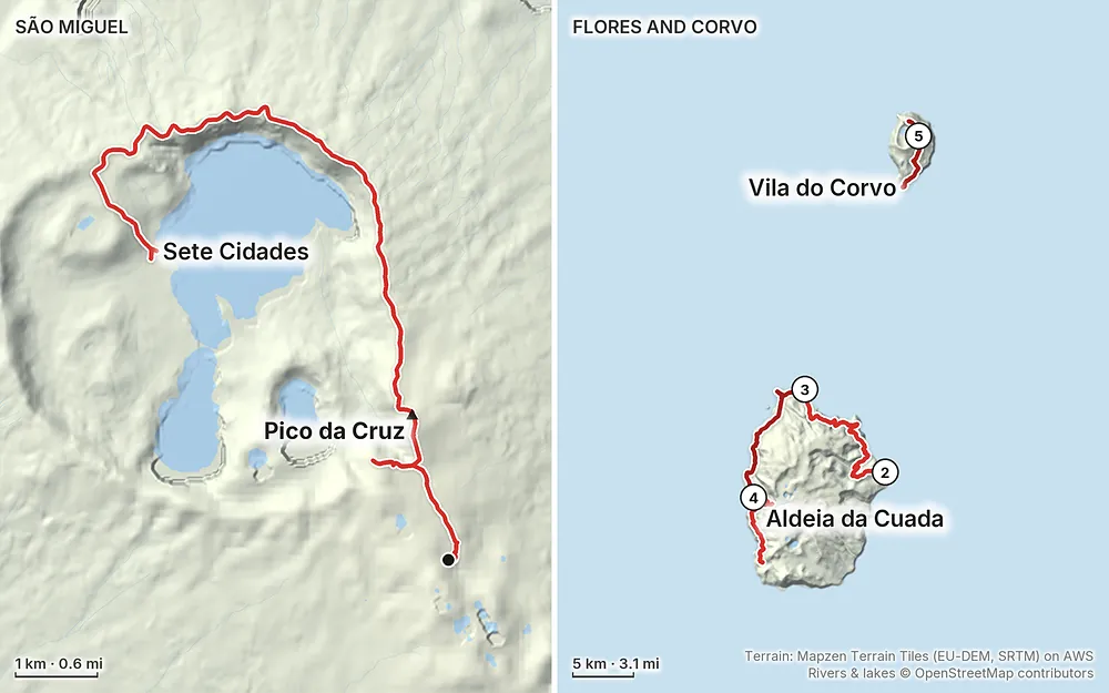
Elevation16–2,769 ft47.1 mi
Terrain: Mapzen Terrain Tiles (EU-DEM, SRTM) on AWS · Rivers & lakes © OpenStreetMap contributors
Tap a map to open it full size.
Checked on the official Azores trails site (trails.visitazores.com, its trail pages and its alerts page) and in local news, on October 3, 2026.
Flores: half the Grande Rota is closed. The Grande Rota das Flores (GR01FLO) is one linear trail of 47 km in two stages. Stage 1, Santa Cruz das Flores to Ponta Delgada (21 km), is open. Stage 2, Ponta Delgada to Lajedo (26 km), is listed as closed. The closed part is the trail from Ponta Delgada along the high west coast to Fajã Grande (PR01FLO), which the alerts page lists as "temporarily closed", with no date or reason. Reports say it has been closed since July 2024 because of rockfall risk on the cliffs (as reported). The other half of stage 2, Fajã Grande to Lajedo (PR02FLO), is open.
What that means for this guide. My Day 2 (stage 1) and my Day 4 (Fajã Grande to Lajedo) are open. The first 8 miles of my Day 3, from Ponta Delgada to the edge of Fajã Grande, are on the closed trail. Don't walk it while it's closed: take a taxi from Ponta Delgada to Fajã Grande and walk on from there. The plan in A week on the islands does this. Check the alerts page before you go; if PR01FLO reopens, my Day 3 is back on.
São Miguel. None of the Sete Cidades trails is on the closed list. A landslide in January 2026 cut part of the access to the Vista do Rei viewpoint (as reported); my route doesn't go there.
Corvo. Both of Corvo's official trails, PR01COR (Cara do Índio) and PRC02COR (Caldeirão), were listed as open.
Fees and permits. None. In 2025 and again in March 2026 the regional government turned down proposals to charge hikers (as reported). No booking or registration is needed for any trail in this guide.
Checked on the official Azores trails and government pages and in the local press on October 3, 2026.
Where you are. Most of the trail in this guide crosses protected land: the island natural parks of São Miguel, Flores and Corvo, and Corvo's Caldeirão is a protected area for habitats and species.
Camping. Only at campsites, unless you have permission. The regional laws for the protected areas and island parks ban camping outside designated places, and fines can reach about €600 (as reported). Use the campsites: Sete Cidades (free); on Flores, Santa Cruz, Alagoa, Ponta Delgada, Fajã Grande and Lajes (all free, as reported); on Corvo, the campsite at Praia da Areia, which needs written permission from the Câmara Municipal do Corvo in advance and is generally open from May to October (as reported). Some may open only from May to September: check with the councils before an off-season trip.
On the trail (the official code). Stay on the marked trail and don't take shortcuts. Close gates and leave the cattle alone. Clean seeds off your shoes between islands. Tell someone your route and when you'll be back. The trail posts are numbered every 500 m: give the number to rescuers.
Corvo's crater. Keep to the marked trail, stay off the lake banks (the water level changes), and don't disturb the grazing cattle.
Drones. Portugal follows the EU drone rules: register as an operator with ANAC, Portugal's aviation authority, if your drone weighs 250 g or more or has a camera. Flying in the Azores' parks and reserves needs authorisation from the regional environment department, which has an online form. Flores's and Corvo's airports sit next to Santa Cruz and Vila do Corvo, so check the no-fly zones on ANAC's map first.
Tourist tax. Ponta Delgada and some other councils on São Miguel charge €2 a night (three nights at most), collected by your hotel (as reported).
My trip. I was on São Miguel on February 29, 2024, on Flores from March 1 to 3, and on Corvo from March 4. It was the very quiet season: the restaurants and campsites I needed were open, but I was the only hiker everywhere I went. The weather changed by the hour: overcast on Sete Cidades, spells of sun on my first day on Flores, a clear sunrise and then cloud on the second, overcast on the third, and on Corvo heavy showers and strong gusts with a few windows of sun.
The seasons. June to August are the warmest and driest months; May and September are good too. Hydrangeas flower from late June and are best in July. Winter (about November to March) brings storms off the Atlantic: in February 2026 Flores and Corvo were under a red warning for waves up to 19 m (as reported).
Rain and temperature (normals, as reported). Santa Cruz das Flores in February: 12 to 17 °C (54 to 63 °F), 170 mm of rain on about 17 days. In July: 19 to 25 °C (66 to 77 °F), 60 mm on 8 days. Flores gets about 1,665 mm of rain a year; Ponta Delgada on São Miguel about 970 mm. The crater rims are cooler, wetter and windier than the coast.
Daylight. About 11 hours 20 minutes at the end of February, about 14 hours 45 minutes in midsummer.
Wind and flights. Corvo's short runway (800 m) is particularly sensitive to wind and fog, and cancellations are most common from November to March (as reported). Wind and sea cancelled my ferry and two flights off Corvo.
Emergencies. Call 112. The trail posts are numbered every 500 m: tell rescuers the number. The official SOS Environment line is 800 292 800. Leave your route and your return time with someone.
Hospitals. The main hospital is in Ponta Delgada (Hospital do Divino Espírito Santo). Flores (in Santa Cruz) and Corvo have health centres; serious cases are flown to the hospital at Horta on Faial. Get travel insurance that covers evacuation and delays.
Cliffs and rockfall. The Flores coast is high, steep and crumbling; reports say rockfall risk is why PR01FLO is closed. Keep to the trail, keep back from edges, and don't stop under cliffs. Never walk a closed trail.
Slippery ground. Wet rock, mud, wet grass and the edges of the levadas are the everyday risk. Take your time on the descents.
Streams. The streams on Flores rise a lot after heavy rain. Don't cross one that's running strong: wait or go back.
Wind and fog. On the crater rims, wind can be strong enough to knock you off balance, and fog can hide the edge. Check the IPMA (Portugal's weather service) warnings for the western group (Flores and Corvo) and the eastern group (São Miguel); on a red or orange day for wind, stay off the rims.
Flights and ferries. Weather cancels the small planes and boats, Corvo's most of all. Keep spare days, and keep your plans flexible until you're back on São Miguel.
Do I need a permit? No. There's no permit, booking or fee for any of these trails in 2026. The only Azores trail that needs registration is Mount Pico, which isn't in this guide.
Is the Grande Rota das Flores open? Half of it. Stage 1 is open; stage 2 is listed as closed because of the Ponta Delgada to Fajã Grande section. You can still walk my Days 2 and 4 and the end of Day 3. See Is it open?.
How hard is it? Moderate, with no scrambling. Flores is the hard part: 3,553 ft of climbing on my first day there, in and out of steep coastal valleys, on paths that are slippery and muddy in the wet. The cliff paths have big drops beside them. Sete Cidades is mostly dirt road, and Corvo is a short rim walk and a road down.
Which island should I hike if I only have a few days? Flores. That's where I did three of my five hikes and where my favorite stretch was, and Corvo is next to it. My Sete Cidades day on São Miguel was the weakest: overcast, mostly on a dirt road, and in my notes I called it a mediocre time on a touristy volcano rim.
Can I camp anywhere? No. Camping outside campsites isn't allowed in the Azores' protected areas and natural parks, and fines can reach about €600 (as reported). There are free campsites on all three islands. I camped at the ones in Sete Cidades and Ponta Delgada.
Do I need a car? No. I used taxis to get to and from the trails and walked everything else. On Flores, buses are rare and don't run on weekends.
When should I go? June to September is warmest and driest. I went at the very end of February: cheap, empty, green, wet, windy, and the flights to Corvo cancel more often. See When to go.
Can I fly a drone? Only with permission. You need to register with Portugal's aviation authority, and flying in the Azores' parks and reserves needs authorisation from the regional environment department. Both Flores's and Corvo's airports are right next to the main villages. See The rules.
All on the official trail network, open on October 3, 2026 (trails.visitazores.com).
São Miguel
Flores
Corvo
My trip, with what I'd change. It needs a week; if your flights home are fixed, leave two spare days for the weather at the end.
| Day | Plan | Sleep |
|---|---|---|
| 1 | Arrive in Ponta Delgada. Taxi or bus to Sete Cidades, walk the rim (Day 1) or just Boca do Inferno | Sete Cidades campsite, or Ponta Delgada |
| 2 | Morning flight to Flores. Walk stage 1 from the airport to Ponta Delgada (Day 2) | Ponta Delgada campsite |
| 3 | While PR01FLO is closed: taxi from Ponta Delgada to Fajã Grande, lunch, walk up to Aldeia da Cuada | Aldeia da Cuada or Fajã Grande |
| 4 | Cuada, the waterfalls and PR02FLO to Lajedo (Day 4). Taxi to Santa Cruz | Santa Cruz das Flores, for the morning flight or boat to Corvo |
| 5 | Fly or take the ferry to Corvo. Van to the Caldeirão, walk the rim and down (Day 5) | Vila do Corvo |
| 6 | Back to Flores, then fly to Ponta Delgada | Ponta Delgada |
| 7 | Spare day for the weather. Fly home |
What I learned. Leave spare days: I lost two on Corvo, missed my flights home and had to rebook (I got credit back for most of it). It's better to be dropped off at the start of a hike than to wait for a pickup at the end: I waited two hours at Lajedo. And I wouldn't go back to the Sete Cidades walk; next time I'd rather see the islands in the middle of the archipelago.
Also. Don't put an inter-island flight on the same day as your flight home (as reported, and my own experience).
In summer. Book flights, Cuada and the Corvo beds ahead: they're small and they fill up. In the quiet season I didn't need to book much ahead.
These change. Everything else in this guide stays the same.
Is it open?
Getting there and around
Your stuff
The film is at the top of this page.
Planning questions about The Azores, answered only from this page's facts, the creators' versions and hikers' public tracks, with where each answer comes from. When the data doesn't say, the answer says "not given".
From hikers
Sign in to comment. Free; your hikes stay private unless you share them.
Some lodging links earn me a small commission at no cost to you.
Something wrong or missing on this page? Send feedback.