
Content made there


Photos
Hikes / Ak-Suu Traverse / Kraig Adams's version
Asia · Kyrgyzstan
Jun 10–13, 2025 · 4 days · about 42 miles by my GPS · Solo · Tent

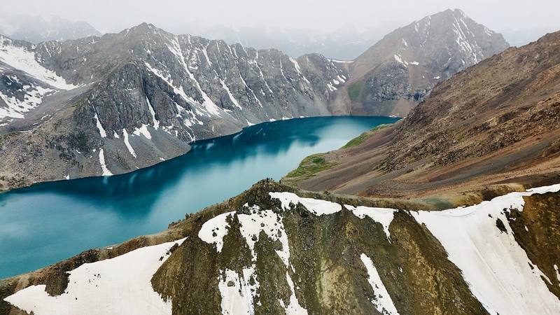
I hiked the Ak-Suu Traverse alone in the Tian Shan mountains near Karakol, Kyrgyzstan, from June 10 to 13, 2025. It was my first time in Central Asia. For four days I carried everything I needed, slept in my tent, ate alone and dodged storms almost every day. I crossed streams, passed seasonal yurt camps, climbed over big passes and finished with the Ala-Kul pass and its turquoise lake.
I didn't expect the landscapes to be this beautiful. Kyrgyzstan reminds me of the Swiss Alps, but with fewer buildings, no ski resorts and barely any people. Horses roam free, herds of sheep move across the valleys, and there's always a dog following the horsemen.
| Quick facts | |
|---|---|
| Distance | 42.4 miles (68.2 km) on my four GPS recordings. My films round it up to 50 |
| Climbing | About 14,150 ft (4,315 m) up, 13,000 ft (3,960 m) down |
| Days | 4 hiking days, 3 nights (2 wild camps, 1 night in my tent inside a yurt frame at a yurt camp) |
| Start | The dirt road up the Boz-Uchuk valley, a taxi ride east of Karakol |
| Finish | The bridge over the Karakol River at the end of the jeep road, then a 4x4 down to Karakol |
| High point | Ala-Kul pass, 12,815 ft (3,906 m) |
| Best months | Mid-June to September; the Ala-Kul pass is most reliably free of snow from about mid-July to mid-September |
| Difficulty | Moderate to challenging: high passes, snowmelt streams, daily storms and no marked trail over most of it |
| Nearest airport | Bishkek Manas (FRU); Karakol (IKG) has flights from Bishkek |
| Trip date | June 10 to 13, 2025, solo, in early summer at the tail end of snowmelt |
| Day | Route | Miles (km) | Up / down (ft) | Sleep |
|---|---|---|---|---|
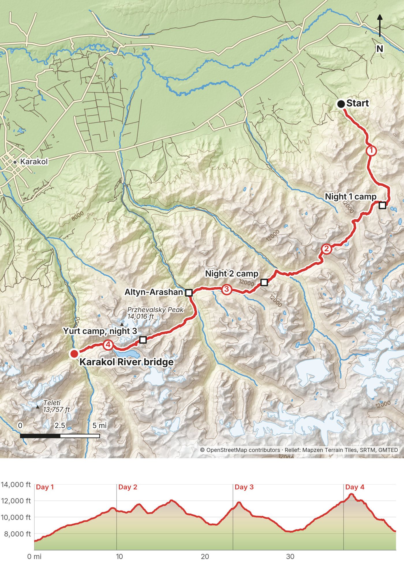
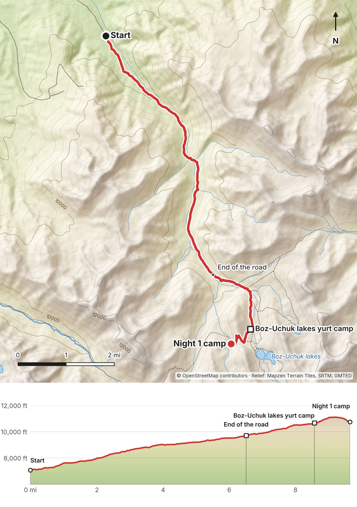
| 1 | Boz-Uchuk valley road to the Boz-Uchuk lakes | 9.6 (15.5) | 3,999 / 325 | Tent, 10,755 ft |
| 2 | Over two passes to the Ak-Suu valley | 13.6 (21.9) | 4,610 / 4,349 | Tent, 11,010 ft |
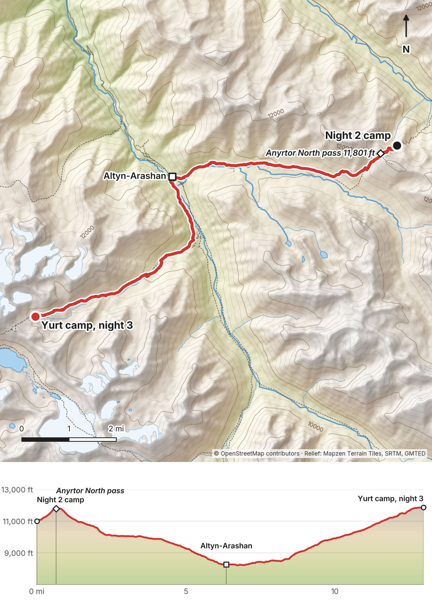
| 3 | Anyrtor pass, Altyn-Arashan, up the Arashan valley | 13.0 (20.9) | 4,449 / 3,611 | Tent in a yurt frame, 11,873 ft |
| 4 | Ala-Kul pass and lake to the Karakol River | 6.2 (9.9) | 1,098 / 4,696 | Karakol |
Why 50 miles and 42 miles? My films and my first guide say I hiked 50 miles. That was a round number. The daily distances I gave in the narrated film (about 10, 14, 13 and 6 miles) add up to about 43, and my four GPS recordings measure 42.4 miles (68.2 km). This guide uses the recorded numbers everywhere. My original plan was longer, 60 to 70 miles, before I cut it short (see Other ways to do it). The climbing figures come from the same files, smoothed the same way for every day, so they're lower than what apps show.
Which Ak-Suu Traverse? The name gets used for several different routes. Some local operators sell a 7 to 9 day version that starts at Jyrgalan and links Boz-Uchuk, Jergez, the Ailanysh pass, Altyn-Arashan, Ala-Kul and the Karakol valley. My four days follow that line from the Boz-Uchuk valley to the Karakol valley, skipping the first days from Jyrgalan. Other sites use the same name for a Jeti-Oguz to Ala-Kul to Altyn-Arashan route. Make sure the itinerary you're reading matches the one you're planning.
There are no trail signs or paint marks for most of this route. You follow horse and hiker paths through open grass valleys, and there are no trees above the lower valleys, so you can usually see where you're going. Carry the GPX files and offline maps.
New York to Bishkek. On Saturday, June 7, 2025, I flew 10 hours from New York to Istanbul, then 5 hours to Bishkek. I landed at Bishkek's Manas airport at 5 a.m. on Sunday, tired and jet-lagged. A subscriber had messaged me on Instagram and picked me up from the airport. I stayed at Five Hotel in Bishkek ($70), which I found on Booking.com. When I pick a hotel in a new city, I look for coffee shops and nice hotels, and I've learned that the area near embassies usually has both.
Bishkek to Karakol. On Monday, June 9, my driver took me along the south side of Lake Issyk-Kul. It took about 7 hours because of a lot of road construction, and cost about $75. The alternative was a flight, but I think it only ran two days a week. I could have made one if I hadn't spent any time in Bishkek, but after a red-eye I wanted a solid sleep and to get situated first, so I made that trade-off. I watched shows and listened to music in the back and it wasn't bad.
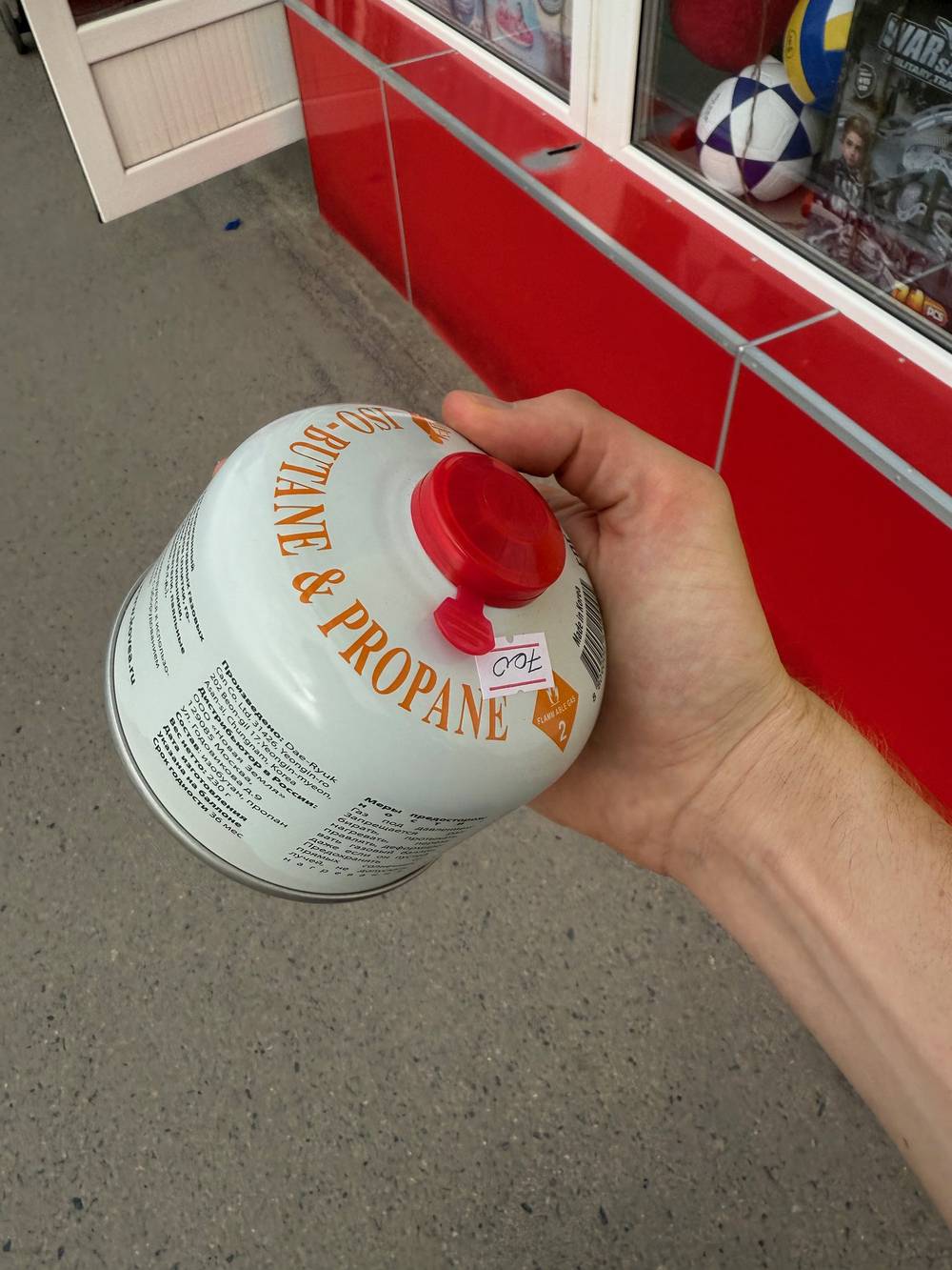
Karakol. I love Karakol. It's a smaller mountain town that reminded me of the ski towns in Colorado. I stayed at the Mangu mini hotel, which my contact set up: cheap, simple, with Wi-Fi, a place to charge, and breakfast on a rooftop terrace. It's a short walk to the main street, where the Sportmaster store had stove gas canisters (I got one for $9 on my first try), and there's a supermarket, Karakol Coffee, and an ATM nearby. I left my big duffel with the hotel while I hiked.
Karakol to the start. On Tuesday, June 10, a taxi picked me up after breakfast. It's a short distance, but the road isn't good and gets very winding at the top; the drive took an hour or two. I expected to get dropped much higher, but there was construction at a bridge and a river crossing, so he dropped me early and I had about 6.5 miles of uphill dirt road to walk. I paid around $50 to $100.
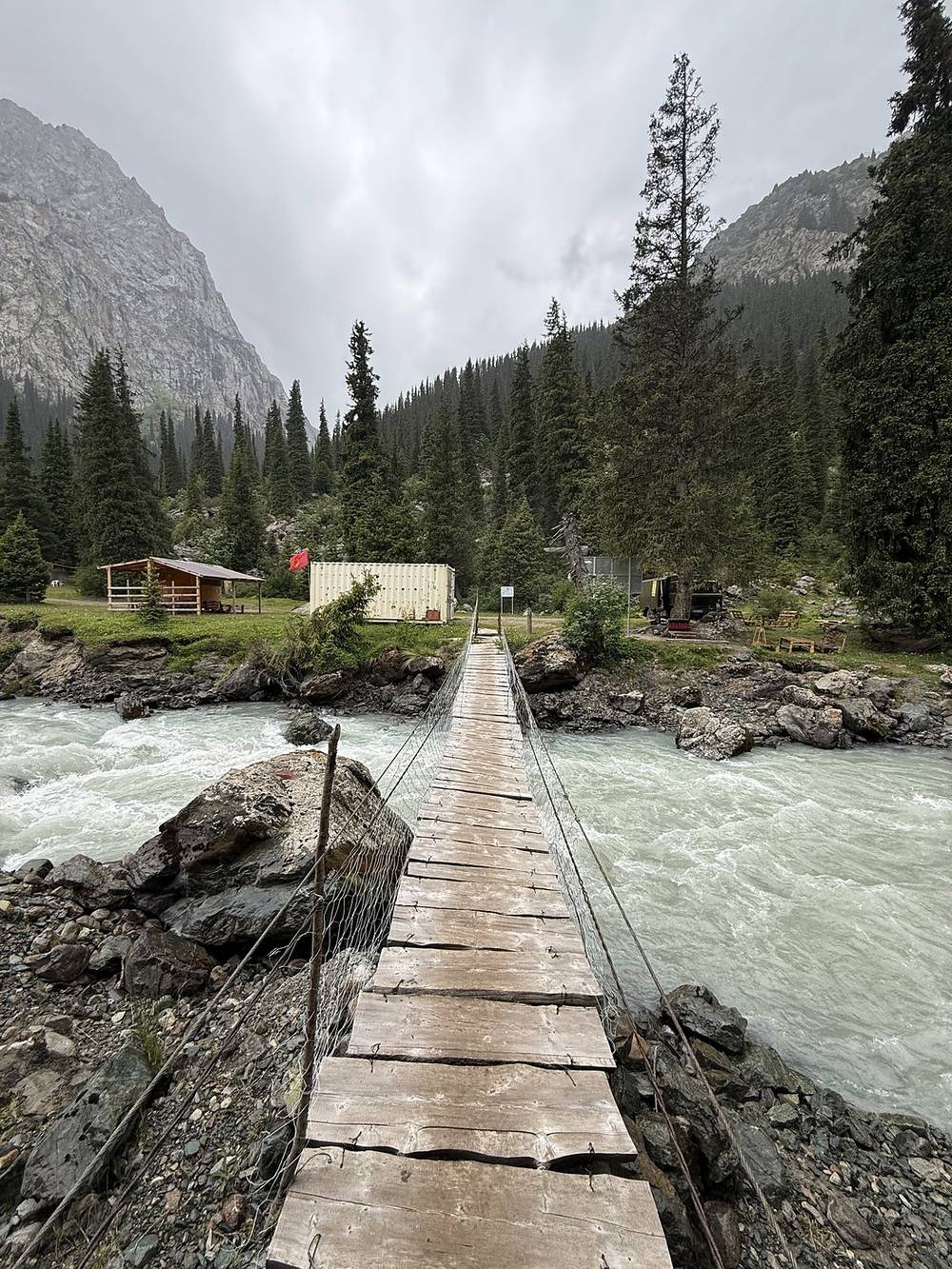
I got to the Karakol River bridge well before the 2:00 p.m. pickup we'd agreed, and killed time crossing the footbridge and getting out of the rain. The jeep was an old Soviet-era 4x4, and it was completely necessary for the crazy, muddy road down out of the mountains. This was the craziest road I had ever seen, and I don't know if I could have driven it. The driver stopped partway to fix something on the tires, then we hit a smooth road. At the bottom I paid the park entry fee, and in town he dropped me off and I walked to my next hotel. The pickup cost $100.
Back in Karakol I stayed in a guesthouse run by an older Russian woman who spoke no English, talked constantly to her cat and cooked me breakfast. I stayed two nights, exchanged cash and ate at the same restaurant a few times while I did laptop work. On my last evening I finally met Ibraim, who had helped me plan the trip.
These are the costs I mentioned in my films, from June 2025, in US dollars. I didn't write the rest down.
| Item | What I paid |
|---|---|
| Flights New York to Bishkek via Istanbul | Not recorded |
| Cappuccino at Istanbul airport | Over $12 |
| Five Hotel, Bishkek, 1 night | $70 |
| Private driver, Bishkek to Karakol (about 7 hours) | About $75 |
| Lunch at a roadside food court on the way | $5 |
| Mangu mini hotel, Karakol | Cheap (not recorded) |
| Stove gas canister, Sportmaster in Karakol | $9 |
| Taxi, Karakol to the start | $50 to $100 |
| Tea and biscuits, Altyn-Arashan | Not recorded |
| Yurt camp below the Ala-Kul pass: my tent inside a yurt frame, dinner and breakfast | Very cheap (not recorded) |
| Tea, food and Starlink at a farmer's hut at the end | About $5 |
| Jeep, Karakol River bridge to Karakol | $100 |
| Karakol National Park entry fee | Paid at the gate (amount not recorded) |
| Guesthouse in Karakol, 2 nights | Not recorded |
For comparison, local travel sites in 2025 and 2026 list the park fee at 250 som per foreigner plus 100 to 150 som per tent, beds or yurts at Altyn-Arashan at roughly 1,000 to 4,500 som per person, often with dinner and breakfast, and the Bishkek to Karakol minibus from about 500 som. On September 26, 2026, the National Bank of Kyrgyzstan rate was 87.45 som to the dollar.
Kyrgyzstan is tough to get to, and probably more expensive to reach depending on where you fly from. Once I was in Karakol, restaurant food was dirt cheap for me as a New Yorker, but professional, with real menus and Wi-Fi. A 7-hour drive for $75 is not that bad.
I didn't book anything on the trail itself. I messaged a Kyrgyz travel creator, Ibraim (@ibraim.explorer on Instagram), who gave me advice and set up my drivers: Bishkek to Karakol, Karakol to the start, and the jeep out of the Karakol valley. I definitely overpaid a bit, but it was worth it for the peace of mind. I met him in Karakol at the end of the trip, and he insisted on buying me dinner.
He also booked my first hotel in Karakol. In Bishkek I found my hotel on Booking.com.
My original plan was longer, with an easier jeep pickup in a different valley. On the trail I used Wi-Fi to message my contact: I'd come out at the Karakol River bridge in the Karakol valley instead, could the jeep meet me there? He said yes, for $100. We agreed on 2:00 p.m. At the Altyn-Arashan lodge on Day 3 I double-checked the time and place. If you plan to change your exit, Altyn-Arashan is the place to sort it out.
You don't book the yurt camps. Most of the ones I passed had people, and you can walk in and ask to sleep and eat. They charge cash. Sleeping there usually means eating there, and they have a bathroom. See Yurt camps and villages for each one I passed.
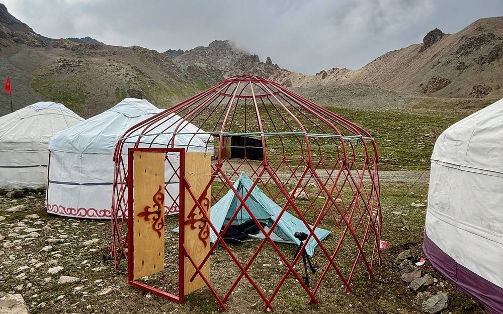
These are the places with people along my route, in order. None of them take bookings the way a hut does; walk in and ask. Bring cash. Names and positions come from OpenStreetMap and my own GPS; I didn't record prices.
| Where | Mile | What I found |
|---|---|---|
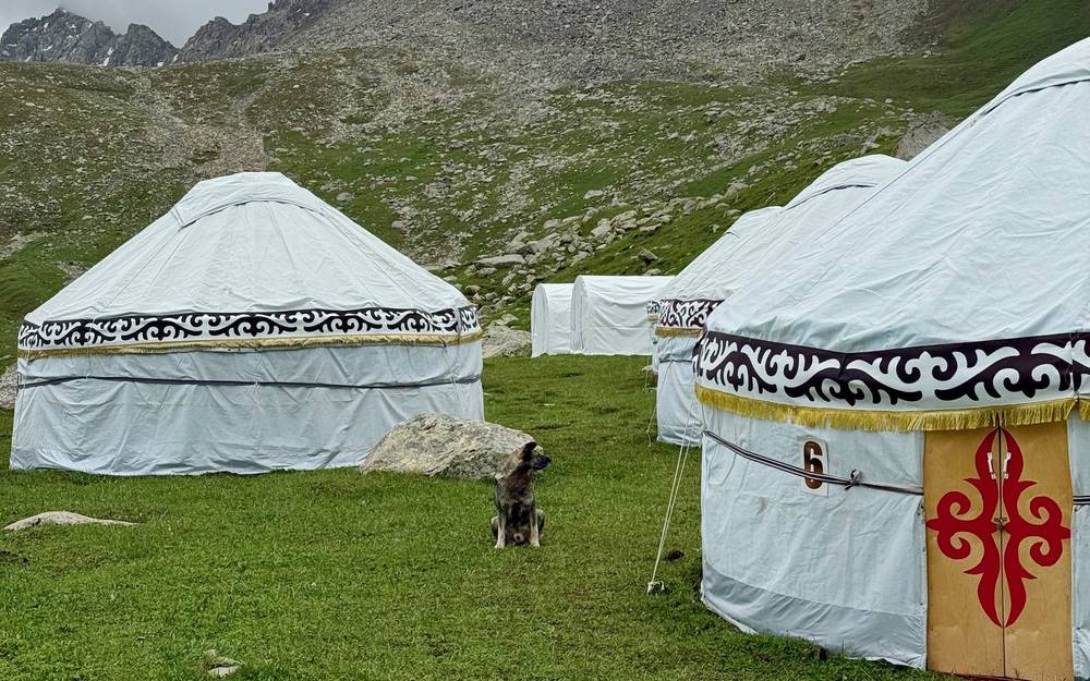
| Boz-Uchuk lakes yurt camp | Day 1, 8.6 | A group of yurts in the distance, just before the fog came in. A friendly dog followed me for a few minutes |
| Jergez yurt camp | Day 2, 3.6 | German hikers eating breakfast. I could have slept here; they'd charge and probably feed you |
| Yurt camp in the Ak-Suu valley | Day 2, 10.7 | Looked unused when I passed |
| Altyn-Arashan | Day 3, 6.4 | Hotels, guesthouses, yurt camps, restaurants, a small shop, hot springs and Starlink. The busiest place on the route |
| Yurt camps below the Ala-Kul pass | Day 3, 12.8 to 13.0 | Where I stayed: tent inside a yurt frame, dinner and breakfast in the main yurt. A big horse group, a few other hikers |
| Ala-Kul lake shore | Day 4, about 2.5 | Multiple open tent spots, no services |
| Sirota yurt camp | Day 4, 4.3 | Food, Wi-Fi and beds for a small fee. Cleaning up after breakfast when I passed |
| Karakol River bridge | Day 4, 6.2 | End of the jeep road. A snack shop in an old truck, a farmer's hut with tea and Starlink, and a yurt camp building new cabins |
What the yurt camps are like. I'd say most of the ones I passed had people. They would charge you to sleep, you'd probably eat there too, and they have a bathroom. It's cash only, and a lot of them had Starlink, which surprised me: it was the first time I'd seen Starlink used so heavily out in the wilderness.
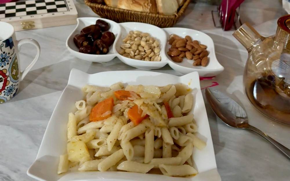
The food. At my yurt camp dinner was noodles with garlic, vegetables, broth and potatoes. Carbs. Breakfast was eggs and potatoes. The stale bread was not good, but I drank tea after tea. Compared to other places in the world, I was pleasantly surprised by the food in Kyrgyzstan.
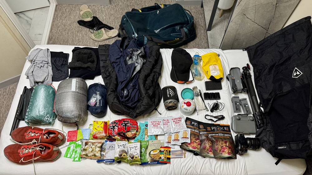
Food. Three granola breakfast bars, coffee packs, peanut butter, pistachios, rice with seasoning, an egg, ramen, seaweed, miso packs, tea and dates. I don't think I brought enough. I should have had a couple more meals.
Paid links: I earn a commission if you buy through these links, at no extra cost to you. As an Amazon Associate I earn from qualifying purchases.
For four days I carried everything I needed and slept in my tent. Here's what I carried in June 2025, what I'd take now (starting with what I regretted leaving behind), and what I filmed with.
My gear changes over time, and I've since stopped using the tent.
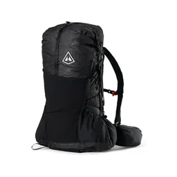 Pack: Hyperlite Mountain Gear Unbound 55 (Hyperlite)
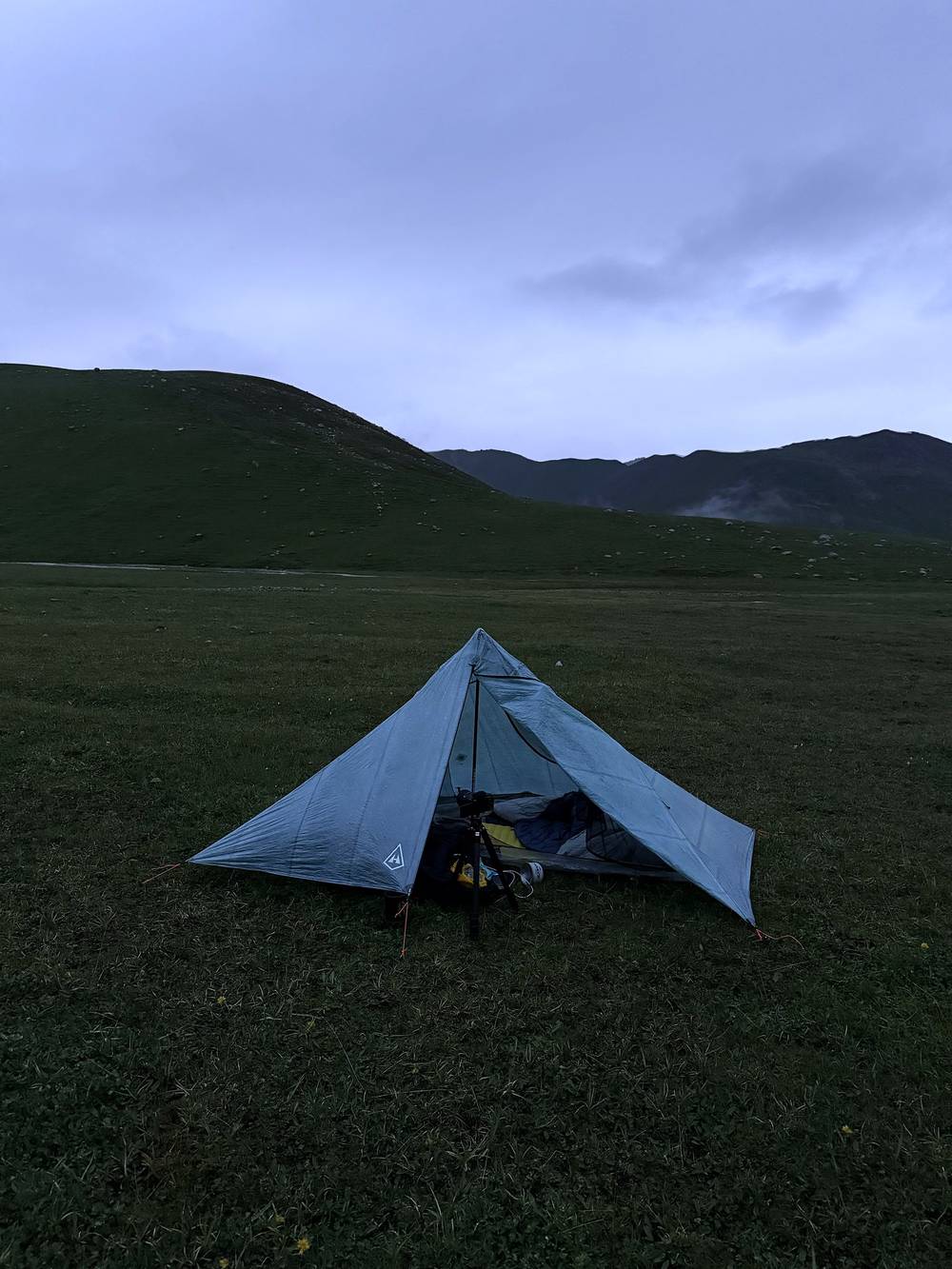
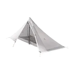 Tent: Hyperlite Mountain Gear Mid 1 (Hyperlite). It was the first time I used it and, I believe, the last. I didn't like the size, how long it took to set up, or that the half where my bag goes was bare ground and got muddy. I'm back to my Nemo Hornet.
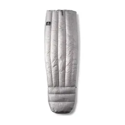 Quilt: Hyperlite Mountain Gear 20° Quilt (Hyperlite)
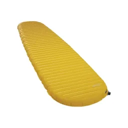 Sleeping pad: Therm-a-Rest NeoAir XLite NXT (Amazon)
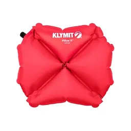 Pillow: Klymit Pillow X (Amazon)
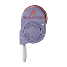 Pad inflator: AlpenBlow Micro Inflator (Garage Grown Gear)
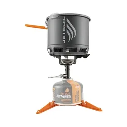 Stove: Jetboil Stash (Amazon). With a gas canister bought in Karakol.
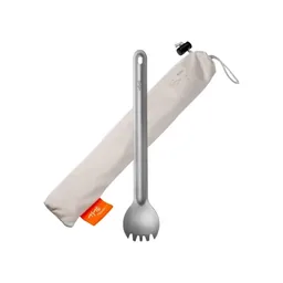 Spork: TiTo Long Handle Spork (Amazon)
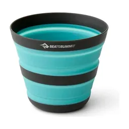 Cup: Sea to Summit Frontier Camp Cup (Amazon)
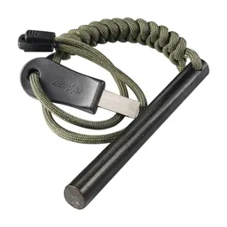 Ferro rod: Bayite Ferro Rod (Amazon)
 Water filter: Katadyn BeFree AC · 1L (Amazon). Treat everything: livestock graze these valleys all summer.
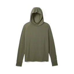 Sun hoodie: PATH Projects Pyrenees T19 Hoodie (PATH Projects)
 Puffy: Arc’teryx Cerium Hoody (Arc’teryx)
 Rain shell: Arc’teryx Beta AR Jacket (Arc’teryx). Expect a heavy shower or hail most days and rain most nights.
 Shorts: Territory Run Co. Long Haul Short. Similar: PATH Projects Sykes PX Short (PATH Projects).
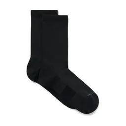 Socks: PATH Projects Joyner Crew Sock (PATH Projects)
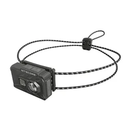 Headlamp: Nitecore NU20 Classic (Amazon)
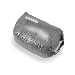 Pack pod: Hyperlite Mountain Gear Side Entry Pod (Hyperlite)
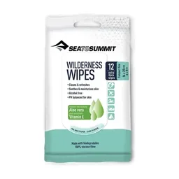 Wipes: Sea to Summit Wilderness Wipes (Amazon)
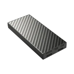 Power bank: Nitecore NB20000 (Amazon)
What I'd change for this route, from my current kit.
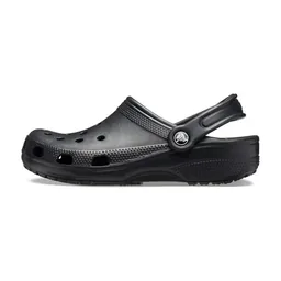 Camp shoes: Crocs Classic Clog (Amazon). I didn't bring my Crocs and I really regretted it. They're light, good for water crossings and so nice at camp after hiking all day.
 Tent: NEMO Hornet Elite OSMO 1P (Amazon). The tent I'm back to. Bring one that handles rain and wind: it rained every day or night for me.
 Poles: Black Diamond Alpine Carbon Z Poles (Amazon). For the Ala-Kul pass and the stream crossings. I used my tripod.
 Cap: PATH Projects Muir Cap 2.0 (PATH Projects). Sun protection: I came home with a bad suntan.
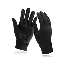 Gloves: Unigear Touchscreen Liner Gloves (Amazon). Gloves and a hat, even in June: every pass had snow.
What I filmed this trip with in 2025. My setup is smaller now (below).
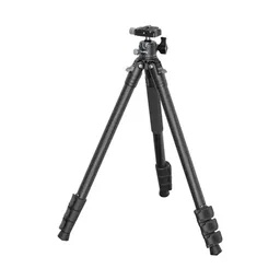 Tripod: SmallRig Carbon Fiber Tripod (Amazon). It doubled as my trekking poles.
 Tripod head: Joby BallHead 3K (now the 3K PRO) (Amazon)
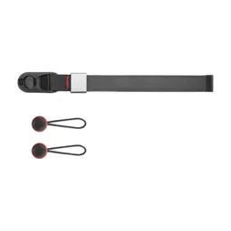 Wrist strap: Peak Design Cuff Wrist Strap (Amazon)
Since September 2026 I film with a smaller setup: the Pocket 4 and the Mic 3 on the trail, and the Mini 5 Pro in the air.
 Camera: DJI Osmo Pocket 4 (Amazon)
 Mic: DJI Mic 3 · 1 TX + 1 RX (Amazon). It pairs with the Pocket 4.
 Drone: DJI Mini 5 Pro (Amazon)
My driver dropped me off earlier than planned, so I had an extra 6.5 miles walking uphill on the dirt road. It was hot in the direct sun and not fun to walk on the road, and the little shade from the pine trees disappeared as I climbed. I was in a bad mood: the road walk, the altitude and the clouds rolling in. After a fence and bridge, the road finally gave way to trail and an open grass field, and I got views, a breeze and herds of cows in the distance.
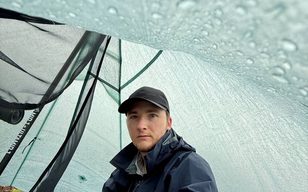
At about 10,000 ft I started to feel fatigued and took a rest. The wind picked up, thunder sounded, and I set up my tent just as the rain started. It was the first time I'd pitched it. Instead of going out to the stream, I collected rainwater running off the tent and boiled it for ramen. Dogs sniffed around my tent and horsemen passed in ponchos. After about an hour the sky opened up and I kept going, past a group of yurts, until fog rolled in and I crossed the top with zero visibility. A patch of snow that looked small was big enough that I had to walk all the way around it. I went down in the fog and set up my tent as it started to rain again. A downpour started as soon as I was inside, but it didn't last long. There wasn't much of a view on Day 1.
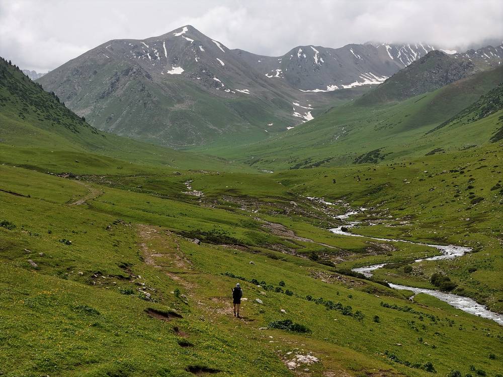
The first 6.5 miles (10.5 km) follow the dirt road up the Boz-Uchuk valley from about 7,075 ft (2,157 m) to about 9,700 ft (2,960 m), through pines and then open grass. The road ends at a fence and a bridge area, and a grass path continues up the valley. Streams on this day were easy to jump over.
The Boz-Uchuk lakes yurt camp is at about mile 8.6 (13.8 km). The high point, 11,119 ft (3,389 m), is at about mile 9 (14.5 km), near the Boz-Uchuk lakes; it was fogged in for me. I camped just below it on the far side.
This is a big first-day jump in altitude. You start at about 7,000 ft and sleep at about 10,750 ft, and I felt it. To make it gentler, camp near the end of the road instead (see A slower version).
Walk back down the valley road. If you're struggling with the altitude, going down is the fix. The Boz-Uchuk lakes yurt camp is the only place with people near the top.
Narrated film, Day 1 · Planning film, Day 1 · Ambient film, Day 1 · My recording on AllTrails
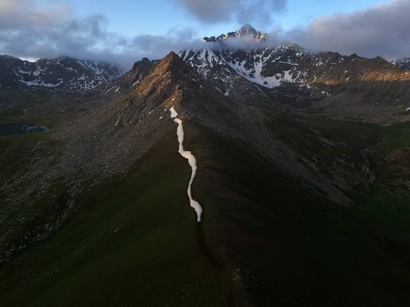
The weather had improved so much overnight. First light hit the snowy mountains, and I could finally see the lake below where I'd been hiking in the fog. My tent was soaked, so I strapped it to the outside of my pack to dry. I kept my pants and gloves on in the cold morning and passed herds of horses with their babies.
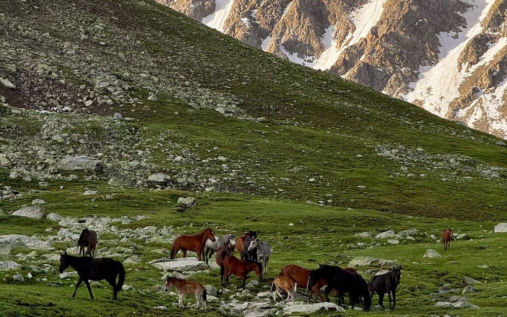
There was more snow as I reached the first pass, some really vibrant dirt up there, and my first big mountain with glaciers. Blue skies put me in a much better mood. I descended easily to another yurt camp, where German hikers were eating breakfast. I crossed my first big stream with my shoes on, since I was already soaked from the wet grass, and climbed past a small lake to a rockier pass with a big patch of snow to get around. I was all alone at the top, just shy of 12,000 ft, and I felt winded.
The big descent into the next valley had the glaciers in view, amazing wildflowers and a massive herd of sheep. Down in the pine trees, a wooden bridge crossed a big river that would have been super dangerous to cross on foot. I took a long lunch and nap and dried my feet, then worked up the motivation to climb. I got completely gassed on the switchbacks, probably from the elevation, and set up camp below the next pass. It was gorgeous: a perfect little stream, a view, and nobody else around. I had miso soup for dinner.
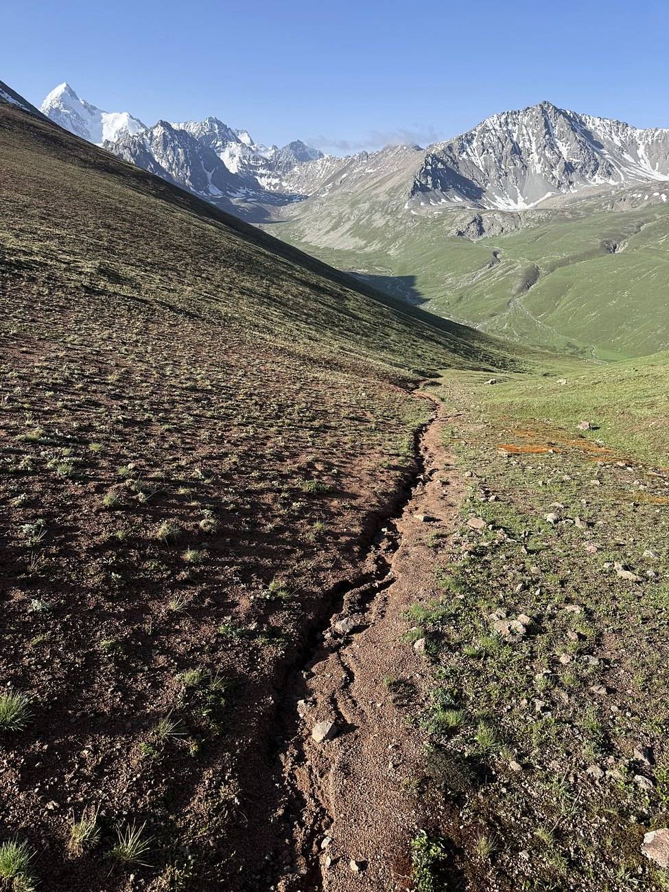
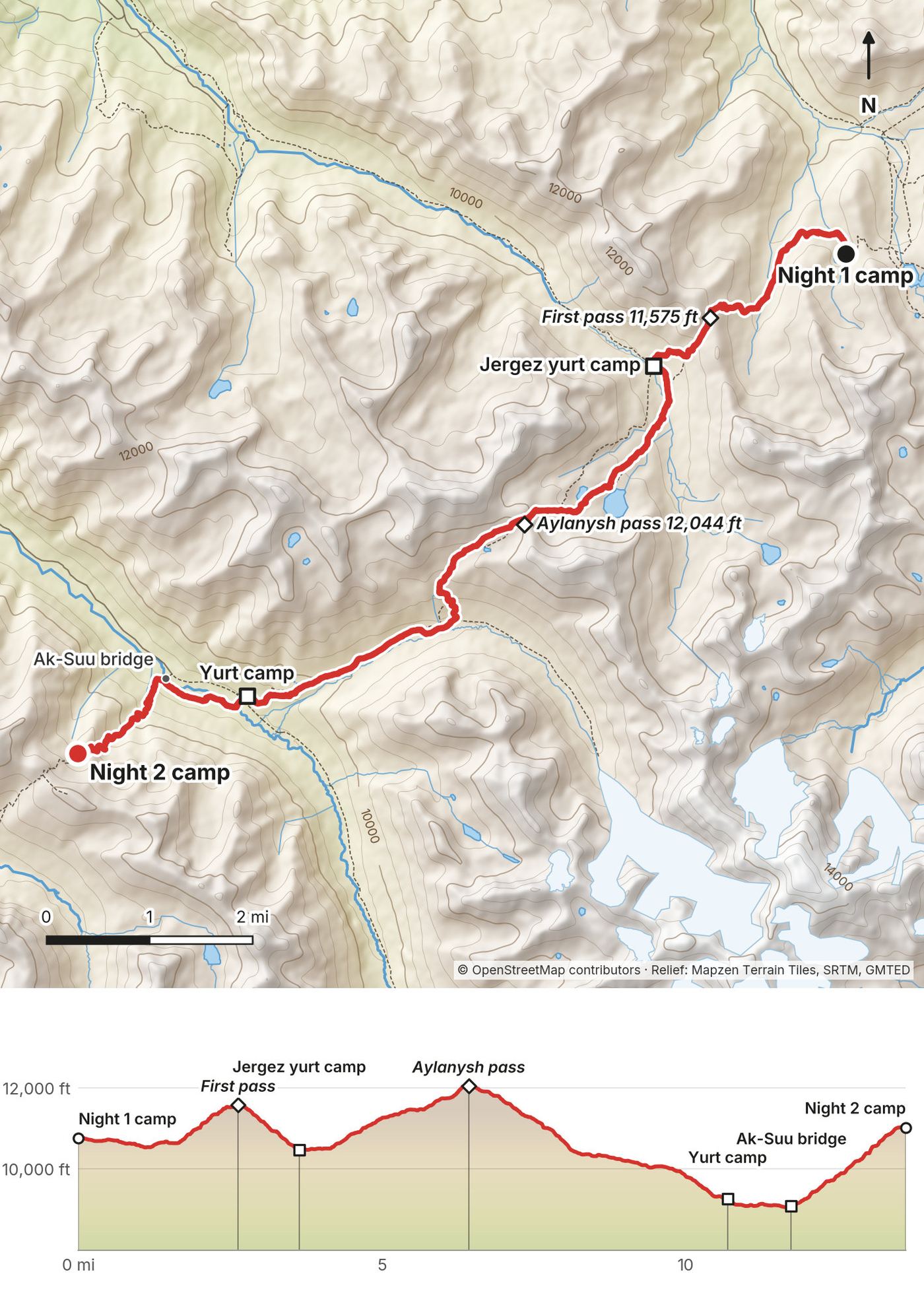
This is the big day, with two passes. The first pass, 11,575 ft (3,528 m), is at about mile 2.6 (4.2 km) and had snow near the top for me. The descent to the Jergez yurt camp, at about mile 3.6 (5.8 km), is easy.
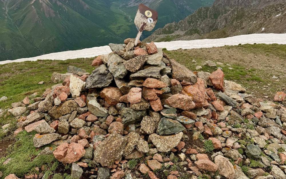
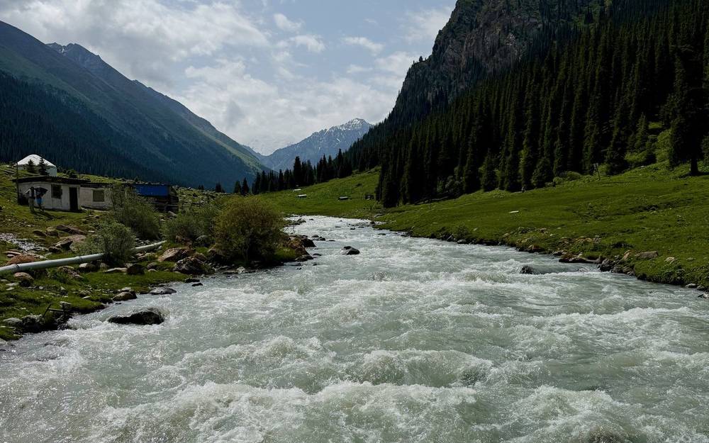
Below Jergez you cross your first real stream. Then you climb past a small lake to the Aylanysh pass, 12,044 ft (3,671 m), at about mile 6.4 (10.3 km). It's rockier, with a large snow patch to go around before the stacked rocks at the top. The long descent passes an empty yurt camp at about mile 10.7 (17.2 km) and reaches a wooden bridge over the Ak-Suu river at about mile 11.7 (18.8 km), the day's low point at 9,055 ft (2,760 m). Use the bridge. There were other bridges in this valley too, and I'd search them out rather than wade.
The trails on this day were easy to follow, mostly compacted grass, and not muddy even with the rain. From the river it's a steep climb on switchbacks toward the Anyrtor pass. I camped at about 11,010 ft (3,356 m), about 0.7 mile below the top, next to a small stream. There's no running water at the pass itself, so this stream is the last good camp before the top.
Before the Aylanysh pass, go back to the Jergez yurt camp or the Boz-Uchuk lakes and down the Boz-Uchuk valley road. After the pass, the fastest way to a road is to keep going over the Anyrtor pass to Altyn-Arashan on Day 3, which has a 4x4 track down to Ak-Suu village.
Narrated film, Day 2 · Planning film, Day 2 · Ambient film, Day 2 · My recording on AllTrails
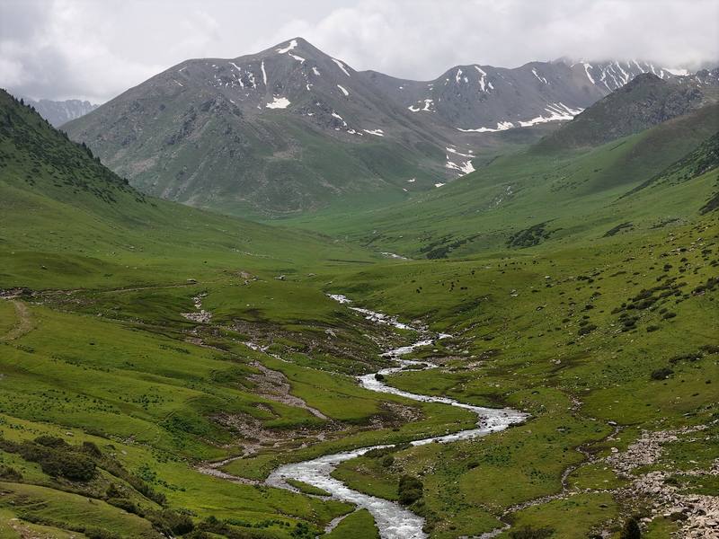
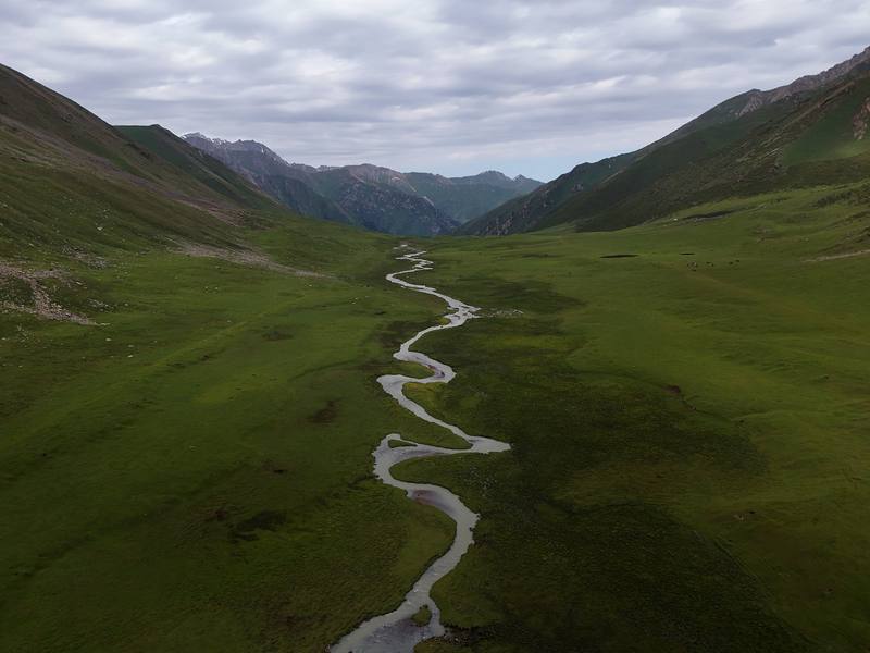
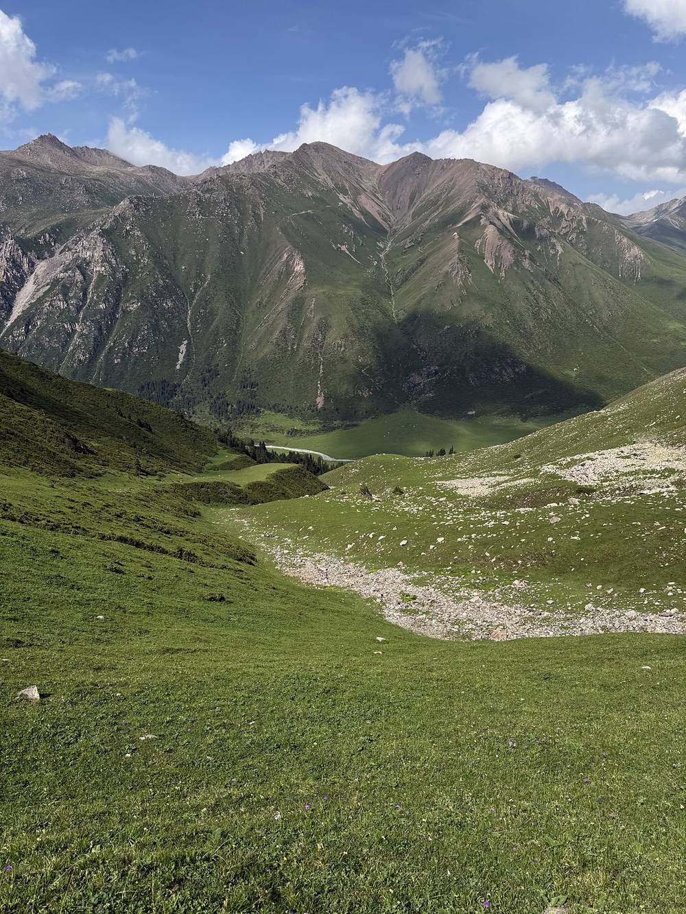
I woke up completely alone on a nice morning, made granola and coffee, and crushed the pass in less than an hour. I thought, this was so easy, I should have just done it the day before. The other side was gorgeous: a treeless, grassy valley split by a squiggly stream dotted with horses. Baby cows stared at me as I dropped below the treeline again.
A gate brought me into the Altyn-Arashan area: red yurt frames, hotels, restaurants and the first touristy, busy place of the trip. I stopped at a lodge with Starlink for tea and biscuits and used the Wi-Fi to double-check my jeep pickup. I could have slept there, but I prefer wild camping when I have my tent. A bridge crossed the biggest river I'd see on the hike. The horse traffic made the trail outside Altyn-Arashan very muddy until I climbed higher.
I climbed slowly and consistently to lunch, washed my legs, and tried a plant-based ramen someone sent me that I didn't really like. Dark clouds rolled in and I got caught in a hail storm before I could get my tent up completely. When I could see the pass, I decided to stop at the yurt camp below it. A big horse group was just leaving. The owner had me set up my tent inside a yurt frame, and I ate garlicky noodles with potatoes and carrots and drank endless tea in the main yurt. Only one or two other hikers were there. The weather that evening looked nasty, so I was glad I didn't push over the pass. There was one bright light on all night, but I still slept 10 hours.
The Anyrtor North pass, 11,801 ft (3,597 m), is about 0.7 mile (1.1 km) above my camp. From the top, a long, open descent follows the Anyrtor valley on what look like horse trails. Hiking with no trees means you can always see where you're going, but it feels slow because the view doesn't change much. Lower down come shrubs, the first trees, horse gates and fences, a track you could drive, yurts and small farms.
Altyn-Arashan is at about mile 6.4 (10.3 km) and about 8,270 ft (2,520 m). There are several hotels and guesthouses, restaurants, yurt camps, a small shop and hot springs. I was told the hot springs here weren't the good ones and that a better one is farther down the road valley. A bridge crosses the Arashan river, which you could not wade.
Above Altyn-Arashan the trail follows the river through the forest. This is a horse highway, and it was the muddiest part of my trip. Past a spot where people rent horses (no reservation needed), it opens up and climbs steadily up the Keldike valley to the yurt camps below the Ala-Kul pass at 11,873 ft (3,619 m). I saw six or seven other hikers on this day.
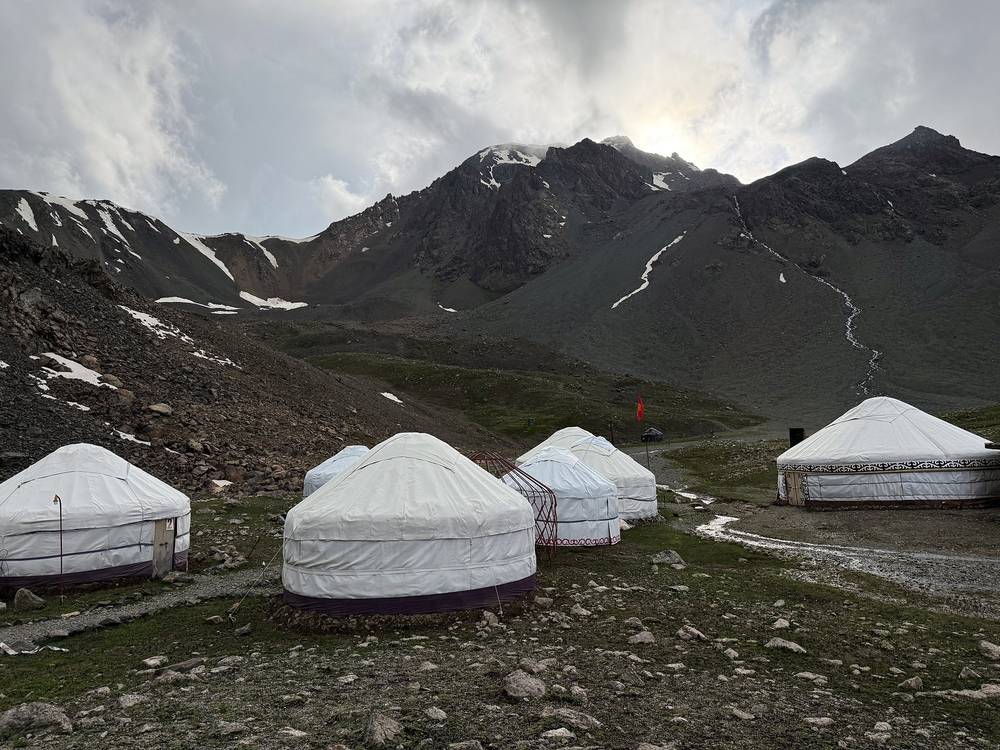
Altyn-Arashan is the easy exit. A rough 4x4 track runs about 9 miles (14 km) down to Ak-Suu village, where minibus 350 goes to Karakol (about 50 som plus 30 som for a big pack, 2025 fare). Old Soviet 4x4s run it for a fee, or you can walk down in 3 to 4 hours. Ordinary cars can't drive it. The yurt camps above Altyn-Arashan have people and food.
Narrated film, Day 3 · Planning film, Day 3 · Ambient film, Day 3 · My recording on AllTrails
The weather didn't improve and it was still overcast, which is fine to hike in. I packed up before anyone woke up, had a quick breakfast of eggs and vegetables, paid my bill and started off. I only had about 6 miles to hike, but I had the big pass to do and a jeep to meet.
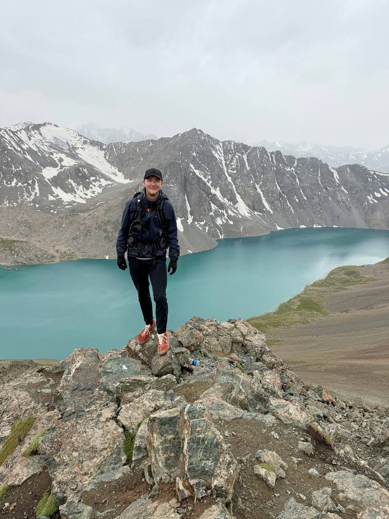
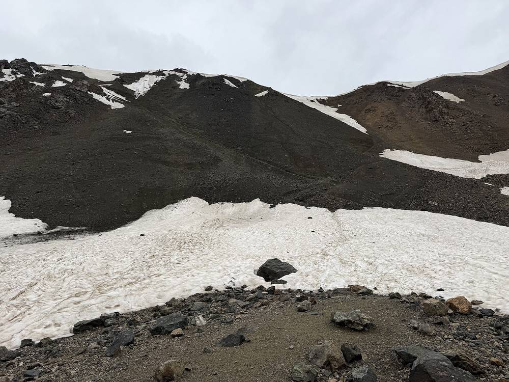
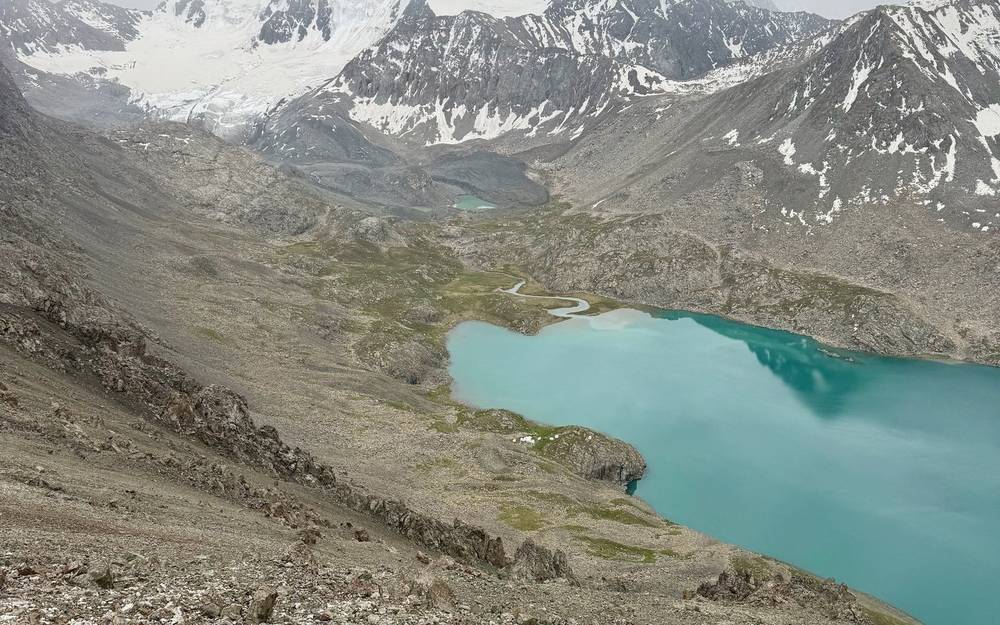
The climb was extremely steep, with loose rocks and patches of ice at the top. It's a dirt path, so you take one step and lose half a step. I used my tripod as trekking poles. The pass is more of a large ridge, with views of the massive turquoise lake, Ala-Kul, surrounded by low clouds and mountains. A big Dutch group came up the other side at the same time and crowded the viewpoint, so I hurried down toward the lake. Even the guides were telling people to go slow. One older hiker in that group couldn't get down over the ice, and his guide was looking for another way.
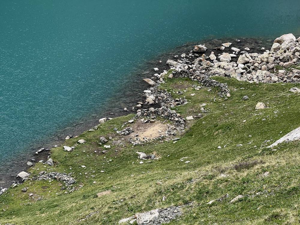
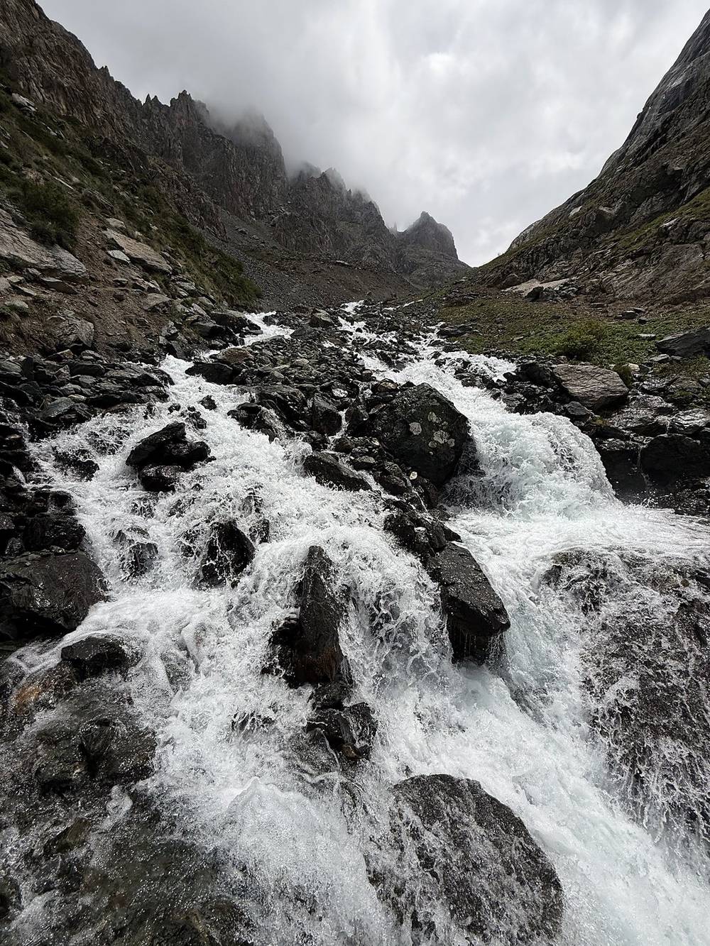
Following the lake to its end took longer than I expected. I passed a number of rock circles for tents, big waterfalls, an emergency cabin I would not want to spend any time in, and fields of yellow flowers before reaching the Sirota yurt camp. The trail got wider and more lush, with pine trees, and I arrived at the bridge over the Karakol River that marked the end of my hike. Waiting there was a mini shop in an old Russian truck, so I bought a Coke. It started to rain, so I had tea and some last spicy ramen in a farmer's hut until my jeep arrived.
From the yurt camp it's about 0.9 mile (1.5 km) and about 950 ft (290 m) of climbing to the Ala-Kul pass, 12,815 ft (3,906 m), the high point of the trip. The Arashan side faces away from the sun and holds snow and ice. It isn't scree, but it's loose dirt and steep, and one or two icy spots were legit tricky in June. That morning more people were crossing from the lake side than from mine.
From the ridge you look down on Ala-Kul, a lake at 11,588 ft (3,532 m). I didn't go down to the shore; I skirted the lake on a side trail above it. There are multiple open tent spots along the lake, and I'd have liked to camp there in good weather. Past the end of the lake the trail gets much steeper beside a set of big waterfalls, and there's a spot marked as a rocky place for tents, though I didn't see many good ones.
The Sirota yurt camp is at about mile 4.3 (6.9 km) and 9,711 ft (2,960 m). You can get food, Wi-Fi and a bed there for a small fee. Below it the trail widens for horse traffic and drops through tall plants and pines to the Karakol River bridge at 8,271 ft (2,521 m), where the jeep road ends.
Before the pass, go back down to Altyn-Arashan and out on the 4x4 track to Ak-Suu village. Once you're over the pass, the only way out is down to the Karakol valley, so the Sirota yurt camp and the end of the jeep road are your safest places to wait. See Getting back to Karakol.
Narrated film, Day 4 · Planning film, Day 4 · Ambient film, Day 4 · My recording on AllTrails
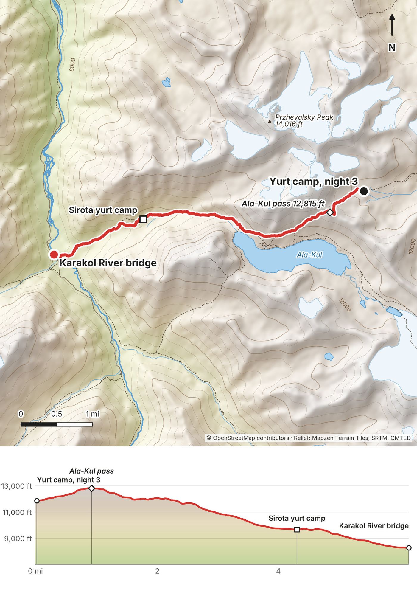
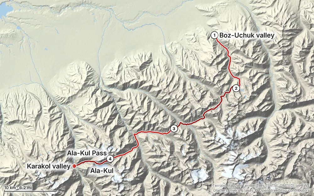
Elevation7,077–12,812 ft42.4 mi
Terrain: Mapzen Terrain Tiles (SRTM, GMTED) on AWS · Glaciers, rivers & lakes © OpenStreetMap contributors
Tap a map to open it full size.
No trekking or border permit is needed for these valleys. Foreigners pay a Karakol National Park entry fee, 250 som per person according to local sources in 2025 and 2026, plus a small tent fee if you camp in the park.
From the hike's facts; check the official page before you go.
Now (November 2026). This is not a trekking season. The high passes, including the Ala-Kul pass at 3,914 m, are under winter snow, the yurt camps are down and the operators are not running trips. Go in the season below.
Early summer, like my trip. I went June 10 to 13, 2025. I'd describe it as late spring: the snow was melting, the valleys were bright green and full of wildflowers, and herds of horses had their springtime babies with them. Every pass still had snow on it, and on the Ala-Kul pass there were one or two icy spots on the shady side. All the snowmelt made the streams and rivers big.
Daily storms. Something happened almost every day: the clouds would come in and dump a heavy shower, sometimes hail, for 10 to 30 minutes, and then it would clear. It rained every night. On Day 1 I waited out a storm in my tent for about an hour, and on Day 3 I got caught in a hail storm before I could get my tent up. A tent that handles rain was super important.
The season window. Local operators run treks here from about mid-June to September, and some list July to September for the Ak-Suu Traverse. They say the Ala-Kul pass is most reliably free of snow from about mid-July to mid-September, and that snow is possible in any month. I can only tell you what I found in early June 2025. Different years have different snowpacks.
Crowds. Early June was extremely empty. On Days 1 and 2 I saw three or four European hikers at a yurt camp and otherwise only horsemen and herders. Day 3 into Altyn-Arashan was the busiest part, because people drive up from Karakol and ride horses to Ala-Kul. On Day 4 a big guided group crowded the Ala-Kul viewpoint.
Storms. Expect a heavy shower or hail most days and rain most nights. They usually passed in 10 to 30 minutes for me. I got into my tent on Day 1 and waited, and got caught by hail on Day 3. On passes, pay attention to thunder and dark clouds, and be ready to stop early. On Day 3 I stopped below the Ala-Kul pass when the evening weather looked nasty, and I was glad I didn't push it.
Forecasts. The official forecast service is Kyrgyzhydromet, meteo.kg, with a Karakol forecast and storm warnings; the English pages are only partly translated. Meteoblue and Windy give point forecasts for pass elevations.
Altitude. You sleep at 10,750, 11,010 and 11,873 ft after starting from Karakol, and you cross 12,815 ft on the last day. I didn't acclimatize at all and felt winded, slow and fatigued on the big climbs. The CDC says altitude illness is a risk above 8,000 ft, and advises that above 9,000 ft you raise your sleeping elevation by no more than about 1,600 ft a day (CDC: travel to high altitudes). This route breaks that rule on the first night, so spend time up high before you start if you can, go slowly, and go down if you feel sick.
River crossings. In June all the snowmelt makes the streams and rivers big. There's a difference between trying not to get wet and trying not to get swept away. Small streams are easy hops. Some take a bit of searching to find the right place, and I crossed one with my shoes on. The big rivers, on Day 2, at Altyn-Arashan and in the Karakol valley, have bridges. Look for them, and don't wade anything big.
Snow and ice. Every pass had snow in early June. The shady Arashan side of the Ala-Kul pass had ice near the top. Trekking poles help; I used my tripod. Ask at Altyn-Arashan or the yurt camps what the pass is like.
Emergencies. Call 112, the Ministry of Emergency Situations dispatch number. Operators don't always speak English. Fire is 101, police 102 and ambulance 103. The MChS main line is +996 312 32 38 12, and it's on WhatsApp at +996 550 112 765: save them before you go. There's no phone signal on most of the route, and local sources say mountain rescue is very limited. Register your route online with the MChS, leave your itinerary and pickup plan with someone at home, carry a satellite messenger if you have one, and get travel insurance that covers trekking to 4,000 m and helicopter evacuation.
Going solo. I walked alone, saw almost no other hikers on Days 1 and 2, and met horsemen, herders and their dogs. If something goes wrong in the first two days, you're on your own until you reach a yurt camp. The yurt camps with Starlink are your best chance to get a message out.
Water. Treat everything; livestock graze these valleys all summer.
| Where | Height | What I found in June |
|---|---|---|
| Day 1 high point, mile 9 | 11,119 ft (3,389 m) | Fog, zero visibility. A snow patch I had to walk all the way around |
| First pass, Day 2 mile 2.6 | 11,575 ft (3,528 m) | Snow near the top, easy descent to Jergez |
| Aylanysh pass, Day 2 mile 6.4 | 12,044 ft (3,671 m) | Rockier, a large snow patch to get around, stacked rocks on top |
| Anyrtor North pass, Day 3 mile 0.7 | 11,801 ft (3,597 m) | Under an hour from my camp. Melting snow patches, no running water on top |
| Ala-Kul pass, Day 4 mile 0.9 | 12,815 ft (3,906 m) | Steep loose dirt, one or two icy spots on the shady Arashan side |
Streams. Day 1 had easy hops. Below Jergez on Day 2 I crossed my first big stream with my shoes on. The Ak-Suu river on Day 2, the Arashan river at Altyn-Arashan and the Karakol River at the end all have bridges; don't try to wade them.
Where I camped. Night 1 was just below the Day 1 high point, where I stopped because it was raining and I was done. Night 2 was about 0.7 mile below the Anyrtor pass, next to a small stream, with nobody around. Night 3 was my tent inside a yurt frame at the yurt camp below the Ala-Kul pass. Other spots I saw: open tent spots along the Ala-Kul lake shore, rock circles for tents along the lake, and a place below the waterfalls marked for tents where I didn't see many good ones. Camp near water, away from the herders' yurts unless you ask, and carry out your trash.
How many days do I need? I walked it in 4 days with 3 nights out. I planned on more: my idea was 60 to 70 miles with a different exit. A slow first day pushed my timing back, so I cut it short at the Karakol valley. My whole trip, from landing in Bishkek to leaving Karakol, took a week. If you want more time at altitude, there's a 5-day plan in A slower version.
When should I go? I went in early June 2025, at the tail end of snowmelt. The valleys were green and full of wildflowers, the passes still had snow, and the streams were big. It was the best time I felt I could go, and it's the only time I can tell you about. Local operators run this area from about mid-June to September, and the Ala-Kul pass is most reliably clear of snow from about mid-July to mid-September. See When to go.
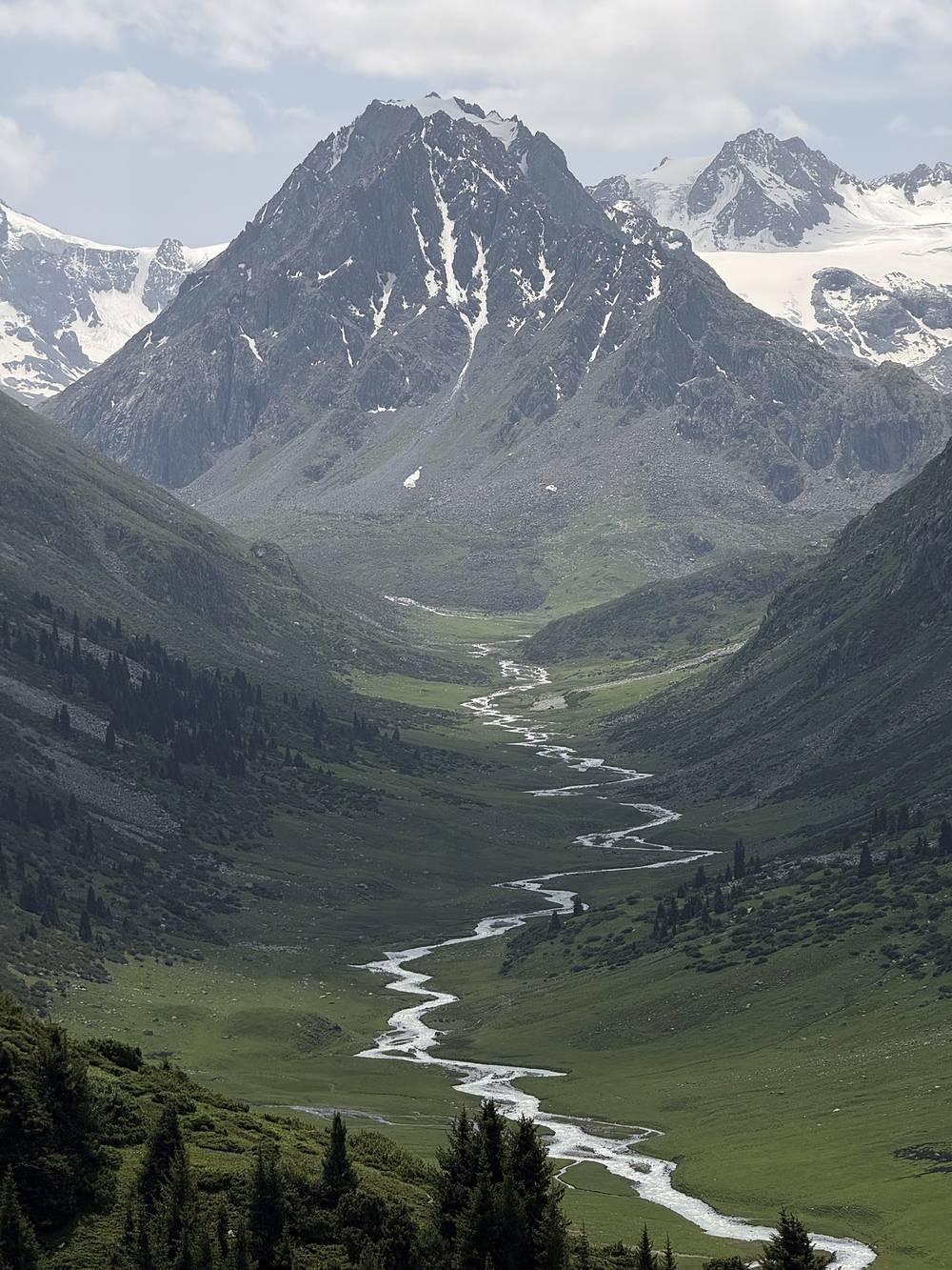
How hard is it? I'd call it moderate to challenging. The trails were mostly easy to follow over compacted grass, but you're at 10,000 to 12,800 ft for most of four days. I didn't acclimatize at all, and it showed: I felt winded on the climbs. The longest day, Day 2, has 13.6 miles and 4,610 ft of climbing over two passes, and that's where I got completely gassed. The steep, icy Arashan side of the Ala-Kul pass on Day 4 is the trickiest single spot.
Am I fit enough? Try this at home: hike 13 miles with 4,500 ft of climbing, two days in a row, with the pack you'll carry. If you're fine on the second morning, the distances are manageable. The altitude is the part you can't train for at home, so add time, not miles.
Do I need a guide? No. I went alone with no guide and recorded every day on AllTrails; those recordings are the GPX files in this guide. A local contact set up my drivers. Guided groups do use the Ala-Kul pass, and I saw guides helping older hikers over the ice.
Where do you sleep? I carried a tent and wild camped for two nights. On the third night I stopped at a yurt camp and the owner had me pitch my tent inside a yurt frame; I ate dinner and breakfast in the main yurt. Most yurt camps I passed had people and would feed you and give you a bed for cash. I preferred camping when I had my tent.
Can I wild camp? I did, two nights, both next to water. Where I sleep, I want water to boil for food and tea, so I stopped near streams. The Ala-Kul lake shore has open tent spots (the park's tent fee applies there too). Inside Karakol National Park, local sources list a tent fee on top of the entry fee. See Passes, streams and camps.
What will it cost? My whole four-day hike cost me very little once I was in Karakol: a taxi to the start ($50 to $100), one night at a yurt camp with dinner and breakfast (very cheap), and a jeep out ($100). Getting to Karakol from Bishkek was about $75 by private driver. See What I paid.
Do I need a permit? No trekking or border permit is needed for these valleys. Foreigners pay a Karakol National Park entry fee, 250 som per person according to local sources in 2025 and 2026, plus a small tent fee if you camp in the park. I paid at the gate on the way out. You should also register your route with the Ministry of Emergency Situations (MChS) online: its page says the law requires tourist groups to register 10 working days before the trip, and the form has an option for a single tourist. See Cash, fees and registration.
Is there phone signal? Plan for none on the trail. What surprised me was how many yurt camps and lodges had Starlink. At Altyn-Arashan I used a lodge's Wi-Fi to sort out my jeep pickup, and at the end of the trail a farmer let me use his Starlink for a small fee. I used an eSIM for data while I was in Kyrgyzstan.
How do you get water? There was water everywhere in June, so filtering was never an issue. I carried a filter bottle and a 1 liter bladder. Treat everything: these valleys are grazed all summer.
Can I resupply? Only at Altyn-Arashan on Day 3, where there are guesthouses, cafes and a small shop, and at yurt camps that will cook for you. Bring all your food from Karakol. I don't think I brought enough; I should have had a couple more meals.
Cash or cards? Cash. The drivers wanted cash, and so do the yurt camps and the park gate. Get som from an ATM in Karakol before you start.
I only walked the four-day line in this guide. These are the other options I know about, with the facts I could verify.
Local operators sell a 7 to 9 day Ak-Suu Traverse that starts at Jyrgalan, farther east, and links the Boz-Uchuk lakes, Jergez, the Ailanysh pass, Altyn-Arashan, Ala-Kul and the Karakol valley. My route is roughly the second half of that. I planned 60 to 70 miles myself, with a different exit and an easier jeep pickup, but a slow first day pushed my timing back and I finished at the Karakol valley.
The same line split at places I passed with water or people, so your first night is lower and the two-pass day is shorter. I didn't walk it this way.
Do I regret not camping at Ala-Kul lake? Kind of. It would have been cool with good weather. The lake shore has open tent spots if you want another night.
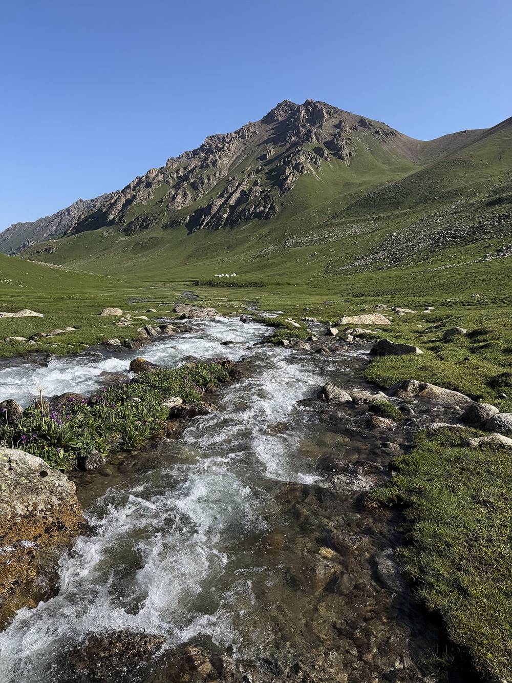
The most popular trek near Karakol is 3 or 4 days from the Karakol valley up to Ala-Kul, over the Ala-Kul pass and down to Altyn-Arashan, or the reverse. It's my Day 3 and Day 4 without the remote first half, and it's where I saw the other hikers and the guided groups. On the morning I crossed, more people were coming up from the lake side than from Altyn-Arashan.
These change from year to year. Everything else in this guide stays the same.
Getting there
On the route
You and your stuff
Planning questions about Ak-Suu Traverse, answered only from this page's facts, the creators' versions and hikers' public tracks, with where each answer comes from. When the data doesn't say, the answer says "not given".
From hikers
Sign in to comment. Free; your hikes stay private unless you share them.
Some lodging links earn me a small commission at no cost to you.
Something wrong or missing on this page? Send feedback.