
Content made there
The film is at the top of this page.
Photos
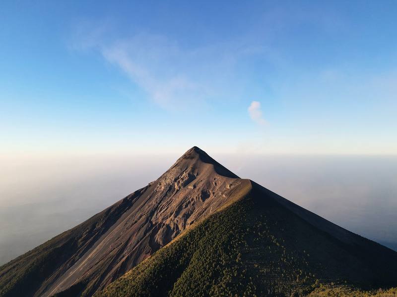
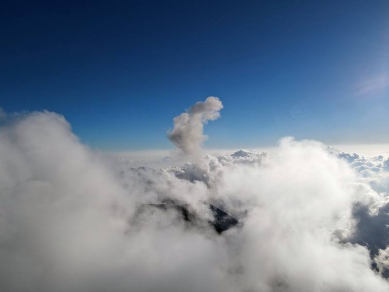
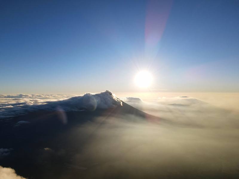
Hikes / Acatenango Volcano / Kraig Adams's version
North America · Guatemala
Dec 2020 · 2 days · Solo · Tent

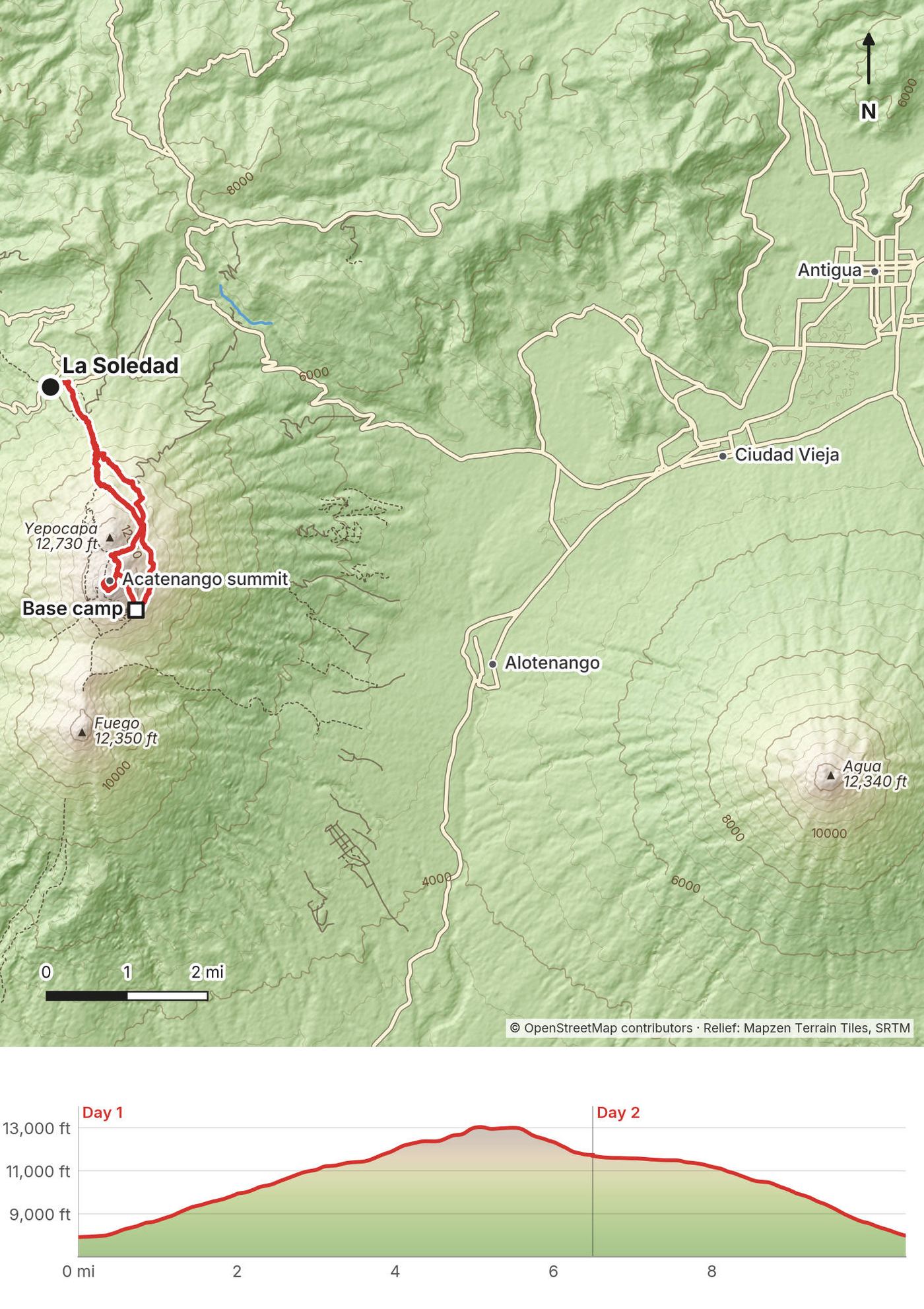
In December 2020 I hiked Acatenango, the volcano above Antigua in Guatemala, on my own. It was my first time in Guatemala. I started from the village of La Soledad around noon, climbed through the farms and the forest to the summit for sunset, walked part of the crater rim looking across at Fuego, the active volcano next door, and came down in the dark to the base camp on the side facing it. Fuego erupted all night. The next morning I hiked down in about an hour. Two days, about 10.5 miles by my GPS: 6.5 on the first day and 4 on the second. It's the trip from my film Hiking to Acatenango Volcano in Guatemala.
I was just happy to be out there solo hiking again. This was the closest I'd ever been to an active volcano.
| Quick facts | |
|---|---|
| Distance | 10.5 miles (16.8 km) by my GPS: 5 miles up to the summit, 1.5 down to the base camp, 4 back to La Soledad |
| Climbing | About 5,210 ft (1,590 m) up and 5,060 ft (1,540 m) down |
| Days | 2: 6.5 miles on Day 1, 4.0 on Day 2 |
| Start and finish | La Soledad, a village at about 7,900 ft (2,410 m), about an hour's drive from Antigua |
| Direction | Out and back: up to the summit and the base camp, and back down the same trail to La Soledad |
| High point | Acatenango's summit, 13,045 ft (3,976 m). Fuego, 12,350 ft (3,763 m), is next door to the south |
| When | I went December 16 and 17, 2020 |
| Difficulty | One long, steady climb of over 5,000 ft on soft, steep volcanic ground, at an altitude most people aren't used to, then a freezing night |
| Fees and guides (2026) | About Q100 (US$13) cash for foreigners; a registered local guide is widely described as required. Most people book a two-day tour from Antigua |
| Day | Route | Miles (km) | Up / down (ft) | Sleep |
|---|---|---|---|---|
| 1 | La Soledad to the summit and the base camp | 6.5 (10.5) | 5,200 / 1,391 | The base camp facing Fuego, about 11,700 ft |
| 2 | The base camp to La Soledad | 4.0 (6.4) | 13 / 3,666 |
Distances and climbing are from my own GPS, smoothed the same way every day. Heights of the summits are the usual published figures; the other heights are from my GPS, so they're given as "about."
Antigua is the base. It's about 45 minutes to 1.5 hours from Guatemala City's La Aurora airport (GUA), depending on traffic. In 2026 a shared shuttle costs about US$15 to $25, an Uber about Q320 (US$42). There are ATMs in the arrivals hall; the quetzal was about 7.6 to the US dollar in late September 2026.
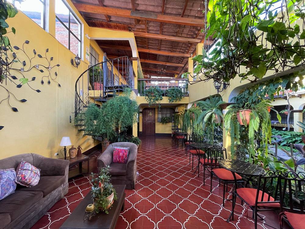
My way in, 2020. For this trip I only packed my hiking backpack and a small duffel, so no checked bags. I usually just get local money at the ATM right at the airport when I land. I grabbed the first taxi that got my attention outside the terminal and made the hour-and-a-half drive, because of traffic, to Antigua, and booked a single night at Hotel Las Camelias, where I saw lava on top of Fuego through the fog from the patio for the first time.
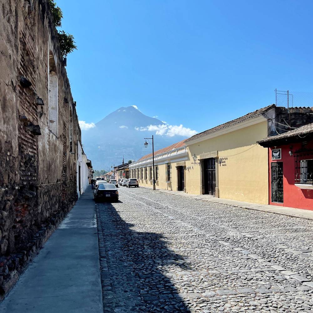
The next morning a subscriber named Rodrigo, who'd noticed I was in town, met me for breakfast. He had taken a wedding couple up the same hike and had some advice. I checked out of the hotel, packed for the hike, stopped at a cafe for coffee, a last meal and Wi-Fi to call an Uber, and rode about an hour to La Soledad, for about $15. In La Soledad I stopped at a few stores to buy snacks, and the lady at one convinced me to buy way more chocolate than I'd planned. Then I walked a couple of minutes up the road to where the trail starts.
Getting to La Soledad (2026).
My way back, 2020. I hopped on a bus in La Soledad, connected to an even cooler-looking bus, and made it back to Antigua two hours later. The entire trip cost only two dollars.
| Item | What I paid (2020) |
|---|---|
| Round-trip flights to Guatemala City | $600 |
| Taxi from the airport to Antigua | Not in my records |
| Hotel Las Camelias, Antigua, one night | Q325.50 (about $42) |
| Uber from Antigua to La Soledad | About $15 |
| Entrance fee at the registration hut | Q50 (I called it eight dollars in the film) |
| Breakfast after the hike, La Soledad | $2.50 |
| Buses from La Soledad to Antigua | About $2 |
| Porta Hotel Antigua, two nights | Over $200 |
For your budget (2026). Entrance about Q100 (US$13), cash, often not included in tour prices. A two-day tour from Antigua about US$57 to $160, private from $240. Taxi or Uber to La Soledad about Q150 to Q200 each way; the bus about Q15 to Q20. A porter about Q250 to Q300 to camp. Tip your guide about Q50 to Q100 and a porter Q25 to Q50. Airport shuttle to Antigua US$15 to $25.
| Night | Where | Height |
|---|---|---|
| Before | Hotel Las Camelias, Antigua | |
| 1 | The base camp facing Fuego (Day 1 mile 6.5) | About 11,700 ft (3,570 m) |
| After | Porta Hotel Antigua, two nights |
The base camp. It's a slope on the side of Acatenango facing Fuego: little rows of terraces dug out to fit tents and campfires, and the occasional hut for a trekking company. Arriving in the dark was a little difficult, because I didn't know what the ground looked like or where I should set up my tent, but I found a spot alongside some other hikers and asked if I could join their campfire for a bit. The group was from Costa Rica and wore Denver Broncos gear, so it was easy to make friends.
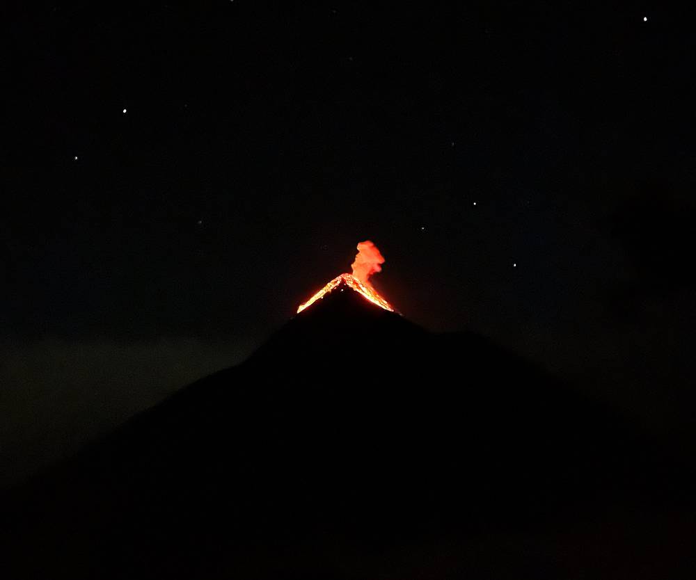
Fuego all night. Later in the night, when the fog had disappeared, we started to get awesome views of Fuego erupting. You can hear how long the sound takes to reach you, and that sense of distance gives you an idea of how massive the eruptions are. The booms came every 30 minutes or so and kept me up all night.
The cold. It was really cold. I didn't pack a sleeping bag, like an idiot. I don't know why I thought I'd be warm enough with just my liner. That was a mistake. I slept with my feet inside my pack to help keep them warm.
In 2026 the camps on this side are in the Municipalidad de Alotenango's camping area, and tour companies have their own camps and cabins there. Campfires are banned now.
In Antigua. My first night, at Hotel Las Camelias, cost Q325.50 (about $42; I said $50 in the film). After the hike I booked two nights at Porta Hotel Antigua for over $200, because treat yourself. It had parrots, but I'm not sure I'd recommend it: it had wedding-venue vibes and the food was just okay. You could find cooler boutique places for much less.
What I brought. I was okay on food and water, and only brought one liter of water, two bananas, beef jerky and some chocolate bars (from the store lady in La Soledad).
Water. There's no water on the trail or at the camp. Carry all of it from Antigua or La Soledad, and more than I did if you'll be slower. Tours provide meals; ask what they provide in water. There are toilets at a few rest spots on the way up and latrines at the camps; pack out all your trash.
After. The small farmhouse cafe right next to the trailhead in La Soledad served me eggs, peppers, onions, tortillas and mole with coffee for $2.50.
Paid links: I earn a commission if you buy through these links, at no extra cost to you. As an Amazon Associate I earn from qualifying purchases.
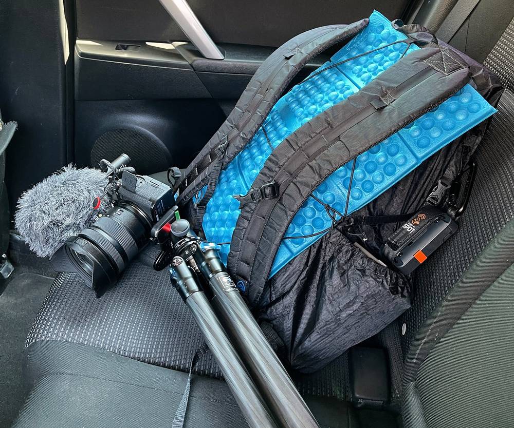
I hiked this alone in December 2020 and carried everything myself, minus the one thing I needed most: a sleeping bag. Here's what I carried, what I'd take now, and what I filmed with.
From my film's original gear list.
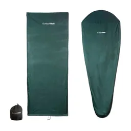 Liner: Outdoor Vitals Sleeping Bag Liner (Amazon). No sleeping bag: a mistake. I was freezing with only the liner.
 Water: Katadyn BeFree AC · 1L (Amazon). There was nothing to filter: carry all your water.
 Shirt: Amazon Essentials Quick-Dry Tech Hoodie (Amazon)
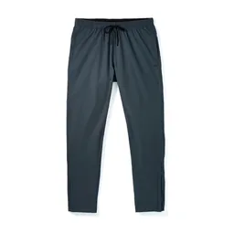 Pants: Patagonia Terrebonne Joggers. Similar: PATH Projects Killam PX Pant (PATH Projects).
 Rain shell: The North Face Dryzzle Futurelight Jacket. Similar: Arc’teryx Beta AR Jacket (Arc’teryx).
 Puffy: Patagonia Nano Puff Jacket. As the wind picked up I layered up: pants, jacket, puff, gloves. Similar: Arc’teryx Cerium Hoody (Arc’teryx).
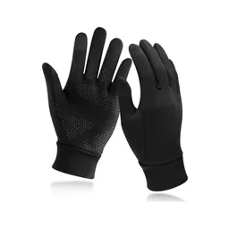 Gloves: Unigear Touchscreen Liner Gloves (Amazon). Thin, but I was super glad I brought them.
What I'd add for this hike, from my current kit.
 Sleeping bag: Hyperlite Mountain Gear 20° Mummy Bag (Hyperlite). Camp is around or below freezing at night all year.
 Hat: PATH Projects Hoyt Merino Beanie (PATH Projects). The saddle and summit are freezing and very windy.
 Poles: Black Diamond Alpine Carbon Z Poles (Amazon). For the steep, loose sand on the way down.
What I filmed this trip with in 2020. Read Fuego, weather and safety before you go.
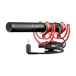 Mic: Rode VideoMic NTG (Amazon)
 Tripod head: Joby ball head (Amazon)
Since September 2026 I film with a smaller setup: the Pocket 4 and the Mic 3 on the trail, and the Mini 5 Pro in the air.
 Camera: DJI Osmo Pocket 4 (Amazon)
 Mic: DJI Mic 3 · 1 TX + 1 RX (Amazon). It pairs with the Pocket 4.
 Drone: DJI Mini 5 Pro (Amazon)
I started recording on my AllTrails app at 12:38 p.m. and began the five-mile hike up the side of the volcano to the summit. It was pretty empty: COVID had halted almost all tourism to Guatemala, and there was just no one there. The first section passes through dozens of farms, and I made it past a welcome area that was quiet, closed and empty.
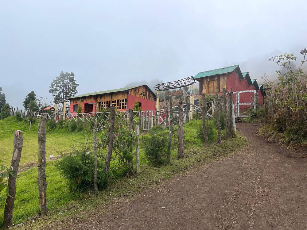
Further in I started to get really nice sunlight filtering through the canopy. I reached the registration area at 1:46, paid the entrance fee and filled out a form, and climbed into the cloud forest. After two miles of hiking I'd reached the high forest at about 10,000 ft. Every so often some random dogs would just show up. I don't know who owns them, or if anyone does, but I'm always happy to hang out with some dogs.
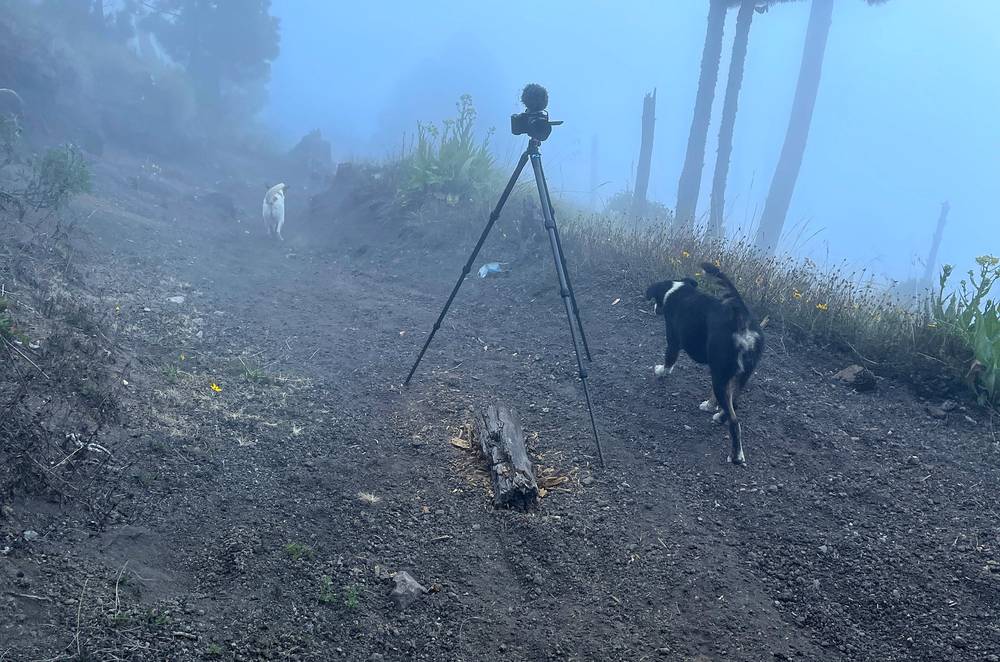
After four miles of constant climbing I was starting to feel it. I reached the saddle between the false peak and the actual summit at about 4:15 and started to get some views as the clouds swirled in and out. It was really beautiful, but it was getting cold with the elevation and the wind picking up. It was freezing, so I layered up: pants, jacket, puffy, gloves. I was super glad I'd brought those gloves. It wasn't until the final push to the summit that I finally ran into other hikers, along with some more random dogs and a view of Agua in the background.
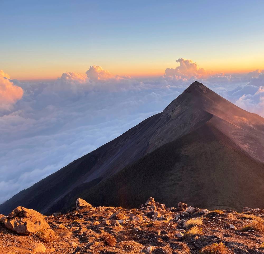
I made the five miles up to the summit, about 13,000 ft, at 5:24. The wind was really intense: I actually had to put my mask over my mouth just to catch a breath of air, it was that gusty. But the top was totally worth it, the views and the fact that I was totally alone on the summit. I walked the loop of the crater and stopped for views of Fuego, the active volcano off to the side. I spent some time sitting and filming Fuego, waiting for the little eruptions to happen in front of me. Little did I know these were tiny compared to the ones I'd see that night.
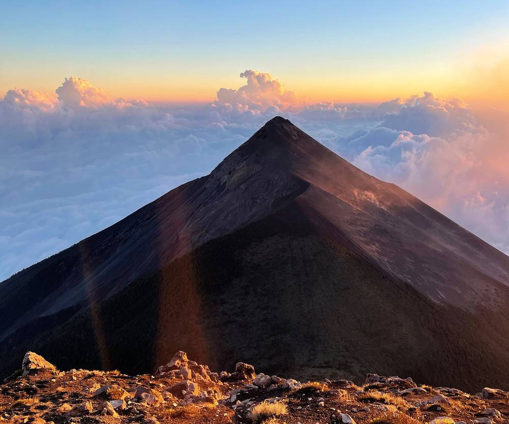
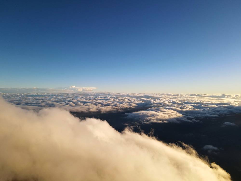
It's always beautiful being above the clouds for a sunset, but as the sun dipped below the horizon a massive fog rolled in, and it got really dark and really hard to see very quickly. Coming down the steep, loose slope in the darkness and thick fog was a bit difficult, and to be honest, if I hadn't had GPS on my phone with the AllTrails app, I probably would have gotten lost. The temperature was dropping fast. I made it to the base camp at 6:36, after 6.5 miles of hiking for the day.
La Soledad. My recording starts in the village, at about 7,900 ft (2,410 m), where a road leads up out of the village toward the volcano. There are small stores and cafes on the main street. In 2026 this is where you pay the entrance fee and show your registration.
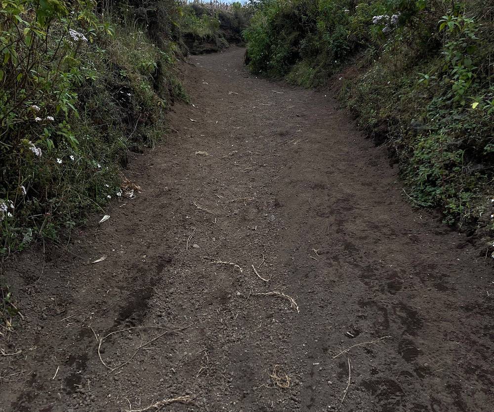
The farms. For the first mile and a half the trail is a dirt track, wide and steady, climbing through fields and past farm buildings. At mile 0.9 on my GPS it passes the welcome area, a group of wooden buildings that I pinned on my recording as the ticket booth.
The registration hut. At mile 1.6, about 9,430 ft (2,870 m), in the trees. This is where I paid and filled out the form in 2020.
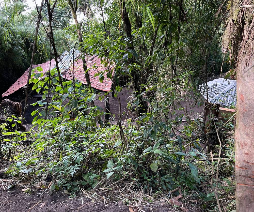
The forest. Above the hut the trail climbs steeply through cloud forest, then pine forest. By my GPS it gains about 1,000 ft a mile here. OpenStreetMap shows a few rest spots with shelters and toilets in the forest; my track passes one at about mile 2.5.
The saddle. At mile 4.4, about 12,370 ft (3,770 m), the trail comes out of the trees onto the open saddle between Acatenango's main summit (Pico Mayor) and its lower north summit, Yepocapa (3,880 m). The wind and the cold hit here. Put your layers on.
The summit. The last stretch is a steep climb on loose volcanic sand and cinders to the summit at 13,045 ft (3,976 m), mile 5.1. There's a small cross on the crater rim. I walked part of the way around the crater, stopping on its south side, at mile 5.4, to look across at Fuego.
Down to the base camp. From the rim I went back a little way along the crater, then down the east side of the cone, steep and loose, to the base camp at mile 6.5, about 11,700 ft (3,570 m) by my GPS. It's a slope of terraces dug out for tents, facing Fuego, with tour companies' huts among them.
The only way off is back down the way you came, to La Soledad: from the saddle that's about 4.4 miles and 4,500 ft down. Turn back if you're feeling the altitude badly (a headache that gets worse, vomiting, confusion), if a storm is coming, or if Fuego picks up. Don't come down the upper slopes in the dark and fog without a GPS track: I probably would have gotten lost without mine.
Film, the climb and the night · My guide to the trip (from 2:44) · The hike up
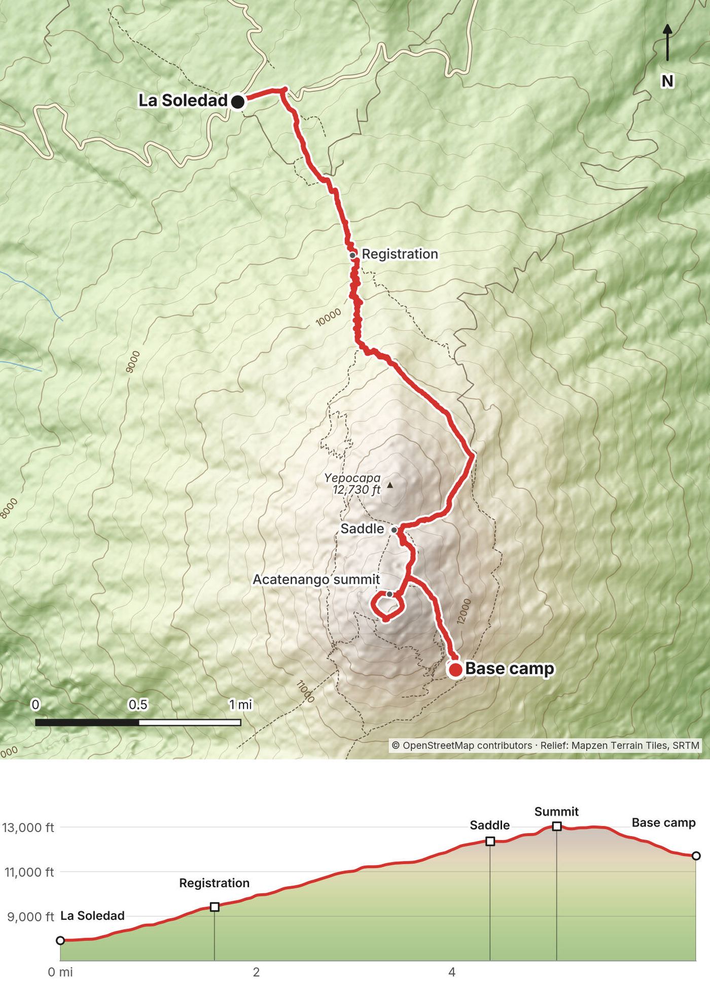
I made sure to wake up at the crack of dawn to get Fuego erupting with some color on the horizon, but to be honest it was just nice to get up and moving to warm up my feet, because they were absolutely freezing. Warm sunlight hitting you after a long, cold night is such a nice feeling. With the sunlight I could see what the area was like, and noticed a couple dozen other hikers camping and watching Fuego alongside me.
I left the camp at 7:01. The hike back down was relatively uneventful, very covered in fog, and only took me about an hour: I was booking it, practically trail running down the mountain. I was back in La Soledad at 8:10.
The first meal I have after a hike is always one of my favorite things. I found a small farmhouse cafe right next to the trailhead: eggs, peppers, onions, tortillas and mole, with coffee, for $2.50.
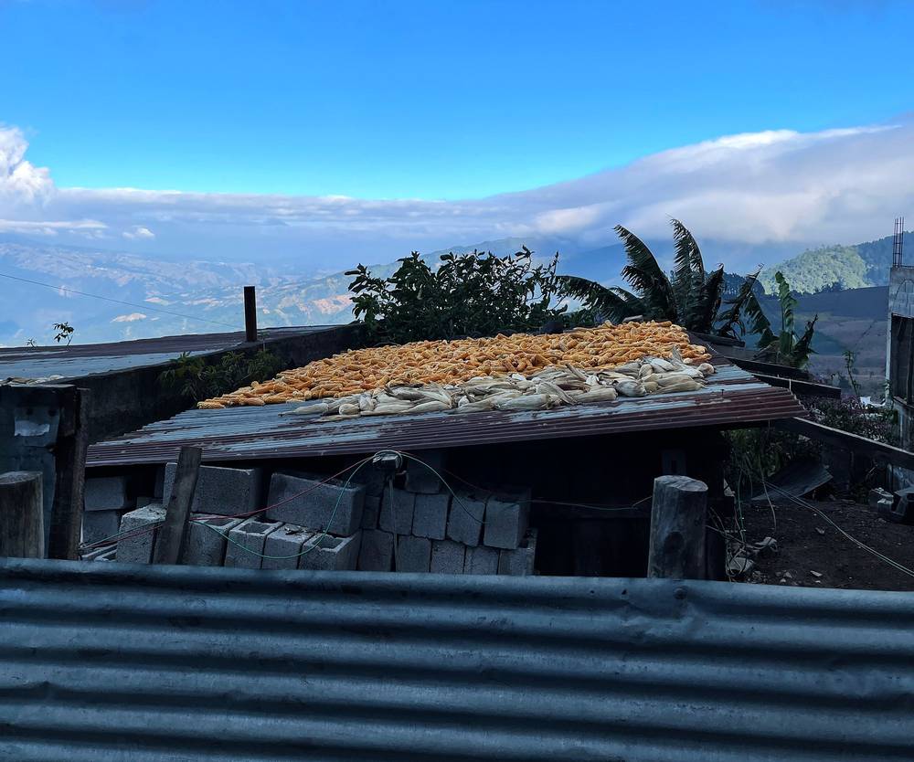
From the base camp the trail I took down doesn't go back over the summit. It traverses north across the east side of the mountain, through the high pine forest, and comes close to the way up at about 11,350 ft, near Day 1's mile 3.6. Below that my track takes its own line down through the forest, a few hundred yards east of the way up, and rejoins it at the registration hut.
Down the forest and the farms. From the registration hut it's the same trail as Day 1: steep, sandy and loose in places, past the registration hut and the welcome area to La Soledad. Going down is fast but hard on the knees; poles help.
This is the way off. If someone at camp is sick with the altitude, the fix is to go down.
Film, Day 2 · My guide to the trip (from 2:44)
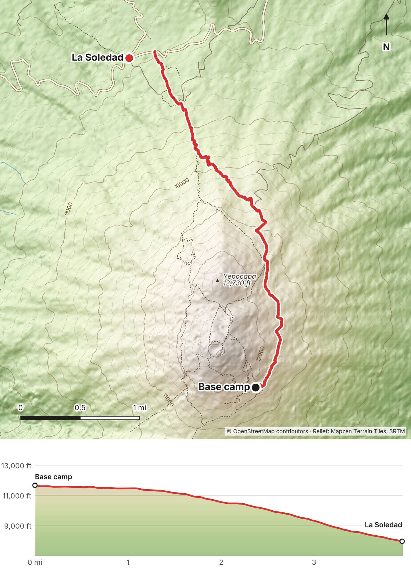
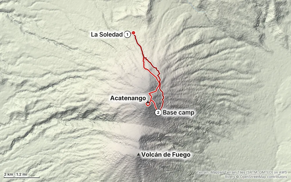
Elevation7,904–13,054 ft10.5 mi
Terrain: Mapzen Terrain Tiles (SRTM, GMTED) on AWS · Rivers © OpenStreetMap contributors
Tap a map to open it full size.
Checked in Guatemalan news reports of the official statements, and on INSIVUMEH's and CONRED's own pages, on October 2, 2026.
Open. The Municipalidad de Acatenango, which runs the park (its official name is the Parque Regional Municipal Astillero Municipal Volcán de Acatenango), reopened it on August 7, 2026, on its approved routes only. It had closed it on August 3, when Fuego went into a big eruption that lasted about 50 hours and led to evacuations below Fuego. In September 2026 tour companies were running their overnight trips as normal.
It closes at short notice. Fuego erupts all the time, a few small explosions an hour, and every so often it has a big phase. In the last two years Acatenango was closed for that in March 2025, June 2025 and August 2026, and in August 2025 CONAP closed it for a while after earthquakes damaged camp platforms. The municipality has said that any change in Fuego's behavior will bring new restrictions. Keep a spare day in your plans.
Fuego is off limits. Since July 14, 2026 a CONAP rule bans visits to Fuego for any kind of tourism, and the municipality banned climbing Fuego through the park on April 1, 2026. INSIVUMEH, the national volcano service, warns that the ridge between the two volcanoes (the meseta, or El Camellón) is dangerous because of falling rock. Some tour companies still advertise a Fuego ridge add-on. It's prohibited.
Going alone. I hiked alone in 2020. In 2026 many tour and information sites say a registered guide is required, and that hikers without one can be turned back at La Soledad. I couldn't find the official rule that says so, but don't plan on going alone. See Fees, guides and rules.
What to do. The day before, read INSIVUMEH's Fuego bulletin (insivumeh.gob.gt) and ask your guide or tour company whether the park is open. INGUAT's tourist assistance line is 1500, and the Municipalidad de Acatenango is on 7882-3716.
These were checked on October 2, 2026, mostly through Guatemalan news reports of what the municipality, CONAP (the protected-areas agency) and INGUAT (the tourism institute) announced. No government page on the park itself would load, so check on arrival.
Who runs it. The Municipalidad de Acatenango runs the park, and the camping area on the side facing Fuego is run by the Municipalidad de Alotenango. CONAP, INGUAT and the municipality can each stop people going up; CONRED, the disaster agency, judges the risk, and INSIVUMEH watches the volcano.
Entrance fee (2026). About Q100 (about US$13) for foreigners, in cash, at the entrance at La Soledad: Q50 for Acatenango and Q50 for Alotenango's camping area. Guatemalans pay Q25 plus Q25. Tours often leave this out of their price.
What I paid, 2020. I made it to the registration area, a hut in the forest about 1.6 miles up, paid the entrance fee and filled out an information form before continuing on. My note on the photo I pinned there says Q50.
Registration. Since April 2023 INGUAT has asked every hiker to fill in an online registration form before going up, then show a screenshot of it at the entrance to get a wristband. Your guide or tour company will usually do this for you; otherwise ask your guide for the current link, or look for it on INGUAT's or VisitGuatemala's pages before you go.
Guides. No official rule I could find says a guide is required: CONAP only says that if you go with an organized group, the tour company and guides must be registered with INGUAT (registro.inguat.gob.gt). But in 2026 many tour and information sites say a registered guide is required on every route and that hikers without one are turned back at La Soledad, and after the August 2026 eruption the advice was to go with accredited guides. So plan on one. ASOAVA, the guides' association in La Soledad, is the local option, and every tour from Antigua includes a guide.
Fuego and the ridge. CONAP's rule of July 2026 bans visits to Fuego for any kind of tourism. The municipality banned climbing Fuego through the park in April 2026 and repeated it when it reopened the park in August. Staying on El Camellón, the ridge toward Fuego, is banned too, and has been since 2021.
Camping. Camp only in the established camps. The municipality has banned camping on the ridge between Acatenango and Fuego and on Acatenango's flat areas since 2021, and CONAP warned in 2026 that many of the cabins and platforms on the volcano were built without authorization. The camps on the side facing Fuego, where I slept, are in Alotenango's camping area. Whether you can still pitch your own tent there without a tour, and what that costs, I couldn't confirm for 2026.
No fires, alcohol or cigarettes. CONAP's July 2026 rule bans bonfires, fireworks, alcohol, cigarettes and drugs on the volcanoes. In 2020 I joined a campfire at the camp; that's no longer allowed.
Drones. I flew a drone on this trip. I couldn't find the 2026 rules for drones in the park: ask at the entrance or your tour company.
December. I went on December 16 and 17. It was warm in Antigua, but on the volcano it was cold, windy and foggy at times: the clouds swirled in and out at the saddle, and after sunset a massive fog rolled in. Later in the night it cleared and we got awesome views of Fuego erupting.
The dry season, November to April, is the time to go. INSIVUMEH says the rainy season normally runs from May to October; in 2026 it started early, at the end of April, and is ending in October. In the dry season the mornings are clearest. January is usually the clearest month and also the coldest.
The rainy season. Afternoon clouds, rain and storms, and mud on the trail. In August 2024 a hiker was killed by a flash flood of water and mud on the volcano. If you go between May and October, start early and get to camp before the afternoon weather.
Cold fronts. INSIVUMEH expects about 16 cold fronts in the 2026 to 2027 cold season, from November to March (as reported on October 2, 2026), with lows near freezing and frost possible in the highlands in the early morning. Six hikers died on Acatenango in a cold front with rain, strong wind and freezing temperatures in January 2017.
Daylight. Guatemala doesn't change its clocks. On December 16 the sun rose about 6:21 a.m. and set about 5:37 p.m. I reached the summit at 5:24 and came down to the camp in the dark. Around the 15th of the month the sun rises and sets at about: January 6:31 a.m. and 5:52 p.m.; February 6:27 and 6:07; March 6:12 and 6:14; April 5:50 and 6:17; November 6:04 and 5:32; December 6:20 and 5:36.
Emergencies. CONRED 119, police 110, firefighters 122 or 123, tourist assistance (INGUAT's Asistur) 1500. Don't count on a phone signal on the volcano. Leave your plan with someone in Antigua.
Fuego. Fuego is one of the most active volcanoes in Central America. It usually throws out a few small explosions an hour, which is what you watch from camp, but it can go into a big eruption within hours: in June 2018 one killed nearly 200 people in the villages on its slopes, and the August 2026 phase closed Acatenango for four days. Never go toward Fuego or onto the ridge between the two volcanoes (the meseta, or El Camellón): INSIVUMEH warns of falling rock there. That's not the saddle below Acatenango's summit at Day 1 mile 4.4, which is on the normal route. Read INSIVUMEH's bulletins before you go, and if the park closes or your guide says go down, go down.
Cold. The cold is the biggest danger for most hikers. Camp is around or below freezing at night all year, and the summit wind makes it much colder. In January 2017 six hikers died on Acatenango in a cold front; Guatemala's forensic institute found three died of hypothermia. In August 2026 a 17-year-old died on the way up, and Infobae reported severe hypothermia. I was freezing with only a liner. Carry a real sleeping bag, warm layers, a hat and gloves, and keep them dry.
Altitude. Antigua is about 5,000 ft (1,530 m); the summit is over 13,000 ft. Many people get headaches or nausea at camp. Spend a couple of days in Antigua first, go slowly, drink, and go down if it gets worse.
Rain and storms. In the rainy season, afternoon storms bring lightning on the open upper slopes and mud on the trail; a hiker was killed by a flash flood of mud in August 2024. Be at camp before the afternoon weather.
Fog and the dark. Fog came in fast at sunset and it got really dark and hard to see very quickly. The upper slopes are steep, loose and confusing in the dark. Carry a headlamp and have the GPX track on your phone.
Safety in Guatemala. In March 2026 the US State Department rated Guatemala at Level 3, "Reconsider Travel," and it allows its own staff to visit Antigua; its advisory lists buses among possible targets. I found no recent reports of robberies on the Acatenango trail (there have been on Volcán de Agua). Going with a registered guide is the simple answer.
How many days do I need? Two, with one night at the base camp. That's what I did and what almost every tour does: up the first day, sunrise and down the next morning. You can do it in one long day too. Give yourself a couple of days in Antigua first to get used to the altitude, and keep a spare day in case Fuego closes the park.
How hard is it? It's one long climb of about 5,200 ft (1,585 m) by my GPS, steep the whole way, with soft volcanic sand and loose rock near the top. It took me about 4.6 hours of moving to the summit and down to the camp. Time-wise it didn't take me that long to get to the summit, but the slope of the volcano and constantly gaining elevation the entire time make it a bit of an effort. After four miles of constant climbing I was starting to feel it.
Do I need a guide? I went without one in 2020. Today, plan on one: many sources say a registered guide is required, and the authorities say to go with accredited guides. A tour from Antigua includes one. See Fees, guides and rules.
Can I hike to Fuego? No. Since July 2026 visits to Fuego are banned for any kind of tourism, and the ridge toward it is off limits. You watch Fuego from Acatenango.
How cold does it get? Very. It was freezing at the saddle and on the summit, and the night at the base camp was really cold. Camp is around freezing at night all year. I didn't pack a sleeping bag, just a liner, and that was a mistake. Bring a real sleeping bag and a warm jacket, or take the ones your tour lends you.
Will I see lava? Probably, if the sky is clear. Fuego erupted every 30 minutes or so all night when I was there, and the booms kept me up. Clouds and fog can hide it for hours. See When to go.
How do I get to the trailhead? I took an Uber from Antigua to La Soledad: about an hour and about $15 in 2020. Tours drive you there. There's a local bus too, by way of Parramos. See Getting there.
Is there water on the trail? No, and none at the camp. Carry all your water from Antigua or La Soledad. I only brought one liter and was okay, on a cool December afternoon at my pace; most people are on the mountain much longer. See Food and water.
This is how most people do it in 2026. A typical two-day tour picks you up in Antigua in the morning, hikes to a base camp facing Fuego in about four to five hours, goes up to the summit for sunrise the next morning, and has you back in Antigua around noon or 1 p.m. In 2026 prices run from about US$57 to $90 for a basic group trip, about $94 to $160 with a cabin at camp, and from about $240 for a private trip. Most include transport, a guide, a cabin or tent, a sleeping bag and mat, meals, and a warm jacket, hat and gloves to borrow; the entrance fee is often extra. Porters will carry your pack from La Soledad to camp for about Q250 to Q300.
I went up to the summit for sunset on the way to camp. Most tours instead sleep at the base camp and climb to the summit in the dark for sunrise the next morning, about 1.5 hours up from camp. Either way, the summit is cold and windy. After Fuego's August 2026 eruption, CONRED advised avoiding climbs at night or in bad weather and using only the authorized, signposted routes. Ask your guide how they handle the sunrise climb, and skip it if Fuego is restless or the weather is bad.
You can go up and down in one long day, without the night at camp: about 10 miles and over 5,000 ft of climbing round trip. You'll miss Fuego at night, which is the reason most people stay.
La Soledad is the main route. The others the municipality lists are a route on the west side and the Raizales route from the Alotenango side. Ask a local guide. The Fuego ridge add-on that some tours still sell is banned (see Fees, guides and rules).
These change every year, and on Acatenango they can change overnight. Everything else in this guide stays the same.
Is it open?
Fees, guides and rules
Getting there
Conditions
Your stuff
The film is at the top of this page.
Planning questions about Acatenango Volcano, answered only from this page's facts, the creators' versions and hikers' public tracks, with where each answer comes from. When the data doesn't say, the answer says "not given".
From hikers
Sign in to comment. Free; your hikes stay private unless you share them.
Some lodging links earn me a small commission at no cost to you.
Something wrong or missing on this page? Send feedback.